Landowner's Guide to the Lower St. Croix Riverway. Protect. Restore. Celebrate. stcroixriverassociation.org
|
|
|
- Derick Blaise Mathews
- 5 years ago
- Views:
Transcription

1 Landowner's Guide to the Lower St. Croix Riverway Protect. Restore. Celebrate. stcroixriverassociation.org

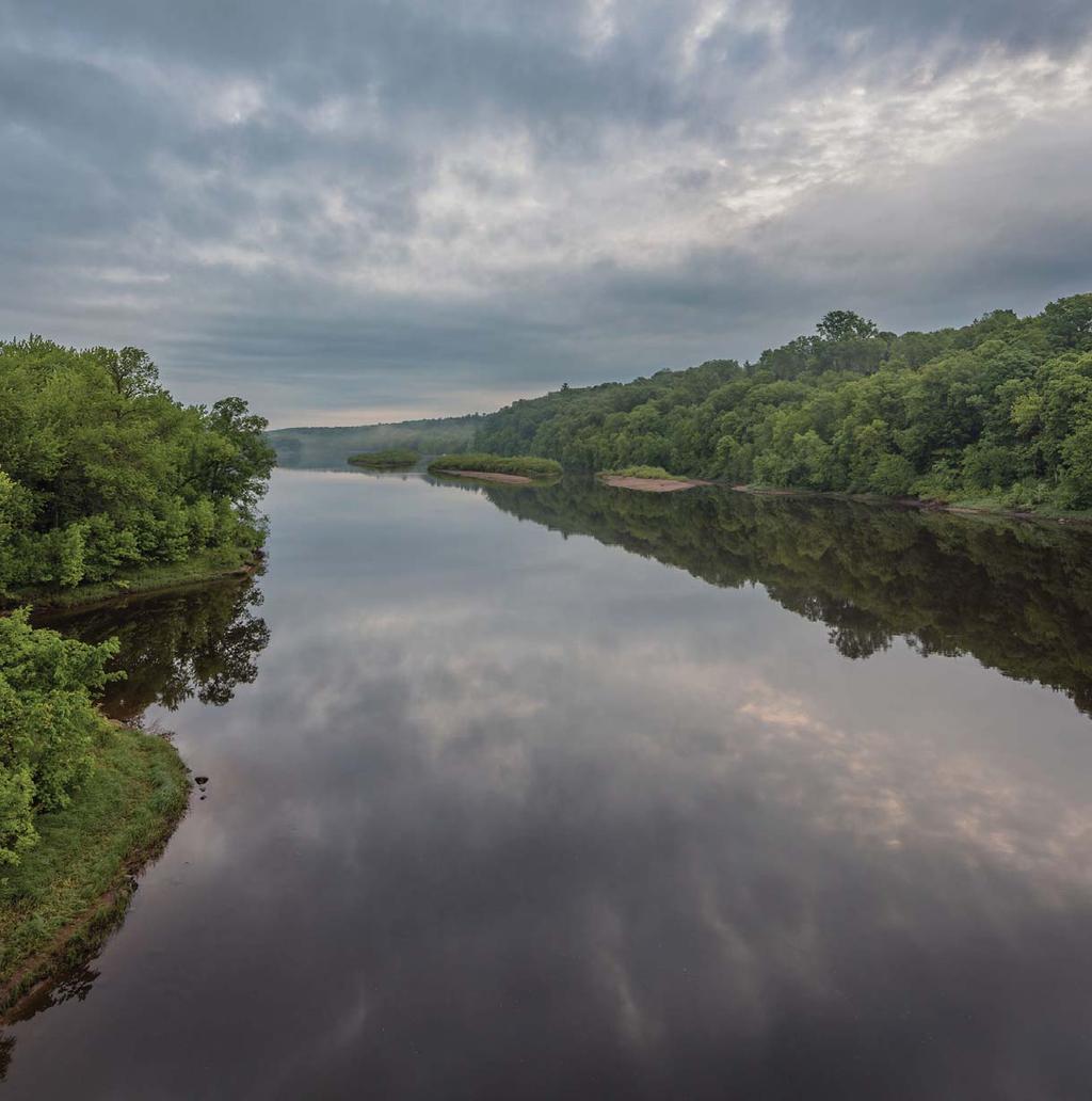
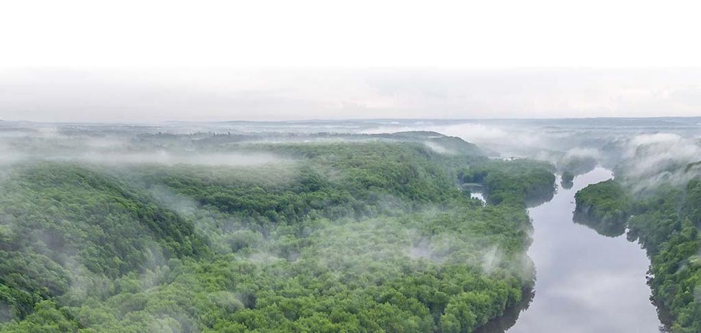
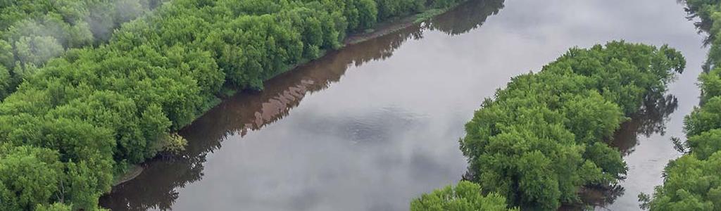
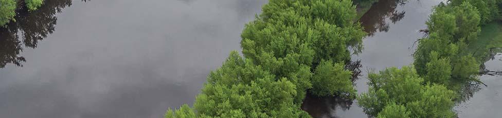
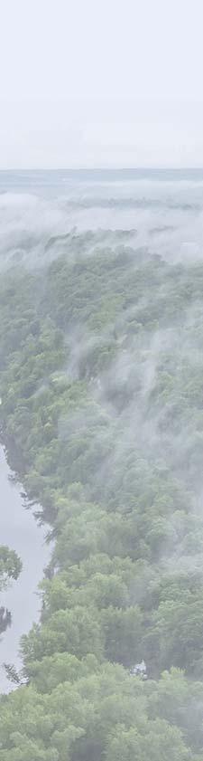
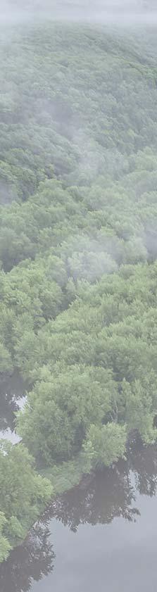
2 Cover and page spread photographs by Craig Blacklock. For more information on how to be a river steward visit stcroixriverassociation.org Our mission: To protect, restore, and celebrate the St. Croix River and its watershed stcroixriverassociation.org


3 Earth-tone Colors This resource was created by the St. Croix River Association with funding from the Legislative-Citizen Commission on Minnesota Resources. Thank you to the many cities, counties, government agencies, landowners, and realtors that reviewed this resource and supported our efforts to increase awareness of Riverway regulations on the Lower St. Croix River. The exterior colors of new or renovated structures are required to be earth or summer vegetation tones. Building in harmony with the environment includes building with materials in tones that blend with the natural settings such as using dark roof areas and earth-tone paints.


4 TABLE OF CONTENTS Habitat Native plants have deep roots which absorb excess rainfall and prevent water from running directly into our rivers and streams. Native plants, instead of turf lawns, help reduce your carbon footprint, and provide clean water for everyone. They also provide food and habitat for pollinators! Contact your local watershed management organization for more information. Information and photo provided by Blue Thumb: bluethumb.org 20
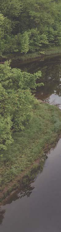
5 Vegetative Management A local permit is needed to remove trees or shrubs within the St. Croix Riverway District. Contact your local zoning administrator for more information. A buffer of trees along the bank can provide privacy, enhance property values, and protect the shoreline. Vegetation protects buildings from wind in winter and strong sunlight in summer. The roots of native plants stabilize soil, prevent erosion, and improve water quality FAQs Contacts Riverway Regulations Ordinary High Water Level Bluffline Minimum Lot Width Minimum Water Frontage Minimum Lot Size Maximum Impervious Surface Height of Structure Water Quality Vegetative Management Habitat Colors 4

6 FAQs Where is the St. Croix Riverway District? On average, the St. Croix Riverway District extends a quarter-mile out from the river, following the bluffline. In some communities, the Riverway boundary extends well beyond the river and in other places the Riverway boundary is very narrow. Contact your local government to learn if your property is within the St. Croix Riverway District. Where can I learn about restrictions on my property? Contact your local government to The St. Croix River is one of only 208 Wild and Scenic Rivers in North America. It is the only river in Minnesota listed under the Wild and Scenic Rivers Act. The St. Croix River valley is a beautiful place to live, work, and play thanks to the protections outlined in this guide. Landowners along the river provide the stewardship of the land and water to preserve this natural treasure for future generations. Can I build, rebuild, or remodel in the St. Croix Riverway District? Yes, of course! However, there are Using water-friendly landscaping, like native plants and raingardens, helps minimize runoff and helps keep our water clean. A raingarden is a bowl shaped garden that is built where it will capture rain and snowmelt (stormwater runoff ) before it reaches a storm sewer or nearby stream, lake, or river. You can plant a raingarden at home to catch runoff from your rooftop, driveway, or street. Contact your local watershed management organization for more information! Water Quality Properly designed raingardens: Beautify your landscape Reduce pollution to lakes, rivers, and streams Reduce flooding and erosion Attract birds and butterflies Protect fish and other aquatic animals Raingardens DO NOT: Attract mosquitoes Hold water more than 2 days Require more maintenance than other gardens Cost lots of money inquire about zoning and restrictions unique building restrictions within the specific to your property. In many St. Croix Riverway. Be sure to explore cases, local ordinances may be more the local ordinances and contact your restrictive than the Riverway rules local government before making any outlined in this booklet. plans for your property. Information provided by Blue Thumb: bluethumb.org 18
7 Height of Structure Height regulations help ensure that all new structures and additions to existing structures, to the extent possible, are not seen from the river. If you have a structure that was built before the adoption of the Riverway regulations, different height restrictions may apply. 35ft Who can I contact to learn more about Riverway regulations or scenic easements? Contact your local government, the Department of Natural Resources (DNR), or the National Park Service (for scenic easements) before undertaking any work on your property to learn about Riverway zoning regulations related to your proposed activity or project. MN DNR (Properties in Washington County): MN DNR (Properties in Chisago County): MN DNR Easements: National Park Service (for scenic easements): Afton: Bayport: Lakeland: Lakeland Shores: Lake St. Croix Beach: Marine on St. Croix: Oak Park Heights: Scandia: Stillwater: St. Mary s Point: Taylors Falls: For townships, contact your county: Washington County: Chisago County:
8 The Riverway Regulations Maximum Impervious Surface The following pages provide visuals to better understand the building restrictions within the St. Croix Riverway boundary. The images reflect the Minnesota rules and are based on the model ordinance that was adopted by local governments. Depending on how your property is zoned, there may be different factors to take into consideration. Please use this as an introduction to the Riverway ordinances and contact your local government to learn more about restrictions specific to your property. Impervious surfaces are generally manmade surfaces that water cannot easily penetrate. In natural systems, most rainfall infiltrates into the soil and slowly moves to streams, springs, or aquifers. Impervious surfaces prevent infiltration and lead to increased water flow on the surface of the land. 20% 20% Many structures were built prior to the adoption of the Riverway regulations. This may limit what you can do on your property. Be sure to work closely with your local government before investing in plans. Examples of impervious surfaces: Patios Roofs Decks Gravel/paved roads Driveways Structures 16
9 Minimum Lot Size Overview of Riverway Regulations Regulation Rural District Urban District Minimum lot size above ordinary high water level Lot width at building setback line Urban District with Public Sewer and Water 2.5 acres 1 acre 20,000 sq ft 200 ft 150 ft 100 ft Lot width at water line 200 ft 150 ft 100 ft Urban District 1 acre Building setback from ordinary high water level Building setback from bluffline Maximum structure height Maximum total lot area covered by impervious surface 200 ft 100 ft 100 ft 100 ft 40 ft 40 ft 35 ft 35 ft 35 ft 20 % (1/2 acre) 20 % (8,700 sq ft) 20 % (4,000 sq ft) Contact your zoning administrator to learn whether your property is zoned rural, urban, or urban with sewer and water. Local ordinances may be more restrictive Rural District 2.5 acres Urban District with Public Sewer and Water 20,000 sq ft than the Riverway regulations outlined in this resource. Please reference your local ordinances and contact your zoning administrator for more information. 8
10 Ordinary High Minimum Lot Width at Water Line OHWL Rural District 200 ft The river is susceptible to flooding. Maintaining distance between the water and structures is important to preserve your property. Setback requirements help maintain the scenic character of the Riverway for visitors and landowners to enjoy the natural beauty of the St. Croix River. Setback requirements also protect water quality and provide habitat for wildlife. Urban District with Public Sewer and Water - 100ft Urban District - 150ft Rural District - 200ft 14
11 Minimum Lot Width at Building Setback Line Water Level (OHWL) Urban District with Public Sewer and Water - 100ft Urban District - 150ft Rural District - 200ft OHWL 100 ft Urban District and Urban District with Sewer and Water Lot width requirements ensure privacy for landowners, promote vegetative screening, and provide a buffer for fire separation. The ordinary high water level is commonly the point where the natural vegetation changes from predominantly aquatic to predominantly terrestrial. Contact the Minnesota DNR for a correct OHWL determination before making plans for your property. 10
12 Building Setback from Bluffline Bluffline Bluffline Bluffline Bluffline Rural District 100 ft 100 ft 40 ft 40 ft Urban District and Urban District with Sewer and Water Bluffs provide important wildlife habitat and contribute to the character and natural beauty of your homesite. Bluffs are slopes that are greater than 12%. Steep slopes and land adjacent to them are subject to earth movement and can be easily disturbed by excavation, ground cover removal, and tree/shrub cutting. Although the amount of movement may be slight, it can result in cracked foundations, tilted basement walls, soil erosion, and damaged utility lines. 12
Presented By: Matt Roberts and Cass Chapman The University of Minnesota Law School Environmental Sustainability Clinic
 Presented By: Matt Roberts and Cass Chapman The University of Minnesota Law School Environmental Sustainability Clinic Overview Who We Are and MIDS Project The Problem Recommendations Benefits to Communities
Deb Grube, Sr. Zoning Officer
 Deb Grube, Sr. Zoning Officer Wisconsin Department of Natural Resources Administrative Code NR 115 under the authority of Wisconsin Statute 59.692, establishes and provides that shoreland zoning regulations
Shoreland Zoning. Kay Lutze Shoreland Zoning Policy Coordinator
 Shoreland Zoning Kay Lutze Shoreland Zoning Policy Coordinator Kay.Lutze@wisconsin.gov Purposes of shoreland zoning include Prevent and control water pollution Protect spawning grounds, fish and aquatic
Nick Sigmund, Sr. Zoning Officer
 Nick Sigmund, Sr. Zoning Officer Wisconsin Department of Natural Resources Administrative Code NR 115 under the authority of Wisconsin Statute 59.692, establishes and provides that shoreland zoning regulations
Stormwater Runoff and the District of Columbia RiverSmart Homes Defined:
 Stormwater Runoff and the District of Columbia Stormwater runoff is rainwater that flows off impervious surfaces such as rooftops, driveways, roads, sidewalks and sometimes even lawns. Stormwater runoff
Putting the Pieces Together
 Putting the Pieces Together A guided tour of the St Croix Valley's land and water resources A Guided View from the River: What are the challenges and obstacles your community is facing? 1 Site 2 Buk and
RAIN GARDENS. Task: PART 1 (60 minutes) Student Directions: Steps you will be following: Directions for beginning: Source Information:
 Student Directions: Steps you will be following: Directions for beginning: Source Information:") PART 1 (60 minutes) Student Directions: Your assignment: Steps you will be following: Your neighborhood council is researching the benefits of installing rain gardens in your community. You will read two
PART 1 (60 minutes) Student Directions: Your assignment: Steps you will be following: Your neighborhood council is researching the benefits of installing rain gardens in your community. You will read two
St. Croix County Shoreland Overlay Zoning Districts. Public Hearing Community Development Committee December 19, 2013
 St. Croix County Shoreland Overlay Zoning Districts Public Hearing Community Development Committee December 19, 2013 Timeline CDC Review October 17 Public Information Meeting October 29 (6:00-8:00 pm)
Worksheet #14 Water Runoff Management
 Water Runoff Management Use this worksheet to assess how well your property minimizes the potential for water runoff and property damage.. Why should you be concerned? What can you do? Rural runoff, also
Weston s Wetlands, Stormwater, & Open Space
 Weston s Wetlands, Stormwater, & Open Space Weston s Wetlands, Stormwater, & Open Space Conservation Commission Role and Responsibilities Laws that protect wetlands What residents can do to protect wetlands
SECTION 1 CLEARING /GRADING PERMIT APPLICATION:
 PLEASE REFER TO THE CLEARING & GRADING PERMIT CHECKLIST BELOW FOR SUBMITTAL REQUIREMENTS. SECTION 1 CLEARING /GRADING PERMIT APPLICATION: PROJECT ADDRESS (Street, Suite #): Parcel(s) #: Total Site Area
Working Group Meeting
 April 4,, 2017 Parks Operations Bldg Working Group Meeting Arts Districts Overview Stormwater/RPA/Stream Considerations First Principles Agenda 7:00pm 7:05pm 7:10pm 7:40pm 8:30pm 9:40pm 9:45pm Welcome
BE WATER WISE. Managing Your Onlot Stormwater. Sept. 23, 2006 Watershed Weekend
 BE WATER WISE Managing Your Onlot Stormwater Sept. 23, 2006 Watershed Weekend 2006 1 All water resources are interrelated through the Hydrologic Cycle Sept. 23, 2006 Watershed Weekend 2006 2 What is Storm
Raingardens. Conserving and Protecting Water L
 L-5482 08-08 Raingardens Justin Mechell, Extension Assistant, and Bruce Lesikar, Extension Program Leader for Biological and Agricultural Engineering,The Texas A&M University System A raingarden is an
Rain Gardens. A Welcome Addition to Your Landscape
 Rain Gardens A Welcome Addition to Your Landscape Where Does The Rainwater Go? Naturally, forests provide a way for rainwater to percolate into the soil, filtering pollutants while trees are allowed to
Landscaping by the Water s Edge
 Landscaping by the Water s Edge Dr. Cathy Neal, UNH Extension Professor and Specialist in Landscape Horticulture. Contact info: Cathy.neal@unh.edu or phone 603-862-3208. This session will provide an introduction
LANDSCAPING. Design. Development of the site shall not unreasonably impair the ability of adjoining properties to utilize solar energy.
 Landscape design is an integral component of Site Planning and Building. The current pattern of walkways, driveways and landscape elements such as fences, hedges, and retaining walls in the neighborhood
Use of Best Management Practices
 Use of Best Management Practices Presented at the ANJEC Flood Hazard Workshop Bordentown, NJ March 13, 2008 Stormwater BMPs "a technique, measure or structural control that is used for a given set of conditions
Storm Water Quality and Shoreline Restoration Improvements - Grant Funding Request City of Mound Carlson Park Bolton & Menk Project No.
 September 15, 2016 Brett Eidem Cost Share Grant Administrator Minnehaha Creek Watershed District 15320 Minnetonka Boulevard Minnetonka, MN 55345 RE: Storm Water Quality and Shoreline Restoration Improvements
Natural Shoreline Landscapes on Michigan Inland Lakes. Introduction. Workshop for Property Owners. Photo by Jane Herbert
 Natural Shoreline Landscapes on Michigan Inland Lakes Workshop for Property Owners Introduction Photo by Jane Herbert MSU is an affirmative action, equalopportunity employer. Michigan State University
Weston Conservation Commission
 Weston Conservation Commission Commission Roles and Responsibilities Laws that protect Wetlands What residents can do to protect wetlands and open space 1 Conservation Commission Made up of 7 volunteer
Homeowners Guide to Stormwater BMP Maintenance
 Homeowners Guide to Stormwater BMP Maintenance What You Need to Know to Take Care of Your Property Rain Barrel Dry Well Rain Garden Pervious Asphalt Porous Pavers City of El Monte Stormwater BMP Management
Riparian Buffer on the Bushkill Creek. Policies
 Riparian Buffer on the Bushkill Creek Riparian buffers provide numerous benefits to landowners and the community by protecting groundwater recharge areas, providing flood control, providing stormwater
A Review of Green Infrastructure Projects Implemented in the Grand Traverse Region
 A Review of Green Infrastructure Projects Implemented in the Grand Traverse Region Sarah U Ren Program Director The Watershed Center of Grand Traverse Bay 231-935-1514, suren@gtbay.org Our Mission: The
Woodland Conservation and the Master Plan
 1 WHAT IS A MASTER PLAN? A Vision for the Future of Your Community Woodland Conservation and the Master Plan Goals Objectives Strategies 2 How Will Your Community Look? TREE PRESERVATION AND THE MASTER
COMMUNITY DEVELOPMENT DEPARTMENT POLICY DRAINAGE FOR RESIDENTIAL PROJECTS WITH ONE OR TWO UNITS REVISED JANUARY 4, 2018
 COMMUNITY DEVELOPMENT DEPARTMENT POLICY DRAINAGE FOR RESIDENTIAL PROJECTS WITH ONE OR TWO UNITS REVISED JANUARY 4, 2018 A. California Residential Code Requirement - Construction plans shall indicate how
Options for Managing Coastal Erosion. Presentation by: Ashley Sprague
 Options for Managing Coastal Erosion Presentation by: Ashley Sprague Shoreline stabilization methods Armouring - Boulders/rockwalls most common method of erosion control in Nova Scotia Concerns: - Accelerate
Stockbridge Bowl Watershed Survey Conducted by the BRPC, SBA and Town of Stockbridge June 2012
 Stockbridge Bowl Watershed Survey Conducted by the BRPC, SBA and Town of Stockbridge June 2012 This project has been financed with Federal Funds from the Environmental Protection Agency (EPA) to the Massachusetts
SMALL PROJECTS SIMPLIFIED APPROACH
 SMALL PROJECT APPLICATION AND STORMWATER MANAGEMENT DESIGN ASSISTANCE MANUAL FOR SMALL PROJECTS IN FULTON TOWNSHIP LANCASTER COUNTY, PENNSYLVANIA SMALL PROJECTS SIMPLIFIED APPROACH Prepared By: Light-Heigel
Create your own. Rain Garden
 Create your own Rain Garden July 2013 Sacramento County Rain Garden Guidelines What s so cool about rain gardens? Rain gardens are shallow, landscaped depressions that capture rain water that runs off
City of Petersburg, VA Stormwater Utility Frequently Asked Questions
 Q. What is stormwater runoff? A. Stormwater runoff is the water that flows off roofs, driveways, parking lots, streets and other hard surfaces during rain storms. Stormwater runoff is also the rain that
Draft Stillwater 2030 Comprehensive Plan- Goals and Policies
 Draft Stillwater 2030 Comprehensive Plan- Goals and Policies Instructions- Review each goal and policy and discuss with group any changes, deletions for additions to the list using your groups pen. Keep
Rainscaping. Rainscaping includes rain gardens, bioswales, combinations of. A guide to local projects in St. Louis
 Rainscaping A guide to local projects in St. Louis Rain garden on South Grand Boulevard in the city of St. Louis. Rainscaping includes rain gardens, bioswales, combinations of plantings, water features,
A couple of hours to pull weeds and fertilize with compost
 2. A NATURAL LAWN Reducing Your Use of Weed Killers and Fertilizers on Your Lawn WHY ACT? If you have a lawn, you may be using weed killers and fertilizers to keep it green and weed-free. Unfortunately,
Adopt-A-Creek. You are the solution to water pollution.
 Respect the property line. You are the solution to water pollution. Adopt-A-Creek Avoid polluting, dumping or draining to your creek. Respect the natural habitat. The Santa Clara Valley Water District
Tale of Two Cities: Exploring How Two Communities are Using Green Infrastructure to Reduce Flood Risk
 Tale of Two Cities: Exploring How Two Communities are Using Green Infrastructure to Reduce Flood Risk NACo Steering Subcommittees Education Session Lori Cary-Kothera NOAA Coastal Services Center Issue
2
 1 2 3 The water used for watering landscapes accounts for a significant percentage of total water demand. Every year, Aurora citizens use about 40% of their potable water for irrigating lawns and gardens.
What is stormwater runoff? Why is it a problem? Available Financial Incentives for Stormwater BMP s Downspout Disconnection - up to $20
 What is stormwater runoff? Stormwater is any form of natural precipitation (including ice and snow melt) that flows across undeveloped or developed land. In a natural setting, a majority of the water seeps
Chapter 3 Site Planning and Low Impact Development
 CHAPTER 3 Site Planning and Low Impact Development Chapter 3 Site Planning and Low Impact Development 3.0 Introduction The City of Charleston requires that major residential, large commercial (>1 acre),
Variance Staff Report St. Croix County Board of Adjustment Ben Hanke / Calda Donna LLC Hearing Date: January 20 & 21, 2016
 Applicant: Agent: Calda Donna LLC / Ben Hanke Bruce Lenzen Site Address: Salishan Drive Government Lots 1 and 2 Parcel ID #: 040-1146-40-000 Computer #: Site Location: Zoning District: Site Size: Requests:
Small Project Guidance Document
 Small Project Guidance Document Introduction If you are considering a relatively small construction project on your property that creates new impervious area and you need to manage the stormwater that
Benchmark Nonpoint Source Management Approaches In Other States
 Governor s Environmental Advisory Council 2007 Nonpoint Source Pollution Control Initiative Benchmark Nonpoint Source Management Approaches In Other States Governor s Environmental Advisory Council April
CLACKAMAS COUNTY ZONING AND DEVELOPMENT ORDINANCE
 704 RIVER AND STREAM CONSERVATION AREA (RSCA) 704.01 PURPOSE Section 704 is adopted to: A. Maintain the integrity of the rivers and streams in the County by minimizing erosion, promoting bank stability,
RAIN GARDEN ILLINOIS URBAN MANUAL PRACTICE STANDARD. (feet) CODE 897 DEFINITION
 CODE 897 DEFINITION") ILLINOIS URBAN MANUAL PRACTICE STANDARD RAIN GARDEN (feet) CODE 897 Source: Kendall County Soil and Water Conservation District DEFINITION Rain gardens are small, shallow, flat bottomed depressions constructed
ILLINOIS URBAN MANUAL PRACTICE STANDARD RAIN GARDEN (feet) CODE 897 Source: Kendall County Soil and Water Conservation District DEFINITION Rain gardens are small, shallow, flat bottomed depressions constructed
Summer Public Education and Outreach Campaign Toolkit
 Summer Public Education and Outreach Campaign Toolkit ABOUT THIS TOOLKIT The communications tools and messages included in this toolkit were developed by Bluestem Communications for the Lower DuPage River
CITY OF TUMWATER 555 ISRAEL RD. SW, TUMWATER, WA (360) (360) (FAX)
 (360) (FAX)") CITY OF TUMWATER 555 ISRAEL RD. SW, TUMWATER, WA 98501 (360) 754-4180 (360) 754-4126 (FAX) Email: cdd@ci.tumwater.wa.us APPENDIX II-C SHORT FORM CONSTRUCTION STORMWATER POLLUTION PREVENTION PLAN (SWPPP)
CITY OF TUMWATER 555 ISRAEL RD. SW, TUMWATER, WA 98501 (360) 754-4180 (360) 754-4126 (FAX) Email: cdd@ci.tumwater.wa.us APPENDIX II-C SHORT FORM CONSTRUCTION STORMWATER POLLUTION PREVENTION PLAN (SWPPP)
SIMPLIFIED APPROACH TO STORMWATER MANAGEMENT FOR SMALL PROJECTS
 SIMPLIFIED APPROACH TO STORMWATER MANAGEMENT FOR SMALL PROJECTS Introduction As required by federal and state law, the Borough of Swarthmore has adopted regulations that affect stormwater runoff and surface
Pat Rector, Environmental & Resource Management Agent Morris and Somerset Counties
 Morris County Presented to Bayer August 26, 2014 Pat Rector, Environmental & Resource Management Agent Morris and Somerset Counties rector@njaes.rutgers.edu Goal of the program Program Goal: The goal of
Understanding Stormwater Drainage Maintenance
 WARREN COUNTY STORMWATER DISTRICT Understanding Stormwater Drainage Maintenance Home Owner s Association Guide Introduction Our goal is to help property owners and Home Owner s Associations (HOA) understand
Sustainable Stormwater Management through Green Infrastructure. Jersey City Public School #5
 Green Infrastructure Site Evaluation Friday, October 25 th, 2013 Sustainable Stormwater Management through Green Infrastructure Jersey City Public School #5 FORMAT: (15 minutes) An Introduction to Stormwater
Pennsylvania Stormwater Best Management Practices Manual. Chapter 1. Introduction and Purpose
 Pennsylvania Stormwater Best Management Practices Manual Chapter 1 Introduction and Purpose Chapter 1 Introduction and Purpose 1.1 Purpose of this Manual 1 1.2 How to Use this Manual...1 1.3 Overview
Lesson 2: Stormwater Best Management Practices (BMPs)
") Lesson 2: Stormwater Best Management Practices (BMPs) Environmental Stewards Class Christopher C. Obropta, Ph.D., P.E. Extension Specialist in Water Resources 732-932-9800 ext. 6209 obropta@envsci.rutgers.edu
Lesson 2: Stormwater Best Management Practices (BMPs) Environmental Stewards Class Christopher C. Obropta, Ph.D., P.E. Extension Specialist in Water Resources 732-932-9800 ext. 6209 obropta@envsci.rutgers.edu
Artwork by Ami Sheffield
 Hi! My name is Running Rain. When it rains, I join other rain drops to become stormwater. I m happy when I m clean and when I run onto planted areas where I can easily run (soak) into soil. You can help
Community LID Workgroup Issue Paper #6
 Community LID Workgroup Issue Paper #6 Topic: Hard and Impervious Surface Coverage Limits Objective: Minimize the amount of hard and impervious surfaces in developments to allow more stormwater to infiltrate
Swatara Township Stormwater Program. 1. There are no storm sewers on or near my property. Why should I pay a fee?
 1. There are no storm sewers on or near my property. Why should I pay a fee? All properties produce stormwater runoff that must be managed by the Township. Even if your property has never flooded and there
APPENDIX A. Proposed Guidance and LID checklists for UConn and Town of Mansfield
 APPENDIX A. Proposed Guidance and LID checklists for UConn and Town of Mansfield 22 Guidance Document for Low Impact Development Best Management Practices for UConn June, 2011 In 2007, the Connecticut
Panther Pond Conservation Project Phase II
 Panther Pond Conservation Project Phase II 2009-2012 Working to protect and improve the water quality of Panther Pond The Panther Pond Conservation Project Phase II was funded in part by the US Environmental
Improve Neighborhood Design and Reduce Non Point Source Water Pollution
 HOW TO Planning Guide Improve Neighborhood Design and Reduce Non Point Source Water Pollution This document was funded by a grant from the New Hampshire Coastal Program with funding from the National Oceanic
Healthy Watershed Practices
 Healthy Watershed Practices Summit County Soil and Water Conservation District Mission Statement: To provide local leadership and technical assistance for innovative programs to conserve soil, improve
STORM WATER UTILITY FREQUENTLY ASKED QUESTIONS
 STORM WATER UTILITY FREQUENTLY ASKED QUESTIONS In 2007, the City Council adopted Ordinance No. 1155 establishing a storm water utility in the City. No fee structure was adopted at that time. The idea of
Natural Landscapes for Homes with Jersey-Friendly Yards
 Natural Landscapes for Homes with Jersey-Friendly Yards Becky Laboy, Education Outreach Specialist Ocean County Soil Conservation District education@soildistrict.org 609-971-7002 ext. 114 Karen Walzer,
Section 3 Non-Structural BMPs
 3.1 Stream Buffers A stream buffer or stream setback is a designated area around a stream, lake, or wetland left in a natural, densely vegetated state so as to protect the receiving water quality and provide
Stormwater and Your Rain Garden
 Stormwater and Your Rain Garden When rain falls on natural areas, such as a forest or meadow, it is slowed down, filtered by soil and plants, and allowed to soak back into the ground. When rain falls on
What is the EDPA? The EDPA has three objectives: 1. Protect biodiversity. 2. Mitigate damage during development. 3. Restore degraded ecosystems
 What is the EDPA? Environmental Development Permit Areas are the best tool available to municipalities to protect ecosystems and habitat on private land. The EDPA has three objectives: 1. Protect biodiversity
A Cooperative Effort Between:
 Lake Shamineau Shoreline Assessment August 2007 A Cooperative Effort Between: Morrison County Planning and Zoning Morrison Soil and Water Conservation District Minnesota Department of Natural Resources
LICENSES FOR UTILITY CROSSINGS OF PUBLIC LANDS AND WATERS ACCORDING TO MINNESOTA RULES CHAPTER [Rules Effective July 1, 2004]
![LICENSES FOR UTILITY CROSSINGS OF PUBLIC LANDS AND WATERS ACCORDING TO MINNESOTA RULES CHAPTER [Rules Effective July 1, 2004]](/thumbs/78/77546780.jpg "LICENSES FOR UTILITY CROSSINGS OF PUBLIC LANDS AND WATERS ACCORDING TO MINNESOTA RULES CHAPTER [Rules Effective July 1, 2004]") LICENSES FOR UTILITY CROSSINGS OF PUBLIC LANDS AND WATERS ACCORDING TO MINNESOTA RULES CHAPTER 6135 [Rules Effective July 1, 2004] Minnesota Department of Natural Resources Division of Lands and Minerals
LICENSES FOR UTILITY CROSSINGS OF PUBLIC LANDS AND WATERS ACCORDING TO MINNESOTA RULES CHAPTER 6135 [Rules Effective July 1, 2004] Minnesota Department of Natural Resources Division of Lands and Minerals
APPENDIX A SIMPLIFIED APPROACH TO STORMWATER MANAGEMENT FOR SMALL PROJECTS. In West Sadsbury Township, Chester County, Pennsylvania
 APPENDIX A SIMPLIFIED APPROACH TO STORMWATER MANAGEMENT FOR SMALL PROJECTS In West Sadsbury Township, Chester County, Pennsylvania TABLE OF CONTENTS I. Introduction 3 II. Importance of Stormwater Management
13 Maintenance and Operations Plan 223
 222 13 Operations Maintenance and Plan 223 Chapter 13 MAINTENANCE AND OPERATIONS PLAN 13.1 Stewardship The Minneapolis Park and Recreation Board (MPRB) is the steward of a nationally-acclaimed park system.
Upcoming MS4 Training. Erosion and Sediment Control - Regulatory Enforcement Training - May 17
 Spring Landscaping Workshops Thursday, April 7 - Lake Elmo Tuesday, April 26 - Cottage Grove Wednesday, April 27 - Scandia Wednesday, May 4 - Forest Lake Tuesday, May 10 - Denmark Twp. This spring, we
Minnesota Department of Natural Resource - Natural Resource Guidance Checklist Conserving Natural Resources through Density Bonuses
 Minnesota Department of Natural Resource - Natural Resource Guidance Checklist Conserving Natural Resources through Density Bonuses NRDB Why Use Density Bonuses & This Checklist Local units of government
CITY OF SCANDIA ORDINANCE NO. 174
 CITY OF SCANDIA ORDINANCE NO. 174 AN ORDINANCE AMENDING ORDINANCE NO. 122, THE SCANDIA DEVELOPMENT CODE, CHAPTER 2, SECTION 4.34, REGARDING SOLAR FARMS AND COMMUNITY SOLAR GARDENS The City Council of the
Mendota Heights 2040 Comprehensive Plan Draft Vers
 4 Parks and Trails The City of Mendota Heights boasts a variety of recreational and open space opportunities. Few cities can claim access to regional trails, riverside and lakeside parks, scenic bluffs
Greenscape Challenge Toolkit
 Greenscape Challenge Toolkit Take the Greenscape Challenge: https://www.surveymonkey.com/r/greenscapechallenge Yard maintenance and water quality When it rains, fertilizers, pesticides and other chemicals
Title of Program: Residential Rain Garden Program Facilitator s Guide Number of Sessions: One Date of Publication: 12/2014
 Title of Program: Residential Rain Garden Program Facilitator s Guide Number of Sessions: One Date of Publication: 12/2014 Length of Lesson: 45 minutes + Author(s): A. Osborne Audience: KEHA members, Master
Environment and Natural Resources Trust Fund 2009 Phase 2 Request for Proposals (RFP)
") Environment and Natural Resources Trust Fund 2009 Phase 2 Request for Proposals (RFP) LCCMR ID: 049B1 Project Title: Preventing Nonpoint Pollution in Cannon, Rum, Mississippi Rivers Total Project Budget:
Environment and Natural Resources Trust Fund 2009 Phase 2 Request for Proposals (RFP) LCCMR ID: 049B1 Project Title: Preventing Nonpoint Pollution in Cannon, Rum, Mississippi Rivers Total Project Budget:
The Development of Riparian Stream Buffers in Greensboro, NC
 The Development of Riparian Stream Buffers in Greensboro, NC Why our stream banks have grown up? Presented by: Peter Schneider, Water Quality Supervisor City of Greensboro Stormwater Management Division
Natural Shorelines. for Inland Lakes. A Landowner s Guide to using. to STABLIZE SHORELINES, Michigan s inland lakeshore.
 Natural Shorelines for Inland Lakes A Landowner s Guide to using NATURAL MATERIALS to STABLIZE SHORELINES, IMPROVE WATER QUALITY and ENHANCE WILDLIFE HABITAT along Michigan s inland lakeshore. Natural
Toronto Complete Streets Guidelines
 Toronto Complete Streets Guidelines 108 110 7.1 Green Infrastructure Design Principles 112 7.2 Context-Sensitive Green Streets 114 7.3 Key Green Street Elements Green infrastructure refers to natural and
2.1 Principles & Objectives
 Designing With The Landform 2.1 Principles & Objectives Land planning which integrates the natural features of a site (i.e., designing with the landform ) into the site design is a major component of the
INTRODUCTION TO GREEN INFRASTRUCTURE HOW WE CAN PROTECT OUR COMMUNITIES AND OUR WATERS Maywood Public Library Bergen County, New Jersey
 INTRODUCTION TO GREEN INFRASTRUCTURE HOW WE CAN PROTECT OUR COMMUNITIES AND OUR WATERS Maywood Public Library Bergen County, New Jersey Jeremiah D. Bergstrom, LLA, ASLA Rutgers Cooperative Extension Water
Chagrin River Watershed Partners, Inc. Local Regulations. Amy H. Brennan (440)
") Chagrin River Watershed Partners, Inc. Local Regulations Amy H. Brennan (440) 975-3870 www.crwp.org abrennan@crwp.org July 9, 2013 Applicable Zoning and Building Codes Erosion and Sediment Control Grading
Chagrin River Watershed Partners, Inc. Local Regulations Amy H. Brennan (440) 975-3870 www.crwp.org abrennan@crwp.org July 9, 2013 Applicable Zoning and Building Codes Erosion and Sediment Control Grading
CITY OF HOLLY SPRINGS STORMWATER UTILITY FREQUENTLY ASKED QUESTIONS
 CITY OF HOLLY SPRINGS STORMWATER UTILITY FREQUENTLY ASKED QUESTIONS GENERAL What is a Stormwater Utility and why is it needed in Holly Springs? A Stormwater Utility is an entity responsible for the daily
Boardman River Watershed VILLAGE OF KALKASKA. WATER QUALITY ACTION PLAN Fall 2009
 Boardman River Watershed VILLAGE OF KALKASKA WATER QUALITY ACTION PLAN Fall 2009 Partners: The Watershed Center Grand Traverse Bay Northwestern Michigan College - Great Lakes Water Studies Institute Grand
Town of Essex Small Site Erosion Control Guide
 Town of Essex Small Site Erosion Control Guide Why do we need to protect against erosion? Water Quality: Erosion and the transport of sediment and pollutants impacts the water quality of nearby streams
The Benefits and Challenges Associated with Green Infrastructure Practices
 The Benefits and Challenges Associated with Green Infrastructure Practices Thomas M. Evans ASLA, LEED AP Regional Green Infrastructure Design Services Director OWEA Technical Conference, June 20, 2013
Part 4: CRS Stormwater Management Activity (450) and Urban Flooding Best Practices
 and Urban Flooding Best Practices") Coastal Resilience through Community Engagement Webinar Series Part 4: CRS Stormwater Management Activity (450) and Urban Flooding Best Practices 1:00 2:30pm CT 8 Today s Moderator Chad Berginnis, CFM
Coastal Resilience through Community Engagement Webinar Series Part 4: CRS Stormwater Management Activity (450) and Urban Flooding Best Practices 1:00 2:30pm CT 8 Today s Moderator Chad Berginnis, CFM
Green Infrastructure Policies and Ordinances
 Green Infrastructure Policies and Ordinances October 23, 2013 By Karen Firehock, Green Infrastructure Center 2013 Georgia Urban Forest Council s 23 rd Annual Conference The mission of the nonprofit Green
CHAPTER 4 FUTURE LAND USE AND URBAN SERVICES DISTRICTS
 CHAPTER 4 FUTURE LAND USE AND URBAN SERVICES DISTRICTS Introduction This chapter discusses how Benzie County should grow and change in the future. A community can grow and change in many different ways.
Lawn and Yard Care Choices
 SYSTEM (n) Interacting and interdependent parts that form a whole. Whether you choose an exceptional lawn, low input lawn, conversion of lawn, or a combination of types Lawn and Yard Care Choices Thank
PLANNING & DEVELOPMENT SERVICES 1800 Continental Place Mount Vernon, WA Inspections Office Fax
 PLANNING & DEVELOPMENT SERVICES 1800 Continental Place Mount Vernon, WA 98273 Inspections 360.336.9306 Office 360.336.9410 Fax 360.336.9416 Application will expire 6 mo from this date: Floodplain Development
Principles for Ecological Landscape Design in Brownfield Business Parks
 Principles for Ecological Landscape Design in Brownfield Business Parks Part of USDA Forest Service research project # 00-JV-11231300-033: Aligning Social and Ecological Drivers of Urban Landscape Change
West Norriton Township
 West Norriton Township Earth Disturbance and Drainage Permit Application 1630 W. Marshall Street Norristown, PA 19403 Phone: (610) 631-0450 Fax: (610) 630-0304 www.westnorritontwp.org A stormwater permit
All About Rain Gardens
 All About Rain Gardens The Problem: We all know what happens when it rains a bunch puddles, overflowing creeks, and flooded basements. Impervious surfaces such as streets, rooftops, sidewalks, and parking
Homeowner Rewards Program
 Homeowner Rewards Program Mitigating storm water runoff into our bays can help improve water quality, reduce nutrient pollution, and help restore our natural resources. Rain Gardens, Native Plantings,
LOW IMPACT DEVELOPMENT TOOLS FOR VERMONT TOWNS
 LOW IMPACT DEVELOPMENT TOOLS FOR VERMONT TOWNS Low Impact Development (LID) is an approach to managing stormwater runoff based on strategies that mimic natural hydrologic processes. LID provides an alternative
Case studies. B1.1 Lloyds Crossing, Portland (USA)
") B. Case Studies 57 B1 Case studies B1.1 Lloyds Crossing, Portland (USA) Lloyds Crossing in Portland is a brownfields redevelopment site in the central city area, with the aim of: Developing a conceptual
B. Case Studies 57 B1 Case studies B1.1 Lloyds Crossing, Portland (USA) Lloyds Crossing in Portland is a brownfields redevelopment site in the central city area, with the aim of: Developing a conceptual
Town of Peru Comprehensive Plan Executive Summary
 Town of Peru Comprehensive Plan Executive Communities that plan grow by choice, not by chance. A plan makes growth thoughtful, understandable, and predictable. A plan shows that a community is managing
GENERAL INFORMATION What is Stormwater? What is a stormwater utility? What is an impervious surface?
 GENERAL INFORMATION What is Stormwater? Stormwater is rain or snowmelt that falls on streets, parking areas, rooftops, and other developed land and either flows directly into nearby streams or travels
Planning for and Managing Open Space and Natural Areas
 Planning for and Managing Open Space and Natural Areas Increasingly, development proposals in Delaware include large amounts of open space and natural areas. While open space is important as a community
Lake Nokomis Shoreline Enhancement Project
 Lake Nokomis Shoreline Enhancement Project Community Meeting 2 February 13, 2018 Agenda Current Problems Project Goals Project Status Existing Conditions Community Input Draft Schematic Design Long-term