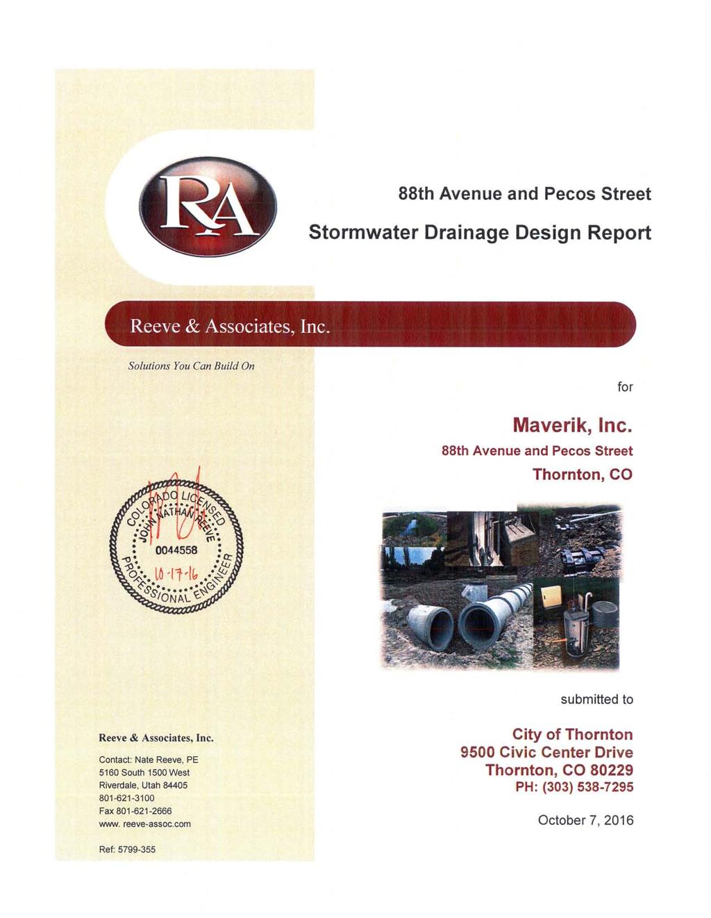
October 7, City of Thornton 9500 Civic Center Drive Thornton, CO (303) RE: Maverik Thornton, CO - Drainage Report
|
|
|
- Clarissa Wilkinson
- 5 years ago
- Views:
Transcription
1

2 October 7, 2016 City of Thornton 9500 Civic Center Drive Thornton, CO (303) RE: Maverik Thornton, CO - Drainage Report As per your request, we are submitting to you the drainage report and calculations of the drainage design for the Maverik located at 88 th Avenue and Pecos Street in Thornton, CO. The stormwater drainage report meets the criteria and specifications per Section 100 of the City of Thornton design manual. The Rational Method was used to calculate the runoff for historic and post-development per the UDFCD manual and imperviousness table. Using the UD-Detention spreadsheet, the detention pond/outlet structures were sized per COT and UDFCD details. The majority of storm water generated onsite will sheet flow to newly installed inlet boxes. The last inlet box prior to the detention basin is equipped with a sump and snout that will filter the storm water from hydrocarbons and other pollutants. After passing through the filtration process, the storm water will be directed to an above ground open detention basin that has been sized for the WQCV, EURV, and 100-year volume per USDCM and City of Thornton criteria. Once the storm water is in the detention system, it will be gravity fed towards a control box that is equipped with orifice plates and overflow structures that have been sized to control the outflow at rates for WQCV, EURV, and to below pre-historic flows for the 5-yr and 100-yr storms. The storm water hydraulic and hydrology calculations including the basin sizing and orifice plate are discussed in this report. If you have any questions, or we can be of further assistance, please let us know. Sincerely, Nate Reeve, P.E. Principal Engineer Reeve & Associates, Inc. nreeve@reeve-assoc.com Anna Newman, E.I.T. Civil Engineer Reeve & Associates, Inc. anewman@reeve-assoc.com Solutions You Can Build On Civil Engineering / Land Planning / Structural Engineering / Landscape Architecture / Land Surveying 5160 South 1500 West Riverdale, Utah Tel: Fax: ogden@reeve-assoc.com Website:
3

4 Reeve & Associates, Inc. Table of Contents MAVERIK, INC. 88th Avenue and Pecos Street Thornton, CO Item Section Introduction 1 Drainage System and Description 2 Drainage Analysis and Design Criteria 3 Summary and Conclusion 4 Appendix 5
5 Stormwater Drainage Design Report 1.0 Introduction 1.1 Purpose The purpose of this drainage report is to reflect proposed changes to the current drainage patterns associated with the proposed Maverik and subdivision. Proposed changes to the property include construction of a 5,518 sq. ft. Maverik convenience store with fuel pumps and associated utility service connections. The detention basin and associated facilities have been designed for a full build-out scenario. 1.2 General Property Description At the request of Thornton City, Reeve & Associates has prepared the following Storm Drainage Design Report for the proposed Maverik located at 88 th Avenue and Pecos Street in Thornton, Colorado. The site is located in the southeast quarter of section 21, township 2 south, range 68 west. See Figure 1 for a general location map that shows the proposed location and surrounding properties. A private storm sewer system will collect stormwater runoff from the proposed development. The storm sewer system will discharge into a private detention pond located on the eastern side of the property. An outlet pipe from the detention pond will outlet to the public right of way located along the north side of W. 88 th Avenue. The proposed development includes an access road and vacant land for future development. The detention basin and outlet structures are sized for a full buildout scenario for all future developments. 1.3 Pre-developed Drainage Characteristics The existing site is currently undeveloped and consists mostly of dry weeds and sandy loam with the soil type being C/D. The existing runoff from this property is divided into two sub-basins (EX-1 and EX-2) but sheet flows primarily from the north to the south and into the curb and gutter on 88 th Avenue as outline in this section and depicted on the predevelopment drainage plan located in the Appendix; with design point Z being the outfall of these existing basins. There is a third drainage basin (EX-3) on the north east corner of the site that sheet flows to the north east and into the Orchard Hill Senior Apartment Complex with design point Y being the outfall of this basin. 3
6 Stormwater Drainage Design Report The property is bordered to the north by residential property to the west by Pecos Street and Water World Amusement Park, to the south by 88 th Ave, and to the east by Orchard Hill Senior Apartments. The pre-developed stormwater runoff leaves the site without the use of engineered quality or detention facilities. 1.4 Post-developed Drainage Characteristics The proposed site will operate as a Maverik Convenience Store with vehicle fueling stations. The entire parcel sits on 6.35 acres. The site will contain 197,154 s.f. of undeveloped area, 54,546 s.f. of hard surface area, 19,880 s.f. of landscaped area and 5,518 s.f. of building area. Note that the detention basin has been sized to accommodate future developments on the site to tie into the detention basin. The proposed grading will divide the site into twelve drainage basins and seven design points as outlined in this section and depicted on the developed drainage plan located in the Appendix. Basin R-1 encompasses 0.43 acres of sidewalk and landscape between the onsite curb and gutter and Pecos Street and W. 88 th Avenue right of way. Stormwater generated in this basin will sheet flow undetained into the curb and gutter within the right-of-way and into the southeast corner of the lot. Basin R-2 encompasses 0.23 acres of sidewalk and landscape between the onsite curb and gutter and W. 88 th Avenue right of way. Stormwater generated in this basin will sheet flow undetained into the curb and gutter within the right-of-way and into the southeast corner of the lot. Basin R-3 encompasses 0.02 acres of asphalt paving on the southeast corner of the lot. Stormwater generated in this basin will sheet flow undetained into the curb and gutter within the right-of-way in W. 88th. Basin R-4 encompasses 0.02 acres of asphalt paving on the northwest corner of the lot. Stormwater generated in this basin will sheet flow undetained into the curb and gutter within the right-of-way on Pecos and follow the curb and gutter to the southeast corner of the lot. Basin B-1 encompasses 0.63 acres of parking and drive aisles of the proposed convenience store. Stormwater generated in this basin will sheet flow to a low point on the curb with an inlet box titled A. The water will be conveyed by a private storm sewer system to the private detention pond. Basin B-2 encompasses 0.02 acres of parking and drive aisles of the proposed convenience store. Stormwater generated in this basin will sheet flow to a low 4
7 Stormwater Drainage Design Report point on the curb with an inlet box titled d B. The water will be conveyed by a private storm sewer system to the private detention pond. Basin B-3 encompasses 0.14 acres of parking and drive aisles of the proposed convenience store. Stormwater generated in this basin will sheet flow to a low point on curb with an inlet box titled C. The water will be conveyed by a private storm sewer system to the private detention pond. Basin B-4 encompasses 0.57 acres of parking and drive aisles, the building and canopy for the proposed convenience store. Stormwater generated in this basin will sheet flow to a low point on curb with an inlet box titled D. The water will be conveyed by a private storm sewer system to the private detention pond. Basin B-5 encompasses 0.40 acres of parking and drive aisles, the building and canopy for the proposed convenience store. Stormwater generated in this basin will sheet flow to a low point on curb with an inlet box titled E. The water will be conveyed by a private storm sewer system to the private detention pond. Basin B-6 encompasses 0.35 acres of parking and drive aisles, the building and canopy for the proposed convenience store. Stormwater generated in this basin will sheet flow to a low point on curb with an inlet box titled F and G. The water will be conveyed by a private storm sewer system to the private detention pond. Basin B-7 encompasses 0.82 acres of detention pond. This has been sized to detain the 100-year storm event per COT code with an outlet structure and orifice plates for the WQCV, EURV and 100-year storm event. It will be landscaped per COT code. Basin F-1 encompasses 2.73 acres and will be developed at a later date. However, the detention basin design has included this area in a full build-out scenario. Future developments will convey their storm water to the proposed private detention pond. Pipe P1 conveys the stormwater from Basin B-2 from the inlet box B. Pipe P2 conveys the stormwater from Basin B-1 from the inlet box A. This pipe also carries the water from Basin B-2. Pipe P3 conveys the stormwater from Basin B-3 from the inlet box C. Pipe P4 conveys the stormwater from Basin B-4 from the inlet box D. This pipe also carries the water from Basin B-2 and B-1. Pipe P5 conveys the stormwater from B-5 from the inlet box E. This pipe also carries the water from Basin B-4, B-3, B-2 and B-1. 5
8 Stormwater Drainage Design Report Pipe P6 conveys the stormwater from B-6 from the inlet box F. This pipe also carries the water from Basin B-5, B-4, B-3, B-2 and B-1. Pipe P7 also conveys the stormwater from B-6 from the inlet box G. This pipe also carries the water from Basin B-5, B-4, B-3, B-2 and B-1. Ultimately, all storm water runoff from this site is conveyed to the South Platte River. In a fully developed scenario, 1% or cfs and 0.17 cfs will exit the site at each access untreated during the 5-yr and 100-yr storms respectively. The remaining storm water from hard surface areas will be directed to a private detention pond that is sized for the WQCV, EURV and 100-yr volumes. It will release 0.5 cfs and 8.60 cfs into the 88 th Ave right-of-way during the 5-year and 100-year storm events respectively. 1.5 Water Quality A private water quality facility will be provided for the full build-out at this time. Post-development stormwater runoff will be collected via curb and gutter and private combination curb inlets throughout the property. A private storm sewer system will convey storm water flows to the private detention pond facility located along the northeast property line. The detention pond will provide storage for the water quality capture volume of acre-feet or 6,926 c.f. with a water surface elevation of and the EURV storage has also been provided with a volume of acre-feet or 13,765 c.f. with an elevation of An outlet structure within the detention pond will provide water quality and staged release of stored stormwater that meets the City of Thornton Storm Drainage Design requirements. Because the 5-yr, and 100-yr design storm event developed flows are larger than the pre-developed site runoff totals, the detention pond outlet structure also reduces the release rates of the post-developed flows to the pre-developed rates. The pond will provide storage for the 5-yr design storm event and the water quality volume of acre-feet or 21,867 c.f. with a water surface elevation of The pond will also provide storage for the 100-yr, design storm event and the water quality volume of acre-feet or 35,240 c.f. with a water surface elevation of During the 100-yr design storm event, the pond outlet structure will provide a release rate of 8.6 cfs which is less than the predeveloped outflow of 9.7 cfs provided the UD-Detention analysis of the detention pond volume. A private 24 RCP pipe will connect to the outlet structure and release into a sidewalk chase drain and into the curbline along the north side of W. 88 th Avenue. 6
9 Stormwater Drainage Design Report See Hydraulic Calculations located in the Appendix for more details regarding detention pond design. 1.6 Hydrology Calculations The City of Thornton Storm Drainage Design, Grading, and Water Quality Technical Criteria within the City of Thornton Standards and Specifications was used to perform hydrology calculations. The Rational Method has been used to compute storm water runoff, as preferred for drainage areas less than 100-acres. Design storms with the 5-yr, and 100-yr, occurrence intervals were used. Weighted or composite C values for the site were calculated using the following formula. 5-year, and 100-yr, flows for the proposed site are summarized in the Appendix. Table 1 shows a comparison between pre-development discharges and postdevelopment discharges from the project site. Tablie 1: Peak Discharge Comparison Pre-Development Discharge (cfs) Post-Development Discharge (cfs) Discharge Difference (cfs) Q5 Pecos Q100 Pecos Q5 88th Q100 88th NE Corner NE Corner Pipe and inlet capacity calculations were performed at each design point as shown on the drainage plan. Storm sewer for this project was designed to convey the required 100-yr storm even with a surcharge hydraulic grade line not less than one foot below finished grade. Hydrologic and hydraulic calculations are located in the Appendix. All assumptions shall be field verified by the contractor prior to commencing construction, and discrepancies shall be reported to the engineer immediately for review. 7
10 Stormwater Drainage Design Report 1.7 Floodplain Statement According to the Federal Emergency Management Agency (FEMA), as depictured on Flood Insurance Rate Map (FIRM) 08001C0582H with an effective date of March 5, 2007, the site lies within areas determined to be outside the 500- year floodplain. 1.8 Erosion Control It is respectfully requested that an erosion control plan be submitted in conjunction with the final grading plan and not be required to be submitted with this drainage report. 1.9 Summary Developed runoff generated from the project site during the 100-yr. design storm event are anticipated to be less than or equal to the pre-developed runoff rates. Prior to being released off-site, runoff will be treated via a private detention pond and water quality facility, while a small percentage of the site s runoff will discharge (un-detained) to the adjacent right-of-way or adjacent properties. Downstream of the detention pond, a private 24 RCP pipe and sidewalk chase drain will convey treated runoff into the W. 88 th Avenue right of way. A series of private combination inlets will collect runoff in multiple locations on site and convey the runoff to the proposed private detention pond east of the Maverik building. The storm sewer has been designed to handle developed flows in the required 100-yr. design storm event condition within minimal surcharge. Since the site s anticipated developed runoff rate is less than the allowed predevelopment runoff rate, development on this site as described in the enclosed drainage plan is not anticipated to adversely impact downstream stormwater infrastructure. Upon the completion of construction, if conditions or outfall locations differ from the assumptions stated within this drainage study, an amendment to this report must be completed. Maverik Inc. will be responsible for any maintenance on the drainage facilities. 8
11 Stormwater Drainage Design Report APPENDIX 9

12 Stormwater Drainage Design Report Figure 1 Vicinity Map 88 th Avenue and Pecos Street Project Site The project site is located at 88 th Avenue and Pecos Street in Thornton, CO. 10
13 11 Stormwater Drainage Design Report

14 12 Stormwater Drainage Design Report

15 13 Stormwater Drainage Design Report

16 14 Stormwater Drainage Design Report
17 15 Stormwater Drainage Design Report
18 16 Stormwater Drainage Design Report
19 17 Stormwater Drainage Design Report
20 18 Stormwater Drainage Design Report
21 19 Stormwater Drainage Design Report
22 20 Stormwater Drainage Design Report
23 21 Stormwater Drainage Design Report
24 22 Stormwater Drainage Design Report
25 Hydraulic Grade Line - 5-yr Maverik, Inc 88th Ave & Pecos - Thornton, CO 8/29/2016 AHN Pipe Size (in) Slope (%) Length (ft) Flow (cfs) Invert Elev Invert Elev Up HGL Down (ft) (ft) Down HGL Up P P P P P P P P * All pipes analyzed with a Manning's roughness coefficient of Hydraulic Grade Line yr Maverik, Inc 88th Ave & Pecos - Thornton, CO 8/29/2016 AHN Pipe Size (in) Slope (%) Length (ft) Flow (cfs) Invert Elev Invert Elev Up HGL Down (ft) (ft) Down HGL Up P P P P P P P P * All pipes analyzed with a Manning's roughness coefficient of
26 Storm Runoff Calculations Maverik, Inc 88th Ave & Pecos - Thornton, CO 6/3/2016 TJH Basin Designation EX-1 EX-2 EX-3 Composite 'C' Factors - Pre & Post-Development GRASS ROOFS PAVEMENT GRAVEL COMPOSITE C FACTOR Grass Roofs Paved Gravel Total 5-YR 10-YR 100-YR 5-YR 10-YR 100-YR 5-YR 10-YR 100-YR 5-YR 10-YR 100-YR 5-YR 10-YR 100-YR % IMPERVIOUS R-1 R-2 R-3 R-4 B-1 B-2 B-3 B-4 B-5 B-6 B-7 F-1 * EX = existing * R = undetained * B = detained * F = future Basin Designation Time of Concentration C5 Acre Length (ft) Slope % Ti (min) Length (ft) Slope (ft/ft) Vel. (fps) Tt (min.) Total EX-1 EX-2 EX R-1 R-2 R-3 R-4 B-1 B-2 B-3 B-4 B-5 B-6 B-7 F-1 * EX = existing * R = undetained * B = detained * F = future Design Point Z Y * EX = existing * R = undetained * B = detained * F = future min. assumed min. assumed min. assumed min. assumed min. assumed min. assumed min. assumed min. assumed min. assumed assumed Design Storm: 5-Year Runoff Basin Area (ac) Coeff. (c) Tc C*A I (in./hr.) Q (cfs) Sum Area Max (Tc) Sum C*A Total Q (cfs) EX EX EX R-1 R-2 R-3 R-4 B-1 B-2 B-3 B-4 B-5 B-6 B-7 F
27 Design Storm: 10-Year Runoff Design Point Basin Area (ac) Coeff. (c) Tc C*A I (in./hr.) Q (cfs) Sum Area Max (Tc) Sum C*A Total Q (cfs) Z EX EX Y EX * EX = existing * R = undetained * B = detained * F = future R-1 R-2 R-3 R-4 B-1 B-2 B-3 B-4 B-5 B-6 B-7 F Design Point Z Y Basin EX-1 EX-2 EX-3 R-1 R-2 R-3 R-4 B-1 B-2 B-3 B-4 B-5 B-6 B-7 F-1 Design Storm: 100-Year Runoff Area (ac) Coeff. (c) Tc C*A I (in./hr.) Q (cfs) Sum Area Max (Tc) Sum C*A Total Q (cfs) Sum Area Max (Tc) Sum C*A Total Q (cfs) A B C D E F G FOR PIPE CAPACITY CALCULATIONS P1 P2 P3 P4 P5 P6 P7 Sum Area (Tc) Sum C*A I (in./hr) Total Q (cfs) P8 See UD-Detention Spreadsheet 8.90 Z post Y post See UD-Detention Spreadsheet
PHASE III DRAINAGE REPORT
 PHASE III DRAINAGE REPORT FOR Eastlake Assisted Living & Memory Care April 20, 2016 June 3, 2016 August 5, 2016 Prepared for: 3301 E 120 th Ave, LLC. 8200 E. Maplewood Ave., Suite 150 Greenwood Village
STORMWATER REPORT FOR WALMART SUPERCENTER STORE # SIOUX FALLS, LINCOLN COUNTY, SOUTH DAKOTA BFA PROJECT NO
 STORMWATER REPORT FOR WALMART SUPERCENTER STORE # 2443-00 SIOUX FALLS, LINCOLN COUNTY, SOUTH DAKOTA BFA PROJECT NO. 3286 March 1, 2012 I hereby certify that this engineering document was prepared by me
MASTER DEVELOPMENT DRAINAGE PLAN FOR MONUMENT HEIGHTS
 MASTER DEVELOPMENT DRAINAGE PLAN FOR MONUMENT HEIGHTS DRAINAGE REPORT STATEMENT ENGINEER'S STATEMENT: The attached drainage plan and report were prepared under my direction and supervision and are correct
PRELIMINARY DRAINAGE REPORT LATHAM 200 MMSCFD GAS PROCESSING PLANT
 PRELIMINARY DRAINAGE REPORT LATHAM 200 MMSCFD GAS PROCESSING PLANT LOTS B, RECORDED EXEMPTION 1211-2-1, RECX13-0096 LOCATED IN THE NORTH 1/2 OF SECTION 2, TOWNSHIP 3 NORTH, RANGE 66 WEST, 6 TH PRINCIPAL
CHECKLIST FOR PHASE II DRAINAGE REPORT
 I. COVER SHEET CHECKLIST FOR PHASE II DRAINAGE REPORT A. Name of Project B. Address C. Owner D. Developer E. Engineer F. Submittal date and revision dates as applicable II. GENERAL LOCATION AND DESCRIPTION
HEALTH SCIENCES BUILDING REDEVELOPMENT PROJECT
 INTRODUCTION In recent years, the University of Cincinnati (University) has demonstrated a commitment to identifying and implementing sustainable goals and objectives throughout University s Uptown Campuses.
Table of Contents G.1.a Water Resources - Surface Water - Drainage
 Table of Contents G.1.a Water Resources - Surface Water - Drainage 1. INTRODUCTION... 1335 2. ENVIRONMENTAL SETTING... 1335 a. Regional Hydrology... 1335 b. Local Hydrology... 1337 c. On-site Hydrology...
PCE PRELIMINARY DRAINAGE ANALYSIS REPORT FOR WESTWOOD MIXED USE NEIGHBORHOOD PROJECT 772 NORTH FOREST ROAD TOWN OF AMHERST, ERIE COUNTY, NEW YORK
 PCE PRELIMINARY DRAINAGE ANALYSIS REPORT FOR WESTWOOD MIXED USE NEIGHBORHOOD PROJECT 772 NORTH FOREST ROAD TOWN OF AMHERST, ERIE COUNTY, NEW YORK MAY 19, 2014 Prepared By: Timothy M. Lavocat, P.E., CFM
DRAINAGE CALCULATIONS
 DRAINAGE CALCULATIONS For the Carroll Single Family Residence At Santa Clara County Saratoga, California APN: 517-26-010 December 18, 2015 Prepared For: John and Peggy Carroll Prepared By: RI Engineering,
Pollutant Removal Benefits
 Bioswales Bioswales Similar to biocells, but have a slight, but positive grade toward an outlet Designed to convey the WQv event at very low velocities Promote filtration through native vegetation, infiltration
HCI ENGINEERING. March 27, City of Thornton, Development Engineering 9500 Civic Center Drive Thornton, CO 80229
 HCI ENGINEERING A division of HABERER CARPENTRY INC. March 27, 2014 Attn: Heath Klein, P.E. City of Thornton, Development Engineering 9500 Civic Center Drive Thornton, CO 80229 Re: Drainage Letter for
Figure 1 Cypress Street Study Area Location Map
 July 20, 2016 TO: FROM: Jim Massarelli Director of Engineering Jeff Julkowski, PE Michael Burke, PE SUBJECT: Cypress Street Study Area Stormwater Analysis (CBBEL Project No. 16-0058) At the request of
A. Regional Detention Requirements
 I. GENERAL DESIGN GUIDELINES A. Full-spectrum detention is provided for all new development, redevelopment or expansion of a site to provide for water quality and flood control detention. B. Detention
City of Waco Stormwater Management Regulations
 1.0 Applicability: City of Waco Stormwater Management Regulations These regulations apply to all development within the limits of the City of Waco as well as to any subdivisions within the extra territorial
STORMWATER MANAGEMENT CODES ANALYSIS RICHLAND COUNTY, SC SITE PLANNING ROUNDTABLE
 STORMWATER MANAGEMENT CODES ANALYSIS RICHLAND COUNTY, SC SITE PLANNING ROUNDTABLE Codes analyses for each subcommittee were completed to assist participants of the Richland County Site Planning Roundtable.
A. INTRODUCTION AND SUMMARY OF FINDINGS B. EXISTING CONDITIONS. Table 10-1 Adjacent Storm Drains
 Chapter 10: Stormwater Management A. INTRODUCTION AND SUMMARY OF FINDINGS This chapter describes existing and proposed stormwater management on the Site. Potential impacts to stormwater infrastructure
6.1. INTRODUCTION AND SUMMARY OF FINDINGS
 Chapter 6: Stormwater Management 6.1. INTRODUCTION AND SUMMARY OF FINDINGS A Stormwater Pollution Prevention Plan (SWPPP) has been prepared for the Proposed Project in accordance with the requirements
Project Narrative For Fruita RV Resort Conditional Use Permit
 Project Narrative For Fruita RV Resort Conditional Use Permit Date: November 18, 2016 Prepared by: Robert W. Jones, II, P.E. Vortex Engineering & Architecture, Inc. 2394 Patterson Rd., Ste. 201 Grand Junction,
When planning stormwater management facilities, the following principles shall be applied where possible.
 2.0 Principles When planning stormwater management facilities, the following principles shall be applied where possible. 2.0.1 Drainage is a regional phenomenon that does not respect the boundaries between
Lincoln 270. City of Lincoln. Stormwater Management Plan. April 2, 2013
 Lincoln 270 City of Lincoln Stormwater Management Plan April 2, 2013 # 2005.48 Prepared By: Civil Engineering Solutions, Inc. 590 E Street Lincoln, Ca 95648 (916) 645 5700 1.0 Background: The project site
User s Guide for the BMP Sizing Tool. Revised December 2017
 User s Guide for the BMP Sizing Tool Revised December 2017 Table of Contents Section 1.0 Introduction... 1 Section 2.0 Intended Audience... 2 Section 3.0 Installing and Starting the Application... 2 Section
TENNESSEE GAS PIPELINE COMPANY, L.L.C.
 TENNESSEE GAS PIPELINE COMPANY, L.L.C. HYDROLOGIC AND HYDRAULIC CALCULATIONS FOR ACCESS ROADS ALONG THE CONNECTICUT PIPELINE EXPANSION PROJECT CONNECTICUT LOOP Submitted by: Tennessee Gas Pipeline Company,
Moon Brook FRP BMP Summary Sheet. Ownership of Land where BMP is Located
 Outlet Retrofit Hitzel Terrace The town owned parcel along Hitzel Terrace is a natural wetland area which currently provides some level of stormwater detention and peak-flow attenuation. The proposed project
Chapter 14. Stormwater Quality Introduction
 14.0 Introduction This chapter addresses requirements and design criteria related to post-construction stormwater best management practices (requirements for construction erosion and sediment control are
CITY OF FORT LUPTON STORM DRAINAGE DESIGN AND TECHNICAL CRITERIA SECTION 10 STREETS
 SECTION 10 STREETS CITY OF FORT LUPTON STORM DRAINAGE DESIGN AND TECHNICAL CRITERIA SECTION 10 STREETS 10.1 INTRODUCTION The criteria presented in this section shall be used in the evaluation of the allowable
Appendix K. Stormwater Management Plan
 Regional Municipality of Halton - Steeles Avenue (Regional Road 8) Class EA - Industrial Drive to Regional Road 25/Martin Street Appendix K Stormwater Management Plan PR226401.001 Rev. 2 PR.DOT, 00/01
APPENDIX C: STORMWATER CONTROL PLAN
 APPENDIX C: STORMWATER CONTROL PLAN STORM WATER MANAGEMENT PLAN FOR PLEASANT HILL, CALIFORNIA Prepared for Compliance with the Clean Water Program (C.3) and the San Francisco Bay Regional Water Quality
STORMWATER MANAGEMENT PLAN: ERAND GARDENS X70
 STORMWATER MANAGEMENT PLAN: ERAND GARDENS X70 Client: Central Developments 09 April 2018 _ Rev00 Report no: SWMP/410/00 SWMP FOR ERAND GARDENS X70 TABLE OF CONTENTS 1 INTRODUCTION... 1 2 GENERAL INFORMATION...
Three Rivers Park District Administration Center Rain Garden
 Three Rivers Park District Administration Center Rain Garden Introduction There are significant changes to the hydrologic regime and nutrient loading following urban and industrial development. The post-development
GREEN ON THE HORIZON. Challenges of Integrating LID into New Development. Southeast Stormwater Association
 GREEN ON THE HORIZON Challenges of Integrating LID into New Development Southeast Stormwater Association Annual Seminar, Charleston SC October 9, 2014 JENNIFER A. NUNN, PE THE BALMORAL GROUP Acknowledgments
Huntington Stormwater Utility
 Huntington Stormwater Utility Stormwater Management & Sediment and Erosion Control Requirements for Construction Sites Authorized by Huntington City Code Articles: 971, 970, 930, 935, 955, Revised April
Chapter 4 - Preparation of Stormwater Site Plans
 Chapter 4 - Preparation of Stormwater Site Plans The Stormwater Site Plan is the comprehensive report containing all of the technical information and analysis necessary for the City to evaluate a proposed
6.1. INTRODUCTION 6.2. EXISTING CONDITIONS
 Chapter 6: Stormwater Management 6.1. INTRODUCTION This Chapter describes the current drainage patterns on the Project Site, the stormwater management system that is proposed as part of the Proposed Project,
Review Zone Application for D&R Canal Commission Decision
 Review Zone Application for D&R Canal Commission Decision MEETING DATE: July 20, 2016 DRCC #: 16-4803 Latest Submission Received: June 13, 2016 Applicant: Robert McCarthy, PE PSE&G 4000 Hadley Road, 2
BRISBANE BAYLANDS INFRASTRUCTURE PLAN FEBRUARY 2011 APPENDIX O DRAFT
 BRISBANE BAYLANDS INFRASTRUCTURE PLAN FEBRUARY 2011 APPENDIX O DRAFT PRELIMINARY STORM DRAIN CALCULATIONS ASSOCIATED WITH BRISBANE BAYLANDS REDEVELOPMENT BRISBANE, CALIFORNIA Prepared by BKF Engineers
ANSWER KEY MGSFlood v WWHM2012 (released 5/15/2015)
") ANSWER KEY MGSFlood v. 4.35 --- WWHM2012 (released 5/15/2015) Name: Date: Module 6.0: Advanced Topics in LID Design: Hydrologic Modeling General instructions: You may model facility dimensions to the nearest
ANSWER KEY MGSFlood v. 4.35 --- WWHM2012 (released 5/15/2015) Name: Date: Module 6.0: Advanced Topics in LID Design: Hydrologic Modeling General instructions: You may model facility dimensions to the nearest
City of Elmhurst. City of Elmhurst. Storm Sewer System Workshop November 22, 2010
 City of Elmhurst City of Elmhurst Storm Sewer System Workshop November 22, 2010 1 City of Elmhurst Watershed divide (green dashed line) through Elmhurst Area east of divide drains to Addison Creek Area
C. WATER. 1. Surface Water Runoff. See Section C.3, Flood Hazard/Mudflow Hazard, page Ground Water
 C. WATER 1. Surface Water Runoff See Section C.3, Flood Hazard/Mudflow Hazard, page 67. 2. Ground Water Determined not significant by the October 1984 and January 1999 Initial Studies conducted by the
Grass Buffer T-1. Description. Site Selection. Designing for Maintenance
 Description Grass buffers are densely vegetated strips of grass designed to accept sheet flow from upgradient development. Properly designed grass buffers play a key role in LID, enabling infiltration
APPENDIX B. Hydrologic and Hydraulic Analysis
 APPENDIX B Hydrologic and Hydraulic Analysis HYDROLOGIC AND HYDRAULIC ANALYSIS PETERSBURG ROAD IMPROVEMENTS DOT&PF Project No. 67879 Prepared for: State of Alaska Department of Transportation and Public
Old Mill Community Association Bioretention Facility
 Project Overview This project will install a bioretention facility in a community recreation area owned by the Old Mill Community Association, Inc. Drainage from the area is currently unmanaged and has
City Development Department 9500 Civic Center Drive Thornton, Colorado FAX
 City Hall City Development Department 9500 Civic Center Drive 303-538-7295 Thornton, Colorado 80229-4326 FAX 303-538-7373 www.cityofthornton.net Ben Swanson Dormie Capital Partners 3740 Dacoro Lane, Suite
Erosion & Sediment Control Plan Application Form & Checklist
 Erosion & Sediment Control Plan Application Form & Checklist GENERAL INFORMATION Application Date: Project Address: Tax Map / Parcel Number(s): PROPERTY OWNER / DEVELOPER Firm Name: Contact Person: Title:
Baltimore, MD Lt. Gov. Boyd Rutherford
 MODEL STANDARD PLAN FOR POULTRY HOUSE SITE DEVELOPMENT ON MARYLAND S EASTERN SHORE MARCH 2011 1800 Washington Boulevard 410-537-3000 Gov. Larry Hogan Baltimore, MD 21230-1718 800-633-6101 Lt. Gov. Boyd
STAFFORD TRACT NORTH OF US90A 1.0 INTRODUCTION 1.1 OBJECTIVE
 1.0 INTRODUCTION 1.1 OBJECTIVE This report, prepared for submittal to TxDOT, analyzes existing and proposed detention facilities draining into the TxDOT US90A storm sewer system. The results of the detailed
Floodplain Technical Memorandum
 Southeast Extension Project Lincoln Station to RidgeGate Parkway Prepared for: Federal Transit Administration Prepared by: Denver Regional Transportation District May 2014 Table of Contents Page No. Chapter
 PSLS Surveyors' Conference Workshop Information Form Workshop Number: (leave blank if unknown) Hours: Workshop Title: Workshop Description: Suggested Speaker(s), affiliation/contact information 1. 2. 3.
ATTACHMENT 1 WILSON MINE LECROY AREA SEMIPERMANENT DEWATERING SYSTEM
 ATTACHMENT 1 WILSON MINE LECROY AREA SEMIPERMANENT DEWATERING SYSTEM Reclamation plans for the Wilson Mine Lecroy area were approved by the Arkansas Department of Environmental Quality with a passive barrier
Draft Rhode Island Stormwater Design and Installation Standards Manual
 Draft Rhode Island Stormwater Design and Installation Standards Manual Summary The May 2009 Public Review Draft version of the RI Stormwater Design and Installation Standards Manual consists of approximately
Pond Siting Report Update
 Pond Siting Report Update Prepared for: Florida Department of Transportation District 5 CR 46A Realignment from SR 46 to North of Arundel Way Lake County, Florida FPID No. 238275-8-32-02 October 2013 (Draft
5. LOW IMPACT DEVELOPMENT DESIGN STANDARDS
 5. LOW IMPACT DEVELOPMENT DESIGN STANDARDS Low Impact Development (LID) requires a shift in stormwater management away from conveying runoff to a small number of downstream points through hydraulically
MANUAL OF DESIGN, INSTALLATION, AND MAINTENANCE REQUIREMENTS FOR STORMWATER MANAGEMENT PLANS
 MANUAL OF DESIGN, INSTALLATION, AND MAINTENANCE REQUIREMENTS FOR STORMWATER MANAGEMENT PLANS May 2007 SECTION 1 Responsibility of Applicant TABLE OF CONTENTS A. Stormwater Management Plan Required Information
Village of Forest Park. July 27, Sewer Separation Evaluation
 Village of Forest Park July 27, 2015 Sewer Separation Evaluation Presentation Overview Study Background Historic Nature of Forest Park Drainage Scale of Flooding Problem Forest Park Sewer System Background
Drexel, Barrell & Co.
 Drexel, Barrell & Co. June 18, 2018 Engineers/Surveyors Boulder Colorado Springs Greeley 3 South 7 th Street Colorado Springs, Colorado 80905-1501 719 260-0887 719 260-8352 Fax El Paso County Planning
Appendix A - Submittal Checklists
 City of Aspen Urban Runoff Management Plan Appendix A - Submittal Checklists 1. Conceptual Review Submittal Checklist 2. Landscape and Grading Permit Requirements and Checklist 3. Sufficiency Review Checklist
Drainage Control Plans
 2016 Drainage Design and Erosion Control Manual - Guide Sheet 1C Drainage Control Plans A Drainage Control Plan is the comprehensive submittal package containing all of the technical information, analysis,
Chapter 3 Site Planning and Low Impact Development
 CHAPTER 3 Site Planning and Low Impact Development Chapter 3 Site Planning and Low Impact Development 3.0 Introduction The City of Charleston requires that major residential, large commercial (>1 acre),
Planning the BMP. Region 2000 Planning District Commission Lynchburg, VA December 13, 20013
 Planning the BMP Region 2000 Planning District Commission Lynchburg, VA December 13, 20013 PLANNING THE BMP AGENDA BMP Selection BMP Design SWM Plan Preparation 2 BMP SELECTION Types of BMPs Structural
Part 4: CRS Stormwater Management Activity (450) and Urban Flooding Best Practices
 and Urban Flooding Best Practices") Coastal Resilience through Community Engagement Webinar Series Part 4: CRS Stormwater Management Activity (450) and Urban Flooding Best Practices 1:00 2:30pm CT 8 Today s Moderator Chad Berginnis, CFM
Coastal Resilience through Community Engagement Webinar Series Part 4: CRS Stormwater Management Activity (450) and Urban Flooding Best Practices 1:00 2:30pm CT 8 Today s Moderator Chad Berginnis, CFM
6.5 Lakewood Gulch. Basin Snapshot
 6.5 Lakewood Gulch The Lakewood Gulch Map Unit is comprised of both Lakewood Gulch and Dry Gulch (4800-01 and 4801-01) from the Denver Storm Drainage Master Plan (SDMP) and has a total drainage area of
Attachment 2: Permeable Pavement Design Guidelines
 Attachment 2: Permeable Pavement Design Guidelines Design of permeable pavement systems is critical if they are to function properly and efficiently. The area and shape are dependent on the site design,
City of Troutdale South Troutdale Road Storm Drainage Plan
 City of Troutdale South Troutdale Road Storm Plan January 29 City of Troutdale SOUTH TROUTDALE ROAD STORM DRAINAGE PLAN January 29 Prepared for: City of Troutdale 342 SW 4th Street Troutdale, OR 976 Prepared
NEORSD Green Infrastructure Grant (GIG) Program Opening Remarks
 Program Opening Remarks") NEORSD Green Infrastructure Grant (GIG) Program Opening Remarks 2019 NEORSD GIG Eligibility and Technical Requirements Project must be located in the Sewer District s combined sewer area Location Applicant
NEORSD Green Infrastructure Grant (GIG) Program Opening Remarks 2019 NEORSD GIG Eligibility and Technical Requirements Project must be located in the Sewer District s combined sewer area Location Applicant
SEATTLE PUBLIC UTILITIES Drainage Design Options for street right of ways.
 SEATTLE PUBLIC UTILITIES Drainage Design Options for street right of ways. Numerous ecosystem-based functional stormwater quantity and quality design alternatives are possible within the street ROW. Several
OP Council Resolution June 16, Planning and Development Services
 OP-08-01 Council Resolution June 16, 2008 Planning and Development Services Kingsgate Landing Outline Plan Table of Contents 1.0 Introduction 1 1.1 Purpose of Plan 1 1.2 Plan Area Location 1 1.3 Ownership
Overall Drainage Report
 Overall Drainage Report Date: May 3, 2016 Project: Attn: Gateway at Prospect Overall Development Plan Fort Collins, Colorado Mr. Shane Boyle Fort Collins Utilities 700 Wood Street Fort Collins, Colorado
Leduc Industrial Outline Plan SE W4
 Leduc Industrial Outline Plan SE 1-50-25-W4 Within the North Leduc Industrial ASP Prepared for: Leduc Energy Park Ltd. Prepared by: Stantec Consulting Ltd. File No. 1161 104655 V5 Table of Contents 1.0
PRELIMINARY ENGINEERING REPORT
 PRELIMINARY ENGINEERING REPORT GRAND AVENUE STREET & SIDEWALK EXTENSION WORTHINGTON, MINNESOTA 6-3-15 Project No. 14-16841 Table of Contents Page # Introduction... 1 Project Need... 1 Design... 1 Costs
SEMSWA s Role in the Land Development Process
 SEMSWA s Role in the Land Development Process One of SEMSWA s responsibilities is to ensure that any new development or redevelopment within its service area is designed and constructed in compliance with
City of Elmhurst. Comprehensive Flood Plan. City of Elmhurst. City Council Meeting September 15, 2014
 City of Elmhurst City of Elmhurst Comprehensive Flood Plan City Council Meeting September 15, 2014 City of Elmhurst Presentation Overview Study Background Study Methodology Analysis of Three Additional
CHAPTER 9 STORM DRAINAGE. Minimum Requirements for New Development and Redevelopment
 CHAPTER 9 STORM DRAINAGE 9.01 General The standards established by this chapter are intended to represent the minimum standards for the design and construction of storm drainage facilities. 9.02 Design
New Development Stormwater Guidelines
 New Development Stormwater Guidelines CITY OF MOUNTLAKE TERRACE Table of Contents Introduction... 2 Ecology s Minimum Requirements for stormwater management... 2 Description of the 9 Minimum Requirements...
Swatara Township Stormwater Program. 1. There are no storm sewers on or near my property. Why should I pay a fee?
 1. There are no storm sewers on or near my property. Why should I pay a fee? All properties produce stormwater runoff that must be managed by the Township. Even if your property has never flooded and there
2012 Saginaw Bay Watershed Conference
 2012 Saginaw Bay Watershed Conference March 16, 2012 Russ Beaubien, P.E., CFM Low Impact Development Fundamentals Summary LID overview Education on LID Fundamentals of LID Examples of LID practices Other
4. CONCEPT PLAN DEVELOPMENT
 4. CONCEPT PLAN DEVELOPMENT Concept Plan Step 1: Identify Site Constraints and Opportunities Review the existing site to identify constraints and opportunities for GI Practices to meet the RRv. Constraints
Why a new Food & Farm Ordinance?
 Growing for Kane Why a new Food & Farm Ordinance? 1. Growing obesity issue 64% of Kane adults are overweight or obese 2. Low rates of fruit & vegetable consumption Healthy diets include more fruits & veggies.
West Virginia Stormwater Management Manual: Methods.
 West Virginia Stormwater Management Manual: Methods Created to deliver targeted training on new tools and practices to improve the quality of stormwater runoff. www.cbstp.org www.chesapeakestormwater.net
South Bismarck Watershed Model Update and Stormwater Improvement Project
 Preliminary Engineering Report Bismarck Tribune South Bismarck Watershed Model Update and Stormwater Improvement Project City of Bismarck, ND January 2017 14.105.0046 1.0 Executive Summary The focus of
Bioretention cell schematic key
 Bioretention Cells Bioretention cell schematic key 1 3 Hardwood mulch 2 Curb cut 3 18-30 Modified soil 4 Stone aggregate choker layer 5 Stone aggregate base layer 6 Subdrain 7 Undisturbed soil 8 Overflow/Cleanout
Beyond Runoff Reduction: Thorough Green Infrastructure Design. Zach Sample, PE Innovyze
 Beyond Runoff Reduction: Thorough Green Infrastructure Design Zach Sample, PE Innovyze Presenter Zach Sample, PE Stormwater Products Manager Innovyze Agenda Modern stormwater design (HINT: Runoff Reduction)
S o u t h C e n t r a l O u t l i n e P l a n. Leduc Business Park. North Leduc Industrial Area Structure Plan C it y of Led u c.
 Leduc Business Park North Leduc Industrial Area Structure Plan C it y of Led u c Prepared for Farm Air Properties Inc. January, 2007 Table of Contents Page Number 1.0 Purpose of Plan and Definition of
APPENDIX APPENDIX 6 STORMWATER MANAGEMENT REPORT
 APPENDIX APPENDIX 6 STORMWATER MANAGEMENT REPORT ECHO BAY NEW ROCHELLE, NEW YORK STORMWATER MANAGEMENT REPORT Prepared for: Forest City Residential Group 1 Metro Tech Center North Brooklyn, NY 11201 Prepared
Example Stormwater Control Plan For a Residential Subdivision Project. Whispering Pines Lane Anytown, USA
 Example Stormwater Control Plan For a Residential Subdivision Project Whispering Pines Lane Anytown, USA December 2, 2015 XYZ Corporation Jane Jones, 707-555-1212 This example prepared by Dan Cloak Environmental
Southland Lane Detention Pond Project is a classroom for future green infrastructure projects in the City of Brookings, South Dakota
 Southland Lane Detention Pond Project is a classroom for future green infrastructure projects in the City of Brookings, South Dakota What does a pipe think of a pond? Presented by Rocky J. Keehn, PE, D.WRE,
ARIZONA WATER COMPANY
 ARIZONA WATER COMPANY East Sedona Water Storage Facility February 21, 2018 Community Meeting STORMWATER RUNOFF Issue: Runoff sometimes flows out of the wash at bottlenecks in front of several homes on
Advance Engineering & Surveying PLLC
 Advance Engineering & Surveying, PLLC Consulting in: Civil & Environmental Engineering Land Surveying Land Development 11 Herbert Drive Phone: (518) 698-3772 Latham, N.Y. 12110 Email:ncostape@gmail.com
Article 20 Stormwater Management
 Article 20 Section 20.01 Intent Article 20 The purpose of this Article is to protect the health, safety, and general welfare of the citizens by requiring compliance with accepted standards and practices
Drexel, Barrell & Co.
 Drexel, Barrell & Co. December 21, 2018 Engineers/Surveyors Boulder Colorado Springs Greeley 3 South 7 th Street Colorado Springs, Colorado 80905-1501 719 260-0887 719 260-8352 Fax El Paso County Planning
Level 1 Downstream Analysis
 Level 1 Downstream Analysis Newcastle Way Apartments Newcastle, Washington King County April 14, 2014 Revised July 10, 2014 Prepared by: Dean A. Furr, P.E. Reviewed by: Donald Scarberry, P.E. Coffman Engineering,
EXHIBIT B PROJECT NARRATIVE POULSBO MEADOWS
 EXHIBIT B PROJECT NARRATIVE POULSBO MEADOWS Name of Project: Poulsbo Meadows; A Planned Residential Development (PRD)/Plat Applicants Name: PBH Group LLC/Byron Harris PO Box 1010 Silverdale, WA 98038 Description
Drainage Report. For: Owner/Developer:
 Drainage Report For: My Place Hotel Lot 6, Charles Ritz Subdivision Overland Park, KS Owner/Developer: Overland Park Holdings, LLC Matt Eller 104 Campus Drive, Suite 202 Huxley, IA 50124 Civil Engineer:
Ames City Hall Campus: Stormwater Improvements
 Ames City Hall Campus: Stormwater Improvements Tracy Warner, Municipal Engineer for the City of Ames, IA Jake Moore, Stormwater Specialist for the City of Ames, IA Ryan Benjegerdes, Water Resources Engineer
LOUISIANA STATE UNIVERSITY COMPREHENSIVE & STRATEGIC CAMPUS MASTER PLAN. APPENDIX G - Stormwater Study Findings & Stormwater Solutions
 LOUISIANA STATE UNIVERSITY COMPREHENSIVE & STRATEGIC CAMPUS MASTER PLAN APPENDIX G - Stormwater Study Findings & Stormwater Solutions LSU: MP Narrative July 2017 3.5 Open Space Existing Conditions The
1. Project Description
 To: By: Checked By: Jimmy Vilce, E.I. (FOT istrict 1 Project Manager) Jennifer Nunn, P.E. (The Balmoral Group) Lori Stanfill, P.E. (The Balmoral Group) Memorandum ate: July 10, 2018 Subject: In May of
Colerain Township report to. Hamilton County Regional Planning Commission. December 2, 2010, 1:00PM. t a f f r e p o r t
 Colerain Township report to Hamilton County Regional Planning Commission December 2, 2010, 1:00PM Preliminary Plan: Case No.: ZA2001-04, Forevergreen Prepared By: Amy Bancroft, Land Use Planner t a f f
PRELIMINARY ENGINEERING REPORT
 PRELIMINARY ENGINEERING REPORT GRAND AVENUE STREET & SIDEWALK EXTENSION WORTHINGTON, MINNESOTA 7-25-14 Project No. 14-16841 Signature Sheet I HEREBY CERTIFY THAT THIS REPORT WAS PREPARED BY ME OR UNDER
APPENDIX A SIMPLIFIED APPROACH TO STORMWATER MANAGEMENT FOR SMALL PROJECTS. In West Sadsbury Township, Chester County, Pennsylvania
 APPENDIX A SIMPLIFIED APPROACH TO STORMWATER MANAGEMENT FOR SMALL PROJECTS In West Sadsbury Township, Chester County, Pennsylvania TABLE OF CONTENTS I. Introduction 3 II. Importance of Stormwater Management
C ity of Grande Prairie Development Services Department
 C ity of Grande Prairie Development Services Department FAIRWAY DEVELOPMENT OUTLINE PLAN OP 08 09 Approved April 6, 2009 Prepared by: Focus Corporation Table of Contents 1.0. Introduction 2 3 1.1. Plan
Village of New Maryland. Storm Water Management Master Plan
 Village of New Maryland Storm Water Management Master Plan Village of New Maryland Storm Water Management Master Plan Fredericton Office 80 Bishop Drive Fredericton NB E3C 1B2 Canada Telephone: +1 506
Checklists. Project Name: Location: File Number: Date of Submittal: Reviewer: Date: Applicant: Contact Name: Phone Number:
 Applicant: Contact Name: Phone Number: Email: Project Name: Location: File Number: Date of Submittal: Reviewer: Date: Concept Plan Requirements: I. General Project Information 1. Address or parcel number