DESIGN CONCEPTS. Option C: Seasons
|
|
|
- Everett Doyle
- 6 years ago
- Views:
Transcription


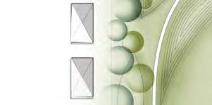
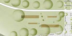
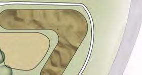
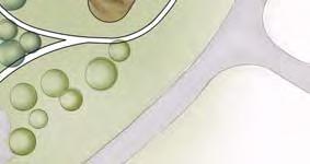
1 DESIGN CONCEPTS Option C: Seasons Colorado is known for its snowy active winters, hot fun summers, brilliant spring blooms, and dramatic fall color. This design highlights all of these elements in order celebrate the four season s bounty. Winter activities in this design include an ice skating ribbon and various sledding hills. Spring is highlighted in the center of the park by a series of mounds bursting with colors and textures provided by drought tolerant plants. Dramatic fall color is expressed by various trees, shrubs, and plant material. Lastly, in the summer the riparian zone comes to fruition highlighted by a manicured creek side and stunning tall grasses. 26


2 DESIGN CONCEPTS [SEE APPENDIX C FOR OPTION C SITE PLAN] 27


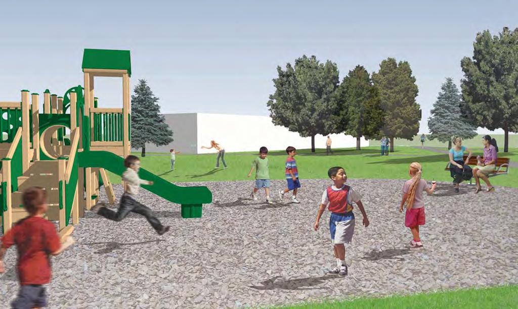
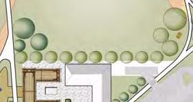
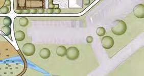
3 DESIGN CONCEPTS Option D: Sports and Rec Sports and Rec combines active sports spaces with passive recreation focused on the local ecology. The activities at the park examine existing recreation opportunities, and build on some of the desired amenities in Gypsum. Baseball and a multi-purpose soccer fi eld provide options for team sports, while BMX creates an exciting individual activity. A ½-mile measured path helps users to track exercise distance. Fitness stations, several of which are co-located with the children s playground, accommodate a full-body workout. Adjacent to the playground, the park design draws inspiration from native and adapted plant species. Colorful gardens surround the pavilion and along the stream children learn about their environmental surroundings through nature play. Here, kids are encouraged to manipulate loose objects and interact with organic materials. These experiences help them to develop an understanding of, and appreciation for, the world around them. 28


4 DESIGN CONCEPTS [SEE APPENDIX D FOR OPTION D SITE PLAN] 29


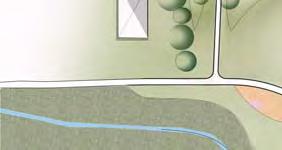
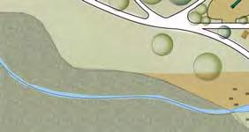
5 DESIGN CONCEPTS Option E: Water Play + Overlook Plan Water Play + Overlook takes inspiration from regional parks around Colorado and beyond. Spaces varying in size and programming create a unique experience providing activities for locals and visitors alike. Passing under a ranch arch from the southwest corner, users are greeted with many activities in close proximity to the parking lot. To the south a splash park and river walk allow users to interact with both natural and man-made creek features. Proceed around the circulation path connecting users to open spaces for picnicking as well as playing soccer. South of the soccer fi elds lies an overlook for users to take in the beauty of the surrounding landscape. 30


6 DESIGN CONCEPTS [SEE APPENDIX E FOR OPTION E SITE PLAN] 31


7 INITIAL PUBLIC FEEDBACK The fi rst initial public meeting was held on January 14th,2015. The meeting was held open house style in the later afternoon in order to create access for more residents to take a look at the work that had been produced. The information that the students were working with was based on information gathered from the fi rst meeting with city offi cials and stakeholders. The presentation itself was very informal. The six schemes that were developed were posted on boards and set around a conference room. Each option had an overall site plan as well as a supplemental board that contained inspiration, visual and design elements in order to convey the theme of that design scheme. The way the boards were presented was intended to allow for visiting residents to fl oat about each display to get an overall sense of what was being developed for the property. All the guest were given access to colored drafting dots that could be placed on the boards in order to indicate design features that they appreciated the most. Sticky notes were also offered to directly place comments on each design. Simple questionnaires were also available for residents to leave feedback, including their favorite and not so favorite design. The questionnaires had a total of 4 questions that would generate feedback to lead the fi nal design process. In total we gathered 41 community feedback forms, 33 sticky notes and 145 draft dot comments. 32

8 SECTION 3 Preferred Design Concept Refi nement Feedback analysis Active Options Passive Options Final Feedback Final Design Option 34
9 PREFERRED DESIGN CONCEPTS Each of the fi ve designs had various favorable qualities identifi ed by the community. In Plan A or the mountain theme the community preferred the location of the athletic fi eld, playground implementation, proximal restrooms, neighborhood privacy. The community suggested pickle ball court implementation instead of tennis courts, more seating throughout the park, and a dog park. Characteristics preferred by the community in the Plan B or the Fields option were the view sheds and passive qualities of the space, but would prefer the athletic fi elds to be moved away from the neighborhood. They also suggested a BMX park and ball fi elds. In Plan C, or the Seasons option, the community liked the gardens near the pavilion and seasonal activity. The idea of the skate ribbon was favorable but not realistic for the climate of Gypsum. They also wanted the athletic fi elds near the school and a larger pavilion. In Plan D or Sports + Rec the community supported the adult fi tness stations and the BMX or pump park. They also advocated for open space fi elds to accommodate little and senior league practice and games. Plan E or Water + Play the community enjoyed the dog park, educational gardens, and the water play. They preferred a paved parking lot instead of gravel. Option Refi nement: With the feedback from the community, the design team refi ned and designed two options considering the preferred concepts. One option had a more active regimen while the other was more passive. 35


![A.1] 36](/docs-images/77/75300862/images/10-3.jpg)


10 ACTIVE OPTION [FOR ENLARGED MAP SEE APPENDIX A.1] 36
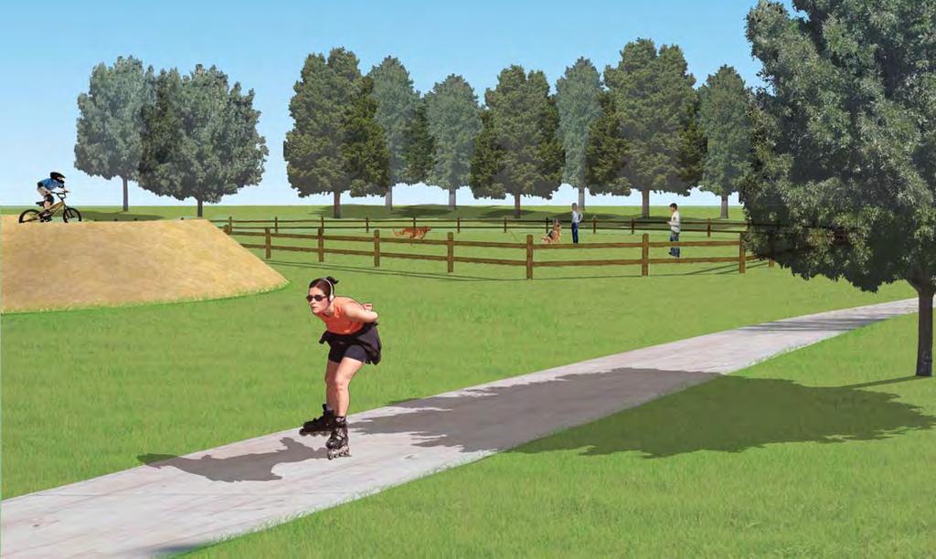
11 ACTIVE OPTION DESCRIPTION Neighborhood connection This path connects the existing asphalt path located in the neighborhood just south of the park to the IK Bar Ranch Property. The width of the path will be congruent with the existing asphalt path and the materials proposed are concrete or asphalt. A benefi t of concrete is less heat projecting from the path during the summer months; where as a benefi t of asphalt is more heat convection to melt snow in the winter time. It is also the same material used by the boarding neighborhood. Park Neighborhood landscape separation A highly vegetated landscape is used to separate the south laying neighborhood from the park. This separation will create privacy for the residence as well as help with noise pollution. Vegetation will be mostly evergreen in order to create a year round screen. Berms or small hills will also be contoured in this highly vegetated area to enhance privacy. Perimeter walking path The perimeter path is a 6 feet wide circulating route through the whole site. The length of this path is.5 miles with just two laps equaling a mile. Material suggested for this path is a crusher fi ne or something similar. Crusher fi ne is a permeable material that helps alleviate storm water runoff. It also decreases joint impact on exercise enthusiasts. Asphalt or concrete could also be used. Viewing berm The viewing berm is located just past the baseball homerun fence. During the baseball season it can be utilized by game viewers, whereas during the winter it can be used as a sledding hill. Regulation size baseball field (striped) The regulation baseball size fi eld will be stripped and include a conventional pitching mound. The outfi eld is 195 from the grass line to the home run fence. This fi eld could also be striped for regulation softball standards. When games are not in process the fi eld acts as open space for everyone to enjoy. Horseshoe bocce ball pits There are two horseshoe and bocce ball courts are located to the east of the park. The bocce ball courts are regulation size with dimensions of 13 x 91. The horseshoe pits are 6 x 48. This area also includes benches as well as picnic tables. Central Walkway and public amenities The central walk way is a permeable path that connects the east side of the park to the west side. The path spans 40 wide with two 10 wide paths for pedestrian circulation. Within the 10 wide paths are intermittently spaced ornamental trees approximately 20 apart. The middle 20 wide space is used also for circulation but also acts as a place for rest and relaxation. The middle 20 wide space includes shade structures, picnic tables, fl owering beds, benches, and water features. Large picnic shelter with restrooms The large picnic shelter is a permanent structure located in the center of the central walkway. It provides large area of shade and restrooms. This shelter can be used for teams while waiting for their games to start or anyone needing to get out of the summer heat. This structure could be fabricated out of metal or wood. Water access Water access is located at the east side of the park. Permeable paving and benches surround the channeled water for those to relax and listen to the fl owing stream. The channeled water is approximately 2 feet deep to allow for wading. Kids Play Kids play is located just off the central walkway and just south of the multi-purpose sports fi eld/ open space. This area includes a conventional play structure and areas of nature play. The playground is shaded by trees and is near a shade structure located in the central walkway. There are two restroom sites nearby. On is located at the shade structure (100 ft. away) and the other in the pavilion (80 ft. away) 37
12 ACTIVE OPTION DESCRIPTION Parking lot with drop off (50 spaces) Upon entering the park users are greeted with a gateway reminiscent of the character of the park. Located far enough off of Grundel Way to the eastern edge allows the parking lot to become a more defi ned space. With 50 spaces with at least 2 handicap spots, the paved lot provides ample space for the events at the pavilion. Placed near the service access to the building, event staff are given easy access to bring catering in. Pump Track Situated around the fenced in dog park is the pump track. Providing a new type of biking excursion both locally and regionally, this feature gives reason for users to attend the park. With varying diffi culties throughout the ramped and mounded dirt track this space aims to accommodate all skill levels. Being essentially a set of varying berms, the location allows for minimization of sound from both the pump track itself and the neighboring fenced in Dog Park. Pavilion The pavilion is located close by the parking for easy drop-off access. The pavilion includes restrooms, warming kitchen, and fl ex space. The pavilion can serve as a gathering place for reunions, weddings, and other various ceremonies. The pavilion has a small courtyard space with potential for fl owering planters and increased outdoor seating. Multi-purpose athletic field The multipurpose fi eld is an open space fi eld that allows for activities like soccer, rugby, and lacrosse to be stripped on to the fi eld if needed. Other activities in this area include but are not limited to volleyball, Frisbee, ultimate Frisbee, sun bathing, etc. Pickle ball courts The pickle ball courts are located in close proximity to the parking lot on the north side. There are 4 courts available for games. Each court is fenced, with the dimensions for the pickle ball courts being regulation size at 20 x 40. Fenced dog park Located in the north-western corner of the park lies the fenced dog park. Easily accessible from the parking lot, users are provided a clean and beautifi ed space for their dogs to run around and interact with others. Both the BMX pump track and the trees on the southern edge provide ways to minimize negative views and sounds associated with the inclusion of a dog park. With dog use restricted elsewhere within the park, this space provides residents a great space to take their dogs outdoors. 38

13 ACTIVE OPTION 39


14 ACTIVE OPTION SECTION A SECTION B SECTION C 40


![B.1] 41](/docs-images/77/75300862/images/15-3.jpg)


15 PASSIVE OPTION [FOR ENLARGED MAP SEE APPENDIX B.1] 41
16 PASSIVE OPTION Neighborhood connection This path connects the existing asphalt path located in the neighborhood just south of the park to the IK Bar Ranch Property. The width of the path will be congruent with the existing asphalt path. Materials proposed are concrete or asphalt. The benefi t of concrete is less heat projecting from the path during the summer. The benefi t of asphalt is more heat to melt snow in the winter time and it is the same material used in the boarding neighborhood. Park Neighborhood landscape separation A highly vegetated landscape is used to separate the south laying neighborhood from the park. This separation will create privacy for the residence as well as help with noise pollution. Vegetation will be mostly evergreen in order to create a year round screen. Berms or small hills will also be contoured in this highly vegetated area to enhance privacy. Perimeter walking path The perimeter path is a 6 feet wide circulating route through the whole site. The length of this path is.5 miles with just two laps equaling a mile. Material suggested for this path is a crusher fi ne or something similar. Crusher fi nes is a permeable material that helps alleviate storm water runoff. It also decreases joint impact on exercise enthusiasts. Asphalt or concrete could also be used. Small Lawn Space Surrounded by smaller berms in the range of 3-5 helping to minimize sound to the surrounding neighborhoods, these small pockets of open space provide area for smaller group activities and individuals alike. Large enough to house smaller soccer practices for kids, as well as space to lounge and enjoy a picnic these pockets allow for impromptu activities. Ornamental/perennial plantings The braided ornamental plantings provide a means for beautifi cation of space and educating users about native fl ora. As a means for providing habitat for local fauna as well as pollinating species they help to break up the space along the inner pathways, while providing a nice backdrop for users within the smaller lawn spaces. Picnic spaces Situated amongst the trees to the eastern edge of the park, various picnic benches with the potential for grills allow users semi-enclosed spaces to gather. Located adjacent to the kids play area, parents can enjoy a meal while keeping a close eye as their kids enjoy the playground structure and water play areas. The picnic spaces provide perfect opportunity for gatherings and birthday parties alike. Developed Water Access Located at the lower east central section of the park, the water access provides both manmade as well as natural water settings for users to enjoy. Easily accessible from the parking lot, pavilion, kids play area, and the picnic spaces; the water area is intended to provide a service that is not currently represented within Gypsum. Both the bridge and the sandstone standing blocks allow people to access the water in a variety of ways, while engaging them with their surroundings. Providing a complimentary backdrop to the water access an emphasis has been placed on an ecological riparian buffer both helping to clean the water and educate the public on native plant species. 42
17 PASSIVE OPTION Kids Play Area Adjacent to the pavilion lies the kids play area. With an emphasis on both natural aspects and play structures, the kids are provided many ways to grow both mentally and physically. Located between the parking lot and the picnic area, parents are given the opportunity to catch up with friends while easily being able to keep an eye on their kids. Carefully placed trees help provide shade during the warmer months, while having the water area near by allows kids to cool off quickly. Large Lawn The large lawn(s), split by the central path provide spaces for larger group activities as well as pick up sports games. Similar to the smaller areas the berms surrounding the open space provide areas to lounge while minimizing sound to neighboring areas. More of the perennial planting braids provide nice backdrops along the central pathway, while aiding in sectioning off the left space and the right. Trees surrounding the edges allow for users to escape the sun after tossing a Frisbee or kicking around a soccer ball in the large lawn(s). School Access As users make their way either around the circulation path or the central path, they slowly make their way up the embankment to the middle school. By the time they reach the crossroads at the western edge of the park, the grade will have increased by around 10 feet before making their way up the fi nal fi ve feet to the school. By increasing the grade on the western side a more interesting and intuitive space mimics the mountains. Parking Lots - 50 spaces Upon entering the park, users are greeted with a gateway reminiscent of the character of the park. Located far enough off of Grundel Way to the eastern edge allows the parking lot to become a more defi ned space. With 50 spaces with at least 2 handicap spots, the paved lot provides ample space for the events at the pavilion. Placed near the service access to the building, event staff are given easy access to bring catering in. Fenced Dog Park Located in the north-western corner of the park lies the fenced dog park. Easily accessible from the parking lot, users are provided a clean and beautifi ed space for their dogs to run around and interact with others. Both the BMX pump track and the trees on the southern edge provide ways to minimize negative views and sounds associated with the inclusion of a dog park. With dog use restricted elsewhere within the park, this space provides residents a great space to take their dogs outdoors. Pump Track Situated around the fenced in dog park is the pump track. Providing a new type of biking excursion both locally and regionally, this feature gives reason for users to attend the park. With varying diffi culties throughout the ramped and mounded dirt track this space aims to accommodate all skill levels. Being essentially a set of varying berms, the location allows for minimization of sound from both the pump track itself and the neighboring fenced in Dog Park. Pavilion and Pergola Space With a large pergola structure to the south, users are provided space to escape the shade. Located within the plaza of the pavilion, the space becomes a beautiful area to host music, weddings, and other events. When not in use by events a small water feature provides yet another area for families to cool off and escape the warm summer months of Colorado. 43

18 PASSIVE OPTION 44


19 PASSIVE OPTION SECTION A SECTION B SECTION C 45
20 FINAL FEEDBACK City offi cials and the stakeholders reviewed over the two options and suggested further refi nement combining elements from both the active and passive designs. Qualities to keep or add in are as follows: Keep perimeter path around site and show exercise stretching stations. Keep large playground from passive option. Liked pavilion and large pergola space in passive option. Increase parking spaces to 75 spaces. Add another entry access point to parking lot. Create a drop off plaza to connect pavilion plaza. Keep school access to the west and gradually terminate the central walkway. Keep active water access and integrate with central walkway. Change location of bocce ball and horseshoe courts. Relocate pickleball courts. More picnic areas, tables, and small shelters. Keep trees and perennial plantings. 46

21 FINAL DESIGN OPTION [FOR ENLARGED MAP SEE APPENDIX FINAL] 47
22 FINAL DESIGN DESCRIPTION Neighborhood connection This path connects the existing asphalt path located in the neighborhood just south of the park to the IK Bar Ranch Property. The width of the path will be congruent with the existing asphalt path and the materials proposed are concrete or asphalt. A benefi t of concrete is less heat projecting from the path during the summer months; where as a benefi t of asphalt is more heat convection to melt snow in the winter time. It is also the same material used by the boarding neighborhood. Park Neighborhood landscape separation A highly vegetated landscape is used to separate the south-laying neighborhood from the park. This separation will create privacy for the residence as well as help with noise pollution. Vegetation will be mostly evergreen in order to create a year round screen. Berms or small hills will also be contoured in this highly vegetated area to enhance privacy. Perimeter walking path The perimeter path is a 6 feet wide circulating route through the whole site. The length of this path is.5 miles with just two laps equaling a mile. Ten fi tness stations are dispersed along this half-mile trail for outdoor resistance training and stretching techniques. Material suggested for this path is a crusher fi ne or something of similar materiality. Crusher fi nes is a permeable material that helps alleviate storm water runoff, while also decreasing joint impact on exercise enthusiasts. Asphalt or concrete could also be used, any of these options provide ADA accessibility. Viewing berm The viewing berm is located just past the baseball homerun fence with an elevation of approximately 10 feet. During the baseball season game viewers can utilize it, whereas during the winter it can be used as sledding hill. The back portion of the view berm is intended to be vegetated with regional plants, potentially including trees, perennials and ornamental grasses. The side facing the baseball should be kept clear of large plants to allow for use. The slope of the berm on the backside would be greater than the side facing the baseball fi eld, allowing for a gentle and comfortable slope on the opposite side. Regulation size baseball fi eld (striped) The regulation baseball size fi eld will be striped and include a conventional pitching mound. The outfi eld is 195 from the grass line to the home run fence. This fi eld could also be striped for regulation softball standards. When games are not in process the fi eld acts as open space for everyone to enjoy. A typical fence line should surround the baseball fi eld but could potential be open at the homerun fence to all unobstructed views from the viewing berm. Demarcation can be shown through the treatment of landscaping including leaving one side overgrown while keeping the baseball fi eld well mowed. Horseshoe pits There are four regulation size horseshoe pits in close proximity to the parking lot and park entrance. The horseshoe pit measures 6 x 48. Benches are dispersed around the pits for seating. Bocce ball There are four regulation size bocce ball pits located just south of the parking lot. Each bocce ball court measures 13 x 91. Benches and picnic tables are dispersed around the courts for seating with larger shade trees surrounding the area to help create a cooler microclimate. 48
23 FINAL DESIGN DESCRIPTION Central corridor and public amenities The central walk way is a permeable path that connects the east side of the park to the west side. The path spans 40 wide with two 10 wide paths for pedestrian circulation. Within the 10 wide paths are intermittently spaced ornamental trees approximately 20 apart. The middle 20 wide space is used also for circulation but also acts as a place for rest and relaxation. The middle 20 wide space includes shade structures, picnic tables, fl owering beds, benches, and water features. Shade structures within the site can be a customized or be a traditional shelter similar to the sports complex in town. Another shade structure option are shade sails, which are less obstructive and also offer versatility. There are two types of fl owering bed styles present in the design of the central corridor. The fi rst option is a smaller rectangular fl owering bed with perennial fl owers and the second option is a larger square planter that can include ornamental grasses, perennial fl ower and a larger shade tree. The material used to create these planters could be concrete, corten steel, or brick mortar style. Two sides of each planter are intended to have bench seating to a create place for rest and gathering. Large picnic shelter with restrooms The large picnic shelter is a permanent structure located in the center of the central walkway. It provides large area of shade and restrooms. This shelter can be used for teams while waiting for their games to start or anyone needing to get out of the summer heat. This structure could be fabricated out of metal or wood. The purpose of this large structure is to help create a break over the length of the central walk. The restrooms can be marked as unisex restrooms or male/female. The space currently allocated for them would allow for ADA accessibility as well as potential two stalls per locations. Developed Water Access Located at the lower east central section of the park, the water access provides both manmade as well as natural water settings for users to enjoy. Easily accessible from the parking lot, pavilion, kids play area, and the picnic spaces; the water area is intended to provide a service that is not currently represented within Gypsum. Both the bridge and the granite standing blocks allow people to access the water in a variety of ways, while engaging them with their surroundings. Providing a complimentary backdrop to the water access an emphasis has been placed on an ecological riparian buffer both helping to clean the water and educate the public on native plant species. The central path dissipates at a loamy type beach where individuals can access the water s edge. Granite or stone blocks can be arranged in a way that makes them easy to walk on or can be scattered throughout the area in a more educational capacity, potentially with engravings of wildlife. This site offers a unique learning opportunity to study a more riparian landscape for the surrounding schools and community. The bridge connection loops to the north just off the central access creating a cove like setting for users to engage the exposed creek. This bridge lies just above the water line and is wide enough to accommodate two people side by side. Kids Play Kids play is located just off the central walkway and just east of the multi-purpose ball fi eld/open space. This area includes a conventional, likely a custom design play structure reminiscent of Gypsum culture with aspects of nature play. The playground is shaded by trees and is near a shade structure located in the central walkway, while being close to the 2 restroom sites nearby. One restroom is located at the shade structure (100 ft. away) with the other being in the pavilion (80 ft. away). 49
24 FINAL DESIGN DESCRIPTION Parking lot with drop off (75 spaces) Upon entering the park users are greeted with a gateway reminiscent of the character of the park. Located far enough off of Grundel Way to the eastern edge allows the parking lot to become a more defi ned space. With 75 spaces with at least 2 handicap spots, the paved lot provides ample space for the events at the pavilion. Placed near the service access to the building, event staff is given easy access in order to bring catering in. Two entrances allow for easy circulation with the drop off location situated more to the southeast entrance of the park. The parking lots are separated with 25 locations including the handicap stops parallel to the pavilion and another 50 spots between the two entrances. Pavilion and Pergola Space The pavilion is located close by the parking for easy drop-off access. The pavilion includes restrooms, warming kitchen, and fl ex space. Adjacent to the pavilion is a large pergola structure with seating to help extend the space of the pavilion. The pavilion and outdoor pergola space can serve as a gathering place for reunions, weddings, and other various ceremonies. The outdoor seating and pergola space is designed to feel more welcoming with no fence or structure blocking access. Although it is open and not bounded by a fence, the site becomes a bit more intimate and secluded due to the design of the surrounding trees and the pergola structure. Pickle ball courts perennial gardens The pickle ball courts are located in close proximity to the parking lot on the north side of the park. There are 4 courts available for games, with each court being fenced. The dimensions for the pickle ball courts are 20 x 40. In close proximity to the pickle ball courts lies a large perennial garden providing a separation backdrop to the dog park, the plantings provide a means for beautifi cation. A potential alternative to pickle ball courts can be the inclusion of a tennis court, a mixture of the two activates can provide additional amenities to park users. Fenced Dog Park Located in the north-western corner of the park lies the fenced dog park. Easily accessible from the parking lot, users are provided a clean and beautifi ed space for their dogs to run around and interact with others. Both the pump track and the trees on the southern edge provide ways to minimize negative views and sounds associated with the inclusion of a dog park. The proposed area of the dog park is currently at 8,500 square feet, ample space for multiple dogs to be present at all times. The longest distances are around 100 feet, so there are great opportunities to throw balls. The ground cover of the dog park can be crushed refi nes to allow a clean surface. A split cedar and wire fence with designated access points controls the areas that dogs could roam in. Multi-purpose athletic field The multi-purpose fi eld is an open space that allows for activities like soccer, rugby, and lacrosse to be stripped on to the fi eld when needed. Other activities in this area include but are not limited to volleyball, Frisbee, ultimate Frisbee, sun bathing, etc. 50
ANCHORAGE PARK REPORT CARD Assessing A Park s Appearance, Function, & Condition
 ANCHORAGE PARK REPORT CARD Assessing A Park s Appearance, Function, & Condition Park Name: Is Your Park an A or an F? Your Name: Contact Information Optional: Date: General Instructions: Phone: Email:
FINAL DESIGN DESCRIPTION
 FINAL DESIGN DESCRIPTION Pump Track Situated around the fenced in dog park is the pump track. Providing a new type of biking excursion both locally and regionally, this feature gives reason for users to
Neighborhood Districts
 NEIGHBORHOOD DISTRICTS SEVEN MAIN DISTRICTS Neighborhood Districts While the Development Plan provides a broad-scale overview of the neighborhood, this section focuses on uses and relationships at the
WARM SPRINGS PARK MASTER PLAN
 TABLE OF CONTENTS page 1.0 Introduction and Overview 1 2.0 Information Gathering 2 3.0 Conceptual Alternative Development 8 4.0 Master Plan Development 14 5.0 Construction Cost Estimates 19 LIST OF FIGURES
Master Plan Presentation August 12, 2015
 Master Plan Presentation August 12, 2015 A vision for tomorrow... May, 13 2015 prepared for: prepared by: SITE LOCATION SITE NTS SITE ANALYSIS +/- 17.8 Ac. RESIDENTIAL HOMES 1 2 RAIL ROAD (SAFETY CONCERNS)
Long Branch-Wayne Local Park Renovation Project
 Montgomery Parks Long Branch-Wayne Local Park Renovation Project Community Meeting #2 September 20, 2016 Oak View Elementary School 7:00-9:00 PM Welcome / Team Introductions M-NCPPC (Montgomery Parks)
Benedict Fountain Park Meeting Notes Wednesday, February 15, 2012
 Benedict Fountain Park Meeting Notes Wednesday, February 15, 2012 ALTERNATIVE #1 Like the big open lawn space in alternative 1. Like cohesiveness of sidewalk walk and play areas shown on alternative 1
PUBLIC MEETING APRIL 21, 2016
 HARWOOD PARK PUBLIC MEETING APRIL 21, 2016 HARWOOD PARK CONTEXT - 2 aerial image of site HARWOOD PARK PUBLIC MEETING On April 21, 2016, Parks for Downtown Dallas, the City of Dallas Park and Recreation
IK Ranch Property Park Master Plan
 Spring 2015 TABLE OF CONTENTS SECTION 1 Introduction Acknowledgments CCCD/ UTA Information Location and Context (Gypsum Background Information) History of Gypsum & Site. Background analysis of existing
Appendix A. Park Land Definitions
 Appendix A Park Land Definitions Mini Park May serve specific function for any and all ages, depending on need of the user area. Size range 1-5 acres with optimum size being 3 acres. Service area is sub-neighborhood
Burrus Old Mill Park
 Burrus Old Mill Park Park Location: 112 NW Woods Chapel Rd. Park Land Established: 1969 Park Size: 14 acres Developed Acres: 14 acres Undeveloped Acres: 0 acres Park Type: Neighborhood Park Amenities:
VEHICULAR AND PEDESTRIAN CIRCULATION
 This perspective sketch communicates the intended character and quality of a proposed streetscape design. Locate benches near a major intersection where people tend to gather. Seating and lighting provide
Silver Creek Subdivision Public Park
 Silver Creek Subdivision Public Park Design Team: team80026 Munding Design Lead Consultant Gaia Designs Landscape Architect Wildrye Design Landscape Architect Akamai Design Civil Engineer introduction
CHAPPLES PARK MASTER PLAN
 CHAPPLES PARK MASTER PLAN Presentation of Preliminary Development Options Public Open House #2 Wednesday November 2 nd, 2016 TONIGHT S AGENDA 1. Welcome & Introductions 2. Presentation by Sierra Planning
master plan hodge park
 KCMO Parks & Commissioners Recreation Board of Parks & Recreation Kansas City, Missouri Mark McHenry Director Heather Runkel Project Manager LAND3 Studio L.L.C. Bob G Bushyhead Principle Michael H Malyn
CARMODY PARK MASTER PLAN
 the site Smith Reservoir Cottonwood Lake Kendrick Lake Carmody Rec Center Carmody Middle School Pool Court Play Carmody Pond Sanderson Ditch Sports Fields Foothills Ice Arena Open Field why a master plan?
100 Dix Drive Conceptual Master Plan. Wyatt Thompson, PLA, ASLA, Assistant Director Lindsay Stucki, Intern Park Planner
 100 Dix Drive Conceptual Master Plan Wyatt Thompson, PLA, ASLA, Assistant Director Lindsay Stucki, Intern Park Planner Final Draft Prepared August 2018 Introduction On September 20, 2016, the City of Manhattan
LEGEND. vehicular circulation. pedestrian circulation. bus stop. residential use. civic use. residential/mixed use. commercial use.
 LEGEND vehicular circulation pedestrian circulation bus stop residential use civic use residential/mixed use commercial use on-street parking CIRCULATION ANALYSIS LEGEND enclosed focal point view open
Y Sports Complex PROGRAMMING Capitol Improvement Plan. Anticipated/Suggested Improvements. Sedgwick County Park: Sports Complex:
 PROJECT OVERVIEW Location: East of Ridge Road, between 21 st Street and 13 th Street, not including SCZ In conjunction with The Sedgwick County Park Facilities Observation Report Compilation of improvements
REQUEST FOR COUNCIL ACTION
 REQUEST FOR COUNCIL ACTION Date: 04/15/13 Item No.: 10.b Department Approval City Manager Approval 1 2 3 4 5 6 7 8 9 10 11 12 13 14 15 16 17 18 19 20 21 22 23 24 25 26 27 28 29 30 31 32 33 34 35 Item Description:
City of Bonney Lake Allan Yorke Park. MASTER PLAN SUMMARY REPORT June 30, 2016
 City of Bonney Lake Allan Yorke Park MASTER PLAN SUMMARY REPORT June 30, 2016 TABLE OF CONTENTS INTRODUCTION PUBLIC INVOLVEMENT PROCESS MASTER PLAN North Park Central Park South Park East Park Field Development
New Park / Entry Court & Plaza Concept Design
 New Park / Entry Court & Plaza Concept Design The SECC Public realm is proposed to have a focus on health, wellness, and community and that site users will include patrons of the neighbourhood. The block
Section 4 - Public Realm & Landscape proposals Landscape Masterplan. Section 4 52
 - Public Realm & Landscape proposals Landscape Masterplan 52 Proposed Masterplan - Green Infrastructure Strategy District Park 4.33 Ha to provide Passive and active recreation with a large play area which
Learning in the Landscape
 Learning in the Landscape Pelion Community Garden at City Honors School Garden Narrative Vacant properties deter community reinvestment. With no prospect for permanent reuse, these properties will become
Georgeson Botanical Garden Master Plan
 Georgeson Botanical Garden Master Plan Alaska Chapter 2018-03-12 This Master Plan was developed by volunteers representing the Alaska Chapter of the American Society of Landscape Architects. Eliza Bober
Las Colonias Park Master Plan
 2013 Las Colonias Park Master Plan City of Grand Junction June 2013 Introduction Las Colonias Park, a 101 acre parcel on the edge of the Colorado River south of downtown, was deeded to the City of Grand
Standards (R-3) Figure B-11: R-3 Residential Standards Exhibit
 Figure B-11: R-3 Residential Standards Exhibit") Avila Ranch Avila Ranch Specific Plan Development Standards High Medium Density - High Residential Density Residential Lot and Building Lot and Standards Building (R-3) Standards (R-3) EXAMPLES These sketches
Avila Ranch Avila Ranch Specific Plan Development Standards High Medium Density - High Residential Density Residential Lot and Building Lot and Standards Building (R-3) Standards (R-3) EXAMPLES These sketches
ROBERTS FIELD BRANDING GOALS NEW BRANDING PROJECT
 ROBERTS FIELD NEW BRANDING PROJECT Create branding and logos for Roberts Field and park areas including Friendship Park, The Wildlife Sanctuary and The Playing Fields. Best define use and expectations
Charles P. Johnson and Associates. Annapolis Landscape Architects
 Charles P. Johnson and Associates Annapolis Landscape Architects AGENDA Introduction Project Limits and Scope Site Analysis Opportunities & Constraints Program Goals Image Boards Design Alternatives Pros
4 Semi-Private & Private Open Spaces
 4 Semi-Private & Private Open Spaces 4.1 Semi-private Open Space 4.1.1 Common Courtyards The common courtyards for each complex will be designed and programmed for the typical owners living there. They
SOUTHEAST SPORTS COMPLEX MASTER PLAN
 REPORT TO SOUTHGATE NEIGHBORHOOD COUNCIL APRIL 13, 2016 Visioning Process April 30: Stakeholder Meeting with Sports Groups May 5: Stakeholder Meeting with Southgate Land Use Committee May 13: SNC Meeting
PARK MASTER PLAN. for MANITOWOC ROAD PARK. HARRISON, WI August Ayres Associates, Inc. Manitowoc Road Park Master Plan 1
 PARK MASTER PLAN for MANITOWOC ROAD PARK HARRISON, WI August 2017 Ayres Associates, Inc. Manitowoc Road Park Master Plan 1 Ayres Associates, Inc. Manitowoc Road Park Master Plan i Table of Contents 1 Introduction
Memo Preliminary. City of Miamisburg Parks Site Reconnaissance
 Memo Preliminary To: From: Ms. Rebecca Benna Woolpert, Inc. Date: Subject: City of Miamisburg Parks Site Reconnaissance The consultant team toured the existing Miamisburg Parks to assess current levels
Bullhead City Rotary Park Plan Update
 Bullhead City Rotary Park Plan Update PLANNERS/LANDSCAPE ARCHITECTS: RBF Consulting 16605 N 28 th Avenue Suite 100 Phoenix, Arizona 85053-7550 (602) 467-2200 CIVIL ENGINEER: RBF Consulting 16605 N. 28
Lasley Park Design Concepts Feedback from meeting on March 3, 2016
 Lasley Park Design Concepts Feedback from meeting on March 3, 2016 1. Which design concept do you prefer for the play experience? 2 1 4 1 2 3 C and E - I like the boulders C and E Lots of different play
More than 30 adults and 19 children were involved in these community workshops.
 Linwood Workshops held at Household of Faith Deliverance Church 3.29.08 and 4.05.08 What is a Design Workshop? We use the term workshop (often called charrette among design professionals) to describe a
Draft Master Plan for Franklin Park
 Draft Master Plan for Franklin Park Metro Parks Tacoma with SiteWorkshop November 2009 I. overview & background Process & History Master Plan Process The Master Plan is based on a community involvement
South th E ast Communit ity Centre (SECC)
") South East Community Centre (SECC) 1 New Park Design & Community Centre Update Thursday, February 8, 2018 Public Open House Thank you for attending this Open House! The town and the Consulting Team will
South East Community Centre (SECC) 1 New Park Design & Community Centre Update Thursday, February 8, 2018 Public Open House Thank you for attending this Open House! The town and the Consulting Team will
03 HIGH PRIORITY SITES
 03 HIGH PRIORITY SITES HOWARD PARK Howard Park is one of South Bend s largest riverfront parks, hosting nearly acres. Howard Park has a very passive landscape with a recreation building, ice skating rink,
MADISON MANOR PARK RENOVATIONS
 MADISON MANOR PARK RENOVATIONS COMMUNITY KICK-OFF MEETING MINUTES To: Wilfredo Calderon, Steven Torgerson (AMT), Tom Mitchler, Kevin Stalica, Vincent Verweij, Greg Anselene, Chris Willett, Peter Alchin,
Wilbur Young Park. Park Land Established: Developed Acres: 15 acres Undeveloped Acres: 25 acres
 Wilbur Young Park Park Location: 1100 SE Adams Dairy Parkway Park Land Established: 1987 Park Size: 40 acres Developed Acres: 15 acres Undeveloped Acres: 25 acres Park Type: Community Park Amenities: Shelter
Design Considerations
 Essential to the development of a successful Master Plan for the Park Complex is input from the community that the park will serve. The community outreach component of the planning process included numerous
ACADEMY AREA CONCEPT PLAN
 ACADEMY AREA Strip ling C hape l Roa d CONCEPT PLAN 7 S2 U Stripling 52 ROADWAYS AND PARKING: ADVENTURE PLAYGROUND AND SPRAYGROUND: Current roadways follow existing drives. It is recommended that the Folds
MASTER PLAN IMPLEMENTATION COSTS. Appendix A
 Appendix A MASTER PLAN IMPLEMENTATION COSTS Town of Bradford West Gwillimbury HENDERSON COMMUNITY PARK MASTER PLAN IMPLEMENTATION COSTS Draft Order of Magnitude Costing Revised 5/27/2014 ITEM DESCRIPTION
PARK DATA THEMES SUMMARY:
 area and identified key themes that should be addressed in the upcoming design process. The following is a compilation of the themes identified (organized by park). Not every park was addressed in this
Barrie Park Site Master Plan
 Barrie Park Site Master Plan Community Meeting Number 4 May 13th, 2015 Barrie Park Site Master Plan: Process A Blue Print for the Future Already taken place: Site walkthrough, Focus Groups, 3 Community
Public Input This appendix describes the public
 COMPREHENSIVE RECREATIONAL MASTER PLAN Public Input This appendix describes the public input process used during the planning of the Comprehensive Recreational Master Plan for the Parks and Open Spaces
City of Naples Parks Master Plan (Draft)
") City of Naples (Draft) CSAB April 12, 2016 OVERVIEW Presentation Outline Overview Needs Assessment Recap Response to Needs Implementation Strategy Questions, Discussion Preserving Naples: A vision plan
City of Naples (Draft) CSAB April 12, 2016 OVERVIEW Presentation Outline Overview Needs Assessment Recap Response to Needs Implementation Strategy Questions, Discussion Preserving Naples: A vision plan
Park Types and Attributes
 02 APPENDIX B APPENDIX B s and s 194 APPENDIX B 04 Size Level of Service Any privately owned park, of any size, is a neighborhood park Primary Service Area - 1/2 mile or within 15 minutes walking distance
MASTERPLAN AND PARK IMPROVEMENTS
 ST.JAMES PARK MASTERPLAN AND PARK IMPROVEMENTS Stakeholder Meeting 3 April 26, 2016 Team: PMA Landscape Architects Ltd. Lead Landscape Architects MASS LBP Public Facilitation Consultant RAW Design Architectural
Seven Creeks Neighbourhood. Community Plan
 Seven Creeks Neighbourhood Community Plan INTRODUCTION SEVEN CREEKS The Seven Creeks Estate is home to a steadily expanding community of families, couples and individuals who enjoy the very best of both
Dowdy Park. Concept Plans TOWN OF NAGS HEAD NORTH CAROLINA. Developed by: Albemarle & Associates, Ltd VHB/ Vanasse Hangen Brustlin, Inc.
 TOWN OF NAGS HEAD NORTH CAROLINA Concept Plans Developed by: Albemarle & Associates, Ltd VHB/ Vanasse Hangen Brustlin, Inc. Site Looking Southeast Dowdy Park Existing Conditions Nags Head Woods Sound Future
Campus Master Plan Description Section 6 Storm water management and people places at campus buildings. Section 6 Campus MP Description
 Campus Master Plan Description Section 6 Storm water management and people places at campus buildings Section 6 Campus MP Description THIS PAGE INTENTIONALLY LEFT BLANK. appendix The following provides
RECREATION AND OPEN SPACE VISION
 City of South Lake Tahoe General Plan Policy Document Recreation and Open Space Element INTRODUCTION This element provides the policy context for the City of South Lake Tahoe to achieve its vision for
1. Parks & Recreation Neighborhood Parks Community Parks Special Use Sites 2. Open Space 3. Trails
 Appendix A: Park Classifications The intent of parks and recreation classifications is to aid in making acquisition and design decisions for park sites, facilities and the organization of recreation space
VISION PLAN PRESENTATION - SEPTEMBER 28, 2013
 AREAS OF IMPROVEMENT E A POOL HOUSE POOL DECK B B MAIN BUILDING UPPER PLAZAS A D F G C MAJOR BLEACHERS DUGOUTS FIELD MAIN COURTYARD D REGGIE PARK C E SPORT COURT ADA RAMP H F G H TENNIS COURTS KITCHENETTE
CHAPPLES PARK MASTER PLAN. Presentation to Council April 10, 2017
 CHAPPLES PARK MASTER PLAN Presentation to Council April 10, 2017 1 PRESENTATION AGENDA 1. Project Background, Aim and Process 2. The Site Issues and Opportunities 3. Community Engagement 4. Vision and
I-70 Highway Cover Study MARCH 4, 2015 COMMUNITY WORKSHOP SUMMARY
 I-70 Highway Cover Study MARCH 4, 2015 COMMUNITY WORKSHOP SUMMARY MARCH 2015 COMMUNITY WORKSHOP CDOT and the City and County of Denver joined together to engage the community and gather ideas to explore
City Council March 27, Parks, Recreation, and Trails Master Plan
 City Council March 27, 2018 Parks, Recreation, and Trails Master Plan Planning Process Develop Goals and Objectives Inventory of Areas and Facilities Needs Assessment And Identification Public Participation
City of Naples Parks Master Plan
 Parks Master Plan Draft Master Plan Presentation January 19, 2015 Presentation Outline Overview Needs Assessment Recap Response to Needs Implementation Strategy Questions, Discussion 2 OVERVIEW Project
The following principles guide the development of goals and strategies to protect and promote these amenities:
 OPEN SPACE/PARKS/TRAILS/RECREATION GOALS/STRATEGIES Cherry Hills Village is a living environment that offers low density development, open areas, public scenic vistas, public trails and public parks. This
Fort Missoula Regional Park PUBLIC COMMENT SUMMARY AND FAQ APRIL, 2015
 Fort Missoula Regional Park PUBLIC COMMENT SUMMARY AND FAQ APRIL, 2015 In April, 2015, Parks and Recreation and Missoula County Parks and Trails hosted an open house to accept public comment on and answer
Chapter 6. Overall Vision RECOMMENDATIONS. More Trail and Trail. Connections. Equal Access to Park. Facilities and Programs. Water Access.
 Overall Vision More Trail and Trail Connections Equal Access to Park Facilities and Programs Water Access Environment Variety Chapter 6 RECOMMENDATIONS Chapter 6 The following recommendations for park,
PARKS & RECREATION SUBCOMMITTEE. Oct. 1, 2015
 PARKS & RECREATION SUBCOMMITTEE Oct. 1, 2015 1999 Bond - $22,000,000 Land Acquisition Allen Station Phase II Neighborhood Parks PREVIOUS BOND ELECTIONS 1999 & 2007 2002 Bond - $4,000,000 Allen Senior Recreation
The open space system should provide connective elements, relate to natural resources, and enhance the suburban character of the landscape..
 The open space system should provide connective elements, relate to natural resources, and enhance the suburban character of the landscape.. Mixed-use and infill development should maintain or enhance
TAO S PARKS MASTER PLAN
 TAO S PARKS MASTER PLAN December 2017 Kit Carson Park Fred aca Park Eco Park Youth + Family Center Eco Park TAOS PARKS MASTER PLAN December 2017 SCOPE OF WORK Town of Taos Parks + Recreation Master Plan
January 11, New benches installed. Paving of parking lot adjacent to piers and the canoe put-in. Near complete with clean up remaining.
 Project Updates January 11, 2018 CENTERVILLE CHESAPEAKE ARBORETUM BELLS MILL CITY CREEKWOOD SOUTH DEEP CREEK LOCK WORK TO BE PERFORMED/UPDATES Improvements to the parking lot include installation of a
Throughout. square. (Crystal City Vision Plan 2050)
") 1: Terms related to the PSMP document 1 public space (see also public realm, civic space) An open space designated on the regulating plan, accessible to all, including Plazas, Mini Parks, and Neighborhoods
1: Terms related to the PSMP document 1 public space (see also public realm, civic space) An open space designated on the regulating plan, accessible to all, including Plazas, Mini Parks, and Neighborhoods
TA B L E O F C ON T EN T S
 TA B L E O F C ON T EN T S Introduction 1 Site Analysis 2 EXISTING TREE ANALYSIS 3 Community Outreach 5 PUBLIC WORK SHOP #1 GENERAL PUBLIC 6 PUBLIC WORKSHOP #2 4 TH OF JULY CELEBRATION 9 PUBLIC WORKSHOP
Little Neck Planning Area
 Little Neck Planning Area Current Reality The Little Neck Planning Area is characterized by established residential neighborhoods, Town Center and Pembroke. The Eastern and Western Branches of the Lynnhaven
30% DRAFT GAINSBORO PARK IMPROVEMENT PROJECT THE CITY OF PLEASANT RIDGE CITY OF PLEASANT RIDGE, OAKLAND COUNTY, MICHIGAN
 LEGAL PROPERTY DESCRIPTION SEE NOTES SHEET FOR LEGAL PROPERTY DESCRIPTIONS THE CITY OF PLEASANT RIDGE GAINSBORO PARK IMPROVEMENT PROJECT CITY OF PLEASANT RIDGE, OAKLAND COUNTY, MICHIGAN 4444 Second Avenue
Welcome to the Neighborhood! COPPERLEAF NEIGHBORHOOD GUIDE
 Welcome to the Neighborhood! COPPERLEAF NEIGHBORHOOD GUIDE 2017 At Copperleaf, feeling at home just comes naturally. Not surprising when you take a look around at the abundance of resources we offer to
2011 ASLA Design Awards. Centennial Park Merit Award Design Concepts CLA, Inc. Design over $500,000 Construction Budget
 2011 ASLA Design Awards Centennial Park Merit Award Design Concepts CLA, Inc. Design over $500,000 Construction Budget 2011 ASLA Colorado Professional Design Awards Project Name: Category: Location: Const.
February 27, 2018 City Council Presentation The Crown Jewel Park in the City of Fairfax
 February 27, 2018 City Council Presentation The Crown Jewel Park in the City of Fairfax Master Planning Charge Van Dyck Park s first Master Plan will provide the City with a road map as to how best incorporate
Hidden Pointe Landscape Master Plan. June, archi terra
 Hidden Pointe Landscape Master Plan June, 2006 t h e archi terra g r o u p 1 Table of Contents Background Purpose and Goals of the Master Plan Master Plan Process Existing Conditions Entrance Hidden Pointe
Focus Groups. 8 Focus Group meetings including 2 with staff, 1 with seniors, and 1 with students
 Project Team Nan Lanahan, Parks & Recreation Jason Gallo, Parks & Recreation Rob Leslie, DEDP John Smolinsky, Planning Board Brent Meredith, Highway Joan Gavrilik, Friends of Parks & Rec MaryLyn Koval,
3.0 Community Consultation. BW Land
 3.0 Community Consultation A BW Land 3.0 Community Consultation See Appendix G The Results of the Public Consultation 3.1 Community Consultation The community consultation consisted of three open house
M E M O R A N D U M February 21, 2018
 M E M O R A N D U M February 21, 2018 Project: Action Requested: Background Information: CP18-001, Ordinance No. 1060-A, Amendment to the City of Southlake Parks, Recreation & Open Space / Community Facilities
South East Sports Complex Phase I
 South East Sports Complex Phase I City of Spokane Design Review Board August 29, 2018 (Revised) Objectives 1. Early discussion and collaboration. 2. Provide framework / catalyst for future improvements
Preliminary Sketch Plan for Fort Hunter Park
 Preliminary Sketch Plan for Fort Hunter Park Public Presentation November 19, 2009 Dauphin County Parks and Recreation 100 Fort Hunter Road Harrisburg, PA 17110 (717) 599-5188 www.dauphinc.org THOMAS COMITTA
Master Plan Workshop October 25, 2007 Charlotte Mecklenburg Government Center
 Master Plan Workshop October 25, 2007 Charlotte Mecklenburg Government Center Land Discussion 1. What are the most important land related issues we need to address? Protect natural areas Passive walking
Montgomery Park Revitalization Plan
 Montgomery Park Revitalization Plan December 22, 2015 Prepared by: Rick Manning, ASLA Maggie Soulstein Prepared by: Montgomery Park Revitalization Committee Table of Contents Background... 1 Description
Washington Park Diagonal
 Public Input Meeting August 3, 2011 Nicole Stahly RLA DPR Project Manager Jesse Clark RLA, LEED Stream Design Paul Thomas RLA Stream Design Kerry White RLA Urban Play Studio Tonight s Agenda 1st Meeting:
SCHOOLS, PARKS AND TRAILS
 Schools, Parks, and Trails Page 1 of 12 SCHOOLS, PARKS AND TRAILS BACKGROUND Public Schools in the Clifton-Fruitvale Community include Clifton Elementary, Rocky Mountain Elementary, Grand Mesa Middle,
alum creek park public workshop January 16, 2014
 alum creek park public workshop January 16, 2014 brief History Schneider Park Early 2000 s - Clean Ohio Fund - Acquisition & Invasive Species Removal SWBMP - Capital University agrees to assist with land
urban design Introduction
 ACHIEVE SP RI NGF I ELD.3 Introduction Urban Design Areas Design Areas are areas within Springfield that have a unique and recognizable character that is different from other areas in the community. The
Norwood Public Library Rendering
 The new Norwood Public Library is based on a lot that is a few blocks south of Highway 145 (Main Street) in Norwood, Colorado at the intersection of Pine Street and San Miguel Street. It is owned by the
PITKIN COUNTY AIRPORT LANDSCAPE MASTERPLAN
 WELCOMING VIEW OF AIRPORT CAMPUS AND AN IM- PORTANT SECTION OF THE EXPERIENCE INTO ASPEN. SOUTH MEADOW IS PART OF THE NATIVE GRASS, SAGE, AND WILDFLOWER MEADOW EXTENDING FROM BUTTERMILK MOUNTAIN DOWN TO
INTRODUCING THE BALTIMORE CITY GREEN NETWORK VISION PLAN
 INTRODUCING THE BALTIMORE CITY GREEN NETWORK VISION PLAN GOALS OF THE GREEN NETWORK PLAN Protect and enhance the unique ecological resources of our city Support economic growth and sustainable redevelopment
Outdoor Recreation Facilities Inventory
 Outdoor Recreation Facilities Inventory Allouez Neighborhood Parks: East Lawn Park (4.90 acres) is located in the northeastern corner of Allouez near Boyd Street. This site contains: Baseball diamond with
MER BLEUE URBAN EXPANSION AREA
 MER BLEUE PARKS MER BLEUE URBAN EXPANSION AREA August 207 INTRODUCTION The objective of the Area Parks Plan (APP) is to outline the overall distribution of parks, amenities and greenspace connections within
AVONDALE ESTATES GREENSPACE AD-HOC COMMITTEE
 AVONDALE ESTATES GREENSPACE AD-HOC COMMITTEE INVENTORY AND RECOMMENDATIONS REPORT November 7, 2018 Our Mission Statement: To provide assistance and support, through professional expertise in matters of
nokomis-hiawatha regional park master plan and park improvements
 master plan and park improvements CAC Workshop # August 26th, 2014 charge of the cac The Nokomis Hiawatha Regional Park CAC shall: Become knowledgeable about the project and its scope Understand and represent
APPENDIX D: PARKS AND RECREATION ACTION PLAN
 APPENDIX D: PARKS AND RECREATION ACTION PLAN Goals The following goals are specific to the development, maintenance, and operation of the existing parks in the Township, as well as the acquisition and
CITY OF GAINESVILLE PARKS, RECREATION AND CULTURAL AFFAIRS DEPARTMENT VISION 2020
 CITY OF GAINESVILLE PARKS, RECREATION AND CULTURAL AFFAIRS DEPARTMENT VISION 2020 A BLUE PRINT FOR THE NEXT 20 YEARS The PRCA Vision 2020 Master Plan, adopted in November 2012, addresses the current state
Minto-Brown Island. November 18, City of Salem, Parks & Transportation Services
 Minto-Brown Island Park Master Plan Public Meeting #1 November 18, 2014 City of Salem, Parks & Transportation Services Division, i i Public Works Welcome... and thanks for participating in the master planning
BISCUIT RUN PARK MASTER PLAN
 BOARD OF SUPERVISORS November 14, 2018 BISCUIT RUN PARK MASTER PLAN COUNTY OF ALBEMARLE ANHOLD ASSOCIATES Contents Project Introduction Property Background County Park Planning Process Existing Site &
PCAL Case Study Open Spaces: Blayney Heritage Park
 PCAL Case Study Open Spaces: Blayney Heritage Park Introduction Blayney Heritage Park is an area of high quality open space that offers a range of active and passive recreation facilities. The multi-purpose
A cknovvledgements. Table of Contents. Project Introduction...1
 Pashek Asscx::iates MARCH2007 A cknovvledgements Pashek Associates would like to thank Jackson Township and the Jackson Township Recreation Board for their valuable contributions, support, and input during
SOUTH COMMUNITY PARK MASTER PLAN
 CORTEZ SOUTH COMMUNITY PARK MASTER PLAN PROCESS SUMMARY During the summer and fall of 2018, the City of Cortez, together with landscape architecture studio Connect One Design, developed a master plan for