Exploring the water s edge: shoreland habitat, biodiversity, and restoration opportunities
|
|
|
- Nora Parrish
- 5 years ago
- Views:
Transcription


1 Exploring the water s edge: shoreland habitat, biodiversity, and restoration opportunities 5.4 restoration ecology basics and getting to solutions 6.0 defining lakeshore habitat restoration 6.1 project overview video 6.2 state standards and biology technical note review 7.0 discussion of landowner backgrounds and how to work effectively with your customers Aug. 27 th & 28 th, Heidel House Resort & Spa Patrick Goggin Lakes Specialist UW Extension Lakes / Wisconsin Lakes Partnership

2 5.4 restoration ecology basics and getting to solutions First practical guidebook to give restorationists and would-be restorationists with little or no scientific training or background the how to information and knowledge they need to plan and implement ecological restoration activities Restoration - the return of a degraded ecosystem to a close approximation of its remaining natural potential The book sets forth a stepby-step process for developing, implementing, monitoring, and refining onthe-ground restoration projects that is applicable to a wide range of landscapes and ecosystems
3 5.4 restoration ecology basics and getting to solutions Is the process of assisting the recovery of an ecosystem that has been degraded, damaged, or destroyed. It is an intentional activity that initiates or accelerates ecosystem recovery with respect to its health (functional processes), integrity (species composition and community structure), and sustainability (resistance to disturbance and resilience). Restoration ensures abiotic support from the physical environment, suitable flows and exchanges of organisms and materials with the surrounding landscape, and the reestablishment of cultural interactions upon which the integrity of some ecosystems depends. Restoration attempts to return an ecosystem to its historic trajectory, i.e., to a state that resembles a known prior state or to another state that could be expected to develop naturally within the bounds of the historic trajectory. (e.g. pre-settlement) The restored ecosystem may not necessarily recover its former state, since contemporary constraints and conditions can cause it to develop along an altered trajectory. Society for Ecological Restoration International - Guidelines for Developing and Managing Ecological - Restoration Projects, 2nd Edition / Guidelines for Developing and Managing Ecological Restoration Projects, 2 Edition. Andre Clewell¹, John Rieger², and John Munro³. December and Tucson: Society for Ecological Restoration International.
4 5.4 restoration ecology basics and getting to solutions Restoring natural landscapes is challenging; ecologists use several benchmarks to judge the success of a restoration: Sustainability: Is the reconstructed community capable of perpetuating itself, or, like a corn field or a golf course, can it be sustained only if continuously managed by people? Resistance to invasion: Does the reconstruction yield a community that resists invasions by new species? Intact, natural communities are, in general, less easily invaded than ones that have been damaged or ones that lack one of more of their key species. Productivity: A restored community should be as productive as the original community. Nutrient retention / recycling: A reconstructed community should lose lesser amounts of nutrients than the original. Biotic interactions / biodiversity: The reassembly of formerly associated plant populations often leads to reconstruction of the entire biotic community. Because of their mobility and ubiquity, animals and microbes usually colonize spontaneously. Water recharge / hydrologic connectivity: Humans have ditched, tiled, and interrupted surface water flow patterns all over the landscape; restoration tries to reestablish these broken linkages to allow for more water infiltration and recharge. Scenic beauty: the aesthetics of our natural landscapes get beat up over time by unsound development. Restoration can reestablish the natural beauty of our ecological systems as well, an important component to why humans love the natural world, especially lakeshores! Adapted from: John J. Ewel Restoration is the ultimate test of ecological theory in: Restoration Ecology, A Synthetic Approach to Ecological Research, 1987.
, United States Environmental Protection Agency, Washington, DC. 4 pp. To order single, free copies, call 1-800-490-9198 and request document number EPA841-F-00-003.")
5 5.4 restoration ecology basics and getting to solutions USEPA, Principles for the Ecological Restoration of Aquatic Resources. EPA841-F Office of Water (4501F), United States Environmental Protection Agency, Washington, DC. 4 pp. To order single, free copies, call and request document number EPA841-F The document is also on the OWOW Restoration Website at: < > Restoration guiding principles: Preserve and protect aquatic resources Restore ecological integrity Restore natural structure Restore natural function Work within the watershed/landscape context Understand the potential of the watershed Address ongoing causes of degradation Develop clear, achievable and measurable goals Focus on feasibility Use reference sites Anticipate future changes Involve a multi-disciplinary team Design for self-sustainability Use passive restoration, when appropriate Restore native species, avoid non-native species Use natural fixes and bioengineering Monitor and adapt where changes are necessary EPA Handout


, to reduce lakeshore erosion and improve aquatic and")
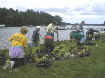
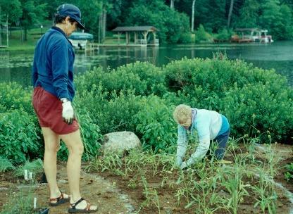
6 6.0 defining lakeshore habitat restoration Defining lakeshore habitat restoration Practice that uses native trees, shrubs, and groundcover, along with natural and biodegradable materials (biologs, delta-lock bags, sediment logs, soil lifts, woody material, etc.), to reduce lakeshore erosion and improve aquatic and wildlife habitat quality.

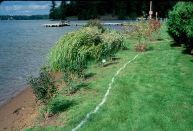
7 6.0 defining lakeshore habitat restoration Lakeshore habitat restoration restorations can be considered a successful management practice if they: Reduce surface water and nutrient run-off Reduce lakeshore bank erosion Increase native plant abundance and diversity Improve wildlife habitat quality Increase wildlife abundance and diversity Create habitat heterogeneity: in other words, design patches of habitat that will benefit a variety of wildlife species. Patchiness is the pattern of nature which allows the highest degree of biodiversity possible.


8 6.0 defining lakeshore habitat restoration 1. Protection of intact buffers No serious erosion problem Native vegetation present Diversity of structure Shoreland buffer requirement met 2. No mow > natural colonization / recovery Native elements present including seed bank Turf grasses not well established Areas screened from view Discourage trampling Look for opportunities to see results and promote 3. Accelerated Recovery Turf grass well established No native plants present Exposed soil Lots of traffic Sand beach maintained Quick results wanted
 Infiltration through forest")
9 6.0 defining lakeshore habitat restoration Transpiration Evaporation Forest duff and soils act as a sponge Roots stabilize soils preventing erosion and allow plants to pump up water back into the atmosphere (transpiration) Infiltration through forest duff


10 The riparian areas of shorelines are glued together by a diversity of plants with strong, deep root systems, especially those of woody plants. 6.0 defining lakeshore habitat restoration
, recreational uses, wildlife support Access points along shoreline including docks, walkways, beach area, storage, etc.")
 look versus a more landscaped feel ( tidy ) What the neighbors will think?")
11 6.0 defining lakeshore habitat restoration View corridor (30 ft. viewshed), recreational uses, wildlife support Access points along shoreline including docks, walkways, beach area, storage, etc. Wildlife impacts (muskrats; deer; etc.) Enhance existing native plants at the site / no mow areas vs. accelerated recovery Aesthetics: natural, wild ( untidy ) look versus a more landscaped feel ( tidy ) What the neighbors will think? Talk w/ the project Exotic species control Attaining proper WDNR / county zoning permits
12 6.0 defining lakeshore habitat restoration View corridor (30 ft. viewshed) Access points along shoreline including docks, walkways, beach area, storage, etc. Wildlife impacts (muskrats; deer; etc.) Enhance existing native plants at the site / no mow areas Aesthetics What the neighbors will think? Talk w/ the project Exotic species control Attaining proper WDNR / county zoning permits Typical questions to ask: 1. What end product does each family 2. member envision for the shoreline? 3. What is the property s drainage pattern? 4. Where are the areas of heaviest use 5. Recreation (types; # of people) etc. 6. Pet and children areas? 7. Where is the viewing corridor? 8. Structures near the water?

13 6.0 defining lakeshore habitat restoration

14 6.0 defining lakeshore habitat restoration


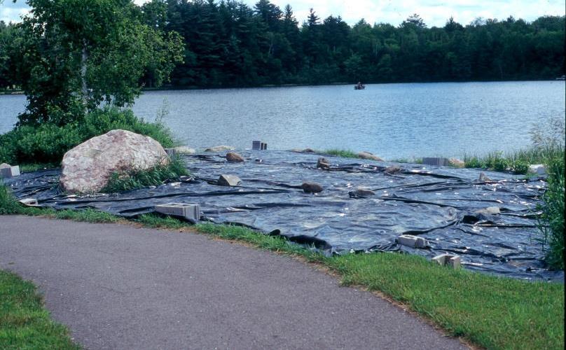
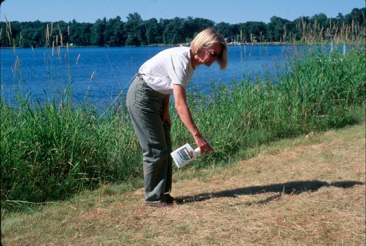
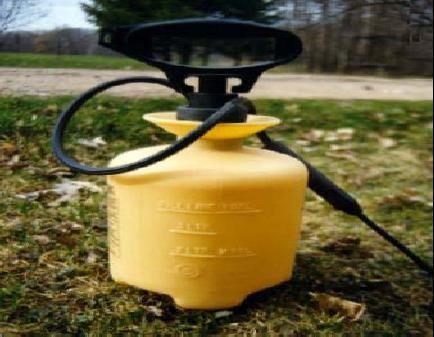
15 6.0 defining lakeshore habitat restoration Black Plastic Soil tilling Herbicides


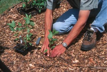
16 6.0 defining lakeshore habitat restoration Find an undisturbed area of your lake similar to your soil, moisture and light conditions and investigate it: What kinds of native trees, shrubs, wildflowers are there? What densities are these plants found in at the site? Look to mimic what you see there in your revegetation efforts


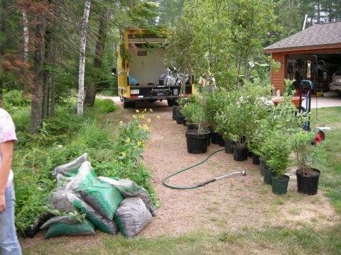
17 6.0 defining lakeshore habitat restoration Revegetation: Three tiers of vegetation: trees, shrubs, and groundlayer wildlfowers, sedges, grasses, ferns


18 6.0 defining lakeshore habitat restoration


19 6.0 defining lakeshore habitat restoration Conservation of local genetic diversity Ability to provide food and shelter for native wildlife Improved health and vigor climatically at home Increased survival rates for your plantings save $ Reduced maintenance costs


20 6.0 defining lakeshore habitat restoration What are they? Typically these plants have traits we admire for lakeshore habitats: Penetrating, deep roots. Prolific seeders that pioneer into disturbed ground before weeds and invasive species arrive. Many also have rhizomatous, fibrous, and/or clump forming root systems that minimize erosion. Most have wildlife habitat benefits of one sort or another too, such as providing nesting material, food, and cover. They are tolerant of variability in site conditions for moisture, water depth, soil type, and light. They can also be propagated efficiently and in a cost effective manner by nurseries specializing in native plant material production.

 Keeping Our Shores: Shoreland Best Management Practices Introduces best")

21 6.1 project overview video Shoreland Restoration: A Growing Solution Outlines why natural shorelines help protect water quality and wildlife habitat, and introduces how shoreland property owners can restore natural functions to their shorelines. (15:30) Keeping Our Shores: Shoreland Best Management Practices Introduces best management practices that shoreland owners can use to protect the water quality in a lake or river, including shoreline filter strips, proper septic maintenance, and appropriate lawn care practices. (15:20)

![w/ standards] Most of what this biology note covers is](/docs-images/83/88734440/images/22-3.jpg "the native planting timing and planting plan")
22 6.2 state standards and biology technical note review Two most popular tools for project development [along w/ standards] Most of what this biology note covers is the native planting timing and planting plan development

23 6.2 state standards and biology technical note review Definition: Treatment(s) used to stabilize and protect eroding banks of streams or constructed channels, and shorelines of lakes, reservoirs, or estuaries. Purpose: Limiting the loss of land and its potential impacts to utilities, roads, buildings, other facilities or cultural resources adjacent to streambanks or lake shorelines; Maintaining or restoring channel dimensions (width, depth), meander (sinuosity and meander geometry) and profile (slope, pools, riffles) allowing the channel to transport sediment and runoff without aggrading or degrading; Reducing sediment loads that cause degradation of habitat and water quality; and Improving or protecting recreation, fish and wildlife habitat, native biodiversity, and natural scenic beauty. Conditions where practice applies: This practice applies to the toe and bank zones of streambanks of natural or constructed channels and shorelines of lakes, reservoirs, or estuaries where they are susceptible to erosion (see Figure 1). This standard applies to controlling erosion using structural treatments1 often in combination with re-vegetation, soil bioengineering, or upland erosion control practices (see NRCS National Engineering Handbook (NEH), Part 650, Engineering Field Handbook (EFH), Chapter 16, Companion Document 580-1). Figure 1: Location of hydrologic zones along a streambank or shoreline
 for aquatic and terrestrial fauna. B.")
24 6.2 state standards and biology technical note review Definition: Area adjacent to a waterbody or watercourse in a non-agricultural setting that is vegetated with a diverse¹ mixture of native species that can include grasses, grass-like species, forbs, shrubs, and trees. Purpose: A. Provide habitat (food, shelter, nesting sites, overwinter cover) for aquatic and terrestrial fauna. B. Enhance littoral zone (shallow water) habitat function for a broad range of vertebrate and invertebrate species by providing shade and cover with overhanging vegetation, and promoting natural recovery of emergent species. C. Provide a source of detritus (decomposing organic matter) and large woody cover for aquatic organisms. D. Provide shade to lower water temperatures and facilitate higher dissolved oxygen concentrations to improve habitat for aquatic organisms. E. Promote shoreland corridors for aquatic and terrestrial flora and fauna. F. Increase the presence and diversity of native plant and animal species in shoreland areas. G. Reduce the environmental and visual impact of human activities in the near-shore area. H. Improve water quality by reducing the amount of sediment and other pollutants, such as pesticides and nutrients in surface runoff. I. Enhance bank stability by limiting intensive use, and reducing wave impact. Conditions where practice applies: This practice applies, but is not limited to, areas of shoreland development where it is desired to enhance or restore native mixed vegetation for the improvement of fish and wildlife habitat, water quality and bank stability. Where the primary purpose is to control sediment to environmentally sensitive areas, refer to the Natural Resources Conservation Service (NRCS) Field Office Technical Guide Section IV (FOTG), Standard 393, Filter Strip. Where the primary purpose is to control bank erosion, refer to NRCS FOTG Standard 580, Streambank and Shoreline Protection to be used in conjunction with this standard.

25 6.2 state standards and biology technical note review Definition: An area predominantly of trees and shrubs that functions as a vegetated ecotone 1 and is located adjacent to and up-gradient of water bodies and water courses. Purpose: Provide shade to lower water temperatures and facilitate higher stream dissolved oxygen concentrations to improve habitat for aquatic organisms. Provide a source of detritus and large woody cover for aquatic organisms. Improve water quality by establishing permanent tree and herbaceous cover in floodplain areas subject to out-of-bank flow and/or scour erosion. Provide habitat and corridors for aquatic and terrestrial flora and fauna. Increase transpiration and infiltration, resulting in slower groundwater discharge to streams and reduced flood flows and to mitigate flood damage. Restore riparian plant communities. Improve water quality by reducing amounts of sediment, organic matter, nutrients, pesticides, and other pollutants in surface runoff and reducing the amounts of nutrients and other chemicals in shallow groundwater. Reduce pesticide drift entering the water body. Increase carbon storage in plant biomass and soils. Conditions where practice applies: This practice applies to areas adjacent to permanent or intermittent streams, drainage ditches, wetlands, and lakes where it is desired to have woody vegetation for the improvement of water quality and riparian stability, and to improve fish and wildlife habitat. This practice does not apply to the treatment of conditions where high levels of pollutants can be anticipated such as animal feed lots, feed storage areas, and milking center waste areas. For these types of situations refer to Wisconsin NRCS Field Office Technical Guide, Section IV (WI FOTG), Conservation Practice Standard 635, Wastewater Treatment Strip. This practice does not apply where soil loss is above T within 300 feet of the riparian forest buffer. Where the primary purpose is to protect environmentally sensitive areas such as sinkholes, crevices, or springs, refer to WI FOTG Standards 393, Filter Strip; 342, Critical Area Planting; or other applicable technical standards.


26 7.0 discussion of landowner backgrounds and how to work effectively with your customers
27 7.0 discussion of landowner backgrounds and how to work effectively with your customers Prime prospects: are landowners who have a conservation mindset but are not engaged in managing their lakeshore property as yet (e.g., they haven t yet developed management plans or consulted with natural resource professionals, and they don't participate in programs such as cost-shares and easements). Understanding what proportion of landowners in your region fall into this category will help you see how many people you can expect to influence. Model owners: have a conservation mindset and they have already been taking many of the actions that natural resource professionals recommend for lakeshore conservation and management. Many love nature and animals and appreciate ecological benefits of lakeshore settings. Appeal to their sense of responsibility and stewardship. Opportunists: are doing some lakeshore management activities but not really out of a conservation orientation--they may find these actions to be financially beneficial or otherwise convenient. Help them understand the ecological significance of their lakeshore property. Uninvolved or write-offs: are people who are not managing their land sustainably and don't demonstrate a conservation mindset toward their lakeshore property; they may come to lakeshore habitat restoration projects through mitigation requirements, for example. Main interests may include reducing taxes and land management hassles to the extent possible. Conservation messages should identify direct financial benefits, preferably without too much effort on their part. Give them information but don't tell them what to do--accept their independence and cautiousness. Lakeshore retreat owners (often retired couples): own their lakeshore property primarily for its beauty and recreational value; likely interested in wildlife viewing, participating in assorted water recreation activities, and enjoying the scenic beauty of their surroundings. The home is likely their largest investment. Give them specific, easy, low-cost actions to achieve their objectives (e.g. attracting wildlife). Summer lake house folks (can be multi-generational and even multi-families): a team of folks are involved with the property; likely interested in ways to minimize land maintenance and management costs. Often interested in maintaining the long term health and value of the land; estate planning and land transfer can be important items to this group. Working the land folks / supplemental income: tend to be pragmatic; value aesthetic and recreational benefits of their lakeshore property but also see it as a financial asset. May be involved with forestry activities and management. Usually interested in how to maintain the long term health and value of the land. Emphasize ways to enhance financial gains or maintain land value for future generations. Affirm their outdoorsy lifestyle and simple, traditional values. Municipalities / town and county parks / state and federal land managers / Native American community partners: different public land managers tasked with oversight of parks, woodlands, forests, open space, and other greenways. Great locations for demonstration sites. Often require a phased approach due to financial resources and the need to work with oversight committees and existing planning strategies for these properties.

28
29


30 LEAVING A LEGACY Thanks for all you do toward leaving a legacy of healthy lakes!


31 Patrick Goggin / < pgoggin@uwsp.edu > Thanks for all you do toward leaving a legacy of healthy lakes!
32 our tools do not suffice for the oldest task in human history to live on a piece of land (water) without spoiling it.. Aldo Leopold
Shoreland restoration plans / plant choices / establishment tips / maintenance
 Shoreland restoration plans / plant choices / establishment tips / maintenance Landscaping at the water s edge: ecological designs for water quality and habitat improvement workshop April 14, 2009 / On
Natural Shorelines. for Inland Lakes. A Landowner s Guide to using. to STABLIZE SHORELINES, Michigan s inland lakeshore.
 Natural Shorelines for Inland Lakes A Landowner s Guide to using NATURAL MATERIALS to STABLIZE SHORELINES, IMPROVE WATER QUALITY and ENHANCE WILDLIFE HABITAT along Michigan s inland lakeshore. Natural
FirstLight Power Shoreline Management Manual Sustainable Shoreline Designs: From Long Island to Lake Erie Webinar Series
 FirstLight Power Shoreline Management Manual Sustainable Shoreline Designs: From Long Island to Lake Erie Webinar Series Presented by Jason Williams, PLA, NCI February 19, 2017 Introduction Lakes (impoundments)
Natural Shoreline Landscapes on Michigan Inland Lakes. Introduction. Workshop for Property Owners. Photo by Jane Herbert
 Natural Shoreline Landscapes on Michigan Inland Lakes Workshop for Property Owners Introduction Photo by Jane Herbert MSU is an affirmative action, equalopportunity employer. Michigan State University
Principles for Ecological Landscape Design in Brownfield Business Parks
 Principles for Ecological Landscape Design in Brownfield Business Parks Part of USDA Forest Service research project # 00-JV-11231300-033: Aligning Social and Ecological Drivers of Urban Landscape Change
Chapter 131 GENERAL REFERENCES
 Chapter 131 STREAM CORRIDOR PROTECTION ZONE 131-1. Objectives. 131-2. Definitions. 131-3. Establishment of the Stream Corridor Protection Zone. 131-4. Uses permitted. 131-5. Uses expressly prohibited.
Stormwater Standards. Clackamas County Service District No. 1. Planting Guide for Buffers
 Stormwater Standards Clackamas County Service District No. 1 APPENDIX B Planting Guide for Buffers Table of Contents Appendix B - Planting Guide for Buffers... Page B.1 General... 1 B.1.1 Introduction...
Riparian Buffer on the Bushkill Creek. Policies
 Riparian Buffer on the Bushkill Creek Riparian buffers provide numerous benefits to landowners and the community by protecting groundwater recharge areas, providing flood control, providing stormwater
BE WATER WISE. Managing Your Onlot Stormwater. Sept. 23, 2006 Watershed Weekend
 BE WATER WISE Managing Your Onlot Stormwater Sept. 23, 2006 Watershed Weekend 2006 1 All water resources are interrelated through the Hydrologic Cycle Sept. 23, 2006 Watershed Weekend 2006 2 What is Storm
Rain Gardens. A Welcome Addition to Your Landscape
 Rain Gardens A Welcome Addition to Your Landscape Where Does The Rainwater Go? Naturally, forests provide a way for rainwater to percolate into the soil, filtering pollutants while trees are allowed to
Green Infrastructure. by Karen Engel, NYS DEC. NYS Department of Environmental Conservation
 Green Infrastructure by Karen Engel, NYS DEC What is Green Infrastructure? For some it s all about water Green Infrastructure techniques use soils and vegetation to infiltrate, evapotranspirate, and/or
3-2 Environmental Systems
 3-2 Environmental Systems 3.0 ENVIRONMENTAL SYSTEMS CONTENTS 3.1 GREENWAY SYSTEM 3.1.1 General Policies 3.1.2 Natural Heritage Network 3.1.3 Natural Heritage Network Enhancement Lands 3.1.4 Rouge Watershed
Guiding Landowners in Stream Restoration. The Science, Practice & Art of Restoring Native Ecosystems 2015
 Guiding Landowners in Stream Restoration The Science, Practice & Art of Restoring Native Ecosystems 2015 January 24, 2015 Guiding Landowners in Stream Restoration January 24, 2015 Agenda 1Watershed Planning
Use of Best Management Practices
 Use of Best Management Practices Presented at the ANJEC Flood Hazard Workshop Bordentown, NJ March 13, 2008 Stormwater BMPs "a technique, measure or structural control that is used for a given set of conditions
Section 3 Non-Structural BMPs
 3.1 Stream Buffers A stream buffer or stream setback is a designated area around a stream, lake, or wetland left in a natural, densely vegetated state so as to protect the receiving water quality and provide
Lake Nokomis Shoreline Enhancement Project
 Lake Nokomis Shoreline Enhancement Project Community Meeting 2 February 13, 2018 Agenda Current Problems Project Goals Project Status Existing Conditions Community Input Draft Schematic Design Long-term
Working Group Meeting
 April 4,, 2017 Parks Operations Bldg Working Group Meeting Arts Districts Overview Stormwater/RPA/Stream Considerations First Principles Agenda 7:00pm 7:05pm 7:10pm 7:40pm 8:30pm 9:40pm 9:45pm Welcome
2001 Southeastern Pennsylvania Stormwater Management Symposium Villanova University. Jean K. Akers
 2001 Southeastern Pennsylvania Stormwater Management Symposium Villanova University Abstract Planting For Water Quality Incorporating plantings into stormwater BMP design to improve water quality. Jean
2011 ASLA Design Awards. Coyote Gulch Honor Award and Land Stewardship Designation Valerian LLC. Environmental Restoration and Reclamation
 2011 ASLA Design Awards Honor Award and Land Stewardship Designation Valerian LLC Environmental Restoration and Reclamation Project Name: Category : Project Location: 5 2011 Environmental Restoration and
Woodland Conservation and the Master Plan
 1 WHAT IS A MASTER PLAN? A Vision for the Future of Your Community Woodland Conservation and the Master Plan Goals Objectives Strategies 2 How Will Your Community Look? TREE PRESERVATION AND THE MASTER
CONSERVATION ELEMENT GOALS, OBJECTIVES, AND POLICIES
 CONSERVATION ELEMENT GOALS, OBJECTIVES, AND POLICIES Goal 4 To conserve, manage, appropriately use and protect the natural resources of the City ensuring continued resource availability and environmental
Study Area Map. Wasatch Hollow Open Space Restoration, Use, & Management Plan. Legend. Harrison Ave East. Roosevelt East.
 Harrison Ave Roosevelt Emerson «4 «5 Rosecrest 1900 East «3 1800 East Wasatch Hollow Open Space Restoration, Use, & Management Plan Study Area Map Legend «2 «1 Potential Access Location Emigration Creek
319 Grant: Baker Creek & Centenary Creek Restoration Initiative
 319 Grant: Baker Creek & Centenary Creek Restoration Initiative Objectives: Overview of Watershed Characteristics: Discussion of Project Tasks: Discussion of Watershed Management Plan: Presented by: Erich
Upper St. Croix & Eau Claire Rivers Watershed. Bony Lake
 Upper St. Croix & Eau Claire Rivers Watershed Bony Lake Bony Lake DNR Lake Protection - Project Partners: Grant Awarded July 2007 Bony Lake Residents-Grant Oversight Committee WI DNR Bayfield County LWCD
SUSTAINABILITY PLAN OTTAWA COUNTY PARKS AND RECREATION COMMISSION FALL 2017
 SUSTAINABILITY PLAN OTTAWA COUNTY PARKS AND RECREATION COMMISSION FALL 2017 Table of Contents Introduction Natural Resources Quality of Life Community Continuing the Mission Sustainability Measuring Sustainability
Worksheet #14 Water Runoff Management
 Water Runoff Management Use this worksheet to assess how well your property minimizes the potential for water runoff and property damage.. Why should you be concerned? What can you do? Rural runoff, also
Deb Grube, Sr. Zoning Officer
 Deb Grube, Sr. Zoning Officer Wisconsin Department of Natural Resources Administrative Code NR 115 under the authority of Wisconsin Statute 59.692, establishes and provides that shoreland zoning regulations
5.0 Storm Water Landscape Guidance Introduction
 5.0 Storm Water Landscape Guidance Introduction Landscaping is a critical element to improve both the function and appearance of storm water management practices. Integrated storm water landscapes can
Wetland Design Manual. A1: Vision, core outcomes and aspirational outcomes
 Wetland Design Manual A1: Vision, core outcomes and aspirational outcomes Table of contents Introduction 5 Vision 6 Core outcomes 7 Effective pollutant removal and flow management... 7 Community safety...
Template for Restoration in a Lake Superior Area of Concern. Template for Restoration in a Lake Superior Area of Concern
 Keith Bowers, Principal Ivette Bolender, Great Lake Bioregion Team Leader Presentation outline: Project background Master planning process Habitat restoration approach Lessons learned Hog Island and Newton
Climate Smart Communities Green Infrastructure Case Studies
 New York State Water Resources Institute Climate Smart Communities Green Infrastructure Case Studies Emily Vail Hudson River Estuary Program NYS Department of Environmental Conservation Cornell University
Chapter 3 Site Planning and Low Impact Development
 CHAPTER 3 Site Planning and Low Impact Development Chapter 3 Site Planning and Low Impact Development 3.0 Introduction The City of Charleston requires that major residential, large commercial (>1 acre),
RAIN GARDEN ILLINOIS URBAN MANUAL PRACTICE STANDARD. (feet) CODE 897 DEFINITION
 CODE 897 DEFINITION") ILLINOIS URBAN MANUAL PRACTICE STANDARD RAIN GARDEN (feet) CODE 897 Source: Kendall County Soil and Water Conservation District DEFINITION Rain gardens are small, shallow, flat bottomed depressions constructed
ILLINOIS URBAN MANUAL PRACTICE STANDARD RAIN GARDEN (feet) CODE 897 Source: Kendall County Soil and Water Conservation District DEFINITION Rain gardens are small, shallow, flat bottomed depressions constructed
4.6. Low Impact and Retentive Grading
 4.6. Low Impact and Retentive Grading Low Impact Grading techniques focus on utilizing existing topography during Site layout to minimize cost. Proposing structures, roads, and other impervious surfaces
As a homeowner in the Pacific Northwest, you
 Archival Copy. For current information, see the OSU Extension Catalog:https://catalog.extension.oregonstate.edu Taking Care of streams in Eastern Washington, A Homeowner s Guide to Riparian Areas PNW 557
SECTION 6. Routine Maintenance Activity Details
 SECTION 6 Routine Maintenance Activity Details 80. DEBRIS REMOVAL When Deadfall, and other objects, such as shopping carts, tires, appliances, and mattresses have accumulated in the drain. Why To prevent
How to Design A Better Wildlife Garden
 How to Design A Better Wildlife Garden This guide will help you design a better wildlife garden by providing useful methods rooted in ecological landscape design. Ecological design works with natural processes
Planning for and Managing Open Space and Natural Areas
 Planning for and Managing Open Space and Natural Areas Increasingly, development proposals in Delaware include large amounts of open space and natural areas. While open space is important as a community
GUIDELINES FOR ECOLOGICAL PERFORMANCE
 3 Landscape........................................... 3.2 Stormwater Management................................... 3.3 Hardscape........................................... 3.4 Streetscape..........................................
Stockbridge Bowl Watershed Survey Conducted by the BRPC, SBA and Town of Stockbridge June 2012
 Stockbridge Bowl Watershed Survey Conducted by the BRPC, SBA and Town of Stockbridge June 2012 This project has been financed with Federal Funds from the Environmental Protection Agency (EPA) to the Massachusetts
Design Around Waterways and Wetlands
 Design Around Waterways and Wetlands NL Green Economy Conference Newleef-2014 NEIA, St. John s, NL October 9-10 th, 2014 Wade Lewis Amherst, Nova Scotia, w_lewis@ducks.ca DUC conserves, restores and manages
Lawn and Yard Care Choices
 SYSTEM (n) Interacting and interdependent parts that form a whole. Whether you choose an exceptional lawn, low input lawn, conversion of lawn, or a combination of types Lawn and Yard Care Choices Thank
Best Management Practices
 Best Management Practices Urban Areas Aquatic Areas Natural Areas Best Management Practices Urban Areas Green Industry Best Management Practices Fertilizer Label Nitrogen Applications Phosphorous Applications
STREAM BUFFER PROTECTION AND MANAGEMENT
 ORDINANCE NO. 753 AN ORDINANCE AMENDING THE CODE OF ORDINANCES OF THE CITY OF PLEASANT HILL, IOWA 1998, BY ESTABLISHIING CHAPTER 104, STREAM BUFFER PROTECTION AND MANAGEMENT Be it enacted by the City of
A Cooperative Effort Between:
 Lake Shamineau Shoreline Assessment August 2007 A Cooperative Effort Between: Morrison County Planning and Zoning Morrison Soil and Water Conservation District Minnesota Department of Natural Resources
Landowner's Guide to the Lower St. Croix Riverway. Protect. Restore. Celebrate. stcroixriverassociation.org
 Landowner's Guide to the Lower St. Croix Riverway Protect. Restore. Celebrate. stcroixriverassociation.org Cover and page spread photographs by Craig Blacklock. For more information on how to be a river
Bioswales: A Guide to Low-Impact Development Design and Maintenance. Introduction and Compilation by: Leslie D. Bartsch And Jennifer S.
 Bioswales: A Guide to Low-Impact Development Design and Maintenance Introduction and Compilation by: Leslie D. Bartsch And Jennifer S. Raible Biological Engineering University of Arkansas Fayetteville,
Guide to Naturalizing a Lakefront Shoreline. September 2010
 Guide to Naturalizing a Lakefront Shoreline September 2010 Retaining walls and non-vegetated shorelines are a very common sight on shore-line properties in Alberta. These urbanized shorelines have a huge
The scope of the plan will focus on the Prospect Heights Slough and Hillcrest Lake as one entity.
 Plan for Prospect Heights Natural Resources Commission Plan for Improved Public Access and Enjoyment of the Prospect Heights Slough and Hillcrest Lake July 23, 2018 The City Council has requested the Natural
Working with nature to manage your stream
 Working with nature to manage your stream Issued by Auckland Council March 2013 If you have any questions about this information sheet please contact Auckland Council on 09 301 0101 A stream in a property
Stream Restoration: Working with Nature?
 Stream Restoration: Working with Nature? Greg Jennings, PhD, PE jenningsenv@gmail.com Ecosystem Restoration activities that initiate or accelerate the recovery of ecosystem health, integrity, and sustainability
Stream Restoration: Working with Nature? Greg Jennings, PhD, PE
 Stream Restoration: Working with Nature? Greg Jennings, PhD, PE jenningsenv@gmail.com Ecosystem Restoration activities that initiate or accelerate the recovery of ecosystem health, integrity, and sustainability
Stormwater Runoff and the District of Columbia RiverSmart Homes Defined:
 Stormwater Runoff and the District of Columbia Stormwater runoff is rainwater that flows off impervious surfaces such as rooftops, driveways, roads, sidewalks and sometimes even lawns. Stormwater runoff
Riparian Buffer and Upland Restoration With Woody Species. Dan Salas Delaware Riverkeeper Network
 Riparian Buffer and Upland Restoration With Woody Species Dan Salas Delaware Riverkeeper Network What s a buffer good for? Sediment Filtration Chemical Filtration Stormwater Infiltration Bank Stabilization
Building Healthy Soil:
 Building Healthy Soil: Making Urban Landscapes More Absorbent to Stormwater Urban development fundamentally changes the ways by which water flows through the local environment. Without the application
Karen A. Duhring Marine Advisory Scientist Center for Coastal Resources Management Virginia Institute of Marine Science College of William & Mary
 Karen A. Duhring Marine Advisory Scientist Center for Coastal Resources Management Virginia Institute of Marine Science College of William & Mary March 20, 2009 Low-Impact Shoreline Stabilization Cumulative
Applied Ecological Services, Inc. Sustainable Solutions for Over 30 Years.
 Applied Ecological Services, Inc. Sustainable Solutions for Over 30 Years. Landfills Can Mitigate and Restore Riparian Impacts on Their Property Jason Dremsa, Construction Manager Applied Ecological Services,
WETLAND SOD u Bare Root Wetland Plants u Deep Rooted Willows u Coir Logs u Native Trees & Shrubs u Habitat Islands u Custom Growing
 WETLAND SOD u Bare Root Wetland Plants u Deep Rooted Willows u Coir Logs u Native Trees & Shrubs u Habitat Islands u Custom Growing 2009 PROJECT HIGHLIGHTS The following 10 projects highlight the interesting
Holland Country Club Golf Course to Wetlands
 Holland Country Club Golf Course to Wetlands John Scholtz, Director Ottawa County Parks & Recreation Commission Amy A. Berry, Project Manager Niswander Environmental, LLC OTTAWA COUNTY PARKS: Focusing
Guidelines for Streambank Protection
 PDHonline Course C187 (3 PDH) Guidelines for Streambank Protection Instructor: John Poullain, PE 2012 PDH Online PDH Center 5272 Meadow Estates Drive Fairfax, VA 22030-6658 Phone & Fax: 703-988-0088 www.pdhonline.org
Save Time and Money and Have a Greener, Healthier Yard!
 1 Save Time and Money and Have a Greener, Healthier Yard! GreenScaping: Reduce use of high maintenance plants and all that watering, fertilizing, and pruning Use low maintenance native plants and grasses
Banking on Natural Fibers Products made from coir and jute play a key role in stabilizing a restored stream for a commercial stream mitigation bank.
 Banking on Natural Fibers Products made from coir and jute play a key role in stabilizing a restored stream for a commercial stream mitigation bank. By Greg Northcutt When White Creek Mitigation, LLC,
Lewisville Lake Master Plan Revision Public Information Meeting May 2 & 4, 2017
 Lewisville Lake Master Plan Revision Public Information Meeting May 2 & 4, 2017 Presented By Rob Jordan Lake Manager U.S. Army Corps of Engineers Fort Worth District US Army Corps of Engineers Purpose
Key elements : Filter Strips must be designed within parameters required by the Fort Wayne s Development Standards/Criteria Manual.
 4.4. Filter Strips Filter Strips are densely vegetated lands that treat sheet flow storm water from adjacent pervious and impervious areas. They function by slowing runoff, trapping sediment and pollutants,
Stop Losing Ground to Erosion. Kimberly Laframboise Ecologist Michalski Nielsen Associates limited
 Stop Losing Ground to Erosion Kimberly Laframboise Ecologist Michalski Nielsen Associates limited Forms of Erosion Surface erosion Sheet erosion Wind erosion Wave action Mass-movement erosion Slips, earth
RECONNECTING A COMMUNITY TO THE CREEK
 RECONNECTING A COMMUNITY TO THE CREEK 0 The J.J. Seabrook Stream Restoration, Rain Garden, and Urban Trail Project Kristin K. Pipkin, P.E. Michelle Adlong, EI.T. TXSER/TRA Joint Conference November 2,
Recommendations for Municipalities
 Protecting the Kayaderosseras Creek through Better Buffers Recommendations for Municipalities Conservation Committee October 2005 Introduction The Kayaderosseras Creek is a superb natural resource that
ST. MARY S SOIL CONSERVATION DISTRICT (SMSCD) AND DPW&T CONCEPT EROSION AND SEDIMENT CONTROL AND STORMWATER MANAGEMENT GUIDELINES AND CHECKLIST
 AND DPW&T CONCEPT EROSION AND SEDIMENT CONTROL AND STORMWATER MANAGEMENT GUIDELINES AND CHECKLIST") St. Mary s Soil Conservation District 26737 Radio Station Way, Suite B Leonardtown, MD 20650 Phone: 301-475-8402 ext. 3 Fax: 301-475-8391 www.stmarysscd.com St. Mary s County Government Department of Public
St. Mary s Soil Conservation District 26737 Radio Station Way, Suite B Leonardtown, MD 20650 Phone: 301-475-8402 ext. 3 Fax: 301-475-8391 www.stmarysscd.com St. Mary s County Government Department of Public
Managing Manure: The Role of Riparian Buffers
 Managing Manure: he Role of Riparian Buffers Fact Sheet Equine Facilities Manure Management Practices June 2003 Equestrians have become aware of the potential environmental impacts that may be caused by
The Development of Riparian Stream Buffers in Greensboro, NC
 The Development of Riparian Stream Buffers in Greensboro, NC Why our stream banks have grown up? Presented by: Peter Schneider, Water Quality Supervisor City of Greensboro Stormwater Management Division
Nick Sigmund, Sr. Zoning Officer
 Nick Sigmund, Sr. Zoning Officer Wisconsin Department of Natural Resources Administrative Code NR 115 under the authority of Wisconsin Statute 59.692, establishes and provides that shoreland zoning regulations
Draft Rhode Island Stormwater Design and Installation Standards Manual
 Draft Rhode Island Stormwater Design and Installation Standards Manual Summary The May 2009 Public Review Draft version of the RI Stormwater Design and Installation Standards Manual consists of approximately
Presentation to Parks and Open Space Advisory. Committee September 22, 2016
 Flood Planning & Preliminary Design Services for South St. Vrain Creek Restoration at Hall Ranch Presentation to Parks and Open Space Advisory Prepared for: Boulder County, Colorado Committee September
Effects of Erosion. Grades 6-8
 Effects of Erosion Grades 6-8 This activity was designed as a companion for the song Don t Treat Mother Earth Like Dirt. Background The song Don t Treat Mother Earth Like Dirt is all about respecting and
Minnesota Department of Natural Resource - Natural Resource Guidance Checklist Conserving Natural Resources through Density Bonuses
 Minnesota Department of Natural Resource - Natural Resource Guidance Checklist Conserving Natural Resources through Density Bonuses NRDB Why Use Density Bonuses & This Checklist Local units of government
Town of Essex Small Site Erosion Control Guide
 Town of Essex Small Site Erosion Control Guide Why do we need to protect against erosion? Water Quality: Erosion and the transport of sediment and pollutants impacts the water quality of nearby streams
Environmental Protection Ordinances (Performance Zoning) Bedminster Township, Bucks County
 Bedminster Township, Bucks County") Environmental Protection Ordinances (Performance Zoning) Bedminster Township, Bucks County ARTICLE VI. PERFORMANCE STANDARDS Section 600 Compliance All uses, activities, subdivisions and/or land developments
Environmental Protection Ordinances (Performance Zoning) Bedminster Township, Bucks County ARTICLE VI. PERFORMANCE STANDARDS Section 600 Compliance All uses, activities, subdivisions and/or land developments
Storm Water Quality and Shoreline Restoration Improvements - Grant Funding Request City of Mound Carlson Park Bolton & Menk Project No.
 September 15, 2016 Brett Eidem Cost Share Grant Administrator Minnehaha Creek Watershed District 15320 Minnetonka Boulevard Minnetonka, MN 55345 RE: Storm Water Quality and Shoreline Restoration Improvements
BEST MANAGEMENT PRACTICES Herb Robert (Geranium robertianum) (Family Geraniaceae Geranium Family)
 (Family Geraniaceae Geranium Family)") JEFFERSON COUNTY NOXIOUS WEED CONTROL BOARD 380 Jefferson Street Port Townsend WA 98368 360 379-5610 Ext. 205 noxiousweeds@co.jefferson.wa.us BEST MANAGEMENT PRACTICES Herb Robert (Geranium robertianum)
JEFFERSON COUNTY NOXIOUS WEED CONTROL BOARD 380 Jefferson Street Port Townsend WA 98368 360 379-5610 Ext. 205 noxiousweeds@co.jefferson.wa.us BEST MANAGEMENT PRACTICES Herb Robert (Geranium robertianum)
Green Infrastructure. NYS Department of Environmental Conservation
 Green Infrastructure Green infrastructure is an interconnected network of natural areas and open spaces that sustains ecosystems. Benedict, M.A. and E.T. McMahon. 2006. Green Infrastructure Linking Landscapes
10.0 Open Space and Public Realm
 10.0 Open Space and Public Realm 10.0 Open Space and Public Realm The Public Open Space System is comprised of: outdoor spaces available for public use that are either publicly owned (e.g., parks and
Did you know that many of
 We All Live Near the Water The Shoreland Stewardship Series Protecting & Restoring Shorelands Number 2 In a sense, we are all waterfront landowners because we all live in a watershed even that storm drain
Lesson 2: Stormwater Best Management Practices (BMPs)
") Lesson 2: Stormwater Best Management Practices (BMPs) Environmental Stewards Class Christopher C. Obropta, Ph.D., P.E. Extension Specialist in Water Resources 732-932-9800 ext. 6209 obropta@envsci.rutgers.edu
Lesson 2: Stormwater Best Management Practices (BMPs) Environmental Stewards Class Christopher C. Obropta, Ph.D., P.E. Extension Specialist in Water Resources 732-932-9800 ext. 6209 obropta@envsci.rutgers.edu
The Restoration of Reading Creek & Model Stream Buffer Ordinances/ Zoning Regulations for Alabama Streams
 The Restoration of Reading Creek & Model Stream Buffer Ordinances/ Zoning Regulations for Alabama Streams Charlene LeBleu, AICP, ASLA, Associate Professor of Landscape Architecture Auburn University Auburn,
STREAM BUFFERS
 88-415 STREAM BUFFERS 88-415-01 PURPOSE In the Kansas City region and throughout the nation, vegetated stream buffers have been clearly shown to protect stream stability and related infrastructure, improve
STREAM BANK STABILIZATION THORPS MORTIMER RECREATION AREA Grandfather Ranger District SITE LOCATION & DRAINAGE AREA
 STREAM BANK STABILIZATION THORPS CREEK @ MORTIMER RECREATION AREA SITE LOCATION & DRAINAGE AREA SITE LOCATION Drainage Area = 1.14 sq. miles STREAM BANK STABILIZATION THORPS CREEK @ MORTIMER RECREATION
City of Surrey Ecosystem Management Study. Integration of ecological processes with land use
 City of Surrey Ecosystem Management Study Integration of ecological processes with land use Natural areas in Surrey are changing as the City grows and evolves. Many important natural areas remain or may
TOWN OF SPRINGFIELD, NEW HAMPSHIRE
 TOWN OF SPRINGFIELD, NEW HAMPSHIRE NATURAL RESOURCES INVENTORY EXECUTIVE SUMMARY March 2008 Prepared by: Watershed to Wildlife, Inc. Natural Resource Consultants 42 Mill Street, Suite 3 Littleton, NH 03561
4.5 City of Indianapolis Stormwater Green Infrastructure Guidance: Bioretention (rain gardens) Bioretention Fact Sheet Bioretention Technical Design
 Bioretention Fact Sheet Bioretention Technical Design") 4.5 City of Indianapolis Stormwater Green Infrastructure Guidance: Bioretention (rain gardens) Bioretention Fact Sheet Bioretention Technical Design Specification Bioretention O & M Manual Draft Green
4.5 City of Indianapolis Stormwater Green Infrastructure Guidance: Bioretention (rain gardens) Bioretention Fact Sheet Bioretention Technical Design Specification Bioretention O & M Manual Draft Green
Importance of Master Planning Marcy Colclough
 Importance of Master Planning Marcy Colclough Senior Planner Southwest Michigan Planning Commission WHERE and HOW we develop Land affects Water Quality! 43.2 Acres total 20 Homes 35.8 Acres of open space
NATURAL LAKE & STREAMBANK PROTECTION & NATURAL BUFFERS. By Sam Martin, Water Management Specialist, Pine SWCD
 NATURAL LAKE & STREAMBANK PROTECTION & NATURAL BUFFERS By Sam Martin, Water Management Specialist, Pine SWCD Natural Lake & Streambank Protection & Natural Buffers Lakeshore & Streambank Erosion Projects
Juneau Watershed Partnership
 Juneau Watershed Partnership Native Plant Resource Center Final Report A Partners for Fish and Wildlife Project Prepared for: U.S. Fish and Wildlife Service For Grant #F11C00552 Prepared by: The Juneau
Surrey Ecosystem Management Study
 Surrey Ecosystem Management Study Green Infrastructure Network Opportunities Public Open House & Information Session June 24 th, 2010 EMS Process Ecological Inventory Ecological Assessment Management Policy
Greenscape Challenge Toolkit
 Greenscape Challenge Toolkit Take the Greenscape Challenge: https://www.surveymonkey.com/r/greenscapechallenge Yard maintenance and water quality When it rains, fertilizers, pesticides and other chemicals
Weston s Wetlands, Stormwater, & Open Space
 Weston s Wetlands, Stormwater, & Open Space Weston s Wetlands, Stormwater, & Open Space Conservation Commission Role and Responsibilities Laws that protect wetlands What residents can do to protect wetlands
Green Lawns. Promoting environmental stewardship
 Green Lawns Promoting environmental stewardship Gardening is America s most popular outdoor activity. We enjoy seeing things grow and improving our home environment. Working in the yard is also good exercise
Stormwater Management Techniques WMPF LAND USE TRAINING INSTITUTE MARCH 14, 2018
 Stormwater Management Techniques WMPF LAND USE TRAINING INSTITUTE MARCH 14, 2018 Potential Impacts of New Development Urban development can significantly increase stormwater runoff Water quality considerations
5. Initiating a restoration project
 5. Initiating a restoration project CONTRIBUTING TO CONSERVATION In many parts of the country, restoration planting is your last and only option for repairing or rebuilding damaged native communities so
Chagrin River Watershed Partners, Inc. Local Regulations. Amy H. Brennan (440)
") Chagrin River Watershed Partners, Inc. Local Regulations Amy H. Brennan (440) 975-3870 www.crwp.org abrennan@crwp.org July 9, 2013 Applicable Zoning and Building Codes Erosion and Sediment Control Grading
Chagrin River Watershed Partners, Inc. Local Regulations Amy H. Brennan (440) 975-3870 www.crwp.org abrennan@crwp.org July 9, 2013 Applicable Zoning and Building Codes Erosion and Sediment Control Grading
Riparian zones A guide to the protection of Canterbury s rivers, streams and wetlands
 Riparian zones A guide to the protection of Canterbury s rivers, streams and wetlands Everything is connected What is a riparian zone? Riparian zones are strips of land bordering rivers, streams, lakes