Chapter Six: Tree Removal and Erosion Control
|
|
|
- Erika Lauren Stokes
- 5 years ago
- Views:
Transcription

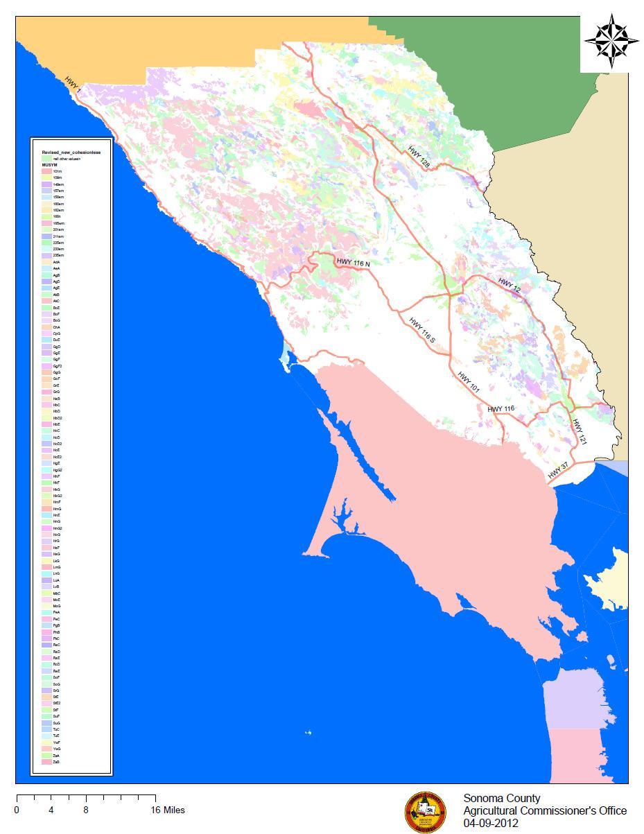
1 Chapter Six: Tree Removal and Erosion Control Through the combination of canopy and roots, trees help protect and stabilize the land. Their removal requires proper planning and adherence to land-based best management practices designed to reduce the velocity of run-off, safeguard surface waters from excessive runoff, and maintain the soil s integrity and its potential to absorb water. Environmental Concerns 1. Erosion caused by an increase in precipitation runoff and/or soil disturbance. Erosion and sedimentation have the potential to impact aquatic habit and related resources by affecting turbidity, and altering channel structure. 2. Alteration of drainage patterns. Alteration of drainage patterns may affect sheet flow dispersal and outfall within streams. 3. Loss of stabilization of slopes. Integrity of slopes may be affected by tree removal, which could contribute to substantial increases in erosion and sedimentation in surface waters. Site Evaluation A site assessment is required for each Level II project and designated ridgetop projects that propose the removal of more than ½-acre of tree canopy. The site must be assessed by an Engineering Geologist for areas of instability, and mapped areas over 25% slope that contain potentially cohesionless soils. The preferred approach is to divide the development into blocks with similar landforms and slopes, generally no more than 20 acres in size. This allows for the use of existing drainages, major slope breaks, and topographic divides as natural boundaries. As part of the engineered plan, the licensed engineer must calculate a soil loss or sediment delivery factor to evaluate pre-development and post-development conditions for each block. For blocks in which tree removal has occurred since November 2008, the aerial photo available at or more recent aerial photo as approved by the Agricultural Commissioner will be used to determine pre development cover/canopy levels. If more than ½ acre of tree canopy has been removed since November 2008, or is proposed for removal, the project shall be subject to the tree removal standards. 1
2 Best Management Practices For projects with natural slopes less than 25%, use Universal Soil Loss Equation (USLE) to show no net increase in erosion from pre-development conditions. For projects with natural slopes of 25% or greater, use Revised Universal Soil Loss Equation (RUSLE2) to show no net increase in erosion from pre-development conditions. When using USLE, use tabulated USLE slope length/gradient (LS), cover management (C), and conservation practice factors (P), listed in the BMP Handbook appendix to evaluate the pre- versus post-development soil loss. Alternatively, propose to use another published or peer reviewed soil loss predictive model consistent with the standard of care to show no net increase in erosion from pre-development conditions. Alternatively, instead of using a soil loss predictive model, prepare a sediment delivery analysis using a published or peer-reviewed method consistent with the standard of care that demonstrates that the project will result in no net increase in sediment delivery to streams, lakes or wetlands. SLOPE STABILITY 1. For all Level ll projects with proposed tree removal, a report by an Engineering Geologist is to be submitted identifying and characterizing areas of slope instability. 2. On identified areas of slope instability (landslides etc.), vineyard and orchard site development that involves tree removal is prohibited unless the area is first repaired in accordance with engineered plans. 3. Adhere to the setbacks from identified areas of instability (landslides etc.) called for in Chapter 11 of the Sonoma County Code; 50 feet below or laterally and 100 feet above these landforms or as recommended by an Engineering Geologist. 4. For all Level ll projects with tree removal proposed in mapped areas of potentially cohesionless soils over 25% slope, a report by a Engineering Geologist is to be submitted identifying areas of cohesionless soils. Areas of mapped potentially cohesionless soils are determined from the map titled Areas of Potentially Cohesionless Soils which is available at the following web address: 5. Tree removal is prohibited on areas with identified cohesionless soils on slope gradients between 40% and 50%. 2
3 6. On slopes with gradients between 25% and 40% having cohesionless soils identified from a geologic report, a slope stability analysis must be conducted and tree removal will only be allowed when the factor of safety is equal to or greater than 1.5, or the report must otherwise demonstrates that there is sufficient cohesion for the slope to remain stable. RIDGETOPS 7. Adhere to 50 foot setbacks for defined ridgetops. Setbacks for ridgetops may consist of a 25 ft grassy turnaround and 25 foot no touch zone, or 50 foot no touch zone. OPERATIONS 8. Individual trees and stands of trees to be retained within the limits of clearing shall be marked at a height visible to equipment operators and steps taken to protect the drip line of retained trees. 9. Identify and maintain the existing riparian zone. A healthy riparian zone consists of trees, shrubs of different ages growing closest to the channel and a grassy zone closest to the vineyard/orchard operation. 10. All native trees and associated woody vegetation should be retained within the active channel of all stream corridors regardless of size. 11. Establish and maintain cover crops both between rows and around the perimeter of a vineyard/orchard to minimize the exposure of bare soil. 12. Minimize impact from roads, culvert installation and activity centers on stream channels. 13. Preserve existing ground cover and natural mulch around native trees to be retained in order to prevent erosion, protect roots and hold water. 14. Leave downed trees in the riparian corridor for recruitment as large woody debris, as long as it does not pose an immediate threat to infrastructure or property downstream. 15. Avoid placing other debris from tree removal operations in locations where it could potentially be discharged into streams. 16. All tree removal activity will be carried out from April 1st to October 15 th. 3
4 17. At all times, erosion control measures must be utilized and in place prior to the end of the day if the US Weather Service forecast is a chance (30% or more) of rain before the next day, and prior to a weekend or other shutdown periods. MONITORING & REPORTING 18. During the first year after site development is completed, the project owner shall inspect the site for significant erosion or instability prior to the storm season and then monthly from October to May. 19. Annual monitoring reports will be prepared and submitted to the Agricultural Commissioner on June 30 th of each monitoring year. Year one will be considered the first full calendar year after final inspection. 20. The first year s report will summarize the baseline information as well as the first year s monitoring results. Thereafter, annual reports will include a summary of the year s monitoring results and a discussion of trends noted or problems observed, as well as a description of any repairs that were made. The report should include a description of the monitoring methods, including data collection and analysis. 21. Identical color photographic scenes will be taken and submitted to the Agricultural Commissioner before development and each January from specific locations as identified in the project permit for a minimum of three years following completion of the project. 22. County staff will perform at least one on site inspection at the end of the three year monitoring period, and other inspections as necessary. 23. Sonoma County Agricultural Commissioner will have all submitted engineered plans reviewed by a licensed engineer, and all geologic reports reviewed by a certified Engineering Geologist. COMPLIANCE 24. Projects that already have an approved CEQA document that contains measures that reduce geologic hazards and water quality impacts to a level of insignificance will be 4
5 considered to be in compliance with the applicable requirements of Chapter 11 and the BMPs. 5
6 APPENDIX
7 APPENDIX
8 APPENDIX
9 APPENDIX
10 APPENDIX
11 APPENDIX
12 APPENDIX
13 Length of Slope Values (1 of 2) APPENDIX
14 Length of Slope Values (2 of 2) APPENDIX
15 APPENDIX
Chapter 4 - Preparation of Stormwater Site Plans
 Chapter 4 - Preparation of Stormwater Site Plans The Stormwater Site Plan is the comprehensive report containing all of the technical information and analysis necessary for the City to evaluate a proposed
Section 3 Non-Structural BMPs
 3.1 Stream Buffers A stream buffer or stream setback is a designated area around a stream, lake, or wetland left in a natural, densely vegetated state so as to protect the receiving water quality and provide
CITY OF TUMWATER 555 ISRAEL RD. SW, TUMWATER, WA (360) (360) (FAX)
 (360) (FAX)") CITY OF TUMWATER 555 ISRAEL RD. SW, TUMWATER, WA 98501 (360) 754-4180 (360) 754-4126 (FAX) Email: cdd@ci.tumwater.wa.us APPENDIX II-C SHORT FORM CONSTRUCTION STORMWATER POLLUTION PREVENTION PLAN (SWPPP)
CITY OF TUMWATER 555 ISRAEL RD. SW, TUMWATER, WA 98501 (360) 754-4180 (360) 754-4126 (FAX) Email: cdd@ci.tumwater.wa.us APPENDIX II-C SHORT FORM CONSTRUCTION STORMWATER POLLUTION PREVENTION PLAN (SWPPP)
SUPPORTING DOCUMENT STORMWATER POLLUTION PREVENTION PLAN (SWPPP) NARRATIVE
 NARRATIVE") SUPPORTING DOCUMENT STORMWATER POLLUTION PREVENTION PLAN (SWPPP) NARRATIVE Please complete this narrative form and submit with your SWPPP drawings. Refer to Kitsap County Stormwater Design Manual Vol.
SUPPORTING DOCUMENT STORMWATER POLLUTION PREVENTION PLAN (SWPPP) NARRATIVE Please complete this narrative form and submit with your SWPPP drawings. Refer to Kitsap County Stormwater Design Manual Vol.
Best Management Practices for Agricultural Erosion and Sediment Control
 Best Management Practices for Agricultural Erosion and Sediment Control SONOMA COUNTY AGRICULTURAL COMMISSIONER S OFFICE TABLE OF CONTENTS INTRODUCTION... i REGULATORY REQUIREMENTS... ii CALIFORNIA TIGER
City of Stoughton Erosion Control Permit Application (effective 2/6/2018)
") City of Stoughton Erosion Control Permit Application (effective 2/6/2018) Incomplete applications will not be accepted Project Name: Address of subject property: Landowner Name(s): Applicant Name: Landowner
City of Stoughton Erosion Control Permit Application (effective 2/6/2018) Incomplete applications will not be accepted Project Name: Address of subject property: Landowner Name(s): Applicant Name: Landowner
SECTION 6. Routine Maintenance Activity Details
 SECTION 6 Routine Maintenance Activity Details 80. DEBRIS REMOVAL When Deadfall, and other objects, such as shopping carts, tires, appliances, and mattresses have accumulated in the drain. Why To prevent
Plan Review Checklist
 Plan Review Checklist FOR EROSION AND SEDIMENT CONTROL PLANS _ Minimum Standards - All applicable Minimum Standards must be addressed. All minimum Standards must be adhered to during the entire project
STORMWATER SITE PLAN INSTRUCTIONS AND SUBMITTAL TEMPLATE Medium and Large Projects
 DEPARTMENT OF COMMUNITY DEVELOPMENT 621 Sheridan Street, Port Townsend, WA 98368 Tel: 360.379.4450 Fax: 360.379.4451 Web: www.co.jefferson.wa.us/communitydevelopment E-mail: dcd@co.jefferson.wa.us STORMWATER
Using the Updated RI Soil Erosion and Sediment Control Handbook. The Introductory Workshop for RIDEM/CRMC Staff January 23, 2015
 Using the Updated RI Soil Erosion and Sediment Control Handbook The Introductory Workshop for RIDEM/CRMC Staff January 23, 2015 URI Cooperative Extension NEMO URI Cooperative Extension NEMO White Oak,
Request for an Exception to the Napa County Road and Street Standards
 F Request for an Exception to the Napa County Road and Street Standards Shed Creek Winery Use Permit P16-327 and Use Permit Exception to the Conservation Regulations P17-178 Planning Commission Hearing
New Development Stormwater Guidelines
 New Development Stormwater Guidelines CITY OF MOUNTLAKE TERRACE Table of Contents Introduction... 2 Ecology s Minimum Requirements for stormwater management... 2 Description of the 9 Minimum Requirements...
WQ-23 MOUNTAINOUS AND STEEP SLOPE SITES
 Greenville County Technical Specification for: WQ-23 MOUNTAINOUS AND STEEP SLOPE SITES 1.0 Mountainous and Steep Slope Sites 1.1 Description The geographic locations of portions of Greenville County are
Beyond Rain Gardens Advancing the Use of Compost for Green Infrastructure, Low Impact Development, & Stormwater Management
 Beyond Rain Gardens Advancing the Use of Compost for Green Infrastructure, Low Impact Development, & Stormwater Management VORS 2018 Stormwater Management Session 2 Stormwater Management, Green Infrastructure,
STORMWATER MANAGEMENT CODES ANALYSIS RICHLAND COUNTY, SC SITE PLANNING ROUNDTABLE
 STORMWATER MANAGEMENT CODES ANALYSIS RICHLAND COUNTY, SC SITE PLANNING ROUNDTABLE Codes analyses for each subcommittee were completed to assist participants of the Richland County Site Planning Roundtable.
Gloucester County PLAN SUBMITTER'S CHECKLIST
 Page 1 of 9 Gloucester County PLAN SUBMITTER'S CHECKLIST FOR EROSION AND SEDIMENT CONTROL PLANS Please fill in all blanks and please reference the plan sheets/pages where the information may be found,
MANUAL OF DESIGN, INSTALLATION, AND MAINTENANCE REQUIREMENTS FOR STORMWATER MANAGEMENT PLANS
 MANUAL OF DESIGN, INSTALLATION, AND MAINTENANCE REQUIREMENTS FOR STORMWATER MANAGEMENT PLANS May 2007 SECTION 1 Responsibility of Applicant TABLE OF CONTENTS A. Stormwater Management Plan Required Information
Highlands Region Stormwater Management Program Guidance
 DRAFT Highlands Region Stormwater Management Program Guidance Release Date: January 2016 Abstract This guidance document provides an overview of the Highlands Stormwater Management Program. It is intended
Vegetated Filter Strips and Buffers
 3.15 Sediment Control Description: Buffer strips (existing vegetation) and filter strips (planted vegetation) are sections of vegetated land adjacent to disturbed areas. They are designed with low slopes
Stormwater Standards. Clackamas County Service District No. 1. Planting Guide for Buffers
 Stormwater Standards Clackamas County Service District No. 1 APPENDIX B Planting Guide for Buffers Table of Contents Appendix B - Planting Guide for Buffers... Page B.1 General... 1 B.1.1 Introduction...
2.1.4 Roof Downspout Rain Gardens
 2008 SWMM, 2010 Revision City of Tacoma 2.1.4 Roof Downspout Rain Gardens Purpose and Definition Bioretention areas are shallow stormwater retention facilities designed to mimic forested systems by controlling
Shelbyville, KY Stormwater Best Management Practices. Section 2 EROSION PREVENTION AND SEDIMENT CONTROL PLAN
 Section 2 EROSION PREVENTION AND SEDIMENT CONTROL PLAN 2.1 Requirements The City of Shelbyville, KY will require an Erosion Prevention and Sediment Control (EPSC) Plan for most types of development construction.
4. Contractor (and subcontractors if applicable) certification statement(s)
 certification statement(s)") CHEMUNG COUNTY STORMWATER COALITION STORMWATER POLLUTION PREVENTION PLAN (SWPPP) SUBMITTAL CHECKLIST GENERAL INFORMATION: 1. Owner/Operator name, legal address, phone number 2. Copy of signed Notice of
CHEMUNG COUNTY STORMWATER COALITION STORMWATER POLLUTION PREVENTION PLAN (SWPPP) SUBMITTAL CHECKLIST GENERAL INFORMATION: 1. Owner/Operator name, legal address, phone number 2. Copy of signed Notice of
Draft Rhode Island Stormwater Design and Installation Standards Manual
 Draft Rhode Island Stormwater Design and Installation Standards Manual Summary The May 2009 Public Review Draft version of the RI Stormwater Design and Installation Standards Manual consists of approximately
Marin Stream Ordinance
 Marin Stream Ordinance Development Code Amendments Planning Commission Hearing May 13, 2013 Overview Stream Conservation Area (SCA) and SCA Permit. Development activity not prohibited but must avoid stream
WQ-07 INFILTRATION TRENCH
 Greenville County Technical Specification for: WQ-07 INFILTRATION TRENCH 1.0 Infiltration Trench 1.1 Description Infiltration Trenches are excavations filled with stone to create an underground reservoir
Post Construction BMPs
 Post Construction BMPs Why are Post Construction BMPs important? With increased development brings the increase of impervious cover Parking lots, rooftops, driveways Storm water runoff volume increases
Chagrin River Watershed Partners, Inc. Local Regulations. Amy H. Brennan (440)
") Chagrin River Watershed Partners, Inc. Local Regulations Amy H. Brennan (440) 975-3870 www.crwp.org abrennan@crwp.org July 9, 2013 Applicable Zoning and Building Codes Erosion and Sediment Control Grading
Chagrin River Watershed Partners, Inc. Local Regulations Amy H. Brennan (440) 975-3870 www.crwp.org abrennan@crwp.org July 9, 2013 Applicable Zoning and Building Codes Erosion and Sediment Control Grading
VEGETATED SLOPE STABILIZATION DESCRIPTION APPLICABILITY. Advantages
 4.2-d VEGETATED SLOPE STABILIZATION Alternative Names: Willow Wattles, Live Bundles, Fascines, Live Staking, Joint Planting, Branch Packing, Brush Layering, and Brush Matting DESCRIPTION Vegetated slope
The use of low head weirs to. perennial streams with their floodplains:
 The use of low head weirs to reconnect severely entrenched perennial streams with their floodplains: An Anne Arundel County TMDL Watershed Implementation Plan Strategy presented by Hala Flores, P.E Mid
Zoning Ordinance Chapter 10
 CHAPTER 10 - WASHES SECTION 10.0 GENERAL: A. The purpose of this Ordinance is to establish standards for development in or near Major and Minor Washes as defined in Appendix A Glossary of Terms and Definitions
North Branch of Cypress Creek Ecological Restoration: A Comprehensive Approach to Stream Restoration
 North Branch of Cypress Creek Ecological Restoration: A Comprehensive Approach to Stream Restoration Rocky Powell Clear Creeks Consulting, LLC Keith D. Tate, P.E. BayLand Consultants & Designers, Inc.
Chapter 3 Site Planning and Low Impact Development
 CHAPTER 3 Site Planning and Low Impact Development Chapter 3 Site Planning and Low Impact Development 3.0 Introduction The City of Charleston requires that major residential, large commercial (>1 acre),
Erosion & Sediment Control Plan Application Form & Checklist
 Erosion & Sediment Control Plan Application Form & Checklist GENERAL INFORMATION Application Date: Project Address: Tax Map / Parcel Number(s): PROPERTY OWNER / DEVELOPER Firm Name: Contact Person: Title:
Oak View Estates Specific Plan
 Oak View Estates Specific Plan Environmental Impact Report SCOPING MEETING MARCH 14, 2018 CITY OF BRADBURY PLANNING DEPARTMENT Welcome and Project Team Kevin Kearney, City Manager Jim Kasama, City Planner
4.6. Low Impact and Retentive Grading
 4.6. Low Impact and Retentive Grading Low Impact Grading techniques focus on utilizing existing topography during Site layout to minimize cost. Proposing structures, roads, and other impervious surfaces
Appendix I. Checklists
 Appendix I Checklists Town of Greenwich Drainage Manual Department of Public Works - Engineering Division Town Hall - 101 Field Point Road, Greenwich, CT 06836-2540 Phone 203-622-7767 - Fax 203-622-7747
STORMWATER PERMIT SUBMITTAL REQUIREMENTS
 STORMWATER PERMIT SUBMITTAL REQUIREMENTS Most development within the City of Bellingham that involves disruption of soils, or construction of buildings, streets, parking lots, etc. requires a Stormwater
Public Works Department 104 W. Magnolia Street, Suite 109 Bellingham, WA (360)
") Public Works Department 104 W. Magnolia Street, Suite 109 Bellingham, WA 98225 (360) 778-7900 STORMWATER PERMIT SUBMITTAL REQUIREMENTS Most development within the City of Bellingham that involves disruption
Public Works Department 104 W. Magnolia Street, Suite 109 Bellingham, WA 98225 (360) 778-7900 STORMWATER PERMIT SUBMITTAL REQUIREMENTS Most development within the City of Bellingham that involves disruption
Department of Agriculture. Conservation Service. United States. Natural Resources REVISED 8/26/16
 GENERAL NOTES: SYMBOL LEGEND 1. All work shall comply with the constriction specifications, drawings, project-specific quality assurance plan and other contract requirements. 2. All notes on the drawings
Washington County, Maryland Division of Public Works Policy Manual
 Washington County, Maryland Division of Public Works Policy Manual Subject: Downstream Drainage Easement Category: Land Development Engineering Number: 7-4.1 Date: June 1, 2009 (effective) PURPOSE: The
Homeowners Guide to Stormwater BMP Maintenance
 Homeowners Guide to Stormwater BMP Maintenance What You Need to Know to Take Care of Your Property Rain Barrel Dry Well Rain Garden Pervious Asphalt Porous Pavers City of El Monte Stormwater BMP Management
BIORETENTION FACILITY
 ILLINOIS URBAN MANUAL PRACTICE STANDARD BIORETENTION FACILITY (feet) CODE 800 Source: Jessica Cocroft, Winnebago Soil and Water Conservation District DEFINITION Facility that utilizes a soil media, mulch,
6Natural. Environment Development Permit Guidelines
 6Natural Bylaw 2600-2016, being "Official Community Plan Bylaw, 2016" Schedule "A" CITY OF ABBOTSFORD OFFICIAL COMMUNITY PLAN Environment Development Permit Guidelines Part V - 6-1 Area Subdivision or
City of Lafayette Staff Report
 City of Lafayette Staff Report For: By: Design Review Commission Greg Wolff, Senior Planner Meeting Date: April 27, 2015 Subject: SS03-15 Gundi & Peter Younger (Owners), R-40 Zoning: Request for a Study
DRAFT DESIGN CRITERIA STORMWATER TREATMENT STANDARDS CITY OF OVERLAND PARK
 DRAFT DESIGN CRITERIA STORMWATER TREATMENT STANDARDS CITY OF OVERLAND PARK A. Authority As set forth in the Overland Park Municipal Code (OPMC), Chapter 16.210, the Director of Planning and Development
PERMANENT SEEDING. Overview of Sedimentation and Erosion Control Practices. Practice no. 6.11
 Overview of Sedimentation and Erosion Control Practices Practice no. 6.11 PERMANENT SEEDING Permanent vegetation controls erosion by physically protecting a bare soil surface from raindrop impact, flowing
Vegetated Filter Strips and Buffers
 3.15 Sediment Control Description: Buffer strips (existing vegetation) and filter strips (planted vegetation) are sections of vegetated land adjacent to disturbed areas. They are designed with low slopes
Drainage Control Plans
 2016 Drainage Design and Erosion Control Manual - Guide Sheet 1C Drainage Control Plans A Drainage Control Plan is the comprehensive submittal package containing all of the technical information, analysis,
SIMPLIFIED APPROACH TO STORMWATER MANAGEMENT FOR SMALL PROJECTS
 SIMPLIFIED APPROACH TO STORMWATER MANAGEMENT FOR SMALL PROJECTS Introduction As required by federal and state law, the Borough of Swarthmore has adopted regulations that affect stormwater runoff and surface
City of Lafayette Study Session Staff Report Design Review Commission
 ++ City of Lafayette Study Session Staff Report Design Review Commission Meeting Date: January 08, 2018 Staff: Subject: Chris Juram, Planning Technician SS12-17 Miramar Homebuilders, R-20 Zoning: Request
Weston s Wetlands, Stormwater, & Open Space
 Weston s Wetlands, Stormwater, & Open Space Weston s Wetlands, Stormwater, & Open Space Conservation Commission Role and Responsibilities Laws that protect wetlands What residents can do to protect wetlands
Soil Erosion & Sediment Control Plan Requirements for Submittal to the Cape Atlantic Conservation District
 Soil Erosion & Sediment Control Plan Requirements for Submittal to the Cape Atlantic Conservation District The following is a list of the minimum requirements required on Soil Erosion and Sediment Control
Town of Essex Small Site Erosion Control Guide
 Town of Essex Small Site Erosion Control Guide Why do we need to protect against erosion? Water Quality: Erosion and the transport of sediment and pollutants impacts the water quality of nearby streams
How to Update a Storm Water Management Program (SWMP) to Incorporate Total Maximum Daily Load (TMDL) BMPs
 to Incorporate Total Maximum Daily Load (TMDL) BMPs") How to Update a Storm Water Management Program (SWMP) to Incorporate Total Maximum Daily Load (TMDL) BMPs Janine Rybka Cuyahoga Soil & Water Conservation District About Habitat Habitats are the places
How to Update a Storm Water Management Program (SWMP) to Incorporate Total Maximum Daily Load (TMDL) BMPs Janine Rybka Cuyahoga Soil & Water Conservation District About Habitat Habitats are the places
SOP 6: Erosion and Sedimentation Control SOP 6: EROSION AND SEDIMENTATION CONTROL
 Standard Operating Procedures Central Massachusetts Regional Stormwater Coalition SOP 6: Erosion and Sedimentation Control SOP 6: EROSION AND SEDIMENTATION CONTROL Erosion and sedimentation from land-disturbing
KENT COUNTY STORMWATER MAINTENANCE DISTRICT STORMWATER BMPs MAINTENANCE TASKS AND RESPONSIBILITIES GUIDANCE DOCUMENT BIO-RETENTION FACILITIES
 BIO-RETENTION FACILITIES (for all basins / BMPs) Annually Prepare Operation and Maintenance Plan. Clearly outline how vegetation in the facility and its buffer area will be managed or harvested in the
APPENDIX C: HILLSIDE DEVELOPMENT REGULATIONS (prev. Ordinance #2008-1)
") APPENDIX C: HILLSIDE DEVELOPMENT REGULATIONS (prev. Ordinance #2008-1) 1. PURPOSE: The purpose of this section is to define the conditions under which hillside development may occur that will not result
APPENDIX C: HILLSIDE DEVELOPMENT REGULATIONS (prev. Ordinance #2008-1) 1. PURPOSE: The purpose of this section is to define the conditions under which hillside development may occur that will not result
Riparian Buffer on the Bushkill Creek. Policies
 Riparian Buffer on the Bushkill Creek Riparian buffers provide numerous benefits to landowners and the community by protecting groundwater recharge areas, providing flood control, providing stormwater
Checklists. Project Name: Location: File Number: Date of Submittal: Reviewer: Date: Applicant: Contact Name: Phone Number:
 Applicant: Contact Name: Phone Number: Email: Project Name: Location: File Number: Date of Submittal: Reviewer: Date: Concept Plan Requirements: I. General Project Information 1. Address or parcel number
STREAM BUFFERS
 88-415 STREAM BUFFERS 88-415-01 PURPOSE In the Kansas City region and throughout the nation, vegetated stream buffers have been clearly shown to protect stream stability and related infrastructure, improve
Use of Best Management Practices
 Use of Best Management Practices Presented at the ANJEC Flood Hazard Workshop Bordentown, NJ March 13, 2008 Stormwater BMPs "a technique, measure or structural control that is used for a given set of conditions
Project: Developer/Designer: Reviewer: I. Narrative: 1. Project Description: Describes the nature and purpose of the land disturbing activity.
 City of Charlottesville, Virginia Erosion and Sediment Control Plan Review Checklist 610 East Market Street, Charlottesville, VA 22902 Telephone 434-970-3182; Fax 434-970-3359 Project: Developer/Designer:
BE WATER WISE. Managing Your Onlot Stormwater. Sept. 23, 2006 Watershed Weekend
 BE WATER WISE Managing Your Onlot Stormwater Sept. 23, 2006 Watershed Weekend 2006 1 All water resources are interrelated through the Hydrologic Cycle Sept. 23, 2006 Watershed Weekend 2006 2 What is Storm
Zoning Ordinance Article 3
 Article 3 Natural Resources Protection Section 301 Natural Resources Protection 301.1. Purpose - The following natural resources protection standards are established to protect the public health, safety
Information for File # ARC
 Information for File # 2016-02630-ARC Applicant Corps Contact Will Bomier-Carlton County Transportation Department Andrew R Chambers Address 600 South Lake Avenue, Suite 211, Duluth, MN 55802 E-Mail Andrew.R.Chambers@usace.army.mil
POST-FIRE RESTORATION Dos and Don ts
 POST-FIRE RESTORATION Dos and Don ts USDA Natural Resources Conservation Service The NRCS/RCD office is located at: 744 LA GUARDIA ST BLDG A SALINAS, CA 93905-3354 (831) 424-1036 (NRCS) (831) 424-1036
Working Group Meeting
 April 4,, 2017 Parks Operations Bldg Working Group Meeting Arts Districts Overview Stormwater/RPA/Stream Considerations First Principles Agenda 7:00pm 7:05pm 7:10pm 7:40pm 8:30pm 9:40pm 9:45pm Welcome
Non-Residential&Multi-Family PropertyCreditManual
 CityofRichmond DepartmentofPublicUtilities StormwaterManagementProgram Non-Residential&Multi-Family PropertyCreditManual ApprovedFebruary2011 City of Richmond Stormwater Non-Residential & Multi-Family
Nick Sigmund, Sr. Zoning Officer
 Nick Sigmund, Sr. Zoning Officer Wisconsin Department of Natural Resources Administrative Code NR 115 under the authority of Wisconsin Statute 59.692, establishes and provides that shoreland zoning regulations
Bioswales: A Guide to Low-Impact Development Design and Maintenance. Introduction and Compilation by: Leslie D. Bartsch And Jennifer S.
 Bioswales: A Guide to Low-Impact Development Design and Maintenance Introduction and Compilation by: Leslie D. Bartsch And Jennifer S. Raible Biological Engineering University of Arkansas Fayetteville,
Drainage Analysis-Newgate/Phelps & Hatchett Hill Road Areas Rev. 0 Erosion & Sediment Control Measures
 Drainage Analysis-Newgate/Phelps & Hatchett Hill Road Areas Rev. 0 Erosion & Sediment Control Measures 4.0 EROSION & SEDIMENT CONTROL MEASURES After performing the analysis summarized above, Burns & McDonnell
Tips for Maintaining and Enhancing Stormwater Management Areas
 4 4 N. Second Street, Denton, Md. 21629 (410) 479-3625 (410) 479-3534 fax www.dentonmaryland.com Tips for Maintaining and Enhancing Stormwater Management Areas Information provided by the Town of Denton
6.1 Bioretention Areas
 SAN MATEO COUNTYWIDE WATER POLLUTION PREVENTION PROGRAM 6.1 Bioretention Areas Figure 6-1. Bioretention Area. Source: City of Brisbane Bioretention areas 1, or rain gardens, are concave landscaped areas
Small Project Guidance Document
 Small Project Guidance Document Introduction If you are considering a relatively small construction project on your property that creates new impervious area and you need to manage the stormwater that
CHAPTER 9 STORM DRAINAGE. Minimum Requirements for New Development and Redevelopment
 CHAPTER 9 STORM DRAINAGE 9.01 General The standards established by this chapter are intended to represent the minimum standards for the design and construction of storm drainage facilities. 9.02 Design
Principles for Ecological Landscape Design in Brownfield Business Parks
 Principles for Ecological Landscape Design in Brownfield Business Parks Part of USDA Forest Service research project # 00-JV-11231300-033: Aligning Social and Ecological Drivers of Urban Landscape Change
CHECKLIST FOR PHASE II DRAINAGE REPORT
 I. COVER SHEET CHECKLIST FOR PHASE II DRAINAGE REPORT A. Name of Project B. Address C. Owner D. Developer E. Engineer F. Submittal date and revision dates as applicable II. GENERAL LOCATION AND DESCRIPTION
PLAN SUBMITTER'S CHECKLIST
 Page 1 of 8 PLAN SUBMITTER'S CHECKLIST FOR EROSION AND SEDIMENT CONTROL PLANS Please fill in all blanks and reference the plan sheets/pages where the information may be found, where appropriate, or write
Planning the BMP. Region 2000 Planning District Commission Lynchburg, VA December 13, 20013
 Planning the BMP Region 2000 Planning District Commission Lynchburg, VA December 13, 20013 PLANNING THE BMP AGENDA BMP Selection BMP Design SWM Plan Preparation 2 BMP SELECTION Types of BMPs Structural
Illinois Urban Manual
 Illinois Urban Manual Jim Nelson: Association of Illinois Soil and Water Conservation Districts (AISWCD) Funding for this project provided, in part, by the Grand Victoria Foundation of Elgin IL, the Governor
Guiding Landowners in Stream Restoration. The Science, Practice & Art of Restoring Native Ecosystems 2015
 Guiding Landowners in Stream Restoration The Science, Practice & Art of Restoring Native Ecosystems 2015 January 24, 2015 Guiding Landowners in Stream Restoration January 24, 2015 Agenda 1Watershed Planning
City of Lafayette Study Session Staff Report Design Review Commission
 City of Lafayette Study Session Staff Report Design Review Commission Meeting Date: April 24, 2017 Staff: Payal Bhagat, Senior Planner Subject: HDP18-15 & HDP31-15 Ramesh Patel & Melcor Development (Owners),
Bowling Green, Kentucky Stormwater Best Management Practices (BMPs) Erosion Prevention Practices (EPPs) Activity: Nets and Mats (N and M)
 Erosion Prevention Practices (EPPs) Activity: Nets and Mats (N and M)") Bowling Green, Kentucky Stormwater Best Management Practices (BMPs) Erosion Prevention Practices (EPPs) Activity: Nets and Mats (N and M) EPP-11 PLANNING CONSIDERATIONS: Design Life: 1 yr Acreage Needed:
Bowling Green, Kentucky Stormwater Best Management Practices (BMPs) Erosion Prevention Practices (EPPs) Activity: Nets and Mats (N and M) EPP-11 PLANNING CONSIDERATIONS: Design Life: 1 yr Acreage Needed:
Information for File # JTF
 Information for File # 2013-04665-JTF Applicant Corps Contact Enbridge Energy, Limited Partnership Josh Fitzpatrick Address 1554 Highway 2, Suite 2, Two Harbors, MN 55616 E-Mail joshua.t.fitzpatrick@usace.army.mil
Stormwater Regulations & Considerations Morse Study Area. Pam Fortun, P.E. CFM Senior Stormwater Treatment Engineer Engineering Services Division
 Stormwater Regulations & Considerations Morse Study Area Pam Fortun, P.E. CFM Senior Stormwater Treatment Engineer Engineering Services Division Stormwater Regulations Development Considerations Floodplain
Memorandum Planning. Thursday, January 8, 2015
 Memorandum Planning Thursday, January 8, 2015 7.A. To: Coastal Advisory Committee From John Ciampa, Associate Planner Subject: Review Draft Local Coastal Program Copies: James Pechous, City Planner Purpose
PAVING PARKING AREAS AND ROADS DESCRIPTION. Alternate Names: Pavement Practices, Impervious Paving
 4.2-i PAVING PARKING AREAS AND ROADS Alternate Names: Pavement Practices, Impervious Paving DESCRIPTION All roads, driveways, and parking lots proposed for year-round use shall be paved with a hard plowable
Stormwater Retrofitting: The Art of Opportunity. Presented by the Center for Watershed Protection
 Stormwater Retrofitting: The Art of Opportunity Presented by the Center for Watershed Protection What Are Stormwater Retrofits? Retrofits are stormwater management measures inserted in an urban or ultra-urban
5. Standard Details & Design Guidance
 5. Standard Details & Design Guidance Standard details and design guidance contain the recommended content and guidelines for mitigation plans using various techniques. Each section also contains relevant
COMMUNITY DEVELOPMENT DEPARTMENT POLICY DRAINAGE FOR RESIDENTIAL PROJECTS WITH ONE OR TWO UNITS REVISED JANUARY 4, 2018
 COMMUNITY DEVELOPMENT DEPARTMENT POLICY DRAINAGE FOR RESIDENTIAL PROJECTS WITH ONE OR TWO UNITS REVISED JANUARY 4, 2018 A. California Residential Code Requirement - Construction plans shall indicate how
Can Urban Redevelopment Restore Aquatic Resources
 Can Urban Redevelopment Restore Aquatic Resources with Standards for Stormwater Retention and Landscape Performance? Rebecca C. Stack District of Columbia Department of the Environment Industry, Agriculture,
Caledon Villas Corp. c/o Mr. John Spina 55 Blue Willow Drive Woodbridge, ON L4L 9E8 May 14, Floodplain Characteristics, Old Church Road
 Caledon Villas Corp. c/o Mr. John Spina 55 Blue Willow Drive Woodbridge, ON L4L 9E8 May 14, 2013 Re: Floodplain Characteristics, Old Church Road This letter serves to confirm that I, Linda Sober, have
GVSU Sustainable Storm Water Initiative
 GVSU Sustainable Storm Water Initiative MWEA Watershed Seminar Bath, MI December 5, 2013 Dr. Peter J. Wampler Talk Road Map Brief Geomorphic History of the Grand River and Grand River Ravines Historic
Florence County Small Commercial Land Disturbance Permit Application
 Florence County Small Commercial Land Disturbance Permit Application Florence County Engineering Division 518 South Irby Street Florence, S.C. 29501 Phone (843) 676-8600 Fax (843) 676-8667 Tax Map Number:
Stream Restoration: Working with Nature?
 Stream Restoration: Working with Nature? Greg Jennings, PhD, PE jenningsenv@gmail.com Ecosystem Restoration activities that initiate or accelerate the recovery of ecosystem health, integrity, and sustainability
Stream Restoration: Working with Nature? Greg Jennings, PhD, PE
 Stream Restoration: Working with Nature? Greg Jennings, PhD, PE jenningsenv@gmail.com Ecosystem Restoration activities that initiate or accelerate the recovery of ecosystem health, integrity, and sustainability
A. INTRODUCTION AND SUMMARY OF FINDINGS B. EXISTING CONDITIONS. Table 10-1 Adjacent Storm Drains
 Chapter 10: Stormwater Management A. INTRODUCTION AND SUMMARY OF FINDINGS This chapter describes existing and proposed stormwater management on the Site. Potential impacts to stormwater infrastructure
Technical guidance to meet stormwater management design requirements; and,
 Chapter 1. INTRODUCTION 1.1 Purpose of the Manual The purpose of this Stormwater Management Design Manual is to provide engineers, developers, plan reviewers, inspectors, contractors, property owners,
EROSION & SEDIMENT CONTROL
 EROSION & SEDIMENT CONTROL Surface Water Protection During Well Site Construction Kelly Kees, PE WVDEP, Office of Oil and Gas SEDIMENT & EROSION CONTROL PLANS Per West Virginia State Code 22-6-6(d) 22-6A-7(c),