Digital soil mapping from legacy data and hyperspectral imagery in CapBon (Tunisia) First results and perspectives.
|
|
|
- Ellen Davis
- 6 years ago
- Views:
Transcription

1 Digital soil mapping from legacy data and hyperspectral imagery in CapBon (Tunisia) First results and perspectives. Philippe Lagacherie 1, Cécile Gomez 2, Sinan Bacha 4, Rossano Ciampalini 2, Hedi Hamrouni 5, Pascal Monestiez 3 1. INRA LISAH Montpellier 2. IRD LISAH Montpellier 3. INRA BiosP Avignon 4. CNCT Tunis 5. Ministry of agriculture (DG ACTA) Tunis
2 Two objectives Test a DSM approach that map soil properties from sparse sets of measured soil profiles and globally avalaible soil covariates Applicable in in many regions of the world (GlobalSoilMap.net) Develop a new DSM approach using a Vis-NIR hyperspectral image Applicable from 2015 in regions with bare or partially vegetated surfaces DIGISOL-HYMED project ( ) Funding : GSP Workshop «toward Global Soil Information» March, FAO headquarter Rome (Italy) 2
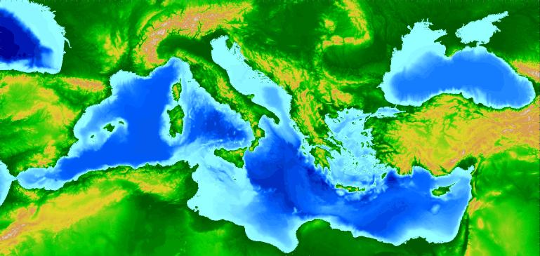
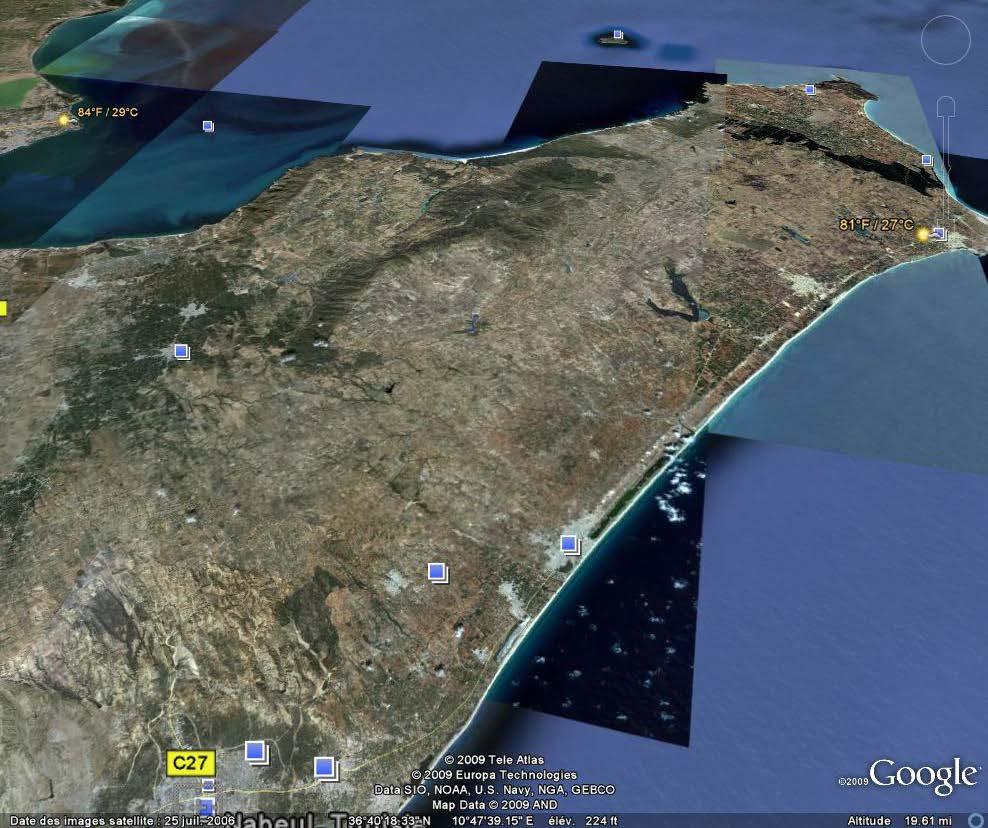
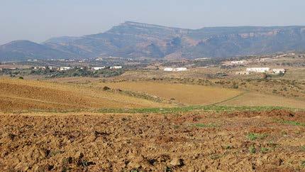
3 A Proof-of-concept area : The Cap- Bon Region (2,841 km²) GSP Workshop «toward Global Soil Information» March, FAO headquarter Rome (Italy) 3
 from a DG/ACTA survey (1973-1979) 91 profiles (345 hrz) from a IAO (Italy) survey")
")
4 Legacy measured soil profiles and control data Soil profiles Control sampling 89 profiles (344 hrz) from a DG/ACTA survey ( ) 91 profiles (345 hrz) from a IAO (Italy) survey (2000) 262 topsoil samples with certified (ISO) soil analysis profile/ 16 km² GSP Workshop «toward Global Soil Information» March, FAO headquarter Rome (Italy) 4


5 Globally available soil covariates SRTM 90m / ASTER 30m Elevation Flow accumulation Landsat7 band5 Slope Wetnex index Landsat7 band7 Total curvature MRVBF Landsat7 NDVI Profile curvature MRRTF Landsat7 bands 5, 2 GSP Workshop «toward Global Soil Information» March, FAO headquarter Rome (Italy) 5
 GSP Workshop «toward Global Soil Information» 20-23 March,")
6 Aisa-Dual hyperspectral image Image characteristics 338 km², 5 m resolution nm (280 bands) November 2 nd 2010, 10h00-12h % of bare soils Spatial resolution degraded to 30 m to mimic near future satellite product (ENMAP, ) GSP Workshop «toward Global Soil Information» March, FAO headquarter Rome (Italy) 6
7 Some first results DSM approach using sparse sets of soil profiles Detecting, correcting and interpreting the biases of measured soil profile data: A case study in the Cap Bon Region (Tunisia) (Ciampalini et al Geoderma, in revision) Documenting GlobalSoilMap.net grid cells from legacy measured soil profiles and global available covariates (Ciampalini et al accepted in DSM12 proceedings) DSM approach using a Vis-NIR hyperspectral image Using Vis-NIR hyperspectral data to map topsoil properties over bare soils in the Cap Bon region, Tunisia (Gomez et al accepted in DSM12 proceedings) GSP Workshop «toward Global Soil Information» March, FAO headquarter Rome (Italy) 7
 2) Testing the significance of bias using a paired test (Wilcoxon signed rank-test) 3) Repeat 1) and 2) for n sets of simulations Correcting Biases 1) Compute the interpolation error of")
8 Bias detection and correction methods Detecting Biases 1) Creating virtual pairs of samples by simulating a soil property value at legacy soil profiles locations ( ) conditionned by the control sampling ( ) 2) Testing the significance of bias using a paired test (Wilcoxon signed rank-test) 3) Repeat 1) and 2) for n sets of simulations Correcting Biases 1) Compute the interpolation error of the control sampling using as validation data the soil property values of the measured soil profiles 2) Minimize interpolation error by tuning a proportional factor (y = ax) applied to the validation data Variance Correction coefficient (a) VS Variance CLAY Correction coeff. GSP Workshop «toward Global Soil Information» March, FAO headquarter Rome (Italy) 8
9 Results (IAO data) Clay Silt Sand CEC OC ph_h2o Frequency of H O rejection 99.0 ** 85.0** 54.0* 66.0* ** Optimised Correction factor GSP Workshop «toward Global Soil Information» March, FAO headquarter Rome (Italy) 9
10 DSM approach using sparse sets of soil profiles Detecting, correcting and interpreting the biases of measured soil profile data: A case study in the Cap Bon Region (Tunisia) (Ciampalini et al Geoderma, in revision) Documenting GlobalSoilMap.net grid cells from legacy measured soil profiles and global available covariates (Ciampalini et al accepted in DSM12 proceedings) DSM approach using a Vis-NIR hyperspectral image Using Vis-NIR hyperspectral data to map topsoil properties over bare soils in the Cap Bon region, Tunisia (Gomez et al accepted in DSM12 proceedings) Co-kriging of soil properties with Vis-NIR hyperspectral covariates in the Cap Bon region (Tunisia) (Ciampalini et al submitted in DSM12 proceedings) GSP Workshop «toward Global Soil Information» March, FAO headquarter Rome (Italy) 10
11 Methods Prediction of soil properties following GSM specifications Clay%, Silt%, Sand%, OC, ph, CEC Depths : 0-5 cm, 5-15 cm, 15-30cm, cm, cm, cm Input data 30 m ASTER DEM derived variables : Elevation, Slope, Total Curvature, Profile Curvature, MRVBF, MRRTF, Flow Accumulation, Wetnex Index Landsat 7 TM+, nov 2011 derived variables:, b1 to b7, NDVI, b3/b2, b3/b7, b5/b7, (b5- b2)/(b5+b2) 89 profiles with 344 horizons (DG-ACTA survey), depths harmonisation with equal area spline A spatial soil inference system driven by an exploratory analysis Outputs Is there a spatial structure? Is there any correlated landscape covariate? YES NO YES Regression Kriging Ordinary Kriging NO Regression Means 95% confidence intervals (CI 95% ) of soil property values Proportion of true values in CI 95% obtained by cross validation GSP Workshop «toward Global Soil Information» March, FAO headquarter Rome (Italy) 11

")
12 Results Exploratory analysis 10 soil properties were neither correlated with a landscape variable nor spatially structured (mainly ph and OC) no way to predict! Regression-Kriging, Ordinary kriging and Regression were selected by the spatial soil inference system for 16, 4 and 6 soil properties respectively Performances of DSM functions Only a minor part of the soil variability was mapped : between 0 and 38% decrease of CI 95% width Error are slightly underestimated : prop of true values in CI 95% between 85 and 96% Example of map : silt 5-15 cm GSP Workshop «toward Global Soil Information» March, FAO headquarter Rome (Italy) 12
13 Some first results DSM approach using sparse sets of soil profiles Detecting, correcting and interpreting the biases of measured soil profile data: A case study in the Cap Bon Region (Tunisia) (Ciampalini et al Geoderma, in revision) Documenting GlobalSoilMap.net grid cells from legacy measured soil profiles and global available covariates (Ciampalini et al accepted in DSM12 proceedings) DSM approach using a Vis-NIR hyperspectral image Using Vis-NIR hyperspectral data to map topsoil properties over bare soils in the Cap Bon region, Tunisia (Gomez et al accepted in DSM12 proceedings) Co-kriging of soil properties with Vis-NIR hyperspectral covariates in the Cap Bon region (Tunisia) (Ciampalini et al accepted in DSM12 proceedings) GSP Workshop «toward Global Soil Information» March, FAO headquarter Rome (Italy) 13


14 Method : Partial Least Square Regression Inputs : AISA spectra bands PLSR Ouputs : 8 soil properties: Clay%, Silt%, Sand%, CEC, ph, CaCO 3, i iron 129 topsoil samples located on bare soils 8 regression models built from cross validation GSP Workshop «toward Global Soil Information» March, FAO headquarter Rome (Italy) 14
15 Performances of prediction models GSP Workshop «toward Global Soil Information» March, FAO headquarter Rome (Italy) 15


16 Mapping of topsoil clay content GSP Workshop «toward Global Soil Information» March, FAO headquarter Rome (Italy) 16
 Need to be refined!")
17 Using Vis-NIR hyperspectral images in DSM : ongoing researchs The pedometric way Co-kriging of soil properties with Vis-NIR hyperspectral covariates ( Lagacherie et al, 2012 EJSS, Ciampalini et al, DSM 2012 Sydney) Need to be refined! The signal processing way Using spectral unmixing techniques to predict soil properties over partly vegetated surface ( Ouerghemmi et al, 2011, geoderma) Merging Vis-NIR hyperspectral and legacy data Hyp + Measured legacy soil profiles subsurface soil property prediction Hyp+ Soil maps Extrapolate from bare soil surfaces R²cv = 0.51 Toward a DSM approach for mediterranean areas using hyperspectral satellite imagery GSP Workshop «toward Global Soil Information» March, FAO headquarter Rome (Italy) 17
18 Lessons for Global soil mapping programs Conversion of legacy data into DSM inputs is not a straightforward step. Pedometric techniques may help to overcome some problems ( filtering errors, data harmonisation) In some regions of the world, processing only legacy soil data and globally available soil covariates may produce uncertain estimations of soil properties Sparse datasets Short range soil variations This however provide a strong rationale to planify new investments in soil data to fulfill user s requirements New covariates like hyperspectral imagery should be considered in the near future at least in the most difficult regions GSP Workshop «toward Global Soil Information» March, FAO headquarter Rome (Italy) 18
Predicting soil depth using a survival analysis model Quentin Styc and Philippe Lagacherie
 Predicting soil depth using a survival analysis model Quentin Styc and Philippe Lagacherie INRA, Laboratoire d étude des Interactions Sol Agrosystème Hydrosystèmes, Montpellier, France The problem Maps
CROWD-SOURCED REMOTE ASSESSMENTS OF REGIONAL-SCALE POST-DISASTER DAMAGE
 Eleventh U.S. National Conference on Earthquake Engineering Integrating Science, Engineering & Policy June 25-29, 2018 Los Angeles, California CROWD-SOURCED REMOTE ASSESSMENTS OF REGIONAL-SCALE POST-DISASTER
Alternative Crop Suitability Methodology
 Alternative Crop Suitability Methodology The Alternative Agriculture in Missouri Hub on Community Commons includes model-based ratings of natural suitability for selected alternative crops. These ratings
Global Biomass Burning Emissions from a Constellation of Geostationary Satellites for Global Model Forecast Applications
 1 Global Biomass Burning Emissions from a Constellation of Geostationary Satellites for Global Model Forecast Applications Shobha Kondragunta NOAA/NESDIS Center for Satellite Applications and Research
Composing Agent and Landscape Models
 Composing Agent and Landscape Models an Example from the Mediterranean Hessam Sarjoughian: School of Computing & Informatics C. Michael Barton: School of Human Evolution & Social Change Center for Social
Study on paddy rice planting area and yield monitoring
 Study on paddy rice planting area and yield monitoring based on MODIS A case study of the Jianghan Plain Xin Mei 1,2, Hai Liu 3,1,2,* (1 Key Laboratory of Resources Remote Sensing and Digital Agriculture,
Ecography. Supplementary material
 Ecography E7519 García, D., Martínez, D., Herrera, J. M. and Morales, J. M. 2012. Functional heterogeneity in a plant frugivore assemblage enhances seed dispersal resilience to habitat loss. Ecography
Measure Lifetime Derived from a Field Study of Age at Replacement
 Measure Lifetime Derived from a Field Study of Age at Replacement David Robison, MicroGrid David Cohan Bruce True, Portland General Electric The traditional engineering technique for estimating the expected
Application Note. Application Note for BAYEX
 Application Note Application Note for BAYEX Preface This application note provides the user a more detailed description of the Bayesian statistical methodology available in Version 8.05 and above, of the
Calculating crop evapotranspiration using a dual crop coefficient Part 3
 Calculating crop evapotranspiration using a dual crop coefficient Part 3 By Pieter van Heerden and Isobel van der Stoep Introduction As discussed in part 2, the water used by a crop, or crop evapotranspiration
Submitted to Northern Coalfields Limited. Singrauli Coalfield 2015
 Land Restoration / Reclamation Monitoring of more than 5 million cu. m (Coal+OB) Capacity Open Cast Coal Mines of Northern Coalfields Limited based on Satellite Data for the Year 2015 Singrauli Coalfield
Soil Moisture Data Assimilation in Process Based Models
 Soil Moisture Data Assimilation in Process Based Models Wade Crow, Rolf Reichle, John Bolten, and Iva Mladenova Emerging Technologies and Methods in Earth Observation for Agricultural Monitoring February
AGRICULTURAL LAND CLASSIFICATION
 AGRICULTURAL LAND CLASSIFICATION STAINSBY HALL, MIDDLESBROUGH PROPOSED GOLF COURSE ADAS December 1990 Leeds Regional Office 2FCS 5100 CONTENTS 1. INTRODUCTION AND GENERAL SITE CHARACTERISTICS 2. AGRICULTURAL
GOES-R AWG Land Team: Fire Detection and Characterization
 GOES-R AWG Land Team: Fire Detection and Characterization June 8, 2010 Presented By: Christopher C. Schmidt 1 1 UW-Madison/SSEC/CIMSS 1 FIRE Product Team AWG Land Team Chair: Yunyue (Bob) Yu FIRE Product
Official Journal of the European Union. (Non-legislative acts) REGULATIONS
 REGULATIONS") 19.6.2015 L 154/1 II (Non-legislative acts) REGULATIONS COMMISSION DELEGATED REGULATION (EU) 2015/942 of 4 March 2015 amending Delegated Regulation (EU) No 529/2014 supplementing Regulation (EU) No 575/2013
19.6.2015 L 154/1 II (Non-legislative acts) REGULATIONS COMMISSION DELEGATED REGULATION (EU) 2015/942 of 4 March 2015 amending Delegated Regulation (EU) No 529/2014 supplementing Regulation (EU) No 575/2013
DETECTION AND MONITORING OF ACTIVE FIRES USING REMOTE SENSING TECHNIQUES
 DETECTION AND MONITORING OF ACTIVE FIRES USING REMOTE SENSING TECHNIQUES Source: Unknown n.d., http://www.hotrodsandclassics.net/featuredpictures/featurepictures2.htm. by Claire Riddell DETECTION AND MONITORING
Informaciaó de sòls. situciaó actual i perspectives. Nicola Filippi, D.G.Ambiente, Regione Emilia-Romagna Barcelona, 4 June 2009
 Informaciaó de sòls à la Regió Emilia-Romagna: situciaó actual i perspectives Nicola Filippi, D.G.Ambiente, Regione Emilia-Romagna Barcelona, 4 June 2009 EL MAPA DE SÒLS DE CATALUNIA 1 Informaciaó de sòls
How SWIR Imaging contributes to the optimization of automatic quality control in the food industry
 How SWIR Imaging contributes to the optimization of automatic quality control in the food industry 2013 Overview Xenics in Short New Architecture Products Line Overview Visionlink Infrared Seminar 2013
Soil quality indicators & plant growth
 Plant-soil interaction discussion, Wageningen, 20 April 2016 Soil quality indicators & plant growth Oene Oenema Wageningen University "What chemical and physical soil properties should every plant ecologist
Prediction of Soil Infiltration Rate Based on Sand Content of Soil
 Agricultural Engineering Research Journal 3 (): 0-4, 013 ISSN 18-3906 IDOSI Publications, 013 DOI: 10.589/idosi.aerj.013.3..1109 Prediction of Soil Infiltration Rate Based on Sand Content of Soil 1 1 Majid
Using Remote sensing technique for estimation of real evapotranspiration
 Using Remote sensing technique for estimation of real evapotranspiration Hassan Fathizad, Bijan Azad, Ali Yousefi, Azin jafarian Abstract Evapotranspiration is not easy to measure; Specific devices and
The operational MSG SEVIRI fire radiative power products generated at the Land-SAF
 Environmental Monitoring & Modelling Research Group The operational MSG SEVIRI fire radiative power products generated at the Land-SAF Martin Wooster, Gareth Roberts, Weidong Xu, Patrick Freeborn, Jianping
[Some] Updates on Research into Fire Radiative Power & Energy
![[Some] Updates on Research into Fire Radiative Power & Energy](/thumbs/89/100768239.jpg "[Some] Updates on Research into Fire Radiative Power & Energy") Environmental Monitoring & Modelling Research Group [Some] Updates on Research into Fire Radiative Power & Energy Presented by Martin Wooster (Kings College London, UK) Slide contributions from many others
Environmental Monitoring & Modelling Research Group [Some] Updates on Research into Fire Radiative Power & Energy Presented by Martin Wooster (Kings College London, UK) Slide contributions from many others
Modeling Long-term Socioecology the Mediterranean Landscape Dynamics Project. Michael Barton & Hessam Sarjoughian
 Modeling Long-term Socioecology the Mediterranean Landscape Dynamics Project Michael Barton & Hessam Sarjoughian Project Overview Develop a modeling laboratory for the long-term recursive dynamics of agropastoral
INEEL (1500) [45] 5.6 C 217 mm 60. Precipitation (mm) Temperature (oc) Month
![INEEL (1500) [45] 5.6 C 217 mm 60. Precipitation (mm) Temperature (oc) Month](/thumbs/91/105194910.jpg "INEEL (1500) [45] 5.6 C 217 mm 60. Precipitation (mm) Temperature (oc) Month") Figure 1. Water balance of a vegetated plot. Plants extract water from throughout the soil profile, to depths that may exceed 2 m in deep soils. In contrast, most water lost by direct evaporation comes
Figure 1. Water balance of a vegetated plot. Plants extract water from throughout the soil profile, to depths that may exceed 2 m in deep soils. In contrast, most water lost by direct evaporation comes
Improving the effectiveness of mitigation and monitoring for bats on roads and railways in the UK. Anna Berthinussen & John Altringham
 Improving the effectiveness of mitigation and monitoring for bats on roads and railways in the UK Anna Berthinussen & John Altringham Two year government funded project Prompted by PhD research showing
DRAFT ISPM: International movement of cut flowers ( )
") International Plant Protection Convention DRAFT ISPM: International movement of cut flowers (2008-005) IPPC first consultation 1 July to 30 September 2017 Background SC recommended topic in November 2004
International Plant Protection Convention DRAFT ISPM: International movement of cut flowers (2008-005) IPPC first consultation 1 July to 30 September 2017 Background SC recommended topic in November 2004
GOFC/GOLD Fire IT Strategic Planning. Day 1 - Break Out Group Discussion
 GOFC/GOLD Fire IT Strategic Planning Day 1 - Break Out Group Discussion Aims of the Fire IT refining and articulating the international requirements for fire related observations making the best possible
Fire Mapping Chapter. Working Paper
 Fire Mapping Chapter Working Paper Version 1.0 as of September 2018 International Working Group on Satellite-based Emergency Mapping (IWG-SEM) Contents 1. FOREWORD... 3 2. IWG-SEM Fire delineation section...
Vu Kim Chi Nguyen Thi Thuy Hang
 Vu Kim Chi Nguyen Thi Thuy Hang Tokyo, Dec 7, 2015 Introduction Data and methods Results and discussions Conclusion The city of Quy Nhon Urban planning in Quy Nhon Climate change and sea level rise Natural
Irrigating Olives. Janet Caprile UCCE Farm Advisor Alameda & Contra Costa Counties
 Irrigating Olives Janet Caprile UCCE Farm Advisor Alameda & Contra Costa Counties Olive Production Basics: Introduction to Irrigation Management Sunday, July 21, 1 3:30 pm, Livermore Why do olives need
Understanding Soil Variability to Utilize Variable Rate Fertilizer Technology
 Understanding Soil Variability to Utilize Variable Rate Fertilizer Technology Agronomy Update -2012 Red Deer, AB Jan 17 & 18, 2012 Ross H. McKenzie Research Scientist Agronomy Research & Innovation Div.
Evaluation of remote sensing-based active fire datasets in Indonesia
 INT. J. REMOTE SENSING, 20JANUARY, 2004, VOL. 25, NO. 2, 471 479 Evaluation of remote sensing-based active fire datasets in Indonesia F. STOLLE*{, R. A. DENNIS{, I. KURNIWAN{ and E. F. LAMBIN {Global Forest
0.40 Argent-Loblolly Pine. Clarksville-Shortleaf Pine 0.20 Dome-Ponderosa Pine Cohasset-Ponderosa Pine
 2.00 1.80 1.60 1.40 Argent: R 2 = 0.50 Shoot Weight (g) 1.20 1.00 0.80 Clarksville:R 2 = 0.79 0.60 Dome: R 2 = 0.82 0.40 Argent-Loblolly Pine Cohasset: R 2 = 0.64 Clarksville-Shortleaf Pine 0.20 Dome-Ponderosa
FLIGHT UNLOADING IN ROTARY SUGAR DRYERS. P.F. BRITTON, P.A. SCHNEIDER and M.E. SHEEHAN. James Cook University
 FLIGHT UNLOADING IN ROTARY SUGAR DRYERS By P.F. BRITTON, P.A. SCHNEIDER and M.E. SHEEHAN James Cook University Paul.Britton@jcu.edu.au, Phil.Schnieder@jcu.edu.au, Madoc.Sheehan@jcu.edu.au Keywords: Drying,
Key words: soil electrical conductivity, nitrate nitrogen, drip-irrigation, fertigation, lysimeters.
 1 THE "NITRATE NITROGEN ELECTRICAL CONDUCTIVITY" RELATIONSHIP IN NON-SALINE SOILS UNDER FERTIGATION LA CONDUCTANCE ELECTRIQUE DU NITRAT DE NITROGENE EN RAPPORT AVEC DES SOLS NON-SALES SOUS LA FUMURE Kouman
Evapotranspiration Rate of Lettuce (Lactuca sativa L., Asteraceae) in a Non-Circulating Hydroponics System
 in a Non-Circulating Hydroponics System") 4:1-6 (2014) Evapotranspiration Rate of Lettuce (Lactuca sativa L., Asteraceae) in a Non-Circulating Hydroponics System Vivencio A. Pelesco 1 * & Feliciano B. Alagao 2 1 Naval State University-Biliran,
4:1-6 (2014) Evapotranspiration Rate of Lettuce (Lactuca sativa L., Asteraceae) in a Non-Circulating Hydroponics System Vivencio A. Pelesco 1 * & Feliciano B. Alagao 2 1 Naval State University-Biliran,
Soil Physical Properties I: Outline
 Soil Physical Properties I: Outline Soil color See plates between pages 114 and 115 in textbook. Soil texture Soil structure Soil color Soil color provides clues to other soil properties and to soil conditions.
Soil 1/18/2012. Soils, Nutrients and Fertilizers Part I. Soil Profile
 Soils, Nutrients and Fertilizers Part I Handouts: Soil Texture Triangle ph Nutrient Availability Soil Diverse combination of weathered rock fragments and minerals, with decaying remains of plants and animals
R&D for the improvement of O&M in CSP plants. Dr. Marcelino Sánchez. - November,
 R&D for the improvement of O&M in CSP plants. Dr. Marcelino Sánchez - November, 2015 - í n d i c e 1 Need of R&D for O&M improvement in CSP Plants 2 Current R&D activities in O&M improvement carried out
SPEECH PRIVACY DISTANCE IN 3 OPEN-PLAN OFFICE LAYOUTS: COMPUTER MODELLING AND SIMULATION APPROACH
 SPEECH PRIVACY DISTANCE IN 3 OPEN-PLAN OFFICE LAYOUTS: COMPUTER MODELLING AND SIMULATION APPROACH Joko Sarwono, Annisa E. Larasati, F.X. Nugroho Soelami, and Indra Sihar Department of Engineering Physics,
1.1. SYSTEM MODELING
 1 INTRODUCTION Electro-optical imaging system analysis is a mathematical construct that provides an optimum design through appropriate trade studies. A comprehensive model includes the target, background,
Evaluating Chicago s Urban Heat Island Policy with Remote Sensing. Chris Mackey
 Evaluating Chicago s Urban Heat Island Policy with Remote Sensing Chris Mackey The Heat Island Effect When a large urban area is a few degrees warmer than its surrounding rural area. Composed from LANDSAT
Mapping Low-density Residential Development and Estimating # of Septic Systems
 Mapping Low-density Residential Development and Estimating # of Septic Systems Peter Claggett, Fred Irani, Renee Thompson, and David Donato June 17, 2013 Land Use Workgroup Meeting U.S. Department of the
Hydrologic Assessment of using Low Impact Development to Mitigate the Impacts of Climate Change. Chris Jensen, AScT Master of Science Thesis
 Hydrologic Assessment of using Low Impact Development to Mitigate the Impacts of Climate Change Chris Jensen, AScT Master of Science Thesis Bowker Creek Initiative April 12, 2012 Outline 1. Future Impacts
ACRE NOOK EAST QUARRY, CHELFORD, CHESHIRE. Statement of Site Physical Characteristics January 1998
 ACRE NOOK EAST QUARRY, CHELFORD, CHESHIRE Statement of Site Physical Characteristics January 1998 J M LePage Resource Planning Team RPT Reference: 084/97 & 25/RPT/0863 Northern Region FRCA Reference: EL
Tools to facilitate the use of Soil Maps in Emilia-Romagna region (Italy) Paola Tarocco
 Paola Tarocco") Tools to facilitate the use of Soil Maps in Emilia-Romagna region (Italy) Paola Tarocco Soil maps Vs Thematic maps Soil maps are not easy to manage. Legends are usually based on soil classifications (e.g.
Tools to facilitate the use of Soil Maps in Emilia-Romagna region (Italy) Paola Tarocco Soil maps Vs Thematic maps Soil maps are not easy to manage. Legends are usually based on soil classifications (e.g.
for family composition, time allocation of people, ownership and specification of home appliances. This paper first presents the simulation procedure
 Validation of an Energy Demand Model of Residential Buildings Yohei Yamaguchi 1*, Yoshiyuki Shimoda 1 1 Graduate School of Engineering Osaka University, S4 Building, 2-1 Yamadaoka, Suita, Osaka, 565-871,
URBAN SOILS & SEATTLE EXAMPLES
 Class Results - Mystery Soil #1 14 12 10 8 6 4 2 0 Sandy Clay Loam Sandy Loam Silty Loam Class Results - Mystery Soil #2 6 5 4 3 2 1 0 Silty Clay Clay Loam Sandy Sandy Silty Sandy Silty Loamy Loam Clay
Soil Fertility and Plant Nutrition Aspects. Stuart Pettygrove Cooperative Extension Soils Specialist UC Davis
 Potassium in Vegetable Production: Soil Fertility and Plant Nutrition Aspects Stuart Pettygrove yg Cooperative Extension Soils Specialist UC Davis Winegrapes (Bloom petiole: 0.68% K) K deficient weed Tomato
Wildland fire phenomenology experiments:
 Wildland fire phenomenology experiments: 2001-2002 RIT: Bob Kremens Stef VanGorden Andy Fordham Bryce Nordgren Dave Pogolarza Adam Cisz RMSC: Dan Latham Colin Hardy Brett Butler We plan to measure unknown
SOIL AGGREGATES AND CARBON DISTRIBUTION IN Tectona grandis (Linn. F.) PLANTATION, NIGERIA
 PLANTATION, NIGERIA") SOIL AGGREGATES AND CARBON DISTRIBUTION IN Tectona grandis (Linn. F.) PLANTATION, NIGERIA Falade, O. F. Department of Forest Production and Products, University of Ibadan. E-mail: faladedele@yahoo.com
SOIL AGGREGATES AND CARBON DISTRIBUTION IN Tectona grandis (Linn. F.) PLANTATION, NIGERIA Falade, O. F. Department of Forest Production and Products, University of Ibadan. E-mail: faladedele@yahoo.com
The Effect of Drying Soil Samples on Soil Test Potassium Values
 University of Kentucky UKnowledge Agronomy Notes Plant and Soil Sciences 2 The Effect of Drying Soil Samples on Soil Test Potassium Values Kenneth L. Wells University of Kentucky James E. Dollarhide University
Lesson 3: Understanding Soil Color
 Lesson 3: Understanding Soil Color 1 Bright colored Color Dull colored Humus Mottle colored Native vegetation Structure Tall prairie grass Texture Deciduous hardwood forest 2 I. Soils have many features
Unit II Soil Management
 Unit II Soil Management Lesson 2: Using Soil Survey Manuals Soil survey manuals provide useful information for grassland management. Soil scientists evaluate the soil for chemical and physical properties,
An FT-NIR Primer. NR800-A-006
 Industry: Product: Oils and Gas NR800 Near Infra-red Spectroscopy Like other forms of spectroscopy, light from a lamp (usually called the source ) is passed through a sample and measured by a detector.
THE NORTHSTAR SYSTEM: A NEW ERA IN EARTH OBSERVATION
 THE NORTHSTAR SYSTEM: A NEW ERA IN EARTH OBSERVATION Daniel O Connell 1, Derek R. Peddle 2, 6, Stewart Bain 3, Douglas W. Bancroft 4, Kjell Stakkestad 5,7 NorthStar, Montréal, Québec, Canada. http://www.northstar-data.com
If you are not able to turn in your notebook see me or Dan ASAP
 Notebook Collection Collecting hard copies now OR Electronic versions using Catalyst drop box Due by 5:30 pm today Use website for link If you are not able to turn in your notebook see me or Dan ASAP URBAN
EMPIRICAL MODEL SIMULATING RAINWATER HARVESTING SYSTEM IN TROPICAL AREA
 EMPIRICAL MODEL SIMULATING RAINWATER HARVESTING SYSTEM IN TROPICAL AREA Thamer Ahmad Mohammad, Abdul Halim Ghazali, Megat Johari Megat Mohd. Noor Department of Civil Engineering, Faculty of Engineering,
Agricultural Land Classification and Statement of Physical Characteristics Higbfield Farm Whitley Bridge North Yorkshire October 1996
 Agricultural Land Classification and Statement of Physical Characteristics Higbfield Farm Whitley Bridge North Yorkshire October 1996 Resource Planning Team ADAS Reference: 82/96 Leeds Statutory Group
Assessing Directly Connected Impervious Areas in Residential Subdivisions in Western Sydney, NSW
 Assessing Directly Connected Impervious Areas in Residential Subdivisions in Western Sydney, NSW 1, 1 Cardno (APAC South), 203 Pacific Highway St Leonards, 2065. Email: Stephen.Gribble@cardno.com.au Key
Spatial analysis of soil fertility estimates and NDVI in south-western Nigeria: A new paradigm for routine soil fertility mapping
 Research Journal of Agriculture and Environmental Management. Vol. 2(12), pp. 403-411, December, 2013 Available online at http://www.apexjournal.org ISSN 2315-8719 2013 Apex Journal International Full
Heat Transfer in Evacuated Tubular Solar Collectors
 Heat Transfer in Evacuated Tubular Solar Collectors Graham L. Morrison, Indra Budihardjo and Masud Behnia School of Mechanical and Manufacturing Engineering University of New South Wales Sydney 2052 Australia
Research Article Digital Mapping of Soil Drainage Classes Using Multitemporal RADARSAT-1 and ASTER Images and Soil Survey Data
 Applied and Environmental Soil Science Volume 2012, Article ID 430347, 17 pages doi:10.1155/2012/430347 Research Article Digital Mapping of Soil Drainage Classes Using Multitemporal RADARSAT-1 and ASTER
Bats, Roads & Railways Improving survey and assessment. Anna Berthinussen and John Altringham
 Bats, Roads & Railways Improving survey and assessment Anna Berthinussen and John Altringham Format Background 10 min + 5 min discussion Methodology Landscape scale assessment 10 min + 5 min discussion
Applications. Features & Benefits ULTRASONIC WATER METER
 MEASURE TODAY. ENSURE TOMORROW wprime TM Series 280W-CI Spire Metering offers the latest in Commercial/Industrial ultrasonic metering technology for reliable flow measurement. The rugged 280W-CI water
NYC Envirothon 2017 Soil Science Review. Richard K Shaw USDA-NRCS
 NYC Envirothon 2017 Soil Science Review Richard K Shaw USDA-NRCS Introduction Who Are We? U.S. Department of Agriculture (1862) Natural Resources Conservation Service (1935) What Do We Do? Provide leadership
PREMFIRE. Final Presentation, ESRIN, 17 January Copyright Critical Software SA Allrightsreserved
 Final Presentation, ESRIN, 17 January 2003 Copyright Critical Software SA 2001. Allrightsreserved AGENDA! Overview! Objectives! Architecture! Reference System! Field Device System! Communication System!
DEVELOPMENT OF A SWAT-BASED SOIL PRODUCTIVITY INDEX
 DEVELOPMENT OF A SWAT-BASED SOIL PRODUCTIVITY INDEX Roberto de J. López-Escudero 1 Jesus Uresti-Gil 1 Héctor D. Inurreta-Aguirre 1 Diana Uresti-Durán 1 1 Instituto Nacional de Investigaciones Forestales,
Gary Person, Foundation Engineer Geotechnical Engineering Section
 Minnesota Department of Transportation MEMO Mailstop 64 14 Gervais Avenue Maplewood, MN 9 DATE: November 3 rd, 214 TO: FROM: CONCUR: Bruce Johnson, Project Manager Metro Design Hossana Teklyes, Assist.
Marion Bogers and Bas Pedroli
 Alterra Lead Partner DLO Wageningen UR The Netherlands UEDIN Edinburgh University United Kingdom UNIKLU Institute of Social Ecology Austria VUA VU University Amsterdam The Netherlands PIK Potsdam Institute
Data-Driven Energy Efficiency in Buildings
 Data-Driven Energy Efficiency in Buildings Amir Kavousian, PhD Candidate Stanford University February 20, 2013 Photo: David Clanton What is my research about? to demonstrate the power of data mining. [
Advanced Foundation Engineering. Soil Exploration
 Shahrood University of Technology Department of Geotechnical Engineering Advanced Foundation Engineering Soil Exploration Mohsen Keramati, Ph.D. Assistant Professor 1 - Introduction The field and laboratory
Evaluation of undrained shear strength of soft New Orleans clay using piezocone
 Evaluation of undrained shear strength of soft New Orleans clay using piezocone L. Wei & R. Pant HNTB Corporation, Baton Rouge, LA, USA M.T. Tumay Louisiana State University, Baton Rouge, LA, USA and Bogazici
Use of new spatially refined satellite remote sensing fire detection data in support of advanced wildfire mapping and modeling
 Use of new spatially refined satellite remote sensing fire detection data in support of advanced wildfire mapping and modeling Dr. Wilfrid Schroeder 1 Dr. Janice Coen 2 Dr. Patricia Oliva 1 Dr. Louis Giglio
818 Series Low-Power Detectors
 1090 818 Series Low-Power Detectors Newport uses the highest quality semiconductor detector materials available in our 818 Series Low-Power Detectors. In addition, each detector arrives with a complete
A novel test method for predicting crushing elasticity in medium fluting with higher relevance than for instance currently used methods like CMT
 White paper Thomas Fürst (ABB) Lorentzen & Wettre products, Sweden Peter Gerards (Smurfit Kappa) Product Development, Netherlands A novel test method for predicting crushing elasticity in medium fluting
Shortcut Model for Predicting Refrigeration Cycle Performance
 17 A publication of CHEMICAL ENGINEERING TRANSACTIONS VOL. 5, 15 Guest Editors: Petar Sabev Varbanov, Jiří Jaromír Klemeš, Sharifah Rafidah Wan Alwi, Jun Yow Yong, Xia Liu Copyright 15, AIDIC Servizi S.r.l.,
Predicting Narrow-band and Wideband Speech Quality with WB-PESQ and TOSQA
 Predicting Narrow-band and Wideband Speech Quality with WB-PESQ and TOSQA Nicolas Coté 1,2, S. Möller 2, V. Gautier-Turbin 1 1 France Télécom R&D, TECH/SSTP/MOV, France 2 Deutsche Telekom Laboratories,
edry Model Based Paper Machine Drying Optimization
 Model Based Paper Machine Drying Optimization www.automationx.com www.procsim.eu Agenda Company Presentation The Energy used in Paper Making Potentials for Dryer Steam Reduction edry Solution ( How it
STATEMENT OF PHYSICAL CHARACTERISTICS AND AGRICULTURAL LAND CLASSIFICATION
 STATEMENT OF PHYSICAL CHARACTERISTICS AND AGRICULTURAL LAND CLASSIFICATION BIRKWOOD FARM, ALTOFTS WEST YORKSHIRE Proposed Opencast Extraction of Clay and coal ADAS January 1990 Leeds Regional Office File
LAND NORTH OF TAMWORTH. Agricultural Land Classification ALC Map and Report April 1998
 LAND NORTH OF TAMWORTH Agricultural Land Classification ALC Map and Report April 1998 A,L Cooke Resource Planning Team RPT Reference: 130/97 & 25/RPT/Ol loa Northern Region FRCA Reference: EL 37/11747
Analyzing the Effects of High Water Tables on Evapotranspiration from Uncultivated Land in Colorado s Lower Arkansas River Valley
 Hydrology Days 2008 Analyzing the Effects of High Water Tables on Evapotranspiration from Uncultivated Land in Colorado s Lower Arkansas River Valley Niklas U. Hallberg 1, Jeffrey D. Niemann 2, and Timothy
STAFFORDSHIRE AND STOKE-ON- TRENT STRUCTURE PLAN Site 7: Priory Farm. Agricultural Land Classification ALC Map and Report November 1998
 STAFFORDSHIRE AND STOKE-ON- TRENT STRUCTURE PLAN Site 7: Priory Farm Agricultural Land Classification ALC Map and Report November 1998 A J Spalding Resource Planning Team RPT Reference: 008/98 & 25/RPT/Ol
International comparison of validation methods for dust concentration measurement
 International comparison of validation methods for dust concentration measurement Validation of dust monitors can be divided into 2 steps: 1. Validation of a generic dust monitor as an instrument (Type
Low-Power Detectors. Key Features. 818 Series. Power levels from pw to 2W. Wavelengths from 190 nm to 1800 nm. Proprietary detector optics
 818 Series TUTORIAL SPECTRUM ANALYZER HIGH-POWER DETECTORS INTEGRATING SPHERES LOW-POWER DETECTORS POWER & ENERGY METERS Key Features Power levels from pw to 2W Wavelengths from 190 nm to 1800 nm Proprietary
Semi-automated scores of urbanization
 System Requirements Supported Operating Systems: Windows 8, Windows 7, Windows Vista Microsoft.NET Framework 3.5 (available for download: http://www.microsoft.com/enus/download/confirmation.aspx?id=21)
Optimization of Water and Nitrate Use Efficiencies for Almonds under Micro-Irrigation
 Optimization of Water and Nitrate Use Efficiencies for Almonds under Micro-Irrigation Project No.: Project Leader: 13-PREC4-Hopmans Jan W. Hopmans Department of Land, and, Air and Water Resources UC Davis
Land Development Characteristics (Module 6)
") Land Development Characteristics (Module 6) Robert Pitt and Celina Bochis Department of Civil, Construction and Environmental Engineering The University of Alabama Tuscaloosa, AL 35487 Example of 1 m monochromatic
Land Development Characteristics (Module 6) Robert Pitt and Celina Bochis Department of Civil, Construction and Environmental Engineering The University of Alabama Tuscaloosa, AL 35487 Example of 1 m monochromatic
New forms of territorial governance for the promotion of landscape policies in the field of water resources management at water
 New forms of territorial governance for the promotion of landscape policies in the field of water resources management at water territories i EU Community Initiative Interreg III B ArchiMed KEPEMEP-MedRegio
INDOOR AIR QUALITY IN ENGLISH HOMES - NITROGEN DIOXIDE
 INDOOR AIR QUALITY IN ENGLISH HOMES - NITROGEN DIOXIDE SKD Coward, GJ Raw, JW Llewellyn and DI Ross BRE, Watford WD25 9XX, UK ABSTRACT BRE has conducted a national survey of air pollutants in 876 homes
A temporal active fire detection algorithm applied to geostationary satellite observations
 8 th 10 th June LSA-SAF Workshop 2015 A temporal active fire detection algorithm applied to geostationary satellite observations Gareth Roberts (University of Southampton) Outline Active fire detection
A Notification under Article 12 of Regulation (EU) No 1025/2012 1
 No 1025/2012 1") EUROPEAN COMMISSION ENTERPRISE AND INDUSTRY DIRECTORATE-GENERAL Sustainable Growth and EU 2020 Standards for Boosting Competitiveness Brussels, 02/07/2014 A Notification under Article 12 of Regulation
EUROPEAN COMMISSION ENTERPRISE AND INDUSTRY DIRECTORATE-GENERAL Sustainable Growth and EU 2020 Standards for Boosting Competitiveness Brussels, 02/07/2014 A Notification under Article 12 of Regulation
Topoclimate Southland Soil Technical Data Sheet No Waiau
 This Technical Data Sheet describes the typical average properties of the specified soil. It is essentially a summary of information obtained from one or more profiles of this soil that were examined and
Rangeland Health (Rangeland only)
") Chapter 20 Rangeland Health (Rangeland only) 20.1 Overview This chapter covers data elements relating to Rangeland Health. Rills Infiltration and Runoff Waterflow patterns Compaction Layer Pedestals and/or
Chapter 20 Rangeland Health (Rangeland only) 20.1 Overview This chapter covers data elements relating to Rangeland Health. Rills Infiltration and Runoff Waterflow patterns Compaction Layer Pedestals and/or
LANDSCAPE VISUAL QUALITY ASSESSMENT IN WASHTENAW COUNTY, MI
 LANDSCAPE VISUAL QUALITY ASSESSMENT IN WASHTENAW COUNTY, MI Jiawei Huang Advisor: Oliver Kiley School of Natural Resources and Environment University of Michigan, Ann Arbor Visual Quality Visual Quality
Modeling a real backdraft incident fire
 Advanced Computational Methods in Heat Transfer IX 279 Modeling a real backdraft incident fire A. Tinaburri 1 & M. Mazzaro 2 1 Central Direction for Prevention and Technical Safety, Firefighters, Public
ASSESSING THE FIRE PERFORMANCE OF ELECTRIC CABLES (FIPEC)
") ASSESSING THE FIRE PERFORMANCE OF ELECTRIC CABLES (FIPEC) P. Van Hees and J. Axelsson, SP Sweden, S. J. Grayson and A. M. Green, Interscience Communications UK, H Breulet, ISSeP Belgium and U Vercellotti,
ASSESSING THE FIRE PERFORMANCE OF ELECTRIC CABLES (FIPEC) P. Van Hees and J. Axelsson, SP Sweden, S. J. Grayson and A. M. Green, Interscience Communications UK, H Breulet, ISSeP Belgium and U Vercellotti,
Technical Memorandum
 JB Industries Geostatistical Analysis of Spatial Data John Bull 2014 Introduction Finlay s Fabulous Ficiticious Fern, or Osmunda Finlayensis, is a plant species whose numbers took a sharp decline when
Research on Decision Tree Application in Data of Fire Alarm Receipt and Disposal
 Research Journal of Applied Sciences, Engineering and Technology 5(22): 5217-5222, 2013 ISSN: 2040-7459; e-issn: 2040-7467 Maxwell Scientific Organization, 2013 Submitted: October 09, 2012 Accepted: December