zone long enough to affect yield; gray colors below 48 in. horizon thick, dark gray or black
|
|
|
- Mabel Kelly
- 6 years ago
- Views:
Transcription


1 Wetland & Sub baqueous Soils NRE M 665 Coastal & Wetland Ecology & Management 1
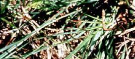
2 Soil Drainage Classes (USDA) Well Drained = Seasonal high water table (SHWT) not w/i root zone long enough to affect yield; gray colors below 48 in. Moderately Well Drained = SHWT w/i root zone long enough to affect some crops unless drained d; gray bet in. Somewhat Poorly Drained = SHWT table near surface for long enough to effect yield unless drai ned; gray bet in. Poorly Drained = or near surface for large part of year; 10 in. Very Poorly Drained = surface for most of year; surface horizon thick, dark gray or black 2
3 Root zone WD MWD SPD PD VPD Dry Wet 3
4 Soil Color Color is a useful property for soil classification Munsell soil color syste em classifies soil color on the basis of HUE, VALUE, and CHROMA 4
5 Hue: Spectral or rainbow color; 5 gradations per hue Most common wetland hue 5
6 6
7 Value: Darkness or lightness of color; ranges = pure white All light reflected 5 = gray 0 = pure black No light reflected 7
8 8
9 Chroma: Strength or concentration of hue 9
10 10


11 Reading Soil Colors Optimal Conditions Natural Light Clear, Sunny Day Not Dawn or Dusk Light at Right Angles Soil Moist 11
12 Soil Colors Matrix = predominant color Mottles = spots of color that differ from the matrix Mottling occurs wheree water table fluctuates 12
13 13
14 Soil Color Chromas 2, w/ values > 4 appear gray, are characteristic of mineral hydric soils Soils dominated d by bi bright reds, browns, yellows, oranges are usu. non-hydric 14
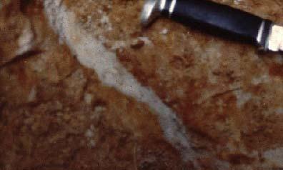
15 Organic vs Mineral Soils Soil Taxonomy separates organic from mineral based on OC & clay 20 %OC = %OM/2 OC (%) %) OC( clay content (%) 60 15
16 Hydric Soils Soils formed under conditions of saturation, flooding, ponding long enough during growing season to develop anaerobic conditions in upper part (NRCS 1998) Once hydric, always hydric 16
17 Development of Hydric Soils Inundation or saturation Anaerobic conditions Reducing environment Lower redox potential Chemical red duction (Fe, Mn, etc.) Distinctive soil characteristics 17
18 Organic Soils Fibrists = fibers compose > 2/3 of mass of soils, not very decomposed (peats, Sphagnum bogs) Hemists = fibers compose 1/3 to 2/3 of mass, somewhat decomposed, (mucky peat) Saprists = fibers compose < 1/3 of mass, well- decomposed (mucks) Folists = freely drained Histosols, i.e. OM filling cracks in bedrock (NOT HYDRIC) 18
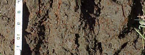
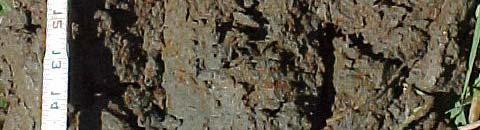
19 Organic 19
20 Mineral Hydric Soils Mineral soils, when flooded for long periods, develop certain unique characteristics, called REDOXIMORPHIC FEATURES (RF) The development of RFs mediated by microbiological proces ses. Formation rate depends on: (1) anaerobic conditions, (2) soil temperature, (3) organic matter 20


21 Mineral 21
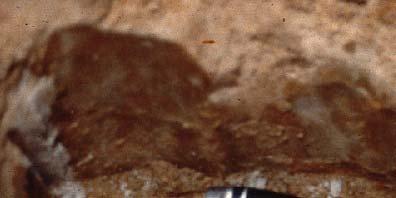

22 Redoximorphic Features Concentrations = high chroma areas where eefe e& Mn are concentrated Depletions = high h chrom ma areas where Fe & Mn have moved out Reduced matrix = soil matrix that changes color when exposed to air 22
23 Identification of Hydric Soils Search NRCS Hyd di dric Soil ildatabases or Hydric Soils Lists (crude approx.) Field inspection fo or hydric soil indicators (accurate); if indicator(s) present, it s hydric & vice versa 23
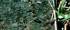
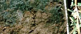
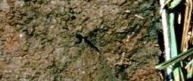
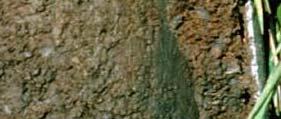
24 Indicators of Hydric Soils: All Soils Histosols: 16 in. (40 cm) or > of the upper 32 in. (80 cm) as organic material Histic Epipedon: surface ho rizons 8 in. (20 cm) or more thick of organic soil material Sulfidic S Material: evolution of fhs 2 w/i 12 in. (30 cm) Layers of Muck: layers < 8 in. (20 cm) thick, must be Oa horizons 24


25 25
26 Indicators of Hyd dric Soils: Sands Dark Surface: layer of black or dark gray color, w/ value=3, chroma 1. Layer below must be gray w/ value=4, chroma 2 Sandy Redox: gray layer w/ reddish colored mottles, matrix chroma 2,, mottles occ cupy > 2 % Stripped Matrix: similar to sandy redox except red mottles absent 26
27 27
28 Indicators of Hydric Soils: Loams, Clays Depleted Matrix: gray layer below A horizon that may or may not have reddish mottles Redox Dark Surface: blacka horizon that contains red mottles in the form of Fe masses or pore linings Umbric U b i Surface: black layer chroma 1 6i in. thick w/ value 3 and 28

29 29
30 Comparison of Mineral Organic matter <20-35% Miner ral ph usually circumne utral Bulk density 1-2 g/cm 3 Porosity ~45-55% Hydraulic conductivity Water Holding Capacity Nutrient Availability high (sand, silt); low (clay) low (sand, silt); high (clay) high (cations, P); & Organic Hydric Soils low (C, N) > 20-35% Organic acidic (bogs) circumneutral (Evgs.) <0.3 03g/cm 3 > 80% high high low (bogs) moderate (Evgs.) CEC low (sand, silt); high (clays) high 30
31 Subaque eous Soils George Demas, NRCS Noted that sediments in met definition iti of soil by: Ches. Bay 1) supporting rooted plan tgo growth (Eel grass) 2) forming soil horizons 3) undergoing g pedogenic processes 31
32 Subaqueou us Soil Defs. Subaqueous soil: formed under continuous water column (<2.5 m), capable of supporting rooted vegetation Submerged soil: form ed in upland env., became submerged as result of water table, flooding (beaver dam), SL rise 32
33 Soil vs. SA Soil Formation 5 Soil Forming Factors S = ƒ (C, (Dokuchaiev 1883, Jenny 1941): O, R, P, T) 8 SA Soil Forming Facto ors (Demas & Rabenhorst 2001): Ss = ƒ (C, O, B, F, P, T, W, E) Climate, Organisms, Bathymetry, Flow regime, Parent Material, Time, Water Column Attributes, Extreme Events 33
34 Subaqueous Soil Map From Rabenhorst 34
35 Uses of Subaqueous Soil Mapping SAV Restoration Pathogen residence site identification Benthic preservation site identification Wildlife management Aquaculture Management of clam, oyster, scallop production Acid-sulfate weathering hazard mapping Dune maintenance/replenishment Baseline condition monitoring Resource inventory Dredging considerations Wading shore birds, migratory waterfowl, nurseries and spawning ground 35
zone long enough to affect yield; gray colors below 48 in. horizon thick, dark gray or black
 Wetland & Sub baqueous Soils NRE M 665 Coastal & Wetland Ecology & Management 1 2 Soil Drainage Classes (USDA) Well Drained = Seasonal high water table (SHWT) not w/i root zone long enough to affect yield;
Field Indicators of Hydric Soils in the United States: For All Soils. Field Indicators. Indicators for all soils regardless of texture
 Field Indicators of Hydric Soils in the United States: For All Soils From Vasilas, L.M., G.W. Hurt, and C.V. Noble. 2010. Field indicators of hydric soils in the United States (Version 7.0), USDA, NRCS,
Whole Landscape Hydrology: Application to Restore or Create Wetlands. Introduction SOLUTION
 Whole Landscape Hydrology: Application to Restore or Create Wetlands by: Wade Hurt, USDA, NRCS, NSSC/University of Florida and Jimmie Richardson, North Dakota State University. Problem: Wetland construction
Reference Card S-2, Side A: Delineating Horizon Boundaries
 Reference Card S-2, Side A: Delineating Horizon Boundaries Distinguishing Soil Horizons Soil horizons are delineated based on differences in: Texture Color Structure and Consistence Redoximorphic Features
Soil Colors, Texture & Structure
 Application Soil Colors, Texture & Structure Limiting conditions Soil color type/depth of system Bedrock type/depth of system Soil texture, structure, percolation rate size and type of system Sara Heger,
S9. Thin Dark Surface
 Dominant Field Indicators of Hydric Soils in Florida S9. Thin Dark Surface For use in LRRs R, S, U, and T; for testing in LRRs K and L. A layer 5 cm (2 inches) or more thick within the upper 15 cm (6 inches)
Inconsistencies in terminology and definitions of organic soil materials
 Inconsistencies in terminology and definitions of organic soil materials Mineral soil material (less than 2.0 mm in diameter) either: 1. Is saturated with water for less than 30 days (cumulative) per year
DO YOU KNOW YOUR SOILS? (Rev. 10/11)
") DO YOU KNOW YOUR SOILS? (Rev. 10/11) Circle all the correct answers. 1. What is the layer normally present on the surface of the soil in cropped fields? a. O c. Ap e. B g. R b. A d. E f. C 2. Available
DO YOU KNOW YOUR SOILS? (Rev. 10/11) Circle all the correct answers. 1. What is the layer normally present on the surface of the soil in cropped fields? a. O c. Ap e. B g. R b. A d. E f. C 2. Available
Field Indicators of Hydric Soils in the United States: Sandy Soils
 Field Indicators of Hydric Soils in the United States: Sandy Soils From: Vasilas, L.M., G.W. Hurt, and C.V. Noble. 2010. Field indicators of hydric soils in the United States (Version 7.0), USDA, NRCS,
Soil Horizons cont. Oa- highly decomposed Oi-undecomposed
 Soils Soil Basics Soil Horizons Soil Horizons cont. O Horizon: Or organic layer Organic layer of decomposing plant and animal tissue. Wooded upland areas have thin O horizons Wetlands may have thick O
IOWA FFA STATE SOILS CDE SATURDAY, OCTOBER 13, 2007 AMES, IOWA
 IOWA FFA STATE SOILS CDE SATURDAY, OCTOBER 13, 2007 AMES, IOWA 1. Moderately sloping has what percent slope: a. 9-14% b. 2-5% c. 5-9% d. over 14% 2. Which of the following horizons is the loose underlying
Overview of Soil Properties
 Willie Harris apatite@ufl.edu Acknowledgments: Wade Hurt Mike Vepraskas FAESS Soil Scientists Overview of Soil Properties Website to download files of talks: wgharris.ifas.ufl.edu.hsw.htm Meaning of Soil
Overview of Soil Properties
 Willie Harris apatite@ufl.edu Acknowledgments: Wade Hurt Mike Vepraskas FAESS Soil Scientists Overview of Soil Properties Website to download files of talks: wgharris.ifas.ufl.edu.hsw.htm Meaning of Soil
Horner-McLaughlin Woods: Soil Types
 Horner-McLaughlin Woods: Soil Types Not present at HMW Adrian Muck Conover Loam 0-4% Slopes Houghton Muck Miami Loam 2-6% Slopes Miami Loam 6-12% Slopes Miami Loam 12-18% Slopes t 0 0.125 0.25 Miles Mary
Lecture 5: Introduction to Soil Classification; Soil Physical Properties
 Lecture 5: Introduction to Soil Classification; Soil Physical Properties Soil Classification Argillic Horizon Alfisols Moderately leached soils with a clay-rich B-horizon Typically found in forests Andisols
12/11/2008. HYDRIC SOILS: Soil Parameters Used for Jurisdictional Delineation. Objectives
 HYDRIC SOILS: Soil Parameters Used for Jurisdictional Delineation Andrew Harley, Ph.D. andrew.harley@wspgroup.com & Lyndon C. Lee, Ph.D., PWS lyndon.lee@wspgroup.com Objectives Introduce concepts & procedures
Field Indicators for Identifying Hydric Soils in New England Version 4
 Field Indicators for Identifying Hydric Soils in New England Version 4 May 2017 New England Hydric Soil Technical Committee 1 The New England Hydric Soils Technical Committee (NEHSTC) consists of the following
Field Indicators of Hydric Soils in the United States A Guide for Identifying and Delineating Hydric Soils, Version 7.0, 2010
 United States Department of Agriculture Natural Resources Conservation Service In cooperation with the National Technical Committee for Hydric Soils Field Indicators of Hydric Soils in the United States
3 Hydric Soil Indicators
 ERDC/EL TR-12-1 32 3 Hydric Soil Indicators Introduction The National Technical Committee for Hydric Soils (NTCHS) defines a hydric soil as a soil that formed under conditions of saturation, flooding,
Field Indicators of Hydric Soils in the United States Guide for Identifying and Delineating Hydric Soils, Version 5.0, 2002
 Natural Resources Conservation Service Wetland Science Institute Soil Survey Division Field Indicators of Hydric Soils in the United States Guide for Identifying and Delineating Hydric Soils, Version 5.0,
SOIL CHARACTERIZATION USING DIAGNOSTIC PROPERTIES
 SOIL CHARACTERIZATION USING DIAGNOSTIC PROPERTIES The following are the characters of the pedologically important properties used in categorizing soils: SOIL CHARACTERIZATION Soil Profile Description:
Iowa FFA Soil Career Development Event 2008
 Iowa FFA Soil Career Development Event 2008 1. In Iowa, corn suitability ratings for soil mapping units specifies a. natural weather conditions b. surface and subsurface drainage installed where needed
Site Selection. The #1 Most Important Step in Planting Anything Soils a major component. Physical Characteristics. Chemical Composition
 SOILS COMPONENT Site Selection The #1 Most Important Step in Planting Anything Soils a major component Physical Characteristics Drainage Texture Saturated Hydraulic Conductivity Permeability Swales Chemical
LAB 12: Soils. Name School. Patrich Physical Geography Lab 1
 Name School LAB 12: Soils Soil is a mixture of weathered rock & organic matter that usually covers bedrock (solid rock that underlies all soil). Both chemical & mechanical processes are involved in the
Learning Objectives Part 1. Chapter 4 Soil Physical Properties. Soil Physical Properties. Color. Physical properties part 1
 Learning Objectives Part 1 Chapter 4 Soil Physical Properties Know what color tells you about a soil Describe the concept of soil texture and its importance Use the textural triangle to determine a soil
ON LANDSCAPING, SOILS, SOIL AMENDMENTS AND PROPER SEED ESTABLISHMENT (BOTH GRASS LAWNS AND MEADOWS).
.") ON LANDSCAPING, SOILS, SOIL AMENDMENTS AND PROPER SEED ESTABLISHMENT (BOTH GRASS LAWNS AND MEADOWS). John D. Chibirka USDA-NRCS Resource Soil Scientist 1238 County Welfare Road, Suite 220 Leesport, PA
ON LANDSCAPING, SOILS, SOIL AMENDMENTS AND PROPER SEED ESTABLISHMENT (BOTH GRASS LAWNS AND MEADOWS). John D. Chibirka USDA-NRCS Resource Soil Scientist 1238 County Welfare Road, Suite 220 Leesport, PA
Soils and the Environment. A Summary of RI Envirothon Study Materials Compiled by Sally Paul
 Soils and the Environment A Summary of RI Envirothon Study Materials Compiled by Sally Paul Why Soils Food and water resources Disposing of waste Support for human structures Growing timber and fibers
2011 Wisconsin Envirothon Soils and Land Use Exam
 2011 Wisconsin Envirothon Soils and Land Use Exam USE THE OCONTO COUNTY SOIL SURVEY TO ANSWER QUESTIONS 1-4 The Pensaukee River Wetland Complex is a mixture of state (Pensaukee Wildlife Area) and privately
2016 Area 3 Envirothon Muskingum County Soils Test ANSWER KEY
 2016 Area 3 Envirothon Muskingum County Soils Test ANSWER KEY 1. The majority of the bedrock in Muskingum County is. a. sedimentary bedrock b. glacial bedrock c. igneous bedrock d. metamorphic bedrock
2014 Iowa FFA Soil Judging CDE Exam
 2014 Iowa FFA Soil Judging CDE Exam 1. Landscape position is one aspect of evaluating the surface features of a certain tract of land. Identifying the correct landscape position will indicate: a. If the
Soils of Palau. Diversity and Fertility. Palau Livestock Management Workshop March 23-25, Jonathan Deenik, PhD University of Hawaii
 Soils of Palau Diversity and Fertility Jonathan Deenik, PhD University of Hawaii Palau Livestock Management Workshop March 23-25, 2011 Outline Plant nutrition Soil fertility Soil composition Texture and
Soil Physical Properties
 Soil Physical Properties ESRM 311 SEFS 507 Some examples of mineral soil development eg, Rock Weathering Types of Weathering Physical/Mechanical Chemical Biological Photo by D Vogt CO 2 + H 2 O H 2 CO
2016 Iowa FFA Soils Evaluation CDE Exam
 2016 Iowa FFA Soils Evaluation CDE Exam 1. Which of the following is true regarding soil horizons? a. A horizon is darker in color and has more organic matter b. B horizon is darker in color and has more
SOIL SCIENCE 101 FUNCTIONS OF SOIL SOIL FORMATION
 SOIL SCIENCE 101 By Dawn Pettinelli UConn Soil Nutrient Analysis Lab CT Envirothon Training, 2014 dawn.pettinelli@uconn.edu FIVE CRUCIAL ECOLOGICAL ROLES OF SOILS FUNCTIONS OF SOIL Regulate water flow
The GEOGRAPHY of SOILS. Physical Geography (Geog. 300) Prof. Hugh Howard American River College
 Prof. Hugh Howard American River College") The GEOGRAPHY of SOILS Physical Geography (Geog. 300) Prof. Hugh Howard American River College SOIL and SOIL- FORMING FACTORS SOIL and FORMING FACTORS Soil Natural surface layer of Earth Composed of mineral
The GEOGRAPHY of SOILS Physical Geography (Geog. 300) Prof. Hugh Howard American River College SOIL and SOIL- FORMING FACTORS SOIL and FORMING FACTORS Soil Natural surface layer of Earth Composed of mineral
Site Selection. The #1 Most Important Step in Planting Anything Soils a major component. Physical Characteristics. Chemical Composition
 SOILS COMPONENT Site Selection The #1 Most Important Step in Planting Anything Soils a major component Physical Characteristics Drainage Texture Saturated Hydraulic Conductivity Permeability Swales Chemical
Soil 1/18/2012. Soils, Nutrients and Fertilizers Part I. Soil Profile
 Soils, Nutrients and Fertilizers Part I Handouts: Soil Texture Triangle ph Nutrient Availability Soil Diverse combination of weathered rock fragments and minerals, with decaying remains of plants and animals
Special Assignment for Wednesday: Watch video on soil texture analysis https://youtu.be/ioyabxj767s
 Special Assignment for Wednesday: Watch video on soil texture analysis https://youtu.be/ioyabxj767s Lecture 3: Soil Physical Properties Important Physical Properties Soil Color: Most obvious physical property;
SOIL DATA: Avondale. in Allen, TX. This information was taken from NRCS web soil survey of Collin County, Texas.
 SOIL DATA: Avondale in Allen, TX This information was taken from NRCS web soil survey of Collin County, Texas. United States Department of Agriculture Soil Conservation Service in cooperation with Texas
Soils and their Relationship with Agriculture
 Soils and their Relationship with Agriculture Presentation created by Thomas Gallagher Modified by Hank Bignell Capital Area Agriculture and Horticulture Program Cornell University Cooperative Extension
1. Position (2 pts.) 2. Parent Material (2 pts.) 3. Slope Characteristics (2 pts.) 4. Surface Stoniness or Rockiness (2 pts.)
 2. Parent Material (2 pts.) 3. Slope Characteristics (2 pts.) 4. Surface Stoniness or Rockiness (2 pts.)") Maryland Envirothon SOILS Exam Guidance Information (revised 2017) Objective: To test students' knowledge and awareness of basic soil science and its application in wise land-use planning and therefore
Maryland Envirothon SOILS Exam Guidance Information (revised 2017) Objective: To test students' knowledge and awareness of basic soil science and its application in wise land-use planning and therefore
Supplement. Hydric Soils. Hydric Soils
 Field Supplement to to Version 3 April 2004 in New In New England England Hydric Soils Hydric Soils Identifying Identifying Indicators Indicators for for Supplement to Field Indicators for Identifying
3.44b. Soil Classification AK & BR
 3.44b Soil Classification AK & BR Why look at soil? Because soil and its constituents are the base material for growing trees. History Why a Forestry Commission soil classification? There is a need for
Lecture 3: Soil Microclimatology
 Lecture 3: Soil Microclimatology Introduction to Soils Heat Transfer Through Soils Water Transfer Through Soils What is a Soil? Soil is a complex mixture of mineral matter, organic matter and living organisms
Soil characteristics that influence nitrogen and water management
 Section C Soil characteristics that influence nitrogen and water management Soil characteristics vary across the landscape Soils vary from one field to another, and often within the same field. Soil differences
2017 Iowa FFA Soil Judging CDE Exam
 2017 Iowa FFA Soil Judging CDE Exam 1. Landscape positions vary in soil composition and makeup. What landscape position would be characterized by having strata and lenses of different textures in the profile:
3. What are the five master horizons? Give distinguishing features of each. 5. List three means by which plant roots come into contact with nutrients.
 Study Questions Exam 1 1. What are the four general components of soil? 2. Define regolith and solum. 3. What are the five master horizons? Give distinguishing features of each. 4. What is meant by an
SOIL SCIENCE 101. By Dawn Pettinelli UConn Soil Nutrient Analysis Lab CT Envirothon Training, 2015
 SOIL SCIENCE 101 By Dawn Pettinelli UConn Soil Nutrient Analysis Lab CT Envirothon Training, 2015 dawn.pettinelli@uconn.edu Soil is the collection of natural bodies in the earth s surface, in places modified
Lesson 1: Recognizing the Characteristics of Soils and the Soil Requirements for Fruit and Nut Crops
 Lesson 1: Recognizing the Characteristics of Soils and the Soil Requirements for Fruit and Nut Crops 1 Mineral matter Organic matter Pore spaces Tilth Hygroscopic water Soil aeration 22 I. Soil is a layer
Buzzards Bay National Estuary Program and the Massachusetts Association of Conservation Commissions. The BBNEP and MACC have been cooperating,
 This workshop is a cooperative venture between the Buzzards Bay National Estuary Program and the Massachusetts Association of Conservation Commissions. The BBNEP and MACC have been cooperating, coordinating
Unit E: Basic Principles of Soil Science. Lesson 3: Understanding Soil Color
 Unit E: Basic Principles of Soil Science Lesson 3: Understanding Soil Color 1 Important Terms Bright-colored Color Deciduous hardwood forest Dull-colored Humus Mottle-colored Native vegetation Structure
SOIL SCIENCE 101. By Dawn Pettinelli UConn Soil Nutrient Analysis Lab CT Envirothon Training, 2016
 SOIL SCIENCE 101 By Dawn Pettinelli UConn Soil Nutrient Analysis Lab CT Envirothon Training, 2016 dawn.pettinelli@uconn.edu Soil is the collection of natural bodies in the earth s surface, in places modified
SUBSURFACE DRIP DISPERSAL OF EFFLUENT for LARGE SYSTEMS. Presented by: David Morgan and Rodney Ruskin
 SUBSURFACE DRIP DISPERSAL OF EFFLUENT for LARGE SYSTEMS Presented by: David Morgan and Rodney Ruskin Program Map Making Program Soil Parent material, Relief, Time. Organisms, Color, Texture, Depth, Profile
The New England Hydric Soils Technical Committee (NEHSTC) consists of the following members:
 consists of the following members:") Acknowledgements This manual reflects the collective effort and vision of the New England Hydric Soils Technical Committee. The Committee consists of soil scientists, wetland scientists, and regulatory
Acknowledgements This manual reflects the collective effort and vision of the New England Hydric Soils Technical Committee. The Committee consists of soil scientists, wetland scientists, and regulatory
Lesson 3: Understanding Soil Color
 Lesson 3: Understanding Soil Color 1 Bright colored Color Dull colored Humus Mottle colored Native vegetation Structure Tall prairie grass Texture Deciduous hardwood forest 2 I. Soils have many features
2012 FINAL SOILS AREA 2 Envirothon Questions Answer KEY
 2012 FINAL SOILS AREA 2 Envirothon Questions Answer KEY Questions 1-6 to be answered at the soil pit: 1. Soil scientists categorize soils by drainage classes. What is the drainage class of the soil at
icators for Identif icators for Identi y ldief Hydric Soils Iin NNeew England Version 3 April 2004
 Hydric Hydric Soils Soils Field Version 3 April 2004 in New In New England England Identifying Identifying Indicators Indicators for for Field Indicators for Identifying Hydric Soils in New England Version
icators for Identif icators for Identi y ldief Hydric Soils Iin NNeew England Version 3 April 2004
 Field Indicators Indicators in New In New for for Identifying Identifying Hydric Soils England England Version 3 April 2004 Field Indicators for Identifying Hydric Soils in New England Version 3 April
ASCE - Philadelphia. Soils & Stormwater Management. Matthew C. Hostrander, CPSS, SEO Soil Scientist. Gilmore & Associates, Inc.
 ASCE - Philadelphia Soils & Stormwater Management Matthew C. Hostrander, CPSS, SEO Soil Scientist Gilmore & Associates, Inc. Course Overview COURSE OUTLINE Soil Science Fundamentals Discuss United States
Hydric Soils - Overview
 Hydric Soils - Overview The Hydric Soils section presents the most current information about hydric soils. It updates information that was previously published in "Hydric Soils of the United States" and
Soil & Site Evaluator - Need to Know
 Soil & Site Evaluator - Need to Know I. The professional will understand the factors of soil development and demonstrate their importance to site evaluations. A. Topography 1. Landscape & landform description
2018 Iowa FFA Soil Judging CDE Exam 1. Landscape positions characterizes the location of the soil on the landscape and identifies potential risks.
 2018 Iowa FFA Soil Judging CDE Exam 1. Landscape positions characterizes the location of the soil on the landscape and identifies potential risks. Which landscape position is considered the floodplain
Soil Physical Properties I: Outline
 Soil Physical Properties I: Outline Soil color See plates between pages 114 and 115 in textbook. Soil texture Soil structure Soil color Soil color provides clues to other soil properties and to soil conditions.
Understanding Soils. 1. What is Soil? 2. What does soil do for us?
 Understanding Soils 1. What is Soil? Soil: (i) The unconsolidated mineral or organic material on the immediate surface of the earth that serves as a natural medium for the growth of land plants. (ii) The
Soil Classification: Outline
 Soil Classification: Outline Introduction Soil moisture regimes Soil temperature regimes The Soil Taxonomy Diagnostic horizons soil orders Why Classify? Organize knowledge in an attempt to find order in
Unit 1 Lesson 5 Soil Formation. Copyright Houghton Mifflin Harcourt Publishing Company
 The Dirt on Soil What causes soil to form? Soil is a loose mixture of rock fragments, organic matter, water, and air that can support the growth of vegetation. The first step in soil formation is the weathering
Soils and Land Use Test
 SOIL PROPERTIES Total Score /50 1) List two of the five main functions of soil. (2 points) Habitat for organisms, Engineering medium, Filters and stores water, Anchor for plants, Cycles nutrients 2) Small
CONNECTICUT ENVIROTHON 2012 SOILS QUESTIONS
 CONNECTICUT ENVIROTHON 2012 SOILS QUESTIONS Please select the best response to the following questions. There are 25 4 point questions. Many have more than one part. Good luck! Section 1: Judging the soil
a. OVERALL PROFILE DEPTH: Assess the depth to the first restrictive layer, which can be a tree root, a rock or an
 OBSERVING SOIL PROCEDURE Using a shovel, soil probe, or soil auger, collect a soil profile. (Go as deep as you can with the equipment). Arrange the soil you remove from the ground on newspaper or in a
Why do soils differ across the landscape?
 Today s Objectives: Elements of soil formation Describe important soil physical & chemical properties Describe the ability to use and interpret soil survey information (printed and digital) List some site
URBAN SOILS & SEATTLE EXAMPLES
 Class Results - Mystery Soil #1 14 12 10 8 6 4 2 0 Sandy Clay Loam Sandy Loam Silty Loam Class Results - Mystery Soil #2 6 5 4 3 2 1 0 Silty Clay Clay Loam Sandy Sandy Silty Sandy Silty Loamy Loam Clay
4/23/2018. Soil John Wiley & Sons, Inc. All rights reserved. Lecture 14
 Lecture 14 Soil Lecture 14 1. The Soil System 2. Soil Properties and Major Soil Types 3. Environmental Problems Related to Soil 4. Soil Conservation and Regeneration 1 The Soil System Soil Uppermost layer
Field Manual for Soil Type Identification
 Soil Fertility Evaluation/Advisory Service in Negara Brunei Darussalam Field Manual for Soil Type Identification CSIRO Land and Water Department of Agriculture 2008 Brunei Darussalam Copyright and Disclaimer
Do Now: From which materials do you think soil is made? Are all soils the same? Think of some ways that they are different?
 Do Now: From which materials do you think soil is made? Are all soils the same? Think of some ways that they are different? Basics Soil is a major component of the biosphere It contains solids, liquids
Soil Quality / Understanding Soil Health what are we missing?
 Soil Quality / Understanding Soil Health what are we missing? Soil Quality Test Kit Clarence Chavez Soil Scientist The USDA is an Equal Opportunity Provider and Employer Soils are not machines: It s an
OHIO STATE UNIVERSITY EXTENSION. Soil and Nutrients. OSUE Master Gardeners Mahoning County Class of Bill Snyder March 21, 2017
 OHIO STATE UNIVERSITY EXTENSION Soil and Nutrients OSUE Master Gardeners Mahoning County Class of 2017 Bill Snyder March 21, 2017 Soil vs DIRT Ecological Roles of Soil 1. Medium for plant growth 2. Recycling
Section 1. Judging the soil pit (questions 1-4)
") CONNECTICUT ENVIROTHON 2009 SOILS QUESTIONS Please select the best response to the following questions. There are 25 questions; each question is worth 4 points. Section 1. Judging the soil pit (questions
CONNECTICUT ENVIROTHON 2009 SOILS QUESTIONS Please select the best response to the following questions. There are 25 questions; each question is worth 4 points. Section 1. Judging the soil pit (questions
Bell Ringer. d) Erosion e) Decomposition of organic compounds
 Erosion e) Decomposition of organic compounds") Bell Ringer 1) A rock exposed to high winds, over a long period of time, loses half of its original size. This is an example of a) Physical weathering b) Chemical weathering c) Biological weathering d)
Bell Ringer 1) A rock exposed to high winds, over a long period of time, loses half of its original size. This is an example of a) Physical weathering b) Chemical weathering c) Biological weathering d)
The relationship between soil (growing
 4 Plant, Soil and Water Relationships The relationship between soil (growing media), air, and water is one of the least understood aspects in production and maintenance of plants. As a result, a significant
If you are not able to turn in your notebook see me or Dan ASAP
 Notebook Collection Collecting hard copies now OR Electronic versions using Catalyst drop box Due by 5:30 pm today Use website for link If you are not able to turn in your notebook see me or Dan ASAP URBAN
NYC Envirothon 2017 Soil Science Review. Richard K Shaw USDA-NRCS
 NYC Envirothon 2017 Soil Science Review Richard K Shaw USDA-NRCS Introduction Who Are We? U.S. Department of Agriculture (1862) Natural Resources Conservation Service (1935) What Do We Do? Provide leadership
Today. Climate. Role of water. Rainfall: Intensity and duration. Effective precipitation. (1)Parent materials + 4 other factors of soil formation
Parent materials + 4 other factors of soil formation") Today Models of soil formation Soil taxonomy Horizon descriptions (1)Parent materials + 4 other factors of soil formation Climate Topography Time Biota Can be interrelated and interact Climate Moisture
Today Models of soil formation Soil taxonomy Horizon descriptions (1)Parent materials + 4 other factors of soil formation Climate Topography Time Biota Can be interrelated and interact Climate Moisture
Chapter 15 Soil Resources
 Chapter 15 Soil Resources Overview of Chapter 15 What is Soil? Soil Horizons Nutrient Cycling Soil Properties and Major Soil Types Soil Problems Soil Conservation and Regeneration Soil Uppermost layer
Soil & Site Evaluator - Need to Know
 Soil & Site Evaluator - Need to Know I. The professional will understand the factors of soil development and demonstrate their importance to site evaluations. A. Topography 1. Landscape description 2.
Pits 1 & 3 Questions. 7. Subsurface: Texture (5 pts) A. Coarse B. Moderately course C. Medium D. Fine E. Very Fine
 A. Coarse B. Moderately course C. Medium D. Fine E. Very Fine") Minnesota Soils Scorecard Questions for Pits 1-4 Scantron # 105481 Use your soils scorecard to fill out the answers on your scantron Bubble in the front side of the sheet for Pit 1 (# 1-45) and Pit 2 (#51-95)
Minnesota Soils Scorecard Questions for Pits 1-4 Scantron # 105481 Use your soils scorecard to fill out the answers on your scantron Bubble in the front side of the sheet for Pit 1 (# 1-45) and Pit 2 (#51-95)
Alternative Crop Suitability Methodology
 Alternative Crop Suitability Methodology The Alternative Agriculture in Missouri Hub on Community Commons includes model-based ratings of natural suitability for selected alternative crops. These ratings
Specifying Soils for Plant Growth
 Specifying Soils for Plant Growth Which by coincidence reduces runoff Timothy A. Craul, CPSSc President, Craul Land Scientists The soil must be plant friendly. The soil is a natural system. All soils are
Assessing Soil Health: Building Resilience Following a Wet Harvest
 Assessing Soil Health: Building Resilience Following a Wet Harvest............................... Marla Riekman, PAg, CCA Soil Management Specialist Manitoba Agriculture SOIL HEALTH PHYSICAL Soil compaction
Glossary of Wetland Terminology
 Glossary of Wetland Terminology Common wetland terms defined Active water table A condition in which the zone of soil saturation fluctuates, resulting in periodic anaerobic soil conditions. Soils with
Soil Drainage. Dr. Jim Walworth Dept. of Soil, Water & Environmental Sci. University of Arizona
 Soil Drainage Dr. Jim Walworth Dept. of Soil, Water & Environmental Sci. University of Arizona Yield (kg kernel/cm 2 ) Y = (0.04*sand) + 0.79 R 2 = 0.57 Percent Sand Pecans like well-drained soil. In Arizona
Soil Management: the basis of sustainable agriculture
 Soil Management: the basis of sustainable agriculture FAB-465 Lecture 11 Lecture Outline Soil Formation Soil Structure/Texture Indicators of Soil Health or Fertility Soil Conservation Practices 1 Soil
Soil Structure, Density, and Porosity. Laboratory #4
 Soil Structure, Density, and Porosity Laboratory #4 Objectives Understand the concept of soil structure and how it differs from soil texture. Understand how soil structure influences other soil properties.
Soils of Oahu. Outline. Soils and Plant Nutrient Supply 2/20/2014
 Soils of Oahu Jonathan Deenik Department of Tropical Plant and Soil Sciences Outline Importance of Soils Soil Diversity on Oahu Soil Properties Diagnosis and soil testing Management for Health Soils and
Soil Resources. Soil Horizons
 Soil Resources Soil Uppermost layer of earth s crust that supports plants, animals and microbes Soil Forming Factors Parent Material Time Climate Organisms Topography Soil Composition Mineral Particles
Soil Interpretations Erosion and Sedimentation Control Planning and Design Workshop
 Soil Interpretations Erosion and Sedimentation Control Planning and Design Workshop Presented by Richard Brooks Presentation prepared by Kristin May Resource Soil Scientists USDA-Natural Resources Conservation
Overview of Chapter 14
 14 Soil Resources Overview of Chapter 14 The Soil System Soil Properties and Major Soil Types Environmental Problems Related to Soil Soil Conservation and Regeneration Soil Uppermost layer of earth s crust
Do You Dig Wetland Soil?
 Do You Dig Wetland Soil? [Soil texture flow chart adapted from Steve Thein, 1979. Source unknown.] Grade Level K-12, as indicated Subject Areas Earth Science Duration Part I, 30-40 minutes; Part II, 60
Factoids on SC soils. Soils. What is Soil? Variability of soils in your yard. Soil Components. Soil Tilth 6/23/14
 Factoids on SC soils Soils Managing Soils Over 100 different soil types Soil type covering largest areas 7.0% Ben Lomond Complex 50-70% slope 5.6% Lompoc Felton Complex 50-75% slope 5.8% Lompoc Felton
AGRONOMY 255, 251, 270 SOIL DIFFERENCES
 Name AGRONOMY 255, 251, 270 SOIL DIFFERENCES Soils differ strikingly from each other. This week we illustrate the great differences and ask you to learn how they differ and to become skilled in describing
O horizon: the O-horizon is made up of organic material. The horizon is found at the soil surface.
 A Good Dirty n Soil Lab: References: Wagner & Sanford. Environmental Science. Wiley & Sons, 2005. Molnar. Laboratory Investigations for AP* Env. Science. Peoples Ed, 2005. Soil Porosity & Permeability