Designing INSIDE the Box
|
|
|
- Jonah Webb
- 5 years ago
- Views:
Transcription


1 Designing INSIDE the Box Using the ITE/CNU Walkable Urban Thoroughfares Manual to Build Complete Streets National Association of Regional Councils Raleigh, NC June 8, 2015 G. Wade Walker, P.E. Principal / Complete Streets Regional Leader Alta Engineering Southeast LLC / Alta Planning + Design Davidson, North Carolina


2 We ve known how to build great streets

3 What Happened??? Cartoon courtesy of Walter Kulash

4 Conventional Transportation Philosophy Capacity Operational Efficiency Vehicular LOS Minimize Vehicular Delay
5 Ideal Traffic Planning Widen 20-Year Forecast Capacity Years Slide courtesy of Walter Kulash
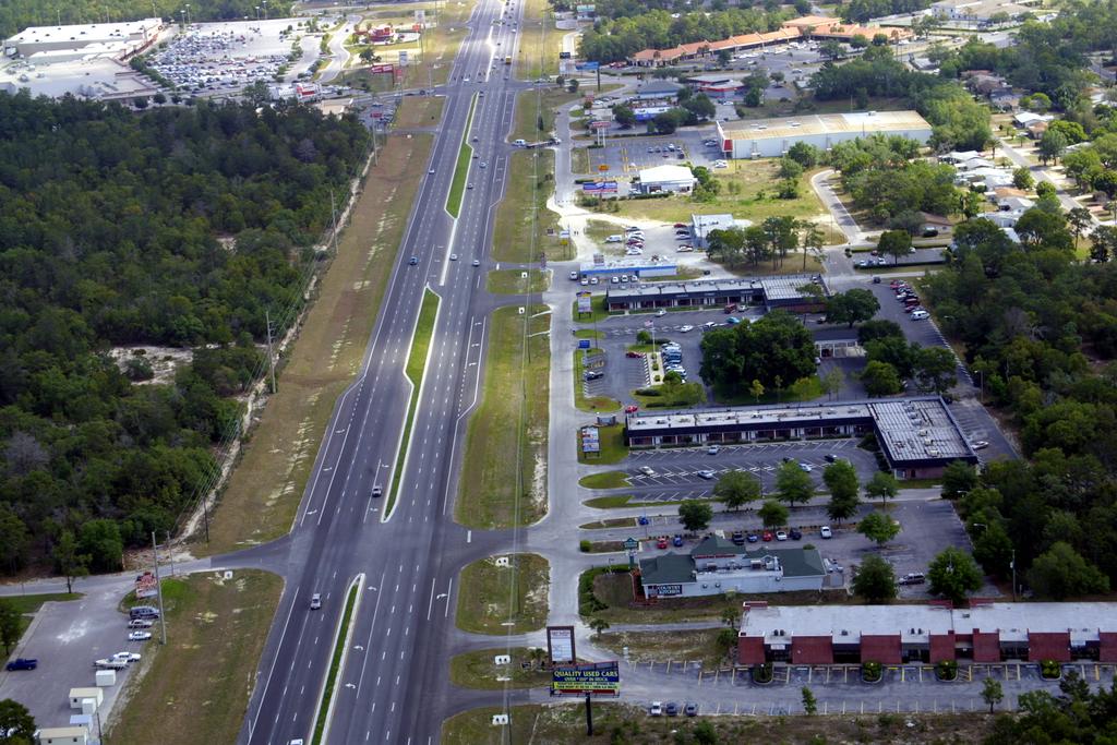
6 The Reality Widen Actual Induced Traffic Forecast Capacity Years Slide courtesy of Walter Kulash

7 Road Size, Not Congestion is the Choice Widen Congestion Widen Congestion Traffic Congestion Capacity Years Slide courtesy of Walter Kulash
8 Trying to cure traffic congestion with more capacity is like trying to cure obesity by loosening your belt - Glen Heimstra, Futurist
9

10 Sometimes Prohibited Items Speeds Lower Than 45 mph Narrow Lanes Two Lane Roads On Street Parking Street Trees/Furniture Crosswalks/Sidewalks
11

12 The Size and Character of Road Influences the Quality of Urban Environment Photo courtesy of Rick Hall, Hall Planning & Engineering

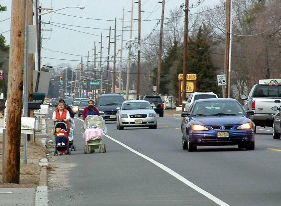
13 Pedestrians in conventional suburban development


14 Livability and balance Complete Streets Combine land use and transportation improvements Full range of seamless multi-modal opportunities transit, pedestrian, bicycle, and roadway networks Context sensitive solutions utilize inherent flexibility in design Collaborative, interdisciplinary, and community-led design Holistic Transportation Strategy


15 A New Transportation Philosophy Livability and Balance Context Sensitive Design & Solutions Land Use & Transportation Relation Smart Growth Consistency Collaboration WHAT S HIDING BEHIND THE CURBS?
16 The intent of this policy is to provide guidance to the designer by referencing a recommended range of values for critical dimensions. Good highway design involves balancing safety, mobility, and preservation of scenic, aesthetic, historic, cultural, and environmental resources. This policy is therefore not intended to be a detailed design manual that could supersede the need for the application of sound principles by the knowledgeable design professional. Sufficient flexibility is permitted to encourage independent designs tailored to particular situations. Minimum values are either given or implied by the lower value in a given range of values. The larger values within the ranges may be used where social, economic, and environmental impacts are not critical. Engineering judgment is exercised by highway agencies to select appropriate design values. From the Forward to the AASHTO Green Book

17 These geometric design are intended to provide operation efficiency, comfort, safety, and convenience for the motorist. The design concepts presented herein were also developed with consideration for environmental quality. The effects of the various environmental impacts can and should be mitigated by thoughtful design processes. This principle, coupled with that of aesthetic consistency with the surrounding terrain and urban setting, is intended to produce highways that are safe and efficient for users, acceptable to non-users, and in harmony with the environment. From the Forward to the AASHTO Green Book

18 Image Courtesy CDOT Complete, Walkable Streets


19 And Complete Streets are important because?


20 So engineers and urbanists got together Encouraged: 25 mph Speeds Narrow Lanes (10 ) Bike & Ped Facilities On Street Parking Street Trees/Furniture Context Sensitivity


21 Complete Streets Toolbox for Urban Thoroughfares This? Target Speed vs. Design Speed Access Management/Connectivity On Street Parking Bicycle Facilities Or this? Midblock Pedestrian Crossings Medians Green Infrastructure Elements Placemaking Elements
22
23 Balancing the Expectations Small Impacts Motorist Travel Time Large Gains Overall Street Livability

24 Riverfront Parkway Chattanooga (pre-1995)

25 Riverfront Parkway Today
26


27 Relationship between Speed and Safety mph Source: On a Collision Course? Smart Growth & Traffic Safety (Charlier, Garrick, Dumbaugh 2011)

28 30 mph 25 mph 20 mph 15 mph
29


30 Network and Capacity Same Total Lanes More Capacity VMT Turns Clearance Time Signal Phase Imagery Courtesy of Walter Kulash


31 Consolidate Access Points Shared Driveways Cross Access Easements Access Roads


32 Imagery Courtesy of Walter Kulash Trip Assignments in Two Patterns of Development
33

34 Place-making Elements Image by Bethany Hughes, Fuss & O Neill


35 Complete Streets Planning and Design Guidelines (NCDOT, July 2012 Urban Multiway Boulevard


36 SR 434 Winter Springs, FL

37 Think of the Space between Buildings as an Asset Parking Parallel Angled (head in/back in) Bicycle Wider Sidewalks Street Furniture Streetscape Stormwater Rain Gardens Bioswales Bike Facilities Bike lanes Cycle Tracks Multi-use Paths Medians Turn lanes Planting opportunities Access Management Photo by Dan Gallagher, Charlotte DOT

38 Images of Alexandria VA courtesy of Code Studio Put it all together = Great Streets


39 And because engineers can t have enough guidance

40 America... conceived many odd inventions for getting somewhere, but could think of nothing to do when they got there Will Rogers, 1936
Designing Walkable Urban Thoroughfares: A Context Sensitive Approach
 Designing Walkable Urban Thoroughfares: A Context Sensitive Approach Communities Want: Flexibility Compatibility with adjacent land uses Balanced land use/transportation functions Safe and attractive streets
Defining and Measuring the Sustainable Transportation Network
 Defining and Measuring the Sustainable Transportation Network Andrew Gast-Bray Norm Marshall Kevin Tilbury Scott McCarey Fred Dock Norman Garrick Ellen Greenberg What is a Network? A structure that serves
Implementation Guide Comprehensive Plan City of Allen
 Implementation Guide 2030 Comprehensive Plan City of Allen DRAFT 2015 Implementation Guide Allen 2030 Comprehensive Plan INTRODUCTION The Comprehensive Plan serves as a guide for the growth and development
Route 347. New York State Department of Transportation Region 10, Long Island. THE GREENING of ROUTE 347
 The GREENING of Route 347 The Greening of Route 347 The Greening of Route 347: History 3 The Greening of Route 347 4 The Greening of Route 347 5 The Greening of Route 347 Smith Haven Mall 6 The Greening
This page left intentionally blank.
 July 2012 This page left intentionally blank. Table of Contents Appendix A : Project Development Checklist Appendix B: At-Grade Rail Crossings Appendix C: Maintenance and Operations Examples Appendix D:
DRAFT Subject to Modifications
 TREASURE COAST REGIONAL PLANNING COUNCIL M E M O R A N D U M To: Council Members AGENDA ITEM 8 From: Date: Subject: Staff May 19, 2017 Council Meeting Florida Department of Transportation Complete Streets
Lambeth Main Street Streetscape Improvements
 Lambeth Main Street Streetscape Improvements Open House October 5th, 2017 Agenda 1. Introduction 2. Project Background 3. Context 4. Project Objectives 5. Design Principles & Approach 6. Streetscape Design
PLANNING COORDINATING COMMITTEE
 PLANNING COORDINATING COMMITTEE Fall Meeting/Luncheon Welcome! October 16, 2009 PLANNING COORDINATING COMMITTEE Fall Meeting/Luncheon WELCOME! WELCOME! October 16, 2009 October 16, 2009 Agenda I. Lunch/Socialize
Transportation Land Use Integration & Regional Planning. Don Kostelec, AICP Senior Planner, Louis Berger Group February 1, 2010
 Transportation Land Use Integration & Regional Planning Don Kostelec, AICP Senior Planner, Louis Berger Group February 1, 2010 Transportation Land Use Integration DOT-HUD-EPA Sustainable Communities Initiative
Toronto Complete Streets Guidelines
 Toronto Complete Streets Guidelines 108 110 7.1 Green Infrastructure Design Principles 112 7.2 Context-Sensitive Green Streets 114 7.3 Key Green Street Elements Green infrastructure refers to natural and
FDOT D4 Complete Streets
 FDOT D4 Complete Streets Context Sensitive Solutions Directs that complete street solutions will complement the context of the community. Collaborative approach to decision making, project development,
Chapter 1 - General Design Guidelines CHAPTER 1 GENERAL DESIGN GUIDELINES
 CHAPTER 1 GENERAL DESIGN GUIDELINES 1.0 INTRODUCTION This Publication has been developed to provide current, uniform procedures and guidelines for the application and design of safe, convenient, efficient
Route 1 Corridor Study
 Route 1 Corridor Study Westbrook, Connecticut A Vision for the Connecticut Shoreline Public Informational Meeting July 28, 2015 Lower Connecticut River Valley Council of Governments Fitzgerald & Halliday,
PLANNING COMMISSION. Agenda Item # 6.
 PLANNING COMMISSION Agenda Item # 6. LAND DEVELOPMENT CODE AMENDMENT Planning Commission: October 5, 2016 Case: LDC-6-1016 Staff Contact: Eryn K. Moller; eryn.moller@wilmingtonnc.gov 910-341-4695 Staff
Section4 Design Vision & Implementation Plan
 Section4 Design Vision & Implementation Plan W Woodschurch Rd 4.1 Design Focus Areas The Framework Plan is simply the starting point for directing the design and implementation of a wide range of transportation
Street Flooding Mitigation Plan KYOVA Interstate Planning Commission. Presented to AMPO National Conference October 18, 2017
 Street Flooding Mitigation Plan KYOVA Interstate Planning Commission Presented to AMPO National Conference October 18, 2017 Saleem Salameh, Ph.D., P.E., M.ASCE Chet Parsons, AICP CTP Agenda: Background
Linking Land Use and Transportation
 Linking Land Use and Transportation NJ s Experience January 18, 2006 NYMTC - PFAC Mark Stout Planning & Development New Jersey Department of Transportation Where We Are Los Angeles, CA San Francisco, CA
Maplewood Avenue Downtown Complete Street Project
 Maplewood Avenue Downtown Complete Street Project Second Public Meeting January 24, 2018 Welcome and Introduction of Project Team City Planning and Public Works Staff City of Portsmouth Juliet Walker Planning
open house 3 CITY OF SALEM Downtown Streetscape Plan
 open house 3 Streetscape concepts CITY OF SALEM Downtown Streetscape Plan analysis concepts we are here refined concepts & document Feb 13th 1 2 3 apr 18th KICKOFF OPEN HOUSE Streetscape Work Group Walking
III - design standards
 III - design standards The Circulation Classification and Character section of the Design Standards chapter prescribes the types of circulation routes, the location of the circulation routes, the connections
Pine Island Road Corridor Master Plan
 RECOMMENDED DEVELOPMENT PLAN Figure 9: Del Prado Village District Conceptual Framework The Conceptual Framework (Figure 8) for development of the Pine Island Corridor is to encourage mixed-use development
Access Management: An Overview
 Figures 1-5 Below Evolution of development along a highway. In the early stages, land along the road is used for farming with little traffic generated. As time passes, the highway corridor becomes a de
7Page 91 CLEMMONS COMMUNITY COMPASS 7 COMMUNITY CHARACTER
 7 Community Character The beauty of Clemmons won t necessarily be a reflection of our past, but our future. This quote from Comprehensive Plan Steering Committee member Wayne Dodson captures the essence
Toronto Complete Streets Guidelines
 c. DTAH 58 60 3.1 70 3.2 Performance Measurement 71 3.3 Exceptions Chapter 3 describes the five general steps in the street design process. Not all projects follow these steps, as the number of steps and
Appendix I. Access Management & Land Use Zoning Strategies Memo
 Appendix I ` Access Management & Land Use Zoning Strategies Memo Route 96 Access Management and Land Use/Zoning Strategies The Town of Victor has access management guidelines in Section 5.0 of the 2014
ARTICLE 13 STREETS General
 ARTICLE 13 STREETS 13.1 General Streets shall be designed to suit their functions. Many streets have purposes other than vehicular traffic. As an alternative to current N.C. Department of Transportation
Potential Green Infrastructure Strategies May 6, 2015 Workshop
 Potential Green Infrastructure Strategies May 6, 2015 Workshop Background The City of Cortland is developing the Tioughnioga Urban Headwaters Green Infrastructure Action Plan with funding from the National
Hockessin Community Redevelopment Plan
 Hockessin Community Redevelopment Plan 3.1 Introduction The Community Redevelopment Plan for the Village of Hockessin is the result of the people s vision for a distinct village center that serves as the
ITEM #8. Regional Smart Growth Program. Regional Smart Growth Program. Presentation Overview. Coast Highway Vision and Stategic Plan.
 Regional Smart Growth Program Economic Development Commission What is Smart Growth? Adopted as part of the Regional Comprehensive Plan (RCP) RCP provides vision for region based on Smart Growth and sustainability
Access Management Strategies for Major Corridors. Town of Amherst, New York Erie County
 Access Management Strategies for Major Corridors Town of Amherst, New York Erie County September 2004 Table of Contents Section I Introduction to the Project A. Project Background 2 Section II Overview
COMPLETE GREEN STREET CHECKLIST
 COMPLETE GREEN STREET CHECKLIST This document was developed to dissect the structure of an urban street and explore opportunities to make our streets more complete while also integrating green street strategies.
Rezoning Issues Setting a Foundation for Zoning Decisions
 Rezoning Issues Setting a Foundation for Zoning Decisions City Council Workshop May 2, 2016 Agenda Goal Need actionable items and sequence of steps Foundation for Zoning Decisions Council Workshop Discussion
Rezoning Transportation Analysis Petition Number: General Location Identifier:
 From: Kelsie Anderson, PE Kelsie.Anderson@charlottenc.gov 704-432-5492 Staff Reviewer: Kory Hedrick, PE, PMP Khedrick@charlottenc.gov 704-432-6511 CDOT s review of this rezoning petition is intended to
City of Dallas Complete Streets Program. SAME Infrastructure Forum February 2, 2018
 City of Dallas Complete Streets Program SAME Infrastructure Forum February 2, 2018 Complete Streets Design Manual Adopted by City Council January 27, 2016 JANUARY 27, 2016 2 What are Complete Streets?
Study Area. Capitol Way. Greening America s Capitals 11/13/2014. A Greening America s Capitals Project
 Olympia, WA: Greening Capitol Way Supporting Communities move towards sustainability is a priority for the federal government. A Greening America s Capitals Project Office of Sustainable Communities U.S.
ARTICLE 13 STREETS General
 ARTICLE 13 STREETS 13.1 General Streets shall be designed to suit their functions. Many streets have purposes other than vehicular traffic. As an alternative to current N.C. Department of Transportation
What s the role of a Gateway?
 What s the role of a Gateway? A community gateway is like the front door. It provides an introduction. It can express pride and sense of place. A gateway marks the end of one kind of area and the beginning
PROPOSED REDEVELOPMENT OF THE GLEN ABBEY GOLF CLUB. STREETSCAPE DESIGN STUDY (excerpt from the Urban Design Brief) TOWN OF OAKVILLE.
 TOWN OF OAKVILLE.") PROPOSED REDEVELOPMENT OF THE GLEN ABBEY GOLF CLUB STREETSCAPE DESIGN STUDY (excerpt from the Urban Design Brief) TOWN OF OAKVILLE OCTOBER, 2016 for 2.4.2 STREETS Streets are the single largest component
PROPOSED REDEVELOPMENT OF THE GLEN ABBEY GOLF CLUB STREETSCAPE DESIGN STUDY (excerpt from the Urban Design Brief) TOWN OF OAKVILLE OCTOBER, 2016 for 2.4.2 STREETS Streets are the single largest component
Rezoning Transportation Analysis Petition Number: General Location Identifier: , ,
 From: Felix Obregon, PE fobregon@charlottenc.gov 704-432-5729 Reviewer: Rick Grochoske, PE rgrochoske@charlottenc.gov 704-432-1556 Revision Log: Date Description 10-18-2018 First Review 11-19-2018 Second
University Parkway Corridor Plan. Public Workshop Sept. 18, 2017
 University Parkway Corridor Plan Public Workshop Sept. 18, 2017 AGENDA 1. Overview of Process 2. Study Area 3. Components of the Plan 4. What We Know 5. What We Have Heard 6. Tonight s Input 7. Next Steps
Portage Parkway Environmental Assessment Public Information Centre No. 1
 City of Vaughan Portage Parkway Environmental Assessment Public Information Centre No. 1 November 25, 2015 Welcome to the Public Information Centre This first Public Information Centre (PIC) introduces
RIVER ARTS DISTRICT TRANSPORTATION PROJECT
 RIVER ARTS DISTRICT TRANSPORTATION PROJECT A section of the Public Meeting #3 December 6, 2012 The RiverWay Plan The Wilma Dykeman RiverWay is a 17 mile corridor along the French Broad and Swannanoa Rivers.
CHAPTER 1. Ms. Guajardo s Class - Central Elementary CH 1 1
 INTRODUCTION CHAPTER 1 Ms. Guajardo s Class - Central Elementary CH 1 1 1.1 SETTING South Centre City is a linear corridor south of Downtown Escondido paralleling Centre City Parkway and South Escondido
Sustainable Road Design And Multimodal Roads. Presented by: Sheina Hughes
 Sustainable Road Design And Multimodal Roads Presented by: Sheina Hughes May 21, 2015 Roadways more than just mobility Perspectives from a former City Engineer LEED for Buildings made a Public Agency change
STREETSCAPE MANUAL ONLINE TRAINING SESSION 1: Background
 TRAINING SESSION 1: The Urban Design Streetscape Manual is a reference tool developed to help implement City policy and guide the design, construction and maintenance of streetscape improvements in Toronto.
Seneca Meadows. Block 4 Locate office, technology, and medical development adjacent to I Screen views of garage structures from I-270.
 Seneca Meadows Seneca Meadows has an industrial park in its southern end and a mixed-use employment area planned for the north end. The district benefits from extensive I-270 visibility, stream valley
TRANSPORTATION AND LAND USE
 CHAPTER 10 TRANSPORTATION AND LAND USE Transportation and land use are intimately linked. The expansion of a highway typically spurs housing, employment growth and land development in the communities that
TENNESSEE STATE ROUTE 109 CORRIDOR MANAGEMENT AGREEMENT MEMORANDUM OF UNDERSTANDING CORRIDOR MANAGEMENT ALONG STATE ROUTE 109
 TENNESSEE STATE ROUTE 109 CORRIDOR MANAGEMENT AGREEMENT MEMORANDUM OF UNDERSTANDING CORRIDOR MANAGEMENT ALONG STATE ROUTE 109 I. Purpose The purpose of this Agreement is to provide a framework for the
Executive Summary. NY 7 / NY 2 Corridor
 Executive Summary NY 7 / NY 2 Corridor Transportation and Land Use Study December 2005 Prepared for: Town of Colonie Capital District Transportation Committee Prepared by: Introduction: Land use decisions
Urban Design & Placemaking
 Urban Design & Placemaking What is Urban Design? Urban Design is the discipline of creating equitable, vibrant, and sustainable places with distinct identities. The profession pulls from other built environment
GPA FALL 2017 CONFERENCE
 Change in Doraville Doraville at the beginning of a new era Design Doraville (Comp. Plan) adopted in 2016 Doraville Town Center Masterplan LCI (2005) Downtown Doraville Masterplan LCI (2010) 2014 Adoption
VILLAGE OF CLEMMONS PLANNING BOARD DRAFT STAFF REPORT
 VILLAGE OF CLEMMONS PLANNING BOARD DRAFT STAFF REPORT PETITION INFORMATION Docket # C-226 Staff Megan Ledbetter Petitioner(s) JBJH Properties, LLC Owner(s) JBJH Properties, LLC Subject Property 5892-49-1766
Transportation Research Center
 Increasing Design Flexibility in the AASHTO Green Book Your Department Name Presentation to AASHTO Subcommittee on Design Doug Harwood, MRIGlobal July 2017 Transportation Research Center Resolution of
Scope of Services. River Oaks Boulevard (SH 183) Corridor Master Plan
 Corridor Master Plan") Scope of Services River Oaks Boulevard (SH 183) Corridor Master Plan PROJECT AREA The project area consists of the River Oaks Boulevard (SH 183) corridor bounded by SH 199 at the northern end and the Trinity
Scope of Services River Oaks Boulevard (SH 183) Corridor Master Plan PROJECT AREA The project area consists of the River Oaks Boulevard (SH 183) corridor bounded by SH 199 at the northern end and the Trinity
PARKLET PROPOSAL PACKAGE & PROCESS
 500.3 I PARKLETS The term parklet refers to a small temporary constructed seating or community gathering area over an on-street parking space or an extension of the sidewalk into the operating State highway
Mavis Road Class Environmental Assessment
 Mavis Road Class Environmental Assessment Public Information Centre #2 Wednesday November 9, 2016 6:00 to 8:00 p.m. Please sign in and complete a comment sheet Review the displays on your own or join in
TORONTO COMPLETE STREETS GUIDELINES
 TORONTO COMPLETE STREETS GUIDELINES Presentation by Fiona Chapman, Manager, Pedestrian Projects Public Realm Section, Transportation Services, City of Toronto June 2017 PURPOSE OF THE PROJECT To develop
The open space system should provide connective elements, relate to natural resources, and enhance the suburban character of the landscape..
 The open space system should provide connective elements, relate to natural resources, and enhance the suburban character of the landscape.. Mixed-use and infill development should maintain or enhance
DRAFT. 10% Common Open Space
 % OF CHARLOTTE IS CATEGORIZED AS A. LAND USES : Placeholder map displaying location of Place Type GOALS: Accommodate XX% of future growth. Provide a concentration of primarily commercial and civic activity
SECTION TWO: Urban Design Concepts
 SECTION TWO: Urban Design Concepts The Gardnerville Plan for Prosperity shapes economic opportunities presented by regional growth. The Urban Design Concepts provide policies and concepts for land use,
Project Advisory Committee
 Project Advisory Committee March 1, 2006 Meredith US 3/NH 25 Improvements Transportation Planning Study A Changing New Hampshire Source: Society for the Protection of NH Forests, 2005. Meredith US 3/NH
Date: April 10, 2017 City Council Work Session April 24, 2017: Status Report on the Comprehensive Plan Update and Transportation Master Plan
 AGENDA REPORT To: From: By: Honorable Mayor and City Council Members Warren Hutmacher, City Manager Sharon Ebert, Director Community Development Date: April 10, 2017 Agenda: City Council Work Session April
Public Meeting May 20, 2014
 Public Meeting May 20, 2014 Overview Study Purpose Study Area Overview Strategies Potential Opportunities Implementation and Discussion Skeo Solutions Raleigh Walkable Watershed Pilot 2 Purpose Develop
Establish a network of streetscaped vehicle and pedestrian routes that connect within and outside the Plan area.
 This Plan s urban design goals are to create an urban scale, walkable community with connections to transit, parks, and services and with amenities and facilities for residents and employees. The 1992
4 CIRCULATION AND TRANSPORTATION
 4 CIRCULATION AND TRANSPORTATION 4.1 INTRODUCTION One of the central concepts of the Hecker Pass Specific Plan is to maintain the rural character and scenic qualities of the area. The transportation and
Introduction. Chapter 1. Purpose of the Comprehensive Plan Plan Organization Planning Process & Community Input 1-1
 Chapter 1 Introduction Lakewood 2025: Moving Forward Together Purpose of the Comprehensive Plan Plan Organization Planning Process & Community Input 1-1 Purpose of the Comprehensive Plan The Comprehensive
appendix and street interface guidelines
 appendix five: building and street interface guidelines appendix 5 building and street interface guidelines BOULEVARDS Boulevards are generally characterized by higher levels of traffic movement at higher
Plano Tomorrow Vision and Policies
 Plano Tomorrow Vision and Policies PLANO TOMORROW PILLARS The Built Environment The Social Environment The Natural Environment The Economic Environment Land Use and Urban Design Transportation Housing
Subregion 4 Central Avenue-Metro Blue Line Corridor Transit-Oriented Development (TOD) Implementation Project. Community Meeting April 27, 2011
 Implementation Project. Community Meeting April 27, 2011") Subregion 4 Central Avenue-Metro Blue Line Corridor Transit-Oriented Development (TOD) Implementation Project Community Meeting April 27, 2011 Overview Introduction to Subregion 4 TOD Implementation Program
Subregion 4 Central Avenue-Metro Blue Line Corridor Transit-Oriented Development (TOD) Implementation Project Community Meeting April 27, 2011 Overview Introduction to Subregion 4 TOD Implementation Program
ILLINOIS 47 CORRIDOR PLANNING STUDY H E N R K A N E SEPTEMBER 2010
 WISCONSIN ILLINOIS 173 M 47 C ILLINOIS 47 H E 14 120 CORRIDOR PLANNING N R 176 STUDY Y SEPTEMBER 2010 72 20 47 90 72 20 RANDALL ROAD Participants Village of Burlington Village of Campton Hills City of
Effective Application of Complete Streets Design Principles for Enhancing Pedestrian Safety
 Effective Application of Complete Streets Design Principles for Enhancing Pedestrian Safety Phil Kirkham, P.Eng, Transportation Engineer, Urban Systems Ltd. Paper prepared for presentation at the Improving
Green Book 7 th Edition Summary of Changes. Jim Rosenow NCITE Geometric Design Committee August 30, 2018
 Green Book 7 th Edition Summary of Changes Jim Rosenow NCITE Geometric Design Committee August 30, 2018 Outline 1. The drama 2. Chapter 1 rewrite 3. The rest of the book 2 Outline 1. The drama 2. Chapter
Lesson 6. Corridor Planning
 Lesson 6 Corridor Planning 1 Learning Outcomes Identify land use strategies and solutions that can be incorporated into multimodal transportation corridor plans Identify land use stakeholders and describe
Definitions. Average Daily Traffic Demand (ADT): The actual number or projected number of cars that pass a point in a 24-hour period.
: The actual number or projected number of cars that pass a point in a 24-hour period.") Definitions Access Management: A combination of physical techniques and transportation policies used to control the flow of traffic between roads and the surrounding lands. Alternative City Form Scenarios:
Definitions Access Management: A combination of physical techniques and transportation policies used to control the flow of traffic between roads and the surrounding lands. Alternative City Form Scenarios:
COMMUNITY DESIGN. GOAL: Create livable and attractive communities. Intent
 COMMUNITY DESIGN Intent An attractive, well-designed County will attract quality development, instill civic pride, improve the visual character of the community, and create a strong, positive image for
Community Workshop. Tuesday, February 15, 2011 New Haven Free Public Library
 Community Workshop Tuesday, February 15, 2011 New Haven Free Public Library 1 Planning and Engineering Design Team PARSONS BRINCKERHOFF (PB) Lead Planning and Design NEWMAN ARCHITECTS Urban Architecture
Mississippi Drive Corridor Revitalization. A DestinationTransportation Project...
 Mississippi Drive Corridor Revitalization A DestinationTransportation Project... Mississippi Drive Corridor Revitalization Welcome! Tonight s Agenda: Further define the Scope of the Project Discuss the
The petition proposes to rezone the site to allow all uses permitted in the B-1 (neighborhood business) district.
 district.") Rezoning Petition 2018-040 Pre-Hearing Staff Analysis June 18, 2018 REQUEST Current Zoning: R-17MF (multi-family residential) Proposed Zoning: B-1 (neighborhood business) LOCATION Approximately 0.38 acres
Rezoning Petition 2018-040 Pre-Hearing Staff Analysis June 18, 2018 REQUEST Current Zoning: R-17MF (multi-family residential) Proposed Zoning: B-1 (neighborhood business) LOCATION Approximately 0.38 acres
St. Clair Avenue West Area Transportation Master Plan
 1 (Between Keele Street and Old Weston Road) Public Information Centre 1 December 2, 2015 2 Welcome Welcome to the first Public Information Centre for the St. Clair Avenue West Area. The panels will present
GREATER CAMBRIDGE CITY DEAL. Urban Design Guidance for Transport Infrastructure Projects
 GREATER CAMBRIDGE CITY DEAL Urban Design Guidance for Transport Infrastructure Projects KEY OBJECTIVES OF CITY DEAL The City Deal aims to help Greater Cambridge maintain and grow its status as a prosperous
Zoning Code Issues Prioritization
 City of Streetsboro The City of Streetsboro has begun the process of updating its Zoning Code. The new Zoning Code will be based on the recently adopted Comprehensive Plan, which establishes the overall
Issues Requiring Future Study
 Issues Requiring Future Study Transportation planning is an ongoing process that tends to identify new issues as it finds solutions for others. Some issues are so complex that a solution to one problem
PLANNING COMMISSION. Agenda Item # 3.
 PLANNING COMMISSION Agenda Item # 3. CASE SUMMARY Conditional District Rezoning Planning Commission February 4, 2015 CD-9-215 Jeff Walton, 341-3260, jeff.walton@wilmingtonnc.gov Staff recommendation CONDITIONAL
CHAPTER 3 VISION, GOALS, & PLANNING PRINCIPLES. City of Greensburg Comprehensive Plan. Introduction. Vision Statement. Growth Management Goals.
 CHAPTER 3 VISION, GOALS, & PLANNING PRINCIPLES Introduction The Greensburg Comprehensive Plan is intended as a working community document. A combination of long and short-term goals, this document is intended
Commercial Node Plan Devine Street/Jackson Blvd. COLUMBIA, SC
 Commercial Node Plan Devine Street/Jackson Blvd. COLUMBIA, SC 9.17.13 AGENDA 1 Introductions 2 Project Update 3 Concepts 4 Recommendations 5 Next Steps Introductions Project Update Process 5-Phase Process
The petition proposes the development of five townhomes on a vacant parcel between Charlotte Latin School and Providence Presbyterian Church.
 Rezoning Petition 2017-202 Final Staff Analysis June 18, 2018 REQUEST LOCATION Current Zoning: R-3 (single family residential) Proposed Zoning: UR-2(CD) (urban residential, conditional) with five-year
TRANSPORTATION ELEMENT
 TRANSPORTATION ELEMENT GOAL I: To create and maintain a safe, efficient and aesthetic transportation system that encourages multi-modal transportation and promotes the mobility strategies of the Ocala
Rezoning Transportation Analysis Petition Number: General Location Identifier: , ,
 From: Kelsie Anderson, PE Kelsie.Anderson@charlottenc.gov 704-432-5492 Staff Reviewer: Rick Grochoske, PE rgrochoske@charlottenc.gov 704-432-1556 CDOT s review of this rezoning petition is intended to
hermitage town center
 hermitage town center A Community Vision prepared by Strada for The City of Hermitage and The Mercer County Regional Planning Commission January 2007 table of contents introduction 3 design principles
Outer Congress Street Land Use
 Outer Congress Street Land Use Outer Congress Street, with its historic residential district, natural resource and open space amenities, trail network, and proximity to major transportation infrastructure
City of Redmond. Urban Holding Area Master Planning Requirements and Approval Process
 City of Redmond Urban Holding Area Master Planning Requirements and Approval Process June 21, 2006 City of Redmond: Urban Holding Area Master Planning Requirements and Approval Process Table of Contents
MISSION STREETSCAPE PLAN. Neighborhood Commercial Streets handle continuous activity. Neighborhood Commercial STREET ROW: Main Design Treatments
 Neighborhood Commercial STREET ROW: 64-80 Main Design Treatments CORNER reduce crossing distance for pedestrians, create entrances to a residential area and slow cars down. help widen sidewalk allocating
38 Queen s University Campus Master Plan Part 1
 38 Queen s University Campus Master Plan Part 1 46 The Campus at the City Scale Chapter 4 The Campus at the City Scale 39 Queen s is an urban University centrally located in Kingston. Decisions made by
Designing for Sustainability: A Consultant s Perspective
 Session 462 Asphalt Pavement Sustainability Designing for Sustainability: A Consultant s Perspective Timothy A. Bevan, P.E. / CH2M HILL Transportation Research Board 87th Annual Meeting January 13-17,
Health and the Built Environment Placemaking Workshop, February 2018
 Health and the Built Environment Placemaking Workshop, February 2018 Vermont Department of Health Suzanne Kelley; Healthy Communities Program Coordinator Vision: Healthy People in Healthy Communities As
7Page 72 CLEMMONS COMMUNITY COMPASS 5 DEVELOPMENT AND GROWTH
 5 Development and Growth WHHAATT DDOOEESS IITT I MMEEAANN TTOO BBEE SSUUSSTTAAI IINNAABBLLEE?? Many communities throughout the U.S. are taking on the challenge of becoming more sustainable. But what exactly
TRANSPORTATION PROJECTS
 TRANSPORTATION PROJECTS 40 BUFFALO S LWRP PROPOSED PROJECTS T1. Niagara Street/Great Lakes Seaway Trail Streetscape Project City of Buffalo Department of Public Works Niagara Street from Niagara Square
Fifth and Detroit Street Design May 2017 Capital Improvements Committee. DOWNTOWN Street Design
 1 Fifth and Detroit Street Design May 2017 Capital Improvements Committee Agenda 2 Review Street Configuration Prior Meeting Review Outreach Synopsis Functional Street Design Refinements Curb Edge, Turning
Cobb County Design Guidelines Mableton Parkway & Veterans Memorial Highway Community Design Workshop January 12, 2017
 Community Design Workshop January 12, 2017 Agenda Opening Remarks / Introductions Scope of Work Existing Conditions Key Issues / Opportunities VPS Summary Draft Vision & Goal Statement Implementation Concepts
Jenifer Street Reconstruction Neighborhood Engagement Meeting November 4, 2015
 Jenifer Street Reconstruction Neighborhood Engagement Meeting November 4, 2015 Hosted by the Marquette Neighborhood Association Facilitated by Urban Assets Funded in part by the City of Madison Neighborhood