Eastern City District Plan
|
|
|
- Mary Sutton
- 5 years ago
- Views:
Transcription

1 OUR GREATER SYDNEY 2056 Eastern City District Plan connecting communities March 2018 Updated
2 2 Acknowledgement of Country The Greater Sydney Commission acknowledges the traditional owners of the lands that include Eastern City District and the living culture of the traditional custodians of these lands. The Commission recognises that the traditional owners have occupied and cared for this Country over countless generations, and celebrates their continuing contribution to the life of Greater Sydney. Eastern City District Bayside Burwood City of Canada Bay City of Sydney Inner West Randwick Strathfield Waverley Woollahra


3 3 Chief Commissioner Lucy Hughes Turnbull AO I am delighted to present the Eastern City District Plan, which sets out planning priorities and actions for improving the quality of life for residents as the District grows and changes. The District, particularly Harbour CBD, is the engine room of Greater Sydney s economy. Of the District s 904,500 jobs, 496,100 are in the Harbour CBD. Almost half of these are in the finance, professional, business and knowledge sectors. The Eastern City District is vitally important to the success and prosperity of Greater Sydney, NSW and Australia. To remain globally competitive, we need the District to be a magnet for skilled people and innovative ideas from around the world. The District must be a powerhouse of creativity and innovation at all levels. The world s greatest cities are prosperous and great places to live and work. With the Eastern City District s population growing from almost one million to approximately 1.34 million by 2036, we need to plan for jobs, housing and essential services such as health and education. We need to plan for demographic changes, such as strong growth in the proportions of children and the frail aged. We will continue advocating for effective infrastructure to keep pace with population growth. We will be supporting the coordination of government activity and delivery transport, infrastructure, land use, housing, health, education, heritage and environment. We will continue working positively with the private sector and local government. By taking a leadership role, we are bringing together public resources and expertise to create a more liveable, productive and sustainable city. On behalf of the Greater Sydney Commission, I acknowledge the important work of councils whose submissions and feedback on the needs of their neighbourhoods, and centres and people have been invaluable. Together with the community and other stakeholders, your expertise and interest have helped to produce an inspiring and practical plan. Eastern City Commissioner Maria Atkinson While our District has the lowest car use for journeys to work, and the highest proportion of walking and cycling to and from work, the Eastern City District Plan will help to improve these statistics, and enable smarter solutions for moving people, goods and services. We have parks and schools with green assets, but we need more the District Plan shows how we can make better use of existing spaces by sharing them, and how we can make better use of vacant or under-utilised spaces. It addresses the need for more artistic and creative activities and industries day and night. Also, it addresses the need to grow our metropolitan and strategic centres, protect commercial areas from residential encroachment, and preserve and grow our urban services land, which supports our economic future. The Plan shows how we can improve access to our amazing waterways, connect our green links, and add to our street tree canopy. It also recognises the need to update ageing and constrained energy and water infrastructure and ensure urban renewal projects deliver liveability and sustainability outcomes. And finally, beyond our physical spaces, the Plan helps us to think about how to foster a stronger, more connected community and celebrate our heritage, both Indigenous and non-indigenous. It will put us on the path of real diversity of housing choices, including affordable local housing, and better and more social housing so that people can change housing type but stay in our District. The Eastern City District Plan is part of a continuing conversation about the changes we need to create the District we want.
4 4 Contents Future of the Eastern City District 6 3 Liveability 24 Metropolitan context of the Eastern City District 8 Structure Plan for the Eastern City District 10 Ten Directions for a metropolis of three cities and the Eastern City District 12 1 About the draft Plan Infrastructure and collaboration 16 Planning Priority E3. Planning Priority E4. Planning Priority E5. Planning Priority E6. Providing services and social infrastructure to meet people s changing needs 26 Fostering healthy, creative, culturally rich and socially connected communities 31 Providing housing supply, choice and affordability, with access to jobs, services and public transport 36 Creating and renewing great places and local centres, and respecting the District s heritage 46 4 Productivity 54 Planning Priority E1. Planning for a city supported by infrastructure 18 Planning Priority E2. Working through collaboration 20 Planning Priority E7. Planning Priority E8. Planning Priority E9. Planning Priority E10. Planning Priority E11. Planning Priority E12. Planning Priority E13. Growing a stronger and more competitive Harbour CBD 57 Growing and investing in health and education precincts and the Innovation Corridor 62 Growing international trade gateways 68 Delivering integrated land use and transport planning and a 30-minute city 72 Growing investment, business opportunities and jobs in strategic centres 77 Retaining and managing industrial and urban services land 90 Supporting growth of targeted industry sectors 94

5 5 5 Sustainability 96 Planning Priority E14. Protecting and improving the health and enjoyment of Sydney Harbour and the District s waterways 99 Planning Priority E15. Protecting and enhancing bushland and biodiversity 105 Planning Priority E16. Protecting and enhancing scenic and cultural landscapes 106 Planning Priority E17. Increasing urban tree canopy cover and delivering Green Grid connections 107 Planning Priority E18. Delivering high quality open space 112 Planning Priority E19. Reducing carbon emissions and managing energy, water and waste efficiently 115 Planning Priority E20. Adapting to the impacts of urban and natural hazards and climate change Implementation 122 Planning Priority E21. Planning Priority E22. Preparing Local Strategic Planning Statements informed by local strategic planning 125 Monitoring and reporting on the delivery of the Plan Endnotes 130 Refer to inside back cover for list of amendments to this plan.


6 6 Future of the Eastern City District The vision for Greater Sydney as a metropolis of three cities the Western Parkland City, the Central River City and the Eastern Harbour City and a 30 minute city will see the Eastern City District become more innovative and globally competitive, carving out a greater portion of knowledgeintensive jobs from the Asia Pacific Region. The vision will improve the District s lifestyle and environmental assets. This will be achieved by: Strengthening the international competitiveness of the Harbour CBD, supported by the Innovation Corridor, health and education precincts and the District s strategic centres Boosting innovation and creative industries alongside knowledge-intensive jobs growth Stimulating the night-time economy within a responsive regulatory environment Protecting international trade and freight routes Retaining industrial and urban services land Nurturing quality lifestyles through well-designed housing in neighbourhoods close to transport and other infrastructure Sustaining communities through vibrant public places, walking and cycling, and cultural, artistic and tourism assets Aligning growth with infrastructure, including transport, social and green infrastructure, and delivering sustainable, smart and adaptable solutions Being innovative in providing recreational and open space areas, and increasing urban tree canopy Transitioning to a low-carbon, high-efficiency District through precinct-scale initiatives Building effective responses to climate change and natural and urban hazards.


7 Connecting 7 Communities Sydney Metro West Fast and frequent connection between Greater Parramatta and the Harbour CBD WestConnex Part of an integrated transport plan to keep Sydney moving easing congestion, creating jobs and connecting communities. A western bypass of the Sydney CBD Eastern Economic Corridor Harbour CBD, the established economic heart of Greater Sydney Sydney s global gateways at Sydney Airport and Port Botany Harbour CBD with a strong cultural, arts and education focus Transport Investigation to the South East From Harbour CBD to Malabar via Randwick and Eastgardens/ Maroubra Junction Sydney Metro City & Southwest Fully integrated, fast, reliable metro service through the Eastern Harbour City that includes: three new CBD stations new station at Waterloo as part of urban renewal Collaboration Areas Camperdown-Ultimo health and education precinct Randwick health and education precinct Rhodes East sustainability initiative Green Grid Priorities Iron Cove Greenway and the Hawthorne Canal Mill Stream and Botany wetlands open space corridor Cooks River open space corridor

8 8 Metropolitan context of the Eastern City District Infrastructure and collaboration Major transport investments and investigations are underway across the District; road based, rail and light rail to support the ongoing strengths of the District. Collaboration Areas include health and education precincts at Camperdown-Ultimo and Randwick, and a sustainability initiative at Rhodes East. Liveability The Eastern City District will continue to grow over the next 20 years with demand for an additional 157,500 dwellings. This will be provided through urban renewal around new and existing infrastructure and infill development. The focus of growth will be on well-connected walkable places that build on local strengths and deliver quality places. A Metropolis of Three Cities the region plan for Greater Sydney is built on a vision of three cities where most residents live within 30 minutes of their jobs, education and health facilities, services and great places Western Parkland City, Central River City and Eastern Harbour City. This vision seeks to rebalance the economic and social opportunities and deliver a more equal and equitable Greater Sydney. Greater Sydney s three cities reach across five districts: Western City District, Central City District, Eastern City District, North District and South District. The Eastern City District is at the centre of the Eastern Harbour City with the Harbour CBD, as its metropolitan centre, Australia s global gateway and financial capital. Well-established, well-serviced and highly accessible by its radial rail network, the Harbour CBD has half a million jobs and the largest office market in the region. The Eastern Economic Corridor from Macquarie Park through the Harbour CBD to Sydney Airport is the State s greatest economic asset contributing two-thirds of NSW s economic growth in the financial year. Sydney Metro Northwest links Rouse Hill to Chatswood, Sydney Metro City & Southwest connects Chatswood to Sydenham-Bankstown. Sydney Metro West will provide faster travel to Greater Parramatta. New Metro stations will improve access in the Harbour CBD and support urban renewal in Waterloo. The CBD and South East Light Rail connects the Harbour CBD to the Randwick health and education precinct. Productivity The Harbour CBD will be supported by an emerging Innovation Corridor on its western edge which includes universities, a teaching hospital, international innovation companies and fast-growing start-ups. Industrial lands will be retained and support productivity and growth. Western Parkland City Central River City Eastern Harbour City Sustainability An integrated approach to the green infrastructure of the District waterways, bushland, urban tree canopy and open spaces will improve sustainability. The Greater Sydney Green Grid will provide cool, green links to support walking, cycling and community access to open space.
9 Connecting 9 Communities

10 10 Structure Plan for the Eastern City District Metropolitan Centre Train Station Health and Education Precinct Strategic Centre Local Centre Committed Train Link Train Link/Mass Transit Investigation years Train Link/Mass Transit Visionary Economic Corridor City Serving Transport Corridor Trade Gateway Light Rail Industrial Land Light Rail Investigation Transit Oriented Development Motorway Urban Renewal Area Committed Motorway Urban Area Road Investigation 0 10 years Major Urban Parkland including National Parks and Reserves Road Visionary Waterways District Boundary Green Grid Priority Corridor NOTE: Committed projects of Western Harbour Tunnel & Beaches Link, F6 WestConnex to President Avenue Kogarah, Parramatta Light Rail Stage 2 and Sydney Metro West are subject to final business case, no investment decision yet. Routes and stops for some transport corridors/projects are indicative only.

11 Connecting 11 Communities


12 12 Ten Directions for a metropolis of three cities and the Eastern City District A liveability, productivity and sustainability framework Delivering and monitoring the Plan planning priorities and indicators A city supported by infrastructure A collaborative city A city for people Housing the city A city of great places Directions Infrastructure supporting new developments Working together to grow a Greater Sydney Celebrating diversity and putting people at the heart of planning Giving people housing choices Designing places for people Potential indicator* Potential indicator: Increased 30-minute access to a metropolitan centre/cluster Potential indicator: Increased use of public resources such as open space and community facilities Potential indicator: Increased walkable access to local centres Potential indicators: Increased housing completions (by type) Number of councils that implement Affordable Rental Housing Target Schemes Potential indicators: Increased access to open space Eastern City District Planning Priorities Planning Priority E1 Planning for a city supported by infrastructure Planning Priority E2 Working through collaboration Planning Priority E3 Providing services and social infrastructure to meet people s changing needs Planning Priority E4 Fostering healthy, creative, culturally rich and socially connected communities Planning Priority E5 Providing housing supply, choice and affordability with access to jobs, services and public transport Planning Priority E6 Creating and renewing great places and local centres, and respecting the District s heritage *Indicators will be developed in consultation with State and local Government to optimise regional, district and local monitoring programs.
13 Connecting 13 Communities A well connected city Jobs and skills for the city A city in its landscape An efficient city A resilient city Developing a more accessible and walkable city Creating the conditions for a stronger economy Valuing green spaces and landscape Using resources wisely Adapting to a changing world Potential indicators: Percentage of dwellings located within 30 minutes by public transport of a metropolitan centre/ cluster Potential indicator: Increased jobs in metropolitan and strategic centres Potential indicators: Increased urban tree canopy Expanded Greater Sydney Green Grid Potential indicators: Reduced transportrelated greenhouse gas emissions Reduced energy use per capita Potential indicator: Number of councils with standardised statewide natural hazard information Percentage of dwellings located within 30 minutes by public transport of a strategic centre Planning Priority E10 Delivering integrated land use and transport planning and a 30-minute city Planning Priority E7 Growing a stronger and more competitive Harbour CBD Planning Priority E8 Growing and investing in health and education precincts and the Innovation Corridor Planning Priority E9 Growing international trade gateways Planning Priority E11 Growing investment, business opportunities and jobs in strategic centres Planning Priority E12 Retaining and managing industrial and urban services land Planning Priority E13 Supporting growth of targeted industry sectors Planning Priority E14 Protecting and improving the health and enjoyment of Sydney Harbour and the District s waterways Planning Priority E15 Protecting and enhancing bushland and biodiversity Planning Priority E16 Protecting and enhancing scenic and cultural landscapes Planning Priority E17 Increasing urban tree canopy cover and delivering Green Grid connections Planning Priority E18 Delivering high quality open space Planning Priority E19 Reducing carbon emissions and managing energy, water and waste efficiently Implementation Planning Priority E20 Adapting to the impacts of urban and natural hazards and climate change Planning Priority E21 Preparing local strategic planning statements informed by local strategic planning Planning Priority E21 Monitoring and reporting on the delivery of the Plan
. This Eastern City District Plan is a 20-year plan to manage growth in the context of economic, social and environmental matters to achieve the 40-year vision for Greater Sydney.")
14 1 About the Plan The Eastern City District covers the Bayside, Burwood, City of Canada Bay, City of Sydney, Inner West, Randwick, Strathfield, Waverley and Woollahra local government areas (refer to Figure 1). This Eastern City District Plan is a 20-year plan to manage growth in the context of economic, social and environmental matters to achieve the 40-year vision for Greater Sydney. It contains the planning priorities and actions for implementing the Greater Sydney Region Plan, A Metropolis of Three Cities, at a district level and is a bridge between regional and local planning. The District Plan informs local strategic planning statements and local environmental plans, the assessment of planning proposals as well as community strategic plans and policies. The District Plan also assists councils to plan for and support growth and change, and align their local planning strategies to place-based outcomes. It guides the decisions of State agencies and informs the private sector and the wider community of approaches to manage growth and change. Community engagement on the District Plan has contributed to a plan for growth that reflects local values and aspirations, in a way that balances regional and local considerations (refer to Figure 2). In preparing this District Plan, the focus has been on identifying the Planning Priorities to achieve a liveable, productive and sustainable future for the District. Relevant Objectives, Strategies and Actions from A Metropolis of Three Cities are embedded in each of the Planning Priorities, to integrate the District s challenges and opportunities with the Greater Sydney vision of the metropolis of three cities. In undertaking strategic planning processes, and/or preparing or considering planning proposals, planning authorities must give effect to the District Plan, specifically the Planning Priorities and Actions. Refer Environmental Planning and Assessment Act 1979, section 3.8 Implementation of strategic plans (cf previous s 75AI) and the NSW Department of Planning and Environment s A guide to preparing planning proposals, Section B Relationship to strategic planning framework. Figure 1: Eastern City District A Metropolis of Three Cities has been prepared concurrently with the NSW Government s Future Transport Strategy 2056 and Infrastructure NSW s State Infrastructure Strategy to integrate land use, transport and infrastructure across the region. In this context, all the transport initiatives outlined in this District Plan are sourced from Future Transport The concurrent preparation of the District Plans with A Metropolis of Three Cities has maximised the integration of these plans. All data in this District Plan is based on current Government published data sourced from State agencies.

15 15 Figure 2: Relationship between regional, district and local plans Requirements of the Plan This District Plan has been prepared to give effect to A Metropolis of Three Cities, the Region Plan that applies to the five districts that make up the Greater Sydney Region. It is the role of the Greater Sydney Commission to prepare and finalise the district plans. This District Plan has been prepared in accordance with section 3.4 of the Environmental Planning and Assessment Act 1979 which requires it to include or identify: the basis for strategic planning in the district, having regard to economic, social and environmental matters; Planning Priorities that are consistent with the relevant Objectives, Strategies and Actions in the Region Plan; Actions for achieving those Planning Priorities; and an outline of the basis on which the implementation of those Actions will be monitored and reported. In finalising the Plan, the Greater Sydney Commission engaged with the community, businesses, councils, and State agencies throughout the process. This includes feedback from community and stakeholder engagement including submissions to the draft Greater Sydney Region Plan exhibited from 22 October 2017 to 15 December 2017 and the five revised draft District Plans exhibited from 26 October 2017 to 15 December Submission reports on the draft regional plan and district plans are available on the Commission s website at Giving effect to the Plan Give effect to is the legislative term for delivering the region and district plans through local plans. Opportunities to coordinate and realise greater efficiencies in the implementation of plans have been made possible by the introduction of local strategic planning statements, which together with region and district plans strengthen the line of sight in strategic planning at regional, district and local levels. The common requirement for all plans to identify the basis for their strategic planning having regard to economic, social and environmental matters and for monitoring and reporting creates the opportunity to improve the integration of data and analysis that informs transparent decision-making and evaluation across all three spatial levels of planning. A key component of this framework is the local strategic planning statement which leads the local response to changes and trends. As set out in the Environmental Planning and Assessment Act 1979, the local strategic planning statement must include or identify the Planning Priorities that are consistent with any strategic plan for the area and (subject to any such strategic plan) any applicable community strategic plan under section 402 of the Local Government Act Local planning is supported by NSW Government funding for implementation and infrastructure. This includes funding that accelerates planning processes for a selection of councils and state infrastructure funding programs that align to growth (refer Planning Priority E5). The relationship between the plans and their implementation is discussed further in Chapter 6.


16 16 2 Infrastructure and collaboration Directions for infrastructure and collaboration A city supported by infrastructure Planning Priority E1 Planning for a city supported by infrastructure A collaborative city Planning Priority E2 Working through collaboration
17 17 2 Infrastructure and collaboration Greater Sydney is a successful and growing city, but to become more liveable, productive and sustainable, it needs additional infrastructure and services in the right places and at the right time. Infrastructure planning requires collaboration managing the competing needs of a city involves all levels of government, industry and the community. A Metropolis of Three Cities emphasises the alignment of local environmental plans, transport programs and other agency programs. This involves the interface of NSW Government investment, such as transport interchanges, and local infrastructure provided by councils, such as public domain improvements. The increasingly rapid change of technological innovations will influence the planning and delivery of infrastructure. Recognising and facilitating adaptability in infrastructure is critical. Infrastructure planned to support orderly growth, change and adaptability must be delivered and used efficiently. Optimal use of infrastructure increases its capacity to better support communities. For the Eastern City District, this means the following Planning Priorities: E1. Planning for a city supported by infrastructure E2. Working through collaboration. Planning for infrastructure includes consideration of how such investments contribute to the shape and connectivity of Greater Sydney as A Metropolis of Three Cities. This District Plan responds to major transport, health and education investments in the District, either committed or planned, such as Sydney Metro and the CBD and South East Light Rail, which aligns with Future Transport 2056.
18 18 Infrastructure and collaboration Planning Priority E1 Planning for a city supported by infrastructure In giving effect to A Metropolis of Three Cities, this Planning Priority delivers on the following objectives and the corresponding strategies: Objective 1 Infrastructure supports the three cities. Objective 2 Infrastructure aligns with forecast growth growth infrastructure compact. Objective 3 Infrastructure adapts to meet future needs. Objective 4 Infrastructure use is optimised. New infrastructure at local, district or metropolitan levels is to be planned and delivered to meet the needs of Greater Sydney as A Metropolis of Three Cities. This includes transport infrastructure for connections within each of the cities and for making connections between the three cities. Importantly, transport corridors and locations for new centres need to be safeguarded for future infrastructure investments. For the Eastern City District, this includes connections along the Eastern Economic Corridor and to the North and South districts. It also includes connections west, to the Central City and Western City districts. Across Greater Sydney significant areas have already been committed to growth and change. At the same time the NSW Government is allocating unprecedented levels of investment in transport, education and health. This is alongside investment in arts and cultural facilities across the region. However, there is room to better align growth with infrastructure by identifying place-based infrastructure priorities. This would take into account the capacity of existing infrastructure and existing infrastructure commitments and programs such as Special Infrastructure Contributions, affordable housing initiatives, social housing programs and augmentation of utilities. Planning decisions need to support new infrastructure in each city including cultural, education, health, community and water infrastructure to fairly balance population growth with infrastructure investment. Decisions are required to equitably enhance local opportunities, inclusion and connection to services. In this way infrastructure provision can move from a focus on network-based services to a place-based service approach. Aligning land use and infrastructure planning will maximise the use of existing infrastructure. A growth infrastructure compact could be used to align infrastructure with growth. This approach is being piloted in Greater Parramatta and the Olympic Peninsula (GPOP). The compact will identify possible scenarios for land use and infrastructure to assess optimal land use, infrastructure investment and community outcomes. The outcomes of the pilot will potentially inform government on how the growth infrastructure compact could provide an important benchmark for understanding the relative costs and benefits of new development. The growth infrastructure compact could also provide greater context for coordination with infrastructure delivered by local councils. In time, and as appropriate, this approach could be expanded to include local infrastructure requirements. Planning for infrastructure considers infrastructure in terms of its function: city-shaping infrastructure such as major transport investments that generate demand for and influences land uses; enabling infrastructure such as electricity and water, without which development cannot proceed; and supporting infrastructure such as local bus services that meet demand in growing communities. In terms of transport planning, new public transport infrastructure, such as rideshare, car sharing and other emerging modes that complement public transport, will help connect residents to their nearest strategic or metropolitan centre within 30 minutes. In other areas, traditional facilities such as libraries are being reimagined as community hubs.

19 19 Haymarket Actions 1. Prioritise infrastructure investments to support the vision of A Metropolis of Three Cities. 2. Sequence growth across the three cities to promote north-south and east-west connections. Responsibility Councils, other planning authorities, State agencies and State-owned agencies Councils, other planning authorities, State agencies and State-owned corporations 3. Align forecast growth with infrastructure. Councils, other planning authorities, State agencies and State-owned corporations 4. Sequence infrastructure provision using a place-based approach. Councils, other planning authorities, State agencies and State-owned corporations 5. Consider the adaptability of infrastructure and its potential shared use when preparing infrastructure strategies and plans. Councils, other planning authorities, State agencies and State-owned corporations 6. Maximise the utility of existing infrastructure assets, and consider strategies to influence behaviour changes, to reduce the demand for new infrastructure, including supporting the development of adaptive and flexible regulations to allow decentralised utilities. Councils, other planning authorities, State agencies and State-owned corporations
20 20 Infrastructure and collaboration Planning Priority E2 Working through collaboration In giving effect to A Metropolis of Three Cities, this Planning Priority delivers on the following objective and the corresponding action: Objective 5 Benefits of growth realised by collaboration of governments, community and business. Collaboration in the planning and delivery of infrastructure, housing, jobs and great places is essential to realise the full benefits of growth. The complexities of a growing region mean different approaches are required depending on the context. This ranges from nationally significant investment, corridors of renewal and land release, to a focus on a specific strategic centre or precinct. The role of the collaboration also varies: it may be for the development of an integrated strategy where alignment of agencies is critical, for coordination of investment across different tiers of government to achieve land use outcomes, or for the delivery of specific projects. Table 1 outlines the approaches supporting land use and infrastructure planning and delivery. The suite of Collaboration Areas, Growth Areas and Planned Precincts are highlighted throughout this District Plan. The Greater Sydney Commission s facilitation role in bringing together various parties with an interest in the District s future and channelling their collective energy into improved planning outcomes is demonstrated by Collaboration Areas and support for collaborative processes. This collaborative approach is underpinned by Directions for a Greater Sydney and is central to the way the Commission works. The responsibility for creating great places does not rest with any one organisation. As a non-statutory initiative, Collaboration Areas offer a new way of working to deliver improved planning outcomes that support growth and change. Collaboration Areas are a place-based process led by the Greater Sydney Commission to address complex issues that require cross-stakeholder solutions. This will be undertaken by identifying and aligning the activities and investments of government and stakeholders, based on evidence, to deliver significant regional and district liveability, productivity and sustainability outcomes. Other collaboration roles by the Commission include providing expert advice on significant regional and district collaborations led by other State agencies such as the NSW Department of Planning and Environment s Planned Precincts. Each Collaboration Area starts with a Collaboration Area Agreement. The Agreement is a governance tool that sets out the shared vision and purpose, outputs and membership of each Collaboration Area. The collaborative process is characterised by: transparency: share information openly consistency: speak with one voice about the Collaboration Area respect: recognise that everyone has a view to contribute early involvement: involve stakeholders throughout the process exploration: explore and understand all perspectives before finalising recommendations. A tailored approach for each Collaboration Area is established through the following steps. Members of each Collaboration Area will: establish a shared vision for the area identify impediments and opportunities agree to priorities for the Collaboration Area identify projects and initiatives to deliver the vision.
21 21 These elements will be documented in a Place Strategy which will identify the role of State agencies and local councils, governance arrangements and strategies and actions required to deliver the desired outcomes for the area. It is also likely that these outcomes will be reflected in updates to the District Plan to provide enhanced clarity on the priorities for the area, and provide certainty to the community and the private sector, and inform the NSW Government s investment and policies to creating great places (refer to Planning Priority E6). In the Eastern City District, the following have been identified as places where the Greater Sydney Commission will chair collaboration processes: Camperdown-Ultimo health and education precinct, led by the Commission, will bring together the City of Sydney, Inner West Council, the Royal Prince Alfred Hospital, the University of Sydney, University of Technology Sydney, University of Notre Dame Sydney Campus, TAFE Ultimo and medical research institutions. Randwick health and education precinct, led by the Commission, will bring together Randwick City Council, the University of NSW Kensington Campus, Prince of Wales public and private hospitals, the Royal Hospital for Women and Sydney Children s Hospital. Rhodes East where the Commission will facilitate collaboration between the City of Canada Bay, utility providers, Transport for NSW, NSW Department of Planning and Environment and other key institutions and agencies to develop a long-term sustainability initiative. Other projects in the District which involve a collaborative process between various agencies include: Central to Eveleigh Urban Transformation Strategy the Strategy is being realised through a number of linked, but separate, projects being led by Transport for NSW and the NSW Department of Family and Community Services with support from UrbanGrowth NSW Development Corporation. Sydenham to Bankstown Urban Renewal Corridor, led by the NSW Department of Planning and Environment, provides a framework for development that is cohesive with the existing character and amenity. Parramatta Road Corridor Urban Transformation Strategy, initially developed by UrbanGrowth NSW, will be a collaboration between councils implementing the Strategy, supported by the Commission. Bayside West is a Growth Area being led by the NSW Department of Planning and Environment and includes the Arncliffe Communities Plus project, which will deliver a mix of social, affordable and private dwellings. Additional projects where collaboration will assist with outcomes are outlined in Planning Priority E5. Collaboration is key in delivering other land use projects that support growth and change. Planned Precincts will be consistent with the objectives and strategies of A Metropolis of Three Cities and this District Plan. They will be delivered in collaboration with councils and informed by the asset plans of relevant agencies. Planned Precincts will be supported by a Special Infrastructure Contribution or similar satisfactory arrangement to help fund the delivery of essential community infrastructure such as health facilities, schools, open space and roads. The Greater Sydney Commission is also collaborating with local councils to improve regional open space and deliver Greater Sydney s Green Grid through the administration and management of the Metropolitan Greenspace Program (refer to Planning Priority E17).
22 22 Infrastructure and collaboration Table 1: Approaches to supporting land use and infrastructure planning and delivery Collaboration Agency Focus Western Sydney City Deal Australian, State and local government City Deal commitments: connectivity jobs for the future skills and education liveability and environment planning and housing implementation and governance Collaboration Areas Greater Sydney Commission Place-based process including: identification and resolution of impediments to deliver the region and district plans strategy drivers: productivity, liveability and sustainability coordinated investment and infrastructure alignment whole-of-government considerations issue-specific demonstration focus. Growth Areas Urban Renewal Corridors Planned Precincts Urban Transformation NSW Department of Planning and Environment NSW Department of Planning and Environment UrbanGrowth NSW Development Corporation and Landcom Transformative corridor delivery including: new land release areas city-shaping transport investment and urban renewal infrastructure schedules and funding options. Transformative precinct delivery: targeted development focused on housing diversity around a centre and transit node/rail station infrastructure schedules and funding options Project delivery: unlocking development opportunities. Actions Responsibility 7. Identify, prioritise and deliver Collaboration Areas. Greater Sydney Commission

23 23 Pyrmont

24 24 3 Liveability Directions for liveability A city for people Planning Priority E3 Providing services and social infrastructure to meet people s changing needs Planning Priority E4 Fostering healthy, creative, culturally rich and socially connected communities Housing the city Planning Priority E5 Providing housing supply, choice and affordability with access to jobs, services and public transport A city of great places Planning Priority E6 Creating and renewing great places and local centres, and respecting the District s heritage
25 25 3 Liveability Liveability is about people s quality of life. Maintaining and improving liveability requires housing, infrastructure and services that meet people s needs, and the provision of a range of housing types in the right locations with measures to improve affordability. This enables people to stay in their neighbourhoods and communities as they transition through life. Improving liveability is about creating and renewing great places, neighbourhoods and centres. This requires place-based planning and design excellence that builds on local strengths and focuses on public places and open spaces. The Eastern City District is a place of distinctive and lively centres, villages, neighbourhoods and suburbs that house diverse and culturally rich communities. This diversity is strongly valued by residents and a key to the dynamism and energy of the District s many great places. As Greater Sydney s global gateway, the District offers residents many work, housing, health and education choices. The District s residents and visitors also enjoy access to plentiful cultural and creative assets and opportunities for participation in sporting, creative, cultural and artistic pursuits. The Eastern City District is home to a range of places with lively street life and a night-time economy that contribute to the District s attractiveness as a place to live, work and visit. The Eastern City District will continue to be home to the highest proportion of people aged 25 to 64 in Greater Sydney, including the highest number of knowledge workers and tertiary educated workers in the region who add to the vibrancy and productivity of the District 1. As the District s 2016 population of more than 1 million people increases, it is also ageing. By 2036, the number of residents over 65 is expected to grow by 70 per cent. Single-person households are expected to remain the dominant household type, with the largest growth in this group projected to occur in Strathfield (75 per cent), Burwood (62 per cent) and Sydney (60 per cent) (refer to Planning Priority E6). Together with overall population growth of around 325,000 ( ), these demographic changes mean that an additional 157,500 homes will be required in the District by Many new homes will be in the Sydenham-Bankstown, Parramatta Road and Redfern to Eveleigh urban renewal corridors. New housing will also be concentrated in the Bayside West Precincts and The Bays. Great places are walkable this means they are designed, built and managed to encourage people of all ages and abilities to walk or cycle for leisure, transport or exercise. This requires fine grain urban form and land use mix at the heart of neighbourhoods. Places that demonstrate these characteristics promote healthy, active lifestyles and social interaction and can better support the arts, creativity, cultural expression and innovation. The 30-minute city aspiration will guide decisionmaking on locations for new jobs and housing and the prioritisation of transport, health, schools and social infrastructure investments. This will facilitate the co-location of infrastructure in metropolitan and strategic centres and more direct and convenient public transport to these places, so that people can access services and jobs. A place-based and collaborative approach is required to maintain and enhance the liveability of the Eastern City District. This can be achieved by the following Planning Priorities: E3. Providing services and social infrastructure to meet people s changing needs E4. Fostering healthy, creative, culturally rich and socially connected communities E5. Providing housing supply, choice and affordability, with access to jobs, services and public transport E6. Creating and renewing great places and local centres, and respecting the District s heritage.
26 26 Liveability Planning Priority E3 Providing services and social infrastructure to meet people s changing needs In giving effect to A Metropolis of Three Cities, this Planning Priority delivers on the following objective and the corresponding strategies: Objective 6 Services and infrastructure meet communities changing needs. As the District s population grows, major demographic changes are also occurring. Planning must recognise the changing composition of population groups in local places and provide services and social infrastructure that meet the changes in people s needs through different stages of life. This requires integrated planning and collaboration including consideration of the provision of services and the overall health and wellbeing outcomes for the community and intergenerational equity. Population projections show distinct differences in projected growth in some age groups in the District s local government areas (refer to Figures 3 and 4). The City of Sydney will accommodate 32 per cent of the District s total growth over the 20 years to 2036, an increase of 102,600 people due to the anticipated urban renewal across the local government area. Growth increases demand on existing services and infrastructure, including sport and recreation facilities that are, in some cases, at or nearing capacity. Integrated and targeted delivery of services and infrastructure is needed to support growth and take account of existing levels of provision and use, while also responding to changing demands over time and in different places. Residents need the right local mix of services, programs and infrastructure to meet their needs. Facilities can be the focus of neighbourhoods with the co-location of schools, youth and health services, aged care, libraries, community and cultural facilities, parks and recreation. These facilities need to be accessible with direct and safe walking and cycling connections that can be used by people of all ages and abilities. This encourages people to be more physically and socially active, improves health outcomes and enhances the overall liveability of a neighbourhood or centre. Improving safety, accessibility and inclusion by colocating activities benefits all residents and visitors. When supported by a fine grain urban form and land use mix which provides a greater diversity of uses and users, liveability can be improved. Creating opportunities for increased shared use and more flexible use of under-utilised facilities such as schools, sports facilities, halls and creative spaces can support growth and respond to the different needs of local demographics groups. Multipurpose and intergenerational facilities are the key to better use of, and access to, infrastructure and services in urban renewal. Publicly owned land, including social housing in renewal precincts, may provide opportunities to optimise the co-location of social infrastructure and mixed uses at the heart of neighbourhoods. Integrated and targeted delivery of services and infrastructure is needed to support growth and respond to the different needs of population groups. Accessible local health services and regional health infrastructure such as hospitals are important for all people across the District. Sydney Local Health District and South Eastern Sydney Local Health District focus on healthy communities through community health services, obesity prevention and promotion of a healthy built environment (refer to Planning Priority E4). Cemeteries and crematoria are key social infrastructure that also need to be accessible geographically and economically, and reflective of a diversity of cultures and backgrounds. A growing Greater Sydney requires additional land for burials and cremations with associated facilities such as reception space and car parking.

27 27 Children and young people Over the 20 years to 2036, projections show an expected increase of 20 per cent in the number of children four years and younger who will live in the District, with almost 33 per cent of the growth in this age group anticipated in the City of Sydney, 25 per cent in Bayside and approximately 10 per cent each in Canada Bay and Inner West local government areas. Planning for early education and child care facilities requires innovative approaches to the use of land and floor space, including co-location with compatible uses such as primary schools and office buildings, close to transport facilities. The NSW Department of Education estimates that an extra 42,850 students will need to be accommodated in government and non-government schools in the District by The City of Sydney and Bayside local government areas will each take up 22 per cent of the District s increase in school-aged children, followed by Canada Bay and Inner West local government areas, with per cent of this growth each. The NSW Department of Education s high-level School Assets Strategic Plan Summary 2017 coordinates planning for, and delivery of, both new and expanded schools. It encourages the joint and shared use of school facilities with local government and the private sector to develop innovative ways to provide school infrastructure. School Infrastructure NSW, a new specialist unit within the Department, will undertake school community planning and deliver the education infrastructure program, working with other State agencies and community groups to develop schools as community hubs. Schools help to create and support inclusive and vibrant neighbourhoods. Planning for new schools, and the use of existing schools, must respond to growth and changing demand in innovative ways such as more efficient use of land, contemporary design, greater sharing of spaces and facilities, and flexible learning spaces. Safe walking and cycling links to schools encourage young people to be more active and better connect schools with local communities. They can reduce local congestion around schools, improving safety for children and families. Figure 3: Eastern City District projected population change by local government area: 0 4, 5 19 and years Source: NSW Department of Planning and Environment, 2016 New South Wales State and Local Government Area Household Projections and Implied Dwelling Requirements 2016 to 2036, NSW Government, Sydney
28 28 Liveability The design and management of open space, cultural spaces and the public realm need to consider the needs of children and young people (refer to Planning Priority E6). The Office of the NSW Advocate for Children and Young People s NSW Strategic Plan for Children and Young People is the first legislated three-year whole-of-government plan focused on all children and young people aged 0-24 years. It aims to give children and young people opportunities to thrive, get the services they need and have their voice heard. The Eastern City District provides important opportunities for tertiary and vocational education and training facilities that allow people to gain and refine skills for employment and connect with other people in the community. TAFEs and universities are also employment hubs for knowledge-intensive industries. State Environmental Planning Priority (Educational Establishments and Child Care Facilities) 2017 recognises the need for child care, schools, TAFEs and university level infrastructure with a focus on good design. Strathfield and Bayside local government areas are projected to see the largest growth in people aged years across the District (41 per cent and 32 per cent respectively) between 2016 and Figure 4: Eastern City District projected population change by local government area: and 85 years and over Source: NSW Department of Planning and Environment, 2016 New South Wales State and Local Government Area Household Projections and Implied Dwelling Requirements 2016 to 2036, NSW Government, Sydney
29 29 Older people A 102 per cent proportional increase in people aged 85 and over and a 64 per cent increase in the age group, is expected by This means 16 per cent of the District s population will be aged 65 or over in 2036, up from 12 per cent in The local government areas of Sydney, Bayside and the Inner West will have the largest projected growth in both age groups. In the Bayside, Burwood, Strathfield and Sydney local government areas there will be a significant proportional increase in people over 65. More diverse housing types and medium density housing, as well as the design of walkable neighbourhoods, will create opportunities for older people to continue living in their communities, where being close to family, friends and established health and support networks improves people s wellbeing. Coordinated and additional health, social and aged care services and collaborative responses across government and industry are needed to meet the expected increase in demand for local aged care facilities and respite services, including home care options (with associated visitor parking). This approach will also need to address care for people with specific needs such as those with dementia and the frail aged. The NSW Ageing Strategy , prepared by the NSW Department of Family and Community Services, responds to the opportunities and challenges of the ageing population. It focuses on five priority areas: health and wellbeing, working and retiring, housing choices, getting around and inclusive communities. Accessibility Public places including streets, parks, shopping precincts and community facilities must be safe, inclusive and of universal design so that all people can participate in community life. In addition to the rapidly ageing population, the District includes over 37,000 people with a disability 2. Walkable places and homes of universal design are essential to provide opportunities for the participation of all people. Universal design of places, homes and public transport is increasingly required as the population grows and demographics change. It is a key part of planning for 30-minute cities ensuring that children, young people, people with disability and older people can easily access services. Neighbourhoods, streets, and transport also need to be safe and designed in accordance with the principles of Crime Prevention Through Environmental Design. This focus on accessibility, inclusion and safety when designing and building neighbourhoods, public transport and transport interchanges, places and homes will encourage a greater cross-section of people to lead physically active and socially connected lives. This is especially important to the health outcomes of older people ageing in community and also benefits people with a disability and families. Joint and shared use Infrastructure can be adapted and shared for different uses school and open space facilities can be used for community, sports, arts, screen, cultural and recreational use when they are not otherwise required. Creating opportunities for increased shared use, and more flexible use, of under-utilised facilities can support growth and respond to the different needs of local demographic groups. In new developments, providing multipurpose and intergenerational facilities can support better access to and use of infrastructure. There are a number of opportunities for developing a more collaborative city by enhancing shared use of spaces and greater connectivity between residents. These include the occasional use of streets for community events such as temporary markets, basketball and other sports or school fetes. Joint and shared use of facilities is encouraged to make school assets available to the community outside school hours and to give schools access to community facilities. Joint use involves a school and a community partner, funding the building and operations of a shared facility, such as a sportsground, with a local council.
30 30 Liveability Shared use is where a school allows community use of school facilities during out-of-school hours. Each neighbourhood has schools, libraries, community centres, adult education, sport and recreation facilities that enhance and promote social connections and networks within the community. Schools are an important example of these social connectors. Where shared use of these facilities is achieved its future as a community hub is enhanced (refer to Planning Priority E4). Joint and shared-use agreements increase opportunities for the community to access facilities and resources and facilitate programs and activities where resources and funding are limited. This is particularly important in urban environments with high land values and growing demand for access to open space and community facilities. Established partnerships between local councils and the NSW Government for shared use of school facilities in the Eastern City District include a jointuse agreement between the Council of the City of Sydney and the NSW Department of Education, enabling co-use of a movement complex, fitness lab and performing and visual arts areas. Related government initiatives: NSW Government Mapping the NSW Budget NSW Government State Environmental Planning Policy (Educational Establishments and Child Care Facilities) 2017 Livable Housing Australia 2017 Livable Housing Design Guidelines NSW Department of Education 2017, School Assets Strategic Plan summary Office of the Advocate for Children and Young People, NSW Strategic Plan for Children and Young People, NSW Family and Community Services, The NSW Ageing Strategy NSW Health South Eastern Sydney Local Health District SESLHD Healthcare Services Plan NSW Health Sydney Local Health District 2014 Strategic Plan, Actions 8. Deliver social infrastructure that reflects the needs of the community now and in the future. Responsibility Councils, other planning authorities and State agencies 9. Optimise the use of available public land for social infrastructure. Councils, other planning authorities, State agencies and State-owned corporations
31 31 Planning Priority E4 Fostering healthy, creative, culturally rich and socially connected communities In giving effect to A Metropolis of Three Cities, this Planning Priority delivers on the following objectives and the corresponding strategies: Objective 7 Communities are healthy, resilient and socially connected. Objective 8 Greater Sydney s communities are culturally rich with diverse neighbourhoods. Objective 9 Greater Sydney celebrates the arts and supports creative industries and innovation. To foster healthy, creative, culturally rich and socially connected communities this District Plan recognises cultural richness and diversity as one of Greater Sydney s key strengths. Strong social connections are key to these strengths and a foundation of resilience and healthy lifestyles among the District s residents. To support and deliver these outcomes a multi-faceted and place-based approach is required to focus on the local inter-relationships between healthy, creative, culturally rich and socially connected communities. Healthy and active lifestyles Research identifies three key aspects of the built environment that support healthy lifestyles and improved health outcomes: strong social connections, physical activity and access to fresh food3. Consequently, the design and management of streets, places and neighbourhoods are essential to improve mental and physical health outcomes. These aspects of a healthy built environment are important preventative responses to the incidence of chronic lifestyle diseases like obesity and type 2 diabetes. This is important as around 36 per cent of the adult population in Eastern City District is overweight or obese 4. Walkable streets that provide direct accessible and safe pedestrian and cycling connections from homes to schools, daily needs and recreation facilities can encourage greater physical activity and social connection. Delivering fine grain urban form and local mixed-use places can provide better access to local retailers of fresh food, together with opportunities for people to participate in arts, recreation and cultural activities. Connectivity of, and access to, diverse open spaces and opportunities for recreational physical activity are also essential. Sport and active lifestyles provide many social, cultural and health benefits. The Office of Sport is working in collaboration with key partners, including councils, to develop a Sport and Recreation Participation Strategy and a Sport and Recreation Facility Plan for each district during 2018 and The plans will include local and regional sport facilities that provide a strong foundation for participation in sport and active recreation. Diverse neighbourhoods Greater Sydney, like many global cities, has a diversity of people from differing socio-economic circumstances and a range of social, cultural, ethnic and linguistic backgrounds. This cultural richness brings to the region a wide array of skills, languages, cultures and experiences. It gives identity and distinctive character to Greater Sydney s neighbourhoods and centres. In the District this diversity and richness is reflected in places such as Redfern, Leichhardt and Burwood, which are associated with unique historic and cultural identities. As the District grows and changes, supporting social connections, and cultural and creative expression will build resilience through understanding, trust and neighbourliness. The District includes social housing in places such as Waterloo. Targeted local responses to address spatial variations in socioeconomic disadvantage across the Eastern City District are required, particularly in neighbourhoods that experience greater disadvantage. This includes creating communities where social housing is part of the same urban fabric
32 32 Liveability as private and affordable housing; where people have good access to transport and employment, community facilities and open spaces which can therefore provide a better social housing experience. The Eastern City District is home to people from many cultural and social backgrounds. Fortyseven per cent of residents in the District are from 206 countries including China, England, New Zealand, India and Italy. As a result, 41 per cent of the District s population speak 208 non-english languages in their homes 5. The top four languages other than English are Mandarin (19 per cent), Cantonese (eight per cent), Greek (eight per cent) and Italian (six per cent). The Strathfield and Burwood local government areas demonstrate the strongest linguistic diversity with more than 65 per cent of residents speaking a language other than English at home. The Eastern City District is home to refugees from many parts of the world. Burwood, City of Sydney, Inner West, Waverley and Randwick City councils have declared their areas Refugee Welcome Zones and have made a commitment in spirit to welcoming refugees into communities and celebrating their diversity of cultures. A diversity of housing types provided through urban renewal and local infill (such as missing middle) supports the many household types and different community needs (refer to Planning Priority E5). Place-based planning in the District s culturally diverse neighbourhoods will enhance the use of engagement that recognises the different ways people participate (refer to Planning Priority E6). Many councils have targeted approaches that consider specific linguistic or other needs to support greater participation. A better understanding of people s social and economic aspirations and specific needs will enhance inclusion and identify culturally appropriate responses to local needs, to deliver improved health and wellbeing outcomes. Aboriginal people The District s Aboriginal people, their histories and connections to Country and community make a valuable and continuing contribution to the District s heritage, culture and identity. Supporting Aboriginal self-determination, economic participation and contemporary cultural expression through initiatives such as the development of culturally-appropriate social infrastructure, will strengthen the District s identity and cultural richness. The District contains landholdings acquired under the Aboriginal Land Rights Act 1983 where Local Aboriginal Land Councils can work towards planning outcomes that will help support self-determination and economic participation. As this District Plan is implemented, engagement with Aboriginal communities will be founded on self-determination and mutual respect, and to foster opportunities for economic participation, culturally appropriate social infrastructure and contemporary cultural expression. Exemplar programs include the Redfern community s Clean Slate Without Prejudice program that supports children and young people s development. Supporting creative enterprise and cultural expression Cultural expression and creative expression promote understanding of people s experiences. Place-based planning will build on the District s artistic, heritage, cultural, volunteering and creative strengths. Co-locating artistic and creative organisations will support creative enterprises and precincts. This requires planning for multi-functional and shared spaces with opportunities for artists and makers to live, work, exhibit, sell and learn locally. Cultural diversity is celebrated by the communities of the Eastern City District and includes artistic and cultural experiences such as NAIDOC Week, National Reconciliation Week, Chinese New Year and Ferragosto festivals, Sydney Gay and Lesbian Mardi Gras, Vivid, and Sydney Festival. The District s artistic and cultural experiences are supported by: arts and cultural facilities, including major attractions such as the Sydney Opera House, Roslyn Packer Theatre, the Art Gallery of NSW, Museum of Contemporary Art, Carriageworks and local attractions such as the White Rabbit Gallery, Monkey Baa Theatre for Young People, 107 Projects, Addison Road Community Centre and local public libraries
33 33 open space and recreational facilities, such as Moore and Centennial parks; Elizabeth Park, Concord; Bressington Park, Homebush; Heffron Park, Maroubra; and the Royal Botanic Gardens. Creative expression and cultural expression are also a hallmark of innovation, and innovation underpins the productivity of a 21st century city. Creative industries a core element of an innovative economy have a growing role in the District s productivity, with creativity, entrepreneurship, technical ability and collaboration being essential skills for the future workforce. Support for a range of creative enterprises and opportunities for cultural expression will expand arts and cultural institutions, and encourage audience and artist participation. Locations to consider for creative industries and cultural enterprise include under-utilised mixed-use areas, ground level commercial or declining high streets, in particular providing better and more opportunities for creative industries to collaborate with health and education can also facilitate local innovation. The Moore Park area, for example, brings together a diverse range of cultural, creative educational and recreational endeavours. There is potential to grow the opportunities of this precinct. The NSW Cultural Infrastructure Program Management Office is working with Infrastructure NSW to develop a cultural infrastructure strategy, which will include strategies and actions for Greater Sydney. Continued investment in the arts, screen and culture sector attracts a skilled workforce and encourages innovation in other sectors. In the Eastern City District it is important that the capacity for creative industries, arts and cultural uses to locate near to major cultural institutions be protected, for example in the areas of the Inner West, Ultimo-Pyrmont and Sydenham to Bankstown. The District s cultural vibrancy is reinforced by night-time activities from popular eat streets, clubs and small bars to cinemas, arts and cultural activities. Stimulating and diversifying the nighttime economy in appropriate locations across the District can support local economies and culture. This can generally occur in mixed-use centres with adequate noise control, locally appropriate operating hours and safe late-night travel options. Greater use of the public realm for temporary uses, and vacant or under-utilised commercial spaces for arts, events, and creative uses can support activation of places and encourage participation. Investigation of options to reduce the regulatory burden for arts, creative and temporary uses as well as the night-time economy is essential. This may require measures such as simplifying development approval processes or increasing the application of exempt and complying development provisions to these uses. The provision of arts and creative spaces in areas experiencing significant urban renewal will further support local identity and innovation. Supporting social connections Many educational and community facilities, social enterprises, community initiatives, clubs and sporting organisations and facilities connect people with one another. These social connectors help foster healthy, culturally rich and networked communities that share values and trust and can develop resilience to shocks and stress. The multi-faceted nature of social networks and connections are illustrated in Figures 5 to 8. These maps illustrate concentrations of some key social connectors in and around some local centres, which provide opportunities for people to connect with one another. They include: social infrastructure such as community and neighbourhood hubs, sports fields, clubs and courts, men s sheds, pools and leisure centres education facilities like child care, schools, TAFEs and universities as well as libraries sharing spaces like community gardens, co-working spaces and car sharing street life and meeting places including live music venues, farmers markets, high streets and eat streets. Stronger concentrations of social connectors are indicated by larger dots. The maps illustrate examples of centres where place-based planning can enhance existing community connections and strengthen or add new social connectors. Focusing on building social connectors in tandem with universal design will help to improve individual and community health, inclusion and participation outcomes.
34 34 Liveability Lifelong learning facilities and libraries continue to provide valuable opportunities to continue education and connect with others in the community. Digital connectivity builds broad and diverse communities of interest that cross traditional spatial boundaries. Social connectors are a major element of the characteristics on which the local identity, specialties and distinctive functions of centres are built. For example, street life is particularly evident in places like Surry Hills, Marrickville and Pitt Street Mall, Sydney. In the Eastern City District, places with high concentrations of social connectors are characterised by: access to trains or high frequency bus routes cultural and economic diversity high levels of volunteering high provision of social infrastructure access to education and learning walkable town centres or eat streets diverse housing mix (density, tenure and affordability). Place-based planning to enhance social connections should focus these activities at the heart of neighbourhoods and in local centres. This co-location of social infrastructure with daily needs and other services helps build connections as is evidenced at multipurpose intergenerational facilities such as The Connection, Community Centre, Rhodes, and Surry Hills Library. Related government initiatives: NSW Department of Planning and Environment 2017 Aboriginal Community Lands and Infrastructure Program NSW Government 2018 Cultural Infrastructure in NSW NSW Office of Sport A New Way of Delivering Sport and Active Recreation in NSW Actions Responsibility 10. Deliver healthy, safe and inclusive places for people of all ages and abilities tha t support active, resilient and socially connected communities by: a. providing walkable places at a human scale with active street life b. prioritising opportunities for people to walk, cycle and use public transport c. co-locating schools, health, aged care, sporting and cultural facilities d. promoting local access to healthy fresh food and supporting local fresh food production. 11. Incorporate cultural and linguistic diversity in strategic planning and engagement. 12. Consider the local infrastructure implications of areas that accommodate large migrant and refugee populations. 13. Strengthen the economic self-determination of Aboriginal communities by engagement and consultation with Local Aboriginal Land Councils to better understand and support their economic aspirations as they relate to land use planning. 14. Facilitate opportunities for creative and artistic expression and participation, wherever feasible with a minimum regulatory burden, including: a. arts enterprises and facilities, and creative industries b. interim and temporary uses c. appropriate development of the night-time economy. 15. Strengthen social connections within and between een communities through betttter er understanding of the nature of social networks and supporting infrastructure in local places. Councils, other planning authorities, State agencies and Stateowned corporations Councils, other planning authorities, State agencies and State-owned corporations Councils, other planning authorities, State agencies and State-owned corporations Councils, other planning authorities, State agencies and State-owned corporations Councils, other planning authorities, State agencies and State-owned corporations Councils, other planning authorities, State agencies and State-owned corporations


,")
35 35 Eastern City District social connectors Figure 5: Eastern City District social infrastructure Figure 6: Eastern City District shared places Social infrastructure includes facilities such as community and neighbourhood hubs, sportsfields, clubs and courts, men s sheds, pools and leisure centres Shared places include community gardens, co-working spaces and car sharing Figure 7: Eastern City District learning Figure 8: Eastern City District street life Learning spaces include education facilities like child care, schools, TAFEs and universities as well as libraries Street life and meeting places include live music venues, farmers markets, high streets and eat streets Source: Greater Sydney Commission, 2017 adapted from Greater Sydney s Social Capital Study (2017), Cred Consulting.

36 36 Liveability Planning Priority E5 Providing housing supply, choice and affordability, with access to jobs, services and public transport In giving effect to A Metropolis of Three Cities, this Planning Priority delivers on the following objectives and the corresponding strategies and actions: Objective 10 Greater housing supply. Objective 11 Housing is more diverse and affordable. A Metropolis of Three Cities sets objectives to deliver housing supply and affordability. The location, type and cost of housing requires choices that have farreaching impacts on quality of life, including time spent commuting, which affects people s ability to spend time with family or in the community. The housing continuum recognises all types of housing from crisis and social housing through to market housing. Housing is more than just dwellings and needs to be considered in a local context with a place-based approach. The NSW Department of Planning and Environment s projections of population and household growth in the Eastern City District translate to a need for an additional 157,500 homes between 2016 and Housing diversity and choice New housing must be in the right places to meet demand for different housing types, tenure, price points, preferred locations and design. Housing supply must be coordinated with local infrastructure to create liveable, walkable neighbourhoods with direct, safe and universally designed pedestrian and cycling connections to shops, services and public transport. This means that some areas are not appropriate for additional housing due to natural or amenity constraints, or lack of access to services and public transport. Planning for housing needs to consider the type of dwellings required to respond to expected changes in household and age structures (refer to Figure 9). Figure 9: Eastern City District projected household structure Source: NSW Department of Planning and Environment, 2016 New South Wales State and Local Government Area Household Projections and Implied Dwelling Requirements 2016 to 2036, NSW Government, Sydney.
37 37 The number of single-person households is projected to increase by 61,100 households and comprise 35 per cent of all household types across the District. Couple-only households are expected to experience strong growth, increasing by 31,750 households to This requires more smaller homes, group homes, homes of universal design and aged care facilities. By local government area, the greatest proportional increase in single-person households will be in the City of Sydney (from 45 to 48 per cent) and Waverley (34 to 37 per cent). The greatest proportional decrease in households made up of couples with children are expected in Bayside (from 35 to 33 per cent) and Canada Bay (34 to 32 per cent). Of course, while proportions decrease, overall the numbers of these households are still increasing with population growth. Seventy eight per cent of the District s housing is provided as either apartment or medium density housing 6. Multi-unit dwellings can provide important housing for seniors and more affordable homes for young people. This needs to be balanced with medium density row, terrace and villa homes that provide diversity, especially for larger households. A diverse mix of housing can provide greater opportunities to cater for a range of changing needs. Housing preferences Research into housing preferences in Greater Sydney has shown that people generally prefer to remain within their local area, with 82 per cent of residents moving into a new home within 15 kilometres of their former residence 7. There are five housing market demand areas that influence the housing market in the Eastern City District (refer to Figure 10): City and Harbourside located entirely within the Eastern City District, this housing market area comprises all of Woollahra and Waverley local government areas and part of Randwick and City of Sydney local government areas Eastern Shore located entirely within the Eastern City District, this housing market area comprises the majority of Randwick, part of the City of Sydney and the former Botany Bay local government areas Inner West-Marrickville the majority of this housing market area sits within the Eastern City District and contains part of the City of Sydney as well as most of the Inner West local government areas Inner West-Burwood the majority of this housing market area sits within the Eastern City District and contains part of the Inner West Local Government Area as well as Burwood, Canada Bay and Strathfield local government areas St George located partially within the Eastern City District, this housing market area comprises the entirety of the Georges River Local Government Area, part of Bayside Local Government Area as well as the Riverwood and Roselands parts of the Canterbury-Bankstown Local Government Area. These housing markets mean that providing supply in one market demand area may not satisfy demand in another. Understanding need and capacity in individual housing markets will better satisfy residents preferred housing locations. Historic housing supply The Eastern City District is experiencing significant housing growth. In the District experienced 7,598 dwelling completions. In the five-year period from July 2012 June 2017, 36,889 dwellings were completed, which represents 27 per cent of all completions in Greater Sydney over this period and an increase of 96 per cent on the previous five-year period ( to ). The highest completions over this time were in the City of Sydney (13,660 dwellings), Bayside (8,570 dwellings), Canada Bay (3,990 dwellings) and Inner West (3,575 dwellings) local government areas. Strathfield Local Government Area is emerging as a significant housing delivery area with 2,250 dwelling completed in the past five years. The rates of delivery of housing along the District s eastern edge has been lower than those in the remainder of the District. Dwelling completions have focused around strategic centres and transport nodes, with a large proportion of these being multi-unit dwellings.

38 38 Liveability Figure 10: Eastern City District housing market areas District Boundary Metropolitan Centre Strategic Centre Local Government Boundary Inner West Burwood Inner West Marrickville St George Eastern Shore City and Harbourside Source: Greater Sydney Commission, 2016 adapted from Implementing metropolitan planning strategies: taking into account local housing demand. Technical report (2013). City Futures Research Centre UNSW
39 39 Of the District s total housing stock, 59 per cent are multi-unit dwellings compared with 32 per cent across Greater Sydney 8. Large-scale urban renewal precincts are increasing both the numbers and proportion of high density dwellings and are the primary location for housing growth across the District. This type of renewal will contribute to housing supply into the future and improve liveability outcomes through enhanced amenity, connectivity, infrastructure and jobs growth. Over the past 10 years the Eastern City District has had an annual average dwelling completions rate of 5,570. Forecast supply of housing growth in the Eastern City District has identified the potential for dwelling completions above this annual average in the next five years. Significant projects providing housing supply in the short term include: Ashmore Precinct, Erskineville Harold Park, Annandale Green Square, Alexandria Little Bay Cove, Little Bay. Current initiatives and opportunities Additional capacity for housing supply is well progressed across much of the District. Current State-led initiatives include: Redfern to Eveleigh Urban Transformation The Sydenham to Bankstown Urban Renewal Corridor Parramatta Road Corridor Urban Transformation Strategy Bayside West Precincts, including Arncliffe and Banksia Planned Precincts The Bays Precinct Transformation Plan Planned Precincts: Rhodes East Burwood, Strathfield, and Homebush Turrella Bardwell Park Anzac Parade corridor Communities Plus: Waterloo Redfern Arncliffe. The Planned Precincts will be consistent with the objectives and strategies of A Metropolis of Three Cities and the relevant district plans to enhance liveability, sustainability and productivity. These projects will be well planned, designed and delivered in collaboration with councils and informed by State agencies and their asset plans. This planning will be supported by a Special Infrastructure Contribution or similar satisfactory arrangement to help fund the delivery of essential community infrastructure such as health facilities, schools, open space and roads. Local government strategies that identify opportunities to increase capacity for housing in the Eastern City District include: Ashfield Urban Planning Strategy 2010 Botany Bay Urban Design Controls Study 2010 Canada Bay Local Planning Strategy 2010 Marrickville Urban Strategy (2007) Randwick City Plan (2013) Strathfield Residential Land Use Strategy (2011) City of Sydney Housing Strategy (Sustainable Sydney 2030) Waverley Council s Bondi Junction Urban Design Review (2013) Woollahra Municipal Council s Opportunity Sites Study (2010) Rockdale Council s Residential Strategy (2007) Rockdale Urban Centres Strategy (2010) Rockdale Town Centre Masterplan (2012). Further opportunities exist to align growth with infrastructure investment. These include: urban renewal opportunities to integrate with Sydney Metro projects urban renewal opportunities that leverage potential future mass transit to Malabar, Maroubra, La Perouse and Port Botany.
40 40 Liveability More housing in the right locations Creating capacity for new housing in the right locations requires clear criteria for where capacity is located. Accommodating homes for the next generation needs to be linked to local infrastructure both to optimise existing infrastructure use and to maximise investment in new infrastructure. Opportunities for capacity can be realised by urban renewal and local infill developments (refer to Figure 11). Urban renewal Opportunities for urban renewal need to be considered by location and by capacity of existing and proposed infrastructure. In older more established parts of Greater Sydney, urban renewal opportunities may exist around regional transport and strategic centres where links for walking and cycling promote a healthy lifestyle and contribute to liveability. Where there is significant investment in transit corridors, both existing and proposed, urban renewal may best be investigated in key nodes along the corridor. Corridor investigations can provide a longer term strategic context while the development of precincts within the corridor is sequenced over time. Locational criteria for urban renewal investigation opportunities could include: alignment with investment in regional and district infrastructure. This acknowledges the catalytic impacts of infrastructure such as Sydney Metro City & Southwest, WestConnex, CBD and South East Light Rail other possible future NSW Government investments such as and Sydney Metro West. It also acknowledges the opportunities created by enhancements to existing infrastructure such as upgrades to schools, open space, including sporting facilities, and transport accessibility to jobs, noting close to half of greater Sydney s jobs are generated in strategic centres accessibility to regional transport, noting that high-frequency transport services can create efficient connections to local transport services and expand the catchment area of people who can access regional transport efficient interchanges and a comprehensive walking and cycling network the catchment area that is within walking distance (up to 10 minutes) of centres with rail, light rail or regional bus transport areas of high social housing concentration where there is good access to services, transport and jobs distance from special land uses such as ports and airports. Local infill development Local infill development the missing middle refers to medium density housing such as villas and townhouses within existing areas, that provide greater housing variety. Councils are in the best position to investigate and confirm which parts of their local government areas are suited to additional medium density opportunities. As part of their investigations councils should consider: transitional areas between urban renewal precincts and existing neighbourhoods residential land around local centres where links for walking and cycling help promote a healthy lifestyle areas with good proximity to regional transport where more intensive urban renewal is not suitable due to challenging topography or other characteristics lower density parts of suburban Greater Sydney undergoing replacement of older housing stock areas with existing social housing that could benefit from urban renewal and which provide good access to transport and jobs. Design guidelines set out in the NSW Department of Planning and Environment s Draft Medium Density Design Guide show how this infill can promote good design outcomes.

41 41 Figure 11: Eastern City District future housing supply District Boundary Metropolitan Centre Strategic Centre Local Centre Train Station Light Rail Motorway Urban Renewal Area Transit Oriented Development Planned Precincts Forecast Dwelling Completions 2016 to 2021 Source: Greater Sydney Commission, Department of Planning and Environment and NSW Government Housing Affordability Package
42 42 Liveability Housing strategies Housing strategies are to be prepared by councils for a local government area or district and given effect through amendments to local environmental plans. To deliver coordinated outcomes the development of housing strategies are to be aligned with councils community strategic planning and to inform local strategic planning statements and local environmental plans. To address housing supply, housing strategies are to be developed by councils to: make provision for the anticipated growth associated with the 0 5 and 6 10 year housing targets (when agreed) align projected growth with existing and proposed local infrastructure and open space improvements (refer to Planning Priorities E3, E4 and E18) identify the right locations for growth, including areas that are unsuitable for significant change in the short to medium term identify capacity to contribute to the District s 20-year strategic housing target inform the Affordable Rental Housing Target Schemes for development precincts coordinate the planning and delivery of local and State infrastructure. The NSW Department of Planning and Environment will prepare guidelines to support housing strategies as outlined in A Metropolis of Three Cities (Objective 10). Housing targets Table 2 sets five-year housing targets for the Eastern City District. These are based on the District s dwelling needs and existing opportunities to deliver supply. They include traditional detached and attached houses, apartments and granny flats. The five-year targets are generally consistent with known housing approvals and construction activity. These are minimum targets and largely reflect delivery potential under current planning controls. Table 2: Eastern City District housing targets by local government area LGA 0 5 year housing supply target: Bayside 10,150 Burwood 2,600 Canada Bay 2,150 Inner West 5,900 Randwick 2,250 Strathfield 3,650 City of Sydney 18,300 Waverley 1,250 Woollahra 300 Eastern City District Total 46,550 Meeting housing demand over 20 years requires a longer term outlook. A Metropolis of Three Cities sets a District 20-year strategic housing target of 157,500, equating to an average annual supply of 7,875 dwellings, or one in five of all new homes in Greater Sydney over the next 20 years. Future Transport 2056 identifies city-shaping transport projects that will, in the long term, improve accessibility to jobs and services, and act as a stimulus for additional housing supply. To deliver the 20-year strategic housing target, councils should, in local housing strategies, investigate and recognise opportunities for long-term housing supply associated with city-shaping transport corridors; growing, emerging and new centres; and other areas with high accessibility. Each council is to develop 6 10 year housing targets. The 6-10 year housing targets will be developed iteratively through the housing strategy. The strategy is to demonstrate capacity for steady housing supply into the medium term. Principles for housing are set out below and will be expanded on in guidance by the NSW Department of Planning and Environment.
43 43 Principles for housing strategies Housing strategies play an important role in planning for more liveable neighbourhoods and to meet housing demand by responding to the following principles: Housing need: the projected housing need and demographic characteristics of the existing and growing community, including different cultural, socio-economic and age groups and the availability of a range of housing types, tenures and price points. Diversity: including a mix of dwelling types, a mix of sizes, universal design, seniors and aged care housing, student accommodation, group homes, and boarding houses. Market preferences: market demand considerations that drive the take-up of housing, including local housing preferences. Alignment of infrastructure: opportunities to optimise transport infrastructure enabling access to jobs, health, education and recreation facilities, that align with State and local government infrastructure priorities (refer to More housing in the right locations ). Displacement: managing potential impacts of growth on existing communities such as displacement by understanding the location and volume of affordable rental housing stock. Amenity: opportunities that improve amenity including recreation, the public realm, and increased walkable and cycle-friendly connections to centres. Engagement: engaging the community on a range of options and neighbourhood priorities that can be integrated with new housing and benefit existing and future communities. Efficiency: opportunities for innovations in waste management, water and energy provision by determining the nature of growth, location and demand for utilities. Key technical aspects of preparing a housing strategy to improve housing affordability and choice will be further supported by a new planning circular and guidelines to be prepared by the NSW Department of Planning and Environment. Key aspects include: Capacity: land with potential for rezoning for residential development. Viability: the assessment of new areas and whether the capacity created is financially viable for a range of configurations (one, two, three or more bedrooms) and is consistent with market demand and planning controls. Good design: buildings that exhibit design excellence in neighbourhoods that are walkable, cycle friendly, connected to transport and services, and have a mix of land uses to support active healthy and socially-connected communities. Environment: green infrastructure including biodiversity and waterways, local features (such as topography, heritage and cultural elements, visual impacts, natural hazards such as flooding, special land uses and other environmental constraints) lot sizes, strata ownership and the transition between different built forms. Mix: a mix of housing types that allows people to relocate within their local area and stay connected to community services, friends and family. Supply: land zoned for residential development, served by adequate infrastructure and ready for development projects. Affordable rental housing: through housing diversity for those on moderate incomes and affordable rental housing for low and very lowincome households. Local character: recognising the distinctive and valued combination of characteristics that contribute to local identity. Social housing: more and better access to supported and/or subsidised housing. Delivery: the staging of enabling infrastructure, upgrades or expansions of local infrastructure such as schools, open space including sportsgrounds and community facilities. Monitoring: homes completed and ready for occupation. A place-based planning approach to the development of housing strategies will help facilitate high quality urban outcomes including the creation of walkable neighbourhoods which support active and healthy lifestyles, as well as the creation and renewal of great places.
44 44 Liveability Affordable Rental Housing Targets Housing has a dual social and economic role across Greater Sydney. Communities require housing that meets changing demographic needs over time and that provides stability. At the same time housing has an economic productivity role by providing housing choice and affordability for a cross section of workers. Research and testing of needs through stakeholder and community consultation reaffirms the critical importance of providing a diversity of housing outcomes across the housing continuum in Greater Sydney. Ensuring a steady supply of market housing in locations supported by existing or planned services and amenity with an emphasis on public transport access, is outlined in Objective 10 of A Metropolis of Three Cities. The Affordable Rental Housing State Environmental Planning Policy provides incentives for development projects to include a 10-year term for affordable rental housing dwellings for very low to moderate income households, however the areas where this is being applied are limited. A Metropolis of Three Cities includes Affordable Rental Housing Targets for very low to low-income households in Greater Sydney. Affordable Rental Housing Targets that are generally in the range of 5-10 per cent of new residential floor space are subject to viability. A Metropolis of Three Cities identifies the need for further work by the Greater Sydney Commission to support the implementation of the Affordable Rental Housing Targets including consideration of allocation, ownership, management and delivery models. The NSW Department of Planning and Environment and the Greater Sydney Commission will also jointly investigate ways to facilitate housing diversity through innovative purchase and rental models. Further opportunities for planning to support housing affordability and diversity measures include: more compact housing, either on smaller land lots or through a proportion of smaller apartments of innovative design to support moderate-income households and particularly key workers and skilled workers in targeted employment areas such as health and education precincts new owner-developer apartment models that support lower cost and more flexible delivery of apartments for like-minded owner groups. Related government initiatives: NSW Department of Community Services Future Directions for Social Housing in NSW NSW Government 2017 A fair go for first home buyers Useful links: Landcom Living Cities
 housing supply targets for each local government area c. capacity to contribute to the longer term 20-year strategic housing target for the District d.")
45 45 Canada Bay Actions 16. Prepare local or district housing strategies that address the following: a. the delivery of five-year housing supply targets for each local government area b. the delivery of 6-10 year (when agreed) housing supply targets for each local government area c. capacity to contribute to the longer term 20-year strategic housing target for the District d. the housing strategy requirements outlined in Objective 10 of A Metropolis of Three Cities that include: i. creating capacity for more housing in the right locations ii. supporting planning and delivery of growth areas and planned precincts as relevant to each local government area iii. supporting investigation of opportunities for alignment with investment in regional and district infrastructure iv. supporting the role of centres. 17. Prepare Affordable Rental Housing Target Schemes following development of implementation arrangements. Responsibility Bayside Council, Burwood Council, City of Canada Bay, Council of the City of Sydney, Inner West Council, Randwick City Council, Strathfield Council, Waverley Council and Woollahra Municipal Council Councils and other planning authorities
46 46 Liveability Planning Priority E6 Creating and renewing great places and local centres, and respecting the District s heritage In giving effect to A Metropolis of Three Cities, this Planning Priority delivers on the following objectives and the corresponding strategies: Objective 12 Great places that bring people together. Objective 13 Environmental heritage is identified, conserved and enhanced. Greater Sydney s cities, centres and neighbourhoods each have a unique combination of local people, history, culture, arts, climate, built form and natural features creating places with distinctive identities and functions. Great places build on these characteristics to create a sense of place that reflects shared community values and culture. Through this, they attract residents, workers, visitors, enterprise and investment. Great places include all parts of the public realm such as open space, streets, centres and neighbourhoods, and the interface with the private realm which includes residential, commercial and industrial streetscapes. They exhibit design excellence and start with, and focus on, open space and a people-friendly public realm. They recognise and celebrate the local character of the place and its people. To create great places, the mechanisms for delivering public benefits need to be agreed early in the planning process, so that places provide a combination of the following elements as set out in A Metropolis of Three Cities: Well-designed built environment: great places are enjoyable and attractive, they are safe, clean and flexible with of a mix of sizes and functions. Social infrastructure and opportunity: great places are inclusive of people of all ages and abilities, with a range of authentic local experiences and opportunities for social interaction and connection. Fine grain urban form: great places are walkable, of human scale, with a mix of land uses including social infrastructure and local services at the heart of communities. The District s great places include local and strategic centres such as Bondi Junction, Green Square, Rhodes, Marrickville and Rockdale; beachside neighbourhoods like Bondi Beach and Tamarama Beach; and major shopping precincts, and distinctive dining and night-time precincts such as Newtown and Burwood. The District s many great places also include local neighbourhoods in leafy suburbs like Bellevue Hill and Strathfield, inner-city, mixed-use places around Potts Point and Surry Hills, and the city high-rise areas of Pyrmont and the Sydney CBD. Each offers its own identity and sense of place where social cohesion and belonging is fostered. The unique character and distinctive mix of land uses, activities, social connectors and functions in these places provide social and physical connectivity, local diversity and cultural richness, all of which contribute to the liveability of neighbourhoods and enhance people s quality of life. Improving liveability in urban environments necessitates planning for a mix of high quality places that engage and connect people and communities. Co-locating activities and social infrastructure in mixed use areas is a more efficient use of land and enhances the viability of, and access to, great places, centres and public transport. To deliver high-quality, community specific and place-based outcomes, planning for the District should integrate site-specific planning proposals with precinct-wide place and public domain outcomes through place-based planning. This is a method by which great places can capitalise on the community s shared values and strengths and the place s locally distinctive attributes through collaboration and meaningful community participation.


47 47 As the population grows and demographics change, more high quality public places will be required in and around centres. Ground level places including streets, plazas, parks and recreation spaces provide places for community events, markets and festivals and for encouraging social interaction and active lifestyles. Growth and renewal will increase opportunities to expand and connect these places and to explore innovative public places, such as rooftops and podiums. Streets as places Streets are the most common places in any city. They connect and unite communities. The way streets meet people s different needs is fundamental to the way the city is experienced. Streets are important for moving people and goods between places, but are also important places for people and street life, enhancing social and economic participation. A Metropolis of Three Cities and Future Transport 2056 adopt a common approach to balancing the dual functions of streets (refer to Figure 12). Creating and renewing streets as great places is therefore key to improving liveability. Walkable places, particularly streets, need to be designed, built and managed to encourage people of all ages and abilities to walk or cycle for leisure, transport or exercise. Walkable neighbourhoods support an active street life, which enhances community connections, safety and the success of local businesses, and improves social and economic participation. Improving walkability should guide decision-making on locations for new jobs and housing and prioritisation of transport, health, schools and social infrastructure investment. Although streets differ in their function and character, maximising opportunities for walking, safe cycling and social interaction is a priority. This requires allocation of road space between footpaths, cycleways, public transport and vehicles that considers people s safety needs and balances movement and place functions in response to the type of street and local conditions. Figure 12: Movement and place framework Source: Future Transport 2056 and Greater Sydney Commission Places for people, like Pitt Street Mall and Martin Place, perform intense place functions with highly significant local pedestrian movements. Vibrant streets like King Street, Newtown in the Inner West Local Government Area are important places for street life and transport. Local streets provide the principal opportunity for formal and informal connections with neighbours and the local community. They must also provide good local accessibility. Movement corridors like City Road provide safe, reliable and efficient movement between centres, neighbourhoods, whilst balancing the needs of the places and the communities it passes through.
48 48 Liveability This occurs through design and management of the street environment. The pattern and amount of road space allocated to pedestrians, cyclists, public transport and private vehicles and the speed of travel are important considerations. Where streets are destinations that people want to visit and spend time in shopping, dining, meeting friends, waiting for transport or working the design of the street environment affects the attractiveness, vitality and viability of a place. Leading a healthy and active life means substituting walking and cycling for short car journeys. More people can be encouraged to walk and cycle where there is a safe road environment and suitable pathways (refer to Greater Sydney Services and Infrastructure Plan Customer Outcome 3). This requires better: Accessibility footpaths need to be suitable for use by people of all ages and abilities. Connectivity direct routes to local destinations and services are required along streets that allocate sufficient road space to safe walking and cycling. A permeable and well-connected urban form that has human scale and attractive streetscapes is required. In local streets with low traffic volumes safe cycling can be encouraged through design of the street environment for low vehicle speeds. Amenity safe, direct and comfortable pedestrian pathways for all people are essential. Where footpaths, pedestrian crossings and wayfinding are of universal design, have appropriate lighting, shading, pram ramps, rest points and natural surveillance to maintain comfortable and safe conditions for pedestrians with mobility constraints, all of the community benefits and people are able to be more active and healthy. In addition, provision of fine grain urban form and land use mix through the co-location of schools, retail services and transport infrastructure in local centres will contribute to enhanced walkability as well as the viability of, and access to, great places, centres and public transport. Local centres Local centres include many of the District s great places, from clusters of local shops and vibrant main streets such as those at Strathfield and Marrickville that provide culturally diverse eating and shopping experiences, to retail centres such as Eastlakes. These centres are highly accessible and provide interchanges for bus and rail networks linking to strategic centres. Centres such as Rockdale also serve as community hubs. Local centres are a focal point of neighbourhoods and where they include public transport and transport interchanges, they are an important part of a 30-minute city. While local centres are diverse and vary in size, they provide essential access to dayto-day goods and services close to where people live. Future Transport 2056 identifies the importance of transport interchanges as places which will have a high level of accessibility which is enhanced as service frequencies and travel times are improved. There will be potential for interchanges to deliver mixed-use, walkable, cycle-friendly centres and neighbourhoods. As service frequencies and travel times are improved, there is a need for councils to consider local conditions through placebased planning that provides for centres around interchanges to grow and evolve over time. Local centres also have an important role in providing local employment. Approximately 200 local centres include a supermarket with floor space greater than 1,000 square metres. These centres account for close to 18 per cent of all of Greater Sydney s jobs (refer to Figure 13). The mapped local centres in Figure 13 are not exhaustive as there are many local centres without a supermarket that provide essential local functions, access to goods and services, social or community infrastructure or transport interchanges. Transport for NSW is also establishing the Principal Bicycle Network, which will connect centres with high quality cycling routes.
49 49 Principles for local centres As part of the exhibition of the revised draft district plans, a number of councils recommended additions to the centres identified in Figure 13. As the management of local centres is predominantly led by councils, the resolution of which local centres are important to each council will need to be assessed as part of their preparation of local strategic planning statements and local environmental plans. Councils will need to consider which centres: will be appropriate to accommodate additional housing as part of their housing strategy will need to grow to provide for the required goods and services of the community may also need to grow to deliver other roles for the community, such as recreation, cultural, arts and community hubs. This hierarchy of local, strategic and metropolitan centres (including transport interchanges) should be informed by an evidence-based assessment of local and district-wide housing, employment, retail, commercial services and infrastructure demand. An understanding of the identity, character, size, land use mix, function, catchment and potential of each local centre and the local centres hierarchy will inform housing strategies. Additional residential development within a five-minute walk of a centre focused on local transport, or within a 10-minute walk of a centre with city-shaping or city-serving public transport, will help to create walkable local centres. However, housing should not compromise a centre s primary role to provide goods and services, and the opportunity for the centre s employment function to grow and change over time. Place-based planning for centres should address the following principles: provide public realm and open space focus deliver transit-oriented development and co locate facilities and social infrastructure provide, increase or improve local infrastructure and open space improve walking, cycling and public transport connections, including through the Greater Sydney Green Grid protect or expand retail and/or commercial floor space protect or expand employment opportunities integrate and support arts and creative enterprise and expression support the night-time economy augment arts provide community facilities and services, arts and cultural facilities conserve and interpret heritage values accommodate local festivals, celebrations, temporary and interim uses increase residential development in, or within walkable distance of, the centre provide parking that is adaptable to future uses and takes account of access to public transport, walking and cycling connections. A vibrant and safe night-time economy will enhance the social and recreational needs of communities across Greater Sydney. Planning for a night-time economy in centres includes supporting a range of small businesses such as retail, arts and cultural enterprises and events.

50 50 Liveability Figure 13: Eastern City District centres District Boundary 400m walking catchment Light Rail Metropolitan Centre 800m walking catchment Strategic Centre Waterways Local Centre Railway The map illustrates the approximate five minute walking catchment around local centres serviced by local transport and the approximate 10 minute walking catchment around a centre focused on a mass transit stop. Actual walking catchments of 5-10 minutes will depend on local connections and conditions and should be determined using a place-based approach within which housing, retail and commercial growth opportunities need to be balanced and planned for by councils.
51 51 Heritage Heritage and history are important components of local identity and great places. The District s rich Aboriginal, cultural and natural heritage reinforces its sense of place and identity. A variety of local heritage items and heritage streetscapes also form part of the character of centres throughout the District. This includes items listed on the State Heritage Register such as the Sydney Harbour Bridge, Aboriginal Place listings, rock art sites and middens, and conservation areas. The District s important natural and cultural heritage values are reflected through its landscape including Sydney Harbour, South Head, the eastern beaches and La Perouse, water catchment areas and ridgelines. Identifying, conserving, interpreting and celebrating Greater Sydney s heritage values leads to a better understanding of history and respect for the experiences of diverse communities. Heritage identification, management and interpretation are required so that heritage places and stories can be experienced by current and future generations. Sympathetic built form controls and adaptive reuse of heritage are important way to manage the conservation of heritage significance. Respectfully combining history and heritage with modern design achieves an urban environment that demonstrates shared values and contributes to a sense of place and identity. This is particularly important for transitional areas and places experiencing significant urban renewal, where it is necessary to take account of the cumulative impacts of development on heritage values. Improved public access and connection to heritage through innovative interpretation is also required. Understanding the significance and community values of heritage early in the planning process provides the greatest opportunity for conservation and management. This provides an opportunity to address cumulative impacts on heritage using a strategic approach. Protection and management of heritage is a community responsibility undertaken by a broad range of stakeholders including Aboriginal people, State and local governments, businesses and communities. Place-based planning Place-based planning is a design-led and collaborative way of examining the complexity of the city by viewing it as a mosaic of different places, each with unique potential and characteristics. It is a means of better understanding a place, and building relationships and collaboration to deliver a vision and solutions that respond to a place s potential. Focusing on how specific places work and collaborative processes that recognise the value and need for local expertise, knowledge, responsibility and investment allows development of a shared vision and values. People involved in the process vary depending on the circumstances, nature and scale of the task and may include the community, local businesses, residents, State and local governments and other stakeholders. A shared vision for a place that resolves different perspectives and interests can then be created. The shared vision and a spatial framework for a place provide the basis for future development, governance and allocation of responsibilities. The outputs of place-based planning detail how the vision will be implemented and the place activated, monitored and managed. Place-based planning is also a way of managing change over time through staging, sequencing and revisioning that allows for continual adjustments and improvements. A place-based planning approach can be applied to streets, neighbourhoods, local centres and larger scale urban renewal. This approach also underpins the development of strategies in Collaboration Areas.
52 52 Liveability Related government initiatives: Government Architect NSW 2017 Better Placed: An integrated design policy for the built environment of New South Wales The Government Architect NSW has prepared Better Placed: An integrated design policy for the built environment of New South Wales, which supports the creation and renewal of great places for use by all place makers including State and local government, business and the community. Actions Responsibility 18. Using a place-based and collaborative approach throughout planning, design, development and management, deliver great places by: a. prioritising a people-friendly public realm and open spaces as a central organising design principle b. recognising and balancing the dual function of streets as places for people and movement c. providing fine grain urban form, diverse land use mix, high amenity and walkability, in and within a 10-minute walk of centres d. integrating social infrastructure to support social connections and provide a community hub e. recognising and celebrating the character of a place and its people. 19. In Collaboration Areas, Planned Precincts and planning for centres: a. investigate opportunities for precinct-based provision of adaptable car parking and infrastructure in lieu of private provision of car parking b. ensure parking availability takes into account the level of access by public transport c. consider the capacity for places to change and evolve, and accommodate diverse activities over time d. incorporate facilities to encourage the use of car sharing, electric and hybrid vehicles including charging stations. 20. Identify, conserve and enhance environmental heritage by: a. engaging with the community early in the planning process to understand heritage values and how they contribute to the significance of the place b. applying adaptive re-use and interpreting heritage to foster distinctive local places c. managing and monitoring the cumulative impact of development on the heritage values and character of places. 21. Use place-based planning to support the role of centres as a focus for connected neighbourhoods. Councils, other planning authorities, State agencies and State-owned corporations Councils, other planning authorities and State agencies Councils, other planning authorities, State agencies and State-owned corporations Councils, other planning authorities and State agencies 22. Use flexible and innovative approaches to revitalise high streets in decline. Councils, other planning authorities and State agencies

53 53 Central Park, Chippendale
54 54 4 Productivity Directions for productivity A well-connected city Planning Priority E10 Delivering integrated land use and transport planning and a 30-minute city Jobs and skills for the city Planning Priority E7 Growing a stronger and more competitive Harbour CBD Planning Priority E8 Growing and investing in health and education precincts and the Innovation Corridor Planning Priority E9 Growing international trade gateways Planning Priority E11 Growing investment, business opportunities and jobs in strategic centres Planning Priority E12 Retaining and managing industrial and urban services land Planning Priority E13 Supporting growth of targeted industry sectors
55 55 4 Productivity The vision for Greater Sydney as A Metropolis of Three Cities the Western Parkland City, the Central River City and the Eastern Harbour City seeks to deliver a more productive region. This will be achieved by driving opportunities for investment, business and jobs growth; supporting economic diversity; supporting internationally competitive industry sectors; and rebalancing the region s eastern economic focus so that all three cities benefit from growth. The urban structure to support a metropolis of three cities needs to ensure people have access to a large number and range of jobs and services delivering a well-connected city a 30-minute city. A well-connected Greater Sydney will contribute to productivity by improving efficiency in supply chains and reducing business costs; increasing access to markets; enhancing access to large numbers of skilled workers; and enhancing business-to-business interactions. Metropolitan and strategic centres provide 50 per cent of all Greater Sydney s jobs and therefore play a significant role in providing jobs close to home. When larger local centres are considered, this increases to 68 per cent. Facilitating the growth of new metropolitan, strategic and local centres will be an important outcome in growing jobs. gateways; Camperdown-Ultimo and Randwick are innovation, health and education precincts; and six strategic centres provide retail, commercial, health and community service activities. It is with the support of these places that the Harbour CBD continues to be competitive in a global market. The District also fosters a strong cultural and arts sector, and thriving night-time economies in centres like Darling Harbour, Newtown, Bondi, Marrickville, Balmain, Double Bay, Potts Point and Darlinghurst. The Eastern City District has the highest proportion of knowledge and professional services workers in Greater Sydney 9. Approximately 62 per cent of the population has achieved a tertiary qualification, one of the highest proportions in Greater Sydney. It also has the largest number of start-ups attracted to locations like Pyrmont, Ultimo, Surry Hills, Redfern, Port Botany and Sydney Airport. Figure 14: Eastern City District job distribution by type of location The Eastern City District forms the central portion of the Eastern Harbour City, in the eastern area of Greater Sydney. It contains more than a third of Sydney s jobs (over 900,000) and generates about half of its economic activity. Sydney CBD is the nation s financial and business capital and its connection to the world. It has a strong international and domestic tourist base and is known for its range of services, activities and attractions. Beyond the Sydney CBD, Sydney Airport and Port Botany are international trade and transport Source: Australian Bureau of Statistics 2011 Census

56 56 Productivity Figure 15: Eastern City District job density District Boundary Metropolitan Centre Strategic Centre 1 dot = 100 Jobs Source: Greater Sydney Commission, 2016 Productivity Profile The District s economy is underpinned by a complex network of urban systems and services on industrial and urban services land and significant tracts of employment land in Port Botany, Banksmeadow, Enfield Intermodal Centre and Alexandria. Balancing the transition from manufacturing to professional, high-tech, scientific, creative industry, and ancillary distribution and warehousing while retaining locations for local urban services will further boost productivity. More than 55 per cent of all jobs in the District are in the Harbour CBD. A further 20 per cent of jobs are within the trade gateways and strategic centres of Port Botany, Sydney Airport, Burwood, Bondi Junction, Eastgardens-Maroubra Junction, Green Square-Mascot, Randwick and Rhodes (refer to Figures 14 and 15) 10. Job targets for strategic centres will guide councils and State agencies to the potential scale of growth and inform land use and infrastructure planning. For the Eastern City District, improving productivity can be achieved by the following Planning Priorities: E7. Growing a stronger and more competitive Harbour CBD E8. Growing and investing in health and education precincts and the innovation corridor E9. Growing international trade gateways E10. Delivering integrated land use and transport planning and a 30-minute city E11. Growing investment, business opportunities and jobs in strategic centres E12. Retaining and managing industrial and urban services land E13. Supporting growth of targeted industry sectors.
57 57 Planning Priority E7 Growing a stronger and more competitive Harbour CBD In giving effect to A Metropolis of Three Cities, this Planning Priority delivers on the following objectives and the corresponding strategies: Objective 15 The Eastern, GPOP and Western Economic Corridors are better connected and more competitive. Objective 18 Harbour CBD is stronger and more competitive. The Harbour CBD contains 22 per cent of Greater Sydney s jobs 11 and is Australia s financial and business capital, containing a large proportion of the regional headquarters of multinational and national companies. It has the largest commercial office market in Australia with the largest concentration of high-value knowledge-intensive jobs. Backed by the Eastern Economic Corridor, the Harbour CBD underpins Greater Sydney s global and national economic strength, and its growth must be enabled for the region to remain competitive. The Harbour CBD includes Sydney CBD, North Sydney CBD, Barangaroo, Darling Harbour, and Sydney East plus the Innovation Corridor which extends south from The Bays Precinct through Pyrmont, Ultimo, University of Sydney to Royal Prince Alfred Hospital and swings around through North Eveleigh, Australian Technology Park to Central Station and parts of Surry Hills (refer to Figure 16). Australia s most significant industry clusters are in the Harbour CBD, including finance, health and education, business services and an emerging innovation cluster. The concentration of these large, specialised clusters attracts global talent and investment, and is expected to offer economic benefits to Greater Sydney and NSW. The success of the Harbour CBD is underpinned by the competitive advantages of: internationally desirable premium-grade and A-grade office space supported by lower cost office spaces being connected to the agglomeration of businesses in the Eastern Economic Corridor a world-class health and education precinct a developing innovation precinct with a robust creative sector providing entrepreneurial opportunities entertainment, cultural, tourist and conference assets high accessibility, supported by an established transport network safe and high-amenity residential precincts a highly valued natural environment. Office market Of particular significance for Greater Sydney is the Sydney CBD office market, which at 5 million square metres is larger than all the other major metropolitan office markets combined 12 (refer to Table 3). In 2014, the Sydney CBD generated $68 billion worth of Australia s Gross Domestic Product, compared to Melbourne CBD s $39 billion 13. However, there is limited capacity available to attract the investment that will support expansion of Sydney CBD s footprint and increase the supply of premium and A-grade office space. Barangaroo has provided a much-needed supply increase; however, new sites are required to expand Greater Sydney s competitive tradable export services. Planning Priority E13 provides more information on supporting industry sectors. New office towers require relatively large floorplates (800 to 2,000 square metres) on large sites. The mid-town and southern precincts of the Sydney CBD, which hold most development potential, have a profusion of relatively small sites. New sites need to be consolidated, which takes time and occurs in phases. The more difficult it is to merge sites, the higher the likelihood that existing buildings will be converted to other uses, thus limiting Sydney CBD s capacity to accommodate future demand for office space.
58 58 Productivity Table 3: Greater Sydney office precincts 2017 Precinct Office floor space (sqm) Sydney CBD* 5,079,899 Macquarie Park 878,950 Sydney CBD Fringe* 864,640 North Sydney* 822,496 Parramatta CBD 707,099 St Leonards 315,542 Chatswood 278,919 Norwest 272,474 Green Square/Mascot 200,000 Rhodes 161,668 Sydney Olympic Park 158,907 Total 9,740,594 *components of Harbour CBD Source: Colliers International 2017, NSW Office Market Research Report 2017 (unpublished) However, sustained commercial rent growth should underpin new office developments in the short term. In 2015, commercial rents in the Sydney CBD grew by 8.2 per cent, and sustained rent growth puts Sydney CBD at the high end of commercial rents in the Asia Pacific region 14. Residential price growth has been strong, particularly since 2009 when residential values strengthened significantly against office values. In the Sydney CBD, office to residential conversions since 2012 have resulted in the loss of over 15 years office supply and space for 45,000 jobs 15. While price growth is expected to lessen in the short term, resulting in moderated growth, the tension between residential and commercial office uses is expected to be a long-term feature of the market. The added vibrancy created by residential development needs to be recognised. However, residential growth needs to be managed so it does not compromise the Eastern Economic Corridor. Sydney CBD planning controls need to support commercial developments, otherwise there will be insufficient floor space to accommodate the 45,000-80,000 future jobs forecast 16. The City of Sydney s Central Sydney Planning Strategy and the Planning Proposal Central Sydney propose controls to facilitate this and enable the delivery of these job forecasts. Eastern Economic Corridor The Eastern Economic Corridor stretches from Macquarie Park, Chatswood, St Leonards, the Harbour CBD and Randwick to Green Square, Mascot and the international trade and tourism gateways of Sydney Airport and Port Botany. Its connection to an efficient and reliable public transport network that provides unprecedented access to jobs and services is the Corridor s primary competitive advantage. The Corridor and surrounding neighbourhoods are attractive places to work and live, further encouraging substantial investment. For example, the Corridor includes four major university campuses, three principal referral hospitals and six of the top 10 office precincts in Greater Sydney. It also includes the important industrial areas of Artarmon, South Sydney and Marrickville. With its strong economic output, the Harbour CBD is a major anchor within this corridor. The Corridor s agglomeration of nationally significant businesses and institutions generates about 775,000 jobs. Its connections will be further improved with Sydney Metro, which will provide faster business-to-business links and increase the size of the labour market catchment.
59 59 Health, education and innovation The Camperdown-Ultimo health and education precinct is part of the Innovation Corridor along the western and southern fringes of the Harbour CBD. The Innovation Corridor contains knowledgeintensive, creative and start-up industries along with health, education and research services that support the global competitiveness of the Harbour CBD. The opportunities to grow this precinct are further discussed in Planning Priority E8. Tourism, conferences, entertainment and culture The Harbour CBD has a strong cultural, arts and entertainment focus, attracting 8 million domestic and international visitors in It has established tourism facilities such as the Overseas Passenger Terminal at Circular Quay, many of Australia s internationally significant cultural institutions such as the Art Gallery of NSW, and major entertainment precincts such as Darling Harbour. Cultural, entertainment, arts and leisure activities must continue to be provided to build a more diverse and competitive offering in these sectors. The Harbour CBD s attractiveness is further reinforced by night-time activities, from popular food precincts, clubs, venues and small bars to lifestyle activities like cinemas and 24-hour gyms. Protecting and diversifying the night-time economy in appropriate locations is an essential component of the CBD s growth. The Circular Quay Precinct renewal, for example, aims to upgrade a busy transport hub and revitalise a strategically important destination for both domestic and international visitors. The renewal will stimulate the day and night-time economies through a mix of land uses based on place-based planning principles. Transport networks Growing a stronger and more competitive Harbour CBD, improving business-to-business links and providing a 30-minute city requires better transport connections and measures to address local congestion, as outlined in Planning Priorities E10 and E11. High liveability and stunning natural environment High liveability for workers and visitors and clean, safe and attractive public places and natural environments contribute to the productivity of the Harbour CBD. They generate business investment from around the world, leading to economic and jobs growth and a globally enhanced reputation. These considerations are detailed in Planning Priority E6 and Planning Priority E16. Residential precincts The Harbour CBD contains many established residential precincts that are vibrant, safe and attractive. The area is increasingly experiencing the renewal of residential and surplus sites for high density apartments. The nature of high-rise living necessitates a reliance on public places to meet a range of activities, and many new areas have been developed within high amenity precincts. In a global city, these precincts are important attractors for investment, especially for international relocation choice. Planning for great places across the Harbour CBD is integral to achieving this, and is detailed in Planning Priority E6. Job targets Job targets, expressed as a range, have been projected for the Harbour CBD. These targets seek to inform planning authorities and infrastructure agencies of anticipated growth. They should not be seen as maximum targets. The lower end of the range of these job targets reflects the baseline of projected job growth that is anticipated in the centre, while the upper end is an aspirational higher growth scenario to reflect outcomes in the case of future investment and land use planning. Harbour CBD* Jobs 2016 estimate 496, baseline target 662, higher target 732,000 *excludes North Sydney

60 60 Productivity Figure 16: Harbour CBD Highway Local Road CBD & South East Light Rail & stations currently under construction Inner West Light Rail Future Metro Station Train Station Underground Train Station Waterway Harbour CBD Innovation Corridor

61 61 Sydney Harbour Actions 23. Prioritise: a. public transport projects to the Harbour CBD to improve business-to-business connections and support the 30-minute city b. infrastructure investments, particularly those focused on access to the transport network, which enhances walkability within 2 kilometres of metropolitan or strategic centres or 10 minutes walking distance of a local centre c. infrastructure investments, particularly those focused on access to the transport network, which enhance cycling connectivity within 5 kilometres of strategic centres or 10 kilometres of the Harbour CBD. 24. Strengthen the international competitiveness of the Harbour CBD and grow its vibrancy by: a. further growing an internationally competitive commercial sector to support an innovation economy b. providing residential development without compromising commercial development c. providing a wide range of cultural, entertainment, arts and leisure activities d. providing a diverse and vibrant night-time economy, in a way that responds to potential negative impacts. 25. Review as required, planning controls to facilitate economic activity to deliver on the job targets. Responsibility Councils, other planning authorities, and State agencies Councils, other planning authorities, and State agencies Councils and other planning authorities
62 62 Productivity Planning Priority E8 Growing and investing in health and education precincts and the Innovation Corridor In giving effect to A Metropolis of Three Cities, this Planning Priority delivers on the following objective and the corresponding strategies: Objective 21 Internationally competitive health, education, research and innovation precincts. Innovation underpins 21st century cities. An Innovation corridor is emerging along the western and southern fringes of the Harbour CBD (refer to Figure 17). The creative and digital industries and business support services in this corridor are important to the competitiveness and attractiveness of Greater Sydney and need to be fostered and supported. The health and education sectors, creative, cultural and digital industries, business support services and start-ups are often referred to as the innovation ecosystem. Camperdown-Ultimo health and education precinct and Randwick health and education precinct contribute to internationally competitive economic sectors and precincts; support changing technologies; grow knowledge-intensive jobs; and help create a 30-minute city. With support, these precincts will consolidate Greater Sydney s economic future and its national and international competitiveness. Innovation Corridor More than any other sector, digital innovation and start-ups rely on physical location to maximise success and ultimate profitability. Digital and cultural industries require events spaces, and affordable and scalable office spaces. They seek out space in character buildings in suburbs like Sydney CBD, Pyrmont, Surry Hills and Ultimo and are attracted to a diverse pool of talent and expertise, research facilities, customers and investors. Competitive innovation precincts depend on high levels of amenity and walkability, with good transport connections spurring the rapid exchange of ideas and the establishment of networks. They require proximity to affordable and diverse housing options that can be multipurpose, and a range of cultural, entertainment and leisure activities, including strong night-time activities. Recent expansion of digital and creative industries has reduced the availability of suitable workspaces and substantially increased rents. Planning controls to allow a sufficient supply of workspaces and provide flexibility for these enterprises include providing for a range of permissible uses and activities and allowing for suitable night-time operations. Urban regeneration projects should capitalise on opportunities to deliver cultural infrastructure, and walking and cycling connections, alongside these spaces.

63 63 Figure 17: Innovation Corridor, Harbour CBD Sydney Dance Company Barangaroo Roslyn Packer Theatre Sydney Theatre Company WALSH BAY PRECINCT Sydney Startup Hub Powerhouse Museum International Convention Centre Sydney Australian Maritime Museum DARLING HARBOUR PRECINCT Sydney School of Entrepreneurship Student Accommodation UTS Campus UNIVERSITY OF TECHNOLOGY SYDNEY PRECINCT Carriageworks Australian Technology Park REDFERN TO EVELEIGH PRECINCT Student Accommodation Sydney University Campus UNIVERSITY OF SYDNEY PRECINCT TAFE NSW ULTIMO THE UNIVERSITY OF NOTRE DAME ROYAL PRINCE ALFRED HOSPITAL T Town Hall L T Central L L L T Redfern T Circular Quay T Wynyard L L L L L L L L L White Bay Power Station Bays Market District Waterfront Promenade Rozelle Bay & Bays Waterways BAYS PRECINCT

64 64 Productivity Health and education As outlined in A Metropolis of Three Cities, the evolution of health and education precincts follow a Maturity Pathway. As precincts evolve, the economic productivity of the precinct increases substantially. This corresponds to three general models, which become progressively more complex: Clusters, Precincts and Innovation Districts (refer to Figure 18). Concord health and education precinct is currently a Cluster, while Camperdown-Ultimo health and education precinct and Randwick health and education precinct have the potential to become Innovation Districts. Each will need a tailored response to progress along the Maturity Pathway based on what is already in place and what is required in the short, medium and long term. Growing innovation, start-up and creative industries alongside the health and education sectors will create opportunities for a new generation of workers. There is a need to: plan for the diversification and expansion of these precincts protect surrounding employment areas for health, education, research, innovation and creative industry land uses explore flexible zoning to accommodate ancillary and complementary uses such as health and medical research activities, private hospitals, allied health, start-ups, innovation and creative industries, ancillary retail, visitor, carer and aged accommodation, in the right locations plan for infrastructure, improved access and urban amenity within and around the precincts. While these precincts have attributes that could be developed to become internationally competitive and achieve sufficient critical mass, it is not expected that all precincts should, or will, develop into an Innovation District. Figure 18: Maturity Pathway for health and education precincts
65 65 Camperdown Ultimo The Camperdown-Ultimo Collaboration Area is part of the Innovation Corridor and one of the largest and most comprehensive health and education precincts in Greater Sydney. It is a mature precinct that contains the Royal Prince Alfred Hospital, the University of Sydney, University of Technology Sydney, University of Notre Dame Sydney Campus, TAFE Ultimo, and medical research institutions that already contribute to the success of the area. It is distinctive for world-leading education, health and training institutions that supply research, skills and talent for knowledge jobs in science-based deep-tech, medicine, business and creative sectors. It is located in a walkable precinct within a vibrant, cultural and night-time economy. The surrounding high density and mixed-use precincts with workers, residents and students support the Collaboration Area s vitality and growth. Rapid and continuing expansion of the precinct is having a multiplier effect on innovation and creative industries and start-ups. A collaboration process has been established which seeks to facilitate the efforts of all stakeholders by addressing existing impediments including a lack of affordable space, loss of employment floor space, limited opportunities to create new commercial floor space, the need for suitably zoned employment land, and rising property and accommodation costs for students and key workers. The Commission will facilitate collaboration with key stakeholders and agencies to create an area of international standing by: creating a vision and narrative for the area that is distinguished by its scale, multiples places and unique concentration of people and jobs identifying a global brand and identity, to attract and accelerate talent and investment generating growth in economic activity, employment and investment by protecting and supporting the leadership and growth of core health and education activity within the precinct providing new research facilities and science-based deep-tech technologies commercialising research and entrepreneurship delivering innovative health and medical related commercial premises planning for complementary uses that support the hospital and universities increasing cultural, creative, digital or technology businesses and employees capitalising on the unique elements of existing assets establishing, enhancing and promoting the interdependencies between health and education and the growth of innovation, start-up and creative industries improving transport, walking and cycling connections between key hubs, particularly in response to students and job growth upgrading the public domain through new place-making initiatives supporting a range of housing types and price points for key workers and students. The collaboration will see the area recognised for joint specialised projects that discover and solve issues, especially those based around: education and health science and technology arts and creative enterprises small and start-up enterprises commercialisation of research sustainable technologies and energy use. The Collaboration Area will promote its themes and shared activities. Over time, the achievements and skills that originate here will integrate across regions and will benefit the nation.
66 66 Productivity Randwick The Randwick Collaboration Area contains the cluster of the University of NSW Kensington Campus, Prince of Wales public and private hospitals, the Royal Hospital for Women and Sydney Children s Hospital. The surrounding mixed-use precincts in the Kensington to Kingsford corridor, Randwick Junction and The Spot support the area s growth and liveability for workers, residents and students. The area presents an opportunity to deliver significant economic benefits through the agglomeration of health, research and education services, with projected job targets noted below. Randwick Jobs 2016 estimate 22, baseline target 32, higher target 35,500 The primary stakeholders already coordinate their efforts. The NSW Government s investment in the CBD and South East Light Rail will increase accessibility and unlock the potential for employment growth and urban renewal. The Commission will facilitate the collaboration of key stakeholders to develop a shared vision, objectives, identify impediments and opportunities. Collaboration will focus on: protecting and supporting the growth of core health and education activity supporting the growth of innovation and advanced research industries improving patient outcomes and attracting the required skilled workforce such as scholars, researchers, lecturers and students focusing on knowledge-based and populationserving employment needs activating High Street, including initiatives to promote affordable housing for students and key workers improving transport, walking and cycling connections across the precinct aligning with Randwick City Council s redevelopment of Kensington and Kingsford to improve and integrate the urban area to attract and support a vibrant and modern community integrating key surrounding centres and facilities including Randwick Junction, the Spot, the National Institute of Dramatic Art and Royal Randwick Racecourse capitalising on the potential mass transit solution for the south east of the District, with a view to creating complementary employment opportunities, delivering affordable housing for key worker and student populations and facilitating improved connections to residential areas investigating opportunities to enhance east-west public transport connections, particularly in response to the increasing travel demand from growth areas such as Green Square and Mascot investigating more efficient approaches to energy, water and waste, and where these could be delivered. Kogarah health and education precinct The Kogarah health and education precinct is a nominated Collaboration Area ( ). It crosses the boundary of the South and Eastern City districts. Health services at Kogarah service communities in the Bayside and Georges Rivers local government areas as part of the South Eastern Sydney Local Health District. Refer to Planning Priority S8 in the South District Plan.

67 67 University of NSW Actions 26. Facilitate an innovation corridor that: a. provides access to a sufficient supply of affordable and scalable spaces b. promotes co-location and increased business-to-business interaction c. connects with events spaces d. delivers a high amenity, highly walkable and safe corridor e. has access to affordable, diverse and multi-purpose housing options f. supports a strong night time economy. 27. Facilitate health and education precincts that: a. create the conditions for the continued co-location of health and education facilities, and services to support the precinct and growth of the precincts b. have high levels of accessibility c. attract associated businesses, industries and commercialisation of research d. facilitate housing opportunities for students and workers within 30 minutes of the precinct. 28. Deliver a Place Strategy for the Camperdown-Ultimo health and education precinct. 29. Deliver a Place Strategy for the Randwick health and education precinct. Responsibility Councils other planning authorities and State agencies Councils other planning authorities and State agencies Greater Sydney Commission, State agencies, The Council of the City of Sydney, Inner West Council, The University of Sydney, University of Technology Sydney, The University of Notre Dame Australia, TAFE, Sydney Local Health District Greater Sydney Commission, State agencies, Randwick City Council, The University of New South Wales, NSW Health
68 68 Productivity Planning Priority E9 Growing international trade gateways In giving effect to A Metropolis of Three Cities, this Planning Priority delivers on the following objective and the corresponding strategies: Objective 16 Freight and logistics network is competitive and efficient. Port Botany and Sydney Airport are trade gateways for the CBD and the nation. Sydney Harbour contributes as a working harbour and also welcomes international visitors through cruise ship tourism. They play a major role in supporting the Harbour CBD and the Eastern Economic Corridor. They generate significant opportunities for employment and industry as places that distribute business resources and freight across Greater Sydney, regional NSW and all other states. These essential economic gateways, their supporting industrial precincts and essential transport connections and corridors must therefore be safeguarded and given the support required for growth. Port Botany and Sydney Airport will grow significantly with the container traffic at Port Botany projected to grow from 2.4 million to 8.4 million containers by 2050 and passenger trips at Sydney Airport forecast to grow from 39 million to 74 million passengers by Each trade gateway has substantial areas of industrial zoned land and road and rail infrastructure in their immediate environs. These provide support services critical to their operations, capacity and growth (refer to Planning Priorities E10 and E12). Even though larger scale freight and logistics firms may choose to locate in the Western Parkland City, a significant freight and logistics task will remain in the Eastern City District due to the competitive advantages and efficiencies afforded by proximity to these gateways and the District s four intermodal terminals. Critical to servicing these operations will be the retention of sites large enough to meet their needs generally, two hectares or more. Retaining the current capacity and growth of these gateways will help maintain their competitive advantage over interstate ports. Preventing the encroachment of sensitive uses that can impact on their operations, such as residential and commercial, and ensuring good transport networks is of national significance. Opportunities provided by improved links to Port Botany and Sydney Airport and planning for the F6 Extension will improve motorway access and freight movements from the Eastern Harbour City across Greater Sydney and to Port Kembla/Illawarra, supporting the functions of critical economic gateways and freeing up road capacity (refer Planning Priority E10). Freight movements Changes are continuing to occur in the freight and logistics sector, in part driven by technology changes and related changes to some retail business models. While significant long-term growth in the freight and logistics sector is in the Western Parkland City, the nature of different supplies such as local produce will require opportunities in the Central River City and Eastern Harbour City to be retained. Port Botany is the freight hub for the State and is a major focus of the NSW freight network. Internally within the District, freight moves between the gateways of Sydney Airport and Port Botany to Sydenham, the Cooks River Intermodal Terminal and the Enfield Intermodal Logistics Centre. Glebe Island and White Bay provide critical port infrastructure and marine logistics support in Sydney Harbour. Port functions at Glebe Island and White Bay need to be retained and expanded primarily to meet the needs of the inner city concrete supply chain.

69 69 Botany Bay In addition, the Eastern City District has the highest concentration of parcel deliveries across Greater Sydney many of which arrive via air-freight with others via road. Planning decisions should support the growing demand for parcel deliveries and on-demand freight. The Sydney Airport curfew and the consequent timing of parcel deliveries and collections often coincides with the morning and evening peaks, intensifying peak traffic congestion. Freight-related initiatives include: NSW Cargo Movement Coordination Centre WestConnex and Sydney Gateway Port Botany freight line duplication Northern Sydney Freight Corridor improvements from Strathfield Sydney Airport road upgrades. As the Eastern City District grows, the need for freight movements, particularly delivery vehicles, will continue to increase. Freight movements can have negative impacts on the amenity of neighbourhoods, such as noise and additional congestion on roads, particularly during the morning peak. Transport for NSW will be developing a Last Mile Freight Policy (i.e. the final stage of delivering freight to a customer in collaboration with industry to encourage more freight movements in centres to take place outside of normal business hours). Freight movements outside of peak times can help reduce congestion, greenhouse gas emissions and freight costs. The planning and design of communities should take a balanced approach to minimising the negative impacts of freight movements, and support more efficient freight movements. This could include considering how development addresses busy roads, the siting of loading docks and how more freight movements can take place out of peak hours. Since January 2016, a trial has been underway to improve the Harbour CBD s last mile freight network by providing courier companies with a hub to transfer goods from vans to bicycles and other modes. Space within the Goulburn Street car park has been used as a distribution and collection point on the fringe of the CBD for couriers and businesses.
70 70 Productivity Eight courier companies have been testing the hub by transferring parcels from vans to couriers on bicycles and foot that then make deliveries to customers throughout the CBD. When operating at full capacity it is estimated that the hub could help ease congestion by saving 26,000 kilometres travelled by van in the CBD and reducing loading zone usage by approximately 4,000 hours each year. Port Botany Port Botany contains one of Australia s major land and sea freight gateways and is Australia s second largest container port as well as a bulk liquids berth. It distributes import trade across Australia and provides local producers with access to world markets. The Port s industrial-zoned land within the port precinct provides jobs mainly in transport, postal and warehousing, manufacturing and wholesale trade sectors. The freight and container handling function of surrounding industrial zoned land is being eroded through subdivision of blocks to less than two hectares, residential encroachment and an increasing share of knowledge-intensive jobs. This encroachment undermines the economic strength of the precinct. Strong protection and planning for port growth and change can stem this loss. The NSW Department of Planning and Environment is reviewing planning controls for land surrounding Port Botany to enable continued operation and to minimise conflicts with sensitive land uses. In addition, planning for buffer zones around the precinct must improve. Sydney Airport Sydney Airport is a major freight, business and tourism gateway for the Harbour CBD and the nation. It contains Sydney s existing domestic and international air terminals, and is located approximately six kilometres from the Harbour CBD. It generates an estimated 18,100 jobs 18 and has a passenger rail connection to the Harbour CBD. Public transport access for employees is hindered by the high costs of travel when disembarking at Sydney Airport train stations. A commercial core has developed around Mascot Station which comprises a number of hotels and high density, mixed-use A-grade commercial buildings catering to large tenants. The amount of industrial land supporting Sydney Airport has decreased with encroachment from residential developments and knowledge-intensive jobs. Like Port Botany, Sydney Airport s role in supporting a global city and as a major freight gateway requires protection and planning for growth. It will be important to ensure retention of the surrounding industrial land which provides essential supporting functions for the airport. Glebe Island The port precinct at Glebe Island is critical to the bulk construction supply chain for concrete, the cruise industry and the provision of essential services to the harbour economy. It offers a land/ water interface, essential to current and future industrial/heavy commercial uses, which could not be easily replaced within Sydney Harbour and for which there are few, if any, feasible and sustainable alternatives. For the bulk construction materials supply chain, the port provides the only sustainable marine logistics solution where the alternate transport option is often long haul truck movements coming from sources that are increasingly remote from Sydney. The port precinct also provides essential services for Sydney Harbour including commercial vessel refuelling and the staging of harbour-based construction and events.
71 71 Actions 30. Manage the interfaces of industrial areas, trade gateways and intermodal facilities by: Land use activities a. providing buffer areas to nearby activities such as residential uses that are sensitive to emissions from 24-hour port and freight functions b. retaining industrial lands for port, intermodal and logistics uses as well as the landside transport network from the encroachment of commercial, residential and other non-compatible uses which would adversely affect industry viability to facilitate ongoing operation and long-term growth c. requiring sensitive developments within influence of port and airport operations to implement measures that reduce amenity impacts d. improving communication of current and future noise conditions around Port Botany, airports, surrounding road and rail networks, intermodal terminals and supporting private lands e. improving the capacity of existing stakeholders to implement existing planning noise standards for incoming sensitive developments f. protecting prescribed airspace from inappropriate development, for example, height of building controls that would allow buildings to penetrate prescribed airspace and reducing the capacity of existing airport operations g. identifying and preserving land for future port and airport, intermodal and rail infrastructure h. ensuring adequate land is available for transit uses, for example, bus layovers. Transport operations i. providing the required commercial and passenger vehicle, and freight and passenger rail access j. preventing uses that generate additional private vehicle traffic on roads that service Port Botany and Sydney Airport such as large-scale car-based retail and high density residential, to reduce conflicts with large dangerous goods vehicles (for example, Foreshore Road and Denison Street, Banksmeadow) k. recognising and giving effect to the National Airports Safeguarding Framework, incorporating airspace protection (for example height), turbulence and wildlife safety measures. 31. Protect and grow the trade gateways by: Port Botany a. retaining industrial zoned land in and near Port Botany precinct b. protecting Port Botany s function as an international gateway for freight and logistics and supporting port-related land uses and infrastructure in the area around the port c. supporting the land use needs of freight movement to increase the proportion of container freight transported by rail d. investigating a corridor for an enhanced road link from Port Botany to WestConnex e. investigating duplication of Port Botany freight line f. improving management of land use conflicts g. managing the biosecurity risk for primary industries h. creating safe cycling and walking connections. Sydney Airport i. identifying and retaining strategically important employment and urban services land in and near Sydney Airport precinct j. protecting Sydney Airport s function as an international gateway for passengers and freight, and support airport-related land uses and infrastructure in the area around the Airport k. facilitating road planning to connect Sydney Airport to WestConnex l. managing the biosecurity risk for primary industries. m. Providing safe cycling and walking connections, particularly to Mascot Station Glebe Island n. develop a strategy for the management of port and related land side activities as part of the masterplan for the Bays Precinct 32. Optimise the efficiency and effectiveness of the freight handling and logistics network by: a. protecting current and future freight corridors and shared freight corridors b. balancing the need to minimise negative impacts of freight movements on urban amenity with the need to support efficient freight movements and deliveries c. identifying and protecting key freight routes d. limiting incompatible uses in areas expected to have intense freight activity. Responsibility Councils, other planning authorities, State agencies and State-owned corporations Bayside Council, Council of the City of Sydney, Inner West Council, Randwick City Council, other planning authorities and State agencies Bayside Council, Council of the City of Sydney, Inner West Council Randwick City Council, and other planning authorities and State agencies Councils, other planning authorities, State agencies and State-owned corporations
72 72 Productivity Planning Priority E10 Delivering integrated land use and transport planning and a 30-minute city In giving effect to A Metropolis of Three Cities, this Planning Priority delivers on the following objective and the corresponding strategies: Objective 14 A Metropolis of Three Cities integrated land use and transport creates walkable and 30-minute cities Delivering A Metropolis of Three Cities will require the integration of land use and transport planning to create walkable and 30-minute cities. To achieve this, Future Transport 2056 and A Metropolis of Three Cities propose the concept of a 30-minute city. The 30-minute city is a long-term aspiration that will guide decision-making on locations for new transport, housing, jobs, education, health and other facilities. It means they will be planned for metropolitan and strategic centres and more people will have public transport access to their closest metropolitan or strategic centre within 30 minutes. This will enable more efficient access to workplaces, services and community facilities. As Sydney transitions to A Metropolis of Three Cities, convenient and reliable access for customers by public transport to their nearest metropolitan or strategic centre is increasingly important for: liveability, reducing the need for long commutes and spreading transport demand productivity, reducing the time people spend travelling and increasing people s access to jobs and services sustainability, increasing the proportion of trips by public transport and walking or cycling and reducing emissions. Initiatives to support integration in line with continued population and economic growth include: city-shaping transport providing higher speed and volume linkages to better connect people to centres and services including committed and proposed links to the Central River City and ultimately to the Western Parkland City Cluster. capacity and reliability improvements on transport corridors serving the Harbour CBD and strategic centres, for example the CBD & South East Light rail currently under construction between Circular Quay, Randwick and the University of NSW improved city-serving and centre-serving transport links between strategic centres, and as feeders into city-shaping corridors including transport improvements along Victoria Road and Parramatta Road improvements to the strategic road network which may include both new roads such as the Western Harbour Tunnel and Beaches Link and roadspace reallocation to prioritise the efficient movement of people and goods on transport corridors and key intersections to improve movement through the District and access to strategic centres strategic freight network improvements including the duplication of Port Botany freight rail link, in conjunction with the Australian Government, between Port Botany and Cooks River and Northern Sydney Freight Corridor north of Strathfield travel behaviour change programs to help manage demand on the transport network. A Metropolis of Three Cities and Future Transport 2056 outline the city-shaping public transport network and strategic road network initiatives which are integrated with the land use objectives for Greater Sydney. The relevant transport initiatives for this District, and their role in supporting land use outcomes are included in Planning Priorities: E7. Growing a stronger and more competitive Harbour CBD E8. Growing and investing in health and education precincts and the innovation corridor E9. Growing international trade gateways E11. Growing investment, business opportunities and jobs in strategic centres.

73 73 City-serving network Source: Future Transport 2056 Note: Timing, staging and station/stop locations for new corridors are indicative and subject to further assessment. The city-serving network will provide high-frequency services within approximately 10 kilometres of the metropolitan centres and metropolitan cluster. This will support public transport access within some of the highest density residential areas in Greater Sydney where demand for travel is most concentrated. As these inner urban areas in the three cities develop further, the NSW Government will investigate increasing the reliability and frequency of these public transport services. The city-serving network enables and supports higher density residential areas by offering convenient and reliable connectivity to key destinations. The current city-serving network is characterised by scheduled ferry, bus, light rail and train services as well as walking and cycling networks. The network provides access across the Eastern Harbour City and the Central River City and in some centres with the Western Parkland City. Over the next 10 years the NSW Government has committed to increasing the capacity of the city- serving network. This includes increasing the role of public transport through greater prioritisation of bus services along city-serving corridors and within centres to improve 30-minute access, and investing in priority walking and cycling networks around the centres. The NSW Government will also investigate improvements to the frequency of public transport services, including more on-demand services, across all city-serving modes of public transport to improve 30-minute access and support growth. By 2036, the areas surrounding the Western Sydney Airport and Badgerys Creek Aerotropolis will be more urbanised than today. Residents within these areas will require reliable, fast and frequent public transport to access jobs and services. The Government is committed to meeting the transport needs of residents and will investigate how emerging technology and on-demand services will help meet the needs of Western Parkland City residents.
74 74 Productivity Improving access to local jobs and services The District s strategic and local centres provide a range of local jobs and services that support the growing population. Encouraging the growth of strategic and local centres will reduce the need for people to travel long distances to access jobs and local services. Access to strategic centres and interchanges will be supported by city-serving and centre-serving transport and an improved road network. Key elements of the road and city serving and centre-serving transport network which are committed or to be investigated in the next 20 years include: Sydney Metro West (committed subject to final business case and funding) and Sydney Metro City & Southwest (under construction), increasing the frequency, speed and reliability of services between the Harbour CBD and Greater Parramatta, as well as for residents from the southern areas of Greater Sydney CBD and South East Light Rail extension to Maroubra Junction to support urban renewal and growth to the south of Kingsford Harbour CBD to Green Square mass transit link to help the liveability and vibrancy of the centres along the Botany Road corridor by improving the attractiveness of public transport along the corridor Circular Quay renewal to revitalise ferry wharves and the transport interchange which will also stimulate the day and night-time economy investigation into train improvements on the T1 Western/Northern rail line, T4 Eastern Suburbs/Illawarra line and the T8 Airport and South Line Parramatta Road and Victoria Road transport improvements (committed) to support the provision of frequent, reliable and efficient city-serving transport for the Greater Parramatta to Harbour CBD corridor which will integrate with, and complement, other committed and proposed initiatives within the corridor including WestConnex, Parramatta Light Rail and Sydney Metro West light rail to The Bays Precinct to support urban renewal and to alleviate potential long-term capacity constraints on the Inner West Light Rail by spreading inbound demand from the west of Lilyfield via two branches centre-serving transport links: Green Square to La Perouse rapid bus link Eastern Suburbs to Inner West rapid bus links improvements to complement CBD and South East Light Rail. Safeguarding the next phase of growth Where possible, the proactive and early reservation of corridors to protect longer term linear infrastructure opportunities should be undertaken to provide greater clarity and certainty for landowners, communities and businesses. In assessing potential infrastructure corridors, economic, social and environmental outcomes need to be considered. The early preservation of corridors also reduces the potential for conflict in the future. The NSW Government is planning for long-term transport needs of Greater Sydney by identifying and protecting corridors of land that can be used to deliver transport and infrastructure in the future when it is needed. Acting early, engaging the community, and having an open and transparent process allows certainty for the community and all levels of government when making land use decisions or purchasing land. Improving walking and cycling Walking is a fundamental part of the transport system and most journeys start and end with walking. On a typical weekday in the Eastern City District, people make about 2.9 million trips that are shorter than five kilometres and approximately 1.3 million (47 per cent) of these are walking trips. Pleasant and safe environments for walking and cycling contribute to great places where people and businesses choose to locate and invest. Direct, safe and accessible routes to local destinations and services should be prioritised within a 10-minute walk of centres.

75 75 The District has the lowest car use for journeys to work and the highest proportion of walking and cycling to and from work across the region. Around one in 10 people walk to work 19. A third of all trips, including for recreation and shopping, are walking trips 20. Cycling for short trips to centres, transport interchanges and local services such as schools and health facilities will free road capacity for people who need to travel further by road and public transport. Transport for NSW will focus on completing key missing links in the bicycle network within 10 kilometres of the metropolitan centres and five kilometres of strategic centres. Transport for NSW is establishing the Principal Bicycle Network which will provide high quality, high priority cycling routes across Greater Sydney. This is in addition to coordinating the Sydney Regional Bike Network, a network of safe, connected and direct cycleways within a 10-kilometre radius of the Harbour CBD. The bike network will be integrated with the Greater Sydney Green Grid. Regional and local routes in councils bicycle plans including the Inner Sydney Regional Bike Network will connect to the Principal Bicycle Network resulting in a seamless and safe network of paths. Cycling improvements underway or being planned within, and to, the District are: Inner Sydney Regional Bicycle Network better access to the northern and southern approaches to the Sydney Harbour Bridge Inner West links South East Light Rail links Sydney Airport links Inner West Greenway missing links between Iron Cove Bridge and Cooks River. Where walking and cycling are not viable, local public transport links for the first and final parts of commutes will reduce car dependency and encourage a shift towards public transport use. Centennial Park Designing adaptable infrastructure Innovation and the digital economy are dramatically changing the way people and goods move around Greater Sydney and providing more efficient service delivery. Technological advances have created new mobility options including automated vehicles, assisted mobility devices such as e-bikes, automated trains and buses, and enhanced aerial mobility. Strategic planning must harness innovation and accommodate new technologies to create new opportunities for improved productivity and accessibility to jobs, goods and services.
76 76 Productivity Throughout Greater Sydney, there are many examples where councils and State agencies are embracing new technologies to promote adaptable infrastructure. For example, Blacktown Council is investing in smart poles where electric vehicle drivers can charge their cars for free. Transport for NSW is trialling a driverless passenger bus to observe how automated vehicles can improve the mobility of customers and interact with other people. In planning for adaptable infrastructure, opportunities for more flexible design of streets and public spaces must be considered; planning must also consider car parking strategies. The NSW Government is introducing intelligent technology, known as a managed motorway system, to Sydney s motorways. Work has commenced on the M4 Smart Motorway project, which will use real-time information, communication and traffic management tools to maximise the performance of the motorway and provide a safer, smoother and more reliable journey. Optimising infrastructure assets To make the most of existing infrastructure assets, planning must constantly explore opportunities to support behaviour change, unlock infrastructure capacity and manage demand, and use land more efficiently by co-locating similar or mixed services or utilities. New technologies provide opportunities for better management of traffic and contribute to more efficient use of existing infrastructure. Related government initiatives: Transport for NSW Roads and Maritime Services M4 Smart Motorway project Transport for NSW Roads and Maritime Services Western Harbour Tunnel and Beaches Link Transport for NSW Sydney Light Rail Transport for NSW Sydney Metro Actions Responsibility 33. Integrate land use and transport plans to deliver the 30-minute city. Councils, other planning authorities and State agencies 34. Investigate, plan and protect future transport and infrastructure corridors. Councils, other planning authorities and State agencies 35. Support innovative approaches to the operation of business, educational and institutional establishments to improve the performance of the transport network. 36. Plan for urban development, new centres, better places and employment uses that are integrated with, and optimise opportunities of, the public value and use of Sydney Metro City & South West, CBD and South East Light Rail, and Westconnex as well as other city shaping projects. Councils, other planning authorities and State agencies Councils, other planning authorities, State agencies and State-owned corporations 37. Investigate and plan for the land use implications of potential long-term regional transport connections. Councils, other planning authorities and State agencies
77 77 Planning Priority E11 Growing investment, business opportunities and jobs in strategic centres In giving effect to A Metropolis of Three Cities, this Planning Priority delivers on the following objective and the corresponding strategies: Objective 22 Investment and business activity in centres The growth, innovation and evolution of centres will underpin the economy of the Eastern City District. Centres continue to be a key organising element of the urban structure of Greater Sydney and provide access to jobs, goods and services. Their vitality and viability are important to the local economy, support the economy of the Harbour CBD and help define the character of local areas. Well-planned centres stimulate economic activity and innovation through the co-location of activities, provide jobs closer to where people live and use infrastructure more efficiently. This Plan builds on the existing strengths of each centre within a common framework to deliver on the wider productivity and liveability objectives to grow jobs across Greater Sydney and improve community access to good and services. To manage the growth and change of the Eastern City District s centres, a hierarchy for centres has been established as outlined below: Metropolitan centre: Harbour CBD (refer to Planning Priority E7) Strategic centres: Bondi Junction, Burwood, Eastgardens-Maroubra Junction, Green Square-Mascot, Randwick and Rhodes Local centres: (refer to Planning Priority E6). All strategic centres will be the focus of public transport investments that seek to deliver the 30-minute city objective (refer to Planning Priority E10). Some strategic centres in the Eastern City District are part of the Eastern Economic Corridor. All have major office precincts or health and education activities while others have a retail focus. They differ in size and scale of economic activity. However, as strategic centres they all have similar expectations including: high levels of private sector investment flexibility, so that the private sector can choose where and when to invest co-location of a wide mix of activities, including residential high levels of amenity, and walkability and being cycle friendly areas identified for commercial uses and, where appropriate, commercial cores. As a strategic centre, Randwick contains significant health, research and education services. Details on planning for Randwick are outlined in Planning Priority E8. Employment growth is the principal underlying economic goal for metropolitan and strategic centres. Therefore the designation of a commercial core within a strategic centre, for economic and employment uses, may be necessary to manage the impact of residential developments in crowding out commercial activity. A balance must be struck in providing adequate mixed-use or residential zoned land around the commercial core zone to ensure new residential developments can benefit from access and services in centres. Centres are not just places for economic exchange. They are where communities gather, and where recreational, cultural and educational pursuits are found. They are important to how people participate in community life. This is particularly true in the Eastern City District, where an increasing number of residents live in apartments and rely on public spaces. Creating the conditions for growth and making centres great places is a focus of Planning Priority E6.

78 78 Productivity Martin Place Delivering housing within a walkable distance of strategic centres encourages non-vehicle trips, which also foster healthier communities. Housing within centres contributes to a sense of vibrancy; however, the delivery of housing should not constrain the ongoing operation and expansion of commercial and retail activities. Research has shown that the Eastern City District will need to accommodate approximately 1.8 million square metres of additional retail floor space over the next 20 years21. In addition, there will be significant demand for additional office floor space. Creating the opportunities to attract retail and office development requires growth in either existing or new centres. The principles for expanding existing centres and developing new centres are outlined in this Planning Priority. The NSW Department of Planning and Environment will prepare a state-wide retail planning policy. Rapid changes in technology and in retail trends, emerging night-time economies and population growth require councils to be agile and responsive in their planning for centres growth. Adaptive and flexible spaces may be required, particularly in centres close to the CBD, because of an increasing demand for workspaces from start-up and creative industries. Smart work hubs offer the conveniences of a modern office in local areas high-speed internet, meeting rooms, video conferencing facilities, informal lounges and quiet booths. They operate as shared workspaces with other small businesses, government and corporate organisations. Opportunities for smart work hubs in strategic centres should be encouraged.
79 79 A vibrant and safe night-time economy will enhance Greater Sydney s standing as a global city, while meeting the social and recreational needs of shift workers, families, children and communities. Planning for a night-time economy in centres should support a diverse range of small businesses, such as retail, and cultural events and assets accompanied by a suitable regulatory environment. With economic growth a core goal for centres planning, job targets, expressed as a range, have been identified for each strategic centre. These targets seek to inform planning authorities and infrastructure agencies of anticipated growth. They should not be seen as maximum targets. The lower end of the range of these job targets reflects the baseline of projected jobs growth anticipated in the centre, while the upper end is an aspirational higher growth scenario to reflect outcomes in the case of future investment and land use planning in centres. Actions Responsibility 38. Provide access to jobs, goods and services in centres by: a. attracting significant investment and business activity in strategic centres to provide jobs growth b. diversifying the range of activities in all centres c. creating vibrant, safe places and quality public realm d. focusing on a human-scale public realm and locally accessible open space e. balancing the efficient movement of people and goods with supporting the liveability of places on the road network f. improving the walkability within and to centres g. completing and improving a safe and connected cycling network to and within centres h. improving public transport services to all strategic centres i. conserving and interpreting heritage significance j. designing parking that can be adapted to future uses k. providing for a diverse and vibrant night-time economy in a way that responds to potential negative impacts l. creating the conditions for residential development within strategic centres and within walking distance (10 minutes), but not at the expense of the attraction and growth of jobs, retailing and services; where appropriate, strategic centres should define commercial cores informed by an assessment of their need. 39. Prioritise public transport investment to deliver the 30-minute city objective for strategic centres along the economic corridor. 40. Prioritise transport investments that enhance access to the economic corridor and between centres within the corridor. 41. Co-locate health, education, social and community facilities in strategic centres along the economic corridor. 42. Create new centres in accordance with the Principles for Greater Sydney s centres. 43. Review the current planning controls and create capacity to achieve the job targets for each of the District s strategic centres. 44. Prioritise strategic land use and infrastructure plans for growing centres, particularly those with capacity for additional retail floor space. Councils, other planning authorities and State agencies Councils, other planning authorities and State agencies Councils, other planning authorities and State agencies Councils and other planning authorities Councils and other planning authorities Councils and other planning authorities Councils and other planning authorities 45. Encourage opportunities for new smart work hubs. Councils and other planning authorities
80 80 Productivity Principles for Greater Sydney s centres As Greater Sydney s population grows over the next 20 years, there will be a need to grow existing centres, particularly strategic centres and supermarket-based local centres, to create new centres including business parks, and attract health and education activities into centres. The principles for developing centres are: Existing centres: Expansion options will need to consider building heights and outward growth. In some cases, directly adjacent industrial land may be appropriate for centre expansions to accommodate businesses. Quality design and adequate infrastructure provision is critical to enable expansions. This approach needs to be informed by local government industrial strategies. New centres: These will be required across the whole of Greater Sydney. In established areas, innovative approaches to creating new centres are likely to be part of urban renewal and mixed-use developments. All new centres are to have good public transport commensurate with the scale of the centre. Business parks: Not all centres will start as retail centres. Creating jobs and providing services to local communities can be initiated within business parks. However, the built form of these business parks is critical that is, they need to be developed from the outset as urban places which can transition into higher amenity and vibrant places while maintaining their main role as an employment precinct. Councils retail and employment strategies should provide guidance on the transition of business parks into mixed employment precincts including, where appropriate, ancillary residential developments to support the business park. New health and tertiary education facilities, such as hospitals and community health centres: These should be located within or directly adjacent to centres, and ideally co-located with supporting transport infrastructure. In some cases, health and education facilities may be the anchor of a new centre. Built form is critical to facilitate the transition of centres with health and education uses into more mature innovation precincts. A mix of retail and other services including hotel-type accommodation adjacent to the precinct should be supported. Clusters of large format retail should be treated as part of the retail network, and planning for new clusters of large format retail should be done in the same way other new centres are planned. This includes ensuring centres are places that can grow and evolve over time, and have adequate access to transport services and quality public domains. Increases in online ordering and home delivery means some retail is essentially a distribution centre. These dark retail stores are most suited to industrial areas as they involve significant logistics support and do not require community access. Where there is a prevalence of retail activities in an industrial area, there may be exceptional circumstances which warrant the development of a new centre. This should be informed by a net community benefit test supported by a strategic review of centres (which identifies the need for the centre) and an industrial land review (which identifies that the loss of industrial activity can be managed) for the local government area. These reviews will be prepared by councils, and endorsed by the Greater Sydney Commission. In such cases, the centre should be: located where public transport services are commensurate with the scale of the centre directly opposite a residential catchment accessible by a controlled pedestrian crossing more than a standalone supermarket of quality urban design with amenity, informed by a masterplan supported by planned and funded infrastructure commensurate with the needs of the centre. For new centres in industrial areas, the economic impact of the centre should be assessed for its effect on the operation of existing businesses in the locality and the viability of surrounding centres.
81 81 Sydney Harbour Planning for new and existing centres is to: be informed by council growth strategies which should consider the network of centres, retail, commercial and industrial supply and demand; and local housing strategies be potentially informed by district-based studies, facilitated by collaborations between councils consider the temporal nature of growth and change across Greater Sydney, both historic and future, and its influence on development opportunities at the local level recognise improvements to walkability as a core outcome for change in centres result in the development and implementation of land use and infrastructure plans to inform infrastructure investment and land use policy decisions respond to the detailed planning considerations of Strategy 12.1 and Strategy 22.1 set out in A Metropolis of Three Cities.

82 82 Productivity Bondi Junction Bondi Junction is a high amenity centre providing retail and local services to Greater Sydney s Eastern Suburbs. The centre is well connected to the Harbour CBD, the eastern beaches and other amenities such as Queens Park and Centennial Park. Commercial and retail activities are concentrated around the train station and Westfield Bondi Junction. In 2016 the centre was estimated to generate approximately 13,800 jobs, mainly in retail trade; health care and social assistance; professional, scientific and technical services; and accommodation and food services Train Station (Underground) Public open space Indicative location of existing jobs and services in centre 1000m The centre has opportunities to attract a greater diversity of commercial activities, health and education services, cultural and creative spaces and to improve connections to other centres of employment, the cultural and creative activities at Moore Park, the Randwick health and education precinct, its southern catchment area and to significant facilities like Bondi Beach and regional open space networks. Activation of the centre would benefit from improved and diversified nighttime offerings. Pressure for residential redevelopment is increasing across the centre. Future growth will need to ensure the capacity for jobs growth, provision of a diverse mix of uses across the centre and creation of a high-quality, vibrant public realm. Waverley Council has nominated Bondi Junction as a low-carbon precinct and is and will be working with current and future land owners and building managers to reduce water use and greenhouse gas emissions and improve waste management. Data sources: Public open space Sydney Open Space Audit (DPE 2016), aerial photo Nearmap 2018 Bondi Junction Jobs 2016 estimate 13, baseline target 17, higher target 20,500 Actions 46. Strengthen Bondi Junction through approaches that: a. protect capacity for job targets and a diverse mix of uses to strengthen and reinforce the economic role of the centre b. consider potential options for future public transport connections to the south east of the District to accommodate forecast population and employment growth, and better connect the District c. expand the centre s function and type of land uses, and knowledge-intensive jobs d. improve access from the centre of Bondi Junction to nearby open space and recreation facilities such as Queens Park, Centennial Park, Moore Park and Bondi Beach e. recognise the centre s health attributes to support the Randwick health and education precinct and mechanisms for increasing floor space for health uses, including a health-focused business incubator f. investigate opportunities to improve and diversify night-time economy offerings g. promote place making initiatives to improve the quality of public spaces. Responsibility Waverley Council, other planning authorities and State agencies

83 83 Burwood Burwood is centrally located between the Harbour CBD and Greater Parramatta. It has a large retail catchment and offers many local services for communities. It provides a mix of commercial, residential and retail development with a night-time economy based around its cultural precincts and other entertainment venues. In 2016, the centre was estimated to have approximately 10,300 jobs, with a large share of these within the population-serving and knowledge-intensive sectors. A decrease in the proportion of knowledge-intensive jobs since 1996 reflects widespread residential redevelopment at the expense of job growth across the centre 23. The centre is developed around the train station with the main retail strip anchored by Westfield and Burwood Plaza. The western rail corridor divides the centre. The Parramatta Road Corridor Urban Transformation Strategy proposes further development along Burwood Road. Capacity to meet job targets must be protected, accompanied by a diverse mix of uses and a strong night-time economy. 0 Burwood Train Station Public open space Indicative location of existing jobs and services in centre 1000m Data sources: Public open space Sydney Open Space Audit (DPE 2016), aerial photo Nearmap 2018 Jobs 2016 estimate 10, baseline target 12, higher target 14,000 Opportunities exist to provide shortterm and hotel accommodation to serve the growing Olympic Park precinct. Creating a high quality, vibrant public realm and strong transport links to Olympic Park and other commercial centres should accompany this growth. Actions 47. Strengthen Burwood through approaches that: a. protect capacity for job targets and a diverse mix of uses to strengthen and reinforce the economic role of the centre b. consider development initiatives that encourage the development of large floorplate mixed use buildings c. improve connections across the centre, including permeability of the rail line d. expand the function and type of land uses in the centre e. investigate opportunities to improve and diversify night time economy offerings f. promote place-making initiatives to improve the quality of public spaces. Responsibility Burwood Council, other planning authorities and State agencies

84 84 Productivity Eastgardens-Maroubra Junction The Eastgardens-Maroubra Junction strategic centre is located approximately nine kilometres south of the Harbour CBD and has a large retail catchment at Westfield Eastgardens and Pacific Square at Maroubra Junction. In 2016, the centre was estimated to have approximately 6,900 jobs, with the majority of these in the populationserving sector 24. Opportunities exist for Maroubra Junction to support growth and transport infrastructure investment in the south east of the District. Balanced growth of the centre should link the two centres along a corridor of activity, with Maroubra Road providing opportunities to achieve this, and integrate opportunities to accommodate appropriate urban services. Public open space Indicative location of existing jobs and services in centre m Data sources: Public open space Sydney Open Space Audit (DPE 2016), aerial photo Nearmap 2018 Eastgardens Maroubra Junction Jobs 2016 estimate 6, baseline target 8, higher target 9,000 Actions 48. Strengthen Eastgardens-Maroubra Junction through approaches that: a. protect capacity for job targets and a diverse mix of uses to strengthen and reinforce the economic role of the centre b. extend and investigate additional economic activities to connect Eastgardens and Maroubra Junction and complement the existing activities c. leverage future public transport connections in the south east and west of the District d. encourage provision of affordable housing to support the nearby health and education facilities and employment lands e. promote place making initiatives to improve the quality and supply of public spaces, promote walking and cycling connections and integrate with the Green Grid f. improve public transport connections, and walking and cycling between Eastgardens-Maroubra Junction and Randwick Responsibility Bayside Council, Randwick City Council, other planning authorities and State agencies

85 85 Maroubra beach
86 86 Productivity Green Square Mascot Train Station (Underground) Committed Sydney Metro Station Public open space Indicative location of existing jobs and services in centre m Data sources: Public open space Sydney Open Space Audit (DPE 2016), aerial photo Nearmap 2018

87 87 Green Square-Mascot is a significant centre for the District and a supporting centre for the nearby Harbour CBD, Port Botany and Sydney Airport. It is undergoing major urban renewal from a predominantly industrial area to one of increased residential use. This renewal has also resulted in the loss of half the commercial office space within the precinct since 2014, a reduction from 400,000 to 200,000 square metres 25. The centre has low tenant turnover, reflective of affordable rents and access to other major centres. The centre would benefit from improved city-serving and centre-serving transport to address growing congestion and to improve access to Sydney Airport and Port Botany and to other employment centres. Mascot requires careful planning to ensure it develops a diverse and vibrant presence and improved access for workers from Mascot Station to Sydney Airport. The centre s changing role needs to be better defined, especially around Mascot Station, and given appropriate policy support to grow and evolve. Supporting social infrastructure at Mascot must accompany this changing role. Administration of the centre falls across the City of Sydney and Bayside local government areas. A coordinated approach to planning across the centre is supported. Green Square Mascot Jobs 2016 estimate 59, baseline target 75, higher target 80,000 Actions Responsibility 49. Strengthen Green-Square Mascot through approaches that: a. protect capacity for job targets and a diverse mix of uses to strengthen and reinforce the economic role of the centre b. retain and manage surrounding employment, industrial and urban services lands and their role in supporting the Harbour CBD, trade gateways and other strategic centres c. continue to address road and public transport network congestion and avoid development that generates high road traffic volumes such as large-scale retail d. continue reviews to remove barriers to cultural and creative uses e. provide for safe walking and cycling throughout the centre and from Mascot Station to Sydney Airport f. plan for the provision of social infrastructure within Mascot g. Council of the City of Sydney and Bayside Council work together to strengthen and diversify the centre. Bayside Council, Council of the City of Sydney, other planning authorities and State agencies

88 88 Productivity Rhodes Rhodes has attracted significant new housing and employment and has a strong healthcare presence. It has a developed office precinct with major tenants including Australand, Nestle and Citibank. As at January 2013, the total floor space of Rhodes was 143,927 square metres 26, with commercial office uses concentrated in Rhodes Corporate Park on the western side of Concord Road. Train Station Public open space Indicative location of existing jobs and services in centre In 2016, the centre was estimated to have approximately 15,700 jobs. Strengthening its commercial and retail presence, coupled with improved links to GPOP, will be important to its productive future. The NSW Department of Planning and Environment and City of Canada Bay Council have been working collaboratively on the Rhodes East Planned Precinct to maintain jobs in the area, and to provide new homes, shops, cafes and foreshore access. Integral to this work is investigation into sustainable utility infrastructure, particularly the delivery of network wire and recycled water dual reticulation, and opportunities for improved mass transit to the precinct m Data sources: Public open space Sydney Open Space Audit (DPE 2016), aerial photo Nearmap 2018 The Commission will facilitate collaboration between the City of Canada Bay, utility providers, Transport for NSW, NSW Department of Planning and Environment and other key institutions and agencies, to progress a long-term sustainability initiative for this area. Rhodes Jobs 2016 estimate 15, baseline target 22, higher target 24,000 Actions 50. Strengthen Rhodes through approaches that: a. protect capacity for job targets and a diverse mix of uses to strengthen and reinforce the economic role of the centre b. protect employment generating capacity at Rhodes Business Park c. improve links to the GPOP area d. enhance links with the Concord Health Precinct e. promote place-making initiatives to improve the quality of public spaces f. develop opportunities to provide sustainable utility infrastructure g. create a connected walking and cycling network within the precinct, to regional links and where possible along river foreshores h. plan for growth that is supported by public transport. Responsibility City of Canada Bay, other planning authorities and State agencies
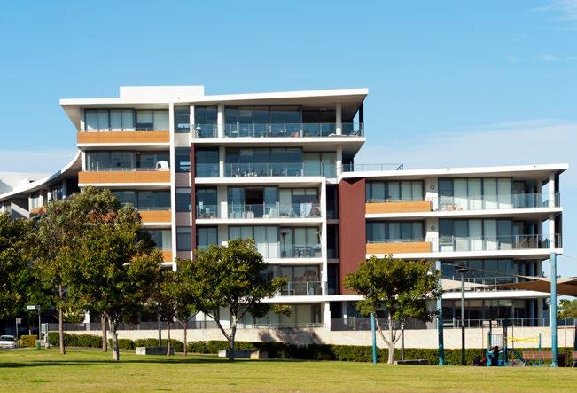

89 89 Rhodes
90 90 Productivity Planning Priority E12 Retaining and managing industrial and urban services land In giving effect to A Metropolis of Three Cities, this Planning Priority delivers on the following objective and the corresponding strategies: Objective 23 Industrial and urban services land is planned, retained and managed. Greater Sydney s existing industrial, manufacturing, warehousing and distribution industries contribute to its role as Australia s manufacturing capital. These activities occur on industrial land that also accommodates urban services, freight and logistics services, and advanced manufacturing. Industrial and urban services land in the Eastern City District provides cost competitive and welllocated land for industries and services that support businesses in the Harbour CBD, other centres and Greater Sydney s two existing international trade gateways of Port Botany and Sydney Airport. Urban services include activities such as motor vehicle services, printing, waste management, courier services and concrete batching plants. These activities serve local communities and businesses and require adequate access to industrial land across the District. Demand for this land will increase commensurate with population growth. Good local access to these services reduces the need to travel to other areas, minimising congestion on the transport system. Table 4: Eastern City District s largest industrial and urban services precincts LGA Precinct Undeveloped Land (ha) Developed Land (ha) Total (ha) Bayside Banksmeadow Botany Mascot Port Botany Inner West Bays Precinct (Glebe Island/White Bay) Marrickville Randwick Port Botany Strathfield Flemington South Strathfield / Enfield Sydney Alexandria Source: NSW Department of Planning and Environment, Employment Lands Development Program 2017 Report (ELDP 2017 Report), NSW Government, Sydney.
91 91 Industrial land supply The Eastern City District has 1,497 hectares of industrial and urban services land, spread over 58 separate precincts (refer to Figure 19) 27. This represents approximately 11 per cent of Greater Sydney s total stock of industrial and urban services land. About three per cent (39 hectares) is undeveloped, and the District has record low vacancy rates of four per cent, indicating strong demand for this land. This land contributed approximately $15.4 billion or six per cent to NSW Gross Domestic Product in It also accommodated approximately 123,000 jobs (15 per cent of jobs) in the District 29. The largest industrial and urban services precincts in the Eastern City District are listed in Table 4. These precincts are clustered around the trade gateways of Port Botany and Sydney Airport/Mascot, with large tracts at South Strathfield/Enfield and Alexandria. The remaining precincts in the District, while relatively small, account for approximately 32 per cent of the total industrial and urban services land, and are essential areas for the location of urban services growth. Outside the Harbour CBD, Mascot, Alexandria and Botany are the most significant employment precincts in the District in terms of job generation. Managing industrial and urban services land Industrial activity and urban services are important to Greater Sydney s economy and the nature of this economic sector is continuing to change, with emerging technologies and new industries with different requirements. Industrial land is evolving from traditional industrial and manufacturing lands, and freight and logistics hubs, into complex employment lands. This trend is consistent with other parts of Greater Sydney, particularly east of Parramatta. The District is home to one of Australia s busiest container terminals which is forecast to grow from the current annual container volume of 2.4 million to 8.4 million. It also contains half of Greater Sydney s existing container intermodal facilities, a freight rail network and extensive private lands that support import and export activities. For these logistics industries to thrive, and for Greater Sydney to be a primary choice for national and international logistics businesses, access to sites over two hectares is essential. Small, inner-city industrial precincts have relatively affordable rents and provide high proportions of urban services jobs for local communities. The value of these precincts should not be underestimated. Industrial and urban services land in the Eastern City District is highly constrained due to the development of residential dwellings and large-scale retail, which are higher-return land uses, and the lack of opportunities for new supply. There is strong competition for space from non-urban services industries that seek proximity to Sydney Airport, Port Botany, the Harbour CBD and health and education precincts. While these businesses must be supported in a service-oriented modern economy, capacity for industrial and essential urban services must be retained. Future employment growth across all industries and urban services will require additional floor space, additional land or both. Urban services are often less able to increase their floor space efficiency or locate in multi-storey buildings. Research has identified a benchmark of three square metres of urban services land per person. The research found that in the Eastern City District, the per person amount is below the benchmark in 2016, and the per capita amount is anticipated to reduce further between 2016 and

92 92 Productivity Figure 19: Eastern City District industrial and urban services land and freight assets District Boundary Metropolitan Centre Strategic Centre Waterways Industrial and Urban Services Land Trade Gateway Intermodal Terminal Freight Rail Shared Rail Motorway Committed Motorway
93 93 Principles for managing industrial and urban services land The retention, growth and enhancement of industrial and urban services land should reflect the needs of each of Greater Sydney s three cities, and their local context. It should provide land for a wide range of businesses that support the city s productivity and integrated economy. For the Eastern City District the approach to managing industrial land is that it be retained and managed. Retain and manage: All existing industrial and urban services land should be safeguarded from competing pressures, especially residential and mixed-use zones. This approach retains this land for economic activities required for Greater Sydney s operation, such as urban services. Specifically these industrial lands are required for economic and employment purposes. Therefore the number of jobs should not be the primary objective rather a mix of economic outcomes that support the city and population. The management of these lands should accommodate evolving business practices and changes in needs for urban services from the surrounding community and businesses. Where a retain and manage approach is being undertaken, councils are to conduct a strategic review of industrial land as part of updating local environmental plans. There will also be a need, from time to time, to review the list of appropriate activities within any precinct in consideration of evolving business practices and how they can be supported through permitted uses in local environmental plans. Any review should take into consideration findings of industrial, commercial and centre strategies for the local government area and/or the district. The Parramatta Road Corridor Urban Transformation Strategy (November 2016) provides for a diversity of jobs and housing to meet the needs of a broad cross-section of the community. Along with the Parramatta Road Corridor Implementation Tool Kit, they guide the incremental transformation of the Parramatta Road Corridor in line with the delivery of necessary infrastructure. Provisions for development consistent with this Corridor Strategy and Implementation Toolkit are made under a section 9.1 Direction. This Corridor Strategy and Implementation Toolkit reflect the extensive process undertaken and therefore the land subject of this Corridor Strategy is not subject to the industrial land strategies and actions of the District Plan. Actions Responsibility 51. Retain and manage industrial and urban services land, in line with the Principles for managing industrial and urban services land in the Eastern City District by safeguarding all industrial zoned land from conversion to residential development, including conversion to mixed use zones. In updating local environmental plans, councils are to conduct a strategic review of industrial land. 52. Facilitate the contemporary adaptation of industrial and warehouse buildings through increased floor to ceiling heights. Bayside Council, Burwood Council, City of Canada Bay, Council of the City of Sydney, Inner West Council, Randwick City Council, Strathfield Council, Waverley Council, Woollahra Municipal Council, and other planning authorities Councils and other planning authorities
94 94 Productivity Planning Priority E13 Supporting growth of targeted industry sectors In giving effect to A Metropolis of Three Cities, this Planning Priority delivers on the following objective and the corresponding strategies: Objective 24 Economic sectors targeted for success. A Metropolis of Three Cities highlights the importance and role of the NSW Government in leading the development and coordination of development strategies to grow and globally position key sectors of the economy. The NSW Government recognises that these sectors are important in fostering innovation in the development of highly skilled jobs which drive productivity and global competitiveness. The strategies are being developed in consultation with industry, government partners and other key stakeholders. They build on and leverage existing industry and government activities and plans, and focus on delivering high impact practical initiatives to drive sector growth through industry, academia and government collaboration. A Metropolis of Three Cities outlines the strategies to support industry sectors. They cover the areas of: industry skills and capacity building investment attraction export growth and facilitation industry showcasing and promotion opportunities through government procurement government and industry partnerships. To support these strategies, Objective 24 of A Metropolis of Three Cities emphasises the need to work with internationally competitive trade sectors by considering the barriers to growth, including regulatory barriers. Visitor economy As Australia s prime international gateway, Greater Sydney welcomes 30 million visitors per annum. The tourism industry contributed $15.4 billion to the economy 4.7 per cent of Gross Domestic Product and directly employed 74,300 people in The visitor economy is growing in all areas, including business, leisure and visiting friends and family. Visitors experiences are shaped by major attractions and events, by the places and facilities they visit, and by how their needs are met. Promoting links between business and leisure visits provides better experiences and has widespread benefits. The Eastern City District is one of the world s premier tourism and major events destinations. Approximately 8 million visitors stayed overnight in the District in , 32 per cent of whom were international visitors. Visits to the District grew by 5.3 per cent over this same period and contributed over $8.6 billion to the District s economy. The District boasts assets such as Sydney Harbour, the eastern beaches, Centennial Park, Sydney Park, Cooks River and Parramatta River; vibrant urban, heritage, creative and night-time activities of Sydney CBD, Darlinghurst/Kings Cross and Newtown; and the established cultural centres of Strathfield and Ashfield. These same elements attract global talent and encourage businesses to invest. Areas such as Marrickville, Erskineville and surrounding neighbourhoods are emerging as a focal point for boutique breweries, coffee roasters and other artisans, and there is a breadth of unique, small-scale cultural and arts experiences across the District such as the White Rabbit Gallery in Chippendale. These assets have the potential to add a new and unique face to the tourist economy. The Eastern City District has emerging industry sectors that are drawn to its highly skilled workforce, high connectivity and accessibility to local and global markets and labour, as well as a range of welldeveloped, specialised business services sectors.
95 95 Many of the District s attractions can be easily accessed by high quality transport infrastructure. However, connectivity between these places is not always easy. A multi-dimensional tourist economy relies on connectivity and accessibility. Growth of the District s tourism economy needs innovative transport and access solutions. While the District s tourism economy is mature, it can grow by tapping into the breadth of assets in the District, understanding and better connecting interdependencies and building diverse experiences. Aboriginal heritage is an untapped opportunity for cultural tourism, with La Perouse a major asset to explore. Collaboration with relevant Aboriginal groups and the Local Aboriginal Land Councils will help to identify if or where they wish to share this cultural richness and strategies to implement this. Adapting to changing technologies Rapid technological changes and digital advancements are disrupting established business models and the workplace worldwide. These are dramatically changing the way people and goods move around, providing more efficient transport services. While technological changes can reduce demand for certain types of jobs, they also help to deliver innovation, new knowledge-intensive jobs and business opportunities. Businesses and governments must continually engage with industry, assess regulatory barriers and manage data to update governance and policies to capitalise on changes. Actions Responsibility 53. Consider the barriers to the growth of internationally competitive trade sectors, including engaging with industry and assessing regulatory barriers. 54. Consider the following issues when preparing plans for tourism and visitation: a. encouraging the development of a range of well-designed and located facilities b. enhancing the amenity, vibrancy and safety of centres, places and precincts c. supporting the development of places for artistic and cultural activities d. improving public facilities and access e. protecting heritage and biodiversity to enhance cultural and eco-tourism f. supporting appropriate growth of the night-time economy g. developing industry skills critical to growing the visitor economy h. incorporating transport planning to serve the transport access needs of tourists 55. Provide a regulatory environment that enables economic opportunities created by changing technologies 56. Consider opportunities to implement place-based initiatives to attract more visitors, improve visitor experiences and ensure connections to transport at key tourist attractions. 57. Consider opportunities to enhance the tourist and visitor economy in the District, including a coordinated approach to tourism activities, events and accommodation Councils and other planning authorities Councils and other planning authorities Councils, other planning authorities and State agencies Councils and other planning authorities Councils, other planning authorities and State agencies


96 96 5 Sustainability Directions for sustainability A city in its landscape Planning Priority E14 Protecting and improving the health and enjoyment of Sydney Harbour and the District s waterways Planning Priority E15 Protecting and enhancing bushland and biodiversity Planning Priority E16 Protecting and enhancing scenic and cultural landscapes Planning Priority E18 Delivering high quality open space Planning Priority E17 Increasing urban tree canopy cover and delivering Green Grid connections An efficient city Planning Priority E19 Reducing carbon emissions and managing energy, water and waste efficiently A resilient city Planning Priority E20 Adapting to the impacts of urban and natural hazards and climate change
97 97 5 Sustainability Improving sustainability will involve incorporating natural landscape features into the urban environment; protecting and managing natural systems; cooling the urban environment; innovative and efficient use and re-use of energy, water and waste resources; and building the resilience of communities to natural and urban hazards, shocks and stresses. All aspects of sustainability rely on maintaining and managing green infrastructure. Green infrastructure is the network of green spaces, natural systems and semi-natural systems that support sustainable communities. It has four connected elements: waterways; urban bushland; urban tree canopy and green ground cover; parks and open spaces. Parks and gardens, remnant bushland and tree-lined streets also attract and sustain the talent required for Greater Sydney to thrive as a global city. Optimising and protecting existing assets will be essential in ensuring the ongoing health and sustainability of the District. The Eastern City District is known globally for its natural beauty and the quality of its environment. It has an abundance of scenic landscapes, with its coastline and waterways, as well as distinct parklands. Sydney Harbour is one of the most highly valued scenic landscapes in Australia. The natural amenity of the Parramatta and Cooks rivers and Botany Bay also enhance the District. The health of waterways, and the quality of, and connections to, waterways and open space will become increasingly important, as will cool, green links throughout the District. The Greater Sydney Green Grid will provide the regional network of high quality green spaces that supports walking, cycling and community access to open spaces and with urban tree canopy lining streets and neighbourhoods. Expansion of the urban tree canopy will complement the Green Grid and support the cooling of neighbourhoods. As the Eastern City District grows, improvements in the way buildings and precincts are planned and designed, and the way water and energy infrastructure is delivered, can support the more efficient use of resources and lower carbon emissions. The management of waste will present both an environmental challenge and an economic opportunity. New approaches to how waste materials and resources are re-used within a circular economy will help reduce impacts on the environment. The District s climate and natural landscape can create natural hazards such as heatwaves, flooding, storms and coastal erosion and inundation. Natural and urban hazards will be exacerbated by climate change. Supporting actions that mitigate climate change and actions that assist communities to adapt to the impacts of climate change will be important. For the Eastern City District an integrated approach to improving sustainability can be achieved in the following Planning Priorities: E14. Protecting and improving the health and enjoyment of Sydney Harbour and the District s waterways. E15. Protecting and enhancing bushland and biodiversity. E16. Protecting and enhancing scenic and cultural landscapes. E17. Increasing urban tree canopy cover and delivering Green Grid connections. E18. Delivering high quality open space. E19. Reducing carbon emissions and managing energy, water and waste efficiently. E20. Adapting to the impacts of urban and natural hazards and climate change.

98 98 Sustainability Cooks River Green infrastructure and greener places Green infrastructure is fundamental to creating a high quality of life and is important in creating a region that is climate resilient and adaptable to future needs. The NSW Government s draft green infrastructure policy Greener Places: Establishing an urban green infrastructure policy for New South Wales was produced by the Government Architect NSW to guide the planning, design and delivery of green infrastructure. The draft policy also highlights the role of green roofs and walls, private and semi-private residential gardens and agricultural land that complement green infrastructure and help support more sustainable places. The draft policy is based on a green infrastructure framework which has key components: Bushland and Waterways delivering green infrastructure for habitat and ecological health The Urban Tree Canopy delivering green infrastructure for climate change adaptation and resilience Parks and Open Space delivering green infrastructure for people.
99 99 Planning Priority E14 Protecting and improving the health and enjoyment of Sydney Harbour and the District s waterways In giving effect to A Metropolis of Three Cities, this Planning Priority delivers on the following objective and the corresponding strategies: Objective 25 The coast and waterways are protected and healthier. The Eastern City District s coast and waterways shape its landscape and character. They are natural assets, cultural resources and recreational destinations. As the District grows, greater housing density around waterways, and more people looking to use waterways for recreation, will mean that these assets will need to be carefully managed so they continue to support a wide range of activities. The waterways and rivers of the Eastern City District are part of an overall natural system and contribute to the green infrastructure that cools and greens the District. The District s waterways support coastal, marine and groundwater dependent ecosystems, which benefit from continuing protection and management. They support threatened ecological communities and accommodate the disposal of stormwater and wastewater. The District s catchments and waterways are shown on Figure 20. The District s waterways support significant biodiversity, and include Sydney Harbour, Parramatta River, Botany Bay, the Cooks River, a small section of the Georges River estuary, and two nationally important wetlands: the Lachlan Swamps/Botany Wetlands corridor which runs from Centennial Park to Botany Bay, and the Rockdale Wetlands corridor which includes important open space. The Bronte-Coogee and Cape Banks aquatic reserves provide protection for fish, aquatic animals and marine vegetation. Land use planning controls play an important role in protecting environmentally sensitive coastlines, waterways and foreshores, and the health of catchments above these waterways. The Cooks River runs through some of the most urbanised suburbs in Australia. Many parts of the river and its foreshores offer beautiful riverside walkways and cycle paths, wonderful parks and facilities and habitat for native plants and animals. Many of the District s creeks have been channelised and hard-edged with concrete such as Alexandria, Hawthorne and Dobroyd canals and the city s first water-supply stream, the Tank Stream, is now completely channelised and enclosed. Seawalls have also reduced the habitat available for aquatic species. The Eastern City District s waterways play an integral role in creating a sense of place, providing recreational opportunities, and supporting economic and cultural activities. Sydney Harbour is an internationally celebrated tourism destination and continues to be a working harbour. The District s famous beaches, including Bondi and Coogee, also attract visitors and support a great lifestyle for residents. A legacy of historical land uses, contaminated land and groundwater, aged infrastructure and the pattern of urban development have impacted some of the District s waterways, including Alexandria Canal, Botany Bay, the Botany Bay Sand Bed Aquifer, Parramatta River and harbour sediments. Other waterways are in better health, provide habitat, are accessible and are popular settings for swimming. Urban development, the clearing of vegetation and the increase in impermeable surfaces have resulted in elevated run-off, reduced water quality and loss of habitat. Urban stormwater carries litter and contaminants into the District s waterways. The District s waterways often flow through more than one local government area and are managed by a number of agencies and stakeholders, so water quality and waterway health is best managed at a catchment and sub-catchment level.

100 100 Sustainability Figure 20: Eastern City District catchments and waterways District Boundary Metropolitan Centre Strategic Centre River Flow Direction Georges River Basin Cooks River Basin Parramatta River Basin Port Jackson Basin Botany Bay Basin Coastal Catchment Waterway
101 101 New development and investment in infrastructure provide an opportunity to improve the necessary health and quality of the District s waterways, foreshores and riparian corridors, through improving public access to, and along, the foreshores; providing connected green space around the foreshores; conserving cultural heritage; protecting and enhancing flora, fauna, and urban bushland; reducing erosion and sedimentation; which improves bank stabilisation; promoting pervious surfaces; providing riparian vegetation buffers; and recovering and reinstating more natural conditions in highly modified waterways. Enhancing community access to the coast and waterways within the District and, in particular, the foreshores of Sydney Harbour should be prioritised. This includes access for pedestrians as well as boats and other watercraft. The delivery of the Greater Sydney Green Grid will enhance connections to Sydney Harbour, the Parramatta River and the coastline from Botany Bay to Watsons Bay. Further information on delivering the Green Grid is outlined in Planning Priority E17. Legislation, policies and plans are in place to improve the health of waterways and to manage water resources. For example, the Coastal Management Act 2016 integrates coastal management and land use planning, and the Fisheries Management Act 1994 protects aquatic biodiversity. The NSW Water Quality and River Flow Objectives identify high-level goals for several catchments in the District. NSW Government agencies and councils also manage the health of waterways through planning and development decisions, environmental programs and through the management of public land. The Metropolitan Water Plan 2017 is the NSW Government s plan to ensure there is sufficient water to meet the needs of the people and environment of the Greater Sydney region, now and for the future. It established the WaterSmart Cities Program, which will explore new ways to supply drinking water, and manage stormwater and wastewater in a more integrated, cost-effective and sustainable way. The Marine Estate Management Authority has prepared the draft Marine Estate Management Strategy which, when finalised, will support a clean, healthy and productive marine environment. This District Plan aims to protect and improve the environmental health of waterways. Many councils have identified and mapped environmentally sensitive areas of waterways that are important to the local community and use additional local provisions and natural waterways and environment zones to protect these areas. For local waterways, where governance and ownership of the waterway can be highly fragmented, a green infrastructure approach, which values waterways as infrastructure, can lead to more innovative management of waterways with outcomes that better reflect community expectations. An integrated approach to the protection and management of waterways will also rely on more comprehensive approaches to the monitoring and reporting of water quality and waterway health. Councils monitor water quality and waterway health, implement sustainable urban water management approaches and encourage water-sensitive urban design. The District Plan aims to integrate the objectives for waterways that are set out in legislation, policies and plans, by prioritising the management of waterways as green infrastructure. This involves: reconceptualising waterways as an infrastructure asset that provides environmental, social and economic benefits to communities integrating approaches to protecting environmentally sensitive waterways within a larger network of green infrastructure addressing the cumulative impacts of development and land management decisions across catchments in a way that improves water quality and waterway health. Collaboration and coordination across levels of government and with the community is needed to deliver the green space, urban cooling and integrated water management outcomes needed to support the Eastern City District.
102 102 Sustainability Future work will apply the lessons from previous management of the District s rivers notably the Parramatta River Catchment Group and the Cooks River Alliance that facilitate a coordinated approach to the management of the Parramatta and Cooks rivers. Managing water quality and waterway health continues to be a significant challenge, given the highly urbanised nature of the catchments, the changes to the shoreline following reclamation for infrastructure, and the legacy of groundwater contamination from historical industrial activity. Bore water usage needs consideration of how it impacts on aquifers and groundwater dependent ecosystems and how it supports efficient use of water resources. Catchment-scale management and coordination can: solve multiple problems for example, catchment condition and water scarcity, or addressing water quality impacts on aquifers, estuaries and the marine estate set objectives for the District s waterways and enable them to be achieved in innovative and cost-effective ways enable both public and private benefits to be achieved for example, stormwater from private land could provide a benefit to public management of green space and urban waterways promote integrated water cycle management and investment in sustainable water, wastewater and stormwater infrastructure. Strategic planning needs to manage the cumulative impact of activities and associated infrastructure such as moorings, marinas and boat launching facilities while ensuring public access to the waterways and opportunities for swimming, and small boat and kayak launching from publicly owned land. Access to waterways should not compromise the integrity of environmentally sensitive aquatic and riparian habitats. Sydney Harbour Sydney Harbour is one of Greater Sydney s most recognised and valuable assets it is part of what makes Sydney one of the most attractive and recognisable cities in the world. The Harbour and its tributaries also act as a major transport corridor, flora and fauna habitat and recreation area. It is a significant natural scenic feature with its many tributaries, estuaries, beaches and bays providing abundant biodiversity. Associated with the Harbour is a rich environmental heritage including natural, Aboriginal and built heritage. Public access to Sydney Harbour and its foreshore is important for water-based activities, especially where adjacent to public open space. To ensure access to Sydney Harbour foreshores should be maintained and increased wherever possible. Sydney Harbour is a major economic asset and makes a significant contribution to tourism as a place for major cultural events, including New Year s Eve, Vivid and Australia Day celebrations. It is also a working waterway, supporting defence and military operations, cruise ships, commercial shipping, recreational watercraft industries, ferries and water taxis. There are port facilities at Glebe Island/White Bay and refined fuel is imported at Gore Cove. Cruise ship activity has grown rapidly and future growth will need to be managed carefully to avoid conflicts with other harbour users and nearby residential areas. Planning Priority E9 sets out actions to help manage working waterways. Collaboration is required to resolve conflicts between recreational, residential and industry users. Currently, Sydney Regional Environmental Plan (Sydney Harbour Catchment) 2005 provides a framework to maintain, protect and enhance the catchment, foreshores, waterways and islands of Sydney Harbour. There may be opportunities to take a more comprehensive view as to how major waterways and their foreshore across Greater Sydney are managed and protected.

103 103 La Perouse, Botany Bay Botany Bay Botany Bay is recognised for its significant economic, environmental and cultural assets. Kamay Botany Bay National Park, Towra Point Nature Reserve and Cape Banks Aquatic Reserve have been established in recognition of Botany Bay s environmental and cultural significance, while other waterway and foreshore areas also contain valuable biodiversity and scenic coastal landscapes. The land adjacent to Botany Bay was settled for thousands of years by the Eora and Tharawal people and Aboriginal people continue to have a strong association with Botany Bay. Botany Bay was the scene of the first European landfall on the east coast of Australia, (in 1770) and Captain Cook s landing place at Kurnell has become a popular tourist attraction. As home to Sydney Airport and Port Botany, Botany Bay is Greater Sydney s main international passenger and trade gateway. The waters around La Perouse are renowned for snorkelling and scuba diving, while the beaches and extensive foreshore parklands along the Grand Parade provide attractive settings for recreation. Councils around both the Eastern City and South districts are working together to improve water quality in the Georges and Cooks rivers which both flow into Botany Bay. Managing water quality and waterway health continues to be a significant challenge, given the highly urbanised nature of the catchments, the changes to the shoreline of the bay following reclamation for infrastructure, and the legacy of groundwater contamination from historical industrial activity. The Cooks River Alliance is a partnership of Bayside, Canterbury-Bankstown, Inner West and Strathfield Councils, which has been in place since The Alliance works with communities for a healthy Cooks River catchment. In 2018, the Alliance, with funding from the NSW Government, will begin a scoping study for the first Cooks River Catchment Coastal Management Plan. It will be developed under the NSW coastal management framework with priorities and actions for the Cooks River.
104 104 Sustainability Parramatta River Parramatta River is central to Greater Sydney s Aboriginal and colonial history and the development of modern Sydney. Its foreshore is the focal point for an enhanced network of open spaces, walkways and cycleways. In the past, Parramatta River and its tributaries have suffered from degradation and contamination. There have been gradual improvements to water quality in recent decades, although recent modelling has predicted water quality in the river will worsen unless additional management interventions are implemented. The NSW Government is working with councils and the community to develop the Parramatta River masterplan, a blueprint for making selected sites along the Parramatta River swimmable. Four sites, including Dawn Fraser Pool, Chiswick Baths and Cabarita Beach are already open for swimming and a number of potential swimming sites have been identified for further investigation. The masterplan adopts the Office of Environment and Heritage and the Environment Protection Authority s risk-based decision framework. Proactive management and improvements to wastewater and stormwater systems, including state-of-the-art water quality analysis and modelling, will provide the foundation of a healthy river. Making more sites along the Parramatta River swimmable will require improvements to the water quality and waterway health in the upstream catchment. This will take time to implement. Measures which slow the flow of stormwater into waterways and create bio-retention systems along streets, where water can be filtered and soak into the soil, will help make the river swimmable. Related government initiatives: NSW Department of Industry 2017 Draft Marine Estate Management Strategy The Parramatta River Catchment Group Strategic Plan Parramatta River Catchment Group Let s make Parramatta River swimmable again by 2025 NSW Office of Environment and Heritage and the Environment Protection Authority 2017 Risk-based Framework for Considering Waterway health Outcomes in Strategic Land-use Planning Decisions Actions Responsibility 58. Protect environmentally sensitive areas of waterways and the coastal environment area. 59. Enhance sustainability and liveability by improving and managing access to waterways, foreshores and the coast for recreation, tourism, cultural events and water-based transport. 60. Improve the health of catchments and waterways through a risk-based approach to managing the cumulative impacts of development including coordinated monitoring of outcomes. 61. Work towards reinstating more natural conditions in highly modified urban waterways. Councils, other planning authorities, State agencies and State-owned corporations Councils, other planning authorities, State agencies and State-owned corporations Councils, other planning authorities, State agencies and State-owned corporations Councils, other planning authorities, State agencies and State-owned corporations
105 105 Planning Priority E15 Protecting and enhancing bushland and biodiversity In giving effect to A Metropolis of Three Cities, this Planning Priority delivers on the following objective and the corresponding strategy: Objective 27 Biodiversity is protected, urban bushland and remnant vegetation is enhanced. Objective 27 in A Metropolis of Three Cities outlines how the NSW Government seeks to protect and manage biodiversity values across Greater Sydney, from national and State biodiversity conservation legislation to information such as biodiversity mapping. This Planning Priority reinforces the importance of Objective 27 and provides a context to District issues. Bushland areas and remnant vegetation support the District s significant biodiversity, provide habitat, help cool the environment and support cleaner waterways and air. The Eastern City District retains parcels of remnant bushland making up 1.3 per cent of the District s area32. Larger portions of urban bushland are found at South Head, Malabar and Wolli Creek, and provide rare opportunities to experience and interpret the original landscape of the District and for local communities to enjoy bushland in an urban setting. Many areas of urban bushland are on public land managed as green infrastructure by councils, while some is privately owned land, such as golf courses. Urban bushland, close to some of the District s most densely populated areas, supports opportunities for nature-based recreation and enhance liveability. Areas of bushland at the edges of urban neighbourhoods need to be managed and enhanced to reduce edgeeffect impacts, such as pollution and nutrients from stormwater runoff, weeds, domestic pets, litter and unmanaged or informal recreation trails. For the Eastern City District, conservation planning will focus on opportunities to protect and enhance areas of endangered and critically endangered ecological communities. A strategic approach to protecting the biodiversity in the Eastern City District involves investing in connected bushland corridors and protecting larger pockets of remnant vegetation, as large and connected areas of bushland give the District s wildlife the greatest chance of survival. Councils are also working together to map opportunities to restore and reconnect areas of habitat in established urban areas. This approach complements the delivery of the Greater Sydney Green Grid. Selected species of trees and understorey plants for parks and street planting in targeted areas support the movement of wildlife and help strengthen connections between areas of habitat. Strengthening the protection of bushland in urban areas will help preserve the District s scenic landscape and enhance its tourist and recreational values. Remnant vegetation should be recognised as an asset that can be incorporated into the planning and design of neighbourhoods, for example in parks, school grounds and as street trees. The Biodiversity Conservation Act 2016 provides a framework and tools to avoid, minimise and offset impacts on biodiversity through the planning and development assessment process. There are a range of tools available to protect biodiversity on private land, including biodiversity stewardship agreements, conservation agreements and wildlife refuge agreements. Related government initiatives: NSW Office of Environment and Heritage Cumberland subregion Biodiversity Investment Opportunities Map (BIO Map) Actions Responsibility 62. Protect and enhance biodiversity by: a. supporting landscape-scale biodiversity conservation and the restoration of bushland corridors b. managing urban bushland and remnant vegetation as green infrastructure c. managing urban development and urban bushland to reduce edge-effect impacts. Councils, other planning authorities and State agencies
106 106 Sustainability Planning Priority E16 Protecting and enhancing scenic and cultural landscapes In giving effect to A Metropolis of Three Cities, this Planning Priority delivers on the following objective and the corresponding strategies: Objective 28 Scenic and cultural landscapes are protected. The scenic and cultural landscapes of the Eastern City District contribute to the identity and international profile of Greater Sydney. Scenic and cultural landscapes encourage an appreciation of the natural environment, protect heritage and culture, and create economic opportunities, particularly for recreation and tourism. Aboriginal culture is deeply entwined in the landscapes of Greater Sydney. Scenic and cultural landscapes can complement green infrastructure, particularly where scenic landscapes include waterways and urban bushland. Scenic and cultural landscapes can often be prone to natural hazards, for example escarpments can be prone to land slip and erosion. One of the District s key assets is its stunning Harbour and coastline. The District s urban landscapes sit within this natural setting and contribute to the diversity of the District s scenic value. The unique built form of locations such as the Sydney Opera House, the Rocks and Sydney Harbour Bridge further add to this setting. Opportunities to enhance views of Sydney Harbour come with renewal projects such as The Bays Precinct. Renewal in the eastern urban parts of the District can also protect and maintain views to the coastline, harbours and waterways from public spaces. Opportunities to establish or maintain access to Harbour foreshores and coastline can also be created through urban renewal. Local neighbourhoods and centres, dense commercial and retail centres, open spaces and industrial precincts each have their own distinct character and add to the patchwork of the built environment of the District. The Sydney City skyline (including the Sydney Opera House and the Sydney Harbour Bridge) is an iconic urban landscape and can be viewed from many areas of Greater Sydney. Local centres and neighbourhoods present varied and valuable local character. The planning and design of neighbourhoods across the District, particularly areas experiencing renewal, will need to consider ways to protect and enhance important cultural landscapes. Continued protection of the Eastern City District s scenic and cultural landscapes is important for the sustainability, liveability and productivity of the District. It can complement the protection of biodiversity and habitat, help manage natural hazards and support tourism. Protecting scenic and cultural landscapes can also help preserve links to Aboriginal cultural heritage. Actions Responsibility 63. Identify and protect scenic and cultural landscapes. Councils, other planning authorities and State agencies 64. Enhance and protect views of scenic and cultural landscapes from the public realm. Councils, other planning authorities and State agencies
107 107 Planning Priority E17 Increasing urban tree canopy cover and delivering Green Grid connections In giving effect to A Metropolis of Three Cities, this Planning Priority delivers on the following objectives and the corresponding strategies: Objective 30 Urban tree canopy cover is increased. Objective 32 The Green Grid links parks, open spaces, bushland and walking and cycling paths. The Greater Sydney Green Grid is a long-term vision for a network of high quality green spaces that connects communities to the natural landscape. It links tree-lined streets, waterways, bushland corridors, parks and open spaces with centres, public transport and public places. Tree-lined streets, urban bushland and tree cover on private land form the urban tree canopy. The urban tree canopy is a form of green infrastructure that mitigates the urban heat island effect, with a 10 per cent increase in tree canopy cover reducing the land surface temperature by 1.13 degrees Celsius 33. The urban tree canopy also supports cleaner air and water and provides local habitat. Trees remove fine particles from the air and help insulate against noise pollution, particularly along busy road corridors. The urban tree canopy can also help make communities more resilient, by reducing the impact of heatwaves and extreme heat. The urban tree canopy As one of the most urbanised districts in Greater Sydney, some suburbs have high proportions of hard surface areas and correspondingly low levels of tree canopy cover. Suburbs such as Botany Bay, Randwick, Marrickville, Ashfield through to Strathfield have low tree canopy cover. Botany Bay, for example, has only 12.1 per cent tree cover, compared to North Sydney (28.6 per cent) and Pittwater (59 per cent) 34. By contrast, other established neighbourhoods have streets lined with mature trees that add to the character and appeal of the District s landscape. The NSW Government has set a target to increase tree canopy cover across Greater Sydney to 40 per cent. Figure 25 shows tree canopy cover in the urban area in Sustaining boulevards of trees along the District s busiest roads (such as Oxford Street, King Street, South Dowling Street, Princes Highway, Cleveland Street, Hume Highway, Marrickville Road, Parramatta Road and Canterbury Road) is an important step towards improving amenity and air quality, and cooling the Eastern City District. Along many busy roads, where there is limited space to plant new trees, there may be opportunities to plant other forms of green ground cover, such as garden beds and hedges, that can help improve air quality. Trees are valued by residents, and contribute to the streetscape, character and amenity of the District. As the District continues to grow and change, the urban tree canopy will come under pressure. This means that the urban tree canopy will become even more important for supporting sustainable and liveable neighbourhoods. The tree canopy may be formed by a mix of native and exotic, deciduous or evergreen trees, which provides shade in summer while allowing sunlight into homes and onto roofs for solar power, particularly in winter. The relatively small proportion of landscaped area compared to built area on privately owned land, and constrained public streets and spaces, limit opportunities for widespread tree planting and green infrastructure, especially large trees with shadegiving tree canopy. Therefore, urban renewal and transformation projects will be critical to increasing urban tree canopy cover. This can be complemented by other green cover, including rain gardens, green roofs and green walls. Green cover can help slow and store stormwater and improve water quality, filtering pollution before it reaches the District s waterways.
108 108 Sustainability Challenges to extending the urban tree canopy in public and private include the lack of sufficient space within existing street corridors, and the competition with other forms of infrastructure both above and below the ground. Opportunities to relocate power lines underground or bundle them may be explored at a local or precinct scale, particularly in areas experiencing urban renewal, to provide space for the urban tree canopy and enhance the public domain. Extending the urban tree canopy should be balanced with the need to allow sunlight into homes and onto roofs for solar power. The District s councils generally provide guidance on enhancing tree canopy and tree cover in the urban environment, and information on street trees. Some encourage permeable surfaces to allow rainwater to soak into the ground and reduce stormwater run-off, which supports the growth of canopy trees and vegetation, and reduces pollution, flooding and urban heat. Where trees are lost as a result of development, some councils, such as Randwick, have developed programs to plant replacement trees in the public realm. The NSW Department of Planning and Environment s Apartment Design Guide provides the requirements for landscape areas that can support the urban tree canopy. The NSW Department of Planning and Environment is preparing an urban tree canopy manual, as part of a green infrastructure policy framework, to support the expansion of the urban tree canopy. Connecting the Greater Sydney Green Grid Enhancing the amenity and activity within, and accessibility to, the Greater Sydney Green Grid will promote a healthier urban environment, improve community access to recreation and exercise, encourage social interaction, support walking and cycling connections and improve resilience. The long-term vision for the Greater Sydney Green Grid in the Eastern City District is shown on Figure 21. This vision will be delivered incrementally over decades, as opportunities arise and detailed plans for connections are refined. Green Grid Priority Projects have been selected to provide district-scale connections that link open space, waterways and bushland. Table 5 lists Green Grid Priority Projects for the District. The Great Coastal Walk, the Federation Track (linking Circular Quay with Centennial Parklands and the Cooks River Corridor), Wolli Creek Regional Park and the Iron Cove Bay Run form part of the Greater Sydney Green Grid. Green Grid improvements will benefit the densely populated neighbourhoods of Burwood, Summer Hill, Marrickville and Leichhardt by linking these to the Harbour and Parramatta River, Cooks River and other open space corridors. Councils will lead delivery of the Greater Sydney Green Grid through land use planning and infrastructure investment mechanisms such as development and land use controls, agreements for dual use of open space and recreational facilities, direct investment in open space, and other funding mechanisms such as local development contributions and Voluntary Planning Agreements. State regional and district parklands and reserves form a principal element of the Greater Sydney Green Grid for both biodiversity and recreation purposes. The NSW Government supports the delivery of regional open space and Green Grid connections through the Metropolitan Greenspace Program. The NSW Government also supports delivery of regional open space using Special Infrastructure Contributions. Transport for NSW is establishing a Principal Bicycle Network in collaboration with councils. Opportunities to integrate the Principal Bicycle Network with the Greater Sydney Green Grid will be an important part of linking centres. In some areas, rail lines and other linear infrastructure prevent connectivity. Where feasible, planning and investment must consider opportunities for connections across rail lines, roads and other linear infrastructure. Related government initiatives: NSW Office of Environment and Heritage 2015 Urban Green Cover in NSW Technical Guidelines

109 109 MacKenzies Bay Actions Responsibility 65. Expand urban tree canopy in the public realm. Councils, other planning authorities and State agencies 66. Progressively refine the detailed design and delivery of: a. Greater Sydney Green Grid priority corridors and projects important to the District b. opportunities for connections that form the long-term vision of the network c. walking and cycling links for transport as well as leisure and recreational trips. Councils, other planning authorities and State agencies
110 110 Sustainability Table 5: Eastern City District Green Grid priorities Priority corridors The Iron Cove Greenway and the Hawthorne Canal Creating a sequence of connected open spaces that follow the Hawthorne Canal and the Light Rail Corridor from Leichhardt North to Dulwich Hill light rail stations which provide enhanced open space to growing communities along the light rail. 2 The Cooks River Open Space Corridor Will become a regionally significant parkland corridor, improving water quality and providing high quality open space with links to nearby centres including Strathfield, Sydney Olympic Park, Campsie, Canterbury, Dulwich Hill, Marrickville and Wolli Creek. This is a priority Green Grid project for both the Eastern City and South districts. Wolli Creek Regional Park and Bardwell Valley Parklands Straddles the boundary of the South and Eastern City districts. It will provide open space for recreation, walking and cycling trails, connect patches of ecologically significant vegetation and improve water quality and stormwater management. It will also connect to other nearby Green Grid projects. This is a priority Green Grid project for both the South and Eastern City districts. Mill Stream and Botany Wetlands Open Space Corridor Extends from Botany Bay and Sydney Airport through The Australian, Lakes, Eastlakes and Bonnie Doon golf courses to Centennial Park. The corridor is home to two regionally rare vegetation communities, the Sydney freshwater wetlands and the Eastern Suburbs banksia scrub. Public use and access along this corridor is limited, and this project presents a significant opportunity for improved north-south access and cross-district access. Rockdale Wetlands Open Space Corridor Will create a connected open space corridor for walking, cycling and greening the urban environment. It will also protect and enhance the important hydrological and ecological assets of the corridor. Parts of this corridor are currently zoned for a future motorway. This motorway should be designed to retain and protect recreational open spaces and the ecological values of the corridor. Projects important to the District The Great Coastal Walk Completing missing links, including around Malabar Headland, from Malabar to La Perouse and South Coogee to North Maroubra, and from North Bondi to South Head. Powells Creek and Mason Park, Strathfield Providing walking and cycling links, urban greening, stormwater treatment and a mix of open space uses that link Concord West, North Strathfield, Homebush and Strathfield to Parramatta Road, Bicentennial Park and the Parramatta River foreshore. Rhodes and Concord Open Space and Hospital Precincts Connecting the Parramatta River foreshore open spaces from Rhodes and Concord including Brays Bay Reserve, the Kokoda Track Memorial Walkway, Rocky Point, the Thomas Walker Hospital grounds, Concord Hospital grounds and river foreshores, the Dame Edith Walker Hospital grounds, Concord Golf Course and Concord RSL lands. This will make better use of under-utilised open space around the hospitals and community facilities and create a connected walking and cycling trail along the river foreshores. Hen and Chicken Bay Foreshore Hen and Chicken Bay will be connected to the Bay Walk, providing more opportunities for walking and cycling. This project also provides opportunities for enhanced connections to Burwood via Burwood Road, St Luke s Park and Queen Elizabeth Park. Eastern Beaches Walk Building on the success of the Great Coastal Walk by providing improved east-west connections, primarily through street conversion projects and improved pedestrian and cycle links, from both Bondi and Bronte beaches, to Bondi Junction, Centennial Park, Moore Park, Oxford Street and the Harbour CBD. Bankstown to Sydenham Open Space Corridor This project will transform surplus rail easement land and wide local streets that run parallel to the rail line into an active walking, cycling and open space corridor connecting the Cooks River, Wolli Creek Regional Park, The Greenway and Salt Pan Creek open space corridor, as well as the wider open space network.

111 111 Figure 21: Eastern City Green Grid opportunities District Boundary Projects important to the District National Parks and Reserves Metropolitan Centre Other Green Grid Opportunities Open Space and Reserves Strategic Centre Existing Tracks and Trails Waterways Green Grid Priority Corridor Road Source: Greater Sydney Commission, 2017, adapted from Sydney Green Grid, unpublished report prepared by Tyrrell Studio and Office of the Government Architect for the Greater Sydney Commission
112 112 Sustainability Planning Priority E18 Delivering high quality open space In giving effect to A Metropolis of Three Cities, this Planning Priority delivers on the following objective and the corresponding strategy: Objective 31 Public open space is accessible, protected and enhanced. Public open space is a form of green infrastructure that enhances the character of the Eastern City District s neighbourhoods, supports healthy and active lifestyles and brings communities together. As the District grows, providing open space areas for recreation, sport and social activity, as well as establishing physical links that support social networks and create a sense of community, will become increasingly important. Delivering connected walking and cycling trails will maximise their use. The key considerations for planning open space within the Eastern City District are quality, quantity and distribution. There will be relatively few opportunities to increase the quantity of public open space, and therefore greater emphasis will be needed on improving the quality and distribution of open space, including sporting facilities. Councils have been investigating solutions for the shortfall in active open space, including making better use of existing sportsgrounds, converting existing open space into sports fields, and partnering with schools to share spaces outside school hours. Urban renewal also creates opportunities to increase the quantity of open space. Planning for urban renewal needs to consider opportunities to deliver new, improved and accessible open spaces, including space for active sport and recreation, that meets the needs of the growing community. High density development (over 60 dwellings per hectare) should be located within 200 metres of open space and all dwellings should be within 400 metres of open space. People in urban neighbourhoods should be able to walk to local open space. In high density neighbourhoods, public open space is used like a shared backyard, providing a green communal living space. Open space in high density neighbourhoods needs to be durable, multi-purpose and accessible to a variety of users. High density neighbourhoods also need to have high quality open space within close proximity. In local and strategic centres, local open space is important to provide places for people to relax, meet and socialise. It provides for tree and vegetation planting in the centre. Place-based planning can identify opportunities to improve the quality, management and use of existing open space, and opportunities to provide new open space. The Eastern City District s network of open spaces includes unique and iconic landscapes, harbours, beaches, wetlands, coastal walks, waterfront promenades, rivers, parks and playgrounds. Combined, they provide opportunities for healthy lifestyles and create significant economic benefit. Nature-based recreation also helps connect communities to the natural landscape. The largest areas of open space in the District are around La Perouse and Malabar, Centennial Park and Moore Park, and the Royal Botanic Gardens and Domain. Other highly valued open spaces include the Bondi to Coogee Beach coastal walk, the Botany wetlands and the long corridor of open space and cycle paths along the foreshore of Botany Bay and the Cooks River. Almost 98 per cent of the District s residents live within 400 metres of open space (refer to Figure 22) 35. The District s major sports and recreation facilities include Royal Randwick Racecourse, the Sydney Cricket Ground and Sydney Stadium, Leichhardt Oval and Concord Oval and large golf courses, especially in the eastern and south-eastern neighbourhoods and in the local government areas of Canada Bay, Strathfield and Burwood.

113 113 Figure 22: Eastern City District access to open space District Boundary Metropolitan Centre Strategic Centre Urban Renewal Area Transit Oriented Development Railway Residential Areas > 400m to open space Open Space
114 114 Sustainability Active open space is in high demand across the District, with limited opportunity to provide additional capacity alongside growth. Utilisation rates are high, with some sporting clubs unable to access fields as needed and providers such as local councils, finding it difficult to fund upkeep and maintenance. A trend towards greater participation in sport by women and people aged over 35 is beginning to appear, as well as a trend towards indoor sports, and sports requiring less space such as futsal, changing patterns of demand for sports fields and facilities. Links to and between open space assets tend to favour major scenic areas. In the east, links along the coastline, and to a lesser extent along the Harbour, are well established. In the west, links east-west along the Parramatta River have progressively been improved, as have those along the Cooks River and Botany Bay foreshores. Connections from the residential areas to these and other major assets would boost access to valuable open space resources. Demand for nature-based recreation will need to be managed to minimise impacts on biodiversity. The future of some larger spaces used for activities such as golf may be uncertain due to declining membership and attendance figures. Any land or facilities in public ownership should be retained as open space and transitioned to shared open space and facilities, including for organised sports. For land in private ownership, there may be opportunities for part of the land to be repurposed or set aside for open or shared spaces. The District s golf courses may offer an opportunity to contribute to additional open space. Consolidating existing courses to support international grade facilities, while delivering additional public open space for active sport and recreation, walking and cycling will require further investigation and effective collaboration. Protecting waterways and biodiversity on consolidated and repurposed golf courses is also important. Open space within school grounds is a potential asset that could be shared by the wider community outside of school hours. Other opportunities to create greater recreational capacity across the District include non-traditional methods such as rooftop gardens and recreational areas; shared use of open spaces currently inaccessible due to private use or being enclosed and innovative approaches to planning for and using small/pocket parks. The Government Architect NSW is developing an open space toolkit, a resource for councils to use for open space planning. Actions Responsibility 67. Maximise the use of existing open space and protect, enhance and expand public open space by: a. providing opportunities to expand a network of diverse, accessible, high quality open spaces that respond to the needs and values of communities as populations grow. b. investigating opportunities to provide new open space so that all residential areas are within 400 metres of open space and all high density residential areas (over 60 dwellings per hectare) are within 200 metres of open space. c. requiring large urban renewal initiatives to demonstrate how the quantity of, or access to, high quality and diverse local open space is maintained or improved. d. planning new neighbourhoods with a sufficient quantity and quality of new open space. e. delivering shared and co-located sports and recreational facilities including shared school grounds and repurposed golf courses. f. delivering or complementing the Greater Sydney Green Grid g. providing walking and cycling links for transport as well as leisure and recreational trips. Councils, other planning authorities, State agencies and State-owned corporations
115 115 Planning Priority E19 Reducing carbon emissions and managing energy, water and waste efficiently In giving effect to A Metropolis of Three Cities, this Planning Priority delivers on the following objectives and the corresponding strategies: Objective 33 A low-carbon city contributes to net-zero emissions by 2050 and mitigates climate change. Objective 34 Energy and water flows are captured, used and re-used. Objective 35 More waste is re-used and recycled to support the development of a circular economy. The significant growth and development planned for the Eastern City District will mean that demand for energy and water and the generation of waste will increase. Without new approaches to the use of energy and water and management of waste, greenhouse gas emissions are likely to increase. The District has an opportunity to include precinctwide energy, water and waste efficiency systems for urban renewal, industrial and urban services land, centres and Collaboration Areas. Adopting a placebased approach is necessary to achieve the best sustainability outcomes, including renewing and replacing inefficient infrastructure and organising utilities, waste management, car parking, amenities, open space, urban green cover and public spaces. Better design of precinct-wide energy, water and waste systems will encourage a circular economy that improves efficiency. A circular economy means designing waste out of the system. For example, a food manufacturing plant could send waste to an adjacent anaerobic digester to power the plant. A low-carbon District More efficient use of energy and water in the District will reduce impacts on the environment and the District s greenhouse gas emissions. The Commission has been seeking to better understand greenhouse gas emissions for each district across Greater Sydney and will continue to explore opportunities for planning initiatives to support the NSW Government s goal of achieving a pathway towards net-zero emissions by Potential pathways towards net-zero emissions in the District include: new public transport infrastructure, electric vehicles and autonomous vehicles to connect residents to their nearest strategic centre or metropolitan centre within 30 minutes a range of transport demand management initiatives including working from home, improved walking and cycling, or improved access to car sharing, carpooling and on-demand transport new building standards and retrofits so that energy, water and waste systems operate as efficiently as possible in residential and non-residential buildings building and precinct-scale renewables waste diversion from landfill. The way Greater Sydney s urban structure and built form develops in future can support NSW s transition towards net-zero emissions. Better integrating land use with transport planning will help slow emissions growth by locating new homes near public transport and high quality walkways and cycle paths.
116 116 Sustainability Building on existing public transport connections with electric vehicle transport hubs, shared autonomous vehicles and other innovative transport technologies can further reduce greenhouse emissions, and reduce levels of noise and air pollution. Prioritising parking spaces for car sharing and carpooling can support more efficient use of road space and help reduce emissions. Emerging transport technologies will reduce the need for parking spaces and help reduce congestion. Designing high efficiency buildings and incorporating renewables will reduce emissions and reduce costs over time. This means improving the energy and water efficiency of buildings, and reducing waste in urban renewal projects and infrastructure projects. Recycling local water and harvesting stormwater creates opportunities for greening public open spaces including parks, ovals and school playgrounds. Recycling water diversifies the sources of water to meet demands for drinking, irrigating open spaces, keeping waterways clean and contributing to Greater Sydney s water quality objectives. The Eastern City District is leading the way in sustainability and energy efficiency innovation by mainstreaming highly energy-efficient buildings, encouraging building renovations that ensure lowcarbon and high efficiency performance, enabling green energy, water and waste infrastructure solutions, and replacing old and inefficient existing infrastructure and technologies. Urban renewal projects in the District will provide opportunities to improve the energy and water efficiency of new and existing buildings; incorporate building and precinct-scale renewables; and manage waste more efficiently to reduce greenhouse gas emissions and costs, and appeal to building owners and tenants. They also create the opportunity to upgrade ageing water, stormwater, sewer and waste infrastructure at the precinct scale. Sites such as Barangaroo and Central Park, Broadway are recent examples of these gains, while renewal in areas like Redfern to Eveleigh/Waterloo and The Bays Precinct have potential to become low-emissions and high environmental efficiency precincts. Recycling and reducing waste There is diminishing capacity in existing landfill sites in Greater Sydney, with more waste being sent to landfill outside the region. This increases costs to the community. Additional sites for waste management in Greater Sydney would improve efficiencies in managing waste. The Eastern City District relies on landfill as a waste disposal option. Waste generated in Eastern City District is moved by rail and road to landfills outside the District, such as Woodlawn near Goulburn. The planning and design of new developments should support the sustainable and effective collection and management of waste. The Environment Protection Authority has prepared a range of guidelines and other information to assist in the sustainable management of waste. Treating separated organic waste and then processing it through an energy from waste facility will reduce waste sent to landfill, and can help to reduce greenhouse gas emissions. In higher density neighbourhoods, innovative precinct-based waste collection, re-use and recycling would improve efficiency, reduce truck movements and boost the recycling economy. Where possible, additional land should be identified for waste management reprocessing, re-use and recycling. Collaboration on major precincts such as the Randwick health and education precinct present a unique opportunity to investigate more efficient approaches to energy, water and waste management. Related government initiatives: NSW Environment Protection Authority NSW Waste Avoidance and Resource Recovery Strategy NSW Environment Protection Authority Resources for local council waste and recycling operations NSW Environment Protection Authority Waste Less, Recycle More
117 117 Towards net-zero emissions by 2050 Barangaroo is one of the world s leading sustainable urban developments and Australia s first large-scale carbon neutral community. All three office towers have been awarded 6 Star Green Star Office Design. Central Park is characterised by its rooftop gardens, green walls and smart-metering systems. On-site water recycling and a central thermal tri-generation plant will reduce greenhouse gas emissions, minimise mains water demand and has the capacity to export excess water and electricity to nearby neighbourhoods. Bondi waste water treatment plant is producing enough renewable energy from local organic waste biogas in a cogeneration plant to meet 100% of its own requirements. Cogeneration is providing renewable energy at Malabar waste water treatment plant. Sydney Water s facilities have significant potential for progressing organics to generate renewable energy in the years to come. Actions Responsibility 68. Support initiatives that contribute to the aspirational objective of achieving net-zero emissions by 2050, especially through the establishment of low-carbon precincts in Planned Precincts, Collaboration Areas, State Significant Precincts and Urban Transformation projects. 69. Support precinct-based initiatives to increase renewable energy generation, and energy and water efficiency, especially in Planned Precincts, Collaboration Areas, State Significant Precincts and Urban Transformation Projects. 70. Protect existing and identify new locations for waste recycling and management. 71. Support innovative solutions to reduce the volume of waste and reduce waste transport requirements. 72. Encourage the preparation of low-carbon, high efficiency strategies to reduce emissions, optimise the use of water, reduce waste and optimise car parking provision where an increase in total floor area greater than 100,000 square metres is proposed in any contiguous area of 10 or more hectares. 73. Investigate potential regulatory mechanisms such as a Protection of the Environment Policy (PEP) that sets low-carbon, high-efficiency targets to be met through increased energy efficiency, water recycling and waste avoidance, reduction or re-use. This could include a framework for the monitoring and verification of performance for Planned Precincts, Collaboration Areas, urban renewal precincts and housing growth areas that are planned to have an increase in total floor area greater than 100,000 square metres. Councils, other planning authorities, State agencies and State-owned corporations Councils, other planning authorities, State agencies and State-owned corporations Councils, other planning authorities and State agencies Councils, other planning authorities and State agencies Councils, other planning authorities, State agencies and State-owned corporations Environment Protection Authority
118 118 Sustainability Planning Priority E20 Adapting to the impacts of urban and natural hazards and climate change In giving effect to A Metropolis of Three Cities, this Planning Priority delivers on the following objectives and the corresponding strategies: Objective 36 People and places adapt to climate change and future shocks and stresses. Objective 37 Exposure to natural and urban hazards is reduced. Objective 38 Heatwaves and extreme heat are managed. The District s climate and natural landscape can create natural hazards such as heatwaves, flooding, storms, and coastal inundation and erosion. Climate change will exacerbate these natural hazards. While planning for resilience has traditionally focused on responses to natural hazards and climate change, it is increasingly being used to consider a wider range of social and economic shocks and stresses. Effective planning can reduce the exposure to natural and urban hazards and build resilience to shocks and stresses. Planning for population growth and change needs to consider exposure at a local level as well as cumulative impacts at district and regional levels. State agencies and councils use a range of policies and tools to reduce risks from natural and urban hazards. Centralised and coordinated collection of data on hazards, particularly on how infrastructure is exposed to hazards, will help embed resilience in land use planning and infrastructure planning. Natural and urban hazards The climate, vegetation, topography and pattern of development in the District mean that flooding will continue to be a hazard. Placing developments in hazardous areas or increasing the density of development in areas with limited evacuation options increases risk to people and property. Managing flooding is particularly important in locations like Green Square, where localised flash flooding has been a problem in the past. The NSW Government has developed Floodplain Development Manual 2005 and provides councils with policy directions and tools for managing exposure to flooding. Some coastal areas of the District and areas of Sydney Harbour s foreshore are also at risk from coastal inundation and erosion. Potential sea level rise associated with climate change could also lead to saltwater intrusion into freshwater ecosystems and damage coastal open space and infrastructure. Past and present urban development and activities can also create urban hazards such as noise, air pollution and soil contamination. Compared to many cities around the world, Greater Sydney enjoys excellent air quality, which enhances its reputation as a sustainable and liveable city. However, the combined effect of air circulation patterns in the Sydney Basin, local topography, and proximity to different sources of air pollution such as wood-fire smoke, can lead to localised air quality issues. Transport movements along major roads and rail corridors generate noise and are a source of air pollution. The degree of noise or air pollution can be related to the volume of traffic and the level of truck and bus movements. The design of new buildings and public open space can help reduce exposure to noise and air pollution along busy road and rail corridors. Public transport, walking and cycling, as well as hybrid and electric cars provide opportunities to reduce air pollution. The NSW Government has recently strengthened regulation of ventilation outlets in motorway tunnels, which will also help reduce air pollution. Soil and groundwater contamination is another urban hazard which will require careful management as the District grows, and land uses change. This is particularly important when planning for more sensitive land uses such as

119 119 Central Park, Chippendale schools, open space and low-density residential neighbourhoods, in areas with potential for pre-existing contamination. State Environmental Planning Policy No. 55 Remediation of Land and its associated guidelines manage the rezoning and development of contaminated land. Greater Sydney, particularly its rural land, is at risk from biosecurity hazards such as pests and diseases that could threaten agriculture, the environment and community safety. Biodiversity hazards are being managed by the NSW Government through the Greater Sydney Peri Urban Biosecurity Program. In planning for growth, consideration of natural hazards and cumulative impacts include avoiding locating growth and development in areas exposed to natural hazards and limiting growth in existing communities that are exposed and vulnerable to natural hazards. In exceptional circumstances, there may be a need to reduce the number of people and amount of property that are vulnerable to natural hazards, through managed retreat of development. The impact of extreme heat on communities and infrastructure networks can also be significant. More highly developed parts of the District can be exposed to extreme heat as a result of the urban heat island effect. Increasing the tree canopy is important to help reduce those impacts. The State Heatwave Sub Plan, which sits under the NSW State Emergency Management Plan, details the control and coordination arrangements across State and local government for the preparation for, response to, and immediate recovery from a heatwave. Current guidelines and planning controls also aim to minimise hazards and pollution by: using buffers to limit exposure to hazardous and offensive industries, noise and odour designing neighbourhoods and buildings that minimise exposure to noise and air pollution in the vicinity of busy rail lines and roads, including freight networks cooling the landscape by retaining water and protecting, enhancing and extending the urban tree canopy to mitigate the urban heat island effect. Minimising interfaces with hazardous areas can reduce risks. Clearing vegetation around developments on bushfire-prone land can help reduce risks from bushfire, but must be balanced with protecting bushland, and its ecological processes and systems. Planning on bushfire-prone land should consider risks and include hazard protection measures within the developable area. The Rural Fire Service requires new development to comply with the provisions of Planning for Bush Fire Protection 2006.
 & CSIRO Landsat 5 LST (Land surface temperature) for 02/02/2011 (2011).")
 for 02/02/2011")
 Figure 25: Tree canopy cover at 2011 < 10% 10% 20% 20% 30% 30% 40% 40% 50% 50% 60% > 60% Source:")
120 120 Sustainability Figure 23: Vulnerability to heatwaves Less vulnerable More vulnerable Source: Australian Bureau of Statistics Socioeconomic Index For Areas (2011) & CSIRO Landsat 5 LST (Land surface temperature) for 02/02/2011 (2011). Analysis by Kinesis (2016) Figure 24: Landsurface temperature during a heatwave District Boundary Metropolitan Rural Area boundary < > 43 Source: CSIRO Landsat 5 LST (Land surface temperature) for 02/02/2011 (2011). Averaged to SA1 (2016) Figure 25: Tree canopy cover at 2011 < 10% 10% 20% 20% 30% 30% 40% 40% 50% 50% 60% > 60% Source: SPOT5 Woody Extent and Foliage Projective Cover (FPH) 5-10m, 2011, NSW Office of Environment and Heritage. Averaged to SA1 (2016)
121 121 Adapting to climate change The most significant natural hazards and acute shocks that affect the Eastern City District include severe storms and coastal erosion and inundation, which can also impact coastal lagoons and streams. These natural phenomena will be exacerbated by climate change. The draft Coastal Management Manual 2017 sets out approaches to address sea level rise and the resilience of coastal assets, while CoastAdapt collates tools to support adaptation to coastal climate change and sea-level rise. Air temperatures in Greater Sydney are expected to increase due to climate change and increasing urbanisation, though less so in coastal areas of the Eastern City District, with projected increases in heatwaves and the number of extreme temperature days. Taking action to cool the city, in conjunction with supporting the community to adapt to a changing climate, is increasingly important. Figure 23 shows different levels of vulnerability to heatwaves. Areas are ranked by their combined level of socioeconomic disadvantage and exposure to heat during a heatwave. Figure 24 shows land surface temperatures during heatwave conditions. Figure 25 shows tree canopy cover as at The way neighbourhoods and buildings are planned and designed can help communities adapt and be more resilient to extreme heat. Increased tree canopy and green ground cover will help minimise these effects. Retaining more water in the landscape and integrating waterways in the design of new communities will help create a greener and cool city. Water-play features and connections with water will become essential elements of urban areas, while green walls, green roofs and initiatives such as rain gardens will help cool urban environments. Building design and building materials can also mitigate the urban heat island effect. Cooler building materials, including lighter-coloured roofs, lightercoloured paving and more permeable paving can be highly effective. Shocks and stresses Councils across the Eastern City District are participating in the 100 Resilient Cities initiative and considering ways to respond to shocks and stresses that could strengthen community resilience. The Australian Government has released Australia s Strategy for Protecting Crowded Places from Terrorism, which provides a framework for making public places safer and more resilient. This Strategy is accompanied by tools which councils, building owners and managers can use to implement protective measures that will strengthen community resilience. Related government initiatives: NSW Office of Environment and Heritage Floodplain Development Manual 2005 NSW Rural Fire Service Planning for bush fire protection 2006 NSW Justice Office of Emergency Management 2011 State Heatwave Sub Plan NSW Justice Office of Emergency Management Emergency Risk Management NSW Office of Environment and Heritage AdaptNSW Australian Government Australia s Strategy for Protecting Crowded Places from Terrorism Useful links: 100 Resilient Cities Actions Responsibility 74. Support initiatives that respond to the impacts of climate change. Councils, other planning authorities and State agencies 75. Avoid locating new urban development in areas exposed to natural and urban hazards and consider options to limit the intensification of development in existing urban areas most exposed to hazards. Councils, other planning authorities and State agencies 76. Mitigate the urban heat island effect and reduce vulnerability to extreme heat. Councils, other planning authorities and State agencies
122 122 6 Implementation Successful implementation of the district plans requires: councils to prepare and implement local strategic planning statements as part of their strategic planning framework councils to update local environmental plans through the development of their local strategic planning statements and other relevant plans and policies collaboration across government and with local government and the private sector where each have clear roles and responsibilities (refer to Figure 26) private sector investment in line with the expectations and targets for housing, and jobs including commercial, retail and industrial developments infrastructure delivery which is responsive to the District Plan s priorities and growth patterns across each District ongoing engagement to inform implementation annual monitoring of the performance of the District Plan and the status of delivering actions. Role of district and local plans Region and district plans inform the preparation and endorsement of local strategic planning statements and the preparation and assessment of planning proposals. Councils are to complete the update of their local environmental plan within three years of the district plans being finalised. This involves councils: E21. Reviewing their strategic planning framework, including a review of the existing local environmental plans against the relevant District Plan E22. Undertaking necessary studies and strategies and preparing a local strategic planning statement which will guide the update of the local environmental plans. To accelerate the local planning process, the Housing Affordability Package announced by the NSW Government in June 2017 requires the Greater Sydney Commission, as part of a suite of policy measures, to nominate 10 Priority Councils in Greater Sydney, which will each receive up to $2.5 million to assist with updating their local environmental plans to give effect to the district plans, within two years of the Commission releasing final district plans.

123 123 Figure 26: Roles of planning authorities in Greater Sydney
124 124 Implementation The role of the local strategic planning statement is to provide an alignment between regional and district strategic plans and local strategic planning and delivery. To assist the alignment of regional district and local planning, protocols are required that formalise cooperation between State and local governments in that many of the opportunities and challenges in local planning are interrelated with government programs, particularly infrastructure investment. Therefore a level of consistency in strategic planning approaches is needed to provide: alignment in interpretation of the region and district plans that supports the development of local strategic planning statements coordinated inputs by State agencies, particularly where State agency programs cross council and district boundaries such as investment in major rail corridors, or the need for a new high school the ongoing review of the region and district plans that is informed by local inputs. The first step towards this is developing, in consultation with councils, a level of consistency in the approach to the council review of their local environmental plans. Local planning is also informed by councils community strategic plans. These community focused plans provide the strategic framework for the planning and delivery of services over a 10-year period for each local government area and are part of the broader Integrated Planning and Reporting Framework under the Local Government Act These plans can provide an important source of economic, social and environmental context for local strategic planning as well as a greater context to councils delivery programs and operational plans. The community engagement strategy that supports the preparation of a community strategic plan may also inform a council s community participation plan. As such a council, in the review of their local environmental plan can provide local economic, social and environmental context that will help identify the priorities for investigation needed to inform the local strategic planning statement. In undertaking strategic planning processes, and/or preparing or considering planning proposals, planning authorities must give effect to the District Plan, specifically the planning priorities and actions. This also includes, as set out in the NSW Department of Planning and Environment s A guide to preparing planning proposals, consistency with other plans and policies that form part of the strategic planning framework for Greater Sydney, such as: State environmental planning policies the NSW Department of Planning and Environment is currently reviewing state environmental planning policies as part of initiatives to simplify the NSW planning system and reduce complexity. This review process will modernise, simplify and improve the effectiveness and usability of the policies. Ministerial Directions under Section 9.1 of the Environmental Planning and Assessment Act 1979, which require consideration for local plan making that cover issues such as employment, environment and heritage, housing, infrastructure and urban development. Information Note 6 outlines the status of the district plans in regard to planning matters.

125 125 Planning Priority E21 Preparing local strategic planning statements informed by local strategic planning In giving effect to A Metropolis of Three Cities, this Planning Priority delivers on the following objective and corresponding action: Objective 39: A collaborative approach to city planning. A role of strategic planning is to provide a basis for planning decisions. Critically, strategic planning provides the community with transparency to the planning process. The Community Participation Plan and mandatory exhibition of draft local strategic planning statements reinforce the importance of community participation in shaping the plans that will guide future decision-making in their local area. The local strategic planning required to inform the preparation of local strategic planning statements will support State-local government partnerships where State agencies have a critical role in supporting councils in managing growth and change. Councils identification of the scope and priorities for local strategic planning will be a streamlined process supported by the Greater Sydney Commission and the NSW Department of Planning and Environment and follows a similar approach to the Greater Sydney Commission s review of A Plan for Growing Sydney. This approach highlights the importance of understanding the context at the same time as an assessment of the planning framework to deliver the plan. Bondi Junction
Eastern City District Plan
 OUR GREATER SYDNEY 2056 Revised Draft Eastern City District Plan OVERVIEW Bayside Burwood Canada Bay City of Sydney Inner West Randwick Strathfield Waverley Woollahra Snapshot of the Eastern City District
OUR GREATER SYDNEY A metropolis of three cities. OVERVIEW. connecting people. DRAFT Greater Sydney Region Plan
 OUR GREATER SYDNEY 2056. A metropolis of three cities. OVERVIEW. connecting people. DRAFT Greater Sydney Region Plan October 2017 This document is an overview of the draft Greater Sydney Region Plan. To
South District Plan OVERVIEW
 OUR GREATER SYDNEY 2056 Revised Draft South District Plan OVERVIEW Canterbury-Bankstown Georges River Sutherland Snapshot of the South District today and into the future The Greater Sydney Commission acknowledges
DRAFT GREATER SYDNEY REGION PLAN OBJECTIVES, STRATEGIES AND ACTIONS
 Greater Sydney Commission DRAFT GREATER SYDNEY REGION PLAN OBJECTIVES, STRATEGIES AND ACTIONS Issued: 26 OCTOBER 2017 Version: 1 Subject: Greater Sydney Region and District Plans This information note
connecting communities
 OUR GREATER SYDNEY 2056 Western City District Plan connecting communities March 2018 Updated 2 Acknowledgement of Country The Greater Sydney Commission acknowledges the traditional owners of the lands
South District What we heard
 What we heard Vision to 2056 and Priorities Governance and implementation Infrastructure and funding Feedback supported: The vision for a metropolis of three cities, but emphasised the importance of infrastructure
North District What we heard
 What we heard Vision to 2056 and Priorities Governance and implementation Infrastructure and funding The vision for a metropolis of three cities, and the 30 minute city. Feedback emphasised: That for the
Central City District What we heard
 What we heard Vision to 2056 and Priorities Governance and implementation Infrastructure and funding The vision for a metropolis of three cities, and the 30 minute city. Feedback requested: Clearer communication
Central City District Plan
 OUR GREATER SYDNEY 2056 Revised Draft Central City District Plan OVERVIEW Blacktown Cumberland Parramatta The Hills Snapshot of the Central City District today and into the future People Population, age
Western City District What we heard
 What we heard Vision to 2056 and Priorities Governance and implementation Infrastructure and funding The protection of the natural landscape including biodiversity and the Metropolitan Rural Area for food
Draft South West District Plan - Campbelltown City Council Submission Attachment 1
 Draft South West District Plan - Campbelltown City Council Submission Attachment 1 Campbelltown City Council Report and Resolution - Draft South West District Plan - Draft Submission Ordinary Meeting 28/03/17
Draft Eastern District Plan
 Draft Eastern District Plan Submission_id: 31238 Date of Lodgment: 13 Dec 2017 Origin of Submission: Online Organisation name: Turrulla Gardens Pty Ltd C/- Mecone Organisation type: Industry First name:
REVISED DRAFT NORTH DISTRICT PLAN PLANNING PRIORITIES AND ACTIONS
 Greater Sydney Commission REVISED DRAFT NORTH DISTRICT PLAN PLANNING PRIORITIES AND ACTIONS Issued: 26 OCTOBER 2017 Version: 1 Subject: Greater Sydney Region and District Plans This information note is
DRAFT WESTERN CITY DISTRICT PLAN PLANNING PRIORITIES AND ACTIONS
 Greater Sydney Commission DRAFT WESTERN CITY DISTRICT PLAN PLANNING PRIORITIES AND ACTIONS Issued: 26 OCTOBER 2017 Version: 1 Subject: Greater Sydney Region and District Plans This information note is
A Metropolis of Three Cities
 GREATER SYDNEY REGION PLAN A Metropolis of Three Cities connecting people March 2018 Aboriginal people know if you care for Country, it will care for you Since time immemorial Aboriginal people have managed,
Draft Western District Plan
 Powered by TCPDF (www.tcpdf.org) Draft Western District Plan Submission_id: 31371 Date of Lodgment: 14 Dec 2017 Origin of Submission: Online Organisation name: Mecone Pty Ltd Organisation type: Industry
Draft Western District Plan
 Powered by TCPDF (www.tcpdf.org) Draft Western District Plan Submission_id: 31440 Date of Lodgment: 15 Dec 2017 Origin of Submission: Online Organisation name: Goodman Property Services Australia Pty Ltd
submission_details represented_by_who title age_bracket first_name last_name organisation position_in_organisation withhold_name address_1
 submission_details represented_by_who title age_bracket first_name last_name email organisation position_in_organisation withhold_name address_1 I am making a personal submission 20-29 X Targeting jobs
Scottish Natural Heritage. Better places for people and nature
 Scottish Natural Heritage Better places for people and nature Contents Summary... 3 SNH approach... 5 Place-making in policy and practice... 6 Developing the contribution of the natural heritage to place-making...
Draft South District Plan. Co-creating a Greater Sydney November 2016
 Draft South District Plan Co-creating a Greater Sydney November 2016 How to be involved This draft District Plan sets out aspirations and proposals for Greater Sydney s South District, which includes the
Hobart A Strategic Framework
 Hobart 2025 A Strategic Framework Adopted by the Hobart City Council 15 October 2007 Table of Contents Introduction...2 Vision and Future Directions...3 FD1 Offers opportunities for all ages and a city
Statement of. Planning Intent. Mick Gentleman MLA Minister for Planning
 Statement of Planning Intent 2 015 Mick Gentleman MLA Minister for Planning Minister s message As Minister for Planning, I would like Canberra to be a city renowned not only for its liveability, but its
represented_by_who title age_bracket first_name last_name organisation position_in_organisation withhold_name address_1 suburb I am making a
 submission_details webform_serial webform_sid webform_time webform_completed_time webform_modified_time webform_draft webform_ip_address webform_uid webform_username 98 27841 03/19/2017-19:06 03/19/2017-19:06
UrbanGrowth NSW: Sustainable Built Environment Professor David Pitchford CBE LVO Chief Executive, UrbanGrowth NSW
 UrbanGrowth NSW: Sustainable Built Environment 2016 Professor David Pitchford CBE LVO Chief Executive, UrbanGrowth NSW To drive an internationally competitive economy, through the creation of great destinations
submission_details represented_by_who title age_bracket first_name last_name organisation position_in_organisation withhold_name address_1
 submission_details represented_by_who title age_bracket first_name last_name email organisation position_in_organisation withhold_name address_1 I am making a personal submission 50-59 X Targeting jobs
Inclusive and Engaging City
 Inclusive and Engaging City An Inclusive City welcomes and enables all people to participate fully in City life. Population, housing, services, social inclusion and liveability are important elements of
Macro Town Planning Submission
 7 March 2017 Ref: WTJ16-153_Macro Town Planning Submission_Macquarie Park Investigation Area Macro Town Planning Submission Macquarie Park Investigation Area Multiple Goodman Land Holdings Prepared by
Our City Centre is a vibrant, creative and welcoming destination, with a modern business, cultural, shopping, leisure and residential offer
 3. Sheffield in 2034 Our City sits at the heart of a strong, distinctive and internationally successful City Region economy which supports innovation and enterprise Our City Centre is a vibrant, creative
Public Open House. Overview of the Downtown Plan Official Plan Amendment April 23, 2018
 Public Open House Overview of the Downtown Plan Official Plan Amendment April 23, 2018 1 A 25-Year Plan for Downtown To ensure growth contributes positively to Toronto s Downtown as a great place to live,
Draft Western District Plan
 Powered by TCPDF (www.tcpdf.org) Draft Western District Plan Submission_id: 31466 Date of Lodgment: 15 Dec 2017 Origin of Submission: Online Organisation name: Coronation Property Co Pty Ltd Organisation
PHASE ONE. A summary report: What the community told Alcoa during Phase One of the community engagement program for Point Henry 575.
 PHASE ONE A summary report: What the community told Alcoa during Phase One of the community engagement program for Point Henry 575. DECEMBER 2015 FEBRUARY 2016 INTRODUCTION In 2014 Alcoa closed its Point
Draft South West. District Plan. Co-creating a Greater Sydney November 2016
 Draft South West District Plan Co-creating a Greater Sydney November 2016 How to be involved This draft District Plan sets out aspirations and proposals for Greater Sydney s South West District, which
BETTER PLACED. A design led approach: developing an Architecture and Design Policy for New South Wales
 BETTER PLACED A design led approach: developing an Architecture and Design Policy for New South Wales DESIGN OFFERS A STAND-ALONE AND CONTRIBUTING PROCESS TO PLANNING OUR FUTURE, BRINGING CREATIVE INTELLIGENCE,
Billbergia also own a property outside the Rhodes Station Precinct at Oulton Avenue, Rhodes.
 31 March 2017 Maria Atkinson AM District Commissioner Greater Sydney Commission PO Box 257 Parramatta 2124 Dear Maria, This submission has been prepared on behalf of Billbergia Group (Billbergia), who
AT A GLANCE... Our People, Culture & Place. A plan to sustain Ballarat s heritage (final draft)
") AT A GLANCE... Our People, Culture & Place A plan to sustain Ballarat s heritage 2017-2030 (final draft) Image: Lydiard Street, Ballarat, c1875-1938, John Henry Harvey collection, La Trobe Picture Collection,
AT A GLANCE... Our People, Culture & Place A plan to sustain Ballarat s heritage 2017-2030 (final draft) Image: Lydiard Street, Ballarat, c1875-1938, John Henry Harvey collection, La Trobe Picture Collection,
Draft West Central. District Plan. Co-creating a Greater Sydney November 2016
 Draft West Central District Plan Co-creating a Greater Sydney November 2016 How to be involved This draft Plan sets out aspirations and proposals for Greater Sydney s West Central District, which includes
Official Plan Review
 Official Plan Review Summary Report - The Built Environment August 2014 Part 1: Introduction Planning for a healthy, prosperous and sustainable community is an important goal for our municipality. From
RE: QUEENSLAND GOVERNMENT PLANNING POLICY REVIEW
 Planning Group Department of Infrastructure, Local Government and Planning PO Box 15009 CITY EAST QLD 4002 Via email: planningpolicy@dilgp.qld.gov.au 9 February 2017 Dear Sir/ Madam, RE: QUEENSLAND GOVERNMENT
WATERLOO STATE SIGNIFICANT PRECINCT SUMMARY OF STUDIES
 WATERLOO STATE SIGNIFICANT PRECINCT SUMMARY OF STUDIES Technical studies will be undertaken to inform the master planning process for the Waterloo precinct to develop a Precinct Proposal to redevelop the
Taking forward the All London Green Grid
 Taking forward the All London Green Grid Foreword Earlier this year, the Mayor published the All London Green Grid Supplementary Planning Guidance to the London Plan which set the vision, and framework,
1 Introduction. Chapter. In this chapter:
 Chapter 1 Introduction In this chapter: 1.1 A Snapshot of the Region 1.2 Towards a Sustainable Region 1.3 The Provincial Context 1.4 Purpose and Organization The Regional Municipality of York Official
section 3: Vision, Values and Goals
 Vision, Values and Goals 3 2041 Vision: Victoria is an urban sustainability leader inspiring innovation, pride and progress towards greater ecological integrity, livability, economic vitality, and community
LIVEABLE. A diverse and welcoming capital city with an enviable lifestyle and strong community. Liveable City of Adelaide Strategic Plan
 LIVEABLE A diverse and welcoming capital city with an enviable lifestyle and strong community 38 Liveable City of Adelaide 2016-2020 Strategic Plan City of Adelaide 2016-2020 Strategic Plan 39 LIVEABLE
World Towns Agreement
 World Towns Agreement A Public-Private-Social Vision for Urban Centres Sponsored by Developed with support from MISSION STATEMENT We, the delegates and online participants at the World Towns Leadership
Response to the London Bridge Area Vision and Site Allocations within the New Southwark Plan
 1 Melior Place London SE1 3SZ 020 7407 4701 teamlondonbridge.co.uk info@teamlondonbridge.co.uk 28 April 2017 Response to the London Bridge Area Vision and Site Allocations within the New Southwark Plan
MACROC Submission on the Draft South West District Plan
 MACROC Submission on the Draft South West District Plan MACROC Cnr Queen & Broughton Streets CAMPBELLTOWN NSW 2560 MACROC Submission on the Draft South West District Plan. March 2017 Page 2 MACROC Submission
Fishermans Bend Draft Framework. Submission to public consultation
 Fishermans Bend Draft Framework Submission to public consultation 14 December 2017 An opportunity for a world class innovation precinct The University of Melbourne welcomes the release of the Draft Fishermans
City Regions Ireland
 City Regions Ireland 01 CITY REGIONS IRELAND COMPRISES OF CORK CHAMBER, DUBLIN CHAMBER, LIMERICK CHAMBER, WATERFORD CHAMBER AND GALWAY CHAMBER, ALL MEMBERS OF CHAMBERS IRELAND. 5 CITIES 8 PRINCIPLES A
Institute Response to Design Guidelines: Design Quality and Housing Choice
 Institute Response to Design Guidelines: Design Quality and Housing Choice The Australian Institute of Landscape Architects South Australian Chapter (AILA SA) is pleased to provide a response on the Draft
Create Policy Options Draft Plan Plan Approval. Public Consultation Events. Phase 2
 Background Grandview-Woodland Community Plan In the spring of 2012, the City of Vancouver embarked on a comprehensive community planning program in the Grandview-Woodland neighbourhood. The process has
Making the case for Sustainable Transport Project Potential
 Making the case for Sustainable Transport Project Potential The Structural Investment Fund (SIF) Strategy for Greater Lincolnshire identifies the barriers to growth identified by having poor transport
Urban Design Expert Evidence Leanne Hodyl
 Fishermans Bend GC81 Panel Hearing Urban Design Expert Evidence Leanne Hodyl 14 March 2018 1 Fishermans Bend GC81 Panel Hearing - Urban Design Expert Evidence Leanne Hodyl Overview 1. Role of the Urban
Managing our Landscapes Conversations for Change
 Managing our Landscapes Conversations for Change Frequently Asked Questions The new State Government is committed to a significant reform program that will change the way natural resources are managed.
Municipal Development Plan 2013
 UNIQUELY STONY PLAIN: Municipal Development Plan 2013 Quick Reference Guide What is a Municipal Development Plan (MDP)? The Town s highest-level planning document Sets the long-term vision and key themes
... on the draft Arden Vision & Framework
 April 2017 Integrated world-class urban renewal Feedback... on the draft Arden Vision & Framework On 1 September 2016 the Victorian Planning Authority (VPA) released the draft Arden Vision & Framework
DUBLIN DOCKLANDS MASTER PLAN AND RELATIONSHIP WITH OTHER PLANS
 .1 National Policy and Programmes.1.1 Sustainable Development A Strategy for Ireland, 1997.1.2 National Climate Change Strategy, 2007-2012.1. National Development Plan 2007-201.1.4 National Spatial Strategy,
ernational and local investment.
 submission_details webform_serial webform_sid webform_time webform_completed_time webform_modified_time webform_draft webform_uid webform_username represented_by_who organisation 493 30398 03/31/2017-17:29
Submission to the Kildare County Council Development Plan North Kildare Chamber. Executive Summary
 ` 28 th May 2015 Submission to the Kildare County Council Development Plan 2017-2023 North Kildare Chamber Executive Summary North Kildare Chamber s mission is to work with businesses, community groups,
Section 1 Introduction
 Section 1 Section 1,, describes the role of the Official Plan. The Official Plan is one of five growth management plans that was completed under the umbrella of Ottawa 20/20. 1.1 The Role of the Official
Tāhuhu whakaruruhau ā-taone The sheltering ridge pole
 B2. Tāhuhu whakaruruhau ā-taone - Urban growth and form B2.1. Issues Tāhuhu whakaruruhau ā-taone The sheltering ridge pole Auckland s growing population increases demand for housing, employment, business,
As will be detailed, our site plays a strategic role in providing these opportunities.
 29 March 2017 Greater Sydney Commission PO Box 257 Parramatta NSW 2124 Email: info@gsc.nsw.gov.au Dear Sir/Madam, RE: DISTRICT PLAN-SOUTH WEST AREA. Woodward Park and Liverpool CBD. I have been requested
Vision for Mayfair and Belgravia
 Vision for Mayfair and Belgravia Vision for Mayfair and Belgravia Foreword We have a 20 year vision for Mayfair and Belgravia. It summarises our aspirations for the future of this London estate, which
Draft Newcastle Urban Renewal Strategy Submission by Planning Institute of Australia (NSW Division)
") Draft Newcastle Urban Renewal Strategy Submission by Planning Institute of Australia (NSW Division) March 2013 The Planning The Planning Institute of Australia (PIA) is the peak body representing professionals
Draft Newcastle Urban Renewal Strategy Submission by Planning Institute of Australia (NSW Division) March 2013 The Planning The Planning Institute of Australia (PIA) is the peak body representing professionals
Local Growth Planning in North Central Green Line Communities
 2018 April 30 Page 1 of 6 EXECUTIVE SUMMARY This report outlines a high-level scope for local growth planning for north central Green Line communities. The catalyst for this review is the significant investments
To help in your review of these I have summarised our response into a top ten list of comments (not necessarily in order of importance).
.") Greater Sydney Commission PO Box 257 Parramatta 2124 info@gsc.nsw.gov.au March 31 st 2017 Dear Commissioners Comments on the District Plans As NSW President of the Australian Institute of Landscape Architects,
Greater Sydney Commission PO Box 257 Parramatta 2124 info@gsc.nsw.gov.au March 31 st 2017 Dear Commissioners Comments on the District Plans As NSW President of the Australian Institute of Landscape Architects,
Auckland City Council
 Auckland City Council Future planning framework version 3.0 9 September 2010 Find out more: Telephone (09) 379 2020 or visit www.aucklandcity.govt.nz www.itsmybackyard.co.nz Foreword Future planning framework
Western Sydney Parklands Australia s Largest Urban Park
 Western Sydney Parklands Australia s Largest Urban Park 37 WLA 1 MAGAZINE 21 38 WESTERN SYDNEY PARKLANDS AUSTRALIA S LARGEST URBAN PARK Large urban parks have dual roles to play in meeting the demands
Northern Territory Compact Urban Growth Policy
 Northern Territory Compact Urban Growth Policy A Reference Policy Document to clause 2.7 (Reference to Policy) of the NT Planning Scheme May 2015 Table of Contents 1 Policy Setting... 3 1.1 Context for
Welcome to the Oakridge Centre Open House
 Welcome to the Oakridge Centre Open House Why is the City hosting this event? This open house is to inform you of a rezoning application submitted to the City of Vancouver to amend the existing CD-1 (Comprehensive
DAREBIN PLANNING SCHEME AMENDMENT C137
 Who is the planning authority? Planning and Environment Act 1987 DAREBIN PLANNING SCHEME AMENDMENT C137 EXPLANATORY REPORT This amendment has been prepared by the Darebin City Council, who is the planning
10.0 Open Space and Public Realm
 10.0 Open Space and Public Realm 10.0 Open Space and Public Realm The Public Open Space System is comprised of: outdoor spaces available for public use that are either publicly owned (e.g., parks and
CITY CLERK. Parkland Acquisition Strategic Directions Report (All Wards)
") CITY CLERK Clause embodied in Report No. 10 of the, as adopted by the Council of the City of Toronto at its meeting held on November 6, 7 and 8, 2001. 10 Parkland Acquisition Strategic Directions Report
CITY CLERK Clause embodied in Report No. 10 of the, as adopted by the Council of the City of Toronto at its meeting held on November 6, 7 and 8, 2001. 10 Parkland Acquisition Strategic Directions Report
submission_details /31/ :00 03/31/ :00 03/31/ :00 0 0
 submission_details webform_serial webform_sid webform_time webform_completed_time webform_modified_time webform_draft webform_ip_address webform_uid webform_username 481 30290 03/31/2017-15:00 03/31/2017-15:00
Kampala Declaration on Building Inclusive Growth and Liveability in African Cities
 Kampala Declaration on Building Inclusive Growth and Liveability in African Cities We, the Ministers, Governors, Mayors City Managers and Administrators of Eastern, Central and Southern African cities
University of Saskatchewan CAMPUS MASTER PLAN. Senate Meeting Preliminary Presentation. April 21, 2018 DIALOG ECS DA WATT
 University of Saskatchewan CAMPUS MASTER PLAN Senate Meeting Preliminary Presentation April 21, 2018 DIALOG ECS DA WATT project process presentation agenda Stakeholder Engagement Project Control phase1
20 June Mr Michael Masson Chief Executive Officer Infrastructure Victoria Level 34, 121 Exhibition Street. Melbourne VIC 3000
 Victoria Level 3, 124 Exhibition Street Melbourne VIC 3000 A.B.N. 34 151 601 937 Leading effective planning for people and places 20 June 2016 Mr Michael Masson Chief Executive Officer Infrastructure Victoria
CITY VIEW OBJECTIVES
 SECTION 2: CITY VIEW OBJECTIVES CONTENTS 2.1 Introduction 1 2.2 Strategic Direction 1 2.3 The City View Resource Management Issues for the City 1 2.4 The Goal 3 2.5 The City View Objectives 3 Palmerston
Arlington, Virginia is a worldclass
 EXECUTIVE S U M M A RY Arlington maintains a rich variety of stable neighborhoods, quality schools and enlightened land use policies, and received the Environmental Protection Agency s highest award for
WINCHESTER TOWN 3.1 LOCATION, CHARACTERISTICS & SETTING
 WINCHESTER TOWN 3.1 LOCATION, CHARACTERISTICS & SETTING 3.1.1 The area referred to by the City Council, as Winchester Town, consists of the Winchester Wards plus the adjoining built up areas of Badger
3. Endorse the LRT vision in transforming Surrey into Connected-Complete-Livable communities, and more specifically, the official vision statement:
 CORPORATE REPORT NO: R038 COUNCIL DATE: February 20, 2017 REGULAR COUNCIL TO: Mayor & Council DATE: February 16, 2017 FROM: General Manager, Engineering FILE: 8740-01 SUBJECT: Surrey Light Rail Transit
PSRC REVIEW REPORT & CERTIFICATION RECOMMENDATION
 PSRC REVIEW REPORT & CERTIFICATION RECOMMENDATION KITSAP COUNTY COUNTYWIDE PLANNING POLICIES July 2, 2012 BACKGROUND A major emphasis of the Washington State Growth Management Act (GMA) is the need to
Cambie Corridor Planning Program Phase Two Draft Plan. Standing Committee on City Services and Budgets May 5, 2011
 Cambie Corridor Planning Program Phase Two Draft Plan Standing Committee on City Services and Budgets May 5, 2011 Cambie Corridor Program Terms of Reference approved July 2009 Land Use Transportation Energy
SOUTH AFRICA S PREPARATIONS FOR HABITAT III COMMON AFRICAN POSITION FOR HABITAT III. Habitat III Urban Breakfast 5 October 2016
 SOUTH AFRICA S PREPARATIONS FOR HABITAT III COMMON AFRICAN POSITION FOR HABITAT III Habitat III Urban Breakfast 5 October 2016 Context and Background 1. Africa intends actively shaping the New Urban Agenda,
Building with nature
 Building with nature Prioritising ecology and biodiversity for better buildings and cities Executive Summary May 2018 National Strategic Sponsor Research and evidence demonstrating the positive impacts
Draft Western District Plan
 Powered by TCPDF (www.tcpdf.org) Draft Western District Plan Submission_id: 31356 Date of Lodgment: 14 Dec 2017 Origin of Submission: Online Organisation name: APP Corporation PTY LTD Organisation type:
2.0 Strategic Context 4
 2.0 Strategic Context 4 2.1 The Area Action Plan is a non-statutory plan, which forms a corporate policy document, expressing particular issues and areas of concern while also providing a vision for the
WELCOME TO THE CHOUTEAU GREENWAY ECONOMIC DEVELOPMENT WORKING GROUP!
 WELCOME TO THE CHOUTEAU GREENWAY ECONOMIC DEVELOPMENT WORKING GROUP! Chouteau Greenway Steering Committee and Working Groups Overview Overview January 9, 2019 Chouteau Greenway will transform St. Louis
BETTER DEVELOPMENT. The Greens will take on shoddy developers
 BETTER DEVELOPMENT For the Community, by the Community The Greens will take on shoddy developers As our city grows, we need to protect the quality of our homes and our neighbourhoods. We can create spaces
4 Sustainability and Growth Management
 4 Sustainability and Growth Management Introduction Traditionally, has assumed growth and development with limited consideration for the long-term negative social, environmental or economic impacts on
WELCOME TO THE CHOUTEAU GREENWAY DESIGN, DEVELOPMENT AND CONSTRUCTION WORKING GROUP!
 WELCOME TO THE CHOUTEAU GREENWAY DESIGN, DEVELOPMENT AND CONSTRUCTION WORKING GROUP! Chouteau Greenway Steering Committee and Working Groups Overview Overview January 9, 2019 Chouteau Greenway will transform
ACKNOWLEDGEMENTS PROJECT TEAM
 ACKNOWLEDGEMENTS La Trobe University proudly acknowledges the Dja Dja Wurrung people, the traditional custodians of the land upon which the Bendigo Flora Hill campus is located. We recognise that Indigenous
Hackney A Place for Everyone
 October 2016 Introducing Hackney A Place for Everyone Local Plan 2033 (LP33) A New Local Plan For Hackney What is the Local Plan 2033? The Local Plan will set out a vision for what Hackney will be like
The Proposed Auckland Unitary Plan (notified 30 September 2013)
") 3 Business zones Introduction There are 10 business zones in the Unitary Plan: City Centre Metropolitan Centre Town Centre Local Centre Neighbourhood Centre Mixed Use General Business Business Park Light
3 Business zones Introduction There are 10 business zones in the Unitary Plan: City Centre Metropolitan Centre Town Centre Local Centre Neighbourhood Centre Mixed Use General Business Business Park Light
The Charter of European Planning BARCELONA 2013
 The Charter of European Planning BARCELONA 2013 The Vision for Cities and Regions Territoires of Europe in the 21st Century ECTP-CEU (The European Council of Spatial Planners Le Conseil Européen des Urbanistes)
Plan Modification to Chapter B2 of the Auckland Unitary Plan(AUP) Operative in part (15 November 2016)
 Operative in part (15 November 2016)") UNITARY PLAN UPDATE REQUEST MEMORANDUM TO FROM Phill Reid Linley Wilkinson DATE 25 September 2018 SUBJECT Plan Modification to Chapter B2 of the Auckland Unitary Plan(AUP) Operative in part (15 November
UNITARY PLAN UPDATE REQUEST MEMORANDUM TO FROM Phill Reid Linley Wilkinson DATE 25 September 2018 SUBJECT Plan Modification to Chapter B2 of the Auckland Unitary Plan(AUP) Operative in part (15 November
04Design. Methodology. Future of Jacksons Hill Identifying Potential Uses Building Typology and Adaptability Community Engagement
 Jacksons Hill Adaptive Re-Use Study 25 04Design Methodology Objectives Future of Jacksons Hill Identifying Potential Uses Building Typology and Adaptability Community Engagement Jacksons Hill Adaptive
1.0 PLANNING MARKHAM S FUTURE CONTENTS
 1-1 Planning Markham s Future 1.0 PLANNING MARKHAM S FUTURE CONTENTS 1.1 THE PURPOSE OF THE OFFICIAL PLAN 1.2 THE MARKHAM CONTEXT 1.3 THE REGULATORY CONTEXT 1.3.1 Province of Ontario 1.3.2 York Region
This matter is a Key Decision within the Council s definition and has been included in the relevant Forward Plan
 This matter is a Key Decision within the Council s definition and has been included in the relevant Forward Plan Barnsley Museums National Portfolio Organisation Status 1. Purpose of Report Report of Executive
2.0 A FRAMEWORK FOR SUSTAINABLE GROWTH CONTENTS
 2-2 A Framework for Sustainable Growth 2.0 A FRAMEWORK FOR SUSTAINABLE GROWTH CONTENTS 2.1 MANAGING SUSTAINABLE GROWTH THE VISION TO 2031 2.2 GOALS AND OBJECTIVES 2.2.1 Protecting the Natural Environment
Wollondilly Resilience Network (WReN) Inc. Comments on the Draft South West District Plan
 Inc. Comments on the Draft South West District Plan") Wollondilly Resilience Network (WReN) Inc. Comments on the Draft South West District Plan March 2017 About WReN Wollondilly Resilience Network (WReN) Inc. is a not for profit community association based
Wollondilly Resilience Network (WReN) Inc. Comments on the Draft South West District Plan March 2017 About WReN Wollondilly Resilience Network (WReN) Inc. is a not for profit community association based