ROBERT SIBLEY VOLCANIC REGIONAL PRESERVE LAND USE PLAN AMENDMENT COMMUNITY MEETING #2 NOVEMBER 16, 2016
|
|
|
- Ella Pierce
- 5 years ago
- Views:
Transcription


1 ROBERT SIBLEY VOLCANIC REGIONAL PRESERVE LAND USE PLAN AMENDMENT COMMUNITY MEETING #2 NOVEMBER 16, 2016

2 Presentation Overview Introduction Project Overview LUPA Project Status Technical studies Preliminary Findings Preliminary Stream Design Site Opportunities & Constraints Community Identify Future Recreation & Interpretive Opportunities Next Steps - Staying Involved & Connected

3 LAND USE PLAN AMENDMENT PROJECT PURPOSE Incorporate subject open space & developed local trails into Robert Sibley Volcanic Regional Preserve [EBRPD Resolution No ] AND Preserve the rich heritage of natural & cultural resources & provide open space, trails, & safe & healthful recreation & environmental education [District 2013 Master Plan]
 To enhance the natural ecology of the Preserve through conservation")
4 LAND USE PLAN AMENDMENT PROJECT GOALS 1) To augment existing public recreation and interpretive opportunities at Robert Sibley Volcanic Regional Preserve, including but not limited to, providing camping, trail use, staging areas, and/or outdoor education focused on natural ecology and cultural pre-history and history; and 2) To enhance the natural ecology of the Preserve through conservation easements, and the restoration of a tributary of Upper San Leandro Creek including, potentially providing upstream migration access for native rainbow trout (Oncorhynchus mykiss).

5 MEETING PURPOSE For the community to identify recreation and interpretive facilities and programs focusing on the McCosker parcel for incorporation into the Sibley Preserve Land Use Plan Amendment

6 LUPA Study Area Wilder Development 660-acre - Robert Sibley Volcanic Regional Preserve Sibley Regional Preserve incorporating LUPA Study Area 1,299 Acres 389-Acre Future Conservation Easement Acquisition 250-Acre Donation - EBRPD Owns in Fee
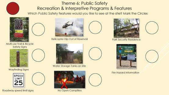
7 SUMMARY OF KNOWN LUPA SITE FEATURES & PROGRAMS Site Features LUPA Study Area - 1,299 Acres 660-acre - Robert Sibley Volcanic Regional Preserve 389-Acre Western Hills Open Space Future Conservation Easement Acquisition Primary purpose - habitat conservation Recreation amenities include: 2 new staging areas Trail connections to City of Orinda Parks, Sibley Trail System & new McCosker Parcel 250-Acre McCosker Parcel Donation EBRPD currently owns in fee Stream restoration project underway Interim public access opportunities & baseline data Opportunities to develop recreation amenities & programs Operations & Public Safety Sibley Parks staff and EBRPD Public Safety Department provide the following services to the entire 1,299 acres of the Preserve: 3 on-site security residences Public safety & visitor experience enrichment through on site patrol & emergency response Fuels management & fire response Land management through Grazing IPM weed abatement Habitat monitoring


 Youth")

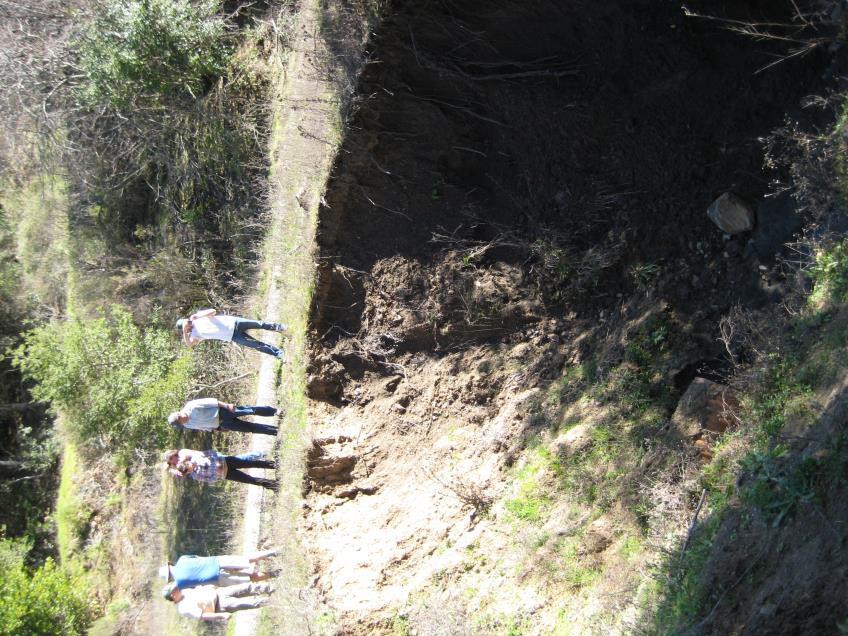
8 LUPA PROJECT STATUS - COMMUNITY ENGAGEMENT April 2016 Community Mtg. #1 Project Introduction November 16, 2016 Community Mtg. #2 Identify Alternatives July 2016 Landbank Tour December 4, 2016 Community Tour Wilcox Station Staging Area Sibley Regional Preserve Youth Involvement August 2016 Eco-teen Camp Identify Alternatives January 18, 2017 Community Mtg. #3 Select Preferred Alternative(s) Youth Involvement November 2016 Canyon School Identify Alternatives Spring 2017 Initiate LUPA Select Preferred Alternative(s)

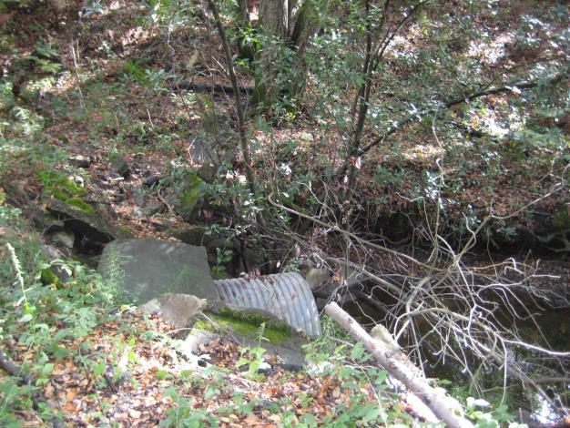
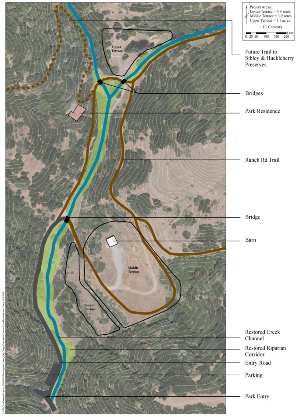
9 Technical Studies - Preliminary Stream Assessment Findings Soils & Geology Disturbed areas contain 7-30 feet of fill material with an average depth of feet It will be possible to balance cut and fill material on-site Stream channel fill material is suitable for onsite reuse Stream Design Geomorphology The gradient of the stream s main stem is about 6 % Habitat for rainbow trout the stream design will include: A mix of cascades, resting pools, and spawning sites Over summering pools with a minimum depth of 1.5 feet A low flow channel 8-12 feet wide Circulation Primary access into the site will be an all-weather surface off Pinehurst Rd. Three - single lane (16 foot wide), fire truck rated bridges will be incorporated into circulation system


10 Preliminary Stream & Circulation Design Bridge Opportunity to integrate a nature trail on the east side of the creek Opportunity to integrate a nature trail on the east side of the creek &/or outdoor classroom space where the creek is approachable with gentle bank Single lane fire road New connection to single lane fire road Park Security Residence Bridge Opportunity for new trail Single lane fire road Bridge 2-lane access road Trailhead Parking for 10 cars


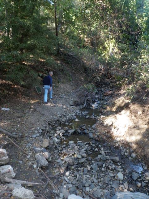
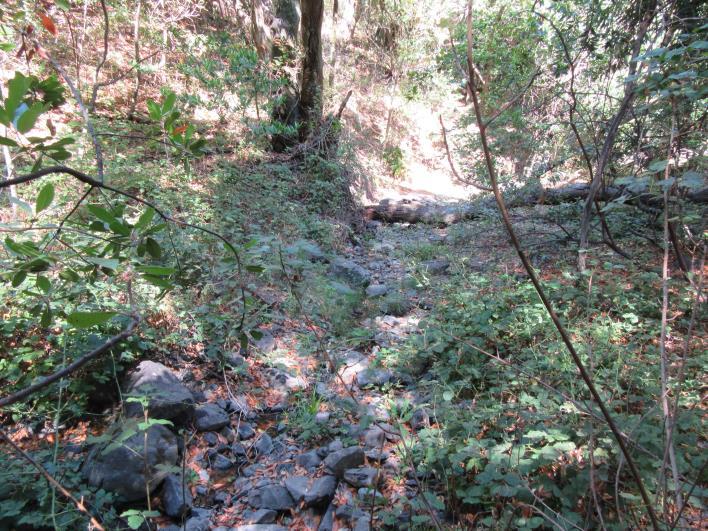
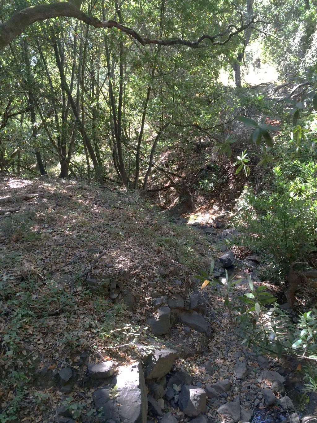
11 Site Analysis - Riparian Corridor Existing Conditions
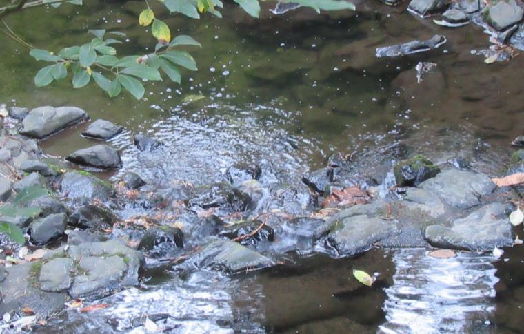
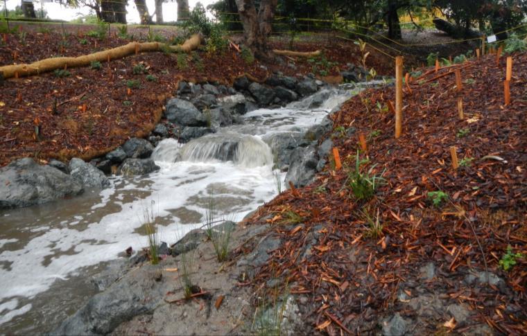
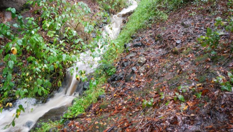

12 Preliminary Stream Design A mix of: Cascades Pool-riffles Step-pools Resting pools

13 Recreation & Interpretive Programs & Facilities Opportunities & Constraints

14 Site Features Opportunities Panoramic views Unique geology Sense of seclusion & intimate views Riparian channel restoration Encompasses whole watershed Constraints: Steep terrain Limited areas for recreation facility development Main tributary channel culverted & filled


15 Biological Features Opportunities Variety of habitat types including: o Coastal prairie grasslands o Coast live oak woodlands o Coastal scrub communities Rich riparian habitat, but no special status natural communities constraining development in disturbed areas Constraints: Potential for listed & special wildlife & plant species of concern including: o California red-legged frog o Alameda striped racer o Golden eagle o Rainbow trout o Pallid Manzanita o Ben-flowered fiddleneck o Oregon Meconella


16 Cultural Features Opportunities Geological resources Rich history including: o OA&E Railroad o 150+ year Ranching History o Canyon Community History o Redwood History/Lumber Mills o Quarrying/Construction Constraints: Highly disturbed site with few remnants of earlier history

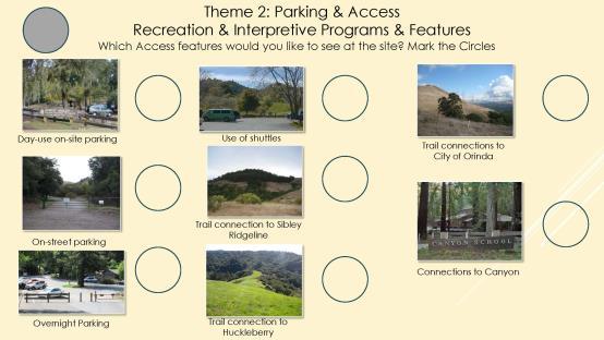
17 Existing & Planned Access to Sibley Regional Preserve Sibley - Main Staging Area - Skyline Blvd. Parking for 34 cars Sibley Old Tunnel Rd. Parking for 10 cars Huckleberry Preserve Skyline Blvd. Parking for 12 cars Huckleberry Preserve Pinehurst Rd. Trailhead no parking Sibley Wilcox Station Staging Area - Pinehurst Rd. Parking for 10 cars City of Orinda Wilder Park Parking for 273 spaces - 10 spaces dedicated to Sibley Preserve access Wilder Rd. S. Terminus EBRPD Staging 19 cars 2 horse trailers Opportunities Multiple access points o Disperses use o Provides local access to many communities Constraints: Limited parking at all sites
18 Brainstorming Preferences Park Design Presentation WORKSHOP ACTIVITY Overview


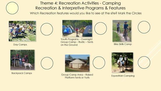
19 McCosker Project Area 5.9 acres Lower Terrace 0.9 acres Middle Terrace - Acres: 3.9 Upper Terraced Area Acres: 1.1 Redwood Girls Group Camp 0.9 Acres Capacity: 50 people, 10 cars Coyote Hills - Dairy Glen Camp 1.5 Acres Capacity: 50 people, 10 cars Tilden - Gillespie Youth Camp 1.2 Acres Capacity: 75 people, 15 cars Chabot - Bort Meadow Camp 5 Acres Capacity: 200 people, 75 cars Comparative Development Areas Examples of East Bay Regional Park Group Campsites Occupancy: Minimum 11, Maximum 200 Dining Area: Picnic tables, serving tables, & extra-large BBQ Other Common Amenities: Fire circle, drinking fountain with spigot, toilets Sleeping & Activity Areas: Minimum size 0.9 acres, maximum 5 acres Parking Overnight parking passes REQUIRED - passes mailed 7-10 days prior to reservation Parking capacity is set 7 to 75 cars dependent on camp size; no other parking is allowed Security: Group camps are accessed through 2 gates: trailhead/staging area gate & group camp gate Gates are locked daily; no entrance is allowed after 10:00pm until the next morning Group camp gate is to be kept locked closed at all times


 Capacity: 10 reservable picnic sites")
20 Comparative Development Areas McCosker Project Area 5.9 acres Lower Terrace 0.9 acres Middle Terrace - Acres: 3.9 Upper Terraced Area Acres: 1.1 Temescal Building & Parking acre Capacity: 130 people, 28 cars Trudeau Meeting Facility Building & Parking Acres Capacity:164 people, capacity 30 cars Roberts Park Open Area, Picnicking, Play Area & Swimming & Parking acres (developed area) Capacity: 10 reservable picnic sites capacity 35 to 300 people Tilden Botanic Garden Building & Parking -10 acres Capacity: Tours 20 people, cars


21 Why the emphasis on small destination activities & site restoration? Master Plan goals of balancing conservation with recreation & interpretive activities Degraded creek system with opportunities to enhance habitat Limited site access Limited opportunities for parking Water availability limited no connections to City water systems Limited sewage management capabilities - no connections to City sewage systems


22 Potential Development Areas Lower & Middle Terrace Site Features Two large, level areas Equipment storage Barn Public vehicle access & parking opportunities Trail access opportunities Potable water & septic or vault toilet options Maintenance & emergency vehicle access Potential Development Areas Lower Terrace 0.9 acres Middle Terrace - Acres: 3.9


23 Potential Development Area Potential Development Area Upper Terrace Area - Acres: 1.1 Upper Terrace Site Features Several smaller, level disturbed terraces Remnants of McCosker quarrying business No public vehicle access or parking opportunities Trail access opportunities Potable water & vault toilet option Maintenance & emergency vehicle access


24 Interpretive & Recreation Development & Program Opportunities WORKSHOP ACTIVITY Ground Rules Be Respectful Acknowledge others Be inclusive Active listening - Consider interests & philosophy each individual no prejudging, no putdowns, attacks or threats Tolerance Observe courtesy & agree to disagree

25 Interpretive & Recreation Development & Program Opportunities WORKSHOP ACTIVITY Present Ideas Ground Rules Be Respectful Acknowledge others Be inclusive Active listening - Consider interests & philosophy each individual no prejudging, no putdowns, attacks or threats Tolerance Observe courtesy & agree to disagree

26 MCCOSKER & WESTERN HILLS LUPA NEXT STEPS Dec 4, On-site Tours/Open House RSVP at Sign-in table Jan 18, Community Meeting # 3 o Community Review of Alternatives o Community Determination of Preferred Design MCCOSKER LOOP TRAIL Dec 6, Board Meeting
27 SIBLEY LUPA NEXT STEPS Winter Dec 4 - On-site Tours/Open House Dec 6 Board Mtg. McCosker Loop Trail Jan 18 -Community Meeting # 3 Community Review of Design Alternatives Community Determination of Design Recommendations Spring Summer 2017 LUPA initiated incorporating Community Recommendations Fall 2017 Spring 2018 LUPA Completed CEQA Analysis Community Review of LUPA & CEQA 4 th Newsletter Board - CEQA Certification Board - LUPA Approvals Fall 2017 Spring 2018 Regulatory Permitting Ongoing - Pursue Grant Funding Summer 2018 Summer 2019 Permits Obtained Funding Secured WHOS land transfer completed Stream Restoration Construction 2-Parcel Preserve opening 3 rd Newsletter

28 Land Use Plan Amendment incorporating the McCosker & Western Hill Open Space will: Evaluate park resources & facilities Document agreements & restrictions related to park use Provide recommendations for managing resources Identify future recreation uses & service facilities incorporating recommendations from community workshops CEQA analysis will: Inform decision-makers & public of potential environmental effects Identify ways to avoid or significantly reduce effects Prevent significant, avoidable damage through project alternatives or mitigation measures

29 STAYING INVOLVED & CONNECTED There are several easy ways for you to participate in this Land Use Planning process: Sign up on the attendance sheet to be placed on the mailing list Visit our website at the following link: Attend upcoming public planning open houses & presentations: Dec 4 th & Jan 18 th Volunteer - Information about our volunteer program can be accessed at the following link:
Coyote Hills Restoration and Public Access Project Coyote Hills Regional Park C o n c e p t P l a n a n d S i t e P r o g r a m
 Coyote Hills Restoration and Public Access Project Coyote Hills Regional Park C o n c e p t P l a n a n d S i t e P r o g r a m Chris Barton Environmental Programs Manager Aquisition Stewardship Development
ADOPTED CAPITAL IMPROVEMENT PROGRAM BUDGET ARROYO PROJECTS
 ADOPTED CAPITAL IMPROVEMENT PROGRAM BUDGET ARROYO PROJECTS HAHAMONGNA FY 212-216 Capital Improvement Program Priority Description Total Estimated Costs Appropriated Through FY 211 Adopted FY 212 FY 213
SCC PRD (2016) COUNTY PARK MASTER PLAN
 COUNTY PARK MASTER PLAN") SCC PRD (2016) COUNTY PARK MASTER PLAN MASTER PLAN UPDATE PARKS AND RECREATION COMMISSION NOVEMBER 7, 2018 PURPOSE OF THE MASTER PLAN The Sanborn County Park Master Plan will provide the Department with
SCC PRD (2016) COUNTY PARK MASTER PLAN MASTER PLAN UPDATE PARKS AND RECREATION COMMISSION NOVEMBER 7, 2018 PURPOSE OF THE MASTER PLAN The Sanborn County Park Master Plan will provide the Department with
ARROYO PROJECTS ADOPTED CAPITAL IMPROVEMENT PROGRAM BUDGET
 A RROYO P ROJECTS ADOPTED CAPITAL IMPROVEMENT PROGRAM BUDGET FISCAL YEARS 214-218 HAHAMONGNA Priority Description 1 Hahamongna Watershed Park - Implement Master Plan 211,6 211,6 (77565) 2 Hahamongna -
Study Area Map. Wasatch Hollow Open Space Restoration, Use, & Management Plan. Legend. Harrison Ave East. Roosevelt East.
 Harrison Ave Roosevelt Emerson «4 «5 Rosecrest 1900 East «3 1800 East Wasatch Hollow Open Space Restoration, Use, & Management Plan Study Area Map Legend «2 «1 Potential Access Location Emigration Creek
Arana Gulch Park Master Plan
 809 Center Street, Santa Cruz, CA 95060 Arana Gulch Park Master Plan Executive Summary The Arana Gulch Master Plan completes the last master planning work for the parks and open spaces within the City
Notice of Preparation of an Environmental Impact Report and Scoping Meeting for the Canyon Lane Roadway Improvements Development Project
 of an Environmental Impact Report and Scoping Meeting for the As the Lead Agency, the County of San Mateo (County) will prepare an Environmental Impact Report (EIR) for the (project), and would like your
I. INTRODUCTION SITE DESCRIPTION
 Request for Proposals Design Services for the Visitor Access and Engagement Project at Roy s Redwoods Open Space Preserve Marin County Parks & Open Space Preserve Woodacre, Marin County, CA November 12,
PLANNING AND NATURAL RESOURCES COMMITTEE. Public Access Conceptual Design Alternatives for the Red Barn Area of La Honda Creek Open Space Preserve
 PLANNING AND NATURAL RESOURCES COMMITTEE R-17-56 May 9, 2017 AGENDA ITEM AGENDA ITEM 2 Public Access Conceptual Design Alternatives for the Red Barn Area of La Honda Creek Open Space Preserve GENERAL MANAGER
EACCS Goal: provide guidelines for mitigation practices and overall conservation in east Alameda County
 EAST ALAMEDA COUNTY CONSERVATION STRATEGY: A BLUEPRINT FOR ACTION Community Meeting June 11, 2009 Agenda Welcome and Introductions Project Update o Introduction o Progress to Date o Next Steps Perspectives
Master Plan Objectives and Policies
 Master Plan Objectives and Policies Introduction This chapter identifies the Park issues and recommended policies established by this Master Plan. The issues were identified through meetings with staff,
M-NCPPC Park System in
 Park Planning & Stewardship Division Park & Trail Planning Section East County Science Center Master Plan Parks, Recreation, Trails, and Open Space- Issues and Opportunities PARK PLANNING & STEWARDSHIP
The River Future. San Gabriel River Confluence with Cattle Canyon Creek Improvements Project (the Cattle Canyon Project)
") The River Future San Gabriel River Confluence with Cattle Canyon Creek Improvements Project (the Cattle Canyon Project) Collaboration Agency Leads Engaged Stakeholders Non-Profit Organizations USFS Pacific
The River Future San Gabriel River Confluence with Cattle Canyon Creek Improvements Project (the Cattle Canyon Project) Collaboration Agency Leads Engaged Stakeholders Non-Profit Organizations USFS Pacific
Town of Lyons Parks Flood Recovery Planning Process. Photograph courtesy of Ed Bruder
 Town of Lyons Parks Flood Recovery Planning Process Photograph courtesy of Ed Bruder Lyons Parks and Recreation Flood Recovery Update 1. Meadow Park Phase II - Project PW20B1 Estimated Completion: Summer
EL DORADO COUNTY GENERAL PLAN PARKS AND RECREATION ELEMENT PRINCIPLE INTRODUCTION STATE AUTHORIZATION
 EL DORADO COUNTY GENERAL PLAN PARKS AND RECREATION ELEMENT PRINCIPLE The General Plan must identify the types of governmental services, including parks and recreation facilities, which are necessary to
glenwood canyon design process I-70 Statement of Direction TRG Recreation Subcommittee Colorado Division of Highways August 11, 1976 prepared by the
 glenwood canyon I-70 design process Statement of Direction TRG Recreation Subcommittee August 11, 1976 prepared by the TRG Recreation Subcommittee for the Colorado Division of Highways glenwood canyon
Presentation to Parks and Open Space Advisory. Committee September 22, 2016
 Flood Planning & Preliminary Design Services for South St. Vrain Creek Restoration at Hall Ranch Presentation to Parks and Open Space Advisory Prepared for: Boulder County, Colorado Committee September
Public Review Draft Oceanside Subarea Habitat Conservation Plan/ Natural Communities Conservation Plan
 Oceanside Subarea Habitat Conservation Plan/ Natural Communities Conservation Plan Prepared for City of Oceanside Planning Department 300 N. Coast Highway Oceanside, CA 92054 Prepared by Ogden Environmental
The following principles guide the development of goals and strategies to protect and promote these amenities:
 OPEN SPACE/PARKS/TRAILS/RECREATION GOALS/STRATEGIES Cherry Hills Village is a living environment that offers low density development, open areas, public scenic vistas, public trails and public parks. This
Mendota-Lebanon Hills Greenway Master Plan Executive Summary. August draft for more information visit
 Mendota-Lebanon Hills Greenway Master Plan Executive Summary August 2013 draft for more information visit www.hkgi.com/projects/dakota INTRODUCTION The Mendota-Lebanon Hills Greenway Master Plan portrays
River Bend Area Plan Map Amendment ARPP Analysis Camp Fire Day Camp November 20, 2014
 Regional Parks Department Jeffrey R. Leatherman, Director County of Sacramento Attachment 2 Divisions Administration Golf Leisure Services Maintenance Rangers Therapeutic Recreation Services River Bend
Chapter 5: Natural Resources and Environment
 NATURAL RESOURCES AND ENVIRONMENT 5-1 5 Chapter 5: Natural Resources and Environment BACKGROUND AND INTENT Urban expansion represents the greatest risk for the future degradation of existing natural areas,
COASTAL CONSERVANCY. Staff Recommendation December 13, 2007 COASTAL TRAIL AT LAND S END. File No Project Manager: Joan Cardellino
 COASTAL CONSERVANCY Staff Recommendation December 13, 2007 COASTAL TRAIL AT LAND S END File No. 07-086-01 Project Manager: Joan Cardellino RECOMMENDED ACTION: Authorization to disburse up to eight hundred
CARMODY PARK MASTER PLAN
 the site Smith Reservoir Cottonwood Lake Kendrick Lake Carmody Rec Center Carmody Middle School Pool Court Play Carmody Pond Sanderson Ditch Sports Fields Foothills Ice Arena Open Field why a master plan?
Ecological Restoration at the Las Vegas Springs Preserve. Von K. Winkel, Ph.D.
 Ecological Restoration at the Las Vegas Springs Preserve Von K. Winkel, Ph.D. The Las Vegas Springs Before Disturbance The springs are very large. A small creek flows from each of 3 or 4 springs and
2011 ASLA Design Awards. Westside Creeks Restoration Plan Merit Award AECOM, Fort Collins. Planning & Urban Design
 2011 ASLA Design Awards Westside Creeks Restoration Plan Merit Award AECOM, Fort Collins Planning & Urban Design Project Fact Sheet Category of Entry: Rotating Specialty Award: 2011 2011 ASLA Colorado
Member Service Plan Sierra Nevada AmeriCorps Partnership
 Member Service Plan Sierra Nevada AmeriCorps Partnership Service plans lay the framework for what each Member will be doing during their service. Service plans detail the major projects and expected results
Saratoga Quarry Park Master Plan
 Project Team City of Saratoga John Cherbone, Director of Public Works Iveta Harvancik, Senior Engineer PlaceWorks Isabelle Minn, Principal-in-Charge Isby Fleischmann, Project Manager Kyle Simpson, CEQA
SITE INTRODUCTIONS AND OVERVIEW
 SITE INTRODUCTIONS AND OVERVIEW The City s formal Open Space Program was established in 1990 to implement long-standing policies that called for the protection of the farmlands and wild areas that surround
Goleta Community Plan Update
 Goleta Community Plan Update Ecology, Biology, and Habitats GVPAC Meeting Agenda [Wednesday, December 17, 2008, 6:00PM] Pledge of Allegiance and Roll Call Public Comment Period Administrative December
New Brighton Park Shoreline Habitat Restoration Project
 Vancouver Board of Parks and Recreation and Port Metro Vancouver New Brighton Park Shoreline Habitat Restoration Project Conceptual Design Public Consultation August 26 September 9, 2015 Discussion Paper
Antioch Habitat Conservation Plan/Natural Community Conservation Plan
 Antioch Habitat Conservation Plan/Natural Community Conservation Plan Science Advisor Workshop February 8, 2018 Kathryn Gaffney Project Manager Matt Ricketts Lead Biologist 1 PRESENTATION OUTLINE Background
Las Colonias Park Master Plan
 2013 Las Colonias Park Master Plan City of Grand Junction June 2013 Introduction Las Colonias Park, a 101 acre parcel on the edge of the Colorado River south of downtown, was deeded to the City of Grand
Policy & Procedure Effective Date: Parks Department Page of
 City of Arvada Policy & Procedure Effective Date: Parks Department Page of TITLE: City of Arvada Prairie Dog Habitat Plan APPROVAL: PURPOSE: To establish a plan for the preservation of black-tailed prairie
Redesigning Vogel Flat Angeles National Forest, California
 Redesigning Vogel Flat Angeles National Forest, California WRPI Watershed Management Internship 2017 Cristina Plemel, Master s of Landscape Architecture California State Polytechnic University, Pomona
Pinellas County Greenways
 Pinellas County Greenways USING GREENWAYS TO LINK OPEN SPACES The Florida Greenways Commission has defined a greenway as...a corridor of protected open space that is managed for conservation and/or recreation.
Parks, Trails, and Open space Element
 Parks, Trails, and Open space Element Parks, Trails, and Open Space element Parks, Recreation, and Open Space are important components of the quality of life desired by the residents of Elk Grove. This
Parks, Trails, and Open Space Element
 P arks, Recreation, and Open Space are important components of the quality of life desired by the residents of Elk Grove. This Element of the General Plan addresses the City s goals, policies, and actions
BISCUIT RUN PARK MASTER PLAN
 BOARD OF SUPERVISORS November 14, 2018 BISCUIT RUN PARK MASTER PLAN COUNTY OF ALBEMARLE ANHOLD ASSOCIATES Contents Project Introduction Property Background County Park Planning Process Existing Site &
TOWN COUNCIL / PLANNING COMMISSION
 Workshop #3 TOWN COUNCIL / PLANNING COMMISSION January 20, 2011 Consultant Team In Attendance Tonight BMS Design Group Nevada City and San Francisco Michael Smiley, AICP, ASLA Partner-in-Charge Nancy L.
METROPOLITAN COUNCIL 390 North Robert Street, St. Paul, MN Phone (651) ; TDD (651)
 ; TDD (651)") DATE: December 20, 2011 METROPOLITAN COUNCIL 390 North Robert Street, St. Paul, MN 55101 Phone (651) 602-1000; TDD (651) 291-0904 TO: Metropolitan Parks and Open Space Commission FROM: Tori Dupre, Senior
DATE: December 20, 2011 METROPOLITAN COUNCIL 390 North Robert Street, St. Paul, MN 55101 Phone (651) 602-1000; TDD (651) 291-0904 TO: Metropolitan Parks and Open Space Commission FROM: Tori Dupre, Senior
STREAM BANK STABILIZATION THORPS MORTIMER RECREATION AREA Grandfather Ranger District SITE LOCATION & DRAINAGE AREA
 STREAM BANK STABILIZATION THORPS CREEK @ MORTIMER RECREATION AREA SITE LOCATION & DRAINAGE AREA SITE LOCATION Drainage Area = 1.14 sq. miles STREAM BANK STABILIZATION THORPS CREEK @ MORTIMER RECREATION
Forest Grove Park Master Plan
 Workshop 03 Steering Committee Meeting 2:00 5:00 PM Public Open House 5:00 7:00 PM February 21, 2012 Agenda February 21, 2012 Schedule and planning process update. Preliminary Program review. Concept plan
RIDGES TO RIVERS OPEN SPACE NETWORI< OF THE MID-COLUMBIA DRAFT ACTION PLAN
 RIDGES TO RIVERS OPEN SPACE NETWORI< OF THE MID-COLUMBIA DRAFT ACTION PLAN Ridges to Rivers Open Space Network of the Mid-Columbia Region Draft Action Plan (8/6/08) The goals of the propose
CECW-AG 11 June 1998 MEMORANDUM FOR MAJOR SUBORDINATE COMMANDS AND DISTRICT COMMANDS
 CECW-AG 11 June 1998 MEMORANDUM FOR MAJOR SUBORDINATE COMMANDS AND DISTRICT COMMANDS SUBJECT: Policy Guidance Letter No. 59, Recreation Development at Ecosystem Restoration Projects 1. References: a. ER
APPENDIX C NATURAL RESOURCES MANAGEMENT PLAN: ACTIONS AND PRIORITIES
 APPENDIX C NATURAL RESOURCES MANAGEMENT PLAN: ACTIONS AND PRIORITIES TABLE C-1: Resource Actions and Priorities GOAL NRM-4 Objective 4.1: Restore Natural floodplain functions. Objective 4.2: Define and
Open Space, Natural Areas, Parks, and Recreation
 Open Space, Natural Areas, Parks, and Recreation WHAT ARE THE CITY S CURRENT VALUES? This section addresses open spaces, natural areas, parks and recreation, and stormwater multi-use projects under separate
Table of Contents TABLE OF CONTENTS SECTION TITLE PAGE
 TABLE OF CONTENTS SECTION TITLE PAGE 1 INTRODUCTION AND OVERVIEW 1-1 1.1 Purpose and Need 1-1 1.2 Goals and Objectives 1-3 1.3 Overview of the Planning Process 1-5 1.4 Federal and State Requirements and
Whitemarsh Township Greenway Plan
 Whitemarsh Township Greenway Plan Prepared for: Whitemarsh Township August 16, 2007 Table of Contents Table of Contents... i Introduction... 1 Study Area Setting... 2 Regional Setting... 2 Township Character...
ADDENDUM TO BIOLOGICAL SCOPING SURVEY REPORT, BOTANICAL SURVEY AND WETLAND DELINEATION
 ADDENDUM TO BIOLOGICAL SCOPING SURVEY REPORT, BOTANICAL SURVEY AND WETLAND DELINEATION FOR AVALON INN (APN 069-241-27 & -04) 1201 & 1211 NORTH MAIN STREET FORT BRAGG, CA MENDOCINO COUNTY prepared for:
San Diego River Coalition 2012 Work Plan
 San Diego River Coalition 2012 Work Plan Adopted November 18, 2011 The mission of the San Diego River Coalition is preserve and enhance the San Diego River, its watershed, and its natural, cultural and
M E M O R A N D U M. DATE: July 19, Patrick D. O Keeffe, City Manager. Economic Development & Housing
 M E M O R A N D U M DATE: July 19, 2011 TO: FROM: Patrick D. O Keeffe, City Manager Economic Development & Housing SUBJECT: Resolution of the City Council of the City of Emeryville Approving the Application
This page intentionally blank.
 This page intentionally blank. Parks, Recreation, and Open Space Chapter Relationship to Vision Vision Parks, Recreation and Open Space Chapter Concepts County Government. County government that is accountable
ATTACHMENT A AERIAL PHOTO OF McINTIRE PARK EAST
 ATTACHMENT A AERIAL PHOTO OF McINTIRE PARK EAST McIntire Botanical Garden Request for Proposals Attachments Page 1 of 33 ATTACHMENT B - MEMORANDUM OF AGREEMENT WITH THE CITY OF CHARLOTTESVILLE McIntire
3. VISION AND GOALS. Vision Statement. Goals, Objectives and Policies
 Vision Statement Queen Creek s interconnected network of parks, trails, open spaces and recreation opportunities provide safe and diverse activities and programs that sustain its unique, small town, equestrian
Daniels Park Master Plan
 Daniels Park Master Plan Prepared for: Douglas County & The City and County of Denver October, 2007 EXHIBIT A Contents Daniels Park Overview 2 Project History & Goals 2-3 Regional Context Map 4 Park Zone
Call for Artists for: Design and Construction of Environmental Art Activation Story Mill Community Park, Bozeman, MT
 Call for Artists for: Design and Construction of Environmental Art Activation Story Mill Community Park, Bozeman, MT Seeking artists to design, fabricate and install art elements in the nature sanctuary
Welcome to the Neighborhood! COPPERLEAF NEIGHBORHOOD GUIDE
 Welcome to the Neighborhood! COPPERLEAF NEIGHBORHOOD GUIDE 2017 At Copperleaf, feeling at home just comes naturally. Not surprising when you take a look around at the abundance of resources we offer to
3.10 Land Use and Planning
 3.10 This section describes the regulatory and environmental setting for land use and planning in the program and individual project areas. It also describes impacts on land use and planning that could
To: Planning Commission D.. June 3, 2009
 Agenda Item No. 9(a~ CITY OF WOODINVILLE, WA REPORT TO THE PLANNING COMMIS ION 17301 133 1'd Avenue NE, Woodinville, WA 98072 WWW.CI.WOODINVILLE.WA.US To: Planning Commission D.. June 3, 2009 From: Subject:
319 Grant: Baker Creek & Centenary Creek Restoration Initiative
 319 Grant: Baker Creek & Centenary Creek Restoration Initiative Objectives: Overview of Watershed Characteristics: Discussion of Project Tasks: Discussion of Watershed Management Plan: Presented by: Erich
DRAFT ALDER CREEK FARM MASTER PLAN
 DRAFT ALDER CREEK FARM MASTER PLAN Lower Nehalem Community Trust Mission: To preserve land and nurture conservation values in partnership with an engaged community in the Nehalem region of the Oregon Coast
2 PLANNING AREA DESCRIPTION
 2 PLANNING AREA DESCRIPTION 2.1 LOCATION Hecker Pass is located within the City of Gilroy near the western city limit. Figure 2-1 illustrates the regional location of the Hecker Pass Area. Figure 2-1:
COASTAL CONSERVANCY. Staff Recommendation March 25, 2004 LOS ANGELES GREEN VISION PLAN. File No.: Project Manager: Marc Beyeler
 COASTAL CONSERVANCY Staff Recommendation March 25, 2004 File No.: 04-014 Project Manager: Marc Beyeler RECOMMENDED ACTION: Authorization to disburse up to $50,000 to the University of Southern California
Town of Rico Three Mile Plan for Annexation
 Town of Rico Three Mile Plan for Annexation 10.20.2010 Adopted by Resolution 2010-2 Produced with funding support from the Colorado Department of Local Affairs 2 Content Guide Introduction. 3 Annexation
IMPLEMENTATION STRATEGY: GOAL 1: TO SUSTAIN A HEALTHY NATIVE PRAIRIE GRAZING RESOURCE
 IMPLEMENTATION STRATEGY: GOAL 1: TO SUSTAIN A HEALTHY NATIVE PRAIRIE GRAZING RESOURCE Objectives Actions Timetable Lead and Supporting Agencies 1. Maintain or adopt sound rangeland practices that are reflective
Alternative Routes. St. Vital to La Verendrye Station - Southern Loop Transmission Corridor. 20 different segments 4 segments common to all routes
 Alternative Routes St. Vital to La Verendrye Station - Southern Loop Transmission Corridor In a fixed right-of-way St. Vital to Letellier Station 20 different segments 4 segments common to all routes Goal
(Exhibit A) Site Plan Adoption Detail and Support Information
 Site Plan Adoption Detail and Support Information") McCormick Park Master Site Plan (Exhibit A) Site Plan Adoption Detail and Support Information July, 2003 McCormick Park Site Plans.... 2-3 McCormick Park Site Plan Comparison... 4 Basic Assumptions about
McCormick Park Master Site Plan (Exhibit A) Site Plan Adoption Detail and Support Information July, 2003 McCormick Park Site Plans.... 2-3 McCormick Park Site Plan Comparison... 4 Basic Assumptions about
Otay Regional Trail Alignment Study. Public Workshop March 14 th, 2017 from 5:30-8 p.m.
 Public Workshop March 14 th, 2017 from 5:30-8 p.m. Purpose of the Study A multi-agency planning effort to create a coordinated and sustainable trail system that enhances recreation and provides trail connections
Section 3 INVENTORY OF RECREATION LAND AND FACILITIES
 Photo of Juan Bautista de Anza Park Section 3 INVENTORY OF RECREATION LAND AND FACILITIES Summary of Findings Park Definitions Summary of Recreation Facilities Other Recreation Facilities Nearby Recreation
Bristol Marsh Heritage Conservancy
 Bristol Marsh Heritage Conservancy The Pennsylvania Environmental Council (PEC) protects and restores the natural and built environments through innovation, collaboration, education and advocacy. PEC believes
2011 ASLA Design Awards. Coyote Gulch Honor Award and Land Stewardship Designation Valerian LLC. Environmental Restoration and Reclamation
 2011 ASLA Design Awards Honor Award and Land Stewardship Designation Valerian LLC Environmental Restoration and Reclamation Project Name: Category : Project Location: 5 2011 Environmental Restoration and
RECREATION AND OPEN SPACE ELEMENT GOALS, OBJECTIVES, AND POLICIES
 RECREATION AND OPEN SPACE ELEMENT GOALS, OBJECTIVES, AND POLICIES Goal 7 To provide park facilities, recreation programs, and open space resources that are safe, adequate, and accessible to all City residents,
Support for Walnut Creek Watershed Council. Adopt resolution of support for the newly formed Walnut Creek Watershed Council.
 CITY OF MARTINEZ CITY COUNCIL AGENDA March 6, 2013 TO: FROM: SUBJECT: DATE: Mayor and City Council Tim Tucker, City Engineer Support for Walnut Creek Watershed Council March 1, 2013 RECOMMENDATION: Adopt
Connecting people to parks
 Connecting people to parks Introduction from the Governor It is up to all of us to ensure the conservation of our State s wonderful national parks, marine parks and other conservation reserves continues
EIR Scoping Meeting MULTI-BENEFIT/MULTI USE PROJECT
 EIR Scoping Meeting MULTI-BENEFIT/MULTI USE PROJECT in Hahamongna Watershed Park July 12, 2012 and July 14, 2012 presented by City of Pasadena, Department of Public Works and Willdan Engineering Purpose
Oak View Estates Specific Plan
 Oak View Estates Specific Plan Environmental Impact Report SCOPING MEETING MARCH 14, 2018 CITY OF BRADBURY PLANNING DEPARTMENT Welcome and Project Team Kevin Kearney, City Manager Jim Kasama, City Planner
Arkansas River Corridor
 Planning for Access Welcome to the Access Project. This project is a recreational planning effort in response to an interest by regional communities along the Arkansas River corridor. The project plan
Memorandum Planning. Thursday, January 8, 2015
 Memorandum Planning Thursday, January 8, 2015 7.A. To: Coastal Advisory Committee From John Ciampa, Associate Planner Subject: Review Draft Local Coastal Program Copies: James Pechous, City Planner Purpose
Project Team. 2M Associates. City of Saratoga. HT Harvey Biology. PlaceWorks. NV5 Infrastructure. Tom Origer Associates History/Archeology
 Project Team City of Saratoga John Cherbone, Director of Public Works Iveta Harvancik, Senior Engineer PlaceWorks Isabelle Minn, Principal-in-Charge Isby Fleischmann, Project Manager Kyle Simpson, CEQA
CHIEF HUMAN RESOURCES OFFICER CHIEF OF PLANNING & GIS. Recruitment Services provided by Ralph Andersen & Associates
 CHIEF HUMAN RESOURCES OFFICER CHIEF OF PLANNING & GIS Recruitment Services provided by Ralph Andersen & Associates Photo courtesy of Mark Crumpler EXPERIENCE EAST BAY Alameda and Contra Costa counties,
Green Infrastructure. NYS Department of Environmental Conservation
 Green Infrastructure Green infrastructure is an interconnected network of natural areas and open spaces that sustains ecosystems. Benedict, M.A. and E.T. McMahon. 2006. Green Infrastructure Linking Landscapes
Southeast Quadrant Plan
 Southeast Quadrant Plan Southeast Quadrant Distinctive Features Land Use The Southeast Quadrant includes all the area within the planning area that is east of Interstate 5 and south of State Route 44.
Community Conservation Workshop. Lake Placid
 Community Conservation Workshop Lake Placid 2 Community Conservation Program Welcome! We have designed a Community Conservation Program that listens to the needs of community members. We are conducting
PG&E WINTERS GAS OPERATIONS AND TECHNICAL TRAINING CENTER
 PG&E WINTERS GAS OPERATIONS AND TECHNICAL TRAINING CENTER CEQA scoping Meeting March 19 th, 2014 Winters City Council Chambers - 6:30 pm AGENDA FOR THE MEETING 6:30 Welcome (John Donlevy) 6:40 Overview
Yarra Strategic Plan community engagement summary
 Yarra Strategic Plan community engagement summary Between May and August 2018 Melbourne Water undertook community engagement to build the content of the draft Yarra Strategic Plan. This engagement included
& SUSTAINABILITY PLAN
 Chapter 6: IMPLEMENTATION, MANAGEMENT, & SUSTAINABILITY PLAN Overview The Oxbow Park and Zollman Zoo Master Plan presents a long-term vision for the park. While phasing of improvements is suggested, Olmsted
Minto-Brown Island. November 18, City of Salem, Parks & Transportation Services
 Minto-Brown Island Park Master Plan Public Meeting #1 November 18, 2014 City of Salem, Parks & Transportation Services Division, i i Public Works Welcome... and thanks for participating in the master planning
Improving Communities Through the Arroyo Seco Sustainability Campaign and Watershed Assessment
 Improving Communities Through the Arroyo Seco Sustainability Campaign and Watershed Assessment Arroyo Seco Headwaters in the San Gabriel Mountains Major tributary to the Los Angeles River 44 square mile
Introduction. Integrating Ecological Restoration of Estuarine Shorelines with Urban Community Revitalization Efforts. Ed Morgereth Biohabitats, Inc.
 Introduction Integrating Ecological Restoration of Estuarine Shorelines with Urban Community Revitalization Efforts Ed Morgereth Biohabitats, Inc. 5 th National Conference & Expo on Coastal and Estuarine
FY Capital Improvement Program Arroyo Projects
 FY 219-223 Capital Improvement Program FY 218 FY 219 FY 22 FY 221 FY 222 FY 223 1 2 3 4 5 6 7 8 9 1 Hahamongna - Implement Master Plan - Oak Grove Area Improvements (7756) Hahamongna - Implement Master
Rural Tourism. Amendments to the Non-Coastal Zoning Ordinance (Legislative Format)
") Page 1 of 7 Amendments to the Non-Coastal Zoning Ordinance (Legislative Format) ARTICLE 2 DEFINITIONS Article 2, Sec. 8102-0, DEFINITIONS, of the Ventura County Ordinance Code is hereby amended by revisions
Page 1 of 7 Amendments to the Non-Coastal Zoning Ordinance (Legislative Format) ARTICLE 2 DEFINITIONS Article 2, Sec. 8102-0, DEFINITIONS, of the Ventura County Ordinance Code is hereby amended by revisions
PARKS AND RECREATION ELEMENT
 PARKS AND RECREATION ELEMENT TABLE -3 First Priority 1 2 POTENTIAL SAN CARLOS TRAIL CONNECTIONS Crestview to Pulgas Ridge Open Space Preserve and San Francisco Watershed Lands Unimproved City-Owned Parcel
Candlestick Point SRA Yosemite Slough Restoration Project. Presented by
 Candlestick Point SRA Yosemite Slough Restoration Project Presented by Yosemite Slough Restoration Project The Center of a Revitalized Waterfront in Southeastern San Francisco The Yosemite Slough Restoration
DISCUSSION TOPIC: ST JOHNS RIVER & ITS TRIBUTARIES (BPII) 2030 COMPREHENSIVE PLAN POLICES AND REGULATORY FRAMEWORK
 2030 COMPREHENSIVE PLAN POLICES AND REGULATORY FRAMEWORK") DISCUSSION TOPIC: ST JOHNS RIVER & ITS TRIBUTARIES (BPII) 2030 COMPREHENSIVE PLAN POLICES AND REGULATORY FRAMEWORK St. John s River & Its Tributaries Issue Summary: The St. Johns River is an important
DISCUSSION TOPIC: ST JOHNS RIVER & ITS TRIBUTARIES (BPII) 2030 COMPREHENSIVE PLAN POLICES AND REGULATORY FRAMEWORK St. John s River & Its Tributaries Issue Summary: The St. Johns River is an important
3.0Guiding Principles
 DRAFT 15 3.0Guiding Principles The Guiding Principles and associated Planning Opportunities represent a framework of desirable planning values and general planning concepts that set an overall vision for
Pittsfield Action Plan (West Branch of the Housatonic River)
") An initiative of the Massachusetts Executive Office of Energy and Environmental Affairs in partnership with the City of Pittsfield Pittsfield Action Plan (West Branch of the Housatonic River) The spring
An initiative of the Massachusetts Executive Office of Energy and Environmental Affairs in partnership with the City of Pittsfield Pittsfield Action Plan (West Branch of the Housatonic River) The spring
Oconee Rivers Greenway Project. TSPLOST 2018 Project # 5 Project Concept Sub-projects 7, 8, 9, 10, & 11. Mayor & Commission Work Session
 Oconee Rivers Greenway Project Project # 5 Project Concept Sub-projects 7, 8, 9, 10, & 11 Mayor & Commission Work Session February 13, 2018 North Oconee River Greenway 1 Project # 05 - Oconee Rivers Greenway
DATE: May 25, Watershed Conservation Authority Governing Board. Johnathan Perisho, Project Manager. Mark Stanley, Executive Officer
 DATE: May 25, 2017 TO: FROM: THROUGH: SUBJECT: Watershed Conservation Authority Governing Board Johnathan Perisho, Project Manager Mark Stanley, Executive Officer : Consideration of a resolution to approve
Dalla Mountain Park Management Plan
 Dalla Mountain Park Management Plan Adopted by Durango City Council February 7, 2006 I. INTRODUCTION Dalla Mountain Park, located on the southwestern slope of Animas Mountain, is a 177.8 acre tract rich