Plumpton Neighbourhood Plan Site Assessment Report
|
|
|
- Mavis Cummings
- 5 years ago
- Views:
Transcription
1 Plumpton Neighbourhood Plan Site Assessment Report May
2 Contents 1. Introduction 3 2. Methodology Identification of Potential Sites Assessment Process Assessment Criteria Suitability Assessment Criteria Acceptability Assessment Criteria Assessment of Individual Sites Map of Potential Sites Site Assessments 11 Appendix: Site Assessment Scoring Matrix 35 2
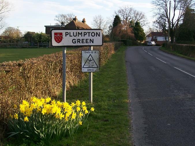
3 1. Introduction This report is produced as part of the evidence base for the Plumpton Neighbourhood Plan. It includes assessments of all sites that have been considered by the Steering Group and sets out the group s recommendations for the allocation of sites for future housing development. Plumpton is a rural parish located north west of the town of Lewes and contains two primary settlements, Plumpton and Plumpton Green. The parish is partly located in the South Downs National Park and the downland, rural character is very much valued by parish residents. However, there is a need for new housing nationwide which the Plumpton Neighbourhood Plan aims to address, in line with the targets set in the emerging (but almost adopted) Lewes District Joint Core Strategy. This Site Assessment Report contains a thorough assessment of sites considered through the process and is considered a comprehensive and robust component of the Neighbourhood Plan evidence base which sets out the reasoning for selecting the development sites allocated in the Neighbourhood Plan. Through the site assessment, a comprehensive objective assessment of each site is carried out alongside a consideration of the achievability and availability of sites. This is then balanced against an acceptability assessment whereby considerations that are important to the parish community are taken into account. The Lewes District Council Emerging Joint Core Strategy sets a target of a minimum of 50 additional homes for the settlement of Plumpton Green in the period to The target that the Neighbourhood Plan is planning for is therefore considered in line with the latest housing need evidence for the Parish and settlement of Plumpton Green. 3
4 2. Methodology 2.1 Identification of potential sites The initial list of development site options was identified through two key sources: Lewes District Council s Strategic Housing Land Availability Assessment (SHLAA) and the Parish Council s Call for Sites process. SHLAA As local planning authority, Lewes District Council (LDC) is required to produce a SHLAA to identify sites throughout the District with potential for housing, assess their housing suitability and consider when they could potentially be developed. The document is updated regularly on an annual basis and helps to inform judgements on future development and allocation of land for housing, but does not allocate sites. The Parish Council made the decision to consider suitable SHLAA sites in the site assessment process although, as noted in the next section, some of these suitable sites were also put forward by landowners/agents through the Call for Sites. Call for Sites Following designation of the Plumpton Neighbourhood Area, and formulation of the Steering Group, a Call for Sites process was undertaken to identify further potential development sites in addition to those suitable sites identified in the SHLAA. The Parish Council wrote to Parish landowners on 1 September 2014 offering the opportunity to put land forward for consideration. A number of responses were received, including sites already identified in the SHLAA, as well as other previously unidentified sites. In addition to previously unidentified sites (that have subsequently been included in the SHLAA), some of the sites put forward through the Call for Sites were sites considered unsuitable in the SHLAA (usually as a result of development constraints). The Parish Council considers it appropriate to consider sites that the District Council has assessed as unsuitable in the SHLAA to form its own opinions of the sites, carry out its own assessments against community-led criteria and to ensure a fair and transparent process is undertaken. Furthermore, an additional site was put forward to the Steering Group by the owners of the Racecourse at a later stage than the other sites and so this has not been consulted on with the parish community as other sites have (see paragraph 2.2 below regarding the Land Sponsors Meeting). However, it was concluded that the site should be given due consideration in the Draft Neighbourhood Plan as it would essentially form enabling development to secure the future of the Racecourse and also has the potential to tie in with other Neighbourhood Plan policies (specifically Policy 6 Racecourse). Inclusion in the Draft Neighbourhood Plan would also provide an opportunity for residents to comment on the site to ultimately determine whether the site should be included in the submitted Neighbourhood Plan and, if so, inform the detailed policy wording. The sites are as follows: List of development options - Site 1 - Riddens Lane (SHLAA Ref 14PL, approximately 15 units) - Site 2 - Little Inholmes Farm (SHLAA Ref 16PL, approximately 40 units) 4
5 - Site 3 - Shaw/Inholmes Farm (SHLAA Ref 19PL, approximately 20 units) - Site 4 - Inholms Farm (northernmost) (SHLAA Ref 18PL, approximately 30 units) - Site 5 - Lentridge/Old Police House (SHLAA Ref 20PL, approximately 30 units) - Site 6 - Wells Close (SHLAA Ref 13PL, approximately 6 units) - Site 7 - Glebe Land (SHLAA Ref 04PL, approximately 30 units) - Site 8 - Land rear of Oakfield (SHLAA Ref 05PL, approximately 30 units) - Site 9 - Land East of Nolands (SHLAA Ref 10PL, approximately 10 units) - Site 10 - Land behind school (SHLAA Ref 21PL, approximately 17 units) - Site 11 - Site South of Railway (SHLAA Ref 22PL, approximately 15 units) - Site 12 - Racecourse Land (not included in SHLAA, approximately 19 units) During the Neighbourhood Plan process, alternative levels of development (options) on some sites were put forward to the Parish Council for consideration. 2.2 Assessment Process Parish Questionnaire The Plumpton Parish Neighbourhood Plan survey was issued in January 2015 and gained valuable feedback for the Steering Group in informing the site assessment criteria and, ultimately, the allocation of sites in the Neighbourhood Plan. The main feeling among parishioners was an appreciation of the rural nature of the Parish and a feeling that the Parish should not change or expand too rapidly. There was also a strong preference for linear development of Plumpton Green, with 63% of residents favouring this growth option. Further information on the Neighbourhood Plan survey can be found here Land Sponsor Meetings Following the identification of the above sites, two public land sponsor meetings were arranged to provide landowners/agents with the opportunity to present their sites. These events also provided an opportunity for Parish residents to put questions to landowners/agents, make any concerns known and allowed the Parish Council to gain feedback to inform the site selection process. These events took place on 6 January and 3 March 2015 and provided valuable feedback for the Neighbourhood Plan Steering Group. 2.3 Assessment Criteria With two key sources of evidence attained, the Steering Group, with assistance from planning consultants AiRS and the District Council s Neighbourhood Planning Officer, set about the process of forming an assessment criteria matrix to assess the sites against. The basis of the Assessment Criteria was derived from a number of relevant sources and much evidence was taken into consideration. The sources are listed below: - Neighbourhood Plan Objectives and Vision; - Issues and factors shown to be of key importance to the community through the Parish Survey and village consultations; - Consideration of national planning policies (NPPF), guidance (NPPG) and LDC adopted (2003 Local Plan) and emerging (Joint Core Strategy) policies. The following components make up the assessment process. 5
6 Suitability (see Section 2.4) A site is considered suitable for housing if it offers a suitable location for development and would contribute to the creation of sustainable, mixed communities. An objective assessment of the suitability of a site will give an indication of whether there are any constraints to development. Sustainability (Scoring Matrix can be found in Appendix 1) A Sustainability Appraisal (incorporating a Strategic Environmental Assessment) has been produced to comply with European and UK Regulations and inform the Neighbourhood Plan process. A list of Sustainability Objectives and Indicators can be found in the Sustainability Appraisal and have been used to appraise and identify the environmental (and wider social and economic) impacts of the options and policies in the Draft Neighbourhood Plan. This has then fed into the assessment process. Achievability A site is considered achievable if the site is economically viable. Viability varies from site to site and can be influenced by considerations such as physical constraints and the numbers of market and affordable houses. Availability A site is considered to be available when there are no known legal or ownership problems and the landowner has expressed an intention to develop. All sites are considered to be immediately available for development unless information to the contrary has been received or needs further investigation. Acceptability (see Section 2.5) Neighbourhood Plans must be approved by a majority of electors voting in a local referendum. Thus the site assessment must include consideration of the acceptability of the site to the local community based on issues of importance that have been drawn out through consultation feedback. 2.4 Suitability assessment explanation and criteria table National Planning Practice Guidance states the need to assess sites against clearly identified criteria. The Suitability Assessment forms the objective part of the assessment process and the table below sets out the criteria and questions that have been used in carrying out this assessment. Ref Site Criterion - Suitability Score A SOCIAL 1. Housing: Affordable housing? + positively meets criteria Could the site provide affordable housing + 0 meets criteria/ neutral - doesn t meet criteria The site could not provide affordable housing - 1.Transport/accessibility: impact on highway network Adequate car and pedestrian access + Inadequate car and pedestrian access - 2.Transport/accessibility: safety Traffic naturally slows near the site entrance + 6
7 B C D E Traffic doesn t slow/speeds up near the site entrance - 3.Transport/accessibility: visibility Suitable visibility from potential access point + Unsuitable visibility from potential access point - 1. Additional/improved community facilities The development brings about additional/improved facilities The development does not bring about additional/improved facilities ENVIRONMENTAL 1.Biodiversity & Ecology: protected plant, animal, insect life There is no presence of protected species + There is some presence of protected species - 2.Biodiversity & Ecology: wider species & habitats There is no presence of wider species & habitats + There is some presence of wider species & habitats - 3. Geodiversity: geological, soil conservation, or mineral deposits There is no geological interest + There is some geological interest - 4.Landscape & Green Infrastructure: ancient trees & hedges & TPOs No ancient trees/ hedges/ TPOs on the site/within the vicinity Ancient trees/ hedges/ TPOs on the site/within the vicinity 5.Historical assets No listed building within the vicinity + Listed building within the vicinity - 1. Flood Risk + Flood Zone 1 Flood Zone 2 0 Flood Zone 3 a/b - 2.Topography/ drainage/ surface water There is no evidence of surface water + There is some evidence of surface water which run into a natural water course There is some evidence of surface water which doesn t - run into a natural water course ECONOMIC 1.Support of local business: is the site within 800m of the shop?
8 F The site is less than 399m from the shop + The site is between 400m to 799m to the shop 0 The site is more than 800m to the shop - 2.Support of local business: loss of employment/facility Vacant site + In active use or development results in loss of community/ services/ employment uses Acceptability assessment explanation and criteria table To complement the Suitability Assessment, a more subjective element to the assessment was carried out which reflects the aspirations of the Parish residents. The following table was developed to include consideration of National Planning Policy and local considerations. Ref Site Criterion- ACCEPTABILITY Score H I J K Brownfield site + Prioritising smaller sites (Source: PPNP Greenfield site - Survey results) Size of the site-number of units being considered Up to 20 units + More than 21 units - Location of site-geographical The site is to the North/South of village + The site is East/West of the village - 1.Landscape & Green Infrastructure: impact on land adjoining Minimal adverse impact on adjoining + property/development Significant adverse impact on adjoining by the - development 2.Landscape & Green Infrastructure: natural screening The site is naturally well screened + The site has some natural screening 0 The site is exposed and not naturally well - screened 3.Landscape & Green Infrastructure: views from the South Downs The site is not visible from the South Downs + 63% of residents voted for a natural extension of the village in a northerly/southerly direction to retain its natural linear shape (Source: PPNP Survey results) To maintain the rural character of the village (Source: PPNP Consultations) To maintain the rural character of the village (Source: PPNP Consultations) 8
9 The site is partially visible from the South Downs The site is completely visible from the South Downs Assessment of individual sites An Assessment Table has been produced for each site considered through the Neighbourhood Plan process. The tables below form a summary of the various strands of the assessment process including the following: - Relevant site specific information; - Summary of the Suitability Assessment; - Reference to and/or reference to the Sustainability Appraisal assessment; - Achievability assessment; - Availability assessment; - Acceptability assessment. For some sites, more than one option for development has been put forward to the Parish Council. Sites have been considered as broad areas. The Sustainability Appraisal considers different and distinct options ( reasonable alternatives ) that have been put forward to the Parish Council for consideration. This has fed in to the site assessment below. 9

10 2.7 Map of Potential Development Sites 10
11 3. Site Assessments Site 1 Riddens Lane Background Information The site was identified by the Lewes District Council SHLAA and the Neighbourhood Plan call for sites. It is located to the west of the village off Riddens Lane and is approximately 0.6 hectares currently grade 3 agricultural use. The site is being promoted for approximately 16 units. Suitability This is a green field site adjacent to the planning boundary. There is presence of protected/wider species and habitats which should be preserved along with the ancient trees, hedges and geological interest also in evidence. There are no listed buildings within the vicinity. The higher northern part of this site is within Flood Zone 1. The lower southern part falls within Flood Zone 3 where it slopes down to a natural water course. Evidence of surface water issues would need to be addressed and waste water/sewage infrastructure put in place. The site is less than 399 metres from the shop and near to other village amenities. Achievability Availability Traffic slows naturally near the site entrance but visibility for the access onto Station Road is limited. Vehicle and pedestrian access to Riddens Lane and Station Road would need to be upgraded with a suitable surface. Plumpton Green is located in an area of strong housing market demand and so the site is considered to be commercially viable. This is also the case as the site is being promoted for development The site has been promoted through the Lewes District Council SHLAA and the Neighbourhood Plan Call For Sites and has been confirmed in subsequent discussion with the developer. 11
12 Acceptability This is a green field site which could provide affordable housing, with a minimal impact on existing adjoining properties. It is partially screened and not visible from the Downs. The site does not explicitly represent the preference for linear growth of the village but is considered small in scale and nature Strategic Environmental Assessment Steering Group Recommendation This site scored well when appraised against the sustainability framework, in particular against the social objectives due to the central location of the site near to village services. However, due to the existing constraints that impact on pedestrian and vehicle access to the site, as well as the flood risk that affect parts of the site, there are question marks surrounding some of the objectives. The site scores fairly well against the suitability and acceptability criteria albeit some adverse environmental impacts were identified. However, given that it does not have any insurmountable obstacles preventing the site from being developed, the Steering Group recommends allocating the Riddens Lane site as a Reserve Site for approximately 16 units which would help to demonstrate the Parish Council s positive approach to the plan making process. In light of the findings of the above assessment and the SEA, this allocation would be subject to steps being taken to mitigate the effects on wildlife and biodiversity and the provision of suitable vehicle and pedestrian access to Station Road. Also, development would need to be kept to the higher northern part of the site and the area within Flood Zone 3 preserved as green space. 12
13 Site 2 Little Inholmes Farm Background Information The site was identified by the Lewes District Council SHLAA and the Neighbourhood Plan Call For Sites. It is located to the west of the village, north of West Gate, and is approximately 4.53 hectares currently grade 3 agricultural use. The site is being promoted for approximately 20 units within the Neighbourhood Plan period. A larger option of approximately 40 units was also put forward to the Parish Council for consideration. Suitability This is a green field site adjacent to the planning boundary. There is presence of protected/wider species and habitats which should be preserved along with the ancient trees and hedges also in evidence. There is no indication of geological interest. There is a Listed building immediately adjacent to the site vulnerable to subsidence and flooding which could be exacerbated if the site was developed. The site is within Flood Zone 1. There is a history of surface water flooding on the site which slopes to a natural watercourse running through the centre of the village to other proposed sites. Waste water/sewage infrastructure improvements would need to be addressed. Vehicle and pedestrian access is good via West Gate onto Station Road but only the southern end of the site is within 399 metres of the shop and close to village amenities. Achievability Availability Plumpton Green is located in an area of strong housing market demand and so the site is considered to be commercially viable. This is also the case as the site is being promoted for development The site has been promoted through the Lewes District Council SHLAA and the Neighbourhood Plan Call For Sites and has been confirmed in subsequent discussion with the developer. 13
14 Acceptability Although this is a green field site which could provide affordable housing, the scale does not reflect the Parish preference for modest development when compared with other sites Strategic Environmental Assessment Of all the proposed sites, this would affect the greatest number of adjoining existing properties. The site is exposed and visible from the South Downs. The site would not represent the preference for linear growth of the village, nor is it considered small in scale and nature. The site carries a Section 106 agreement limiting development to agricultural use only for 80 years, valid until 26 September This agreement is of great importance to the Parish who wish to preserve the site as agricultural land and local green space. Two options (one approximately 20 units and another approximately 40) were considered for this site and both scored similarly with a mix of positives and negatives when appraised against the sustainability framework. Both options would provide housing to meet Parish housing needs (option 2 more so) and, due to the central location, both scored well against the social objectives. Both appraisals identified potential concerns over landscape impact, the National Park and the village s built environment and heritage assets. Option 2, being of a higher density and greater scale, is likely to have more pronounced adverse impact against these objectives. This area also suffers from surface water flood issues. It is considered that a lower density of development may have more scope to mitigate this adverse effect, whereas option 2 scores negatively against Env/4. Steering Group Recommendation This site was assessed as only partially suitable and the acceptability to the Parish was deemed to be very poor. It does not support the Parish preference for small developments when compared with other sites and there is a strong sense in the village that the Section 106 agreement be upheld, adding weight to the assessment of the site being unacceptable to the Parish. As highlighted in the SEA, the site also suffers from significant surface water flood issues which were considered to be unfavourable. For these reasons the Steering Group does not recommend this site for allocation in the Neighbourhood Plan. 14
15 Site 3 Shaw/Inholms Farm Background Information The site was identified by the Lewes District Council SHLAA and the Neighbourhood Plan Call For Sites. It is located to the north of the village, west of Station Road, and is approximately 0.8 hectares currently grade 3 agricultural use. The site is being promoted for approximately 12 units. Suitability This is a green field site adjacent to the planning boundary which could provide affordable housing. There is no indication of protected/wider species or habitats, ancient trees or hedges but some geological interest is in evidence. There are no Listed buildings within the vicinity. The site is within Flood Zone 1. Evidence of surface water issues would need to be addressed and waste water/sewage infrastructure put in place. The site is more than 800 metres from the shop and not immediately close to other village amenities. Access would require the current 30mph zone on Station Road to be extended northwards to ensure safe passage for traffic. However, traffic would have the opportunity to exit the village without going through the village centre and adding to existing congestion. Achievability Availability The existing pavement would need to be extended for pedestrian access Plumpton Green is located in an area of strong housing market demand and so the site is considered to be commercially viable. This is also the case as the site is being promoted for development The site has been promoted through the Neighbourhood Plan Call For Sites and has been confirmed in subsequent discussion with the site owners. 15
16 Acceptability This site would have a minimal impact on surrounding existing properties. It is not naturally well screened and is visible from the South Downs. The site reflects the community aspiration for future growth to retain the linear nature of the village. Strategic Environmental Assessment Steering Group Recommendation Broadly speaking, this site scored neutrally against the sustainability framework. There is some risk of a potential adverse environmental impact as the site would encroach into the green gap between the built up boundary of the village and the farmstead to the north, however no negative impact was identified at this stage. There are also question marks surrounding some of the objectives due to the lack of pedestrian access to the site currently. The site scored well against the suitability and acceptability criteria. The distance from existing village services is acknowledged, however its location on the edge of the village may help to ease traffic and congestion in the centre of the village as traffic can exit to the north. For the reasons above, the Steering Group recommends allocation on an east-west axis on the southern part of the site only. The northern part of the site should remain undeveloped to maintain the green space between new development to the south and the existing buildings to the north. The site assessment and Sustainability Appraisal highlighted particular issues and so the recommendation would be subject to mitigation of the effects of poor screening, provision of suitable footpath access to the village for pedestrians, an extended 30mph speed restriction to ensure safe passage for traffic and an appropriate drainage of surface water (although this is not a site most at risk from surface water flooding). 16
17 Site 4 Inholms Farm North Background Information The site was promoted through the Lewes District Council SHLAA and the Neighbourhood Plan Call For Sites. It is located to the north of the village, west of Station Road, and is approximately 2.45 hectares currently grade 3 agricultural use. The site is being promoted for a flexible number of units. Suitability This is a green field site remote from the planning boundary but could provide affordable housing. There is no indication of protected/wider species or habitats, ancient trees or hedges but some geological interest is in evidence. There are no Listed buildings within the vicinity. The site is within Flood Zone 1. Evidence of surface water issues would need to be addressed and waste water/sewage infrastructure put in place. The site is more than 800 metres from the shop and not immediately close to other village amenities. It is likely that access would need to be via the site to the south, impinging on its green space to the north; it would require the current 30mph zone on Station Road to be extended northwards to ensure safe passage for traffic. However, traffic would have the opportunity to exit the village without going through the village centre and adding to existing congestion. Achievability Availability Existing pavement would need to be extended northwards for pedestrian access. Plumpton Green is located in an area of strong housing market demand and so the site is considered to be commercially viable. This is also the case as the site is being promoted for development The site has been promoted through the Neighbourhood Plan Call For Sites and has been confirmed in subsequent discussion with the site owners. 17
18 Acceptability This site is likely to have a minimal impact on the small number of existing properties nearby. It is not naturally screened and is visible from the Downs. Strategic Environmental Assessment Steering Group Recommendation The site reflects the community aspiration for future growth to retain the linear nature of the village. This site scored potential negative impacts against Soc/2 and Soc/3 of the sustainability framework due to its remote location, being the northernmost site considered. It is also likely that development of this site could have an adverse landscape impact (Env/2), again due to its remote location, the loss of green gap between the village and the farmstead to the north and the visibility from the Downs. The site assessment, and in particular the Sustainability Appraisal, highlighted significant adverse landscape and environmental effects as a result of the site s remote location, high visibility from the Downs and the loss of the green gap between the current boundary of the village and the farmstead to the north. Primarily for these landscape impacts, the Steering Group does not recommend allocation of this site. 18
19 Site 5 Lentridge / Old Police House Background Information The site was identified by the Neighbourhood Plan Call For Sites. It is located to the north of the village, east of Station Road, and is approximately 2.2 hectares currently grade 3 agricultural use. Suitability The site is being promoted for approximately units. This is a green field site adjacent to the planning boundary and could provide affordable housing. There is no presence of protected species but evidence of wider species, habitats and geological interest which should be preserved. There are no Listed buildings within the vicinity. The site falls within Flood Zone 1. Evidence of surface water issues would need to be addressed and waste water/sewage infrastructure put in place. The site is between metres from the shop and near to other village amenities. Although visibility is good, access onto Station Road would require the current 30mph zone to be extended northwards to ensure safe passage for traffic. However, traffic would have the opportunity to exit the village without going through the village centre and adding to existing congestion. Achievability Availability Acceptability Pedestrian access would need to be provided. Plumpton Green is located in an area of strong housing market demand and so the site is considered to be commercially viable. This is also the case as the site is being promoted for development The site has been promoted through the Neighbourhood Plan Call For Sites and has been confirmed in subsequent discussion with the site owners. This site is likely to have a minimal adverse impact on adjoining existing properties. The site reflects the community aspiration for future growth to retain the linear nature of the village. It has some natural screening and is partially visible from the Downs. 19
20 Strategic Environmental Assessment Steering Group Recommendation This site scored neutrally against the sustainability framework although there are also question marks surrounding some of the objectives due to the lack of pedestrian access to the site currently and the potential landscape impact of development as it would result in some loss of the green gap between the built-up area of the village and the farmstead to the north. However, development in this area would be consistent with the existing character of the village and a modest development may be able to retain this green gap The site was one of the highest scoring sites against the suitability and acceptability criteria. Despite being one of the furthest sites from village services, its location on the edge of the village could ease traffic and congestion in the centre of the village as traffic can exit to the north. For the reasons above, the Steering Group recommends allocation in the Neighbourhood Plan for development on an east-west axis of the southern part of the site only. The northern part of the site should remain undeveloped to maintain the green space between new development to the south and the existing buildings to the north. This recommendation would be subject to provision of suitable footpath access to the village for pedestrians, an extended speed restriction for traffic and appropriate drainage of surface water. 20
21 Site 6 Wells Close Background Information The site was identified by the Lewes District Council SHLAA and the Neighbourhood Plan Call For Sites. It is located to the east of the village between Wells Close and Strawlands and is approximately 0.5 hectares currently vacant. Suitability The site is being promoted for approximately 6-10 units. This site could provide affordable housing. There is presence of protected/wider species and habitats which should be preserved but no evidence of ancient trees, hedges or geological interest. There are no Listed buildings within the vicinity. The site is within Flood Zone 1. Evidence of surface water issues would need to be addressed and waste water/sewage infrastructure put in place. The site is between metres from the shop and near to other village amenities. Vehicle and pedestrian access to Station Road would be via Wells Close. Achievability Availability Plumpton Green is located in an area of strong housing market demand and so the site is considered to be commercially viable. This is also the case as the site is being promoted for development. Being a former brickworks, there may be some land remediation required, although it is not expected that this would affect viability. The site has been promoted through the Lewes District Council SHLAA and the Neighbourhood Plan Call For Sites and has been confirmed in subsequent discussion with the owner. 21
22 Acceptability There are no buildings currently on the site and it is currently vacant grassland. However, the site was previously used for clay extraction, the manufacturing of bricks and most recently a coal yard and so it is likely that there were previously buildings on the site. Therefore, although not technically brownfield land, the site scores well regardless. The site could potentially have an adverse impact on existing adjoining properties. The site has some natural screening and is partially visible from the Downs. The site does not represent the preference for linear growth of the village, although is considered small in scale and nature Strategic Environmental Assessment Steering Group Recommendation Broadly speaking, this site scored well against the sustainability framework, scoring a number of positives against the social and environmental objectives. This was particularly the case for Soc/1 as the site would provide additional housing on a vacant former brickworks site. The site is also centrally located and so within easy reach of existing village services and facilities. The site is also well screened and unlikely to have an adverse landscape impact. However, the site is located in area of surface water flood risk and so scored negatively against objective Env/4. This site is currently vacant and, due to its use as a former brickworks, could be considered previously developed. Access to Station Road is good. Although 12 units are proposed by the owner, 6 units are recommended by the Steering Group for allocation in the Neighbourhood Plan, in line with the village preference for small developments at an acceptable density. In light of the findings of the site assessment and the SEA, if this site is allocated in the Neighbourhood Plan, appropriate criteria should be included in the policy wording to mitigate any surface water issues. 22
23 Site 7 Glebe Land Background Information The site was identified by the Lewes District Council SHLAA and the Neighbourhood Plan Call For Sites. It is located to the east of the village and All Saints Church, and is approximately 1.5 hectares currently grade 3 agricultural use. The site is being promoted for approximately units. Suitability This is a green field site adjacent to the planning boundary which could provide affordable housing. There is presence of protected species and habitats which should be preserved along with the ancient trees, hedges and geological interest also in evidence. There are no Listed buildings within the vicinity. However, development of this site is likely to affect the environment of the church and adjacent burial ground. The site is within Flood Zone 1. There is evidence of waste water/sewage and surface water issues which would need to be addressed. The site is less than 399 metres from the shop and near to other village amenities. Achievability Availability Acceptability Access would be directly onto Station Road at a point where, although visibility is good, traffic does not naturally slow down. Plumpton Green is located in an area of strong housing market demand and so the site is considered to be commercially viable. This is also the case as the site is being promoted for development The site has been promoted through the Lewes District Council SHLAA and the Neighbourhood Plan Call For Sites and has been confirmed in subsequent discussion with the agent This site would have an adverse impact on adjoining existing properties. It is partially screened and partially visible from the Downs. The scale of the proposed development does not reflect the preference for linear growth of the village or for modest developments when compared with other sites. 23
24 Strategic Environmental Assessment Steering Group Recommendation Overall, this site scored a mix of positive, negative and neutral outcomes against the sustainability framework, scoring particularly well against the social objectives due to its central location near to village amenities. However, there are question marks surrounding the impact against some of the environment objectives due to evidence of protected species, trees (including Tree Preservation Orders) and hedges on the site, the potential landscape impact and visibility from the Downs and the potential impact on the environment of the church, rectory and adjacent burial ground. A potential adverse impact against Env/4 objective was identified due to existing waste water/sewage issues and surface water flood risk. The site did not assess particularly well against suitability or acceptability criteria and does not reflect the village s aspirations for future growth. It is adjacent to another proposed site which together could lead to an excessively large area of development. Also, the site assessment and, in particular the Sustainability Appraisal, highlighted surface water flood issues on the site which is located in an area with a 1 in 30 year surface water flood risk. This is a significant issue within the village, and a concern for many village residents, and so for the above reasons the Steering Group does not recommend this site for allocation in the Neighbourhood Plan. 24
25 Site 8 Land rear of Oakfield Background Information The site was identified by the Lewes District Council SHLAA and the Neighbourhood Plan Call For Sites. The site is located to the east of the village and is approximately 1.5 hectares in size and currently grade 3 agricultural use. The site is being promoted for approximately units. Suitability This is a greenfield site adjacent to the planning boundary which could provide affordable housing. There is presence of protected species and habitats which should be preserved along with the ancient trees, hedges and geological interest also in evidence. There is a Listed building within the vicinity which could potentially be impacted upon. The site is within Flood Zone 1. There is evidence of waste water/sewage and surface water issues which would need to be addressed. The site is less than 399 metres from the shop and near to other village amenities. Access would be directly onto Station Road at a point where, although visibility is good, traffic does not naturally slow down. Achievability Availability Acceptability Development of this site would result in the loss of the garage service. Plumpton Green is located in an area of strong housing market demand and so the site is considered to be commercially viable. This is also the case as the site is being promoted for development. The site has been promoted through the Lewes District Council SHLAA and the Neighbourhood Plan Call For Sites and has been confirmed in subsequent discussion with the developer. This is a green field site and is likely to have an adverse impact on adjoining existing properties. It is partially screened and partially visible from the Downs. The proposed development does not represent the preference for linear growth of the village or modest developments when compared with other sites. 25
26 Strategic Environmental Assessment Steering Group Recommendation Overall, this site scored a mix of scores against the sustainability framework. The site scored well against some of the social objectives (Soc/3) due to its central location near to village amenities. However, due to the potential loss of the existing garage site, there is a likely adverse impact against Eco/1 and to some extent Soc/2. There are also question marks surrounding the impact against some of the environment objectives due to evidence of protected species, trees and hedges on the site, the potential landscape impact and visibility from the Downs. There is also a Grade 2 listed building within the vicinity of the site which could be impacted upon. A potential adverse impact against Env/4 objective was identified due to existing waste water/sewage issues and surface water flood risk. The site did not assess well against suitability or acceptability criteria and does not reflect the village preference for modest development when compared with other sites. It is adjacent to another proposed site which together could lead to an excessively large area of development. The site would result in the loss of a local employment site and service (garage). The Sustainability Appraisal also highlighted surface water flood issues on the site which is located in an area with a 1 in 30 year surface water flood risk. This is a significant issue within the village, and a concern for many village residents For these reasons the Steering Group does not recommended this site for allocation in the Neighbourhood Plan. 26
27 Site 9 Land East of Nolands Farm Background Information The site was identified by the Lewes District Council SHLAA and the Neighbourhood Plan Call For Sites. It is located to the east of the village and Nolands Farm and is approximately 6.1 hectares currently grade 3 agricultural use. The site is being promoted for approximately 10 units. Suitability This is a green field site which could provide affordable housing There is no presence of protected/wider species and habitats and no evidence of ancient trees, hedges or geological interest. There is a Listed building within the vicinity which could potentially be impacted upon. The site is within Flood Zone 1. Evidence of surface water issues would need to be addressed and waste water/sewage infrastructure put in place. The site is less than 399 metres from the shop and near to other village amenities. Achievability Availability At present there is no confirmed access to the site for vehicles or pedestrians. Plumpton Green is located in an area of strong housing market demand and so the site is considered to be commercially viable. This is also the case as the site is being promoted for development. However, the site is isolated and no access arrangements have been confirmed as yet and so the deliverability of the site is in question. The site has been promoted through the Lewes District Council SHLAA and the Neighbourhood Plan Call For Sites and has been confirmed in subsequent discussion with the site owner. 27
28 Acceptability This is a green field site remote from the planning boundary and could potentially have an adverse impact on adjoining existing properties. The site is poorly screened and partially visible from the Downs. Strategic Environmental Assessment Steering Group Recommendation The site would not represent the preference for linear growth of the village, although is considered small in scale and nature. Overall this site scored a mix of positive, negative and neutral impacts against the sustainability framework. While scoring positively against the social objectives due to its central location, questions marks surround the site as no access has yet been formalised. The foremost impact identified however was the potential adverse landscape impact due to the exposed nature of the site and visibility from the Downs. Although the site is small and within easy distance of village facilities, the delivery of the site is severely hampered by the fact that no access arrangements to the site have yet been confirmed. There is also a listed building nearby which would be impacted upon. The Sustainability Appraisal highlighted a potential adverse landscape impact due to its isolated nature, including from the current planning boundary, and so for these reasons the Steering Group does not recommend this site for allocation in the Neighbourhood Plan. 28
29 Site 10 Land behind School Background Information The site was identified by the Lewes District Council SHLAA and the Neighbourhood Plan Call For Sites. The site is located to the east of the village and the school and is approximately 1.2 hectares currently grade 3 agricultural use. Suitability The site is being promoted for approximately 17 units. This is a green field site adjacent to the planning boundary. There is no presence of protected/wider species and habitats and no evidence of ancient trees, hedges or geological interest. There is no Listed building within the vicinity. The higher northern part of the site is within Flood Zone 1. The lower southern part falls within Flood Zone 3 where the site slopes down to a natural water course. Evidence of surface water issues would need to be addressed and waste water/sewage infrastructure put in place. The site is less than 399 metres from the shop and near to other village amenities. Achievability Availability Access to Station Road would be via North Barnes Lane which is already used to capacity. Visibility onto Station Road is restricted although traffic naturally slows at this point. Plumpton Green is located in an area of strong housing market demand and so the site is considered to be commercially viable. This is also the case as the site is being promoted for development. However, highways improvements would be required along North Barnes Lane to enable development which could affect viability. The site has been promoted through the Lewes District Council SHLAA and the Neighbourhood Plan Call For Sites and has been confirmed in subsequent discussion with the developer. 29
30 Acceptability This is a green field site which could provide affordable housing but could potentially have an adverse impact on adjoining existing properties. The site is not naturally screened and is visible from the Downs. The site does not represent the preference for linear growth of the village. Strategic Environmental Assessment Steering Group Recommendation Vehicle access onto North Barnes Lane would impact negatively on existing traffic and properties. Overall this site scored a mix of positive, negative and neutral impacts against the sustainability framework. While scoring positively against the social objectives due to its central location, questions marks surround the site as the current access along North Barnes Lane is not sufficient for vehicles or pedestrians. There are also question marks surrounding the impact against some of the environment objectives due to the exposed nature of the site and the visibility from the Downs. A potential adverse impact against Env/4 objective was identified due to existing waste water/sewage issues and flood risk. As highlighted in the site assessment and the Sustainability Appraisal, this site is subject to a number of issues, such as landscape/environmental, flood risk and concerns over the provision of a suitable safe access for pedestrians and vehicles. Access onto North Barnes Lane would be problematic as this route is already heavily used. For these reasons the Steering Group does not recommended this site for allocation in the Neighbourhood Plan. 30
31 Site 11 Site South of Railway Background Information The site was identified through the Neighbourhood Plan Call For Sites and has since been included in the Lewes District Council SHLAA. It is located to the south of the village and the railway line, east of Plumpton Lane, and is approximately 6.7 hectares currently grade 3 agricultural use. Suitability The site is being promoted for approximately 12 units and potential car parking for the station with a drop-off point. This is a green field site adjacent to the planning boundary which could provide affordable housing. There is presence of protected/wider species and habitats which should be preserved along with the ancient trees and hedges also in evidence. There is no indication of geological interest. There is no Listed building within the vicinity. The site is within Flood Zone 1. Evidence of surface water issues would need to be addressed and waste water/sewage infrastructure put in place. The site is less than 399 metres from the shop and near to other village amenities. Access would be directly onto Plumpton Lane at a point where traffic naturally slows and visibility is good. The current 30 mph speed restriction would need to be extended southwards. However, traffic would have the opportunity to exit the village without going through the village centre and adding to existing congestion. Achievability Availability Pedestrian access to the village would need to be provided although a demarcated pedestrian zone across the rail tracks has recently been completed. Plumpton Green is located in an area of strong housing market demand and so the site is considered to be commercially viable. This is also the case as the site is being promoted for development The site has been promoted through the Neighbourhood Plan Call For Sites and has been confirmed in subsequent discussion with the site owner. 31
32 Acceptability This is a green field site which would have a minimal impact on existing adjoining properties. It is partially screened and partially visible from the Downs. There is potential for a drop-off point and extra car parking for the station to relieve excessive parking in the village. The site represents the community s preference for linear growth of the village Strategic Environmental Assessment Steering Group Recommendation This site scored a mix of positive, neutral and negative outcomes against the sustainability framework. It scored well against the social objectives due to its close proximity to village services and the prospect of additional car parking for the village. However, there are question marks surrounding the access as there is currently no pedestrian footway linking the site to the village. The SEA did identify potential environmental and landscape impacts due to the site s location in an open setting south of the railway line. This site assessed well against both suitability and acceptability criteria and is close to the station and other village amenities with potential for relief of the current excessive car parking in the village. Although outside the village boundary, partial development of this site would have minimal impact on neighbouring properties. The Steering Group recommends allocation in the Neighbourhood Plan for development in the north western corner with the remainder being designated as local green space. This recommendation would be subject to the extension of the restricted speed zone and provision of suitable and safe pedestrian access to the village. The Sustainability Appraisal recognises the challenge of developing this site which is situated in an open setting. It is recommended that strong mitigation criteria are detailed in the policy wording to mitigate this impact 32
Plumpton Neighbourhood Development Plan Revised Pre Submission Document - Regulation 14 Consultation
 REPRESENTATIONS... Plumpton Parish Council Plumpton Neighbourhood Development Plan Revised Pre Submission Document - Regulation 14 Consultation Representations submitted on behalf of: Cala Homes (South
SOUTH EAST LINCOLNSHIRE LOCAL PLAN: HOUSING PAPER DONINGTON (JUNE 2016)
") SOUTH EAST LINCOLNSHIRE LOCAL PLAN: HOUSING PAPER DONINGTON (JUNE 2016) 1 DONINGTON S PLACE IN THE SPATIAL STRATEGY 1.1 Policy 2 of the South East Lincolnshire Local Plan 2011-2036 Draft for Public Consultation
SOUTH EAST LINCOLNSHIRE LOCAL PLAN: HOUSING PAPER DONINGTON (JUNE 2016) 1 DONINGTON S PLACE IN THE SPATIAL STRATEGY 1.1 Policy 2 of the South East Lincolnshire Local Plan 2011-2036 Draft for Public Consultation
Neighbourhood Planning Site Assessment Pro-forma and Guide Version 2
 Neighbourhood Planning Site Assessment Pro-forma and Guide Version 2 September 2014 Site HNP 006 Land East of Stanbridge Road and North of Lower Road 1. Background information Site location and use Site
Site Assessment Technical Document Appendix A: Glossary
 Central Bedfordshire Council www.centralbedfordshire.gov.uk Site Assessment Technical Document Appendix A: Glossary July 2017 1.1.11-1 - ii Appendix A: Glossary Term Agricultural Land Classification AONB
Great Easton Neighbourhood Plan Statement of Basic Conditions
 Great Easton Neighbourhood Plan 2017-2031 Statement of Basic Conditions OCTOBER 2016 GREAT EASTON PARISH COUNCIL Contents 1.0 Introduction....Page 2 2.0 Summary of Submission Documents and Supporting Evidence..
DUNSFOLD NEIGHBOURHOOD PLAN Site Selection Policies
 DUNSFOLD NEIGHBOURHOOD PLAN Site Selection Policies The criteria for assessing sites for future housing and business development in Dunsfold are set out below. (Development criteria, covering what it is
LONGDEN VILLAGE DEVELOPMENT STATEMENT
 LONGDEN VILLAGE DEVELOPMENT STATEMENT 2017-2027 1 Longden Development Statement 2017-2027 15/01/18 1. Background 1.1 Longden Village Longden village is a very rural and traditional community first mentioned
Settlement Boundaries Methodology North Northumberland Coast Neighbourhood Plan (August 2016)
") Introduction This background paper sets out a methodology for the definition of settlement boundaries in the North Northumberland Coast Neighbourhood Plan. The neighbourhood plan is planning positively
Introduction This background paper sets out a methodology for the definition of settlement boundaries in the North Northumberland Coast Neighbourhood Plan. The neighbourhood plan is planning positively
Neighbourhood Planning Local Green Spaces
 Neighbourhood Planning Local Green Spaces Introduction... 2 1. Why green space is important... 4 2. Neighbourhood plans and green space... 6 3. Evidence... 8 Statutory designations... 9 Green space audit...
Parish of Repton NEIGHBOURHOOD DEVELOPMENT PLAN
 Parish of Repton NEIGHBOURHOOD DEVELOPMENT PLAN BASIC CONDITIONS STATEMENT December 2018 CEF 4 Legal Requirements This statement has been produced by the NDP Working Group on behalf of Repton Parish Council
Joint Core Strategy Rushden Sustainable Urban Extension
 Date Page 1 of 18 Report Originator Title Planning Manager Joint Core Strategy Rushden Sustainable Urban Extension 1. PURPOSE OF REPORT 1.1 To consider representations received on the emerging Joint Core
Everton s Neighbourhood Plan. Site Allocation - Assessment Criteria
 Everton s Neighbourhood Plan Site llocation - ssessment Criteria Introduction 1.1 This report assesses all the sites identified through the emerging Neighbourhood Plan for Everton and their potential for
Schedule of Planning Applications Committee Date: 23 May Reference: 06/17/0726/F Parish: Hemsby Officer: Mr J Beck Expiry Date:
 Schedule of Planning Applications Committee Date: 23 May 2018 Reference: 06/17/0726/F Parish: Hemsby Officer: Mr J Beck Expiry Date: 22-05-2018 Applicant: Proposal: Site: Mr Gillett Change of use to the
Wallingford Neighbourhood Plan
 Wallingford Neighbourhood Plan Introduction What is neighbourhood planning? Neighbourhood planning was introduced by the Localism Act 2011 to give local people more influence over how development comes
Neighbourhood Plan Representation
 Date: 10 th November 2017 Neighbourhood Plan Representation Land to the east of Callow Hill Road, Alvechurch Introduction This representation has been prepared by RPS Planning and Development on behalf
Bradleys Both Parish Council
 Bradleys Both Parish Council Bradleys Both Housing Site Assessments April 2015 Contents 1.0 Introduction... 2 2.0 BR001 Health Lea and Land to Rear, Skipton Road... 2 3.0 BR002 Holly Tree House and Land
Copyright Nigel Deeley and licensed for reuse under this Creative Commons Licence
 1 Copyright Nigel Deeley and licensed for reuse under this Creative Commons Licence Prepared by the Neighbourhood Plan Steering Group on behalf of Garway Parish Council with assistance from 2 Table of
Land at Fiddington Hill Nursery, Market Lavington
 Land at Fiddington Hill Nursery, Market Lavington Briefing Report for Market Lavington Parish Council Persimmon Homes (Wessex) April 2016 Background This brief report has been prepared following the Market
Statement of Community Involvement LAND OFF SOUTHDOWN ROAD HORNDEAN, HAMPSHIRE
 LAND OFF SOUTHDOWN ROAD HORNDEAN, HAMPSHIRE CONTENTS Page 1. Introduction 3 2. Pre-application Discussions 4 3. The Consultation Process 5 4. Consultation Feedback 7 5. Responses to Consultation Feedback
3. Neighbourhood Plans and Strategic Environmental Assessment
 1. Introduction This report sets out a draft Screening Determination for the Preston Parish Council s Neighbourhood Plan and has been prepared by rth Hertfordshire District Council. The purpose of the
Great Easton Sustainable Housing Development Sites - Site Seven, Broadgate extension site SHLAA Ref HSG/03)
") Great Easton Sustainable Housing Development Sites - Site Seven, Broadgate extension site SHLAA Ref HSG/03) 1. Introduction The Great Easton Neighbourhood Plan Group are preparing a Neighbourhood Plan
Great Easton Sustainable Housing Development Sites - Site Seven, Broadgate extension site SHLAA Ref HSG/03) 1. Introduction The Great Easton Neighbourhood Plan Group are preparing a Neighbourhood Plan
EXTRACT FROM THE CUDDINGTON NEIGHBOURHOOD PLAN The Policies
 EXTRACT FROM THE CUDDINGTON NEIGHBOURHOOD PLAN The Policies Environment and Landscape Policy 1 - Landscape Setting Development should respect and wherever possible enhance the landscape setting of Cuddington
Introduction. Grounds of Objection
 Planning application ref. number 18/04496/APP Planning application to Aylesbury Vale District Council for the erection of 17 dwellings and associated works to the South of Hogshaw Road Granborough. Granborough
SITE ASSESSMENT CHECKLIST
 1. Site Details a. What is the site s name/reference? SITE ASSESSMENT CHECKLIST CR3NPWHY 3007 Gasometer Site Godstone Road CR3 0EG b. Where is the site located? Wyhteleafe; Godstone Road. Urban category1
ROCHFORD LOCAL DEVELOPMENT FRAMEWORK: Sustainability Appraisal/ Strategic Environmental Assessment. Rochford Core Strategy Preferred Options Document
 ROCHFORD LOCAL DEVELOPMENT FRAMEWORK: Sustainability Appraisal/ Strategic Environmental Assessment Non Technical Summary Rochford Core Strategy Preferred Options Document October 2008 SUSTAINABILITY APPRAISAL
Newcourt Masterplan. November Exeter Local Development Framework
 Newcourt Masterplan November 2010 Exeter Local Development Framework Background The Exeter Core Strategy Proposed Submission sets out the vision, objectives and strategy for the development of Exeter up
DRAFT STRATEGIC ENVIRONMENTAL ASSESSMENT REPORT
 DRAFT STRATEGIC ENVIRONMENTAL ASSESSMENT REPORT Published by Limpsfield Parish Council in accordance with EU Directive 2001/42 on Strategic Environmental Assessment and with the Environmental Assessment
DEVELOPMENT MANAGEMENT REPORT
 ITEM A08-1 DEVELOPMENT MANAGEMENT REPORT TO: BY: DATE: DEVELOPMENT: SITE: WARD: APPLICATION: APPLICANT: Development Management Committee Development Manager Proposed live/work unit in connection with existing
Blandford Forum Town Council, Blandford St Mary Parish Council and Bryanston Parish Council
 Blandford Forum Town Council, Blandford St Mary Parish Council and Bryanston Parish Council Blandford + Neighbourhood Plan 2 Pre-Submission Plan Consultation (November 2018) Representations submitted on
Local Plan Committee
 Local Plan Committee 8 June 2015 Item 8 Report of Head of Commercial Services Author Chris Downes 01206 282476 Title Update on the new Local Plan Call for Sites process Wards affected All The Local Plan
Babergh and Mid Suffolk Joint Draft Local Plan Consultation, August 2017, Public Consultation
 Babergh and Mid Suffolk Joint Draft Local Plan Consultation, August 2017, Public Consultation Having reviewed the documents, the Society has made the following response: Housing Delivery Q 7. Do you agree
Public Consultation. Land at Monks Farm, North Grove. Welcome
 Welcome Welcome to our public exhibition for development on Land at Monks Farm, orth Grove. Gallagher Estates and Gleeson Strategic Land are preparing an outline planning application for new homes, open
Welcome to our exhibition
 Welcome to our exhibition The Homes & Communities Agency (HCA) welcomes you to this public exhibition explaining our proposals for the redevelopment of the former Lea Castle Hospital site. About the Homes
Copyright Nigel Deeley and licensed for reuse under this Creative Commons Licence
 1 Copyright Nigel Deeley and licensed for reuse under this Creative Commons Licence Prepared by the Neighbourhood Plan Steering Group on behalf of Garway Parish Council with assistance from 2 Table of
OKEFORD FITZPAINE NEIGHBOURHOOD PLAN
 OKEFORD FITZPAINE NEIGHBOURHOOD PLAN Dear Parishioner, The Neighbourhood Plan Project Team have prepared this leaflet to summarise the full Neighbourhood Plan document. It provides a summary of the Vision,
Oxford Green Belt Study. Summary of Final Report Prepared by LUC October 2015
 Oxford Green Belt Study Summary of Final Report Prepared by LUC October 2015 Project Title: Oxford Green Belt Study Client: Oxfordshire County Council Version Date Version Details Prepared by Checked by
Cookham Parish Council s Response to The Draft Local Borough Plan
 Cookham Parish Council s Response to The Draft Local Borough Plan As Agreed at the Planning Committee Meeting on 10 th January 2017. Designation of Poundfield as a Local Green Space The Parish Council
SITE ASSESSMENT CHECKLIST
 1. Site Details a. What is the site s name/reference? CR3 FORUM NEIGHBOURHOOD PLAN SITE ASSESSMENT CHECKLIST CR3NPCOH3016 Douglas Brunton Centre Park Rd b. Where is the site located? Caterham Hill urban
Draft Hailey Neighbourhood Plan
 Persimmon Homes (Wessex) Draft Hailey Neighbourhood Plan Representations to West Oxfordshire District Council s Regulation 16 Consultation December 2018 2 Copyright 2018 Persimmon Homes Ltd. All rights
LAVANT NEIGHBOURHOOD DEVELOPMENT PLAN
 LAVANT NEIGHBOURHOOD DEVELOPMENT PLAN 2016-2032 PRE-SUBMISSION NEIGHBOURHOOD PLAN SUSTAINABILITY APPRAISAL Lavant Parish Council March 2016 2 INTRODUCTION TABLE OF CONTENTS INTRODUCTION... 4 What is a
WILMCOTE NEIGHBOURHOOD PLAN
 WILMCOTE NEIGHBOURHOOD PLAN 1. Introduction. 1.1 David Holmes Planning Ltd has been instructed to advise Wilmcote Parish Council, who wish to prepare a Neighbourhood Plan. In particular we are asked to
WELCOME GYPSY LANE. Wider Site Location plan. Proposals for the development of LAND OFF FOXLYDIATE LANE WEBHEATH. Proposals for the development of
 WELCOME The developers are preparing an outline planning application for a residential led development and need the community s views in order to develop the proposals further WHAT IS PROPOSED? A high
STATEMENT OF OBJECTION TO THE PROPOSED DEVELOPMENT OF LAND AT CHURCH CLIFF DRIVE FILEY
 STATEMENT OF OBJECTION TO THE PROPOSED DEVELOPMENT OF LAND AT CHURCH CLIFF DRIVE FILEY You will be aware that Scarborough borough council have adopted a new local plan that includes land at Church Cliff
Land at Rampton Road. Cottenham
 Land at Rampton Road Cottenham Introduction TEP is preparing an outline planning application for 54 dwellings on 6.9 hectares of land adjacent to Rampton Road, Cottenham on behalf of the owners Cambridgeshire
SITE ASSESSMENTS. September 2018 SOUTHWATER PARISH COUNCIL BEESON HOUSE, 26 LINTOT SQUARE, SOUTHWATER, RH13 9LA
 September 2018 SITE ASSESSMENTS PREPARED TO ASSIST THE PREPERATION OF THE SOUTHWATER NEIGHBOURHOOD PLAN SOUTHWATER PARISH COUNCIL BEESON HOUSE, 26 LINTOT SQUARE, SOUTHWATER, RH13 9LA INTRODUCTION TABLE
Wildlife and Planning Guidance: Neighbourhood Plans
 Wildlife and Planning Guidance: Neighbourhood Plans This Leaflet is one of a series of 4 Wildlife and Planning Guidance Leaflets and is intended to provide useful information to assist you to campaign
LEEDS SITE ALLOCATIONS PLAN MATTER 3 GREEN BELT KCS DEVELOPMENT AUGUST 2017
 LEEDS SITE ALLOCATIONS PLAN MATTER 3 GREEN BELT KCS DEVELOPMENT AUGUST 2017 Smith Limited Suite 9C Joseph s Well Hanover Walk Leeds LS3 1AB T: 0113 2431919 F: 0113 2422198 E: planning@peacockandsmith.co.uk
SPG 1. * the northern and western sections which are open fields used for pasture and grazing;
 SPG 1 1.0 INTRODUCTION This development brief is based on the allocation of the Priors Hall site for employment and countryside recreational purposes in the Corby Borough Local Plan. The brief is intended
Sustainability Statement. Whitby Business Park Area Action Plan
 Sustainability Statement Whitby Business Park Area Action Plan November 2014 Contents Page 1. Introduction 1 2. Scoping 3 3. Sustainability Appraisal of Options 6 4. Assessment of Draft Area Action Plan
Response by The Dartington Hall Trust
 Consultation Response by The Dartington Hall Trust Site Reference: SH_39_02_08/13 Contents Introduction 1 Site Description 2 Development Proposal and Context 3 Site Technical Assessment 4 Planning Policy
Appendix 1 Structure plan guidelines
 Appendix 1 Structure plan guidelines This appendix forms part of the regional policy statement [rps]. 1.1. Introduction Structure plans are an important method for establishing the pattern of land use
A VISION FOR BLAIRGOWRIE
 Welcome to the Westpark Partnership and Lidl UK GmbH Community Presentation. The purpose of this presentation is for you to view and comment upon the revised and updated proposals for the allocated development
Suffolk Coastal Local Plan Review Issues and Options, August 2017, Public Consultation
 Suffolk Coastal Local Plan Review Issues and Options, August 2017, Public Consultation Having reviewed the issues and options documents, the Society has made the following response: Part 1 - Strategic
WHITELEY TOWN COUNCIL NORTH WHITELEY DEVELOPMENT SEPTEMBER 2014
 WHITELEY TOWN COUNCIL NORTH WHITELEY DEVELOPMENT SEPTEMBER 2014 Dear Resident This Special Edition of the Whiteley Voice which has been prepared in conjunction with the North Whiteley Consortium is to
ABOUT CALA HOMES CALA HOMES
 WELCOME Welcome to this public consultation event for our proposed development on land to the east of Salisbury Road, in Hungerford. Thank you for taking the time to come along today. Homes and Wates Developments
Effingham Neighbourhood Plan 1. Basic Conditions Statement
 Effingham Neighbourhood Plan 1 Basic Conditions Statement Effingham Neighbourhood Plan 2016: Basic Conditions Statement 2 Contents This statement has been prepared by Effingham Parish Council to accompany
Lower Hollow Copse. Questions and Answers on Proposals for Permanent Gypsy and Traveller Accommodation
 Lower Hollow Copse Questions and Answers on Proposals for Permanent Gypsy and Traveller Accommodation 0 Why does Mid Sussex District Council need to provide permanent gypsy and traveller accommodation?
Briefing Document of CNP. June 2017
 Cholsey Parish Council Cholsey Neighbourhood Plan Briefing Document of CNP June 2017 Cholsey Neighbourhood Plan Page! 1 of! 8 Cholsey Plan Briefing v1.4 Page Left Intentionally Blank Cholsey Neighbourhood
Basic Conditions Statement
 POTTON NEIGHBOURHOOD DEVELOPMENT PLAN Basic Conditions Statement Date: 19/10/2018 Version: 1 Status: draft Table of Contents 1 INTRODUCTION... 3 1.1 POTTON NEIGHBOURHOOD PLAN DESIGNATED AREA... 3 1.2 PREPARATION
Representation to East Lothian Council Local Development Plan, Main Issues Report
 Representation to East Lothian Council Local Development Plan, Main Issues Report CALA Management Ltd - In respect of land at Pinkie Mains Farm, Inveresk Question 11: Musselburgh Cluster The Site The site
DEVELOPMENT MANAGEMENT REPORT
 ITEM A07-1 DEVELOPMENT MANAGEMENT REPORT TO: BY: Development Management Committee (South) Development Manager DATE: 21 June 2016 DEVELOPMENT: SITE: WARD: APPLICATION: APPLICANT: Outline application for
Wildlife and Planning Guidance: Local Plans
 Wildlife and Planning Guidance: Local Plans This Leaflet is one of a series of 4 Wildlife and Planning Guidance Leaflets and is intended to provide useful information to assist you to campaign effectively
The Gwennap Parish Vision Statement
 QUICK GUIDE What is a Neighbourhood Development Plan? Ultimately it is a document used by developers or anyone wishing to submit a planning application that describes the vision, strategy, plans, regeneration,
Stantonbury Neighbourhood Plan
 Stantonbury Neighbourhood Plan 2018-2031 Basic Conditions Statement October 2018 Intentionally blank 1.0 Basic Conditions Statement Introduction 1.1 This statement has been prepared by Stantonbury Parish
Habitat Regulations Assessment (HRA) Screening Determination. May 2017
 Screening Determination. May 2017") Cholsey Parish Council Cholsey Neighbourhood Plan Habitat Regulations Assessment (HRA) Screening Determination May 2017 Cholsey Neighbourhood Plan Page! 1 of! 10 SASR - HRA v1.1 Page Left Intentionally
Cholsey Parish Council Cholsey Neighbourhood Plan Habitat Regulations Assessment (HRA) Screening Determination May 2017 Cholsey Neighbourhood Plan Page! 1 of! 10 SASR - HRA v1.1 Page Left Intentionally
Tisbury and West Tisbury Neighbourhood Plan. Site Assessment
 Tisbury and West Tisbury Neighbourhood Plan Site Assessment 16 th June 2017 This page is intentionally blank. Quality information Project Role Name Position Actions Summary Signature Date Researcher and
Ipswich Issues and Options for the Ipswich Local Plan Review, August 2017, Public Consultation
 Ipswich Issues and Options for the Ipswich Local Plan Review, August 2017, Public Consultation Having reviewed the issues and options documents, the Society has made the following response: Part 1 Strategic
INTRODUCTION NORTH HEYBRIDGE GARDEN SUBURB
 INTRODUCTION This event is being hosted by the promoters of the proposed North Heybridge Garden Suburb who are working with Maldon District Council and other key stakeholders on the preparation of a comprehensive
Manywells, Cullingworth
 Introduction You may recall that planning permission was granted in 2010 for the redevelopment of Manywells Industrial Estate to provide a mix of employment and residential uses. Since that time, the country
Welford-on-Avon. Neighbourhood Development Plan Welford-on-Avon Parish Council
 Welford-on-Avon Neighbourhood Development Plan 2011-2031 Welford-on-Avon Parish Council Parish Consultation: Summary Version December 2014 January 2015 Foreword This is the latest version of the Welford
Linby Neighbourhood Plan Masterplan Safeguarded Land Top Wighay Farm March Linby Neighbourhood Development Plan Masterplan 1
 Linby Neighbourhood Plan Masterplan Safeguarded Land Top Wighay Farm March 2017 Linby Neighbourhood Development Plan Masterplan 1 Linby Neighbourhood Development Plan Masterplan 2 Contents: Section 1:
Basic Conditions Statement
 POTTON NEIGHBOURHOOD DEVELOPMENT PLAN Basic Conditions Statement Date: 19/10/2018 Version: 1 Status: draft Table of Contents 1 INTRODUCTION... 3 1.1 POTTON NEIGHBOURHOOD PLAN DESIGNATED AREA... 3 1.2 PREPARATION
ENVIRONMENTAL AND LANDSCAPE MAPPING
 APPENDIX IV : Environmental and Landscape Mapping ENVIRONMENTAL AND LANDSCAPE MAPPING Calveley Neighbourhood Plan November 2016 ENVIRONMENTAL AND LANDSCAPE MAPPING Calveley Neighbourhood Plan Calveley
RURAL ZONE - POLICY. Rural Zone Policy. Issue: Rural Environment. Ruapehu District Plan Page 1 of 8
 Rural Zone Policy RU2 RURAL ZONE - POLICY RU2.1 Introduction The natural resources of the rural environment in the Ruapehu District provide the basis for the existing and potential character, intensity
Development of land adjacent to Braggs Farm Lane and Rumbush Lane, Dickens Heath. Welcome. Today s exhibition. The proposal site
 Welcome Welcome to this event to discuss the development of land adjacent to Braggs Farm Lane. is currently in the preliminary stages of designing proposals to sensitively develop this site with high-quality
Droitwich Spa 6. Reasoned Justification
 87 Droitwich Spa 6 Reasoned Justification 6.1 Droitwich Spa is identified in the settlement hierarchy (Policy SWDP1) as a main town being the largest settlement in Wychavon District with an estimated population
Welford-on-Avon Neighbourhood Plan Consultation Event Sunday, 6 April Your name Your address
 Welford-on-Avon Neighbourhood Plan Consultation Event Sunday, 6 April 2014 Your name Your email address Please either: - complete this feedback form and put it in the box before leaving the Memorial Hall
an Inspector appointed by the Secretary of State for Communities and Local Government
 Appeal Decision Site visit made on 23 January 2017 by Gareth Wildgoose BSc (Hons) MSc MRTPI an Inspector appointed by the Secretary of State for Communities and Local Government Decision date: 6 February
Welcome. Land adjacent Sandy Lane WALTHAM CHASE THE PROPOSED SITE
 Land adjacent Sandy Lane WALTHAM CHASE Existing Linden Homes developments Welcome Welcome to Linden Homes Southern s ( Linden ) public exhibition about its proposals for a range of high-quality homes for
Rochford District Council Allocations Development Plan Document: Discussion and Consultation Document Sustainability Appraisal
 Option SWH1 Balanced Communities Option SWH1 1 To ensure the delivery of high quality sustainable communities where people want to live and work Will it ensure the phasing of infrastructure, including
Welcome to our Public Consultation
 About our development This exhibition gives you the chance to view and comment on our emerging plans for a proposed residential development located on land to the West of Alwyn Road, Rugby. Welcome to
BLEWBURY NEIGHBOURHOOD DEVELOPMENT PLAN STATEMENT OF BASIC CONDITIONS
 BLEWBURY NEIGHBOURHOOD DEVELOPMENT PLAN STATEMENT OF BASIC CONDITIONS Introduction 1.1 This statement has been prepared to accompany the submission of the Blewbury Neighbourhood Development Plan ( the
About 10% of the Borough's population lives in the seven rural parishes. Population figures from the 1991 census are given below:-
 8. THE DISTRICT VILLAGES 8.1 Population About 10% of the Borough's population lives in the seven rural parishes. Population figures from the 1991 census are given below:- Village No. of Persons Cottingham
Amy Burbidge North Northants Joint Planning and Delivery Unit Tresham Garden Village
 Amy Burbidge North Northants Joint Planning and Delivery Unit Tresham Garden Village Location Location Background Garden Village promoted through preparation of Joint Core Strategy ENC supportive, others
NEW SCARBOROUGH BOROUGH LOCAL PLAN
 NEW SCARBOROUGH BOROUGH LOCAL PLAN OBJECTION TO THE INCLUSION OF SITE HA 21 (LAND OFF CHURCH CLIFF DRIVE, FILEY) AS AN ALLOCATED SITE FOR NEW HOUSING DELIVERY Prepared by: Emily Agus MEng (Hons), PhD,
Response by The Dartington Hall Trust
 Consultation Response by The Dartington Hall Trust Site Reference: (T6 in DPD) 14_56/2246/13/f Contents Introduction 1 Site Description 2 Development Proposal and Context 3 Site Technical Assessment 4
CAERNARFON DEPENDENCY CATCHMENT AREA
 CAERNARFON DEPENDENCY CATCHMENT AREA GWYNEDD UNITARY DEVELOPMENT PLAN - HOUSING Map not to scale Dependency Catchment Area Location 2 Caernarfon Topic Housing To the rear of Bro Eglwys, Bethel. Grid Ref.
Welcome. Site/11/04. Site/11/03. Proposed Site. 11,400 new homes needed in east Cambs
 Welcome Welcome to our consultation on our proposals for new homes on land north east of Soham Road, Fordham. Members of the project team are available to answer any questions you have and listen to feedback.
Tāhuhu whakaruruhau ā-taone The sheltering ridge pole
 B2. Tāhuhu whakaruruhau ā-taone - Urban growth and form B2.1. Issues Tāhuhu whakaruruhau ā-taone The sheltering ridge pole Auckland s growing population increases demand for housing, employment, business,
Chapter 2: OUTLINE PLANNING APPLICATION PROPOSALS. A New Garden Neighbourhood Matford Barton 17
 Chapter 2: OUTLINE PLANNING APPLICATION PROPOSALS A New Garden Neighbourhood Matford Barton 17 2.1. SUMMARY AND STATUS OF THE PROPOSALS 2.1.1. The parameter plans and associated wording in this chapter
The targets do not adhere to the government projections or methodology, being aspirational rather than achievable.
 Question 1: Preferred Growth Option (see pages 7-9 of the consultation document) Do you agree with the preferred growth option for the Joint Local Plan? The targets do not adhere to the government projections
A Growing Community Rural Settlement Areas
 Town of Huntsville Official Plan Review - POLICY BACKGROUND PAPER A Growing Community Rural Settlement Areas BACKGROUND: In addition to the fully municipally-serviced Urban Settlement Area and the Hidden
SITE ASSESSMENT FORM
 Appendix 2 SITE ASSESSMENT FORM 1. Site information Settlement: Colwall Main Village Site name: SITE 1 Part of vacated Colwall school site and adjacent area Site address: Walwyn Road Site area (hectares):
BEDFORD BOROUGH COUNCIL PLAN IMPLEMENTATION MONITORING REPORT
 BEDFORD BOROUGH COUNCIL PLAN IMPLEMENTATION MONITORING REPORT 2017-18 Summary 1 Progress on local development documents 1 Local development documents adopted in the monitoring period 1st April 2017 31st
Test Valley Borough Council. Strategic Housing Land Availability Assessment (SHLAA)
") Test Valley Borough Council Strategic Land Assessment (SHLAA) Appendix 2 Southern Test Valley Sites Where a Change in Policy is Required for Residential Development Final Version as at 1 st April 2014
Test Valley Borough Council Strategic Land Assessment (SHLAA) Appendix 2 Southern Test Valley Sites Where a Change in Policy is Required for Residential Development Final Version as at 1 st April 2014
Environmental and Landscape Mapping
 Environmental and Landscape Mapping In support of the Calveley Neighbourhood Plan November 2016 Project Name and Number: Calveley Neighbourhood Plan 16-025 Document Name and Revision: Environmental and
Sutton cum Lound Neighbourhood Plan
 Sutton cum Lound Parish Neighbourhood Plan 2016-2031 Pre-Submission Consultation Version Sutton cum Lound Neighbourhood Plan 2016-2031 Sutton cum Lound Neighbourhood Plan Steering Group on behalf of Sutton
Cottenham Civil Parish. Neighbourhood Development Plan to 2031
 Cottenham Civil Parish Neighbourhood Development Plan 2017 to 2031 Cottenham Parish Council Basic Conditions Statement December 2018 In 2031 Cottenham will still be an attractive safe rural village, proud
7.1.6 The main components of the development strategy for Hertford are as follows:
 Chapter 7 Hertford 2 Chapter 7 Hertford 7.1 Introduction 7.1.1 The County town of Hertford lies at the confluence of four rivers in a valley setting, which in the past has influenced its shape and form.
an Inspector appointed by the Secretary of State for Communities and Local Government
 Appeal Decision Site visit made on 6 November 2017 by Rachel Walmsley BSc MSc MA MRTPI an Inspector appointed by the Secretary of State for Communities and Local Government Decision date: 19 th January