Improvements Municipal Class Environmental Assessment. Public Information Centre #1 June 11, 2015
|
|
|
- Moris Stevenson
- 5 years ago
- Views:
Transcription


1 Western Road & Sarnia Road/Philip Aziz Avenue Improvements Municipal Class Environmental Assessment Public Information Centre #1 June 11, 2015

")


2 1. Welcome We re hosting this Public Information Centre (PIC) to provide you with information about possible improvements to the Western Road & Sarnia Road / Philip Aziz Avenue intersection. Here you will learn about: The Municipal Class Environmental Assessment (Class EA) process; Project background information & study purpose; Problems & opportunities associated with the study area; Natural and social/cultural environment conditions; Current traffic conditions; Recent Western Road Improvements Improvement alternatives; Preliminary recommended improvement alterantives; How we are planning to keep you involved; and Next steps. Recent Western Road Improvements


 PHASE 3: Alternative Design")


.")
3 2. Study Process PHASE 1 PHASE 2 PHASE 3 PHASE 4 PHASE 5 PHASE 1 : Problem/Opportunity Identify & describe the problem/opportunity. PHASE 2 : Alternative Solutions Prepare environmental inventory Identify & evaluate Alternative Solutions Establish the Preferred Solution Prepared and File the Project File (Schedule B projects) PHASE 3: Alternative Design Concepts for Preferred Solution Identify and evaluate Alternative Design Concepts Identify environmental effects Select the Preferred Design PHASE 4: Environmental Study Report Prepare and File Environmental Study Report (Schedule C projects) PHASE 5 : Implementation Project design and construction Municipal Class Environmental Assessment Process We are here. This study will follow the requirements of the Municipal Class Environmental Assessment process as defined by the Municipal Engineers Association (as amended in 2007 & 2011). Schedule B projects include Phases 1, 2 & 5. Schedule C projects include Phases 1 5. This project is proceeding as a Schedule C project (Phases 1-4).
4 3. Study Area Note: Study area may also include adjacent lands and/or roads.


.")
5 4. Background & Purpose of the Study The 2030 Transportation Master Plan (TMP) identified necessary improvements to the study area. These include: Intersection improvements to accommodate forecasted increase in traffic; Signal improvements to support transit signal priority; Address safety; and Improve road width constraints along Philip Aziz Avenue. In 2007, improvements were made to Western Road north of Huron University College to Richmond Street. These improvements included road widening, bike lanes, medians and signage. Concurrent Class EAs are underway that may impact/influence this study area (Western Road/Wharncliffe Road Class EA, Rapid Transit Class EA). Western University draft Master Plan (2015) identifies significant development along the study area and corridors.
6 5. Study Area Features Huron University College On-street Bike Lanes Proposed Parking Lot Expansion Brescia University College Springett Parking Lot Western University Existing Storm Outlet Transit Priority Optimization Corridor Busiest Transit Stops Philip Aziz Property Existing Woodland Proposed Primary Development Sites (Draft Western University Master Plan) Primary Commuter Bike Route (Bicycle Master Plan) Proposed Priority On-street Bike Lanes (2030 TMP) Proposed On-street Bike Lanes (Sarnia Road Class EA) Platts Lane


 D in")


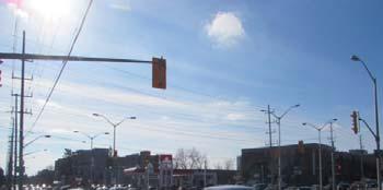
7 6. Existing Conditions Traffic Primary trip generating/destination areas: Springett parking lot Huron University College parking lot Average Daily Traffic Western Road 26,000 vehicles per day Sarnia Road 23,000 vehicles per day Pedestrian Traffic Mid-block pedestrian crossing volume is equal to the amount of pedestrian crossing at the Western Road/Sarnia Road intersection Level of Service intersection is operating over capacity at a level of service (LOS) D in the AM and LOS F in the PM. Acceptable operations are generally considered LOS A to C. Critical failure of a system occurs at LOS E & F. See Board #7 for further details Collisions (2011 to 2013) 19 mid-block collisions 54 intersection collisions 7 pedestrian/vehicle collisions
 at an intersection is determined by the amount of traffic delay.")
 and evening (PM).")

8 7. Existing Conditions Weekday AM Peak Hours Weekday PM Peak Hours Traffic Analysis Elgin Rd Huron College Western Rd ¹ Elgin Rd Elgin Rd Huron College Western Rd ¹ Elgin Rd The Level of Service (LOS) at an intersection is determined by the amount of traffic delay. LOS A Little or no delays LOS B Short traffic delays LOS C Average delays LOS D Long traffic delays LOS E Very long delays LOS F Extreme delays causing congestion. The current LOS along the study corridor is illustrated in these figures for the peak travel times: morning (AM) and evening (PM). Brescia Lane Lambton Ave Brescia Lane Lambton Ave Sarnia Rd Althouse College Western Rd Philip Aziz Ave Sarnia Rd Althouse College Western Rd Philip Aziz Ave Legend Turning Movements: Level of Service A Level of Service B Level of Service C Level of Service D Level of Service E Level of Service F Intersection: Level of Service A Level of Service B Level of Service C Level of Service D Level of Service E Level of Service F Platts Lane Platts Lane
 within 1 km of the study area.")
; 14 reptiles (including Spotted Turtle,")
.")
; 10 mussel species (including Fawnsfoot, Kidneyshell and Rainbow Mussel).")


9 8. Existing Conditions Natural Environment A desktop analysis was conducted to determine potential Species at Risk (SAR) within 1 km of the study area. The following species may occur within the study area: Terrestrial Species* 9 breeding birds (including Bank Swallow, Barn Swallow and Bobolink); 14 reptiles (including Spotted Turtle, Queensnake and Blanding s Turtle); 8 bats (including Little Brown Myotis and Northern Long-eared Myotis). Aquatic Conditions* 10 fish species (including Gravel Chub, Eastern Sand Darter and Black Redhorse); 10 mussel species (including Fawnsfoot, Kidneyshell and Rainbow Mussel). Woodland Area Barn Swallow Eastern Sand Darter Little Brown Myotis The woodland located southeast of the Western Road/Sarnia Road intersection contains the following vegetation: Manitoba Maple. Black Walnut, Wild Mustard, Common Buckthorn, Hackberry A small cattail wetland also occurs. Tree Assessment A boulevard tree inventory and assessment was conducted and evaluated 130 trees along the study corridor. Most trees were found to be in fair to good condition. Common Buckthorn * Majority of these species are associated with the Thames River corridor. Wild Mustard


10 9. Existing Conditions Archaeological Assessment Stage 1 archaeological assessment: High potential for the recovery of Aboriginal and Euro-Canadian archaeological resources within parts of the study area. Stage 2 study will be required for lands outside of the disturbed road allowance. Brescia University College Cultural & Built Heritage Resources The study area contains the following cultural & built heritage resources: One designated heritage property (Philip Aziz) Four listed properties: Brescia University College Huron University College Cronyn House Cronyn Hall Huron University College One additional historic feature (unmarked 19 th century Euro-Canadian cemetery) Cronyn House


11 10. Problem/Opportunity Statement Problems: Existing road/intersection experiences capacity or over capacity conditions; Traffic congestion, increased delays and decreasing level of service will result if untreated; Western Road/Sarnia Road intersection is currently operating at a low level of service; and Existing storm drainage system is not at current design standards. Existing conditions at Western Road & Sarnia Road Opportunities: Improve intersection turning movements; Provide additional road capacity by removing constraints; Provide continuity with Western Road north and south of the study area; Improve stormwater drainage; Improve intersection operations; Improve pedestrian and cyclist facilities; and Enhance streetscape conditions. Recent Western Road Improvements
12 11. Alternative Planning Solutions Planning solutions are alternatives that can implement the problems/opportunities identified on Board #10. The Planning Solutions for this project are identified below: 1. Do Nothing this alternative provides a basis to which other alternative planning solutions can be compared. 2. Expand Pedestrian, Bicycle, Transit Use - This alternative would involve diverting current traffic within the corridor from vehicles to pedestrian, bicycle and transit use. 3. Operational Improvements - This alternative would consider operational improvements to the intersection and study corridor (improved turning lanes, intersection signalization optimization). 4. Improvements to Parallel Roads - This alternative considers improvements to Wonderland Road, Platts Lane and Richmond Street to increase corridor capacity. 5. Improvements to Local Roads - This alternative would involve utilizing local roads (such as Brescia Lane or Kininvie Drive) to improve destination access. 6. Improvements along Philip Aziz Avenue - This alternative would involve widening Philip Aziz Avenue to provide improved traffic operations, sight distances, to build cycling facilities and adequately support pedestrian usage.
13 12. Summary of Evaluation Many alternatives are being considered to address problems and opportunities: Long List of Alternative Ideas Screening Result Alternatives for Further Study 1. Do Nothing Does not address the problem statement. Does not comply with 2030 TMP. 2. Expand Pedestrian, Bicycle, Transit Use Not possible for sufficient diversion to these modes of transportation to solely address the problem. 3. Operational Improvements Does not provide sufficient improvement to address the current rated capacity when carried forward as a sole solution. Does not prevent continued service degradation when carried forward as a sole solution. 4. Improvements to Parallel Roads Will not provide necessary capacity relief within the north/south corridor. Wonderland Road is outside of an acceptable proximity. Does not solve the local turning movement issue. 5. Improvements to Local Roads Supports Western University it Master Plan with a secondary collector. Diverts traffic away from Sarnia Road & Western Road. Direct route to Springett parking lot. 6. Improvements along Philip Aziz Avenue Addresses the problem statement. Complies with 2030 TMP. Will prevent continued service degradation. Not carried forward Carried Forward To be studied further in Phase 3 Carried Forward To be studied further in Phase 3 Not carried forward Carried Forward To be studied further in Phase 3 Carried Forward To be studied further in Phase 3


14 13. Recommended Solution The Recommended Planning Solution is a combination of : Alternative 2: Expand Pedestrian, Bicycle, Rapid Transit Use & Alternative 3: Operational Improvements & Alternative 5: Improvements to Local Roads & Alternative 6: Improvements along Philip Aziz Avenue These alternatives ti will be the basis upon which h alternative ti design concepts are developed d and evaluated.
15 HURON ST SHERWOOD AVE VICTORIA ST ST REGENT THE PARKWAY WHARNCLIFFE RD N CEDAR AVE 14. Alternative Planning Solutions HURON UNIVERSITY COLLEGE ENTRY ¹ Alternate routing to parking lots and secondary service road to future Western Master Plan buildings. WESTERN UNIVERSITY ENTRY qp nm qp Enhance ROW visual appeal by landscaping nm qp RAMSAY RD PHILIP AZIZ AVE nm BLOOMFIELD DR qp BRESCIA LANE ROLLINGWOOD CIR Improvements to Philip Aziz Avenue ROW and facilities nm KININVIE DR qp SARNIA RD STIRRUP CRT NEVILLE DR SLEIGHTHOLME AVE WESTERN RD Enhance operations for pedestrian bicycle and transit corridor Planning Solutions & Enhancements These potential solutions and enhancements will be the basis for design alternatives to be considered in Phase 3 of the study. FORD CRES COOMBS AVE EDGAR DR CHEPSTOW CLOSE CHEPSTOW GATE CASTLEGROVE BLVD CHESHAM CRT TAMBLYN DR CHESHAM GROVE CHESHAM AVE HOLLYWOOD CRES PLATT'S LANE FOX AVE SUFFOLK PL
16 15. What Happens Next? Spring 2015 Consider input from the public, agencies and stakeholders to confirm Preferred Solution Summer 2015 Determine Alternative Designs that t can implement the Preferred Solution Fall 2015 Hold PIC #2 to present the Recommended d Design Alternative Thank you for attending and participating in the study process. We encourage you to fill out a comment sheet provided and drop it in the comment box or send your comments by June 25, 2015 to either of the Project Managers listed below: Tony Fediw, P.Eng., Project Manager AECOM Canada 250 York Street, Suite 410 London ON, N6A 6K2 Tel: antony.fediw@aecom.com Karl Grabowski, P.Eng., Transportation ti Design Engineer The Corporation of the City of London 300 Dufferin Avenue London ON, N6A 4L9 Tel: Ext kgrabows@london.ca Public comments will be collected in accordance with the Freedom of Information and Protection of Privacy Act. With the exception of personal information, all comments will become part of the public record. Additional information is available on the City of London website:
Bostwick Road. Municipal Class Environmental Assessment. October 13, City of London. Bostwick Road Municipal Class Environmental Assessment
 Bostwick Road Municipal Class Environmental Assessment October 13, 2016 Welcome! Welcome to the first Public Information Centre for the Bostwick Road Municipal Class Environmental Assessment. Representatives
Recreational Pathway Crossing of Richmond Street Municipal Class Environmental Assessment. Public Information Centre #2 April 22, 2015
 Recreational Pathway Crossing of Richmond Street Municipal Class Environmental Assessment Public Information Centre #2 April 22, 2015 1. Study Process PHASE 1 PHASE 2 PHASE 3 PHASE 1 : Problem/Opportunity
Western Road/Wharncliffe Road North Widening from Platts Lane to Oxford Street. Municipal Class Environmental Assessment Public Information Centre #1
 Western Road/Wharncliffe Road North Widening from Platts Lane to Oxford Street Municipal Class Environmental Assessment Public Information Centre #1 June 11, 2014 Welcome Welcome to the first Public Information
Bostwick Road. Municipal Class Environmental Assessment. Public Information Centre #2 June 14, City of London
 Bostwick Road Municipal Class Environmental Assessment Public Information Centre #2 June 14, 2017 Welcome! Welcome to the 2 nd Public Information Centre for the. Representatives from the and the consulting
Portage Parkway Environmental Assessment Public Information Centre No. 1
 City of Vaughan Portage Parkway Environmental Assessment Public Information Centre No. 1 November 25, 2015 Welcome to the Public Information Centre This first Public Information Centre (PIC) introduces
Mavis Road Class Environmental Assessment
 Mavis Road Class Environmental Assessment Public Information Centre #2 Wednesday November 9, 2016 6:00 to 8:00 p.m. Please sign in and complete a comment sheet Review the displays on your own or join in
Heritage Road Improvements from Steeles Avenue to Rivermont Road
 The Corporation of the City of Brampton Heritage Road Improvements from Steeles Avenue to Rivermont Road Class Environmental Assessment Study (Schedule C) September 19, 2013 The Corporation of the City
Commissioners Road West Realignment Environmental Assessment
 City of London Commissioners Road West Realignment Environmental Assessment Public Information Centre No. 1 March 30, 2017 Welcome to the Public Information Centre This first Public Information Centre
City of Cornwall Municipal Class Environmental Assessment. Proposed Improvement and Extension of Lemay Street
 Welcome City of Cornwall Municipal Class Environmental Assessment Proposed Improvement and Extension of Lemay Street Redevelopment and Design of the Municipal Works Yard Public Information Centre #1 Thursday,
Public Information Centre #1
 and Highway 401 Interchange Improvements WELCOME Public Information Centre #1 Veterans Memorial Parkway Extension and Highway 401 Interchange Improvements Study May 23, 2012 4 p.m. to 7 p.m. Brief Overview
FANSHAWE PARK ROAD/RICHMOND STREET INTERSECTION IMPROVEMENTS. PUBLIC INFORMATION CENTRE 2 June 16, 2016
 FANSHAWE PARK ROAD/RICHMOND STREET INTERSECTION IMPROVEMENTS Municipal Class Environmental Assessment PUBLIC INFORMATION CENTRE 2 June 16, 2016 ACCESSIBILITY Under the Accessibility Standards 2015 for
Commissioners Road West Realignment Environmental Assessment
 City of London Commissioners Road West Realignment Environmental Assessment Public Information Centre No. 2 November 29, 2017 Welcome to the Public Information Centre This 2 nd Public Information Centre
Highway 427 Industrial Secondary Plan Area 47 Schedule C Class Environmental Assessment For Arterial Roadways
 Welcome to Pubic Information Centre #1 Highway 427 Industrial Secondary Plan Area 47 Schedule C Class Environmental Assessment For Arterial Roadways Welcome to Open House # 1 Tonight, we invite you to.
St. Clair Avenue West Area Transportation Master Plan
 1 (Between Keele Street and Old Weston Road) Public Information Centre 1 December 2, 2015 2 Welcome Welcome to the first Public Information Centre for the St. Clair Avenue West Area. The panels will present
Municipal Class EA Study Public Information Centre No. 1 December 13, :00 pm 7:00 pm. Please sign in so we can keep you updated on this study
 Reconstruction of Regional Road 45 (Creek Road) Between Regional Road 27 (River Road) and Regional Road 63 (Canborough Road) in the Township of Wainfleet Municipal Class EA Study Public Information Centre
Better Cycling. The City will update the cycling master plan (London ON Bikes) based on the approved BRT network.
 based on the approved BRT network.") Better Cycling Dedicated bike facilities will be constructed along BRT corridors where space is available. Nearby bike routes will also be upgraded to ensure a complete network is available for cyclists.
Better Cycling Dedicated bike facilities will be constructed along BRT corridors where space is available. Nearby bike routes will also be upgraded to ensure a complete network is available for cyclists.
WILLIAM STREET STORM SEWER OUTFALL. PUBLIC INFORMATION CENTRE March 23, 2017
 WILLIAM STREET STORM SEWER OUTFALL Municipal Class Environmental Assessment PUBLIC INFORMATION CENTRE March 23, 2017 ACCESSIBILITY Under the Accessibility Standards 2015 for Customer Service Regulation
City of Toronto. Emery Village Transportation Master Plan
 City of Toronto Emery Village Transportation Master Plan May 2009 Emery Village Transportation Master Plan Toronto, ON May 2009 Consulting Inc. 100 York Blvd., Suite 300 Richmond Hill, ON L4B 1J8 Tel:
GEOMETRIC IMPROVEMENTS AND WATERMAIN LOOPING MUNICIPAL CLASS ENVIRONMENTAL ASSESSMENT
 GEOMETRIC IMPROVEMENTS AND WATERMAIN LOOPING MUNICIPAL CLASS ENVIRONMENTAL ASSESSMENT Veterans Way (previously Powerline Road) and Klondike Park Road Wasaga Beach Welcome Please sign in Take a comment
Public Information Centre. Welcome
 Transportation Improvements from the Beaver Creek Bridge to the Entrance of Santa s Village District of Muskoka Municipal Class Environmental Assessment Welcome Please sign in Take a comment sheet Staff
Shift Rapid Transit Public Participation Meeting May 3, 2017
 Shift Rapid Transit Public Participation Meeting May 3, 2017 Shift Rapid Transit Initiative Largest infrastructure project in the city s history. Rapid Transit initiative will transform London s public
WELCOME TO OPEN HOUSE # 3
 Bayview Avenue Class Environmental Assessment Study Steeles Avenue to Elgin Mills Road WELCOME TO OPEN HOUSE # 3 Please sign in and join our mailing list Why Are We Here Tonight? Study Process and Purpose
Appendix B-13: Community Stakeholders Group Meeting Materials and Minutes
 Appendix B-13: Community Stakeholders Group Meeting Materials and Minutes PREPARED BY IBI Group and WSP London s Rapid Transit Initiative Community Stakeholder Group Meeting Summary Report for October
12 AMENDMENT NO. 149, TOWN OF MARKHAM HIGHWAY 404 NORTH SECONDARY PLAN
 12 AMENDMENT NO. 149, TOWN OF MARKHAM HIGHWAY 404 NORTH SECONDARY PLAN The Planning and Economic Development Committee recommends the adoption of the recommendation contained in the following report August
WELCOME TO OPEN HOUSE TWO November 28, 2018
 Langstaff Road Weston Road to Highway 7 Class Environmental Assessment Study WELCOME TO OPEN HOUSE TWO November 28, 2018 Please sign in and join our mailing list Study Overview York Region is conducting
Blackfriars Bridge Municipal Class Environmental Assessment. Public Information Centre #1 November 19 th, 2014
 Blackfriars Bridge Municipal Class Environmental Assessment Public Information Centre #1 November 19 th, 2014 Why are you here tonight? To determine the future requirements of the river crossing at Blackfriars
Public Information Centre No. 1 King-Vaughan Road Bridge Replacement Municipal Class Environmental Assessment City of Vaughan
 Public Information Centre No. 1 King-Vaughan Road Bridge Replacement Municipal Class Environmental Assessment City of Vaughan Date: April 7, 2016 Location: Al Palladini Community Centre, Meeting Room #1
Adelaide Street / Canadian Pacific Railway (CPR) Grade Separation. Public Information Centre #1
 Grade Separation. Public Information Centre #1") 1 Adelaide Street / Canadian Pacific Railway (CPR) Why Are We Here? 2 The purpose of Public Information Centre (PIC) #1 is to: Introduce the study Provide the study background and context Identify the
1 Adelaide Street / Canadian Pacific Railway (CPR) Why Are We Here? 2 The purpose of Public Information Centre (PIC) #1 is to: Introduce the study Provide the study background and context Identify the
The Gore Road Queen Street East to Castlemore Road
 Municipal Class Environmental Assessment The Gore Road Queen Street East to Castlemore Road Public Open House # 1 Date: Thursday May 29, 2014 Time: 5:30pm to 8:30pm Location: Gore Meadows Community Centre
North York Centre South Service Road
 North York Centre South Service Road Municipal Class Environmental Assessment Addendum Potential Changes to Doris Avenue, Bonnington Place & Tradewind Avenue Study Summary (June 11, 2015) toronto.ca/nyc-south-road.
Rapid Transit Implementation Working Group September 14, 2017
 Rapid Transit Implementation Working Group September 14, 2017 BACKGROUND Council approved the Rapid Transit Master Plan and Updated Business Case on July 25, 2017. Approval of the RTMP confirmed the BRT
Bus Rapid Transit Backgrounder. December 2016
 Bus Rapid Transit Backgrounder December 2016 Background The City of London is completing the second stage of Shift, its public transit planning exercise. Shift, focuses on rapid transit, along with vehicular
Rapid Transit Implementation Working Group
 Rapid Transit Implementation Working Group October 12, 2017 1 Agenda 1. Consultation Update 2. Technical Work Update 3. LTC Rapid Transit Integration 4. Next Steps 2 Consultation Update 3 Consultation
The purpose of tonight s PIC is to:
 The purpose of tonight s PIC is to: Provide an overview of the work completed to date and a summary of the Class EA process being followed; Provide a summary of public input received so far, including
Station Street/Haig Road Extension Environmental Assessment (EA)Study. Welcome
Study. Welcome") Station Street/Haig Road Extension Environmental Assessment (EA)Study Welcome Welcome to this Public Information Centre (PIC) meeting. Please record your attendance and obtain a comment sheet at the registration
Station Street/Haig Road Extension Environmental Assessment (EA)Study Welcome Welcome to this Public Information Centre (PIC) meeting. Please record your attendance and obtain a comment sheet at the registration
Welcome to the Public Information Update for
 Welcome to the Public for 1 Tonight, we invite you to. Welcome to the Public 01 02 03 04 05 WelcomeL Sign-in and take a comment sheet Learn about the process. Review findings of previous studies. Learn
Appendix E: Evaluation of Network Alternatives - July 2017
 Appendix E: Evaluation of Network Alternatives - July 2017 1 Overview This Appendix provides information used in the corridor level screening and detailed corridor assessment. Corridor Level Screening:
WELCOME and introduction
 1 WELCOME and introduction Mobility Hub Locations within Burlington STUDY OVERVIEW STUDY OBJECTIVES The City of Burlington is developing four Area Specific Plans, one for each of Burlington s Mobility
Master Plan Class Environmental Assessment for Downtown Mississauga Road Improvements
 Master Plan Class Environmental Assessment for Downtown Mississauga Road Improvements Public Information Centre # 1 Wednesday June 25, 2014 5:30 p.m. to 8:00 p.m. Mississauga Civic Centre Great Hall Welcome
John M. Fleming Managing Director, Planning and City Planner. Old East Village Dundas Street Corridor Secondary Plan Draft Terms of Reference
 Report to Planning and Environment Committee To: From: Subject: Chair and Members Planning & Environment Committee John M. Fleming Managing Director, Planning and City Planner Old East Village Dundas Street
One River Environmental Assessment. Welcome!
 One River Environmental Assessment Welcome! One River Environmental Assessment Welcome to the One River Environmental Assessment Public Information Centre. Please explore each presentation area to learn
Vaughan Metropolitan Centre (VMC) Black Creek Renewal CLASS ENVIRONMENTAL ASSESSMENT
 Black Creek Renewal CLASS ENVIRONMENTAL ASSESSMENT") PUBLIC INFORMATION CENTRE Vaughan Metropolitan Centre (VMC) Black Creek Renewal Wednesday, May 10, 2017 6:00 p.m. to 8:00 p.m. Add photo Project Management, Environmental Assessment, Stormwater Management
PUBLIC INFORMATION CENTRE Vaughan Metropolitan Centre (VMC) Black Creek Renewal Wednesday, May 10, 2017 6:00 p.m. to 8:00 p.m. Add photo Project Management, Environmental Assessment, Stormwater Management
Appendix M4 - Part 1. Public Information Centre Summary Report. Appendix M4
 Appendix M4 - Part 1 Public Information Centre Summary Report Appendix M4 Public Information Centre Summary Report Sheridan Park Drive Municipal Class Environmental Assessment City of Mississauga R.J.
Lambeth Main Street Streetscape Improvements
 Lambeth Main Street Streetscape Improvements Open House October 5th, 2017 Agenda 1. Introduction 2. Project Background 3. Context 4. Project Objectives 5. Design Principles & Approach 6. Streetscape Design
Adelaide Street / Canadian Pacific Railway (CPR) Grade Separation Class Environmental Assessment. Public Information Centre 3
 Grade Separation Class Environmental Assessment. Public Information Centre 3") 1 Adelaide Street / Canadian Pacific Railway (CPR) Grade Separation Study Process and Purpose of PIC 3 2 Study Commencement February 2016 Phase 1: Problem and Opportunity Identify problems and opportunities
1 Adelaide Street / Canadian Pacific Railway (CPR) Grade Separation Study Process and Purpose of PIC 3 2 Study Commencement February 2016 Phase 1: Problem and Opportunity Identify problems and opportunities
CITY OF VAUGHAN EXTRACT FROM COUNCIL MEETING MINUTES OF JUNE 7, 2016
 Item 5, Report No. 26, of the Committee of the Whole (Working Session), which was adopted without amendment by the Council of the City of Vaughan on June 7, 2016. 5 MUNICIPAL CLASS ENVIRONMENTAL ASSESSMENT
TABLE OF CONTENTS Page
 TABLE OF CONTENTS Table of Contents Page 1 INTRODUCTION... 1-1 1.1 Introduction and Background... 1-1 1.1.1 Current Class Environmental Assessment Study... 1-1 1.2 Study Area (Section 1)... 1-3 1.3 Ontario
Burloak Drive Grade Separation
 Burloak Drive Grade Separation Transit Project Assessment Process Public Meeting #1 March 30, 2017 GO Lakeshore West Service Plan Weekday Rush Hour 15-minute, two-way service between Aldershot* and Union
PROJECT STATEMENT LOCATION/DESIGN PUBLIC HEARING. 19 th AVENUE NORTH EXTENSION PROJECT FROM SPRINGDALE DRIVE TO NORTH 2 ND STREET/U.S.
 PROJECT STATEMENT LOCATION/DESIGN PUBLIC HEARING 19 th AVENUE NORTH EXTENSION PROJECT FROM SPRINGDALE DRIVE TO NORTH 2 ND STREET/U.S. 67 HEARING LOCATION: ERICKSEN COMMUNITY CENTER 1401 11 TH AVENUE NORTH
SPECIAL COMMITTEE OF THE WHOLE DECEMBER 9, 2002 BLOCK 57/58 WEST BLOCK PLAN BLOCK PLAN FILE BL.57/58W.99 HUNTINGTON BUSINESS PARK LAND OWNERS
 SPECIAL COMMITTEE OF THE WHOLE DECEMBER 9, 2002 BLOCK 57/58 WEST BLOCK PLAN BLOCK PLAN FILE BL.57/58W.99 HUNTINGTON BUSINESS PARK LAND OWNERS Recommendation The Commissioner of Planning recommends: THAT
Dundas Place Flexible Street Public Information Centre
 WELCOME TO THE DUNDAS PLACE DESIGN REVEAL Dundas Place Flexible Street Public Information Centre November 8, 2017 This project is funded by the City of London with support from the Government of Canada
3.0 master plan concept
 3.0 master plan concept 3.1 introduction The purpose of the Huron Church Road Master Plan Concept is to provide an overview of the Master Plan design process, identify preliminary streetscape installations
Public Open House. Yonge Street and Bernard Avenue (Bernard KDA) Planning Study Update Town of Richmond Hill. March 30, 2017
 Planning Study Update Town of Richmond Hill. March 30, 2017") Public Open House Yonge Street and Bernard Avenue (Bernard KDA) Planning Study Update Town of Richmond Hill March 30, 2017 Open House Review of Project Purpose and Process Policy Refresher Highlights of
Public Open House Yonge Street and Bernard Avenue (Bernard KDA) Planning Study Update Town of Richmond Hill March 30, 2017 Open House Review of Project Purpose and Process Policy Refresher Highlights of
Introduction. Public Information Package. Project website. Overview. Class Environmental Assessment Process
 1 Introduction Public Information Package Baseline Road Extension between Lambs Road and Bennett Road, Bowmanville Schedule B Municipal Class Environmental Assessment November 6, 2017 Overview The purpose
Inform you of the purpose and scope of the study for PTH 100 and a proposed future St. Norbert Bypass;
 WELCOME The intent of today s Open House is to: Inform you of the purpose and scope of the study for PTH 100 and a proposed future St. Norbert Bypass; Review highway crossing locations, future access closures
Report to: Development Services Committee Report Date: April 24, 2017
 SUBJECT: Cornell Rouge National Urban Park Gateway - Report on Design Charrette and Next Steps PREPARED BY: Lilli Duoba, MES, MCIP, RPP, Manager, Natural Heritage (ext. 7925) REVIEWED BY: Marg Wouters,
Welcome. Community Consultation Meeting November 28, Review and discuss the Bathurst Quay Neighbourhood Plan Framework
 Welcome Community Consultation Meeting November 28, 2016 Why Are We Here Today? Review and discuss the Bathurst Quay Neighbourhood Plan Framework Review and discuss an Action Plan for Implementation Next
TOWN OF WHITBY REPORT RECOMMENDATION REPORT
 TOWN OF WHITBY REPORT RECOMMENDATION REPORT REPORT TO: Council REPORT NO: PL 95-09 DATE OF MEETING: October 13, 2009 PREPARED BY: Planning/Public Works Joint Report FILE NO(S): N/A LOCATION: N/A REPORT
London s Bus Rapid Transit System
 London s Bus Rapid Transit System HERITAGE WORKSHOP November 7, 2017 1 Agenda 1. Introductions 2. Overview of Transit Project Assessment Process 3. Archaeology and Heritage Approval Process 4. Role of
CHAIR AND MEMBERS CIVIC WORKS COMMITTEE MEETING ON AUGUST 13, 2018
 TO: FROM: SUBJECT: CHAIR AND MEMBERS CIVIC WORKS COMMITTEE MEETING ON AUGUST 13, 2018 KELLY SCHERR, P.ENG., MBA, FEC MANAGING DIRECTOR, ENVIRONMENTAL & ENGINEERING SERVICES AND CITY ENGINEER ADELAIDE STREET
SCTPO Project Summary September 2014
 A1A MULTIMODAL CORRIDOR PLANNING AND ENGINEERING ANALYSIS Florida Department of Transportation SCTPO Project Summary September 2014 PRESENTATION FOOTER Meeting Agenda What We Plan To Do Project Background
Coordinated Transit Planning in Toronto SmartTrack GO RER Scarborough Relief Line Waterfront Transit
 Coordinated Transit Planning in Toronto SmartTrack GO RER Scarborough Relief Line Waterfront Transit Public Information Centres February 2016 Transportation Planning Section City Planning Division Toronto
City of London Adelaide Street North - Canadian Pacific Railway Grade Separation Class Environmental Assessment Study Report
 Executive Summary ES1 Introduction The City of London has completed a Class Environmental Assessment (Class EA) study for the Adelaide Street North - Canadian Pacific Railway Grade Separation. While the
South Federal corridor improvements
 South Federal corridor improvements Welcome to the South Federal Green Infrastructure Project Public Open House October 25, 2018 The City and County of Denver Department of Public Works, in collaboration
Redevelopment of Ajax Plaza Area Public Open House Meeting February 19, 2015 Questions and Answers
 Redevelopment of Ajax Plaza Area Public Open House Meeting February 19, 2015 Questions and Answers Redevelopment of Ajax Plaza Area Why is the redevelopment of the Ajax Plaza important to the revitalization
2. Existing & Future Conditions
 LONDON S RAPID TRANSIT INITIATIVE MASTER PLAN PART I BACKGROUND Section 2 2. Existing & Future Conditions 2.0 Existing & Future Conditions LONDON S RAPID TRANSIT INITIATIVE MASTER PLAN 2.1 Socio-Economic
Environmental Study Report
 Environmental Study Report Britannia Road (Regional Road 6) Transportation Corridor Improvements The Regional Municipality of Halton TN1390TNA00 The Regional Municipality of Halton 1151 Bronte Road Oakville,
7 HIGHWAY 7 CORRIDOR AND VAUGHAN N-S LINK ENVIRONMENTAL ASSESSMENT RECOMMENDED ALIGNMENT
 7 HIGHWAY 7 CORRIDOR AND VAUGHAN N-S LINK ENVIRONMENTAL ASSESSMENT RECOMMENDED ALIGNMENT The Rapid Transit Public/Private Partnership Steering Committee recommends the adoption of the recommendations contained
PUBLIC OPEN HOUSE HURONTARIO-MAIN CORRIDOR SECONDARY PLAN
 PUBLIC OPEN HOUSE HURONTARIO-MAIN CORRIDOR SECONDARY PLAN Tuesday, February 28, 2012 6pm 9pm 1 st Floor Atrium, City Hall 2 Wellington Street West, Brampton 1 POLICY FRAMEWORK The 2006 Provincial Growth
Integration of Trees into Roads Policy - the road to success -
 Integration of Trees into Roads Policy - the road to success - Trees, People and the Built Environment 3 City of Birmingham, UK April 5 th, 2017 Ian Buchanan Natural Heritage and Forestry Regional Municipality
King-Spadina Secondary Plan Community Consultation Meeting. Michelle Knieriem, City Planner October 11, 2017
 King-Spadina Secondary Plan Community Consultation Meeting Michelle Knieriem, City Planner October 11, 2017 Agenda 6:30 Welcome 6:35 Presentation 7:15 Question and Answer Session 8:15 Closing Remarks HOW
Subarea 4 Indian Creek. Vision The combination of park networks and transportation amenities make Subarea 4 the greenest hub in the Corridor.
 indian creek 180 extends south from 101st Street to I-435. The I-435 and Metcalf intersection is one of the primary intersections in the Kansas City Metro Area. The area includes several residential neighborhoods
Baby Point Wastewater Pumping Station Forcemain Class Environmental Assessment Study
 Baby Point Wastewater Pumping Station Forcemain Class Environmental Assessment Study Public Drop-in Event 1 Thursday, October 12, 2017 6:00 p.m. to 8:00 p.m. Humbercrest United Church Welcome Welcome to
McKay Road Interchange and Salem / Lockhart Crossing
 McKay Road Interchange and Salem / Lockhart Crossing The McKay Road Interchange Class EA has two components: 1. A new MacKay Road Interchange at Highway 400; and 2. A new bridge crossing of Highway 400
ONLINE PUBLIC INFORMATION CENTRE
 ONLINE PUBLIC INFORMATION CENTRE County Road 17 Bridge Replacements Detail Design and Environmental Assessment GWP 4203-15-00 The Ministry of Transportation Ontario (MTO) has retained CH2M Hill and Dillon
Welcome. Walk Around. Talk to Us. Write Down Your Comments
 Welcome This is an information meeting introducing the applications for proposed redevelopment of the Yorkdale Shopping Centre site at 3401 Dufferin Street and 1 Yorkdale Road over the next 20+ years,
WELCOME CPT CORRIDOR AREA PROJECT BACKGROUND BROOKSIDE BLVD. The objectives of the CPT Functional Design Study included:
 1 WELCOME Welcome to the Public Information Session for the Functional Design Study of the Chief Peguis Trail Extension West from Main Street to Brookside Boulevard PROJECT BACKGROUND The objectives of
PD&E STUDY SR 9/I-95 FROM SOUTH OF SR 870/COMMERCIAL BOULEVARD TO NORTH OF CYPRESS CREEK ROAD FM # ETDM 14222
 PD&E STUDY SR 870/COMMERCIAL BOULEVARD TO NORTH OF CYPRESS CREEK ROAD FM # 435808-1-22-02 ETDM 14222 WELCOME TO THE KICK-OFF MEETING May 24, 2016 1 1 2 3 4 5 6 PLANNING PROJECT DEVELOPMENT AND ENVIRONMENT
Angeline Street North Corridor
 Public Information Centre Angeline Street North Corridor Colborne Street West to Roosevelt Street Town of Lindsay Municip l Cl ss Environment l Assessment Febru ry 28 th, 2019 4:30 p.m. to 6:30 p.m. Welcome
This Review Is Divided Into Two Phases:
 Semiahmoo Town Centre Review The purpose of this review: To review the Semiahmoo Town Centre Concept Plan, originally approved in 1993, to ensure that this centre will continue to serve the needs of South
M E M O R A N D U M. Chair and Members of North West Planning Advisory Committee
 Item 9.1.1 PO Box 1749 Halifax, Nova Scotia B3J 3A5 Canada M E M O R A N D U M TO: FROM: Chair and Members of North West Planning Advisory Committee Stephanie Salloum, Planner II DATE: June 26, 2017 SUBJECT:
DETROIT RIVER INTERNATIONAL CROSSING STUDY. Walpole Island First Nations Meeting December 13, 2007
 DETROIT RIVER INTERNATIONAL CROSSING STUDY Walpole Island First Nations Meeting December 13, 2007 Agenda Study Status Results from August 2007 Public Information Open House Overview of the Parkway Alternative
1.0 INTRODUCTION AND BACKGROUND
 1.0 INTRODUCTION AND BACKGROUND 1.1 INTRODUCTION / BACKGROUND The Regional Municipality of York (hereafter referred to as York Region ) has completed a Municipal Class Environmental Assessment (Class EA)
Potential Green Infrastructure Strategies May 6, 2015 Workshop
 Potential Green Infrastructure Strategies May 6, 2015 Workshop Background The City of Cortland is developing the Tioughnioga Urban Headwaters Green Infrastructure Action Plan with funding from the National
Public Meeting #3 May 9, 2009 MVVA Team
 Public Meeting #3 May 9, 2009 MVVA Team Welcome to the third Public Meeting for the Lower Don Lands Municipal Class Environmental Assessment (EA) Infrastructure Master Plan and Keating Channel Precinct
Purpose of Open House #3
 Public Meeting #3 May 9, 2009 MVVA Team Purpose of Open House #3 The main purpose of this Open House is to present and seek input on the: Evaluation of transportation and infrastructure design alternatives
Memorandum CITY OF DALLAS. Riverfront Boulevard Design From Continental Avenue to Cadiz Street
 Memorandum DATE November 10, 2011 CITY OF DALLAS TO Trinity River Corridor Project Committee Members: Vonciel Jones Hill (Chair) Linda Koop (Vice Chair), Monica Alonzo, Scott Griggs, Angela Hunt, and Delia
East River Waterfront Esplanade and Piers New York, New York Draft Environmental Impact Statement
 East River Waterfront Esplanade and Piers New York, New York Draft Environmental Impact Statement October 12, 2006 CEQR No.: TO COME ULURP Nos.: TO COME Lead Agency: Lower Manhattan Development Corporation
3.10 Network Assessment and Business Case
 LONDON S RAPID TRANSIT INITIATIVE MASTER PLAN 3.10 Network Assessment and Business Case The network alternatives were assessed using the multi-disciplinary list of criteria and measures detailed in Exhibit
Glenborough at Easton Land Use Master Plan
 Vision Statement Sunrise Blvd. Hazel Ave. Prairie City Rd. Gencorp Property Lincoln Regional Airport 1.0 VISION STATEMENT The identifies City of the principles, goals, policies, and standards Lincoln that
Public Information Centre # 2 Coronation Park Drainage Improvements Town of Oakville Municipal Class Environmental Assessment
 November 26, 2014 Public Information Centre # 2 Coronation Park Drainage Improvements Town of Oakville Municipal Class Environmental Assessment Study Area & Drainage System Legend Coronation Project Park
Planning Division Case Report
 Planning Division Case Report SE17-0006 Review Date: June 2, 2017 Property Owner: Applicant: SB-Vets-1, LLC SB-Vets-1, LLC Owner Address: 900 SW Pine Island Road, Suite 202 Cape Coral, FL 33991 Authorized
Master Environmental Servicing Plan & Secondary Plan
 East Side Lands Stage 2 1 Master Environmental Servicing Plan & Secondary Plan Public Information Centre #1 June 16, 2016 Welcome! Today s Agenda Please sign in at the front desk. 5:30 pm 6:30 pm: Open
Scope of Services. River Oaks Boulevard (SH 183) Corridor Master Plan
 Corridor Master Plan") Scope of Services River Oaks Boulevard (SH 183) Corridor Master Plan PROJECT AREA The project area consists of the River Oaks Boulevard (SH 183) corridor bounded by SH 199 at the northern end and the Trinity
Scope of Services River Oaks Boulevard (SH 183) Corridor Master Plan PROJECT AREA The project area consists of the River Oaks Boulevard (SH 183) corridor bounded by SH 199 at the northern end and the Trinity
Welcome. Northern Segment of Hwy 100 I-90 to South of Madison Street Meeting Goals:
 Welcome Northern Segment of Hwy 100 I-90 to South of Madison Street Meeting Goals: - Review Environmental Assessment - Share Preferred Alternative -Receive Public Comments 2003 EA Preferred Alternative
Table of Contents. Executive Summary...S-1
 Table of Contents Executive Summary...S-1 1: Project Description... 1-1 A. Project Identification... 1-1 B. Background to the Proposed Project... 1-5 C. Description of the Project Site... 1-8 D. Description
MAYFIELD WEST SECONDARY PLAN PHASE 2
 MAYFIELD WEST SECONDARY PLAN PHASE 2 Council Information Workshop February 16, 2010 Draft Preferred Land Use Plan TOWN OF CALEDON PLANNING & DEVELOPMENT DEPARTMENT Workshop Agenda TOWN OF CALEDON 1. Welcome
Key Moves in the Plan
 Key Moves in the Plan 2 Add housing that fits the neighbourhood s character Make it easier to leave the car behind Oak Bay Avenue Village plan to be completed in future planning process Future active transportation
URBAN DESIGN BRIEF. Saginaw Subdivision 124 SAGINAW PARKWAY, CAMBRIDGE OCTOBER 2015 OUR FILE 1422A
 URBAN DESIGN BRIEF Saginaw Subdivision 124 SAGINAW PARKWAY, CAMBRIDGE OCTOBER 2015 OUR FILE 1422A Contents 1.0 INTRODUCTION AND SITE DESCRIPTION... 1 2.0 MUNICIPAL DESIGN DIRECTION... 7 3.0 MASTER CONCEPT
California Environmental Quality Act (CEQA) Environmental Review Process
 Environmental Review Process") California Environmental Quality Act (CEQA) Environmental Review Process Los Angeles Union Station Forecourt and Esplanade Improvements constitute a Project Los Angeles County Metropolitan Transportation
California Environmental Quality Act (CEQA) Environmental Review Process Los Angeles Union Station Forecourt and Esplanade Improvements constitute a Project Los Angeles County Metropolitan Transportation