Secrest Short Cut and Monroe Expressway Small Area Plan AUGUST 29, 2018
|
|
|
- Erick Poole
- 5 years ago
- Views:
Transcription
1 Secrest Short Cut and Monroe Expressway Small Area Plan AUGUST 29, 2018

2 Background and Process Monroe Expressway will be open by the end of 2018 Union County and Indian Trail identified a need to revisit recommended land uses and other related issues in vicinity of interchange A joint plan was developed with the assistance of Gresham, Smith and Partners; and Centralina Council of Governments A Steering Committee provided local knowledge, recommendations, and review of the overall process The public was engaged through an online survey and two community meetings Indian Trail and Union County planning boards and governing boards will be asked to recommend and approve the plan. 8/29/2018 2

3 Study Area 1,323 acres (approximately two square miles) Bisected by the Monroe Expressway and Sardis Church/Unionville-Indian Trail Road Less than 10% is considered developed 99% of development is residential 25% is used for agriculture Approximately 230 parcels 8/29/2018 3

4 Local Jurisdictions Indian Trail is responsible for the majority of land in the study area, and Hemby Bridge has a small portion in the northern end Monroe and Lake Park are adjacent Only Indian Trail and Union County will take action to approve the plan 8/29/2018 4
 calls for multi-lane Secrest Short Cut Road and Sardis Church/Unionville- Indian Trail Road 8/29/2018")
5 Transportation Plans Interchange with Expressway is focal point for future growth Faith Church intersection will be improved, but no other improvements are funded Comprehensive Transportation Plan (CTP) calls for multi-lane Secrest Short Cut Road and Sardis Church/Unionville- Indian Trail Road 8/29/2018 5

6 Current Zoning Most land use currently zoned for one acre lot residential Very little employment/commercial zoned land exists 8/29/2018 6

7 Utilities Union County water and sewer are available in most parts of study area City of Monroe able to serve southern end of study area 8/29/2018 7

8 Environmental Features Floodplains and streams are found throughout the study area Hydric soils adjacent to floodplains 8/29/2018 8


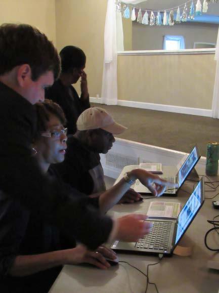
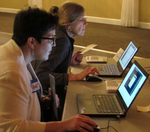
9 Open House #1 Summary February 22 nd, The Carriage House Purpose Learn about the project Review maps Complete survey Ask staff questions and share comments 122 participants 26 hard-copy surveys completed 8/29/2018 9


10 Open House #1 Summary Survey Results Bike and pedestrian facilities desired Safety issues accessing Crooked Creek Park Mixed comments for more/less parks & recreation Office space desired Mixed comments for industrial development No more homes was a common theme / overbuilt Senior center desired Protect family farms More places to shop/eat desired Intersection improvements desired Connections to transit desired 8/29/
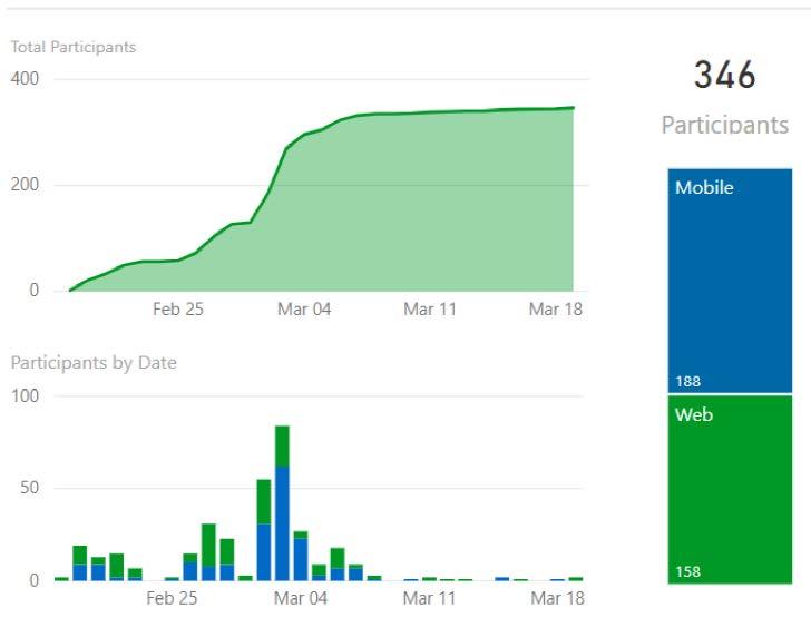
11 MetroQuest Summary 8/29/


12 MetroQuest Summary Demographics Age Range ~45% = years old ~35% = years old ~19% = 65 years and older ~1% = years old Zip Code ~75% = ~20% = Others = 28104, 28111, Years of Residence 8/29/


13 MetroQuest Summary Places to Shop & Eat Scale: 1=Top Priority, 5=Lowest Priority 8/29/
14 Issue and Opportunities Multiple Jurisdictions - Three local governments that control land use, zoning and development policies in their jurisdictions - Indian Trail, Hemby Bridge and Union County - Monroe and Lake Park adjacent to study area Residual Parcels - Parcel size - Unusual shaped parcels Noise - Proximity to expressway and adjacent roadways - Compatible land uses Mobility - Changes in travel patterns - Increased traffic - Pedestrian and bicycle needs 8/29/
15 Issues and Opportunities Growth and Public Perception - Continued growth in the area - Change in community character - Need for new facilities - Desire to limit/control growth Regional Access - Opening of Monroe Expressway - Interchange at Unionville-Indian Trail Road Economic Development - New accessibility via the Monroe Expressway - Need to balance tax base Housing Options - Introduce a mix of housing options/types - Supply empty nester and young professional housing needs Mixed-Use Center - Allow a well designed, walkable integrated development 8/29/

16 Land Use Scenarios Employment Mixed-Use Low Density 8/29/
17 Land Use Scenario Comparisons (Buildout Potential) Land Use Scenario Comparisons (Buildout potential) Dwelling Units Low Density Dwelling Units Medium Density Dwelling Units High Density Dwelling Units Non-Residential Square Footage Existing Zoning 1,497 1, ,000 Existing Land Use Plans Low Density Land Use Scenario Mixed-Use Land Use Scenario Employment Land Use Scenario 2,870-1,397 1,473 1,065,000 2, , ,340,000 2, , ,360,000 2, , ,250,000 Notes: Non-residential calculated at 10,000 square feet per acre. Dwelling units are based on gross acreage yields. 8/29/
18 Land Use Scenarios Employment Emphasis on locations for employment based units Mixed use and higher density residential transitions to medium and lower density residential Nonresidential uses could double to appox. 2.3M sqft from baseline Potential residential units would decrease by ~500 units Issues & Opportunities Economic Development Mobility Regional Access Multiple Jurisdictions 8/29/

19 Land Use Scenarios Mixed Use Focus on mixed-uses at and around the interchange Slight increase in potential residential units (less than 60 units) Increases non-residential footprint (300,000 sq ft) Employment corridor b/t Faith Church Rd. and Unionville-Indian Trail Road Consistent with Hemby Bridge Land Use Plan Issues & Opportunities Economic Development Mixed-Use Center Housing Options Residual Parcels Regional Access 8/29/
20 Land Use Scenarios Lower Density Potential residential units would decrease by ~750 units Maintains rural character Limited employment introduced in northern section of study area Issues & Opportunities Residual Parcels Growth and Public Perception Housing Options 8/29/

21 Public Engagement Open House # 2 2 nd Open House May 31 5:00 7:00 PM Indian Trail Town Hall By the numbers 50 individual participants; not including staff 22 hard-copy surveys completed 8/29/


22 Recommended Land Use Plan Recommended Land Use Scenario (Buildout potential) Dwelling Units Low Density Dwelling Units Medium Density Dwelling Units High Density Dwelling Units Non-Residential Square Footage Existing Zoning 1,497 1, ,000 Existing Land Use Plans Recommended Land Use Scenario 2,870-1,397 1,473 1,065,000 2, , ,970,000 Notes: Non-residential calculated at 10,000 square feet per acre. Dwelling units are based on gross acreage yields. On the recommended plan, low density is calculated at 1.5 du/acre to reflect bonus density for clustering 8/29/
23 Plan Implementation/Implementation Strategies GOAL 1: CREATE A LIVABLE, DESIRABLE COMMUNITY WHERE A VARIETY OF HOUSING OPTIONS ARE AVAILABLE IN THE AREA Strategy 1.1: Support rezoning of properties in accordance with the plan recommendations to allow for attached single family and multifamily units. Strategy 1.2: Require the clustering of single family developments throughout the study area either through the rezoning and/or the subdivision process to preserve the environmentally sensitive areas, locations with hydric soils or forested areas. Strategy 1.3: Require connectivity for all modes within developments and to adjacent developable properties. 8/29/
24 Plan Implementation/Implementation Strategies GOAL 2: ACCOMMODATE COMMERCIAL AND RETAIL OPPORTUNITIES PER THE RECOMMENDED LAND USE MAP TO SUPPORT THE LOCAL POPULATION OF THE AREA AND ATTRACT CONSUMERS TRAVERSING THE COUNTY ON THE MONROE EXPRESSWAY. Strategy 2.1: Support rezoning of properties to retail uses as identified on the land use plan that are well designed within the mixed-use areas to complement the mix of uses and capture retail sales in the area. Strategy 2.2: Support service industry uses within the area to support existing and future residents and create local jobs. The location of these uses should be tied to the services they provide and their market area. 8/29/
25 Plan Implementation/Implementation Strategies GOAL 3: PROVIDE FOR EMPLOYMENT BASED USES TO BRING NEW JOBS TO THE AREA Strategy 3.1: Support rezoning for light industrial, flex space or office uses in the areas between the Monroe Expressway and Secrest Short Cut Road. Strategy 3.2: Require project development to mitigate noise impacts from the expressway and to provide for an attractive viewshed from both the expressway and Secrest Short Cut Road. This can be accomplished through building design, placement and appropriate landscaping measures. GOAL 4: CREATE A SENSE OF PLACE IN IDENTIFIED MIXED USE AREAS Strategy 4.1: Encourage density and a mix of uses in identified mixed use areas. Strategy 4.2: Require community amenities and gathering places in identified mixed use areas. Strategy 4.3: Focus adjacent residential density close to mixed use areas. 8/29/
26 Plan Implementation/Implementation Strategies GOAL 5: RETAIN NATURAL FEATURES AND ENVIRONMENTAL PROTECTION Strategy 5.1: Utilize bioswales and other techniques to reduce runoff and control stormwater in all development types. Strategy 5.2: Mandate the use of the stricter Indian Trail stormwater standards, regardless of boundary. Strategy 5.3: Focus open space preservation on forested areas and areas with hydric soils. Strategy 5.4: Require enhanced setbacks and landscaping along areas of particular concern. 8/29/
27 Plan Implementation/Implementation Strategies GOAL 6: PROVIDE INCENTIVES TO DEVELOPERS TO OFFSET REQUIRED IMPROVEMENTS AND CREATE THE VISION CALLED FOR IN THIS PLAN THROUGH THEIR RESPECTIVE DEVELOPMENTS. Strategy 6.1: Allow a density bonus to residential developments that cluster to protect natural features. Strategy 6.2: Require consistent improvements (within both jurisdictions) to build sidewalks, multi-use paths or needed transportation improvements including ROW and/or construction. Strategy 6.3: Require traffic impact analysis for rezoning and development proposals to identify needed internal and external multi-modal improvements. Strategy 6.4: Indian Trail and Union County should jointly review and comment on proposed developments within the Secrest Short Cut Road Small Area Plan Study Area. This continued coordination between the two jurisdictions will help address and coordinate improvements to traffic, stormwater and other issues common to both. 8/29/
28 Plan Implementation/Implementation Strategies GOAL 7: PROVIDE FOR BICYCLE AND PEDESTRIAN IMPROVEMENTS THROUGHOUT THE STUDY AREA. Strategy 7.1: Implement pedestrian and bicycle improvements through the development process and supplement where necessary with publicly funded capital projects for the following roadways. o Tactic 7.1.1: Secrest Short Cut Road sidewalks and multi-use path. Both sides of street separated from roadway by a landscaped strip. o Tactic 7.1.2: Unionville-Indian Trail sidewalks. Both sides of street separated from roadway by a landscaped strip. o Tactic 7.1.3: Poplin Road sidewalks. Both sides of street separated from roadway by a landscaped strip. o Tactic 7.1.4: Faith Church Road sidewalks. Continue cross-section existing in Lake Park. o Tactic 7.1.5: Scott Long Road sidewalks. Both sides of street separated from roadway by a landscaped strip. o Tactic 7.1.6: South Fork Crooked Creek Greenway multi use path. o o Tactic 7.1.7: Extend proposed Crooked Creek Greenway with multi use path to Crooked Creek Park. Tactic 7.1.8: Implement a multi-use path on north side of expressway connecting Bonterra Village area to South Fork of Crooked Creek. The proposed trail creates a better inter-connected recreational network by connecting neighborhoods to the Crooked Creek greenway and eventually the existing Crooked Creek Park. 8/29/
29 Plan Implementation/Implementation Strategies GOAL 8: PROVIDE AN INTEGRATED, WELL-CONNECTED ADEQUATE CAPACITY ROADWAY SYSTEM THROUGHOUT THE STUDY AREA. Strategy 8.1: Perform a traffic analysis of intersections and roadway segments in the study area and beyond approximately six months after the opening of the Monroe expressway. Updated traffic counts and turning movements should be conducted prior to the analysis to confirm the changes in travel behavior due to the new expressway facility. Strategy 8.2: Prioritize identified improvements needed as a result of the traffic analysis and seek funding for improvements through CRTPO, NCDOT, the Town of Indian Trail and Union County. Strategy 8.2: Continue to advocate for the widening of Secrest Short Cut Road through the study area. This roadway is identified as a boulevard that needs improvement on the CTP. As such it should be widened to multi lanes with a planted median and turn lanes where appropriate. Strategy 8.3: Advocate for the widening of Unionville-Indian Trail Road to a 4-lane boulevard cross section from Sardis Church Road to Rocky River Road. Strategy 8.4: Advocate for the widening of Rocky River Road to a 4-lane boulevard cross section from US 74 to Unionville- Indian Trail road. Strategy 8.5: Through the development process, require connectivity wherever possible with local roads that will supplement to overall roadway network. 8/29/
30 Conclusion The Secrest Short Cut Small Area Plan recommendations and implementation strategies will: 1. Create a sense of place 2. Support a more balanced tax base with employment and retail 3. Capture local retail opportunities to support the local economy 4. Connect parks and open space in the community. 5. Through implementation of the plan, this area near the Monroe Expressway interchange at Unionville-Indian Trail Road will reach the goals established through public engagement, reflect community priorities and guide economic development opportunities in the changing landscape. 8/29/
31 Adoption Process and Timeframe Town of Indian Trail 1. August 21: Planning Board recommended approval of the plan 2. September 25: Town Board consider approving plan Union County 1. September 11: Planning Board consider recommending plan 2. October 1: County Commission consider approving plan 8/29/
BROOKHILL NEIGHBORHOOD MODEL ZONING MAP AMENDMENT PREFACE TO APPLICATION
 BROOKHILL NEIGHBORHOOD MODEL ZONING MAP AMENDMENT PREFACE TO APPLICATION June 15, 2015 Revised: August 1, 2016 I. VISION Brookhill is a proposed community based upon the principles of Albemarle County
DOMINION BOULEVARD CORRIDOR STUDY AND ECONOMIC DEVELOPMENT STRATEGIC PLAN A MODEL FOR CHESAPEAKE S FUTURE
 DOMINION BOULEVARD CORRIDOR STUDY AND ECONOMIC DEVELOPMENT STRATEGIC PLAN A MODEL FOR CHESAPEAKE S FUTURE Overview I. Draft Plan Process II. Draft Plan Overview a. Market Analysis b. Master Land Use Plan
Implementation Guide Comprehensive Plan City of Allen
 Implementation Guide 2030 Comprehensive Plan City of Allen DRAFT 2015 Implementation Guide Allen 2030 Comprehensive Plan INTRODUCTION The Comprehensive Plan serves as a guide for the growth and development
Ten Mile Creek Planning Area
 PLANNING AREA POLICIES TEN MILE CREEK Ten Mile Creek Planning Area Location and Context The Ten Mile Creek Planning Area ( Ten Mile Creek area ) is located south of the current Boise AOCI, generally south
MORRISVILLE TRANSPORTATION PLAN TOWN COUNCIL PRESENTATION AUGUST 22, 2017
 TOWN COUNCIL PRESENTATION AUGUST 22, 2017 SCENARIO PLANNING CORRIDORS Town Hall Drive Baseline + 2 McCrimmon Parkway Baseline + 2 NC 54 Baseline + 2 7 subregion model runs determining carrying capacity
Scope of Services. River Oaks Boulevard (SH 183) Corridor Master Plan
 Corridor Master Plan") Scope of Services River Oaks Boulevard (SH 183) Corridor Master Plan PROJECT AREA The project area consists of the River Oaks Boulevard (SH 183) corridor bounded by SH 199 at the northern end and the Trinity
Scope of Services River Oaks Boulevard (SH 183) Corridor Master Plan PROJECT AREA The project area consists of the River Oaks Boulevard (SH 183) corridor bounded by SH 199 at the northern end and the Trinity
Status Report: MD 355 Project
 Status Report: MD 355 Project OCTOBER 2006 M-NCPPC MONTGOMERY COUNTY PLANNING DEPARTMENT Summary of Community Comments, and break to the Results of the MD 355 Participation Session Brookside Gardens -
CHAPTER 7: VISION AND ACTION STATEMENTS. Noble 2025 Vision Statement
 CHAPTER 7: VISION AND ACTION STATEMENTS This chapter presents the vision, policy and action statements that transform the comprehensive planning study, an analysis of Noble s past, future trends and community
Executive Summary. NY 7 / NY 2 Corridor
 Executive Summary NY 7 / NY 2 Corridor Transportation and Land Use Study December 2005 Prepared for: Town of Colonie Capital District Transportation Committee Prepared by: Introduction: Land use decisions
CHAPTER 7: Transportation, Mobility and Circulation
 AGLE AREA COMMUNITY Plan CHAPTER 7 CHAPTER 7: Transportation, Mobility and Circulation Transportation, Mobility and Circulation The purpose of the Transportation, Mobility and Circulation Chapter is to
Description of Preferred Alternative
 Chapter 2 Description of Preferred Alternative 2.1 Introduction This chapter of the programmatic Sammamish Town Center Sub-area Plan Final EIS provides a more detailed description of the Preferred Alternative
Proposed Comprehensive Plan Strategies DRAFT for discussion June 28, 2017
 Proposed Comprehensive Plan Strategies DRAFT for discussion June 28, 2017 Land Use Rural Areas Refine the Farm and Forest area (FF) Update FF boundaries to account for existing lots less than five acres
The Five Components of the McLoughlin Area Plan
 The Five Components of the McLoughlin Area Plan This documents contains the complete language of the five components of the McLoughlin Area Plan: The Vision Statement The Values The Guiding Principles
Gold Line Bus Rapid Transit Transit Oriented Development (BRTOD) Helmo Station Area Plan
 Helmo Station Area Plan") Appendix F Gold Line Bus Rapid Transit Transit Oriented Development (BRTOD) Helmo Station Area Plan Introduction and Purpose of the Plan The Gold Line Bus Rapid Transit facility is an eleven-mile dedicated
Appendix F Gold Line Bus Rapid Transit Transit Oriented Development (BRTOD) Helmo Station Area Plan Introduction and Purpose of the Plan The Gold Line Bus Rapid Transit facility is an eleven-mile dedicated
EXECUTIVE SUMMARY DRAFT CHAPTER 1 INTRODUCTION EXECUTIVE SUMMARY
 CHAPTER 1 EXECUTIVE SUMMARY INTRODUCTION Through the joint efforts of the City of Tulsa planning staff and the Land Services division of Indian Nations Council of Governments (INCOG), the Berryhill Land
Corridor Vision. 1Pursue Minnehaha-Hiawatha Community Works Project. Mission of Hennepin County Community Works Program
 1Pursue Minnehaha-Hiawatha Community Works Project Minnehaha-Hiawatha Community Works is a project within the Hennepin Community Works (HCW) program. The mission of the HCW program is to enhance how the
Subregion 4 Central Avenue-Metro Blue Line Corridor Transit-Oriented Development (TOD) Implementation Project. Community Meeting April 27, 2011
 Implementation Project. Community Meeting April 27, 2011") Subregion 4 Central Avenue-Metro Blue Line Corridor Transit-Oriented Development (TOD) Implementation Project Community Meeting April 27, 2011 Overview Introduction to Subregion 4 TOD Implementation Program
Subregion 4 Central Avenue-Metro Blue Line Corridor Transit-Oriented Development (TOD) Implementation Project Community Meeting April 27, 2011 Overview Introduction to Subregion 4 TOD Implementation Program
PREPARED FOR: PLATTEVIEW ROAD CORRIDOR STUDY EXECUTIVE SUMMARY
 PREPARED FOR: PLATTEVIEW ROAD CORRIDOR STUDY EXECUTIVE SUMMARY SEPTEMBER 2016 Introduction The Platteview Road Corridor Study was led by the Metropolitan Area Planning Agency (MAPA) with assistance from
A BLUEPRINT FOR BROCKTON A CITY-WIDE COMPREHENSIVE PLAN
 A BLUEPRINT FOR BROCKTON A CITY-WIDE COMPREHENSIVE PLAN Public Meeting October 2016 1 Plan Summary and Discussion Public Meeting May 4 2017 City of Brockton Bill Carpenter, Mayor Department of Planning
Planning Academy MARCH 8, 2015
 Planning Academy MARCH 8, 2015 Overview of Growth Management in Albemarle County Comprehensive Plans, Planning Initiatives Major Milestones Key Policies History Comprehensive Plan should precede Zoning
Subarea 4 Indian Creek. Vision The combination of park networks and transportation amenities make Subarea 4 the greenest hub in the Corridor.
 indian creek 180 extends south from 101st Street to I-435. The I-435 and Metcalf intersection is one of the primary intersections in the Kansas City Metro Area. The area includes several residential neighborhoods
PRELIMINARY REPORT. HIGHWAY 18 CORRIDOR NEIGHBORHOOD PLAN VILLAGE OF DOUSMAN November, 2014
 PRELIMINARY REPORT HIGHWAY 18 CORRIDOR NEIGHBORHOOD PLAN VILLAGE OF DOUSMAN November, 2014 This preliminary report presents the initial recommendations for land use within the Highway 18 corridor along
Northwest Rail Corridor and US 36 BRT Development Oriented Transit Analysis 4.4 STATION AREA FINDINGS
 4.4 STATION AREA FINDINGS Each station is different, and each one requires a separate set of recommendations based on the vision for the site. This section outlines an initial TOD strategy and recommendations
SH 199 Corridor Master Plan. Community Meeting No. 2 May 31, 2017
 Community Meeting No. 2 May 31, 2017 Transportation Projects On or Near SH 199 SH 199 from 0.3 miles south of FM 1886 to south end of Lake Worth bridge Construct freeway mainlanes and frontage roads 10-Year
This page left intentionally blank.
 July 2012 This page left intentionally blank. Table of Contents Appendix A : Project Development Checklist Appendix B: At-Grade Rail Crossings Appendix C: Maintenance and Operations Examples Appendix D:
IH35 Corridor Plan Amendment to the Comprehensive Plan
 IH35 Corridor Plan Amendment to the Comprehensive Plan Background The corridor plan for the IH35 corridor is an amendment to the Burleson comprehensive plan. Generally, the purpose of a corridor plan is
REQUEST Current Zoning: O-15(CD) (office) Proposed Zoning: TOD-M(CD) (transit oriented development mixed-use, conditional)
 (office) Proposed Zoning: TOD-M(CD) (transit oriented development mixed-use, conditional)") Rezoning Petition 2016-117 Zoning Committee Recommendation January 4, 2017 REQUEST Current Zoning: O-15(CD) (office) Proposed Zoning: TOD-M(CD) (transit oriented development mixed-use, conditional) LOCATION
Rezoning Petition 2016-117 Zoning Committee Recommendation January 4, 2017 REQUEST Current Zoning: O-15(CD) (office) Proposed Zoning: TOD-M(CD) (transit oriented development mixed-use, conditional) LOCATION
Citizen Comment Staff Response Staff Recommended Revision Planning Committee
 Citizen Comment Staff Response Staff Recommended Revision Planning Committee Area No. 1: Owner desires retail land uses. Area No. 1a: Owner of two small parcels adjacent to Area No. 1 desires retail land
TREASURE COAST REGIONAL PLANNING COUNCIL M E M O R A N D U M. To: Council Members AGENDA ITEM 5H
 TREASURE COAST REGIONAL PLANNING COUNCIL M E M O R A N D U M To: Council Members AGENDA ITEM 5H From: Date: Subject: Staff October 17, 2008 Council Meeting Local Government Comprehensive Plan Review Draft
2018 Northampton Township Comprehensive Plan
 2018 BUCKS COUNTY, PENNSYLVANIA What is a? A comprehensive plan is a municipality s main policy document that details the collective vision for the future, the historic, environmental, and cultural facilities
COLVER ROAD INDUSTRIAL CONCEPT PLAN
 COLVER ROAD INDUSTRIAL CONCEPT PLAN A CONCEPTUAL LAND USE AND TRANSPORTATION PLAN FOR TA-4 AN URBAN RESERVE AREA OF THE CITY TALENT City of Talent Adopted by City Council Resolution No., June, 2015 PART
Atlanta BeltLine Subarea 3 Master Plan Update
 Atlanta BeltLine Subarea 3 Master Plan Update April 14, 2018 Workshop Meeting 1 22 miles, connecting 45 neighborhoods 22 MILES of transit 46 MILES of streetscapes and complete streets 33 MILES of urban
The Floyds Fork Area Study A Framework for Growth
 The Floyds Fork Area Study A Framework for Growth 2 21 st Century Parks Master Plan: The Fork 3 Neighborhood Development Area Policy Recommendations 1. Create incentives to promote infill of existing development
3.0 PROJECT DESCRIPTION
 3.0 PROJECT DESCRIPTION 3.1 BACKGROUND Under California law (Government Code Section 65300 et seq.), every city and county is required to have a general plan. The general plan is to be comprehensive and
Town of Peru Comprehensive Plan Executive Summary
 Town of Peru Comprehensive Plan Executive Communities that plan grow by choice, not by chance. A plan makes growth thoughtful, understandable, and predictable. A plan shows that a community is managing
Executive Summary. The Mebane CLP is not a regulatory document, but is intended to guide land development decisions. The plan includes:
 Executive Summary P URPOSE AND O RGANIZATION OF THE P LAN The City of Mebane, with input from citizens and an appointed CLP Advisory Committee, adopted Mebane by Design, a Comprehensive Land Development
LAND USE ELEMENT. Purpose. General Goals & Policies
 LAND USE ELEMENT Purpose This Land Use Element contains the goals and policies necessary to support the City s responsibility for managing land resources and guiding development through implementing regulations,
Urban Development Areas Frederick County
 18 Urban Development Areas Frederick County UDA Needs Profile: All UDAs Frederick County, Virginia's northernmost county has two UDA s, surrounded by the City of Winchester and located adjacent to the
Applicant Name Phone / Fax / Address City State Zip Code . Property Owner Phone / Fax / Address City State Zip Code
 Master Development Plan Application Community Development Department City of Redmond 411 SW 9 th Street Redmond, Oregon 97756 541-923-7721 541-548-0706 FAX Master Development Plan Fee $38,862.52 File Number
Dwelling Units Max 12 dwelling units per acre/min 8 dwelling units per acre. Development Mix 80% non residential/20% residential
 13. OSTEEN LOCAL PLAN Background: The Osteen Local Plan area is located in southwest Volusia County along the SR 415 corridor between Lemon Bluff Road and Acorn Lake Road and includes 3,990 acres. The
INDEPENDENCE BOULEVARD AREA PLAN
 INDEPENDENCE BOULEVARD AREA PLAN Public Meeting October 28, 2008 Tonight s Agenda Introduction 4:00 4:05 Tom Warshauer Presentation 4:05 5:00 Blake Drury Group Exercises 5:00 5:50 All Wrap Up & Next Steps
The transportation system in a community is an
 7 TRANSPORTATION The transportation system in a community is an important factor contributing to the quality of life of the residents. Without a sound transportation system to bring both goods and patrons
Silver Line CPAM UPDATE. Transportation and Land Use Committee October 14, 2016
 Silver Line CPAM UPDATE Transportation and Land Use Committee October 14, 2016 Purpose Recap Project History and Map Changes Provide Overview of CPAM Components Discuss Transportation Impacts Discuss Fiscal
4-Town Comprehensive Plan DRAFT 7/30/07
 4-Town Comprehensive Plan DRAFT 7/30/07 Acknowledgements ning Committee Town of Harrisburg Norman Roof Randy Nicol Town of Martinsburg Terry Thisse Paul Kelly Town of Montague Jan Bagdanowicz Wendy Perry
Today Land & People. Northeast Nampa Gateway District. Employment. Land Use Characteristics. Demographics. Current Zoning
 Today Land & People Employment Major employers include Saint Alphonsus, the College of Western Idaho, the Auto Mall, Sorrento Lactalis and Walmart. 3,004 jobs in 2010 (COMPASS-CIM 2040 TAZ data) 4,345
9 CITY OF VAUGHAN OFFICIAL PLAN AMENDMENT NO BOCA EAST INVESTMENTS LIMITED
 9 CITY OF VAUGHAN OFFICIAL PLAN AMENDMENT NO. 631 - BOCA EAST INVESTMENTS LIMITED The Planning and Economic Development Committee recommends the adoption of the recommendations contained in the following
Asbury Chapel Subdivision Sketch Plan
 Asbury Chapel Subdivision Sketch Plan PART 1: PROJECT SUMMARY Applicant: NVR Inc. Project Size: +/- 76.13 acres Parcel Numbers: 02101112,02116101,02116112, 02116113 Current Zoning: Transitional Residential
A. WHAT IS A GENERAL PLAN?
 I. Introduction A. WHAT IS A GENERAL PLAN? A general plan is the planning guideline for the future of a city. It contains goals and policies which regulate urban development, the protection of the natural
CITY OF WESTERVILLE, PLANNING AND DEVELOPMENT. BASSEM BITAR / (614) /
 /") Staff Report Meeting Date: September 21, 2016 Case #: PC 2016-17 WESTERVILLE PLANNING COMMISSION Request: Applicant: Staff Liaison: RECOMMEND TO CITY COUNCIL FOR ITS FURTHER ACTION THE IMAGINE WESTERVILLE
Staff Report Meeting Date: September 21, 2016 Case #: PC 2016-17 WESTERVILLE PLANNING COMMISSION Request: Applicant: Staff Liaison: RECOMMEND TO CITY COUNCIL FOR ITS FURTHER ACTION THE IMAGINE WESTERVILLE
A larger version of this map is located on the last page of this PDF.
 MAP Committee Input McLoughlin Area Draft Vision Map A larger version of this map is located on the last page of this PDF. 1. The map above is intended to portray a vision for the McLoughlin area. It highlights
LAND USE MODEL UPDATE. Planning and Land Use Advisory Committee Meeting #2 September 4, 2014
 1 LAND USE MODEL UPDATE Planning and Land Use Advisory Committee Meeting #2 September 4, 2014 2 Presentation Outline Introduction and Recap Model Process Study Design Place Types Suitability Factors 3
University Parkway Corridor Plan. Public Workshop Sept. 18, 2017
 University Parkway Corridor Plan Public Workshop Sept. 18, 2017 AGENDA 1. Overview of Process 2. Study Area 3. Components of the Plan 4. What We Know 5. What We Have Heard 6. Tonight s Input 7. Next Steps
Prepared for the Citizens of Forsyth County by the City-County Planning Board
 Prepared for the Citizens of Forsyth County by the City-County Planning Board Bryce A. Stuart Municipal Building 100 East First Street, Winston-Salem, NC 27101 336.727.8000 www.cityofws.org/planning www.legacy2030.com
AWH REPORT OF THE PLANNING AND DEVELOPMENT DEPARTMENT FOR APPLICATION FOR REZONING ORDINANCE TO PLANNED UNIT DEVELOPMENT
 AWH REPORT OF THE PLANNING AND DEVELOPMENT DEPARTMENT FOR APPLICATION FOR REZONING ORDINANCE TO PLANNED UNIT DEVELOPMENT MAY 8, 2014 The Planning and Development Department hereby forwards to the Planning
Yadkin River Greenway Feasibility Study Fact Sheet Village of Clemmons, Town of Lewisville, Town of Bermuda Run
 Fact Sheet Village of Clemmons, Town of Lewisville, Town of Bermuda Run Project Background The Yadkin River Greenway Feasibility Study is a joint project with the Village of Clemmons, the Town of Bermuda
THE 355/270 CORRIDOR:
 THE 355/270 CORRIDOR: Strategic Ideas for Sustaining a Livable Work Place Project Summary ACCESS LIFE DESIGN HEALTH WORK Montgomery County Planning Department The Maryland-National Capital Park and Planning
This page intentionally blank.
 This page intentionally blank. Parks, Recreation, and Open Space Chapter Relationship to Vision Vision Parks, Recreation and Open Space Chapter Concepts County Government. County government that is accountable
VILLAGE OF CLEMMONS PLANNING BOARD DRAFT STAFF REPORT
 VILLAGE OF CLEMMONS PLANNING BOARD DRAFT STAFF REPORT PETITION INFORMATION Docket # C-226 Staff Megan Ledbetter Petitioner(s) JBJH Properties, LLC Owner(s) JBJH Properties, LLC Subject Property 5892-49-1766
C. Westerly Creek Village & The Montview Corridor
 C. Westerly Creek Village & The VISION Community Vision When the goals of the city are achieved Westerly Creek Village, a distinctive community defined by Montview Boulevard and Westerly Creek, is a strong
Improve Neighborhood Design and Reduce Non Point Source Water Pollution
 HOW TO Planning Guide Improve Neighborhood Design and Reduce Non Point Source Water Pollution This document was funded by a grant from the New Hampshire Coastal Program with funding from the National Oceanic
Preliminary Recommendations Tk Takoma/Langley Crossroads Sector Plan
 Preliminary Recommendations Tk Takoma/Langley Crossroads Sector Plan Vision is to achieve a Transit Oriented, pedestrian friendly Community that Celebrates and builds upon the cultural Diversity of the
CHAPTER 1. Ms. Guajardo s Class - Central Elementary CH 1 1
 INTRODUCTION CHAPTER 1 Ms. Guajardo s Class - Central Elementary CH 1 1 1.1 SETTING South Centre City is a linear corridor south of Downtown Escondido paralleling Centre City Parkway and South Escondido
Overview of the Plan. The Building Blocks of Centers, Neighborhoods and Network INTERNAL DRAFT
 Overview of the Plan 4 East Davidson Ramah Church Rd June Washam Rd Bradford District Park Bradford Shearer Rd Campus District NC 73 Davidson-Concord North Rocky River This Master Plan projects an approximate
2030 Comprehensive Plan VISION STATEMENT
 RESOURCE DOCUMENT for Steering Committee Meeting #2 July 12, 2017 2030 Comprehensive Plan VISION STATEMENT Steering Committee from 2008 Established the Lauderdale s Vision as: Creating a livable, lovable
9 th Street Sub Area Plan
 9 th Street Sub Area Plan In the 1990 s, when the Township prepared the last Master Plan, the 9 th Street corridor was studied as part of a larger 9 th Street Focus Area that included the West Main Street
Cobb County Design Guidelines Mableton Parkway & Veterans Memorial Highway Community Design Workshop January 12, 2017
 Community Design Workshop January 12, 2017 Agenda Opening Remarks / Introductions Scope of Work Existing Conditions Key Issues / Opportunities VPS Summary Draft Vision & Goal Statement Implementation Concepts
Review of Opportunity Area C Draft Comprehensive Plan and Draft BOS Follow-On Motions. Special Working Group Meeting March 4, 2015
 Review of Opportunity Area C Draft Comprehensive Plan and Draft BOS Follow-On Motions Special Working Group Meeting March 4, 2015 The slides that follow identify where the draft Comprehensive Plan has
Remi Mendoza City Planning Academy March 13, 2017
 Remi Mendoza City Planning Academy March 13, 2017 1 What is the General Plan? The 2030 General Plan 5-Year Update (2035 General Plan) Questions and Answers 2 Guidebook for development and growth Required
Robbinsdale LRT Station. CDI Development Guidelines. August Overview
 Robbinsdale LRT Station August 2018 Overview The City of Robbinsdale may have the coolest opportunity site along the 13 mile stretch of the Bottineau LRT corridor / Blue Line extension. Located a block
THEMES, VISION, + PRINCIPLES
 CHAPTER 2: THEMES, VISION, + PRINCIPLES This page intentionally left blank. 20 VISION DRAFT AUGUST 2018 2 2 THEMES, VISION, + GUIDING PRINCIPLES The Key Themes, Vision, and Guiding Principles presented
Welcome! to Keller Town Hall
 Welcome! to Keller Town Hall Keller Town Center Planning a New Downtown What is Keller Town Center? A new, growing downtown district planned as an urban village A combination of retail and office spaces,
Town of New Scotland. Public Workshop. Visioning / Planning the Future of this Hamlet. New Scotland Hamlet Master Plan.
 Public Workshop Visioning / Planning the Future of this Hamlet December 1, 2011 Voorheesville High School Commons Agenda I. Presentation Project Introduction The Study Area Existing Conditions Outcomes
INDEPENDENCE BOULEVARD AREA PLAN. June 24, 2008
 INDEPENDENCE BOULEVARD AREA PLAN Public Meeting #1 June 24, 2008 Tonight s Agenda Introduction Welcome and Ground Rules Overview Presentation Purpose of the Plan What Brings Us Here? A Tour of the Corridor
Potential Green Infrastructure Strategies May 6, 2015 Workshop
 Potential Green Infrastructure Strategies May 6, 2015 Workshop Background The City of Cortland is developing the Tioughnioga Urban Headwaters Green Infrastructure Action Plan with funding from the National
Introduction. Chapter 1. Purpose of the Comprehensive Plan Plan Organization Planning Process & Community Input 1-1
 Chapter 1 Introduction Lakewood 2025: Moving Forward Together Purpose of the Comprehensive Plan Plan Organization Planning Process & Community Input 1-1 Purpose of the Comprehensive Plan The Comprehensive
Draft Memorandum #1: Goals and Vision for Revitalization
 Keizer Revitalization Plan Draft Memorandum #1: Goals and Vision for Revitalization Submitted to: City of Keizer April 12, 2018 (revised) Prepared By: Angelo Planning Group and Otak, Inc. Project No. 17482.A
The University District envisions, in its neighborhood
 Envisioning the University District Link Light Rail in Seattle s neighborhoods CIY OF SEALE CONCEP-LEVEL SAION AREA PLANNING RECOMMENDAION RESOLUION # 30165 EXHIBI L Vision 08.2000 he University District
IH35 Corridor Plan Amendment to the Comprehensive Plan
 IH35 Corridor Plan Amendment to the Comprehensive Plan Background The corridor plan for the IH35 corridor is an amendment to the Burleson comprehensive plan. Generally, the purpose of a corridor plan is
RIVER ARTS DISTRICT TRANSPORTATION PROJECT
 RIVER ARTS DISTRICT TRANSPORTATION PROJECT A section of the Public Meeting #3 December 6, 2012 The RiverWay Plan The Wilma Dykeman RiverWay is a 17 mile corridor along the French Broad and Swannanoa Rivers.
Seneca Meadows. Block 4 Locate office, technology, and medical development adjacent to I Screen views of garage structures from I-270.
 Seneca Meadows Seneca Meadows has an industrial park in its southern end and a mixed-use employment area planned for the north end. The district benefits from extensive I-270 visibility, stream valley
VILLAGE OF CLEMMONS PLANNING BOARD DRAFT STAFF REPORT. Single Family Residential, Townhomes
 VILLAGE OF CLEMMONS PLANNING BOARD DRAFT STAFF REPORT PETITION INFORMATION Docket # C-212 Staff Megan Ledbetter Petitioner(s) Peacehaven Development LLC Owner(s) Larry Jarvis, William Alexander and Peacehaven
Transportation. Strategies for Action
 Transportation A major priority for the Overlake Neighborhood is to develop a multimodal transportation system. To achieve this system, a balance has to be found among travel, circulation and access needs;
COMMUNITY DESIGN. GOAL: Create livable and attractive communities. Intent
 COMMUNITY DESIGN Intent An attractive, well-designed County will attract quality development, instill civic pride, improve the visual character of the community, and create a strong, positive image for
12/9/2013. HOLLYWOOD/PINES CORRIDOR PROJECT AMPO 2013 Annual Conference October 24, Our Perspective. Broward.
 HOLLYWOOD/PINES CORRIDOR PROJECT AMPO 2013 Annual Conference October 24, 2013 Our Perspective Broward Fort Lauderdale 1 Broward Metropolitan Planning Organization Fort Lauderdale Fort Lauderdale Skyline
Chapter 5: Recreation
 Chapter 5: Recreation Introduction and Setting Recreational opportunities within Nevada County are varied, ranging from public parks with intensively used active recreational facilities, to vast tracts
POCKET COMMUNITY PLAN
 POCKET COMMUNITY PLAN Part Three : COMMUNITY PLAN AREAS AND SPECIAL STUDY AREAS CONTENTS Community Location... 3-P-3 Community Vision... 3-P-4 Community Profile... 3-P-4 Community Issues... 3-P-6 Land
NACCED/NACo CONFERENCE JULY 10, 2015
 NACCED/NACo CONFERENCE JULY 10, 2015 Regional Growth Framework 2 Regional Growth Framework Regional Priorities Preferred Growth Concept Tools to Support Local Governments 3 Top Priorities for the CONNECT
NORTH LAKE SPECIFIC PLAN AREA
 NORTH LAKE SPECIFIC PLAN AREA June 21, 2018 WELCOME Workshop Agenda Introduction Provide information about the program and introduce the team Background Information Share information about the North Lake
Isabel Neighborhood Plan: Alternatives
 Isabel Neighborhood Plan: Alternatives Presented by: Lori Parks, Associate Planner February 2, 2015 Agenda 1. Background on BART to Livermore 2. Isabel Neighborhood Plan 3. Alternative Scenarios 4. General
Further input invited as Colchester Growth Strategy nears final phase
 IUE 3 / NOVEMBER 2015 Further input invited as Colchester Growth trategy nears final phase trathcona County is seeking public feedback as it enters the final phase of work on a Growth Management trategy
2136 & 2148 Trafalgar Road Town of Oakville Region of Halton
 PLANNING JUSTIFICATION REPORT 2136 & 2148 Trafalgar Road Town of Oakville Region of Halton Zoning By-Law Amendment Application 2500674 Ontario Inc. November 2016 Table of Contents Page 1.0 Location/Summary
Micco Park Village Development
 FOR SALE Call For Pricing Micco Park Village Development Proposed Project Property Details Micco Park Village Development PRICE Call For Pricing A monumental development opportunity of a lifetime! The
Route 347. New York State Department of Transportation Region 10, Long Island. THE GREENING of ROUTE 347
 The GREENING of Route 347 The Greening of Route 347 The Greening of Route 347: History 3 The Greening of Route 347 4 The Greening of Route 347 5 The Greening of Route 347 Smith Haven Mall 6 The Greening
Planned Development Review Revisions (Project No. PLNPCM )
") Planned Development Review Revisions (Project No. PLNPCM2014-00139) Standard residential development Planned Development Example: Smaller lot sizes than what is allowed to create open space amenity. What
Planned Development Review Revisions (Project No. PLNPCM2014-00139) Standard residential development Planned Development Example: Smaller lot sizes than what is allowed to create open space amenity. What
South Davis County COMMUNITY SPOTLIGHT
 South Davis County COMMUNITY SPOTLIGHT Davis/SLC Community Connector Bus Rapid Transit line connecting SLC & Davis County RTP Phase 1 Project Generate 3,100 average weekday riders Relieve congestion on
Chapter 1: Introduction
 Chapter 1: Introduction The Penn Avenue Community Works Corridor Vision and Implementation Framework presents an integrated communitybased vision and a coordinated, long-term implementation framework for
Making Transit Oriented Development Work For Boonton, NJ
 Making Transit Oriented Development Work For Boonton, NJ Bloustein School of Planning and Public Policy Studio Dan Burton Loannie Dao Webster Slater Brandon Williams Ian Watson Maria Laham Nicola Mammes
ARTICLE 6: Special and Planned Development Districts
 ARTICLE 6: Special and Planned Development Districts 6-10 Traditional Neighborhood Development (TND) District 6-10.10 Purpose and Intent The Traditional Neighborhood Development (TND) District provides
RECREATION AND OPEN SPACE ELEMENT GOALS, OBJECTIVES, AND POLICIES
 RECREATION AND OPEN SPACE ELEMENT GOALS, OBJECTIVES, AND POLICIES Goal 7 To provide park facilities, recreation programs, and open space resources that are safe, adequate, and accessible to all City residents,
Silverdale Regional Center
 Silverdale Regional Center Vision for Silverdale Regional Center The Silverdale Regional Center Plan (Plan) will guide the evolution of the Silverdale Regional Center from a collection of strip malls and