Regional Restoration Planning:
|
|
|
- Allyson Perry
- 5 years ago
- Views:
Transcription
1 Regional Restoration Planning: A Case Study in Collaborative Restoration Science and Planning Campbell Ingram, Executive Officer NCER August 28, 2018
2 Co-Equal Responsibilities Act as a primary state agency to implement ecosystem restoration in the Delta, and Support efforts that advance environmental protection and the economic well-being of Delta residents

3 Historic and Current Delta
4


5 The Delta s habitats supported a web of diverse species.

6 ca Upland habitats Marsh Aquatic habitat

7 channel orders HISTORICAL MODERN
8
9
10 Yolo Bypass/Cache Slough Partnership Partnership Formed in Agencies Include: USBR, USFWS, NMFS, USACE, CNRA, CDFW, DWR, CVFPB, State Water Boards, and LS/DN Region MOU Executed in May 2016
11 Steps to Successful Integration Step 1 Start with input from local organizations, landowners, and government entities Step 2 Empower local agencies with funding support Step 3` Conduct public outreach (the real kind, not check the box ) Step 4 Develop an inclusive governance entity for planning and implementation Step 5 Compromise, then use adaptive management to build on success Step 6 Mitigate for impacts, including economic impacts Step 7 Provide net benefits to local entities (all boats must rise)

12 Lower Elkhorn Levee Setback Sacramento Bypass Setback Lookout Slough Multi-Objective Project Step Levee Modification Egbert Tract Multi-Objective Project Sacramento Weir Extension Fremont Weir Operable Fish Gate Knights Landing Flood Protection West Side Levee Improvements Rio Vista Floodwall Putah Creek Restoration Lower Yolo Ranch Restoration Project Prospect Island Restoration Project FEMA Floodplain Relief West Sacramento Rail Relocation Highway 84 Improvements Cache Slough Management Plan Yolo Flood Improvements Yolo Flyway Farms Project 3 to 7 Year Projects

13 Central Delta Corridor Opportunity Significant ecological corridor with the majority of lands currently in public ownership Unique opportunity to more readily achieve ecological restoration objectives without taking lands out of private ownership Review concepts in relation to agricultural sustainability, flood protection, and other needs Integrate concepts into a corridor strategy
14 Developing example visions Habitat and connectivity for marsh wildlife 1. What are key ecological functions we should try to support along Corridor? Near-term 1. What are generalized guiding principles for supporting these functions? 1. What can potentially be done on public lands (over near-term and over long term)?


15 What are key ecological functions we should try to support along Corridor? Marsh wildlife Provides habitat and connectivity for native marsh wildlife Riparian wildlife Provides habitat and connectivity for native riparian wildlife Fish Provides habitat and connectivity for native fish Waterbirds Provides habitat and connectivity for native waterbirds Edge wildlife Provides habitat and connectivity for native edge wildlife
16 Protected areas Protected areas (CPAD CCED 2016) Existing land cover Freshwater marsh Urban development Elevation-based zones Natural levees Supratidal zone Sea-level rise zone Intertidal zone Minimally subsided zone Deeply subsided zone NOTE: Draft consultant work product for discussion purposes only. Not endorsed by landowners. Near-term Habitat and connectivity for native fish Restore complex floodplains and flood basins Expand floodplains along Mokelumne and Cosumnes Consider managing Stone Lakes as intermittently flooded basins Restore large marshes at regular intervals along movement corridors Gap in coverage between Twitchell and MWT To allow for tidal marsh restoration in subsided areas, create managed wetlands for reverse subsidence/carbon farming Create more natural vegetated channel edges via levee modifications (e.g. planting benches) Evaluate potential to restore long blind/dendritic channels elsewhere through reconfiguration of channel cuts Restore continuous, hydrologically connected woody riparian habitats in appropriate locations Where process-based woody riparian restoration not feasible, consider more novel/engineered options (e.g., vegetated benches on levees)

17 Protected areas Protected areas (CPAD CCED 2016) Existing land cover Freshwater marsh Urban development Elevation-based zones Natural levees Supratidal zone Sea-level rise zone Intertidal zone Minimally subsided zone Deeply subsided zone NOTE: Draft consultant work product for discussion purposes only. Not endorsed by landowners. Long-term Habitat and connectivity for native fish Restore complex floodplains and flood basins Expand floodplains along Mokelumne and Cosumnes Consider managing Stone Lakes as intermittently flooded basins Restore large marshes at regular intervals along movement corridors Gap in coverage between Twitchell and MWT To allow for tidal marsh restoration in subsided areas, create managed wetlands for reverse subsidence/carbon farming Create more natural vegetated channel edges via levee modifications (e.g. planting benches) Evaluate potential to restore long blind/dendritic channels elsewhere through reconfiguration of channel cuts Restore continuous, hydrologically connected woody riparian habitats in appropriate locations Where process-based woody riparian restoration not feasible, consider more novel/engineered options (e.g., vegetated benches on levees)
18 High-Level Strategies West and Central Stop Subsidence Change crops (rice, alfafa) Managed wetlands Landside Conservation Managed wetlands Willow groves Wildlife friendly agriculture Recreation Access fishing, boating, birding, windsurfing Supporting services/development Levee Stability Levee migration Channel-side Conservation Setbacks/benches Channel island protection Margin enhancement Sediment impoundment Economic Viability Agriculture Recreation Carbon Incentives 18 06/05/18 Central Delta Corridor Conservation Strategy Public Meeting
19 Take Homes Creating space and time for collaboration with representation of all interests Utilizing tools of the day Understanding fears but never call them fears! Optimal isn t reality, so work within the confines Know that it is important and valuable no matter how challenging
FISH RESTORATION PROGRAM AGREEMENT Implementing Habitat Restoration Requirements Of The Biological Opinions
 FISH RESTORATION PROGRAM AGREEMENT Implementing Habitat Restoration Requirements Of The Biological Opinions Dennis McEwan Department of Water Resources waterways tidal wetlands Whipple et al. 2012: Sacramento-San
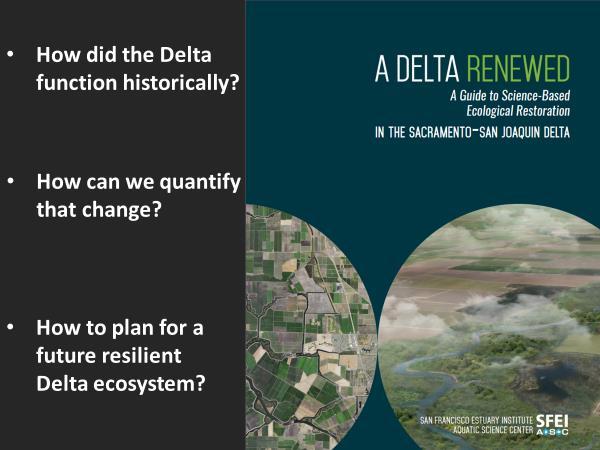
A Delta Renewed: A Guide to Science Based Ecological Restoration in the Delta
 A Delta Renewed: A Guide to Science Based Ecological Restoration in the Delta J. Letitia Grenier, San Francisco Estuary Institute, letitia@sfei.org Julie Beagle, San Francisco Estuary Institute, julieb@sfei.org
HISTORICAL ECOLOGY OF THE DELTA Emerging Concepts about a Spatially Complex and Temporally Dynamic System
 ITEM REMOVED DUE TO COPYRIGHT STATUS HISTORICAL ECOLOGY OF THE DELTA Emerging Concepts about a Spatially Complex and Temporally Dynamic System Robin Grossinger and Alison Whipple San Francisco Estuary
The Napa River Flood Protection Project
 The Napa River Flood Protection Project Creating Flood Protection and Restoring Geomorphic and Biological Processes Jeremy Sarrow, Napa County Flood Control & Water Conservation District June 2, 2014.
Middle Mississippi River. Regional Corridor
 Middle Mississippi River St. Louis District Regional Corridor Lessons Learned from a Collaborative Planning Study Brian Johnson US Army Corps of Engineers 12 th Biennial Governor s Conference on the Management
Terra Nova Rural Park Plan
 Terra Nova Rural Park Plan Part 1 Getting to know the land The Surrounding Area North Side Airport, River, Trail East Side - Residential West Side- Sturgeon Banks, West Dyke Trail South Side:Terra Nova
BASS PONDS, MARSH, & WETLAND HABITAT RESTORATION PROJECT
 FACT SHEET BASS PONDS, MARSH, & WETLAND HABITAT RESTORATION PROJECT MINNESOTA VALLEY NATIONAL WILDLIFE REFUGE, MINNESOTA ENVIRONMENTAL MANAGEMENT PROGRAM LOCATION Three areas located on the Minnesota Valley
Baylands Segment J. Bay between the Golden Gate and Segment J. Coyote Point. of For managed ponds. included habitat enhancement.
 Baylands Segment J Crissy Field Alameda Naval Air Station Heron's Head Park COLMA CREEK SFO Millbrae San Mateo BAYLANDS 2009 SAN FRANCISCO AREA san francisco area Western side of central San Francisco
Building Ecological Solutions to Coastal Community Hazards: Guidance and NJ Coastal Community Assistance
 Building Ecological Solutions to Coastal Community Hazards: Guidance and NJ Coastal Community Assistance Stacy Small-Lorenz National Wildlife Federation Restore America s Estuaries Summit New Orleans,
Parks, Trails, and Open space Element
 Parks, Trails, and Open space Element Parks, Trails, and Open Space element Parks, Recreation, and Open Space are important components of the quality of life desired by the residents of Elk Grove. This
Parks, Trails, and Open Space Element
 P arks, Recreation, and Open Space are important components of the quality of life desired by the residents of Elk Grove. This Element of the General Plan addresses the City s goals, policies, and actions
Peninsular Florida Landscape Conservation Cooperative. Marine and Estuarine Priority Resources and Conservation Targets
 Peninsular Florida Landscape Conservation Cooperative Marine and Estuarine Priority Resources and Conservation Targets Why are we here today? Workshop Goals: Develop a list of potential conservation targets
Planning for Staten. Habitat Restoration and Green Infrastructure. Island s North Shore
 Habitat Restoration and Green Infrastructure Planning for Staten Island s North Shore Community Board 1 March 1, 2018 NYC Parks Forestry, Horticulture, and Natural Resources Funded by the NYS Department
Coyote Hills Restoration and Public Access Project Coyote Hills Regional Park C o n c e p t P l a n a n d S i t e P r o g r a m
 Coyote Hills Restoration and Public Access Project Coyote Hills Regional Park C o n c e p t P l a n a n d S i t e P r o g r a m Chris Barton Environmental Programs Manager Aquisition Stewardship Development
[FWS R8 R 2015 N087; FXRS282108E8PD0 156 F ] South Bay Salt Pond Restoration Project, Phase 2; Don Edwards National Wildlife
![[FWS R8 R 2015 N087; FXRS282108E8PD0 156 F ] South Bay Salt Pond Restoration Project, Phase 2; Don Edwards National Wildlife](/thumbs/84/90602803.jpg "[FWS R8 R 2015 N087; FXRS282108E8PD0 156 F ] South Bay Salt Pond Restoration Project, Phase 2; Don Edwards National Wildlife") Surname Billing Code: 4310 55 Deputy RD ARD Refuges DEPARTMENT OF THE INTERIOR Fish and Wildlife Service Solicitor Refuge Supervisor Asst. Refuge Supervisor Ch. Natural Resources Project Leader [FWS R8
Surname Billing Code: 4310 55 Deputy RD ARD Refuges DEPARTMENT OF THE INTERIOR Fish and Wildlife Service Solicitor Refuge Supervisor Asst. Refuge Supervisor Ch. Natural Resources Project Leader [FWS R8
Photo by Carlton Ward Jr. Executive Summary
 Photo by Carlton Ward Jr. Executive Summary The Cooperative Conservation Blueprint (Blueprint) is a multi-partner strategic conservation process developed by the Florida Fish and Wildlife Commission (FWC)
Bristol Marsh Heritage Conservancy
 Bristol Marsh Heritage Conservancy The Pennsylvania Environmental Council (PEC) protects and restores the natural and built environments through innovation, collaboration, education and advocacy. PEC believes
Open Space Element. General Plan. County of Sacramento Community Planning and Development Department
 General Plan Open Space Element Adopted December 15, 1993 Amended November 9, 2011 County of Sacramento Community Planning and Development Department This Page blank. Table of Contents SECTION I... 1 OPEN
Natural & Nature-Based Solutions for Risk Reduction & Resilience
 University of Massachusetts Amherst ScholarWorks@UMass Amherst International Conference on Engineering and Ecohydrology for Fish Passage International Conference on Engineering and Ecohydrology for Fish
APPENDIX C NATURAL RESOURCES MANAGEMENT PLAN: ACTIONS AND PRIORITIES
 APPENDIX C NATURAL RESOURCES MANAGEMENT PLAN: ACTIONS AND PRIORITIES TABLE C-1: Resource Actions and Priorities GOAL NRM-4 Objective 4.1: Restore Natural floodplain functions. Objective 4.2: Define and
Human use of Restored and Naturalized Delta Landscapes
 Human Use of Restored and Naturalized Delta Landscapes Brett Milligan and Alejo Kraus-Polk University of California, Davis August 2016 EXECUTIVE SUMMARY APPROACH & PROJECT DESCRIPTION Current legislation
Shoreline Master Program Town of La Conner, Washington
 Shoreline Master Program Town of La Conner, Washington Department of Ecology approval effective Adopted September 24, 2013 by Town of La Conner Ordinance No.1106 Amended May 13, 2014 by Town of La Conner
Coastal Planning in Texas. Tony Williams Senior Director of Planning Coastal Resources Division Texas General Land Office
 Coastal Planning in Texas Tony Williams Senior Director of Planning Coastal Resources Division Texas General Land Office e The Texas General Land Office (GLO) and the Texas Coast Since 1836: Manager of
Supporting Hudson Riverfront Communities as Climate-Adaptive Leaders. Libby Zemaitis November 17, 2017 NYS DEC Hudson River Estuary Program
 1 Supporting Hudson Riverfront Communities as Climate-Adaptive Leaders Libby Zemaitis November 17, 2017 NYS DEC Hudson River Estuary Program The Hudson River Estuary Program 2 Working to achieve 6 key
Habitat Connectivity and Wildlife Corridor Stakeholder Meeting
 Habitat Connectivity and Wildlife Corridor Stakeholder Meeting VENTURA COUNTY PLANNING DIVISION JUNE 8, 2017 Agenda Introductions, Meeting Goal, and Format January 2017 Board Action Current Project Phasing
Environmental Resources Branch
 I REPLY TO ATEMION OF DEPARTMENT OF THE ARMY U.S. ARMY ENGINEER DISTRICT, SACRAMENTO CORPS OF ENGINEERS 1325 J STREET SACRAMENTO, CALIFORNIA 95814-2922 Environmental Resources Branch Mr. Milford Wayne
Balancing Conservation and Development on the Jordan River
 Balancing Conservation and Development on the Jordan River Jordan River Parkway Trail Regional Athletic Complex Conservation & Restoration Balancing Conservation and Development on the Jordan River Jordan
PICTURE CANYON Planning Riparian-Wetland Refugia in an Urban Setting
 PICTURE CANYON Planning Riparian-Wetland Refugia in an Urban Setting Rio De Flag Existing Conditions. Ephemeral stream; Limited riparian plants, habitats.. & Opportunities Water (effluent) available Restore
Surrey Ecosystem Management Study
 Surrey Ecosystem Management Study Green Infrastructure Network Opportunities Public Open House & Information Session June 24 th, 2010 EMS Process Ecological Inventory Ecological Assessment Management Policy
NJ Department of Environmental Protection
 NJ Department of Environmental Protection COASTAL AND LAND USE PLANNING New Jersey Coastal Management Program Covers NJ coastal waters to limit of tidal influence including 239 municipalities in 19 counties,
Summary of Changes in the DRAFT Rivers Project Natural Resource Master Plan from the 2001 approved plan to 2014 plan
 Summary of Changes in the DRAFT Rivers Project Natural Resource Master Plan from the 2001 approved plan to 2014 plan The entire Master Plan format and layout has been changed to comply with regulation
Restoring Water Ecosystems in NYC Parks
 Restoring Water Ecosystems in NYC Parks Hooked on our Waters Con October 19, 2013 - CUNY Graduate Center Marit Larson NYC Parks Landscape and ecosystem focus Watershed Streams Freshwater wetlands Tidal
Commercial Launch Site Addendum to Wetland Mitigation Plan. Revision 2. April 25, SpaceX Proprietary
 Commercial Launch Site Addendum to Wetland Mitigation Plan Revision 2 April 25, 2017 SpaceX Proprietary Contents 1.0 Project Information... 1 1.1 Background... 1 2.0 Compensatory Mitigation... 2 2.1 Goals
Tentatively Selected Plan within Harlem River, East River and Western Long Island Sound Planning Region. First Level Costs. Federal Non-Federal Total
 HARLEM RIVER, EAST RIVER AND WESTERN LONG ISLAND SOUND PLANNING REGION Flushing Bay and Creek Ecosystem Restoration Source Feasibility Study Background Study Resolution (1994), Reconnaissance Report (1996),
Improving Communities Through the Arroyo Seco Sustainability Campaign and Watershed Assessment
 Improving Communities Through the Arroyo Seco Sustainability Campaign and Watershed Assessment Arroyo Seco Headwaters in the San Gabriel Mountains Major tributary to the Los Angeles River 44 square mile
WETLAND SOD u Bare Root Wetland Plants u Deep Rooted Willows u Coir Logs u Native Trees & Shrubs u Habitat Islands u Custom Growing
 WETLAND SOD u Bare Root Wetland Plants u Deep Rooted Willows u Coir Logs u Native Trees & Shrubs u Habitat Islands u Custom Growing 2009 PROJECT HIGHLIGHTS The following 10 projects highlight the interesting
New Brighton Park Shoreline Habitat Restoration Project
 Vancouver Board of Parks and Recreation and Port Metro Vancouver New Brighton Park Shoreline Habitat Restoration Project Conceptual Design Public Consultation August 26 September 9, 2015 Discussion Paper
3-2 Environmental Systems
 3-2 Environmental Systems 3.0 ENVIRONMENTAL SYSTEMS CONTENTS 3.1 GREENWAY SYSTEM 3.1.1 General Policies 3.1.2 Natural Heritage Network 3.1.3 Natural Heritage Network Enhancement Lands 3.1.4 Rouge Watershed
Ashbridges Bay Erosion and Sediment Control Project
 Ashbridges Bay Erosion and Sediment Control Project Project Brief Overview Toronto and Region Conservation Authority, in partnership with the City of Toronto, intends to carry out remedial erosion control
Chapter 3: Natural Environment. Proposed Waikato District Plan Stage 1. (Notified version)
") Chapter 3: Natural Environment Proposed Waikato District Plan Stage 1 Page 2 of 7 Contents Chapter 3: Natural Environment... 3 3.1 Indigenous Vegetation and Habitats... 3 3.1.1 Objective Biodiversity and
Chapter 3: Natural Environment Proposed Waikato District Plan Stage 1 Page 2 of 7 Contents Chapter 3: Natural Environment... 3 3.1 Indigenous Vegetation and Habitats... 3 3.1.1 Objective Biodiversity and
STREAM BUFFERS
 88-415 STREAM BUFFERS 88-415-01 PURPOSE In the Kansas City region and throughout the nation, vegetated stream buffers have been clearly shown to protect stream stability and related infrastructure, improve
The Benefits and Challenges Associated with Green Infrastructure Practices
 The Benefits and Challenges Associated with Green Infrastructure Practices Thomas M. Evans ASLA, LEED AP Regional Green Infrastructure Design Services Director OWEA Technical Conference, June 20, 2013
Habitat Improvements to the Motor Island Shoreline in the Upper Niagara River, NY: A Collaborative Approach
 Habitat Improvements to the Motor Island Shoreline in the Upper Niagara River, NY: A Collaborative Approach Edward Alkiewicz 1, Stephen Schoenwiesner 1, Jeff Gerlach 1, Morris Perot 2, Scott Ault 2, Mark
Regional Open Space Conservation Plan. Regional Staff Committee January 18, 2018
 Regional Open Space Conservation Plan Regional Staff Committee January 18, 2018 Schedule We are here Task 1 - Stakeholder Input & Work Plan Dev. v z 2016 2017 2018 Oct Nov Dec Jan Feb Mar Apr May Jun Jul
Community Conservation Workshop. Lake Placid
 Community Conservation Workshop Lake Placid 2 Community Conservation Program Welcome! We have designed a Community Conservation Program that listens to the needs of community members. We are conducting
ROLE OF LANDSCAPE CONSERVATION COOPERATIVES IN EVERGLADES RESTORATION
 ROLE OF LANDSCAPE CONSERVATION COOPERATIVES IN EVERGLADES RESTORATION GEER April 2017 Steve Traxler 1, Todd Hopkins 1, Beth Stys 2 1 US Fish and Wildlife Service 2 Florida Fish & Wildlife Conservation
Stormwater Standards. Clackamas County Service District No. 1. Planting Guide for Buffers
 Stormwater Standards Clackamas County Service District No. 1 APPENDIX B Planting Guide for Buffers Table of Contents Appendix B - Planting Guide for Buffers... Page B.1 General... 1 B.1.1 Introduction...
Natomas Joint Vision Open Space Plan
 Natomas Joint Vision Open Space Plan First Workshop series The City of Sacramento The County of Sacramento LAFCo ERA Economic Research Associates EIP Associates a Division of PBS & J Natomas Joint Vision
2011 ASLA Design Awards. Westside Creeks Restoration Plan Merit Award AECOM, Fort Collins. Planning & Urban Design
 2011 ASLA Design Awards Westside Creeks Restoration Plan Merit Award AECOM, Fort Collins Planning & Urban Design Project Fact Sheet Category of Entry: Rotating Specialty Award: 2011 2011 ASLA Colorado
10.0 Open Space and Public Realm
 10.0 Open Space and Public Realm 10.0 Open Space and Public Realm The Public Open Space System is comprised of: outdoor spaces available for public use that are either publicly owned (e.g., parks and
Juneau Watershed Partnership
 Juneau Watershed Partnership Native Plant Resource Center Final Report A Partners for Fish and Wildlife Project Prepared for: U.S. Fish and Wildlife Service For Grant #F11C00552 Prepared by: The Juneau
1/21/2014. Definitions vary widely Legal vs. functional Not always obvious. Wetlands are legally protected by Clean Water Act (1972)
") What is a Wetland? Freshwater Wetlands of Gulf Coast Plains Definitions vary widely Legal vs. functional Not always obvious What is a Wetland? Wetlands are legally protected by Clean Water Act (1972) Corps
What is a Wetland? Freshwater Wetlands of Gulf Coast Plains Definitions vary widely Legal vs. functional Not always obvious What is a Wetland? Wetlands are legally protected by Clean Water Act (1972) Corps
National Association of Conservation Districts. Kris Hoellen Vice President, Sustainable Programs The Conservation Fund September 19, 2013
 National Association of Conservation Districts Kris Hoellen Vice President, Sustainable Programs The Conservation Fund September 19, 2013 Our Mission The Conservation Fund forges partnerships to conserve
Florida Forever Conservation Needs Assessment Overview Maps
 Florida Forever Conservation Needs Assessment Overview Maps Prepared by Florida Natural Areas Inventory, The maps in this document are derived from the Florida Forever Conservation Needs Assessment, an
April 11, 2016 Park Board Chair and Commissioners General Manager Vancouver Board of Parks and Recreation New Brighton Salt Marsh - Preferred Concept
 TO: FROM: SUBJECT: April 11, 2016 Park Board Chair and Commissioners General Manager Vancouver Board of Parks and Recreation New Brighton Salt Marsh - Preferred Concept RECOMMENDATION A. THAT the Vancouver
Design Around Waterways and Wetlands
 Design Around Waterways and Wetlands NL Green Economy Conference Newleef-2014 NEIA, St. John s, NL October 9-10 th, 2014 Wade Lewis Amherst, Nova Scotia, w_lewis@ducks.ca DUC conserves, restores and manages
RIVERFRONT REDEVELOPMENT PLAN
 RIVERFRONT REDEVELOPMENT PLAN PROJECT BACKGROUND DEVELOPMENT OPPORTUNITIES This project strives to connect St. Francisville s downtown Historic District to the Mississippi River through river tourism,
City of Surrey Ecosystem Management Study. Integration of ecological processes with land use
 City of Surrey Ecosystem Management Study Integration of ecological processes with land use Natural areas in Surrey are changing as the City grows and evolves. Many important natural areas remain or may
Template for Restoration in a Lake Superior Area of Concern. Template for Restoration in a Lake Superior Area of Concern
 Keith Bowers, Principal Ivette Bolender, Great Lake Bioregion Team Leader Presentation outline: Project background Master planning process Habitat restoration approach Lessons learned Hog Island and Newton
Fisher Slough Tidal Marsh Restoration Project Scaling Down the Restoration Planning & Analysis Framework to Evaluate Project Alternatives
 Fisher Slough Tidal Marsh Restoration Project Scaling Down the Restoration Planning & Analysis Framework to Evaluate Project Alternatives Project Sponsor/Partners The Nature Conservancy Dike District #3
Proposed Ranked List of Projects for Capital Budget Funding
 Proposed Ranked List of Projects for 2015-17 Capital Budget Funding Ecology Publication #: 14-06-033 October 2014 Ecology Publication #: 14-06-033 October 2014 Focus on Proposed Projects for FY 15-17 Floodplains
Green Infrastructure. NYS Department of Environmental Conservation
 Green Infrastructure Green infrastructure is an interconnected network of natural areas and open spaces that sustains ecosystems. Benedict, M.A. and E.T. McMahon. 2006. Green Infrastructure Linking Landscapes
The scope of the plan will focus on the Prospect Heights Slough and Hillcrest Lake as one entity.
 Plan for Prospect Heights Natural Resources Commission Plan for Improved Public Access and Enjoyment of the Prospect Heights Slough and Hillcrest Lake July 23, 2018 The City Council has requested the Natural
ESA Compliance With Less Pain & More Gain?
 ESA Compliance With Less Pain & More Gain? January 30, 2018 4640 SW Macadam Ave., Suite 50, Portland, OR 97239 T: 503.946.8350 F: 971.229.1968 W: www.willamettepartnership.org How I Learned to Stop Worrying
Community Conservation Workshop. Saranac River Basin Communities
 Community Conservation Workshop Saranac River Basin Communities 2 Community Conservation Program Welcome! We have designed a Community Conservation Program that listens to the needs of community members.
RECREATION AND OPEN SPACE ELEMENT GOALS, OBJECTIVES, AND POLICIES
 RECREATION AND OPEN SPACE ELEMENT GOALS, OBJECTIVES, AND POLICIES Goal 7 To provide park facilities, recreation programs, and open space resources that are safe, adequate, and accessible to all City residents,
Conserving Ca[ifomiaJs Wi[tf[ife Si~e 1870
 State of California - The Resources Aqency DEPARTMENT OF FISH AND GAME huo:/ /www.dfg.ca.gov POST OFFICE BOX 47 YOUNTVillE, CALIFORNIA 94599 (707) 944-5500 ARNOLD SCHWARZENEGGER. Governor October 5,2007
A Field Guide to Common Aquatic Plants of Pennsylvania
 A Field Guide to Common Aquatic Plants of Pennsylvania College of Agricultural Sciences CONTENTS Introduction... 2 Algae... 8 Emergent... 20 Submerged... 48 Floating... 82 Index... 102 INTRODUCTION Pennsylvania
City of Iowa City Department of Neighborhood and Development Services Department of Parks and Recreation Department of Public Works City Manager s
 RFP Pre-submittal meeting December 18, 2015 City of Iowa City Department of Neighborhood and Development Services Department of Parks and Recreation Department of Public Works City Manager s Office Background
Phase I Ecological Network Report Terms of Reference
 Phase I Ecological Network Report Terms of Reference INTRODUCTION In 2007, the City of Edmonton created a new Natural Area Systems Policy (C-531) and a strategic plan, Natural Connections. Together, these
Stream Corridor Management Plan
 Stream Corridor Management Plan A unified and comprehensive approach to protecting, restoring and managing the Upper Delaware River Graydon Dutcher Delaware County Soil and Water Conservation District
Aquatic, Terrestrial and Landscape Conservation Design Tools and Products of the North Atlantic LCC
 Aquatic, Terrestrial and Landscape Conservation Design Tools and Products of the North Atlantic LCC Scott Schwenk Science Coordinator, North Atlantic LCC Chesapeake Bay FWS Partners Meeting Annapolis,
Libby Zemaitis October 18, 2017 Climate Outreach Specialist, NYS DEC Hudson River Estuary Program
 1 Supporting Hudson Riverfront communities as Climate-Adaptive Leaders Libby Zemaitis October 18, 2017 Climate Outreach Specialist, NYS DEC Hudson River Estuary Program The Hudson River Estuary Program
Master Plan for Preservation and Scenic Conservation (1995)
") 3.2 Master Plan for Preservation and Scenic Conservation (1995) The Master Plan for Preservation and Scenic Conservation was developed under the direction of the Guilford Preservation Alliance in the 1980s
3.2 Master Plan for Preservation and Scenic Conservation (1995) The Master Plan for Preservation and Scenic Conservation was developed under the direction of the Guilford Preservation Alliance in the 1980s
Natural Resource Protection
 VISION Our Parker community will enhance the quality of life by avoiding development in environmentally hazardous areas and by safeguarding the natural environment. Natural Resource Protection Introduction
Rule D Wetland and Creek Buffers
 Rule D Wetland and Creek Buffers 1 Policy It is the policy of the Board of Managers to ensure the preservation of the natural resources, recreational, habitat, water treatment and water storage functions
San Joaquin River Restoration Program Mendota Pool Bypass and Reach 2B Improvements Project. Restoration Goal Technical Feedback Group
 San Joaquin River Restoration Program Mendota Pool Bypass and Reach 2B Improvements Project Restoration Goal Technical Feedback Group March 20, 2014 1:30 pm San Luis and Delta-Mendota Water Authority 842
SECTION 5: REACH RECOMMENDATIONS/MAPS
 SECTION 5: REACH RECOMMENDATIONS/MAPS This section describes areas of concern and provides specific recommendations for each project reach. Locations of stormwater drains were from GIS coverage supplied
Santa Cruz River Master Plan. Presented to the Arizona Floodplain Management Association Spring Conference June 8-10, 2011
 Santa Cruz River Master Plan Presented to the Arizona Floodplain Management Association Spring Conference June 8-10, 2011 Introduction Who is FICO? 2 Project Team Kimley-Horn and Associates, Inc. River
Meta-Analysis of Project Effectiveness: Learning at the Regional Scale
 Western Washington University Western CEDAR Salish Sea Ecosystem Conference 2014 Salish Sea Ecosystem Conference (Seattle, Wash.) May 1st, 10:30 AM - 12:00 PM Meta-Analysis of Project Effectiveness: Learning
Using the Past to Understand the Present Emerging Lessons for Environmental Planning in the Santa Clara Valley
 Using the Past to Understand the Present -- -- -- Emerging Lessons for Environmental Planning in the Santa Clara Valley Robin Grossinger Director of the Historical Ecology Program San Francisco Estuary
U.S. Army Corps of Engineers, Los Angeles District Prado Basin Project Updates
 U.S. Army Corps of Engineers, Los Angeles District Prado Basin Project Updates Host: Inland Empire Utilities Agency January 19, 2017 10:00 a.m. Purpose: To provide project overviews and updates to regional
Open Space, Natural Areas, Parks, and Recreation
 Open Space, Natural Areas, Parks, and Recreation WHAT ARE THE CITY S CURRENT VALUES? This section addresses open spaces, natural areas, parks and recreation, and stormwater multi-use projects under separate
Linking Ecological Restoration and Economic Recovery at a Great Lakes Area of Concern: Muskegon Lake, MI. Heather Braun Great Lakes Commission
 Linking Ecological Restoration and Economic Recovery at a Great Lakes Area of Concern: Muskegon Lake, MI Heather Braun Great Lakes Commission Why Here? Restoration in urban centers: Muskegon Lake AOC Why
systems is available on the Colorado Wetland Information Center (CWIC) website.
 website.") Colorado Natural Heritage Program Wetland Program Plan -- Dec 2015 Status Update and Addendum -- The Colorado Natural Heritage Program (CNHP) developed a Wetland Program Plan (WPP) in 2010 for the planning
Colorado Natural Heritage Program Wetland Program Plan -- Dec 2015 Status Update and Addendum -- The Colorado Natural Heritage Program (CNHP) developed a Wetland Program Plan (WPP) in 2010 for the planning
PEOPLE, WATER, AND WILDLIFE: BLUE PRINCIPLES FOR RIVER DESIGN
 PEOPLE, WATER, AND WILDLIFE: BLUE PRINCIPLES FOR RIVER DESIGN Category One: People Protecting and Enhancing the Quality of Life Role of the Chicago River People and the River For many, the connection between
WWT Steart Marshes: a coastal wetland that works for people and wildlife
 Background Environment Agency required to compensate for loss of internationally important intertidal habitat from process of coastal squeeze (3000ha in next 100 years) Severn Estuary: 200km flood defence
Riparian Buffer on the Bushkill Creek. Policies
 Riparian Buffer on the Bushkill Creek Riparian buffers provide numerous benefits to landowners and the community by protecting groundwater recharge areas, providing flood control, providing stormwater
Sustainable TamAlmonte 215 Julia Avenue Mill Valley, CA 94941
 Sustainable TamAlmonte 215 Julia Avenue Mill Valley, CA 94941 July 5, 2016 Marin County Community Development Agency, Planning Division 3501 Civic Center Dr., Room 308 San Rafael, CA 94903 Attention: Planner
MAYFIELD WEST SECONDARY PLAN PHASE 2
 MAYFIELD WEST SECONDARY PLAN PHASE 2 Public Open House #3 February 25, 2010 Draft Preferred Land Use Scenario TOWN OF CALEDON PLANNING & DEVELOPMENT DEPARTMENT Open House Agenda TOWN OF CALEDON 1. Welcome
Los Angeles River-Arroyo Seco Confluence Restoration Vision Plan. Professor Meredith McKenzie, JD Urban & Regional Planning Dept Cal Poly Pomona
 Los Angeles River-Arroyo Seco Confluence Restoration Vision Plan Professor Meredith McKenzie, JD Urban & Regional Planning Dept Cal Poly Pomona The Los Angeles River Watershed Arroyo Seco Watershed Map
Presentation to Parks and Open Space Advisory. Committee September 22, 2016
 Flood Planning & Preliminary Design Services for South St. Vrain Creek Restoration at Hall Ranch Presentation to Parks and Open Space Advisory Prepared for: Boulder County, Colorado Committee September
River Road New Castle Marsh Restoration Recommendations
 University of New Hampshire University of New Hampshire Scholars' Repository PREP Reports & Publications Institute for the Study of Earth, Oceans, and Space (EOS) 6-2010 River Road New Castle Marsh Restoration
Arkansas River Corridor
 Planning for Access Welcome to the Access Project. This project is a recreational planning effort in response to an interest by regional communities along the Arkansas River corridor. The project plan
Colorado Watershed Protection Fund - Project Grant Application Fountain Creek Restoration Shryver Park Reach Including Shryver Pond
 Fountain Creek - Manitou Springs, CO Shryver Park Reach and Pond Restoration Project Submitted by: The Fountain Creek Restoration Committee & The Pikes Peak Community Foundation April 28, 2008 FCRC Page
COASTAL MANAGEMENT ELEMENT. Last amended December 6, 2016 as part of the 2016 EAR
 COASTAL MANAGEMENT ELEMENT Last amended December 6, 2016 as part of the 2016 EAR Table of Contents Objective Page 7.1 Development and redevelopment of waterfront properties...7-1 7.2 Agency coordination
THE SPATIAL PLAN AND THE LANDSCAPE IN CZECH REPUBLIC
 THE SPATIAL PLAN AND THE LANDSCAPE IN CZECH REPUBLIC 13th ELC Conference, 2 3 October, Cetnjie, Montenegro Ing. Igor Kyselka CSc., Institute for spatial development, Jakubské náměstí 3, 60200 Brno, tel.:
Pontchartrain Coastal Lines of Defense Program Figure 1 Figure 2 Figure 1
 Pontchartrain Coastal Lines of Defense Program Coastal Sustainability Program February 2006 The Pontchartrain Coastal Lines of Defense Program consists of ten priority project areas within the Pontchartrain
AMENDMENT NO. 30 TO THE OFFICIAL PLAN OF THE TOWN OF MILTON
 AMENDMENT NO. 30 TO THE OFFICIAL PLAN OF THE TOWN OF MILTON Subject: Boyne Survey Secondary Plan and Related Official Plan Amendments The following text and schedules constitute Amendment No. 30 to the
Kootenai River Habitat Restoration Program June 18, 2018 Kootenai Valley Resource Initiative Update
 Kootenai River Habitat Restoration Program June 18, 2018 Kootenai Valley Resource Initiative Update Kootenai River Habitat Restoration Program Multi-year habitat restoration program Restoration treatments