OPEN HOUSE #3. Project Manager Kristi Sebastian, PE, PTOE
|
|
|
- Griffin Hart
- 5 years ago
- Views:
Transcription


1 OPEN HOUSE #3 Project Manager Kristi Sebastian, PE, PTOE
2 WHY ARE WE CONDUCTING THE ARTERIAL CONNECTOR STUDY? Dakota County and the cities of Rosemount, Inver Grove Heights, and Eagan are working together toward a common goal of proactively planning for future transportation needs based on the expected growth and development identified in their Comprehensive Plans. The Dakota County 2030 Transportation Plan identifies the need for this study: Increase in traffic with proposed planned growth Disconnected north/south and east/west county roadway system through area Bridge gap between area of adjacent studies The Dakota County Arterial Connector Study will help prioritize future infrastructure improvements and reduce long-term costs and future right-of-way impacts. What is the purpose of the Open House? The purpose of the open house is to provide an update on the study process. The open house provides an opportunity to display the refined alternatives undergoing further evaluation and solicit feedback to assist in the selection of a preferred alternative. What have we heard from affected stakeholders? Provide further definition of project need Explain how area growth was developed Denote fuel pipeline along Akron Avenue Provide relative scenario costs Consider impacts to residents and businesses Take more time to listen to resident concerns and work through the issues Address short-term needs in consideration of long-term vision options How have we responded? Shared additional assessment with the following stakeholders Bituminous Roadways Flint Hills Residents along/near Akron Avenue Businesses along 117th Street
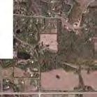
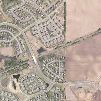
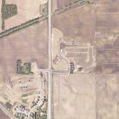
3 STUDY AREA Mississippi Eagan G WX Inver Grove Heights GÓWX 105th St E Lebanon Hills Regional Park G WX 117th St E SÈ Rosemount Bonaire Path Flint Hills 140th St E G±WX Study Area Coates [ Miles

 STUDY 80th Concord St S St E Blvd E Concord?")

4 AREA STUDIES 30? %&f( Cliff Rd Mendota Heights Pilot Knob Rd 31 Eagan %&c( Lone Oak Rd 43 Lexington Sunfish Lake %&f( Robert St REGIONAL 70th St W 26 ROADWAY Yankee Doodle Rd Diffley Rd 63 Delaware Ave Argenta Tr W VISIONING STUDY 110th St W th Ave 105th St Inver Grove Heights South Saint Paul 26 Connection to future high 56 capacity intersection and long-term interchange 28 HIGHWAY 32 (CLIFF ROAD) STUDY 80th Concord St S St E Blvd E Concord?éA@ 38 McAndrews Rd Apple Valley 125th St W 33 Connections to future roadways through UMore Park Area 145th St W 73 Rich Valley Blvd PINE BEND AREA STUDY Rosemount Blaine Ave E 145th St E 150th St W th St W 46 Coates Dodd Blvd Pilot Knob Rd 31 ROSEMOUNT/EMPIRE/UMORE TRANSPORTATION STUDY?éA@ Farmington Empire Township Cedar Ave [ 0 1 2Miles 200th St W th St E
5 STUDY GOALS GOAL 1 Encourage planning and design of an arterial roadway system that accounts for future travel growth and planned development. GOAL 2 Enhance transportation system efficiency and mobility. GOAL 3 Improve transportation system connectivity, spacing, and continuity. GOAL 4 Enhance the safety of the traveling public. GOAL 5 Encourage preservation of right-of-way for future transportation corridors. GOAL 6 Coordinate with potential greenway alignments, other bicycle/pedestrian facilities, transit connections, and rail alignments. GOAL 7 Consider adopted plans/studies and maintain interagency coordination in developing the future transportation system. GOAL 8 Minimize social, environmental, and property impacts as much as possible while achieving the desired functionality out of the transportation system. GOAL 9 Maximize cost effectiveness of the overall transportation system vision, as well as its flexibility to be implemented over time.
 Future Land Use (Rosemount) UMore Concept Master Plan The Concept Master Plan for the")


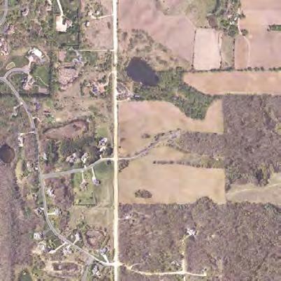
6 LAND USE Existing Land Use (Inver Grove Heights) Future Land Use (Inver Grove Heights) Existing Land Use (Rosemount) Future Land Use (Rosemount) UMore Concept Master Plan The Concept Master Plan for the University of Minnesota s New Sustainable Community at UMore was completed in The result of an intensive two-year planning process, the concept master plan identified a future development pattern from the UMore property. The study is a foundation element for the AUAR completed in The land use plan contained in the study is the basis for three of the four scenarios being considered: Biscayne Avenue CR Approximately 4,900 acres CR 46 Scenario 1 future population of 35,000 people and about 18,000 jobs Scenario 2 future population of 25,000 people and about 18,000 jobs 170 th Street Scenario 3 future population of 31,500 people and about 24,500 jobs Scenario 4 consistent with current Comprehensive Plans of both the City of Rosemount and Empire Township Vermillion Highlands A Research, Recreation and Wildlife Management Area 2,822 Acres
7 Existing Traffic Volumes 2030 Forecast Traffic Volumes Eagan G WX Lebanon Hills Regional Park?tA@ 9,200 12,500 5,500 5,600 8,600 5,000 2,400 5,900 7,500 2, SÈ G WX Inver Grove Heights Rosemount 18,700 2,450 4,500 3,850 GÓWX Bonaire Path 2,650 2, th St E 117th St E 6,800 Flint Hills 44,500 Eagan G WX Lebanon Hills Regional Park (10,300) (22,000)?tA@ (8,700) (31,000) (15,000) (6,100) (13,100) (13,100) (26,000) (35,000) (9,100) 9,000 (12,900) 14,000 (17,800) 9,900 (15,900) SÈ G WX Inver Grove Heights Rosemount 4,000 GÓWX Bonaire Path 7, th St E 9,500 (13,300) 14,000 (14,800) 7,400 (11,400) 117th St E Flint Hills (78,000) Mississippi River #### Annual Average Daily Traffic Study Area 2,550 G±WX 1,450 11, th St E [ Miles #### (####) Dakota County Transportaion Plan Other Studies 10,000 (16,000) G±WX 6,300 (10,600) 27,000 (41,300) 140th St E [ Coates Miles
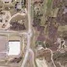
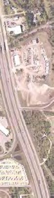
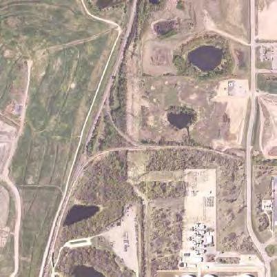
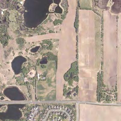
8 STUDY AREA CONSTRAINTS Mississippi Eagan G WX Inver Grove Heights GÓWX Lebanon Hills Regional Park Koch Jet Fuel Pipeline St. Patrick Cemetery G WX Rich Valley Park Bituminous Roadways, Inc. Hilton Mini Storage 105th St E Allied Waste 117th St E SKB Landfill Xcel Energy Meadows Park SÈ Shafer Contracting Co. Inc. Rosemount Flint Hills Recreation Complex Bonaire Path Flint Hills 140th St E Major Pipeline Bloomfield Park G±WX Rural Residential Flint Hills Park Area Study Area Coates [ Miles


9 ALTERNATIVES - PRESENTED AT JANUARY 2015 OPEN HOUSE #2 ELIMINATED ELIMINATED
10 ALTERNATIVES EVALUATION - PRESENTED AT JANUARY 2015 OPEN HOUSE #2 Project Goals Alternatives Evaluation Preliminary Scenario Evaluation Matrix Presented at January 2015 Open House #2 Criteria Scenario A Scenario B Scenario C Scenario D?tA@ Provide 90 degree intersection and tangent alignment at CSAH 71 and 117th St Requires intersection at high speed curve Provides skewed intersection?ta@ Provides new CSAH 71 alignment with 90 degree intersection at 117th St Provides skewed intersection Safety & Mobility G WX Provide 90 degree intersection and tangent alignment at CSAH 32 and CR 73 Horizontal roadway alignments meet 55 MPH design speeds Minimize common sections along CSAH 32 and CSAH 71 GWX Minimize wetland impacts Inver Grove Heights Intersection not on tangent alignment Provides skewed intersection 45 MPH curve at CSAH 71 and 117th St 45 MPH curve along new CSAH 73/ GÓWX Barnes Ave alignment Requires common section of CSAH 32 and CSAH 71 Increased turning movements Greater traffic volume on short segment Additional major intersection (Compared to B and D) 0.8 Acres Impacted Limits impacts primarily to seasonally flooded wetlands Intersection on tangent alignment Intersection at 90 degrees G WX All alignments meet 55 MPH design speeds Does not require common section of CSAH 32 and CSAH Acres Impacted Impacts to forested/shrub wetlands Intersection on tangent alignment Intersection at 90 degrees 45 MPH curve at CSAH 71 and 117th St 45 MPH curve along new CSAH 73/ Inver Grove Barnes Ave alignment Heights GWX GÓWX Requires common section of CSAH 32 and CSAH 71 Increased turning movements Greater traffic volume on short segment Additional major intersection (Compared to B and D) 1.1 Acres Impacted Limits impacts primarily to seasonally flooded wetlands Intersection on tangent alignment Intersection at 90 degrees All alignments meet 55 MPH design speeds Does not require common section of CSAH 32 and CSAH Acres Impacted Limits impacts primarily to seasonally flooded basin Minimize woodland impacts 10.2 Acres Impacted Limits impacts to heavily wooded areas 13.7 Acres Impacted Limits impacts to heavily wooded areas 20.7 Acres Impacted Bisects heavily wooded area 25.8 Acres Impacted Bisects heavily wooded area Impacts & Cost Minimize impacts to non-residential property SÈ Minimize impacts to residential property Minimize utility impacts Rosemount G±WX 17 Impacted Parcels (63.7 acres) Avoids parcel severance, primarily utilizes Flint Hills parcels 24 Impacted Parcels (11.2 acres) 1 Total Acquisition Northern Natural Gas R/W Acquisition along CR 73 Xcel Transmission 6 conflicts (Low Voltage Line) Buried Pipeline 8 crossings 1.32 miles of parallel pipe along CR Impacted Parcels (60.5 acres) Results in parcel severance and diminishes functionality at Bituminous Roadways site, avoids desirable mining land 23 Impacted Parcels (10.8 acres) 0 Total Acquisitions Northern Natural Gas R/W Acquisition along CR 73 Xcel Transmission 4 conflicts (Low Voltage Line) Buried Pipeline 7 crossings 1.28 miles of parallel pipe along CR miles of parallel pipe along CSAH Impacted Parcels (90.9 acres) Primarily utilizes Flint Hills parcels, resulting in parcel severance SÈ Rosemount 7 conflicts (Low Voltage Line) G±WX 3 Impacted Parcel (2.4 acres) 1 Total Acquisition Xcel Transmission 1 conflict (High Voltage Line) Buried Pipeline 10 crossings 0.52 miles of parallel pipe along CR Impacted Parcels (78.1 acres) Results in parcel severance and diminishes functionality at Bituminous Roadways site, impacts desirable mining land 4 Impacted Parcels (2.8 acres) 1 Total Acquisition Xcel Transmission 5 conflicts (Low Voltage Line) 1 conflict (High Voltage Line) Buried Pipeline 8 crossings 0.23 miles of parallel pipe along CR miles of parallel pipe along CSAH 32 Removed from consideration This matrix does not reflect any Scenario updates or additional information prepared following Open House #2 Removed from consideration (01/13/15)


11 SCENARIO ASSESSMENT qq Scenarios A and C failed to meet the safety and mobility criteria that were established: ELIMINATED ELIMINATED Scenario A: Required an intersection within a high speed curve Did not meet design speed through horizontal curves Scenario C: Did not meet design speed through horizontal curves Included an intersection closely spaced to horizontal curve qq qq To continue the planning process, Scenarios B and D were evaluated in more detail and refinements were made to these two scenarios to address project needs and stakeholder feedback. Scenarios E and F carried forward - intersection configuration to be determined with project implementation/ further review.


12 Eliminated extension of CR 71 to Barnes Ave Considered residential street connections and driveways including need to align Albavar Path and private street (east side) of roadway Additional analysis and evaluation of non-residential, residential and utility impacts East-west CR 32 alignment shifted to the west Created 90 degree T-intersection to remove skewed intersection North-south CR 73 earthwork assessment Assessed north-south corridor profile


13 Assessed impacts to Bituminous Roadways property Eliminated extension of CR 71 to Barnes Ave North-south CR 73 alignment shifted to the east East-west CR 32 alignment shifted to the west North-south CR 73 earthwork assessment Created 90 degree T-intersection to remove skewed intersection Additional analysis and evaluation of non-residential, residential and utility impacts Greater review of woodland impacts Assessed north-south corridor profile Further review of alignment and design options for CR 71 connection will be completed with future project work if Scenario D is selected


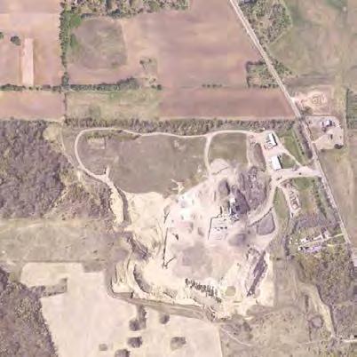


14 Rich Valley Park St. Patrick Cemetery Bituminous Roadways, Inc. Allied Waste Residential Residential Hilton Mini Storage SKB Landfill Residential Shafer Contracting Co. Inc. Flint Hills Recreation Complex Area Constraints August 2015 Scenario D Refined Other Alignments Considered - Not Carried Forward
15 Arterial Connector Study - Pine Bend Area Evaluation Matrix Comparison for Scenarios B and D (North-South CR 73 Only) updated: 9/15/2015 Project Goals Criteria Scenario B - Refined Scenario D - Refined Safety & Mobility Minimize Horizontal Curves Access Management Considerations* Minimize Wetland Impacts 2 Curves 3 Curves 6 Public/16 Private Access Points - 118th Street spacing to Albavar Path non-compliant 2 Public/7 Private Access Points 0.4 Acres Forested/Shrub Wetlands High Quality/Value 0 Acres Social / Environmental Impacts Minimize Woodland Impacts Minimize Impacts to Non-residential Property Minimize Impacts to Residential Property ~12 Acres Mature Oaks 31.5 Acres Northern Natural Gas Co / Flint Hills 6.7 Acres 17 parcels / 3 Potential Total Acquisitions >12 Acres Fragment / Degrade Heavily Wooded Mature Oak Area and Severs Habitat Continuity 49.3 Acres Bituminous Roadways / Flint Hills 1.2 Acres 3 parcels / 1 Potential Total Acquisition Other Considerations Minimize Utility Impacts** Minimize Earthwork/ Construction Limit Impacts 9 Crossings 1.1 miles within right-of-way (Including Koch Jet Fuel Pipeline and MN Energy Resources Corporation) 850,000 cubic yards 10 Crossings 0.1 miles within right-of-way (Including MN Energy Resources Corporation) 1,250,000 cubic yards -Cost Differential Approx. +$4.0-$9.0M (Includes restoration of Bituminous Roadways land) NOTES: * Dakota County Access Management Guidelines: - As access along the corridor increases, safety decreases - Undivided highway, >45 MPH, >1,500 ADT - full intersection movements a minimum spacing of 1/4 miles is required - Private street or driveway access will be reviewed through projects to consolidate/relocate or retain access as applicable to ensure safe ingress/egress throughout the system. ** Utility Impacts Affect the Following Companies: - Enterprise Products Operating, LLC - Magellan Pipeline Company, L.P. - Excel Energy - Koch Pipeline Company, L.P. - Minnesota Energy Resources Corporation
16 1 Example of County rural roadway with turn lanes (Interim) Construct an interim rural roadway with turn lanes along Akron Ave between CR 32 and Bonaire Path 1 2 Example of County 4-lane roadway (Long-Term) *Acquire right-of-way needed for interim CR 73 project, north to CR 32 (110 ) 2 Construct a 4-lane roadway along Akron Ave in longterm when necessary *Acquire required right-of-way through area of long-term corridor (150 minimum) Legend Long-Term Scenario Alignment(s) Interim North-South CR 73 Alignment Cost Considerations Interim CR 73 Long-Term CR 73 Roadway Construction $11 M $21 M Additional Earthwork No additional earthwork cost No additional earthwork cost Right-of-Way* $3.5 M - $4 M $0 M - $2 M additional Interim Intersection Improvements $1 M N/A Total: $15.5 M - $16 M $21 M - $23 M IMPLEMENTATION PHASING OPTION 1 TOTAL PHASING IMPLEMENTATION COSTS $36.5 M - $39 M
 *Acquire right-of-way needed for interim CR 73 project, north to CR 32 (110 ) *Acquire required right-ofway through area of longterm corridor (150 minimum) Construct a 4-lane roadway")
17 1 Example of County rural roadway with turn lanes (Interim) Construct an interim rural roadway with turn lanes along Akron Ave between CR 32 and Bonaire Path 1 2 Example of County 4-lane roadway (Long-Term) *Acquire right-of-way needed for interim CR 73 project, north to CR 32 (110 ) *Acquire required right-ofway through area of longterm corridor (150 minimum) Construct a 4-lane roadway along new alignment in long-term when necessary Further review of alignment and design options for CR 71 connection will be completed with future project work if Scenario D is selected 2 Legend Long-Term Scenario Alignment(s) Interim North-South CR 73 Alignment Cost Considerations Interim CR 73 Long-Term CR 73 Roadway Construction $11 M $18 M - $21.5 M Additional Earthwork No additional earthwork cost $2 M - $4 M additional Right-of-Way* $1 M - $1.5 M $1 M - $5.5 M additional Interim Intersection Improvements $1 M N/A Gravel Mining - Rock N/A Assumed complete Gravel Mining - Grade N/A $5 M reclamation Total: $13 M - $13.5 M $26 M - $36 M IMPLEMENTATION PHASING OPTION 1 TOTAL PHASING IMPLEMENTATION COSTS $39 M - $49.5 M

18 1 Example of County rural roadway with turn lanes (Interim) Construct city street in interim along Akron Ave 2 Example of County 4-lane roadway (Long-Term) 1 Construct an interim rural roadway with turn lanes along Akron Ave between CR 32 and Bonaire Path Further review of alignment and design options for CR 71 connection will be completed with future project work if Scenario D is selected *Acquire required right-ofway through area of longterm corridor (150 minimum) 2 Legend Long-Term Scenario Alignment(s) Interim North-South CR 73 Alignment Cost Considerations Interim CR 73 Long-Term CR 73 Roadway Construction $17 M** $18 M - $21.5 M Additional Earthwork $2 M - $4 M additional No additional earthwork cost Right-of-Way* $2.5 M - $7.5 M Acquired under interim Interim Intersection Improvements $1 M N/A Gravel Mining - Rock $4 M - $8 M Purchased under interim Gravel Mining - Grade $2 M Completed under interim Total: $28.5 M - $39.5 M $18 M - $21.5 M IMPLEMENTATION PHASING OPTION 2 TOTAL PHASING IMPLEMENTATION COSTS $46.5 M - $61 M **Includes cost to build Akron Ave as a city street ($3.5 M)
19 OVERALL TRANSPORTATION SYSTEM NEEDS Mississippi E/F Eagan G WX Inver Grove Heights GÓWX 105th St E Lebanon Hills Regional Park B G WX 117th St E SÈ D Rosemount Bonaire Path Flint Hills 140th St E G±WX 3-Lane County Roadway 4-Lane County Roadway Indicates North-South CR 73/CR 71 Options *Either Scenarios B or D will be reflected in final document once one is selected Coates [ Miles

20 NEXT STEPS City Council Updates - October 2015 Study Documentation - November 2015 City/County Board Meeting Request for Adoption of Study - Winter 2016
ARGENTA TRAIL (CSAH 28/63) REALIGNMENT SOUTH PROJECT (CP 63-25)
 REALIGNMENT SOUTH PROJECT (CP 63-25)") ARGENTA TRAIL (CSAH 28/63) REALIGNMENT SOUTH PROJECT (CP 63-25) Preliminary Design Report February 2015 Prepared For: City of Inver Grove Heights Dakota County Prepared By: Kimley-Horn and Associates,
ARGENTA TRAIL (CSAH 28/63) REALIGNMENT SOUTH PROJECT (CP 63-25) Preliminary Design Report February 2015 Prepared For: City of Inver Grove Heights Dakota County Prepared By: Kimley-Horn and Associates,
Rich Valley Greenway Master Plan. Central Greenway Connectivity Study
 Rich Valley Greenway Master Plan Central Greenway Connectivity Study Dakota County Planning Commission February, 2017 Rich Valley Greenway Master Plan Dakota County Greenway Vision Establish a County-wide
Rosemount Greenway Master Plan Executive Summary. draft. Spring for more information visit
 Rosemount Greenway Master Plan Executive Summary Spring 2012 draft for more information visit www.hkgi.com/projects/dakota INTRODUCTION The Rosemount Greenway Master Plan portrays a vision to establish
METROPOLITAN COUNCIL 390 North Robert Street, St. Paul, MN Phone (651) ; TDD (651)
 ; TDD (651)") DATE: October 24, 2012 METROPOLITAN COUNCIL 390 North Robert Street, St. Paul, MN 55101 Phone (651) 602-1000; TDD (651) 291-0904 TO: Metropolitan Parks and Open Space Commission FROM: Tori Dupre, Senior
DATE: October 24, 2012 METROPOLITAN COUNCIL 390 North Robert Street, St. Paul, MN 55101 Phone (651) 602-1000; TDD (651) 291-0904 TO: Metropolitan Parks and Open Space Commission FROM: Tori Dupre, Senior
Concept Master Plan. for. Draft of. Wildlife Management Area. Prepared for. June, 2008
 Draft of Concept Master Plan for Vermillion Highlands: A Research, Recreation and Wildlife Management Area Prepared for Vermillion Highlands Steering Committee - Minnesota Department of Natural Resources
Lone Oak Road/ 70 th Street West. Efficient, Effective, Responsive. Preliminary Design Services (CP 26-54)
") (CP 26-54) Dakota County Board of Commissioners September 12, 2017 Purpose of Request Award Design Contract to Kimley-Horn and Associates Approve Joint Powers Agreements with the Cities of Eagan and Inver
(CP 26-54) Dakota County Board of Commissioners September 12, 2017 Purpose of Request Award Design Contract to Kimley-Horn and Associates Approve Joint Powers Agreements with the Cities of Eagan and Inver
Metropolitan Parks and Open Space Commission
 Business Item No. 2013-xxx Metropolitan Parks and Open Space Commission Meeting date: October 1, 2013 For the Community Development Committee meeting of October 7, 2013 Subject: Mendota-Lebanon Hills Greenway
PREPARED FOR: PLATTEVIEW ROAD CORRIDOR STUDY EXECUTIVE SUMMARY
 PREPARED FOR: PLATTEVIEW ROAD CORRIDOR STUDY EXECUTIVE SUMMARY SEPTEMBER 2016 Introduction The Platteview Road Corridor Study was led by the Metropolitan Area Planning Agency (MAPA) with assistance from
WHAT IS THE PURPOSE OF THE OPEN HOUSE?
 WHAT IS THE PURPOSE OF THE OPEN HOUSE? OPEN HOUSE PURPOSE The purpose of the open house is to provide an update on the study process and introduce the preliminary concept alternatives. The open house provides
Property Description History Regional Orientation Local Context Existing Assets Analysis Of Developable Areas...
 Appendix: Site Background and Analysis Property Description.... 48 History.... 48 Regional Orientation... 49 Local Context... 52 Existing Assets... 53 Analysis Of Developable Areas... 64 Aggregate Resources....
Mendota-Lebanon Hills Greenway Master Plan Executive Summary. August draft for more information visit
 Mendota-Lebanon Hills Greenway Master Plan Executive Summary August 2013 draft for more information visit www.hkgi.com/projects/dakota INTRODUCTION The Mendota-Lebanon Hills Greenway Master Plan portrays
Welcome. Northern Segment of Hwy 100 I-90 to South of Madison Street Meeting Goals:
 Welcome Northern Segment of Hwy 100 I-90 to South of Madison Street Meeting Goals: - Review Environmental Assessment - Share Preferred Alternative -Receive Public Comments 2003 EA Preferred Alternative
1.0 INTRODUCTION 1.1 TH 14 WEST STUDY AREA Project Description Functional Classification Purpose of the Project
 1.0 INTRODUCTION 1.1 TH 14 WEST STUDY AREA 1.1.1 Project Description The Trunk Highway (TH) 14 West Corridor is a two-lane roadway approximately 22 miles in length. Located in Nicollet County, the corridor
Mendota Heights 2040 Comprehensive Plan Draft Vers
 4 Parks and Trails The City of Mendota Heights boasts a variety of recreational and open space opportunities. Few cities can claim access to regional trails, riverside and lakeside parks, scenic bluffs
Primary Contact. Organization Information. Application Multiuse Trails and Bicycle Facilities
 Application 01971-2014 Multiuse Trails and Bicycle Facilities 02195 - Regional Trail from Lebannon Hills to Downtown Regional Solicitation - Bicycle and Pedestrian Facilities Status: Submitted Date: Submitted
METROPOLITAN COUNCIL 390 North Robert Street, St. Paul, MN Phone (651) ; TDD (651)
 ; TDD (651)") DATE: December 20, 2011 METROPOLITAN COUNCIL 390 North Robert Street, St. Paul, MN 55101 Phone (651) 602-1000; TDD (651) 291-0904 TO: Metropolitan Parks and Open Space Commission FROM: Tori Dupre, Senior
DATE: December 20, 2011 METROPOLITAN COUNCIL 390 North Robert Street, St. Paul, MN 55101 Phone (651) 602-1000; TDD (651) 291-0904 TO: Metropolitan Parks and Open Space Commission FROM: Tori Dupre, Senior
Welcome. Comprehensive Plan & Transportation Plan Open House November 7, 2012
 Welcome Comprehensive Plan & Transportation Plan Open House November 7, 2012 Agenda Proposed future land use plan Comprehensive Plan strategies Traffic forecasts Future traffic operations Possible future
NORTHEAST RIVER CROSSING FUNCTIONAL PLANNING STUDY
 WELCOME Northeast River Crossing Functional Planning Study Phase 2 Public Meeting 4 to 8 PM Informal drop-in format and discussion tables Meeting Purpose Introduce the Northeast River Crossing Functional
Gratigny Parkway East Extension Project Development & Environment (PD&E) Study
 Study") Gratigny Parkway East Extension Project Development & Environment (PD&E) Study Session 4: Presentation of Charrette Results December 8, 2010 MDX Work Program #: 92407 ETDM#: 11500 Project Location & Description
Gratigny Parkway East Extension Project Development & Environment (PD&E) Study Session 4: Presentation of Charrette Results December 8, 2010 MDX Work Program #: 92407 ETDM#: 11500 Project Location & Description
Dayton Transportation Plan 2016 Update
 WENCK File #3164-30 February 9, 2016 Dayton Transportation Plan 2016 Update Prepared for: City of Dayton, MN 12260 S. Diamond Lake Road Dayton, MN 55327 Prepared by: WENCK Associates, Inc. 1800 Pioneer
Metropolitan Council Transportation Committee
 Rochester-Twin Cities Passenger Rail Corridor Investment Plan Metropolitan Council Transportation Committee June 9, 2014 Project Sponsors Minnesota Department of Transportation Passenger Rail Office Dan
TH 336/CSAH 11 CORRIDOR MANAGEMENT PLAN
 TH 336/CSAH 11 CORRIDOR MANAGEMENT PLAN DRAFT REPORT Prepared For: Mn/DOT, FMCOG, Clay County, and Local Government Partners Prepared By: SRF Consulting Group, Inc. November 2003 0024613 TABLE OF CONTENTS
PROJECT STATEMENT LOCATION/DESIGN PUBLIC HEARING. 19 th AVENUE NORTH EXTENSION PROJECT FROM SPRINGDALE DRIVE TO NORTH 2 ND STREET/U.S.
 PROJECT STATEMENT LOCATION/DESIGN PUBLIC HEARING 19 th AVENUE NORTH EXTENSION PROJECT FROM SPRINGDALE DRIVE TO NORTH 2 ND STREET/U.S. 67 HEARING LOCATION: ERICKSEN COMMUNITY CENTER 1401 11 TH AVENUE NORTH
Hastings Area Roadway System Study. February 2009
 Hastings Area Roadway System Study February 2009 TABLE OF CONTENTS EXECUTIVE SUMMARY... iii I. INTRODUCTION & BACKGROUND... 1 A. STUDY GOAL & STUDY AREA... 1 B. NEED FOR STUDY... 1 C. AGENCY COORDINATION
Agenda. Introductions and Overview Study Purpose Study Approach Key Analysis Components Study Context Development Activity ( )
") October 5, 2017 Agenda Introductions and Overview Study Purpose Study Approach Key Analysis Components Study Context Development Activity (2005-2017) Existing Conditions Alternatives Public Engagement
October 5, 2017 Agenda Introductions and Overview Study Purpose Study Approach Key Analysis Components Study Context Development Activity (2005-2017) Existing Conditions Alternatives Public Engagement
VISUALIZATION TOOLS FOR COMMUNICATION & DECISION MAKING REAL MINNESOTA EXAMPLES
 REAL MINNESOTA EXAMPLES 23rd Annual CTS Transportation Research Conference Leif Garnass, P.E., PTOE Senior Engineer lgarnass@srfconsulting.com Sean Jergens, ASLA, LEED AP Senior Landscape Architect sjergens@srfconsulting.com
NORTH-SOUTH CORRIDOR STUDY EXECUTIVE SUMMARY. Executive Summary
 Executive Summary Background As congestion continues to affect mobility in the region, the Ozarks Transportation Organization (OTO) is particularly concerned with traffic movement. The North-South Corridor
MAYFIELD WEST SECONDARY PLAN PHASE 2
 MAYFIELD WEST SECONDARY PLAN PHASE 2 Public Open House #3 February 25, 2010 Draft Preferred Land Use Scenario TOWN OF CALEDON PLANNING & DEVELOPMENT DEPARTMENT Open House Agenda TOWN OF CALEDON 1. Welcome
WELCOME TO OPEN HOUSE TWO November 28, 2018
 Langstaff Road Weston Road to Highway 7 Class Environmental Assessment Study WELCOME TO OPEN HOUSE TWO November 28, 2018 Please sign in and join our mailing list Study Overview York Region is conducting
MODEL ACCESS MANAGEMENT PLAN MINNESOTA TRUNK HIGHWAY 7 COMPREHENSIVE PLAN AMENDMENT (HUTCHINSON SEGMENT)
") MODEL ACCESS MANAGEMENT PLAN MINNESOTA TRUNK HIGHWAY 7 (HUTCHINSON SEGMENT) COMPREHENSIVE PLAN AMENDMENT INTRODUCTION. The purpose of this plan is to provide consistent access management in the Trunk
MODEL ACCESS MANAGEMENT PLAN MINNESOTA TRUNK HIGHWAY 7 (HUTCHINSON SEGMENT) COMPREHENSIVE PLAN AMENDMENT INTRODUCTION. The purpose of this plan is to provide consistent access management in the Trunk
Scope of Services. River Oaks Boulevard (SH 183) Corridor Master Plan
 Corridor Master Plan") Scope of Services River Oaks Boulevard (SH 183) Corridor Master Plan PROJECT AREA The project area consists of the River Oaks Boulevard (SH 183) corridor bounded by SH 199 at the northern end and the Trinity
Scope of Services River Oaks Boulevard (SH 183) Corridor Master Plan PROJECT AREA The project area consists of the River Oaks Boulevard (SH 183) corridor bounded by SH 199 at the northern end and the Trinity
PROJECT BACKGROUND. Preliminary Design Scope and Tasks
 PROJECT BACKGROUND Preliminary Design Scope and Tasks The purpose of this Study is the development of preliminary designs for intersection improvements for Trunk Highway (TH) 36 at the intersections of
Right-of-Way Acquisitions and Relocations Technical Memorandum
 Right-of-Way Acquisitions and Relocations Technical Memorandum Southeast Extension Project Lincoln Station to RidgeGate Parkway Prepared for: Federal Transit Administration Prepared by: Denver Regional
1.0 EXECUTIVE SUMMARY
 1.0 EXECUTIVE SUMMARY The Minnesota Department of Transportation (Mn/DOT) proposes to make capacity improvements to the interregional corridor (IRC) connection between Interstate 94 (I-94) and Trunk Highway
I-84 Hartford Project Open Planning Studio #12. April 25, 2017
 I-84 Hartford Project Open Planning Studio #12 April 25, 2017 Meeting Agenda 1. I-84 Hartford Project alternatives update 2. Multimodal station area planning 3. I-84 / I-91 Interchange Study coordination
Business Item No
 Community Development Committee For the Community Development Committee meeting of December 19, 2016 For the Metropolitan Council meeting of January 11, 2017 Business Item No. 2016-255 Subject: River to
7.0 SOCIAL, ECONOMIC, AND ENVIRONMENTAL ISSUES
 7.0 SOCIAL, ECONOMIC, AND ENVIRONMENTAL ISSUES The following list of social, economic, and environmental issues have been identified based on a preliminary inventory of resources in the project area, an
PLANNING REPORT CITY OF EAGAN. APPLICANT: Wyatt Sharing & Caring, LLC HEARING DATE: January 27, 2015
 PLANNING REPORT CITY OF EAGAN REPORT DATE: January 21, 2015 CASE: 12-CG-05-12-14 APPLICANT: Wyatt Sharing & Caring, LLC HEARING DATE: January 27, 2015 PROPERTY OWNER: Gift of Mary, LLC APPLICATION DATE:
Potential Green Infrastructure Strategies May 6, 2015 Workshop
 Potential Green Infrastructure Strategies May 6, 2015 Workshop Background The City of Cortland is developing the Tioughnioga Urban Headwaters Green Infrastructure Action Plan with funding from the National
Dwelling Units Max 12 dwelling units per acre/min 8 dwelling units per acre. Development Mix 80% non residential/20% residential
 13. OSTEEN LOCAL PLAN Background: The Osteen Local Plan area is located in southwest Volusia County along the SR 415 corridor between Lemon Bluff Road and Acorn Lake Road and includes 3,990 acres. The
PRELIMINARY REPORT. HIGHWAY 18 CORRIDOR NEIGHBORHOOD PLAN VILLAGE OF DOUSMAN November, 2014
 PRELIMINARY REPORT HIGHWAY 18 CORRIDOR NEIGHBORHOOD PLAN VILLAGE OF DOUSMAN November, 2014 This preliminary report presents the initial recommendations for land use within the Highway 18 corridor along
South Dakota 100 Corridor Preservation
 South Dakota 100 Corridor Preservation Purpose of this Public Hearing Inform Receive Input SD100 Project Progress East Side Corridor 1993 East Side Corridor EA March 20, 2003 SD100 Corridor Preservation
Kanata Light Rail Transit Planning and Environmental Assessment Study
 Kanata Light Rail Transit Planning and Environmental Assessment Study Public Open House #2 Transportation Services Department December 7, 2017 Agenda Review study progress Confirm the Preferred Corridor
June 14, 2017 for the June 20, 2017 Parks and Trails Commission Meeting
 105 South Fifth Avenue Suite 513 Minneapolis, MN 55401 Tel: 612-252-9070 Fax: 612-252-9077 www.landform.net TO: FROM: DATE: Corcoran Parks and Trails Commission Kendra Lindahl, Landform June 14, 2017 for
MAYFIELD WEST SECONDARY PLAN PHASE 2
 MAYFIELD WEST SECONDARY PLAN PHASE 2 Council Information Workshop February 16, 2010 Draft Preferred Land Use Plan TOWN OF CALEDON PLANNING & DEVELOPMENT DEPARTMENT Workshop Agenda TOWN OF CALEDON 1. Welcome
Gold Line Bus Rapid Transit Transit Oriented Development (BRTOD) Helmo Station Area Plan
 Helmo Station Area Plan") Appendix F Gold Line Bus Rapid Transit Transit Oriented Development (BRTOD) Helmo Station Area Plan Introduction and Purpose of the Plan The Gold Line Bus Rapid Transit facility is an eleven-mile dedicated
Appendix F Gold Line Bus Rapid Transit Transit Oriented Development (BRTOD) Helmo Station Area Plan Introduction and Purpose of the Plan The Gold Line Bus Rapid Transit facility is an eleven-mile dedicated
Glenborough at Easton Land Use Master Plan
 Land Use Framework November 30, 2007 2.0 LAND USE FRAME- WORK 2.1 LAND USE HISTORY and Setting Glenborough at Easton is located on property that was used for mining in the 19th and 20th centuries and rocket
I-494 Rehabilitation Project SP (I-394 to Fish Lake Interchange) June 2014 Section 4(f) De Minimis Determination
 June 2014 Section 4(f) De Minimis Determination") I-494 Rehabilitation Project SP 2785-330 (I-394 to Fish Lake Interchange) June 2014 Section 4(f) De Minimis Determination State Project Number 2785-330 Federal Project No. NHPP-I494 (002) Trunk Highway:
I-494 Rehabilitation Project SP 2785-330 (I-394 to Fish Lake Interchange) June 2014 Section 4(f) De Minimis Determination State Project Number 2785-330 Federal Project No. NHPP-I494 (002) Trunk Highway:
112th Avenue Light Rail Options Concept Design Report JUNE 2010 PREPARED FOR PREPARED BY TBG PGH
 112th Avenue Light Rail Options Concept Design Report JUNE 2010 PREPARED FOR PREPARED BY TBG060310124909PGH C ontents Introduction 1 Project Overview 1 Public Involvement and Technical Coordination 4 Description
master plan of highways bus rapid transit amendment
 Scope of Work master plan of highways bus rapid transit amendment September 2011 Montgomery County Planning Department M-NCPPC MontgomeryPlanning.org 1 Scope of Work master plan of highways bus rapid transit
Chapter 5: Natural Resources and Environment
 NATURAL RESOURCES AND ENVIRONMENT 5-1 5 Chapter 5: Natural Resources and Environment BACKGROUND AND INTENT Urban expansion represents the greatest risk for the future degradation of existing natural areas,
DEVELOPMENT FRAMEWORK POST 2030 LAND USE PLAN INTRODUCTION
 INTRODUCTION Oak Grove s Comprehensive Plan identifies a future Metropolitan Urban Service Area (MUSA). The Metropolitan Council does not anticipate extending utilities to this area prior to 2030. The
RESPONSES TO PUBLIC CONCERNS AND QUESTIONS
 RESPONSES TO PUBLIC CONCERNS AND QUESTIONS Stations and Summary Questions for Public Meeting #2 June 23, 2015 General Questions / Concerns: 1. Is there any way this development can raise revenue for the
WORK SESSION STAFF REPORT Work Session Item No. 2. Michael Grochala, Community Development Director
 WORK SESSION STAFF REPORT Work Session Item No. 2 WS Item 2 Date: March, 2018 To: From: Re: City Council Michael Grochala, Community Development Director 200 Comprehensive Plan Mixed Use Districts Background
Comprehensive Plan Advisory Panel Meeting #3
 Comprehensive Plan Advisory Panel Meeting #3 November 7, 2016 Agenda 1. September 19 th Meeting Notes 2. Summary of Focus Areas Charrette 3. Heart of the City Focus Area a. HOC2/Station Areas Concept &
1.0 Introduction. Purpose and Basis for Updating the TMP. Introduction 1
 1.0 Introduction The Town of Castle Rock is situated between the metropolitan areas of Denver and Colorado Springs, amidst a unique terrain of rolling hills, mesas, ravines, and waterways. Like many Front
Glenborough at Easton Land Use Master Plan
 Vision Statement Sunrise Blvd. Hazel Ave. Prairie City Rd. Gencorp Property Lincoln Regional Airport 1.0 VISION STATEMENT The identifies City of the principles, goals, policies, and standards Lincoln that
COLLIER BOULEVARD (CR 951) CORRIDOR
 CORRIDOR") Project(s) Goals Improve Traffic Circulation, Capacity & Safety Focus on Safety During Design & Construction Address Public Concerns Design an Aesthetically Pleasing Project Limit Environmental Impacts
Project(s) Goals Improve Traffic Circulation, Capacity & Safety Focus on Safety During Design & Construction Address Public Concerns Design an Aesthetically Pleasing Project Limit Environmental Impacts
City of Phoenix Street Transportation Department East Sonoran Parkway Alignment (ESPA) Committee Committee Recommendation April 2006
 Committee Committee Recommendation April 2006") SONORAN PARKWAY BACKGROUND City of Phoenix Street Transportation Department Important east-west alignment for congested northeast Phoenix Alignment on Street Classification map since 1987 Originally shown
SONORAN PARKWAY BACKGROUND City of Phoenix Street Transportation Department Important east-west alignment for congested northeast Phoenix Alignment on Street Classification map since 1987 Originally shown
Colchester Growth Management Strategy. Open House Meeting October 1, 2015
 Colchester Growth Management Strategy Open House Meeting October 1, 2015 6:00 View panels and meet the consultant team 6:30 Presentation and Q&A 7:30 Informal discussion and fill out comment sheets The
Mississippi Skyway Preliminary Engineering Report
 EXECUTIVE SUMMARY Mississippi Skyway Preliminary Engineering Report CITY OF RAMSEY, MINNESOTA DECEMBER 2014 City of RAMSEY EXECUTIVE SUMMARY Project Need and Intent The Mississippi Skyway pedestrian bridge
Countywide Green Infrastructure
 Montgomery County s Countywide Green Infrastructure F U N C T I O N A L M A S T E R P L A N The Maryland National Capital Park and Planning Commission INFRASTRUCTURE An underlying base or foundation especially
LAND PARK COMMUNITY PLAN
 LAND PARK Community Plan Part Three : COMMUNITY PLAN AREAS AND SPECIAL STUDY AREAS SACRAMENTO 2030 GENERAL PLAN Contents Community Location...3-LP-3 Community Vision...3-LP-4 Community Profile...3-LP-4
Subject: City of Richfield Cedar Avenue Corridor Plan Comprehensive Plan Amendment, Review File No
 Committee Report Business Item No. 2017-21 Community Development Committee For the Metropolitan Council meeting of January 25, 2017 Subject: City of Richfield Cedar Avenue Corridor Plan Comprehensive Plan
Issues Requiring Future Study
 Issues Requiring Future Study Transportation planning is an ongoing process that tends to identify new issues as it finds solutions for others. Some issues are so complex that a solution to one problem
APPENDIX A 6 CONCEPTUAL PRELIMINARY PLAN GUIDE AND CHECKLIST FOR MAJOR SUBDIVISIONS CARRBORO DEVELOPMENT GUIDE APPENDIX A
 6 CONCEPTUAL PRELIMINARY PLAN GUIDE AND CHECKLIST FOR MAJOR SUBDIVISIONS Conceptual Preliminary Guide/Checklist for Major Subdivisions Page 1 FORM: REVIEW DATE: CONCEPTUAL PLAN REVIEW 2000 REVIEWED BY:
POCKET COMMUNITY PLAN
 POCKET COMMUNITY PLAN Part Three : COMMUNITY PLAN AREAS AND SPECIAL STUDY AREAS CONTENTS Community Location... 3-P-3 Community Vision... 3-P-4 Community Profile... 3-P-4 Community Issues... 3-P-6 Land
12 February 9, 2011 Public Hearing APPLICANT: WILDLIFE RESPONSE, INC.
 12 February 9, 2011 Public Hearing APPLICANT: WILDLIFE RESPONSE, INC. PROPERTY OWNER: CITY OF VIRGINIA BEACH REQUEST: Conditional Use Permit (Wildlife Rehabilitation Center) STAFF PLANNER: Karen Prochilo
SEWRPC. Joint Meeting of the Advisory Committees on Regional Land Use Planning and Regional Transportation Planning APRIL 26, 2018
 SEWRPC Joint Meeting of the Advisory Committees on Regional Land Use Planning and Regional Transportation Planning APRIL 26, 2018 WISCONSIN DEPARTMENT OF TRANSPORTATION BRETT WALLACE, FOXCONN PROJECT DIRECTOR
LEGEND. Existing Transit Services in Project Area. I-84 / I-91 INTERCHANGE STUDY I-84 / I-91 Transit Map. Connecticut Department of Transportation
 I-84 / I-91 INTERCHANGE STUDY Basemap 91 Je Alb nn ing sr d Ea st Ha r t for d H ar tfor d H a r t fo r d r t fo r d We s t H a. 5 a ny Av e. FD Oat es Ave. Pa r k. Ave 44 44 A sy lum Av e. Bulkeley Bridge
Asbury Chapel Subdivision Sketch Plan
 Asbury Chapel Subdivision Sketch Plan PART 1: PROJECT SUMMARY Applicant: NVR Inc. Project Size: +/- 76.13 acres Parcel Numbers: 02101112,02116101,02116112, 02116113 Current Zoning: Transitional Residential
Mendota Heights 2040 Comprehensive Plan April 2019
 4 Parks and Trails The City of Mendota Heights boasts a variety of recreational and open space opportunities, including access to regional trails, riverside and lakeside parks, scenic bluffs and a nature
DRAFT SECTION 4(f) EVALUATION INTERSTATE 73 FEIS: I-95 to I-73/I-74 in North Carolina
 EVALUATION INTERSTATE 73 FEIS: I-95 to I-73/I-74 in North Carolina") DRAFT SECTION 4(f) EVALUATION INTERSTATE 73 FEIS: I-95 to I-73/I-74 in North Carolina 1.0 INTRODUCTION Section 4(f) of the Department of Transportation Act of 1966, 49 U.S.C. 303, requires that prior to
DRAFT SECTION 4(f) EVALUATION INTERSTATE 73 FEIS: I-95 to I-73/I-74 in North Carolina 1.0 INTRODUCTION Section 4(f) of the Department of Transportation Act of 1966, 49 U.S.C. 303, requires that prior to
Final Land Use and Development Opportunities Report 5.0 Environmental Impact/Environmental Consequences
 Figure 5-11. Wilshire/16th 1/4-Mile Station Area August 16, 2010 Page 5-27 Figure 5-12. Wilshire/4th 1/4-Mile Station Area August 16, 2010 Page 5-28 5.7 Alternative 4 Westwood/VA Hospital Extension Plus
Missing Link Study Grand Rounds Parkway Planning and Design Introduction
 Missing Link Study Grand Rounds Parkway Planning and Design Introduction June 19, 2007 Minneapolis Park and Recreation Board HNTB Hoisington Koegler Group Inc. Hess Roise 1 The Missing Link Study The Minneapolis
SUNBRIDGE PARKWAY PRELIMINARY DESIGN STUDY. November 30, 2017
 SUNBRIDGE PARKWAY PRELIMINARY DESIGN STUDY November 30, 2017 Agenda Introductions and Overview Study Purpose Study Approach Key Analysis Components Study Context Existing Conditions Corridor Constraints
I-95 Interchange & Ellis Road PD&E Study
 I-95 Interchange & Ellis Road PD&E Study Brevard County, Florida Presentation to the Space Coast TPO October 14, 2010 The Project Provide a New Interchange with I-95 Using the Ellis Road Corridor, Extend
BYLAW NO. 3549/2015. Being a Bylaw of The City of Red Deer to provide a uniform levy of off-site costs in respect of previously undeveloped land.
 BYLAW NO. 3549/2015 Being a Bylaw of The City of Red Deer to provide a uniform levy of off-site costs in respect of previously undeveloped land. 1 WHEREAS pursuant to provisions of Section 648 of the Municipal
PROTOTYPE DESIGN/INTRODUCTION
 PART III: PROTOTYPE DESIGN These concepts and guidelines described earlier were used to develop a prototype design for an emerging suburban area located west of the City of Milwaukee. This was done to
South Davis County COMMUNITY SPOTLIGHT
 South Davis County COMMUNITY SPOTLIGHT Davis/SLC Community Connector Bus Rapid Transit line connecting SLC & Davis County RTP Phase 1 Project Generate 3,100 average weekday riders Relieve congestion on
PLANNING REPORT CITY OF EAGAN CASE: 02-CG
 PLANNING REPORT CITY OF EAGAN REPORT DATE: January 17, 2018 CASE: 02-CG-04-12-17 APPLICANT: TJ Design/Costco HEARING DATE: PROPERTY OWNER: MG Eagan LLC APPLICATION DATE: REQUEST: Comprehensive Guide Plan
West Broadway Transit Study Initial Screening of Alternatives Memo
 West Broadway Transit Study Initial Screening of Alternatives Memo 5/22/2015 Prepared by the SRF Consulting Group Team for Table of Contents Purpose... 1 Methodology... 1 Screening... 5 Screening Criteria...
I-4 Poinciana Parkway Connector Project Development and Environment (PD&E) Study. OCX Board Meeting
 Study. OCX Board Meeting") I-4 Poinciana Parkway Connector Project Development and Environment (PD&E) Study Presentation for: OCX Board Meeting January 14, 2014 Financial Project ID: 433693-2-22-01 ETDM No.: 13957 - Poinciana Parkway
I-4 Poinciana Parkway Connector Project Development and Environment (PD&E) Study Presentation for: OCX Board Meeting January 14, 2014 Financial Project ID: 433693-2-22-01 ETDM No.: 13957 - Poinciana Parkway
Description of Preferred Alternative
 Chapter 2 Description of Preferred Alternative 2.1 Introduction This chapter of the programmatic Sammamish Town Center Sub-area Plan Final EIS provides a more detailed description of the Preferred Alternative
Tysons Circulator Study: Process and Preliminary Results Summary. March 2012
 Tysons Circulator Study: Process and Preliminary Results Summary March 2012 Background: 1. The Comprehensive Plan for the Tysons Corner Urban Center calls for a System of Circulators in Tysons Corner to:
St. Clair Avenue West Area Transportation Master Plan
 1 (Between Keele Street and Old Weston Road) Public Information Centre 1 December 2, 2015 2 Welcome Welcome to the first Public Information Centre for the St. Clair Avenue West Area. The panels will present
Proposed Action That the Metropolitan Council approve the Whitetail Woods Regional Park Master Plan (Referral No ).
.") Business Item C Community Development Committee Item: 2012-164 Meeting date: May 21, 2012 For the Council Meeting of June 13, 2012 ADVISORY INFORMATION Date: May 3, 2012 Subject: Whitetail Woods Regional
Business Item C Community Development Committee Item: 2012-164 Meeting date: May 21, 2012 For the Council Meeting of June 13, 2012 ADVISORY INFORMATION Date: May 3, 2012 Subject: Whitetail Woods Regional
Secrest Short Cut and Monroe Expressway Small Area Plan AUGUST 29, 2018
 Secrest Short Cut and Monroe Expressway Small Area Plan AUGUST 29, 2018 Background and Process Monroe Expressway will be open by the end of 2018 Union County and Indian Trail identified a need to revisit
SUSSEX COUNTY COMPREHENSIVE PLAN COUNTY PLANNING AND ZONING COMMISSION WORKSHOP
 SUSSEX COUNTY COMPREHENSIVE PLAN COUNTY PLANNING AND ZONING COMMISSION WORKSHOP August 21, 2017 TODAY S WORKSHOP Public Comment Utilities Update Economic Development Update Future Land Use Discussion Public
Pennsy Greenway Trail
 Town of Schererville Pennsy Greenway Trail DES. #s: 0401062, 1173595 & 1382661 Construction of Pennsy Greenway Trail beginning at Wilhelm Street and continuing northwest along the former Penn Central railroad
SECTION 4(f) DE MINIMIS DOCUMENTATION
 DE MINIMIS DOCUMENTATION") SECTION 4(f) DE MINIMIS DOCUMENTATION Illinois Route 60/83 IL 176 to the intersection of IL 60 (Townline Road) Lake County P-91-084-07 Mundelein Park and Recreation District Project Limit SECTION 4(f)
SECTION 4(f) DE MINIMIS DOCUMENTATION Illinois Route 60/83 IL 176 to the intersection of IL 60 (Townline Road) Lake County P-91-084-07 Mundelein Park and Recreation District Project Limit SECTION 4(f)
2040 LUP is a part of the Comprehensive Plan and carries the same legal authority. Economic Challenges
 1.1. Guiding Anchorage s Growth Where will new residents settle over the next two decades? Where will people work, shop, and play? Will there be enough room to grow? How will Anchorage look? Will growth
Corridor Vision. 1Pursue Minnehaha-Hiawatha Community Works Project. Mission of Hennepin County Community Works Program
 1Pursue Minnehaha-Hiawatha Community Works Project Minnehaha-Hiawatha Community Works is a project within the Hennepin Community Works (HCW) program. The mission of the HCW program is to enhance how the
A Connected Region for Our Future. Tampa Bay Regional Planning Council
 A Connected Region for Our Future Tampa Bay Regional Planning Council TBARTA Vision A world class transportation network for the Tampa Bay region that will connect people and places, move goods and services,
Capital Projects in and near Odenton Town Center
 Capital Projects in and near Odenton Town Center Map ID Anne Arundel County Department of Public Works This project provides for the design, right of way acquisition, and construction of approximately
ROSEMONT 138kV TRANSMISSION LINE PROJECT. Public Open House Meeting #2 August 27, 2009
 ROSEMONT 138kV TRANSMISSION LINE PROJECT Public Open House Meeting #2 August 27, 2009 Project Overview Tucson Electric Power (TEP), as a part of its obligation to serve, is proposing to construct and operate
Southeast Extension to RidgeGate Parkway Scoping Booklet
 Southeast Extension to RidgeGate Parkway Scoping Booklet PUBLIC SCOPING MEETING SCHEDULE Public Scoping Meeting Wednesday, November 2, 2011 6:00pm to 7:30pm City of Lone Tree Recreation Center Willow Room
Information for File # MVP MMJ
 Information for File # MVP-218-477-MMJ Applicant: City of Rogers Corps Contact: Melissa Jenny Address: 18 Fifth Street East, Suite 7, St. Paul, MN 5511-1648 E-Mail: Melissa.m.jenny@usace.army.mil Phone:
SOUTH NATOMAS COMMUNITY PLAN
 SOUTH NATOMAS Community Plan Part Three : COMMUNITY PLAN AREAS AND SPECIAL STUDY AREAS SACRAMENTO 2030 GENERAL PLAN Contents Community Location... 3-SN-3 Community Vision... 3-SN-4 Community Profile...
DOMINION BOULEVARD CORRIDOR STUDY AND ECONOMIC DEVELOPMENT STRATEGIC PLAN A MODEL FOR CHESAPEAKE S FUTURE
 DOMINION BOULEVARD CORRIDOR STUDY AND ECONOMIC DEVELOPMENT STRATEGIC PLAN A MODEL FOR CHESAPEAKE S FUTURE Overview I. Draft Plan Process II. Draft Plan Overview a. Market Analysis b. Master Land Use Plan