Welcome. Middle School, School Ground Amenities, & Future Fire Station Location
|
|
|
- Eleanor Kelley
- 5 years ago
- Views:
Transcription

1 Welcome Middle School, School Ground Amenities, & Future Fire Station Location
2 LAND DEVELOPMENT PROCESS MUNICIPAL DEVELOPMENT PLAN The Municipal Development Plan is a broad, long range land use planning framework that guides the City s growth and physical development and deals with land use, physical form and future growth. AREA STRUCTURE PLAN An Area Structure Plan (ASP) is a statutory plan that outlines land uses and establishes the general planning framework to guide the growth of future development in matters such as: transportation, servicing networks, schools, parks, commercial locations, bikeway and pathway systems and potential population density. OUTLINE PLAN An Outline Plan identifies specific locations of land uses and local road networks to support subdivision and rezoning for portions of new developments. The Plan satisfies goals identified in the City s Land Development process by creating a unique vision and developing an area concept and infrastructure. The Outline Plan amendment allows for changes to be considered as new markets emerge and landowner concepts develop.
3 NEXT STEPS REZONING OF LAND The rezoning process changes the activities that are allowed to occur on a parcel of land by approval of a bylaw by City Council. The rezoning process includes a public hearing with City Council where the public can lend support or express concerns for any changes. SUBDIVISION & ROAD PLAN The Subdivision process creates new parcels of land by plan of survey including parcels for underground and overhead utilities that are called public utility lots or right of ways. Road plans are also created for new or altered roadways by survey. Both of these processes are required to conform to the statutory plans above and other approvals. DEVELOPMENT & BUILDING PERMITS The final steps in the land development process involve the approval of development and building permits. The development permit authorizes the use of the land or activity to occur. The development permit must conform to the zoning bylaw approved by City Council. The building permit is approved afterwards and follows the requirements of the Alberta Building Code.
4 ivil\ fig-1-1.dwg IF NOT 25 mm ADJUST SCALES IDGE EAST BOUNDARY COUNTRY MEADOWS GARRY DRIVE WEST HIGHLANDS UNIVERSITY DRIVE SCALE(S) SHOWN ARE INTENDED FOR TABLOID (11X17) SIZE DRAWINGS UNLESS NOTED OTHERWISE LOCATION MAP HERITAGE HEIGHTS RIDGEWOOD HEIGHTS 25 mm THIS DRAWING IS FOR THE USE OF THE CLIENT AND PROJECT INDICATED - NO REPRESENTATIONS OF ANY KIND ARE MADE TO OTHER PARTIES GARRY STATION INDIAN BATTLE HEIGHTS WEST LETHBRIDGE METIS TRAIL CROSSINGS WHOOP UP DRIVE COPPERWOOD VARSITY VILLAGE UNIVERSITY DRIVE MACLEOD DRIVE MOUNTAIN HEIGHTS ROCKY MTN BLVD RIVERSTONE 25 ST W WATERMARK SUNRIDGE SUNRIDGE BLVD CHINOOK TRAIL


5 METIS TRAIL COLLECTOR 'B' COLLECTOR 'A' LAND USE CONCEPT P:\ \01_Prelim_Design_OLP\Working_Dwgs\100_Civil\ FIG-3-1.dwg DATE: , Nancy Green LEGEND OUTLINE PLAN BOUNDARY LOW DENSITY RESIDENTIAL MEDIUM DENSITY RESIDENTIAL COMMERCIAL OPEN SPACE SCHOOL SITE SS NEIGHBOURHOOD NODE NON-CREDIT OPEN SPACE FIRE/EMS STORMWATER MANAGEMENT AREA EXISTING UTILITY SUBSTATION U SIMON FRASER BLVD SCALE(S) SHOWN ARE INTENDED FOR TABLOID (11X17) SIZE DRAWINGS UNLESS NOTED OTHERWISE IF NOT 25 mm ADJUST SCALES 25 mm THIS DRAWING IS FOR THE USE OF THE CLIENT AND PROJECT INDICATED - NO REPRESENTATIONS OF ANY KIND ARE MADE TO OTHER PARTIES OUTLINE PLAN STATISTICS HECTARES % OF OPA % OF NDA OUTLINE PLAN AREA OPEN SPACE SCHOOL SPACE (MR) PARK SPACE (MR) STORM WATER MANAGEMENT U MACLEOD DRIVE CIRCULATION NON-CREDIT PATH COMMUNITY ENTRANCE ROAD MACLEOD DRIVE ROADS/LANES NET DEVELOPABLE AREA NET DEVELOPABLE AREA LDR ROCKY MOUNTAIN BLVD MDR FIRE/EMS COMMERCIAL COMMUNITY ENTRANCE ROAD CASCADE BLVD WINDOW STREET WINDOW STREET SS COMMUNITY ENTRANCE ROAD SUNRIDGE BLVD SUNRIDGE BLVD CHINOOK TRAIL Meters FIGURE 3-1 CITY OF LETHBRIDGE WATERBRIDGE OUTLINE PLAN

6 SCHOOL GROUNDS LAYOUT


7 MINI SKATE PARK & BMX PUMP TRACK


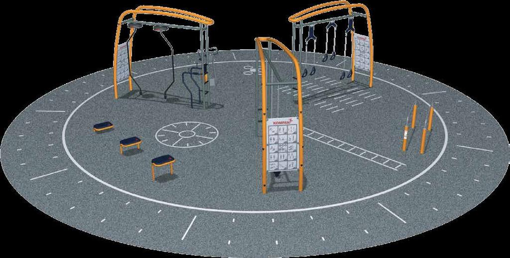

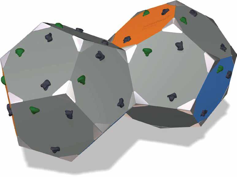
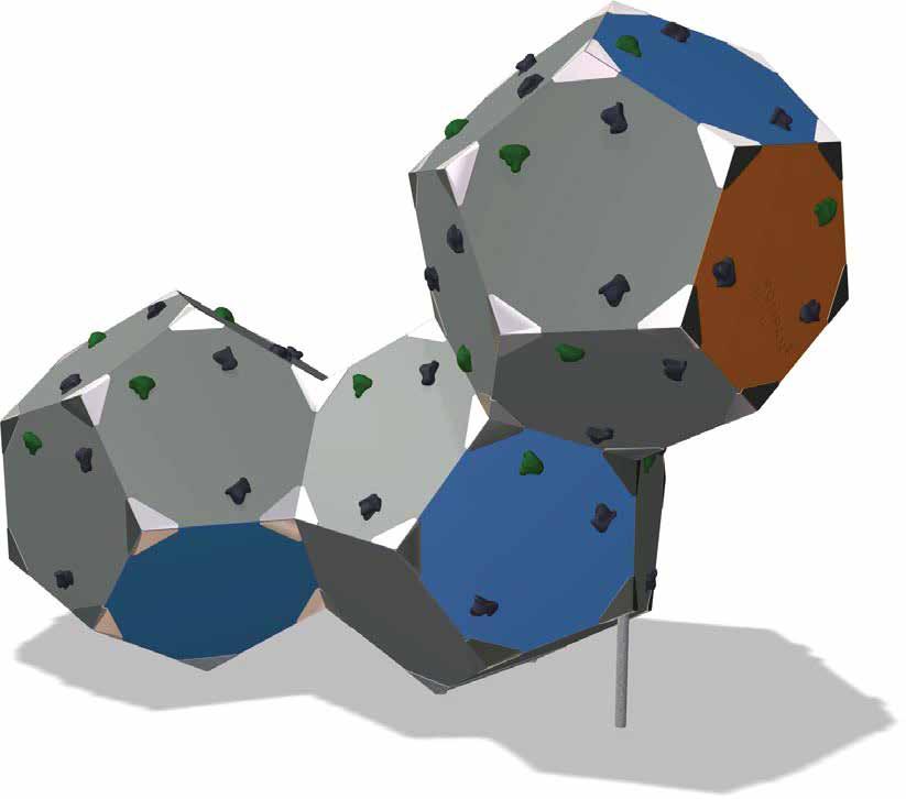
8 FITNESS & CLIMBING AREA
City of Grande Prairie Development Services Department
 City of Grande Prairie Development Services Department ROYAL OAKS NORTH OUTLINE PLAN OP-07-03 NW 35-71-6 W6M May 7, 2007 Royal Oaks North Outline Plan TABLE OF CONTENTS 1.0 INTRODUCTION........ 3 1.1 Purpose
OP Council Resolution June 16, Planning and Development Services
 OP-08-01 Council Resolution June 16, 2008 Planning and Development Services Kingsgate Landing Outline Plan Table of Contents 1.0 Introduction 1 1.1 Purpose of Plan 1 1.2 Plan Area Location 1 1.3 Ownership
GATEWAY AREA STRUCTURE PLAN
 CHESTERMERE GATEWAY AREA STRUCTURE PLAN COMMUNITY OPEN HOUSE SEPTEMBER 22 nd, 2015 PLAN AREA ± 512 hectares (± 1,265 acres) GATEWAY LOCATION UNDEVELOPED LANDS PRESENT AGRICULTURAL USE REGIONAL LAND USE
Rocky View County Plans
 COUNTY PLAN Guides overall growth and development for the county. INTER-MUNICIPAL DEVELOPMENT PLAN Guides growth and development in an area where the County shares a border with another municipality. -
ADMINISTRATION RECOMMENDATION 2016 November 03. That Calgary Planning Commission recommends APPROVAL of the proposed Land Use Amendment.
 Page 1 of 12 EXECUTIVE SUMMARY This Land Use Amendment application covers an area of 75.76 hectares ± (187.20 acres ±) located in northeast Calgary, bound by Stoney Trail NE to the north, 128 Avenue NE
LAND USE AMENDMENT CORNERSTONE (WARD 3) COUNTRY HILLS BOULEVARD AND STONEY TRAIL NE BYLAW 9D2017
 COUNTRY HILLS BOULEVARD AND STONEY TRAIL NE BYLAW 9D2017") Page 1 of 12 EXECUTIVE SUMMARY This Land Use Amendment application covers an area of 54.92 hectares ± (135.71 acres ±) located in northeast Calgary, bound by Country Hills Boulevard NE to the north and
Page 1 of 12 EXECUTIVE SUMMARY This Land Use Amendment application covers an area of 54.92 hectares ± (135.71 acres ±) located in northeast Calgary, bound by Country Hills Boulevard NE to the north and
Outline Plan in Belvedere (Ward 9) at Street SE, LOC (OP)
 at Street SE, LOC (OP)") 2018 October 04 Page 1 of 12 EXECUTIVE SUMMARY This outline plan application was submitted by B&A Planning Group on 2016 July 15, on behalf of Tristar Communities Inc. for 50.14 hectares (123.89 acres)
2018 October 04 Page 1 of 12 EXECUTIVE SUMMARY This outline plan application was submitted by B&A Planning Group on 2016 July 15, on behalf of Tristar Communities Inc. for 50.14 hectares (123.89 acres)
ADMINISTRATION RECOMMENDATION(S) 2017 February 09. That Calgary Planning Commission recommends APPROVAL of the proposed Land Use Amendment.
 2017 February 09. That Calgary Planning Commission recommends APPROVAL of the proposed Land Use Amendment.") Page 1 of 10 EXECUTIVE SUMMARY This land use amendment application is to accommodate changes to the location of a stormwater retention pond and land use boundaries adjacent to Environmental Reserve in
Page 1 of 10 EXECUTIVE SUMMARY This land use amendment application is to accommodate changes to the location of a stormwater retention pond and land use boundaries adjacent to Environmental Reserve in
Bylaw C-1262 Adopted February 6, Planning and Development Department
 Bylaw C-1262 Adopted February 6, 2012 Planning and Development Department CITY OF GRANDE PRAIRIE BYLAW C-1262 A Bylaw to adopt the Brookfield Neighbourhood Outline Plan THE MUNICIPAL COUNCIL OF THE CITY
LAND USE AMENDMENT CORNERSTONE (WARD 3) 60 STREET NE AND COUNTRY HILLS BOULEVARD NE MAP 26NE BYLAW 22D2017
 60 STREET NE AND COUNTRY HILLS BOULEVARD NE MAP 26NE BYLAW 22D2017") Page 1 of 14 EXECUTIVE SUMMARY This Land Use Amendment application covers an area of 43.76 hectares ± (108.14 acres ±) located in northeast Calgary, bound by Country Hills Boulevard NE to the south and
Page 1 of 14 EXECUTIVE SUMMARY This Land Use Amendment application covers an area of 43.76 hectares ± (108.14 acres ±) located in northeast Calgary, bound by Country Hills Boulevard NE to the south and
Bylaw C-1186 Adopted November 5, Planning and Development Services
 Bylaw C-1186 Adopted November 5, 2007 Planning and Development Services CITY OF GRANDE PRAIRIE OFFICE CONSOLIDATION BYLAW C-1186 A Bylaw to adopt the Westgate Area Structure Plan (As Amended by Bylaw C-1186-1,
ADMINISTRATION RECOMMENDATION(S) 2017 June 15. That Calgary Planning Commission recommends APPROVAL of the proposed Land Use Amendment.
 2017 June 15. That Calgary Planning Commission recommends APPROVAL of the proposed Land Use Amendment.") Page 1 of 7 EXECUTIVE SUMMARY The proposed land use amendment seeks to redesignate a Special Purpose Future Urban Development (S-FUD) District parcel in Residual Ward 3 Sub Area 3H to Industrial Outdoor
Page 1 of 7 EXECUTIVE SUMMARY The proposed land use amendment seeks to redesignate a Special Purpose Future Urban Development (S-FUD) District parcel in Residual Ward 3 Sub Area 3H to Industrial Outdoor
S o u t h C e n t r a l O u t l i n e P l a n. Leduc Business Park. North Leduc Industrial Area Structure Plan C it y of Led u c.
 Leduc Business Park North Leduc Industrial Area Structure Plan C it y of Led u c Prepared for Farm Air Properties Inc. January, 2007 Table of Contents Page Number 1.0 Purpose of Plan and Definition of
Westwind Developments Ltd. PIONEER LANDS AREA STRUCTURE PLAN - PROPOSED AMENDMENT
 FEBRUARY 2013 TABLE OF CONTENTS 1.0 BACKGROUND... 1 1.1 Amendment... 1 2.0 LOCATION & CONTEXT... 2 2.1 Land Ownership... 2 3.0 POLICY CONTEXT... 3 3.1 Municipal Development Plan... 3 3.2 Capital Region
Leduc Industrial Outline Plan SE W4
 Leduc Industrial Outline Plan SE 1-50-25-W4 Within the North Leduc Industrial ASP Prepared for: Leduc Energy Park Ltd. Prepared by: Stantec Consulting Ltd. File No. 1161 104655 V5 Table of Contents 1.0
This application has been applied for with support of an Outline Plan to provide the technical details for the site s development.
 Page 1 of 13 EXECUTIVE SUMMARY This application consists of a Land Use Amendment application proposing redesignation from Special Purpose Future Urban Development (S-FUD) District to an assortment of multiresidential,
Municipal Development Plan. Summer Village of ROCHON SANDS. Bylaw #241-18
 Municipal Development Plan Summer Village of ROCHON SANDS Bylaw #241-18 TABLE OF CONTENTS PART ONE: BACKGROUND AND PURPOSE 3 SECTION 1: BACKGROUND 3 SECTION 2: GOALS AND POLICIES 3 PART TWO: PHYSICAL ENVIRONMENT
NEIGHBOURHOOD STRUCTURE PLAN
 NEIGHBOURHOOD STRUCTURE PLAN December 2012 2437.0023.06 This report is prepared for the sole use of Vesta Properties Ltd. No representations of any kind are made by Urban Systems Ltd. or its employees
Palisades Outline Plan
 NE ¼ 25 36 28 W4 Town of Penhold Approved August 13, 2012 Contents Figures & Tables... 2 Introduction... 1 Overview... 1 Purpose... 1 Development Area... 3 Ownership... 3 Topography... 3 Existing & Surrounding
Waverley West B Secondary Planning Process. Open House South Pointe School April 25, 2018
 averley est B Secondary Planning Process South Pointe School April 25, 2018 averley est B Secondary planning process open house Please review the boards and provide your feedback. 1 The Role of a Secondary
Community Information Meeting
 Queensborough Eastern Community Information Meeting July 24, 2014 Cameron Chalmers, MCIP, RPP Platform Properties Meeting Format Purpose Format The purpose of the meeting is to invite the community to
MOUNT PLEASANT SECONDARY PLAN & VILLAGE BLOCK PLAN. Wednesday, March 5, 2008 Informal Public Open House
 MOUNT PLEASANT SECONDARY PLAN & VILLAGE BLOCK PLAN Wednesday, March 5, 2008 Informal Public Open House 1. Welcome & Introductions 2. Highlights of Provincial Growth Plan 3. Overview and Status Update -
Arbour Lake Development Application
 Arbour Lake Development Application This public engagement session is intended to share information about the proposal to develop the Hawkwood Farm, answer questions and collect feedback on various parts
Chappelle Neighbourhood Area Structure Plan
 Chappelle Neighbourhood Area Structure Plan Office Consolidation September 2017 Prepared by: City Planning Urban Form and Corporate Strategic Development City of Edmonton Bylaw 14779 was adopted by Council
LAND USE AMENDMENT DOWNTOWN COMMERCIAL CORE (WARD 7) MACLEOD TRAIL SE AND 5 AVENUE SE BYLAW 254D2017
 MACLEOD TRAIL SE AND 5 AVENUE SE BYLAW 254D2017") Page 1 of 10 EXECUTIVE SUMMARY This Land Use Amendment application seeks to redesignate a full downtown block (currently the YWCA site) from a Direct Control based on the CM-2 District (Land Use Bylaw
Page 1 of 10 EXECUTIVE SUMMARY This Land Use Amendment application seeks to redesignate a full downtown block (currently the YWCA site) from a Direct Control based on the CM-2 District (Land Use Bylaw
Planning, Property and Development Department Report. To the Riel Community Committee
 Planning, Property and Development Department Report To the Riel Community Committee Date: October 30, 2006 File: SP 5/2006 Subject: Waverley West Northeast Neighbourhood Area Structure Plan Location:
5 TOWN OF MARKHAM OFFICIAL PLAN AMENDMENT NO. 144 MILLIKEN MAIN STREET SECONDARY PLAN
 5 TOWN OF MARKHAM OFFICIAL PLAN AMENDMENT NO. 144 MILLIKEN MAIN STREET SECONDARY PLAN The Planning and Economic Development Committee recommends the following: 1. The communication from Brendan O Callaghan,
Bressa Developments Limited. Planning Justification Report. Revised Draft Plan of Subdivision and Zoning By-Law Amendment
 Bressa Developments Limited Revised Draft Plan of Subdivision and Zoning By-Law Amendment Planning Justification Report Part of Lots 7 & 8 Concession 1, North of Dundas Street Town of Oakville September,
TABLE OF CONTENTS. Sierra Springs Outline Plan
 Sierra Springs Outline Plan TABLE OF CONTENTS 1. Introduction...3 1.1. Purpose of the Plan... 3 1.2. The Approval Process... 3 1.3. Policy and Legislative Framework... 3 2. Development Area...6 2.1. Location
THE CITY OF SPRUCE GROVE BYLAW C PIONEER LANDS AREA STRUCTURE PLAN AMENDMENT
 THE CITY OF SPRUCE GROVE BYLAW C-932-15 PIONEER LANDS AREA STRUCTURE PLAN AMENDMENT WHEREAS, pursuant to the Municipal Government Act, R.S.A. 2000, c. M-26, including amendments, a municipality may adopt
Staff Report and Recommendation
 Community Planning and Development Planning Services 201 W. Colfax Ave., Dept. 205 Denver, CO 80202 p: 720.865.2915 f: 720.865.3052 www.denvergov.org/cpd TO: City Council Neighborhoods and Planning Committee
Heritage Valley Town Centre Neighbourhood Area Structure Plan
 Heritage Valley Town Centre Neighbourhood Area Structure Plan Office Consolidation March 2011 Prepared by: Current Planning Branch Planning and Development Department City of Edmonton Bylaw 15296 was adopted
Bylaw No. B-03/2011 Adopted by Airdrie City Council February 21, 2012
 COOPER S CROSSING STAGE 4 Neighbourhood Structure Plan City of Airdrie WESTMARK HOLDINGS LTD. Bylaw No. B-03/2011 Adopted by Airdrie City Council February 21, 2012 CONSULTANTS: LAND USE PLANNING: Southwell
SUNSET RIDGE - HARVEST VIEW SUSTAINABLE NEIGHBOURHOOD PLAN
 SUNSET RIDGE - HARVEST VIEW SUSTAINABLE NEIGHBOURHOOD PLAN November 2008 SUNSET RIDGE - HARVEST VIEW SUSTAINABLE NEIGHBOURHOOD PLAN This document outlines Dawson Creek s first official sustainable neighbourhood
Gorman Neighbourhood Structure Plan LDA WELCOME RESIDENTS. edmonton.ca/gormanneighbourhoodplan. CITY OF EDMONTON Sustainable Development
 Gorman Neighbourhood Structure lan WELCOME RESIDENTS Gorman Neighbourhood Structure lan AGENDA & CONTACT INFO Tonight s Agenda City of Edmonton File lanner Information Sarah Ramey, File lanner Registration
WESTMINSTER GLEN CONCEPTUAL SCHEME
 WESTMINSTER GLEN CONCEPTUAL SCHEME Bylaw C-5379-2001, Adopted July 31, 2001 MUNICIPAL DISTRICT OF ROCKY VIEW NO. 44 Department of Planning and Development MUNICIPAL DISTRICT OF ROCKY VIEW NO. 44 BYLAW
BEAU VAL PARK/ BEAUMONT LAKES SOUTH Area Structure Plan
 BEAU VAL PARK/ BEAUMONT LAKES SOUTH (Parcels A/B/C/D, Plan 1912 EO, Plan 1025 KS) Prepared For: 1871368 AB Ltd. Presented By: DGE Civil Engineering Consultants 221, 9223-28 Avenue Edmonton, AB T6N 1N1
Ambleside Neighbourhood Structure Plan
 Ambleside Neighbourhood Structure Plan Office Consolidation May 2016 Prepared by: City Planning Sustainable Development City of Edmonton Bylaw 14057 was adopted by Council in July 2005. In May 2016, this
THE CITY OF WINNIPEG. TRANSCONA WEST AREA STRUCTURE PLAN BY-LAW NO. 215/2006, as amended
 THE CITY OF WINNIPEG BY-LAW NO. 215/2006, as amended A By-law of THE CITY OF WINNIPEG to adopt a Secondary Plan for the Transcona West Neighbourhood. THE CITY OF WINNIPEG, in Council assembled, enacts
MAGRATH HEIGHTS NEIGHBOURHOOD AREA STRUCTURE PLAN AMENDMENT
 Attachment 2E MAGRATH HEIGHTS NEIGHBOURHOOD AREA STRUCTURE PLAN AMENDMENT NASP JUNE 2008 TABLE OF CONTENTS 1.0 INTRODUCTION...1 1.1 Purpose of Amendment... 1 1.2 Local Setting & Access... 1 1.3 Proposed
FORMER CANADIAN FORCES BASE (CFB) ROCKCLIFFE SECONDARY PLAN. Official Plan Amendment XX to the Official Plan for the City of Ottawa
 ROCKCLIFFE SECONDARY PLAN. Official Plan Amendment XX to the Official Plan for the City of Ottawa") FORMER CANADIAN FORCES BASE (CFB) ROCKCLIFFE SECONDARY PLAN Official Plan Amendment XX to the Official Plan for the City of Ottawa 1 INDEX THE STATEMENT OF COMPONENTS PART A THE PREAMBLE PAGE Purpose...
FORMER CANADIAN FORCES BASE (CFB) ROCKCLIFFE SECONDARY PLAN Official Plan Amendment XX to the Official Plan for the City of Ottawa 1 INDEX THE STATEMENT OF COMPONENTS PART A THE PREAMBLE PAGE Purpose...
AREA STRUCTURE PLAN NE W5M. Adopted by Council September 27, 2010 Bylaw
 AREA STRUCTURE PLAN NE 5-33-1 W5M Adopted by Council September 27, 2010 Bylaw 2010-14 CONTENTS 1.0 Introduction... 3 1.1 Purpose... 3 1.2 Objectives... 3 1.3 Discovery Plains Community Vision... 3 1.3.1
THE CITY OF SPRUCE GROVE BYLAW C PIONEER LANDS AREA STRUCTURE PLAN AMENDMENT
 THE CITY OF SPRUCE GROVE BYLAW C-797-11 PIONEER LANDS AREA STRUCTURE PLAN AMENDMENT WHEREAS, pursuant to the Municipal Government Act, R.S.A., 2000, c.m-26, a municipality shall adopt Area Structure Plans
The Uplands Area Structure Plan. City of Cold Lake, NE & SE W4
 City of Cold Lake, NE & SE 13-63-2-W4 July 2009 1 Contents 1 Background information... 1 1.1 Foreword... 1 1.2 Purpose... 1 1.3 Plan Area and Location... 1 1.4 Ownership... 2 2 Factors Influencing Development...
BRIDGES OF LANGDON CONCEPTUAL SCHEME
 BRIDGES OF LANGDON CONCEPTUAL SCHEME Office Consolidation This page contains the history of relevant bylaws affecting this office consolidation. A copy of the original Bylaw and all amending Bylaws can
City of Grande Prairie Development Services Department KENNEDY DEVELOPMENTS LTD. OUTLINE PLAN OP-09-01
 City of Grande Prairie Development Services Department KENNEDY DEVELOPMENTS LTD. OUTLINE PLAN OP-09-01 July 27, 2009 TABLE OF CONTENTS 1.0 Introduction... 1 1.1 Plan Area Location & Context... 1 1.2 Ownership
DAMKAR LANDS An Amendment to Bylaw C being the Watermark Conceptual Scheme
 APPENDIX 8 DAMKAR LANDS An Amendment to Bylaw C-6798-009 being the Watermark Conceptual Scheme Table of Contents 1.0 Introduction 1.0 Development Objectives 1 3.0 History, Vision and Guiding Principles
C ity of Grande Prairie Development Services Department
 C ity of Grande Prairie Development Services Department FAIRWAY DEVELOPMENT OUTLINE PLAN OP 08 09 Approved April 6, 2009 Prepared by: Focus Corporation Table of Contents 1.0. Introduction 2 3 1.1. Plan
Table 8-4: Road Classification Local Roads, second table, of Chapter 8 Create a Multi-Modal City, be amended by adding the following:
 1 Port Street East Official Plan Amendment APPENDIX 3 Amendments to Mississauga Official Plan Table 8-4: Road Classification Local Roads, second table, of Chapter 8 Create a Multi-Modal City, be amended
1071 King Street West Zoning Amendment Application - Preliminary Report
 STAFF REPORT ACTION REQUIRED 1071 King Street West Zoning Amendment Application - Preliminary Report Date: August 9, 2012 To: From: Wards: Reference Number: Toronto and East York Community Council Director,
ADMINISTRATION RECOMMENDATION(S) 2016 November 03. That Calgary Planning Commission recommends APPROVAL of the proposed Land Use Amendment.
 2016 November 03. That Calgary Planning Commission recommends APPROVAL of the proposed Land Use Amendment.") Page 1 of 7 EXECUTIVE SUMMARY This Land Use Amendment application seeks to redesignate a portion of the parcel from Industrial General (I-G) District to Special Purpose City and Regional Infrastructure
Page 1 of 7 EXECUTIVE SUMMARY This Land Use Amendment application seeks to redesignate a portion of the parcel from Industrial General (I-G) District to Special Purpose City and Regional Infrastructure
RRW Stonebrook, LLC Tentative Map Findings
 RRW Stonebrook, LLC Tentative Map Findings FINDING T1: The request conforms to the Master Plan and zoning ordinances. RELATIONSHIP TO THE MASTER PLAN 1. The respective development is located within an
Red Fox Commercial Outline Plan
 Red Fox Commercial Outline Plan City of Cold Lake, Alberta Prepared by Durrance Projects Ltd and Ross W. Sharp & Associates Ltd October 2014 Rupert 1 Table of Contents 1. PURPOSE...3 1.1. Location...4
1.4 TRANSIT VISION 2040 FROM VISION TO ACTION THEME 1: PUTTING TRANSIT AT THE CENTRE OF COMMUNITIES. Fully integrate transit with community design
 TRANSIT VISION 2040 FROM VISION TO ACTION TRANSIT VISION 2040 defines a future in which public transit maximizes its contribution to quality of life with benefits that support a vibrant and equitable society,
South Macleod Centre. Area Structure Plan
 South Macleod Centre Area Structure Plan 58P2017 September 2017 Publishing information Title South Macleod Centre Area Structure Plan Author The City of Calgary Status Approved by City Council Bylaw 58P2017
SANDSTONE SPRINGS AREA STRUCTURE PLAN
 Sandstone Springs Development Corp. AREA STRUCTURE PLAN This report is prepared for the sole use of Sandstone Springs Development Corp. No representations of any kind are made by Urban Systems Ltd. or
HAMPTONS Area Structure Plan Medicine Hat, Alberta
 HAMPTONS Medicine Hat, Alberta Prepared for: Lansdowne Equity Ventures Ltd. Prepared by: UMA Engineering Ltd. May 2005 Table of Contents Page No. 1. INTRODUCTION...1 1.1 Purpose...1 1.2 Location & Existing
Welcome to the Oakridge Centre Open House
 Welcome to the Oakridge Centre Open House Why is the City hosting this event? This open house is to inform you of a rezoning application submitted to the City of Vancouver to amend the existing CD-1 (Comprehensive
AREASTRUCTURE PLAN AMENDMENT COCHRANE NORTH
 AREASTRUCTURE PLAN AMENDMENT COCHRANE NORTH In order to implement the vision outlined in the Conceptual Scheme, the following three amendments to the Cochrane North ASP are proposed: 1. Allow commercial
Area Structure Plan. A Community for All Seasons. Prepared for the Town of Strathmore. Consolidated September 28, 2015
 Area Structure Plan Prepared for the Town of Strathmore A Community for All Seasons Lakewood Meadows Area Structure Plan Prepared for the Town of Strathmore And Lakewood Meadows Inc. i Table of Contents
BYLAW C A Bylaw of Rocky View County to amend Land Use Bylaw C
 BYLAW C-7720-2017 A Bylaw of Rocky View County to amend Land Use Bylaw C-4841-97. The Council of Rocky View County enacts as follows: PART 1 TITLE This Bylaw shall be known as Bylaw C-7720-2017. PART 2
Area Structure Plan. South East Leduc Area Structure Plan. In the City of Leduc, Alberta. August Prepared for: Report No.
 Area Structure Plan In the City of Leduc, Alberta August 2014 Prepared for: Report No. 6162-03 5307 47 Street, Edmonton, Alberta T6B 3T4 Phone: (780) 440-4411 Fax: (780) 440-2585 August 2014 TABLE OF CONTENTS
The Hamptons Neighbourhood Structure Plan
 The Hamptons Neighbourhood Structure Plan Office Consolidation December 2014 Prepared by: City Planning City of Edmonton Bylaw 11751, was adopted by Council in June 1998. In December 2014, this document
REPORT TO THE CHIEF ADMINISTRATIVE OFFICER FROM THE DEVELOPMENT AND ENGINEERING SERVICES DEPARTMENT
 REPORT TO THE CHIEF ADMINISTRATIVE OFFICER FROM THE DEVELOPMENT AND ENGINEERING SERVICES DEPARTMENT ON REZONING APPLICATION NO. REZ00587 DEVELOPMENT PERMIT APPLICATION NO. DPM00559 1430 SUMMIT DRIVE OWNER/APPLICANT:
Growth Area Reviews Preliminary Directions for Midtown Oakville, the Uptown Core and Palermo Village
 Growth Area Reviews Preliminary Directions for Midtown Oakville, the Uptown Core and Palermo Village Livable Oakville Council Subcommittee January 15, 2018 1 Introduction Why a study? January 2014 Signaled
The Corporation of the TOWN OF MILTON
 Report to: From: Chair & Members of the Administration & Planning Standing Committee W.F. Mann, Director of Planning and Development Date: April 16, 2012 PD 022-12 (Z19/11) Subject: Technical Report Proposed
Natomas Vision Plan and PLNP
 Natomas Vision Plan 20030171 and PLNP2014-00172 Department of Community Development Planning and Environmental Review Leighann Moffitt Sub-Agenda 1. Staff Presentation Leighann Moffitt, County Planning
Municipal Development Plan 2013
 UNIQUELY STONY PLAIN: Municipal Development Plan 2013 Quick Reference Guide What is a Municipal Development Plan (MDP)? The Town s highest-level planning document Sets the long-term vision and key themes
Simon Fraser University Official Community Plan
 Simon Fraser University Official Community Plan 1.0 Introduction Adopted 1996 September 9, Amended April 15, 2002 1.1 The Role of the S.F.U. Official Community Plan 1.1.1 The Simon Fraser University Official
Report to: Development Services Committee Report Date: September 11, 2017
 ~RKHAM Report to: Development Services Committee Report Date: September 11, 2017 SUBJECT: PREPARED BY: Conceptual Master Plan for the Future Urban Area - Community Structure Plan and Key Policy Direction
393, 395, 397, 399, 401 and 403 Spring Garden Avenue Official Plan and Zoning By-law Amendment Application Preliminary Report
 STAFF REPORT ACTION REQUIRED 393, 395, 397, 399, 401 and 403 Spring Garden Avenue Official Plan and Zoning By-law Amendment Application Preliminary Report Date: March 29, 2010 To: From: Wards: Reference
13. VANDORF-PRESTON LAKE SECONDARY PLAN 13.1 INTRODUCTION
 13. VANDORF-PRESTON LAKE SECONDARY PLAN 13.1.1 Purpose 13.1 INTRODUCTION The Vandorf-Preston Lake Secondary Plan establishes the principles, objectives and general policies, as well as specific strategies
1.0 Purpose of a Secondary Plan for the Masonville Transit Village
 Report to Planning and Environment Committee To: Chair and Members Planning & Environment Committee From: John M. Fleming Managing Director, Planning and City Planner Subject: Masonville Transit Village
6 RURAL RESIDENTIAL. 6.1 Rural Use. Rural Use (RU) Goals and Objectives. Policy Goal
 Goals and Objectives. Policy Goal") 6 RURAL RESIDENTIAL The vast majority of East Hants 466,426 acres are considered rural in nature and are characterized by a great diversity of uses. Because of this, land use policies in rural areas of
6 RURAL RESIDENTIAL The vast majority of East Hants 466,426 acres are considered rural in nature and are characterized by a great diversity of uses. Because of this, land use policies in rural areas of
Queensborough Eastern Neighbourhood Node. Community Open House
 Queensborough Eastern Community Open House The Vision The Queensborough Eastern will become the heart of eastern Queensborough. Through a sensitive mix of viable commercial and residential areas, the neighbourhood
SUMMER VILLAGE OF SUNRISE BEACH
 SUMMER VILLAGE OF SUNRISE BEACH Municipal Development Plan Bylaw No. 132-13 ~ 2 ~ Summer Village of Sunrise Beach Municipal Development Plan 1 INTRODUCTION 1.1 SETTING The Summer Village of Sunrise Beach
C.10 Boyne Survey Secondary Plan
 C.10 Boyne Survey Secondary Plan SECONDARY PLAN July 2017 C.10 BOYNE SURVEY SECONDARY PLAN C.10.1 C.10.1.1 GENERAL PURPOSE The purpose of the Boyne Survey Secondary Plan is to establish a more detailed
Brampton. Secondary Plan. Review. Bram West. A New Direction in Planning & Public Consultation
 Brampton Bram West Secondary Plan Review A New Direction in Planning & Public Consultation Introduction The Bram West Secondary Plan Review offers an important opportunity for the community to define a
HAYS RIDGE NEIGHBOURHOOD AREA STRUCTURE PLAN
 Melcor Developments Ltd. HAYS RIDGE NEIGHBOURHOOD AREA STRUCTURE PLAN CONSOLIDATED APRIL 2012 Hays Ridge Neighbourhood Area Structure Plan Office Consolidation April 2012 Prepared by: Current Planning
TOWN OF BRUDERHEIM Report to the capital region board
 TOWN OF BRUDERHEIM Report to the capital region board Introduction to the Town of Bruderheim Municipal Development Plan amendment and Relation to the CRB Evaluation Criteria 02 march 2017 1 Introduction
Auburn Bay Community Plan
 Auburn Bay Community Plan Auburn Bay Community Plan Office Consolidation June 2007 Bylaw 15P2003 Approved January 19, 2004 Note: This office consolidation includes the following amending Bylaws: Amendment
JASPER PLACE. Area Redevelopment Plan
 JASPER PLACE Area Redevelopment Plan Executive Summary Jasper Place is an established community where people live, work and play. The Jasper Place Area Redevelopment Plan (ARP) provides a tool to help
GRAYSTONE ESTATES CONCEPTUAL SCHEME
 GRAYSTONE ESTATES CONCEPTUAL SCHEME Bylaw C-5438-2001, Adopted November 6, 2001 MUNICIPAL DISTRICT OF ROCKY VIEW NO. 44 Department of Planning and Development TABLE OF CONTENTS 1.0 INTRODUCTION 5 1.1 Conceptual
Plumpton Neighbourhood Development Plan Revised Pre Submission Document - Regulation 14 Consultation
 REPRESENTATIONS... Plumpton Parish Council Plumpton Neighbourhood Development Plan Revised Pre Submission Document - Regulation 14 Consultation Representations submitted on behalf of: Cala Homes (South
City of Surrey PLANNING & DEVELOPMENT REPORT. OCP Amendment of a portion from Suburban to Urban
 City of Surrey PLANNING & DEVELOPMENT REPORT File: 7911-0119-00 Planning Report Date: November 7, 2011 PROPOSAL: OCP Amendment of a portion from Suburban to Urban Rezoning from RA to RH and RF in order
Transfer of Development Rights
 Transfer of Development Rights Chesterfield Township: A Case Study New Jersey Highlands Council March 5, 2009 Chesterfield Township s Old York Village Transfer of Development Rights and Traditional Neighborhood
11.4 Highway 400 North Employment Lands Secondary Plan APPROVED BY THE ONTARIO MUNICIPAL BOARD ON NOVEMBER 21, 2011
 11.4 Highway 400 North Employment Lands Secondary Plan APPROVED BY THE ONTARIO MUNICIPAL BOARD ON NOVEMBER 21, 2011 11.4.1 General 11.4.1.1. as approved by the Ontario Municipal Board on November 21, 2011,
ONTARIO MUNICIPAL BOARD
 PL 120483 ONTARIO MUNICIPAL BOARD Applicant/Appellant: 2124123 Ontario Limited Subject: OPA, Rezoning and Draft Plan of Subdivision Municipal Address: 3940 Highway 7 East Municipality: City of Markham
ADMINISTRATION RECOMMENDATION(S) 2018 January 25. That Calgary Planning Commission recommend APPROVAL of the proposed Land Use Amendment.
 2018 January 25. That Calgary Planning Commission recommend APPROVAL of the proposed Land Use Amendment.") Page 1 of 9 EXECUTIVE SUMMARY This land use amendment proposes to redesignate a parcel from DC Direct Control District to Multi-Residential Contextual Grade-Oriented (M-CG) District to allow for multi-residential
Page 1 of 9 EXECUTIVE SUMMARY This land use amendment proposes to redesignate a parcel from DC Direct Control District to Multi-Residential Contextual Grade-Oriented (M-CG) District to allow for multi-residential
City of Spruce Grove East Campsite Business Park Area Structure Plan
 City of Spruce Grove East Campsite Business Park Area Structure Plan Prepared by: UMA Engineering Ltd. 17007 107 Avenue Edmonton, AB T5S 1G3 T 780.486.7000 F 780.486.7070 www.uma.aecom.com Job No. 1560
Charlesworth Neighbourhood Structure Plan
 Charlesworth Neighbourhood Structure Plan Office Consolidation May 2016 Prepared by: City Planning Branch Sustainable Development Department City of Edmonton Bylaw 14010, as amended, was adopted by Council
Further input invited as Colchester Growth Strategy nears final phase
 IUE 3 / NOVEMBER 2015 Further input invited as Colchester Growth trategy nears final phase trathcona County is seeking public feedback as it enters the final phase of work on a Growth Management trategy
PART B.17 Coopertown Neighbourhood Plan
 PART B.17 Coopertown Neighbourhood Plan Bylaw #: Approved by Council: Table of Contents INTRODUCTION... 1 1.1. Background... 1 1.2. Location... 1 1.3. Regulatory Context... 2 1.4. Interpretation... 5 2.
WHAT IS THE PURPOSE OF THIS OPEN HOUSE?
 WHAT IS THE PURPOSE OF THIS OPEN HOUSE? This open house presents: A proposed text amendment to increase height limits for the CD-1 (402) zoning to 22.9m (75 ft) and 18.3m (60 ft) in two sub-areas in the
POLICY AMENDMENT AND LAND USE AMENDMENT TUXEDO PARK (WARD 9) CENTRE STREET N AND 26 AVENUE NE BYLAWS 36P2017 AND 234D2017
 CENTRE STREET N AND 26 AVENUE NE BYLAWS 36P2017 AND 234D2017") Page 1 of 11 EXECUTIVE SUMMARY This application proposes to redesignate a single parcel of land in the Community of Tuxedo Park from Commercial Corridor 2 (C-COR2 f1h10) District to Mixed Use Active Frontage
Page 1 of 11 EXECUTIVE SUMMARY This application proposes to redesignate a single parcel of land in the Community of Tuxedo Park from Commercial Corridor 2 (C-COR2 f1h10) District to Mixed Use Active Frontage
South Shepard Area Structure Plan
 South Shepard Area Structure Plan calgary.ca/planning Working together to make a great city better calgary.ca call 3-1-1 Onward/ Plan It Calgary: We will continue to foster distinctive, attractive communities
Providence. Area Structure Plan
 Providence Area Structure Plan PUBLISHING INFORMATION Title: Author: Status: Printing Date: Additional Copies: Providence Area Structure Plan Local Area Planning and Implementation Planning, Development
NEIGHBORHOOD STRUCTURE PLAN
 June 19, 2006 BYLAW 05/2006 NEIGHBORHOOD STRUCTURE PLAN ADOPTED BY CITY COUNCIL June 19, 2006 BYLAW 05/2006 Prepared for: Hopewell Residential Communities Prepared by: Brown & Associates Planning Group
VILLAGE OF SPRING LAKE MUNICIPAL DEVELOPMENT PLAN
 VILLAGE OF SPRING LAKE MUNICIPAL DEVELOPMENT PLAN July 13, 2010 Table of Contents 1.0 Introduction 1.1 The Village of Spring Lake in Context 1 1.2 The Lake 2 1.3 Need for a Municipal Development Plan 2
PORT WHITBY COMMUNITY
 PORT WHITBY COMMUNITY SECONDARY PLAN UPDATE COMMUNITY IMPROVEMENT PLAN URBAN DESIGN GUIDELINES September 2015 DRAFT PROPOSED AMENDMENT NUMBER # to the Whitby Official Plan PURPOSE: The intent of this Amendment