Nanaimo OCP Community Consultation
|
|
|
- Justin Hall
- 5 years ago
- Views:
Transcription

1 Nanaimo OCP Community Consultation November 18, 2006 Cheeying Ho, Smart Growth BC
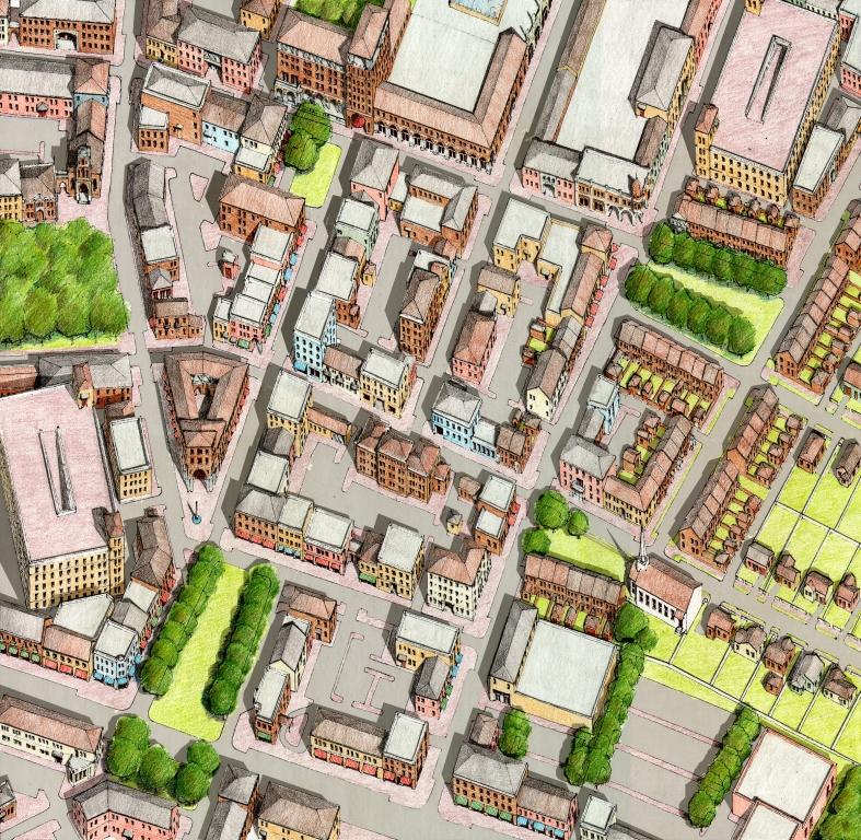
2 Outline Problems with conventional development patterns Smart growth principles Plan Nanaimo 5 goals Progress and areas for improvement Suggestions to advance Plan Nanaimo goals Examples of intensification
3 Smart Growth BC Founded in 1999, Smart Growth BC is a non-profit, nongovernment organization with a mandate to create more livable communities in British Columbia Education and assistance Research Community Engagement Implementation Advisory Services
4 Smart Growth is development that enhances the quality of life, protects the environment, uses land efficiently, and uses tax revenues wisely for the benefit of all.
5 The where and how of growth What is Smart Growth? More transportation choices and less traffic Vibrant cities, suburbs and towns Wider variety of housing choices Well-planned growth that improves quality of life Not against cars and roads Not anti-suburban Not about telling people where or how to live Not against growth
6 Why is Smart Growth a Good Thing?

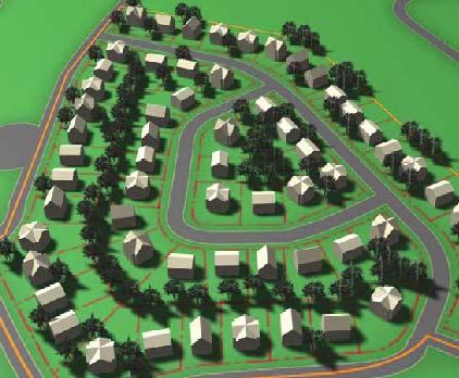
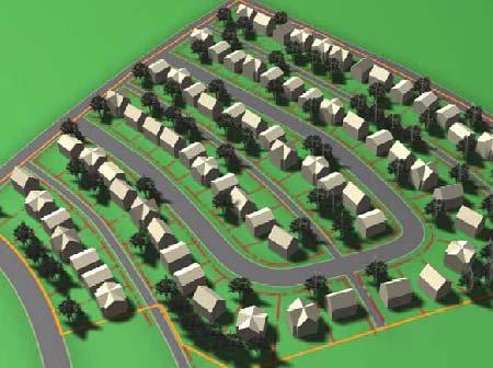
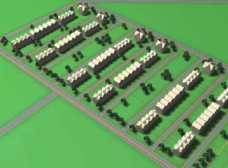
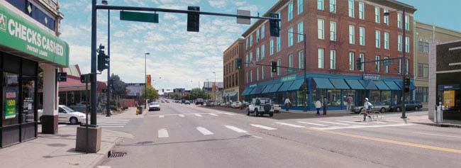
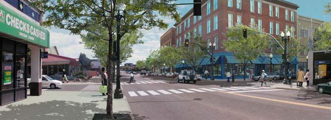
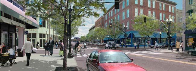
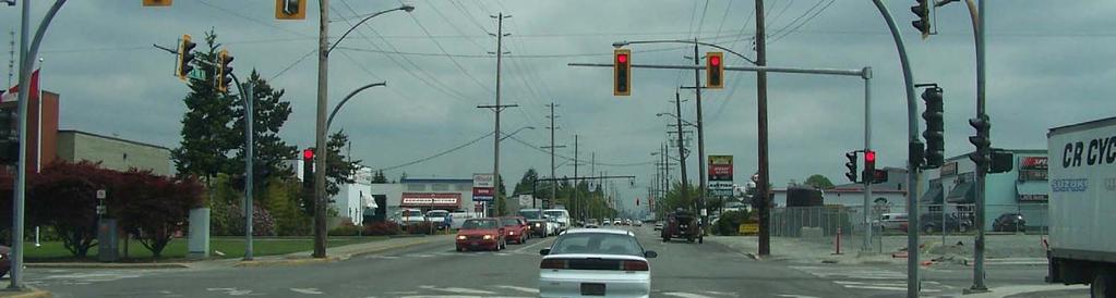
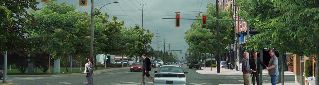
7 Anytown,, BC

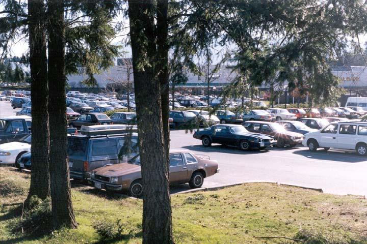
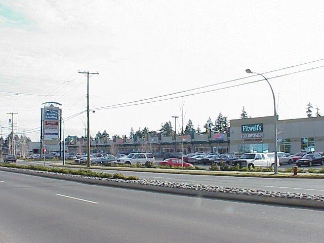
8 Anytown, BC

9 Anytown,, BC Anytown, BC
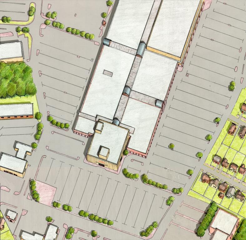
10 What s Wrong with the Current System? Segregation housing, retail, businesses all separated Automobile oriented development necessitating driving; poorly suited for walking, bicycling or transit the S word
11 What s Wrong with the Current System? Segregation housing, retail, businesses all separated Automobile oriented development necessitating driving; poorly suited for walking, bicycling or transit SPRAWL
12 Financial Impacts Costs to individuals to buy, insure, maintain, and gas up: CAA estimates about $8,000/year Costs to taxpayers of building and repairing roads, bridges, parking lots, stormwater systems.sprawl is expensive! Infrastructure costs per unit: $23,520 for low density development $4,408 for compact development

13 Environmental Impacts Air pollution Excess pavement and habitat loss Impact on streams and groundwater Disposal of used cars/parts

14 Social Impacts Loss of community identity and uniqueness Lack of housing and transportation choices

15 Health Impacts Air pollution Traffic accidents Lack of access to services and amenities Lack of physical activity, obesity

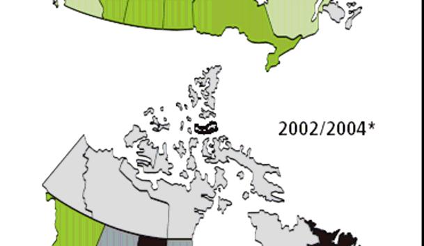
16
17 In the last 20 years, child obesity rates have quintupled in Canada (Centre for Health Promotion Studies). Almost 50% of Canadian adults and 37% of Canadian children are now either overweight or obese. Car-dependent Canadians get far less physical activity and are at increased risk of being overweight or obese.
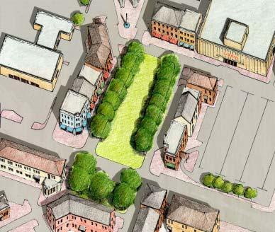
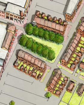
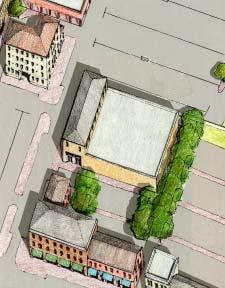
18 Smart Growth Principles 1. Mix land uses. 2. Build compact neighbourhoods. 3. Provide a variety of transportation choices. 4. Create diverse housing opportunities. 5. Encourage growth in existing communities. 6. Preserve open spaces, natural beauty, and environmentally sensitive areas. 7. Maintain agricultural lands. 8. Utilize smarter, and cheaper infrastructure and buildings. 9. Foster a unique neighbourhood identity. 10. Nurture engaged citizens.
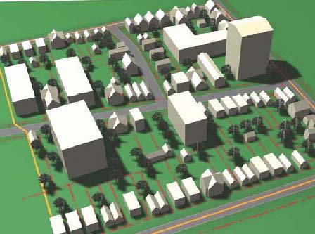
19 Plan Nanaimo Goals 1. Build complete, viable communities 2. Protect the environment 3. Manage urban growth 4. Improve mobility and servicing efficiency 5. Ongoing planning and community involvement
20 Plan Nanaimo enough approved land available today to accommodate about another 50,000 people (estimate is 33,000 people in next 25 years). growth rates between 2% and 4% per year - enough residential zoned land to accommodate growth for the next 14 to 28 years.
21 Plan Nanaimo fill up the existing areas now serviced and zoned for development. protect rural lands from urban sprawl with an Urban Containment Boundary. encourage significant additional development to occur inside Growth Centres - Town Centres and Neighbourhood Villages.
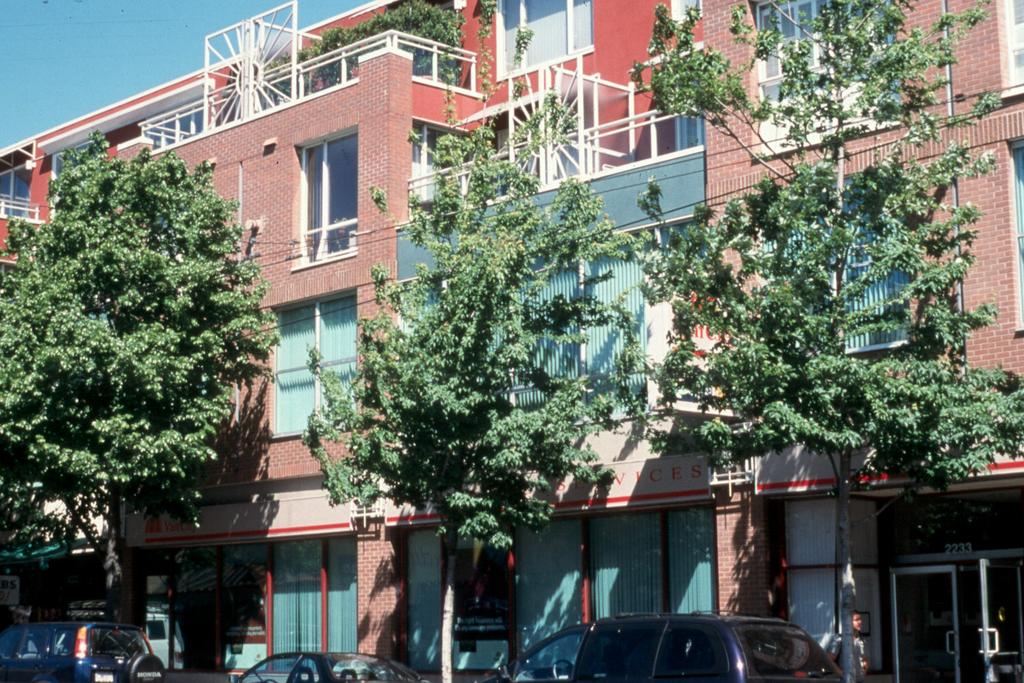
22 Plan Nanaimo does not support rezoning of existing agricultural lands for subdivision and development. does not support significant increases in the density of existing residential neighbourhoods by allowing rezoning for medium or high density housing in these areas.
23 Plan Nanaimo: progress Urban containment boundary in place Plans for creating complete, mixed use growth centres (town centres, regional shopping centres and neighbourhood villages) Improvements in cycling and pedestrian infrastructure Some alternative stormwater management practices Riparian protection policies in place Planning for transit along growth centre nodes DCC planning to reflect land use designations
24 Needs improvement Residential densities are low (4 units per hectare / 12 people per hectare) Segregated residential development still occurring Too many designated growth centres has diffused development interest Still lots of new development taking place outside designated growth centres 89% of commuters drive to work, despite the fact that commuting distances are very short (4.4 km) Transit service remains inefficient (3% trips)

25 Suggestions for OCP Review
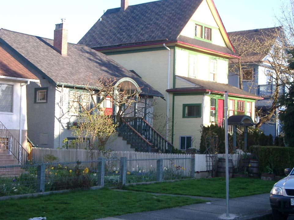
26 1. Build complete, viable communities Focus on fewer growth centres and strengthen investments and incentives for development. Priorize infill development over new undeveloped sites. Ensure increased density, mixture of land uses, and connectivity of streets. Strengthen local economic development opportunities.


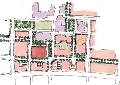
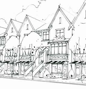
27 Residential Infill PROJECT DATA Site Area: 50 x 122 = Ha. 6 condominium town houses. Two loft style, one 2 storey, three 2.5 storey. Unit size: sq. ft. 105 uph, 0.95 FSR 63.6% site coverage $185,000 to $280,000

28 Small lot duplexes

29 Intensifying corridors, arterials

30 Connectivity and mixed use The three most important factors linked to increased walking were density, land use mix and connectivity.

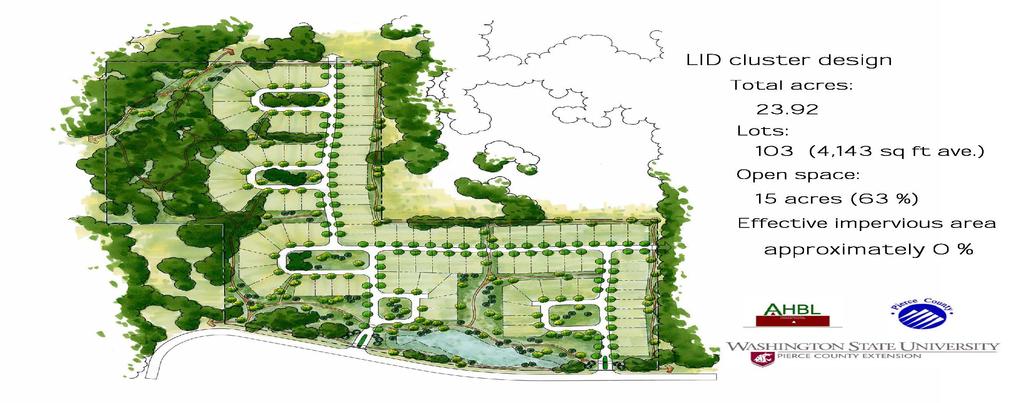
31 Strengthening local economic development
32 Other elements to include in goal Include specific goals and strategies to ensure affordable housing and a diverse range of housing options, especially for an aging demographic (173% growth in age group) Incorporate health goals into land use planning and consider aging demographics
33 Create diverse affordable housing options A variety of housing types and tenures accommodates people in different economic strata, family types, life stages or conditions.
34

35 East Clayton Neighbourhood Concept Plan Inclusionaryzoning for a range of densities and diversity of housing types Permits both secondary suites and coach houses
36 Healthy communities Plan for walking, cycling and transit Plan and design with people in mind, not the car (e.g. interconnected streets) Implement urban design that encourages walking (e.g. sidewalks, storefronts that face the street)
37 2. Protect the Environment Create compact developments to preserve greenspaces and protect environmentally sensitive areas Ensure development that respects natural systems and hydrological cycles Reduce automobile-oriented development to reduce traffic congestion

38 Respect natural systems Water sensitive land use planning Green infrastructure LEED design standards Permeable surfaces


39 Seattle Street Edge Alternatives Before After Natural drainage systems SEA reduced impervious surfaces to 11% less than traditional suburban street


40 Use Existing Drainage Systems so Runoff Infiltrates Naturally Result: 90% reduction in impact to stream hydrology, more greenspace
41
42 3. Manage urban growth Maintain and strengthen urban containment boundary Protect agricultural and rural lands Create industrial reserves or ensure designated space for industry within UCB
43 Urban Containment Boundaries Maximize use of existing infrastructure before making additional investments Help to create vibrant neighbourhoods and centres by concentrating human activity Preserve agricultural, rural and habitat lands Land is a finite resource. Undeveloped lands are required to sustain ecosystems and provide land for farming.

44 Use the ALR, green spaces, forested lands and open spaces as urban containment boundaries.
45 4. Improve mobility and servicing efficiency Focus should be on improving access, not necessarily mobility Urban development should be guided primarily by compact, efficient land use planning rather than the expansion of transportation capacity to meet increasing travel demand. Efficient walking, cycling and transit only become viable when a community achieves a level of compactness. Efficient transit requires residential densities of at least 10 units per acre (25 units per hectare). INVEST in pedestrian / bicycle infrastructure!


46 Density and transit usage

47 Transit service and density Source: BC Transit
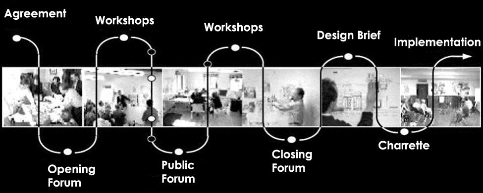
48 Annual petrol use vs density Dr. Jeff Kenworthy
49 4. Improve mobility and servicing efficiency Create compact developments and priorize infill to use existing infrastructure more effectively, reducing new servicing costs Explore strategies such as eco-industrial networking Implement a green building standard or policy such as LEED to reduce solid, liquid waste and energy requirements


50 Per capita service cost Residential density
51
52 5. Ongoing planning and community involvement Ensure early citizen engagement Provide meaningful opportunities for ongoing involvement Use collaborative and integrated visioning, design and planning processes


53 Smart Growth on the Ground
54 8 Guiding Principles
55 Process


56 Charrette Collaborative Integrated Multi-disciplinary Community-based Proactive Research-based Inclusive Representative Consensus-based Flexible
57 Charrette Team Business Developers Landowners Educators Community Recreation Environment Residents Industry District staff Council Squamish Nation Government Transportation Market / cost analysis Other experts Designers Facilitators
58 Project Results Research (e.g. green infrastructure costing; market opportunities) Policy alignment and revision (e.g. zoning and OCP changes, environment by-law) Developer and partner interest Capacity building Institutional change
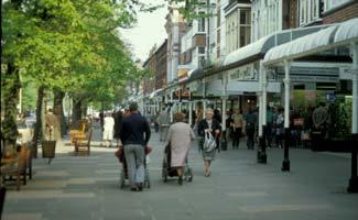
59 Squamish on the ground! Community support changing mind set; shifting community identity The District is preparing a Downtown Sub-Area Plan for the OCP New downtown developments are being reviewed against the recommendations of the Concept Plan Land owners involved in creating the plan Capilano College is exploring their options for an expanded downtown Squamish campus West Coast Environmental Law will assist Squamish with new by-laws and engineering standards The Bridging to the Future project will assist Squamish with energy planning for a growing population
60
61

62 Infill: Before and After

63

64 Selkirk Waterfront
65
66 Healthy by Design Any busy downtown sidewalk will reveal the mystery of why Vancouverites are an uncommonly vigorous and healthy bunch and why their city is so widely admired. Stand on Robson Street for five minutes on a weekday afternoon. Count the people walking past: 346. Note the number who are obviously overweight: 2. Estimate the number wearing backpacks: 100. Now take another five minutes to count the cars moving steadily and easily past: 74 (plus two trucks and three buses). Reach for your calculator: 4.5 pedestrians for every car. There you have it. Not exactly scientific proof, but an insight into Vancouver s formula for health residents and urban vitality: more walking, less driving. More than any North American city, Vancouver has intentionally merged public health with city planning. The goal is not just to promote recreation (there are plenty of bike trails and tennis courts), but to design physical activity into the daily routine, to build a city so compelling that people will leave their cars at home, strap on a backpack and take up walking as their primary mode of travel. Steve Berg, Star Tribune (Minneapolis/St Paul)
67 Smart Growth BC Thank You!
City of St. Thomas New Official Plan
 City of St. Thomas New Official Plan Sustainable & Healthy Community Workshop Ann Joyner and Paddy Kennedy Dillon Consulting Limited Work Shop Outline Introduction Presentation Exercise 1 (individual)
4 Sustainability and Growth Management
 4 Sustainability and Growth Management Introduction Traditionally, has assumed growth and development with limited consideration for the long-term negative social, environmental or economic impacts on
Improve Neighborhood Design and Reduce Non Point Source Water Pollution
 HOW TO Planning Guide Improve Neighborhood Design and Reduce Non Point Source Water Pollution This document was funded by a grant from the New Hampshire Coastal Program with funding from the National Oceanic
Concord Community Reuse Project Goals and Guiding Principles. Overarching Goals (OG)
") Concord Community Reuse Project Goals and Guiding Principles Overarching Goals (OG) No priority is implied by the order of presentation of the goals and guiding principles. Overarching goals for the Concord
Concord Community Reuse Project Goals and Guiding Principles Overarching Goals (OG) No priority is implied by the order of presentation of the goals and guiding principles. Overarching goals for the Concord
Welcome to the Oakridge Centre Open House
 Welcome to the Oakridge Centre Open House Why is the City hosting this event? This open house is to inform you of a rezoning application submitted to the City of Vancouver to amend the existing CD-1 (Comprehensive
SQUAMISH 2010 AND BEYOND COMMUNITY VISION
 Our plan has been imagined and created to be both pragmatic and visionary. At the core of the strategy is a consideration of the highway s role and its impact on the community. First and foremost in creating
New Partners for Smart Growth Conference February 5, 2010
 Dan Stroh, Planning Director City of Bellevue Planning and Community Development Bellevue, WA New Partners for Smart Growth Conference February 5, 2010 Summary of Project Long-range plan update for Bel-Red
10.0 Open Space and Public Realm
 10.0 Open Space and Public Realm 10.0 Open Space and Public Realm The Public Open Space System is comprised of: outdoor spaces available for public use that are either publicly owned (e.g., parks and
Facts in Focus. Compact, Complete Communities
 Facts in Focus 2018 FACTS IN FOCUS DID YOU KNOW? Compact, Complete Communities Citizens daily lives are profoundly impacted by the shape of their cities their urban form. Great urban form can make residents
Complete Neighbourhood Guidelines Review Tool
 Complete Neighbourhood Guidelines Review Tool Prepared By: City of Regina Planning Department October 2014 Page 1 of 14 Community Development Review Checklist for Secondary Plans and Concept Plans The
Chapter 1. Community Context. Vision Statement Population and Housing Trends Legislative Context Regional Context Statement
 Chapter 1 Community Context Vision Statement Population and Housing Trends Legislative Context Regional Context Statement 1.1 VISION STATEMENT CORPORATE MISSION STATEMENT To promote a safe and livable
Integrated Urban Development. April Reflections from the NZPI Study Tour of Portland, Seattle and Vancouver
 Integrated Urban Development April 2009 Reflections from the NZPI Study Tour of Portland, Seattle and Vancouver Integrated Urban Development Urban Growth Management Transportation Transit Orientated Mixed
Plano Tomorrow Vision and Policies
 Plano Tomorrow Vision and Policies PLANO TOMORROW PILLARS The Built Environment The Social Environment The Natural Environment The Economic Environment Land Use and Urban Design Transportation Housing
Greater Langley: NEW BUILDINGS
 District Scale Overview The Liveable Region Strategic Plan (LRSP) identifies four main growth strategies: Protect the green zone; build complete communities; achieve a compact metropolitan area and increase
Subregion 4 Central Avenue-Metro Blue Line Corridor Transit-Oriented Development (TOD) Implementation Project. Community Meeting April 27, 2011
 Implementation Project. Community Meeting April 27, 2011") Subregion 4 Central Avenue-Metro Blue Line Corridor Transit-Oriented Development (TOD) Implementation Project Community Meeting April 27, 2011 Overview Introduction to Subregion 4 TOD Implementation Program
Subregion 4 Central Avenue-Metro Blue Line Corridor Transit-Oriented Development (TOD) Implementation Project Community Meeting April 27, 2011 Overview Introduction to Subregion 4 TOD Implementation Program
TRANSPORTATION AND LAND USE
 CHAPTER 10 TRANSPORTATION AND LAND USE Transportation and land use are intimately linked. The expansion of a highway typically spurs housing, employment growth and land development in the communities that
CHAPTER 7: Transportation, Mobility and Circulation
 AGLE AREA COMMUNITY Plan CHAPTER 7 CHAPTER 7: Transportation, Mobility and Circulation Transportation, Mobility and Circulation The purpose of the Transportation, Mobility and Circulation Chapter is to
Issues Requiring Future Study
 Issues Requiring Future Study Transportation planning is an ongoing process that tends to identify new issues as it finds solutions for others. Some issues are so complex that a solution to one problem
CITY OF LANGLEY OFFICIAL COMMUNITY PLAN BYLAW, 2005, NO APPENDIX II - REGIONAL CONTEXT MAP
 CITY OF LANGLEY OFFICIAL COMMUNITY PLAN BYLAW, 2005, NO. 2600 APPENDIX II - REGIONAL CONTEXT MAP ± Legend Agricultural Mixed Employment Industrial Conservation & Recreation Regional City Centre Urban Containment
Developer s Program. The Station at East 54
 Developer s Program The Station at East 54 Existing Conditions The Station at East 54 is proposed for a 1.12 acre site at the northeast corner of Hamilton Road and Prestwick Road, tucked between the East
Community Design Guidelines. Port Wallace DRAFT
 Community Design Guidelines Port Wallace DRAFT Energy 1 2 3 Nature Movement Connections Built Form DRAFT Layout Energy 1 Nature Community Design Guidelines GREAT COMMUNITIES PROTECT, CELEBRATE, AND CONSERVE
Silverdale Regional Center
 Silverdale Regional Center Vision for Silverdale Regional Center The Silverdale Regional Center Plan (Plan) will guide the evolution of the Silverdale Regional Center from a collection of strip malls and
TOD 101 CREATING LIVABLE COMMUNITIES WITH TRANSIT
 1 CREATING LIVABLE COMMUNITIES WITH TRANSIT What are transit Centered Communities? Benefits of Partnerships to Support and Implement What You Will Learn Portland s Pearl District Your Trainers Today Catherine
Cumberland Region Tomorrow is a private, non-profit, citizen based regional organization working with Greater Nashville Regional Council
 Cumberland Region Tomorrow is a private, non-profit, citizen based regional organization working with Greater Nashville Regional Council and others in the public and private sectors, dedicated to planning
Hamilton Area Plan Bylaw 9000 Schedule 2.14
 Official Community Plan (OCP) Hamilton Area Plan Bylaw 9000 Schedule 2.14 Original Adoption: June 19, 1995 Plan Adoption: February 25, 2014 Planning Area Boundaries Map Hamilton Area Plan Boundary Map
LOW DENSITY RESIDENTIAL
 LOW DENSITY RESIDENTIAL Corner lots with coach houses to increase diversity, provide unity to the streetscape and increase eyes on the street. Garages and ancillary units accessed via rear lanes. Parking
K. SMART ASSOCIATES LIMITED
 Planning Justification Report Zoning By-Law Amendment 185 King Street North Waterloo, Ontario April 7th, 2017 Project Reference Number 16-245 K. SMART ASSOCIATES LIMITED CONSULTING ENGINEERS AND PLANNERS
Clair-Maltby Community visioning
 Clair-Maltby Community visioning workshop #1 Summary April 27th, 2017 Table of Contents INTRODUCTIon 1 PURPOSE 1 CONSULTATION STRUCTURE 2 PARTICIPANT FEEDBACK 3 VISIONING EXERCISE 8 ONLINE SURVEY RESULTS
section 3: Vision, Values and Goals
 Vision, Values and Goals 3 2041 Vision: Victoria is an urban sustainability leader inspiring innovation, pride and progress towards greater ecological integrity, livability, economic vitality, and community
A Growing Community Rural Settlement Areas
 Town of Huntsville Official Plan Review - POLICY BACKGROUND PAPER A Growing Community Rural Settlement Areas BACKGROUND: In addition to the fully municipally-serviced Urban Settlement Area and the Hidden
Shared Principles and Emerging Plan Directions
 Shared Principles and Emerging Plan Directions Introduction Since the Fairfield Neighbourhood planning process launched in June 2016, we have heard from many residents, businesses, groups and other people
1.3 TRANSIT VISION 2040 FROM VISION TO ACTION THEME 1: PUTTING TRANSIT AT THE CENTRE OF COMMUNITIES. Fully integrate transit with community planning
 TRANSIT VISION 2040 FROM VISION TO ACTION TRANSIT VISION 2040 defines a future in which public transit maximizes its contribution to quality of life with benefits that support a vibrant and equitable society,
EXISTING COMPREHENSIVE PLAN
 EXISTING COMPREHENSIVE PLAN Town Center Land Use Element: V. LAND USE POLICIES Town Center Mercer Island's business district vision as described in "Your Mercer Island Citizen-Designed Downtown" was an
2015 Request for Proposals Session Guidelines
 2015 Request for Proposals Session Guidelines The Rocky Mountain Land Use Institute at the University of Denver Sturm College of Law is announcing the Request for Proposals for the 2015 Annual Land Use
Chapter 4. Linking Land Use with Transportation. Chapter 4
 Chapter 4 Linking Land Use with Transportation Chapter 4 59 Chapter 4 Linking Land Use with Transportation Community Design and Transportation Program Introduction Since the 1950s, the predominant development
Official Plan Review
 Official Plan Review Summary Report - The Built Environment August 2014 Part 1: Introduction Planning for a healthy, prosperous and sustainable community is an important goal for our municipality. From
S A C R A M E N T O C O U N T Y JACKSON HIGHWAY & GRANT LINE EAST VISIONING STUDY
 JACKSON HIGHWAY & GRANT LINE EAST S A C R A M E N T O C O U N T Y P L A N N I N G D E P A R T M E N T SUMMARY AND WORKBOOK November 19, 2008 History of the Visioning Study Sacramento County has two growth
Transforming Saint John s Urban Heart -
 Transforming Saint John s Urban Heart - How Innovative Community Engagement Inspires a Bold Municipal Plan for a More Sustainable and Compact Saint John 2012 NNECAPA Conference - Brunswick, ME October
CHAPTER 3 VISION, GOALS, & PLANNING PRINCIPLES. City of Greensburg Comprehensive Plan. Introduction. Vision Statement. Growth Management Goals.
 CHAPTER 3 VISION, GOALS, & PLANNING PRINCIPLES Introduction The Greensburg Comprehensive Plan is intended as a working community document. A combination of long and short-term goals, this document is intended
Burlington s Strategic Plan
 Burlington s Strategic Plan 2015 2040 DRAFT FOR CONSULTATION burlington.ca/strategicplan Welcome to Burlington s 2015 2040 Strategic Plan The City of Burlington s 2015-2040 Strategic Plan is the result
A. Selma Park, Davis Bay and Wilson Creek
 A. Selma Park, Davis Bay and Wilson Creek This waterfront neighbourhood consists of three separate community areas, linked by Highway 101, but with different character, land use patterns and future potential.
Queensborough Eastern Neighbourhood Node. Community Open House
 Queensborough Eastern Community Open House The Vision The Queensborough Eastern will become the heart of eastern Queensborough. Through a sensitive mix of viable commercial and residential areas, the neighbourhood
and services The protection and conservation of environmentally significant and sensitive natural heritage features and functions.
 6. Land Use 6.0 Preamble A healthy and livable city is one in which people can enjoy a vibrant economy and a sustainable healthy environment in safe, caring and diverse neighbourhoods. In order to ensure
Further input invited as Colchester Growth Strategy nears final phase
 IUE 3 / NOVEMBER 2015 Further input invited as Colchester Growth trategy nears final phase trathcona County is seeking public feedback as it enters the final phase of work on a Growth Management trategy
Ch. 13 Urbanization. Global urbanizing trends 2/9/2016. Our urbanizing world. Central Case: Managing growth in Portland, Oregon
 Ch. 13 Urbanization Central Case: Managing growth in Portland, Oregon Oregon residents feared sprawling development would ruin their communities Urban Growth Boundaries (UGBs) allow development in urban
2136 & 2148 Trafalgar Road Town of Oakville Region of Halton
 PLANNING JUSTIFICATION REPORT 2136 & 2148 Trafalgar Road Town of Oakville Region of Halton Zoning By-Law Amendment Application 2500674 Ontario Inc. November 2016 Table of Contents Page 1.0 Location/Summary
KAMPLAN City of Kamloops. Section D. Land Use Policies D-1
 KAMPLAN City of Kamloops Section D Land Use Policies D-1 City of Kamloops KAMPLAN D 1 Land Management and Development This section links to the following Community Values: D-2 develop complete neighbourhoods
Age Friendly Design ( 2:15 Breakout Session )
") Age Friendly Design ( 2:15 Breakout Session ) Second Roundtable on Seniors Transportation Hosted by the Alberta Motor Association and the Edmonton Seniors Coordinating Council Thursday November 29, 2007
Age Friendly Design ( 2:15 Breakout Session ) Second Roundtable on Seniors Transportation Hosted by the Alberta Motor Association and the Edmonton Seniors Coordinating Council Thursday November 29, 2007
Planning & Development. Background. Subject Lands
 Planning & Development APPLICATION BRIEFING Prepared For: Planning Advisory Committee Submitted by: Jason Fox, Director of Planning & Development Date: Subject: Development Agreement Application by Brentwood
Smart Growth Development Checklist
 2004 Smart Growth Development Checklist Smart Growth Development Checklist Corporation of the City of New Westminster Guide and manage growth in a manner which is consistent with the principles of sustainable
III. Design Principles
 III. Design Principles The design of Bay Meadows Phase II has been guided by a series of Urban Design Principles. These principles, informed by consultant site analysis, City staff recommendations, and
ELK GROVE GENERAL PLAN VISION
 2-1 CHAPTER 2: 2-2 CREATING OUR The Community Vision for Elk Grove, expressed through a Vision Statement and a series of Supporting Principles, is a declaration of the kind of community that Elk Grove
Creating Quality Places: Successful Communities by Design
 Creating Quality Places: Successful Communities by Design Communities across the metropolitan Kansas City area are growing. Our challenge is to shape future development in ways that will maintain and enhance
Executive Summary. NY 7 / NY 2 Corridor
 Executive Summary NY 7 / NY 2 Corridor Transportation and Land Use Study December 2005 Prepared for: Town of Colonie Capital District Transportation Committee Prepared by: Introduction: Land use decisions
Executive Summary. The Mebane CLP is not a regulatory document, but is intended to guide land development decisions. The plan includes:
 Executive Summary P URPOSE AND O RGANIZATION OF THE P LAN The City of Mebane, with input from citizens and an appointed CLP Advisory Committee, adopted Mebane by Design, a Comprehensive Land Development
BROOKLYN PARK / 85TH AVE LRT STATION CDI DEVELOPMENT GUIDELINES DRAFT
 August 2018 Page intentionally left blank The Brooklyn Park Library adjacent to the 85th Ave LRT Station Area. OVERVIEW The Blue Line LRT Extension / Bottineau corridor offers a unique opportunity to leverage
Sorted citizen input comments in review of Blount County plans July, August, and September 2007
 Sorted citizen input comments in review of Blount County plans July, August, and September 2007 The following presents sorted citizen input comments from three sessions held in July, August and September
DRAFT FOR PUBLIC REVIEW. Game Plan for a Healthy City
 DRAFT FOR PUBLIC REVIEW 2018 Game Plan for a Healthy City 2 Denveright. Parks & Recreation Game Plan Draft for Public Review Draft for Public Review Executive Summary Game Plan Overview Executive Summary
Planning Sustainable Communities: Implementing Calgary s Vision
 Planning Sustainable Communities: Implementing Calgary s Vision Sasha Tsenkova and Bela Syal Increasing recognition of the importance of sustainability in an urbanizing world has directed the attention
Regional Context Statement
 Regional Context Statement REGIONAL CONTEXT STATEMENT 3. REGIONAL CONTEXT STATEMENT In 1995, the Provincial Government passed into law the Growth Strategies Act. The purpose of this provincial initiative
Living in Albemarle County s Urban Places
 Living in Albemarle County s Urban Places ALBEMARLE COUNTY, VIRGINIA A Closer Look at Albemarle s Approach to Managing Growth and Creating Quality Urban Environments www.albemarle.org Page 2 Living in
Nader Obied Abd al raheem hathat. Dr. Farid S. Al-Qeeq
 Submit from Nader Obied Abd al raheem hathat Submit to Dr. Farid S. Al-Qeeq DEC. 2010 NEW URBANISM : is the most important planning movement this century, which emerged during the late 1980s and early
Create a connected ecological network. Connect districts with transit. Let the centre define the community
 District A - D Southeast False Creek A 1 A 2 A 3 A 4 Create a connected ecological network Connect districts with transit Let the centre define the community Provide a variety of affordable housing types
URBAN DESIGN BRIEF. 2136&2148 Trafalgar Road. Town of Oakville
 URBAN DESIGN BRIEF 2136&2148 Trafalgar Road Town of Oakville Prepared By: METROPOLITAN CONSULTING INC For 2500674 Ontario Inc November 2016 TABLE OF CONTENTS Page No. 1.0 Introduction/Description of Subject
1.4 TRANSIT VISION 2040 FROM VISION TO ACTION THEME 1: PUTTING TRANSIT AT THE CENTRE OF COMMUNITIES. Fully integrate transit with community design
 TRANSIT VISION 2040 FROM VISION TO ACTION TRANSIT VISION 2040 defines a future in which public transit maximizes its contribution to quality of life with benefits that support a vibrant and equitable society,
Planning Charlotte s Future. Planning Committee June 21, 2016
 Planning Charlotte s Future Planning Committee June 21, 2016 Charlotte s Vision Livable city Vibrant economy Thriving natural environment Diverse population Choices for housing, education, employment Safe
The University District envisions, in its neighborhood
 Envisioning the University District Link Light Rail in Seattle s neighborhoods CIY OF SEALE CONCEP-LEVEL SAION AREA PLANNING RECOMMENDAION RESOLUION # 30165 EXHIBI L Vision 08.2000 he University District
SECTION ONE: INTRODUCTION. introduction
 introduction 1 INTRODUCTION Since it was first established in 1843 as a trading post for the Hudson s Bay Company, Victoria has evolved into a Provincial capital city that is recognized across Canada and
Port Credit Local Advisory Panel October 20 th Meeting
 Port Credit Local Advisory Panel October 20 th Meeting Focus Of This Evening s Meeting: 1. Hurontario Main Street Higher Order Transit Study 2. Port Credit Mobility Hub & GO Station Parking Structure Study
greenprint midtown SUSTAINABILITY ACTION PLAN 2012
 greenprint midtown SUSTAINABILITY ACTION PLAN 2012 MIDTOWN ALLIANCE SOUTHFACE ENERGY INSTITUTE RENAISSANCE PLANNING GROUP SUSTAINABLE ATLANTA PERKINS+WILL 2 GREENPRINT MIDTOWN 1. Introduction Sustainability
A. WHAT IS A GENERAL PLAN?
 I. Introduction A. WHAT IS A GENERAL PLAN? A general plan is the planning guideline for the future of a city. It contains goals and policies which regulate urban development, the protection of the natural
South Davis County COMMUNITY SPOTLIGHT
 South Davis County COMMUNITY SPOTLIGHT Davis/SLC Community Connector Bus Rapid Transit line connecting SLC & Davis County RTP Phase 1 Project Generate 3,100 average weekday riders Relieve congestion on
PORT WHITBY COMMUNITY
 PORT WHITBY COMMUNITY SECONDARY PLAN UPDATE COMMUNITY IMPROVEMENT PLAN URBAN DESIGN GUIDELINES September 2015 DRAFT PROPOSED AMENDMENT NUMBER # to the Whitby Official Plan PURPOSE: The intent of this Amendment
Rezoning Frequently Asked Questions
 elcome The City of Vancouver has received an application to rezone 6929-6969 Cambie Street and 515 est 54th Avenue from RS-1 (Single Family) District to CD-1 (Comprehensive Development) District. The proposal
COMMUNITY SUSTAINABILITY AND ENVIRONMENTAL MASTER PLAN IMPLEMENTATION UPDATE
 Attachment 1 COMMUNITY SUSTAINABILITY AND ENVIRONMENTAL MASTER PLAN IMPLEMENTATION UPDATE Priorities and Key Initiatives Committee May 2013 Page E-1 How we grow Goal 2: To ensure sustainable development
1.0 Purpose of a Secondary Plan for the Masonville Transit Village
 Report to Planning and Environment Committee To: Chair and Members Planning & Environment Committee From: John M. Fleming Managing Director, Planning and City Planner Subject: Masonville Transit Village
CONTENTS 2.0 A FRAMEWORK FOR SUSTAINABLE GROWTH 2.1 MANAGING SUSTAINABLE GROWTH THE VISION TO GOALS AND OBJECTIVES 2.3 MARKHAM STRUCTURE
 2 A Framework for Sustainable Growth 2.0 A FRAMEWORK FOR SUSTAINABLE GROWTH CONTENTS 2.1 MANAGING SUSTAINABLE GROWTH THE VISION TO 2031 2.2 GOALS AND OBJECTIVES 2.2.1 Protecting the Natural Environment
2.0 A FRAMEWORK FOR SUSTAINABLE GROWTH CONTENTS
 2-2 A Framework for Sustainable Growth 2.0 A FRAMEWORK FOR SUSTAINABLE GROWTH CONTENTS 2.1 MANAGING SUSTAINABLE GROWTH THE VISION TO 2031 2.2 GOALS AND OBJECTIVES 2.2.1 Protecting the Natural Environment
Urban Form Case Studies
 Urban Form Case Studies Elana Horowitz Ontario Growth Secretariat Ministry of Energy and Infrastructure MINISTRY OF ENERGY AND INFRASTRUCTURE 1 Presentation Structure Role of the Ontario Growth Secretariat
ITEM #8. Regional Smart Growth Program. Regional Smart Growth Program. Presentation Overview. Coast Highway Vision and Stategic Plan.
 Regional Smart Growth Program Economic Development Commission What is Smart Growth? Adopted as part of the Regional Comprehensive Plan (RCP) RCP provides vision for region based on Smart Growth and sustainability
The Urban Environment: Creating Livable and Sustainable Cities
 13 The Urban Environment: Creating Livable and Sustainable Cities Chapter Objectives This chapter will help students: Describe the scale of urbanization Assess urban and suburban sprawl Outline city and
TRANSIT SUPPORTIVE DEVELOPMENT ANALYSIS
 7 TRANSIT SUPPORTIVE DEVELOPMENT ANALYSIS One of the key comments heard over and over through the public involvement process was that the region needs a more robust transit system to provide a viable alternative
4- PA - LD - LIVELY DOWNTOWN. LD - Background
 4- PA - LD - LIVELY DOWNTOWN LD - Background The downtown has been the service centre for the community since the city s inception and the area continues to supply people with their personal services,
Wasatch CHOICE for 2040
 Wasatch CHOICE for 2040 Economic Opportunities We Can Choose a Better Future We enjoy an unparalleled quality of life along the Wasatch Front. People from all over the world are drawn to our stunning scenery,
Transportation. Strategies for Action
 Transportation A major priority for the Overlake Neighborhood is to develop a multimodal transportation system. To achieve this system, a balance has to be found among travel, circulation and access needs;
What s in a Name Sustainability, Smart Growth, New Urbanism
 What s in a Name Sustainability, Smart Growth, New Urbanism Published in the Summer 2011 Issue of APA s The Commissioner Pete Pointner FAICP Planning commissioners frequently hear abstract terms bantered
3 Vision and Goals. Vision and Goals. Blueprint for Bloomsburg. Vision. Town of Bloomsburg Comprehensive Plan,
 Vision and Goals 3 Vision and Goals Citizens of the Town of Bloomsburg clearly value their natural and cultural heritage, the walkable, mixed use pattern of downtown, the access to education, and the community
DEFINED VILLAGE CENTRES & NEIGHBOURHOODS
 DEFINED VILLAGE CENTRES & NEIGHBOURHOODS residents in Nanoose Bay support focusing attractive, planned future development in Red Gap Centre and the Area s neighbourhood centres. In addition, the development
The West Vaughan Employment Area Secondary Plan Policies
 Part 2: The West Vaughan Employment Area Secondary Plan Policies 2.1 General Policies It is the policy of Council: 2.1.1. That the West Vaughan Employment Area (the WVEA), identified on Schedule 1, will
Northern Territory Compact Urban Growth Policy
 Northern Territory Compact Urban Growth Policy A Reference Policy Document to clause 2.7 (Reference to Policy) of the NT Planning Scheme May 2015 Table of Contents 1 Policy Setting... 3 1.1 Context for
REVIEW AND EVALUATION OF REGIONAL LAND USE
 REVIEW AND EVALUATION OF REGIONAL LAND USE AND TRANSPORTATION SCENARIOS #220831 Environmental Justice Task Force October 7, 2014 VISION 2050 Process Development of Guiding Vision for Land Use and Transportation
This page intentionally blank.
 This page intentionally blank. Parks, Recreation, and Open Space Chapter Relationship to Vision Vision Parks, Recreation and Open Space Chapter Concepts County Government. County government that is accountable
D-O LRT Zoning Discussion. Chapel Hill Boards & Commissions October 16, 2017
 D-O LRT Zoning Discussion Chapel Hill Boards & Commissions October 16, 2017 Update on Overall D-O LRT Station Area Initiative Objectives Design and educate on principles of Good Transit-Oriented Development
Prepared for the Citizens of Forsyth County by the City-County Planning Board
 Prepared for the Citizens of Forsyth County by the City-County Planning Board Bryce A. Stuart Municipal Building 100 East First Street, Winston-Salem, NC 27101 336.727.8000 www.cityofws.org/planning www.legacy2030.com
Implementation Guide Comprehensive Plan City of Allen
 Implementation Guide 2030 Comprehensive Plan City of Allen DRAFT 2015 Implementation Guide Allen 2030 Comprehensive Plan INTRODUCTION The Comprehensive Plan serves as a guide for the growth and development
Sustainably Repositioning Greyfield Sites. Greyfield Sites Anywhere
 Sustainably Repositioning Greyfield Sites Jim Constantine Looney Ricks Kiss Architects Todd Poole 4ward Planning Greyfield Sites Anywhere Pennsylvania Chapter American Planning Association Conference 2009
CHAPTER 4 FUTURE LAND USE AND URBAN SERVICES DISTRICTS
 CHAPTER 4 FUTURE LAND USE AND URBAN SERVICES DISTRICTS Introduction This chapter discusses how Benzie County should grow and change in the future. A community can grow and change in many different ways.
Sprawling urban development and auto-dominated streets
 Neighborhood-Scale Planning Tools to Create Active, Livable Communities Sprawling urban development and auto-dominated streets make it nearly impossible for people to integrate walking or bicycling into
Ten Mile Creek Planning Area
 PLANNING AREA POLICIES TEN MILE CREEK Ten Mile Creek Planning Area Location and Context The Ten Mile Creek Planning Area ( Ten Mile Creek area ) is located south of the current Boise AOCI, generally south
tinyan lee the hastings experience masterplan : hastings corridor individual design sustainable urbanism : the hastings corridor
 tinyan lee the hastings experience masterplan : hastings corridor individual design Research Context Managing urban growth in Burnaby has become an increasing challenge. Burnaby currently has an estimated