North Bethany Subarea Plan: An Overview
|
|
|
- Karen Johns
- 5 years ago
- Views:
Transcription

1 North Bethany Subarea Plan: An Overview The North Bethany Subarea Plan (Plan) was adopted by Washington County in The adopted Plan identifies key elements that are shown on the next posters. These elements include: Land Use Districts Future Primary Streets Future Parks, Trails and Pedestrian Connections The adoption of these Plan elements allowed North Bethany s residential areas to be developed.

2 North Bethany Subarea Land Use Districts

3 North Bethany Subarea Primary Streets

4 North Bethany Subarea Parks, Trails and Pedestrian Connections

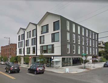
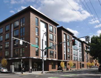
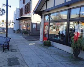
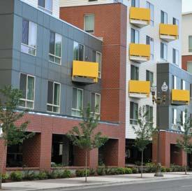
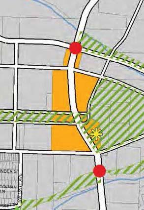
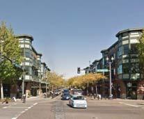
5 What is the Main Street? The North Bethany Main Street is a future mixed-use area along both sides of Kaiser Road between Brugger Road and Shackelford Road. Main Street The Main Street is intended to have: Building scale and form reflecting its role as the community s focal point Mixed-use buildings, high density housing, retail uses and services to serve the entire North Bethany community A main street design: on-street parking, pedestrian scale and urban design features A strong relationship to the adjacent future parks A civic use in a central prominent location, with an adjacent public gathering area

6 Urban Design Plan Why? An Urban Design Plan (UDP) is needed to guide how the Main Street will look, feel and function when future development occurs. The North Bethany Subarea Plan requires a UDP to be developed and adopted through a public planning process before development applications for Main Street properties can be submitted. The UDP should promote a Main Street design that prioritizes pedestrian and bicycle environments, considering elements such as: Building orientation, entrances and setbacks Building design elements Location and format of vehicle parking Streetscape elements, such as street furniture Washington County Long Range Planning and its consultant team is developing the UDP with input from a Project Advisory Committee composed of key stakeholders: Community Participation Organization (CPO) 7 representatives, development interests, and service agencies. We would like your input on the draft UDP concepts displayed at tonight s open house.


7 Main Street Elements - Overview The North Bethany Main Street contains several key elements: A segment of Kaiser Road Portions of three land use districts Two future community gateways Portions of two future parks The location of a future civic use


8 Kaiser Road within the Main Street Polygon Northwest is proposing to improve Kaiser Road from its intersection with Springville Road northward to the county line by summer Kaiser Road runs north-south through the North Bethany Main Street area. Kaiser Road within North Bethany is not currently improved to the county s urban standards. The North Bethany Subarea Plan adopted a cross-section that shows how the Main Street segment of Kaiser Road should be constructed when it is improved to the county s urban standards. Polygon Northwest prepared these Kaiser Road plan views and crosssections to show the proposed general locations of streetscape elements such as street trees, street lights and pedestrian crossings within the Main Street area. Adopted cross-section for Kaiser Road segment of Main Street Proposed cross-section for Kaiser Road segment of Main Street
 District Residential 25 Units or More per Acre (R-25+) District Neighborhood Commercial Mixed Use (NCMU) District")


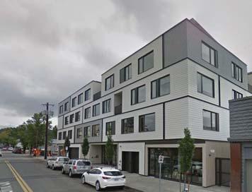
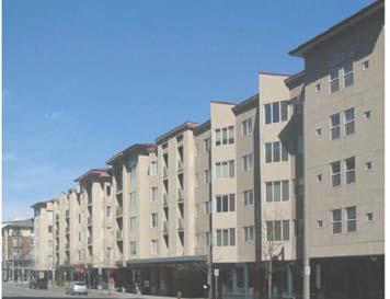
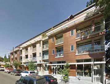
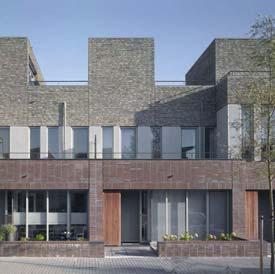
9 Land Use Districts within the Main Street The Main Street contains portions of three land use districts: Residential 24 Units per Acre (R-24) District Residential 25 Units or More per Acre (R-25+) District Neighborhood Commercial Mixed Use (NCMU) District Attached dwelling units (row houses, town houses, duplexes, multi-plexes, apartments, condominiums) Community service uses in residential districts (e.g., farmer s markets, daycares) Live/work housing The R-24 District is intended to provide areas for high density singlefamily attached and multi-family residential development. Allowed land uses include, but are not limited to: The R-25+ District is intended to provide areas for high density multi-family attached residential housing, senior housing and assisted living in proximity to retail uses and services. Allowed land uses include, but are not limited to: Attached multi-family residential dwelling units (e.g., apartments, condominiums, senior housing) Community service uses in residential districts (e.g., farmer s markets, daycares) Live/work housing
 District The NCMU District is intended to provide for the daily shopping and service needs of the North Bethany community, and serve as a community")
 Service businesses (e.g., photocopying, notary public, photographic studios) Financial institutions (e.g., banks,")

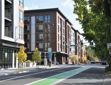
10 Land Use Districts within the Main Street The Main Street contains portions of three land use districts: Residential 24 Units per Acre (R-24) District Residential 25 Units or More per Acre (R-25+) District Neighborhood Commercial Mixed Use (NCMU) District The NCMU District is intended to provide for the daily shopping and service needs of the North Bethany community, and serve as a community focal point and gathering place. Allowed land uses include, but are not limited to: Eating and drinking establishments Personal service establishments (e.g., laundry, dry cleaners, barber and beauty shop) Retail businesses (e.g., variety, hardware, clothing, hobby, auto parts stores, and similar uses) Service businesses (e.g., photocopying, notary public, photographic studios) Financial institutions (e.g., banks, insurance agents, real estate offices) Professional offices, including medical offices High density attached multi-family residential uses may be allowed on building upper floors, but are not allowed on the ground floor The NCMU District does not have standards for building setbacks or maximum building height. These standards will be developed as part of the Main Street Urban Design Plan.


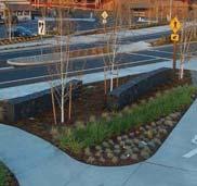
11 Main Street connects Future Parks and a Civic Use The North Bethany Main Street connects the future Park Blocks, the future East Community Park, and a future Civic Use that is planned for the southwest edge of the East Community Park. Park Blocks Main Street East Community Park Civic Use The Park Blocks will be located along the top of a ridge that runs east-west between Kaiser Road and Primary Street P20. The park s location along the ridge was intended to allow views northeast to the Tualatin Hills and southwest to the Tualatin River Valley. The East Community Park will be located on the east side of Kaiser Road at the east end of the Park Blocks. The park will be approximately 15 acres in size. The park anchors the east end of the ridge. The intent was for park s views to extend eastward, terminating at the east end of Primary Street P4. The Civic Use was intended to be visible from Kaiser Road and the Park Blocks, and is intended to have a design that connects it to the East Community Park. The Civic Use will likely be an amenity such as a plaza or covered pavilion that can serve as a community gathering place and complement the East Community Park. Tualatin Hills Park & Recreation District (THPRD) is the park provider for North Bethany. In the future, THPRD will conduct master planning for the Park Blocks and East Community Park to determine the design and amenities of these parks.


 will")


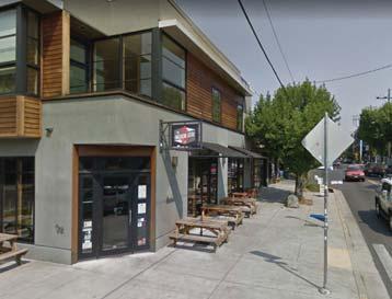
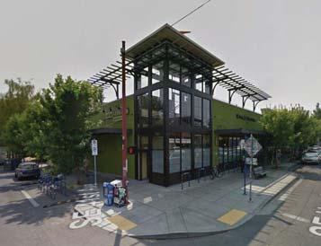
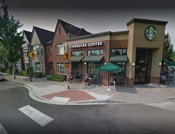
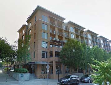
12 Civic Use Examples Which Do You Prefer? Below are examples of plazas and public art focal points that might work well for a Civic Use at the edge of the East Community Park. Tualatin Hills Park & Recreation District (THPRD) will determine the nature of the Civic Use as part of their eventual park master planning. Please place a dot next to the Civic Use examples that you like best. This feedback will help with THPRD s future park master planning.


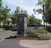
13 Community Gateways Two future Community Gateways are intended to mark the north and south entrances into the North Bethany Main Street area. Northern Gateway The northern Gateway will be located at the Kaiser Road/Shackelford Road intersection. The southern Gateway will be located near the intersection of Kaiser Road and the future trail along the north side of Bethany Creek. This gateway may be located in proximity to the trail on each side of Kaiser Road, or may be shifted north to the Kaiser Road/Brugger Road intersection. Southern Gateway The North Bethany Subarea Plan says that a preferred design for each gateway will include: Vertical element(s) signifying entrance into the commercial district Special detailing on feature elements, which may include water, walls, rocks, metal, special paving, traffic calming, enhanced pedestrian crossing and/or seating Minimal or significant amount of landscaping, depending on the gateway design Lighting for pedestrians, and to emphasize monument features

14 Overview: Urban Design Plan The County is developing the Urban Design Plan (UDP) for the North Bethany Main Street area in Priority Pedestrian Streets Priority Streets Elements Building Height NCMU District Building Design Treatments NCMU District Building Length Ground Floor Transparency Building Materials Kaiser Road Main Street Area We would love your feedback! Please provide direct input on the Street and let us know your thoughts!


15 Priority Pedestrian Streets The North Bethany Main Street area is intended to be a highly walkable and bikeable ĞŶǀŝƌŽŶŵĞŶƚ tŝěğ ƐŝĚĞǁĂůŬƐ ďŝŭğ ůăŷğɛ ĂŶĚ ĂƩƌĂĐƟǀĞ ƐƚƌĞĞƚƐĐĂƉĞƐ ǁŝůů ĐƌĞĂƚĞ ƐĂĨĞ ĂŶĚ ĐŽŵĨŽƌƚĂďůĞ ƐƉĂĐĞƐ ĨŽƌ ƉĞĚĞƐƚƌŝĂŶƐ ĂŶĚ ďŝđljđůŝɛƚɛ dśğ ĚĞƐŝŐŶ ŽĨ ƉƌŝǀĂƚĞ ĚĞǀĞůŽƉŵĞŶƚ should also support a pedestrian-friendly ĞŶǀŝƌŽŶŵĞŶƚ ďlj ƉƌŽǀŝĚŝŶŐ ƉůĞŶƚLJ ŽĨ ŝŷƚğƌğɛƚ ĂŶĚ ĂĐƟǀŝƚLJ Ăƚ ƚśğ ƐŝĚĞǁĂůŬ PRIORITY 1 PRIORITY 2 NCMU R25+ R24 PARK tśŝůğ ƉĞĚĞƐƚƌŝĂŶƐ ĂŶĚ ďŝđljđůŝɛƚɛ ĂƌĞ ƚśğ ĨŽĐƵƐ ƉĂƌŬŝŶŐ ĂŶĚ ĂĐĐĞƐƐ ĨŽƌ ǀĞŚŝĐůĞƐ ŵƶɛƚ ĂůƐŽ ďğ ƉƌŽǀŝĚĞĚ ǁŚŝĐŚ ĐĂŶ ƐŽŵĞƟŵĞƐ ďğ ŝŷ ĐŽŶŇŝĐƚ ǁŝƚŚ ƉĞĚĞƐƚƌŝĂŶͲĨƌŝĞŶĚůLJ ĚĞƐŝŐŶ /ƚ Ɛ ŝŵɖžƌƚăŷƚ ƚž ďăůăŷđğ ƚśğɛğ ĞůĞŵĞŶƚƐ ďlj ƚăƌőğɵŷő ƚśğ ŵžɛƚ ƉĞĚĞƐƚƌŝĂŶͲŽƌŝĞŶƚĞĚ ĚĞƐŝŐŶ ĞůĞŵĞŶƚƐ ƚž ŬĞLJ ǁĂůŬŝŶŐ ƐƚƌĞĞƚƐ ǁŚŝůĞ ĂĐĐŽŵŵŽĚĂƟŶŐ ǀĞŚŝĐůĞ ĂĐĐĞƐƐ ŽŶ ůžǁğƌͳɖƌŝžƌŝƚlj ƐƚƌĞĞƚƐ <ĂŝƐĞƌ ZŽĂĚ ŝɛ ƚśğ ŵăŝŷ ƐƚƌĞĞƚ ĨŽƌ EŽƌƚŚ Bethany and is therefore a Priority 1 ƉĞĚĞƐƚƌŝĂŶ ƐƚƌĞĞƚ ^ĞĞ ƚśğ Priority Streets Elements ƉŽƐƚĞƌ ĨŽƌ ŝůůƶɛƚƌăɵžŷɛ ŽĨ WƌŝŽƌŝƚLJ ϭ ĂŶĚ WƌŝŽƌŝƚLJ Ϯ ƐƚƌĞĞƚ ĞůĞŵĞŶƚƐ Kaiser Road is a Priority 1 street


16 Priority Streets Elements Priority Pedestrian Streets poster shows where Priority 1 and 2 streets are Priority 1 street (Kaiser Road) will Priority 2 streets [non-priority] Buildings right against sidewalks High street frontage Parking behind building No driveways High transparency (windows & doors) Priority 1 Street Priority 2 Street [non-priority] Parking allowed to side


17 Building Setbacks Allow buildings right against the sidewalk uses

18 Building Height NCMU Neighborhood features at corner Tall 1-story at corner 1 story 1 & 2 stories 3 stories 4 stories 5 stories


19 Building Design Treatments NCMU Building Length Neighborhood This building is too long Material Massing Balconies Sun shades Awnings


20 Building Design Treatments NCMU Ground Floor Transparency Neighborhood Building Materials transparency


21 We d like your input! Please take top two Vote Here Vote Here County Standard Standard Streetlight

22 freestanding features, such as buildings We d like your input! What type of gateway do you prefer? Please take top two favorite styles of gateways for the North Vote Here Vote Here
23 Main Street Wish List Please share your wish list of future Main Street retail, service or office uses below. The wish list will not be binding on future Main Street developers, but it could provide them with ideas about the types of businesses that North Bethany residents would support. I WOULD LIKE THE MAIN STREET TO INCLUDE:

24 Transit Considerations Considerations for a Main Street Transit Plaza The North Bethany Subarea Plan requires consideration of a transit plaza along Kaiser Road within the Main Street. A transit plaza is an enhanced bus stop with design requirements and a minimum area of 150 square feet. TriMet is the agency that provides transit service in Washington County. TriMet currently does not have plans to provide additional transit service into North Bethany. If TriMet opts to provide transit service into North Bethany in the future, Kaiser Road could be retrofitted to accommodate a transit plaza. Considerations for Transit Service TriMet considers near-term transit service improvements with each of their new Annual Service Plans. You can receive regular updates and comment on TriMet s service plans through TriMet s Riders Club at TriMet, along with regional partners, is working on plans to expand and improve transit service using funds from Oregon House Bill 2017 (also known as Keep Oregon Moving). An advisory committee reviews and provides input on these plans, and you can find more information at

25 Urban Design Plan Timeline & Next Steps PROGRESS TO DATE Fall 2017 to February 2018: Urban Design Plan (UDP) options were developed Project Advisory Committee (PAC) Meetings 1 3: Discussed Main Street context, UDP considerations, and UDP options UDP options were modified to incorporate PAC feedback TODAY: Open House #1 presents UDP options for public review and feedback WHAT S NEXT? Spring 2018: Recommended UDP options will be selected and refined based on public feedback PAC Meeting 4: Review and comment on draft recommended UDP options Recommended UDP options will be refined to incorporate PAC feedback Open House #2: Presentation of recommended UDP options for public review and comment Recommended UDP options will be refined based on public feedback Late Spring to Fall 2018: County staff file a land use ordinance for adoption of North Bethany Main Street Urban Design Plan Planning Commission and Board of Commissioners hold public hearings on the ordinance Board of Commissioners issues a decision to adopt, adopt with modifications, or reject the ordinance The adopted ordinance effective date would likely be November 22, 2018 Development applications for North Bethany Main Street properties could be submitted after the ordinance s effective date
WASHINGTON COUNTY OREGON
 WASHINGTON COUNTY OREGON July 9, 2009 Revisions to Chapter 2 of the Bethany Community Plan The North Bethany Subarea Plan Exhibit pages 7 and 8 The sections for the Core and Flexible Streets were amended
Aloha Tomorrow Study (2017)
") Study (2017) One step toward implementing the community vision from the Aloha-Reedville Study and Livable Community Plan (2014): A walkable, vibrant, livable town center with a mix of commercial and residential
Study (2017) One step toward implementing the community vision from the Aloha-Reedville Study and Livable Community Plan (2014): A walkable, vibrant, livable town center with a mix of commercial and residential
SAFETY AND CONNECTIVITY IN A PLANNED COMMUNITY
 DALE CITY TLC SAFETY AND CONNECTIVITY IN A PLANNED COMMUNITY PROJECT KICKOFF MEETING MARCH 7, 2016 AGENDA 1. Introductions 2. Project Overview 3. Discussion 4. Site Visit PROJECT KICKOFF MEETING MARCH
PINE CURVE REZONING. BACKGROUND Purchased as two parcels in 2001 and 2002
 BACKGROUND Purchased as two parcels in 2001 and 2002 WHAT THE PROJECT IS AND IS NOT A Rezoning establishes the land use standards for Annexed and Zoned Greater Downtown District Historic Center September
PINE CURVE REZONING. Property does not meet criteria for open space preservation and is not a candidate for a park
 PINE CURVE REZONING BACKGROUND Purchased as two parcels in 2001 and 2002 Annexed and Zoned Greater Downtown District Historic Center September 25, 2002 and October 7, 2002 WHAT THE PROJECT IS AND IS NOT
Staff Report to the North Ogden City Planning Commission
 Staff Report to the North Ogden City Planning Commission SYNOPSIS / APPLICATION INFORMATION Application Request: Concept review on a legislative application to rezone land located at approximately 1750
Town Center (part of the Comprehensive Plan)
") Town Center (part of the Comprehensive Plan) Mercer Island Town Center Looking North (2014) In 1994, a year-long process culminated in a set of design guidelines and code requirements for the Town Center
Town Center (part of the Comprehensive Plan) Mercer Island Town Center Looking North (2014) In 1994, a year-long process culminated in a set of design guidelines and code requirements for the Town Center
Prosperity Hucks Area Plan. Transportation and Planning Committee May 11, 2015
 Prosperity Hucks Area Plan Transportation and Planning Committee May 11, 2015 Presentation Outline 1. Background and Location 2. Community Dialog Process 3. Activity Center Recommendations 4. Wedge Recommendations
EXISTING COMPREHENSIVE PLAN
 EXISTING COMPREHENSIVE PLAN Town Center Land Use Element: V. LAND USE POLICIES Town Center Mercer Island's business district vision as described in "Your Mercer Island Citizen-Designed Downtown" was an
Courthouse Square Planning & Urban Design Study Working Group Meeting #11 September 2, 2014
 Courthouse Square Planning & Urban Design Study Working Group Meeting #11 September 2, 2014 1 Study Area Courthouse Square DRAFT Design Concepts A B C 3 Public Feedback July 23 Workshop & Online Survey
appendix and street interface guidelines
 appendix five: building and street interface guidelines appendix 5 building and street interface guidelines BOULEVARDS Boulevards are generally characterized by higher levels of traffic movement at higher
Metro. Activity Center Design Guidelines. Recommendations For Developing Focused, Mixed-Use Commercial/Residential Centers
 Metro Activity Center Design Guidelines Recommendations For Developing Focused, Mixed-Use Commercial/Residential Centers Metro Activity Centers What is a MAC? Legacy, the adopted guide for the future growth
NORTH BETHANY ELEMENTARY SCHOOL SITE ASSESSMENT
 NORTH BETHANY ELEMENTARY SCHOOL SITE ASSESSMENT Prepared for: Prepared by: October 10, 2014 Page 2 Introduction and Purpose This report provides an assessment of two potential sites for a new elementary
Policies and Code Intent Sections Related to Town Center
 Policies and Code Intent Sections Related to Town Center The Town Center Vision is scattered throughout the Comprehensive Plan, development code and the 1994 Town Center Plan. What follows are sections
Planning Board Briefing
 Planning Board Briefing Why Now? The Sector Plan Implementation Chapter States: Before Stage 1 begins, the following must occur: Approval of the Sectional Map Amendment. Approval of the Greater Lyttonsville
Future Proposed Development
 Future Proposed Development on and around Link light rail s Capitol Hill Station Meeting September 24, 2012 Tonight s Agenda 6:00 pm Open House 6:30 pm Introductions Richard Conlin, City of Seattle Councilmember/Sound
Mark-up of the effect of the proposed Bronte Village Growth Area OPA No.18 on the text of section 24, Bronte Village, of the Livable Oakville Plan
 Mark-up of the effect of the proposed Bronte Village Growth Area OPA No.18 on the text of section 24, Bronte Village, of the Livable Oakville Plan Notes: This document is provided for information purposes
LOW DENSITY RESIDENTIAL
 LOW DENSITY RESIDENTIAL Corner lots with coach houses to increase diversity, provide unity to the streetscape and increase eyes on the street. Garages and ancillary units accessed via rear lanes. Parking
ORANGE LINE TRANSIT NEIGHBORHOOD PLANS VAN NUYS NEIGHBORHOOD COUNCIL, PLUM COMMITTEE DEPARTMENT OF CITY PLANNING, CITY OF LOS ANGELES
 Photo: Mission Meridian(Moule & Polyzoides) ORANGE LINE TRANSIT NEIGHBORHOOD PLANS VAN NUYS NEIGHBORHOOD COUNCIL, PLUM COMMITTEE DEPARTMENT OF CITY PLANNING, CITY OF LOS ANGELES JULY 18, 2018 Project partially
Lower Merion Commercial Districts Issues and Characteristics Handbook November 2013
 Lower Merion Commercial Districts Issues and Characteristics Handbook November 2013 DRAFT TOWNSHIP-WIDE VISION: To maintain and enhance commercial areas to complement the surrounding high-quality residential
EXISTING TOWNHOUSE. What s working & What s not?
 What s working & What s not? Distance from the sidewalk/street to the building Landscape vs. Hardscape in front of the building Porches, stoops, steps, and entries Residential vs. contemporary character
PLAN ELEMENTS WORKSHOP. April 5, 2016
 PLAN ELEMENTS WORKSHOP April 5, 2016 needs more housing. But there is no one-size fits-all solution. Every neighborhood has its own character. In some places, density is not only appropriate it is badly
WHEREAS, after consideration of the evidence presented at the public hearing on January 14, 2010, the Prince George's County Planning Board finds:
 R E S O L U T I O N WHEREAS, the Prince George s County Planning Board has reviewed DDS-600 requesting a departure for the location of two loading spaces without driveway access along Toledo Terrace in
What Does It Take To Create A Town Center?
 What Does It Take To Create A Town Center? Context, Design, and Process The Prince Frederick Master Plan Update 1 Background and Overview A Brief History of Town Centers in Calvert County 2 Background
ELMVALE ACRES SHOPPING CENTRE MASTER PLAN
 ELMVALE ACRES SHOPPING CENTRE MASTER PLAN Contents 1.0 INTRODUCTION... 2 2.0 LOCATION... 2 3.0 EXISTING CONTEXT... 2 4.0 VISION & GUIDING PRINCIPLES... 2 5.0 LAND USE AND BUILT FORM... 4 5.1 St. Laurent
Status Update (2006 vs. Now) Citizen s Advisory Committee February Plan for Prosperity
 Citizen s Advisory Committee February Plan for Prosperity") Status Update (2006 vs. Now) Citizen s Advisory Committee February 2018 Plan for Prosperity 2000 2017 2000 2017 Gardnerville Population 6,000 5,760 5746 5,500 5,000 5,067 5,550 5,165 5,394 5,412 5,250
Status Update (2006 vs. Now) Citizen s Advisory Committee February 2018 Plan for Prosperity 2000 2017 2000 2017 Gardnerville Population 6,000 5,760 5746 5,500 5,000 5,067 5,550 5,165 5,394 5,412 5,250
3.1 community vision. 3.3 required plan elements
 Chapter 3 Community Form 3.1 community vision 3.2 Parks & landscaping concepts 3.3 required plan elements D R A F T 20 Community Form Chapter 3 3.0 Community form 3.1 community vision The Specific Plan
A. Background Summary of Existing Challenges and Potential Possibilities. 1. Summary of Existing Assets and Potential Opportunities
 A. Background 1 A Main Street Master Plan Study was performed and completed in October of 2007. The study was initiated to review current land uses and development patterns along Main Street, from Parrish
Presentation of the Staff Draft. July 17, 2014 SSRVP Team, Area 3
 Presentation of the Staff Draft July 17, 2014 SSRVP Team, Area 3 Presentation Overview Introduction Plan Framework Plan Recommendations Implementation Next Steps and Request for Public Hearing on September
DENVER DESIGN DISTRICT GDP
 DENVER DESIGN DISTRICT GDP Urban Design Standards and Guidelines November 17, 2008 Amended February 3, 2016 City and County of Denver CF Property Management, Inc. C/O Denver Design District - Starboard
North Downtown Specific Plan MEMORANDUM
 North Downtown Specific Plan MEMORANDUM MEETING DATE: November 13, 2017 TO: Members of the North Downtown Specific Plan Advisory Committee FROM: Jeanine Cavalli, Senior Planner SUBJECT: Materials for the
Welcome! to Keller Town Hall
 Welcome! to Keller Town Hall Keller Town Center Planning a New Downtown What is Keller Town Center? A new, growing downtown district planned as an urban village A combination of retail and office spaces,
Small Area Plan. South Gateway
 Small Area Plan Adopted May 12, 2008 South Gateway Purpose. The South Gateway Small Area Plan defines the City s expectations for the future of the southern entrance to the City at Interstate 85 and Highway
Draft Memorandum #1: Goals and Vision for Revitalization
 Keizer Revitalization Plan Draft Memorandum #1: Goals and Vision for Revitalization Submitted to: City of Keizer April 12, 2018 (revised) Prepared By: Angelo Planning Group and Otak, Inc. Project No. 17482.A
2035 General Plan Update and Belmont Village Specific Plan. Joint Study Session with the City Council and Planning Commission April 12, 2016
 2035 General Plan Update and Belmont Village Specific Plan Joint Study with the City Council and Planning Commission April 12, 2016 Agenda 1. Welcome and Introductions 2. General Plan Update Status of
PUBLIC RIGHT-OF-WAY IN THIS CHAPTER PUBLIC REALM
 PUBLIC RIGHT-OF-WAY This section provides design guidelines for improvements in the public right-of-way. The public right-of-way refers to streets, sidewalks, non-vehicular thoroughfares, parks and greenways
Draft Cary Community Plan Review Part 3: Shop, Engage, Serve, Special Area Plans, Other Updates. October 27, 2015 Police Department Training Room
 Draft Cary Community Plan Review Part 3: Shop, Engage, Serve, Special Area Plans, Other Updates Committee for the Future October 27, 2015 Police Department Training Room AGENDA 1. Welcome and Call to Order
4.0 Design Guidelines For The Village Centre. South fields Community Architectural Design Guidelines Town of Caledon
 4.0 Design Guidelines For The Village Centre 4.0 Design Guidelines for the Village Centre The Village Centre is the focal point of the entire South Fields Community and is designed as a traditional commercial
B. Blocks, Buildings and Street Networks
 B. Blocks, Buildings and Street Networks Figure IV.4 A rational block pattern with connected streets Introduction The single most important element in the physical and functional integration of mixed use
RESIDENTIAL DESIGN STANDARDS AND GUIDELINES
 DRAFT RESIDENTIAL DESIGN STANDARDS AND GUIDELINES Resident ial Standards and Guidelines For the Unincorporated Communities of West Alameda County TASK FORCE MEETING March 22, 2010 Tonight s Meeting Overview
Seneca Meadows. Block 4 Locate office, technology, and medical development adjacent to I Screen views of garage structures from I-270.
 Seneca Meadows Seneca Meadows has an industrial park in its southern end and a mixed-use employment area planned for the north end. The district benefits from extensive I-270 visibility, stream valley
The Village. Chapter 3. Mixed Use Development Plan SPECIFIC PLAN
 The Village SPECIFIC PLAN Chapter 3 3.1 INTRODUCTION 3.1.1 Purpose This Chapter describes the development regulations applicable to the Mixed-Use and Transit Center Planning Areas. These form-based regulations
SECTION TWO: Urban Design Concepts
 SECTION TWO: Urban Design Concepts The Gardnerville Plan for Prosperity shapes economic opportunities presented by regional growth. The Urban Design Concepts provide policies and concepts for land use,
Secrest Short Cut and Monroe Expressway Small Area Plan AUGUST 29, 2018
 Secrest Short Cut and Monroe Expressway Small Area Plan AUGUST 29, 2018 Background and Process Monroe Expressway will be open by the end of 2018 Union County and Indian Trail identified a need to revisit
ATTACHMENT A. SILVERDALE DESIGN STANDARDS Amendments to the Waaga Way Town Center Chapter
 ATTACHMENT A SILVERDALE DESIGN STANDARDS Amendments to the Waaga Way Town Center Chapter Chapter 10. Waaga Way Town Center 10.1 Physical Identity Elements & Opportunities The Waaga Way Town Center includes
RESEDA - WEST VAN NUYS COMMUNITY PLAN
 RESEDA - WEST VAN NUYS COMMUNITY PLAN Executive Summary As part of the initial outreach effort, the Department of City Planning hosted two workshops for the Reseda-West Van Nuys Community Plan Area during
Request Alternative Compliance to the prescribed criteria of the Oceanfront Resort District Form- Based Code. Staff Recommendation Approval
 Applicant Property Owner Steven H. Murden Public Hearing June 14, 2017 City Council Election District Beach Agenda Item 8 Request Alternative Compliance to the prescribed criteria of the Oceanfront Resort
DRAFT. October Wheaton. Design Guidelines
 October 2011 DRAFT Wheaton Design Guidelines 2 Draft - Design Guidelines - Wheaton Sector Plan Contents 04 Section 1: Introduction 06 Section 2: Context 08 Section 3: Design Guidelines 09 Goal 1: Create
Gold Line Bus Rapid Transit Transit Oriented Development (BRTOD) Helmo Station Area Plan
 Helmo Station Area Plan") Appendix F Gold Line Bus Rapid Transit Transit Oriented Development (BRTOD) Helmo Station Area Plan Introduction and Purpose of the Plan The Gold Line Bus Rapid Transit facility is an eleven-mile dedicated
Appendix F Gold Line Bus Rapid Transit Transit Oriented Development (BRTOD) Helmo Station Area Plan Introduction and Purpose of the Plan The Gold Line Bus Rapid Transit facility is an eleven-mile dedicated
Implementation Guide Comprehensive Plan City of Allen
 Implementation Guide 2030 Comprehensive Plan City of Allen DRAFT 2015 Implementation Guide Allen 2030 Comprehensive Plan INTRODUCTION The Comprehensive Plan serves as a guide for the growth and development
Good Design Guidelines for Downtown. Preliminary Findings and Recommendations
 Good Design Guidelines for Downtown Preliminary Findings and Recommendations City Council Meeting - February 5, 2017 Advisory Committee Team: Larry Paul: Planning Commission /Architect Bruce Bagnoli: Business
FUTURE LAND USE ELEMENT
 FUTURE LAND USE ELEMENT GOAL I: To create and sustain a great place to live, play, and prosper Objective 1: The City of Ocala shall incorporate the principles and strategies of the Ocala 2035 Vision into
4 LAND USE DESIGNATIONS
 4 LAND USE DESIGNATIONS Chapter 4 describes the land use designations and densities that will implement the development vision for North Burlingame outlined in Chapter 3. Land use densities are described
The subject site plan amendment proposes the following revisions to the approved site plan:
 PROPOSED AMENDMENT The subject site plan amendment proposes the following revisions to the approved site plan: 1. The building footprint was modified to accommodate the revised architectural design. 2.
Neighborhood Districts
 NEIGHBORHOOD DISTRICTS SEVEN MAIN DISTRICTS Neighborhood Districts While the Development Plan provides a broad-scale overview of the neighborhood, this section focuses on uses and relationships at the
ORDINANCE AN ORDINANCE TO ADD A NEW SECTION 4.N. IN THE ZONING CODE FOR THE TOWN OF MIDDLETOWN, RELATING TO MIXED-USE DEVELOPMENT
 Introduced: November 5, 2018 Approved: ORDINANCE 18-11-01 AN ORDINANCE TO ADD A NEW SECTION 4.N. IN THE ZONING CODE FOR THE TOWN OF MIDDLETOWN, RELATING TO MIXED-USE DEVELOPMENT BE IT ENACTED BY THE MAYOR
*** DRAFT 2 FOR PUBLIC REVIEW ***
 6.7 The area is generally bounded by the Red Hill Valley Parkway to the west, Lake Avenue to the east, the Queen Elizabeth Way (QEW) to the north, and by the properties just south of Queenston Road to
Chapter 1.0 Introduction
 Chapter 1.0 Introduction 1.1 Background The North Metro commuter rail line is part of the RTD FasTracks regional transit system expansion program to build more than 100 miles of rail transit throughout
Scope of Services. River Oaks Boulevard (SH 183) Corridor Master Plan
 Corridor Master Plan") Scope of Services River Oaks Boulevard (SH 183) Corridor Master Plan PROJECT AREA The project area consists of the River Oaks Boulevard (SH 183) corridor bounded by SH 199 at the northern end and the Trinity
Scope of Services River Oaks Boulevard (SH 183) Corridor Master Plan PROJECT AREA The project area consists of the River Oaks Boulevard (SH 183) corridor bounded by SH 199 at the northern end and the Trinity
Don Mills Crossing Study and Celestica Lands Development Application Community Meeting, Open House, and Breakout Discussions
 Consultation Summary Don Mills Crossing Study and Celestica Lands Development Application Community Meeting, Open House, and Breakout Discussions This report is not intended to provide a verbatim transcript
Land Use. Hardware Street Vendor Mixed-Use
 Land Use Definition Land Use is the way a piece of real estate is utilized. Existing, proposed, and adopted land uses all play a role in the planning process. Once a land use plan is adopted, the next
Beatties Ford Road & Mt. Holly-Huntersville Road Small Area Plan
 Beatties Ford Road & Mt. Holly-Huntersville Road Small Area Plan Town of Huntersville October 2005 Town of Huntersville Planning Department 101 Huntersville Concord Road Post Office Box 664 Huntersville,
(DC1) Direct Development Control Provision DC1 Area 4
 Direct Development Control Provision DC1 Area 4") . General Purpose (DC) Direct Development Control Provision DC Area 4 The purpose of this Provision is to provide for an area of commercial office employment and residential development in support of the
. General Purpose (DC) Direct Development Control Provision DC Area 4 The purpose of this Provision is to provide for an area of commercial office employment and residential development in support of the
VILLAGE OF SKOKIE Design Guidelines for Mixed-Use Districts NX Neighborhood Mixed-Use TX Transit Mixed-Use CX Core Mixed-Use
 VILLAGE OF SKOKIE Design Guidelines for Mixed-Use Districts NX Neighborhood Mixed-Use TX Transit Mixed-Use CX Core Mixed-Use TABLE OF CONTENTS CHAPTER 1 SITE DESIGN Purpose 1 CHAPTER 2 SITE DESIGN Streetscape
NORTH LAKE SPECIFIC PLAN AREA
 NORTH LAKE SPECIFIC PLAN AREA June 21, 2018 WELCOME Workshop Agenda Introduction Provide information about the program and introduce the team Background Information Share information about the North Lake
Forest Hills Improvement Initiative A Partnership for Building a Better Community. Use & Design Guidelines September 23, 2008
 Forest Hills Improvement Initiative A Partnership for Building a Better Community City of Boston Thomas M. Menino, Mayor Emerging Community Vision p. 2 Site Use & Design Guidelines p. 3 to 21 Arborway
Northwest commuter rail station US 36 BRT. Westminster Station
 Northwest commuter rail station Westminster Station US 36 BRT Westminster Center US 36 & Church Ranch Broomfield Flatiron/96 th St. US 36 & McCaslin Table Mesa Boulder Junction 13-month effort that will
FLORIN ROAD CORRIDOR Site Plan and Design Review Guidelines Checklist
 FLORIN ROAD CORRIDOR Site Plan and Design Review Guidelines Checklist Applicant s Name: Project Address: Phone: Email: Applicant shall fill out the design guidelines checklist for all guidelines applicable
NEIGHBORHOOD DESIGN ELEMENT
 NEIGHBORHOOD DESIGN ELEMENT INTRODUCTION The following recommendations constitute an urban design oriented "neighborhood analysis" of Plantation. It is an optional Comprehensive Plan Element. The five
URBAN DESIGN BRIEF 181 Burloak Drive, Oakville
 URBAN DESIGN BRIEF 181 Burloak Drive, Oakville February 2017 Our File: 1730B 230-7050 WESTON ROAD / WOODBRIDGE / ONTARIO / L4L 8G7 / T: 905 761 5588/ F: 905 761 5589/WWW.MHBCPLAN.COM TABLE OF CONTENTS
CITY OF PUYALLUP. Background. Development Services
 CITY OF PUYALLUP Development Services 333 South Meridian Puyallup WA 98371 To: City Council From: Katie Baker, AICP, Planning Division Re: South Hill Neighborhood Plan Adoption Date: (Meeting date: February
Standards (R-3) Figure B-11: R-3 Residential Standards Exhibit
 Figure B-11: R-3 Residential Standards Exhibit") Avila Ranch Avila Ranch Specific Plan Development Standards High Medium Density - High Residential Density Residential Lot and Building Lot and Standards Building (R-3) Standards (R-3) EXAMPLES These sketches
Avila Ranch Avila Ranch Specific Plan Development Standards High Medium Density - High Residential Density Residential Lot and Building Lot and Standards Building (R-3) Standards (R-3) EXAMPLES These sketches
SYRINGA VALLEY SPECIFIC PLAN NARRATIVE
 SYRINGA VALLEY SPECIFIC PLAN NARRATIVE Introduction With this application, Pleasant Valley South LLC ( Pleasant Valley ) seeks the City of Boise s approval of a new Specific Plan Ordinance to be added
B L A C K D I A M O N D D E S I G N G U I D E L I N E S for Multi-family Development
 B L A C K D I A M O N D D E S I G N G U I D E L I N E S for Multi-family Development Adopted June 18, 2009 This section of the Design and focuses on site planning and design guidance for new multi-family
Public Meeting March 10 th 2011
 Public Meeting March 10 th 2011 Agenda 6:00-6:15 6:15-7:00 7:00-8:00 8:00-8:30 8:30-9:00 9:00 Welcome and Introductions Presentation» Project Overview» Recap Existing Conditions / Issues & Opportunities»
Lehigh Acres Land Development Regulations Community Planning Project
 Lehigh Acres Land Development Regulations Planning Effort Summary In July, 2010 Commissioner Frank Mann invited the Lehigh Acres community to start discussing how to achieve their recently adopted community
Rio/29 Small Area Plan. Design Plan & Implementation Framework Open House - January 25, 2018
 Rio/29 Small Area Plan Design Plan & Implementation Framework Open House - January 25, 2018 MEETING PURPOSE PRESENTATION 1. Orient to the updated design plans 2. Introduce implementing options 3. Explain
URBAN DESIGN BRIEF URBAN DESIGN BRIEF 721 FRANKLIN BLVD, CAMBRIDGE August 2018
 URBAN DESIGN BRIEF URBAN DESIGN BRIEF 721 FRANKLIN BLVD, CAMBRIDGE August 2018 DESIGN BRIEF CONTENTS PART A 1.0 INTRODUCTION 2.0 DESCRIPTION & ANALYSIS OF SITE CONTEXT 3.0 DESIGN CONSTRAINTS AND OPPORTUNITIES
What Pioneer Grove Will Look Like?
 The City of Deerfield Beach has embarked on a journey to create a new town center within the old heart of Deerfield Beach. The new town center is known as Pioneer Grove. Pioneer Grove will be Everybody
REQUEST Current Zoning: O-15(CD) (office) Proposed Zoning: TOD-M(CD) (transit oriented development mixed-use, conditional)
 (office) Proposed Zoning: TOD-M(CD) (transit oriented development mixed-use, conditional)") Rezoning Petition 2016-117 Zoning Committee Recommendation January 4, 2017 REQUEST Current Zoning: O-15(CD) (office) Proposed Zoning: TOD-M(CD) (transit oriented development mixed-use, conditional) LOCATION
Rezoning Petition 2016-117 Zoning Committee Recommendation January 4, 2017 REQUEST Current Zoning: O-15(CD) (office) Proposed Zoning: TOD-M(CD) (transit oriented development mixed-use, conditional) LOCATION
CPD Rules and Regulations. Arapahoe Square Zoning and Design Standards/Guidelines
 CPD Rules and Regulations Arapahoe Square Zoning and Design Standards/Guidelines Denver Planning Board May 4 th, 2016 Sponsor & Community Partners Sponsored by Albus Brooks, Council District 9 Developed
NEC of Central Avenue and Indian School Road
 NEC of Central Avenue and Indian School Road For this location, there are two applicable plans that provide guidance on development. The two plans include the Indian School Specific Plan (1991) and the
A P P E N D I X B - O P P O R T U N I T Y S I T E S
 A P P E N D I X B - O P P O R T U N I T Y S I T E S OPPORTUNITY SITES As listed in the Land Use Element, the City has identified 15 Opportunity Sites expected to be the focus of change and revitalization
MOUNT AVENUE MASTERPLAN WORKING DRAFT NOVEMBER 2006
 MOUNT AVENUE MASTERPLAN WORKING DRAFT NOVEMBER 2006 1 1. OVERALL MASTERPLAN IDENTITY: Dun Dealgan motte and bailey The Dun Dealgan motte and bailey, a national monument, is located to the north east of
GUIDING PRINCIPLES IN THIS CHAPTER
 GUIDING PRINCIPLES The guiding principles and design concepts in this chapter work together with the Chapel Hill 2020 Comprehensive Plan to support new public places that can be enjoyed by all while also
Citizen Advisory Group Meeting 5: Land Use April 14, 2011
 Citizen Advisory Group Meeting 5: Land Use April 14, 2011 Meeting Agenda 1. Background Review 2. Transportation Follow-up 3. PED Overlay Approach 4. Land Use Mapping 5. Group Exercise 6. Wrap-up and Next
PLANNING STAFF REVIEW
 Rezoning Petition 2016-087 Pre-Hearing Staff Analysis October 17, 2016 REQUEST Current Zoning: R-3 (single family residential), O-1(CD) (office, conditional), and INST (institutional) Proposed Zoning:
MIDTOWN MIXED-USE VILLAGE. TECHNICAL DATA SHEET COMPONENT C-1 FOR PUBLIC HEARING - PETITION NUMBER Project No RZ1.1. Issued.
 N MIDTOWN MIXED-USE VILLAGE TECHNICAL DATA SHEET COMPONENT C- FOR PUBLIC HEARING - PETITION NUMBER 04-00 Project No. 496 Issued Revised SCALE: " = 0' N 0 0 0 40 RZ. c GENERAL PROVISIONS: a. SITE LOCATION.
HISTORIC TOWN CENTER MASTER PLAN CITY COUNCIL PRESENTATION APRIL 3, 2012
 HISTORIC TOWN CENTER MASTER PLAN CITY COUNCIL PRESENTATION APRIL 3, 2012 REQUESTED CITY COUNCIL ACTIONS Certification of the Final Program Environmental Impact Report (PEIR); and, Approval of General Plan
Civic Center District
 Civic Center District The Civic Center district is the civic and social heart of Warrenville, containing such public buildings as the City Hall, Warrenville Public Library, Police Station, Park District
ARLINGTON COUNTY, VIRGINIA. County Board Agenda Item Meeting of April 21, 2018 SUPPLEMENTAL REPORT
 ARLINGTON COUNTY, VIRGINIA County Board Agenda Item Meeting of April 21, 2018 SUPPLEMENTAL REPORT DATE: April 18, 2018 SUBJECT: Request to authorize advertisement of public hearings by the Planning Commission
WAC #7 3/14/14. Coachella General Plan Update
 WAC #7 3/14/14 Coachella General Plan Update Agenda 2 Introductions Public Draft General Plan Overview and Discussion of Next Steps Implementation and Evaluation Health Element Process Evaluation (discussion)
Planning Board Hearing October 20th, 2016
 Planning Board Hearing October 0th, 06 Developer: Real Estate Management & Leasing: Architect: Transportation Engineers: Landscape Architect: Civil Engineer: THE ARSENAL PROJECT Planning Board AGENDA Introduction
Establish a network of streetscaped vehicle and pedestrian routes that connect within and outside the Plan area.
 This Plan s urban design goals are to create an urban scale, walkable community with connections to transit, parks, and services and with amenities and facilities for residents and employees. The 1992
This Review Is Divided Into Two Phases:
 Semiahmoo Town Centre Review The purpose of this review: To review the Semiahmoo Town Centre Concept Plan, originally approved in 1993, to ensure that this centre will continue to serve the needs of South
SECTION TWO: Overall Design Guidelines
 SECTION TWO: Overall Design Guidelines This section provides overall design principles and guidelines for the Gardnerville Mixed-use Overlay. They provide criteria for mixed-use places consisting of residential,
Approved: CITY OF ARDEN HILLS, MINNESOTA PLANNING COMMISSION WEDNESDAY, AUGUST 5, :30 P.M. - ARDEN HILLS CITY HALL
 Approved: CITY OF ARDEN HILLS, MINNESOTA PLANNING COMMISSION WEDNESDAY, AUGUST 5, 2015 6:30 P.M. - ARDEN HILLS CITY HALL PLANNING CASES A. Planning Case 15-016; Final Planned Unit Development Arden Plaza;
1.0 Purpose of a Secondary Plan for the Masonville Transit Village
 Report to Planning and Environment Committee To: Chair and Members Planning & Environment Committee From: John M. Fleming Managing Director, Planning and City Planner Subject: Masonville Transit Village
Urban Planning and Land Use
 Urban Planning and Land Use 701 North 7 th Street, Room 423 Phone: (913) 573-5750 Kansas City, Kansas 66101 Fax: (913) 573-5796 Email: planninginfo@wycokck.org www.wycokck.org/planning To: From: City Planning
Broadway District Specific Plan. Community Workshop #2 February 23,2016
 Broadway District Specific Plan Community Workshop #2 February 23,2016 1 Agenda Introductions Project Progress Status Upcoming Milestones Emerging Framework Land Use Urban Design Circulation Infrastructure