Danvers High Street I-1 District Study
|
|
|
- Christal Campbell
- 5 years ago
- Views:
Transcription
1 Danvers High Street I-1 District Study Presentation of Final Recommendations Planning Board Presentation June 26 th,
2 Introductions Metropolitan Area Planning Council Sam Cleaves AICP, Principal Regional Planner Josh Fiala AICP AIA LEED AP, Senior Regional Planner Chris Kuschel AICP, Senior Regional Planner & Transportation Specialist 2 Danvers High Street I-1 District Study 6/26/2018
3 Agenda MAPC Summary Presentation 1 Study Goals and Process 2 District Vision and Principles 3 Development Strategies 4 Zoning Recommendations 5 Design Standards and Guidelines 6 Other Recommendations Planning Board Discussion 3 Danvers High Street I-1 District Study 6/26/2018
4 1 Study Goals and Process Goals Process Establish a community supported vision Make recommendations for modifications to zoning Define characteristics of redevelopment to strengthen district walkability and character November 2016 MAPC site walk with district stakeholders and stakeholder meetings May 2017 Community Workshop 4 Danvers High Street I-1 District Study 6/26/2018

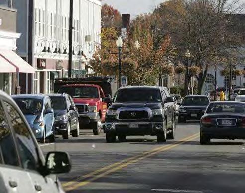
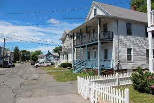
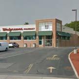
5 1 Study Goals and Process Study Boundary McDonald s Walgreens 5 Danvers High Street I-1 District Plan 6/26/2018
6 2 District Vision and Principles Community Vision Statement In 2027, the High Street Corridor is a flourishing area offering residents a high quality of life by taking full advantage of, and emphasizing, its many unique assets - as a gateway to downtown Danvers, a strong sense of community, and by offering a vibrant mix of business and residential uses. High Street s central location, its mix of business and residential uses, and its proximity to the nearby Danvers bike/pedestrian trail network and parks draw residents and visitors to it. As a residential neighborhood, it offers a welcoming, safe and enriching environment with a variety of housing options - market rate and affordable - for families, seniors and young adults. Redevelopment in the Corridor area has created a series of mixed use properties with shops and services fronting along High Street with residences tucked in the rear of the properties in a walkable environment attractive to young and old residents alike. Sidewalks, safer pedestrian crossings and trails link High Street to school and recreation areas, as well as adjoining residential neighborhoods and downtown Danvers. This appropriately scaled blend of service uses, retail, residential and smaller-scale office spaces attracts business, jobs and increased consumer spending along High Street while the Corridor itself has become safer and more attractive with additional trees and plantings, benches, lighting, consolidated curb cuts, and underground utilities. 6 Danvers High Street I-1 District Study 6/26/2018
7 2 District Vision and Principles District Vision Principles High Street Improvements Expanded Connections Extensive Redevelopment Investment New River Access New Rail Trail Connections Integrated Parks and Plazas Improved Parking 7 Danvers High Street I-1 District Study 6/26/2018

8 3 Current District Plan NORTH 8 Danvers High Street I-1 District Study 6/26/2018

9 3 Current District Plan 9 Danvers High Street I-1 District Study 6/26/2018
10 3 Illustrative District Plan NORTH 10 Danvers High Street I-1 District Study 6/26/2018
11 3 Illustrative District Plan High Street Improvements NORTH 11 Danvers High Street I-1 District Study 6/26/2018
12 3 Illustrative District Plan Public Realm Improvements Complete Streets investments and improvements focused on High Street Investment in rail trail Additional improvements on Purchase Street, Riverside Avenue, Canal Street, Dodge Court, and Healy Court Curb cut consolidation Encouraging additional access ways and connecting circulation 12 Danvers High Street I-1 District Study 6/26/2018
13 3 Illustrative District Plan Expanded Connections NORTH 13 Danvers High Street I-1 District Study 6/26/2018
14 3 Illustrative District Plan Expanded Connections NORTH 14 Danvers High Street I-1 District Study 6/26/2018
15 3 Illustrative District Plan Extensive Redevelopment NORTH 15 Danvers High Street I-1 District Study 6/26/2018
16 3 Illustrative District Plan Extensive Redevelopment NORTH 16 Danvers High Street I-1 District Study 6/26/2018
17 3 Illustrative District Plan New River Access NORTH 17 Danvers High Street I-1 District Study 6/26/2018
18 3 Illustrative District Plan New Rail Trail Connections NORTH 18 Danvers High Street I-1 District Study 6/26/2018
19 3 Illustrative District Plan Integrated Parks and Plazas NORTH 19 Danvers High Street I-1 District Study 6/26/2018
20 3 Illustrative District Plan Integrated Parks and Plazas NORTH 20 Danvers High Street I-1 District Study 6/26/2018
21 3 Illustrative District Plan Improved Parking NORTH 21 Danvers High Street I-1 District Study 6/26/2018
22 3 Illustrative District Plan Improved Parking NORTH 22 Danvers High Street I-1 District Study 6/26/2018
23 3 Illustrative District Plan NORTH 23 Danvers High Street I-1 District Study 6/26/2018

24 4 Zoning Recommendations Zone Type: New High Street Mixed Use District, C1 A District with Design and Parking Updates, or High Street Mixed Use Overlay Uses: Allow mixed-use and multi-family Dimensional Standards: 24 Danvers High Street I-1 District Study 6/26/2018
25 4 Zoning Recommendations Parking Requirements: Increase retail and office development from current range of 1 space per every square feet to 1 space per 400 square feet Parking minimums and maximums for residential: Studio/1 bedroom = 0.5 space min. to 1 space per unit max. 2 bedroom = 1 space min. to 1.5 spaces per unit max. 3+ bedroom = 1.5 space min. to 2 spaces per unit max. Allow shared parking reductions across multiple uses Allow use of on-street parking, satellite parking, bicycle parking to reduce on-site parking 25 Danvers High Street I-1 District Study 6/26/2018
26 5 Design Standards and Guidelines Design Standards 1. Building Orientation 2. Site and Building Frontage 3. Define Streets and Blocks 4. Integrate On-street Parking 5. Reduce Impact of Parking 6. Infill New Opportunities 7. Respect Adjacent Neighbors 8. Create New Connections 9. Connect Properties and Parking 10. Retain Trees and Landscape 11. Connect Sidewalks and Trails 12. Strengthen Recreational Amenities 26 Danvers High Street I-1 District Study 6/26/2018
27 Danvers High Street I-1 District Study Planning Board Discussion Planning Board Presentation June 26 th,
28
29 3 Illustrative District Plan Development Strategies 1 Mixed-use Redevelopment to Update Commercial with High Street Frontage 2 New Compact Residential Uses at Unused Land 3 New Higher Density Residential Uses in Buffered Locations 4 New Pad Infill Development 5 Conversion of Commercial or Light Industrial Uses to Mixeduse Development 6 Convert Auto-oriented to Mixed-use 7 Preserve Existing Services, Commerce, Jobs 8 Site and Landscape Improvements 29 Danvers High Street I-1 District Study 6/26/2018
30 3 Incremental Redevelopment 2 3 NORTH 30 Danvers High Street I-1 District Study 6/26/2018
31 3 Incremental Redevelopment NORTH 31 Danvers High Street I-1 District Study 6/26/2018
32 3 Incremental Redevelopment NORTH 32 Danvers High Street I-1 District Study 6/26/2018

33 3 Incremental Redevelopment NORTH 33 Danvers High Street I-1 District Study 6/26/2018
34 Summary Previous Studies/Reports Report Title Future Vision Plan Maple Street I-1 District (Brovitz Community Planning & Design with Dodson & Flinker Assoc.) Design Standards Maple Street Traditional Development Overlay District Date Placemaking Audit Existing Conditions Maple Street I Danvers Maple Street I-1 District Action Plan 2015 Downtown Danvers Parking Study 2015 Danvers Bicycle Network and Pedestrian Priority Plan 2015 Tapleyville Mixed Use Overlay District Zoning Bylaw 2014 Danvers Tapleyville District Vision + Action Plan Danvers High Street I-1 District Plan 6/26/2018


35 The Role of Downtowns in the Region 35 Danvers High Street I-1 District Plan 6/26/2018

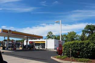
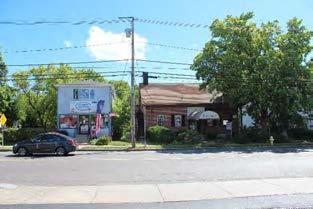
36 Study Area Boundary Dunkin Donuts Merchants GMC McDonald s Jimmy s Happy Garden Fire Dept. 36 Danvers High Street I-1 District Plan 6/26/2018
37 Study Scope and Schedule Defining a Vision and Potential Scenarios Phase 1 Phase 2 Phase 3 Phase 4 Finalize Existing Conditions Community Workshop and Scenarios Illustrative District Plan and Recommendations Final Report and Presentation Review Recent Studies Analysis of Land Use and Patterns 3D Digital Model Composite Mapping Community Meeting Community Vision Statement Community Scenarios and Illustrations Illustrative District Plan Zoning Recommendations Design Guideline Recommendations Draft Report Final Report Final Presentation Danvers High Street I-1 District Plan 6/26/2018
38 Your Experience on High Street Challenges and Opportunities 38 Danvers High Street I-1 District Plan 6/26/2018
39 Demographic Context Population 40,000 30,000 Danvers Recent & Projected Population, % Average projected town population growth per decade ,174 25,212 26,493 28,316 30,240 20, , Population of Focus Area (Aggregated Census Block Groups) 9% Focus area as % of Danvers 2010 Population (Aggregated Census Block Groups) Census Stronger Region Source: U.S. Census, MAPC Population and Housing Demand Projections,
40 Demographic Context Households 15,000 13,000 11,000 9,000 7,000 Danvers Recent & Projected Total Households ,791 9,544 10,615 11,731 12,849 5, Census Stronger Region 1,116 1, % New households in Danvers New households in Danvers Average projected town household growth per decade Source: U.S. Census, MAPC Population and Housing Demand Projections,


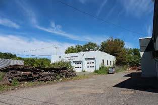
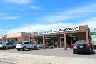
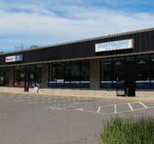
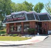
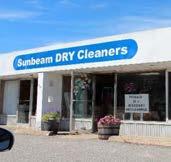
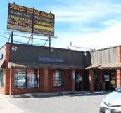
41 Current District Conditions Jimmy s Happy Garden McDonald s GMC Merchants Dunkin Donuts 41 Danvers High Street I-1 District Plan 6/26/2018

42 Current Zoning 42
43 Current District Conditions 48 parcels with 54 structures Total area of 1,601,113 square feet (sf) or acres Total District Area is divided among: Open land 601,735 sf or 38% Parking/paved surface 585,813 sf or 37% Building footprints 227,741 sf or 14% Streets 140,644 sf or 8% Sidewalks 24,823 sf or 2% Water body 20,357 sf or 1% 43 Danvers High Street I-1 District Plan 6/26/2018
44 Current District Conditions Open Land and Open Spaces 38% Open land 601,735 sf or 38% 44 Danvers High Street I-1 District Plan 6/26/2018
45 Current District Conditions Parking and Paved Surfaces 37% Parking/paved surface 585,813 sf or 37% 45 Danvers High Street I-1 District Plan 6/26/2018
46 Current District Conditions Building Footprints 14% Building footprints 227,741 sf or 14% 46 Danvers High Street I-1 District Plan 6/26/2018
47 Current District Conditions Streets 8% Streets 140,644 sf or 8% 47 Danvers High Street I-1 District Plan 6/26/2018
48 Current District Conditions Sidewalks 2% Sidewalks 24,823 sf or 2% 48 Danvers High Street I-1 District Plan 6/26/2018

49 Current District Conditions Water Body 1% Water body 20,357 sf or 1% 49 Danvers High Street I-1 District Plan 6/26/2018
50 Current Land Use Legend Commercial Retail Commercial Office Light Industrial Mixed-use Residential Multi-family Residential Single-family Utility Vacant 50 Danvers High Street I-1 District Plan 6/26/2018
 Moderate-scale Commercial Building (20,000+ Square Feet) 51 Danvers High Street I-1")
51 Current Building Types Legend Single-Family House Multi-Family House Small Commercial Building (Less than 5,000 Square Feet) Mid-scale Commercial/Industrial Building (5,000-19,999 Square Feet) Moderate-scale Commercial Building (20,000+ Square Feet) 51 Danvers High Street I-1 District Plan 6/26/2018

52 Current Building Types Single-Family House Multi-Family House Small Commercial (<5,000 sf) Mid-scale Comm/Ind (5,000-19,999 sf) Moderate-scale Comm (20,000+ sf) 52 Danvers High Street I-1 District Plan 6/26/2018
53 Current Property Utilization Legend High Utilization Building value exceeds land value* Low Utilization Land value exceeds building value* Incomplete Data *Based on Town of Danvers Assessors Data 53 Danvers High Street I-1 District Plan 6/26/2018
54 Current Street Types D C D A (4) Street Types in District A Arterial (High Street/Route 35) B Connector (Purchase Street) C Local Street (Riverside Avenue) D Local Access Drive (Dead end) (Canal Street, Dodge Court, Healy Court, Warren Street) D D B 54 Danvers High Street I-1 District Plan 6/26/2018
 +/- 44 +/- 38 (4) Vehicle Lanes, Lawn Strip, and Sidewalks, About")

 (2) Vehicle Lanes, no other infrastructure About 26 total width of")

55 Current Street Types A Type A Arterial (High Street/Route 35) B Type B Connector (Purchase Street) +/- 44 +/- 38 (4) Vehicle Lanes, Lawn Strip, and Sidewalks, About 65 total width from back of sidewalk C Type C Local Street (Riverside Avenue) D (2) Vehicle Lanes, Landscape, and Sidewalks, About 50 total width from back of sidewalk Type D Local Access Drive (Dead end) (Canal St, Dodge Ct, Healy Ct, Warren St) +/- 26 +/- 24 (average) (2) Vehicle Lanes, no other infrastructure About 26 total width of street pavement (2) Vehicle Lanes, some landscape, some segments of sidewalk, Varies between 18 and 30 total width of street pavement 55 Danvers High Street I-1 District Plan 6/26/2018
56 Challenges and Opportunities Challenges A I H B C G D E F J Legend A Limited marked pedestrian crossings B Parking is dominant visual feature of frontage C Inconsistent streetscape/street trees D Overhead electric utilities E Large/frequent curb cuts G F Signs sized for vehicles G Limited connecting roads/blocks H No coordination across property lines I River setback constraints J Property depth constraints K Lack of bicycle infrastructure 56 Danvers High Street I-1 District Plan 6/26/2018 K

57 Challenges and Opportunities Opportunities D E D F F G A B C F I Legend A Plant street trees in landscape strips B Reduce curb cut width and frequency C Add bicycle infrastructure D New development opportunity E Access to river H F Potential for parcel assembly/larger redevelopment F G Improve relationships/ efficiency between parcels H Opportunity for rail trail G I Preservation opportunities F 57 Danvers High Street I-1 District Plan 6/26/2018
58 Small Group Exercises #1 District Vision #2 Vision Imagery #3 District Concept Plan 58 Danvers High Street I-1 District Plan 6/26/2018


59 Small Group Exercises Vision Components Development Connections Open Space 59 Danvers High Street I-1 District Plan 6/26/2018
60 #1 Craft a District Vision Statement 1. Use a few sentences to describe a shared group vision 2. Use a few bullets to outline goals or priorities for the vision 60 Danvers High Street I-1 District Plan 6/26/2018
61 #2 Select Vision Imagery With your vision established: 1. Select images that the group agrees are consistent with the vision 2. Tape images onto the board according to category 61 Danvers High Street I-1 District Plan 6/26/2018

62 #3 Design a District Concept With your vision established: 1. Select investments or improvements that the group agrees are consistent with the vision 2. Tape diagrams where desired on district map 62 Danvers High Street I-1 District Plan 6/26/2018
Town Center (part of the Comprehensive Plan)
") Town Center (part of the Comprehensive Plan) Mercer Island Town Center Looking North (2014) In 1994, a year-long process culminated in a set of design guidelines and code requirements for the Town Center
Town Center (part of the Comprehensive Plan) Mercer Island Town Center Looking North (2014) In 1994, a year-long process culminated in a set of design guidelines and code requirements for the Town Center
Cobb County Design Guidelines Mableton Parkway & Veterans Memorial Highway Community Design Workshop January 12, 2017
 Community Design Workshop January 12, 2017 Agenda Opening Remarks / Introductions Scope of Work Existing Conditions Key Issues / Opportunities VPS Summary Draft Vision & Goal Statement Implementation Concepts
EXISTING COMPREHENSIVE PLAN
 EXISTING COMPREHENSIVE PLAN Town Center Land Use Element: V. LAND USE POLICIES Town Center Mercer Island's business district vision as described in "Your Mercer Island Citizen-Designed Downtown" was an
PLAN ELEMENTS WORKSHOP. April 5, 2016
 PLAN ELEMENTS WORKSHOP April 5, 2016 needs more housing. But there is no one-size fits-all solution. Every neighborhood has its own character. In some places, density is not only appropriate it is badly
City of Farmington. Downtown Plan. Amendment to the 1998 Master Plan Adopted October 11, 2004
 City of Farmington Amendment to the 1998 Master Plan Adopted October 11, 2004 Introduction Planning Background 1 Scope and Components of the Plan Amendment 2 Concept Introduction 3 Plan Concepts 3 Conceptual
FUNDING CORRIDOR REVITALIZATION
 FUNDING CORRIDOR REVITALIZATION Integrated corridor planning for the 21 st Century America Planning Association Annual Conference Atlanta, GA April 27, 2014 Mariia Zimmerman, MZ Strategies, LLC mariia@mzstrategies.com
YONGE STEELES CORRIDOR SECONDARY PLAN. Young + Wright / IBI Group Architects Dillon Consulting Ltd. GHK International (Canada) Ltd.
 Ltd.") PART A: PREAMBLE 1.0 PURPOSE The purpose of this Secondary Plan is to provide a development framework for intensification of the Yonge/ Steeles corridor including the north side of Steeles Avenue West
PART A: PREAMBLE 1.0 PURPOSE The purpose of this Secondary Plan is to provide a development framework for intensification of the Yonge/ Steeles corridor including the north side of Steeles Avenue West
SECTION TWO: Urban Design Concepts
 SECTION TWO: Urban Design Concepts The Gardnerville Plan for Prosperity shapes economic opportunities presented by regional growth. The Urban Design Concepts provide policies and concepts for land use,
REVIEW AND EVALUATION OF REGIONAL LAND USE
 REVIEW AND EVALUATION OF REGIONAL LAND USE AND TRANSPORTATION SCENARIOS #220831 Environmental Justice Task Force October 7, 2014 VISION 2050 Process Development of Guiding Vision for Land Use and Transportation
Staff Report to the North Ogden City Planning Commission
 Staff Report to the North Ogden City Planning Commission SYNOPSIS / APPLICATION INFORMATION Application Request: Concept review on a legislative application to rezone land located at approximately 1750
CITY OF PUYALLUP. Background. Development Services
 CITY OF PUYALLUP Development Services 333 South Meridian Puyallup WA 98371 To: City Council From: Katie Baker, AICP, Planning Division Re: South Hill Neighborhood Plan Adoption Date: (Meeting date: February
CHAPTER 7: VISION AND ACTION STATEMENTS. Noble 2025 Vision Statement
 CHAPTER 7: VISION AND ACTION STATEMENTS This chapter presents the vision, policy and action statements that transform the comprehensive planning study, an analysis of Noble s past, future trends and community
Staff Report and Recommendation
 Community Planning and Development Planning Services 201 W. Colfax Ave., Dept. 205 Denver, CO 80202 p: 720.865.2915 f: 720.865.3052 www.denvergov.org/cpd TO: City Council Neighborhoods and Planning Committee
WELCOME and introduction
 1 WELCOME and introduction Mobility Hub Locations within Burlington STUDY OVERVIEW STUDY OBJECTIVES The City of Burlington is developing four Area Specific Plans, one for each of Burlington s Mobility
City of Tacoma Planning and Development Services
 Agenda Item E-1 City of Tacoma Planning and Development Services To: Planning Commission From: Elliott Barnett, Planning Services Division Subject: Tacoma Mall Regional Center Subarea Plan and EIS Meeting
4.1.3 LAND USE CATEGORIES
 4.1.3 LAND USE CATEGORIES a. City Center District The City Center District incorporates the existing character and mix of uses in downtown Belmont to encourage redevelopment and new development in keeping
Small Area Plan. South Gateway
 Small Area Plan Adopted May 12, 2008 South Gateway Purpose. The South Gateway Small Area Plan defines the City s expectations for the future of the southern entrance to the City at Interstate 85 and Highway
International Blvd. TOD Plan Public Workshop #1
 International Blvd. TOD Plan Public Workshop #1 Add photos or project images September 21 and 22, 2010 Workshop Purpose Introduce the public to the Project Review and discuss the existing conditions analysis
Tyvola & Archdale Transit Station Area Plan. May 15, 2008
 Tyvola & Archdale Transit Station Area Plan First Public Meeting May 15, 2008 Presentation Outline 1. Purpose and Process 2. Station Area Overview 3. Plan Recommendations Vision Land Use Transportation
LAKEVIEW LOCAL ADVISORY PANEL. THE COPORATION OF THE CITY OF MISSISSAUGA THURSDAY, NOVEMBER 18, 2010
 LAKEVIEW LOCAL ADVISORY PANEL THE COPORATION OF THE CITY OF MISSISSAUGA www.mississauga.ca/lakeviewportcreditreview THURSDAY, NOVEMBER 18, 2010 MISSISSAUGA SENIORS CENTRE LUCY TURNBALL ROOM (1389 Cawthra
, C-MS I June 3, 2016 $1500 pd chk #216918
 , C-MS-8 LOTS 21 THROUGH 40, INCLUSIVE, BLOCK 299 CLEMENTS ADDITION TO THE CITY OF DENVER SOUTHEAST QUARTER OF SECTION 34, TOWNSHIP 3 SOUTH, RANGE 68 WEST, SIXTH PRINCIPAL MERIDIAN, CITY
TRANSIT-ORIENTED DEVELOPMENT POLICY DRAFT. City Planning and Development Department Kansas City, Missouri
 TRANSIT-ORIENTED DEVELOPMENT POLICY DRAFT City Planning and Development Department Kansas City, Missouri What is Transit Oriented Development (TOD)? Development that focuses land uses around a transit
REZONING GUIDE. Zone Map Amendment (Rezoning) - Application. Rezoning Application Page 1 of 3. Return completed form to
 - Application. Rezoning Application Page 1 of 3. Return completed form to") Zone Map Amendment (Rezoning) - Application COMMUNITY PLANNING & DEVELOPMENT REZONING GUIDE Rezoning Application Page 1 of 3 PROPERTY OWNER INFORMATION* CHECK IF POINT OF CONTACT FOR APPLICATION Property
Zone Map Amendment (Rezoning) - Application COMMUNITY PLANNING & DEVELOPMENT REZONING GUIDE Rezoning Application Page 1 of 3 PROPERTY OWNER INFORMATION* CHECK IF POINT OF CONTACT FOR APPLICATION Property
A BLUEPRINT FOR BROCKTON A CITY-WIDE COMPREHENSIVE PLAN
 A BLUEPRINT FOR BROCKTON A CITY-WIDE COMPREHENSIVE PLAN Public Meeting October 2016 1 Plan Summary and Discussion Public Meeting May 4 2017 City of Brockton Bill Carpenter, Mayor Department of Planning
Making Transit Oriented Development Work For Boonton, NJ
 Making Transit Oriented Development Work For Boonton, NJ Bloustein School of Planning and Public Policy Studio Dan Burton Loannie Dao Webster Slater Brandon Williams Ian Watson Maria Laham Nicola Mammes
NEC of Central Avenue and Indian School Road
 NEC of Central Avenue and Indian School Road For this location, there are two applicable plans that provide guidance on development. The two plans include the Indian School Specific Plan (1991) and the
University of Saskatchewan CAMPUS MASTER PLAN. Senate Meeting Preliminary Presentation. April 21, 2018 DIALOG ECS DA WATT
 University of Saskatchewan CAMPUS MASTER PLAN Senate Meeting Preliminary Presentation April 21, 2018 DIALOG ECS DA WATT project process presentation agenda Stakeholder Engagement Project Control phase1
Policies and Code Intent Sections Related to Town Center
 Policies and Code Intent Sections Related to Town Center The Town Center Vision is scattered throughout the Comprehensive Plan, development code and the 1994 Town Center Plan. What follows are sections
REDLANDS TRANSIT VILLAGES SPECIFIC PLAN
 REDLANDS TRANSIT VILLAGES SPECIFIC PLAN CITY COUNCIL STUDY SESSION JANUARY 4, 2019 Redlands Blvd. Eureka St. Orange St. State St. Citrus Ave. Vine St. GENERAL PLAN TRANSIT VILLAGES WE ARE HERE SPECIFIC
North Downtown Specific Plan MEMORANDUM
 North Downtown Specific Plan MEMORANDUM MEETING DATE: November 13, 2017 TO: Members of the North Downtown Specific Plan Advisory Committee FROM: Jeanine Cavalli, Senior Planner SUBJECT: Materials for the
12/9/2013. HOLLYWOOD/PINES CORRIDOR PROJECT AMPO 2013 Annual Conference October 24, Our Perspective. Broward.
 HOLLYWOOD/PINES CORRIDOR PROJECT AMPO 2013 Annual Conference October 24, 2013 Our Perspective Broward Fort Lauderdale 1 Broward Metropolitan Planning Organization Fort Lauderdale Fort Lauderdale Skyline
Chapter 1: Introduction
 Chapter 1: Introduction The Penn Avenue Community Works Corridor Vision and Implementation Framework presents an integrated communitybased vision and a coordinated, long-term implementation framework for
SECTION ONE: INTRODUCTION. introduction
 introduction 1 INTRODUCTION Since it was first established in 1843 as a trading post for the Hudson s Bay Company, Victoria has evolved into a Provincial capital city that is recognized across Canada and
8. Urban Villages. Other Relevant Policies & Bylaws Official Community Plan Development Permit Area Designations and Guidelines
 8. Urban Villages Urban villages provide walkable shops and services, encourage a neighbourhood social life, create a sense of place and provide different housing options. More housing near Urban Villages
A. Background Summary of Existing Challenges and Potential Possibilities. 1. Summary of Existing Assets and Potential Opportunities
 A. Background 1 A Main Street Master Plan Study was performed and completed in October of 2007. The study was initiated to review current land uses and development patterns along Main Street, from Parrish
Subregion 4 Central Avenue-Metro Blue Line Corridor Transit-Oriented Development (TOD) Implementation Project. Community Meeting April 27, 2011
 Implementation Project. Community Meeting April 27, 2011") Subregion 4 Central Avenue-Metro Blue Line Corridor Transit-Oriented Development (TOD) Implementation Project Community Meeting April 27, 2011 Overview Introduction to Subregion 4 TOD Implementation Program
Subregion 4 Central Avenue-Metro Blue Line Corridor Transit-Oriented Development (TOD) Implementation Project Community Meeting April 27, 2011 Overview Introduction to Subregion 4 TOD Implementation Program
Official Plan Review
 Official Plan Review Summary Report - The Built Environment August 2014 Part 1: Introduction Planning for a healthy, prosperous and sustainable community is an important goal for our municipality. From
Appendix C: Interim Mixed-Use Evaluation Criteria
 Appendix C: Interim Mixed-Use Evaluation Criteria C-1 Appendix C: Interim Mixed-Use Evaluation Criteria PURPOSE: The implementation of numerous policies contained within the Master Plan hinges on the creation
Workshop 3. City of Burlington Waterfront Hotel Planning Study. September 14, The Planning Partnership
 Workshop 3 City of Burlington Waterfront Hotel Planning Study September 14, 2017 The Planning Partnership The Waterfront Hotel Planning Study 01 The Brant & Lakeshore Planning Study will establish a Strategic
Planning Board Briefing
 Planning Board Briefing Why Now? The Sector Plan Implementation Chapter States: Before Stage 1 begins, the following must occur: Approval of the Sectional Map Amendment. Approval of the Greater Lyttonsville
Rio/29 Small Area Plan. Design Plan & Implementation Framework Open House - January 25, 2018
 Rio/29 Small Area Plan Design Plan & Implementation Framework Open House - January 25, 2018 MEETING PURPOSE PRESENTATION 1. Orient to the updated design plans 2. Introduce implementing options 3. Explain
7Page 1 CLEMMONS COMMUNITY COMPASS 1 PLAN OVERVIEW
 1 Plan Overview WHAT IS I THE CLEMMONS COMMUNITY COMPASS? The Clemmons Community Compass is our community s comprehensive plan. It serves as our blueprint and provides direction for the future of the Village
6. DOWNTOWN. The Downtown Element focuses on supporting and expanding the vitality and enhancement of Downtown Chico as the City s central core.
 VISION In 2030, Downtown Chico is the heart of the community and the center of cultural activity. Engaging and active at the street level, it is a multi-story, mixed-use hub, with specialty retail, restaurants,
FUTURE LAND USE ELEMENT
 FUTURE LAND USE ELEMENT GOAL I: To create and sustain a great place to live, play, and prosper Objective 1: The City of Ocala shall incorporate the principles and strategies of the Ocala 2035 Vision into
TOWN COUNCIL / PLANNING COMMISSION
 Workshop #3 TOWN COUNCIL / PLANNING COMMISSION January 20, 2011 Consultant Team In Attendance Tonight BMS Design Group Nevada City and San Francisco Michael Smiley, AICP, ASLA Partner-in-Charge Nancy L.
SLIDE TITLE TRANSIT-ORIENTED DEVELOPMENT PLAN RED-PURPLE BYPASS STUDY AREA PUBLIC MEETING #2 RED AND PURPLE MODERNIZATION. RPM TOD Plan Update
 SLIDE TITLE TRANSIT-ORIENTED DEVELOPMENT PLAN RED-PURPLE BYPASS STUDY AREA PUBLIC MEETING #2 RED AND PURPLE MODERNIZATION 1 SLIDE TITLE AGENDA Project Introduction TOD s and Development Trends Real Estate
Public Open House #1
 Public Open House #1 TONIGHT S AGENDA Welcome Project Overview The Big Picture The Station Area The Analysis Thoughts about Future Change Breakout Group Discussions Summation / Next Steps Project Overview
Robbinsdale LRT Station. CDI Development Guidelines. August Overview
 Robbinsdale LRT Station August 2018 Overview The City of Robbinsdale may have the coolest opportunity site along the 13 mile stretch of the Bottineau LRT corridor / Blue Line extension. Located a block
Chapter 2: Vision, Goals and Strategies
 Chapter 2: Vision, Goals and Lake Elmo Today & Tomorrow Comprehensive Plan 2040 2 VISION, GOALS & STRATEGIES - DRAFT 4-6-2018 INTRODUCTION Comprehensive Plan Purpose Perhapse the most important objective
TOWN OF INNISFIL SPECIAL COUNCIL AGENDA OUR JOBS INNISFIL HEIGHTS WORKSHOP WEDNESDAY JANUARY 20, :30 P.M.
 January 13, 2016 TOWN OF INNISFIL SPECIAL COUNCIL AGENDA INNISFIL HEIGHTS WORKSHOP WEDNESDAY JANUARY 20, 2016 5:30 P.M. PLEASE REMEMBER TO TURN OFF CELL PHONES 1. OPENING OF MEETING BY THE MAYOR Opening
Port Lavaca Future Land Use
 Port Lavaca Future Land Use Introduction The City of Port Lavaca is beginning to see sustained growth, after many years of relative stable population. New single family homes, apartments, and businesses
City of Bristol Route 6 Corridor Implementation Program
 City of Bristol Route 6 Corridor Implementation Program FITZGERALD & HALLIDAY, INC. Innovative Planning, Better Communities June 2017 Route 6 Corridor Plan IMPLEMENTATION PROGRAM The following Implementation
RE-Imagining the Downtown Colorado Springs Master Plan
 RE-Imagining the Downtown Colorado Springs Master Plan 2016 APA Colorado State Conference October 25, 2016 Overview 8:00 Welcome, Introductions, and Overview 8:15 Downtown s Planning History 8:30 A Market
Hopkins. Development Guidelines May Overview. Sponsored by: Blake Road Corridor Collaborative City of Hopkins
 Hopkins Blake Road LRT Station Area Development Guidelines May 2015 Sponsored by: Blake Road Corridor Collaborative City of Hopkins Overview Hopkins is a dynamic community of over 17,000 residents located
1.0 VISION STATEMENT. December 6, PRINCIPLES
 Vision Statement Lincoln Regional Airport 1.0 VISION STATEMENT 1.1 City LOCATION of AND OVERVIEW The Easton Lincoln Place Land Use Master Plan identifies the principles, goals, policies, and standards
The University District envisions, in its neighborhood
 Envisioning the University District Link Light Rail in Seattle s neighborhoods CIY OF SEALE CONCEP-LEVEL SAION AREA PLANNING RECOMMENDAION RESOLUION # 30165 EXHIBI L Vision 08.2000 he University District
Tri-County Transportation & Land Use Study. Steering Committee Meeting May 14, 2009
 Tri-County Transportation & Land Use Study Steering Committee Meeting May 14, 2009 Agenda Recap of Study Goals and Objectives Update on CV Land Use Model: Business as Usual (BAU) Growth Scenario Pros vs
BROOKLYN PARK / 85TH AVE LRT STATION CDI DEVELOPMENT GUIDELINES DRAFT
 August 2018 Page intentionally left blank The Brooklyn Park Library adjacent to the 85th Ave LRT Station Area. OVERVIEW The Blue Line LRT Extension / Bottineau corridor offers a unique opportunity to leverage
Lynn Housing Authority and Neighborhood Development. Washington Street Gateway District Plan A p r i l
 Lynn Housing Authority and Neighborhood Development Washington Street Gateway District Plan A p r i l 2 0 0 8 rendering of sagamore hill from lynnway pedestrian overpass table of contents project area
Status Update (2006 vs. Now) Citizen s Advisory Committee February Plan for Prosperity
 Citizen s Advisory Committee February Plan for Prosperity") Status Update (2006 vs. Now) Citizen s Advisory Committee February 2018 Plan for Prosperity 2000 2017 2000 2017 Gardnerville Population 6,000 5,760 5746 5,500 5,000 5,067 5,550 5,165 5,394 5,412 5,250
Status Update (2006 vs. Now) Citizen s Advisory Committee February 2018 Plan for Prosperity 2000 2017 2000 2017 Gardnerville Population 6,000 5,760 5746 5,500 5,000 5,067 5,550 5,165 5,394 5,412 5,250
Riverwalk Dreams compiled by Thomas P. Healy November 16, 2017
 Riverwalk Dreams compiled by Thomas P. Healy November 16, 2017 1986 Ripple Village Plan: A neighborhood plan developed by the City of Indianapolis Department of Metropolitan Development s Division of Planning
CONTEXT: the Highway, the River + the Railroads run through us.
 CONTEXT: the Highway, the River + the Railroads run through us. I-25 36 In the past they have divided us, now we have an opportunity to unite us. I-76 I-270 I-76 CSU I-25 LEGEND Cut + Cover River North
Chapter 1.0 Introduction
 Chapter 1.0 Introduction 1.1 Background The North Metro commuter rail line is part of the RTD FasTracks regional transit system expansion program to build more than 100 miles of rail transit throughout
MAYFIELD WEST SECONDARY PLAN PHASE 2
 MAYFIELD WEST SECONDARY PLAN PHASE 2 Public Open House #3 February 25, 2010 Draft Preferred Land Use Scenario TOWN OF CALEDON PLANNING & DEVELOPMENT DEPARTMENT Open House Agenda TOWN OF CALEDON 1. Welcome
DRAFT ROOSEVELT ROAD. District Recommendations. Figure 5.23 The Roosevelt Road Corridor
 CHAPTER 5 Figure 5.23 The Road Corridor Road will develop as a mixed-use corridor, emphasizing regional retail, west of the river and mixed-use development east of the river. KEY RECOMMENDATIONS 1. High
Broadway District Specific Plan. Community Workshop #2 February 23,2016
 Broadway District Specific Plan Community Workshop #2 February 23,2016 1 Agenda Introductions Project Progress Status Upcoming Milestones Emerging Framework Land Use Urban Design Circulation Infrastructure
Master Plan Implementation Committee Meeting
 MILTON VILLAGE ZONING AND WATERFRONT STUDY Master Plan Implementation Committee Meeting February 12, 2018 7:00-9:00 pm IMAGE: GOOGLE COMPILED MEETING FEEDBACK/SURVEY RESULTS Waterfront Principles - Prioritized
Roosevelt Corridor. R e i n v e s t m e n t P l a n. Public Meeting Gilbert Elementary School May 12, :00 pm
 Roosevelt Corridor R e i n v e s t m e n t P l a n Public Meeting Gilbert Elementary School May 12, 2009 6:00 pm Agenda 6:00 6:10 6:25 6:40 6:55 7:00 Opening Comments Councilwoman Jennifer V. Ramos District
St. Louis Park Wooddale LRT Station Site development guidelines
 St. Louis Park Wooddale LRT Station Site development guidelines November 2013 OVERVIEW St. Louis Park s convenient location as a neighbor to Minneapolis means you re only minutes away from some of the
Developer s Program. The Station at East 54
 Developer s Program The Station at East 54 Existing Conditions The Station at East 54 is proposed for a 1.12 acre site at the northeast corner of Hamilton Road and Prestwick Road, tucked between the East
5 Land Use Element49
 5 Land Use Element 49 City of Forney - Comprehensive Plan Land Use Introduction Forney s Comprehensive Plan is a guide for physical and economic development in the City of Forney over the next 20-years.
Study Area. Capitol Way. Greening America s Capitals 11/13/2014. A Greening America s Capitals Project
 Olympia, WA: Greening Capitol Way Supporting Communities move towards sustainability is a priority for the federal government. A Greening America s Capitals Project Office of Sustainable Communities U.S.
13 THORNHILL YONGE STREET STUDY IMPLEMENTATION CITY OF VAUGHAN OPA 669 AND TOWN OF MARKHAM OPA 154
 13 THORNHILL YONGE STREET STUDY IMPLEMENTATION CITY OF VAUGHAN OPA 669 AND TOWN OF MARKHAM OPA 154 The Planning and Economic Development Committee recommends the adoption of the recommendations contained
The Five Components of the McLoughlin Area Plan
 The Five Components of the McLoughlin Area Plan This documents contains the complete language of the five components of the McLoughlin Area Plan: The Vision Statement The Values The Guiding Principles
Public Meeting March 10 th 2011
 Public Meeting March 10 th 2011 Agenda 6:00-6:15 6:15-7:00 7:00-8:00 8:00-8:30 8:30-9:00 9:00 Welcome and Introductions Presentation» Project Overview» Recap Existing Conditions / Issues & Opportunities»
City of Long Beach. creating vibrant and exciting places
 City of Long Beach creating vibrant and exciting places Land Use Element Urban Design Element Overview of the two draft General Plan elements Discuss areas of change Economic goals of the plans Case study
URBAN DESIGN BRIEF 181 Burloak Drive, Oakville
 URBAN DESIGN BRIEF 181 Burloak Drive, Oakville February 2017 Our File: 1730B 230-7050 WESTON ROAD / WOODBRIDGE / ONTARIO / L4L 8G7 / T: 905 761 5588/ F: 905 761 5589/WWW.MHBCPLAN.COM TABLE OF CONTENTS
THE 355/270 CORRIDOR:
 THE 355/270 CORRIDOR: Strategic Ideas for Sustaining a Livable Work Place Project Summary ACCESS LIFE DESIGN HEALTH WORK Montgomery County Planning Department The Maryland-National Capital Park and Planning
Hockessin Community Redevelopment Plan
 Hockessin Community Redevelopment Plan 3.1 Introduction The Community Redevelopment Plan for the Village of Hockessin is the result of the people s vision for a distinct village center that serves as the
Bourne Downtown Site Planning
 Prepared for: The Town of Bourne, MA In Cooperation with: Bourne Financial Development Corporation Prepared by:, Inc. June 24, 2009 Table of Contents Introduction and Summary... 1 Site Existing Conditions...
ELK GROVE GENERAL PLAN VISION
 2-1 CHAPTER 2: 2-2 CREATING OUR The Community Vision for Elk Grove, expressed through a Vision Statement and a series of Supporting Principles, is a declaration of the kind of community that Elk Grove
ROBBINSDALE LRT STATION CDI DEVELOPMENT GUIDELINES
 August 2018 OVERVIEW The City of Robbinsdale has a prime-opportunity site in the middle of the 13 mile stretch of the Bottineau LRT corridor / Blue Line extension. Robbinsdale offers a prominent, vital,
Welcome to the Oakridge Centre Open House
 Welcome to the Oakridge Centre Open House Why is the City hosting this event? This open house is to inform you of a rezoning application submitted to the City of Vancouver to amend the existing CD-1 (Comprehensive
Phase I Redevelopment Plan. First Community Meeting
 Hoboken Terminal and Yard Phase I Redevelopment Plan First Community Meeting May 31, 2011 One Hudson Place Phase I Redevelopment Plan Redevelopment Plan First Community Meeting Agenda 1. Redevelopment
Potential Green Infrastructure Strategies May 6, 2015 Workshop
 Potential Green Infrastructure Strategies May 6, 2015 Workshop Background The City of Cortland is developing the Tioughnioga Urban Headwaters Green Infrastructure Action Plan with funding from the National
TO: Denver Planning Board FROM: Analiese Hock, Senior City Planner DATE: March 13, 2018 RE:
 Community Planning and Development Planning Services 201 W. Colfax Ave., Dept. 205 Denver, CO 80202 p: 720.865.2915 f: 720.865.3052 www.denvergov.org/cpd TO: Denver Planning Board FROM: Analiese Hock,
SUMMERSIDE / MT. CARMEL REINVESTMENT CORRIDOR COMMUNITY DEVELOPMENT STRATEGY
 SUMMERSIDE / MT. CARMEL REINVESTMENT CORRIDOR COMMUNITY DEVELOPMENT STRATEGY FEBRUARY 2013 I. Location of the Summerside/Mt. Carmel Reinvestment Corridor The Summerside/Mt. Carmel Reinvestment Corridor
LEED-ND 101: Practical Strategies for Achieving Sustainability Goals. Travis Parker Lakewood Planning Director
 LEED-ND 101: Practical Strategies for Achieving Sustainability Goals Travis Parker Lakewood Planning Director Metro Vision Idea Exchange Oct 11, 2012 West Corridor Stations West Corridor Overview West
Implementation Guide Comprehensive Plan City of Allen
 Implementation Guide 2030 Comprehensive Plan City of Allen DRAFT 2015 Implementation Guide Allen 2030 Comprehensive Plan INTRODUCTION The Comprehensive Plan serves as a guide for the growth and development
Windsor Locks Transit-Oriented Development Planning Grant Request. Project Background
 Windsor Locks Transit-Oriented Development Planning Grant Request Project Background Downtown Windsor Locks runs along Main Street in the vicinity of the intersection of Routes 159 and 140. The current
LUNDY S LANE COMMUNITY IMPROVEMENT PLAN STUDY
 PUBLIC INFORMATION MEETING #2 October 12, 2016 LUNDY S LANE COMMUNITY IMPROVEMENT PLAN STUDY AGENDA 5:00 to 5:30pm: Open House 5:30 to 6:15pm: Presentation 6:15 to 7:00pm: Individual paced workshop with
ELMVALE ACRES SHOPPING CENTRE MASTER PLAN
 ELMVALE ACRES SHOPPING CENTRE MASTER PLAN Contents 1.0 INTRODUCTION... 2 2.0 LOCATION... 2 3.0 EXISTING CONTEXT... 2 4.0 VISION & GUIDING PRINCIPLES... 2 5.0 LAND USE AND BUILT FORM... 4 5.1 St. Laurent
JANUARY 19, 2011 CENTRAL AVENUE-METRO BLUE LINE TRANSIT-ORIENTED DEVELOPMENT IMPLEMENTATION PROJECT COMMUNITY FORUM
 CENTRAL AVENUE-METRO BLUE LINE TRANSIT-ORIENTED DEVELOPMENT IMPLEMENTATION PROJECT COMMUNITY FORUM JANUARY 19, 2011 THE MARYLAND-NATIONAL CAPITAL PARK AND PLANNING COMMISSION PRINCE GEORGE S COUNTY PLANNING
SUBJECT: GO Station Mobility Hubs Preferred Concepts: Aldershot GO, Burlington GO and Appleby GO. Planning and Development Committee - Public Meeting
 Page 1 of Report PB-76-17 SUBJECT: GO Station Mobility Hubs Preferred Concepts: Aldershot GO, Burlington GO and Appleby GO TO: FROM: Planning and Development Committee - Public Meeting Planning and Building
FRUITVALE TRANSIT VILLAGE (Phase 2) Residential Project
 Residential Project") FRUITVALE TRANSIT VILLAGE (Phase 2) Residential Project DEVELOPER: SIGNATURE PROPERTIES ARCHITECT: HKIT ARCHITECTS April 23, 2010 TABLE OF CONTENTS 3 Vision 4 Description of Site 5 Guiding Concepts 6
FRUITVALE TRANSIT VILLAGE (Phase 2) Residential Project DEVELOPER: SIGNATURE PROPERTIES ARCHITECT: HKIT ARCHITECTS April 23, 2010 TABLE OF CONTENTS 3 Vision 4 Description of Site 5 Guiding Concepts 6
City of Fort Lauderdale UPTOWN URBAN VILLAGE. Public Workshop December 7, 2016
 Public Workshop December 7, 2016 Workshop Agenda Introductions Project Presentation o o o History Project Scope/Timeline Character of Study Area o o o o Land Use Public Realm/Pedestrian Mobility Multimodal
Obey Creek July 17, Vicinity Map. Concept Plan Submittal. No
 15/501 Fordham Blvd. 15/501 By-Pass To Downtown Chapel Hill Vicinity Map 0 1000 2000 FT Arlen Park DR. Bennett Road Mt. Carmel Church Rd. Southern Village Parkside Circle Market St. 15/501 Founder's Ridge
Description of Preferred Alternative
 Chapter 2 Description of Preferred Alternative 2.1 Introduction This chapter of the programmatic Sammamish Town Center Sub-area Plan Final EIS provides a more detailed description of the Preferred Alternative
Ivywild On The Creek PRELIMINARY CREEK DISTRICT MASTER PLAN
 Ivywild On The Creek PRELIMINARY CREEK DISTRICT MASTER PLAN Introduction: Rejuvenating an extraordinary Creekside neighborhood THE CREEKSIDE DISTRICT The Ivywild On The Creek Neighborhood District Master
Today Land & People. Northeast Nampa Gateway District. Employment. Land Use Characteristics. Demographics. Current Zoning
 Today Land & People Employment Major employers include Saint Alphonsus, the College of Western Idaho, the Auto Mall, Sorrento Lactalis and Walmart. 3,004 jobs in 2010 (COMPASS-CIM 2040 TAZ data) 4,345