José Campos Manager of Planning and Design Review SPUR San José Symposium October 12, 2018
|
|
|
- Jasper Dean
- 5 years ago
- Views:
Transcription

1 1 Transbay: Freeways to New Ways José Campos Manager of Planning and Design Review SPUR San José Symposium October 12, 2018
2 2 Transbay freeway land pre-1989

3 Loma Prieta Earthquake
4 4

5 TRANSBAY c. 2004

6 GG TRANSIT 124,784 SAM TRANS 49,646 3,000 1,481 29,000 2,500 9,850 BART HIGH SPEED RAIL 29,307 HIGH SPEED RAIL EXTENSION AC TRANSIT CALTRAIN CALTRAIN EXTENSION GREYHOUND MUNI New Transbay : Capitalize on Transit Accessibility
7 Goals of Redevelopment 1. Create a livable Downtown neighborhood with well-designed streets and open space linking surrounding areas. 2. Establish the area as a gateway to the city. 3. Promote transit-oriented development with pedestrian-oriented design. 4. Help address the city and regional housing crisis, support regional transit use, and support the Terminal and Caltrain extension. 5. Create a state of the art, multi-modal transit facility that is integrated into the surroundings. 6. A new community of economically and socially diverse residents (35% affordable housing) living together in the enjoyment of excellent urban design.

8 The Vision Framed by the Central Business District and the Rincon Hill neighborhood, Transbay includes important public land that will be developed into a transitoriented mixed use, commercial and residential neighborhood.
9 The Vision The new state-of-the-art multi-modal transit Terminal will be the southern gateway to the financial district, coalescing transit services from all points of the Bay Area in downtown San Francisco.
10 The Vision Enhanced pedestrian connections to and through the Transbay Terminal will facilitate access to transit and to surrounding neighborhoods and districts.
11 Streets & Public Spaces
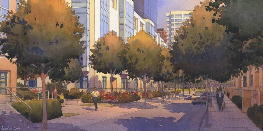
12 The Vision An active and attractive pedestrian environment will be created by expanding the existing public realm with new landscaped parks, pedestrian alleys, and widened sidewalks.

13 The Vision Improvements to the public realm of streets and alleys will create strong connections to the waterfront and other nearby San Francisco amenities.

14 Existing Major Open Space

15 Existing and Proposed Sidewalk Pedestrian Improvements

16 Existing and Proposed Sidewalk Pedestrian Improvements

17 Redesign Streets
18 Heart of Neighborhood

19 The Vision The heart of the neighborhood will be located on Folsom Boulevard, where sidewalks will be widened, streetscape improvements added and where convenience services and retail uses will be located.

20 Santana Row, San Jose
21 The Vision A sense of urbanity and a connection to the past will be achieved by retaining older buildings wherever possible in the historic and conservation districts around Second Street and by requiring compatible infill development in their vicinity.
22 The Vision Views and sunlight will be preserved throughout the area by locating and spacing towers to minimize their shadow impacts and by requiring appropriate slenderness in new buildings.

23 Transbay Redevelopment Area and n Neighboring Pipeline Projects
24 Concept 1 Current development trend extended Many towers (30-40 floors) 8 Floor Base 4700 units
25 Concept 3 Fewer towers Taller towers (slender proportion) Mixed 4-8 floor base Maximizes transparency and views to and from the city Creates a balanced mix of units

26 The Plan Towers should be elegant and wellspaced. Ensure high quality designs to enhance livability and provide aesthetic variety. Place and sculpt towers to avoid shadows on public parks.
27 Concept 1: Shadow Study Mission 12 pm Winter Howard Folsom Spear Fremont Second

28 Concept 3: Shadow Study Mission 12 pm Winter Howard Folsom Spear Fremont Second
29 Development Controls

30 Residential Base Treatment Activate the street edge with attractive, engaging entry treatment and uses.

31 Residential Base Treatment Form streets, alleys or mews at the human scale. Vary low-rise building heights and architectural character. Provide a rhythm of entries to individual units and storefronts and allow for personalization.
32 Residential Alley

33 Folsom Boulevard

34 The Vision
35 36 Transbay and Transit Center District
 (OCII Land Use Jurisdiction)")
36 Transbay Development Program 37 Publicly-Owned Parcels Over 3,100 new residential units (including over 1,300 affordable units) Over 2.6 million s.f. of new office development 200,000 s.f. of new retail space 9 acres of new parks, including 5.5-acre rooftop park on Transbay Transit Center Privately-Owned Parcels Over 1,300 new residential units Nearly 4 million s.f. of new office development (Planning Department Land Use Jurisdiction) (OCII Land Use Jurisdiction)

37 Transbay Redevelopment Area 38

38 39 Transbay Development Model


39 Transbay Affordable Housing 40 Types of affordable housing within blocks: Inclusionary Developer subsidized Stand alone OCII subsidized
40 Transbay Tax Increment Financing 41 Tax increment from the State- Owned Parcels is to be used for construction of the Transit Center and affordable housing Tax increment from the Non State-Owned Parcels will be used to fund affordable housing, streetscape improvements, open space and other public infrastructure
41 Transbay Additional Financing 42 Federal Grants and Loans Regional Transit Grants Local Sales Taxes Land Sales of Former State Parcels Bridge Tolls

42 43 Transbay and Transit Center District

43 Transit Center District Financing 44 Development Impact Fees Community Facilities District Also Transfer of Development Rights for Historic Preservation

44 Streetscape & Open Space Concept Plan 45

45 Under Ramp Park Howard Street Tehama Street Clementina Street First Street Folsom Street 10


46 Transbay Zone 1 Project Status 47 Under Ramp Park Start Summer 2019

47 48 Impact on Pedestrian Experience Folsom Looking East Existing

48 49 Impact on Pedestrian Experience Folsom Looking East Planned Projects

49 50 Impact on Urban Form View from Bay Bridge Existing
50 51 Impact on Urban Form View from Bay Bridge Planned Projects

51 Urban Form View from Yerba Buena Island Existing 52
52 Urban Form View from Yerba Buena Island Planned Projects 53
53 54 THANK YOU
2 Transbay Streetscape & Open Space Concept Plan
 2 Transbay Streetscape & Open Space Concept Plan 1 TRANSBAY REDEVELOPMENT PROJECT AREA DESIGN FOR DEVELOPMENT San Francisco Redevelopment Agency & San Francisco Planning Department Skidmore, Owings & Merrill
Transbay Folsom Streetscape Project 2 nd Street to Spear Street Community Update July 16, 2015
 Transbay Folsom Streetscape Project 2 nd Street to Spear Street Community Update July 16, 2015 A2 Agenda Welcome and introductions Project history and goals Project overview and next steps Questions and
Project Description. A. Overview
 Project Description A. Overview The Planning Department ( Department ) is proposing to rezone the area of San Francisco around the southern portion of the Central Subway transit line in order to increase
Robbinsdale LRT Station. CDI Development Guidelines. August Overview
 Robbinsdale LRT Station August 2018 Overview The City of Robbinsdale may have the coolest opportunity site along the 13 mile stretch of the Bottineau LRT corridor / Blue Line extension. Located a block
TRANSIT CENTER DISTRICT PLAN
 TRANSIT CENTER DISTRICT PLAN Public Workshop #3: Quality of Place 09.17.2008 San Francisco Planning Department In partnership with: San Francisco Redevelopment Agency Transbay Joint Powers Authority Transit
ROBBINSDALE LRT STATION CDI DEVELOPMENT GUIDELINES
 August 2018 OVERVIEW The City of Robbinsdale has a prime-opportunity site in the middle of the 13 mile stretch of the Bottineau LRT corridor / Blue Line extension. Robbinsdale offers a prominent, vital,
Taming Tysons Corner Transforming the Quintessential Edge City
 Taming Tysons Corner Transforming the Quintessential Edge City Transit is the greatest catalyst for change at Tysons, but how do we take advantage of this billion-dollar investment? If transit is built
5M PROJECT/ PLANNING COMMISSION INFORMATIONAL JULY 23, 2015
 5M PROJECT/ PLANNING COMMISSION INFORMATIONAL JULY 23, 2015 TIMELINE 2008-2009 2009-2011 2011-2013 2013-2014 INITIAL FACTORS > Identification of four-acre Chronicle soft site > Prioritizing preservation
Recreation & Parks. Guy Place Mini Park Community Meeting #1. January 10, San Francisco Department of Public Works
 Recreation & Parks Guy Place Mini Park Community Meeting #1 January 10, 2008 San Francisco Department of Public Works Agenda Welcome & Introductions Ground Rules Background and Planning Process Neighborhood
WEST OAKLAND SPECIFIC PLAN & DRAFT ENVIRONMENTAL IMPACT REPORT
 WEST OAKLAND SPECIFIC PLAN & DRAFT ENVIRONMENTAL IMPACT REPORT Landmarks Preservation Advisory Board Public Hearing February 10, 2014 1 Specific Plan Overview Plan Area is generally bounded by I-580 to
Draft for Public Review. The Market and Octavia Neighborhood Plan
 Draft for Public Review The Market and Octavia Neighborhood Plan San Francisco Planning Department As Part of the Better Neighborhoods Program December 2002 IOverview Why Plan a Better Neighborhood Here
Reclaiming Old West Broad Street: I-16 Ramp Removal Study
 Reclaiming Old West Broad Street: I-16 Ramp Removal Study Community Meeting Summary July 15, 2014 The first community meeting for Phase II of the I-16 Ramp Removal Study was held on July 15, 2014, at the
TRANSIT-ORIENTED DEVELOPMENT PLAN PRESENTATION RED-PURPLE BYPASS PROJECT AREA
 TRANSIT-ORIENTED DEVELOPMENT PLAN PRESENTATION RED-PURPLE BYPASS PROJECT AREA Purpose Create a community-led vision for redevelopment in the neighborhood Test specific concepts for CTA-owned parcels Expedite
Subject: 30 Otis Street, Evaluation of Shadow on Proposed 11th and Natoma Park
 Date: September 5, 2018 To: Recreation and Park Commission Capital Committee Through: Philip A. Ginsburg, General Manager Toks Ajike, Director, Capital & Planning Division From: Brian Stokle, Planner,
The Role of Cities in Planning Transportation Megaprojects
 The Role of Cities in Planning Transportation Megaprojects SPUR Oakland, November 28, 2018 + Elizabeth Deakin / UC Berkeley + Eric Eidlin / City of San Jose + Doug Johnson / City of San Francisco The Role
CITYWIDE PLANNING DIVISION
 2014-2019 CITYWIDE PLANNING DIVISION a five-year work program for long-range planning November 2016 TODAY S PRESENTATION 1. Overview 2. Planning Priorities 3. Topics/Focus Areas 5. Essential Practices
Corridor-Level Approaches to Creating Transit-Oriented Districts
 Corridor-Level Approaches to Creating Transit-Oriented Districts Dena Belzer Strategic Economics and Center for Transit-Oriented Development August 2011 5-year old partnership dedicated to improving practice
Railyard Alternatives and I-280 Boulevard Feasibility Study. MTA Board Meeting May 6, 2014
 Railyard Alternatives and I-280 Boulevard Feasibility Study MTA Board Meeting May 6, 2014 Planned Infrastructure Major pieces of new infrastructure are planned including: Downtown Rail Extension (DTX)
LEED-ND 101: Practical Strategies for Achieving Sustainability Goals. Travis Parker Lakewood Planning Director
 LEED-ND 101: Practical Strategies for Achieving Sustainability Goals Travis Parker Lakewood Planning Director Metro Vision Idea Exchange Oct 11, 2012 West Corridor Stations West Corridor Overview West
WORLD CLASS CITY. WORLD CLASS ASSET. WORLD CLASS TENANTS.
 WORLD CLASS CITY. WORLD CLASS ASSET. WORLD CLASS TENANTS. BUILDING INFORMATION PROPERTY HIGHLIGHTS 1.6 Million square foot office and retail complex 42-Story Spear Tower and 27-story Steuart Tower bridged
From: Mayor Sam Liccardo Councilmember Chappie Jones Councilmember Dev Davis Subject: SEE BELOW Date: June 23, 2017
 CITY OF fit SAN JOSE CAPITAL OF SILICON VALLEY Memorandum, To: HONORABLE MAYOR AND CITY COUNCIL From: Mayor Sam Liccardo Councilmember Chappie Jones Councilmember Dev Davis Subject: SEE BELOW Date: June
Partnerships in Transportation Transit-oriented Development The Return on Investment
 Partnerships in Transportation Transit-oriented Development The Return on Investment David M. Taylor, CNU Senior Vice President National Director, Sustainable Transportation Solutions Transit and Development
2030 Comprehensive Plan VISION STATEMENT
 RESOURCE DOCUMENT for Steering Committee Meeting #2 July 12, 2017 2030 Comprehensive Plan VISION STATEMENT Steering Committee from 2008 Established the Lauderdale s Vision as: Creating a livable, lovable
City of Hermosa Beach Administrative Policy #
 City of Hermosa Beach Administrative Policy # SUBJECT: Living Streets Policy Date: Approved by: City Council Authority: Public Works Department & Community Development Department Mayor, PURPOSE The City
Draft for Public Review. The Market and Octavia Neighborhood Plan
 Draft for Public Review The Market and Octavia Neighborhood Plan San Francisco Planning Department As Part of the Better Neighborhoods Program December 2002 . A New Neighborhood in SoMa West OBJECTIVE.1
Increase density to meet housing and affordability goals and to support transit investments.
 Topic Issues Community & Plan Alternatives Ideas Built Environment 1 - Adapt and grow downtown's capacity for a vibrant mix of jobs, housing and other uses to meet the needs of existing residents and the
India Basin/Hunters Point Shoreline Community Workshop May 21, 2008
 India Basin/Hunters Point Shoreline Community Workshop May 21, 2008 Workshop Agenda Welcome Process Overview Context & Existing Conditions Presentation of Draft Concepts Land Use and Open Space Priorities
Draft for Public Review. The Market and Octavia Neighborhood Plan
 Draft for Public Review The Market and Octavia Neighborhood Plan San Francisco Planning Department As Part of the Better Neighborhoods Program December 2002 IIPlan Elements. Land Use and Urban Form 2.
WELCOME and introduction
 1 WELCOME and introduction Mobility Hub Locations within Burlington STUDY OVERVIEW STUDY OBJECTIVES The City of Burlington is developing four Area Specific Plans, one for each of Burlington s Mobility
Status Report: MD 355 Project
 Status Report: MD 355 Project OCTOBER 2006 M-NCPPC MONTGOMERY COUNTY PLANNING DEPARTMENT Summary of Community Comments, and break to the Results of the MD 355 Participation Session Brookside Gardens -
WEST LOOP DESIGN GUIDELINES CHECKLIST
 WEST LOOP DESIGN GUIDELINES CHECKLIST Section 1.0 General Strategies 1.1 DESIGN EXCELLENCE: ENCOURAGE HIGH QUALITY AND INNOVATIVE DESIGN OF NEW BUILDINGS WITHIN THE WEST LOOP WITHOUT BEING PRESCRIPTIVE
BAGBY STREET RECONSTRUCTION PROJECT OCTOBER 2, 2015
 BAGBY STREET RECONSTRUCTION PROJECT OCTOBER 2, 2015 CLAIRE HEMPEL, PLA, AICP, LEED GA PREPARED BY Aspen Asheville Austin Chicago Denver Dubai Houston Lake Tahoe Los Angeles MIDTOWN : A MODEL OF URBAN DEVELOPMENT
A. WHAT IS A GENERAL PLAN?
 I. Introduction A. WHAT IS A GENERAL PLAN? A general plan is the planning guideline for the future of a city. It contains goals and policies which regulate urban development, the protection of the natural
EXPO LINE COMMUNITY WORKSHOPS NOVEMBER 27 TH & DECEMBER 3 RD Los Angeles Department of City Planning
 EXPO LINE COMMUNITY WORKSHOPS NOVEMBER 27 TH & DECEMBER 3 RD 2012 Los Angeles Department of City Planning Agenda for Tonight Open House 6:00 to 6:15pm Presentation and Questions 6:15 to 6:50 Small Group
The University District envisions, in its neighborhood
 Envisioning the University District Link Light Rail in Seattle s neighborhoods CIY OF SEALE CONCEP-LEVEL SAION AREA PLANNING RECOMMENDAION RESOLUION # 30165 EXHIBI L Vision 08.2000 he University District
The transportation and land use connection
 The transportation and land use connection A sustainable trend? 180% 160% 140% 120% 100% 80% 60% 40% 20% 0% Annual vehicle miles traveled US Population Road mileage We re driving more. Infrastructure can
Appendix A COMMUNITY IMPROVEMENT PLAN DESIGN GUIDELINES
 Appendix A COMMUNITY IMPROVEMENT PLAN DESIGN GUIDELINES INTRODUCTION The continuous and desirable improvement of Arnprior requires a clear understanding of what is envisioned for the Town. These Design
4 LAND USE DESIGNATIONS
 4 LAND USE DESIGNATIONS Chapter 4 describes the land use designations and densities that will implement the development vision for North Burlingame outlined in Chapter 3. Land use densities are described
TOWN COUNCIL / PLANNING COMMISSION
 Workshop #3 TOWN COUNCIL / PLANNING COMMISSION January 20, 2011 Consultant Team In Attendance Tonight BMS Design Group Nevada City and San Francisco Michael Smiley, AICP, ASLA Partner-in-Charge Nancy L.
Stockton Waterfront Master Plan. Waterfront Master Plan
 Stockton Waterfront Master Plan Presentation Objectives Process update Planning observations Planning Goals Planning Principles Review of planning activities Summary and next steps Planning Activities
Attachment B Summary of Plan Alternatives Report
 Attachment B Summary of Plan Alternatives Report Based on community ideas and feedback to date, a series of draft alternative scenarios for the future of downtown s neighborhood districts have been created
Affordability & Equity
 Affordability & Equity 1. Impact Fees 2. Displacement Prevention- build more housing to meet growth demands 3. Density Bonuses 4. Regional Housing Bond 5. Stricter Condominium Conversion Laws 6. Vacant
Chapter 1: Introduction
 Chapter 1: Introduction The Penn Avenue Community Works Corridor Vision and Implementation Framework presents an integrated communitybased vision and a coordinated, long-term implementation framework for
Hopkins. Development Guidelines May Overview. Sponsored by: Blake Road Corridor Collaborative City of Hopkins
 Hopkins Blake Road LRT Station Area Development Guidelines May 2015 Sponsored by: Blake Road Corridor Collaborative City of Hopkins Overview Hopkins is a dynamic community of over 17,000 residents located
CENTRAL ESTUARY PLAN AVISION FOR OAKLAND S WATERFRONT
 Central Estuary Plan A VISION FOR OAKLAND S WATERFRONT Specific Plan and Environmental Assessment Presentation to the Parks and Recreation Advisory Commission December 9, 2009 This Afternoon s Presentation
City of Long Beach. creating vibrant and exciting places
 City of Long Beach creating vibrant and exciting places Land Use Element Urban Design Element Overview of the two draft General Plan elements Discuss areas of change Economic goals of the plans Case study
III. Design Principles
 III. Design Principles The design of Bay Meadows Phase II has been guided by a series of Urban Design Principles. These principles, informed by consultant site analysis, City staff recommendations, and
Developer s Program. The Station at East 54
 Developer s Program The Station at East 54 Existing Conditions The Station at East 54 is proposed for a 1.12 acre site at the northeast corner of Hamilton Road and Prestwick Road, tucked between the East
EXISTING COMPREHENSIVE PLAN
 EXISTING COMPREHENSIVE PLAN Town Center Land Use Element: V. LAND USE POLICIES Town Center Mercer Island's business district vision as described in "Your Mercer Island Citizen-Designed Downtown" was an
Lynn Housing Authority and Neighborhood Development. Washington Street Gateway District Plan A p r i l
 Lynn Housing Authority and Neighborhood Development Washington Street Gateway District Plan A p r i l 2 0 0 8 rendering of sagamore hill from lynnway pedestrian overpass table of contents project area
Community Design. Our Use of Land. Introduction
 Community Design Our Use of Land Introduction This element addresses the physical form of the natural environment and the built form of the City. The major features that give San Rafael its visual character
THEMES, VISION, + PRINCIPLES
 CHAPTER 2: THEMES, VISION, + PRINCIPLES This page intentionally left blank. 20 VISION DRAFT AUGUST 2018 2 2 THEMES, VISION, + GUIDING PRINCIPLES The Key Themes, Vision, and Guiding Principles presented
TRANSIT ORIENTED DEVELOPMENT PINELLAS COUNTY MPO LIVABLE COMMUNITIES INITIATIVE PINELLAS COUNTY COMPREHENSIVE PLAN AMENDMENTS
 PINELLAS COUNTY MPO LIVABLE COMMUNITIES INITIATIVE MODEL LAND DEVELOPMENT CODE TRANSIT ORIENTED DEVELOPMENT PINELLAS COUNTY COMPREHENSIVE PLAN AMENDMENTS MPO Livable Communities Initiative Goal: Improve
Secrest Short Cut and Monroe Expressway Small Area Plan AUGUST 29, 2018
 Secrest Short Cut and Monroe Expressway Small Area Plan AUGUST 29, 2018 Background and Process Monroe Expressway will be open by the end of 2018 Union County and Indian Trail identified a need to revisit
EXISTING PLANS Harriet Festing Center for Neighborhood Technology Midlothian Community Meeting March 12, 2015
 EXISTING PLANS Harriet Festing Center for Neighborhood Technology Midlothian Community Meeting March 12, 2015 BENEFITS Bring economic, community + environmental benefits Enhance property values Use
Albert Lea. Redevelopment Plan. 701 Xenia Avenue South, Suite 300 Minneapolis, MN Tel: (763) Fax: (763) wsbeng.
 Fax: (763) wsbeng.") Albert Lea Redevelopment Plan 701 Xenia Avenue South, Suite 300 Minneapolis, MN 55416 Tel: (763) 541-4800 Fax: (763) 541-1700 wsbeng.com Albert Lea Redevelopment Plan Table of Contents Composite Districts...
Albert Lea Redevelopment Plan 701 Xenia Avenue South, Suite 300 Minneapolis, MN 55416 Tel: (763) 541-4800 Fax: (763) 541-1700 wsbeng.com Albert Lea Redevelopment Plan Table of Contents Composite Districts...
WEST OAKLAND SPECIFIC PLAN Final Plan. 2. Vision & Goals. 2.1 Community-Based Goals and Objectives
 WEST OAKLAND SPECIFIC PLAN Final Plan 2. Vision & Goals 2.1 Community-Based Goals and Objectives June 2014 2: Vision & Goals The vision of the West Oakland Specific Plan is to see this remarkable community
Figure BE-4: Urban Form - Corridors. Urban Form and Land Use. Page BE-24 Redwood City General Plan S A N F R A N C I S C O B A Y.
 and Land Use Bird Island S A N F R A N C I S C O B A Y Foster City Bair Island Belmont Greco Island San Carlos Veterans Blvd. El Camino Real Broadway Middleeld Rd. Menlo Park Woodside Rd. Features El Camino
DRAFT ROOSEVELT ROAD. District Recommendations. Figure 5.23 The Roosevelt Road Corridor
 CHAPTER 5 Figure 5.23 The Road Corridor Road will develop as a mixed-use corridor, emphasizing regional retail, west of the river and mixed-use development east of the river. KEY RECOMMENDATIONS 1. High
Northwest Rail Corridor and US 36 BRT Development Oriented Transit Analysis 4.4 STATION AREA FINDINGS
 4.4 STATION AREA FINDINGS Each station is different, and each one requires a separate set of recommendations based on the vision for the site. This section outlines an initial TOD strategy and recommendations
FRUITVALE TRANSIT VILLAGE (Phase 2) Residential Project
 Residential Project") FRUITVALE TRANSIT VILLAGE (Phase 2) Residential Project DEVELOPER: SIGNATURE PROPERTIES ARCHITECT: HKIT ARCHITECTS April 23, 2010 TABLE OF CONTENTS 3 Vision 4 Description of Site 5 Guiding Concepts 6
FRUITVALE TRANSIT VILLAGE (Phase 2) Residential Project DEVELOPER: SIGNATURE PROPERTIES ARCHITECT: HKIT ARCHITECTS April 23, 2010 TABLE OF CONTENTS 3 Vision 4 Description of Site 5 Guiding Concepts 6
Pedestrian and Bike Bridge LOGO
 6.2.2 Pedestrian and Bike Bridge The proposed pedestrian and bike crossing re-envisions the existing bridge at Pismo Creek on Cypress Street. The bridge is currently underutilized by vehicular through
Fisherman s Wharf Public Realm Plan
 Fisherman s Wharf Public Realm Plan SPUR Presentation July 11, 2008 3 February 2010 WHY A PUBLIC REALM PLAN? Public Life 1900 1950 1965 2000 Mainstreet Copenhagen in 100 years From nessesary to optional
THE GAS PLANT DISTRICT MASTER PLAN SCENARIO 2. COMMUNITY MEETING August 6, 2018
 THE GAS PLANT DISTRICT MASTER PLAN SCENARIO 2 COMMUNITY MEETING August 6, 2018 The Gas Plant Neighborhood in the 1970 s The development should honor the history of the Gas Plant neighborhood and the community
Forest Hills Improvement Initiative A Partnership for Building a Better Community. Use & Design Guidelines September 23, 2008
 Forest Hills Improvement Initiative A Partnership for Building a Better Community City of Boston Thomas M. Menino, Mayor Emerging Community Vision p. 2 Site Use & Design Guidelines p. 3 to 21 Arborway
Good Design Guidelines for Downtown. Preliminary Findings and Recommendations
 Good Design Guidelines for Downtown Preliminary Findings and Recommendations City Council Meeting - February 5, 2017 Advisory Committee Team: Larry Paul: Planning Commission /Architect Bruce Bagnoli: Business
Public input has been an important part of the plan development process.
 Lakewood s Comprehensive Plan recognizes that transportation helps shape the community, and that the way the community provides for the safe and efficient movement of people affects the character of the
Highland Village Green Design Guidelines
 Highland Village Green Design Guidelines Publishing Information Title Highland Village Green Design Guidelins Author The City of Calgary Status DRAFT - Proposed document subject to changes Additional Copies
Philip A. Ginsburg, General Manager Dawn Kamalanathan, Director, Capital & Planning Division
 Date: May 3, 2017 To: Through: From: Recreation and Park Commission Capital Committee Philip A. Ginsburg, General Manager Dawn Kamalanathan, Director, Capital & Planning Division Brian Stokle, Planner,
Courthouse Square Planning & Urban Design Study. Courthouse Square Working Group #13 October 15, 2014
 Courthouse Square Planning & Urban Design Study Courthouse Square Working Group #13 October 15, 2014 1 Courthouse Square Process Working Group Community Courthouse Square Advisory Groups & Civic Associations
The transportation system in a community is an
 7 TRANSPORTATION The transportation system in a community is an important factor contributing to the quality of life of the residents. Without a sound transportation system to bring both goods and patrons
THE COUTURE AT A GLANCE $122 MILLION TOTAL PROJECT COST 44 STORIES / 700,000 SQUARE FEET PUBLIC PLAZAS, PARK & PEDESTRIAN BRIDGES 302 MARKET RATE
 MILWAUKEE THE COUTURE AT A GLANCE $122 MILLION TOTAL PROJECT COST 44 STORIES / 700,000 SQUARE FEET PUBLIC PLAZAS, PARK & PEDESTRIAN BRIDGES 302 MARKET RATE APARTMENTS 54,893 SQUARE FEET OF DESTINATION
Access to the University of North Carolina at Chapel Hill, UNC Hospitals, and Chapel Hill Transit.
 M 1/ 4 1/ 2 E IL M E IL Station Family: County: City: UNC Hospitals WHY THIS STATION? University Village Orange Chapel Hill Access to the University of North Carolina at Chapel Hill, UNC Hospitals, and
PIKE PINE RENAISSANCE: ACT ONE. October 19, 2017
 PIKE PINE RENAISSANCE: ACT ONE October 19, 2017 WATERFRONT SEATTLE PROGRAM PROJECT INTRODUCTION Pike and Pine streets, between First and Melrose avenues Pedestrian and streetscape improvements Budget:
the west loop HOME TO 5,000 NEW DOGS
 the west loop the west loop HOME TO 5,000 NEW DOGS the west loop HOME TO 5,000 NEW DOGS AND 20,000 NEW RESIDENTS outline: the west loop now the vision how do we get there? opportunity LEVERAGE TRANSIT
Newer residential construction in lower Potrero Hill.
 Left: The project area s Bryant Street corridor has one- to three-story buildings without many ground-floor storefront windows. Right: Large-format retail constructed in 1991 at Eight, Ninth, and Bryant.
Boston Redevelopment Authority. Boston s s Planning and Economic Development Agency
 Boston Redevelopment Authority Boston s s Planning and Economic Development Agency What is the BRA? Established in 1957 by the City Council and MA Legislature to assume and expand the powers of the BHA
PLAN ELEMENTS WORKSHOP. April 5, 2016
 PLAN ELEMENTS WORKSHOP April 5, 2016 needs more housing. But there is no one-size fits-all solution. Every neighborhood has its own character. In some places, density is not only appropriate it is badly
W O R K S H O P S U M M A R Y
 W O R K S H O P S U M M A R Y Community Workshop #2: Preliminary Design Strategies October 27, 2007 Upper Market Community Workshop Series and Design Plan Page 1 of 13 INTRODUCTION The Upper Market Community
Mr. Craig Young, Managing Principal Tidewater Capital 25 Taylor Street San Francisco, CA October 27, 2014
 95 Brady Street San Francisco, CA 94103 415 541 9001 info@sfhac.org www.sfhac.org Mr. Craig Young, Managing Principal Tidewater Capital 25 Taylor Street San Francisco, CA 94102 Ref: 1028 Market Street
ANC 2A Presentation. November 9, 2006
 ANC 2A Presentation November 9, 2006 Introduction & Overview Applicants Boston Properties and KSI Services (project developers) The George Washington University (land owner) 2.66 acre site (former GW hospital
A BLUEPRINT FOR BROCKTON A CITY-WIDE COMPREHENSIVE PLAN
 A BLUEPRINT FOR BROCKTON A CITY-WIDE COMPREHENSIVE PLAN Public Meeting October 2016 1 Plan Summary and Discussion Public Meeting May 4 2017 City of Brockton Bill Carpenter, Mayor Department of Planning
Cumberland Region Tomorrow is a private, non-profit, citizen based regional organization working with Greater Nashville Regional Council
 Cumberland Region Tomorrow is a private, non-profit, citizen based regional organization working with Greater Nashville Regional Council and others in the public and private sectors, dedicated to planning
V. Urban Design A. INTRODUCTION B. CITY IMAGE
 V. Urban Design A. INTRODUCTION Urban design refers to the physical form and development of a city from the individual neighborhood to the overall city scape. In the largest sense, urban design encompasses
SAN RAFAEL GENERAL PLAN 2040 INTRODUCTION AND OVERVIEW
 SAN RAFAEL GENERAL PLAN 2040 INTRODUCTION AND OVERVIEW Steering Committee Presentation February 14, 2018 Purpose of General Plan Guide land use and development decisions Coordinate transportation, infrastructure,
CITY OF TARPON SPRINGS DCA#11-1AR
 Agenda Item #3.H.2 05/09/11 TAMPA BAY REGIONAL PLANNING COUNCIL LOCAL GOVERNMENT COMPREHENSIVE PLAN ADOPTED AMENDMENT REPORT CITY OF TARPON SPRINGS DCA#11-1AR 1 ADOPTED WITH THE FOLLOWING CHANGES: Ordinance
RE-Imagining the Downtown Colorado Springs Master Plan
 RE-Imagining the Downtown Colorado Springs Master Plan 2016 APA Colorado State Conference October 25, 2016 Overview 8:00 Welcome, Introductions, and Overview 8:15 Downtown s Planning History 8:30 A Market
Freeway Demolition and Economic Regeneration in San Francisco
 Freeway Demolition and Economic Regeneration in San Francisco TRANSform Scotland Is Transport Good for Your Wealth? April 22, 2002 Andrew Nash, P.E. Presentation Outline Loma Prieta Earthquake Embarcadero
DALY CITY VISIONING PROCESS COMMUNITY WORKSHOP 3 MAY 8, 2008
 DALY CITY VISIONING PROCESS COMMUNITY WORKSHOP 3 MAY 8, 2008 PROCESS General Plan - a statement of the community s values, vision and aspirations for now and into the future... Timeframe LONG TERM - 2030
Planning for TOD Implementation at a Corridor Scale
 Planning for TOD Implementation at a Corridor Scale Catherine Cox Blair, Reconnecting America Presentation to DRCOG and the Sustainable Communities Initiative May 14, 2012 What is Reconnecting America?
The Master Plan Framework
 The Master Plan Framework The East Harbour Master Plan advances the development of 60 acres of former industrial lands east of the Don River. The Master Plan outlines a vision for a vibrant, transit-oriented
Cherokee. Corporate Headquarters 111 East Hargett Street Suite 300 Raleigh, NC
 Cherokee Corporate Headquarters 111 East Hargett Street Suite 300 Raleigh, NC 27601 919-743-2500 Denver 4600 S. Ulster Street Suite 500 Denver, CO 80237 303-689-1460 London 41-43 Maddox Street London W1S
SAN FRANCISCO URBAN DESIGN GUIDELINES
 SAN FRANCISCO URBAN DESIGN GUIDELINES Planning Commission Informational 20 October 2016 WHAT ARE DESIGN GUIDELINES? Design Guidelines are implementation documents for city design policies and objectives.
Urban Design Manual PLANNING AROUND RAPID TRANSIT STATIONS (PARTS) Introduction. Station Study Areas
 Introduction. Station Study Areas") 111111 PLANNING AROUND RAPID TRANSIT STATIONS (PARTS) Introduction The ION rapid transit system will link Waterloo, Kitchener and Cambridge through a central transit corridor (CTC). There are a number
111111 PLANNING AROUND RAPID TRANSIT STATIONS (PARTS) Introduction The ION rapid transit system will link Waterloo, Kitchener and Cambridge through a central transit corridor (CTC). There are a number
13. New Construction. Context & Character
 13. New Construction Context & Character While historic districts convey a sense of time and place which is retained through the preservation of historic buildings and relationships, these areas continue
chapter DESIGN GUIDELINES NEW RIVER MASTER PLAN REPORT
 chapter DESIGN GUIDELINES NEW RIVER MASTER PLAN REPORT .76 DESIGN GUIDELINES An Overview design guidelines NEW RIVER MASTER PLAN Design Guidelines can transform the image of a city. Specific, design-based
Appendix E: Illustrative Green Infrastructure Examples
 Appendix E: Illustrative Green Infrastructure Examples Integrating LID into San Francisco s Urban Landscape Figure E. High-density Residential Figure E. Low-density Residential Figure E. Mixed Use 7 Figure
City of Ennis. Downtown Master Plan Catalyst Projects
 City of Ennis Downtown Master Plan Catalyst Projects Revised Framework Plan REVISED Project Types and Descriptions Project Types A. Visitor Attracting Projects: Projects in this category are intended to
NJ s Land Use and Transit Policies
 1 NJ s Land Use and Transit Policies NJ TRANSIT created in 1979 to reverse decline of public transportation State Development & Redevelopment Plan adopted (1986) encourages growth in areas where population,
Executive Summary General Plan Amendment Initiation
 Executive Summary General Plan Amendment Initiation HEARING DATE: AUGUST 6, 2015 Date: July 30, 2015 Case No.: 2011.0409PCA Project Address: 925 Mission Street and various parcels (aka 5M ) Existing Zoning: