PAHRUMP REGIONAL PLANNING DISTRICT MASTER PLAN UPDATE 2014
|
|
|
- Brook Irma Mitchell
- 5 years ago
- Views:
Transcription


1 PAHRUMP REGIONAL PLANNING DISTRICT MASTER PLAN UPDATE 2014 Adopted by the Pahrump Regional Planning Commission on May 1, 2014 by Resolution Adopted by the Nye County Board of County Commission on December 16, 2014 by Nye County Resolution
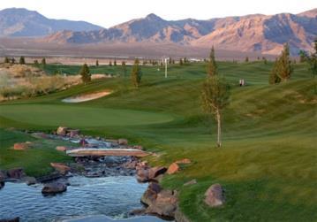
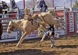
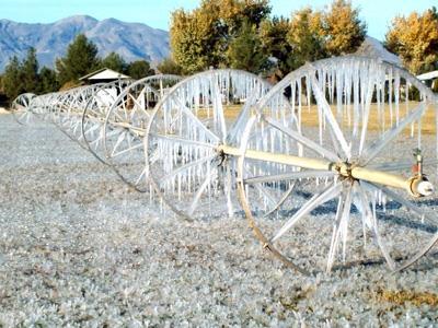
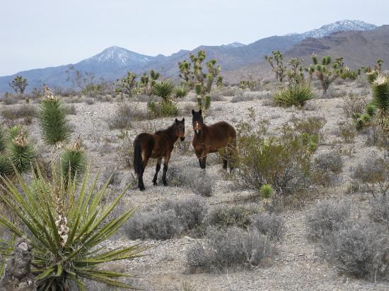
2 Photo Credits Cover beginning clockwise from top left Sanders Family Winery, courtesy of George Trimmer and Wild horses in Pahrump, courtesy of tripadvisor.com; Saddle West Hotel, Casino and RV Resort, courtesy of Rodeo event at McCullough Arena, courtesy of Pahrump Valley Times, Abandoned cattle ramp on Homestead Road, courtesy of Pam Crawford and Gold Town Casino, courtesy of Pahrump Valley Winery, courtesy of hopperblog.com; Old gas station Pahrump, NV, courtesy of Ice on the wheel-line irrigation system, courtesy of Mike Darby and Spring Mountain Motorsports Ranch, courtesy of Front Sight Firearms Training Facility, courtesy of Lakeside RV Resort courtesy of Old truck courtesy of Mountain Falls golf course courtesy of Center photo: Baby Bow courtesy of George Trimmer Page ii
3 NYE COUNTY BOARD OF COUNTY COMMISSION RESOLUTION NO A Resolution Adopting the 2014 Pahrump Regional Planning District Master Plan Update dated May 1st, 2014, WHEREAS, the Pahrump Regional Planning Commission in accordance with Nevada Revised Statutes (NRS) to , inclusive, and with the assistance of the residents of the Pahrump Regional Planning District, the Nye County Planning Department, the Nuclear Waste Repository Project Office, the Natural Resources Office, and with much public input have worked toward updating the 2003 Pahrump Regional Master Plan Update, and WHEREAS, the Pahrump Regional Planning Commission held a noticed Public Hearing on the adoption of the master plan, or of any amendment, extension or addition to the 2014 Pahrump Regional Master Plan Update, and voted to adopt Resolution #: : A Resolution Adopting and Certifying the 2014 PRPD Master Plan Update was carried by the affirmative votes of not less than two thirds of the total membership of the Pahrump Regional Planning Commission, and WHEREAS, pursuant to Nevada Revised Statutes (NRS) , upon receipt of a certified copy of the master plan, or of any part thereof, as adopted by the Planning Commission, the governing body may adopt such parts thereof as may practicably be applied to the development of the region for a reasonable period of time next ensuing; and WHEREAS, the 2014 PRPD Master Plan Update is based on; providing clarity and increased flexibility between Master Plan Designations and zoning districts, promoting a more efficient pattern of community development, preservation of rural areas and recognition of water resource issues; and WHEREAS, after conducting a Public Hearing as required pursuant to NRS , the BOARD finds adoption of the 2014 Master Plan Update for the Pahrump Regional Planning District to be in the best interests of the community of Pahrump and the County of Nye and is hereby declared to be established to conserve and promote the public health, safety and general welfare of the residents of the Pahrump Regional Planning District. NOW THEREFORE, IT IS HEREBY RESOLVED by the BOARD that the 2014 Pahrump Regional Planning District Master Plan Update dated May 1st, 2014 is hereby adopted effective immediately. ADOPTED this 16th day of December, 2014 NYE COUNTY BOARD OF COUNTY COMMISSIONERS: ATTEST: Daniel Schinhofen, Chairman Board of County Commissioner Sandra Sam L. Merlino, Nye County Clerk and Ex-Officio Clerk of the Board Page iii
4 Page iv
5 Page v
6 Acknowledgements Pam Webster, Nye County Manager Darrell Lacy, Director Nye County Planning Department Levi Kryder, Geoscience Manager/Acting Natural Resources Manager Cheryl Beeman AICP, Community Planner Celeste Sandoval, Administrative Secretary Elizabeth Lee, Principal Planner Qiana Medici, Planning Technician I David Fanning, Nye County Public Works Director Ken Plewe, Geographic Information Systems Administrator Debbie Orrick, Mapping Administrator Master Plan Update Steering Committee Carrick Bat Masterson, Chairman Timothy J. McCall, Vice Chairman Norma Jean Opatik, Secretary John MacLaughlin, Vice-Chair Gregory T. Hafen II, PRPC Representative Steve Osborne, AICP, Nye County Principal Planner Pahrump Regional Planning Commission Present Members John Koenig, Chairman Robert T. (Bob) King, Secretary/Clerk Vincent Clark Gregory T. Hafen II, Vice-Chairman Joseph C. Goode, Sr. Paul Carr Bill Dolan, Pahrump Town Board Liaison Pahrump Regional Planning Commission Past Members Terry Hand, Chairman Marvin Minnick, Secretary/Clerk Walter (Walt) Grudzinski Vicky Parker, Pahrump Town Board Liaison Mark D. Kimball, Vice-Chairman Norma Jean Opatik Dave Richards Jennifer McCall, Secretary/Clerk Bruce Earl Page vi
7 Technical Advisory Group Nevada Tolladay Marvin Minnick Jacob Skinner Mark D. Kimball Community Stakeholders Robert Adams, Pahrump Public Lands Advisory Committee Members of the Pahrump Town Board Debra Strickland, Hoof and Foot Trails Committee Rachel Kryder, P.E. Members of the Regional Transportation Commission Cassandra Selback, NCREDA Regional Transportation Commission Loretta MacPherson Nye County Water District Governing Board Susan Holecheck, Pahrump Town Manager Matt Luis, Town of Pahrump Parks & Recreation Manager Capital Improvements Advisory Committee University of Nevada Cooperative Extension Office Nye Communities Coalition Back Country Horsemen of Nevada Consultants TerraSpectra Geomatics 2700 E. Sunset Rd., Suite A-10 Las Vegas, Nevada In memory of Timothy J. McCall, who in the spirit of service first, politics never, labored tirelessly in service to our community by providing hours of meaningful support, expert advice and input in the development of this Master Plan Update. His humility, integrity, and hard work continues to inspire those who knew him. We are forever grateful for your service. Page vii
.")
8 EXECUTIVE SUMMARY Due to increasing growth and development pressure, the Nye County Board of County Commissioners (BOCC) took steps, beginning in 1999, towards developing a community-wide Master Plan for the Pahrump Regional Planning District (PRPD). This Master Planning process took place over several years and the Pahrump Regional Planning District Master Plan was adopted in 2003, which was followed by the adoption of the first comprehensive Zoning Ordinance in In 2010 the Board requested the PRPD Master Plan be updated. The need to update the plan was based on improving plan flexibility, clarity and to address water resource planning issues that had not been addressed during the 2003 update. The Regional Planning Commission through a series of technical reviews, Master Plan Steering Committee meetings and numerous public meetings offers the 2014 Update of the PRPD Master Plan. INTRODUCTION Pahrump is an unincorporated town located in the southern portion of Nye County near the California border. Only 63 miles from Las Vegas, Pahrump is a bedroom community of sorts with thousands of residents who commute to Las Vegas each day. The population within the PRPD has grown from approximately 7,000 in 1990 to over 36,441 i according to the 2010 US Census. This growth has placed pressure on Nye County and the Town Page viii
9 of Pahrump to provide adequate services while protecting the small-town atmosphere along with the health, safety, and general welfare of residents. Planning in the Pahrump Regional Planning District is only beginning to catch up with the divisions of land and population growth. With the adoption of valley wide zoning, regulating land use has become a priority. Because of unregulated development of the past, incompatible land uses are common, resulting in a diminished sense of health, safety and economic potential by the general public. This Master Plan provides goals, objectives and policies to guide future land use planning and address the unregulated development of the past. This Master Plan also establishes the framework for the adopted Adequate Public Facilities Plan and Policy, and future updates to the Zoning Map and/or Ordinances. Even as the population approaches 40,000, Pahrump is still, at its core, a small town and is poised to make important decisions that analyze the past and move towards its future. WHAT IS A MASTER PLAN? The Nye County Board of County Commissioners (BOCC) and the Pahrump Regional Planning Commission (RPC) are charged with the adoption of a Master Plan. Nevada Revised Statute defines the Master Plan as a comprehensive, long-range general plan for the physical development of the city, county or region. The Master Plan serves to guide growth and development decisions over the next 5 to 10 years by providing analysis, recommendations and proposals for the development of the community in terms of rational, economic growth and development, services, facilities, transportation network, land use and recreational opportunities. The Plan is a living document, which is reviewed and amended from time to time and may be comprehensively updated as the community s needs change. Each chapter contains goals and policies that have been identified, along with specific objectives and policies. These goals and objectives are based on public input. PLAN UPDATE PUBLIC OUTREACH PROCESS The planning process for the Pahrump Regional Planning District s Master Plan has centered on public involvement. The process began with a Technical Advisory Team who reviewed the document for grammatical and technical correctness. The Master Plan Update Steering Committee began their monthly meetings in February 2011, with regular meetings taking place nearly every month since. Input has been sought from State and local government officials, planning professionals and area special interests groups. Presentations were made to the Regional Transportation Commission, Nye County Water District Governing Board, Pahrump Town Board, the Groundwater Management Plan Committee, Board of Realtors, the Pahrump Chamber of Commerce and the Capital Improvement Advisory Committee. meeting notifications lists were built, information was placed on the Nye County website and Facebook was utilized to help broadcast information about the plan and scheduled meetings. Two public open houses were held. Staff and Steering Committee members have been interviewed on radio, T.V. and for newspaper articles. Our attempts to reach out for public input has been extensive and a crucial component in the preparation of this update. Page ix
10 PLAN ORGANIZATION Subject Matters of the Master Plan: The Master Plan is divided into various subject matters as described in the Nevada Revised Statutes (NRS) Each chapter addresses one or more of the major planning topics relevant to our community and consistent with the requirements for planning policy as described in the NRS. Goals, objectives and policies are defined as follows: A goal is a concise statement describing a condition to be achieved. It does not suggest specific actions, but identifies a desired outcome or condition. An objective is an achievable step toward the goal. Progress towards an objective can be measured and is generally time dependent. A policy is a specific statement, derived from goals and objectives, to guide decision-making. The Master Plan is a policy document. It does not implement or regulate land uses, therefore, a Master Plan is not a zoning tool it is a document that provides guidance for the regulation of land use. Many of the goals, objectives and policies are carried out through the zoning ordinance amendments that follow which serves to implement the Master Plan. The benefits for having an updated plan include: 1. Consistency in decision making the plan provides decision makers a constant point of reference for land use related actions. 2. Achieve predictability the plan describes where and what type of development the community desires. This information helps individuals to coordinate the purchase and use of property consistent with community goals. 3. Prudent use of resources the plan includes information from the various Nye County Departments, and other county-provided public services related to land development. Such information can be used to direct the location of facilities, services and road improvements. 4. Preserve community character the plan describes the communities ideals for the future and establishes its existing and intended patterns of growth by identifying what is important and what should be protected. 5. Produce positive economic development planning helps existing residents and businesses better predict the future development of an area by lending a level of stability for investment to take place. 6. Address potential impacts planning assists in assessing impacts from a major project such as the proposed development of a high-level nuclear waste repository at Yucca Mountain. To make sure that the Plan is a relevant guide for the community, it should be flexible and dynamic. It must be able to respond to change as well as guide it. It should be reviewed for compatibility with the community s goals every 5 years to keep the document current. This review process Page x
11 should be initiated by the Pahrump Regional Planning Commission with the help of the Nye County Planning Department. Future development applications and County decisions relating to land use, transportation, acquisition of land and major capital improvements should be measured against the adopted Master Plan to see if they are generally consistent with the overall intent and policies of the Plan. ACCOMPLISHMENTS SINCE THE 2003 PRPD MASTER PLAN UPDATE The Board of County Commissioners working in concert with the Pahrump Regional Commission and other key county departments have achieved a number of the goals outlined in the 2003 Master Plan. Of note, Nye County has accomplished the following tasks: Adopted Adequate Public Facilities Plan and Policy, Developed a comprehensive zoning ordinance and established zoning, Developed and implemented water conservation ordinances through land use regulations, Coordinated with various economic development groups to promote and enhance the economic development climate of our community, Upheld the Memorandum of Understanding (MOU) with the State of Nevada regarding Air Quality standards, Developed a Capital Improvement Plan and implemented impact fees to help provide needed infrastructure development, Explored the acquisition of a municipal utility system, Utilized GIS to develop and map existing facilities, Working with Nye County Public Works created a Flood Control Master Plan to identify storm water improvements, Continue to monitor water levels, Pursued the preservation and development of community recreational facilities and a governmental center (i.e. Calvada Eye). Established through legislative action in 2007, the Nye County Water District Act (Chapter 542, under Selected Special and Local Acts), the bill known as the Nye County Water District. Established the Nye County Water District Governing Board, Developed the Basin 162 Ground Water Management Plan Advisory Committee Page xi
12 ACROYNYMS ACEC ACS ADA AFA BLM BOCC CAAP CDBG CIP CC&R EPA DOE DFIRM FEMA FIRM FLPMA GWMP ISDS MOU NAAQS NAC NCC NCSD NCWD NDEP NDOT NDWR Area of Critical Environmental Concern American Community Survey Americans with Disabilities Act Acre Feet Annual Bureau of Land Management Board of County Commissioners Pahrump Valley Clear Air Action Plan Community Development Block Grant Capital Improvement Plan Codes, Covenants and Restrictions U.S. Environmental Protection Agency US Department of Energy Digital Flood Insurance Rate Map Federal Emergency Management Agency Flood Insurance Rate Map Federal Land Policy and Management Act Ground Water Management Plan Individual Sewage Disposal System Memorandum of Understanding National Ambient Air quality Standards Nevada Administrative Code Nye County Code Nye County School District Nye County Water District Nevada Department of Environmental Protection Nevada Department of Transportation Nevada Division of Water Resources Page xii
13 NFIP NRS OHV OSDS PRPC PRPD PTB PV R&PP ROW RMP RPC SFHA SOB WRP YMP National Flood Insurance Program Nevada Revised Statutes Off-Highway Vehicle On-Site Disposal System Pahrump Regional Planning Commission Pahrump Regional Planning District Pahrump Town Board Photovoltaic Recreation and Public Purposes Rights-of-way Resources Management Plan Regional Planning Commission Special Flood Hazard Areas Sexually Oriented Business Water Resources Plan Yucca Mountain Project Disclaimer: Due diligence has been exercised to ensure that accuracy of the information shown in text documents, maps, charts and other materials produced in the development of this plan. However, the Pahrump Regional Planning Commission makes no warranty to representation, express or implied, as to the use, accuracy, or interpretation of the data presented in this plan. This document is provided for informational purposes and is intended as a tool for planning purposes only. Before relying on this document, the user should contact the Nye County Planning Department or other appropriate source to review the official records of the organization and confirm that the information is current. Appropriate use: The maps are for illustrative purposes and are intended as a tool for planning only. Page xiii
14 Table of Contents Board of County Commissioners Resolution No iii Pahrump Regional Planning Commission Resolution No iv Acknowledgements... vi Executive Summary... viii Acronyms... xii Chapter One - Community Profile... 1 A Brief History of Pahrump... 1 Vicinity... 2 Population Demographic and Housing Characteristics... 4 State Population Growth... 4 County Population Growth... 4 Pahrump Population Growth... 4 Gender, Age and Race... 5 Housing Characteristics... 5 Education... 6 Pahrump s Relationship to Las Vegas, Nevada... 7 Current Community Issues... 7 Chapter Two Community Design... 8 Community Image... 9 Rural Preservation... 9 Water Supply/Demand Community Business Development Areas and Neighborhood Centers Community Gateways Streetscapes Xeric Landscaping Dark Night Skies Signage Billboards Division of Land Regulations Cluster or Open Space Subdivisions Page xiv
15 Low Impact Development Natural Infrastructure Leed Infill Development...15 Community Design Goals, Objectives and Policies Chapter Three Public Buildings, Services and Facilities...21 Public Buildings Nye County Government Complex Law Enforcement Facilities Nye County Emergency Management Services (EMS) Pahrump Valley Fire-Rescue Services (PVFRS) Health and Human Services Water/Waste Water Facilities Utility Tariff Areas Public Buildings, Services and Facilities Goals, Objectives and Policies Chapter Four Land Use Plan Planning History in Pahrump Valley Growth in Pahrump Valley Accommodating Future Growth Land Use Considerations..31 Land Use Challenges Grandfathered Uses and Nuisances Land Use Management Strip Zoning Large-Lot Preservation Premature and Obsolete Land Subdivisions Flood Prone/Soils & Land Suitability Analysis Water Availability Capital Improvement Funding Sources Restricted Funds Redevelopment Infill Development Page xv
16 Public Lands Yucca Mountain Project Future Land Use Plan Land Use Designations, Descriptions and Objectives Land Use Designations Public Lands BLM Multiple Use Area BLM Disposable Area Land Use Designations Private Lands Residential Rural Density Residential Low Density Residential High Density Residential Mixed Use Community Development Area Rural Development Area Special Plan of Development Industrial Business Industrial Area Rural Industrial Area Opens Space, Parks and Recreation Build-Out Analysis Land Use Plan Goals, Objectives and Policies Chapter Five Transportation/Streets and Highways Plan Pahrump Streets and Highway Network Existing Conditions Existing Transportation Plans Other Transportation Related Matters Truck Routes Beltway Page xvi
17 Interstate-11 & Intermountain West Corridor Study Access Management, Corridor & Community Gateways Plan (State Routes 160 & 372) Strip Commercial Development NDOT Improvements Rights-of-Way Acquisition Revised Statutes (R.S.) 2477 Roads Traffic Calming Park and Ride Addressing Alternative Motorized Transportation Off-Highway Vehicles (OHVs) Low Speed Vehicles (LSVs) and Golf Carts Non-Motorized Transportation Bicycle Facilities Pedestrian Ways Equestrian Trails Air Transportation Pahrump Valley Airport Private Air Facilities Transportation/Street & Highways Plan Goals, Objectives and Policies Chapter Six Conservation Plan Development and Utilization of Natural Resources Air Quality Flood Control and Drainage Pahrump Flood Zone Mapping National Flood Insurance Program (NFIP) Renewable Energy Soils and Erosion Control Water Nye County Water District Ground Water Management Plan Committee Water Rights Perennial Yield Ground Water Withdrawal Per Capita Use Page xvii
18 Public Water Systems Aquifers Cone of Depression DWR Designated the Pahrump Basin Critical Management Areas Water Conservation/Consumptive Use Conservation Plan Goals, Objectives and Policies Chapter Seven - Recreation Park Standards Community Recreation Inventory Cultural Recreation Opportunities Private Recreation Opportunities Regional Recreation Opportunities Future Recreational Opportunities Recreation Plan Goals, Objectives and Policies References List of Figures: Figure 1.1 Regional Map... 3 Figure 2.1 Pahrump Developed Parcels Map Figure 4.1 BLM Disposal Status Map Figure 4.2 Future Land Use Map Figure 5.1 Streets & Highways Map Figure 6.1 Flood Control Master Plan Map Figure 6.2 FEMA Flood Designations Map Figure 6.3 Soil Suitability Map Figure 7.1 Recreational Facilities & Trails Map List of Tables: Table 1.1 Regional Population Growth... 4 Table 1.2 Pahrump Population Growth... 5 Table 1.3 Pahrump Housing Unit Counts... 6 Page xviii
19 Table 4.1 Master Plan Land Use Designation Acreages Table 4.2 Master Plan & Zoning Conformity Table 4.3 Zoning Abbreviations, Names & Purpose Table 4.4 Build-Out Comparison Table 5.1 Private Air Facilities Table 6.1 Pahrump Valley Water Supply Studies Table 6.2 Allocated Water Rights Table 6.3 Historical Annual Pumpage Table 6.4 Pahrump Total Water Usage (in afa) by Population at Various GPCD Rates Page xix

20 Community Profile CHAPTER ONE COMMUNITY PROFILE Photo courtesy of Patrick Duvall INTRODUCTION Knowledge is of two kinds. We know a subject ourselves, or we know where we can find information on it." ii This section provides an overview of the history and existing conditions of the Pahrump Regional Planning District focusing primarily on 2010 U.S. Census data for socio-economic and demographic information. A BRIEF HISTORY OF PAHRUMP The name Pahrump is derived from the Southern Paiutes who inhabited the Pahrump Valley centuries ago. The term Pah means water and Rimpi means stone or rock. It is believed that natural artesian springs once flowed generously, thus giving Pahrump its name. A century ago, settlers arrived and began farming the valley, with its fertile lands and abundance of water. According to Harry Button Ford, a long-time valley citizen, in an article published in the Pahrump Valley Magazine in 2002, even the Anasazi Indians were in the Pahrump Valley due to the availability of water. The Old Spanish Trail crossed the Pahrump Valley between 1830 and 1848, to connect the trade route linking Santa Fe, New Mexico and Los Angeles, California. The trail facilitated trade between the states, allowing wool, spices, and the exchange of ideas to spread west across the United States. Most of the trail through the Pahrump Valley is on land managed by the Bureau of Land Page 1
21 Community Profile Management (BLM). On Dec. 4, 2002, President George W. Bush signed S The Old Spanish Trail Recognition Act, into law. The bill officially designated the trail as a National Historic Trail, placing it among only 20 trails that have received national recognition by Congress since According to Robert McCracken s book, Pahrump: A Valley Waiting to Become a City, Pahrump s modern history begins around 1917, with the arrival of the Pahrump Valley Company, owners of the Pahrump Ranch. It was the tradition of farming that helped to develop Pahrump into the community it is today. With artesian springs and agriculture in the fertile valley, the Town of Pahrump must have been an oasis in the hot, dry, Nevada desert. Dating back to the late 1940 s cotton was king of Pahrump. With the Hafen and Harris families arriving to pursue a farming career, cotton became the backbone of local industry. However, little evidence of that history remains. The old store near the Pahrump Ranch, the Lois Kellogg grain mill near Manse Ranch, and the Little Red School House, which was moved to Pahrump from Ash Meadows in 1945, are the few remnants of days past and are now located in the Pahrump Museum. VICINITY The Town of Pahrump is located in the southeast corner of Nye County and is 63 miles west of Las Vegas and 45 miles south of the Nevada National Security Site (NNSS, formerly known as the Nevada Test Site). The valley is approximately 40 miles long and 15 miles wide. The Town of Pahrump is located within the Pahrump Regional Planning District (PRPD), which has an area of approximately 369 square miles. Pahrump is the largest town in Nye County, which is the largest county in Nevada, and the third largest county in the lower 48 states in terms of land area with a total area of 18,147 square miles. Tonopah is the county seat and is located 165 miles north of Pahrump. The elevation of Pahrump ranges from 2,500 to 2,750 above sea level, and the town is situated in the valley between the Nopah Range and the Spring Mountains. Page 2

22 Community Profile FIGURE 1.1: REGIONAL MAP Page 3
23 Community Profile POPULATION DEMOGRAPHIC AND HOUSING CHARACTERISTICS Data referenced in this section was obtained primarily from the following sources; the 2010 Census, taken April 1, 2010, the American Community Survey (ACS) five year survey, from 2007 through 2011, the Nye County Planning Department Population Estimates and the Nye County Assessor s Office Certified Housing Unit Counts. State Population Growth: Between the years of 1990 and 2007 the State of Nevada experienced explosive population growth. In 1990, the U.S. Census Bureau listed Nevada as having a population of 1,201,833 persons, increasing to a population of 2,700,551 by 2010 an increase of the State s population by 1,498,718 persons, for a growth rate of approximately 125%, and again making Nevada one of the fastest growing states in the Nation. In fact, Nevada s growth rate during this time period was significantly higher than the next closest state, Arizona, followed by Utah, Idaho, Texas, and North Carolina. Nevada is the only state that has maintained a growth rate of 25.0% or greater for the last three decades. Regional Population Growth Table below compares Nevada with its regional neighbors in terms of population. Table 1.1: Regional Population Growth Table State Population (1990) Population (2010) Increase ( ) Percent (%) Change ( ) Nevada 1,201,833 2,700,551 1,498, % Arizona 3,665,228 6,392,017 2,726, % California 29,760,021 37,253,956 7,493, % Utah 1,722,850 2,763,885 1,041, % Source: U.S. Census Bureau Based on estimated State populations, as of July 1, 2012, Nevada is the 35 th most populated state in the union according to the American Fact Finder at Census.gov. County Population Growth: Between 1990 and 2001, the county experienced an 89% growth rate growing from an estimated 17,000 to over 30,000 during that time period. By 2010, Nye County s population exceeded 43,500 based on Nye County estimates. Pahrump Population Growth: The U.S. Census Bureau and the State Demographer track population statistics for the Pahrump area, which is tracked as a Community Designated Place (CDP). A CDP is a concentration of population identified for statistical purposes by the U.S. Census Bureau. CDPs are populated areas that lack separate municipal government, but which otherwise physically resemble incorporated places. According to the U.S Census Bureau s American Communities Survey, the estimated population of Pahrump was 7,424 in 1990, growing to 24,631 by As of 2013, the population of Pahrump was estimated to be 38,543. Page 4
24 Community Profile Table 1.2: Population Growth: Pahrump Population Growth ( ) End of Year Total Population Population Change Growth Rate , ,383 2, % ,362 2, % ,696 2, % ,859 1, % ,231-1, % , % , % , % , % , % 5 Year Average 1, % 10 Year Average % Table source: Nye County Planning Department Population Estimates, through 4 th Quarter 2013 The U.S. Census remains the official population estimate used for all government purposes (grants, funding formulas, representation by elected officials, shares of federal funds, etc.). The U.S. Census population estimate for the Pahrump Community Designated Place (CDP) for 2010 was estimated to be 36,441. This is the official population estimate, even though the figure may be low. While natural increases can account for some of Pahrump s growth, in-migration from other counties in Nevada as well as other parts of the United States have contributed to Pahrump s growth. Gender, Age, and Race: Male and female percentages are distributed roughly about equally between the genders. Much of Pahrump s population growth has been attributed to in-migration, particularly from retirees and snowbirds seeking a reprieve from the harsh winters in other parts of the United States, or those seeking a more rural environment than the cities they lived in previously. Persons 65 years of age and older comprise 25.4% of Pahrump s population. Persons under 18 comprise 19.9% of the population, while persons under 5 years of age account for 4.7% of the population. Housing Characteristics: Housing growth has naturally followed population increases in the Pahrump Valley. Based on 2010 Census population estimates, Pahrump is the largest community in Nye County and is the 11th largest community in Nevada, including incorporated cities and CDP s. The housing needs in the community will evolve over time and the economy is expected to respond in-kind to diversify the type of housing stock to meet the changing life-cycle needs of aging baby boomers and young families, as well as varying levels of household income. Realtor.com reports that the median home price in Pahrump (zip code 89048) is $90,100 and home appreciation over the past 12 months has been about 1.65%. Compared to the rest of the country, the cost of living in Pahrump is 11.70% lower than the U.S. average. During the second quarter of 2013, Nevada s housing market continued to recover. Housing construction has predominately consisted of single family units, both custom homes on owner s lots and tract housing in planned communities. Depicted in Table 1.3 below are the numbers and the various types of housing units with the Pahrump Valley. The figures below include both owner occupied, renter occupied and vacant housing structures. Page 5
25 Community Profile Table 1.3 Pahrump Housing Unit Counts: Pahrump Housing Unit Counts ,000 2,000 3,000 4,000 5,000 6,000 7,000 8,000 Manufactured Home Personal Property Apartment Single Family Detached Manufactured Home Real Property Single Family Attached Table source: Nye County Assessor Education: Pahrump has one high school (Pahrump Valley High), one middle school (Rosemary Clarke Middle School) and four elementary schools (Floyd, Hafen, JG Johnson, and Manse elementary schools). There is a privately operated Christian School in Pahrump, as well as more than 230 home-schooled children. Pahrump is the home of Great Basin College s (GBC) campus. GBC provides student-centered, post-secondary education to rural Nevada. Educational, cultural, and related economic needs of the multicounty service area are met through programs of university transfer, applied science and technology, business and industry partnerships, developmental education, community service, and student support services in conjunction with certificates and associate and select baccalaureate degrees. GBC has significantly expanded educational services in Pahrump. The Pahrump campus is the center for GBC s educational offerings in Beatty, Gabbs, Round Mountain, Tonopah and other communities throughout Nye County. The Pahrump facility is currently a single building located on the campus of the Pahrump Valley High School and is a joint use high tech center. The College is currently working with the Bureau of Land Management to obtain acreage to build a permanent college campus in Pahrump. GBC s spring 2010 Newsletter emphasized GBC s mission to provide diversification of rural Nevada s economy and how access to higher education is critical to the nation s upcoming workforce. University of Nevada Cooperative Extension "brings the university to you. UNR is known as the outreach college that extends knowledge from the University of Nevada and other land-grant universities to local communities to address critical needs. The Cooperative Extension is a federal-state-county partnership with 19 statewide offices and more than 200 personnel. With the help of volunteers the Cooperative Extension conducts programs in agriculture for children, youth and families; community development; health and nutrition; horticulture; and natural resources. Educational programs are developed based on local needs, sometimes in partnership with other agencies and volunteers. Page 6
26 Community Profile PAHRUMP S RELATIONSHIP TO LAS VEGAS, NEVADA Pahrump is located 63 miles west of Las Vegas, NV. The two communities share similar histories and characteristics: Pahrump and Las Vegas both have arid desert climates typical of the Mojave Desert in which both communities lie with low annual precipitation, an abundance of sunshine year-round, and ties to the Paiute Indians. However, it was the Pahrump Valley that became the prime agricultural producing community in Southern Nevada. Meanwhile, Las Vegas became a commercial center, thriving off gaming, entertainment and retail. Many of the Pahrump residents work in Las Vegas and commute to their employment, contributing to what can be referred to as a bedroom community. Significant housing development occurred over the past decade due in part to the town s proximity to the Las Vegas Valley as the housing development community speculated that many people wanted to work in Las Vegas, but enjoy the lifestyle offered by a small town. Between 2000 and 2010, the number of dwelling units in Pahrump increased from 11,669 to 17,824 an addition of 6,155 housing units constructed during that 10- year time period. Current Community Issues: The U.S. economy fell into a recession in the latter part of 2007 which has persisted to date iii. Although in recent years the national and local economies have contracted, Pahrump is starting to show signs of economic recovery, such as lower rates of unemployment, increasing housing values and increases in residential and commercial construction. The Pahrump Regional Planning Commission, in conjunction with the BOCC, is committed to looking for development approaches beyond the conventional dispersed land use patterns which prevails in the valley. They are using a range of strategies to pursue economic opportunities while maintaining the rural character that resident s value. Page 7

27 Community Design CHAPTER TWO COMMUNITY DESIGN Photo Courtesy of Spring Mountain Motorsports Ranch INTRODUCTION We can never create a sense of community without giving our citizen s a sense of belonging. iv The purpose of the Community Design Chapter is to establish standards to accentuate and improve upon the unique character and outstanding natural environmental setting that make Pahrump Valley a special place for residents, visitors, and new business opportunities. Physical development of the community can enhance or negatively affect the community character. Effective community design can achieve economic efficiency, community beautification, and civic pride. The Pahrump Valley is made up of many distinct neighborhoods, each of which has a unique set of population characteristics, lifestyles, and housing types. This chapter will focus on; preservation of the rural lifestyle, protections of views, vistas and dark night-time skies, use of appropriate building and landscape technique, improved commercial access and community gateways, better subdivision design standards focused on promoting health, safety, prosperity, security and general welfare of the community. NEVADA REVISED STATUTES (NRS ): Subject Matter of the Master Plan states: Community design: Standards and principles governing the subdivision of land and suggestive patterns for community design and development. Page 8

28 Community Design COMMUNITY IMAGE This plan seeks to establish and maintain a positive community image by: creating appropriate land use patterns, promote improved compatibility between adjacent land uses, promote pride in property and community, and take action to prevent blight and encourage investment in our community. Some standard questions to be addressed are: What are the various elements that combine to form a community image? Why is community image important? What is it that we like about a place? What makes us feel comfortable and take pride in our public spaces and buildings? In creating a positive community, we must create places where there is a sense of identity and belonging. Attention to detail can make the difference between a place with no meaning to a place that attracts people, generates activity, economic well-being and is treasured and cared for by its citizens. The quality of our physical environment is recognized to have real psychological and emotional impacts on us. There is a strong link between the design of a place and the extent to which it is cherished by its residents. Too often we think of good design as an extra or the icing on the cake, rather than functional and important part of how we build and use our environment. The way residents feel about their community has everything to do with community image. In the absence of walkable public places streets, town squares, community centers, plazas and parks people are much less likely to meet, talk and become connected as a community. v Rural Preservation: Some of the most valued aspects of living in Pahrump are; fewer restrictions than in a more urbanized area. Keeping of livestock was acknowledged in the 2003 Master Plan Update as an indispensable aspect of living in Pahrump and continued to be important in the 2011 Town of Pahrump Community Assessment. This ideal continues to be strongly valued today along with privacy and space. According to the Pahrump population density is people per square mile, which is much higher than the state average density of people per square mile and is higher than the national average density of people per square mile. Many people choose to live in Pahrump for the wide open spaces, very large residential properties and the ability to raise livestock. Preservation of our large to very-large lot rural neighborhoods will help to protect groundwater, preserve open spaces, views and vistas. Although zoning is an important and useful tool for the continued preservation of rural areas, it is the subdivision regulations that can establish a more permanent mark on the landscape. Improved subdivision design guidelines can be used to encourage efficient land use patterns, discourage sprawl and protect and preserve the rural environment. Living in a rural environment means that one is farther from services, such as police and fire, and schools. Roads may not be paved, maintained or in good condition and emergency service response times may vary due to road conditions, weather and inadequate posting of addresses. Page 9

29 Community Design Although rural living may include risks such as wells running dry or failed septic systems, many people in our community have evaluated the potential risks and prefer to live in a rural community. Community design goals were established for this Master Plan update to remove development pressures that may threaten the rural lifestyle. NRS Regulation by governing bodies of improvement of land and location of structures for general welfare. 1. For the purposes of promoting health, safety, morals, or the general welfare of the community, the governing bodies of cities and counties are authorized and empowered to regulate and restrict the improvement of land and to control the location and soundness of structures. 2. Any such regulation, restriction and control must take into account: (a) The potential impairment of natural resources and the total population which the available natural resources will support without unreasonable impairment; and (b) The availability of and need for affordable housing in the community, including affordable housing that is accessible to persons with disabilities. Water Supply/Demand: There is a strong correlation between land use planning and use of natural resources as evidenced by NRS This statute states that land use plans that regulate and restrict the improvement of land must take into account the total population which the available natural resources will support without unreasonable impairment of the natural resources, including water resources. Appropriately planned developments will use less water and have decreased infrastructure costs vi. Population growth in the western United States has outpaced the rest of the nation, and has placed an increasing strain on our limited water resources. According to the U. S. Drought Monitor vii, the Pahrump Valley remains in a severe drought condition and the drought forecasts indicate that the drought will persist or intensify viii. This reality makes efficient use of our limited water resources crucial. Easy water has already been allocated and many western communities are now proposing to build expensive pipelines to capture ever more distant sources of water supply. However, there is increased recognition that conservation, efficiency, and supply-side alternatives can play just as prominent a role as big water projects in meeting our future water demands. ix The Pahrump Regional Planning Commission, Board of County Commissioners and the Nye County Water District must take a leadership role in the incorporation of water-efficient development practices and integration of planning, land use and water supply. Community Business Development Areas and Neighborhood Centers: Residents participating in the 2011 Town of Pahrump Community Assessment voiced strong concerns regarding the perception of the community and how to improve the town s image through the development of destination shopping areas, plazas, recreational areas and civic centers. Out of the many shared ideas from the Community Assessment, creation of a down town area, provide more retail outlets, a movie theatre and food establishments, were some of the leading opinions Page 10


30 Community Design suggested. x Statements such as those reflect an understanding and importance of the characteristics which define a sense of place. People develop a sense of place and become connected to their community through shared experience and knowledge of a particular area, through understanding history, geography and geology of an area, its flora and fauna. xi Goals, objectives and policies were established to assist in strengthening those symbolic ties that emotionally attach us to our community. This chapter addresses usual amenities such as: pedestrian-oriented shopping, sidewalk cafes, outdoor events, public services, civic places and outdoor gathering spaces, incentivizing development that meets these goals, objectives and policies should remain a primary community principle for years to come. Community Gateways: Community Gateways are significant points of entry into a community. Gateways welcome visitors, residents and the traveling public into the community. The entrances into our community should convey a sense of arrival, signaling the end of travel and the beginning of a new and different experience xii. In the Pahrump Regional Planning District, there are four primary vehicular gateways into Pahrump; north and south State Highway 160, State Road 372 on the west side, and west Bell Vista Road. The gateways into a community should add interest and draw attention to the Example of a Potential Gateway Design. unique qualities of a community, since the spirit and pride of the citizens will quite often be judged based on the gateway into the community. As citizens of the community, we pass through our community gateways frequently, and become unconscious of any blight that may have developed over time. The visitor, on the other hand, driving into town for the first time is immediately aware of any such problem xiii. Common gateway elements include informational kiosks, historic markers or landmark features, landscaping, public art, flagpoles, recognizable logos or other distinctive architectural elements. Designing and building gateways can enhance the sense of arrival to the community. Streetscapes: Streetscape is the term used to describe the practice of designing roadways to Photo courtesy of enhance the experience of pedestrians, bicyclists, and motorists through the use of landscaping, color, texture, massing and shading elements. It can also be used to reflect the desired image for the community. Streetscape design typically includes landscaping with shade trees, sidewalks or paths, planters, convenient trash receptacles, pedestrian oriented lighting and signage, benches, informational kiosks, and planted medians. Public art should also be considered as a valuable component of the streetscape design. Employing these design features creates a more pleasant street, in contrast to a stark and purely automobile-oriented corridor. Appropriate landscaping helps to soften the hardscape and make Page 11


31 Community Design pedestrians feel more secure and safe, creates an edge to the street and can make local businesses more inviting places to visit. Xeric Landscaping: Xeric landscaping means using dry, or low water-use plants that are climate-adapted to the region. Xeriscaping can be lush and beautiful saving time, water and money. It can be confused with zero-scaping which uses mainly rocks, cactus and yucca, and can be hot and less interesting than a xeriscaped garden. In the southwest, typically 60 to 90% of potable water drawn by single family residences is used for outdoor irrigation purposes. The use of xeric, native and drought tolerant plants is a most effective conservation measure towards reducing outdoor water consumption xiv, as well as promoting community beautification. Dark Night Skies: Pahrump has long been recognized as having dark night skies, a valued attribute of the rural character of the community. Dark night skies are a declining resource, threatened by development and the effects of intrusive artificial lighting. Light pollution simply put is, artificial light where it is not needed or wanted. Such unwanted lighting causes light trespass, glare and sky glow which in turn disrupts natural systems that depend on dark Photo Courtesy of NASA.gov nighttime skies. Studies indicate that more light does not reduce crime, however better lighting such as fully shielded, downward lighting provides lighting where it is needed. This plan suggests methods to promote and encourage proper use of nighttime lighting. Signage: Business signs are an important extension of commercial development. Signs announce the presence and location of a business. Without proper management, however, business signs can diminish the overall image of the commercial district and corridors xv. Uncontrolled signage creates visual clutter that is counter-productive to developing a healthy business climate. Sign size and appearances should not detract from a positive community image. This plan promotes means to make better use of such private investments that will enhance the visual appeal of the community. It encourages creative designs that contribute to building a positive image of the community while effectively promoting commerce. Page 12

, existing outdoor advertising in a natural landscape setting has a significant Photo courtesy of NDOT negative effect on the visual quality of")
32 Community Design Signs should be designed in a manner which enhances the image of the community. Billboards: Outdoor advertising, specifically billboards, provide businesses, community groups and other organizations opportunities to inform travelers along the state highways about the various establishments and available services. However, billboards impact the visual quality of the highway because they obstruct views of scenic features and the natural landscape. According to Nevada Department of Transportation (NDOT), existing outdoor advertising in a natural landscape setting has a significant Photo courtesy of NDOT negative effect on the visual quality of the state s highways. xvi The visual impact of billboards on our rural landscape is much greater than the impact generated by billboards located in an urban area. Although Nye County has adopted the ability to regulate the location and type of billboard constructed within the PRPD, consideration should be given to strengthen design standards that address maintenance, height, size, spacing, location and lighting, as well as mitigating the cumulative effect of numerous billboards. Such standards can help to regulate the location of potential new billboards in a manner that the scenic impact of billboards is reduced. Many of the billboards in our community were erected prior to zoning standards and are considered to be non-conforming uses. Division of Land Regulations: The subdivision process is an important element in the management of a community s growth and the impact of subdivision regulations is more permanent than zoning. The first division of land ordinance for Pahrump was adopted in 1998 and amended in However, by then thousands of lots had already been recorded, with the allocation of water rights significantly beyond estimates of available supply. The Division of Land ordinance established regulations governing: maps of reversion, boundary line adjustments and divisions of land including, but not limited to, subdivisions, resubdivisions, common interest communities, parcel maps, minor parcel maps, large parcel maps and any other division of land for any purpose whatsoever. This ordinance did much to advance health safety and welfare of the community by preventing subdivision via subsequent parceling without contributions to road development, impact Page 13


33 Community Design mitigation or infrastructure. It also required relinquishment of water-rights to the State Engineer s Office for new parcels in order to balance the over allocation of water rights that had been issued. The subdivision review process may be the only opportunity that a community has to ensure that a proposed new neighborhood is suited to its location. Failure to plan for the subdivision of land can exacerbate problems such as increased cost of extending utilities, traffic problems, overcrowded schools, and a loss of a sense of community. xvii Prior to approving a Land Use application, the Board of County Commissioners should be advised by staff of existing service levels and any needed infrastructure to support the proposal. The fiscal resources needed to meet the anticipated service demands resulting from approval of the proposed development should also be estimated. Projects that meet the threshold that would require a development agreement should always be required to address adequate service capacities. A new method of development to accommodate future population growth is needed one that recognizes the distinct limits of water in this region. xviii Cluster or Open space Subdivisions: Cluster development is a creative alternative subdivision pattern that can help maintain the rural and open character of land. By arranging the buildings allowed on a site so that they are concentrated on a portion of the site, the remainder of the site can be made available for active or passive open space. Cluster development separates lot size from density and allows the placement of homes on smaller lots than provided for by the gross density. Clustering provides a developer with greater flexibility to design around environmental or other on-site constraints without having to reduce the total number of developable lots while simultaneously protecting natural areas such as steep slopes, arroyos or vegetated areas. Clustering has the potential to increase available recreational areas and/or natural open space which helps to preserve rural character. The size, location and design of the clustered lots, and the number of home sites are influenced directly by water supply and sewage disposal requirements. In such a situation, community wells are often preferred because they can be located in the open space away from septic systems or community sewage disposal system to mitigate potential problems. Low Impact Development: Low Impact Development (LID) employs principles such as preserving and recreating natural landscape features, minimizing impervious surfaces to create functional and appealing site drainage that treats Photo courtesy of Stormwater harvesting storm water as a resource rather than a waste product. LID is an innovative approach to land development that works with nature to manage Page 14
34 Community Design storm waters to better mimic the predevelopment hydrology of a site. LID can be applied to new development or incorporated into existing, development by offering incentives. Natural Infrastructure: Natural infrastructure, so termed because soil and vegetation are used instead of hard infrastructure to store and treat storm water. Natural infrastructure can be used to reduce storm water discharges and help restore the natural hydrology, improve water quality and watersheds. LEED: The Leadership in Energy and Environmental Design (LEED) are voluntary standards for developing high-performance buildings and landscapes. LEED creates buildings and the sites around the buildings that are environmentally responsible, profitable and healthy places to live and work. xix LEED performance is evaluated on five environmental categories, one of which is water efficiency. LEED is a point-based system administered by the U. S. Green Building Council, with points awarded for meeting the specific requirements for credit in a number of various categories such as; water-efficient landscaping, innovative wastewater technologies, reductions in water use. LEED-certified buildings are designed to lower operating costs and increase asset value, reduce waste, conserve energy and water, be healthier for occupants, and qualify for tax rebates, zoning allowances and other incentives. Infill Development: Infill development is the development of vacant, underdeveloped or underutilized sites, or the assembling of parcels within areas of a community where previously configured subdivision forms are no longer functional. The purpose of promoting infill development is to promote investment and maximize existing infrastructure. Policies that promote infill planning can bring economic vitality to our community. The Pahrump Regional Planning District encompasses approximately 369 square miles. It is not reasonable to expect that all of the PRPD can support urban-style development. Much of the land should be reserved for keeping of livestock on large to very large lot residential properties, open spaces and flood control facilities. Infill should be promoted in the community where access to public services such as: transportation, schools, libraries, medical facilities and shopping areas are available and such facilities can support the higher density and mix of uses. Located centrally in the community are thousands of platted lots that have remained undeveloped due to the lack of infrastructure. The central location creates large blocks of land that must be circumnavigated in order to connect utilities. The fiscal impacts on government services from inefficient land use patterns are significant. Goal, policies and objectives to promote infill and reduce regulatory barriers for developers in infill areas have been outlined in this chapter as well as in Land Use Chapter Four. Page 15

35 Map Figure 2. 1: Development patterns and land use according to Assessor land use codes. PRPD Master Plan 2014 Community Design Page 16
36 Community Design COMMUNITY DESIGN GOALS, OBJECTIVES, and POLICIES The following Goals, Objectives, and Policies are proposed to implement the purposes of this Chapter. Goal 1: Ensure that existing land use and future land use development plans for Pahrump are based on sustainable water resources. Objective A: Protect lower density rural neighborhoods and their low water usage by increased use of the Master Plan Designation for Rural Density Residential (RDR) and compatible low density Zoning Districts. Policy 1: Protect rural neighborhoods, where domestic livestock are allowed, from encroachment by urban-style developments and ensure that new development plans are compatible with existing rural low density land uses. Policy 2: Existing density of development should be considered a major factor for all division of land proposals to ensure that existing private wells and septic systems can be maintained without major modification. Objective B: Promote water-efficient development. Policy 1: Incentivize higher density/intensity infill development within existing utility service areas and where county provided services (roads, schools, etc.) exists. Policy 2: Require drought tolerant landscaping for commercial, multi-family, business and industrial park developments, as well as within and along public rights-of-way in appropriate locations to enhance and beautify the streetscape. Objective C: Implement land use planning that protect the land s natural ability to absorb, clean, and store stormwater by preserving existing natural features that perform stormwater management and infiltration functions by implementing cost-effective flood control facilities in areas most likely to suffer flood damage. Policy 1: Encourage the use of cluster development, vegetated swales and other practices that reduce impervious surfaces and increase stormwater infiltration; for example, develop parking standards that reflect average and shared parking needs rather than maximum parking needs to avoid construction of excess parking spaces. Policy 2: Promote a prioritized development of the community flood control plan that initially addresses critical areas of Wheeler Wash flooding. Objective D: Promote the use of planning tools and activities that can reduce consumptive water use and eventually achieve an appropriate balance of water supply and demand for Pahrump Valley. Policy 1: Density bonuses should be offered only if the build-out scenarios show no adverse, cumulative impact on water quantity or quality. Page 17
37 Community Design Policy 2: Promote xeriscaping and discourage intensive water consumptive land uses. Goal 2: Practice good urban design principles that foster local economic development and employment opportunities for Pahrump residents. Objective A: Create one or more Activity center or areas composed of denser residential development and mixed-use development that generates commercial, civic, educational, recreational, entertainment, and other destination activities. Policy 1: Promote the merits of complete streets, streetscape design standards as necessary components of a vibrant livable community. Policy 2: Develop codes that establish neighborhood identity and context in order to promote appropriate types of infill development. xx Policy 3: Investigate the development of Rural Reserve and Development Priority areas in the PRPD. Establish incentives for appropriate development at suitable locations throughout the community. Objective B: Provide limited neighborhood oriented commercial commerce areas at appropriate locations in rural neighborhoods. Policy 1: Encourage cluster development and shared parking with safe roadway access designs. Policy 2: Discourage strip commercial development. Objective C: Develop subdivision practices that support cost-effective community development, by including consideration of necessary infrastructure costs and potential natural resource impacts such as water resources and flood control. Policy 1: Fiscal impact analysis of development for new subdivisions should be undertaken, with considerations to include location specific infrastructure development costs (e.g., water, septic, roads, etc.). Cumulative impacts of many smaller land divisions should also be considered. Policy 2: Establish lot configuration design criteria so that lot sizes and shapes are appropriate for the type of development and use contemplated. Objective D: Explore options that may be available to assist development of subdivisions that have remained undeveloped for extended timeframes. Policy 1: Potential fiscal impacts of alternative development patterns for these subdivisions should be undertaken, with considerations to include location specific infrastructure development costs (e.g., water, septic, roads, etc.). Policy 2: Facilitate the recombining of small lots into larger lots should be considered for undeveloped areas. Page 18
38 Community Design Objective E: development. Explore alternative options and improve coordination of infrastructure Goal 3: Promote development of a safe and efficient transportation system. Objective A: congestion. Assure a safe transportation system throughout the PRPD with minimal Policy 1: Promote coordination with NDOT for maintenance, improvements and beautification of the primary highway corridors through Pahrump (Hwy 160 and 372). Policy 2: Promote development of linked trails, paths, etc. Policy 3: Create an interconnected system of accessible trails for Off Highway Vehicles (OHVs), equestrian, pedestrian and bicyclists. Policy 4: Ensure access to adjacent BLM lands by promoting public access easements of an appropriate width between the public rights-of way to the public land. Goal 4: Enhance the image of Pahrump as a place to live, work, and play. Objective A: Mitigate the cumulative visual effects of billboards and off-premise signs through appropriate design standards, zoning, and code enforcement, especially at community gateways and along highway corridors. Policy 1: Offer incentives to encourage more attractive design of signs. Policy 2: Develop and enforce adequate permitting requirements relating to off-premise signs and billboards throughout the community. Policy 3: Develop and support appropriate options for removal of signs with graffiti, abandoned or dilapidated signs including sunsetting grandfathered billboards over the next ten years. Policy 4: Support RPC efforts to develop and implement good sign controls based on sound planning principles, public health, safety and welfare and community appearance. Policy 5: Continue to require the removal of off-premise outdoor advertising structures as a condition of approval for new development taking place on the same property. Objective B: Create community gateways using streetscape improvements, public art, signage, landscaping and other techniques to enhance and welcome residents, tourists and other individuals to our community. Policy 1: Encourage collaboration with the Nevada Department of Transportation to provide native landscaping and public art at community gateways and along the State Routes through the community. Page 19
39 Community Design Objective C: Enhance landscaping and general appearance of public areas. Policy 1: Promote beautification of the community through streetscape designs, gateway enhancements, and design requirements for town center areas. Policy 2: Mitigate the cumulative visual effects of billboards and off-premise signs through zoning, code enforcement and design standards. Objective D: Develop code amendments that promote cost-effective community building design standards that are appropriate for the community. Policy 1: Integrate best management practices (BMPs) such as development bonuses for increased floor area ratios or increased residential densities based on additional community amenities proved by the developer. Policy 2: Promote LID and Green infrastructure designs and practices through code revisions. Policy 3: Encourage the design of buildings that are in scale with adjacent development and harmonious with its surroundings. Objective E: Protect the scenic views and dark night skies of the Pahrump Valley. Policy 1: Require the use of shielded source lighting to minimize glare and obtrusive light by limiting outdoor lighting that is misdirected, excessive or unnecessary. Policy 2: Allow reasonable uses of outdoor lighting for nighttime safety, utility, security, and enjoyment while preserving the ambiance of the night. Policy 3: Consider adopting a Dark Sky overlay in order to minimize adverse offsite impacts of nighttime lighting such as trespass, glare and obtrusive light. Page 20


40 Public Services and Facilities Plan CHAPTER THREE PUBLIC BUILDINGS, SERVICES & FACILITIES INTRODUCTION Photo: View of Pahrump, Nevada. Mount Charleston, the state's eighth highest mountain peak at an elevation of 11,916 feet, can be seen in the background. All you need is the plan, the road map, and the courage to press on to your destination. xxi In order to adequately provide for the health, safety and welfare, of the citizens of Pahrump, the community must develop a comprehensive and efficient approach to providing sewage, drainage, utilities, right-of-way easements, and facilities. Nye County will work towards ensuring those necessary community facilities and services will be available as growth occurs. Management and delivery of services and facilities should be progressive, creative, and cost-effective. Promoting infill development where infrastructure is available, is one such method for Photo: Nye County Administration Building, Pahrump, Nevada optimizing existing infrastructure in a cost-effective manner. NEVADA REVISED STATUTES (NRS ): Subject Matter of the Master Plan states: Public buildings. Showing locations and arrangement of civic centers and all other public buildings, including the architecture thereof and the landscape treatment of the grounds thereof. Public services and facilities. Showing general plans for sewage, drainage and utilities, and rights-of-way, easements and facilities thereof and the landscape treatment of the grounds thereof. Page 21

41 Public Services and Facilities Plan The Public Services and Facilities Chapter identifies and establishes the County s goals, objectives, and policies relative to the provision of utilities, public infrastructure and services in Pahrump. Nye County is aware of the benefits of master planning and the effects it has on guiding the physical growth and development of the area, resident lifestyles, economic wellbeing, providing for balanced land uses, employment, open space, parks and recreation, and economic development within the Pahrump Regional Planning District (PRPD). The master plan is Photo: Nye County Commissioner s Chambers, Pahrump intended to be used as a tool to provide information and to serve as a guide to elected officials and other decision makers, existing and future residents, business owners, and developers of commercial, industrial, residential and other facilities within the PRPD. The purpose of this section is to establish an official policy which includes, but is not limited to the following: Provides for a coordinated system of infrastructure and public services to adequately serve the Pahrump Regional Planning District. Identifies standards for infrastructure and public services relative to population, land use intensity, and location criteria. Identifies desired courses of action or strategies, which provide the means to implement the community s infrastructure and public services policies. Provide for efficient and fiscally sound planning of the community s public buildings and services. Future expansion of infrastructure, facilities and public services necessitated by population growth and economic development activities should be coordinated between Nye County, the Town of Pahrump, and private service providers to provide maximum benefit to all end users. The potential to utilize creative financing techniques in the provision of utility facilities and public services for economic development purposes should be evaluated. Adequate levels of public safety should be maintained commensurate with population growth and development activity. Page 22


42 Public Services and Facilities Plan PUBLIC BUILDINGS Nye County Buildings and Grounds Department maintains over 120,545 square feet of building and office spaces in the PRPD. These buildings include office spaces, animal shelter, medical centers, museum, detention and jail facilities. Nye County Government Complex: The Calvada Eye is a 33-acre parcel of land owned by Nye County, containing areas of turf, trees, Dog Park, trails and ponds. This property is often referred to by area residents as the Eye due to the property s unusual form resembling the shape of an eye. This site is the location of a number of Nye County government office buildings, including County Administration, County Commissioner s offices and meeting auditorium, Human Resources, Health and Human Services and Veteran s Services. A One Stop Shop for Planning, Building & Safety and Public Works Department is currently being constructed at the Eye. The County government office complex is located close to the geographic center of the community, conveniently able to provide a wide variety of public services within walking distances of each other. Much of the 33-acre site is developed as park lands and is expected to continue to play an even greater part in providing community services, cultural activities and recreational opportunities. Law Enforcement Facilities: The Nye County Sheriff s office headquarters are located in Tonopah, with substations located in Beatty and in Pahrump. Command areas are divided into the North Area Command (Tonopah), Central Area Command (Beatty), and South Area Command (Pahrump). The Sheriff s Office services include Field Services (patrol), K-9 Unit, Volunteer Units, i.e., Sheriff s Auxiliary, Reserve Deputy Program, Search and Rescue, Cadet Program, and Crime Prevention Information. Photo: Dodge Charger Police Edition pursuit vehicle of the Nye County Sheriff s Office Many other programs exist, including the D.A.R.E. Program (Drug Abuse Resistance Education). A new, modern detention facility was constructed in Pahrump in The $17.7 million facility includes a booking area, medical cells, administrative offices, kitchen, laundry room and cells. Nye County Emergency Management Services (EMS): The Nye County EMS department provides a variety of functions, including Animal Control, HazMat Team, Local Emergency Planning Committee (LEPC), and Abatement Services such as bee and mosquito abatement. Page 23

43 Public Services and Facilities Plan Pahrump Valley Fire-Rescue Services (PVFRS): Pahrump Valley Fire-Rescue Services serves a population of approximately 40,000 permanent and 5,000 seasonal residents. This department provides Fire Suppression, HAZ Mat, Fire Prevention / Inspections, Technical Rescue and Advanced Life Support EMS Services. Pahrump Valley Fire-Rescue facilities include the following: Main Station 1, 300 North Highway 160 Station Response Operations: Type I Engines, 75' Tower Ladder, 3500 gallon Tender, Type III Brush Truck, HAZ Mat Team, Heavy Rescue and ALS Ambulances. Apparatus Housed: Engines 1, 2 and 4, Tower Ladder 1, Tender 2, Brush 2, Rescue 15, HAZ Mat 1 and Medics 1 and 2. Station 2, Bell Vista at Barney Station Response Operations: Type I Engine, Reserve Type III Brush and Reserve ARFF Engine and Reserve ALS Ambulances. Apparatus Housed: Reserve Engine, ARFF Engine 52, Reserve Brush and Medics. Career/Volunteer Manning: Volunteer Station 3, Kellogg at Squaw Valley Road Station Response Operations: Type 1 Engine, Type III and Type VI Brush, 3500 gallon Tender and an ALS Ambulance. Apparatus Housed: Engine 11, Tender 3, Brush 1, Attack 1 and Medic 6. Career/Volunteer Manning: 24-hour career staff. Station 5, 461 East Harris Farm Road Station Response Operations: Type 1 Engine, Type 2 Water Tender, Type VI Quick Attack and an ALS Ambulance. Apparatus Housed: Engine 5, Tender 5, Attack 2 and Medic 5. Career/Volunteer Manning: 24-hour, career station. Details: Station 5 covers North Pahrump and provides mutual aid to Highway 95 including Crystal. Photo: Pahrump Valley Fire & Rescue Engine No. 1, with a 35-foot extension ladder, is assigned to Station 1 (Main Station), Pahrump, Nevada. Health and Human Services: Nye County Health and Human Services offers many one-time services, including, but not limited to, rent and utility assistance, child care assistance, food bank, and prescription and dental assistance. Through the Ryan White grant can assist those HIV/AIDS clients with transportation for medical appointments; gas vouchers for appointments and assistance to enroll in Ryan White Part A services. Susan G. Komen grant assists with diagnostic tests, transportation and lodging for breast cancer treatment. A Supplemental Nutrition Program for Women, Infants, and Children (WIC) for supplemental foods, health care referrals, and nutrition education for low-income pregnant, breastfeeding, and nonbreastfeeding postpartum women, and to infants and children up to age five who are found to be at nutritional risk. Page 24

 and Utilities Inc. of Central Nevada (UICN).")
44 Public Services and Facilities Plan Photo: 1.2 million Gallon Water Storage Tank located on the alluvial fan. WATER/WASTE WATER FACILITIES The first well was drilled in Pahrump in 1910 today there are over 11,000 domestic wells in the Pahrump Valley. Existing public water and sewer systems within the PRPD are owned and operated by private utility companies, the three largest are: Desert Utilities Inc., Pahrump Utility Company Inc. (PUCI) and Utilities Inc. of Central Nevada (UICN). Existing subdivisions either construct/operate their own water, waste/water system or the subdivision consists of large lots capable of drilling individual domestic wells and installing septic systems. Most new development within the PRPD is required to connect to one of the existing utility systems. Utility Tariff Areas: The Pahrump Regional Planning District master plan has three major utilities proving service to particular areas of the community. Each utility has a designated tariff which includes rules, rates, requirements and other issues addressing the provision of services within their service territory. The three service areas regulated by the Public Utilities Commission within the PRPD are: Desert Utilities Inc. Pahrump Utility Company Inc. (PUCI) Utilities Inc. of Central Nevada (UICN) Each service area has associated production wells, storage facilities, and distribution mains along with associated sewer collection and treatment facilities. Additional information for each of the utility service territories can be found on the State of Nevada Public Utilities commission website, or by contacting each of the utility companies. Existing treatment facilities range from a septic type system to a sequencing batch reactor sewage treatment Photo: Utilities Inc. of Central Nevada s Wastewater Treatment Plant # 3. plant reusing the treated effluent for golf course irrigation and effluent storage in golf course lakes. It is anticipated that new developments in areas that are designated Rural Density residential will never be a part of a centralized water system and will instead continue to be serviced by domestic wells and individual sewage disposal systems (ISDS). Page 25
45 Public Services and Facilities Plan PUBLIC BUILDINGS, SERVICES AND FACILITIES GOALS, OBJECTIVES, AND POLICIES The following Goals, Objectives, and Policies are proposed to implement the purposes of this Chapter: Goal 1: Provide water master planning to ensure potable water supplies/facilities are provided to all residential and non-residential structures in the community. Objective A: Identify appropriate sites for future water waste/water treatment facilities. Objective B: Continue to examine the possibility of purchasing one, some or all of the private water waste/water systems in the Pahrump Valley. Policy 1: The Pahrump Regional Planning Commission shall strive to coordinate planning efforts with public utility providers to identify priority areas in Pahrump for facility expansions and upgrades. Policy 2: The Pahrump Regional Planning Commission shall strive to coordinate the development process with public utility providers to ensure that distribution facilities are adequately sized to accommodate future development. Policy 3: The Pahrump Regional Planning Commission will cooperate with the State and the public utility providers in advancing water conservation efforts. Policy 4: Encourage new master planned subdivisions and commercial developments to connect to a public water system. Goal 2: Protect groundwater and environmental quality. Objective A: Determine and prioritize where sanitary sewer services should be extended to accommodate existing and proposed developments. Objective B: Where a public utility system is not available, explore alternatives that can provide cost effective service. Objective C: Examine reclaiming treatment plant effluent for beneficial re-use. Objective D: Reduce the impact that individual septic disposal systems can have on ground water quality through public educational programs. Objective E: Utilize a variety of policies to ensure that adequate sewage collection and treatment facilities are provided to all residential and non-residential structures in the community. Objective F: Implement strategies to address problems with On-Site Sewage Disposal Systems (OSDS) in areas of hydro-collapsible, expansive soils or in areas of high nitrates. Policy 1: When feasible, effluent shall be used for irrigation of parks, open space, golf courses, and landscaping. Page 26
46 Public Services and Facilities Plan Goal 3: Continue to develop the Calvada Eye as a focal point of the community in a campus like mixed use office/retail manner. Objective A: Integrate useable outdoor spaces into site design, by way of courtyards, outdoor seating, by providing shading and sheltered spaces. Policy 1: Provide attractive outdoor spaces through the use of public amenities such as; benches, drinking fountains, trash receptacles, kiosks, awnings and rest areas. Policy 2: Create interior and exterior spaces that promote interactions between residents and visitors. Goal 4: Nye County government buildings should be high performing buildings and grounds that use energy and water efficiently and contribute to improving the quality of the built environment. Objective A: Modernize and upgrade existing facilities to keep older buildings functioning at a high level of performance. Objective B: Drought tolerant and xeric landscaping should be the primary choice used to landscape the Nye County government buildings. Objective C: Develop architecturally stimulating and flexible space for a variety of community public services. Policy 1: Provide facilities that are flexible and adaptable in order to meet changing community needs. Goal 5: Co-locate offices of similar purposes to provide streamlined government services. Goal 6: Develop a process for the designation of aboveground utility corridors (i.e., corridors within which electric transmission lines with capacities of 200KV or greater, will be located), in cooperation with the Nevada State Office of Energy, all adjacent counties, and the Bureau of land Management. Objective A: Amend Nye County Code to establish a public hearing review process for the review of aboveground utility projects (creation, amendment or deletion of corridors), by special use permit. Policy 1: Ensure that aboveground utility projects and corridor widths are coordinated with Nevada State Office of Energy, all adjacent counties, the Bureau of Land Management, existing and planned infrastructure or other utility projects. Policy 2: Develop appropriate locational and setback criteria for proposed corridors. Policy 3: Support increasing capacity of existing utility corridors over establishing new ones. Page 27
 NEVADA REVISED STATUTES (NRS 278.160): Subject Matter of the Master Plan states: Land use plan.")
47 Land Use Plan CHAPTER FOUR LAND USE INTRODUCTION Make no little plans; they have no magic to stir men s blood and probably themselves will not be realized. Make big plans; aim high in hope and work. Daniel H. Burnham, Architect ( ) NEVADA REVISED STATUTES (NRS ): Subject Matter of the Master Plan states: Land use plan. An inventory and classification of types of natural land and of existing land cover and uses, and comprehensive plans for the most desirable utilization of land. The land use plan (1) Must address, if applicable: (I) Mixed-use development, transit-oriented development, master-planned communities and gaming enterprise districts; and (II) The coordination and compatibility of land uses with any military installation in the city, county or region, taking into account the location, purpose and stated mission of the military installation. (2) May include a provision concerning the acquisition and use of land that is under federal management within the city, county or region, including, without limitation, a plan or statement of policy prepared pursuant to NRS xxii This section is intended to help guide growth and development in the Pahrump Regional Planning District (PRPD) in a manner that will minimize fiscal impacts of providing services and improve the quality of life and standard of living for the residents of the PRPD. Throughout the United States, unplanned growth is known to require billions of dollars in public subsidies xxiii. Yet, most people assume that growth always provides fiscal benefit to a community. The legal authority to coordinate growth is based on the need to protect the health, safety and welfare of the citizens of the community. Page 28
48 Land Use Plan PLANNING HISTORY IN PAHRUMP VALLEY Once the Pahrump Valley became settled by European descendants, the use of land consisted of agricultural activities and associated residential uses. The predominance of land was dedicated to cotton and feed crops. Natural springs in the valley provided dependable sources of water, which helped create one of Nevada s largest agricultural areas. Today, agriculture on a large scale is virtually absent from the valley xxiv. The first subdivisions began in the early 1960 s when a group of Los Angeles lawyers, purchased large parcels, created paper 1 subdivisions and sold lots by the hundreds. Soon after, valley residents subdivided an additional several hundred acres. In the early 1970 s the Preferred Equities Corporation (PEC), purchased a large tract of land known as the Pahrump Ranch, from local resident and farmer - Walt Williams and began development of Pahrump, subdividing the land, building a golf course, community library, roads and installing water and sewer into some areas. PEC sold thousands of lots to individual owners with promises of roads and infrastructure (water, sewer and parks) xxv. Today, there are scores of parcels that cannot be developed until water and sewer services are extended to such areas xxvi. Land development and land uses remained unrestricted in the PRPD until the late 1990 s with regulations allowing property owners to split parcels of land without contribution to the development of roads, county provided services or other infrastructure. Once the acreages were parceled down to one-acre gross, the serial divisions stopped due to State regulations (NAC ), that requires a minimum of one-acre gross for the installation of a domestic well and an individual sewage disposal system (ISDS). These large lot subdivisions were very easy to develop, and developers avoided significant infrastructure costs. Recent code changes by the BOCC have placed a parcel size requirement (no parcel map application will be accepted for processing if the existing parcel is less than ten (10) gross acres in size), coupled with additional dedication of water-rights. In 1998 Nye County created Pahrump Building and Safety, and required permits for new construction, yet the use of land remained relatively unregulated under Open Use zoning, described by Nye County Ordinance No. 229 as... any use or enterprise, subject to approval by the Nevada Department of Human Resources, Health Division, Bureau of Health Protection Service, where applicable, is authorized in the Open Use (OU) zoning district. That same ordinance also established the Highway Frontage District as a non-residential district. The lack of zoning posed two distinct problems; first, banks were less likely to extend loans for commercial or residential development without zoning and second, the OU classification did little to protect property values or from conflicting land uses. xxvii Land use conflicts coupled with exponential growth and escalating land values in the Pahrump area drove the formulation and eventual adoption of the 2003 Master Plan Update for the Pahrump Regional Planning District. Amendment of the Zoning Code, followed in 2004 which expanded the zoning categories and applied zoning to the land. The 2003 Master Plan Update established close to 20 land use categories. Many of these were narrowly defined, single-use, provided limited flexibility in terms of land use application and created confusion between the Master Plan and Zoning, since the terms used to identify both master plan designation and zoning were identical. The direction 1 Paper subdivisions is a term used to describe land which consists of lots that only have recognition on paper and, in most cases, have no formed roads, drainage, water, sewer or electricity. Page 29
49 Land Use Plan taken by the planners with regard to the 2014 plan update was to, simplify the Master Plan designations, increase plan flexibility, and promote a more efficient pattern of development, preserve rural areas and recognize water supply and quality issues as paramount in terms of land use planning. GROWTH IN THE PAHRUMP VALLEY According to the U.S. Bureau of Census, the 1980 population of Pahrump was 3,311 persons. During ten years since 1980, Pahrump s population tripled to over 10,000 people and between the 1990 s and the early 2000s, it was estimated that the population of Pahrump rose by more than 25,000 people, representing an increase of over 300 percent. More recently, the national housing bubble created one of the worst economic downturns in the United States since the Great Depression and Pahrump was deeply affected by the recession. Pahrump experienced unemployment, population loss, declining housing values, and increasing demands for social services with fewer dollars to pay for them. Pahrump s economy along with national and local economies contracted. Statistics indicate the U.S. economy has yet to return to the pre-recession values, however Economist indicate that the nation is slowly pulling out of the recession and indications of recovery are apparent in the Pahrump Valley as well. ACCOMMODATING FUTURE GROWTH In order to provide necessary community services, growth and development must be directed to appropriate locations in order to coordinate county-provided services. The PRPD has a substantial amount of undeveloped, privately owned, lands that can be made suitable for development much of it based on necessary water and sewer services. Large tracts of undeveloped land are located in all quadrants of the PRPD offering good opportunities for all types of development. The acreages allotted within each designation are substantial and are estimated below. Table 4.1: 2014 Master Plan Land Use Designation Acreages: 2014 Master Plan Designation Allotted Acreages Rural Density Residential Low Density Residential High Density Residential Rural Development Area Community Development Area Special Plan of Development Rural Industrial Area Business Industrial Area Open Space, Parks and Recreation 74,926 ac. 3,107 ac. 1,418 ac. 448 ac. 4,639 ac. 6,873 ac. 364 ac. 1,905 ac. 534 ac. Page 30
50 Land Use Plan LAND USE CONSIDERATIONS The Regional Planning Commission in conjunction with the BOCC are committed to development approaches beyond the conventional land use patterns that make it difficult for the Town and County to meet fiscal, social, public health, and environmental goals by using a range of strategies to pursue economic opportunities while maintaining the rural character that resident s value. LAND USE CHALLENGES Grandfathered Uses and Nuisance: Land use conflicts are common in Pahrump, due in part to the lack of zoning regulations up until 1998 and because zoning categories, where used were implemented incrementally. Some of the most common land use conflicts are industrial business activities adjacent to residential areas or sexually-oriented businesses (SOB) located within proximity to community uses. Conflicting land uses can have extensive negative effects on economic development. Land use conflicts may pose a threat to health, safety and welfare and negatively affect economic values; however, such uses may continue operations as legal nonconforming uses until such time as the owner abandons the specific use. The term grandfathering is a convenient way to refer to lawfully pre-existing nonconforming uses of land. Nuisances are unreasonable or illegal use of land by a person on their own property in ways that adversely affects the health, safety or welfare of the public by injuring the rights of others. Nuisance is based on the principle that no one has the right to use property in a manner such as to injure a neighbor or the community. Goals and policies related to incentives to manage land use conflicts and nuisances are outlined within the Land Use Plan. Land Use Management: Zoning, Codes, Covenants and Restrictions (CC&R s) and Deed Restrictions are various types of governing documents that dictate how real property may be used. Zoning is the tool used to implement the master plan. Zoning categories place development regulations and restrictions on land by local government. It is the most common form of land-use regulation and is typically established on separation of incompatible uses in order to protect and ensure the character of a planning area, neighborhood or community. Zoning may be use-based or it may regulate the form-base of development or light and space design. Form-Based Codes are an alternative to conventional zoning techniques and may prove to be more suited to the PRPD as opposed to segregation or separation of land uses. The form-based code addresses the relationship between building facades and the public realm, the form and building mass in relation to one another and to the scale of the neighborhood, and streets xxviii, as opposed to merely separating the various categories of land uses. Codes, Covenants and Restrictions (CC& R s) are private regulations that are implemented and administered through a private homeowners association (HOA). Restrictive covenants (i.e.: Deed restrictions) are legal limitations on the use of private property xxix. Various means of private land use restrictions were placed on some of the parcels and subdivisions throughout the PRPD. Page 31
 in the community were planned and zoned for commercial activities.")

51 Land Use Plan Goals and policies related to improving land management are outlined within the Land Use Plan. Strip Zoning: Much of the two State Routes (160 and 372) in the community were planned and zoned for commercial activities. The commercial designations were established apart from the physical layout and subdivision design. Much of the land adjacent to either roadway had originally been platted as single or multiple family residential lots backing up to the highways. In recent years, developers have oriented commercial buildings to front and access onto the highway. Overlay zoning is one tool that the community can use to supplement the underlying regulations to address the particular strip corridor issues. Goals objectives and policies to create commercial nodes at secondary and arterial streets is encouraged to mitigate the negative impacts of strip zoning that generate large volumes of traffic, partly as a result of people driving from one store to another, and many left turns make congestions worse. Large-Lot Preservation: In order to maintain the rural characteristics of the community, goals, policies and objectives are established to protect areas of large parcels by implementing appropriate large-lot zoning. The purpose of such standards would be to accommodate the residential/agricultural/livestock uses and lifestyle at very-low densities that characterize the rural heritage of Pahrump, while protecting rural residential communities from encroachment by more dense development patterns. Goals and policies related to developing protections to identify and preserve the rural neighborhoods are outlined within this Land Use Plan. Premature and Obsolete Land Subdivisions: Premature land subdivisions occur when a landowner subdivides a parcel of land into lots for sale far in advance of the market for those lots. In many cases, the landowner does not intend to actually build anything on the subdivided lots, but merely to enhance the value of the land and then to sell the lots to a land developer or to individual lot buyers. xxx Premature subdivisions are of concern to local government for a couple of reasons: 1. Land Use Commitments. Premature subdivisions tend to commit land to a development pattern long before those decisions should have been made, such as lots created within a regulatory flood hazard area. The fact that the lots have been platted and sold makes such subdivisions much more difficult to manage today. xxxi Page 32
52 Land Use Plan 2. Servicing Costs xxxii. In many instances in the Pahrump Valley, early land development did not include on-site or off-site infrastructure providing such infrastructure at today s costs, coupled with the costs of providing police, fire, emergency medical and social services to the widespread subdivisions, the property taxes collected do not cover the costs of providing these services. Obsolete subdivisions are a more difficult subset of premature subdivisions, because they were created before local government had modern subdivision standards in place xxxiii. Flood Prone/Soils & Land Suitability Analysis: Land suitability analysis involves the application of criteria to the landscape to assess where land is most and least suitable for development of structures and infrastructure. Environmentally sensitive areas Flood prone areas Slope and topography Certain soil types Goals and policies related to flood safety and developing within a flood prone area are outlined within this chapter. Water Availability: This topic is covered extensively in the Conservation/Chapter Six of this document, but as water and its availability is key to the vitality of this community this topic is crucial to the Future Land Use Plan. There is increasing concern about the availability of water in the Pahrump Valley especially in regard to land use decisions. The Nevada Division of Water Resources (NDWR) lists over 11,000 domestic wells in its database. Although the current number of new wells being drilled each year is very small, during the economic boom 600 to 700 new domestic wells were being drilled each year. Additionally, there are over 8,000 currently vacant lots in Pahrump entitled to a domestic well increasing the total potential pumpage in the Pahrump valley by approximately 4,000 acre-feet per year. Although the amount of water allowed to be pumped by a domestic well is 2 acre-foot annual (afa), NDWR estimates average domestic well use at 0.5 afa (or 542 gallons per day). Assuming this rate of pumpage and 11,000 existing domestic wells coupled with a potential of 8,000 new domestic wells, the corresponding water use is estimated to be approximately 72,343 acre feet annual without including the subdivisions that have been approved under a Development Agreement. Acknowledging that water is a limited resource and a resource to be understood and studied is an integral step towards making sound land-use decisions. Goals, objectives and policies are outlined in this Land Use Chapter to assure that future land use decisions are predicated upon water availability. Capital Improvement Funding Sources xxxiv : For the county to fund the necessary expansion of facilities over the next several years, the county will need to consider alternative funding sources in addition to those in current use. Additional funding sources may be: Bonds General obligation bonds or revenue bonds may be used for parks and recreation projects, public safety facilities and County facility projects. Public land sales Proceeds from the sales of public lands may fund the development of parks, trails and natural areas. Page 33
53 Land Use Plan Regional Transportation Commission (RTC) Bonds Reimbursements for street construction and flood control projects may be received from RTC bond proceeds. The debt would be repaid with gasoline taxes. Fire Safety Tax A property tax may be used to improve the county s fire protection facilities and staffing. Sales Tax increase Reimbursement received from a sales tax increase may be used to repay bonds issued to design and construct flood control projects. Contributions Businesses or individuals who either wish to fund special projects or want a particular benefit, e.g., road surfacing and drainage projects are partially funded with contributions to have the project completed. Fund Balance Reserve monies accumulated from prior years appropriations for work-inprogress projects. Future Bonds General obligations bonds or revenue bonds to be issued in the future per the CIP recommendation. Grants Federal monies received from: o o Community Development Block Grant (CDBG) programs. HOME Grant programs. Impact Fees Revenue collected from impact fees are used to cover the costs of developing roads, and other public services and infrastructure. The impact fees area assessed on new development and its particular impact on county-provided services. Local Governments Reimbursements from other government entities per interlocal agreements. Nevada Department of Transportation (NDOT) Reimbursements received from NDOT paid from tax revenue for traffic safety programs, as well as gasoline tax revenues for roadway maintenance. Room Tax Monies received from the State of Nevada for a legislatively imposed one percent motel/hotel room tax to be used exclusively for transportation projects. Service Fees Charges to individuals based on their usage on special services. Special Assessments Amounts received from certain property owners to defray all or part of the cost of capital improvement projects deemed to benefit those owners properties. Restricted Funds xxxv : are those that are limited in some manner such as a specific geographic area like a neighborhood or town. Examples of these funds are: Special Improvement Districts (SID) A SID is a device whereby the county acts as the agent for property owners to construct streets, sidewalks, curbs and gutters, sewer and water lines, streetlights and other local improvements. It is the only mechanism the law provides for having public improvements made in an area when 1) the property owners in the area desire the improvement, but some or all of them cannot pay in cash, or 2) when the majority of property owners in the area want an improvement and the minority does not want to pay its fair share. The basic purpose of a SID is to afford a property owner the opportunity of using their property as collateral for financing their prorated share of the proposed improvement and allows payment of this indebtedness at a low rate of interest which is based on the Bond Buyers Index of 20 Municipal Bonds most recent publication of rates. Property owners have the Page 34
54 Land Use Plan option of paying for the costs of the improvement within 30 days or may extend their payments over a period of 2 to 30 years. Business Improvement District (BID) A BID provides improvements and activities such as sidewalk cleaning, trash collection, graffiti removal, security, marketing and events to a commercial district. Its purpose is to supplement, not replace, government services. BIDS are based on a benefit assessment model whereby property owners in a given area agree to assess themselves additional revenues that will be used for services in that area. These revenues are not managed by the county but by property owners themselves. A BID is formed by the private sector, which in most cities must show that a majority of those who will pay the assessment are in support, usually through filing a positive petition with the county Commission. The BID board of directors is made up of district property and business owners who set the policies and oversee operations. The board hires professional staff to manage the district on a daily basis. Community Development Block Grant (CDBG) CDBG is a grant program administered by the U.S. Department of Housing and Urban Development (HUD) on a formula basis for entitlement communities. This grant allots money to cities and counties for housing rehabilitation and community development, including public facilities and economic development. Nye County is an entitlement community grantee which utilizes CDBG funding to develop viable communities by providing decent housing, a suitable living environment and opportunities to expand economic opportunities principally for low and moderate income persons. HUD awards grants to entitlement community grantees to carry out a wide range of community development activities directed toward revitalizing neighborhoods, economic development and providing improved community facilities and services. General Improvement District (GID) The GID is a quasi-public agency established under NRS 318 authorized to construct, acquire, operate and maintain public facilities in the district. The GID can be formed by any county commissioners or an elected board of trustees. The GID may set rates, tolls and fees to be charged for the provision of the facilities and services that it determines to preserve or enhance the general health, safety and welfare of the community. The GID may also borrow or raise funds to acquire, construct and/or provide those facilities and services to the community. The GID has the power to levy and collect taxes necessary to sustain its operations. Within the limits of the statutes, the GID is empowered to provide certain facilities and services to the community, which gives it more control over the level of facilities and services offered as well as their maintenance. The GID is authorized to issue various types of securities to fund facilities, services, maintenance and its operations, such as Revenue Bonds, GO Bonds and Assessment Bonds, all of which offer more public financing options for the developers and builders. Redevelopment: According to NRS Chapter 279, redevelopment means the planning, development, replanning, redesign, clearance, reconstruction or rehabilitation, or any combination of these, of all or part of a redevelopment area, and the provision of such residential, commercial, industrial, public or other structures or spaces as may be appropriate or necessary Page 35
55 Land Use Plan in the interest of the general welfare... Redevelopment is a recognized process where local government works in partnership with private development to enhance the economic vitality of the community within specific project areas with the specific purpose of eliminating economic decline or disuse. The benefits of redevelopment include: Increase investment in the community, Provide a wider range of job opportunities, for retail, service, office, assembly and manufacturing jobs, Improved infrastructure, Increased property values, Restoration of community pride, Remodeling of existing buildings, New cultural, shopping and recreation opportunities, Reversal of the financial drain. Infill Development: This update of the Master Plan proposes goals, objectives and policies that would refine the impact fee regulations, to more accurately reflect the actual impacts of development on the community. New construction in outlying areas, for example, often requires the extension of new roads, additional maintenance for the added miles traveled for other county provided services (such as school bus transportation). In contrast, infill development may require minor improvement to existing facilities rather than the more expensive construction of new facilities or developing in areas with excess service capacity, which may not require any new public infrastructure investments at all. To recognize this differential impact, and encourage investment in developed areas, some communities establish infill areas where impact fees are reduced or waived. xxxvi By varying impact fees, the PRPD can promote location-efficient development and affordable housing. Infill development benefits the community through cost effective provision of services. Growth through infill development is a key principle to ensure that growth is properly managed and directed into areas where county services can be provided at minimal impact on taxpayers. Goals and policies related to incentives for Infill development are outlined within this Land Use Plan. Public Lands: Although Nye County is comprised of more than 98% public lands managed by various federal agencies, the PRPD contains the highest percentage of privately owned land in Nye County. The Bureau of Land Management (BLM) is the main land management agency within the boundary of the Pahrump Regional Planning District. On occasion these BLM lands are designated for sale into private ownership. BLM may only sell public lands that have been identified as potentially suitable for disposal in an approved Resource Management Plan (RMP). Once cleared by BLM, the lands are offered to interested parties through a competitive bidding process. Figure 4.1, shows the locations and identifies the proposed uses of the current BLM disposal lands as well as those lands nominated by Nye County as potential disposal lands for the upcoming Resource Management Plan Update. Figure 4.1 lists the BLM lands in the following classifications: Page 36
56 Land Use Plan 1. Disposable - are lands that have been designated by BLM as appropriate for disposal in the 1998 Las Vegas Resource Management Plan (RMP), which is currently undergoing revision. 2. Recreation and Public Purpose (R&PP) - are public lands that can be made available under federal statutes to meet community needs for public purposes such as schools, parks, recreational facilities, etc. 3. Withdrawn - are those lands that are held by one Federal agency for the benefit of another (Federal, State or Local) agency. 4. Disposal Nominations - are those BLM managed lands that Nye County would like to have included in the RMP update as disposable. Yucca Mountain Project (YMP): The federal government s Yucca Mountain Project (YMP) involves the consolidation of the national inventory of high-level radioactive waste and commercial spent nuclear fuel in a facility within Nye County, located approximately 90 miles northwest of the PRPD. YMP is a major concern for everyone in Nye County. YMP is a Federal project located on Federal land, and it is not a project the residents of Pahrump will be able to make decisions on directly. Should the Nuclear Regulatory Commission grant a license to construct the highlevel nuclear waste storage facility at YMP, there will undoubtedly be significant impacts on county-provided services, local sheriff, fire protection and emergency services, increased demand for medical, housing and classrooms and school facilities. Nye County may find itself hard pressed to absorb the impacts without a cooperative agreement with the DOE for mutual aid and support. As noted in the Draft Environmental Impact Statement (DEIS), YMP impacts on public services could require mitigation. The safe construction and operation of the repository is of paramount concern to residents of the PRPD. FUTURE LAND USE PLAN To graphically represent the form of development that the Pahrump Regional Planning District can achieve over the next 20 years, a future land use map has been developed from the above Land Use considerations. The future land use map (Map Figure 4.2) includes land use designations to guide future growth, development, and possible amendments to the zoning ordinance while providing a substantial amount of flexibility in the application of specific zoning districts. The Future Land Use Plan map is not a zoning map. It is a guide to changes to the zoning map which works to implement the goals and policies of the master plan. As indicated previously, the planning mandate for this plan update was to: 1. Differentiate between Master Plan designations and zoning classifications. 2. Simplify the Master Plan by reducing the number of designations. 3. Increase plan flexibility by allowing a range of conforming zoning districts in each designation. 4. Promote a more efficient pattern of development. 5. Preserve rural areas, and 6. Recognize water supply and quality issues as paramount in terms of land use planning. Page 37
57 Land Use Plan Within each land use designation, the least intensive or least dense applicable zoning designation should be implemented in order to achieve the proposed development. Within each land use designation, the least intensive or least dense applicable zoning designation should be implemented in order to achieve the proposed development. In other words, granting a developer an increase in density and/or intensity may be considered by the Regional Planning Commission on a case-by-case basis given the particular plan of development and the context of development. Protection of sensitive areas will take precedence over the maximum density allowed by a zoning district. Approvals to allow increases in density or intensity will be based on: o sound design principles, o o o o o o o o o o o proper location within the community, appropriate lot configurations, neighborhood suitability, buffering, provision of open spaces, active and passive recreational opportunities, protections of views/ vistas, County s ability to provide services in a cost efficient manner, i.e. not spending tax dollars for the benefit of a particular development s needs, creativity of architecture and innovative subdivision designs, use of Low Impact Development and green building techniques, conservation-oriented indoor and outdoor water use, Participation in community flood mitigation. Using data from the Nye County Assessor s Office combined with the Nye County Geographical Information System; staff has performed an analysis of the existing land uses, acreages, flood hazard, availability of infrastructure and existing zoning. Considerable effort to garner public opinion has also been taken into account in the formulation of the Land Use Plan. The Land Use Plan of the Pahrump Regional Planning District is designed to promote sound land use decisions. The pattern of land uses their location, mix, intensity and density is a critical component of the character of the community. The future land use map is intended to provide sufficient land for a variety of uses and to locate these various land uses appropriately in order to reduce the costs of providing and maintaining adequate public facilities. In accordance with the Federal Land Policy and Management Act (FLPMA) of 1976 Bureau of Land Management (BLM) lands are included in the Future Land Use Map in order to coordinate the use, planning and management of the federally managed lands within the PRPD. Page 38

58 Figure 4.1 BLM Disposal Status Map PRPD Master Plan 2014 Land Use Plan Page 39
59 Land Use Plan LAND USE DESIGNATIONS, DESCRIPTIONS AND OBJECTIVES A. Land Use Designations - Public Lands The following two (2) land use designations pertains to lands that are managed by various federal or state agencies and may or may not be disposed and sold for private use and have no other special designation placed on them by the managing agency. 1. BLM Multiple Use Area BLM-MUA Purpose: To identify potential mining areas, and lands to be reserved for State, Nye County, Nye County Water District, the Town of Pahrump for future development of public facilities, public educational facilities, renewable energy projects, and public infrastructure, industrial, commercial or residential development and to protect these areas from encroachment by incompatible uses. Nye County and BLM must review permit requirements to lease or otherwise use such land for compliance with the goals and policies of this Master Plan and the BLM Resource Management Plan of the Las Vegas District to ensure any use, temporary or permanent, will not jeopardize or negatively impact the historic, scenic, archaeological, habitat, cultural, water resources and air quality of the Pahrump Valley. 2. BLM Disposable Area BLM-DSP Purpose: In the 1998 Las Vegas Resource Management Plan, BLM identified areas in the Pahrump Valley that may be disposed of for public or private ownership at some point in time. Lands so designated have been identified for potential disposal on the future land use map, and may be a recreation and public purposes (R&PP) act or a Congressional withdrawals which are legislative actions by Congress in the form of public laws (Acts of Congress xxxvii ), and have been noted with the specific planned community use. Private development of disposable lands would be subject to a Development Agreement in accordance with Nye County Code Title B. Land Use Designations - Private Lands The following land use categories pertain to privately owned lands within the Pahrump Regional Planning District. 1. Residential: There are three (3) residential designations mapped on the future land use plan for private lands. a. Rural Density Residential RDR Purpose: To designate areas for large-lot, rural residential housing on lots 1-acre in size or greater, and associated uses such as raising livestock at densities consistent with rural lifestyles. The distinctions of this designation are: Development densities are related to very low density residential such as; residential housing on acreage with a domestic well and ISDS system. Roadways are rural in character with minimal lane widths and may or may not be paved. Road designs include: unimproved shoulders, minimal intersection design, no turn lanes or street lighting. Page 40
60 Land Use Plan Residents are advised that Nye County rural road standards apply. Residents may experience longer trips to schools, bus stops, library, recreation facilities and commercial services. Flexibility in subdivision design such as cluster-style developments designed to increase usable open spaces and avoid sensitive or scenic features may be approved by the Governing Board upon positive recommendation by the Planning Commission. Such recommendation is predicated upon increased participation from the developer(s) to provide amenities such as passive and developed active open spaces as well as use of Low Impact Development techniques and U.S. Green Building Council (USGBC) & Leadership in Energy & Environmental Design (LEED) building standards. o Designs that result in a conventional, uniform appearance will not be considered consistent with a rural environment. o Protection of sensitive areas will take precedence over the maximum number of lots allowed by zoning. Schools, churches and public facilities may be located in RDR designated areas. b. Low Density Residential LDR Purpose: To designate areas for suburban-style residential housing with associated uses on lots that are ¼ acre to 1-acre in size. The distinctions of this designation are: Development densities are suburban in character and areas may or may not be served by public water and/or sewer. Livestock are not compatible. Roadways are rural in character with minimal lane widths, are generally paved or chip sealed. Rural road standards apply, however roadway designs may consider designated bicycle lanes or trails within the Rights-of-way (ROW). Flexibility in subdivision design such as cluster-style developments designed to increase usable open spaces and avoid sensitive or scenic features may be approved by the Governing Board upon positive recommendation by the Planning Commission. Such recommendations are predicated upon increased participation from the developer(s) to provide amenities such as passive and developed active open spaces as well as use of Low Impact Development techniques and U.S. Green Building Council (USGBC) & Leadership in Energy & Environmental Design (LEED) building standards. o Designs that result in a conventional, uniform appearance will not be considered consistent with a rural environment. o Protection of sensitive areas will take precedence over the maximum number of lots allowed by zoning. Schools, churches and public facilities may be located in LDR designated areas. Page 41
61 Land Use Plan c. High Density Residential HDR Purpose: To designate areas for urban-style single family neighborhoods and multifamily housing along with open spaces and community facilities at densities consistent with the availability of infrastructure to support the development. The distinctions of this designation are: Development and service standards are related to higher density residential standards. Roadways are paved with curb, gutter and sidewalk, controlled access, turn lanes, bicycle lanes, storm-water drainage systems and street lighting. Connection to a public water and sewer system is requisite and may or may not be available therefore, property development may require significant investment to provide needed infrastructure. Residents in HDR areas typically are able to walk to facilities and commercial services. Flexibility in subdivision design such as cluster-style developments designed to increase usable open spaces and avoid sensitive or scenic features may be approved by the Governing Board upon positive recommendation by the Planning Commission. Such recommendations are predicated upon increased participation from the developer to provide amenities such as passive and developed active open spaces as well as use of U.S. Green Building Council (USGBC) & Leadership in Energy & Environmental Design (LEED) building standards. o Protection of sensitive areas will take precedence over the maximum number of lots allowed by zoning. Schools, churches, public facilities may be located in HDR designated areas. 2. Mixed Use: There are three (3) multiple use designations shown on the future land use plan for private lands. These are: a. Community Development Area: CDA Purpose: An urban designation for higher intensity/density areas at appropriate locations within the PRPD designed to provide a wide-variety of goods, services and housing types to satisfy the needs of the region along with appropriate amenities, open spaces and community facilities consistent with a more developed environment coupled with the availability of infrastructure to support the development. The CDA should be implemented to create defined regional economic development and employment centers. The distinctions of this category are: Development and service standards are related to higher density residential and higher intensity commercial -service, business standards. Roadways developed to urban standards and are paved with curb, gutter and sidewalk, controlled access, signalized intersections, turn lanes, medians, bicycle lanes, storm-water drainage systems, and street lighting. Public water and sewer may or may not be available therefore, property development may require significant investment to provide needed infrastructure. A large variety of commercial goods services and housing opportunities are available. Page 42
62 Land Use Plan Flexibility in subdivision design such as cluster-style developments designed to increase usable open spaces and avoid sensitive or scenic features may be approved by the Governing Board upon positive recommendation by the Planning Commission. Such recommendations are predicated upon increased participation from the developer to provide amenities such as passive and developed active open spaces as well as use of U.S. Green Building Council (USGBC) & Leadership in Energy & Environmental Design (LEED) building standards. o Protection of sensitive areas will take precedence over the maximum number of lots allowed by zoning. b. Rural Development Area: RDA Purpose: A rural designation that allows low intensity/density mixed use areas at appropriate rural locations within the PRPD designed to provide limited goods and services along with compatible rural residential uses, open spaces and community facilities. Development is scaled to the rural nature of the area and lack of infrastructure. RDA provides neighborhood commercial goods and services that typically do not attract vehicle trips from outside of the neighborhood. The distinctions of this designation are: Development standards are related to low and very-low residential densities and lowintensity commercial development. Property development may require significant investment to provide needed infrastructure including roads, water and sewerage facilities. Roadways are rural in character and may require significant investment to meet standards. Flexibility in subdivision design such as cluster-style developments designed to increase usable open spaces and avoid sensitive or scenic features may be approved by the Governing Board upon positive recommendation by the Planning Commission. Such recommendations are predicated upon increased participation from the developer to provide amenities such as passive and developed active open spaces as well as use of U.S. Green Building Council (USGBC) & Leadership in Energy & Environmental Design (LEED) building standards. o Designs that result in a conventional, uniform appearance will not be considered consistent with a rural environment. o Protection of sensitive areas will take precedence over the maximum number of lots allowed by zoning. c. Special Plan of Development: SPD Purpose: The SDP designation is for developments that have undergone an additional level of public review and approval, such as a Development Agreement or any other special level of public review or licensing process, or the property has adequate infrastructure (water/sewer, ROW, etc.) that has been developed. All zoning districts are deemed in conformance with the SPD designation based upon the approved specific plan or license issued. 3. Industrial: There are two (2) industrial designations shown on the future land use plan for private lands. These are: Page 43
63 Land Use Plan a) Business Industrial Area: BIA Purpose: To identify areas for business development of an intense industrial nature including manufacturing, processing, warehousing, construction industries, production, wholesale trade, mining, storage yards transportation and other similarly styled activities that are generally compatible with certain commercial activities. This designation is intended to create an environment in which business and industrial operations are conducted with minimum impact on the surrounding land uses. Limited residential, (caretakers dwelling) and commercial office uses which support the primary industrial activities will be allowed. The distinctions of this designation are: BIA areas are sited on appropriate roadways that can or will be developed to handle the specific type of business traffic. Public water and sewer may or may not be available therefore, property development may require significant investment to provide needed infrastructure. b) Rural Industrial Area: RIA Purpose: To identify adequate areas dedicated to smaller-scale business, light industrial development including agricultural, agri-business and related activities in a rural environment along with complementary services that, if properly located, designed and buffered, are compatible with rural residential or rural commercial activities. RIA areas are sited on appropriate roadways that can or will be developed to handle the specific type of business traffic. Property development may require significant investment to provide needed infrastructure including roads, water and sewerage facilities. Roadways are rural in character and may require significant investment to meet standards. 4. Open Space, Parks, and Recreation: OPR Purpose: The purpose of the recreation, open spaces, parks and trails is to promote interconnected regional open spaces and a network of parks, trails, trail heads, desert belts and other recreational areas including the development of dual-purposed retention/detention basins for the control of flood waters. This designation includes developed golf course properties and cemeteries. Page 44

64 Land Use Plan Figure 4.2: Future Land Use Map Page 45

65 Land Use Plan Page 46

66 Land Use Plan Table 4.3: ZONING ABBREVIATIONS, NAMES and DISTRICT PURPOSES Page 47
67 Land Use Plan Build Out Analysis The purpose of a build-out analysis is to allow the community to test existing land use plans, zoning and subdivision ordinances to estimate the effects that cumulative growth may have upon a community once all developable land has been converted to the uses permitted under the current regulatory framework xxxviii. Naturally, some of the land within the community will not be subdivided, therefore the numbers of residential, commercial or industrial structures generated by the build-out formula used, are higher than what will ever actually be developed in our community. Still, this tool provides a point of discussion regarding our community and what levels of development are acceptable. Table 4.4: Build-out Comparison Between Plans 2003 Master Plan 2014 Update Total # of Potential Dwelling Units 2 269,535 92, ,684 42,939 Estimated Population at Minimum & Maximum Build-out 3 638, , , ,765 LAND USE PLAN GOALS, OBJECTIVES, and POLICIES The following Goals, Objectives, and Policies are proposed to guide development in the Pahrump Regional Planning District (PRPD) in a manner that will minimize fiscal impacts of providing services and improve the quality of life and standard of living within the community. Goal 1: Continue to provide high quality professional planning services. Objective A: The Nye County Planning Department shall continue to serve the public interest through high standards of professional integrity, proficiency, and knowledge xxxix. Policy 1: Continue to provide timely, adequate, clear and accurate information on planning issues to all affected persons and to government decision-makers xl. 2 Includes dwelling unit counts from approved Development Agreements U.S. Census estimates a population of 2.37 persons per household Page 48
68 Land Use Plan Policy 2: Planners shall promote excellence of design and endeavor to conserve and preserve the integrity and heritage of the natural and built environment xli. Policy 3: All participants in the planning process shall be dealt with fairly and evenhandedly xlii. Objective B: Educate property owners on their responsibilities to maintain their property in habitable condition in order to preserve the quality of life in the neighborhood. Policy 1: Protect the health, safety and welfare of Pahrump residents by abating illegal uses and/or nuisances. Policy 2: Enhance the role of Code Compliance to ensure quality of life, livable neighborhoods and a safe living environment. Policy 3: Promote the development code for the good of the entire community in accordance with the master plan. Goal 2: Continually update outdated codes and ordinances. Objective A: Examine the alternate development techniques for possible implementation in the PRPD. Policy 1: Establish capital improvement plans and modify spending strategies that support the master plan s designated growth areas. Policy 2: Consider the use of form-based land development code to promote diversified economic opportunities throughout the community. Policy 3: Consider implementing a unified Development Code. Objective B: Incentivize development in areas of the community where infrastructure is available. Policy 1: Revise the impact fee schedule to reduce fees in areas where infrastructure is readily available to support new developments. Policy 2: Increase impact fees in areas with little or no infrastructure, as costs of providing and maintaining new infrastructure can be significantly higher and can increase as systems age. Goal 3: Maintain and improve the safety of the roadways. Objective A: Coordinate land use and transportation decisions by regulating safe and reasonable access between the public Highways and adjacent land. Page 49
69 Land Use Plan Policy 1: Work with NDOT and Nye County Public Works to develop an Access Management Plan for the State Routes within the PRPD. Policy 2: Coordinate access management with land use planning. Policy 3: Discourage strip commercial development along the highways. Policy 4: Consider options to control the visual clutter of signs that are placed adjacent to the public right-of-way. Goal 4: Promote complementary development patterns that protect and enhance the PRPD s rural areas. Objective A: Preserve large-lot rural areas of the community for residential use with livestock privileges. Policy 1: Protect rural neighborhoods from intrusion by urban-style developments by establishing large-lot zoning. Policy 2: Encourage the preservation of the open space quality of agricultural lands by allowing agricultural and farming activities to continue xliii. Objective B: Carefully consider the consequences of planning and zoning of properties in a manner that is different from the surrounding properties (i.e. Spot Zoning). Policy 1: Ensure that there is a reasonable basis for distinguishing such parcel(s) from surrounding parcels, so that such decisions are upheld in a court of law. Goal 5: Integrate design guidelines and a documented approach to infrastructure development for all developments taking place within the community. Objective A: All new subdivisions shall pay for the cost of necessary infrastructure without impairment to the county s finances through the use of impact fees. Policy 1: Allow further intensification of land uses through the division of land process only in areas that are improved and served by adequate public services. Policy 2: Promote innovative development standards that enhance the community through high-quality projects, diversified and improved economic potential. Objective B: Consider the protection of community investments when making land use decisions. Page 50
70 Land Use Plan Policy 1: All commercial and residential subdivisions shall provide an appropriate level of improvement of the right-of-way adjacent to the subject property being developed. Policy 2: Align land use policy decisions with required public and private investment. Goal 6: Integrate on premise and off-premise sign regulations within the zoning ordinance. Objective A: Develop standards for the aesthetic regulation of signs. Policy 1: Develop options that promote flexibility, creativity, architectural diversity and exceptional design. Policy 2: Encourage creative and unique signs while preventing cluttered and unattractive streetscapes. Policy 3: Continue to follow the NRS to eliminate non-conforming outdoor advertising structures as a condition of development or redevelopment of properties. Objective B: Consider options for regulating outdoor advertising. Policy 1: For the preservation of the natural scenic beauty of the PRPD, consider implementing Chapter 410 of the NRS. Policy 2: Adopt conformance standards for all off-premise signs. Goal 7: Open Space and parks should be provided within the Pahrump Regional Planning District. Objective A: Initiate a program to identify strategies for the acquisition and development of open space throughout the community. Objective B: Require open space or parks within all new subdivision applications and encourage Planned Unit Developments to maximize the amount of open space, through cluster-style development. Policy 1: Assure the appropriate configuration of the planned open spaces that provides the highest degree of visual exposure and neighborhood accessibility. Objective C: Prepare an open space master plan for the PRPD to identify new public open spaces and the means to acquire, develop and maintain them. Policy 1: Consider acquisition of flood prone lands and water flow paths as open space. Objective D: Consider the use of BLM disposal lands for recreation and public purposes. Page 51
71 Land Use Plan Policy 1: Prioritize a list of Open Space criteria to assist in the thoughtful acquisition and development of public lands for recreational purposes. Goal 8: Develop mechanisms in the zoning ordinance to protect public health, safety and welfare. Objective A: Develop a set of nuisance ordinances that define undesirable land uses that impact quality of life or endanger the public health, safety, and welfare. Policy 1: Identify illegal land uses and cause them to be removed or remedied through efficient and effective regulations. Objective B: Revise standards for regulating adult businesses in accordance with U.S. Supreme Court rulings and State laws. Objective C: New subdivisions and master planned communities must provide all necessary infrastructure, including: paved street improvements, sidewalk or trail improvements, drainage improvements to prevent off-site flooding from the property; and if lots are smaller than 1 acre in size, public water and wastewater systems must be provided. Policy 1: Encourage new residential developments to consider LEED and Green Building Standards. Policy 2: Allow flexible design standards that enhance the relationship of the development to the natural environment and neighborhood. Goal 9: Development within the community should consider the limited, natural resources. Objective A: Encourage the use of low water, native and drought tolerant plant species for landscaping within public right-of-ways, medians, gateways, commercial buildings, residential properties, business parks, industrial parks, and new master-planned communities. Objective B: Work cooperatively with the State to resolve issues of water supply, water rights, water allocation and protection of water quality in the Pahrump Valley. Objective C: Coordinate Nye County s planning efforts with other water resource planning activities in the region. Policy 1: The Pahrump Regional Planning Commission Recognizes the need for a Water Conservation Ordinance and shall work with the Nye County Water District in the development and implementation of an ordinance that stipulates water saving tools for landscaping, residential, business and industrial use. Page 52
72 Land Use Plan Policy 2: Work with local, state and county entities to gain a greater understanding about water supply, water quality, water rights and water availability within the Pahrump Regional Planning District. Goal 10: Land Use decision-making processes should be participatory and communitybased xliv. Objective A: Citizen-participation will be encouraged. Objective B: Neighborhood specific plans should be prepared in accordance with the Master Plan. Policy 1: Recognizing that portions of the Pahrump Valley have different histories and different issues, planning for these areas should be at a neighborhood level to allow for the creation of neighborhood plans for distinct areas of the Pahrump Valley. Objective C: Changes to the Land Use Map should be done through a participatory process. Policy 1: Consider limiting the number of Major Master Plan amendment applications on an annual basis in order to maintain the validity of the document. Policy 2: Actively pursue public participation in updating the Master Plan. Policy 3: Consider updating portions of the Master Plan every three (3) to five (5) years in order to maintain relevance of the document. Goal 11: Rehabilitate subdivisions that have parcels which are irregular in shape and inadequate in size for use in development. Objective A: Investigate merger and resubdivision of areas where platted lots are located within a Special Flood Hazard Area, have no infrastructure to support their development or are undersized. Policy 1: Establish redevelopment plans in accordance with NRS 279 to stimulate economic activity and promote private investments. Policy 2: The County should actively replan, redesign and/or redevelop areas which are stagnate, irregular in shape, under-utilized or improperly used. Goal 12: Establish infill strategies that will provide opportunities to revitalize neighborhoods, increase the tax base, improve property values and make efficient use of abandoned buildings, properties or under-utilized infrastructure. Objective A: Ensure that infill developments create a harmonious relationship between the proposed and the existing development. Page 53
73 Land Use Plan Policy 1: Where appropriate, develop guidelines for future infill development to assure that adverse impacts are mitigated. Goal 13: Future land use plan should accommodate uses that preceded the Master Plan when possible. Objective A: Consider existing Deed Restrictions, Development Agreements and CC&R s when specifying allowable land uses and restrictions, and follow good planning principles, where conflicts occur. Policy 1: Designate land uses throughout the community, which consider existing land uses, valid and legal Deed Restrictions, Development Agreements and CC&R s. Policy 2: Grandfather legal non-conforming uses in the land use map and subsequent zoning ordinance. Policy 3: Include a hardship clause in the grandfathering subsection of the zoning ordinance that can be handled as a waiver of standards under certain conditions. Page 54

74 Transportation Streets and Highways Plan CHAPTER FIVE TRANSPORTATION/STREET AND HIGHWAYS PLAN Photo courtesy of L. Beradocco INTRODUCTION The streets of our cities and towns are an important part of the livability of our communities. They ought to be for everyone. In communities across the country, cities and towns are asking their planners and engineers to build road networks that are safer, more livable, and welcoming to everyone xlv There are several purposes for this section of the plan; one is to develop transportation planning goals, objectives and policies that support the complete streets concepts to enhance the livability of our community. Streets and highways provide access to jobs, health care, businesses and schools and require significant public investment to build and maintain. The location, design and quality of these streets influence the quality of life in our community. A second purpose of this chapter is to effectively communicate the community s vision, goals and policies to federal and state agencies to ensure continued investment in safe, accessible and attractive streets within our community. The third purpose of this chapter is to establish an official Nye County policy that: Identifies the network of facilities required to serve anticipated vehicular and non-vehicular travel demand in Pahrump. Identifies and provides suggested means for developing alternative modes of transportation and improving the interconnectivity of the street network to establish feasible multi-modal transportation strategies. Identifies desired courses of actions or strategies, to implement the goals and policies of this plan, in coordination with the Board of County Commissioners, Department of Public Works, Page 55
75 Transportation Streets and Highways Plan the Nye County Regional Transportation Commission, the State of Nevada and Federal government. Detail Nye County s vision and strong policy voice concerning the maintenance, improvement, design, treatment and development of the State Routes within the boundaries of the PRPD and their potential effect on the economic prosperity of our community. The complete streets concepts can provide an effective and balanced approach to providing transportation systems. xlvi When streets are complete safe, comfortable, and convenient for people walking, bicycling, riding public transportation, and driving people of all ages and abilities have more opportunities to be active xlvii. Without safer roads, those with limited transportation options have fewer choices. xlviii As in many other communities across America, Pahrump does not control the two main streets (State Routes 160 & 372) within the community NDOT does. Therefore, plans and policies related to improvements to these streets must be coordinated with the State. NEVADA REVISED STATUTES (NRS ): Subject Matter of the Master Plan provides: Streets and highways plan. Showing the general locations and widths of a comprehensive system of major traffic thoroughfares and other traffic ways and of streets and the recommended treatment thereof, building line setbacks, and a system of naming or numbering streets and numbering houses, with recommendations concerning proposed changes. xlix Transportation plan. Showing a comprehensive transportation system, including, without limitation, locations of rights-of-way, terminals, viaducts and grade separations. The plan may also include port, harbor, aviation and related facilities. l Transit plan. Showing a proposed multimodal system of transit lines, including mass transit, streetcar, motor coach and trolley coach lines, paths for bicycles and pedestrians, satellite parking and related facilities. li It is important to note that while these NRS s cover a myriad of subject matters relevant statewide some are not topical to the Pahrump Valley. This chapter will focus on specific issues and topics outlined in the NRS that are relevant to the PRPD such as; the general locations and widths of a comprehensive system of major traffic thoroughfares and other traffic ways and of streets and the recommended treatment thereof, building line setbacks, locations of rights-of-way, aviation and related facilities, designated routes for Low Speed Vehicles (LSV), Off Highway vehicles (OHV), bicycles, paths and pedestrians, satellite parking and related facilities. The stated vision for future circulation systems within the PRPD will be an inter-connected network of transportation facilities that provide for a safe and adequate multi-modal system of movement throughout the community that is suitable for the respective setting in rural, suburban and urban context. Those users of streets, roads and highways include bicyclists, children, and persons with disabilities, motorists, movers of commercial goods, pedestrians, public Page 56
76 Transportation Streets and Highways Plan transportation and drivers of all ages. It is our goal to provide for safe and proper mobility throughout the community. Circulation system improvements would be implemented incrementally to improve mobility, and incorporate design elements, which enhance the image of the community. Alternative modes of transportation such as bicycling, walking and Low Speed Vehicles (LSV) and Off Highway Vehicles (OHV) will be encouraged. The community will encourage innovative designs that provide an integrated multi-user network of streets and paths that connect schools, parks, residences, and employment areas throughout the valley. This chapter of the Master Plan identifies existing transportation conditions and outlines the goals, objectives and policies to help formulate a comprehensive plan for the Pahrump Regional Planning District related to transportation planning and the development of the streets and highways network. Understanding the existing transportation conditions and anticipating the future transportation needs of the community is vital in order to effectively accommodate transportation demands. It is expected that continued development within the PRPD will result in an increase in vehicular trips and many of the existing roadways and intersections will need to be upgraded to meet the future transportation needs within the community. Planning so that pedestrians, bicyclists, and motorists can travel safely and conveniently is a high priority for residents of the PRPD. A wellplanned transportation system effectively utilize taxpayer dollars, enhance public health, improves quality of living, promotes economic vitality and serves everyone in the community. While mass transportation may be recognized as a need in the community, currently there is no system in place outside of the various local charity organizations that provide transportation services. The Rural Disability and Rehabilitation Research Progress Report, dated May 2007, found that A significant lack of funding to rural communities means that public transit in general, let alone accessible transportation, is often non-existent. Minimal or nonexistent transit services in rural areas severely curtail the mobility of people with disabilities and keep them from jobs, medical appointments, community life and independence. PAHRUMP STREET AND HIGHWAY NETWORK The major challenges in the development of a multi-modal transportation network are the cost factors, the relatively rural roadway system and traffic safety issues. Lack of acceleration, deceleration and turn lanes in many places makes access to businesses difficult; maneuvering onto or from the roadways may often take a significant amount of time and requires much watchfulness by the driver. Deficient sidewalks and appropriate lighting creates safety issues, coupled with a number of uncontrolled business access points contribute to unpredictable turning movements which again, create safety hazards. Roadway user safety is further impacted by clutter located in the sight visibility triangle areas at a number of intersections throughout the community. Existing Conditions: The existing transportation network in Pahrump centers on two primary north/south and east/west State Routes (S.R. 160 & 372). These roadways and all intersections with these roadways are under the authority of NDOT and as such, plans and policies related to improvements must be coordinated with the state. These transportation corridors are valuable Page 57
77 Transportation Streets and Highways Plan physical and economic assets for the community. S.R. 160 extends over 26 miles and S.R. 372 covers almost 8 miles within the PRPD, both roadways are the primary transportation corridors in the community. Today, much of the business and industry activities have situated along these routes in a strip commercial fashion. Significant sections of S.R. 160 and S.R. 372 are two-lane roadways with minimal shoulders, however, within the primary commercial area of the community, both highways have been improved with five traffic lanes (two each direction plus a center left turn lane), along with storm drainage, curbs, gutter & sidewalk(s), medians and lighting. There are three signalized intersections in Pahrump they are: Homestead Road/S.R. 160, S.R. 160/S.R. 372 and S.R.160/Basin Road. Each of these signalized intersections provide a full complement of control technology including Opticom Priority Control System for emergency vehicles, pedestrian crosswalk signal heads, video detection systems and illuminated signage. Due to the expense of construction and long-term maintenance of signalized intersections and higher associated social costs related to traffic accidents, NDOT supports the development of roundabouts in the community along these State routes. Development of roundabouts should only occur as a result of an intersection study by a qualified Traffic Engineer and when the minimum capacity and design criteria can be met. lii Aside from State Routes 160 and 372, the vast majority of existing roadways in Pahrump are developed to rural roadway standards in that they provide two travel lanes (24-foot pavement sections), stop sign-controlled intersections (solar powered for night time lighting) and graded shoulders. There are virtually no storm drainage, curbs, gutters or sidewalks along the rural local streets. In many instances, driveways and access have not been restricted to a significant degree. This previous method of constructing business access (open frontage with no curb or driveways) plays a significant part in contributing to inconsistent driver maneuvers. The Pahrump streets and Highways Map Figure 5.1 illustrates existing roadways in Pahrump, and includes both maintained and the non-maintained rights-of-way. Page 58

78 Transportation Streets and Highways Plan Figure 5.1: Streets & Highways Map Page 59
79 Transportation Streets and Highways Plan EXISTING TRANSPORTATION PLANS The Nye County Street and Highway Plan of 1993 by Lumos & Associates, Inc., the Streets and Highways Plan of 2006 and the Streets and Highways Capital Improvement Plan (CIP) FY included recommended transportation planning for Pahrump as well as general roadway classification and cross-section standards applicable County-wide. The CIP links planning and budget activities by supporting policy decisions and establishing project priorities. The mission of the CIP is to evaluate the existing transportation infrastructure and provide planning for residents of the PRPD to satisfy the local and regional mobility needs of a growing community in a safe and consistent manner. liii The advantages of an effective capital improvement program are that it ensures that the County s capital projects are consistent with changing community objectives, anticipated growth and financial capabilities liv. The existing transportation plans include the following functional classifications and definitions. These functional class and roadway assignments may change over time, as activity centers shift, traffic volumes change and the transportation system matures. Arterials: Arterial routes serve the major activity centers of an urban area and consist mainly of the highest traffic volume corridors. These routes connect and collect traffic from collectors and local streets. Typically carrying the most vehicle trips within the urban area, including primary destination points for residential and commercial traffic. There are three types of arterials described in the Streets and Highways Plan and all three cross sections include a dedicated bike lane: Major Arterial- 100 foot right-of-way Urban Minor Arterial- 80 foot right-of-way (with bike lane on both sides, curb and sidewalk) Rural Minor Arterial- 80 foot right-of-way (with bike lane on both sides, no curb or sidewalk) Typically a key principle of the arterial system is the need to control access. Access is subordinate to the primary need of servicing traffic movement. Parking on a designated arterial is often prohibited. Urban Collector: The main purpose of streets within this system is to collect traffic from local streets in residential areas or central business districts and convey it to the arterial system. Collector streets usually go through residential areas and facilitate traffic circulation within residential, commercial and industrial areas. The Urban Collectors have curb and sidewalk and should include facilities to accommodate bicycle travel. Rural Collector: The rural collector routes generally serve travel of primarily intra-county rather than statewide importance. These routes serve traffic generators of intra-county importance such as shipping points, county parks, and important mining and agricultural areas. Additionally, they link towns with routes of higher classification and primary destination points for residential and commercial traffic. The Rural Collector does not have a curb and Page 60
80 Transportation Streets and Highways Plan sidewalk however roadway geometrics should include facilities to accommodate bicycle travel. Urban Local: The primary purpose of these streets is to provide access to abutting land and connection to the collector streets. Through traffic is deliberately discouraged on these streets. The urban local streets are designed with curb, sidewalk and facilities to accommodate bicycle travel. Rural Local: The rural local road system primarily provides access to land adjacent to the collector network. The rural local street design does not include curb, gutter or sidewalks, however emergency lanes and walking pathways within the ROW separated from the traffic lane are appropriate. The Pahrump Regional Planning District Division of Land and Planned Unit Development Ordinance refers to the Nye County Street and Highway Plan and the aforementioned roadway classification system for new development within the Pahrump Valley. OTHER TRANSPORTATION RELATED MATTERS Truck Routes: The purpose of truck route planning is to identify the appropriate street network which is safest for the movement of large vehicles throughout the community. lv Such routes must have sufficient capacity and be designed and built to accommodate the anticipated volume, size and weight of vehicles. Designating truck routes helps to assure that trucks travel on roadways designed to handle the heavy loads. Noise impacts to residential properties and traffic congestion are minimized, while supporting the movement and delivery of goods that are vital to our economy. Beltway: Is a proposed major roadway that has been included in the long-range (10 20 year horizon) plans for over 10 years. This is a planned future limited-access road, the purpose of which is to provide transportation system improvements, support economic development, and relieve congestion on the streets and highways in the community. lvi At this time, the proposed Beltway is not a part of the Capital Improvements Plan Streets and Highways Plan FY Development of the proposed Beltway will require extensive coordination between the local government, Bureau of Land Management, and funding assistance from State and Federal Page 61
81 Transportation Streets and Highways Plan agencies in the planning, design, and acquisition of the right-of-way, before any actual construction can begin. Interstate -11 & Intermountain West Corridor Study: The Arizona and Nevada Departments of Transportation are working together on the two-year Interstate 11 and Intermountain West Corridor Study. Congress recognized the importance of the portion of the Corridor between Phoenix and Las Vegas and designated it as future I-11 in the recent transportation authorization bill, (MAP-21). The study includes detailed corridor planning of a possible high priority link between Phoenix and Las Vegas, and high-level visioning for potentially extending the corridor. I-11 is intended to be a new high-capacity, multimodal transportation facility with the potential to become a major north-south transcontinental corridor through the Intermountain West. This proposed new north-south trade corridor through Nevada could supplement the existing transportation system and relieve freight congestion on the existing north-south interstate routes. The Corridor is proposed to include an upgraded highway facility, but could be paired with rail and other major infrastructure components such as energy and telecommunications lvii with a focus on providing maximum benefit to Nye County and the PRPD. This project is in its second phase, with the final phase culminating in the Corridor Concept Report due out July, It is important for the community leaders to participate as stakeholders and provide input, opinions and ideas regarding the decisions throughout this process. Access Management, Corridor & Community Gateways Plan (State Routes 160 & 372): As previously indicated, the major routes in the PRPD are managed by NDOT. The purpose for developing access management, corridor and gateway plans is to coordinate improvement actions among the public jurisdictions, provide guidance to adjacent land owners and developers and provide a means by which community suggestions can influence future designs and improvements. Access management is the systematic control of the location, spacing, design and operation of driveways, median openings, interchanges and street connections to a roadway. lviii The purpose of access management is to improve roadway safety, maintain the functional integrity of the roadway by managing the transportation system in an efficient and effective manner. Examples of access management include: regulating the location, spacing and design of driveways, restricting the number of driveways per lot, connecting parking lots, consolidation of driveways, establishing building setbacks to protect the vested public interest and promoting a connected street system. Corridor plans strive to balance the relationship between mobility needs, the needs of the adjacent land uses, and community interests. Corridor plans identify future transportations needs and encourages decision-makers to develop strategies for corridor preservation, such as the loss or acquisition of rights-of-way and recommending appropriate building setbacks along such designated routes. Community gateway plans tend to focus on aesthetic and economic enhancements of the primary transportation routes into a community. The character of the roadway is defined by the visual experience created by physical elements adjacent to the roadway. These effects can create longlasting impressions for residents and visitors about our community and our values. How should Page 62

82 Transportation Streets and Highways Plan land situated within the community gateway be developed so that it contributes to the economy as well as the identity of the community? Will the corridors serve as an introduction into our community or will they become transportation bottlenecks, operating inefficiently with unmanaged access, unlimited driveways and sign clutter? Creating the community gateways starts by defining the desired characteristics and then determining what is needed to carry out that vision. Strip Commercial Development: This automobile-dependent form of commercial development dominates the Regional Planning District. It is highly documented in many urban planning text books, that highway-oriented, automobile-dependent commercial development is an inefficient land-use pattern for obvious reasons. The strip commercial design makes it extremely inconvenient to move between various businesses along a route without driving, does little to maximize land values, while significantly increasing the costs to the Photo credit Chicago Historical Society community to provide services while further complicating access management and corridor planning. NDOT Improvements: It is critical that the citizens of this community, urge our elected officials to continue the dialog with the State agencies so that these NDOT managed roadways which are vital to our community receive appropriate level of consideration in the State s future planning programs. The State Transportation Board has adopted and implemented the following programs to aid Nevada communities with transportation concerns; Landscape and Aesthetics Community Match Program, Transportation Alternatives Program, and the Nevada Coordinated Human Services Transportation Plan. These programs help communities add landscape and aesthetic treatments to existing State highways, provide transportation needs of individuals with disabilities and provide for sidewalks or bike paths to safely link important destinations within the community. lix Rights-of-Way Acquisition: The dictionary defines right-of-way as the lawful right to pass across land, acquired for or devoted to the construction and maintenance of facilities such as roads, railroads and utility facilities. The public rights-of-way include the space, on, above and below the surface. Public rights-of-way are essential to the health, safety and economic development of a community. They accommodate pedestrian and vehicular traffic, landscaping, street enhancements, traffic signals and signs, street lights, electric wires, telephone, cable, sanitary and storm sewers, water mains, gas lines and other pipelines. lx Acquisition of ROW can be a substantial cost of many roadway development projects, therefore it is incumbent upon the County to acquire and maintain proper ROW widths, monitor building setbacks in order to preserve and protect the public investment. Page 63

83 Transportation Streets and Highways Plan Revised Statutes (R.S.) 2477 Roads: in the mid 1800 s Congress established R.S to promote expansion into the western United. States by allowing for the establishment of publicrights-of-way across federal lands. Many western states have the challenge of identifying and maintaining jurisdiction of minor county roads for the use of the public. Access to and through public lands is a critical component of the economic, social, and recreational vitality of the PRPD lxi. Section 8 of the Mining Act of 1866 provided, that the right-of-way for the construction of highways over public lands, not reserved for public uses, is hereby granted. The statute required that rights would be established by construction of a highway on unreserved public lands, without any form of acknowledgement or action by the Federal government. This section was later re-codified and is commonly known as R.S This law was enacted for the purpose of memorializing the right of access to the public lands and establish the right to construct roads and access whether by usage or by mechanical means, to allow travel from one point to another, across or through public lands, to encourage the settlement of the West. lxii Senate Concurrent Resolution No. 6 urges Nevada counties to map and document all county roads over which rights-of-way were acquired before the enactment of the Federal Land Policy and Management Act of Per the Resolution, Without such mapping and documentation of the minor county roads, valid claims of rights-of-way acquired by the public may fail in the course of future federal action and result in road closures that may have a negative impact on the counties. Nye County has established the Nye County Minor Roads Project to aid in establishing the minor county road rights that were acquired before the enactment of the Federal Land Policy and Management Act of 1976, in order to prevent road closures. The goal of the Nye County Minor Roads Project is to complete the Nye County Road Inventory, including the minor roads as defined in NRS (c), support each with a collection of historical data allowing for no reasonable challenge to county jurisdiction, and assure public access into the future as required by NRS , NRS , NRS and Senate Concurrent Resolution No. 6 all in compliance with 43 U.S.C. Section 932 (repealed Pub. L , title VII, Sec. 706 (a), Oct, 21, 1976, 90 Stat. 2793). The R.S issue is a main concern for residents of Nye County, including the PRPD to assure that public lands remain accessible now and in the future. Traffic Calming: The Institute of Transportation Engineers defines traffic calming as a combination of physical measures that reduce the negative effects of motor vehicle use, alter driver behavior and improve conditions for non-motorized street userslxiii. Traffic calming measures are intended to reduce vehicle speeds, influence driver behavior, improve driver Page 64
, speeding is among the most significant contributing factors to")
84 Transportation Streets and Highways Plan attentiveness, and improve safety and quality of life in neighborhoods and other areas where low speed operations are appropriate. Long, straight roadway geometrics tend to contribute to driver speeding and according to AASHTO Strategic Highway Safety Plan (SHSP), speeding is among the most significant contributing factors to fatal collisions. Traffic calming techniques are far more Source: NDOT Conceptual Roundabout Design SR 372 & Blagg. complex than speed humps, roundabouts, chicanes and raised intersections. If implemented, residents of the PRPD would expect to achieve reduction in the probability of traffic accidents, a decrease in the severity of traffic accidents which translates to increased safety for all users of the road, together with creating attractive streets and neighborhoods. Some of the strategies for traffic calming that have been implemented in other jurisdictions have had negative consequences by causing delays for emergency response vehicles. Because of the heavy weight of the fire engines, delicate instruments and patients within ambulances, these vehicles must almost come to a complete stop when they encounter a bump, dip or sharp curve. It would be best to avoid those types of traffic calming measures that cause problems for emergency vehicles. lxiv Park and Ride: Park and ride lots support carpooling which improves the performance of the entire transportation network by removing vehicles from the road. The goals for establishing park and ride lots in the PRPD include, but are not limited to, increasing the mobility options for commuters, decreasing number of vehicle trips, decreasing congestion and air pollution associated with vehicle travel. The added benefit to carpoolers is reduction of commuting costs which results in more discretionary income going back into their pockets. Addressing: Naming and numbering of streets and buildings is a critical component of the street system that protects and promotes the public health, safety and welfare and more particularly: 1. Improves response time for fire, sheriff, ambulance and other emergency services, 2. Expedites postal and general delivery services, and 3. Provides a uniform means of identifying developed property and enhance the ability to locate businesses and residences. A street name is an identifying named that forms a part of the address. Street naming can include an indicator of the type of street and can also include direction (cardinal or quadrants). Pursuant to Nye County Code (NCC) 15.24, addressing standards have been adopted for the PRPD in accordance with NRS (p) (subject matter of master plan streets and highways plan. Showing... a system of naming or numbering streets and numbering houses). Page 65

85 Transportation Streets and Highways Plan ALTERNATIVE MOTORIZED TRANSPORTATION This section includes these sub-topics; alternative motorized transportation Off Highway Vehicle and Low Speed Vehicles, as well as non-motorized modes including bicycle, equestrian and pedestrian. Additional information for non-motorized modes of transportation can be found in Chapter 7. Off-Highway Vehicles (OHVs): OHVs (Off Highway Vehicles) can be considered suitable transportation in certain circumstances and the use of which should be encouraged at appropriate locations within the PRPD, by designating OHV routes throughout the community on paved county-maintained roads. As more land within the PRPD becomes developed, planning for routes of access becomes more important. The public demand for routes that link homes and visitorsupported businesses to public lands and other communities is growing. Low Speed Vehicles (LSVs) and Golf Carts: Low speed vehicles and golf carts are becoming increasingly popular. Although such vehicles have been in use for many years, their use on designated low-speed public roadways (those roads that are posted no greater than 35 mph) has become more accepted. The use of such modes can be incorporated into an overall transportation network as long as safety is a priority. NON-MOTORIZED TRANSPORTATION: Non-motorized modes of transportation are beginning to play an increasingly larger role in community transportation systems. These modes of transportation include pedestrian, bicycle, and equestrian trails. Such modes can provide efficient and enjoyable means of transportation and recreation for people of all ages. Nye County has numerous opportunities to establish non-motorized facilities along streets, utility easements, drainage corridors, and other scenic areas within the Pahrump Regional Planning District. Bicycle Facilities: Bicycles are a legitimate form of transportation and bicyclists are legal drivers of vehicles, with laws and regulations established for their use. Like motorists, cyclists need space to safely operate in traffic. Along with the Bicycle Nevada Plan, this plan also anticipates the increased use of bicycling and supports measures to encourage bicycling. lxv The Bicycle Nevada plan indicates, A greater number of people will be bicycling for utilitarian, social, recreational or exercise purposes. However, people are more likely to bicycle if cycling is made safer and more convenient. lxvi Moving Ahead for Progress in the 21 st Century Act funds multi-modal surface transportation programs for fiscal years 2013 and 2014, and identifies transportation alternatives that provide construction, planning and design of on-road and off-road trail facilities for pedestrians, bicyclists, and other non-motorized forms of transportation, including sidewalks, bicycle infrastructure, pedestrian and bicycle signals, traffic calming techniques, lighting and other safety-related infrastructure, and transportation projects to achieve compliance with the Americans with Disabilities Act of 1990 lxvii. One of the more interesting findings that came out of the surveys conducted for the 2003 PRPD master plan was that the citizens would like to see the addition of bicycle facilities such as new Page 66

86 Transportation Streets and Highways Plan or improved lane, path, or shoulder for use by bicyclists - in the roadways of the valley. In accordance with the 2003 Master Plan there were three types of such facilities proposed for the Pahrump Valley: Paths, Lanes and Routes. Bike Path - A bike path is a special pathway designated for the use of bicycles (and pedestrians) where cross flows by motorists are minimized. Bike paths are usually buffered from vehicular roadways by the use of a landscape strip or physical buffer. Bike paths may be totally separated from roadways, and utilize drainage easements, utility corridors, linear parks or other easements for the path. Some areas may have paved paths while others may consist of natural material or other surfaces. Bike Lane - A bike lane is a paved lane on the shoulder of a roadway that is marked for bicycle use only. Bike lanes may be found on arterial and collector streets, and are marked to alert both bicyclists and motorists that each is sharing the roadway. Bicycle lanes may be established on arterial roadways with sufficient pavement width to allow for the safety of the bicyclist. Bike Route - A bike route is a shared-use roadway identified by signage. Bike routes may be identified within the ROW of arterial, collector and local streets. Pedestrian Ways: Walking is the oldest and most basic form of human transportation. It is also the most affordable modes of transportation. Until recently, it has not been considered a serious component of a modern transportation system. Improving the pedestrian experience is one of the compelling goals behind the Community Core concepts which are outlined in the Land Use Chapter of this plan. Several goals and policies identified in this chapter focus on improving the safety of pedestrians, by promoting development patterns in specific areas that support pedestrian use. Equestrian Trails: In addition to the trail development goals, objectives and policies outlined in the Recreation Chapter of this document, appropriate standards for equestrian facilities located within the public ROW are discussed in this section. A community opinion that is strongly held by residents of the PRPD is that this is a rural to semi-rural community and that keeping of horses and livestock is an important part of the community character. The presence of horses and riders enhance this community quality. This plan strives to provide the general outline for the development of a network of equestrian trails that will link important destinations in the community to trails located on public lands. Many of the proposed equestrian trails within this plan are situated within current rights of way of roads. The Nye County Planning Commission will work with the Public Works Department to amend the road standards in order to allow for shared use and equestrian trails within the existing ROW. It is envisioned that trail surfaces would be comprised of native materials and would not generate dust or be washed away during storm events. Page 67
, shows the location of the proposed Pahrump General Aviation Airport.")


87 Transportation Streets and Highways Plan Examples of equestrian trails within the public ROW and easements. AIR TRANSPORTATION Pahrump Valley Airport: The Land Use Map (Chapter Four), shows the location of the proposed Pahrump General Aviation Airport. Nye County commissioned an airport site selection study for a new General Aviation Airport for the Pahrump Valley, which was completed by Aries Consultants Ltd. in March The study was part of a County-wide Airports Master Plan study. Nye County discontinued its pursuit of constructing an airport in Pahrump and the Pahrump Town Board has taken on the project. The report indicated that the Pahrump Town Board voted to recommend the selection of a site located south of Gamebird Road and west of Pahrump Valley Boulevard on land that is under the jurisdiction of the Bureau of Land Management. Page 68
88 Transportation Streets and Highways Plan Since the time of site selection, the BLM has requested moving the proposed airport site to a different location in order to protect two plant species (Honey Mesquite and Pahrump Valley Buckwheat) and a bird species (the Phainopepla Nitens). The Pahrump Town Board agreed to move the site and this new location was finalized in It is the intent of Nye County to coordinate with the Town to ensure compatible uses are planned for around the airport site that does not adversely affect airport operations. Private Air Facilities: There are six private airports, heliports and other landing facilities located in Pahrump. These are listed below. Table 5.1: Private Air Facilities Private Air Facilities- Pahrump Name Type Runways Aircraft Caas Airport Airport 1 2 Single engine Calvada Meadows Airport 1 26 Single engine 3 Multi-engine 1 Helicopter 6 Ultra-lights Valley View Airport 1 3 Single engine Mercy Air-Pahrump Heliport 1 1 Helicopter Desert View Hospital Heliport n/a No aircraft stationed permanently Precious Materials Heliport 1 Flying S Ranch Ultra-light 2 1 Single engine 1 Helicopter 1 Ultra-light TRANSPORTATION GOALS, OBJECTIVES, AND POLICIES The following Goals, Objectives, and Policies are proposed to implement the purposes of this chapter of the plan. Goal 1: Promote an interconnected transportation system that includes beltway, arterial, collector, local streets and truck routes capable of accommodating the anticipated travel demands of the Pahrump Regional Planning District in a safe, efficient manner. Objective A: Develop a hierarchy of roadway cross sections that recognizes the importance of all users of the roadways. Policy 1: Roadway infrastructure is costly to build, maintain and replace, therefore it is important to integrate transportation plans with land use plans. Page 69
89 Transportation Streets and Highways Plan Policy 2: Develop complete street standards that include a network of trails and pathways that serve as alternate transportation routes. Policy 3: Integrate transportation planning with land use planning. Objective B: Develop design standards for arterial, collector, beltway and local streets that include all potential users of the roadway and reflect anticipated travel volumes based upon development densities and the unique rural and urban character of the Pahrump Valley. Policy 1: Ensure that street designs are context sensitive. Policy 2: Ensure that roadway design standards are accessible and ADA compliant. Policy 3: Establish appropriate guiding setback lines to protect the vested interest of the public Policy 4: Revise parking requirements to improve parking flexibility such as; reduced required parking numbers, encourage shared parking facilities, and allow on-street parking. Objective C: Develop a network of connected collector and arterial streets that provide a high level of mobility and improve safety. Policy 1: Support the design and operation of complete streets. Objective D: In coordination with the BOCC and NDOT, develop an Access Management Plan for State Routes 160 and 372 in the community. Objective E: Enhance the rural areas and character of Pahrump through the development and implementation of context sensitive standards that support development of shared-use paths. Policy 1: Integrate shared-use paths into an overall multi-modal system. Policy 2: Limit direct driveway access to the State Routes, to maintain functionality. Objective F: Designate specialty routes throughout the community to accommodate a variety of roadway users. Policy 1: Develop designated routes of travel throughout the community to improve safety and minimize conflicts between the various modes of transportation. Policy 2: Provide linkages between trails and important destinations. Goal 2: Promote roadway safety for all road users, on legal, predictable and safe behaviors. Page 70
90 Transportation Streets and Highways Plan Objective A: Promote roadway safety for all users of the right-of-way. Policy 1: Support development of complete streets that focus on all users and modes of transportation, balance street design so that motorists, trucking, pedestrian, cyclists can travel safety and comfortably. Policy 2: Provide safe, walkable streets for all types of pedestrians, particularly those with disabilities. Policy 3: Assure that all new transportation facilities constructed within the PRPD are accessible to and usable by people with disabilities pursuant to ADA Title II and Rehabilitation Act Section 504. Policy 4: The Pahrump Regional Planning Commission, in conjunction with the Regional Transportation Commission, the Department of Public Works and staff should develop a comprehensive truck route master plan for the PRPD that will assist the community in the management of truck traffic. Policy 5: Reduce the hazards caused by strip commercial development by consolidating access points. Goal 3: Ensure, maintain and provide access to open spaces and public lands. Objective A: The ways, pathways, trails, roads, highways and other public corridors established within Nye County, whether by uses or mechanical means, have a public purpose, e.g., to allow access to public lands to permit and enable all of the economic and social components of life in the PRPD, including but not limited to mining, ranching, logging and wood harvesting, hunting, fishing, water acquisition, and all types of recreation. lxviii Policy 1: Encourage the development of a network of roads, paths and trails throughout the community that link to key destinations within the community as well as accessing public lands. Policy 2: Provide designated routes that are suitable, connected, convenient, and efficient for all modes of transportation. Policy 3: Improve connectivity and mobility throughout the community where appropriate through the use of easements and rights-of-ways. Policy 4: Encourage the Board of County Commissioners to designate and permit OHVs to operate on all county public rights-of-way. Policy 5: Ensure that all rights-of-way acquired pursuant to R.S be retained in perpetuity for the use and the benefit of the public unless abandoned in accordance with applicable law. Page 71
91 Transportation Streets and Highways Plan Policy 6: Public access to public lands should be provided for before public lands are released, exchanged, sold or contracted for sale. lxix Policy 7: Access to private land must be maintained; assignments of special designation status to public lands must not land lock a private parcel. Goal 4: Promote interagency coordination to address regional transportation needs. Objective A: Identify existing transportation needs including trails, and use uniform mapping techniques across jurisdictions. Objective B: Develop regional transportation plans. Policy 1: Work collaboratively to develop a Regional Transportation Master Plan in association with Nye County, Nye County Regional Transportation Commission, Clark County and the Regional Transportation Commission of Southern Nevada for the transportation planning needs of Southern Nevada. Policy 2: Work collaboratively with NDOT so that future investment and infrastructure benefits the PRPD by creating inviting gateways into the community that improve the appearance and image of the corridors through design features and landscaping. Policy 3: Encourage community involvement in the development of community gateways that would promote and enrich the cultural and visual environment for transportation system users and the community. Policy 4: Consider implementing a park-and-ride program. Policy 5: The design and implementation of roundabouts that move traffic safely and efficiently during peak and non-peak hours will be encouraged at appropriate intersections within the PRPD as an alternative to the installation of traditional traffic signals. The design of roundabouts will be coordinated with the Nevada Department of Transportation and Nye County Public Works. Goal 5: Develop and implement access management, corridor and gateway plans that improve roadway safety, improve mobility, protect the integrity of neighborhoods and protect the taxpayer s investment in the street network. Objective A: Ensure that all such planning activities meet current standards and are coordinated with all required federal, state and local jurisdictions. Objective B: Develop access management, corridor and gateway plans. Policy 1: Access management, corridor and gateway policies and strategies should be developed and incorporated into local codes. Page 72
92 Transportation Streets and Highways Plan Policy 2: Identify strategies needed to acquire new and protect existing rights-of-way to improve transportation connectivity in the community. Goal 6: Continue to study the merits and drawbacks of air-service for the Pahrump Regional Planning District among neighborhoods and stakeholder groups. Objective A: Facilitate the completion of the Federal Aviation Administration study for a general Aviation Airport at the previously selected site in Southwest Pahrump. Objective B: Develop land use plans in accordance with the recommendations and guidelines of the Federal Aviation Administration study to ensure that air service is compatible with the surrounding land uses. Policy 1: Nye County should participate in discussions and planning activities with the Federal Aviation Administration, the Pahrump Town Board, the Bureau of Land Management, neighborhood groups, and other stakeholders regarding land use planning and zoning of areas around the proposed airport site. Goal 7: Provide for non-motorized modes of transportation through the use of bicycle facilities, pedestrian pathways, and equestrian trails. Objective A: Facilitate the use of non-motorized modes of transportation by establishing specific bicycle, pedestrian and equestrian corridors throughout Pahrump. Policy 1: Ensure that street standards include context sensitive designs to promote nonmotorized forms of transportation. Policy 2: Provide designated routes that are suitable, connected, convenient, and efficient for all non-vehicular modes of transportation. Policy 3: Make use of already available ROW and disturbed land where possible for trail alignments. Policy 4: Identify and improve non-motorized crossings of State Routes 160 and 372 where safety is an issue. Objective B: Connect travel routes to community facilities such as parks, schools and shopping, existing trails and trailheads, appropriate federal lands, and clusters of horse properties. Policy 1: Promote safe and healthy alternatives to automobile transportation in Pahrump. Policy 2: The Streets and Highways Plan shall identify appropriate routes for nonmotorized facilities. Page 73
93 Transportation Streets and Highways Plan Policy 3: Implement sidewalks, shared use paths and bicycle lanes as a part of transportation improvements, wherever feasible. Policy 4: Include equestrian trail development within the ROW where suitable. Policy 5: A variety of materials may be considered for pedestrian, bicycle, OHV, LSV s and equestrian routes within the ROW, including materials that can reduce costs compared to conventional materials. Goal 8: The transportation system should be safe for all users. Objective A: Sidewalks, pathways and crossing should be designed and built to be free of hazards. Objective B: Streets, sidewalks, pathways and crossings should ensure safety and mobility of all users by accommodating the needs of people regardless of age or ability. Objective C: Designate routes and low speed routes for alternative modes of transportation throughout the community. Policy 1: Post signage on routes so that drivers are made aware of designated and/or low speed routes. Objective D: Improve the safety and livability of the streets and neighborhoods in the PRPD by using appropriately designed and implemented traffic calming measures to mitigate the negative impacts of traffic while creating safer streets for residents, motorists, pedestrians and bicyclists. Policy 1: Consider all forms of traffic calming strategies and other design elements to reduce traffic speeds where necessary to improve safety for all roadway users and minimize impact on emergency service response time. Page 74
94 Conservation Plan CHAPTER SIX CONSERVATION PLAN Photo courtesy of Dan Harris INTRODUCTION If we have learned any lessons during the past few decades, perhaps the most important is that preservation of our environment is not a partisan challenge; it s common sense. Our physical health, our social happiness, and our economic well-being will be sustained only by all of us working in partnership as thoughtful, effective stewards of our natural resources. lxx NEVADA REVISED STATUTES (NRS ): Subject Matter of the Master Plan states: Conservation plan: for the conservation, development and utilization of natural resources, including, without limitation, water and its hydraulic force, underground water, water supply, solar or wind energy, forests, soils, rivers and other waters, flood control, prevention and control of the pollution of streams and other waters, regulation of the use of land in stream channels and other areas required for the accomplishment of the conservation plan, prevention, control and correction of the erosion of soils through proper clearing, grading and landscaping, beaches and shores, and protection of watersheds. The plan must also indicate the maximum tolerable level of air pollution. This chapter provides information about development and utilization of water, water supply and quality, flood control and flood damage prevention, as well as the development of renewable energy systems. This chapter contains goals, objectives and policies to protect, maintain the Pahrump Valley s natural resources. Page 75
95 Conservation Plan DEVELOPMENT AND UTILIZATION OF NATURAL RESOURCES AIR QUALITY The quality of the air affects the health and well-being of the populous, as well as visibility, including the clear night-time sky. Air quality also affects ecosystem health. Here in the PRPD the soils, land use patterns and atmospheric conditions contribute to make PM-10 air pollution a potential health and environmental hazard. PM-10 are particles with diameters of less than 10 microns which can be inhaled deep into the lungs, causing serious health problems such as asthma, bronchitis, emphysema and pneumonia. The major contributors to the PM-10 emissions in the PRPD were unpaved roadways, construction activities and disturbed vacant lands. Beginning in 2001, the State of Nevada Bureau of Air Quality Planning (BAQP) began an air quality monitoring program in the Pahrump Valley. This monitoring indicated exceedances of the PM-10 National Ambient Air Quality Standards (NAAQS) lxxi. In an effort to proactively address these concerns and prevent the risk of the PRPD being designated as an air quality nonattainment area in 2003, the BOCC signed a Memorandum of Understanding (MOU) between the Nevada Division of Environmental Protection (NDEP), the Pahrump Town Board (PTB) and the U. S. Environmental Protection Agency (EPA). The MOU requires that Nye County and NDEP implement specific measures by 2006 to reduce the PM-10 emissions in the Pahrump Valley. Under the MOU, Nye County and NDEP will develop a Clean Air Action Plan (CAAP), which will outline all the air quality control measures to be implemented. The CAAP was designed to bring the Pahrump Valley into compliance with federal air quality standards. The MOU became the first step to attain and maintain the NAAQS for PM-10. lxxii Reductions in PM-10 have been achieved through paving or chip sealing roadways, implementation of comprehensive Air Quality Program that established programs regarding land disturbance and dust control enforcement. Continued monitoring in Pahrump has shown that annual concentrations of PM10 have decreased in most of the monitored locations and remain well below the annual standard. The 24-hour PM-10 concentrations in Pahrump remain steady at or near the standards. Through the success of the Air Quality Program, the annual standard have not been surpassed in the past 5-years and the number of exceedances of the 24-hour standard has been eliminated with the exception of those that occurred during uncontrollable, high wind events. lxxiii In order to continue to maintain improved air quality that meets or exceeds the national standards, goals, objectives and policies related to air quality are included in this section. FLOOD CONTROL AND DRAINAGE The Flood Control Master Plan Map shown on Figure 6.1 shows a system of retention basins located primarily on BLM managed lands, and conveyance channels throughout the community. The purpose of the retention basins is to reduce peak flows and downstream flows. The basins are designed to hold and discharge low flow rates over an extended period of time. In certain cases basins can also be utilized as neighborhood or regional parks. The channels for the most part are designed as open channel segments that can retain and capture as much water as Page 76
96 Conservation Plan possible during minor storm events for ground water recharge purposes lxxiv. As the population of the Planning District increases along with building and development investments, significant burden is placed on storm water facilities to efficiently and effectively deal with flood water. Development of the Flood Control Master Plan included reviews of previous hydrology and other studies prepared including the following : lxxv Streets and Highways Capital Improvement Plan, FY , approved July 20, Pahrump Capital Improvements Plan & Impact Study, Drainage and Flood Control Update Northern CIP September 16, Adequate Public Facilities Master Plan, May 5, 2006, 4 th Draft. Capital Improvement Plan, FY dated September (Adopted with the exception of the Drainage and Flood Control sections) Adequate Public Facilities Plan and Policy, August 7, 2006, 5 th Draft. Pahrump Regional Flood Control District Service Plan Final Report June 2, 2008 Pahrump Regional Flood Control District Master Plan approved September 1 st, 2009 but not implemented. Flood control planning enables county authorities to identify and mitigate areas of the highest potential flood hazard and provide continuity in facility development. The implementation of flood control plans are completely dependent upon a network of drainage facilities complemented by properly sized and strategically located storm water conveyance, retention and detention facilities. The Flood Control Plan is necessary to ensure that adequate facilities are provided during the anticipated growth of Pahrump and to allow flexibility for future improvements. Pahrump Flood Zone Mapping: There are several Special Flood Hazard Areas (SFHA) mapped in the PRPD by the Federal Emergency Management Agency (FEMA) shown in the attached Map Figure 6.2. These Flood insurance Rate Maps (FIRM) indicate areas that are subject to periodic inundation that can result in loss of property, create health and safety hazards, disrupt commerce and governmental services and cause extraordinary public expenditures for flood mitigation and flood repair. The flood zones mapped in the Pahrump Valley are: Zones X and X (shaded) are areas of moderate to low flood hazard. Zones AO and A are high risk areas with a 1 % or greater chance of flooding (100-year flood). Zone AO flood depth can range from 1 3 feet while Zone A base flood elevations have not been determined and Zone D and are of possible but undetermined flood hazard. FEMA is currently in the process of completing the Pahrump Valley Restudy which will provide updated flood hazard information for the Pahrump Wash, and new flood hazard information for Front Sight Wash, Shadow Mountain Wash, and the Shadow Mountain area alluvial fans. lxxvi Preliminary flood maps were issued in August of 2012 for community review. These new digital Flood Insurance Rate Maps (DFIRMs) are expected to become effective in As information on the preliminary new maps are issued, many property Page 77
, and the PRP")
97 Conservation Plan owners are learning that their risk of flooding has changed. In some instances, the change means new flood insurance requirements. FEMA can assist property owners in obtaining flood insurance Photo courtesy of Nye County Public Works Department with programs such as; the lower-cost Preferred Risk Policy (PRP), and the PRP Eligibility Extension which allows for properties that are newly mapped into a SFHA to be covered by the lower cost insurance until premium rate revisions are put in place by the Biggert-Waters Flood Insurance Reform Act of lxxvii National Flood Insurance Program (NFIP): In 1990 the National Flood Insurance Program (NFIP) implemented the Community Rating System (CRS) as a voluntary program for recognizing and encouraging community floodplain management activities that exceed the minimum NFIP standards. Depending on the level of participation, flood insurance premium rates for policyholders can be reduced up to 45%. Besides the benefit of reduced insurance rates, CRS floodplain management activities enhance public safety, reduce damages to property and public infrastructure, and avoid economic disruption and losses. lxxviii Participation in the CRS would benefit the community through lowered cost of flood insurance. Goals, objectives and policies related to flood control and drainage are included within this chapter. Page 78

98 Conservation Plan Figure 6.1: Flood Control Master Plan Page 79

99 Conservation Plan 2014 PRPD Master Plan Update FEMA Flood Designations Figure 6.2. FEMA Flood Designations, for Flood Hazard descriptions see page 77. Page 80
100 Conservation Plan RENEWABLE ENERGY Solar resources in Nye County are among the best in the nation for both concentrating solar power (CSP) and photovoltaic (PV) systems. In March 2010 Nye County performed a Suitability Analysis for Nye County Solar Generation, transmission, and related Support Facilities. The suitability model included primary variables of solar resources, slope and land exclusions (federally protected lands). Secondary variables included proximity to flood and seismic hazards, proximity to roads and power transmission corridors, visual resources and threatened or endangered species habitats. The analysis results were presented in a map showing the locations of good, better and best suitable lands in Nye County for solar development. lxxix Much of the lands within the PRPD scored a better solar suitability ranking. With abundant open land, the Pahrump Regional Planning District is well-suited for the development of low-profile, low water use renewable energy projects. Additional information regarding the development of renewable energy can be found at Goals, objectives and policies related to encouraging the development of renewable energy facilities using resource appropriate technologies in suitable areas of the community are included in this chapter. SOILS AND EROSION CONTROL As recognized by the Flood Control and Air Quality Programs, the most environmentally dangerous period of development is the initial construction phase when land is cleared of vegetation and graded. Removal of the natural vegetation, crust and topsoil makes the exposed areas particularly susceptible to wind and water erosion. Low Impact Development (LID) is an approach to land development (or re-development) that works with nature to manage storm water by preserving natural landscape features, minimize imperviousness to create functional and appealing site drainage. Drought and concerns about water quality have prompted interest in the treatment and reuse of storm water as a viable resource. LID strategies control water at the source rainfall and runoff. It is a decentralized system that distributes storm water across a project site in order to replenish groundwater supplies rather than sending it into a system of storm drain pipes and channelized networks that control water in a large storm water management facility. lxxx Map Figure 6.3 shows the soil suitability for development map from the U.S. Department of Agriculture, Natural Resources Conservation Service (NRCS). Page 81

101 Conservation Plan Figure 6.3: Soil Suitability Map Page 82
102 Conservation Plan Goals, policies and objectives are included in this chapter encourage the implementation of LID principles and practices to control soil erosion. WATER Whiskey is for drinking, water is for fighting lxxxi Groundwater is one of our most important resources in the arid southwest. Southern Nye County has been ranked as one of the most rapidly growing areas in the United States. In 1990 the community of Pahrump was home to about 7,500 people; by 2000, the community had grown to over 24,000 and today, according to the Nevada State Demographer s Office, is roughly 37,000. Virtually all of the water available for use in the PRPD is ground water pumped from wells less than a thousand feet deep. lxxxii Pahrump Basin (Hydrographic Basin 162). As early as 1990, it was acknowledged by the Nevada Department of Water Resources (NDWR) that they overcommitted groundwater resources in the Pahrump Valley through their subdivision approval process. The document Pahrump Growth Management Options Study, Draft Report, states the current situation results from the fact that most residential water rights in the Pahrump Valley were transferred with agricultural land sold for residential development. As a result DWR approves parceling requests only if water rights in the amount of 2 afa per lot accompany the request if creating a new parcel entitled to a domestic well. lxxxiii This section focuses on the major water issue facing the Pahrump Valley: primarily, the availability of water for sustainable growth. Water is a critical factor in the future development of the Valley and considerable efforts have been made to present a land use plan that accurately represents the total population which the available natural resources will support without unreasonable impairment, in accordance with the Nevada Revised Statues ( ). The key references used are: Nye County Water District Water Supply Investigation Appraisal Report, dated September 9, 2013, written by Glorieta Geoscience, Inc., Meghan Hodgins, Elke Naumburg, Ph.D., Jim Riesterer, P.G. and BEC Environmental, Inc., funded by a U.S. Bureau of Reclamation Grant in Community Source Water Protection Plan for Public Water Systems in Nye County, Nevada, dated November 2012, prepared by the Nye County CSWP Team and endorsed by the Nevada Division of Environmental protection (NDEP) Bureau of Water Pollution Control (BWPC). Groundwater Evaluation (GWE) Program for Southern Nye County, funded in 2006 by the Department of Energy (DOE) and conducted by the Nye County Nuclear Waste Repository Project Office. Nye County Water Resources Plan (WRP), dated August 2004, written by Tom Buqo, Consulting Hydrogeologist Page 83
 was approved by the Nevada legislature on June 18, 2007.")
103 Conservation Plan Southern Nye County Ground-Water Evaluation Proposal, dated July 2003, from the Nye County Department of Natural Resources and Federal Facilities Nye County Water District: Legislation authorizing the formation of the Nye County Water District (NCWD) was approved by the Nevada legislature on June 18, NCWD was formed to develop sustainable sources of water for the long-term economic development and benefit of the residents of Nye County. The Mission Statement of the Nye County Water District Governing Board is "Provide, protect and preserve water resources in Nye County. The NCWD is working to: 1. Develop a long-term sustainability plan of development for the water resources in Nye County; 2. Evaluate and mitigate the environmental impacts associated with resource use; 3. Better define the groundwater and surface water resources conditions in Nye County; and 4. Define alternative approaches for the management of the water resources of the region. The Powers and duties of the NCWD are outlined within Chapter 542 (Nye County Water District Act) of the Nevada Revised Statutes. Ground Water Management Plan Committee: The BOCC formed a Ground Water Management Plan Committee to assist in the development of a Groundwater Management Plan for Basin 162 in order to balance growth to the available water supply in the Pahrump Valley. A Ground Water Management Plan may include: A study of the hydrology and the physical characteristics of the basin as well as the geographic spacing and location of the withdrawals of groundwater from the basin, Quality of water in the basin; Methods for management of the groundwater in a manner that balances the long-term extraction with replenishment and provide for the common benefit of all water users. Ensure sufficient groundwater levels are maintained for reliable, sustainable, efficient and cost effective pumping, and Strategies for protection of the quality of groundwater resources. Water Rights: In the State of Nevada, water rights once granted are considered real property and can be sold, traded and leased and the place and manner of use can be changed with the State Engineer s approval. All waters within the state of Nevada, whether above or beneath the surface of the ground, belong to the public. A state issued water right gives the owner guaranteed use of the water for a specified beneficial use. Prospective users of water, such as developers of multi-family apartments, residential subdivisions, or commercial/industrial projects are required to purchase and own an adequate quantity of certificated water rights for the projected use. lxxxiv Water rights in the Pahrump Valley belong either to the alluvial fan or valley floor aquifers. Page 84
104 Conservation Plan Perennial Yield: The concept of perennial yield (sometimes called sustainable yield) is the maximum amount of ground water that can be used each year over the long term without depleting the ground-water reservoir lxxxv. One theory of sustainable yield expresses it as a percentage of recharge while other researchers, I.e., Maimone (2004) suggest a holistic approach based on the following components: 1. Develop an understanding of the local, subregional, and regional effects, and interactions thereof. NRS The water 2. Develop a comprehensive conceptual water of all sources of water supply budget, including surface water and ground within the boundaries of the water, and consumptive vs. non-consumptive State whether above or use. beneath the surface of the 3. Understand the boundaries and rate of ground, belongs to the public. replenishment of the system. 4. Understand human water needs and their changing nature. 5. Consider the temporal aspects of yield, including droughts and floods. 6. Consider the effects of new technology and changes in societal perceptions. 7. Work with stakeholders to understand the tradeoffs and develop consensus. 8. Recognize the interdisciplinary nature of the impacts of groundwater utilization lxxxvi. Past studies have estimated the perennial yield of the Pahrump Basin (Table 6.1); these estimates range from 12,000 to 26,000 afa. Until recently, the official perennial yield published by NDWR for Basin 162 was 12,000 afa; however, this number was increased to 20,000 afa in March According to State Engineer Jason King, the increase was based on the expectation that future use of water in the basin would include capturing water that currently flows out the southwest side of the basin. Perennial yield is one of the key assumptions used as the basis for full build out, as described in Chapter 4 (Land Use). The range of perennial yields considered is 12,000 afa to 37,000 afa. The lower number corresponds with the estimate produced by Malmberg (1967), while the higher number corresponds to the upper estimate of 26,000 afa from Harrill (1986) plus 11,000 afa (assumed) of imported water. The quantity of water assumed to be imported from nearby basins is based on the capacity of a preliminary pipeline design and cost estimate provided by the Nye County Water District. Given the wide range of water supply estimates and the impacts of limited water supply on future growth, this plan is based on 20,000 acre feet annual. It is important that continued management and conservation of water resources ensures its availability in the future. Page 85

105 Conservation Plan Table 6.1: Pahrump Valley Water Supply Studies Year Recharge AFA Perennial Yield AFA Sub-Surface Outflow AFA 1909 TBD TBD Assumed None 1921 TBD TBD Assumed None TBD TBD Assumed None ,000 No Estimate Assumed None ,000 12,000 12,000 Source Possible just qualitative or very rough estimates Mendenhall Possible just qualitative or very rough estimates Waring University of Nevada Agricultural Experiment Station (cited in Hardman, 1934, 1949) Nevada Water Resources Bulletin 5, Maxey and Jameson USGS Water-Supply Paper 1832, Malmberg ,000-26,000 19,000 26,000 18,000 USGS Water-Supply Paper 2279, Harrill (groundwater recharge model estimate was 37,000 afa) ,000 12,000 19,000 (30,000*) 13,000 Nye County Water Plan, Buqo (also cited 26,000 afa for sustainable yield). Water budget estimates were Nevada Dept. of Conservation and Natural Resources, ,000-31,000 No Estimate Confined model Comartin (UNR), newest estimate for recharge was 31,000 afa, but used 26,000 acre feet in groundwater model based to be consistent with other groundwater models. *Buqo states, The results of recent re-evaluations of water budgets in southern Nevada suggest that the perennial yield of Pahrump Valley could be higher, on the order of 30,000 acre feet per year or more. (Page 95, specific studies were not cited.) Groundwater Withdrawal: Potential groundwater withdrawals include two components, permitted water rights and domestic wells lxxxvii. In October, 2013 the NDWR presented the following table regarding the amount of allocated water rights and the manner of use. This information indicates the potential groundwater withdrawals in the Pahrump Basin at 72,343 afa based on the existing water rights, commercial and other usage at developed properties, estimated domestic well use, and the potential future domestic well use at platted residential lots that have not yet been developed. NRS requires that owners of domestic wells to obtain approval from the local governing body to use water from a domestic well for accessory dwelling units, must install a water meter capable Number of Domestic Wells per Square Mile Source: State of Nevada Division of Water Resources Page 86

106 Conservation Plan of measuring the total withdrawal of water from the well and must ensure that the total water withdrawal does not exceed 2 afa. Table 6.2: Allocated Water Rights in the Pahrump Basin Manner of Use Acre-Feet Commercial 1,038 Domestic 7,105 Irrigation 15,442 Municipal and Quasi-municipal 38,156 Other 799 Total Allocated Water Rights 62,540 Existing domestic wells = 11,106 5,553 Potential new domestic wells = 8,500 4,250 Total Potential Pumpage 72,343 Table Source: From State of Nevada Division of Water Resources Office of the State Engineer s presentation to the Nye County Water District Governing Board, October 29 th, 2012 Table 6.3: Historical Annual Pumpage in the Pahrump Valley: Page 87
107 Conservation Plan Per Capita Use: Gallons per capita per day (gpcd) is the number of gallons of water used per person per day for all manners of use except agriculture. The USGS (Kenney et al., 2009) estimated per capita water use in the state of Nevada at 190 gpcd for domestic (i.e., household and outdoor use [gardens, yards, etc.]) purposes lxxxviii. The same study estimated use in Nye County at 205 to 335 gpcd, with an average of 266 gpcd. The three larger utility companies in the PRPD estimates the average residential utility customer use in Pahrump at 118 gpcd (assuming an average of 2.42 persons per household). Nevada DWR estimates average domestic well use in Pahrump and Amargosa basins at 0.5 afa, or about 186 gpcd (assuming an average of 2.42 persons per household and one household per domestic well). The NCWD Water Supply Appraisal Report lxxxix estimated a higher average use of 0.72 afa, based on Kenney s average use of 266 gpcd and assuming 2.42 persons per household. NRS & : Domestic Use and domestic purposes: According to Nevada law, domestic use or domestic purposes extends to culinary purposes directly related to a single-family dwelling and an accessory dwelling unit (if provided for by local ordinance), including without limitations, the watering of a family garden and lawn and the watering of livestock and any other domestic animals or household pets, if the amount of water drawn does not exceed a maximum total use of 2 acrefeet per year. Public Water Systems xc : Currently there are no municipally operated public water or sewer systems in Pahrump. Developers of subdivisions in the Pahrump Valley have constructed and operate their own private utility system to provide water and sewer service to specific areas of the community. In the PRPD there are three utility service areas as discussed in Chapter 3, each utility has a designated tariff which includes rules, rates, requirements and other issues addressing the provision of services within their service territory. It should be noted that even though these private utility companies have service areas associated with each, services are not necessarily available throughout the individual service areas. Many land-use experts who study suburban development vs. compact (mixed use) development, point to various examples where the use of resources within suburban developments are significantly greater, especially with regard to lot sizes, for example, a case study from Las Vegas reveals that a decrease in housing lot size over the past two decades resulted in a slow but steady drop in average per account water use. In another study for the City of Tucson, AZ shows that surprising water savings can be realized if new urban and suburban developments incorporate higher densities, water reuse, and water efficient xeriscape landscape design and irrigation practices xci. Other studies have shown that there is virtually no difference in consumptive water use between single-family residences on various lot sizes, as long as native and drought-tolerant planting materials are used, xcii and are coupled with proper soil amendment and proper irrigation use. Still other studies point out that the very arid environment simply cannot support a dense population. xciii Aquifers: NDWR recognizes two separate aquifers in Pahrump Valley: the alluvial fan aquifer and the valley floor aquifer. The alluvial fan aquifer, formed at the base of the Spring Mountains, is Page 88
, and conducts groundwater much more slowly than the alluvial fan aquifer.")
108 Conservation Plan composed of coarse-grained materials (cobbles, gravels, sand) and conducts water from the recharge area (the Spring Mountains) toward the valley. The valley floor aquifer is composed of fine-grained materials (sand, silt, clay), and conducts groundwater much more slowly than the alluvial fan aquifer. Springs sometimes form along the boundary between the fan and floor aquifers, when more water is moving through the fan aquifer than can be taken into the floor aquifer. Some wells were drilled in the fan aquifer; however, the majority of wells (domestic and other) were drilled in the valley floor. The Nye County Nuclear Waste Repository Project Office (NWRPO) has measured water levels in the Pahrump and Amargosa Valleys since 1999, and has documented groundwater level declines in much of the valley floor aquifer as well as increases in the water level in the alluvial fan aquifer. Cone of Depression: When groundwater is pumped in a well, water flows from the aquifer into the well, and the water levels around the well decrease. The amount of decline typically becomes less the greater the radial distance from the well. This effect is called a cone of depression. A capture zone is the volume of aquifer through which groundwater flows to a Effect of concentrated housing on ground-water level, USGS.gov pumping well over a given time. When multiple wells are pumping in a given area, the underground water levels can be temporarily or permanently lowered, and the cones of depression and capture zones may overlap, enhancing the total water level change. If the water level drops below the pump in a given well, the pump may need to be lowered or the well deepened to allow further pumping. In the Pahrump Valley, one-acre homesites (the smallest parcel on which a septic system can be used along with domestic well), site design should be considered with wells arranged such that the cones of depression and capture zones do not overlap (i.e., two or more wells located near a common property corner). This causes water levels in the area to decline faster than if the wells were arranged with larger spacing between them. The amount of water level decline due to pumping is influenced by not just the pumping rate, but also by the aquifer materials (finer-grained materials generally have lower permeability and water levels decline faster than in coarser materials). DWR Designated the Pahrump Basin: In the 1990 s the State Engineer began taking numerous actions to minimize pumping and control groundwater drawdown in the Pahrump Valley by Page 89
109 Conservation Plan imposing additional conditions and restrictions on water use in the basin (i.e., designating the basin). These conditions and restrictions include: Restriction on issuance of new water right permits; Transfers of water rights from the valley floor to the fan have been restricted; Water rights are relinquished for subdividing or parceling. Utilities must acquire excess water rights; and Water rights can be forfeited for non-use. xciv Critical Management Area: The State Engineer can administer based on priority date, call for beneficial use or designate the basin as a critical management area pursuant to NRS (7). To date, no basin in Nevada has been designated by the State Engineer as a critical management area. The implications of the Pahrump basin being designated a critical management area could include limitations on development, changes in water rights valuations, and restrictions to domestic well use. Water Conservation/Consumptive Use: Water conservation means using less water and recycling water so that it can be used again. Consumptive use is the water that is consumed, lost through evaporation, or is otherwise not returned to the basin. As indicated throughout this Master Plan, the population of the Pahrump Valley is growing as is the thirst for water. In order to responsibly manage the water resources within Basin 162, it is imperative that conservation and best water management practices are promoted. New supplies of water, secured through water recycling, water use efficiency programs, education and groundwater quality protection will be needed to serve the increasing demand. Efficient water use is the most cost-effective source of water. The Total Water Usage table below (Table 6.4) provides insight into the level of community conservation efforts (in terms of average water use per person per day) that would be required to support overall increases in population. In the example below, the solid color lines through the table represent the sustainable level of total yearly usage in acre-feet of water at the three perennial yield estimates used in this chapter. The green line represents 12,000 afa (published figure from the USGS Water-Supply Paper), the yellow line represents 20,000 afa (State Engineer s increase in perennial yield and the red line represents 37,000 afa (a more optimistic projected number that includes 11,000 afa of imported water). The yearly usage figures in the table are calculated for each level of average daily usage by multiplying the population figure by that daily usage figure in gallons (the gpcd ) and then by 365 days a year to get yearly usage in gallons. Dividing by 325,851 gallons/acre-feet then converts the calculation to afa. For a given perennial yield figure, usage in an amount higher than that perennial yield (i.e.: below the line in the table) will cause groundwater levels to drop and deplete the basin over long-term. As an example, if we wish to grow to a population of 120,000 people, at today s official perennial yield figure of 20,000 afa, we will have had to reduce our average daily water usage per person Page 90

110 Conservation Plan to 150 gpcd by then. Our present usage level is estimated to be in the gpcd range including the commercial and municipal usage that supports the community s population. Table 6.4: Pahrump Total Water Usage (in afa) by Population at Different GPCD Rates Table source: Walt Kuver CONSERVATION PLAN GOALS, OBJECTIVES, and POLICIES The following goals and objectives address planning measures related to the development and utilization and protection of Pahrump Valley s natural resources. Goal 1: Preserve and properly manage where possible, enhance the quality of the natural resources of the Pahrump Valley for existing and future generations. Objective A: Develop land use regulations that are capable of providing responsible growth without long-term degradation to the natural resources of the Pahrump Valley. Goal 2: Continue to manage air quality for the protection of the health of the community and environment. Page 91
111 Conservation Plan Objective A: Work collaboratively with NDEP, EPA, Nye County and the Town of Pahrump to carry on the improvements that have been made since implementation of the Air Quality program. Objective B: Curtail the generation of fugitive dust from all potential sources. Policy 1: Reduce the amount of airborne particulate matter caused by land disturbances and construction through continued implementation of the Air Quality program. Policy 2: Develop educational outreach programs related to promoting improved air quality and reducing the causes of air-quality health-related issues. Goal 3: Review Nye County Code and implement, improvements where needed to the Air Quality program. Objective A: Continue to implement the codes and ordinances that have helped to achieve air quality that is better than the primary attainment standard. Policy 1: Require street improvements at the time of development for the long-term maintenance of improved air quality. Policy 2: Consider implementing additional low-cost alternatives to asphalt paving in certain circumstances as long as air quality is not degraded and street standards are not compromised. Goal 4: Encourage and support development of site and technology-appropriate renewable energy projects. Objective A: Provide opportunities for the development of renewable energy projects and other similar and supportive industries. Policy 1: Ensure that renewable energy projects and related facilities are viable, adequately maintained, are compatible with surrounding land uses and that site rehabilitation will be completed upon termination of the project. Goal 5: Promote the public health, safety, and general welfare by minimizing losses due to floods. Objective A: Ensure that potential property buyers are notified that property is in an area of special flood hazard. Educate potential property buyers of the FEMA flood hazard designations that may impact properties. Policy 1: The Storm Water Drainage and Flood Control District Service Plan of the Adequate Public Facilities Plan shall be the guiding document for the review of land development and flood and drainage issues for Pahrump Valley. Page 92
112 Conservation Plan Objective B: Develop a public awareness program to inform those who occupy the areas of special flood hazard of the County s Flood Damage Prevention Ordinances. Policy 1: Properly manage the floodplain to minimize damage due to flooding and protect life and property. Policy 2: Restrict, prohibit or mitigate uses that are dangerous to health, safety, and property due to water or erosion hazards, or that result in damaging increases in erosion, flood heights or storm water velocities. Policy 3: Require that uses vulnerable to floods be protected against flood damage at the time of initial construction. Policy 4: Control the alteration (grading, dredging, and other development that may increase flood damage) of natural flood plains, stream channels, and natural protective barriers, which help accommodate or channel flood waters. Policy 5: Continue to minimize the need for rescue and relief efforts associated with flooding. Policy 6: Prevent the construction of flood barriers that will unnaturally divert flood hazards into other areas. Goal 6: Approach storm water management from a multi-use/multi-disciplinary aspect for the overall benefit of the community. Objective A: Collaboratively develop solutions to various storm water management problems that achieve cost-effective reductions in flood damages. Policy 1: Balance the need to safely and cost effectively move storm water with the environmental and aesthetic needs of the community. Objective B: Proactively manage the flow paths, drainage channels and arroyos as natural open space amenities throughout the community. Policy 1: The County should proactively acquire areas within and adjacent to significant drainage channels. Policy 2: Preserve the native plants within and along such flow paths to improve water quality and minimize erosion of the channels Goal 7: Where appropriate, encourage development to consider Low Impact Development (LID) standards to minimize; impervious area, runoff and pollution by incorporating best management practices. Objective A: Incorporate LID technologies and practices into the development codes. Page 93
113 Conservation Plan Policy 1: The County shall adopt land development regulations that give consideration to the impact of land use on water quality and quantity. Policy 2: Allow the use of pervious materials on driveways, parking lots and sidewalks as long as air quality standards are not compromised. Policy 3: Revise codes to provide reductions in the amount of required parking spaces if additional landscaped buffers and parking lot landscaping are provided. Goal 8: Develop water conservation goals for all of Nye County that is covered by Hydrographic Basin 162 in accordance with the adopted Ground Water Management Plan Advisory Committee. Objective A: Implement water conservation strategies consistent with the adopted Ground Water Management Plan this is currently being developed to optimize use of the present water supply. Objective B: Establish and promote conservation programs through education, incentives, and best management practices. Policy 1: Create a community focused on water conservation. Policy 2: Promote public education programs that promote water conservation. Objective C: Promote opportunities to recover and utilize wastewater for beneficial purposes. Policy 1: Encourage the use of reclaimed wastewater for non-potable uses, as well as dual plumbing that allows gray water from showers, sinks and washers to be reused for landscape irrigation. Objective D: Adopt water conservation policies and programs that reduce current and future water demands. Policy 1: Implement regulations that require reducing water use through increased efficiency especially with respect to landscape irrigation. Policy 2: Establish and enforce restrictions on residential uses of high water-use turf, promote plant materials appropriate for our specific arid desert climate, including native drought tolerant/resistant varieties of plants. Policy 3: Implement LID principles and practices to enhance available water for landscape purposes. Policy 4: Work cooperatively with the Town of Pahrump, striving to convert park areas to water efficient landscape design standards. Page 94
114 Conservation Plan Policy 5: Implement civil penalties for wasting water. Objective E: Integrate sound land use planning principles with water management planning. Policy 1: When a building permit is issued, the county shall provide water-wise home and landscape design educational information, regarding indoor and outdoor water use best management practices. Policy 2: Restructure impact fees to encourage the construction of water-wise buildings and low water use fixtures. Objective F: Develop and implement a Community Drought Management Plan. Policy 1: Develop a public awareness program to alert residents of drought conditions and its potential impact on our community. Policy 2: Examine the need to develop policies to manage water demand during droughtrelated shortages. Objective G: Investigate the use of Managed Aquifer Recharge (MAR) techniques to redistribute basin groundwater to stressed areas of the valley. Goal 9: Implement the policies outlined within the Ground Water Management Plan to protect the quality and quantity of Pahrump Basin groundwater. Objective A: Utilize best available information in coordination with federal, state and local agencies to define a Pahrump Valley water budget that protects the quality and quantity of groundwater resources and prevents excessive groundwater withdrawal. Policy 1: Evaluate groundwater conservation measures and policies for regulation of water usage, reduction of land use densities, and possible water use restrictions. Policy 2: Consider the Community Source Water Protection Plan for Public Water Systems in Nye County, Nevada, to manage the potential sources of ground water contamination within the community. Policy 3: Working with the Nye County Water District, develop an aquifer recharge overlay classification which set standards to protect the function of the aquifer recharge areas. Policy 4: Develop mechanisms to achieve the greatest public benefit for domestic water use, business and industry, economic development, sanitation, and fire protection in an equitable manner. Policy 5: Support Nye County Water District efforts to better characterize both water supply and water use in Pahrump Water Basin (#162), by establishing land use regulations that support the scientific evidence. Page 95
115 Conservation Plan Policy 6: Evaluate the availability of water for importation from other basins where water is currently under-utilized. Objective B: Review and improve all design codes, construction processes, and inspection procedures to ensure that ISDS do not become a groundwater contamination risk. Objective C: Generate an ISDS Maintenance Ordinance that requires regular inspection and repair of existing septic systems to keep them in proper working order. Objective D: Prepare a Groundwater Contamination Response Plan to educate the community as to what measures will be forced by the State Health Department when a neighborhood becomes contaminated. Policy 1: Develop and provide educational information on the proper use and maintenance of septic systems. Goal 10: Manage water resources in a manner that relies on sound science. Objective A: Participate in ongoing efforts to develop accurate assessments of water supply and demand in the Pahrump Valley. Policy 1: Recommend updates to building and zoning standards related to water use and conservation based on input and findings from other County affiliated water management organizations. Goal 11: Working with Nye County Board of County Commissioners and other County affiliated water management organizations, develop and implement progressive and comprehensive water conservation programs. Objective A: Establish and adjust goals over time to achieve higher levels of conservation. Policy 1: Develop a measured approach to achieve incremental reductions in the gallons per capita per day (gpcd) over a number of years to achieve an overall goal of 198 gpcd. Policy 2: Develop incentives and other flexible tools that inspire the community to participate in conservation efforts. Page 96

116 Recreation CHAPTER SEVEN RECREATION PLAN Photo courtesy of INTRODUCTION You can learn more about a man in one hour of play than in a lifetime of conversation. xcv Recreations purpose is not to kill time, but to make life, not to keep a person occupied, but to keep them refreshed; not to offer an escape from life, but to provide a discovery of life. Author Unknown NEVADA REVISED STATUTES (NRS ): Subject Matter of the Master Plan Provides the purpose of the Recreation Plan as, Recreation Plan: Showing a comprehensive system of recreation areas, including without limitation, natural reservations, parks, parkways, trails, reserved riverbank strips, beaches, playgrounds and other recreation areas, including when practicable, the locations and proposed development thereof. Parks and open space resources within our community include; recreational, scenic, cultural, and historic aspects. Nye County facilitates recreational opportunities within the PRPD by coordinating with the Town of Pahrump in the provision of recreational opportunities. The County has provided picnic tables, benches, pet waste-stations, a performance stage and other up-grades to the landscaping and water system for the ponds located at the Calvada Eye. The Public Works Department has actively developed bicycle lanes and walking paths along several major routes within the community. Read more about efforts to develop bicycle facilities in Chapter Five the Page 97

117 Recreation Transportation/Streets & Highways Plan. The Town of Pahrump continues to invest and improve the park facilities for the enjoyment of community residents and visitors. The primary focus of this chapter is to articulate priorities to guide county strategies in the provision of recreational opportunities in the PRPD, ensuring that county resources are aligned with community priorities. The 2012 Nye County Comprehensive Economic development Strategy (CEDS) document identified, youth activities outside of school including recreational sports... are limited., to address this and improve park facilities, the Town of Pahrump is investing a substantial amount of resources toward park improvements. NRS provides that the Board of County Commissioners,... may operate, manage, improve and maintain all public parks, golf courses and other public recreational and cultural centers and areas, as long as title to which is held by the county. At the present time the Town of Pahrump owns and maintains the majority of the public parks and recreational facilities within the PRPD. The Community Assessment of 2011 identified that area residents highly valued the quality of life in the community, which was closely tied, to the rural setting, the availability of land, the outdoor recreational opportunities, the beautiful scenery, the ability to see the stars at night, and the town parks. In that Community Assessment, area residents also identified the need for an indoor- multi-use facility. Funding for park and recreational facilities comes from a ½ of 1% room tax and in the past as PETT Funds were available, the County provided the Town up to $300,000 (three hundred) thousand toward Parks and Recreation purposes. The county has actively sought and has been awarded a number of grants to provide recreational opportunities. Some of these grant dollars awarded have been used to provide amenities at the Calvada Eye property. As stated in the Transportation Chapter goals, policies and objectives have been established to create an inter-connected network of facilities in order to provide for safe movement throughout the community for bicyclists and pedestrians. It is our goal to encourage development of a safe and proper system of shared use routes and trails throughout the community for bicyclist, pedestrians and equestrians. PARK STANDARDS In 1914 Charles Downing Lay, developed a method to estimate the park needs of a community and arrived at roughly one acre per 100 population. xcvi. In this scenario the Pahrump Regional Planning District would require approximately 385 acres of developed park and recreation facilities. The type of recreational facilities to be provided depends on community needs, cultural Page 98


118 Recreation background, age and socio-economic status of the population. Current standards can range from four acres per 1,000 population to 10 acres per 1,000 as suggested by the National Recreation Association. xcvii COMMUNITY RECREATION INVENTORY The community may want to consider including endangered species habitats, vacant lots, scenic view sheds, arroyos, floodplains, R.S roads, and bike lanes on highways in addition to the developed properties listed below as part of its parks and/or recreation inventory. Petrack Park Nearly 35-acres in size with 21- acres developed. This park includes lighted outdoor ball fields, multi-purpose field, tennis courts, basketball, horse shoe pits, playground equipment, permanent concession stand/public restrooms, an Olympic size swimming pool, and a community center. Park development occurred about 25 years ago and the Town has planned for estimated $650,000 worth of park renovations to include: field lighting improvements, resurfacing basketball court, installation of shade covers, and remodeling of the restrooms. Petrack Park is a place where the community meets for many Photo courtesy of annual events throughout the year. Simkins Park - is an 8.7-acre park that has recently under gone major improvements that include: parking, installation of shade structures over the playground, an octagonal pavilion, picnic tables, softball field, renovated landscaping and sidewalk. Two basketball courts will be added to the available amenities at Simpkins Park. Ian Deutch Memorial Park - an approximate 20-acre park that is the main park for little league and soccer with four lighted playing fields, tee-ball fields, bocce ball and a skate park. Planned improvements to make the skate park more user friendly include added lighting and shade covers totaling over $1,075,000. This park also provides picnic tables, BBQ pits, a gazebo and a large pavilion for special events. Page 99

119 Recreation McCulloch Arena - which contains the town s rodeo grounds, arena, corrals and stadium has hosted an annual Pahrump rodeo in conjunction with the Fall Festival. Blosser Park located at 2300 N. David St. is a 5-acre park with turf area and a backstop for softball practice xcviii. Kellogg Park located at 3650 E. Kellogg Road is currently undergoing development. This park located on the south side of the community, will provide much needed recreational opportunities for area of the community. Improvements include: installing water lines, restrooms, playground and shade cover, dog-park facilities, sidewalks, parking lot and a turf area. Estimated cost of improvements is about $870,000. The Calvada Eye Aka: The Duck Ponds, Aka: The Eye is a site that is owned and managed by Nye County. The Calvada Eye is being redeveloped into an office complex in a park-like-setting. Originally, the Eye was developed by the Preferred Equities Corporation in the late 70 s to help promote sales of their subdivisions. As such, many of the trees at the Eye are close to 40 years old and offer plenty of shade for dog-walkers and picnickers alike. The Cooperative Extension is considering holding a weekly Farmer s Market under Photo credit: Cheryl Beeman the trees and the Eye is home to the springtime Bluegrass Festival. This facility is centrally located in the community with easy access and plenty of parking. In addition to the parks listed above, the Nye County School District (NCSD) maintains sports fields and playgrounds in conjunction with each of the schools in the community. Map Figure 7.1 shows the locations of the park facilities throughout the community. CULTURAL RECREATIONAL OPPORTUNITIES Library: Pahrump Library facility opened in 2001 is located at 701 East Street, maintains printed, audio and E-book collections. There are about 25,700 registered borrowers and the annual library visits tally nearly 135,000. The library receives $343,333 from local government and $105,554 from the state. xcix Pahrump Valley Museum: Located at 410 East Basin Avenue and features a historical collection of the early years of Pahrump. The exhibits include farming and mining equipment, early settlers, historic and political information as well as a southwestern garden. High Desert International Film Festival: the annual film festival debuts films from across the world. Page 100


120 Recreation PRIVATE RECREATION OPPORTUNITIES An abundance private recreational opportunity exists in the community. Such facilities are built and maintained at no expense to taxpayers, yet contribute significantly to community livability, social wellbeing as well as recreational opportunities. There are several private gyms and swimming pools, local wineries with outdoor amphitheaters host music, dancing and other events periodically throughout the year. Pahrump has 3 golf courses, a number of casinos, bowling alleys, a motorsports park and performance driving school, the Pahrump Valley Speedway - a ¼- mile dirt track, and firearms training facilities. REGIONAL RECREATIONAL OPPORTUNITIES Day Trips: Death Valley National Monument is located approximately 50 miles to the northwest; the Ash Meadows Wildlife Refuge is located approximately 20 miles to the west; and the Spring Mountains National Recreation area (SMNRA) is located adjacent to the District to the east and offers many opportunities such as; camp grounds, 4X4, 2-wheel drive, mountain biking, rock climbing, horseback and hiking trails. Mt. Charleston offers skiing along with historical sites and seasonal hunting. Photo courtesy of Robert Adams The Red Rock National Recreational Area; China Ranch; the historic Amargosa Opera House, Rhyolite, Goldwell Outdoor Air Museum and Tecopa Hot Springs, Big Dunes and Dumont Dunes are located within and easy daydrive of Pahrump. FUTURE RECREATIONAL OPPORTUNITIES Public comment from the 2003 Master Plan as well as the 2011 Community assessment indicated a lack of organized recreational activities for community youth. There are opportunities to co-locate public facilities such as ball fields and water retention-facilities or school properties and park sites. The town of Pahrump owns a number of undeveloped parcels that have potential use as future recreational opportunities, maintained as natural open space or offered for sale to fund improvements to existing facilities. Photo of Shadow Mountain in the Last Chance Range Page 101


121 Recreation The Fairgrounds A 427-acre site located near Dandelion Street and Hwy 160. Funding is being secured and this park is currently under the first stages of development. Proposed facilities include: ball fields, exhibit halls and rodeo arena c. Last Chance Park Located at the base of Shadow Mountain of the Last Chance Range in the northwest portion of Pahrump, this park currently is BLM managed land and is planned as a natural park area and will provide opportunities for rock climbing, hiking, mountain biking and equestrian trails. OHV Trail System and Community Routes: Economic studies from Arizona indicate that in 2002 OHV economic contributions to the state was $4.25 billion, generating 36,951 jobs resulting in $1.1 billion in household income and $187 million in state tax revenues. In Colorado from 2007 to 2008 OHV economic impact was over a billion dollars and created 12,048 jobs. The newly formed Nevada Commission on OHV s (NCOHV) is working to develop OHV opportunities in Nevada for residents as well as visitors. NRS 490 has been revised to allow a local community to designate routes for OHV use. Designation of such routes on the improved portion of the roadway would allow OHV rider to access the necessary services and points of interest, without riding in the unimproved portion of the ROW which can exacerbate the PM-10 air quality issues. Goals and objectives have been developed to support and encourage the designation of specific OHV routes throughout the community and for the development of a motorized trail recreation plan that includes trails on public lands. Bicycle & Pedestrian Facilities: A comprehensive, affordable approach to providing both bicycle and pedestrian facilities is encouraged. The RPC in conjunction with the BOCC, Nye County Public Works Department and the Planning Department should work together maximize the usefulness of existing infrastructure by improving the safety of shared roadway space. The Regional Planning Commission may decide to develop a separate bicycle and pedestrian plan. Having a plan in place facilitates applications for grants and other potential funding sources. ci Equestrian Trail System: Many (not all) properties within the PRPD are appropriate for raising of livestock, that is, they are one-acre in size or more, appropriately zoned and are free of deed restrictions or CC&R s that would prohibit livestock. A community opinion that is strongly held by residents of the PRPD is that this is a rural to semi-rural community and that keeping of horses and livestock is an important part of the community character. Motivated by the loss of horse properties in neighboring Clark County, Pahrump is poised to capitalize on this special market component, with the valley s wide open spaces, multiple horse-friendly properties and access to vast acreages of BLM multiple use lands. National statistics indicate that the horse industry provides approximately $39 billion in direct economic impacts with indirect spending jumping to a staggering $102 billion dollars Page 102
122 Recreation contributed to the American economy. cii Approximately 34% of horse owners have a household income of greater than $50,000, and over 70% of horse owners live in communities of 50,000 persons or less. ciii Contained within this chapter are goals and policies that encourage and promote both horse and rider along with the development of equestrian facilities and trails. Read more about the community efforts to develop equestrian trails in Chapter 5 Transportation/Streets & Highways Plan. Page 103

123 Recreation Page 104 Figure 7.1: Recreational Facilities and Trails
PAHRUMP REGIONAL PLANNING DISTRICT MASTER PLAN UPDATE 2014
 PAHRUMP REGIONAL PLANNING DISTRICT MASTER PLAN UPDATE 2014 Adopted by the Pahrump Regional Planning Commission on April 24, 2014 by Resolution 2014-08 Adopted by the Nye County Board of County Commission
Authority of the General Plan
 Authority of the General Plan This La Habra Heights General Plan will serve as the blueprint for future planning and development in the City. This General Plan describes the City s vision for the future
Plan Overview. Manhattan Area 2035 Reflections and Progress. Chapter 1: Introduction. Background
 Plan Overview The Manhattan Urban Area Comprehensive Plan (the Comprehensive Plan) is a joint planning initiative of the City of Manhattan, Pottawatomie County, and Riley County. The 2014 Comprehensive
CHAPTER 3 VISION, GOALS, & PLANNING PRINCIPLES. City of Greensburg Comprehensive Plan. Introduction. Vision Statement. Growth Management Goals.
 CHAPTER 3 VISION, GOALS, & PLANNING PRINCIPLES Introduction The Greensburg Comprehensive Plan is intended as a working community document. A combination of long and short-term goals, this document is intended
Hockessin Community Redevelopment Plan
 Hockessin Community Redevelopment Plan 3.1 Introduction The Community Redevelopment Plan for the Village of Hockessin is the result of the people s vision for a distinct village center that serves as the
City of Royalton Comprehensive Land Use Plan 2005 to Revision February 8, 2011
 City of Royalton Comprehensive Land Use Plan 2005 to 2015 2011 Revision February 8, 2011 PART ONE: INTRODUCTION TO THE COMPREHENSIVE PLAN 1.0 Purpose and Introduction The Comprehensive Land Use Plan provides
3. VISION AND GOALS. Vision Statement. Goals, Objectives and Policies
 Vision Statement Queen Creek s interconnected network of parks, trails, open spaces and recreation opportunities provide safe and diverse activities and programs that sustain its unique, small town, equestrian
In surveys, Dallas residents say what they want to change most
 NEIGHBORHOODS ELEMENT In surveys, Dallas residents say what they want to change most in the city is its appearance they want it to look beautiful, with trees and pedestrian-friendly neighborhoods. The
The transportation system in a community is an
 7 TRANSPORTATION The transportation system in a community is an important factor contributing to the quality of life of the residents. Without a sound transportation system to bring both goods and patrons
Living in Albemarle County s Urban Places
 Living in Albemarle County s Urban Places ALBEMARLE COUNTY, VIRGINIA A Closer Look at Albemarle s Approach to Managing Growth and Creating Quality Urban Environments www.albemarle.org Page 2 Living in
Improve Neighborhood Design and Reduce Non Point Source Water Pollution
 HOW TO Planning Guide Improve Neighborhood Design and Reduce Non Point Source Water Pollution This document was funded by a grant from the New Hampshire Coastal Program with funding from the National Oceanic
4.1.3 LAND USE CATEGORIES
 4.1.3 LAND USE CATEGORIES a. City Center District The City Center District incorporates the existing character and mix of uses in downtown Belmont to encourage redevelopment and new development in keeping
CHAPTER 7: Transportation, Mobility and Circulation
 AGLE AREA COMMUNITY Plan CHAPTER 7 CHAPTER 7: Transportation, Mobility and Circulation Transportation, Mobility and Circulation The purpose of the Transportation, Mobility and Circulation Chapter is to
Comprehensive Plan. Faribault, Minnesota. Hoisington Koegler Group Inc. Claybaugh Preservation Architecture Inc. Howard R. Green Company Bonz/REA
 Comprehensive Plan Faribault, Minnesota Adopted by the Faribault City Council July 8, 2003 prepared for: prepared by: Hoisington Koegler Group Inc. Claybaugh Preservation Architecture Inc. Howard R. Green
SECTION II SECTION II STATEMENT OF GOALS, OBJECTIVES, PRINCIPLES, ASSUMPTIONS, POLICIES AND STANDARDS
 STATEMENT OF GOALS, OBJECTIVES, PRINCIPLES, ASSUMPTIONS, POLICIES AND STANDARDS 1 2 STATEMENT OF GOALS, OBJECTIVES, PRINCIPLES, ASSUMPTIONS, POLICIES AND STANDARDS INTRODUCTION The New Jersey Municipal
1.0 Circulation Element
 5/9/18 1.0 Circulation Element 1.1 Introduction As growth and development occur in Apache County, enhancements to its circulation system will be necessary. With time, more roads will be paved and air and
ELK GROVE GENERAL PLAN VISION
 2-1 CHAPTER 2: 2-2 CREATING OUR The Community Vision for Elk Grove, expressed through a Vision Statement and a series of Supporting Principles, is a declaration of the kind of community that Elk Grove
A. WHAT IS A GENERAL PLAN?
 I. Introduction A. WHAT IS A GENERAL PLAN? A general plan is the planning guideline for the future of a city. It contains goals and policies which regulate urban development, the protection of the natural
CITY OF CHARLOTTESVILLE, VIRGINIA CITY COUNCIL AGENDA
 CITY OF CHARLOTTESVILLE, VIRGINIA CITY COUNCIL AGENDA Agenda Date: December 16, 2013 Action Required: Adoption of Resolution Presenter: Staff Contacts: Title: James E. Tolbert, AICP, Director of NDS James
V. Vision and Guiding Principles
 V. Vision and Guiding Principles The Master Plan for the Powers Ferry Corridor seeks a foundation in the desires of the community. At times, various elements of the community offered opposing viewpoints,
Implementation Guide Comprehensive Plan City of Allen
 Implementation Guide 2030 Comprehensive Plan City of Allen DRAFT 2015 Implementation Guide Allen 2030 Comprehensive Plan INTRODUCTION The Comprehensive Plan serves as a guide for the growth and development
PSRC REVIEW REPORT & CERTIFICATION RECOMMENDATION
 PSRC REVIEW REPORT & CERTIFICATION RECOMMENDATION KITSAP COUNTY COUNTYWIDE PLANNING POLICIES July 2, 2012 BACKGROUND A major emphasis of the Washington State Growth Management Act (GMA) is the need to
Chapter Master Planned Communities (MPC) District
 District") Sections 14.53.010 Purpose and Intent 14.53.020 Applicability 14.53.030 Procedure 14.53.040 MPC Standards 14.53.050 Required Findings 14.53.010 Purpose and Intent Chapter 14.53 Master Planned Communities
Sections 14.53.010 Purpose and Intent 14.53.020 Applicability 14.53.030 Procedure 14.53.040 MPC Standards 14.53.050 Required Findings 14.53.010 Purpose and Intent Chapter 14.53 Master Planned Communities
Comprehensive Plan ADOPTED APRIL 2014
 Comprehensive Plan ADOPTED APRIL 2014 8 8. Outstanding Recreational & Cultural Opportunities We are proud of our community s parks and recreation system. Our community will ensure that the legacy of our
CHAPTER 7: VISION AND ACTION STATEMENTS. Noble 2025 Vision Statement
 CHAPTER 7: VISION AND ACTION STATEMENTS This chapter presents the vision, policy and action statements that transform the comprehensive planning study, an analysis of Noble s past, future trends and community
EXECUTIVE SUMMARY DRAFT CHAPTER 1 INTRODUCTION EXECUTIVE SUMMARY
 CHAPTER 1 EXECUTIVE SUMMARY INTRODUCTION Through the joint efforts of the City of Tulsa planning staff and the Land Services division of Indian Nations Council of Governments (INCOG), the Berryhill Land
ORDINANCE WHEREAS, this Ordinance is consistent with the City of Winter Garden Comprehensive Plan; and
 ORDINANCE 17-06 AN ORDINANCE OF THE CITY COMMISSION OF THE CITY OF WINTER GARDEN, FLORIDA, CREATING ARTICLE XIV OF CHAPTER 118 OF THE CITY OF WINTER GARDEN CODE OF ORDINANCES PROVIDING FOR THE EAST PLANT
Preliminary Port Towns Sector Plan and Proposed Sectional Map Amendment March 2009
 Preliminary Port Towns Sector Plan and Proposed Sectional Map Amendment March 2009 BLADENSBURG u COLMAR MANOR u COTTAGE CITY u EDMONSTON The Maryland-National Capital Park and Planning Commission Prince
Policies and Code Intent Sections Related to Town Center
 Policies and Code Intent Sections Related to Town Center The Town Center Vision is scattered throughout the Comprehensive Plan, development code and the 1994 Town Center Plan. What follows are sections
Planned Development Review Revisions (Project No. PLNPCM )
") Planned Development Review Revisions (Project No. PLNPCM2014-00139) Standard residential development Planned Development Example: Smaller lot sizes than what is allowed to create open space amenity. What
Planned Development Review Revisions (Project No. PLNPCM2014-00139) Standard residential development Planned Development Example: Smaller lot sizes than what is allowed to create open space amenity. What
Arlington, Virginia is a worldclass
 EXECUTIVE S U M M A RY Arlington maintains a rich variety of stable neighborhoods, quality schools and enlightened land use policies, and received the Environmental Protection Agency s highest award for
HE VISION. Building a Better Connected Place
 HE VISION Building a Better Connected Place WALK INTO THE FUTURE. Life in Cranberry, 2030 Here s what our residents told us they wanted to see in their community by 2030: The Cranberry of 2030 is a place
Chapter 5: Recreation
 Chapter 5: Recreation Introduction and Setting Recreational opportunities within Nevada County are varied, ranging from public parks with intensively used active recreational facilities, to vast tracts
URBAN DESIGN GOALS / POLICIES / MEASURES
 URBAN DESIGN GOALS / POLICIES / MEASURES GOALS / POLICIES Authority Consideration of urban design issues in the general plan is provided under the Land Use Element requirements which direct attention to
Laberge Group. Town of Coeymans. Draft Comprehensive Plan. Overview of Planning Process
 Draft : Presentation of Goals & Strategies Laberge Group Benjamin H. Syden, A.I.C.P., E.D.P Director in Charge Nicole Allen, A.I.C.P. Senior Planner Anjali Malhotra Planner Presentation Outline Introductions
The Five Components of the McLoughlin Area Plan
 The Five Components of the McLoughlin Area Plan This documents contains the complete language of the five components of the McLoughlin Area Plan: The Vision Statement The Values The Guiding Principles
Parks Master Plan Implementation: Phase I Waterfront Use and Design REPORT #: September 7, 2016 File #
 0 'O DI Lan-171-14 1 - THE CORPORATION OF THE TOWN OF COBOURG..,. STAFF REPORT TO: FROM: Mayor and Members of Council Dean A. Hustwick, Director of Recreation and Culture DATE OF MEETING: Committee of
REGIONAL ACTIVITY CENTER
 DRAFT REGIONAL ACTIVITY CENTER 70 EAST BENCH MASTER PLAN DRAFT 06 Introduction The East Bench Regional Activity center is comprised of large educational, research, medical, and employment centers. These
THEMES, VISION, + PRINCIPLES
 CHAPTER 2: THEMES, VISION, + PRINCIPLES This page intentionally left blank. 20 VISION DRAFT AUGUST 2018 2 2 THEMES, VISION, + GUIDING PRINCIPLES The Key Themes, Vision, and Guiding Principles presented
COMMUNITY DESIGN. GOAL: Create livable and attractive communities. Intent
 COMMUNITY DESIGN Intent An attractive, well-designed County will attract quality development, instill civic pride, improve the visual character of the community, and create a strong, positive image for
Official Plan Review
 Official Plan Review Summary Report - The Built Environment August 2014 Part 1: Introduction Planning for a healthy, prosperous and sustainable community is an important goal for our municipality. From
DRAFT Amsterdam/Churchill Community Plan (4/17/08) Adopted By the Gallatin County Commission
 Adopted By the Gallatin County Commission") DRAFT Amsterdam/Churchill Community Plan (4/17/08) Adopted By the Gallatin County Commission Table of Contents Acknowledgements Chapter 1: Introduction A Brief History What s Next Authority Organization
DRAFT Amsterdam/Churchill Community Plan (4/17/08) Adopted By the Gallatin County Commission Table of Contents Acknowledgements Chapter 1: Introduction A Brief History What s Next Authority Organization
Table of Contents. Elm Avenue Improvement Plan City of Waco, Texas. Introduction 1. Existing Context 1 Figure 1 2.
 Table of Contents Introduction 1 Existing Context 1 Figure 1 2 Plan Guidelines 3 Future Urban Form 4 The West-End 4 Main Street 6 The East-End 7 Figure 2 9 Public Improvement Recommendations 7 General
Chapter 2: Vision, Goals and Strategies
 Chapter 2: Vision, Goals and Lake Elmo Today & Tomorrow Comprehensive Plan 2040 2 VISION, GOALS & STRATEGIES - DRAFT 4-6-2018 INTRODUCTION Comprehensive Plan Purpose Perhapse the most important objective
6.8 SCENIC HIGHWAYS Introduction
 6.8 SCENIC HIGHWAYS 6.8.1 Introduction The Scenic Highways Element is an optional General Plan element authorized by Section 65303 of the Government Code. The Scenic Highways Element is intended to establish
Mark-up of the effect of the proposed Bronte Village Growth Area OPA No.18 on the text of section 24, Bronte Village, of the Livable Oakville Plan
 Mark-up of the effect of the proposed Bronte Village Growth Area OPA No.18 on the text of section 24, Bronte Village, of the Livable Oakville Plan Notes: This document is provided for information purposes
2.0 AREA PLANS. Lakeside Business District. Lakeside Business District Land Use Categories:
 Lakeside Business District Lakeside Business District Land Use Categories: Campus Commercial Campus Commercial means a mixture of uses which includes corporate offices, office parks, hotels, commercial,
SECTION UNIFIED DEVELOPMENT ORDINANCE SECTION Part 1 Ordinance. ARTICLE 1 Zoning Districts
 SECTION 1-100 UNIFIED DEVELOPMENT ORDINANCE SECTION 1-300 Part 1 Ordinance SECTION 1-100. Introduction. ARTICLE 1 Zoning Districts Crystal Lake strives to maintain a balance of various land uses for a
EXISTING COMPREHENSIVE PLAN
 EXISTING COMPREHENSIVE PLAN Town Center Land Use Element: V. LAND USE POLICIES Town Center Mercer Island's business district vision as described in "Your Mercer Island Citizen-Designed Downtown" was an
Urban Planning and Land Use
 Urban Planning and Land Use 701 North 7 th Street, Room 423 Phone: (913) 573-5750 Kansas City, Kansas 66101 Fax: (913) 573-5796 Email: planninginfo@wycokck.org www.wycokck.org/planning To: From: City Planning
Infill Residential Design Guidelines
 Infill Residential Design Guidelines Adopted March 23, 2004 Amended September 10, 2013 City of Orange Community Development Department Planning Division Phone: (714) 744-7220 Fax: (714) 744-7222 www.cityoforange.org
City Of Sparks Planning Commission Item
 Page 1 of 12 City Of Sparks Planning Commission Item Meeting Date: May17, 2012 Subject: PCN12009, Public Hearing, Consideration and possible action on a Master Plan Amendment and Rezoning request to change
Staff Report and Recommendation
 Community Planning and Development Planning Services 201 W. Colfax Ave., Dept. 205 Denver, CO 80202 p: 720.865.2915 f: 720.865.3052 www.denvergov.org/cpd TO: City Council Neighborhoods and Planning Committee
Concord Community Reuse Project Goals and Guiding Principles. Overarching Goals (OG)
") Concord Community Reuse Project Goals and Guiding Principles Overarching Goals (OG) No priority is implied by the order of presentation of the goals and guiding principles. Overarching goals for the Concord
Concord Community Reuse Project Goals and Guiding Principles Overarching Goals (OG) No priority is implied by the order of presentation of the goals and guiding principles. Overarching goals for the Concord
WATERFORD Plan of Preservation, Conservation and Development Supplement Part 1 - Policy Element
 WATERFORD 2012 Plan of Preservation, Conservation and Development 2015 Supplement Part 1 - Policy Element Effective June 11, 2015 2015 Plan Update GOAL To respond to the evolving land use needs and continually
Status Update (2006 vs. Now) Citizen s Advisory Committee February Plan for Prosperity
 Citizen s Advisory Committee February Plan for Prosperity") Status Update (2006 vs. Now) Citizen s Advisory Committee February 2018 Plan for Prosperity 2000 2017 2000 2017 Gardnerville Population 6,000 5,760 5746 5,500 5,000 5,067 5,550 5,165 5,394 5,412 5,250
Status Update (2006 vs. Now) Citizen s Advisory Committee February 2018 Plan for Prosperity 2000 2017 2000 2017 Gardnerville Population 6,000 5,760 5746 5,500 5,000 5,067 5,550 5,165 5,394 5,412 5,250
Denton. A. Downtown Task Force
 2 Public Involvement Early and ongoing public involvement was solicited so that the public had ample opportunity to help direct the DTIP s concepts and implementation strategies. The residents of Denton
Planning & Zoning Commission Staff Report
 Planning & Zoning Commission Staff Report Meeting Date: May 26, 2015 Drafted by: Katherine Harrison-Rogers CASE # Z2886 PROJECT NAME: APPLICANT/ REPRESENTATIVE: Shawna Runyan PROPERTY OWNER: 1840 (previously
CITY OF UNION CITY MINUTES GENERAL PLAN ADVISORY COMMITTEE
 CITY OF UNION CITY MINUTES GENERAL PLAN ADVISORY COMMITTEE WEDNESDAY, MARCH 4, 2015, 6:30 P.M. IN THE CITY COUNCIL CONFERENCE ROOM OF CITY HALL 34009 ALVARADO-NILES BLVD., UNION CITY, CALIFORNIA Attachment
LAND USE TANGLEWILDE/THOMPSON PLACE PLANNING AREA. C. Identified Neighborhood Groups and Homeowner s Associations
 LAND USE TANGLEWILDE/THOMPSON PLACE PLANNING AREA I. Profile of Tanglewilde/Thompson Place Planning Area (Revised 3/5/02) A. Location The Tanglewilde/Thompson Place Planning Area is located just east of
Downtown Dubuque...it s a great time.
 Downtown Dubuque...it s a great time. Your timing could not be better to invest in Downtown. With hundreds of millions in public and private investment occurring on the City s downtown waterfront, millions
CHAPTER 12 IMPLEMENTATION
 CHAPTER 12 IMPLEMENTATION The 2010 Town of Denton Comprehensive Plan is intended to capture a vision of the future of Denton. As such, it provides a basis for a wide variety of public and private actions
MEMO 1. INTRODUCTION PURPOSE & PROCESS REQUEST
 MEMO Date: August 22, 2017 To: Board of Commissioners From: Jason Burdette, Planning Director Re: Davidson Commons East Hotel Stakeholder Feedback 1. INTRODUCTION PURPOSE & PROCESS This memorandum summarizes
Subregion I. Proposed Sectional Map Amendment, August Preliminary Master Plan and
 Subregion I Preliminary Master Plan and Proposed Sectional Map Amendment, August 2007 The Maryland-National Capital Park and Planning Commission www.mncppc.org/pgco Abstract TITLE: AUTHOR: SUBJECT: Preliminary
HOT SPRINGS COMPREHENSIVE PLAN OUTLINE
 HOT SPRINGS COMPREHENSIVE PLAN OUTLINE 7/28/2015 Draft outline - Hot Springs Comprehensive Plan Draft outline of topics to be discussed at public hearings and in planning sessions. Order and topics and
hermitage town center
 hermitage town center A Community Vision prepared by Strada for The City of Hermitage and The Mercer County Regional Planning Commission January 2007 table of contents introduction 3 design principles
DALY CITY VISIONING PROCESS COMMUNITY WORKSHOP 3 MAY 8, 2008
 DALY CITY VISIONING PROCESS COMMUNITY WORKSHOP 3 MAY 8, 2008 PROCESS General Plan - a statement of the community s values, vision and aspirations for now and into the future... Timeframe LONG TERM - 2030
2035 General Plan Update and Belmont Village Specific Plan. Joint Study Session with the City Council and Planning Commission April 12, 2016
 2035 General Plan Update and Belmont Village Specific Plan Joint Study with the City Council and Planning Commission April 12, 2016 Agenda 1. Welcome and Introductions 2. General Plan Update Status of
CHAPTER 1: INTRODUCTION
 CHAPTER 1: INTRODUCTION MAP OF OUTAGAMIE COUNTY, WI N 1 = 6 miles INTRODUCTION The Town and Village of Black Creek are located in central Outagamie County, Wisconsin. The Village is located in the north
Town Center (part of the Comprehensive Plan)
") Town Center (part of the Comprehensive Plan) Mercer Island Town Center Looking North (2014) In 1994, a year-long process culminated in a set of design guidelines and code requirements for the Town Center
Town Center (part of the Comprehensive Plan) Mercer Island Town Center Looking North (2014) In 1994, a year-long process culminated in a set of design guidelines and code requirements for the Town Center
Streets for People, Place-Making and Prosperity. #TOcompletestreets
 COMPLETE STREETS FOR TORONTO Streets for People, Place-Making and Prosperity COMPLETE STREETS: A NEW APPROACH A Complete Streets design approach considers the needs of all users people who walk, bicycle,
CHAPTER 1. Ms. Guajardo s Class - Central Elementary CH 1 1
 INTRODUCTION CHAPTER 1 Ms. Guajardo s Class - Central Elementary CH 1 1 1.1 SETTING South Centre City is a linear corridor south of Downtown Escondido paralleling Centre City Parkway and South Escondido
Sheridan Boulevard S TAT I O N A R E A P L A N S H E R I D A N B O U L E VA R D S TAT I O N A R E A P L A N
 Sheridan Boulevard S TAT I O N A R E A P L A N 1 City of Lakewood Adopted November, 2006 S H E R I D A N B O U L E VA R D S TAT I O N A R E A P L A N The Vision The City of Lakewood s overall vision is
East Central Area Plan
 East Central Area Plan Steering Committee Meeting March 8 th, 2018 CHUN Tears McFarlane House Vision Statement Development Opportunities Analysis Vision Elements 1. Equitable, Affordable and Inclusive
Applicant Name Phone / Fax / Address City State Zip Code . Property Owner Phone / Fax / Address City State Zip Code
 Master Development Plan Application Community Development Department City of Redmond 411 SW 9 th Street Redmond, Oregon 97756 541-923-7721 541-548-0706 FAX Master Development Plan Fee $38,862.52 File Number
Rural Land Use Designations Kittitas County December 6, 2007 Draft
 KITTITAS COUNTY COMMUNITY DEVELOPMENT SERVICES 411 N. Ruby St., Suite 2, Ellensburg, WA 98926 CDS@CO.KITTITAS.WA.US Office (509) 962-7506 Fax (509) 962-7682 Rural Land Use Designations Kittitas County
Planning Districts INTRODUCTION
 INTRODUCTION To facilitate detailed examination of development prospects for all areas of the community, Delano has been divided into 14 planning districts. The location of these planning districts is
County of Loudoun. Department of Planning MEMORANDUM. SUBJECT: ZMOD , Dulles North Business Park Comprehensive Sign Plan, 2 nd Referral
 County of Loudoun Department of Planning MEMORANDUM DATE: May 30, 2014 TO: FROM: Ginny Rowen, Project Manager Land Use Review Pat Giglio, Planner III Community Planning SUBJECT: ZMOD 2013-0001, Dulles
SECTION IV: DEVELOPMENT CONCEPT
 80 SECTION IV: DEVELOPMENT CONCEPT Section IV: DEVELOPMENT CONEPT This section provides an overall understanding and rationale for what is envisioned in The Preserve, the intended quality and character
SUMMERSIDE / MT. CARMEL REINVESTMENT CORRIDOR COMMUNITY DEVELOPMENT STRATEGY
 SUMMERSIDE / MT. CARMEL REINVESTMENT CORRIDOR COMMUNITY DEVELOPMENT STRATEGY FEBRUARY 2013 I. Location of the Summerside/Mt. Carmel Reinvestment Corridor The Summerside/Mt. Carmel Reinvestment Corridor
EXHIBIT A. Tax Increment Reinvestment Zone No. 1 (Town Center) First Amended Project Plan 1
 First Amended Project Plan 1") EXHIBIT A Tax Increment Reinvestment Zone No. 1 (Town Center) First Amended Project Plan 1 1 As amended by Resolution No. 2008-02-001(TR1R) of the Tax Increment Reinvestment Zone No.1, and approved to
EXHIBIT A Tax Increment Reinvestment Zone No. 1 (Town Center) First Amended Project Plan 1 1 As amended by Resolution No. 2008-02-001(TR1R) of the Tax Increment Reinvestment Zone No.1, and approved to
Chapter 10 IMPLEMENTATION RECOMMENDATIONS
 Chapter 10 IMPLEMENTATION RECOMMENDATIONS The recommended land use plan presented in the previous chapter provides a design for the attainment of the urban and rural development and open space preservation
ARLINGTON COUNTY PLANNING COMMISSION SITE PLAN REVIEW COMMITTEE SITE PLAN CHAIR GUIDE
 ARLINGTON COUNTY PLANNING COMMISSION SITE PLAN REVIEW COMMITTEE SITE PLAN CHAIR GUIDE Excerpts from the SPRC Operating Guide, 1/31/04 Revised March 17,2010 1. Site Plan Chair Responsibilities 1 1, The
Joint Meeting City Council and the Plan Commission. September 1st, 2015
 Joint Meeting City Council and the Plan Commission September 1st, 2015 1 The City Plan Commission shall recommend a City Plan for the physical development of the City Article IX Section 2 of the City of
TREASURE COAST REGIONAL PLANNING COUNCIL M E M O R A N D U M. To: Council Members AGENDA ITEM 5I
 TREASURE COAST REGIONAL PLANNING COUNCIL M E M O R A N D U M To: Council Members AGENDA ITEM 5I From: Date: Subject: Staff December 12, 2008 Council Meeting Local Government Comprehensive Plan Review Town
Volume 2: Implementation Plan
 Volume 2: Implementation Plan February 25 th 2002 Implementation Introduction This document outlines the steps that should be taken to implement the Washington Heights Neighborhood Plan. The City Council
CHAPTER FIVE COMMUNITY DESIGN
 CHAPTER FIVE COMMUNITY DESIGN CHAPTER FIVE - COMMUNITY DESIGN Assumptions Frazier Park and Lebec have historically developed according to different patterns of spatial form. While both communities are
ARLINGTON COUNTY, VIRGINIA
 ARLINGTON COUNTY, VIRGINIA County Board Agenda Item Meeting October 15, 2005 DATE: September 28, 2005 SUBJECT: Request to Advertise the adoption of the 2005 Clarendon Sector Plan C. M. RECOMMENDATION:
This page intentionally blank.
 This page intentionally blank. Parks, Recreation, and Open Space Chapter Relationship to Vision Vision Parks, Recreation and Open Space Chapter Concepts County Government. County government that is accountable
K. SMART ASSOCIATES LIMITED
 Planning Justification Report Zoning By-Law Amendment 185 King Street North Waterloo, Ontario April 7th, 2017 Project Reference Number 16-245 K. SMART ASSOCIATES LIMITED CONSULTING ENGINEERS AND PLANNERS
2010 Plan of Conservation and Development
 2010 Plan of Conservation and Development Wilton Planning and Zoning Commission Adopted November 2, 2009 Effective January 1, 2010 WILTON 2010 PLAN OF CONSERVATION & DEVELOPMENT PARTICIPANTS Planning &
Chapter 1 Vision Statement & Goals
 Chapter 1 Section 1.1 Section 1.2 Section 1.3 Section 1.4 Section 1.5 Introduction Vision Statement Visioning Exercise Prioritization of Land Use Issues Goals of the Comprehensive Plan CHAPTER 1 SECTION
BUILDER LOTS FOR SALE
 BUILDER LOTS FOR SALE NORTHERN CULPEPER - 135 ACRES RESIDENTIAL DEVELOPMENT 1256 Old Bridge Road, Amissville, VA 20106 SALE PRICE: $995,000 LOT SIZE: 135+ Acres APN #: Tax Map 2 Parcel 23 ZONING: R-1 ACCESS:
LAND USE OVERVIEW WHAT YOU WILL FIND IN THIS CHAPTER
 LAND USE WHAT YOU WILL FIND IN THIS CHAPTER Information about the City s expected population and employment growth. Description and capacity of existing and future land use designations. Policies that
FUNDING CORRIDOR REVITALIZATION
 FUNDING CORRIDOR REVITALIZATION Integrated corridor planning for the 21 st Century America Planning Association Annual Conference Atlanta, GA April 27, 2014 Mariia Zimmerman, MZ Strategies, LLC mariia@mzstrategies.com
Keyport. Vision for Keyport
 Keyport Vision for Keyport Keyport is a rural, historic waterfront village bounded and limited in size by its natural borders of water and the Naval Undersea Warfare Center. The community consists primarily
TREASURE COAST REGIONAL PLANNING COUNCIL M E M O R A N D U M. To: Council Members AGENDA ITEM 5H
 TREASURE COAST REGIONAL PLANNING COUNCIL M E M O R A N D U M To: Council Members AGENDA ITEM 5H From: Date: Subject: Staff October 17, 2008 Council Meeting Local Government Comprehensive Plan Review Draft
Urban Design Brief December 23, 2015 Southside Construction Group Official Plan & Zoning By-Law Amendment
 Urban Design Brief Proposed Official Plan & Zoning By-Law Amendment 3244, 3263 and 3274 Wonderland Road South Southside Group December 23, 2015 TABLE OF CONTENTS Page No. INTRODUCTION... 1 SECTION 1 LAND
Ridgefield and the Growth Management Act
 1 2 Ridgefield and the Growth Management Act 3 Why Do We Plan History of Planning in Ridgefield Washington experiences rapid growth in the late 1980 s that began to change the perceived quality of life.
Visioning Statement and Guiding Principles
 Visioning Statement and Guiding Principles Planning for the Future The General Plan The General Plan represents Woodland's shared vision of the future and defines a path to lead the community toward its