the metamorphosis of ringön. A gentle development towards the future.
|
|
|
- Karen Henry
- 5 years ago
- Views:
Transcription

1 the metamorphosis of ringön. A gentle development towards the future. Master s thesis in Architecture and Urban Design RALPH ENDEMANN Department of Architecture and Urban Design CHALMERS UNIVERSITY OF TECHNOLOGY Gothenburg, Sweden 2015
2 ABSTRACT the metamorphosis of ringön. A gentle development towards the future. RALPH ENDEMANN der ende [Ralph Endemann], Gothenburg Department of Architecture and Urban Design Chalmers University of Technology SE Göteborg Sweden 46 (0) Cover: Designed by Ralph Endemann Print: M+N Copyservice, Vienna, Austria Gothenburg, Sweden 2015 Master Program Architecture Spring 2015 Architecture & Urban Design Studio Examiner: Dag Tvilde Supervisors: Joaquim Tarrasó the metamorphosis of ringön. A gentle development towards the future. RALPH ENDEMANN Department of Architecture and Urban Design, Chalmers University of Technology Ringön is an industrial area close to the city centre of Gothenburg located on the northern riverbank of the Göta Älv on Hisingen. Most of the area is owned by the municipality and the vast majority of the lease hold contracts for the single properties will end by The main purpose of this thesis is to show possibilities for a gentle development and vitalisation as well as the opening of this industrial area for the public based on the synergy of four main aspects: inventory, preservation, development and supplement. The inventory (current state) consists of a building structure with exciting but fenced spaces in between, large and widely traversed halls and a functioning social network between building owners, entrepreneurs and employees. The strategy involves the preservation of certain parts like e.g. the original buildings of the 1950s but also businesses with customer traffic, development refers to changes of functions, spaces or structures of existing elements and supplement describes additionally required elements that the area is missing. The thesis finalises with the synergy of these aspects and a concrete design for a temporary art centre functioning as a catalyst for a future development. The design shows possibilities how different new spaces within, around and between the existing building structure can be created and connected by using basic architectural elements like selective, linear and planar elements in different constellations and configurations. Other e.g. flexible elements provide transformable space. The conclusion of this thesis is that Ringön offers a great variety of indoor and outdoor spaces which can easily be transformed into new functions other than for industrial use. Small impulse projects can be the impact for a further gentle development attracting other uses that establish further on. The report is written in English. Keywords: Ringön, metamorphosis, urban planning
3 the metamorphosis of ringön. CONCEPT STRATEGY INTRODUCTION PURPOSE/EXPLORATION MAIN QUESTION AND OBJECTIVES BACKGROUND METHOD DELIMITATIONS CONTEXT INVENTORY PRESERVATION DEVELOPMENT SUPPLEMENT SYNERGY FIRST IMPRESSIONS ACCESSIBILITY STREET PATTERN OPEN SPACES GREEN SPACE WATERFRONT BUILDING STOCK COMPANIES MARITIME SERVICES SOCIAL AND PUBLIC PLACES FENCED SPACE CURRENT DETALJPLAN FOR RINGÖN LEASEHOLD AND PRIVATE PROPERTIES INTERVIEWS SWOT-ANALYSE INVENTORY TABLE OF CONTENTS CASE STUDY A BOTTOM-UP STRATEGY HINDENBURG KASSERNE / THE FRENCH QUARTER IN TüBINGEN, GERMANY CASE STUDY RESPOND TO THE HISTORICAL HERITAGE SUzHOU RIVER WAREHOUSE BY TENG KUN-YEN IN SHANGHAI, CHINA CASE STUDY A INVESTMENT DEVELOPMENT NYA KVILLEBÄCKEN, GOTHENBURG, SWEDEN PRESERVATION CURRENT ROAD SYSTEM SPACE BETWEEN THE BUILDINGS SQUARES AND PLACES RIVERBANK PROMENADE NEW FUNCTIONS IN BUILDINGS BUILDING STOCK & HISTORICAL HERITAGE MARITIM FACILITIES COMMERCIAL FACILITIES SOCIAL FACILITIES DEVELOPMENT CONTEXT HISTORY OF RINGÖN GEOLOGY RISK OF FLOODING ENVIRONMENTAL POLLUTION COSTS FOR SOIL REMEDIATION IN RINGÖN, TOTAL FROM WETLAND TO KANAL-Ö TO TRAFFIC-Ö TRAFFIC PUBLIC TRANSPORT THE RELEVANCE OF SHIPPING, SAILING AND THE HARBOUR NOWADAYS NEW TRAM DEPOT NEW BRIDGE COMPREHENSIVE PLAN ÖP99 25 PROJECT GROUP CENTRALA ÄLVSTADEN PLACES OF ACTIVITIES ARROUND THE CENTER SUPPLEMENT DISTRICT SQUARE HARBOUR CITY DISTRICT STEAMBOAT TERMINAL OPEN-AIR EVENT ARENA SPORT CENTRE ART CENTRE BACKGROUND THE FESTIVAL PROJECT IDEA AND PROPOSAL ANALYSIS OF THE BUILDING STRUCTURE SYNERGY DESIGN COMPONENTS DISCUSSION BIBLIOGRAPHY

.")


4 the metamorphosis of ringön. A gentle development towards the future. The overall goals are a sustainable development, the maintenance of the existing, strengthening the comfig. 01 Location of Ringön SWEDEN VÄSTRA GÖTALAND GOTHENBURG & LUNDBY RINGÖN ON HISINGEN INTRODUCTION Gothenburg is changing. Nowhere else it is more conspicuous than in the development area called the RiverCity Gothenburg (Centrala Älvstaden in Swedish). Ringön is an industrial area close to the city centre of Gothenburg, located on the northern riverbank of the Göta Älv on Hisingen, and a part of the RiverCity development area (fig. 01). After the oil crises in 1973 associated with the demise of the ship building industry and the harbour operations on the river Göta Älv (that nowadays are outsourced to the new harbour of Arendal) huge areas became available for the city s development and planning. An important question is how to deal with the industrial remains of the harbour era with their buildings and open spaces. Are the industrial objects and buildings a burden for the development that needs to be displaced or can it be seen as a useful resource and basis for a future development? In 2010 the municipality of Gothenburg decided that PURPOSE/EXPLORATION The discussion on how the RiverCity could be developed the central part of the city on both sides along the river in the future is in full swing and one of the major needs to be developed. Therefore the project group The main purpose of this thesis is to show possibilities topics in Gothenburg. Great efforts are made to push Centrala Älvstaden was founded to acquire a vision as for a gentle development and vitalisation of the process including public discussions and work- well as a strategy for the future development of the Ringön as well as the opening of this industrial area shops. In regular intervals new ideas and proposals area including the historical City Centre (Historiska for the public by demonstrating alternatives on how The conclusion of this thesis is that Ringön offers from all sides are presented in the various media. It In parallel to the literature study recurring study Stadskärnan), Central Station district (Centralen various places and projects could function as catalysts a great variety of indoor and outdoor spaces which is striking that many of the proposals are posed by visits in Ringön have been made. This was helpful in Området), Gullbergsvass, Sothern Älvstranden (Södra for a future development towards the future. can be transformed into new functions other than a fundamental redevelopment of the single areas order to grasp and understand the area due to the Älvstranden), Lindholmen, Frihamnen, Ringön and The concept of the final proposal for the development for industrial use. Small impulse projects can be the without considering the existing structures. This approach atmosphere and getting to know the people that are Backaplan (Centrala Älvstaden, webside). of Ringön is based on the preservation of the structural impact for a further gentle development attracting makes sense in case of undeveloped areas involved in the area. The core of the vision is based on three strategies and social coherences due to the encountered other uses that might establish further on. being used as factory premises with large outdoor 6 which are Connect the City, Embrace the wa- identity and building heritage complemented through storage spaces like in Frihamnen, large parking ar- An important part in the design process was my ac- 7 ter and Reinforce the center (City of Gothenburg, 2012a+b). Although there is a wide and public discussion about and an ongoing planning and development in most of the areas of the RiverCity, Ringön is quite excepted from this discussion due to its current situation as an active industrial area and that other parts of the RiverCity have priority in the process. Another relevant and important fact about Ringön is that most of the area is owned by the municipality and the vast majority of the leasehold contracts for the single properties will end by Following the latest discussions through various media, the closeness of my residence to the area as well as a personal relationship due to a membership in the association Ångaren Bohuslän, which maintains a historical steamboat at the Gotenius Varv in Ringön, led to the decision of adding an undiscussed aspect, in particular the question of a gentle development by preserving existing values, in form of this Master thesis to the current discussion on how Ringön can develop in the future. structural and programmatic elements. The concept is based on a bottom-up strategy. The strategy and exploration of this thesis is divided in six basic parts which are named CONTEXT, INVENTORY, PRESERVATION, DEVELOPMENT, SUPPLEMENT and SYNERGY. The inventory (current state) consists of a building structure with exciting but fenced spaces in between, large and widely traversed halls and a functioning social network between building owners, entrepreneurs and employees. The strategy involves the preservation of certain parts like e.g. the original buildings of the 1950s but also businesses with customer traffic, development refers to changes of functions, spaces or structures of existing elements and supplement describes additionally required elements that the area is missing. The thesis finalises with the synergy of these aspects and a concrete design within three existing buildings. The design shows possibilities on how different new spaces within, around and between the existing building structure can be created and connected by using basic architectural elements like selective, linear and planar elements in different constellations and configurations. Others, e.g. flexible elements, provide transformable space. munity, activation of the area and accessibility for the public. MAIN QUESTION AND OBJECTIVES This thesis follows two main questions. The first question refers to the urban development of the whole district area and investigates possible impact points from which a further development can sprawl. HOW COULD AN URBAN STRATEGY LOOK LIKE TO ENABLE RINGÖN A GENTLE DEVELOPMENT? The second question refers to a specific site within Ringön and what can be done starting today. HOW CAN ARCHITECTURE CREATE NEW SPACES WITHIN THE EXISTING (BUILDING) STRUCTURE OF RINGÖN? BACKGROUND eas like in Sothern Älvstranden with the ferry terminal or the railway yard of the Central Station district. Often these proposals appear as arbitrarily building blocks of high density reduced to a monotonous unsophisticated cubic capacity. In Ringön there is a different initial situation. As we will see later on, Ringön has a grown and established infrastructure and the area is still in use. In my opinion there is a lack in the previous discussion focusing on the existing values of Ringön and how these values can be used and preserved for the future. METHOD The first step of gathering information about the development of the RiverCity and in specific about Ringön was an intensive search about literature, publications, reports, plans and drawings, etc. The main sources of the research have been the daily newspapers, online searches, the library, the town hall of Gothenburg and the archive of the City Planning Authority (Stadsbygnadskontoret), the Museum of Gothenburg (Stadsmuseum) and the Älvrummet (a temporary pavilion showing the hole development process of the RiverCity) as well as personal conversations with local actors and stakeholders within Ringön. tive participation at the art festival Hall of Fame at Ringöns art gallery Järnhallen where the main elements of the thesis project work were developed and exhibited. DELIMITATIONS The complexity of an urban planning process and the large number of decision makers involved in this process as well as the large variety of possibilities on how Ringön could develop in the future exceeds the frame of this thesis by far. Therefore some aspects seeming to be crucial (in my opinion) are pointed out and enhanced due to my personal conviction and experience. It is not the concern of this thesis to produce a completed (master) plan for the development of Ringön. It is rather an attempt to analyse the actual conditions of Ringön and based on this analysis to show possibilities that could function as a starting point and inspiration within the discussion of a future development of Ringön. The primary aim of this thesis is to make people think differentiated and to encourage them to develop their own ideas.

5 C O N C E P T The concept of this thesis, denoted as the metamor- PHosis of Ringön, proposes the transformation of Ringön from its current state as an industrial area with a monofunctional use and restricted spaces into a post-industrial area with multifunctional, public, non-profit and commercial uses and open spaces. This transformation is based on a bottom-up strategy instead of a top-down strategy providing a gentle development of Ringön toward the future. To specify this concept some terms have to be delimitated in advance. A top-down strategy in general is meant to be a system that breaks down from a superstructure to various sub-systems. In the bottom-up strategy the hierarchy is turned around. Many smaller systems complement each other to a higher system. The concept of this thesis is oriented towards a bottom-up strategy in a manner that the specific buildings and places of Ringön, with its local conditions and individual elements as well as the local stakeholders, form the basis for a superior development and therefore are specified in great detail. The neighbourhood is then a logical consequence of the coordination and merging of those basic elements. Each added or changed element can be considered as a catalysing project initiating a corresponding process. Further on, the different neighbourhoods form a district that interacts with the city. As urban planning is a complex system with many decision makers involved, it is for sure not possible to strictly divide those two strategies. The necessity of a superior overall strategy remains undisputed. However, in case of Ringön, it is proposed to make a leap in the development process back to the buildings and places level. With the Comprehensive Plan for Gothenburg and the Vision for Älvstaden, the general objectives and headline targets are defined for the district level. This is the stage in the developing process where the bottom-up strategy comes into play integrating the existing, available resources and starting a process from the inside. In case of a planning directives level and adopted to the current situation of the majority of the urban planning projects of Gothenburg, the state is on top formulating a superior development, the national interests. The first subsystem is the county formulating a regional development followed by the municipality as the second subsystem formulating a local development. These directives are outlined in the Advantages of a gentle development Comprehensive Plan for Gothenburg (Översiksplan The bottom-up strategy serves as a useful tool to ÖP99). The city is then subdivided in various departments involve the local stakeholders as well as private per- The biggest advantage for the municipality is to use and associations that are detailing the local sons (e.g. artists, inhabitants) as an active part not Ringön as a kind of test site for a certain period of development summarized in the Vision for Älvstaden. only with their opinion in public surveys but also as time, at least for the next 20 years, to pursue new The lowest subsystem represents the investor or decision makers within the existing directives. The ways in the strategy of transforming an industrial building company who executes the decisions. Each concept of a bottom-up strategy uses the possibilities area gently into a post-industrial district of the city subsystem refers thereby to the upper systems and in and resources of Ringön while the top-down involving and closely working together with the lo- considers the higher directives. strategy defines the general framework. cal actors. This would generate know-how and expertise Adopted to a city planning level this is equal with the for the municipality and could be adapted to region as the superior level, the city as a first-level Starting point of the suggested development are single other industrial areas or areas that are in need to be subsystem, the district as second-level subsystem, pre-existing elements within Ringön being suitable to developed. On the other hand people become active the neighbourhood as third-level subsystem and a temporary conversion having a potential to function participants as decision makers with a strong identification last but not least the buildings and places as basic as a catalyst for a future development of Ringön. The with the surrounding. Contacts and social elements. first step is to identify the local stakeholders, buildings networks will be strengthened and the environment 8 and places and to assign changing or new func- will be more attractive for different generations, so- cial or cultural groups. 9 tions to them due to altering circumstances. The idea behind this approach is that a temporary use provides an impulse to impact a development that establishes further on and becomes a permanent use. A temporary use can also attract other uses of the same or other sort that may establish later on. In this entire process time is a crucial factor but it offers the possibility of a gentle development for Ringön to grow from inside considering the identity of Ringön, the historical heritage, the current building structure with its exciting (but fenced) spaces in between, the buildings themselves as well as the social structure. Ringön is an established active industrial area. This means that many people like employees, private and business customers, businessmen or suppliers as well as business owners, property owners and leaseholders are involved in the area. In the meanwhile, apart from an industrial purpose, also musicians, artists, some in official residents and inhabitants on residential boats can be found in the area. There is a wide range of different businesses, services and companies, restaurants, an animal hospital or a second-hand shop run by the church of Smyrna that are located in Ringön. All those local stakeholders have a strong interest in the development of Ringön and are willing to participate in the process as well as to investigate in their future. A gentle development provides manifold opportunities to control the development on the one hand while public needs emerge over time. It also provides possibilities to intervene in case the development leads to unwanted results. A gentle development is more flexible. Over time the changes can be evaluated and analysed (Otto et al., 2009). A gentle development provides enough time for public and private interest groups as well as for an investing public to establish and find common instruments for organising and financing. On the other hand have the already existing companies the possibility to intervene in the process and contribute their interests. At the same time they can come to a decision whether they want to be a part of the common development or if they have to orientate themselves elsewhere. Once the companies have decided to take part in the development further cooperation can be founded, for example building cooperation or private-public partnerships. The combination of private and public ownership, a mixture of production, craft and trade along with cultural, social and public activities will lead to win-win situations distributing the benefits on many shoulders and to a more sustainable and resilient district and its future. In Ringön there is already an existing building stock which means that no new buildings have to be built in the short-term and therefore no financing for new buildings is needed. Investments are limited on renovation, conversion or expansion. The variety of halls provides diverse and flexible spaces inside and outside. The demolition of the existing buildings would mean ignoring their potential. From a sustainability s point of view also a recklessness (Otto et al., 2009). Last but not least it is a matter of heritage and remembering the city s history and building culture but also of working traditions and individual stories that will be preserved and uphold for the future. This results in further opportunities like e.g. the city marketing or tourism. fig. 02 Arial image of Ringön


6 STATE CITY ASSOCIATIONS INVESTOR The concept of this thesis is to follow a bottom-up strategy instead of a top-down strategy. This graphic shows and compares these two opposing strategies and points out at which point the intervention between the strategies might proceed. Formulation of a superior development Formulation of a local development Detailing the local development Execusion COMPREHENSIVE PLAN (ÖP 99) VISION FOR ÄLVSTADEN DETAJLPLAN Central Göteborg - Inner City Central Göteborg - Renewal Areas Intermediate City Outer areas - future development areas Coastal Areas / Archipelago Large scale industry, port and logistics Nature areas - High financial risk / high investigation - Big scale development / catalogue materials and systems - Maximisation of financial outcome - Minimisation of social commodities - Monofunctional containers - Quality suggestion through aggressive marketing - Accelerated gentrification - Displacement of social marginalized groups - Very low grade of participation - Low identification with the surrounding - No evolved structure / social network / neighbourhood - Anonymity of the community PAST PRESENT WETLAND INDUSTRIAL AREA MONOFUNCTIONAL USE RESTRICTED SPACE CURRENT DEVELOPMENT TOP-DOWN REGION CITY DISTRICT NEIGHBOURHOOD BUILDINGS & PLACES FUTURE metamorphosis POST-INDUSTRIAL AREA MULTIFUNCTIONAL USE SUGGESTED DEVELOPMENT INTERVENTION PEOPLE AS PASSIV CONSUMERS PEOPLE AS ACTIVE PARTICIPANTS OPEN SPACE BUILDINGS & PLACES NEIGHBOURHOOD DISTRICT - High grade of participation Local conditions and Coordination and merging of Development and - Decition makers individual elements as basis basic elements incorporation - Identification with the surrounding for superior development in higher level - Contacts and social networks BOTTOM-UP - Transformation of spaces Specification in great detail Organisation to sub-system - Attractive for different generations, social or cultural groups - Compact City - High density of social facilities and services - Small-scale commercial infrastructure fig. 03 Concept
7 REGIONAL ADMINISTRATION STRATEGY SOCIOLOGIST CULTUR MANAGER CURATOR OF MONUMENTS BUILDING ECONOMIST TOURISM MANAGER LAWYER RINGÖN LAND OWNER BUILDING OWNER ENVIRONMENT PLANER CULTURAL SCIENTIST URBAN PLANER ARCHITECT LOCAL STAKEHOLDERS fig. 04 Circel of Professionals Urban planning strategies involve a great number of stakeholders and different institutions (fig. 4) including an elaborate coordination and solicitous planning (Bürgli Nägli Rechtsanwälte, webside). That means that all those stakeholders with their professional expertise should be part of the discussion and process in order to avoid misplanning and to provide for all contingencies. Centrala Älvstaden as the municipal institution guiding the development of the RiverCity is already uniting many of those experts and is in a close dialogue with other associations, for example the River Bank Development INC. (Älvstranden Utveckling), Mistra Urban Futures, the property owners (Ringöns Fastighetsägarförening) and many others. It can be stated that Centrala Älvstaden is closely related to the concept called governance. Governance is the enabling environment that requires adequate legal frameworks, efficient political, managerial and administrative processes, as well as mechanisms, guidelines and tools to enable the local government response to the needs of citizens. It is in fact a process of decision-making that engages various actors with different priorities to ensure that rules are made and enforced, development is realized and services delivered. It is therefore a continuous process that informs the success of a city system. (UNHABITAT). the cities. Public-privat-partnerships are named as an example. According to Häußermann and Siebel urban governance includes all kinds and institutions focusing on local interests and generating resources to satisfy those interests (Häusserman,Siebel, 2004). The strategy for a gentle development of Ringön as proposed in this thesis refers to (urban) governance in the way that the (and in this case mainly theoretical) interests of different stakeholders are taken into account. However, as there is not enough space to discuss all aspects of the different disciplines, the focus in this thesis is emphasized on the architectural issues and possibilities. Furthermore, the strategy of this thesis is influenced by the concept of brownfield re-development. Within the European Union, there is a broad number of institutions and organizations as well as funding that address and conduct research with the re-development of brownfields. Brownfield sites are sites that have been affected by the former uses of the site and surrounding and, are derelict or underused, may have real or perceived contamination problems, are mainly in developed urban areas and require intervention to bring them back to beneficial use. (EUGRIS). Other definitions relating to brownfields can vary within the national or regional context within the European Union. In Germany, the definition is more related to a previous use: Inner city buildings not under use. Inner those definitions, the concepts and strategies of brownfield re-development can in parts be adopted for and involved in the development process of Ringön. In summary it can be stated that the main goals of brownfield re-development adapted to the situation of Ringön are changes in the use of the area as well as the creation of values, diversity and density. As a result, Ringön will be activated as a mixed city district and be more attractive for the common public. Starting the process towards a post-industrial area the changes in the use of Ringön apart from a pure industrial use might be temporary uses, private or personal uses, non-profit uses and other economic uses. The different uses are connected to certain terms of use that need to be discussed and legally stated both in a short-term and a long-term perspective. It is important that the types of uses are clearly determined and that the pattern of utilization will be developed together with the local stakeholders. Further questions like the right of use, the utilization of resources as well as the degree of building coverage, the density of built use and the level of built development have to be specified in advance in order to provide security for future investments. To put a concrete planning process in motion the general land-use type and specific land-use type has to be finalized and encroachments on the exercised uses need to be possible. development. Measures improving the economical values and the support of small-scale businesses will lead to higher tax revenues, income and more employment. Ecological values like recreation, health and protection generate a counter part to the commercial use and improve the physical and mental sense of wellbeing. Therefore the recovery of green space is an important issue. Social values like public spaces, social integration, welfare and justice break down social barriers and segregation. It is a matter of bringing people together and offering opportunities to meet. The creation of cultural values like expression and education promote knowledge and the (intellectual) exchange of ideas represents an important orientation for the society and is also promoting the integration of various cultural groups. The improvement of the hard and soft location factors will moreover increase the attractivity and quality of Ringön as an enterprise location. In order to accomplish a mixed use area the creation of diversity affects the number of uses and functions within the area for various social and cultural groups and generations, the amount of places and implemented buildings as well as economical and ecological diversity. Urban life mainly evolves as a result of density. The creation of density is rather a question of increasing the number of social facilities, services or retail as well as culture and leisure activities. The manifoldly the programme, the more people will be involved in the development and the more people will be attracted to the site. Furthermore, this will lead to a higher grade of economical, ecological and social sustainability and a higher grade of resilience. Density is also a matter of concentration and short distances. Making this strategy successful, certain requirements have to be fulfilled. The most important one appears to be a sufficiently strong political will as here the most influential decision makers are represented. Secondly, the support by and the cooperation with the municipality is a crucial necessity. The strategy and process needs to be transparent and public. On a planning level and in regard to investments, certain securities have to be guaranteed in order to gain willingness and risk-taking of the local stakeholders or others willing to invest. This includes securities in the proceedings, time schedule, financing (potential start-up funding), building permissions, sanitation, environment protection and durability. Of course, there are also impediments connected to this strategy. The high risk for investments, lacking of financing and uncertainties of the structural quality of the area (and reputation), contamination and pollutant burdens as well as lobbying and capitalistic interests eliminating smaller competitors have to be as well as the micro location factors like the connection to the public transport and to the transregional highways, the accessibility to the river Göta Älv, the close distance to the inner city and the promotionally effective visibility of Ringön constitute an outstanding point of departure for the future development. Hartmut Häußermann and Walter Siebel declare urban governance as a change in local politics. Earlier city areas for redevelopment and refurbishment this diversity and the possibilities an area offers to taken into account. 12 top-down strategies of government are overruled (Umweltbundesamt Berlin). The creation of economical, ecological, social and eclectic demographic groups. 13 due to degreasing public resources and more stakeholders cultural values is one of the basic requirements The macro location factors of Ringön like the growing are involved in the political development of Even so the area of Ringön does not fit exactly into to raise Ringön s reputation and for a sustainable Density is not necessarily related to a high building population and the expanding economy of Gothenburg
8 One of the basic requirements in urban planning is a detailed and profound knowledge about the area that shall be developed, its surrounding as well as the local and superior coherences. The strategy of this thesis is divided in and consists of six categories that are exploring different levels and scales of the design process for Ringön focusing on different aspects as shown in the diagram (fig. 05). All levels are correlated to each other and are complementary. The categories CONTEXT, referring to the macro location of Ringön, and INVENTORY, referring to the micro location, are parts of the research introducing and epitomising the pre-existing elements of Ringön and its interrelation to the surrounding. The categories PRESERVATION, DEVELOPMENT and SUPPLEMENT are parts of research for design identifying basic principles and offering ideas for a future development. Last but not least concludes the category SYNERGY with a specific project on the site with a proposal. The method for the last step is based on research by design. The Comprehensive Plan and the Vision for Älvstaden build the framework of the superior development of the RiverCity of Gothenburg. The strategy of this thesis intervenes on a district level. Once the direction of the superior development is clearly determined in a top-down process this strategy jumps back to the local conditions and individual elements of Ringön closely examining possibilities on how the superior goals can be achieved through a bottom-up strategy. fig. 05 Strategy diagram CONTEXT INVENTORY PRESERVATION DEVELOPMENT SUPPLEMENT SYNERGY The CONTEXT gives an overview on the most crucial coherences and basic conditions concerning and directly affecting the area of Ringön. It provides the framework of understanding the overall meaning of Ringön in relation to the surrounding and the integration into the city. Starting with a concise historical summery the focus is than turned towards the hard location factors like the geological situation as an important issue for the further development due to constructing conditions. Other relevant aspects like the superior traffic situation, public transport and the relevance of maritime traffic on the Göta Älv will be addressed. The category INVENTORY addresses and examines the current situation and existing stock of Ringön in depth mapping out the most crucial elements and local coherences. The focus in this category is set on issues like the accessibility of the area, the infrastructure, commercial relations, the current (binding) land-use plan or zoning plan (detailjplan) and the leasehold situation of the properties. Furthermore will the most important elements of the existing stock be addressed and illustrated in the site plan. Subsequently a summary of interviews about Ringön done in a previous study will be given complemented by a SWAT-analyse. The category PRESERVATION extracts and points out different pre-existing objects, functions and values of Ringön worthy of preservation that could be the foundation and starting point for a future development. Ringön offers a great variety of historical buildings, traditional businesses and services as well as social commodities giving Ringön its current identity and significance. The guiding question here is, are the industrial objects and buildings a burden for the development of Ringön that need to be displaced or can they be seen as a useful resource and basis for a future development? Some suggestions for a possible variant for a gentle development are given. The category DEVELOPMENT identifies objects and structures that can be converted or developed in order to increase public accessibility and activity. The main focus here is mainly put on the infrastructure of Ringön and how to create additional value around and between the existing building structures. There are four approaches that are addressed like the current road system, a potential secondary net for pedestrians, the accessibility of the river bank and the creation of public squares with different functions. The guiding question here is how public space can be improved and used in different ways and which functions are able to animate and crowd the streets. In the category SUPPLEMENT a catalogue of measures for possible projects is proposed functioning as catalysts for the area. Which are the elements that could be or need to be added to the respective places proposed in the previous category in order to support their functions and to attract people coming to Ringön? The added elements and objectives are supposed to fill existing gaps and support new functions. In some cases simple elements are sufficient to activate a certain spot, in other cases new and more complex structures need to be created. Latter elements could be temporarily constructed and later on in the development be extended once a certain measure has established and been evaluated as positive. The SYNERGY is meant to combine all previous considerations transferring them on the single projects taking all acquired factors into account. The concluding project of this thesis on a specific site located around Ringön s art gallery Järnhallen gives an example on how the execution of the concept of a gentle development could be proceeded using the pre-existing structures and getting the metamor- PHosis of Ringön into motion. The idea for the project is to create new spaces within the chosen existing buildings by implementing basic architectural elements without changing the building structure. The focus of the project is on showing how space can emerge and how different architectural elements correlate with each other and our perception. The influence of national interests and the comprehensive plan ÖP99 as well as current ongoing plans will be briefly addressed. The category concludes by suggesting some design 14 components for a future development proceeded 15 from an urban-system services map. RESEARCH BY DESIGN


9 fig. 06 Former Hindenburg Kaserne fig. 07 Aixer Straße, Französisches Viertel fig. 08 Französischer Platz, Französisches Viertel fig. 09 Suzhou River Warehouse fig. 10 Gentle Intervention fig. 11 Conservation fig. 12 New office space CASE STUDY A BOTTOM-UP STRATEGY CASE STUDY RESPOND TO THE HISTORICAL HERITAGE HINDENBURG KASSERNE / THE FRENCH QUARTER IN TüBINGEN, GERMANY SUzHOU RIVER WAREHOUSE BY TENG KUN-YEN IN SHANGHAI, CHINA This project was introduced at the IFHP World Congress in Gothenburg, which I attended in September 2012, by the City Councillor for Building and Construction Cord Soehlke. It is an excellent example on how a bottom-up strategy used as a tool by the municipality can lead to a sustainable urban development the French military left the southern part of the city of Tübingen. That was the great opportunity for the city to develop a 60-acre strip that used to be an underprivileged neighbourhood. Until that time, the southern part was determined by the following three factors. First, large areas were marked by special uses like the barracks as inaccessible city within a city, the freight depot, the depot, the large hardware stores and supermarkets, the municipal utilities etc. Second, the State Road 27 intersected the southern part of the city into two parts, between which there were only a few compounds. And third, the southern part of the city was separated by multiple barriers. The Neckar River, the railway and the highway 28 make the Südstadt popularly known as the Kingdom Come. In the new quarter, a different building model has developed After an urban design competition, the city of as a standard model, the private building co- Tübingen and the competition winner Lehen drei operatives. Families, singles, professionals, as well Architekten together developed a master plan for the as investors in rental space joined together to construct new district. Priority was obtained to create a strong a building. The groups received a plot option, 16 basis for an urban development with urban struc- is a wide range of traders, private builders, architects hired a planner and built at the real cost price, not original conditions as possible, Teng Kun-Yen col- 17 tures instead of housing estate to satisfy the great demand for homes and small commercial spaces in an economically reasonable way - mixed, fragmented and alive. The legal instrument of the realization was the designation contained within the binding land- use plan as an Urban Development Area. Until 2012, apartments and commercial spaces for approximately 2400 new residents and 150 new businesses with about 700 new jobs were built (Universitätsstadt Tübingen, website). The urban concept provides a dense and fragmented parcelled City block. Almost all old buildings are preserved and converted. The majority of the area is built by private building communities planning their piece of the city on their own specifications and implement. Roads and squares are primarily lounges for residents and employees and only secondarily of transport. In an extensive public participation the main open spaces were designed by residents and traders, and - as far as technically and financially possible - so realized. The entire project was coordinated from the city redevelopment office, which previously managed the urban renewal of the old city parts for almost 25 years, and is now responsible for development. Its main tasks are: planning from concept over conception to concrete implementation, offering option awards and selling land, building contractor for schools or kindergartens, planning and coordination of public infrastructure, forum for private building cooperatives, interested people and tradesmen. All major decisions on planning, financing and land sales are made in the local council or through a separate Südstadt committee so that at any time a high degree of transparency of decisions is maintained. On the private side, there and project managers joining the high complexity of the Südstadt development. Small-scale city houses are the basic type, vertically mixed with apartments on the upper floors and commercial spaces on the ground floor. Furthermore, there are also purely commercial buildings, usually renovated and reused old buildings. Here, companies with a higher space requirement or noise emissions have settled. The companies are spread over approximately 50% services, 20% manufacturing and trade, about 10% retail and 20% social and cultural fields, including a Volkshochschule (Folk high school), studios, clubs and various private cultural institutions. Two principles play a major role. First, the creation of a decentralized, neighbourhood-oriented and small scaled structure, and second, the use of private resources. The city invested about 15 million Euros in the development of community facilities, schools, kindergartens, youth centres, meeting rooms, and the like. Almost all buildings persisting from the military use have been privatized and reconstructed. Especially for a fast establishment of commercial companies, workshops or artist studios, the old buildings have an important function, because the changes are taking place gradually and financing is quite simple in this way. Early results from the old buildings are also patina and atmospheric density, seen as not to be underestimated qualities of an urban area in the building. set to the market price by a developer. There are four major advantages of this model. The later inhabitants are integrated very early in the planning process realizing their visions and ideas. The final costs, based on past experiences, are usually much lower than the market prices. The residents get to know each other early in the planning process and often real home communities result, which also interfere early in the district planning. Teng Kun-Yen is a Taiwanese architect and artist who came to Shanghai and in 1997 he rented an old warehouse at the Suzhou River and transformed it into a studio for his own purpose. I met Teng Kun-Yen at a lecture he gave at the Technical University of Vienna in 2007 and I was impressed about his strategy on dealing with the historical heritage of the warehouses and factories of the industrial remains and his efforts to protect them from demolition. This case study represents an example on how industrial remains can be transformed into public value and save the historical heritage for the future. Furthermore, certain similarities of prerequisites concerning area restrictions of Ringön can be found. In the beginning of the 20 th century the Suzhou River was an important route for the inland waterway transport as well as for trading and so many businesses and factories established along the riverbanks. Also huge areas of warehouses emerged by that time. Those areas are mainly characterized by a building style of the 1920s and 1930s (UNESCO, website). Since the reform era in the late 1970s, many companies moved away from the area and the factories and warehouses were left empty and fell into disrepair. By that time the river was highly polluted which made the municipality start a programme in 1992 to clean up the river including the demolition of the old building stock (UNESCO, 2007). The ambitious efforts of Teng Kun-Yen pursued two approaches. First, he wanted to intervene in the development of the historically valuable areas and second, he wanted to preserve the buildings and their substance. His initiative proposing an alternative solution to redevelop the area was followed by other creative like artists, photographers or designers who colonized similar properties along the river like The Red Houses but which were demolished in the further modernization development despite strong protests. As a consequence of that the dispersed artists gathered at a near by place that soon became known as the new art district M50 (Sheng zhong, 2011). With the help of media and the upcoming public attention, the responsible municipality was caused to rethink their plans concerning the redevelopment of the Suzhou River area. Like in Ringön the low rents, transformable spaces as well as the architectural styles were mostly responsible for the attractivity of the area for the artists and designers. Another similarity is the fact that the majority of creative production didn t comply with the areas official purpose for industry or manufacturing. The activities in the area are more or less tolerated by the authorities. Furthermore, the tenants face an uncertain future which makes them deny any extensive investments. The development of the Suzhou River area and M50 is still in process and an end is not yet in sight. The warehouse Teng Kun-Yen rented was formally an old grain warehouse built in the 1930s. The facade appears in Art Deco Style and the exterior walls are made of red and grey bricks while the buildings skeleton and floors consist of pinewood. The roof is tiled with red tiles (UNESCO, 2007). Being able to renovate the building as close to the lected similar materials from demolished buildings of the same building period. Necessary changes and new elements were strictly and visibly separated from the original structure. Therefore, contrasting materials like concrete were used. To save the patina of the building uncritical damages like dried-up water damages on the walls were left unchanged. Teng Kun-Yen was awarded with a honourable mention of the UNESCO Asian Heritage Award in Award Citation: The conservation and adaptation of this archetypical warehouse on the Suzhou River demonstrates the large scale impact that an individual, pioneering restoration project can have in focusing public attention and policy-making on new conservation agendas, in this case, Shanghai s industrial history. A minimalist approach and careful retention of the defining features of the structure have preserved the building s ambience, while the innovative adaptation of the warehouse for reuse as a design studio has demonstrated the feasibility of recycling industrial buildings and the practicability of rehabilitating such heritage structures for modern use. (UNESCO, 2007, p.383)


10 NYA KVILLEBÄCKEN BACKAPLAN RINGÖN KVILLESTAN FRIHAMNEN fig. 13 Area of Nya Kvillebäcken fig. 14 Suggestion fig. 15 New and old fig. 16 Housing Fortress fig. 17 Narrow court yards CASE STUDY A INVESTMENT DEVELOPMENT NYA KVILLEBäCKEN, GOTHENBURG, SWEDEN Observing the urban development of Gothenburg, a highly recurring phenomenon can be realised. Urban building projects are often executed as big scale projects through a few companies. Often, whole areas get demolished and redeveloped. As a result of this those areas are withdrawn from a natural, careful and coherent development of the city and appear as monofunctional containers within the townscape. This is especially obvious on the northern riverbank of the river Göta Älv on Hisingen in districts like Eriksberg, Sannegårdhamn, Lindholmen or Nya Kvillebäcken. Huge housing projects have been realised which are missing a natural connection to their surrounding. The Gustaf Dalén Area was known as a living urban environment with a large mixture of businesses I have chosen Nya Kvillebäcken as a case study (Olshammar, 2010, p.75). To give a short historical because its development signifies a kind of urban overview, the area was established in the beginning It is hardly probable that Nya Kvillebäcken will be development having a far-reaching impact on its of the 20th century as an industrial area. According to In conclusion it can be said that the Gustaf Dalén Area much socialised by a wider demographic group but surrounding and commuting area. It is my personal Helga Holgersson (2014) and Gabriella Olshammar Obviously, the fact, as Olshammer points out, that never really had a chance to develop in a direction the residents of Nya Kvillebäcken. opinion and experience and for me it is a negative (2010), during the 1930s and 1940s small metal workshops Wallenstam and NCC purchased quite a number of that would have included the former social networks example on how urban development based on investors and paint factories were located in the area, properties in the 1980s is a prove that the property and communities. It seams that once more the vorac- Katarina Despotovic and Catharina Thörn have close- interests can lead to social and structural exclusion replaced by service and retail companies in the 1950s developers never had in mind to improve the area for ity for profit has made demands on politics much to ly documented the development of Nya Kvillebäcken and segregation. while in the 1970s small factories for tin ware and the people living in and using the area but to increase the chagrin of a socially sustainable solution. scrutinising the process from a sociologically point of garages were dominant. Another change in the business their profits by buying land on favourable prices. view (see Despotovic, Thörn, 2015). Nya Kvillebäcken is an area north-east of Ringön landscape took place in the 1980s when sec- This was more or less supported by the municipal- How does Nya Kvillebäcken appear today after a wide that had a certain similarity in its initial situation to ond-hand markets, import food stores and then associations ity not marking any of the old industry buildings in range of buildings have been completed? Ringön nowadays, even if the situation in Ringön appears took over (Birgersson and Wrigglesworth the area as worth preserving (Olshammer, 2010, to be much better. 1984; Olshammar 2002; Forsemalm 2007). In 1990 p.79). The circumstance that criminality in the area For me personally, Nya Kvillebäcken appears like there were 15 immigrant organisations located in the escalated around 2000 leading to the areas byname a big squared housing fortress consisting of many 18 The area of Nya Kvillebäcken, which is still un- Gustaf Dalén Area. Gaza strip in 2006 and to three murders in 2007 tightly packed orthogonal boxes. The streets are 19 der construction and was introduced by Gabriella Olshammar (2002) as Gustaf Dalén Area, is bounded by the highly frequented Hjalmar Brantingsgatan in the south, Färgfabriksgatan in the north and Fjärdingsgatan in the west. In the east there is the small river Kvillebäcken that flows through a green stripe that will be retained as a park and marks the eastern border of the new housing area. In the following I will name the area Gustaf Dalén Area according to Olshammar but then I will switch to Nya Kvillebäcken to point out the new development as it is already in process. Already in 1970s, the area was estimated to be declining and in 1986 the municipal council classified the area as a slum that is in need of being put in order (Olshammar, 2010, p.76). Due to Olshammar, different initiatives, mainly from the planning and building committee, the city planning administration and the property developers Wallenstam and NCC, who owned most of the land, were set in motion. In 1999 a proposal was given by the city planning administration considering, as Olshammar accounts it, the current small-scale and mixed building area is worth continuing to build on. But these plans were never realised because of new assignments that the city planning administration got and mainly because of the property developers who had basically no interest in these plans. Subsequently a new, more developer-friendly proposal was presented by the city planning administration in 2002 proposing a complete conversion of the area with new buildings. But again those plans ended just in talk. Last but not least the area was transferred to an extended project of the municipal Älvstranden Utveckling Company in 2004 (Olshammar 2010). Today, the whole area is divided in fifteen different squares that are developed by seven different companies. These are Derome, HSB, NCC, Ivar Kjellberg, Wallenstam, Veidekke and Bostadsbolaget. Displacement Overall, in a period of three decades as Helena Holgersson (2014b) points out, no political agreement was reached regarding the future of the area and Gabriella Olshammer (2002) in her conclusion characterized the area to be a case of a permanentprovisional state. Why was that so? Olshammer (2010) explains it by the fact that small businesses, associations and immigrant organisations were only given one-year contracts. The reasons for that were on the one hand that the municipality only accepted time-limited business in the area wanting to leave no hope that they could remain in the area and on the other hand the property developers saw them as a formidable obstacle in developing the area into an exclusive property. (Holgerson 2014) might even have played into the developers hands. The fact that criminality was related only to two illegal nightclubs played no role but underlining the need of a complete redevelopment. Everyone could wash his hands of it. Today it is even used for highlighting ones own attainment as White writes on its homepage: Kvillebäcken. Once an infamous district of Göteborg with high crime levels and low status, Kvillebäcken is being developed into an attractive residential area (White, website). The new development or re-development of the area started then in 2010 and finally all of the former 52 small businesses and associations (Holgersson 2014b, p.116) within the Gustaf Dalén Area had been displaced. developed as pure serving streets with basements mostly for entrances and driveways. The court yards between the new buildings can mostly only be entered by climbing stairs signifying an exclusion of the public. In fact, one appears kind of suspicious walking through the court yards not being a tenant in the area. The few spaces for commercial use in the basement corners of some buildings are unrelated to each other, widely spread and small-scaled. There are no more spatial possibilities for other businesses to establish and therefore, the commercial use will be limited to a local supply.
 1878 Göteborg buys Tingstadsvassen for 275 000 SEK Start of construction of the canal Ringkanalen 1879 Decision for a new harbour in Tingstadsvassen, Piers and 4")
 1914")


![implementation - Strict simplicity in expression - Function before aesthetic 1950 Gotenius Varv 1951 Decation of Lundbyhamnen Construction of first street in Ringön 1958 Länsväg 155 built [wiki]](/docs-images/91/107420203/images/11-4.jpg "Replenishment of Ringkanalen finished 1960s Lindby was a significant harbour - Ringön so far a slum and ship graveyard - Decision by Göteborg to build an industrial area for storage and small")
11 C O N T E X T HISTORY OF RINGÖN 1800 Ringön-Tingstadsvassen was a large reed area 1870 Start of filling up the Tingstadsvassen with excavated soil 1874 First bridge to Hisingen (swing bridge) 1878 Göteborg buys Tingstadsvassen for SEK Start of construction of the canal Ringkanalen 1879 Decision for a new harbour in Tingstadsvassen, Piers and 4 harbour basins Lundbyvassen develops besides the bridge ahead of Hisingsbron - Götaverken is established - Tingstadsvassen gets drained through Ringkanalen - Ringön bordered by Ringkanalen and Kvillebäckskanalen 1906 Incorporation of Lundby into Göteborg 1907 Lundby as Part of Göteborgs hamn and industry 1912 Plan for Ringöns bassins, Ringkanalen and Frihamnen (Johan Gustaf Richert) 1914 Opening of Göteborgs Hamnbana: Göteborg-Tingstad-Sannegårdens järnväg Construction of Göteborgs Frihamn 1920s - Small airport with two aeroplane hangars - Canal used for hydroplanes 1922 Dedication of Frihamnen by prince royal Gustav Adolf 1923 Bus line passing Frihamnen, Kvilletorget, Lundby 1925 Dedication of new harbour railway 1930s - Functionalism obtains entry - Modern, rational harbour buildings - New tram station Hjalmar Brantingsplatsen - Growing of small wharfs and workshops on Ringön - Existence of a fox farm - Start of replenishment of Ringkanalen finished 1939 Dedication of Göta älvbron, with tram connection 1950s - Until 1950 only reachable by train or boat - Main development in Mostly compartmentalized development - Functionalistic implementation - Strict simplicity in expression - Function before aesthetic 1950 Gotenius Varv 1951 Decation of Lundbyhamnen Construction of first street in Ringön 1958 Länsväg 155 built [wiki] Replenishment of Ringkanalen finished 1960s Lindby was a significant harbour - Ringön so far a slum and ship graveyard - Decision by Göteborg to build an industrial area for storage and small businesses on Ringön - Great interest for properties on Ringön - Demolition of old shanties and shakes - Flattening of the reed fields - Demise charters till Many maritim services moved to Arendal [11] 1966 Opening of Älvsborgsbron (11-08) 1968 Opening of Tingstadstunneln (03-29) - Demolition of swing bridge 1970s Begin of the harbour crises (Varvskrisen) 1973 International Oilcrises 1980s - Lindholmen Science Park - Eriksbergskajen - Decrease of industry -> event city(evenemangsstad) 1985 New Detajlplan for Ringön, demise charters expanded till Status of Frihamnen as a free harbour expires (due to Sweden s accession to the EU) fig. 18 fig. 19 fig. 20 fig. 21 fig. 22 fig. 23 fig. 24 fig

 Ä TA GÖ HJALMAR BRANTINGSGATAN road/rail (black) [del1] GÖTA ÄLVBRON GEOLOGY 22 The examination of Gothenburgs underground from the Geological Survey of Sweden (SGU),")

.")
12 > > KVILLEBANGÅRDEN LUNDBYLEDEN Fluvial sediment, clay to silt TINGSTADSTUNNELN Fluvial sediment, clay to silt Postglacial clay Postglacial clay Artificial Fill fig. 26 Depth of bedrock Artificial Fill fig. 27 Soil layers PROJECT SITE fig. 28 Risk of flooding fig. 29 Traffic system of Gothenburg LV fig. 30 Goods traffic shipping (blue) Ä TA GÖ HJALMAR BRANTINGSGATAN road/rail (black) [del1] GÖTA ÄLVBRON GEOLOGY 22 The examination of Gothenburgs underground from the Geological Survey of Sweden (SGU), which is an agency that investigates Sweden s bedrock, soil and groundwater, shows that beneath the area of Ringön rock can be found not until a depth between 20 and >50 meters (fig. 26). Above the rock primarily postglacial clay and fluvial sediment in various thicknesses can be found. According to Sweco consists the top soil of artificial fill that was deposited in the years (fig. 27). About 3.7 million cubic metres have been filled up which corresponds to approximately 2-3 meters of depth but is varying within the area (Sweco Environment AB, 2011, p.1). A more comprehensive investigation about the overall distribution of the artificial fill is not available. Merely in the reports due to recent building projects more precise data can be found. A report of Sweco (Sweco Infrastructure AB, 2013) concerning the planned tram depot documents a thickness of artificial fill in the West of 1-1,5 m and east of Galvaniseringsgatan of 2-4 m while in the zone of the former canal the thickness extends to 3-6 m. The artificial fill consists of gravel, sand, broken brick or construction waste. Within the investigated area no water-bearing formations could be found. The ground-water level was located in a depth between 2-3 m (equal to level +0 HAMNBANAN LÄNSVÄG In the following some facts and relations will be pointed out that seam to be crucial to understand the context and current situation of Ringön and have to be taken into account in the future development. E6 to Oslo to +1) according to the thickness of the artificial fill. The ground subsidence is specified with 5-10 mm per year (Sweco Infrastructure AB, 2013, p.8+11). for example calculated the costs for a kajdäck with SEK/m or a spontkaj with SEK/m (Tyréns AB, 2014). The geological situation in Ringön involves the risk of unexpected problems in the underground. A detailed large-scale soil investigation will be a significant matter of expense of the future development. Backfilling and soil compaction in many parts of the area will be necessary in order to prevent ground subsidence. Sometimes the soil will be in need to get replaced. ENVIRONMENTAL POLLUTION For high-rise constructions deep and expensive foundations will be necessary as well as drainages and structural measures protecting the underground water. These uncertainties pose a high financial risk and require high investigations. RISK OF FLOODING The topological situation of Ringön entails a serious risk of being flooded during high water (fig. 28). Large parts of the territory and almost all built-up areas are below the level that the city has set as a planning standard for future flood levels of the Göta Älv which is +2.8 m over sea level (+12.8 in the local level (Stadsbyggnadskontoret, 2009, Del 1, p.60). An effective flood defence or the elevation of the ground needs to be involved in the long-term planning and will cause no insignificant additional costs. This applies especially for the reconstruction of the quays along the riverbank of Ringön. Tyréns AB has A problematic issue of Ringön is the environmental pollution of the area as Sweco reports (Sweco Environment AB, 2011). While the early lower layers of the artificial fill are less critical the more recent and coarser-grained layers are more problematic due to oil and metals. According to Sweco the pollution is a result of the business activity in the area and the degree of pollution differs among the particular properties. Furthermore a higher degree of pollution can also be found in the section of the former canal. In few available analytical studies of the ground-water PAH (polycyclic aromatic hydrocarbon) and metal could be verified. Sweco also reports that in two examinations of the sediment of the former inlet of the Ringkanalen aliphatic compounds were found as well as lead, cadmium, chromium and mercury (Sweco Environment AB, 2011, p.2+3). A comprehensive analysis has not been made yet and therefore a conclusive valuation is not possible at this point (Sweco, 2013). COSTS FOR SOIL REMEDIATION IN RINGÖN, TOTAL In 2011 Sweco Environment AB (2011b) has calculated the costs for soil remediation for the area of the RiverCity. The report divides the area of Ringön in two sections. The smaller section (Ringön, alt 1) is close to the bridge Götaälvbron with an area of m2 and the larger section (Ringön, alt 2) defines the rest of Ringön with an area of m2. Ringön, alt1 COSTS SEK/m2 INSTABILITY FACTOR (M-SEK) Ringön, alt2 COSTS SEK/m2 INSTABILITY FACTOR (M-SEK) The overall cost including an instability factor account to M-SEK in total (Sweco Environment AB, 2011b, p.13). FROM WETLAND TO KANAL-Ö TO TRAFFIC-Ö Wetland Until the beginning of the 19th century the area of Ringön was covered with water of a depth of approximately 0,5-1 metre. The riverbank run more or less in accordance of today s Lundbyleden (Vägverket, 2008, Del 5, p.44). The main vegetation was reed (vassen) which gave the area its name Tingstadsvassen (see historical map 1809). Tingstadsvassen used to be Europe s largest area of sea birds and was attractive especially for hunters and ornithologists. It was an untouched area till N fig. 31 Borders arround Ringön In order to reclaim land for a new harbour the area of Tingstadsvassen started to be drained and filled up with excavated soil from the river Göta Älv in the 1870s. In 1878 the construction of a canal began which had the form of a ring that gave it the name Ringkanalen. As a result of the canal an island (Ö) emerged which gave Ringön its current name. The canal was constructed as transport way for goods but it turned out to be an obstacle for business on the island. As a consequence the canal started to be filled up in the 1930s and was finished in Until 1950 Ringön could only be reached by boat or train. obstacles make Ringön segregated and isolated (fig. 31). In order to break through all those obstacles a profound change concerning the traffic concept will be necessary in the future. Since the railway, the motorway and the river are crucial transport routes for the harbour of Arendal (fig. 30) and of great national interest, this can only be changed in the long term. One of the restrictions related to a near-term development is for example the necessary safety distance due to the transport of dangerous goods. Furthermore, the traffic is a major source for noise pollution, exhaust gas pollution and fine particulate matter that impact the ecological quality of Ringön. Trafik-Ö (Traffic Island) TRAFFIC In the same year as the canal was filled up the highway Lansväg 155 in the north of Ringön was build, today s Lundbyleden, and in 1968 the road tunnel Tingstadstunneln as part of the motorway E6 western of Ringön was opened. Together with the new bridge Götaälvbron, opened in 1939 in the West, and the railway yard Kvillebangården in the North, the area of Ringön became an island surrounded by traffic (Trafik-Ö). Lundbyleden is one of today s most frequented traffic route in the overall road network of Gothenburg connecting to the E6, E20 and E45. It is furthermore the main highway leading to the harbour Arendal, Torslanda and the northern archipelago. Every weekday approximately vehicles pass the junction Ringömotet. There is also a high share of heavy traffic (over 3,5t) with about vehicles per weekday (Vägverket, 2008, Del 1, p.7). The number of vehicles passing Götaälvbron in the West is about vehicles and Hjalmar Brantingsgatan pass between and vehicles per weekday. The amount of vehicles passing the eastern Tingstadstunneln is indicated with per weekday (Stadsbyggnadskontoret, 2008, p.28). Kanal-Ö (Canal Island) One of the consequences of the historical development is that nowadays the accessibility of Ringön is severely limited due to highly frequented traffic borders which represent a barrier and the various junctions complicate the orientation. The river Göta Älv represents a natural barrier in the South. Those 23


.")
13 HJALMAR BRANTINGSPLATSEN Passengers Passengers Passengers Passengers 82 FRITIDSBOTAR <6,5m SEGELBOTAR SERVICEBÅTAR TUR- och CHARTERBÅTAR FRIHAMNEN 61 LASTFARTYG fig. 32 Pubic transport fig. 34 Gothenburg-Stockholm fig. 35 New tram depot fig. 36 New bridge Hisingsbron fig. 33 Boat traffic In the future the traffic density will further increase due to the future development of the RiverCity and therefore the emergence of new residential areas, jobs and businesses. The expansion of the Arendal harbour will also contribute to rising freight traffic both on the road and rail (Vägverket, 2008, Del 1). Within the area of Ringön the main street Ringögatan is the busiest street with vehicles per weekday (Sweco, 2013, p.14, Bild 5). PUBLIC TRANSPORT The closest tram station of Ringön is Frihamnen in the west, approached by the tram lines 5, 6, 10 and 13. The only bus connection to Ringön is the bus line 47 with stations along the main street Ringögatan (fig. 32). In the north-west of Ringön the biggest traffic hub for public transport Hjalmar Brantingsplatsen is located. It is approached by 4 tram lines, 26 regional busses and 7 transregional express busses (Västtrafik, website) with boardings per day. In total passengers cross the Götaälvbron per weekday (Vägverket, 2008, Del 2, p.26). THE RELEVANCE OF SHIPPING, SAILING AND THE HARBOUR NOWADAYS The shipping industry has been one of the major industries in the 20th century in Gothenburg. It shaped the cityscape of Gothenburg and especially the innport like no other industry. Nowadays the meaning of the shipping industry in the inn-port tends to drop to zero. With the successive removal of the industrial shipping plants an important part of Gothenburg s industrial history and heritage will visibly disappear. By selling and dismantling the old harbour cranes and flooding docks which until today have characterized the cityscape also important landmarks will drop away. But it is not only the visual losses, it is more over the special atmosphere of a silent and sedate bustle of harbour activities that accompanied the Göta Älv over decades. The last witnesses of the great ship building era of the inn-port will then be located in Ringön. Gotenius Varv is the last active shipyard in the inn-port area of Gothenburg. Beside the shipping industry the river Göta Älv (Farled 955) still features prominently in the inland waterway transport especially for merchant shipping from Gothenburg to the lake Vänern (Trafikverket, 2013). In 2012, 1068 cargo ships have passed Götaälvbron, The striking distance of Ringön to Hjalmar A new tram depot is planed straightly south Brantingsplatsen offers a good connectivity to the of the rail track Kvillebangården (fig. 36) - Planning will support local squares and shops. - Urban renewal, [ ], must first occur in areas that public transport system which could be enlarged by 485 with an opening of the bridge, 583 without an (Stadsbyggnadskontoret, 2013) and will affect the generation or waste management and so forth, that (p.6) can be provided with good public transport. (p.10) 24 extending e.g. existing bus lines to Ringön. 25 opening (Trafikkontoret, 2013, Bilaga E+F). Those pass-bys will increase in the future as the amount of goods within the Vänersjöfarten (Shipping on the lake Vänern), which is of national interest, will increase. Another important point is the canal system connecting Gothenburg and Stockholm (fig. 34). The river Göta Älv is not only important for the inland waterway transport but also has a great historical value and is an important route for private and leisure boats. Former investigations of the boat traffic along the river Göta Älv have acquired more than 3500 private boats per year (Stadsbyggnadskontoret, 2013, p.21). During the peak season in 2008 the average number of boats that passed the bridge Götaälvbron were 173 pass-bys per day (fig. 33) (Trafikkontoret, 2009, p.12). In the description of the detaljplan for a new bridge a waiting area for (sailing) boats higher than 12m (bridge opening required) or guest harbour for stays over night and longer is recommended on both sides of the bridge with a capacity for at least 80 boats. On the downstream side the already existing guest harbour in Lilla Bommen can be used as a stopping place. For the upstream side, such a waiting harbour is missing and could be implemented at the riverfront of Ringön, both for short term and long term visits (Stadsbyggnadskontoret, 2013, p.21). NEW TRAM DEPOT area of Ringön in the way that an additional barrier will occur. But depending on the technical design it could also provide possibilities concerning a car park situated on top of the building, acoustic shielding against traffic noise from the highway or the connexion or inclusion of a tram line through Ringön. NEW BRIDGE The current bridge Götaälvbron has passed its prime of life and will soon be replaced by a new bridge, the Hisingsbron (fig. 37). The new bridge will be constructed east of Götälvbron (Stadsbyggnadskontoret, 2013) and will affect the area of Ringön as the public thoroughfares have to be rebuilt and newly organised. COMPREHENSIVE PLAN ÖP99 The Comprehensive Plan ÖP99 is a, in parts, binding directive issued by the municipality for the development of the Gothenburg region. The ÖP99 is subdivided into different parts whereof the first part, Principles and strategies, covers 13 strategic questions determining their respective goals. The second part, Use of land and water, consists of legally binding regulations for both the land use and the use of the water areas. This part furthermore provides recommendations, municipal guidelines as well as policies for the development of Gothenburg and its region. The third part, National interests, environmental and risk factors, lastly includes issues like the treatment of the natural and cultural environment, infrastructure, industrial production, energy are of national interest. The last two parts Impact assessment and Consultation statement conclude the ÖP99 analysing and evaluating the given strategies and specifications (Stadsbyggnadskontoret, 2009). In the following some important points of the ÖP99 are quoted that need to be considered in a future development of Ringön (exemplary) and that are in accordance with the proposals of this thesis (Stadsbyggnadskontoret, 2009b). - Intensify co-operation between all actors (p.4) - [ ] creating suitable conditions for a diverse economy [ ] (p.5) - [ ] attractive homes combined with a rich cultural and commercial city life. (p.5) - ( ) complex mix of uses, [ ] multitude of visual impressions, [ ] ability to bring people together. (p.5) - [ ] requires citizens to have confidence in each other and the municipality. (p.5) - Retailing and other services should be accessible to consumers, promote competition and the establishment of new businesses [ ] (p.6) - Good public transport should already be in place before new areas are developed. (p.7) - [ ] good opportunities for recreation [ ] (p.7) - Access to greenery, sports and play, and membership to clubs and societies shall increase. (p.7) - [ ] cultural environments have an enormous power of attraction [ ] (p.7) - Valuable and irreplaceable natural and cultural heritage should be preserved, enhanced and made accessible. (p.7) - Building in existing built up areas minimises the risk of being left with half-completed, less attractive areas. (p.8) - [ ] future development is planned to take place in central renewal areas. (p.8) - [ ] making the region s centre larger, more accessible and more attractive. (p.8) - [ ] creating places that are alive throughout the day. (p.8) - New development and re-development will contribute to increased diversity and vitality [ ] (p.8) - New development needs to respect the character and cultural heritage of existing development. (p.10)
14 This map illustrates how commercial, leisure and cultural activities are spread over Gothenburg in relation to the centre of Ringön. Flunsåsparken Kvilletorget PROJECT GROUP CENTRALA älvstaden RiverCity Gothenburg Current Development PLACES OF ACTIVITIES Tingstad The project group Centrala Älvstaden works intensively on the development of the northern and southern riverbank of the Göta Älv. Among others four important events have been held since 2010 containing the development of Ringön: Opening of the information pavilion Älvrummet (autumn 2010) (Älvrummet, webside) International workshop RiverCity Gothenburg (summer 2011) (City of Gothenburg, 2011) Citizen Dialog (autumn 2011) (Centrala Älvstaden, webside; Social resursförvaltning, Göteborgs Stad, webside) Workshop The Spontaneous City In Ringön, Gothenburg Property Management Administration of the City of Gothenburg (Fastighetskontoret), Urhahn+Borra and International Federation for Housing and Planning (IFHP) Congress (Sept. 2012) (Fastighetskontoret et.al., 2012) When comparing the amount of places of public activities on Hisingen with those around the City Centre, it is obvious that there is a clear qualitative and quantitative difference between these two urban areas as illustrated in fig. 37. While the commercial activities in the inner city take place in related and widely spread shopping streets, the commercial activities on Hisingen are limited to some central squares, a consequence of the functionalistic period and the Million Programme (Miljonprogrammet in Swedish) of the 1960s and 70s, when Gothenburg developed towards a commuter town. This is even more visible in regard to the locations of cultural activities. The city centre offers a high variety of museums, theatres, cinemas or art galleries, but also cafés and restaurants, clubs and bars. On Hisingen, those locations can rarely be found. Flunsåsparken, an open air stage, and Backa Theatern in Lindholmen are the exceptions. The cultural facilities are mainly limited to small public libraries. The amount of places of leisure activities, in particular sport activities as an example, is more balanced. This is true at least for sports fields and swimming baths. However, the density of gyms on Hisingen for working out is much higher in newly developed areas close to the riverbank while for example in Biskopsgården no such facilities can be found. Ringön, with its central location and good accessibility as well as the many possibilities for integrating new functions and uses into the existing buildings, is predestinated to function as a melting pot for various commercial, cultural and leisure facilities and activities, especially for the people living on Hisingen Biskopsgården Sannegården 2000 Kville Frihamnen Lindholmen Backaplan Ringön Gullbergsvass Centralen Innom Vallgraven The current vision for Ringön by Centrala Älvstaden is reading in the following way: Eriksberg Heden At Ringön, various businesses currently exist side by Haga Götaplatsen side. This diversity will be utilised and reinforced. The Masthugget Vasastan Lorensberg area will be developed under its own power at the same time that scope will be created for industry enterprises that are at the leading edge as well as enterprises that are more conventional. The range between the new enterprises at Frihamnen and the existing enterprises at Majorna Ringön is an important contributing factor in the development process. There will be old and new, expensive Konstepidemin Röda Sten N 26 and less expensive. Alternative forms of housing, such 27 as houseboats, will be accommodated at Ringön. (City of Gothenburg, 2012b, last page) COMMERCIAL CULTURE LEISURE SHOPPING CENTRES CONCERT HALL MUSEUM ARENA / FIELD SQUARE (TORG) THEATER LIBRARY SWIMMING BATH MARKET HALL CINEMA YOUTH CLUB GYM fig. 37 Places of activities


.")
15 BRANTINGSMOTET FRIHAMNSMOTET WEST ENTRANCE INVENTORY fig. 38 Accessibility for cyclists and pedestrians fig. 42 Storage pile of Göteborg Stad fig. 43 Greenspace, predominantly gras fig. 44 View from Götaälvbron FIRST IMPRESSIONS The first impression that I got on my first visit in Ringön is that against by expectations Ringön is a bustling but also placid area. Once one has left the busy main street Ringögatan it becomes quite cosy and one can feel the atmosphere of an old harbour industry area. This is even more noticeable close to the riverbank where here and there the water becomes visible, naturally unfolding its calming effect. Most of Ringöns buildings were built from the 1950s to the 1970s and in the meantime they appear a bit shabby but with a remarkable patina that the time and history has brought over them. The old buildings and warehouses seam to narrate the story of a time that has passed but somehow keeping it alive. It is the small details like the original streetlamps, the leftover rails or the derelicted quay walls that give Ringön its current identity. But not only this, it s also the many small businesses and the people around them who know each other for a long time, like in a small town neighbourhood, and who make themselves comfortable. During a working week around 6 a.m. and 17 p.m. there is a lot of business activity in the area but as soon as it comes to closing time as well as on weekend days, Ringön changes its face to a very quiet place with an almost rural atmosphere. Then only a few people can still be seen like those walking a dog or fishing at one of the basins. This is also unique considering the intraurban locality of Ringön. The only time I felt kind of uncomfortable was during night times because of the emptiness of the streets. Even so it is not legal quite a lot of unofficial residents are living in Ringön being tolerated by the municipality. The exact number of inhabitants is not known and only assumptions can be made. Some people also life on residential boats on the river. ACCESSIBILITY A first obstacle one has to break through by trying to reach Ringön is that of a fairly bad connection especially for cyclists and pedestrians to reach the area (marked red in fig. 38). Although Ringön has a quite central position there are only two entrances to the area. One is on the west side and clearly visible when passing it by tram but the surrounding traffic situation makes it hard to orientate and find the right way leading to this entrance. Coming from the city on the right side of the bridge it is still quite easy as the cycle lane just leads to it but coming from the north one may be confronted with some problems finding the foot-walks and cycle lanes at the traffic junction Brantingsmotet (fig. 38). Furthermore is the junction of Frihamnsmotet quite unclear and distracting (fig. 39). The situation at the eastern entrance is clearer but to reach this entrance one (coming from the northeast) has to go further out east to the traffic junction Tingstadsmotet in order to cross the E6 and then take a long drive along Salmästeregatan. Unfortunately there is no public ferry connection (yet) with the Älvsnabben even so there is an existing landing stage. STREET PATTERN MAIN STREET RINGÖGATAN Ringögatan was one of the first streets that have been built in Ringön and it is generously dimensioned (fig. 40). There is quite a lot of traffic and sometimes it is hard to cross the street because of the lack of marked crossings or traffic lights. The more one gets into the area the less traffic is found. There is also a risk for pedestrians and cyclists not to be seen due to a lot of freight traffic and trucks. Although there is a lot of space on the road cyclists and pedestrians have to share the same lane on the pavement. Ringögatan divides Ringön in a northern and a southern part. Many shops, restaurants and offices are located along Ringögatan which also makes it the main commercial street for customers. CROSSROADS The crossroads north of Ringögatan all come to a dead end while the southern crossroads are connected through the parallel street Järnmalmsgatan (fig. 41). Apart from the main street mainly companies, factories, workshops and storages are located. Close to the riverbank maritime services can be found. Generally it can be said that the road net is well structured and organised but also optimised for the vehicular traffic and here and there the pavements are inadequately available. The road surface is entirely made up of asphalt. Furthermore is the street space the only space accessible for the public (see fig. 57, ACCESSABILITY & UNACCESSABILITY (white)). OPEN SPACES Open spaces are meant to be undeveloped spaces in the area. These spaces represent a large part of the area of Ringön and could play an important role in the future development as they are owned by the municipality. A huge area in the southwest of Ringön for example is used by the City of Gothenburg as storage pile for construction material (fig.42). Other spaces are used as parking places or for the production of cement. The spaces between the buildings form interesting court yards that could be activated and made accessible for the public. GREEN SPACE Green space is absolutely rare in Ringön (see fig. 43). Some very old trees line Ringögatan and Järnmalmsgatan and a few small grass stripes or stripes with bushes can be found along these two streets. More grassland can be found along the no longer used railway track in the northeast of Ringön. However, the majority of Ringön appears as a huge carpet of asphalt. WATERFRONT Ringön is directly connected to the river Göta Älv, but as most of the riverbank is used as quays belonging to the companies properties, the water front is largely inaccessible for the public (fig.44). There are four water basins within the area. The first one, close to Götaälvbron, is rarely in use while the other three basins function as small harbour installations. The two basins in the middle end in (very) small parks with wooden footbridges. These are mainly the places where access to the water is possible and in the evening people come here to fish (fig. 54). Some residential boats are anchored along the river as well as in the basins (fig.53). BUILDING STOCK Many of the buildings and warehouses were built between 1950 and 1970 implemented in a functionalistic style. The majority of the buildings are small scaled and of small volume with a restricted height of 8 metres. Most of the warehouses are elongated halls and warehouses with gabled roofs and a functionalistic expression with a packed austerity. Some of them have carefully designed facades and often their construction is in good preservation. The main materials are wood, brick, plaster and sheet metal (partly belatedly mounted). A selection of buildings will be analysed more closely in the chapter SYNERGY later on. The buildings offer an unique opportunity to study parts of Gothenburg s architectural tradition and industrial development with its construction principles and materials (fig ). On the other hand are the buildings the remnants of the immediate past, traditional craftsmanship and the industrial heritage of trading and producing. Last but not least it is also a social story about the businessmen and workers and their relationship to Ringön. Some of the businesses are already run in the second or third generation. These values can be found nowhere else more than in Ringön and a serious attempt should be made to preserve this precious heritage. COMPANIES There is a huge variety of businesses, industries and companies that can be found in Ringön. On the website of albolag.se were 458 companies in 129 industries registered in early 2015 (allbolag.se, website). Applications range from the manufacture of buildingrelated materials (cement, metal sheets, carpentry) and building-related services (roofer, domestic and sanitary engineering, demolition companies, painters and decorators, janitorial services), trade and sale companies (retail and wholesale companies, specialist shops), car-related businesses (repairing, service, trading of tires, electrics and selling), logistic companies, offices (solicitor s offices, real estate, fig. 39 Frihamnsmotet fig. 40 Ringögatan fig. 41 Järnmalsgatan fig. 45 Historical heritage fig. 46 Building culture fig. 47 Retail & offices at Ringögatan 28 29
, rental and leasing companies, maritime services (wharf, building, repairing and stalling boats), waste management and recycling companies, and others.")

 are a proof of well going economy (Fastighetskontoret, 2012, p.14): TOTAL COMMERCIAL COMPANIES 800 (tenants) TOTAL EMPLOYEES 3.")


 the biggest and most important client.")

16 fig. 48 Riverbank fig. 49 Gotenius Varv fig. 50 Leisure boats fig. 54 Angler at one of the basins fig. 55 The Tunnel fig. 56 Fenced Space financial services, management), rental and leasing companies, maritime services (wharf, building, repairing and stalling boats), waste management and recycling companies, and others. Some companies and businesses might be problematic for a future development due to high fright traffic and dangerous goods. Other companies are dealing with hazardous goods which are also problematic because of legal obligations for this purpose. This applies in particular to the integration of residential buildings where certain and higher safety regulations apply. The following economical facts (estimated) are a proof of well going economy (Fastighetskontoret, 2012, p.14): TOTAL COMMERCIAL COMPANIES 800 (tenants) TOTAL EMPLOYEES PROPERTY OWNERS 90 TOTAL TURNOVER PER YEAR (OMzET) SEK TOTAL MARKET VALUE (6.000SEK x m2) SEK TOTAL TECHNICAL VALUE (1/4 of market value) SEK MARITIME SERVICES Within Ringön and along its riverbank many companies are located that are related to maritime services. The spectrum ranges from the shipyard Gotenius Varv, the rental company for private sailing and motor boats, Yachtcharter Göteborg AB, the trading company of traditional materials and products to preserve and maintain buildings and boats, Claessons Trätjärna AB, to the boat service company BlueMarine with own berths on the Göta Älv and many others. Gotenius Varv Gotenius Varv is probably the oldest and most visible maritime company in Ringön and the last remaining of the inn-port. It established in 1950 and is specialised in the reparation of museum ships, coasters and ships for special purposes. Soon it might be the last active shipping yard in the inn-port of Gothenburg with two flooding docks and a slipway. According to Mats Gotenius (study visit, ) the bigger flooding dock can take ships up to 110 metres length and 15 metres width. It drains between 75 to 100 ships per year from working boats with 10 metres length to costal tankers with 5000 gross register tons. Besides traditional ships they repair all other kinds of ships like fishing boats, sightseeing boats, cruise ships, skärgårdsbåtar (boats running within the archipelago), ferry boats, working boats, dredgers, barges and others. Historically is the Trafikverkets Färjerederi (ferry company of the transport administration) the biggest and most important client. Lately the wharf has specialised in repairing museum ships like the Ångeren Bohuslän, Färjan 4, Herkules or Isolda. SOCIAL AND PUBLIC PLACES SOCIAL SERVICES AND COMMODITIES Social services in the context of this investigation are meant to be places or facilities where people meet and socialise respectively facilities with a social orientation. The restaurants (fig.51) in Ringön are important places for workers, employees or suppliers to socialise with each other. There are five restaurants, one kiosk and a confectionery in the area. Their opening hours are pretty much adjusted to the business hours of the area, mainly for breakfast and lunch. They open up between 6am and 8am and close between 2.30pm and 6pm. Over the weekend all restaurants are closed. The second hand shop of the church Smyrna with its small café is another social institution and a meeting place for people of all ages with different cultural and ethnical backgrounds from different socioeconomic classes. It is also a place of mutual help and solidarity (fig.52). Stadsmissionen runs a care home for the homeless next to Hjalmar Brantingsgatan but it is in thread to be torn down when the new bridge Hisingsbron will be built. The animal hospital and the corresponding training area for dogs can also be seen as social service, even so it is correctly categorized as medical care. Järnhallen, Ringön s art gallery, is another social facility in the way that it provides public exhibitions and other public events, for example workshops and lectures. Social commodities in Ringön are markedly rare. The two small parks at the end of the two water basins in the mid-position with its few benches are actually the only places in Ringön where people can sit and come close to the water. A place in the northeast corner of Ringön, among young people known as The Tunnel (fig.55), is an abandoned rail subway under the highway. Today it is used for graffiti and as unofficial party-location. FENCED SPACE In Ringön almost every property is fenced (fig.56). As visualised in fig. 57 (ACCESSABILITY & INACCESSABILITY (grey)), this fenced spaces represent about 80-90% of the area of Ringön. These fences can be termed as antisocial commodities with a strong connotation of segregation and exclusion. CURRENT DETALJPLAN FOR RINGÖN In 1985 the current zoning plan (detaljplan) for Ringön was decided (Melander et.al. 2002). With the detaljplan the municipality regulates the use of an area as well as restrictions on building within this area. Ringön is designated as industrial area with purposes of industry, port and transport. The restricted building high is 8 metres. (J) Purpose of industry (Jh) Purpose of industry and for the retailing of boats and motor vehicles and related parts and accessories. Retailing of furniture as well as iron, building and garden articles. (Th) Purpose of harbour In order to prepare an amendment due to the possible uses of the area it is essential to change the zoning plan within a narrow time frame or at least regulate a legal transition period. Currently many other uses of and in the buildings are tolerated by the municipality. This is an important adjustment but to enable legal contracts between, for example, the building owners and tenants with alternative business portfolios it is necessary to ensure legal obligations and securities for both the immediate and distant future between the contracting parties. fig. 57 ACCESSABILITY & INACCESSABILITY fig. 51 Restaurant Ringöbaren fig. 52 Smyrna Second Hand fig. 53 Residental Boat N ACCESSIBLE FOR PUBLIC INACCESSIBLE DUE TO FENCES INACCESSIBLE DUE TO BUILDINGS


17 LEASEHOLD AND PRIVATE PROPERTIES With the exception of a few private properties, the territory of Ringön is owned by the municipality and therefore public ownership. Properties that are not used by the municipality itself are divided in smaller plots whereby its use is regulated by long-term lease agreements. The buildings on the specific plots on the other hand are primarily owned by the leaseholders. Some of the buildings or parts of them are again rented out to third parties. This constellation with different ownerships and responsibilities as well as the large number of negotiating partners with variant interests being involved implies a great challenge for the future development especially with regard to changes. Kvillebangården is owned by the national government SÄLTA KEMI AWONA BYGG-GÖTA BERGMAN & HÖÖK EKLANDIA MAIN STREET RINGÖGATAN WEST ENTRANCE FRIHAMNEN SMIDESGATAN BLECKVARUGATAN Smyrna RINGÖGATAN GALVANISIERINGSGATAN TACKJÄRNSGATAN STENKOLSGATAN STENKOLSGATAN KOLGRUVEGATAN KOLGRUVEGATAN MANUFAKTURGATAN KALKBRUKSGATAN MANUFAKTURGATAN MANUFAKTURGATAN STÅLVERKSGATAN KALKBRUKSGATAN JÄRNMALMSGATAN JÄRNMALMSGATAN BESSEMERGATAN RINGÖGATAN STÅLVERKSGATAN STÅLVERKSGATAN LERGODSGATAN The Tunnel RINGÖGATAN EAST ENTRANCE Swimming barges In fig. 58, PRIVATE PROPERTY & LEASEHOLD, the time by when the leasehold contracts on the different properties will end is illustrated. The majority of the contracts will end in Up to date (summer 2015) there is no official decision made on what will happen after 2025 but an unofficial rumour has spread that the municipality might extend the leasehold. The biggest advantage of the leasehold system is that the public authorities as far as possible retain control over the future development. A prolongation of the leasehold contracts can be articled to requirements and obligations that are in line with the development objectives. The difficulty will be to find a broad and acceptable consensus between the negotiating partners. fig. 59 PROPERTY OWNERS Stadsmission City of Gothenburg Renova GJUTJÄRNSGATAN GJUTJÄRNSGATAN STENKOLSGATAN Färjan 4 Gotenius Varv N N 32 PRIVATE PROPERTIES SOCIAL FACILITIES SOCIAL FACILITIES SAILING BOAT / HARBOUR 33 MARITIM SERVICES CITY OWNED PROPERTIES SERVICES WITH HIGH CUSTOMER TRAFFIC DOG PARK HOUSEBOAT LEASEHOLD ENDING SERVICES WITH NO OR FEW CUSTOMER TRAFFIC LEASEHOLD ENDING 2025 STREETPATTERN ANIMAL HOSPITAL SHIPYARD LEASEHOLD ENDING PROJECT SITE RESTAURANT GRAFFITI / THE TUNNEL fig. 58 PRIVATE PROPERTY & LEASEHOLD BORDER BETWEEN RINGÖN AND PARTS OF FRIHAMNEN PARK FISHING KONSTHALL JÄRNHALLEN fig. 60 INVENTORY
18 INTERVIEWS POSSITIVE Melander et.al. (2002, p.35-42) have interviewed several stakeholders for their examination paper and due to the development of Ringön. In the following, the major statements of the interviews are translated and summarised. - ÖP99 : half of Ringön is marked as blandad stadsbebyggelse (LJ) - municipality may proceed with expropriation if there is a public benefit (LJ) - water level and mud is no obstacle for residential buildings (UM) - Decrease of crime in Ringön by building residential housing and offices (UM) - Ringön functions as a nucleus for businesses (BH) - crimes not higher than in other industrial areas (AF) - residential housing is an option (LJ/GJ) - locate residential housing and restaurants which would create a nice atmosphere and surrounding (RR) - build cheap housing to keep the prices and standard low as well as the traffic density (BH) - leasehold provides strong security of property (besittningskydd) (GJ) - central location, great potential (GJ/RS/PS/FaBo) - well developed communications (GJ/RS/PS) - Ringön functions as a växthus för företagen (GJ/MB) - a mixed city on a long term view means residential housing, jobs, service, trade, etc. (PAK) - reasons for locating in Ringön: owners already live on Hisingen, no traffic problem crossing the river (RR) - the closeness to the river for marine business (RR) - great potential in the area (RS / PS) Interview partners (AF) Arne Forslind (Polis) (BH) Birgitta Holmdahl (Chalmers bostadsplanering) (BMO) Maj-Britt Olsbo (stadsplanerare) NEGATIVE - problem is tomträtt and the long periods (LJ) - many small private businesses, difficult for the municipality to negotiate, (LJ) - contaminated soil (LJ/UM) - businesses want to see a refurbishment of the area (BMO) - residential housing and offices might rise the prices, nucleus for businesses will vanish (UM/MB/BH) - Ringön is kind of dead after 18:00 (UM) - disadvantage of not looking very representative (GJ/RS/PS) - the area appears a little bit boring and shabby,, derelicted premises and ruinous buildings (RR/RS/PS) - not so fresh and fine like Mölndal or Sisjöns (RR) - physical limitations for those who want to/have to expand (lack of space) (RR) - demand for cheap and derelict premises which might cause a delay in Ringöns renewal (RS/PS) SWOT-ANALYSE STRENGTH - Strong Identity as industrial district - Part of the riverside - Closeness to inner city - Connectivity to public transport - Building stock with cultural heritage - Mixed building stock - Spacious storage buildings and warehouses - Diversity of businesses - Employment - Existing social network - Existing customer network - Public landowner (municipality of Gothenburg) WEAKNESS - Traffic barriers around the area - Fright traffic, high traffic density on Ringögatan - Fences: no public access - Few social commodities, bad maintenance - Dark nights, low activity after 18:00 - Pure industrial area (FaBo) Fastighetsbolag NEUTRAL (GJ) Göran Johansson (kommunstyrelsens ordförande) - to build residential housing certain requirements concerning the environment must be met (BH) - first a geological examination has to be done, need of sanitation has to be mapped (BH) - other projects have priority (Eriksberg, Lindholmen, Frihamnen), (GJ) - no bigger plans are made to Ringön, no new detaljplan so far (PAK) - leaseholders are responsible for the renovation and maintenance of the buildings (PAK) - municipality is responsible for public places and water front (PAK) - streets and parks (gatumarken) are properties of the municipality (PAK) - it can be detrimental only concentrating on the new economy because Göteborg looses many companies (MB) (PS) Petra Sedelius (Business Region Göteborg / advisor business relocation) (RR) Rikard Röhme (BRIF / nuvarande ordförande) (RS) Roger Strömberg (Business Region Göteborg / manager business relocation) (UM) Ulf Moback (landskapsarchitekt / ÖP99) - Compartmentalized structure - Pollution (LJ) Lena Jacobsson (arkitekt) - Open ground plans - Rising flood waters - Flexible space - Leasehold, many negotiating parties (MB) Mårten Björk (Backa Ringöns Industri Förening - Small scaled outdoor places - High renovation costs / ordförande ) - Increase of density is possible - Security regulations due to public safety - Transformation of roofed space - Geological situation (PAK) Per-Anders Käll (industriavdelningen, - Property owners willing to invest - Gentrification, rising prices 34 fastighetskontoret) - it is more positive with offices neither than with residential housing so that other branches or old compa- - National interests due to transport routes - Lobbying and capitalistic interests 35 nies can stay (MB) - municipality (kommunledning) and fastighetsbolag are important actors (same people sitting in both leading positions) (MB) - locate residential housing and restaurants which would create a nice atmosphere and surrounding (RR) - leasehold is not the problem - it s a question of negotiation (RS / PS) - clean up of the area, planting of trees, renovation of roundabouts, setting signs (RS/PS) - Castellum Eklandia concentrate on commercial facilities (lager, kontor, industri) (FaBo) - Svenska Hus is interested in building housing (FaBo) - rental unites are not considered to be interesting because of the combination of high construction costs and rent regulation (FaBo) OPPORTUNITIES THREADS

19 PRESERVATION A significant part in the strategy of this thesis is the preservation of pre-existing elements. The idea is to develop Ringön from the inside using the existing stock as basis for the future development. BUILDING STOCK & HISTORICAL HERITAGE It is obvious that not every building in Ringön is worthy of preservation. It depends on many factors like the substantial conditions, consistence of the construction ground, capabilities for preservation and conversion or possible pollutants and so forth, and must be decided individually. In any case a prior and careful examination and situational analysis has to be done. Whether a building can be seen as historically valuable or not should in detail be discussed by a group of experts of the different disciplines together with the building owners. Once a building is worthy of protection it should be painstakingly and thoroughly restored and refurbished and where necessary be modernised. Especially the first-generation buildings are characteristic for Ringön and its unique identity. New functions and the opening to the public can arouse the buildings from their slumber. These buildings are significant landmarks for the area and could serve the purpose of branding or the corporate identity. MARITIM FACILITIES precious expertise and knowledge. As a further criterion for the preservation of the maritime cityscape, the great variety of ships and leisure respectively residential boats that are anchored along Ringöns riverbank, as well as the characterising cranes and the swimming dock of the Gotnenius Varv, shall be mentioned. COMMERCIAL FACILITIES Along Ringögatan, a great variety of retail companies and services are located. This structure should be preserved in order to develop Ringögatan towards a diverse and attractive commercial street. The point of departure is to intensify trading on Ringögatan by attracting more and different shopkeepers and, as a result of this, to attract more and various customers and clients. Long-term aims are higher fiscal revenue for the city, higher turnovers and sales for businesses, creation of employment, optimising the commercial use and the increase of attractiveness and stimulation of the street level. A first step could be to evaluate empty properties and properties with aptitude for retail activity and develop a concept making those spaces available for concept stores like e.g. guerrilla stores or pop-up stores. Those kinds of stores are often run by young and creative entrepreneurs or start-ups with very specific target groups and customers. As a result of greaser subculture (Wikipedia: Raggare)). A strong concept and available spaces can get a process into motion. The first phase could be temporarily limited in order to evaluate the outcomes. This phase is not necessarily combined with big investments but it will lead to win-win situations for landlords, who will have a good occupation rate of their properties, business constitutors who find space (at the beginning with lower rents) to start and established companies who might extend their client base. A diverse economic foundation is also more sustainable and resilient. After a successful initial phase a concept for establishing permanent uses can follow. In case of a negative outcome the concept can be changed or rejected. The long-term strategy should seek to create a dense, diverse and cohesive structure of small-scale shops by promoting the rehabilitation of the building stock and closing the unfavourable gaps between the existing buildings on vacant plots. SOCIAL FACILITIES The elements of social facilities are another important issue for the future development. Those facilities are rare but still are relevant for socialising and meeting of people. In order to create a socially sustainable district it is necessary to establish personal and social space that is available for different cultural and ethnic individuals, groups and organisations. SOCIAL FACILITIES MARITIM SERVICES SERVICES WITH HIGH CUSTOMER TRAFFIC HISTORICAL VALUE PROJECT SITE Shipping was and is a significant characteristic of DOG PARK the urban image of Gothenburg as a coastal city. The this the variety of shops and the number of different An appropriate balance between commercial use, 36 maritime services in Ringön are active and successful companies that preserve, albeit in a much deci- companies with the new shops is also conceivable. guarantees a fair and urban communal life open for customers would increase. A combination of existing business benefits and social and cultural encounters PARK 37 SAILING BOAT / HARBOUR mated scale, the industrial and traditional heritage For example, a car service station could be combined everybody to participate. continuing the proud history of the harbour era. They with a trendy store for raggarbil accessories (a raggarbil is an American car from the 1950s, 60s or 70s, HOUSEBOAT are not only an important economic factor but also attract national and international customers and (Wikipedia: Raggarbil)) which in turn may attract a SHIPYARD tourists (Yacht Charter). Furthermore, they possess shop for clothing for raggare (person related to the N fig. 61 PRESERVATION


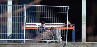
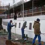
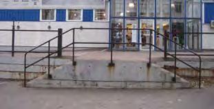
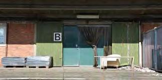


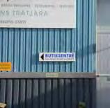


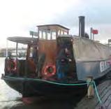


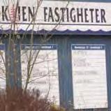


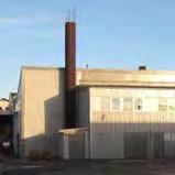


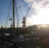

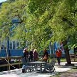
20 38 39 fig. 62 COLLAGE THE IDENTITY OF RINGÖN
21 OPEN AIR EVENT ARENA RINGÖGATAN BOULEVARD PLANTED ESPLANADE JÄRNMALMSGATAN DEVELOPMENT Apart from the preservation of important parts of the existing stock, the advancement and transformation of pre-existing structures is a central point of the strategy. Here the emphasis is put on the infrastructure and how it can be developed to create new spaces and places. CURRENT ROAD SYSTEM The current road system is splendidly constructed and generously dimensioned. It ensures a good traffic connection of the particular properties. However, the roads are primarily built for vehicular traffic and pedestrians and cyclist only play a secondary role. In reference to an environmentally compatible future development, the existing road system needs to be converted into a reduced-traffic area with emphasis on pedestrians, cyclists and greenery. By narrowing the wide roads, plenty of space can be generated. The design of the streets should expand the public space and serve as meeting place instead as pure service roads. As a result of this, exhaust pollution as well as traffic noise can be reduced and traffic safety increased. The specific and concrete measurements to improve the traffic situation should be incorporated at an early stage of the planning so that further developments can be adjusted to them. HARBOUR SQUARE ART SQUARE RIVERBANK PROMENADE RIVERBANK PROMENADE PEDESTRIANS SQUARES GREEN SPACE fig. 63 PEDESTRIANIzATION & GREEN SPACE The relocation of the main road to the northern edge of Ringön (red in fig.64), which could be realised in connection with the construction work of the new tram depot, opens up new possibilities for Ringöngatan to develop into a boulevard and planted esplanade. Moreover it will remedy the division of Ringön in a NEW FUNCTIONS IN BUILDINGS northern and southern part. The open space marked as Harbour Square is also The extension respectively the reactivation of Järnmalmsgatan, which currently leads through the grounds used by the municipality, could create a new entrance into the area and be connected to the new bridge Hisingsbron (fig.64). Additionally the expansion of the tram system into the area along Ringögatan is desirable in order to improve the accessibility to the public transport system. This could be realised in combination with a prospective new tram line leading to Eriksberg (orange in fig.64),. SPACE BETWEEN THE BUILDINGS The disposal of the existing buildings with its intermediate spaces and court yards allows cross connections within the road network. These intermediate spaces can be made accessible for the public and converted into pedestrian areas. Adjacent parts of the buildings become publicly accessible and new functions within the buildings along the new pathways get connected to the public road network. SQUARES AND PLACES An important part of urban neighbourhoods is the integration of open areas such as public squares serving as meeting places and centres for encounter and where activities of various kinds are possible. Within Ringön there are five larger appropriate open spaces that could be turned into such public squares as marked in fig. 63. The space called District Square is currently an open space used by the municipality as car pool. Because of its central location between Ringögatan and Järnmalmsgatan as well as its closeness to the tram station Frihamnen it is easy to reach and a central point for urban pathways. The idea here is to create a traditional city square for Ringön inviting people to meet and linger. A point of departure could be to organize a weekly market with specialities of local and regional farmers. used by the municipality as a material pile. The location with access to the riverbank and a beautiful view over the river could be transformed into a square with maritime atmosphere with a strategic focus on tourist preferences in connection with a new guest harbour, a steamboat terminal and a Harbour City District. The space for the Art Square emerged through an accidentally fire on December, 1st in 2014 that razed an entire warehouse to the ground. This location with access to one of the water basins next to Ringöns art gallery could be turned into a square or park for outdoor cultural and leisure activities. Providing walls for street art painting, pedestals for sculptures, stages for performances, and similar more, the square can become a central place for collaborative exhibitions and shows in public spaces functioning as an interface between arts and urban commons. The grounds of the cement company in the northern part could be transformed into an Open Air Event Arena for open air concerts, film screenings and similar events. The peripheral location is close to the highway allowing a higher level of noise (sound) for the duration of the events. Last but not least is there the Sport Arena located in the East of Ringön, also close to the water, which is ideally suited for an outdoor sport and leisure centre combining activities on the land as well as on the water. Here the river gets wider and the distance to the fairway increases. This means ideal conditions to settle water sports associations like rowing or sailing clubs. Furthermore, fields for beach volleyball or a skate park could be developed. RIVERBANK PROMENADE Making the riverfront available for the public is a crucial point in the development of Ringön because of its attractivity and possibilities for leisure activities. A riverbank promenade enables public access to the water and could be designed as structural flood protection combining hard and soft surfaces, pathways and greenery. There should be a fair balance between public and commercial uses as well as public and private control so both sides can benefit. In order to develop a lively and versatile district it is important to increase offerings for public uses. This applies as much to the public space as to the use of the existing buildings. Many buildings are outstandingly suitable for alterations and conversion with the advantage of not having to be rebuilt. Necessary investments are limited to renovation and sanitation and a temporary use will show whether further investments are worthwhile in order to establish a permanent use. DISTRICT SQUARE EXTENSION OF JÄRNMALMSGATAN RING ROAD TO REMOVE THE DIVISION OF THE AREA ONE-WAY SYSTEM SPORT AREA NEW TRAM STATION NEW TRAM LINE STREET PATTERN RING ROAD N fig. 64 TRAFFIC ASSIGNMENT


22 From OPEN MATERIAL PILE to DISTRICT SQUARE The square called Yppenplatz is one of the liveliest squares in Vienna. During the last ten years it developed into a multicultural square with a farmers market, various street cafés, restaurants and delicatessen in small pavilions. Many artists and other creative have settled around the square and its neighbourhood. The Yppenplatz is also a location for many public events. From SPACE IN BETWEEN to SHOPS & BARS Some of the narrow spaces between the buildings in Ringön could be turned into lively, cosy streets with cafés, bars and shops. This concept turned the Old Truman Brewery in London into a popular meeting place for young people, especially on week-end evenings. fig. 65 Material Pile in Ringön fig. 66 Yppenplatz, Vienna, Austria fig. 69 Court Yards fig. 70 The Old Truman Brewery, London, UK From zement PRODUCTION to EVENT ARENA Since the 1970s, the Arena in Vienna developed out of an area used as a slaughterhouse and is today a centre for alternative culture. In addition, it is also a location for music events. During the summer it is used as an open-air cinema. The Arena is managed by an association on an autonomous and direct democratic basis. From RECYCLING COMPANY to TENNIS COURT The comparison of the IL Recycling hall and a tennis hall in Switzerland shows, that it is not a question of the construction. It is a question of use. Take the paper out, put some sand in... Advantage - Ringön. fig. 67 Cement factory Thomas Betong fig. 68 Die Arena, Vienna, Austria fig. 71 IL Recycling fig. 72 Tennis Court in Switzerland 42 43
23 SUPPLEMENT ADDING NEW ELEMENTS The general proposition of this thesis is to implement a view projects that could function as catalysts for the development of the area. The municipality of Gothenburg has already shown the effectiveness of such catalyst projects in Frihamnen. The establishment of a roller-skating rink, urban farming boxes, a water artwork as playground, the public sauna Svettekörka and the outdoor pool Pöl Harbour has attracted many people of all ages and has become a great success activating the area and finding out peoples desires due to the future development of the new park Jubileumsparken. New elements, particularly with regard to architectural elements, can temporarily be implemented in order to fill existing gaps or to supplement existing structures and to set off a desired development. In some cases, this could simply be street furniture like benches, in other cases small temporary buildings need to be placed enhancing to determine the efficiency of the implemented measures and to prove, if the design works in its entirety. In a second step and once a measure has turned out to function, the structures and elements can be rebuild and become a permanent component of the development. DISTRICT SQUARE The proposed district square should be complemented and surrounded by small pavilions hosting market stalls, small shops, boutiques, cafés and restaurants. Their disposal should reinforce the impression of the square and limit its dimension. Adjoining buildings could be further developed to extend the activities on the square, e.g. as a converted market. The idea here is aligned to the ancient Greek agora as a paradigm in the development of urban squares. HARBOUR CITY DISTRICT The establishment of a new guest harbour could go hand in hand with the creation of a Harbour City District in Ringön with a directive focus on tourism as well as the concentration of maritime services and trade. The presently undeveloped area offers a unique opportunity to create small-scale but coherent architectural structures hosting, for example, a maritime museum in combination with a museum for industrial history, hotels and boatels (hotel on the water), shops with spare parts and accessories for boats, seafood restaurants, and so forth. The square itself could be designed in a way that it could be used as winter storage for leisure boats. STEAMBOAT TERMINAL A steamboat terminal could be the central landing stage for excursion boats to the archipelago as well as to the lake Vännern and the canals to Stockholm. Furthermore, it could become the home port for museum boats like Ångaren Bohuslan and Färjan 4. A small boat rental can complement leisure activities on the river. Last but not least provides the terminal the opportunity to extend the ferry line Älvsnabben having a landing stage there. OPEN-AIR EVENT ARENA The area around the cement plant in the north could be the place for various open-air events like music festivals, concerts, theatre performances and cinema shows. Several smaller and larger stages as well as a movie screen could be implemented. The cement plant itself could be converted for bars, restaurants, nightclubs, smaller indoor stages and rehearsal rooms. This would also preserve the plant as a landmark. The area should be surrounded by smaller buildings or pavilions in order to delimit it towards the outside and additionally being able to control the attendance for safety reasons. Those buildings could host rehearsal rooms, a music and acting school, a youth centre or the like, activating the area during week days. SPORT CENTRE Many sports are bounded to sports fields or in case of aquatics to the water. Around sport fields and along a possible rowing track, stands for spectators could be constructed in order to watch sport events or competitions. Other possibilities using the area could be a beach amusement park, a surfing school or a waterskiing centre with a lift system. The existing building, currently used as cold storage, could be converted into an indoor sports hall. ART CENTRE Last but not least it is the artists who are often responsible for initiating a significant change. Ringön offers various opportunities for the needs of artists. Järnhallen has already taken this step and cautiously spreads out its wings over Ringön. This is the starting point of the next chapter SYNERGY focusing on the spot and developing a design for it. 44 fig. 73 IMPULSE LOCATIONS & CATALYSTS 45 DISTRICT SQUARE HARBOUR CITY GUEST HARBOUR LANDMARK ART CENTRE STEAMBOAT TERMINAL VÄNNERN CRUISES ÄLVSNABBEN TERMINAL OPEN-AIR EVENT ARENA INDOOR OUTDOOR SPORT CENTRE ADDITIONAL BUILDINGS ADDITIONAL CONSTRUCTION DEVELOPMENT IN FUNCTION PROJECT SITE N
 attracting many visitors and tourist from all")


 in Vienna into an urban chill-out and party beach, the Herman")

24 From RIVERSIDE to WATER STAGE The lake stage on the Lake Constance is the venue for the famous Bregenzer Festspiele (Bregenz Festival) attracting many visitors and tourist from all over the world. Göta Älv still offers some unspoiled places along the riverbank and on the river itself that could be developed for cultural events in front of a spectacular scenery with an impressive atmosphere. From SWIMMING BARGES to BATHING SHIP Vienna already had it for several years,and Gothenburg has it since summer A swimming pool on the water. Viennas Badeschiff combines two boats including a pool, a sun deck, a restaurant and a clubdiscotheque below deck. fig. 74 Göta Älv, south-east Ringön fig. 75 fig. 78 Basin Lergodsgatan fig. 79 Badeschiff, Donau Kanal, Vienna, Austria From OPEN SPACE to SAND BEACH A simple backfill with sand, an improvised bar, two turntables and some sun loungers turned an unused place at the Donaukanal (Danube Canal) in Vienna into an urban chill-out and party beach, the Herman Strand (Herman beach). From YARD to CITY FURNITURED Often it is enough to implement small things to activate a certain place and attract people. The court yard of the Museumsquartier in Vienna is furnished with creative street furniture called Enzi. It is a favourite meeting place for people of all kinds, origin and ages. fig. 76 Stålverksgatan, riverfront fig. 77 Herman Strand, Vienna, Austria fig. 80 Tackjärnsgatan fig. 81 Museums Quarter, Vienna, Austria 46 47


25 S Y N E R G Y fig. 86 Work in process fig. 87 Architecture meets art fig. 88 Exhibition BACKGROUND Quite accidentally I saw an announcement in the local newspaper Göteborgs-Posten with the information that one can apply for an exhibition at the Konsthall på Ringön (art gallery in Ringön) for an exhibition called Hall of Fame. As I haven t heard about this gallery nor seen it on the site so far I searched and found on their webside that there was an upcoming workshop. On March, 10 th 2015, I attended the workshop Kulturens plats i Älvstaden (Järnhallen, 2015) with Lars Mellin, Anna Bergman and Mathias Holmberg, a sociologist working for Älvstaden (fig. 83). After the workshop I had an interesting talk with Anna Bergman exchanging some thoughts about the development of Ringön and in the end she invited me to take part at the festival Hall of Fame - Art Laboration in May Anna Bergman is an artist and the founder of the art gallery Järnhallen that she established just a few weeks before. She started her atelier in an old warehouse at Järnmalmsgatan 5 in summer 2014 and all of a sudden she found herself in the middle of an unexpected development. Getting attention and encouragement from various sides like the association of the building owners (Fastighetsägare), some companies and the municipality, she started to realise her vision of implementing an art gallery in the area. fig. 82 Exhibition poster THE FESTIVAL The concept of the Hall of fame art laboration festival was to show the process of creating art within the context of Ringön. The festival has lasted 4 weeks and various national and international artists created different art pieces showing their process over time inside and outside of Järnhallen. The festival finished with a following exhibition. The festival was sponsored by Göteborgs Stad Fastighetskontoret, Ringöns Fastighetsägarförening, Ringö Brygga, Ringökajen Fastigheter, Lundby Plåt, Stavdal, IL Recycling and Visions Gruppen. As a participant of the Hall of Fame and the vision to spread art over the area of Ringön the question was followed how can architecture create new spaces within the existing halls of Ringön The sponsoring by the Fastighetskontoret of Gothenburg and various local stakeholders as well as the great numbers of visitors shows that there are great interests in activating and changing the area from both sides, the municipality and the people. PROJECT IDEA AND PROPOSAL Starting point of this thesis is to transform Ringön in a bottom-up strategy on the basis of the existing buildings and places of Ringön, its existing structure and in accordance with its local conditions and requirements. The example of Järnhallen, located on the second floor of a warehouse from the 1960s at Järnmalmsgatan, has already shown that small changing and renovations can cause great effects and bring a process into motion without the need of big investments. During the discussions and conversations with the artists and other interested visitors it came out that there is a great demand for available space. The idea for the project is to show how new spaces can be created within the existing buildings around the festival area by implementing basic architectural elements without changing the existing building structure. The design is easily feasible and could be realised straight away. The background of an art exhibition is taken as an occasion to show that architectural elements are not only constructing elements but correlating with each other and our perception. In order to showcase these ideas, ten examples for a design have been chosen and implemented into or outside three different buildings. A particular investigation of some buildings has preceded the design process in order to understand the structure of those buildings and to agitate the resulting opportunities for the design. The outcome of this investigation was then transferred into a scale model 1:200 serving as a basis for the exhibition. In order to apperceive space it has to be determined by its boundaries (Ullmann 2005). This boundaries can occur through selective, linear or planar elements or objects in horizontal or vertical directions. A combination of those elements and the correlation between them defines space and makes it perceptible to the senses. Depending on direction, orientation, size, geometric form, colour or surface structures, the elements themselves appear in different appearances. The shape of an object determines its spatial feature (Arnheim 2000). According to Kandinsky (1973) the effect of dynamic is a result of the inherent tensions of the elements and objects. A point is the simplest selective element. Selective elements denote terms like origin, centre, concentration or stagnation of time (Ullmann 2005). Two points with a certain distance relieve a tension between them and put them into relation. The closer the distance is, the stronger the tension appears. Single points in a row form a line and when the points are shifted, an area results. Points with a vertical expansion, for example columns, own a spatial dimension. Columns in a row with little distance appear as a wall and a minimum of three not linear orientated columns are defining a volume. A straight line is the simplest linear element. It is characterised by a starting point and an endpoint and therefore by direction and dynamic. A line divides in here and there while two lines mark an in-between and a beside. Elevated lines form walls increasing those effects. While a line can be stepped over, a wall needs openings to step through. Paul Klee has investigated several kinds of lines and their forms. An angled or curved line defines an area in itself and owns one or several imaginary centroids. Because of the interaction of various forces they appear more dynamic (Klee 1964). Next to each other running lines define an area in between while two in opposite standing walls already define a volume. Walls can appear as separating elements or as closing or paling elements. Planar elements, for example a surface of the same material different from its surrounding, already define an area on their own. According to Ullmann qualify planar elements the spatial form and covering elements define the type of a room while elements restricting space set room in relation to each other and their surrounding (Ullmann 2005). Before introducing the project design in more detail, the examined buildings will be described first on the next pages. To keep this short, only the most important aspects are shown, but it has to be mentioned, that the complete examination is based on the original construction plans that are available in the archive of the City Planning Authority. fig. 83 Workshop Kulturens plats i Älvstaden fig. 84 Finissage of the festival fig. 85 Hall of Fame artists fig. 89 Work by Ruskig fig. 90 Work by Ekta fig. 91 Work by SCEB 48 49


26 fig. 92 View from North fig. 93 View from North-east fig. 94 View from South-east fig. 97 Work in process fig. 98 architecture meets art fig. 99 Wooden construction inside ANALYSIS OF THE BUILDING STRUCTURE This building on the western part of the property Tingstadsvassen 19:3 is surrounded by the streets Ringögatan, Kolgruvegatan and Järnmalmsgatan. It was built in 1954 as a warehouse with rail connection as well as loading ramps for trucks. The building has a semi-basement of concrete with two rows of 40x40cm piles and transversal concrete beans that carry the ceiling. The first floor is constructed as a concrete skeleton with a red brick infill. The infill is partly punctuated with ribbon windows or cargo doors. The roof is carried by 12m pre-stressed concrete beams. Construction plans: unknown fig. 95 Detail facade 1 dubbeltäckning 11,8cm lättbetongplator förspänd betong strängbetongbalkar 2 20cm lättbetong galv. plåt utwändigt 3 koouderad aluminium svetsad plåtbalk 4 1/2-stens fasadtegel pelare betong 30x30cm 5 25cm betong pelare betong 30x40cm 6 3cm stålslipning 13cm betong platta 7 pel betong 40x40cm 8 3cm stålslippning 8cm betong 10cm makadam This building on the eastern part of the property Tingstadsvassen 19:3 is surrounded by the streets Ringögatan, Manufacturgatan and Järnmalmsgatan. It was built in 1954 as a department store or depot. The first plans are made by Tholén & Stenberg Byggnads AB. It consists of a larger and a smaller hall and an addition with office space. The larger hall is completely constructed as a timber skeleton while the smaller hall has steel uprights. The halls are divided through a 25cm light concrete wall. The addition is constructed as a steel skeleton, The whole building has trapezoidal sheet metal cladding. Construction plans: Tholén & Stenberg Byggnads AB fig. 100 Detail roof construction cm lag papp 50cm mineralull Rockwool 341 Trapetsprofilerad stålplåt, h=45cm, t=0,7 på bef. åsar 3 x7 c ~ cm lag papp 50cm mineralull Rockwool 341 Trapetsprofilerad stålplåt, h=90cm, t=0,8 Balk HIPEX c lag papp 70cm mineralull Rockwool 341 Trapetsprofilerad stålplåt, h=90cm, t=0,8 Balk HE 180 A c cm gipsskiva 17cm gles panel Diff.tät papp 100cm mineralull Reglar 95x48 c enl. K22 3,2cm internit Trapetsprofilerad stålplåt, h=60, t=0, HE 160A HE 160A fig. 96 Priciple Section fig. 101 Priciple Section


.")


27 fig. 102 View from West fig. 103 Paper storage in the back fig. 106 Office section fig. 107 Warehouse fig. 108 Steel construction This building on the property Tingstadsvassen 18:18 is located at Manufacturgatan. It is an old garage built in A paper storage was added to the property in The garage is a timber construction with a saddleback with a timber roof framework. It has a firewall out of light concrete. The interior wall and the southern exterior wall have an infill out of hollow cement blocks. The paper storage is a steel skeleton construction with foamed concrete panells as infill (fig.104). Construction plans: LTB Byggkonsult AB fig. 104 Detail facade paper storage 1 korrg. eternit fackverkstakstol 2 25cm lättbetong 20cm massiva betongblock 3 25x25cm pelare vert. arm cm cementhålsten 6 2cm skärv, avjämnas med makadam grundbalk bxh = 25x60cm 7 2 lag papp enl. AMA 2cm mineralwull typ RW cm mineralwull TYP RW TRP 120/0,65 TYP DOBEL prefab stålbak + trapetsplåt cm gasbetong HEA HEA 200 This building on the property Tingstadsvassen 18:17 is located at Manufacturgatan and Järnmalmsgatan. The warehouse and a one-story office section were built in The warehouse got an addition in 1967 in the nothern backyard. The second floor of the office section was built in The steel construction on the southern facade was used to load and unload steal beams from the cargo trains (fig.108). Construction plans: Byggnadstekniska Byrån Sten Alberktsson, Gosta Waller fig. 109 Material Mix 1 2 lags papptäckning 2,2cm råspont 4,5cm luftspalt 3,2cm hård träfiberskiva 4,5 + 26cm kertobalker c ,5cm mineralwull 0,20cm plastfolie 1,8-7,0cm gles panel c 400 1,3cm gipsskiva 2 28x70cm spikläkt c 600 9cm gipsskiva GU 45x145cm reglar c cm mineralwull 0.20cm plastfolie 13cm gipsskiva 3 20cm betonghålsten 4,5cm stålreglar c 600 4,5cm mineralwull 0.20cm plastfolie 1,3cm gipsskiva 4 2,2cm golvspänskive 45-uirke honteras c 600, snedsägas 50 M upplag för golv papp 5+8cm lättbetong 18cm betong 5 linoleum 5cm överbetong 10cm lättbetong 15cm betong 6 lättbetongplåt Dimel 28 7 plaganplåt profil 4/0,7 INP cm grovbetong 15cm vibrogolvbetong Modern Betonggolvteknik Förl. Cementföreningen ingjuta råls 5 / dimel 28 9 betonhålsten dimel plaganplåt profil 1/0,5 dimel cm betongplatta fig. 105 Priciple Section fig. 110 Priciple Section


28 fig. 111 View from North-east fig. 112 Claessons Trätjära AB fig. 113 Second floor fig. 117 View from South fig. 118 View from South-east fig. 119 Loading dock This building on the property Tingstadsvassen 24:8 is located at Järnmalmsgatan next to the water basin. The department store was built in The entire building is constructed out of wood and consists of two floors. The whole building has trapezoidal sheet metal cladding. Construction plans: A.-B. Skanska Cementgjuteriet Göteborg fig Detail construction 1 plåt / kottugerad eternit takbalk 2 plåt takbalk 3 mellanbjälklag HB balk h=40cm 4 20cm brandmur lättbetong betong pelare 5 plint 7 19,5cm träpelare This building on the property Tingstadsvassen 18:16 is located at Järnmalmsgatan and Kalkbruksgatan. The office building, combined with a warehouse, was built in The roof of the warehouse consists of space frame trusses loaded on precast concrete pillars with an infill of light concrete. The office building has walls of light concrete blocks on the ground floor while the first floor is a wood construction. It has a saddleback with a timber roof framework. Construction plans: Aktiebolaget Göteborgs Industribyggnader GIB Gustaf Sandén fig. 120 Detail facade 1 bjälklag 2 6mm eternit 3,2mm internit papp 5/8 råsp 10 cm mineralwullsskivar 2 +5 reglor 5/8 råsp aluminium foliepapp 1,3cm gipsskivar 3 stänkputs 20cm lättbetongmurblock inv. puts 4 IT 4 8cm makadam 20cm grus 5 korr. eternit profil åser SWL-fackverk 6 fabrikstillverkande strängbetonpelare 20cm lättbetong 7 fabrikstillverkande strängbetonpelare brandmur 25cm lättbetong 8 asphaltbeläggn. IT.4 20cm makadam fig. 116 Priciple Section fig. 121 Priciple Section


29 RINGÖGATAN DESIGN COMPONENTS DESIGN ELEMENTS AND THEIR CORRELATIONS RINGÖGATAN KOLGRUVEGATAN TINGSTADSVASSEN 19: N 1 N 7 8 TINGSTADSVASSEN 18: MANUFAKTURGATAN TINGSTADSVASSEN 18:17 10 TINGSTADSVASSEN 18:16 KALKBRUKSGATAN 10 JÄRNMALMSGATAN MOVEMENTS TINGSTADSVASSEN 24:8 WATERBASIN fig. 122 Ground plan fig. 123 Model


. fig.")


30 TRANSVERSAL LONGITUDINAL fig. 124 Basic position fig. 125 Possible arrangement fig. 126 Variety of space creations fig. 130 Wall configuration fig. 131 Court yard fig. 132 Seating stairs 1 MOVEABLE AND ADAPTABLE WAGONS 2 WALLS AS SPACE DIVIDING ELEMENTS LINEAR ELEMENTS The imagination on how in the past trucks approached the building getting loaded and unloaded led to the idea of re-interpretating the movements of the goods that have been stored in the warehouse. The moveable wagens are a quote to this procedure and the former use of the building. The basic principle of the wagons is borrowed from the stage design. A basic wheeled and walkable frame out of wood or steel that is planked with walls having openings where they are needed or wanted (fig. 128). The wagons are embedded into a raised floor and can be moved with the help of counterweights similar to the principle of an elevator, but in horizontal direction. The symmetry of the building with opposite cargo doors in the exterior walls and the unsupported roof construction allows arranging three wagons in a row (fig. 127). The traversed hall has a width of 12m which makes each wagon 4m long. The cross section of a wagon has the measures of the cargo doors with 2.4m in width and 2.8m in height. The outer wagons of the rows can move left and right, out of the building or into it, while the centred wagon of the row can also turn round as illustrated in fig This system leads to a huge variety of possible constellations generating different spaces inside and outside the building (fig ). fig. 127 Basic position / 3 in a row Walls are a combination of linear and vertical lines dividing and creating space. The idea is to place them with open room corners to create a floating space with open views from central points providing a good overview of several rooms. The diagonal lines of sight increase the dynamic appeal. The depth of the rooms in this constellation gets maximised and allows an open communication between them. Furthermore, this arrangement causes rooms of varying openness or closeness suitable for different uses. The centre corridor links all rooms as a service axis and houses also the staircases to the cellar (fig ). The original openings on the outer facades for the cargo doors can be converted into windows or terrace doors. The cargo doors themselves can be preserved as shutters. Hans Hollein has used this concept in a much larger scale for the design of the exhibition rooms at the museum Abteiberg in Mönchengladbach, Germany (fig. 133; Museum Abteiberg, website). The court yard The L-shaped court yard between the two buildings on the property Tingstadsvassen 19:3 continues on the property Tingstadsvassen 18:16 connecting Ringögatan and Järnmalmsgatan. Those two court yards are outstanding suitable for a pedestrian zone offering new and surprising views due to their frequent changes of direction. The inner right angle provides two opposite perceptions towards the movement. In the longitudinal direction, one is guided in parallel and along the building but at the same time moves against the transverse standing building part appearing as an obstacle. In order to offer a choice on how one continues its way two open passages through the L-shaped warehouse along the axes of the court yard can be created connecting the yard with the surrounding streets (fig. 131). This has also the effect that one passing the building, all of a sudden finds oneself in a completely different environment even with a view to the water basins. Seating steps connecting the street level and the former loading ramps of the L-shaped warehouse, and therefore the building level (fig. 132), can activate the court yard and invite to sit and meet fig. 128 Scheme of a wagon fig. 129 Interior view fig. 133 Museum Abteiberg / Hans Hollein fig. 134 Arrangement of walls
 respectively a different floor material")


31 fig. 135 Painted floor fig. 136 Sketch fig. 137 Piazza Maggiore, Bologna, Italy fig. 140 Pavilion 3 DEFINING SPACE THROUGH A PAINTED FLOOR PLAIN ELEMENTS 4 GENERATING SPACE THROUGH AN ELEVATED FLOOR AND A CEILING A painted floor (plain element) respectively a different floor material of a limited extention already defines a certain space (fig.137). Here this space is supported by three open ring elements above to extend the space in the vertical direction. (fig ). The cantilever of the middle ring element creates an additional recognisable space besides emphasising the overhead space and projecting it to the ground. This element is carried by a row of round columns limiting the space to the side but allowing a gentle flow arround as the columns are round. Round selective elements are undirected having a neutral and equal impact on their surrounding as shown in fig Lined up in a row, the columns suggest a wall and spatial limitation but offer very little resistance to the surrounding space allowing circulation which in turn reunites the space in our perception. The row of columns functions as an undirected filter. EMISSION FORCE FIELD CENTRALISATION CIRCULATION The graphic illustrates the correlations between round columns and the energy flows (blue) or force fields (orange) appearing on them. FLOWS ARROUND SPHERE OF INFLUENCE fig. 138 Columns as selective elements Another possibility of creating space with plain elements is the correlation between a given base area and a corresponding ceiling. The distance between those two horizontal surfaces determines the density of the space and how we perceive it. The smaller the distance, the higher the density of the space and the higher the intensity as we perceive it. This principle is the idea of the implemented pavilion. The perception of this space differs fundamentally 5 GENERATING SPACE THROUGH LOWERING THE FLOOR A third possibility of defining space is to lower the ground. As it is not possible in this case, the idea is to use the height of the building and make the space accessible only from above which has the same effect. from the perception of the space of the hall. By this, the pavilion is experienced as an autonomous space element. This impression gets strengthened by the elevation of the base area and the wall at the end defining the expansion in the longitudinal direction. The columns lifting up the ceiling mark an additional space. Here, the space moulding and space supporting attributes are combined. fig. 141 Sketch fig. 142 Sketch fig. 139 Summarization of design fig. 143 Lowered floor CEILING DEFINED SPACE LOWERED SPACE ELEVATED FLOOR PAINTED FLOOR COLUMNS


.")

 is the horizontal connection to the outside created as a penetration of the facade.")


 is designed as a gate to symbolise the stepping through and to emphasise the spatial change. fig.")
32 4 Building entrances D B Shifted building axis C CONTINUOS INTERRUPTED INTERFERING fig. 149 Interfering walls fig. 150 Top view fig. 151 Wall structures fig. 144 Flows arround the atrium A fig. 145 Entrances fig. 146 Atrium 7 DIFFERENT QUALITIES OF THE WALL STRUCTURE 6 THE ATRIUM WITH SHIFTED AXES Walls have different effects due to their texture or consistency. A common wall is mainly a closed and physically impenetrable boundary. This space deals with perforation and interruption of the walls. impression of a closed wall. By eliminating the interspaces between the lamellas, the transverse walls appear as interrupted closed walls. CONTINUOS INTERRUPTED INTERFERING The four different designed entrances into the building all lead to the atrium. The pathways are designed with a different surface material as shown in the ground plan (fig.122). As the shifted axes do not meet in a single point, a dynamic flow around the atrium is created (fig. 144). This effect is intensified through the inclined position within the hall. As the atrium is opened at the top, it connects the inside with the outside and provides an outdoor space within the hall. The south entrance (A) is a simple and barrier-free opening. The opening to the east (B) is the horizontal connection to the outside created as a penetration of the facade. The west entrance (C) from an elevated corridor symbolises the crossing of a threshold (joist). This stepping over or stepping in features the special character of the room that is entered. The longitudinal walls, designed out of deep vertical wooden slats, convey a spatial boundary through a physically permeable wall but interfering with the space around. Only the view from the side gives an 8 WALL WITH BREAK THROUGHS fig. 152 Wall sections EQUAL DIRECTED FLOWS ARROUND SPHERE BETWEEN The atrium is meant to be built out of old patio doors and windows (fig. 147). Entrance Qualities The north entrance (D) is designed as a gate to symbolise the stepping through and to emphasise the spatial change. fig. 147 Construction Angular columns or pillars are in contrast to round columns directional. EMISSION FORCE FIELD The idea of the entrances to the room around the atrium is to thematise different qualities of transitions. The pillars of the inner wall of this room have an expansion in the longitudinal direction guiding into the hall. The cantilever at the end reaches into the room around the atrium creating a spatial connection to it. The pillars in the facade are orientated transversal emphasising the relation to the outside street level. DIRECTIONS ORIENTATION 62 fig. 153 Pillars as selective elements OPENING PENETRATION THRESHOLD GATE / WALK THROUGH fig. 154 Directing pillars fig. 155 Sketch The graphic illustrates the correlations between square or rectangular 63 A B C D pillars and the energy flows (blue) or force fields (orange) appearing on them. fig. 148 Entrance qualities

 are composed as two open circles with different centroids. This creates a spatial interrelation between the elements (fig.162).")


.")
33 fig. 156 Entrance fig. 157 Lounge fig. 158 Organic structure fig. 163 High line structure at Järnmalmsgatan ORGANIC STRUCTURE 9 10 PERSPECTIVE AND LONGITUDINAL DYNAMIC This design shows the influence of curved walls and the different correlations of concave and convex formed structures that lead to a variety of spatial dynamics. The entrance is emphasised by the convex orientation and therefore has a pulling effect into the building (fig ). The circular walls of the lounge (fig.157) are composed as two open circles with different centroids. This creates a spatial interrelation between the elements (fig.162). The different centres of gravity create a spatial tension with variant densities of space resulting in a dynamic space composition (fig.162). Kandinski calls this effect a zweiklang (Kandinski 1973). fig. 159 Convex orientation fig. 160 Naturescape by Kengo Kuma, Milano, Italy There are two main ideas of this high line structure. On the one hand it is a quote to the former rail wagons operating in the area and a re-interpretation of the industrial activities in Ringön. On the other hand it emphasises the dynamic of movements along Järnmalmsgatan. The structure starts in the west in front of the L-building with a elevated front court signalising the main entrance to the building. Following the former rails, a number of equal elements with the proportions of a fright wagon are lined up towards the east. Each element is provided with and accessible through a separate stairway. The stairways create a wave like structure responsible for the longitudinal dynamic impression. view when standing at the beginning of the structure or walking in between. Second, the frames can be used for installations or as static pillars for additional constructions (fig.165). The elements are meant to be a possibility to activate the public space along Järnmalmsgatan by letting people use and organise the elements according to their own ideas (fig.165). The organic and amorphous structure has no specific spatial orientation (fig.158). The dynamic of the space arises from the interaction of compression and expansion as well as narrowing and enlargement. Thereby, the dynamic motion gets slowed down or speeded up which leads to exciting spatial experiences with opening and closing rooms. The frame constructions on the elements have two intentions. First, to express the effect of a perspective fig. 164 Perspective and dynamic fig. 165 Sketch fig. 161 Imaginary midpoints fig. 162 Centroids EQUAL CENTROID Einklang CONCAVE VARIED CENTROID zweiklang CONVEX
The Dreispitz in Basel / Switzerland: New economy on old sites
 The Dreispitz in Basel / Switzerland: New economy on old sites 1. Introduction At 50.000m 2 Dreispitz is currently the largest and most ambitious development project in Basel, the second biggest town in
Municipality-led development with extensive user participation. The Tübingen development strategy by private building cooperatives
 Municipality-led development with extensive user participation The Tübingen development strategy by private building cooperatives Trondheim june 2012 I. The concept of the Südstadt development II. The
ARISE: The Rock Renaissance Area Redevelopment & Implementation Strategy
 2014 Professional Awards 1 ARISE: The Rock Renaissance Area Redevelopment & Implementation Strategy Janesville, WI Completed December 2014 Analysis & Planning Purpose of Project 2 The purpose of the Rock
Inspiring Technovation
 1 2 Table of content List of table and figures... Executive summary... 1. Introduction... 2. Material and methods... 3. Results... 3.1 Today s facts about Versailles: a diagnostic approach... 3.1 Vision
Excellencies, Dear colleagues from other agencies and organizations, Ladies and Gentlemen,
 Address by Dr Mechtild Rossler Deputy Director of UNESCO s World Heritage Centre The UNESCO Recommendation on the Historic Urban Landscape on the occasion of the European Heritage Heads Forum Leuven, Belgium,
Świętokrzyskie region (PL): Modern water supply and sewerage disposal for more effective utilisation of local assets.
: Modern water supply and sewerage disposal for more effective utilisation of local assets.") Świętokrzyskie region (PL): Modern water supply and sewerage disposal for more effective utilisation of local assets. SYNTHESIS The Serwis village project was an infrastructure project in Nowa Słupia commune
Świętokrzyskie region (PL): Modern water supply and sewerage disposal for more effective utilisation of local assets. SYNTHESIS The Serwis village project was an infrastructure project in Nowa Słupia commune
Port Lavaca Future Land Use
 Port Lavaca Future Land Use Introduction The City of Port Lavaca is beginning to see sustained growth, after many years of relative stable population. New single family homes, apartments, and businesses
Town of Peru Comprehensive Plan Executive Summary
 Town of Peru Comprehensive Plan Executive Communities that plan grow by choice, not by chance. A plan makes growth thoughtful, understandable, and predictable. A plan shows that a community is managing
Cooperative Research in Water Management
 Proceedings of the 8 th International Conference on Applied Informatics Eger, Hungary, January 27 30, 2010. Vol. 1. pp. 273 281. Cooperative Research in Water Management Margit Horosz-Gulyás, Katalin Katonáné
CITY CLERK. Parkland Acquisition Strategic Directions Report (All Wards)
") CITY CLERK Clause embodied in Report No. 10 of the, as adopted by the Council of the City of Toronto at its meeting held on November 6, 7 and 8, 2001. 10 Parkland Acquisition Strategic Directions Report
CITY CLERK Clause embodied in Report No. 10 of the, as adopted by the Council of the City of Toronto at its meeting held on November 6, 7 and 8, 2001. 10 Parkland Acquisition Strategic Directions Report
Local Growth Planning in North Central Green Line Communities
 2018 April 30 Page 1 of 6 EXECUTIVE SUMMARY This report outlines a high-level scope for local growth planning for north central Green Line communities. The catalyst for this review is the significant investments
Recent UN and EU Sustainable Development Policies (Post 2015): What challenges for city planning and governance
: What challenges for city planning and governance") Recent UN and EU Sustainable Development Policies (Post 2015): What challenges for city planning and governance Europe at a crossroads: the challenge for future sustainable development 20 July 2016 Roudaina
Recent UN and EU Sustainable Development Policies (Post 2015): What challenges for city planning and governance Europe at a crossroads: the challenge for future sustainable development 20 July 2016 Roudaina
Title: A comparison between rural and urban permaculture projects
 Title: A comparison between rural and urban permaculture projects Introduction: I have visited four rural permaculture projects so far, and only one urban project. The Concrete Garden has therefore been
1.0 Purpose of a Secondary Plan for the Masonville Transit Village
 Report to Planning and Environment Committee To: Chair and Members Planning & Environment Committee From: John M. Fleming Managing Director, Planning and City Planner Subject: Masonville Transit Village
Integrated urban policies and land management The URBACT Experience Didier Vancutsem
 Integrated urban policies and land management The URBACT Experience Didier Vancutsem Didier Vancutsem URBACT Expert Prof Urban Planner ISOCARP Contents Integrated urban policies and land management: a
CHRISTELER Stéphane URBAN GROWTH WITHOUT SPRAWL: FOUR EXAMPLES IN THE GENEVESE REGION
 CHRISTELER Stéphane URBAN GROWTH WITHOUT SPRAWL: FOUR EXAMPLES IN THE GENEVESE REGION INDEX 1) Issues of urban densification 2) Perceptions of the urban densification 3) The consequences of urban densification
Strategies to Connect and Integrate Urban Planning and Environmental Planning Through Focusing On Sustainability : Case Study of Cheongju City, Korea.
 Strategies to Connect and Integrate Urban Planning and Environmental Planning Through Focusing On Sustainability : Case Study of Cheongju City, Korea. Assistant Professor, Dept. of Urban Engineering, Chungbuk
CONSERVATION PLAN BASED ON THE CONCEPT OF INTEGRITY
 CONSERVATION PLAN BASED ON THE CONCEPT OF INTEGRITY Y. N. Yen a C. F. Cheng a, * a China University of Technology, 56 Sec. 3 Shin Long Rd., 116 Taipei, Taiwan - (alexyen, aabbyy)@ cute.edu.tw KEY WORDS:
A study on the regional landscape planning framework on the relationships between urban and rural areas: case study of Tokachi region, Hokkaido, Japan
 A study on the regional landscape planning framework on the relationships between urban and rural areas: case study of Tokachi region, Hokkaido, Japan K. Yamagishi & H. Kobayashi Laboratory of Urban Planning
SUSTAINABLE CONSERVATION SYSTEMS FOR PRESERVATION OF MONUMENTS, SITES IN THEIR SETTINGS
 SUSTAINABLE CONSERVATION SYSTEMS FOR PRESERVATION OF MONUMENTS, SITES IN THEIR SETTINGS Staneva Hristina / Bulgarian National Correspondent of the HEREIN Project Associated member of the ICVA This paper
Zagreb. Strategic planning. City of Zagreb City Office of Strategic Planning and Development of the City
 Zagreb http://www.zagreb.hr/ Strategic planning Through ZAGREBPLAN a vision of Zagreb was defined: City of Zagreb as an urban incubator of sustainable concepts, entrepreneurship and new values City of
BLOK BADEL ZAGREB. Competition for the urban-architectural concept design for the BADEL SITE redevelopment COMPETITION NUMBER: ZG-UA
 BLOK BADEL ZAGREB Competition for the urban-architectural concept design for the BADEL SITE redevelopment COMPETITION NUMBER: 136-12-ZG-UA 1.0 DESCRIPTION AND EXPLANATION OF THE OVERALL CONCEPT The Badel
Parks Master Plan Implementation: Phase I Waterfront Use and Design REPORT #: September 7, 2016 File #
 0 'O DI Lan-171-14 1 - THE CORPORATION OF THE TOWN OF COBOURG..,. STAFF REPORT TO: FROM: Mayor and Members of Council Dean A. Hustwick, Director of Recreation and Culture DATE OF MEETING: Committee of
SEVENTH SESSION. (Strasbourg, May 2000) Resolution 98 (2000) 1 on historic towns in Europe
 Resolution 98 (2000) 1 on historic towns in Europe") CONGRES DES POUVOIRS LOCAUX ET REGIONAUX DE L'EUROPE CONGRESS OF LOCAL AND REGIONAL AUTHORITIES OF EUROPE SEVENTH SESSION (Strasbourg, 23-25 May 2000) Resolution 98 (2000) 1 on historic towns in Europe
CONGRES DES POUVOIRS LOCAUX ET REGIONAUX DE L'EUROPE CONGRESS OF LOCAL AND REGIONAL AUTHORITIES OF EUROPE SEVENTH SESSION (Strasbourg, 23-25 May 2000) Resolution 98 (2000) 1 on historic towns in Europe
SUSTAINABLE URBAN DEVELOPMENT AND COHESION POLICY EUROPEAN COMMISSION. Urban Policy within the framework of EU Cohesion Policy
 Urban Policy within the framework of EU Cohesion Policy 2007-2013 16/09/2007 SUSTAINABLE URBAN DEVELOPMENT AND COHESION POLICY 2007-2013 Marco Orani European Commission Directorate General for 1 SUSTAINABLE
CHAPTER 5: GUIDING PRINCIPLES
 CHAPTER 5: GUIDING PRINCIPLES The following 10 principles were developed based on public consultation, planning policy and the background analysis conducted during Phase 1. The Guiding Principles significantly
The ACTION PLAN OBJECTIVES, POLICIES, ACTIONS
 The ACTION PLAN OBJECTIVES, POLICIES, ACTIONS Responsible actors Key actors Funds needed and funding sources available OBJECTIVE 1 Strengthening the governance and the social capital through the development
ASSESSMENT OF THE URBAN AND TOURISM DEVELOPMENT IN THE FENER-BALAT DISTRICTS. Sevgul Limoncu & Banu Celebioglu
 ASSESSMENT OF THE URBAN AND TOURISM DEVELOPMENT IN THE FENER-BALAT DISTRICTS Sevgul Limoncu & Banu Celebioglu Fener and Balat districts are located in the Historical Peninsula, in the region stretching
Market Demand and Land Use
 Market Demand and Land Use Summary 57 Challenges 60-61 Guiding Principles 62 Strategy and Implementation 63-69 Establish a mix of uses that contribute to a vibrant downtown. 58 Summary Historically, downtown
Craigmillar, Edinburgh, UK
 I m p r o v i n g t h e q u a l i t y o f l i f e i n L a r g e U r b a n D i s t r e s s e d A r e a s Craigmillar, Edinburgh, UK E-Compendium: Good Practice Case Studies LUDA is a research project of
Highest & Best Use Study Marina Park Lands
 Executive Summary of Report MARCH 2006 TABLE OF CONTENTS 1. Introduction...1 2. Study Process...2 3. Highest And Best Use Program...3 4. Concept Plan...8 5. Public Area Animation...9 6. Marina Park Implementation
THE ARCHITECTURAL POLICY OF ESTONIA. Passed at the Parliamentary sitting , protocol no. 43, item no. 5
 THE ARCHITECTURAL POLICY OF ESTONIA Passed at the Parliamentary sitting 22.10.2002, protocol no. 43, item no. 5 THE ARCHITECTURAL POLICY OF ESTONIA With the development of a market economy the responsibility
Policy for management and protection of the coast
 Policy for management and protection of the coast Policy for management and protection of the coast Mona Ohlsson Samhällsbyggnadsförvaltningen Ystads kommun, 2008 3 THE MUNICIPALITY GUIDELINES REGARDING
quarters Building Our Cultural Quarters Together
 cultural quarters Building Our Cultural Quarters Together Implementation Plan june 2013 To enrich the ability of Montréalers to appreciate art, culture and heritage in its downtown core and throughout
... on the draft Arden Vision & Framework
 April 2017 Integrated world-class urban renewal Feedback... on the draft Arden Vision & Framework On 1 September 2016 the Victorian Planning Authority (VPA) released the draft Arden Vision & Framework
North Fair Oaks Community Plan Summary and Information
 North Fair Oaks Community Plan Summary and Information WHAT IS THE NORTH FAIR OAKS COMMUNITY PLAN? The North Fair Oaks Community Plan is part of the San Mateo County General Plan, and establishes policies
Chapter 1: Introduction
 Chapter 1: Introduction The Penn Avenue Community Works Corridor Vision and Implementation Framework presents an integrated communitybased vision and a coordinated, long-term implementation framework for
BEIT SAHOUR OLD TOWN : A CORNER OF CULTURE
 BEIT SAHOUR OLD TOWN : A CORNER OF CULTURE 1. Context The city of Beit Sahour holds a huge legacy of customs and traditions due to its origins going back to the Bronze Age (3000 B.C.). The Canaanites inhabited
Improving the Quality of Life in Urban Regions Through Urban Greening Initiatives EU URGE-Project
 00016 Improving the Quality of Life in Urban Regions Through Urban Greening Initiatives EU URGE-Project Richard Coles 1 and Nick Grayson 2 1 Faculty of the Built Environment, University of Central England,
1. Introduction to Linköping
 INTERREG IVC - Project "Hybrid Parks" Partner 5: Linköping Municipality Environment and Community Development Department Situation Report, April 2012 1. Introduction to Linköping Linköping is Sweden s
Required total credit : 43 All graduate students must register one of RES 501, RES 502 or RES 503, RES 504 or RES 505, RES 506 or RES 509, RES 510.
 İZMİR INSTITUTE OF TECHNOLOGY GRADUATE SCHOOL OF ENGINEERING AND SCIENCES DEPARTMENT OF ARCHITECTURAL RESTORATION CURRICULUM OF THE M.S. PROGRAM IN ARCHITECTURAL RESTORATION (NON-THESIS) Fall Semester
Urban Development and Planning in Vienna
 Urban Development and Planning in Vienna Angelika Winkler Municipal Department for Urban Development and Planning Urban Development and Planning in Vienna April 2013 1 Vienna Key Facts and Figures federal
25th November Final statement by the ministers in charge of urban development
 11 25th November 2008 Final statement by the ministers in charge of urban development EU urban development ministers met in Marseille on 25 November 2008 at the invitation of the French Presidency of the
2.0 Strategic Context 4
 2.0 Strategic Context 4 2.1 The Area Action Plan is a non-statutory plan, which forms a corporate policy document, expressing particular issues and areas of concern while also providing a vision for the
The Halland Model - A Trading Zone. Christer Gustafsson CHANGES Monza 26 May 2016
 The Halland Model - A Trading Zone Christer Gustafsson CHANGES Monza 26 May 2016 6 antenna towers 127 meters high 700.000 800.000 each tower The only remaining longwave transmitter in the world UNESCO
A Bilingual Cooperative Planning Process on the Swiss-French Border in the Basel Area
 A Bilingual Cooperative Planning Process on the Swiss-French Border in the Basel Area 1. Situation The city of Basel is located on the north-western edge of Switzerland. With the borders of France to the
EXHIBIT A. Tax Increment Reinvestment Zone No. 1 (Town Center) First Amended Project Plan 1
 First Amended Project Plan 1") EXHIBIT A Tax Increment Reinvestment Zone No. 1 (Town Center) First Amended Project Plan 1 1 As amended by Resolution No. 2008-02-001(TR1R) of the Tax Increment Reinvestment Zone No.1, and approved to
EXHIBIT A Tax Increment Reinvestment Zone No. 1 (Town Center) First Amended Project Plan 1 1 As amended by Resolution No. 2008-02-001(TR1R) of the Tax Increment Reinvestment Zone No.1, and approved to
NZIS Urban Design Strategy. September 2012
 NZIS Urban Design Strategy September 2012 What is Urban Design? There are a multitude of different definitions available on Urban Design Following are some from well recognised Urban Design organisations
Planning Districts INTRODUCTION
 INTRODUCTION To facilitate detailed examination of development prospects for all areas of the community, Delano has been divided into 14 planning districts. The location of these planning districts is
Downtown Streetscape Manual & Built Form Standards
 City of Guelph Downtown Streetscape Manual & Built Form Standards July 2014 Prepared by Brook McIlroy Inc. in association with Unterman McPhail Associates and McCormick Rankin Inc. City of Guelph Downtown
Practices about Site:
 Practices about Site: Reflecting on the design of the Museum of Liverpool Fig 01. The Museum of Liverpool Picture from official website of the 3XN Yuan Chen 100202902 MAAD University of Sheffield 4th May,
Case Study Berlin. Abstract. WP 3 Urban Development
 Case Study Berlin Abstract WP 3 Urban Development Table of Contents Situation of the Area in the early 1990ies... 2 Needs for Action in the early 1990ies... 3 Integrated Development Concepts of the past
6 Growth Management Challenges and Opportunities
 6 Growth Management Challenges and Opportunities The Town has established a goal of attaining a 50% participation rate with respect to employment opportunities versus residential population. The Town s
Vancouver. Title of the Initiative. Initiative Duration. Submitted by. Comments by the Jury
 134 Vancouver Title of the Initiative Initiative Duration Submitted by Comments by the Jury Visionary Vancouver: Creating a Welcoming and Sustainable Place for All 2009-2020 Wendy Au, Deputy City Manager,
NEW VISIONS OF URBAN POLITICS MEDIUM-SIZED EUROPEAN CITIES IN THE 21 ST CENTURY MAY 14-16, 2014, OLOMOUC, CZECH REPUBLIC
 NEW VISIONS OF URBAN POLITICS MEDIUM-SIZED EUROPEAN CITIES IN THE 21 ST CENTURY MAY 14-16, 2014, OLOMOUC, CZECH REPUBLIC The Green City as Model for Cities in CEE? Sustainable urban development strategies
Published in March 2005 by the. Ministry for the Environment. PO Box , Wellington, New Zealand ISBN: X.
 Action Pack Published in March 2005 by the Ministry for the Environment Manatū Mō Te Taiao PO Box 10-362, Wellington, New Zealand ISBN: 0-478-18994-X ME number: 580 This document is available on the Ministry
Living with World Heritage in Africa
 INTERNATIONAL CONFERENCE Living with World Heritage in Africa [26 26-29 September 2012] South Africa BACKGROUND DOCUMENT The Government of the Republic of South Africa, in collaboration with the African
Laberge Group. Town of Coeymans. Draft Comprehensive Plan. Overview of Planning Process
 Draft : Presentation of Goals & Strategies Laberge Group Benjamin H. Syden, A.I.C.P., E.D.P Director in Charge Nicole Allen, A.I.C.P. Senior Planner Anjali Malhotra Planner Presentation Outline Introductions
Results and Expectations of the Megacity Project LiWa
 Presentation Results and Expectations of the Megacity Project LiWa Innovative Urban Planning Aspects - Context and Special Significance of Water Issues Dr.-Ing. Irene Wiese-von Ofen Member of the BMBF
Workshop on the Management of Historic Urban Landscapes of the XXth century, December 2007 Chandigarh, India
 Workshop on the Management of Historic Urban Landscapes of the XXth century, 18-21 December 2007 Chandigarh, India INTRODUCTION The participants of the International Workshop on the Management of Historic
Arlington, Virginia is a worldclass
 EXECUTIVE S U M M A RY Arlington maintains a rich variety of stable neighborhoods, quality schools and enlightened land use policies, and received the Environmental Protection Agency s highest award for
Questions for Carlsbad City Council Members and Candidates (July 1, 2016)
") Ponto is Carlsbad s Southern Coastal Gateway Questions for Carlsbad City Council Members and Candidates (July 1, 2016) 1. Are you aware of the 3 proposed developments in Ponto? What are your most important
Ponto is Carlsbad s Southern Coastal Gateway Questions for Carlsbad City Council Members and Candidates (July 1, 2016) 1. Are you aware of the 3 proposed developments in Ponto? What are your most important
PSRC REVIEW REPORT & CERTIFICATION RECOMMENDATION
 PSRC REVIEW REPORT & CERTIFICATION RECOMMENDATION KITSAP COUNTY COUNTYWIDE PLANNING POLICIES July 2, 2012 BACKGROUND A major emphasis of the Washington State Growth Management Act (GMA) is the need to
Elodie Gonthier (Team leader) Kevin Ramirez Sandra Velasco Krishna Chandran Anna Aghvanyan Sirin Hamsho
 Kevin Ramirez Sandra Velasco Krishna Chandran Anna Aghvanyan Sirin Hamsho") 2 T he nature of today s global economy highlights our interdependence and the need for much better global policies. Inspiring Technovation is pleased to present its report on transforming the city of
2 T he nature of today s global economy highlights our interdependence and the need for much better global policies. Inspiring Technovation is pleased to present its report on transforming the city of
Sheffield City Centre: shaping the future
 Sheffield City Centre: shaping the future A discussion paper Sheffield Executive Board (SEB) discussed the future of Sheffield City Centre at its March 2013 meeting. The Board agreed that the last decade
Environmental Hazards and Risk Management
 Terms of Reference for ESPON-INTERACT Thematic Study Environmental Hazards and Risk Management Environmental hazards and risk management/preventions are important elements in the discussion of future Structural
AT A GLANCE... Our People, Culture & Place. A plan to sustain Ballarat s heritage (final draft)
") AT A GLANCE... Our People, Culture & Place A plan to sustain Ballarat s heritage 2017-2030 (final draft) Image: Lydiard Street, Ballarat, c1875-1938, John Henry Harvey collection, La Trobe Picture Collection,
AT A GLANCE... Our People, Culture & Place A plan to sustain Ballarat s heritage 2017-2030 (final draft) Image: Lydiard Street, Ballarat, c1875-1938, John Henry Harvey collection, La Trobe Picture Collection,
which basically correspond to the urban area inscribed on the World Heritage List.
 9. SUMMARY The present study reflects the express political wish of the City of Vienna that the historic center of Vienna be represented on the World Heritage list of the UNESCO. Currently it is not possible
Agenda 21. Arthur Lyon Dahl. Contents
 Agenda 21 61 Arthur Lyon Dahl Contents Definition... 528 What Is Agenda 21?... 528 Agenda 21 and Pollution... 528 Climate Change in Agenda 21... 529 Agenda 21 and Global Change... 529 Conclusions... 530
CONSULTANT VACANCY ANNOUNCEMENT
 United Nations Human Settlements Programme Future Saudi Cities Programme United Nations, Diplomatic Quarters, Riyadh Telephone: +966 (11) 488 5301 Fax: +966 (11) 488 5309, www.unhabitat.org CONSULTANT
RIGA LATVIA. KEY FEATURES OF THE CITY Demographic Facts. Urban Figures. Heritage. EXISTING GOVERNANCE MECHANISMS Development and Management Plans
 RIGA LATVIA KEY FEATURES OF THE CITY Demographic Facts around 700.000 inhabitants in the city 1.15 million people in the Riga region Urban Figures the medieval core of the Old Town the 19th century grid
Sustainability Statement. Whitby Business Park Area Action Plan
 Sustainability Statement Whitby Business Park Area Action Plan November 2014 Contents Page 1. Introduction 1 2. Scoping 3 3. Sustainability Appraisal of Options 6 4. Assessment of Draft Area Action Plan
CITY OF HELSINKI ACCESSIBILITY GUIDELINES
 CITY OF HELSINKI ACCESSIBILITY GUIDELINES 2011 HELSINKI FOR ALL 2(13) Contents 1. Introduction... 3 1.1 Drafting of the accessibility guidelines... 3 1.2 Aim and content of the accessibility guidelines...
CHAPTER 4.1 COMMUNITY HERITAGE AND HISTORIC PRESERVATION ELEMENT
 CHAPTER 4.1 COMMUNITY HERITAGE AND HISTORIC PRESERVATION ELEMENT Vision: Retention of the community s heritage and atmosphere through identification, preservation and ongoing support of important traditions,
Description of Green Corridors in the Gothenburg Region
 1 (8) Description of Green Corridors in the Gothenburg Region A way to utilise natural features in community land use planning Sector for administrative support Gustav Cruce gustav.cruce@harryda.se +46
ANNEX A CONCEPT FOR SUSTAINABLE URBAN MOBILITY PLANS. to the
 EUROPEAN COMMISSION Brussels, 17.12.2013 COM(2013) 913 final ANNEX 1 ANNEX A CONCEPT FOR SUSTAINABLE URBAN MOBILITY PLANS to the COMMUNICATION FROM THE COMMISSION TO THE EUROPEAN PARLIAMENT, THE COUNCIL,
Norwich (United Kingdom), 9-10 September 2004
, 9-10 September 2004") THE CONGRESS OF LOCAL AND REGIONAL AUTHORITIES Council of Europe F 67075 Strasbourg Cedex Tel : +33 (0)3 88 41 20 00 Fax : +33 (0)3 88 41 27 51/ 37 47 http://www.coe.int/cplre COLLOQUIES, SEMINARS, FORUMS
THE CONGRESS OF LOCAL AND REGIONAL AUTHORITIES Council of Europe F 67075 Strasbourg Cedex Tel : +33 (0)3 88 41 20 00 Fax : +33 (0)3 88 41 27 51/ 37 47 http://www.coe.int/cplre COLLOQUIES, SEMINARS, FORUMS
SECTION ONE: INTRODUCTION. introduction
 introduction 1 INTRODUCTION Since it was first established in 1843 as a trading post for the Hudson s Bay Company, Victoria has evolved into a Provincial capital city that is recognized across Canada and
Vision for Irvine: a self-confident town where people aspire to live and work and which they are proud to call home
 Vision for Irvine: a self-confident town where people aspire to live and work and which they are proud to call home Stunning view out to the harbourside Artist s impression of how the Bridgegate area could
Global Report on Culture and Sustainable Urban Development
 CONCEPT NOTE Global Report on Culture and Sustainable Urban Development 1 Within the framework of the discussion on the Post-2015 Development Agenda, UNESCO has been engaged in supporting the full recognition
10 Principles for a Sustainable Development of Urban Waterfront Areas
 10 Principles for a Sustainable Development of Urban Waterfront Areas In the context of the initiatives for the Global Conference on the Urban Future (URBAN 21) held in Berlin in July 2000 and in the course
LEIPZIG CHARTER on Sustainable European Cities
 LEIPZIG CHARTER on Sustainable European Cities PAGE 1 PREAMBLE The LEIPZIG CHARTER on Sustainable European Cities is a document of the Member States, which has been drawn up with the broad and transparent
Case Study of Integrated Housing and Railway Development (Kohoku New Town and Yokohama City Metro Development)
") Case Study of Integrated Housing and Railway Development (Kohoku New Town and Yokohama City Metro Development) Project Division, Urban Development Bureau and Development Cooperation Division, International
Case Study of Integrated Housing and Railway Development (Kohoku New Town and Yokohama City Metro Development) Project Division, Urban Development Bureau and Development Cooperation Division, International
CIRCUSE the project, not a circus
 Circular Flow Land Use Management (CircUse) CIRCUSE the project, not a circus Anna Starzewska-Sikorska, CircUse Project Coordinator CircUse Forum at the TerraTec in Leipzig on 31st January 2013 CircUse
Welcome to the Oakridge Centre Open House
 Welcome to the Oakridge Centre Open House Why is the City hosting this event? This open house is to inform you of a rezoning application submitted to the City of Vancouver to amend the existing CD-1 (Comprehensive
MALL REVITALIZATION CASE STUDIES
 MALL REVITALIZATION CASE STUDIES DECEMBER 9, 2012 MALL REVITALIZATION OVERVIEW Introduction Sample Case Studies prepared for Lacey Woodland District Steering Committee as it considers strategies to revitalize
Tasks and content (under the former Planning Act)
") DENMARK: fact sheet for planning levels REGIONAL, B Danish Town Planning Institute, draft of 19.03.2007 Planning level Type of plan Illustration of the planning level Overview of the plan Facts Facts Legal
DENMARK: fact sheet for planning levels REGIONAL, B Danish Town Planning Institute, draft of 19.03.2007 Planning level Type of plan Illustration of the planning level Overview of the plan Facts Facts Legal
Animating the Rideau Canal December 2013
 Executive Summary Animating the Rideau Canal December 2013 Why study the Rideau Canal? The Rideau Canal has been an important part of Ottawa throughout its history, and has shaped and been shaped by the
The transportation system in a community is an
 7 TRANSPORTATION The transportation system in a community is an important factor contributing to the quality of life of the residents. Without a sound transportation system to bring both goods and patrons
Urban Voids: Recoding Functionless Areas in a City
 Urban Voids: Recoding Functionless Areas in a City German-Korean Cooperation Project Wants to Give Functionless Areas in Karlsruhe and Seoul a New Meaning Monika Landgraf Chief Press Officer Kaiserstraße
and services The protection and conservation of environmentally significant and sensitive natural heritage features and functions.
 6. Land Use 6.0 Preamble A healthy and livable city is one in which people can enjoy a vibrant economy and a sustainable healthy environment in safe, caring and diverse neighbourhoods. In order to ensure
Northern Territory Compact Urban Growth Policy
 Northern Territory Compact Urban Growth Policy A Reference Policy Document to clause 2.7 (Reference to Policy) of the NT Planning Scheme May 2015 Table of Contents 1 Policy Setting... 3 1.1 Context for
UDF PLANS AND GUIDELINES
 UDF PLANS AND GUIDELINES 5 Land Use Land Use Development Plan Plan no. 3 Land Use Development Mixed Use Retail / Leisure Residential Civic and Institutional Proposed Zoning Table Development Edges Plan
CHAPTER 8 ISSUES, CONCERNS, CONSTRAINTS AND OPPORTUNITIES
 CHAPTER 8 ISSUES, CONCERNS, CONSTRAINTS AND OPPORTUNITIES Introduction This River Conservation Plan was developed during a time of tremendous activity and effort in planning the transformation of the Delaware
Town Center (part of the Comprehensive Plan)
") Town Center (part of the Comprehensive Plan) Mercer Island Town Center Looking North (2014) In 1994, a year-long process culminated in a set of design guidelines and code requirements for the Town Center
Town Center (part of the Comprehensive Plan) Mercer Island Town Center Looking North (2014) In 1994, a year-long process culminated in a set of design guidelines and code requirements for the Town Center
NASSAU COUNTY TOWN HALL NEW YORK & CONNECTICUT SUSTAINABLE COMMUNITIES. A Unique Bi-State Partnership to Improve Jobs, Housing and Transportation
 NASSAU COUNTY TOWN HALL NEW YORK & CONNECTICUT SUSTAINABLE COMMUNITIES A Unique Bi-State Partnership to Improve Jobs, Housing and Transportation Police Headquarters Auditorium Mineola, NY December 9 th,
THE TOWN OF WASAGA BEACH
 THE TOWN OF WASAGA BEACH Downtown Development Master Plan Committee of the Whole Presentation January 26 th 2017 Uses within this designation should reflect a dependence on tourism as opposed to the permanent
Nordic Built Cities Challenge: Evaluations by the Nordic/international jury
 Nordic Built Cities Challenge: Evaluations by the Nordic/international jury 29 August 2016 Evaluation and decision of the jury of the Nordic Built Cities Challenge The jury is pleased to submit our final
BUSINESS PLAN CEN/TC 250 STRUCTURAL EUROCODES EXECUTIVE SUMMARY
 Page: 1 BUSINESS PLAN CEN/TC 250 STRUCTURAL EUROCODES EXECUTIVE SUMMARY Scope CEN/TC 250 covers the standardization of structural and geotechnical design rules for building and civil engineering works
Our City Centre is a vibrant, creative and welcoming destination, with a modern business, cultural, shopping, leisure and residential offer
 3. Sheffield in 2034 Our City sits at the heart of a strong, distinctive and internationally successful City Region economy which supports innovation and enterprise Our City Centre is a vibrant, creative