Jennifer McKay, Conservation Administrator & Elizabeth Gladfelter, Chairman, Falmouth Conservation Commission
|
|
|
- Merilyn Perkins
- 5 years ago
- Views:
Transcription

1 Implementation of an Innovative Tool for Cape and Island Towns District of Critical Planning Concern (DCPC) - Protecting the Black Beach/Great Sippewissett Marsh, Falmouth Jennifer McKay, Conservation Administrator & Elizabeth Gladfelter, Chairman, Falmouth Conservation Commission
2

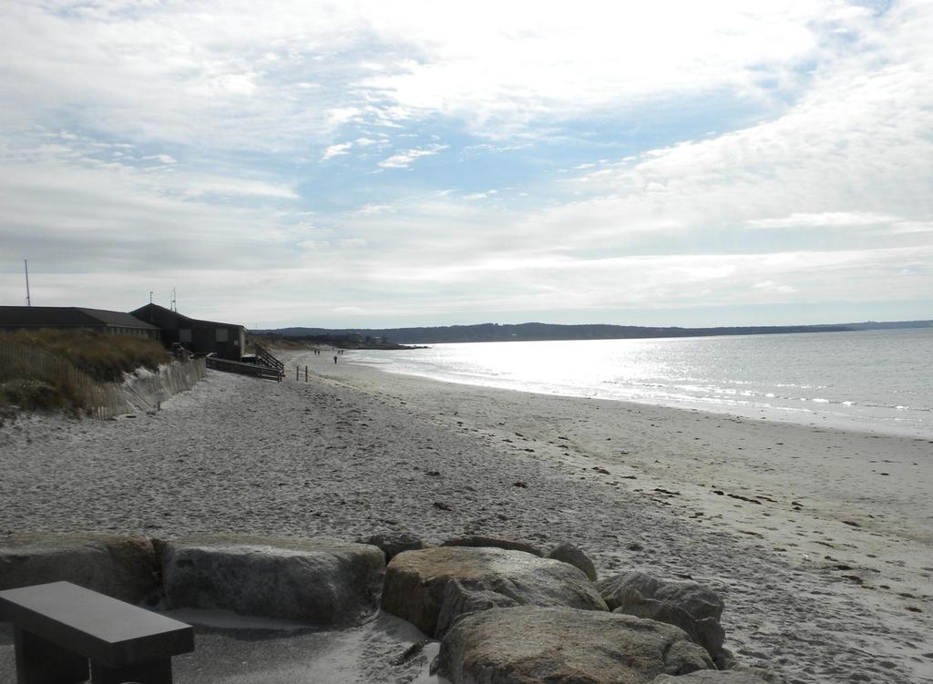
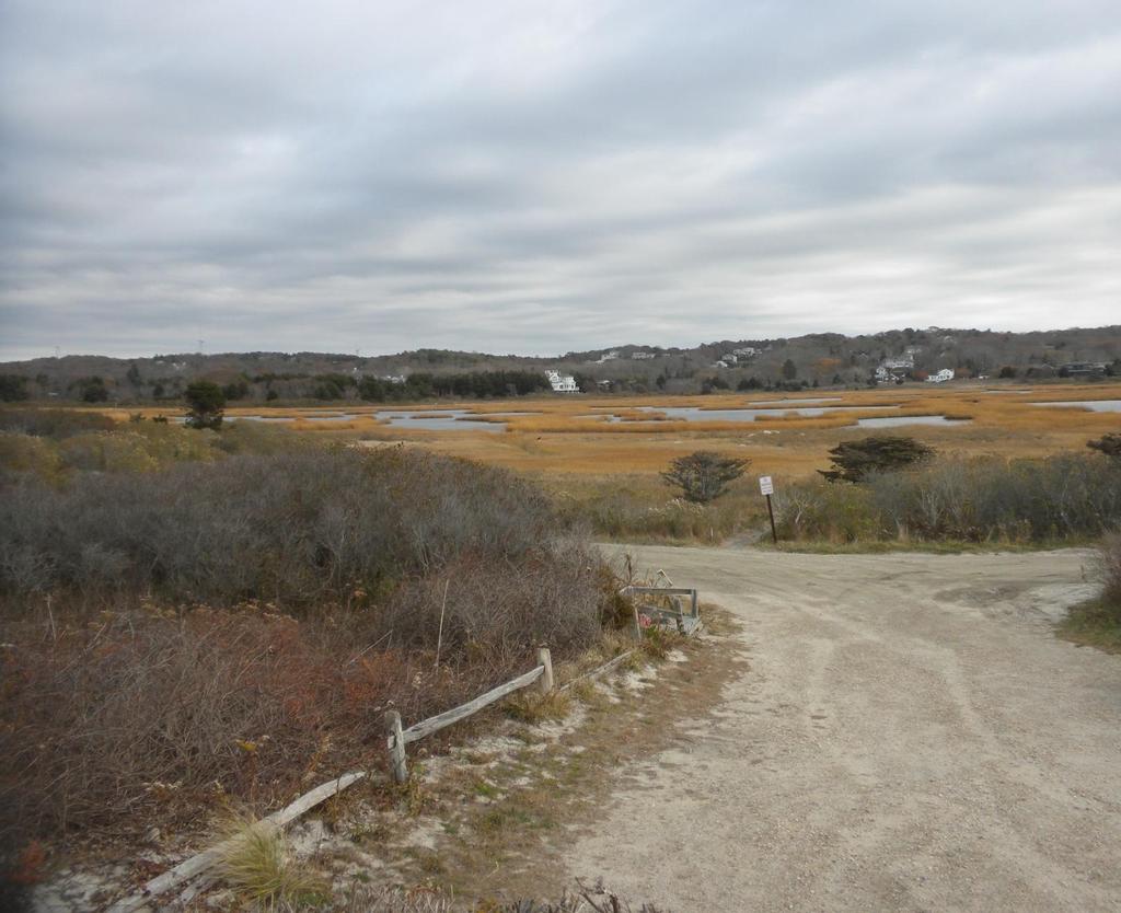
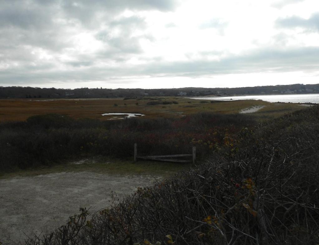
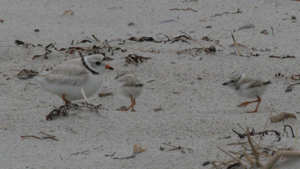
3 Marsh, barrier beach, dunes Productivity Birds Environmental Services
4
5
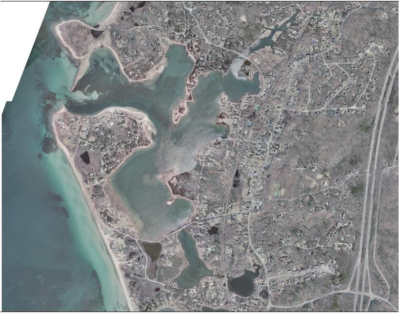
6 AKER RD CHASE RD LITTLE ISLAND RD ASSO CIA TES RD CHA POQUO IT RD OLD DOCK RD LITTLE NECK BARS RD NASHAWENA ST AMBLESIDE DR STAGECOACH WAY SERVICE RD BLACKSMITH SHOP RD FRAZAR RD FAIR WAY LN KATELYN HILLS DR RIDGEVIEW DR BLACKSMITH SHOP RD NO_NAME RTE 28 BRICK KILN RD VIEW CREST DR H A WKS WAY RTE 28 FIRE TOWER RD 4 CHARLES LN BLAIR LN GARRISON RD DANIELS RD INDIAN RIDGE RD SAC ONESSET RD PALMER AVE WEST FALMOUTH HWY BRAESIDE RD

7 Barnstable County Assembly of Delegates Ord No Purposes of District 1. To maintain integrity of the Black Beach/Great Sippewissett Marsh barrier beach system 2. To preserve the habitat value of the marsh/beach area 3. To improve/upgrade septic systems and stormwater discharges and employ other means to alleviate shellfish closures and improve water quality of the marsh
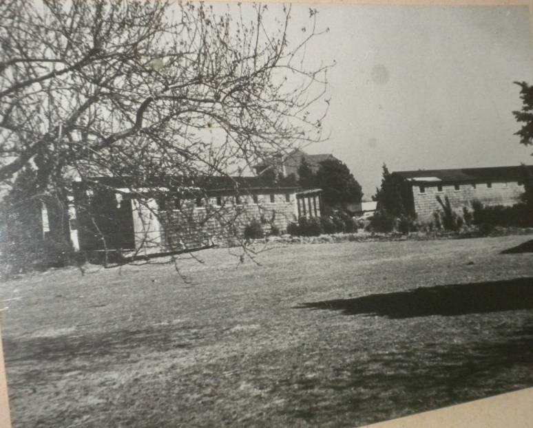
8 1950
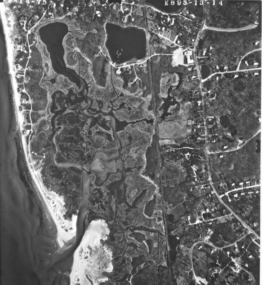
9 1975


10 C HAPO QUOIT RD COTTAGE LN FRAZAR RD F AIRWAY LN KATELYN HILLS DR SERVICE RD RTE 28 LITTLE NECK BARS RD NO_NAME OYSTER POND BRICK KILN RD BEACH POND FRESH POND QUAHOG POND LN VIEW CREST DR HAWKS WAY RTE 28 GROUSE ST B LAIR LN HIBBS LN 4 GARRISON RD WEST FALMOUTH HWY Great Sippewissett Marsh BOB WHITE LN PALMER AVE DANIELS RD PEACE PIPE RD ARNOLD GIFFORD RD BUMBLEBEE HILL RD M ELTIA SACONESSET RD H RD ANTIOCH RD INDIAN RIDGE RD B ARNAB AS RD
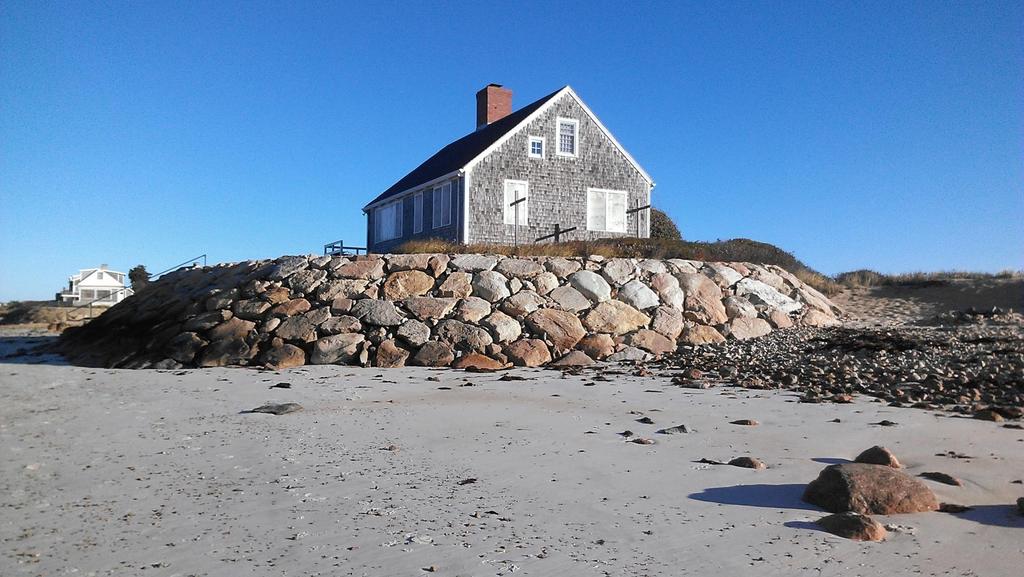
11 Brief background A. Wildlife, Natural, Scientific, Ecological District USFWS explored wildlife refuge status (Environ Assessment) WHOI, MBL, BUMP ecological/nutrient studies >100 publs EPA: Buzzard s Bay - estuary of National Significance Northeast Coastal Areas Study (1991; USFWS): Sippewissett marshes are significant coastal habitat (1/7 in CC and Is) MA Div Mar Fisheries Sanitary Survey Rept 1993 Development pressure: 0 NOIs 85-93; 8 NOIs 6/94-6/95 B. Hazard District (natural and man made) Black Beach (Fm-31) and Saconessett Hills (Fm-30) Barrier Spits: CZM 1982 Barrier Spit Beach Inventory FEMA V and A zones
12
13
14
15
16
17
18
19

20 : Falmouth ConCom (June 1995 after 24 public meetings over >18 months) June 13, 1995 Aug 1995 Oct 5, 1995 Oct 1995 boundaries? Jan 3, 1996 Town Meeting art61 Nov 1996
21 LITTLE POND BEACH RD QUAKER RD LITTLE ISLAND RD CLIFFWOOD LN COLO NIAL WAY FOX LN CHASE RD MASHAPAQUIT CREEK AMBLESIDE DR CROCKERS POND RTE 28 WEST FALMOUTH HWY 4 ASSOCIA TES RD C H APOQU OIT RD OLD DOC K RD FRAZAR RD OYSTER POND NO_NAME FRESH POND BEACH POND STAGECOAC H WAY SERVICE RD BLACKSMITH SHOP RD FAIRWAY LN RTE 28 BRICK KILN RD VIEW CREST DR HA WKS WAY BLAIR LN GARRISON RD BLACKSMITH SHOP RD FIRE TOW ER R D EL I R D Great Sippewissett Marsh DANIELS RD SACO NESSET RD CACHALOT LN BRAESIDE RD LONG POND LO O P R D ANGEL MIRROR POND
22 CODE of FALMOUTH Chapter Town Meeting ByLaw change: Nov 18, 1996 Purpose: B. In the Black Beach/Great Sippewissett Marsh District of Critical Planning Concern, the following resource area values are expressly protected: prevention of flood damage by limiting of development in flood hazard zones, prevention of damage to structures and natural resources as a result of erosion, improvement of water quality, protection and enhancement of existing vegetative cover in order to maintain water quality and wildlife habitat, protection of wildlife, waterfowl and plant habitat and the maintenance of existing populations and species diversity, prevention of loss or degradation of critical wildlife and plant habitat, prevention of new stormwater runoff discharges and the improvement of existing stormwater runoff discharges, protection of coastal ecosystems which support the continued viability of harvestable shellfish and finfish habitat, public access to water and land, improvement of groundwater recharge, and the minimization of the impact of new development, reconstruction and/or expansion on the resource area values protected by this bylaw.

23 after ca. 15 public meetings working with a DCPC Advisory Committee, the Falmouth ConCom voted on Apr 17, 1997: FWR Black Beach/Great Sippewissett Marsh Regulations these were revised again in 1998
24 - limiting of development in flood hazard zones Additions which exceed 25% of Total Gross Floor area are subject to the provisions of FWR Single-family dwellings constructed after July 1, 1989, multifamily dwellings, and nonresidential structures are subject to the provisions of FWR regardless of the size of the expansion or alteration. Exemption from FWR does not exempt the Applicant from any other provision of FWR or any other local bylaw, or state and federal statutes. Limiting area to be permanently altered to 6000 SF or 10% lot size, whichever greater (if altered area greater than this value, then 10% dcpc planting required)
25 water quality and wildlife habitat protection and enhancement of existing vegetative cover in order to maintain water quality and wildlife habitat -Limiting area to be permanently altered to 6000 SF or 10% lot size, whichever greater (if altered area already greater, then 10% dcpc planting required) -Increased buffer widths: land under the Ocean; Land underwater bodies; salt Marsh; Land under a Salt pond; land containing species that are endangered, rare, threatened, or of special concern; Freshwater wetlands; Land under water bodies; or Vernal pool. A buffer width of at least 200 and no more than 300 feet is required unless otherwise specified in FWR the improvement of existing stormwater runoff discharge minimization of the impact of new development, reconstruction and/or expansion on the resource area
26 LITTLE NECK BARS RD LN BLACK BEACH HILLS RD GILB ERT DRIFT RD 4
27 CHAPOQUOIT RD COTTAGE LN WEST FALMOUTH HWY 4 LITTLE NECK BARS RD LN BLACK BEACH HILLS RD GILBERT NO_NAME BOWMAN LN QUAHOG POND LN DRIFT RD

28 Thanks to folks involved in this process from >20 yrs ago, and to Bob Shea, Falmouth GIS Dept
Supporting Information
 Brewster Water Protection DCPC In mid February 2008, the Commission received a nomination from the Brewster Board of Selectmen to create a DCPC to protect zones of contribution (or watersheds) to public
Environmental Consulting & Restoration, LLC Specializing in Wetland and Coastal Resource Area Delineation & Permitting
 Brad Holmes, Manager Professional Wetlands Scientist & Massachusetts Certified Arborist ECR is a small environmental consulting firm specializing in wetland and coastal project permitting and resource
Executive Office of Energy and Environmental Affairs Massachusetts Vulnerability Preparedness Program. June 6, 2018
 Executive Office of Energy and Environmental Affairs Massachusetts Vulnerability Preparedness Program June 6, 2018 Presentation Outline: 1. What Natural Hazards Impact Falmouth 2. Coastal Resiliency Efforts
Port of San Diego Sea Level Rise Ad Hoc Committee Meeting 1 of 3.. September 18, 2018
 Port of San Diego Sea Level Rise Ad Hoc Committee Meeting 1 of 3. September 18, 2018 Agenda Welcome Introductions Rules of the Ad-Hoc Presentation Background Vulnerability Assessment Results Non-Agenda
Westport Master Plan. Town of Westport. Master Plan Master Plan Update Committee. Westport, Massachusetts
 Town of Westport Master Plan 2004 Master Plan Update Committee Westport, Massachusetts Open Space and Recreation 5-1 Table of Contents Table of Contents... i List of Tables... ix List of Figures... ix
A. General Information
 Important: When filling out forms on the computer, use only the tab key to move your cursor - do not use the return key. Massachusetts Department of Environmental Protection A. General Information 1. Project
Introducing Green Infrastructure for Coastal Resilience
 Introducing Green Infrastructure for Coastal Resilience National Oceanic and Atmospheric Administration (NOAA) Office for Coastal Management Gloucester, MA Office of Travel Courtesy, Tim Grafft What Is
Pontchartrain Coastal Lines of Defense Program Figure 1 Figure 2 Figure 1
 Pontchartrain Coastal Lines of Defense Program Coastal Sustainability Program February 2006 The Pontchartrain Coastal Lines of Defense Program consists of ten priority project areas within the Pontchartrain
Kevin M. Rampe, President -- Lower Manhattan Development Corporation
 For Internal Use Only: Date Received: WRP no. DOS no. NEW YORK CITY WATERFRONT REVITALIZATION PROGRAM Consistency Assessment Form Proposed actions that are subject to CEQR, ULURP or other local, state
Constructed Stormwater Wetlands
 Types: Shallow Marsh System, Basin/Wetland System, Extended Detention Wetland, Pocket Wetland F. X. Browne, Inc., Lansdale, PA http://www.fxbrowne.com/html/fxb%20wetland%20cs/fxbi_constructed%20wetland_cs.htm
EEA Capital Investment in Green Infrastructure
 EEA Capital Investment in Green Infrastructure Goal: Advance local efforts to implement measures to increase natural storm damage protection, flood control, and community resilience State capital funding
STEWARDSHIP OF LONG ISLAND SOUND S ECOLOGICAL AND RECREATIONAL RESOURCES
 STEWARDSHIP OF LONG ISLAND SOUND S ECOLOGICAL AND RECREATIONAL RESOURCES Robin Kriesberg, Save the Sound, Inc. Thomas Halavik, US Fish and Wildlife Service Coastal Program An Initiative to Identify, Protect
WETLANDS PROTECTION ACT REFERENCE MANUAL
 WETLANDS PROTECTION ACT REFERENCE MANUAL Table of Contents 1. Wetlands Protection Program a. Wetlands Protection Act: M.G.L. c.131, 40: http://www.mass.gov/legis/laws/mgl/131-40.htm b. Restricted Wetlands:
Coastal Planning in Texas. Tony Williams Senior Director of Planning Coastal Resources Division Texas General Land Office
 Coastal Planning in Texas Tony Williams Senior Director of Planning Coastal Resources Division Texas General Land Office e The Texas General Land Office (GLO) and the Texas Coast Since 1836: Manager of
City of Tacoma Shoreline Master Program Update Stakeholder Advisory Committee Meeting September 10, 2009
 City of Tacoma Shoreline Master Program Update Stakeholder Advisory Committee Meeting September 10, 2009 Agenda Overview Progress to Date Upcoming Schedule Structure of the SMP Shoreline Environment Designations
Peconic Estuary Homeowner Rewards Program
 Peconic Estuary Homeowner Rewards Program Dr. Alison Branco- Peconic Estuary Program Director Julie Nace- Peconic Estuary Program Coordinator Sherryll Jones- PEP Education and Outreach Coordinator Christie
edmonton.ca/ribbonofgreen #ribbonofgreen
 WHAT IS THE RIBBON OF GREEN? The Ribbon of Green is Edmonton s entire river valley and ravine system. The Ribbon of Green (2018) Project will provide strategic guidance for the southwest and northeast
Planning for Staten. Habitat Restoration and Green Infrastructure. Island s North Shore
 Habitat Restoration and Green Infrastructure Planning for Staten Island s North Shore Walker Park December 7, 2017 NYC Parks Forestry, Horticulture, and Natural Resources Funded by the NYS Department of
TOWNSHIP OF LOGAN SOIL & FILL IMPORTATION AND PLACEMENT APPLICATION SUBMITTAL CHECKLIST
 TOWNSHIP OF LOGAN SOIL & FILL IMPORTATION AND PLACEMENT APPLICATION SUBMITTAL CHECKLIST Applications: 5 copies of application - Applicant will reproduce the copies at his/her costs. The Township Clerk
Peninsular Florida Landscape Conservation Cooperative. Marine and Estuarine Priority Resources and Conservation Targets
 Peninsular Florida Landscape Conservation Cooperative Marine and Estuarine Priority Resources and Conservation Targets Why are we here today? Workshop Goals: Develop a list of potential conservation targets
EXHIBIT A CITY OF FORT WALTON BEACH, FLORIDA COASTAL MANAGEMENT & CONSERVATION
 EXHIBIT A CITY OF FORT WALTON BEACH, FLORIDA INTRODUCTION The Coastal Management and the Conservation Elements required by Chapter 9J-5.012 and 5.013, F.A.C., respectively, have been combined into one
Empowering Local Action for Coastal Resilience in Massachusetts. Bruce K. Carlisle MA Office of Coastal Zone Management
 Empowering Local Action for Coastal Resilience in Massachusetts Bruce K. Carlisle MA Office of Coastal Zone Management Context Coastal communities continue to face both chronic and acute storm surge, erosion,
Blue/Green Infrastructure Study Accomack County, VA
 Blue/Green Infrastructure Study Accomack County, VA Draft Asset Maps March 8-9, 2010 Green Infrastructure Center, Inc. 2 Overview What is Green and Blue Infrastructure Project Timeline & Tasks Literature
PRESENTATION NOTES. 4. So, why should we care about stormwater and its impacts?
 PRESENTATION NOTES 1. Welcome to Managing Stormwater to Protect Rhode Island s Waters, part of the online module series Providing Resilience Education for Planning in Rhode Island (or PREP RI). Image Source:
Planning for Staten. Habitat Restoration and Green Infrastructure. Island s North Shore
 Habitat Restoration and Green Infrastructure Planning for Staten Island s North Shore Community Board 1 March 1, 2018 NYC Parks Forestry, Horticulture, and Natural Resources Funded by the NYS Department
COASTAL MANAGEMENT ELEMENT. Last amended December 6, 2016 as part of the 2016 EAR
 COASTAL MANAGEMENT ELEMENT Last amended December 6, 2016 as part of the 2016 EAR Table of Contents Objective Page 7.1 Development and redevelopment of waterfront properties...7-1 7.2 Agency coordination
5 TH ANNUAL CAPE COASTAL CONFERENCE COONAMESSETT RIVER RESTORATION PROJECT. Elizabeth H. Gladfelter, Ph.D. Conservation Commission Town of Falmouth
 5 TH ANNUAL CAPE COASTAL CONFERENCE COONAMESSETT RIVER RESTORATION PROJECT Elizabeth H. Gladfelter, Ph.D. Conservation Commission Town of Falmouth Mural by Teaticket Elementary School 2 nd graders, Spring
INTRODUCTION Key Issues and Findings Goals, Objectives, and Policies - Natural Resources - Map M18 - Environmental Resources
 Natural, Environmental, Cu INTRODUCTION This Element provides policies related to the preservation and protection of the Centre Region s natural, environmental, cultural, and historic resources. This Element
VP for Public Service and Outreach Mark Risse Chuck Hopkinson David Bryant Mona Behl integrated
 Coastal Georgia Largest state east of the Mississippi Coast is 2 nd fastest growing region in the state Coastal population to double over next 40 years Ports and military bases Economically challenged
April 11, 2016 Park Board Chair and Commissioners General Manager Vancouver Board of Parks and Recreation New Brighton Salt Marsh - Preferred Concept
 TO: FROM: SUBJECT: April 11, 2016 Park Board Chair and Commissioners General Manager Vancouver Board of Parks and Recreation New Brighton Salt Marsh - Preferred Concept RECOMMENDATION A. THAT the Vancouver
CONSERVATION ELEMENT GOALS, OBJECTIVES, AND POLICIES
 CONSERVATION ELEMENT GOALS, OBJECTIVES, AND POLICIES Goal 4 To conserve, manage, appropriately use and protect the natural resources of the City ensuring continued resource availability and environmental
Riparian Buffer on the Bushkill Creek. Policies
 Riparian Buffer on the Bushkill Creek Riparian buffers provide numerous benefits to landowners and the community by protecting groundwater recharge areas, providing flood control, providing stormwater
Master Plan for Preservation and Scenic Conservation (1995)
") 3.2 Master Plan for Preservation and Scenic Conservation (1995) The Master Plan for Preservation and Scenic Conservation was developed under the direction of the Guilford Preservation Alliance in the 1980s
3.2 Master Plan for Preservation and Scenic Conservation (1995) The Master Plan for Preservation and Scenic Conservation was developed under the direction of the Guilford Preservation Alliance in the 1980s
TITLE 650 COASTAL RESOURCES MANAGEMENT COUNCIL
 650-RICR-20-00-6 TITLE 650 COASTAL RESOURCES MANAGEMENT COUNCIL CHAPTER 20 COASTAL MANAGEMENT PROGRAM SUBCHAPTER 00 N/A PART 6 Greenwich Bay Special Area Management Plan 6.1 Authority Pursuant to the federal
Sierra Club Comments on ACOE Public Notice NAE Re: Proposed Town Neck Beach Project at Sandwich, Massachusetts
 August 27, 2015 US Army Corps of Engineers New England District 696 Virginia Road Concord, MA 01742-2751 Attn: Phillip W. Nimeskern Dear Mr. Nimeskern, Sierra Club Comments on ACOE Public Notice NAE-2014-259
PRE-DESIGN CONCEPT REPORT GRAND CANAL RESTORATION
 PRE-DESIGN CONCEPT REPORT GRAND CANAL RESTORATION Project Background November 19, 2007 Executive Summary The Grand Canal is an important tidal waterway in the Venice community of Los Angeles, California,
Coyote Hills Restoration and Public Access Project Coyote Hills Regional Park C o n c e p t P l a n a n d S i t e P r o g r a m
 Coyote Hills Restoration and Public Access Project Coyote Hills Regional Park C o n c e p t P l a n a n d S i t e P r o g r a m Chris Barton Environmental Programs Manager Aquisition Stewardship Development
PURPOSE: The purpose is to provide commercial facilities in the Vancouver and Clark County vicinity.
 US Army Corps of Engineers Seattle District Joint Public Notice Application for a Department of the Army Permit and a Washington Department of Ecology Water Quality Certification and/or Coastal Zone Management
 Stormwater Management Plan Narrative Quality Fleet Services, Inc. SITE RE-DEVELOPMENT 548 New Ludlow Road South Hadley, MA The project proposed by Quality Fleet Services, Inc. consists of the site improvements
Existing Conditions Site Context
 Provincetown Municipal Airport Capital Improvement Plan Development of Regional Impact Hardship Exemption Provincetown, MA Cape Cod Commission Public Hearing November 4, 2015 Horsley Witten Group, Inc.
LOS ANGELES AIRPORT/EL SEGUNDO DUNES Specific Plan
 LOS ANGELES AIRPORT/EL SEGUNDO DUNES Specific Plan Ordinance No. 167,940 Effective June 28, 1992 TABLE OF CONTENTS MAP Section 1. Section 2. Section 3. Section 4. Section 5. Section 6. Specific Plan Area
Weston Conservation Commission
 Weston Conservation Commission Commission Roles and Responsibilities Laws that protect Wetlands What residents can do to protect wetlands and open space 1 Conservation Commission Made up of 7 volunteer
Nature-Based Adaptation Projects Challenges and Opportunities in California Marilyn Latta, Project Manager California State Coastal Conservancy
 Nature-Based Adaptation Projects Challenges and Opportunities in California Marilyn Latta, Project Manager California State Coastal Conservancy Restore America s Estuaries California State Coastal Conservancy
Discussion: ELSI comments re Colwood Draft Official Community Plan
 File: 0360-20 Esquimalt Lagoon Stewardship Initiative AGENDA Steering Committee Tuesday, December 12, 2017 2:30 4:30 p.m. Committee Room, Colwood Municipal Hall TIME ACTIVITY RESPONSIBILITY 2:30 Approval
TOWN OF BEDFORD CONSERVATION COMMISSION
 PUBLIC NOTICE DRAFT Work Plan The is in the process of forming a subcommittee that will be studying the of Exceptional Value and their importance to the Town of Bedford. This document will serve as the
Natural Resource Adaptation Action Area Addressing Sea Level Rise in Estuarine Ecosystems TO: TOWN OF YANKEETOWN MAY
 Natural Resource Adaptation Action Area Addressing Sea Level Rise in Estuarine Ecosystems TO: TOWN OF YANKEETOWN MAY 6 2013 University of Florida Conservation Clinic Vivek Babbar, Student Associate, J.D.
Date: April 6, Attorney Michael Ford PO Box W. Main Street Harwich, MA Cape Cod Commission
 Date: April 6, 2006 To: From: RE: Applicant: Project: Attorney Michael Ford PO Box 665 72 W. Main Street Harwich, MA 02671 Cape Cod Commission District of Critical Planning Concern (DCPC) Hardship Exemption
The Falmouth Conservation Commission MEETING MINUTES - WEDNESDAY, FEBRUARY 22, 2017 Selectmen s Meeting Room, First Floor at Town Hall, 7:00 p.m.
 The Falmouth Conservation Commission MEETING MINUTES - WEDNESDAY, FEBRUARY 22, 2017 Selectmen s Meeting Room, First Floor at Town Hall, 7:00 p.m. Present: Russ Robbins, Chair Mary Schumacher, Vice-Chair
DANE COUNTY COMPREHENSIVE PLAN 5-YEAR UPDATE. Madison Area Surveyors March 12, 2014 Resource Protection Corridors
 DANE COUNTY COMPREHENSIVE PLAN 5-YEAR UPDATE Madison Area Surveyors March 12, 2014 Resource Protection Corridors Resource Protection Corridors Part 1: Purposes and Concepts Resource Protection Corridors
ENVIRONMENTAL ADVISORY COMMITTEE WEDNESDAY, JANUARY 11, 2017 AT 7:00 P.M. CITY HALL MEETING ROOM C MINUTES
 ENVIRONMENTAL ADVISORY COMMITTEE WEDNESDAY, JANUARY 11, 2017 AT 7:00 P.M. CITY HALL MEETING ROOM C MINUTES Present: C. Oakes (Chair) M. Wilson A. Baron A. Miller A. Singh L. Todd L. Renzetti Regrets: City:
Staff will be providing an overview of the project need, purpose and intent for consideration as part of the Amendment cycle.
 Agenda Item D-2 City of Tacoma Planning and Development Services To: Planning Commission From: Stephen Atkinson, Planning Services Division Subject: Open Space Corridors Project Meeting Date: March 1,
SCIENCE AND RESEARCH INTERNAL REPORT NO.75 DATABASES AND THEIR APPLICATION TO MANAGEMENT PLANNING. W. Mary McEwen
 SCIENCE AND RESEARCH INTERNAL REPORT NO.75 DATABASES AND THEIR APPLICATION TO MANAGEMENT PLANNING by W. Mary McEwen This is an internal Department of Conservation report and must be cited as Science and
Building Ecological Solutions to Coastal Community Hazards: Guidance and NJ Coastal Community Assistance
 Building Ecological Solutions to Coastal Community Hazards: Guidance and NJ Coastal Community Assistance Stacy Small-Lorenz National Wildlife Federation Restore America s Estuaries Summit New Orleans,
Florida Forever Conservation Needs Assessment Overview Maps
 Florida Forever Conservation Needs Assessment Overview Maps Prepared by Florida Natural Areas Inventory, The maps in this document are derived from the Florida Forever Conservation Needs Assessment, an
Chapter 3 Site Planning and Low Impact Development
 CHAPTER 3 Site Planning and Low Impact Development Chapter 3 Site Planning and Low Impact Development 3.0 Introduction The City of Charleston requires that major residential, large commercial (>1 acre),
Northeast Florida Estuary Restoration Initiative: A District Perspective. Ron Brockmeyer, SJRWMD And a cast of thousands!!
 Northeast Florida Estuary Restoration Initiative: A District Perspective Ron Brockmeyer, SJRWMD And a cast of thousands!! Success and Local Partners Impoundment Reconnection / Restoration (Merritt Island
Restoring Water Ecosystems in NYC Parks
 Restoring Water Ecosystems in NYC Parks Hooked on our Waters Con October 19, 2013 - CUNY Graduate Center Marit Larson NYC Parks Landscape and ecosystem focus Watershed Streams Freshwater wetlands Tidal
Template for Restoration in a Lake Superior Area of Concern. Template for Restoration in a Lake Superior Area of Concern
 Keith Bowers, Principal Ivette Bolender, Great Lake Bioregion Team Leader Presentation outline: Project background Master planning process Habitat restoration approach Lessons learned Hog Island and Newton
The Falmouth Conservation Commission MEETING MINUTES - WEDNESDAY, MAY 17, 2017 Selectmen s Meeting Room, Falmouth Town Hall, 7:00 p.m.
 The Falmouth Conservation Commission MEETING MINUTES - WEDNESDAY, MAY 17, 2017 Selectmen s Meeting Room, Falmouth Town Hall, 7:00 p.m. Present: Absent: Mary Schumacher, Acting Chair Jamie Mathews Courtney
Welcome. Tannery and Waterworks Parks Shoreline Improvements Environmental Assessment. Public Information Centre #1 November 27, pm to 8 pm
 Welcome Tannery and Waterworks Parks Shoreline Improvements, Environmental Assessment Tannery and Waterworks Parks Shoreline Improvements Environmental Assessment #1 6 pm to 8 pm Why We Are Here Tannery
The Moors at Arne Project, Managing Coastal Change
 General Questions What are we doing? The Environment Agency, RSPB and Natural England are working together to adapt approximately 150ha of The Moors at Arne into a diverse wetland habitat. With the sea
CONSERVATION ELEMENT:
 CONSERVATION ELEMENT: Goals, Objectives and Policies Goal 1: To conserve, protect and enhance the functions and values of the natural resources within Jupiter to ensure the highest environmental quality
AREA-WIDE PEDESTRIAN AND BICYCLE CIRCULATION
 OUSD LANEY CHILD CARE CENTER ART BUILDING LANEY COLLEGE BALL FIELDS PCCD OFFICES PERALTA PARK AQUATIC CENTER & ESTUARY PARK EDOFF MEMORIAL BANDSTAND SNOW PARK COURT HOUSE OAKLAND MUSEUM OAK ST AREA-WIDE
Lake Nokomis Shoreline Enhancement Project
 Lake Nokomis Shoreline Enhancement Project Community Meeting 2 February 13, 2018 Agenda Current Problems Project Goals Project Status Existing Conditions Community Input Draft Schematic Design Long-term
Baylands Segment J. Bay between the Golden Gate and Segment J. Coyote Point. of For managed ponds. included habitat enhancement.
 Baylands Segment J Crissy Field Alameda Naval Air Station Heron's Head Park COLMA CREEK SFO Millbrae San Mateo BAYLANDS 2009 SAN FRANCISCO AREA san francisco area Western side of central San Francisco
Weston s Wetlands, Stormwater, & Open Space
 Weston s Wetlands, Stormwater, & Open Space Weston s Wetlands, Stormwater, & Open Space Conservation Commission Role and Responsibilities Laws that protect wetlands What residents can do to protect wetlands
Natural & Nature-Based Solutions for Risk Reduction & Resilience
 University of Massachusetts Amherst ScholarWorks@UMass Amherst International Conference on Engineering and Ecohydrology for Fish Passage International Conference on Engineering and Ecohydrology for Fish
Commercial Launch Site Addendum to Wetland Mitigation Plan. Revision 2. April 25, SpaceX Proprietary
 Commercial Launch Site Addendum to Wetland Mitigation Plan Revision 2 April 25, 2017 SpaceX Proprietary Contents 1.0 Project Information... 1 1.1 Background... 1 2.0 Compensatory Mitigation... 2 2.1 Goals
Using the Past to Understand the Present Emerging Lessons for Environmental Planning in the Santa Clara Valley
 Using the Past to Understand the Present -- -- -- Emerging Lessons for Environmental Planning in the Santa Clara Valley Robin Grossinger Director of the Historical Ecology Program San Francisco Estuary
Venice Pumping Plant Dual Force Main Project Draft EIR
 City of Los Angeles 5.9 LAND USE PLANS 5.9.1 Environmental Setting Venice Pumping Plant Dual Force Main Project Draft EIR The Project lies within the bounds of Los Angeles County and the City of Los Angeles.
NC Coastal Management Program Update. Mike Lopazanski Policy & Planning Section Chief April 3, 2015
 NC Coastal Management Program Update Mike Lopazanski Policy & Planning Section Chief April 3, 2015 NC Coastal Area Management Act (1974) Balances competing coastal pressures through development permitting
DRAFT Open Space Technical Bulletin
 DRAFT Open Space Technical Bulletin This guidance is intended to clarify how the Open Space Goal and Objectives of the Regional Policy Plan (RPP) are to be applied and interpreted in Cape Cod Commission
NC Division of Coastal Management
 November 14, 2016 NC Division of Coastal Management NCBIWA Update NC Coastal Area Management Act (1974) Balances competing coastal pressures through development permitting and creation of a Coastal Resources
Common Name: KRAL S WATER-PLANTAIN. Scientific Name: Sagittaria secundifolia Kral. Other Commonly Used Names: Little River water-plantain
 Common Name: KRAL S WATER-PLANTAIN Scientific Name: Sagittaria secundifolia Kral Other Commonly Used Names: Little River water-plantain Previously Used Scientific Names: none Family: Alismataceae (water-plantain)
BASS PONDS, MARSH, & WETLAND HABITAT RESTORATION PROJECT
 FACT SHEET BASS PONDS, MARSH, & WETLAND HABITAT RESTORATION PROJECT MINNESOTA VALLEY NATIONAL WILDLIFE REFUGE, MINNESOTA ENVIRONMENTAL MANAGEMENT PROGRAM LOCATION Three areas located on the Minnesota Valley
Green Infrastructure. NYS Department of Environmental Conservation
 Green Infrastructure Green infrastructure is an interconnected network of natural areas and open spaces that sustains ecosystems. Benedict, M.A. and E.T. McMahon. 2006. Green Infrastructure Linking Landscapes
Cost Effective Low Impact Development
 Cost Effective Low Impact Development An Introductory Guide to Conserve Land, Restore Resources, Protect Water, and Save Money in Massachusetts Stefanie Covino Shaping the Future of Your Community Program
An Update on the Air Force Pilot Project: Developing the Florida Strategic Plan for Sustaining Military Readiness through Conservation Partnerships
 An Update on the Air Force Pilot Project: Developing the Florida Strategic Plan for Sustaining Military Readiness through Conservation Partnerships 18 November 2015 Quick Overview Pilot Project Background
Antioch Habitat Conservation Plan/Natural Community Conservation Plan
 Antioch Habitat Conservation Plan/Natural Community Conservation Plan Science Advisor Workshop February 8, 2018 Kathryn Gaffney Project Manager Matt Ricketts Lead Biologist 1 PRESENTATION OUTLINE Background
Update on the Bayfront Canal Bypass Project. Recommendation This an informational item only. No City Council action is required at this time.
 AGENDA ITEM H-7 continued from 4/18 Public Works STAFF REPORT City Council Meeting Date: 4/18/2017 Staff Report Number: 17-081-CC Informational Item: Update on the Bayfront Canal Bypass Project Recommendation
Baylands Segment P. 206 The Baylands and Climate Change: What We Can Do COYOTE CREEK
 Baylands Segment P BAYLANDS coyote 2009 creek area COYOTE Southern CREEK end of San Francisco Bay AREA between Alviso Slough and Albrae Slough Southern end of San Francisco Bay Baylands between Alviso
Ecosystem Restoration Business Line Budgeting A Systems Approach
 Ecosystem Restoration Business Line Budgeting A Systems Approach Laura Orr (NWS), Shawn Phillips (MVM), Greg Steele (NAO) Introduction Chesapeake Bay Bridge Mouth of Mississippi River Bonneville Dam Fish
NJ Department of Environmental Protection
 NJ Department of Environmental Protection COASTAL AND LAND USE PLANNING New Jersey Coastal Management Program Covers NJ coastal waters to limit of tidal influence including 239 municipalities in 19 counties,
RECREATION, OPEN SPACE AND GREENWAYS ELEMENT GOALS, OBJECTIVES, AND POLICIES
 RECREATION, OPEN SPACE AND GREENWAYS ELEMENT GOALS, OBJECTIVES, AND POLICIES GOAL R-1: DEVELOP A RECREATION, OPEN SPACE AND GREENWAYS SYSTEM AS AN INTEGRAL COMPONENT OF AN OVERALL, COUNTY-WIDE ECONOMIC
Peoria has a tremendous opportunity to get sewer overflows under control and fight stormwater runoff head-on
 Peoria has a tremendous opportunity to get sewer overflows under control and fight stormwater runoff head-on The time is right to find funding solutions that address our aging infrastructure. We can enable
Karen A. Duhring Marine Advisory Scientist Center for Coastal Resources Management Virginia Institute of Marine Science College of William & Mary
 Karen A. Duhring Marine Advisory Scientist Center for Coastal Resources Management Virginia Institute of Marine Science College of William & Mary March 20, 2009 Low-Impact Shoreline Stabilization Cumulative
-MENDOCINO COUNTY PLANNING AND BUILDING SERVICES- DIVISION II OF TITLE 20--COASTAL ZONING CODE
 CHAPTER 20.504 VISUAL RESOURCE AND SPECIAL TREATMENT AREAS Sec. 20.504.005 Applicability. Sec. 20.504.010 Purpose. Sec. 20.504.015 Highly Scenic Areas. Sec. 20.504.020 Special Communities and Neighborhoods.
SITE PLAN REVIEW ITEMS - REFERENCE CHECKLIST
 City of Seminole 9199 113 th Street N. Seminole, FL 33772 Ph: (727) 392-1966 Fx: (727) 319-6583 SITE PLAN REVIEW ITEMS - REFERENCE CHECKLIST Note: This checklist is designed to aid designers in the review
DETERMINATION OF SIGNIFICANCE FOR THE LONGWOOD PUBLIC LIBRARY EXPANSION & RENOVATION; STATE ENVIRONMENTAL QUALITY REVIEW ACT (SEQRA) RESOLUTION
 RESOLUTION") Longwood Public Library Resolution Library Board of Trustees August 13, 2012 DETERMINATION OF SIGNIFICANCE FOR THE LONGWOOD PUBLIC LIBRARY EXPANSION & RENOVATION; STATE ENVIRONMENTAL QUALITY REVIEW ACT
Longwood Public Library Resolution Library Board of Trustees August 13, 2012 DETERMINATION OF SIGNIFICANCE FOR THE LONGWOOD PUBLIC LIBRARY EXPANSION & RENOVATION; STATE ENVIRONMENTAL QUALITY REVIEW ACT
Township of Adjala-Tosorontio Official Plan Review. Natural Heritage
 Township of Adjala-Tosorontio Official Plan Review 13 Natural Heritage Introduction What is an Official Plan? An official plan is a municipal policy document which sets out the community s vision and strategies
ELIGIBILITY CRITERIA CHECKLIST OPEN SPACE CLASSIFICATION
 THURSTON COUNTY DEVELOPMENT SERVICES OPEN SPACE TAX PROGRAM ELIGIBILITY CRITERIA CHECKLIST OPEN SPACE CLASSIFICATION Use this checklist to help you determine whether your property is eligible for open
STORMWATER MANAGEMENT CODES ANALYSIS RICHLAND COUNTY, SC SITE PLANNING ROUNDTABLE
 STORMWATER MANAGEMENT CODES ANALYSIS RICHLAND COUNTY, SC SITE PLANNING ROUNDTABLE Codes analyses for each subcommittee were completed to assist participants of the Richland County Site Planning Roundtable.
SECTION 11.07: WETLAND BUFFER ORDINANCE
 11.07. Wetland Buffer Ordinance 1.0 Council Findings, Purpose, and Means. SECTION 11.07: WETLAND BUFFER ORDINANCE Section 11.07: Wetland Buffer Ordinance Subdivision 1.0: Council Findings, Purpose, and
DANE COUNTY COMPREHENSIVE PLAN 5-YEAR UPDATE
 DANE COUNTY COMPREHENSIVE PLAN 5-YEAR UPDATE Dane County Towns Association December 17, 2013 Resource Protection Corridors DRAFT 12-10-2013 Resource Protection Corridors In all cases, when presented with
CITY OF MORRO BAY PUBLIC SERVICES DEPARTMENT 955 SHASTA AVENUE. MORRO BAY, CA
 CITY OF MORRO BAY PUBLIC SERVICES DEPARTMENT 955 SHASTA AVENUE. MORRO BAY, CA 93442 805-772-6261 When is a Permit Required? Implementation Measures For Major Vegetation Removal, Replacement and Protection
The Falmouth Conservation Commission MEETING MINUTES - WEDNESDAY, MAY 3, 2017 Selectmen s Meeting Room, Falmouth Town Hall, 7:00 p.m.
 The Falmouth Conservation Commission MEETING MINUTES - WEDNESDAY, MAY 3, 2017 Selectmen s Meeting Room, Falmouth Town Hall, 7:00 p.m. Present: Absent: Mary Schumacher, Acting Chair Russell Robbins Jamie
Landscaping for Healthy Watersheds
 Chapter 8 Landscaping for Healthy Watersheds From Great Hill through Lovers Lake and Stillwater Pond to Ryders Cove; from downtown Chatham and West Chatham to Oyster Pond, the Mill Ponds and Stage Harbor;
Turkey Creek Streamway Corridor
 Turkey Creek Streamway Corridor Turkey Creek Corridor Overview History Watershed Corridor Inventory Coalition Corridor Plan Stages of Development Benefits Funding Turkey Creek History Kansas and Missouri
Fish Habitat Evaluation Report
 Fish Habitat Evaluation Report To: Jeff Lovegrove From: Rod Bilz Date: November 24, 2017 Subject: Gettings Property Part of Lot 28, Concession 2, Geographic Township of Brunel Introduction The client wishes
Attention Seawall and Dock Contractors
 Building Code Monthly Review March 2015 The Brevard County Building Code Monthly Review discusses issues of interest, including new code information and a brief status of the permit activity for the unincorporated