Marpole Community Plan. Parks and Open Space
|
|
|
- Damian Francis
- 5 years ago
- Views:
Transcription

1 Marpole Community Plan Parks and Open Space Community Workshop, March 13 th, 2013

2 Overview 1 Community Plan 2 City-wide initiatives 3 4
3 Overview 1 Community Plan 2 City-wide initiatives 3 4
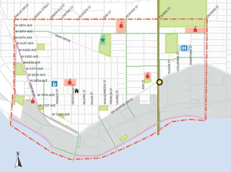
4 Marpole: Boundaries
5 What is a Community Plan
6 Community Planning: Four Phases 1 LAUNCH Outreach Research Deliverables Key Issues Metrics 2 POLICY DEVELOPMENT Apr-Jul 12 Aug April 13 Workshops Analysis Deliverables Plan & Policy Options 3 DRAFT PLAN Conclusions Deliverables Draft Plan May - Sept 13 4 PLAN APPROVAL Oct 13


7 Five Key Themes Land Use, Built Form Community Amenities Housing Parks & Public Realm Transportation
8 Process Breadth and Depth Phase 1 Phase 2 Phase 3 Phase 4: A new Marpole Community Plan (Fall 2013)
9 Overview 1 Community Plan 2 City-wide initiatives 3 4
 What is the")
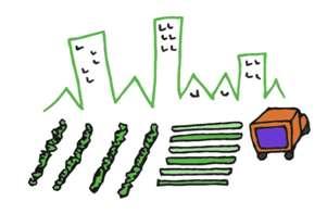
10 Parks and Public Space What is public space? Parks Plazas Streets Sidewalks Community gardens Public facilities (libraries and community centres) What is the public realm? Street furniture, street trees, planters, pavers, etc.
 in areas with significant population growth b) in park deficient neighbourhoods c) along the waterfront - access rights (e.g. along Fraser River) d) through major rezoning: public open space or payment in lieu Where do the funds for public amenities come from?")
11 Parks & Amenities How do we plan for parks in the city? The Park Board gives priority to acquiring new parks: a) in areas with significant population growth b) in park deficient neighbourhoods c) along the waterfront - access rights (e.g. along Fraser River) d) through major rezoning: public open space or payment in lieu Where do the funds for public amenities come from? 75% from property taxes, utility fees, and user fees 10-15% through new development (DCLs and CACs) 10-15% from other levels of government + non-profit partners

12 Public Space Projects Greenways Orphaned Spaces VIVA Green Streets Community Gardens Boulevard Fruit Trees Streets-to-Parks Pavement-to-Plaza

13 RELEVANT POLICY

14 17 greenways city-wide; 2 are in Marpole: North Arm Trail and Ontario GREENWAYS Enhanced bikeway system for pedestrians and cyclists GCAP action & Transportation 2040 Currently consulting on Point Grey Cornwall, Union Bikeway, and Comox Helmcken Greenway

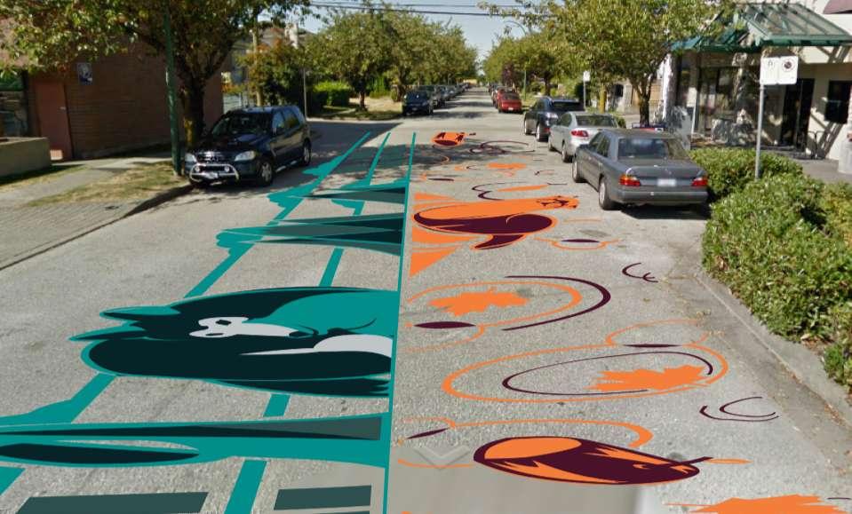
15 ORPHANED SPACES GCAP and Transportation : 103 city-owned spaces mapped; currently 5 pilot projects underway 15 Led by CityStudio

16 ORPHANED SPACES 16


17 VIVA Transportation 2040 direction to expand creative use of streets as public spaces City s test platform for innovative temporary public space ideas PARKLET: Urban Pasture, 2012
18 VIVA 18

19 GREEN STREETS Supporting GCAP, Transportation 2040, Food Strategy Allows residents to volunteer to tend to street gardens in traffic calming spaces 19

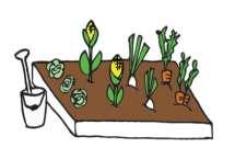
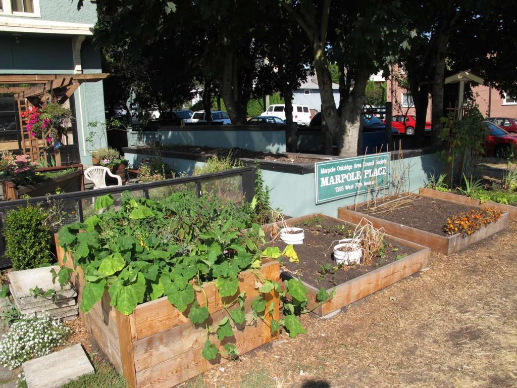
20 COMMUNITY GARDENS High priority GCAP action, supports Food Strategy Annual request for expressions of interest to solicit new projects Community-led 20 and supported by city

21 BOULEVARD FRUIT TREES 21 High priority GCAP action, Food Strategy

22 Currently consulting on potential sites in Mt. Pleasant and Marpole STREETS TO PARKS High priority GCAP action

23 STREETS TO PARKS 23

24 PAVEMENT TO PLAZAS Transportation 2040 action and implementation emerging area Low-cost, high-impact public spaces Focused on wide intersections or side streets in busy commercial areas Exploring trial through West End Community Plan
25 Food Assets in Marpole

26 Food Production

27 Food Production
28 Food Production
29 Food Processing

30 Food Processing
31 Food Distribution

32 Food Distribution

33 Food Waste

34 Food Waste

35 + Health + Education + Local food jobs + Community-building + Culturally-appropriate + Affordability + Sustainability How does this benefit the community?

36 Check Out Our Assets


37 Neighbourhood Values and Identity How important is it to have the following located close to your home?
38 Overall Degree of Satisfaction How would you rate the following statement?
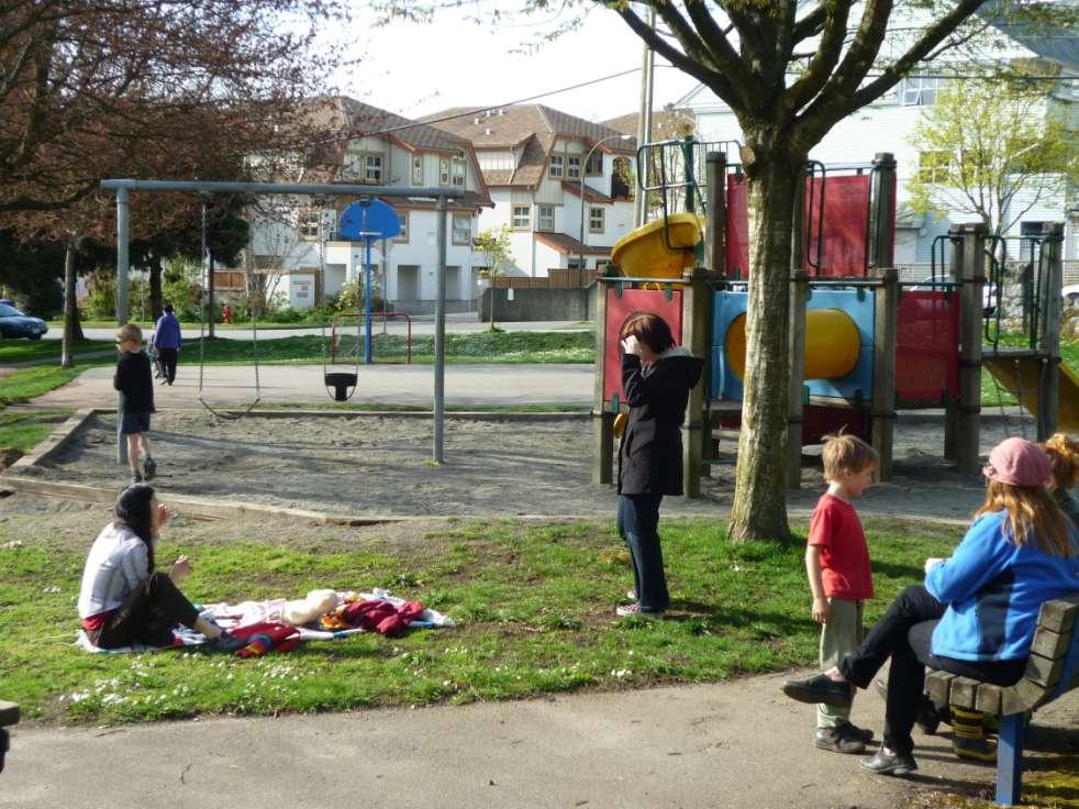
39 Parks

40 Neighbourhood Values and Identity In the next 25 years, I want Marpole to be recognised for its:

41 Parks Frequency of Use Marpole has a number of public parks, how often do you visit these?

42 Parks Type of Use What activities do you most often use parks for?

43 Parks - Favourite What is your favourite park to visit in Marpole?

44 Parks Least Favourite What is your least favourite park to visit in Marpole?
45 Parks - Improvements What are three things the City could do to improve parks?
 Safety concerns in isolated parks better lighting (e.g. Shaughnessy Park, Fraser River Park)")
46 Parks General Comments More park space Better signage and access to Shaughnessy Park and Fraser River Park. More trees to buffer traffic (e.g. Oak Park and Eburne Park) Safety concerns in isolated parks better lighting (e.g. Shaughnessy Park, Fraser River Park)

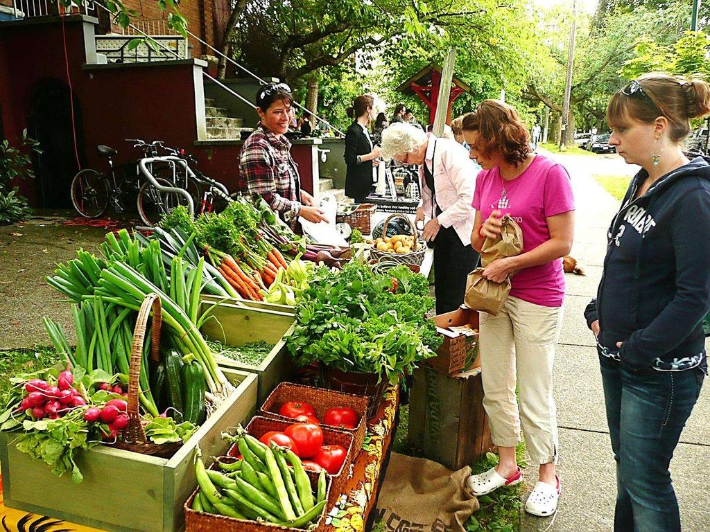
47 Open Space

48 Open Space More effective use of informal green spaces, like school More plazas Specific locations for more trees (e.g. W 70 th Ave., W 71 st Ave. and around Ebisu Park) Riverfront walkway that includes activation/ draw like community gathering place and/or a pier

49 Public Realm, Access and Linkages

50 Public Realm, Access and Linkages More benches More public art Make Granville more lively with patios and murals More crosswalks and bulges, and improved sidewalks Walking and cycling trail along Arbutus corridor Better waterfront access
51 Community Facilities

52 Community Facilities: Use How often do you use these facilities?
53 Community Facilities: Activities What services do you access and/or activities do you most often enjoy at these facilities?
54 Community Facilities: Additional Needs that you wish were offered?

55 Community Facilities: Co-location Do you agree that co-locating City services such as library, recreation, senior services, family programs, and childcare together improves your ability to access these services?

56 Community Facilities: Co-location How important is it to you that co-located services be:
57 Food
 Need for grocery store at Oak and 67 th Ave.")
58 Food Markets and Stores possibly at new riverfront location More variety of grocery stores (e.g. organic, Chinese produce) Need for grocery store at Oak and 67 th Ave.

59 Food - Gardens More community garden plots Oak and Winona Park Along Arbutus tracks Rental apartment area lawns and boulevards Help newcomers get involved in their community More fruit trees in parks Composting program, especially in apt. area
60 Overview 1 Community Plan 2 City-wide initiatives 3 4
61 Going Deeper with the Discussion heard (Phase I) What we know (via stats, etc.) Principles, policies, bylaws, etc. Refining This workshop will build on information gathered in Phase I of the Community Plan
")
 Report-Out already")

62 World Café Plenary World Café Discussions Round 1 (30min) Round 2 (30 min) Round 3 (30 min) Report-Out already learned Comment on emerging policies Engage thematically and geographically

63 World Café 1. Find a table 2.Listen and share ideas already learned; Comment on emerging policies Engage thematically and geographically
MARPOLE COMMUNITY PLAN. Parks & Public Space Information Package
 MARPOLE COMMUNITY PLAN s & Public Space Information Package CONTENTS Introduction 1 What we know! s and Open Space 11 Public Spaces and Facilities 12 Services 13 Food 14 What We Know: General 15 What We
11 GUIDING PRINCIPLES:
 11 GUIDING PRINCIPLES: CATEGORIES FIVE GUIDING PRINCIPLE CATEGORIES The Policy Statement will contain a set of Guiding Principles to inform the urban design and sustainability objectives for the site.
The Cambie Corridor 2015 Fall workshop series. What we heard WORKSHOP OUTLINE
 The Cambie Corridor 2015 Fall workshop series W 16 AVE Area 5 CAMBIE CORRIDOR Phase 3 What we heard ovember 21, 2015, 9am-noon, 1:30-4:30pm Peretz Centre 89 Participants* WORKSHOP OUTLIE Introductions
TOWN COUNCIL / PLANNING COMMISSION
 Workshop #3 TOWN COUNCIL / PLANNING COMMISSION January 20, 2011 Consultant Team In Attendance Tonight BMS Design Group Nevada City and San Francisco Michael Smiley, AICP, ASLA Partner-in-Charge Nancy L.
CAMBIE CORRIDOR PLAN
 1 WELCOME TO THE OPEN HOUSE PUBLIC REALM PLAN - CAMBIE CORRIDOR Thank you for coming to the Cambie Corridor Public Realm Open House! Place a dot where you live Please provide us with your comments and
Johnson Street Bridge Public Realm Update
 Johnson Street Bridge Public Realm Update August 20, 2015 Background Johnson Street Bridge Replacement Project impacts a diverse range of stakeholders In addition to a new bridge, the project also includes
Sustainability, Health, Safety, Recreation & Open Space Working Group August 3, 2017
 Sustainability, Health, Safety, Recreation & Open Space Working Group August 3, 2017 DOWNTOWN OAKLAND SPECIFIC PLAN WELCOME Sustainability, Health, Safety, Recreation & Open Space Working Group Social
WELCOME WHY A TEMPORARY PATHWAY? WE WANT TO HEAR FROM YOU
 WELCOME In March, the City of Vancouver purchased the lands known as the Arbutus Corridor from Canadian Pacific Railway for the purpose of creating a transportation corridor from False Creek to the Fraser
Figure 3-1: Public Realm Plan
 3 Public Realm Figure 3-1: Public Realm Plan 3.1 Public Realm Concept The public realm concept for the Little Mountain site integrates a clear and accessible movement network with public spaces for social
City of Plattsburgh DRI: Downtown Streetscapes & Riverfront Access. Downtown Streetscape and Riverfront Access Design
 City of Plattsburgh DRI: Downtown Streetscapes & Riverfront Access Welcome Thank you for coming this evening. Agenda PART I - Project Context The Downtown Revitalization Program Our DRI Projects Other
Building Great Neighbourhoods. Strathcona
 Building Great Neighbourhoods Strathcona March 21, 2018 Becky Redford Project Manager, Planning & Design Building Great Neighbourhoods Integrated Infrastructure Services Welcome and Purpose To provide
Welcome to the Oakridge Centre Open House
 Welcome to the Oakridge Centre Open House Why is the City hosting this event? This open house is to inform you of a rezoning application submitted to the City of Vancouver to amend the existing CD-1 (Comprehensive
Rezoning Frequently Asked Questions
 elcome The City of Vancouver has received an application to rezone 6929-6969 Cambie Street and 515 est 54th Avenue from RS-1 (Single Family) District to CD-1 (Comprehensive Development) District. The proposal
10.0 Open Space and Public Realm
 10.0 Open Space and Public Realm 10.0 Open Space and Public Realm The Public Open Space System is comprised of: outdoor spaces available for public use that are either publicly owned (e.g., parks and
WHAT IS A POLICY STATEMENT?
 1 PURPOSE OF OPEN HOUSE PREVIOUS WHAT IS BEING CONSIDERED? Vancouver Coastal Health (VCH) would like to renew the existing facilities to meet the current and future health care needs of the community while
Cambie Corridor Planning Program Phase Two Draft Plan. Standing Committee on City Services and Budgets May 5, 2011
 Cambie Corridor Planning Program Phase Two Draft Plan Standing Committee on City Services and Budgets May 5, 2011 Cambie Corridor Program Terms of Reference approved July 2009 Land Use Transportation Energy
Old Town Neighborhoods Plan. Choices Event Wednesday, December 9, 2015
 Old Town Neighborhoods Plan Choices Event Wednesday, December 9, 2015 Agenda 6:00 6:10 p.m. Welcome + Sign In 6:10 6:30 p.m. Presentation 6:30 8:00 p.m. Workshop + Open House Seeking your input on: Neighborhood
IMAGINE CLEARWATER. Community Workshop 3. November 2016
 IMAGINE CLEARWATER Community Workshop 3 November 2016 Imagine Clearwater has been a 6-month community-focused process to re-envision the downtown waterfront. VISIONING FRAMEWORK MASTER PLAN HOW CAN WE
Streets, Connectivity & Built Environment Working Group August 2, 2017
 Streets, Connectivity & Built Environment Working Group August 2, 2017 DOWNTOWN OAKLAND SPECIFIC PLAN WELCOME Streets, Connectivity & Built Environment Working Group Social Equity Meeting August 2, 2017
Port Lavaca Future Land Use
 Port Lavaca Future Land Use Introduction The City of Port Lavaca is beginning to see sustained growth, after many years of relative stable population. New single family homes, apartments, and businesses
Whitemarsh Comprehensive Plan Update: Housing & Land Use. Public Workshop #3: September 20, 2018
 Whitemarsh Comprehensive Plan Update: Housing & Land Use Public Workshop #3: September 20, 2018 Agenda Welcome Process Recap What We ve Heard The Plan Framework Review of Recommended Actions Land Use Housing
PLACEMAKING & MOBILITY WORKSHOP. January 27, 2016
 PLACEMAKING & MOBILITY WORKSHOP January 27, 2016 Boston needs more housing. But there is no one-size fitsall solution. Every neighborhood has its own character. In some places, density is not only appropriate
Oakridge Redevelopment: New Park Concept Overview and Phase 1 Engagement Results
 Oakridge Redevelopment: New Park Concept Overview and Phase 1 Engagement Results REPORT REFERENCE Regular Park Board Meeting Monday, February 19, 2018 Purpose of Presentation To provide the Board with
Shared Principles and Emerging Plan Directions
 Shared Principles and Emerging Plan Directions Introduction Since the Fairfield Neighbourhood planning process launched in June 2016, we have heard from many residents, businesses, groups and other people
Welcome! MILLENNIUM LINE BROADWAY EXTENSION. Over the next 30 years, Metro Vancouver will welcome 1 million new residents and 600,000 new jobs.
 WELCOME Welcome! MILLENNIUM LINE BROADWAY EXTENSION Over the next 30 years, Metro Vancouver will welcome 1 million new residents and 600,000 new jobs. The Broadway Corridor is home to the second largest
Roosevelt Station: Transit-Oriented Development. Workshop #3 - February 22, 2017
 Roosevelt Station: Transit-Oriented Development Workshop #3 - February 22, 2017 Roosevelt TOD NORTH SITE Central Site Available: Early 2020 Parcel Size + 53,000 SF + 1.22 ac Zoning + NC3P-85 + 5.75 FAR
Burnside Gorge Neighbourhood Plan. Engagement Summary
 Burnside Gorge Neighbourhood Plan Engagement Summary Table of Contents Engagement Summary... 3 Phase One Engagement (April May 2015)... 4 Phase Two Engagement (January March 2016)... 4 Appendix One: Summary
Queensborough Eastern Neighbourhood Node. Community Open House
 Queensborough Eastern Community Open House The Vision The Queensborough Eastern will become the heart of eastern Queensborough. Through a sensitive mix of viable commercial and residential areas, the neighbourhood
CHAPTER 6 URBAN DESIGN
 CHAPTER 6 URBAN DESIGN WINNETKA DOWNTOWN PLAN 51 URBAN DESIGN isn t just about making places attractive. People tend to associate urban design with community beautification and while it does many things
C I T Y O F T O R O N T O L A W R E N C E A V E N U E E A S T S T U D Y. Northwest Corner of Birchmount Road and Lawrence Avenue East
 C I T Y O F T O R O N T O A P P E N D I X A Northwest Corner of Birchmount Road and Lawrence Avenue East 92 DILLON CONSULTING LTD. - J.C. WILLIAMS GROUP LTD. APPENDIX B LAWRENCE AVENUE EAST STUDY SUMMARY
Lehigh Acres Land Development Regulations Community Planning Project
 Lehigh Acres Land Development Regulations Planning Effort Summary In July, 2010 Commissioner Frank Mann invited the Lehigh Acres community to start discussing how to achieve their recently adopted community
1. POPLAR LANDING + MUNI EVERS PARK
 . POPLAR LANDING + MUNI EVERS PARK WHAT S HAPPENING? PROJECT DESCRIPTION PROJECT TIMELINE Poplar Landing and the future Muni Evers Park site (located at 00 Quayside Drive) is jointly owned by the City
Toronto Complete Streets Guidelines
 c. DTAH 58 60 3.1 70 3.2 Performance Measurement 71 3.3 Exceptions Chapter 3 describes the five general steps in the street design process. Not all projects follow these steps, as the number of steps and
edmonton.ca/ribbonofgreen #ribbonofgreen
 WHAT IS THE RIBBON OF GREEN? The Ribbon of Green is Edmonton s entire river valley and ravine system. The Ribbon of Green (2018) Project will provide strategic guidance for the southwest and northeast
PLAN ELEMENTS WORKSHOP. April 5, 2016
 PLAN ELEMENTS WORKSHOP April 5, 2016 needs more housing. But there is no one-size fits-all solution. Every neighborhood has its own character. In some places, density is not only appropriate it is badly
ROCKTON DOWNTOWN STREETSCAPE MASTER PLAN. Plan Commission Presentation April 10, 2018 Teska Associates Christopher Burke Engineering
 ROCKTON DOWNTOWN STREETSCAPE MASTER PLAN Plan Commission Presentation April 10, 2018 Teska Associates Christopher Burke Engineering AGENDA 1. Project Scope & Schedule 2. Steering Committee & Community
Town Center (part of the Comprehensive Plan)
") Town Center (part of the Comprehensive Plan) Mercer Island Town Center Looking North (2014) In 1994, a year-long process culminated in a set of design guidelines and code requirements for the Town Center
Town Center (part of the Comprehensive Plan) Mercer Island Town Center Looking North (2014) In 1994, a year-long process culminated in a set of design guidelines and code requirements for the Town Center
International Blvd. TOD Plan Public Workshop #1
 International Blvd. TOD Plan Public Workshop #1 Add photos or project images September 21 and 22, 2010 Workshop Purpose Introduce the public to the Project Review and discuss the existing conditions analysis
LOW DENSITY RESIDENTIAL
 LOW DENSITY RESIDENTIAL Corner lots with coach houses to increase diversity, provide unity to the streetscape and increase eyes on the street. Garages and ancillary units accessed via rear lanes. Parking
DOWNTOWN NORFOLK COUNCIL ACTION PLAN. Strategic Initiatives Focus Area Objectives. Departmental Focus Area Key Objectives
 DOWNTOWN NORFOLK COUNCIL ACTION PLAN FY18 Strategic Initiatives Focus Area Objectives Departmental Focus Area Key Objectives STRATEGIC INITIATIVES FOCUS AREA OBJECTIVE #1: NURTURE A VIBRANT URBAN ENVIRONMENT
Community Design Guidelines. Port Wallace DRAFT
 Community Design Guidelines Port Wallace DRAFT Energy 1 2 3 Nature Movement Connections Built Form DRAFT Layout Energy 1 Nature Community Design Guidelines GREAT COMMUNITIES PROTECT, CELEBRATE, AND CONSERVE
4 Semi-Private & Private Open Spaces
 4 Semi-Private & Private Open Spaces 4.1 Semi-private Open Space 4.1.1 Common Courtyards The common courtyards for each complex will be designed and programmed for the typical owners living there. They
General Manager of Planning, Urban Design and Sustainability
 ADMINISTRATIVE REPORT Report Date: March 20, 2017 Contact: Karen Hoese Contact No.: 604.873.7665 RTS No.: 11971 VanRIMS No.: 08-2000-20 Meeting Date: March 29, 2017 TO: FROM: SUBJECT: Standing Committee
The Auburn Plan Designing the Future of Auburn February 28, 2005
 The Auburn Plan Designing the Future of Auburn February 28, 2005 Block-by-Block Bicycle Tour Aerial survey Focus Group Meetings September 7 and 8 Design Workshops October 11, 14, and 21 Revitalization
The Vision. Photo provided by The Minervini Group. 46 Vision, Objectives & Strategies
 Vision, Objectives & Strategies The is the public framework and guide for future development of the Grand Traverse Commons. The establishes public polices for infrastructure, the preservation of natural
open house 3 CITY OF SALEM Downtown Streetscape Plan
 open house 3 Streetscape concepts CITY OF SALEM Downtown Streetscape Plan analysis concepts we are here refined concepts & document Feb 13th 1 2 3 apr 18th KICKOFF OPEN HOUSE Streetscape Work Group Walking
Stadium District Masterplan
 Stadium District Masterplan Masterplan (noun): an evolving long-term planning document that establishes the framework and key elements of a site. It reflects a clear vision synthesizing developer goals
WELCOME! WHAT IS A GREENWAY?
 WELCOME! In March 2016, the City of Vancouver purchased 42 acres of land from Canadian Pacific Railway for the purpose of creating a high-quality public space for walking, cycling and wheeling. Streetcar
Vancouver Towers + Podiums. West End to Abu Dhabi
 Vancouver Towers + Podiums West End to Abu Dhabi What is the major issue that the City of Vancouver is dealing with in the next five to ten years? What is the City of Vancouver s Vision for growth? How
The Allen District. Community Consultation Meeting #1. Presented for Local Advisory Committee Monday, May 2, 2016
 The Allen District Community Consultation Meeting #1 Presented for Local Advisory Committee Monday, May 2, 2016 Presenters William Bryck President & CEO Build Toronto Pino Di Mascio Partner Urban Strategies
QUESTION 8: What are your Public Realm priorities for implementation? What would you like to see happen first? TELL US WHAT YOU THINK
 Public Realm Plan How will the Public Realm Plan be implemented? The Public Realm Plan document will set out a vision for the next 30 years. Over time, Plan elements and aspects can be implemented as opportunities
Enhanced Planning Process
 Welcome The City of Vancouver has received an application to rezone 725-747 Southeast Marine Drive from CD-1 (Comprehensive Development) District to a revised CD-1 District By-law. The proposal is for
to the Pearson Dogwood Open House! REZONING
 PEARSN G W Rezoning pen House - February 23 & 27 WELCME to the Pearson ogwood pen House! Today s pen House: PEARSN GW Is an opportunity to share your feedback on the rezoning application REZNING submitted
Baraga Avenue PlacePlan Marquette, MI July 24 th, 2014
 Baraga Avenue PlacePlan Marquette, MI July 24 th, 2014 Presentation Outline Project Purpose Acknowledgements Placemaking Overview PlacePlan Process Design Overview PlacePlan Recommendations Physical Design
Vancouver s public spaces our plazas, squares, streets, laneways, pathways, and waterfront are where public life happens.
 Vancouver s public spaces our plazas, squares, streets, laneways, pathways, and waterfront are where public life happens. These places and spaces are where we interact with the city on a daily basis, as
Crofton Manor 2803 West 41st Avenue WHAT WE HEARD. Public Consultation: Phase 1
 Crofton Manor 2803 West 41st Avenue WHAT WE HEARD Public Consultation: Phase 1 Background CROFTON MANOR What s Happening The City of Vancouver is undertaking a planning and public engagement process to
Plan Framework Report. Attachment A
 Plan Framework Report Attachment A Uptown-Douglas Corridor Plan - Plan Framework Report Contents Introduction... 1 Planning Process... 3 Project Objectives... 4 Vision... 5 Community Values... 6 Structural
VEHICULAR AND PEDESTRIAN CIRCULATION
 This perspective sketch communicates the intended character and quality of a proposed streetscape design. Locate benches near a major intersection where people tend to gather. Seating and lighting provide
East Bayshore Road Neighbourhood
 East Bayshore Road Neighbourhood Northridge Property Management Urban Design Brief 3195 East Bayshore Road City of Owen Sound January 2016 East Bayshore Road Neighbourhood Northridge Property Management
City of Langford Green Development Checklist
 City of Langford Green Development Checklist The following Green Development Checklist creates a sustainability standard for all comprehensive development within the City of Langford. The commitments made
The Lower SaLuda Greenway
 The Lower SaLuda Greenway InITIaTIve a FLourIShInG Greenway. a hub For economic GrowTh. a ConneCTIon BeTween CoMMunITIeS. In April 2017 the Michael J. Mungo Foundation and Lexington County commissioned
Summary Community Workshop #1 Fruitvale San Antonio Senior Center Monday, March 23, :00-9:00 p.m.
 Summary Community Workshop #1 Fruitvale San Antonio Senior Center Monday, March 23, 2009 7:00-9:00 p.m. Workshop Format and Process The City of Oakland is preparing a Specific Plan that will help define
Strategies/Actions Priority List
 Strengthening the Creative Sector: Build stronger relationships with, and between, cultural organizations and businesses and increase opportunities for working together to build capacity within organizations.
Summary of Public Input & Discussion of Alternatives
 Meeting #4 Summary of Public Input & Discussion of Alternatives May 6 th, 2009 City of Bellingham, Washington April 1 April 15 April 22 May 6 Introduction, Character and Boundary Study Areas Public Realm:
RESEDA - WEST VAN NUYS COMMUNITY PLAN
 RESEDA - WEST VAN NUYS COMMUNITY PLAN Executive Summary As part of the initial outreach effort, the Department of City Planning hosted two workshops for the Reseda-West Van Nuys Community Plan Area during
A 10-Year Strategic Plan for Recreation, Parks, Arenas and Culture City of Peterborough
 Vision 2025 A 10-Year Strategic Plan for Recreation, Parks, Arenas and Culture City of Peterborough Progress Update Prepared by: The RETHINK GROUP Leisure Services Planning & Management in association
MISSION STREETSCAPE PLAN. Neighborhood Commercial Streets handle continuous activity. Neighborhood Commercial STREET ROW: Main Design Treatments
 Neighborhood Commercial STREET ROW: 64-80 Main Design Treatments CORNER reduce crossing distance for pedestrians, create entrances to a residential area and slow cars down. help widen sidewalk allocating
City of Burlington Downtown Street Design & Construction Standards
 City of Burlington Downtown Street Design & Construction Standards Adopted April 16, 2018 b City of Burlington Downtown Street Design Standards CITY OF BURLINGTON, VT The Great Streets Initiative is a
Bow to Bluff Public Realm Plan Design Update
 Bow to Bluff Public Realm Plan Design Update December 017 Great public spaces encourage people to gather, recreate, explore and discover. Introduction The City of Calgary is planning to improve the corridor
Workshop #1 Outcomes. The Planning Partnership
 Workshop #1 Outcomes The Planning Partnership 1 Background Review Planning Provincial Policy Statement Greenbelt Plan Places to Grow: Growth Plan York Region Official Plan York Region Draft Official Plan
ELMVALE ACRES SHOPPING CENTRE MASTER PLAN
 ELMVALE ACRES SHOPPING CENTRE MASTER PLAN Contents 1.0 INTRODUCTION... 2 2.0 LOCATION... 2 3.0 EXISTING CONTEXT... 2 4.0 VISION & GUIDING PRINCIPLES... 2 5.0 LAND USE AND BUILT FORM... 4 5.1 St. Laurent
Pedestrian and Bike Bridge LOGO
 6.2.2 Pedestrian and Bike Bridge The proposed pedestrian and bike crossing re-envisions the existing bridge at Pismo Creek on Cypress Street. The bridge is currently underutilized by vehicular through
DRAFT FOR PUBLIC REVIEW. Game Plan for a Healthy City
 DRAFT FOR PUBLIC REVIEW 2018 Game Plan for a Healthy City 2 Denveright. Parks & Recreation Game Plan Draft for Public Review Draft for Public Review Executive Summary Game Plan Overview Executive Summary
Long Lost Allies? Walking Advocates & Business District Organizations. Matt Kazinka Lake Street Council. Shaina Brassard Seward Redesign
 Long Lost Allies? Walking Advocates & Business District Organizations Shaina Brassard Seward Redesign Rob Hanson West Broadway Business and Area Coalition Matt Kazinka Lake Street Council Jamie Schumacher
Board Members Vancouver Park Board General Manager Parks and Recreation
 TO: FROM: SUBJECT: Board Members Vancouver Park Board General Manager Parks and Recreation Date: February 6, 2014 Proposed Community Garden at Creekside Community Centre RECOMMENDATION THAT the Board support
Potential Green Infrastructure Strategies May 6, 2015 Workshop
 Potential Green Infrastructure Strategies May 6, 2015 Workshop Background The City of Cortland is developing the Tioughnioga Urban Headwaters Green Infrastructure Action Plan with funding from the National
3. Endorse the LRT vision in transforming Surrey into Connected-Complete-Livable communities, and more specifically, the official vision statement:
 CORPORATE REPORT NO: R038 COUNCIL DATE: February 20, 2017 REGULAR COUNCIL TO: Mayor & Council DATE: February 16, 2017 FROM: General Manager, Engineering FILE: 8740-01 SUBJECT: Surrey Light Rail Transit
4.9 Mendocino Avenue Corridor Plan Design Guidelines
 4.9 Mendocino Avenue Corridor Plan Design Guidelines The Mendocino Avenue Corridor Plan addresses the area between College Avenue and Steele Lane. Mendocino Avenue is a busy arterial that runs parallel
VISION AND GUIDING DESIGN PRINCIPLES
 pleasure point commercial corridor VISION AND GUIDING DESIGN PRINCIPLES Public Draft November 26, 2018 County of Santa Cruz with assistance from MIG CONTENTS PART I: INTRODUCTION AND VISION... 3 Community
Yadkin River Greenway Feasibility Study Fact Sheet Village of Clemmons, Town of Lewisville, Town of Bermuda Run
 Fact Sheet Village of Clemmons, Town of Lewisville, Town of Bermuda Run Project Background The Yadkin River Greenway Feasibility Study is a joint project with the Village of Clemmons, the Town of Bermuda
General Manager of Planning and Development Services
 POLICY REPORT DEVELOPMENT AND BUILDING RR-2 Report Date: April 3, 2015 Contact: Susan Haid Contact No.: 604.871.6431 RTS No.: 10910 VanRIMS No.: 08-2000-20 Meeting Date: April 14, 2015 TO: FROM: SUBJECT:
Cambie Corridor Planning Program Phase One. Standing Committee on Transportation and Traffic January 19, 2010
 Cambie Corridor Planning Program Phase One Standing Committee on Transportation and Traffic January 19, 2010 Work Program Terms of Reference approved July 2009 Land Use Transportation Energy Cambie Corridor
Waverley West B Secondary Planning Process. Open House South Pointe School April 25, 2018
 averley est B Secondary Planning Process South Pointe School April 25, 2018 averley est B Secondary planning process open house Please review the boards and provide your feedback. 1 The Role of a Secondary
2035 General Plan Update and Belmont Village Specific Plan. Joint Study Session with the City Council and Planning Commission April 12, 2016
 2035 General Plan Update and Belmont Village Specific Plan Joint Study with the City Council and Planning Commission April 12, 2016 Agenda 1. Welcome and Introductions 2. General Plan Update Status of
In surveys, Dallas residents say what they want to change most
 NEIGHBORHOODS ELEMENT In surveys, Dallas residents say what they want to change most in the city is its appearance they want it to look beautiful, with trees and pedestrian-friendly neighborhoods. The
SOUTH UNIVERSITY Street Design Alternatives in Progress
 1 Alternatives in Progress 2016.01.20 Meeting Agenda 2 1. Progress & Schedule 2. Utilizing the Street Design Manual 3. Site Characteristics and Input Received 4. Street Geometry What can we accomplish
PARK AND RECREATION MASTER PLAN UPDATE
 PARK AND RECREATION MASTER PLAN UPDATE 2014-2018 Prepared for: Avon Parks, Recreation and Beautification Council (PRBC) and Town of Avon Prepared by: Lehman & Lehman, Inc. 24-Apr-14 Mission Statement The
Denver Moves: Transit Task Force
 Insert transit picture Denver Moves: Transit Task Force Meeting #8 October 5, 2017 1. Welcome & Introductions Opening remarks and housekeeping Task Force and audience introductions Upcoming events and
CHAPPLES PARK MASTER PLAN
 CHAPPLES PARK MASTER PLAN Presentation of Preliminary Development Options Public Open House #2 Wednesday November 2 nd, 2016 TONIGHT S AGENDA 1. Welcome & Introductions 2. Presentation by Sierra Planning
Create Policy Options Draft Plan Plan Approval. Public Consultation Events. Phase 2
 Background Grandview-Woodland Community Plan In the spring of 2012, the City of Vancouver embarked on a comprehensive community planning program in the Grandview-Woodland neighbourhood. The process has
Sheridan Boulevard S TAT I O N A R E A P L A N S H E R I D A N B O U L E VA R D S TAT I O N A R E A P L A N
 Sheridan Boulevard S TAT I O N A R E A P L A N 1 City of Lakewood Adopted November, 2006 S H E R I D A N B O U L E VA R D S TAT I O N A R E A P L A N The Vision The City of Lakewood s overall vision is
New-Cast Mixed-use Development Proposal King Street West, Newcastle, Ontario
 URBAN DESIGN BRIEF New-Cast Mixed-use Development Proposal King Street West, Newcastle, Ontario TABLE OF CONTENTS: 1.0 Executive Summary 2.0 Creating Vibrant and Sustainable Urban Places: Excerpts from
University of the District of Columbia Van Ness Campus Master Plan Community Open House 3. December 8, 2010
 University of the District of Columbia Van Ness Campus Master Plan Open House 3 December 8, 2010 Introductions Sequence of Work: Campus Master Plan BEGIN: INTRODUCE AND START WORK Project Initiation Team
WILBURTON COMMERCIAL AREA
 WILBURTON COMMERCIAL AREA BELLEVUE DOWNTOWN ASSOCIATION L A N D U S E A N D L I VA B I L I T Y C O M M I T T E E B R A D L E Y C A LV E R T, A I C P C O M M U N I T Y D E V E L O P M E N T P R O G R A
Chairman and Members of the Planning and Development Committee. Thomas S. Mokrzycki, Commissioner of Planning and Building
 LA.09.TOR (Toronto) DATE: TO: FROM: SUBJECT: Chairman and Members of the Planning and Development Committee Thomas S. Mokrzycki, Commissioner of Planning and Building Central Waterfront Secondary Plan
Comprehensive Plan & Station Area Zoning
 Village of Tarrytown Comprehensive Plan & Station Area Zoning Public Workshop November 5, 2017 Warner Library WXY architecture + urban design Pace University - Land Use Law Center George M. Janes & Associates
City of Dallas Complete Streets Program. SAME Infrastructure Forum February 2, 2018
 City of Dallas Complete Streets Program SAME Infrastructure Forum February 2, 2018 Complete Streets Design Manual Adopted by City Council January 27, 2016 JANUARY 27, 2016 2 What are Complete Streets?
Gas Stations ottawa.ca
 Urban Design Guidelines for Gas Stations ottawa.ca Ce document est disponible en français sur ottawa.ca. This document is available in French on ottawa.ca. Approved by City Council May 24, 2006 City of
Grantsburg Community Design Team (CDT)
") Grantsburg Community Design Team (CDT) Summary Report Overview On April 10-13, 2014, a team of (19) volunteer planners, design professionals, and community development educators volunteered their time
Grantsburg Community Design Team (CDT) Summary Report Overview On April 10-13, 2014, a team of (19) volunteer planners, design professionals, and community development educators volunteered their time
Downtown River District
 City & Downtown Development Authority Partnership Infrastructure Analysis & Design Project Transportation & Utilities Fix Current Deficiencies Set the Stage for Future Infill & Redevelopment Who s Involved: