AN ARCHAEOLOGICAL SURVEY FOR THE DOGWOOD SPRINGS WATER SUPPLY CORPORATION WATER SYSTEM IMPROVEMENTS PROJECT IN ANDERSON COUNTY, TEXAS
|
|
|
- Melissa Rich
- 5 years ago
- Views:
Transcription

1 AN ARCHAEOLOGICAL SURVEY FOR THE DOGWOOD SPRINGS WATER SUPPLY CORPORATION WATER SYSTEM IMPROVEMENTS PROJECT IN ANDERSON COUNTY, TEXAS Antiquities Permit 4709 By William E. Moore Brazos Valley Research Associates Contract Report Number
2 AN ARCHAEOLOGICAL SURVEY FOR THE DOGWOOD SPRINGS WATER SUPPLY CORPORATION WATER SYSTEM IMPROVEMENTS PROJECT IN ANDERSON COUNTY, TEXAS BVRA Project Principal Investigator William E. Moore, RPA Prepared for Dogwood Springs Water Supply Corporation Post Office Box 608 Frankston, Texas Prepared by Brazos Valley Research Associates 813 Beck Street Bryan, Texas 77803
3 ABSTRACT An archaeological survey of a well and plant site in central Anderson County, Texas was performed on November 4, 2007 by Brazos Valley Research Associates (BVRA) for the Dogwood Springs Water Supply Corporation (WSC) under Antiquities Permit The project area was investigated by shovel testing. Due to extensive forest debris, a surface inspection was not possible. The footprint for the well and plant site is 100 x 100 (.23 acre), and the entire project area is on a six percent slope. Five shovel tests dug through sandy soil to depths of 80 cm to 100 cm were negative in terms of producing cultural materials, and no artifacts were collected. Therefore, it is recommended that construction be allowed to proceed as planned. Copies of the report are on file at the Texas Historical Commission (THC), Archeology Division, Texas Archeological Research Laboratory (TARL), and BVRA. ii
4 ACKNOWLEDGMENTS I am appreciative of the assistance provided by others during this project. Hollie H. Nowlin at J. F. Fontaine & Associates, Inc. was the Project Engineer. The President of the Dogwood Springs WSC (Jim Hallman) provided maps and signed the permit application as the representative of the landowner. I am grateful to Randall Anderson and Jennifer McMillan for accompanying me to the project area and assisting with the shovel testing and mapping. Jean Hughes checked the site records at the Texas Archeological Research Laboratory (TARL) for previously recorded sites in the project area and vicinity. The figures and cover were prepared by Lili G. Lyddon and Edward P. Baxter. Nora Rogers proofread the report for errors and consistency. iii
5 CONTENTS ABSTRACT...ii ACKNOWLEDGMENTS... iii INTRODUCTION... 1 ENVIRONMENTAL SETTING... 4 ARCHAEOLOGICAL BACKGROUND... 7 METHODS... 8 RESULTS AND CONCLUSIONS RECOMMENDATIONS REFERENCES CITED APPENDIX I: Shovel Test Log Figures FIGURE 1. GENERAL LOCATION... 2 FIGURE 2. PROJECT AREA ON TOPOGRAPHIC MAP PERT... 3 FIGURE 3. VIEW OF PROJECT AREA AND SHOVEL TEST 5 (LOOKING WEST)... 5 FIGURE 4. SOILS IN THE PROJECT AREA... 6 FIGURE 5. SHOVEL TEST FIGURE 6. SHOVEL TESTS iv
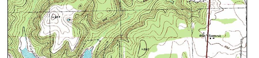
6 INTRODUCTION The Dogwood Springs WSC plans to construct a well and plant site in the Pineywoods Lake Resort Unit 1 on Lot 58 in the M. Fleming (A-295) and Nathan Hendrichs (A-388) surveys in central Anderson County, Texas (Figure 1). The existing system provides water service to properties in Pineywoods Lake Resorts, Frankston properties, and properties in Lake Frankston. The system currently serves 180 active water meters. Access to the area is provided by State Highway 155 and several county roads. The Dogwood Springs WSC currently consists of two existing wells and a distribution system that serves 180 customers. This project will meet the minimum requirements as established by the Texas Commission for Environmental Quality (TCEQ) for the existing customers and provide for moderate growth. There will be no permanent structures located within flood zones or wetland areas. The existing plant to the northwest will be demolished and replaced by the new well and plant site that will have a greater capacity. The Dogwood Springs WSC will adopt binding resolutions protecting the floodplains and wetland areas from future development. The project area is depicted on the USGS topographic map Pert (Figure 2). Anderson County is located in a part of Texas that contains numerous prehistoric and historic sites, many of which have been considered to possess significant research potential. This county is in the area once inhabited by the prehistoric Caddo Indians of Northeast Texas. Many of these sites contain burials and pottery vessels of exceptional quality. Vandalism of archaeological sites in this area is a serious problem, and the number of intact Caddoan sites is rapidly decreasing. The THC has requested a cultural resources survey be performed by a professional archaeologist prior to the construction of the well and plant site. In order to comply with this request, the Dogwood Springs WSC retained BVRA of Bryan, Texas to conduct this investigation. The project number assigned by BVRA is
7 Figure 1. General Location 2

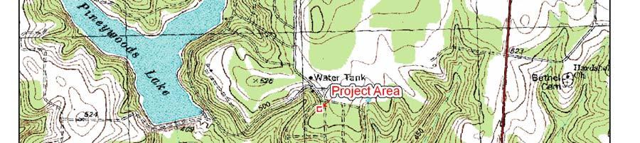
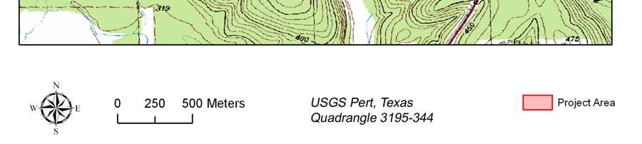
8 Figure 2. Project Area on Topographic Map Pert 3
9 ENVIRONMENTAL SETTING The project area is located within the West Gulf Coastal Plain physiographic province as defined by Fenneman (1946) and the Austropriarian biotic province as defined by Blair (1950:98-100). The reader is referred to Volume I (Stratigraphy) of the Geology of Texas by Sellards et al. (1932) for a more in-depth discussion of the geology of this area. Data taken from the Texas Almanac for (Kingston and Harris 1983) state that the county receives inches of annual rainfall. When combined with a January minimum temperature of 37 degrees Fahrenheit and a July maximum temperature of 94 degrees Fahrenheit, a growing season of 264 days results. Fauna known to be present within the project area at various times of the year include fox and gray squirrel, armadillo, raccoon, opossum, cottontail rabbits, white-tailed deer, coyote, beaver, and feral hogs. Many birds utilize the site including dove, meadowlark, killdeers, various sparrows, great blue herons, bluebirds, mockingbirds, and cardinals. The project area is located in an upland setting with elevations at or greater than 500 feet above mean sea level. A large portion of the project area was heavily wooded with mixed hardwoods, juniper, pines, and various kinds of understory vegetation present such as vines and limited natural grasses (Figure 3). The nearest water source is a tributary of Brushy Creek that has been dammed to create Lake Frankston (680 meters to the Southwest) and Pineywoods Lake (765 meters to the Northwest). According to the soil survey for Anderson County (Coffee 1975), the project area is located within soils of the Darco Association. The soils in the project area are described by Coffee (1975:Sheet 19) as Darco fine sand (DaD), 1 to 8 percent slopes (Coffee 1975:12). This is a gently sloping to sloping soil that occurs on the uplands in areas from ten acres to several hundred acres in size. A typical profile is fine sand from the surface to 49 inches. Below that is a sandy clay loam from 49 inches to 67 inches. Sandy loam is present from 67 inches to 80 inches. Darco soils are well drained to excessively drained. Permeability is moderately slow, and the available water capacity is low. Runoff is slow. The project area soils are depicted in Figure 4. 4

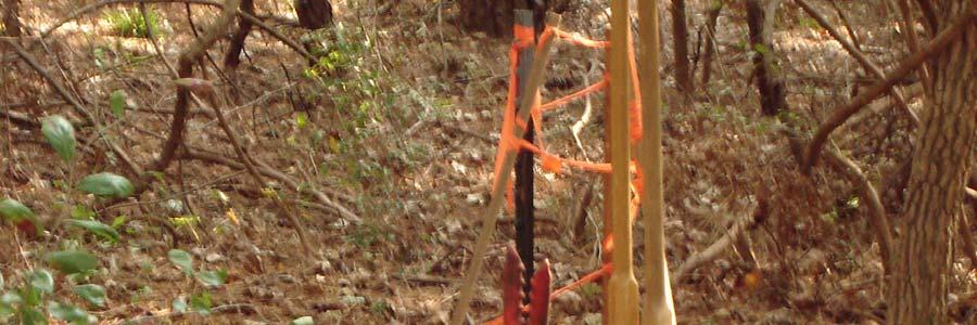
10 Figure 3. View of Project Area and Shovel Test 5 (looking west) 5
11 Figure 4. Soils in the Project Area 6
12 ARCHAEOLOGICAL BACKGROUND Anderson County is located in the Northeast Texas Archeological Study Region of the Eastern Planning Region as defined by the Department of Antiquities Protection in Archeology in the Eastern Planning Region, Texas: A Planning Document (Kenmotsu and Perttula 1993). According to the planning document, there were 121 sites recorded in the county as of 1991 (Kenmotsu and Perttula 1993:41). In the region, Anderson County was 16th in terms of numbers of sites recorded. Of the 121 recorded sites, 12 were considered not significant, 41 were of unknown significance, 46 were probably significant, and 22 were significant. Two sites (41AN19 and 41AN51) are listed in the National Register of Historic Places. Site 41AN51, the Pace McDonald site, has been discussed in an unpublished manuscript by Thurmond (1978) on file at TARL. At the time of this survey there were over 180 recorded prehistoric and historic sites in the county. The Archeological Bibliography for the Northeastern Region of Texas (Martin 1990) cites 50 references for the county. Although many of these investigations have been small area surveys, often resulting in negative findings, several major reservoir projects have been conducted. These are the Blackburn Crossing Reservoir (Johnson 1958, 1961), Palestine Reservoir (Anderson et al. 1974), Tennessee Colony Lake (Richner 1977; Richner and Lee 1976, 1977), Trinity River Basin (Richner and Bagot 1978), and the Trinity River Multiple Use Project (Sorrow 1973). Overviews of the area include works by (Lynott and Richner 1977), Woodall (1972), and Story, et al. (1990). Prehistoric occupations in the region cover all time periods from Paleoindian through Historic Caddoan, circa 9500 B.C. - A.D (Kenmotsu and Perttula 1993:44). The reader is referred to this comprehensive and well-organized document for additional information regarding the archaeological background for Anderson County and vicinity. Numerous prehistoric sites have been recorded along Caddo Creek in Anderson and Henderson counties and along Caney Branch in Anderson County. Several of these sites were investigated in the 1930s under the direction of A. M. Woolsey and A. T. Jackson of The University of Texas at Austin. Although collections were sometimes curated, site forms and formal reports may not exist. Most of these sites have been described as Caddoan, and some contain burials with grave goods. According to the few site forms that are present, the preferred location for sites appears to be terraces adjacent to streams. Archaic hunting sites were recorded during the Lake Palestine survey in 1960s and early 1970s (Anderson 1971). Sites found during this study were predominantly associated with streamside locations near relatively fertile soils (Anderson 1971:iii). The nearest recorded archaeological site to the project area is 41AN42, approximately meters to the northeast. Very little information is available for this prehistoric site that is described on the site card as a midden mound. No site form exists for this site. 7
13 METHODS Prior to entering the field a records check for previously recorded sites in or near the project area was conducted by Jean Hughes at TARL. Two important reports were reviewed during the planning stages of this project. These are a planning document by the Department of Antiquities Protection (Kenmotsu and Perttula 1993) and an archeological bibliography for the Northeastern Region of Texas (Martin 1990). The interested reader is referred to these sources for additional information regarding the prehistory of this area. The field investigation was conducted on November 4, The project area was investigated through shovel testing. There was too much forest debris to make a surface inspection possible except for obvious historic features. The field crew consisted of the Principal Investigator and two assistants Randal Anderson and Jennifer McMillan. The President of the Dogwood Springs WSC (Jim Hallman) met us at the project area and showed us where the well is proposed. We dug our first shovel test in this location to a depth of 100 cm through sandy soil (Figure 4). The remaining four tests were dug to the southeast, northeast, west, and southwest of the first test, and they were also negative. The distance from the first shovel test at the well site (center hole) to the remaining four tests was measured using a 50-meter metric tape, and the orientation of the tests was determined using a Brunton compass. This information was recorded on a shovel test log, which appears in this report as Appendix I. The location of each test was plotted on a field map (Figure 5). This project was also documented through field notes and a digital camera. 8

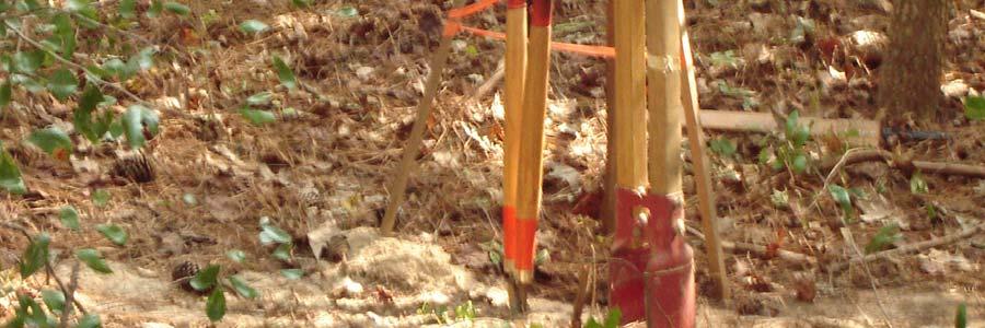
14 Figure 5. Shovel Test 1 9
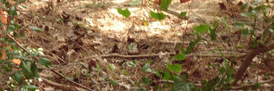
15 Figure 6. Shovel Tests 10
16 RESULTS AND CONCLUSIONS Literature Review The records check at TARL revealed that no professional investigations have been conducted in the project area. Most of the sites recorded in Anderson County were probably located during the Lake Palestine survey (Anderson 1971) and a survey of the Trinity River basin (Richner and Bagot 1978). Both endeavors were conducted by Southern Methodist University. According to Carolyn Spock (personal communication, June 10, 1994), there was a surge of site recording for the county during 1979 (62 sites), 1980 (62 sites), and 1981 (79 sites). Most of these are believed to represent TARL numbers being assigned to previously recorded sites by Southern Methodist University from the Lake Palestine and Trinity River Basin projects. Today, there are more than 180 sites in Anderson County. Field Survey Five shovel tests in the 2/3-acre project area were dug through sandy soil. Four tests were terminated at 100 cm, and one test was terminated at 80 cm when clay was encountered. No artifacts were found in any of the five tests, which were dug randomly across the project area. Several pieces of sandstone were recovered in Shovel Test 3, and three small fragments of unidentified material were recovered in shovel tests 1 and 4. Analysis of these materials by William A. Dickens revealed that they did not contain enough attributes for him to identify them as cultural. According to Jim Hallman (personal communication), it is unlikely that a house or other structure has ever stood in this area. He also believes that, due to the slope of the tract, it has probably never been cultivated. Although artifacts associated with prehistoric and historic sites can exist virtually anywhere on the landscape, even on a slope, it is my opinion that the most likely setting for a site is to the southeast at the top of the landform. At the time of this visit, there was a residence in this location. 11
17 RECOMMENDATIONS No archaeological sites were found during the survey of the proposed well and plant site. It is, therefore, recommended that construction be allowed to proceed as planned by the Dogwood Springs WSC without further consultation with the THC. Should the construction plans change to include a greater area that can be viewed as a likely setting for a prehistoric site, the THC must be notified in case additional survey by a professional archaeologist is warranted. Also, if cultural materials are unearthed during construction, all work in the area of the find must stop until the situation can be evaluated by the THC. This study conformed to the Minimum Survey Standards as defined by the Archaeology Division of the THC. 12
18 REFERENCES CITED Anderson, Keith M Archaeological Resources of Lake Palestine, Texas. Report submitted by Southern Methodist University to the National Park Service Anderson, Keith M., Kathleen Gilmore, Olin F. McCormick, III, and E. Pierre Morenon 1974 Archaeological Investigations at Lake Palestine Texas. Southern Methodist University, Institute for the Study of Earth and Man, Department of Anthropology, Contributions in Anthropology Number 11. Blair, W. Frank 1950 The Biotic Provinces of Texas. The Texas Journal of Science 2(1): Fenneman, Nevin M Physical Divisions of the United States Map. United States Geological Survey, Washington, D.C. Johnson, LeRoy, Jr Appraisal of the Archeological Resources of Blackburn Crossing Reservoir, Anderson, Cherokee, Henderson, and Smith Counties, Texas. Archeological Salvage Program, National Park Service, Austin Office An Archeological Survey of Blackburn Crossing Reservoir on the Upper Neches River. Bulletin of the Texas Archeological Society 31: Kenmotsu, Nancy Adele, and Timothy K. Perttula 1993 Archeology in the Eastern Planning Region, Texas: A Planning Document. Department of Antiquities Protection, Cultural Resources Management Report 3. Texas Historical Commission. Kingston, Michael T., and Ruth Harris (Editors) Texas Almanac and State Industrial Guide. Dallas. Lynott, Mark J., and Jeffrey J. Richner 1977 An Archaeological Overview of East-Central Texas. Manuscript prepared by Southern Methodist University on file at the Texas Historical Commission in Austin, Texas. 13
19 Martin, William A Archeological Bibliography for the Northeastern Region of Texas. Department of Planning and Review, Cultural Resource Management Report 1 and Office of the State Archeologist Special Report 32. Richner, Jeffrey J Archeological and Ethnohistorical Survey at Tennessee Colony Lake. Archaeology Research Program, Southern Methodist University. Dallas. Richner, Jeffrey J., and Joe T. Bagot (Assemblers) 1978 A Reconnaissance Survey of the Trinity River Basin, Archaeology Research Program, Southern Methodist University, Research Report 113. Richner, Jeffrey J., and Reed Lee 1976 Cultural Resources at Tennessee Colony Lake. Archaeology Research Program, Southern Methodist University Archaeological and Ethnohistorical Survey at Tennessee Colony Lake, Archaeology Research Program, Southern Methodist University. Sellards, E. H., W. S. Adkins, and F. B. Plummer 1932 The Geology of Texas, Volume I, Stratigraphy. The University of Texas, Bureau of Economic Geology, Bulletin Sorrow, William M Preliminary Archeological Reconnaissance of the Selected Area to be Affected by the Trinity River Multiple Purpose Project, Texas. Texas Archeological Salvage Project, Research Report 17. The University of Texas at Austin. Story, Dee Ann, Janice A. Guy, Barbara A. Burnett, Marthy Doty Freeman, Jerome C. Rose, D. Gentry Steele, Ben W. Olive, and Karl G. Reinhard 1990 The Archeology and Bioarcheology of the Gulf Coastal Plain. Arkansas Survey, Research Series Number 38. Fayetteville. Thurmond, J. Peter 1978 The Pace McDonald Site: A Caddoan Mound Center in Anderson County, Texas. Unpublished manuscript on file at the Texas Archeological Research Laboratory in Austin, Texas. 14
20 Woodall, J. Ned 1972 Prehistoric Social Boundaries: An Archeological Model and Test. Bulletin of the Texas Archeological Society 43:
21 APPENDIX I SHOVEL TEST LOG* Shovel Test Depth (cm) Soil Comments sandy loam many roots 2 80 sandy loam terminated at orange clay sandy loam sandstone fragments sandy loam many roots sandy loam many roots *All tests were negative
AN ARCHAEOLOGICAL SURVEY FOR THE RICHARDS, TEXAS FARM-TO-MARKET ROAD 149 FIBER OPTIC CABLE PROJECT IN MONTGOMERY COUNTY, TEXAS
 AN ARCHAEOLOGICAL SURVEY FOR THE RICHARDS, TEXAS FARM-TO-MARKET ROAD 149 FIBER OPTIC CABLE PROJECT IN MONTGOMERY COUNTY, TEXAS Antiquities Permit 6097 By William E. Moore Brazos Valley Research Associates
AN ARCHAEOLOGICAL SURVEY FOR THE DIALVILLE-OAKLAND WATER SUPPLY CORPORATION IN CENTRAL CHEROKEE COUNTY, TEXAS. BVRA Project Number 03-25
 AN ARCHAEOLOGICAL SURVEY FOR THE DIALVILLE-OAKLAND WATER SUPPLY CORPORATION IN CENTRAL CHEROKEE COUNTY, TEXAS BVRA Project Number 03-25 Author and Principal Investigator William E. Moore Prepared by Brazos
AN ARCHAEOLOGICAL SURVEY OF PROPOSED SYSTEM IMPROVEMENTS FOR THE ALTO RURAL WATER SUPPLY CORPORATION IN SOUTHEAST CHEROKEE COUNTY, TEXAS
 AN ARCHAEOLOGICAL SURVEY OF PROPOSED SYSTEM IMPROVEMENTS FOR THE ALTO RURAL WATER SUPPLY CORPORATION IN SOUTHEAST CHEROKEE COUNTY, TEXAS Antiquities Permit 3126 by William E. Moore Brazos Valley Research
AN ARCHAEOLOGICAL SURVEY OF THE TIGER CREEK COMPARTMENT 3 JASPER COUNTY TEXAS
 AN ARCHAEOLOGICAL SURVEY OF THE TIGER CREEK COMPARTMENT 3 JASPER COUNTY TEXAS By William E. Moore Brazos Valley Research Associates Contract Report Number 89 2001 AN ARCHAEOLOGICAL SURVEY OF THE TIGER
AN ARCHAEOLOGICAL SURVEY FOR THE NAVIDAD RESOURCES, LLC FERGUSON STATE PRISON FARM UNIT PROJECT IN MADISON COUNTY, TEXAS
 AN ARCHAEOLOGICAL SURVEY FOR THE NAVIDAD RESOURCES, LLC FERGUSON STATE PRISON FARM UNIT PROJECT IN MADISON COUNTY, TEXAS Antiquities Permit 5714 By William E. Moore Brazos Valley Research Associates Contract
A CULTURAL RESOURCES SURVEY OF THE SITE OF THE PROPOSED NAVASOTA RECREATION CENTER IN SOUTHWESTERN GRIMES COUNTY, TEXAS. Antiquities Permit 2832
 A CULTURAL RESOURCES SURVEY OF THE SITE OF THE PROPOSED NAVASOTA RECREATION CENTER IN SOUTHWESTERN GRIMES COUNTY, TEXAS Antiquities Permit 2832 by William E. Moore Brazos Valley Research Associates Contract
STAGE 1 ARCHAEOLOGICAL ASSESSMENT OF RATHBURN ROAD, FROM DUKE OF YORK BOULEVARD TO SHIPP DRIVE, CITY OF MISSISSAUGA. Submitted to:
 STAGE 1 ARCHAEOLOGICAL ASSESSMENT OF RATHBURN ROAD, FROM DUKE OF YORK BOULEVARD TO SHIPP DRIVE, CITY OF MISSISSAUGA Submitted to: McCormick Rankin Corporation 2655 North Sheridan Way, Suite 280 Mississauga,
Phase One Archaeological Investigation Results, James Madison Park Master Development Plan Project, City of Madison, Dane County, Wisconsin
 Phase One Archaeological Investigation Results, James Madison Park Master Development Plan Project, City of Madison, Dane County, Wisconsin Prepared for the City of Madison Parks Department 28 January
AD-A SDl '"TIC --,.. AUGUST 19 A T n.. n Y E
 AD-A262 970 AUGUST 19 A T n.. n Y E 1, AGENCY USE ONLY 2, e r I REPORT DATE 13 O T Y g. a{ O D A Cultural Resources Survey of the Yazo-s-Mississippi D~lta Levee Slide Repair DeSoto Co.,MS A Negativet '":'
Florida Department of TRANSPORTATION. Technical Memorandum Cultural Resource Assessment Survey of the Proposed VE Pond
 Florida Department of TRANSPORTATION Technical Memorandum Cultural Resource Assessment Survey of the Proposed VE Pond Malabar Road (SR 514) PD&E Study From East of Babcock Street (SR 507) to US 1 Brevard
ARCHAEOLOGICAL INVESTIGATIONS FOR THE OLD DAVIS ROAD REALIGNMENT PROJECT ON THE UNIVERSITY OF CALIFORNIA, DAVIS CAMPUS YOLO COUNTY, CALIFORNIA
 Cultural Resources Consultants ARCHAEOLOGICAL INVESTIGATIONS FOR THE OLD DAVIS ROAD REALIGNMENT PROJECT ON THE UNIVERSITY OF CALIFORNIA, DAVIS CAMPUS YOLO COUNTY, CALIFORNIA Prepared for: Matt Dulcich,
13. PRELIMINARY PLAT NO MILLS FARM - Vicinity of the southeast corner of 159 th Street and Quivira Road
 13. corner of 159 th Street and Quivira Road 1. APPLICANT: HNTB Corporation is the applicant for this request. 2. REQUESTED ACTION: The applicant is requesting approval of a preliminary plat for a 383-lot
Prepared for Stantec Consulting Services, Inc. 23 June 2017
 Phase I Archaeological and Cultural Resource Investigation Results: Proposed Lower Eastern Beaver River Course Realignment Project, Silver Bay Golf Course, Beaver Bay Township, Lake County, Minnesota.
AN ARCHAEOLOGICAL SURVEY FOR THE SOUTHWEST TEXAS TELEPHONE COMPANY FARM-TO-MARKET ROAD 470 FIBER OPTIC PROJECT IN BANDERA COUNTY TEXAS
 AN ARCHAEOLOGICAL SURVEY FOR THE SOUTHWEST TEXAS TELEPHONE COMPANY FARM-TO-MARKET ROAD 470 FIBER OPTIC PROJECT IN BANDERA COUNTY TEXAS Antiquities Permit 5392 BVRA Project 09-27 Principal Investigator
A Historical Context of the Turpentine (Naval Stores) Industry in the Atlantic and Gulf Coastal Plains of Georgia, South Carolina, and Florida
 Industry in the Atlantic and Gulf Coastal Plains of Georgia, South Carolina, and Florida") A Historical Context of the Turpentine (Naval Stores) Industry in the Atlantic and Gulf Coastal Plains of Georgia, South Carolina, and Florida APPENDIX A NAVAL STORES INDUSTRY RELATED ARCHAEOLOGICAL SITES
A Historical Context of the Turpentine (Naval Stores) Industry in the Atlantic and Gulf Coastal Plains of Georgia, South Carolina, and Florida APPENDIX A NAVAL STORES INDUSTRY RELATED ARCHAEOLOGICAL SITES
APPENDIX 1: SCOPED ENVIRONMENTAL IMPACT STATEMENT (EIS) FORM
 FORM") APPENDIX 1: SCOPED ENVIRONMENTAL IMPACT STATEMENT (EIS) FORM This form is intended for use by applicants (primarily private landowners) who need to conduct a Scoped EIS in support of minor development
APPENDIX 1: SCOPED ENVIRONMENTAL IMPACT STATEMENT (EIS) FORM This form is intended for use by applicants (primarily private landowners) who need to conduct a Scoped EIS in support of minor development
MEMORANDUM OF BOG TURTLE HABITAT INVESTIGATION
 MEMORANDUM OF BOG TURTLE HABITAT INVESTIGATION 410-728-2900 Fax: 410-728-3160 www.rkk.com To: From: CC: U.S. Fish and Wildlife Service, Pennsylvania Fish and Boat Commission Jennifer A Ottenberg Miller,
Analysis of Landscape Character for Visual Resource Management 1
 Analysis of Landscape Character for Visual Resource Management 1 Paul F. Anderson 2/ Abstract: Description, classification and delineation of visual landscape character are initial steps in developing
PennDOT. single spann lanes and 3- mayy need to be to accommodate. any bridge. addition to III. Date: CRP 07/27/2015 CRP.
 (10/27/14) PennDOT Section 106 Field Assessments and Finding Combined Early tification/finding? Yes Concurrence required or requested: Yes MPMS: 51507 ER# (if consultation with PHMC required) ): County:
MONITORING REPORT: No. 283
 MONITORING REPORT: No. 283 Dunluce Castle Visitor Centre Option Site D Magheracross Co. Antrim AE/14/109E Dermot Redmond List of Contents Site Specific Information 1 Account of the Monitoring 2 Discussion
Summary of Other State Archeological Guidelines
 Summary of Other State Archeological Guidelines This is a summary all guidelines for archeology from 17 other states. This information was gathered in order to see what type of guidelines other states
Problem soils & its management. Satira Udomsri, LDD
 Problem soils & its management Satira Udomsri, LDD Kingdom of Thailand Location: Southeast Asian mainland 5 o -20 o N 97 o -105 o E Area total: land: water: Capital: 513,120 sq km 510,890 sq km 2,230 sq
Physical Map Revision Flood Insurance Study
 Physical Map Revision Flood Insurance Study Collin County, Texas Over the Shoulder Review Meeting Draft Floodplain Mapping 1 October 26, 2011 Presentation Overview Introductions and Sign in Meeting Purpose
EVALUATION REPORT No. 300
 EVALUATION REPORT No. 300 Southwest of 2A Cloughey Road, Portaferry, Co. Down Licence No.: AE/135/85E Sapphire Mussen Report Date: 14 th May 2015 Site Specific Information Site Name: [Southwest of 2a]
Merrowdene, Earleydene, Sunninghill, Berkshire
 Merrowdene, Earleydene, Sunninghill, Berkshire An Archaeological Watching Brief For Mr and Mrs Jackson by Andy Taylor Thames Valley Archaeological Services Ltd Site Code MES 05/88 January 2006 Summary
... E LECTE, PERFORMiNG ORGANIZATION NAME(S) AND A S( x 6 8. PERiORk MiG OkGA;,NZA-,Oh REPORT NUMB!R
 AND A S( x 6 8. PERiORk MiG OkGA;,NZA-,Oh REPORT NUMB!R") AD-A262 ",III. 693 lu ratiion, PAGE AG., I i!i! l,,,,......... 1. AGENCY USE ONLY :.cave Dcnak) 2. REPORT DATE 3 REPORT TYPE AN:) DATES COVERED SEPT 1985 final A Cultural Resources Survey of the Burke
AD-A262 ",III. 693 lu ratiion, PAGE AG., I i!i! l,,,,......... 1. AGENCY USE ONLY :.cave Dcnak) 2. REPORT DATE 3 REPORT TYPE AN:) DATES COVERED SEPT 1985 final A Cultural Resources Survey of the Burke
BURNT BERRY POND COTTAGE DEVELOPMENT PLAN PHASE II ENVIRONMENTAL ASSESSMENT REGISTRATION
 GOVERNMENT OF NEWFOUNDLAND AND LABRADOR Department of Environment and Conservation Lands Branch, Land Management Division BURNT BERRY POND COTTAGE DEVELOPMENT PLAN PHASE II ENVIRONMENTAL ASSESSMENT REGISTRATION
Note: Staff reports can be accessed at Zone: I-3. Tier:
 The Maryland-National Capital Park and Planning Commission Prince George s County Planning Department Development Review Division 301-952-3530 Note: Staff reports can be accessed at www.mncppc.org/pgco/planning/plan.htm.
Horner-McLaughlin Woods: Soil Types
 Horner-McLaughlin Woods: Soil Types Not present at HMW Adrian Muck Conover Loam 0-4% Slopes Houghton Muck Miami Loam 2-6% Slopes Miami Loam 6-12% Slopes Miami Loam 12-18% Slopes t 0 0.125 0.25 Miles Mary
Revised License Report
 STAGE 1 2 ARCHAEOLOGICAL ASSESSMENT OF THE EGLINTON CROSSTOWN LIGHT RAIL TRANSIT CORRIDOR, EGLINTON AVENUE FROM JANE STREET TO BRICKNELL STREET, CONCESSION 5, LOT 11, CONCESSION 6, LOT 41, YORK TOWNSHIP,
Development. Within of 25% or greater. ridges anticipated that the. foundations. and walk out. Page 1 of 4
 Ridge Estates May 11, 2016 LAND SUITABILITY ANALYSIS REPORT 1. INTRODUCTION This report is provided in accordance with the submittal requirements of the Planned Development Plan (PPD). The report accompanies
Poisoned Park? How Exide s Lead Contamination Risks Frisco s Grand Park
 Frisco City Hall has big plans to transform Stewart Creek into a Grand Park with lots of water features for kids to play in. Poisoned Park? How Exide s Lead Contamination Risks Frisco s Grand Park But
An Archeological Reconnaissance of the Eagle Creek and Chandler Bridge Creek Channelization Project, Dorchester County, South Carolina
 University of South Carolina Scholar Commons Research Manuscript Series Archaeology and Anthropology, South Carolina Institute of 10-1-1980 An Archeological Reconnaissance of the Eagle Creek and Chandler
Glue Pot Farm, Edwards Lane, Bramfield, Suffolk. BMF 024
 Glue Pot Farm, Edwards Lane, Bramfield, Suffolk. BMF 024 Archaeological Evaluation Report SCCAS Report No. 2013/107 Client: Keith Frost Architectural Design Services Author: Linzi Everett August 2013 SCCAS
SITE SUMMARY REPORT Arlington Dump NONCD Yadkin County
 SITE SUMMARY REPORT Arlington Dump NONCD 0000644 Yadkin County Hurricane Recovery Act of 2005 State of North Carolina State Contract N06009S Schnabel Project No. 06210002.15 July 31, 2009 Prepared for:
SCOPING REPORT. On contract research for ILISO CONSULTING
 SCOPING REPORT On contract research for ILISO CONSULTING Proposed Construction of a 65 MW Photovoltaic Power Plant, Duvha Power Station, Mpumalanga Province Soils and Agricultural Potential Scoping Study
ARCHAEOLOGICAL EVALUATION AT THE FORMER WATTON GARDEN CENTRE, NORWICH ROAD, WATTON, NORFOLK OCTOBER 2003 (Accession number WAT)
") NORTHAMPTONSHIRE ARCHAEOLOGY NORTHAMPTONSHIRE COUNTY COUNCIL NOVEMBER 2003 (Planning Application No: 3PL/1997/048/0 ARCHAEOLOGICAL EVALUATION AT THE FORMER WATTON GARDEN CENTRE, NORWICH ROAD, WATTON, NORFOLK
NORTHAMPTONSHIRE ARCHAEOLOGY NORTHAMPTONSHIRE COUNTY COUNCIL NOVEMBER 2003 (Planning Application No: 3PL/1997/048/0 ARCHAEOLOGICAL EVALUATION AT THE FORMER WATTON GARDEN CENTRE, NORWICH ROAD, WATTON, NORFOLK
Development. Within of 25% or greater. ridges anticipated that the. foundations. and walk out. Page 1 of 4
 Ridge Estates May 11, 2016 LAND SUITABILITY ANALYSIS REPORT 1. INTRODUCTION This report is provided in accordance with the submittal requirements of the Planned Development Plan (PPD). The report accompanies
STAGE 1 2 ARCHAEOLOGICAL ASSESSMENT OF YONGE STREET SUBWAY EXTENSION, LOTS 37-41, CONCESSION EYS, TOWNSHIP OF MARKHAM, CITY OF TORONTO, YORK COUNTY
 STAGE 1 2 ARCHAEOLOGICAL ASSESSMENT OF YONGE STREET SUBWAY EXTENSION, LOTS 37-41, CONCESSION EYS, TOWNSHIP OF MARKHAM, CITY OF TORONTO, YORK COUNTY Original License Report Submitted to: Ecoplans Limited
MASTER DEVELOPMENT DRAINAGE PLAN FOR MONUMENT HEIGHTS
 MASTER DEVELOPMENT DRAINAGE PLAN FOR MONUMENT HEIGHTS DRAINAGE REPORT STATEMENT ENGINEER'S STATEMENT: The attached drainage plan and report were prepared under my direction and supervision and are correct
ELIGIBILITY CRITERIA CHECKLIST OPEN SPACE CLASSIFICATION
 THURSTON COUNTY DEVELOPMENT SERVICES OPEN SPACE TAX PROGRAM ELIGIBILITY CRITERIA CHECKLIST OPEN SPACE CLASSIFICATION Use this checklist to help you determine whether your property is eligible for open
City of Waco Stormwater Management Regulations
 1.0 Applicability: City of Waco Stormwater Management Regulations These regulations apply to all development within the limits of the City of Waco as well as to any subdivisions within the extra territorial
TO: Mayor & Council DATE: April 12, The Planning and Development Department and the Engineering Department recommend that Council:
 CORPORATE REPORT NO: R080 COUNCIL DATE: April 12, 2010 REGULAR COUNCIL TO: Mayor & Council DATE: April 12, 2010 FROM: SUBJECT: General Manager, Planning and Development General Manager, Engineering Neighbourhood
Final Initial Study. Chalice Unitarian Universalist Congregation Conditional Use Permit
 5 Final Initial Study Chalice Unitarian Universalist Congregation Conditional Use Permit Appendix B Chalice Unitarian Universalist Congregation Cultural Resources Memorandum TRC 9685 Research Drive Irvine,
REQUEST FOR PROPOSALS. Preparation of National Register of Historic Places. Nominations for the following:
 REQUEST FOR PROPOSALS Preparation of National Register of Historic Places Nominations for the following: The Conner Swales Site, The Baumann Village Site, The Bird Point Heaven Village Site, The Wise Village
University of Florida Conservation Area Land Management Plan Solar Park Pond
 University of Florida Conservation Area Land Management Plan Solar Park Pond Introduction Solar Park Pond is an approximately 10.6-acre Conservation Area located on both sides of SW 23 rd Terrace, adjacent
STATE OF NEW MEXICO DEPARTMENT OF CULTURAL AFFAIRS HISTORIC PRESERVATION DIVISION
 STATE OF NEW MEXICO DEPARTMENT OF CULTURAL AFFAIRS HISTORIC PRESERVATION DIVISION Susana Martinez Governor BATAAN MEMORIAL BUILDING 407 GALISTEO STREET, SUITE 236 SANTA FE, NEW MEXICO 87501 PHONE (505)
ENVIRONMENTAL INITIAL STUDY BERKELEY CITYWIDE POOLS MASTER PLAN
 ENVIRONMENTAL INITIAL STUDY FOR THE BERKELEY CITYWIDE POOLS MASTER PLAN CITY OF BERKELEY PARKS RECREATION AND WATERFRONT DEPARTMENT SEPTEMBER 1, 2009 ENVIRONMENTAL INITIAL STUDY BERKELEY CITYWIDE POOLS
MEMORANDUM. September 10, 2018
 September 10, 2018 MEMORANDUM TO: Chad Bird, City of Decorah FROM: Larry Weber and Dan Gilles, Iowa Flood Center, IIHR Hydroscience & Engineering COPY TO: Dana Werner, St. Paul District Corps of Engineers,
The subject site plan amendment proposes the following revisions to the approved site plan:
 PROPOSED AMENDMENT The subject site plan amendment proposes the following revisions to the approved site plan: 1. The building footprint was modified to accommodate the revised architectural design. 2.
W.H. Bonner Associates
 15619 Ogram Avenu Gardena, CA 90249-444 W.H. Bonner Associates Archaeofaunal Studies Archaeological Surveys Historical & Genealogical Research (310) 675-274 E-mail: whbonner@aol.com April 21, 2014 Wendy
During the field surveys, several species of wading birds and ducks were observed using permanently ponded areas.
 Preliminary Engineering / Environmental Impact Statement Northwest Corridor LRT Line to Irving and DFW Airport During the field surveys, several species of wading birds and ducks were observed using permanently
Samuel E. Paul War Memorial Recreation Area Natural Resource Inventory
 Samuel E. Paul War Memorial Recreation Area Natural Resource Inventory Created By: Timothy Rosadini Keene State College Environmental Studies Acknowledgments I would like to acknowledge the following people
STATE TAX COMMISSION OF MISSOURI ASSESSOR MANUAL
 STATE TAX COMMISSION OF MISSOURI ASSESSOR MANUAL CHAPTER: REVISION DATE: 10/1/2008 Page 1 of 18 7.3 The purpose of this section of the Assessor s Manual is to supplement the State Tax Commission s published
THE CALIFORNIA ENVIRONMENTAL QUALITY ACT (CEQA) AND HISTORICAL AND TRIBAL CULTURAL RESOURCES
 AND HISTORICAL AND TRIBAL CULTURAL RESOURCES") THE CALIFORNIA ENVIRONMENTAL QUALITY ACT (CEQA) AND HISTORICAL AND TRIBAL CULTURAL RESOURCES A review by Dr. John Parker, RPA original 2008, updated 2016 What Projects Require CEQA Review?...1 How does
THE CALIFORNIA ENVIRONMENTAL QUALITY ACT (CEQA) AND HISTORICAL AND TRIBAL CULTURAL RESOURCES A review by Dr. John Parker, RPA original 2008, updated 2016 What Projects Require CEQA Review?...1 How does
Centre for Archaeological Fieldwork, School of Archaeology and Palaeoecology, Queen s University Belfast.
 Centre for Archaeological Fieldwork, School of Archaeology and Palaeoecology, Queen s University Belfast. Monitoring Report No. 04 Duneight Motte and Bailey, May 2004. On behalf of Monitoring Report: Duneight
Area 3 Envirothon Soils Questions Key
 Area 3 Envirothon Soils Questions Key 1. Soil aeration is the exchange of air in soil with air from the atmosphere. When a soil is well aerated, the air within the soil is very similar to the atmosphere
Appendix D Sources, References Cited
 Southwest Transitway Sources, Cited October 2012 Page 1 Southwest Transitway Page intentionally left blank. October 2012 Page 1 Southwest Transitway Sources, Cited Chapter 2 Hennepin County Rail Authority.
Architectural Inventory Form
 COLORADO CULTURAL RESOURCE SURVEY Page 1 of 8 Official Eligibility Determination (OAHP use only) Rev. 9/98 OAHP1403 Date Initials Determined Eligible National Register Determined Not Eligible National
Appendix A Basin Inventory Summary
 Appendix A Basin Inventory Summary Surface Water Management Element A-1 BASIN INVENTORY SUMMARY Pinellas County is divided into 52 individual watersheds. The following Basin Inventory Summary includes
ImEE~E m I UNCLASSIFIED B WITHROW 87 SEP 93 F/G 5/6 NI
 AD-A173 489 CULTURAL RESOURCES SURVEY OF PROPOSED FLOOD CONTROL' / PROJECT AREA GAYS MILLS CRAWFORD COUNTY WISCONSIN(U) CORPS OF ENGINEERS ST PAUL MN ST PAUL DISTRICT I UNCLASSIFIED B WITHROW 87 SEP 93
ARTICLE IV: DEVELOPMENT STANDARDS 404 MASTER PLANNING
 IV 13 404 MASTER PLANNING Master Planning through the Site Analysis (Master Planning Site Analysis) or Planned Development (Master Planning Planned Development) is provided to encourage development which
The entire site supports grass on which sheep had been grazing recently.
 PHYSICAL CHARACTERISTICS REPORT FOR LAND AT HORSEHAY A^ Agricultural Land Classification of approximately 14 hectares of land to the southwest of Horsehay was undertaken in November 1989. The site lies
5. FINAL DEVELOPMENT PLAN APPROVAL MENORAH MEDICAL CENTER OFFICE BUILDING Vicinity of the southwest corner of 119 th Street and Nall Avenue
 5. FINAL DEVELOPMENT PLAN APPROVAL MENORAH MEDICAL CENTER Avenue 1. APPLICANT: Hoefer Wysocki Architects, L.L.C., is the applicant for this request. 2. REQUESTED ACTION: The applicant is requesting final
PURPOSE: The purpose is to provide commercial facilities in the Vancouver and Clark County vicinity.
 US Army Corps of Engineers Seattle District Joint Public Notice Application for a Department of the Army Permit and a Washington Department of Ecology Water Quality Certification and/or Coastal Zone Management
Chapter 19: Cultural Resources
 Chapter 19: Cultural Resources Introduction and Setting Traditionally the term "cultural resources" has been used rather narrowly to refer to archaeological remains and to historical structures. Archaeologists,
National Museum of African American History & Culture ENVIRONMENTAL IMPACT STATEMENT & SECTION 106 CONSULTATION
 Smithsonian Institution National Museum of African American History & Culture ENVIRONMENTAL IMPACT STATEMENT & SECTION 106 CONSULTATION Phase II Archeology May 30, 2007 Review of Phase I Findings Archival
OCEAN POND COTTAGE DEVELOPMENT PLAN
 Edinburgh Group Limited 36 Cabot Avenue St. John s, NL A1A 5L9 OCEAN POND COTTAGE DEVELOPMENT PLAN ENVIRONMENTAL ASSESSMENT REGISTRATION JULY, 2014 TABLE OF CONTENTS Page 1. NAME OF UNDERTAKING... 1 2.
Site Inspection Protocol and Procedures: Mazama Pocket Gopher
 Site Inspection Protocol and Procedures: Mazama Pocket Gopher The following information describes the Thurston County screening protocol for 2018 to assess the likelihood of take of three subspecies of
Detritus Consulting Ltd.
 Archaeological Assessment (Stages 1, 2) Plan 55, Part Lot 18 RP 17R2952, Parts 1, 2, 3 and 4, Geographical Township of West Grey, Formerly Part of Lot 1 and 2, Concession 2, Historical Township of Bentick,
PRELIMINARY DRAINAGE REPORT LATHAM 200 MMSCFD GAS PROCESSING PLANT
 PRELIMINARY DRAINAGE REPORT LATHAM 200 MMSCFD GAS PROCESSING PLANT LOTS B, RECORDED EXEMPTION 1211-2-1, RECX13-0096 LOCATED IN THE NORTH 1/2 OF SECTION 2, TOWNSHIP 3 NORTH, RANGE 66 WEST, 6 TH PRINCIPAL
PHYSICAL CHAtlACTERISTICS REPORT FOR THE PROPOSED SAND AND GRAVEL SITE AT MANOR FARM, UFFINGTON
 PHYSICAL CHAtlACTERISTICS REPORT FOR THE PROPOSED SAND AND GRAVEL SITE AT MANOR FARM, UFFINGTON Introduction Following the" request for detailed information on the physical characteristics of soil at Manor
Chesapeake Bay Critical Area Conservation Plan
 The Maryland-National Capital Park and Planning Commission Prince George s County Planning Department Development Review Division 301-952-3530 Note: Staff reports can be accessed at www.mncppc.org/pgco/planning/plan.htm.
CROFT FARM NATURE TRAIL GUIDE
 CHERRY HILL TOWNSHIP CROFT FARM NATURE TRAIL GUIDE INTRODUCTION. This nature trail is designed to help visitors open the natural world. You will increase your understanding of nature and experience its
Letter of Notification For East Lima Station Expansion Project
 Letter of Notification For East Lima Station Expansion Project PUCO Case No. 18-0906-EL-BLN Submitted to: The Ohio Power Siting Board Pursuant to Ohio Administrative Code Section 4906-6-05 Submitted by:
South Commercial and Rural Fringe Land Use East Rural Fringe Land Use West - Planned Community (Pace Island)
") Revised 11/2/2015 Owners Name: Agent: G & H International Investments LLC 1890 Kingsley Avenue Suite 102 Orange Park, FL 32073 Susan L. Fraser, SLF Consulting, Inc. 3517 Park Street Jacksonville, FL 32205
Revised 11/2/2015 Owners Name: Agent: G & H International Investments LLC 1890 Kingsley Avenue Suite 102 Orange Park, FL 32073 Susan L. Fraser, SLF Consulting, Inc. 3517 Park Street Jacksonville, FL 32205
2014 Iowa FFA Soil Judging CDE Exam
 2014 Iowa FFA Soil Judging CDE Exam 1. Landscape position is one aspect of evaluating the surface features of a certain tract of land. Identifying the correct landscape position will indicate: a. If the
Triangle Land Conservancy Conservation Area Monitoring Report Carolina North
 Triangle Land Conservancy Conservation Area Monitoring Report Carolina North Property Name: Bolin Creek West Conservation Area Date of first visit: 3.12.14 County: Orange Date of second visit: 6.5.14 Property
The Monahan Outdoor Education Center
 The Monahan Outdoor Education Center Department of Biology, Pittsburg State University, Pittsburg, Kansas Description The Monahan Outdoor Education Center is a 153 acre (62 ha) partially reclaimed abandoned
Environmental Assessment for a New Landfill Footprint at the West Carleton Environmental Centre
 Waste Management of Canada Corporation Environmental Assessment for a New Landfill Footprint at the West Carleton Environmental Centre ARCHEOLOGY DETAILED IMPACT ASSESSMENT Prepared by: Archeoworks Inc.
McKay Road Interchange and Salem / Lockhart Crossing
 McKay Road Interchange and Salem / Lockhart Crossing The McKay Road Interchange Class EA has two components: 1. A new MacKay Road Interchange at Highway 400; and 2. A new bridge crossing of Highway 400
Chapter 4 - Preparation of Stormwater Site Plans
 Chapter 4 - Preparation of Stormwater Site Plans The Stormwater Site Plan is the comprehensive report containing all of the technical information and analysis necessary for the City to evaluate a proposed
Ivol Buildings, Woodcote Road, South Stoke, Oxfordshire
 Ivol Buildings, Woodcote Road, South Stoke, Oxfordshire An Archaeological Watching Brief For Christ Church, Oxford by Pamela Jenkins Thames Valley Archaeological Services Ltd Site Code IBSS 04/03 March
Ottawa County Parks, Recreation & Open Space Plan. February, 2006
 2006 Ottawa County Parks, Recreation & Open Space Plan February, 2006 TABLE OF CONTENTS ACKNOWLEDGMENTS.................................................... v PLAN ADOPTION..........................................................vi
Digital Terrestrial Television Infrastructure Rollout. Environmental Impact Assessment - Corridor -
 Digital Terrestrial Television Infrastructure Rollout Environmental Impact Assessment - Corridor - 1 1 ENVIRONMENTAL IMPACT ASSESSMENT (EIA): CORRIDOR 1.1 INTRODUCTION Corridor is a small farming community
The Maryland-National Capital Park and Planning Commission Prince George's County Planning Department Development Review Division
 The Maryland-National Capital Park and Planning Commission Prince George's County Planning Department Development Review Division 301-952-3530 Note: Staff reports can be accessed at www.mncppc.org/pgco/planning/plan.htm.
A District Council of the Urban Land Institute
 A District Council of the Urban Land Institute A District Council of the Urban Land Institute Thank you to our sponsors! Corporate Sponsors: Supporter Sponsors: Friend Sponsor: Thank you to our Community
PHYSICAL CHARACTERISTICS REPORT INCORPORATING AGRICULTURAL LAND CLASSIFICATION LAND AT BOLE INGS, WESTBURTON, NOTTINGHAMSHIRE (SK805875)
") (krahs 2% I?5 PHYSICAL CHARACTERISTICS REPORT INCORPORATING AGRICULTURAL LAND CLASSIFICATION LAND AT BOLE INGS, WESTBURTON, NOTTINGHAMSHIRE (SK805875) 1.0 INTRODUCTION 1.1 The site, an area of 84.5 hectares,
(krahs 2% I?5 PHYSICAL CHARACTERISTICS REPORT INCORPORATING AGRICULTURAL LAND CLASSIFICATION LAND AT BOLE INGS, WESTBURTON, NOTTINGHAMSHIRE (SK805875) 1.0 INTRODUCTION 1.1 The site, an area of 84.5 hectares,
April 4, 2013 Rana Ahmadi San Francisco Municipal Transportation Agency 1 South Van Ness Avenue, 7th Floor San Francisco, CA 94103
 April 4, 2013 Rana Ahmadi San Francisco Municipal Transportation Agency 1 South Van Ness Avenue, 7th Floor San Francisco, CA 94103 RE: CEQA Review Ocean Avenue Public Plaza Block/Lot 3180/001, Case No.
Gadsden County Planning Commission Agenda Request
 Date of Meeting: November 16, 2017 To: From: Through: Subject: Gadsden County Planning Commission Agenda Request Honorable Chairperson and Members of the Board Jill A. Jeglie, AICP, Senior Planner Clyde
GIS to Estimate Archaeological Site Loss and Develop Conservation Strategies
 GIS to Estimate Archaeological Site Loss and Develop Conservation Strategies Terry Jackson Office of Decision Support Systems Planning and Environmental Management Division Georgia Department of Community
Land at Downsview Avenue, Storrington, West Sussex
 Land at Downsview Avenue, Storrington, West Sussex An Archaeological Evaluation for Bellwinch Homes Limited by Andy Taylor Thames Valley Archaeological Services Ltd Site Code DAS 04/21 March 2004 Summary
Archaeological Evaluation and Assessment of Land at Minnis Beeches, Canterbury Road, Swingfield, Dover, Kent
 Archaeological Evaluation and Assessment of Land at Minnis Beeches, Canterbury Road, Swingfield, Dover, Kent NGR: TQ 6307 1545 Site Code: MB-EV-10 (Planning Consent Y10/0311/SH) Report for Thorndene Ltd.
LYTTELTON GRAVING DOCK PUMPHOUSE (M36/327), CYRUS WILLIAMS QUAY, LYTTELTON: REPORT ON ARCHAEOLOGICAL MONITORING
, CYRUS WILLIAMS QUAY, LYTTELTON: REPORT ON ARCHAEOLOGICAL MONITORING") LYTTELTON GRAVING DOCK PUMPHOUSE (M36/327), CYRUS WILLIAMS QUAY, LYTTELTON: REPORT ON ARCHAEOLOGICAL MONITORING HNZ AUTHORITY 2016/248EQ LUKE TREMLETT AND ANNTHALINA GIBSON UNDERGROUND OVERGROUND ARCHAEOLOGY
LYTTELTON GRAVING DOCK PUMPHOUSE (M36/327), CYRUS WILLIAMS QUAY, LYTTELTON: REPORT ON ARCHAEOLOGICAL MONITORING HNZ AUTHORITY 2016/248EQ LUKE TREMLETT AND ANNTHALINA GIBSON UNDERGROUND OVERGROUND ARCHAEOLOGY
Architectural Inventory Form
 COLORADO CULTURAL RESOURCE SURVEY Page 1 of 8 Official Eligibility Determination (OAHP use only) Rev. 9/98 OAHP1403 Date Initials Determined Eligible National Register Determined Not Eligible National
2018 Iowa FFA Soil Judging CDE Exam 1. Landscape positions characterizes the location of the soil on the landscape and identifies potential risks.
 2018 Iowa FFA Soil Judging CDE Exam 1. Landscape positions characterizes the location of the soil on the landscape and identifies potential risks. Which landscape position is considered the floodplain
Level 1 Downstream Analysis
 Level 1 Downstream Analysis Newcastle Way Apartments Newcastle, Washington King County April 14, 2014 Revised July 10, 2014 Prepared by: Dean A. Furr, P.E. Reviewed by: Donald Scarberry, P.E. Coffman Engineering,
319 Grant: Baker Creek & Centenary Creek Restoration Initiative
 319 Grant: Baker Creek & Centenary Creek Restoration Initiative Objectives: Overview of Watershed Characteristics: Discussion of Project Tasks: Discussion of Watershed Management Plan: Presented by: Erich
138 ATTACHMENT 17. DEPARTMENT OF THE ARMY WlLMlNGTON DISTRICT, CORPS OF ENGINEERS
 138 ATTACHMENT 17 DEPARTMENT OF THE ARMY WlLMlNGTON DISTRICT, CORPS OF ENGINEERS B. EVERETT JORDAN DAM AND LAKE P.O. Box 144 MONCURE, NORTH CAROLINA 27559 April 11, 2007 Mr. Scott Radway Radway Design
NOTICE OF PREPARATION
 NOTICE OF PREPARATION DATE: January 6, 2016 TO: LEAD AGENCY: Responsible Agencies, Organizations, and Interested Parties Contact: Tyler Barrington, Principal Planner Planning Department Community Development