BEFORE THE HEARINGS PANEL FOR THE QUEENSTOWN LAKES PROPOSED DISTRICT PLAN AND
|
|
|
- Barry Cain
- 5 years ago
- Views:
Transcription
1 BEFORE THE HEARINGS PANEL FOR THE QUEENSTOWN LAKES PROPOSED DISTRICT PLAN IN THE MATTER of the Resource Management Act 1991 AND IN THE MATTER of Hearing Stream 14: Wakatipu Basin hearing and transferred Stage 1 submissions related to Arrowtown and Lake Hayes REPLY OF MARCUS HAYDEN LANGMAN ON BEHALF OF QUEENSTOWN LAKES DISTRICT COUNCIL PLANNING REZONING REQUESTS IN THE WAKATIPU BASIN 10 August 2018 Barristers & Solicitors S J Scott / C J McCallum Telephone: Facsimile: sarah.scott@simpsongrierson.com PO Box 874 SOLICITORS CHRISTCHURCH 8140
2 TABLE OF CONTENTS 1. INTRODUCTION PROPOSED OTAGO REGIONAL POLICY STATEMENT LAKE HAYES AND MILL CREEK CATCHMENTS IMPACTS ON VIEWS FROM TRAILS IMPLICATIONS OF WASTEWATER DESIGN AS PART OF SUBDIVISION CUMULATIVE IMPACTS OF REZONING PROPOSALS SIGNIFICANT SOILS MCKEAGUE (#2207) HAMILTON AND HAYDEN (#2422) CONFIGURATION OF THE LCU AND (CONSEQUENTLY), THE PRECINCT BOUNDARY THROUGHOUT THE SOUTHERN EXTENT OF LCU 2 FITZPATRICK BASIN ADJACENT LCU 3 SHOTOVER RIVER TERRACE MIDDLETON (#2332) X-RAY TRUST AND AVENUE TRUST (#2619) WATERFALL PARK DEVELOPMENT LIMITED (#2388 and #2389) TOPP (#121 and #2254) HOGANS GULLY FARM LIMITED (#2313) MEEHAN (#526) SPRUCE GROVE TRUST MALAGHANS ROAD (#2513 and #2723) ASHFORD TRUST & BURGESS DUKE FAMILY TRUST (#2591) AND SMITH (#2500) FRENCH AND BURT (#2417) MCDONALD (#495) TROJAN HELMET LIMITED (#2387) BANCO TRUSTEES AND ORS (#240 AND #2716) APPENDIX A Maps showing unformed legal roads in relation to Morven Ferry APPENDIX B A copy of the consent providing for development of the Hills RM and RM APPENDIX C Copies of consent notices relating to the land owned by X-Ray Trust and Avenue Trust APPENDIX D Aerial photograph of Millbrook Resort 1 March _1.docx
3 1. INTRODUCTION 1.1 My name is Marcus Hayden Langman. I prepared the section 42A report for the Stage 2 Wakatipu Basin rezonings as part of Hearing Stream 14, excluding Arrowtown urban and Ladies Mile areas. My qualifications and experience are listed in my evidence dated 30 May I have reviewed the evidence highlights and information filed by other expert witnesses and counsel on behalf of submitters, and attended all of the hearing on 9 July 26 July 2018 (except the final day, for which I have reviewed the recordings). 1.3 I have not addressed every submission or presentation in my reply. In this respect, I rely on my earlier s42a report and rebuttal evidence. This reply evidence covers the following issues: (a) Proposed Otago Regional Policy Statement; (b) Lake Hayes and Mill Creek catchments (c) Impacts on views from trails; (d) Implications of wastewater design as part of subdivision; (e) Cumulative impacts of rezoning proposals; (f) Significant soils; (g) McKeague (#2207); (h) Hamilton and Hayden (#2422); (i) Configuration of the LCU and consequently the Precinct boundary throughout the southern exten of LCU 2 Fitzpatrick Basin adjacent LCU 3 Shotover River Terrace; (j) Middleton (#2332); (k) X-Ray Trust and Avenue Trust (#2619); (l) Waterfall Park Developments Limited (#2388 and #2389); (m) Topp (#121 and #2254); (n) Hogan s Gully Farm Limited (#2313); (o) Meehan (#526); (p) Spruce Grove Trust Malaghans Road (#2513 and #2723); (q) Ashford Trust & Burgess Duke Family Trust (#2591) and Smith (#2500); (r) French and Burt (#2417); _1.docx 1
4 (s) McDonald (#495); (t) Trojan Helmet Limited (#2387); and (u) Banco Trustees and Ors (#240 and #2716). 1.4 The following are attached to my reply evidence: (a) Appendix A - Maps showing unformed legal roads in relation to Morven Ferry; (b) Appendix B A copy of the consent providing for development of the Hills RM and RM081224; (c) Appendix C Copies of consent notices relating to the land owned by X-Ray Trust and Avenue Trust; and (d) Appendix D Aerial photograph of Millbrook Resort 1 March PROPOSED OTAGO REGIONAL POLICY STATEMENT 2.1 Just prior to the hearing, a number of consent orders were issued by the Environment Court confirming provisions for the Proposed Otago Regional Policy Statement (PORPS). These were set out in the Council s opening legal submissions as Appendix A, and Exhibits 14.1 and The Panel issued a minute on those provisions, which included setting out a process should the content of the three consent memoranda that have been filed with the Court but not yet issued, change (Exhibits ). The Panel was of the view that it was apparent that the parties to this process were aware of the shifting in relation to the PORPS. 2.2 I have considered the consent orders (and memoranda) in the context of my recommendations in my s42a report and rebuttal statement, and the questions put to witnesses at the hearing. Given their breadth, I have concentrated only on those policies where I consider they are relevant to decision-making for this hearing. In terms of their application to the current proceedings, proper regard is to be had to the provisions, or, as the case may be should the provisions be made operative, the provisions are to be given effect. Having proper regard to the provisions may also result in them being implemented or given effect to _1.docx 2
5 2.3 In case the operative RPS is not replaced with the PORPS (in part), at the time the Panel deliberates and the Council decision is made, I have considered whether any of my recommendations would not give effect to the operative RPS. No such conflicts were identified in the course of the hearing. 2.4 Proposed Policy is relevant to those areas that are proposed as new urban areas. Discussion on what is classified as urban development for the purpose of the district plan (and the relationship with resorts) is discussed later in my reply. 2.5 Policy Providing for urban growth and development states: Manage Provide for urban growth and development in a strategic and co-ordinated way, including by all of the following: a) Ensuring future urban growth areas are in accordance with any future development strategy for that district. ba) Ensuring there is sufficient Monitoring supply and demand of residential, commercial and industrial zoned land capacity, to cater for the demand for such land, over at least the next 20 years; c) Ensuring that there is sufficient housing and business land development capacity available in Otago; d) Setting minimum targets for sufficient, feasible capacity for housing in high growth urban areas in Schedule 6 eb) Coordinating urban growth and the development and the extension of urban areas with relevant infrastructure development programmes, to provide infrastructure in an efficient and effective way. fc) Identifying future growth areas and managing the subdivision, use and development of rural land outside these areas to achieve all of the following Having particular regard to: i. Providing Minimise for rural production activities by minimising adverse effects on significant soils and activities which sustain food production rural activities and significant soils; ii. Minimising Minimise competing demands for natural resources; iii. Maintaining Maintain high and outstanding natural character in the coastal environment; outstanding natural features, landscapes, and seascapes; and areas of significant indigenous vegetation and significant habitats of indigenous fauna or enhance significant biological diversity, landscape or natural character values; iv. Maintaining Maintain important cultural or historic heritage values; _1.docx 3
6 v. Avoiding Avoid land with significant risk from natural hazards; d) Considering the need for urban growth boundaries to control urban expansion; ge) Ensuring efficient use of land; h) Restricting urban growth and development to areas that avoid reverse sensitivity effects unless those effects can be adequately managed; if) Encouraging Requiring the use of low or no emission heating systems where ambient air quality is: i. Below standards for human health; or ii. Vulnerable to degradation given the local climatic and geographical context; g) Giving effect to the principles of good urban design, in Schedule 5; h) Restricting the location of activities that may result in reverse sensitivity effects on existing activities. j) Consolidating existing coastal settlements and coastal urban areas where this will contribute to avoiding or mitigating sprawling or sporadic patterns of settlement and urban growth. 2.6 It is my view that this impacts on two of the main urban development proposals put forward in submissions; the request by the Middleton Family for the Tucker Beach Residential Precinct and the proposal by Waterfall Park Development Limited for the Ayrburn Special Zone. Neither of these zones are in accordance with a future development strategy for Queenstown Lakes District, given that this has not yet been prepared. 2.7 It is my view that this introduces a bright line test. Ensuring provides a positive obligation for something to be undertaken. In accordance with means implementing, achieving, or giving effect to. In the absence of a future development strategy, it is my view that development is not taking place in a strategic and co-ordinated way. 2.8 Policy Integrating infrastructure with land use is relevant to the rezoning requests. It seeks to: Policy Integrating infrastructure with land use Achieve the strategic integration of infrastructure with land use, by undertaking all of the following: a) Recognising and providing for the functional needs of infrastructure of regional or national importance; b) Locating and designing infrastructure to take into account all of the following: _1.docx 4
7 i. Actual and reasonably foreseeable land use change; ii. The current population and projected demographic changes; iii. Actual and reasonably foreseeable change in supply of, and demand for, infrastructure services; iv. Natural and physical resource constraints; v. Effects on the values of natural and physical resources; vi. Co-dependence with other infrastructure; vii. The effects of climate change on the long-term viability of that infrastructure; viii. Natural hazard risk. c) Locating growth and development : i. Within areas that have sufficient infrastructure capacity; or ii. Where infrastructure services can be upgraded or extended efficiently and effectively; cd) Coordinating the design and development of infrastructure with land use change in growth and redevelopment planning. 2.9 It is my opinion that this policy applies to all development, not just urban development, although I can see that there may be ambiguity about whether Objective 4.5 applies to urban development, or development generally. Reviewing the policies under Objective 4.5 does not, in my view, provide any further context that may assist the word urban is applied only in the context of growth. Policies and 4.5.5, as well as could apply equally to rural-residential areas as they could to urban areas. I do note that the struck through provision (c) does talk about growth and development generally, and does not refer to urban growth As I discussed in my response to the Panel, the policy could be used as a guide for development of infrastructure, however a policy statement provision can only be given effect to through a district plan or regional plan. A regional policy statement cannot direct, or commit, a district council or other authority to capital expenditure. In this sense, it cannot direct a council to provide infrastructure (notwithstanding that, in its infrastructure planning, infrastructure providers should take the matters above into account) Policy is relevant to those areas previously referred to that will be urban. However, the wording of the policy is somewhat weakened by the fact that only regard is to be had to matters a)-i). This does not require implementation (i.e. give effect to), but instead requires a decisionmaker (or developer) to turn their mind to those matters. I _1.docx 5
8 would expect there would need to be reasonably good reasons not to achieve those matters, but they are not mandatory. Policy Urban design Design new urban development with regard to: Encourage the use of Schedule 5 good urban design principles in the subdivision and development of urban areas. a) A resilient, safe and healthy community; b) A built form that relates well to its surrounding environment; c) Reducing risk from natural hazards; d) Good access and connectivity within and between communities; e) A sense of cohesion and recognition of community values; f) Recognition and celebration of physical and cultural identity, and the historic heritage values of a place; g) Areas where people can live, work and play; h) A diverse range of housing, commercial, industrial and service activities; i) A diverse range of social and cultural opportunities In relation to the resort zones, or any other commercial type activities located outside of the town centres, Policy is a relevant consideration. It seeks to: Policy Distribution of commercial activities Manage the distribution of commercial activities by: a) Enabling a wide variety of commercial, social and cultural activities in central business districts, and town and commercial centres; b) Enabling smaller commercial centres to service local community needs; c) Restricting commercial activities outside of a) and b) when such activities are likely to undermine the vibrancy and viability of those centres; d) Encouraging the adaptive reuse of existing buildings Comments were made on the resort zone provisions noting that in the context of the eastern basin, these should provide limits on commercial services None of the remaining issued consent order provisions are, in my view, relevant based on the evidence provided at the hearing In relation to those provisions where consent orders have been lodged with memoranda to the court, but for which no decisions have been issued (Exhibits ), I make the following comments _1.docx 6
9 2.16 I discuss the implications of Policy later in this reply in response to the Friends of Lake Hayes Submission. Policy is also relevant to those requests for zoning adjacent to lakes and rivers, in particular Mill Creek, including, for example, consideration of setbacks for the Ayrburn Special Zone. Policy Beds of rivers, lakes, wetlands, and their margins Manage the beds of rivers, lakes, wetlands, their margins, and riparian vegetation to: a) Safeguard the life supporting capacity of fresh water; b) Maintain good quality water, or enhance it where it has been degraded; c) Maintain or enhance bank stability; d) Maintain or enhance ecosystem health and indigenous biological diversity e) Maintain or enhance, as far as practicable: i. Their natural functioning and character; and ii. Amenity values; f) Control the adverse effects of pest species, prevent their introduction and reduce their spread; and, g) Avoid, remedy or mitigate the adverse effects of natural hazards, including flooding and erosion In relation to the significant enhancement activities proposed as part of the Hogans Gully Zone, the Panel needs to have regard to the following policy and weigh it in its decision-making. There is not a directive element to the policy, rather it provides for encouragement, facilitation and support for activities that involve enhancement. This needs to be in the context of other competing matters, such as protection, maintenance or enhancement of amenity, and impacts on infrastructure. Policy Environmental enhancement Encourage, facilitate and support activities which that contribute to enhancing the resilience and enhancement of the natural environment, by one or more of the following where applicable: a) Improving water quality and quantity; b) Protecting or restoring habitat for indigenous species; c) Regenerating indigenous species; d) Mitigating natural hazards; _1.docx 7
10 e) Protecting or restoring wetlands; f) Improving the health and resilience of: i. Ecosystems supporting indigenous biological diversity ; ii. Important ecosystem services, including pollination; g) Improving access to rivers, lakes, wetlands and their margins, and the coast; h) Buffering or linking ecosystems, habitats and areas of significance that contribute to ecological corridors; i) Controlling pest species The next objective and group of policies are quite important in the context of rezoning sites within the Basin. Objective 3.2 seeks: Otago's significant and highly-valued natural resources are identified, and protected or enhanced where degraded 2.19 Importantly, and in my view properly, the objective does not distinguish between maintenance and enhance, and protection. Rather it seeks that all significant and highly valued resources are protected. The drafting of the objective recognises the need for intergenerational equity; that is that resources are used while sustaining the potential of natural and physical resources to meet the reasonably foreseeable needs of future generations. It does this by seeking that those natural resources are identified and protected The key policy under this objective that is relevant to the current hearing is 3.2.6: Policy Managing highly valued natural features, landscapes and seascapes Protect Maintain or enhance highly valued natural features, landscapes and seascapes by all of the following: a) Avoiding significant adverse effects on those values which that contribute to the high value of the natural feature, landscape or seascape ; b) Avoiding, remedying or mitigating other adverse effects ; c) Recognising and providing for positive contributions of existing introduced species to those values; d) Controlling the adverse effects of pest species, preventing their introduction and reducing their spread; _1.docx 8
11 ce) Encouraging enhancement of those values which that contribute to the high value of the natural feature, landscape or seascape The policy provides for the maintenance of highly valued landscapes by avoiding significant adverse effects on those values which contribute to the high value of the Wakatipu Basin landscape (and avoiding, remedying or mitigating other adverse effects). I note that effect can include any cumulative effect. This is important to the context of cumulative effects, which I address later in my reply I further address those policies that relate to significant soils (Policies and ) later in my reply In relation to rural activities, as well as those activities requiring a rural location (such as golf courses), the following policy is relevant to the Panel s consideration. Policy Rural activities Manage activities in rural areas, to support the region s economy and communities, by all of the following: a) Enabling primary production and other rural activities that support the rural economythat production; b) Providing for mineral exploration, extraction and processing; cb) dc) ed) fe) Minimising the loss of significant soils; Restricting the establishment of incompatible activities in rural areas that may are likely to lead to reverse sensitivity effects; Minimising the subdivision of productive rural land into smaller lots that may result in rural residential activities a loss of its productive capacity or productive efficiency; Providing for other activities that have a functional need to locate in rural areas, including tourism and recreational activities that are of a nature and scale compatible with rural activities Having regard to the above objectives and policies, it is my opinion that both the Precinct and Amenity Zone provisions, and my recommendations throughout my evidence in this hearing, provide for, and give effect to the above provisions. In addition, I am not aware of any conflict with the operative RPS provisions _1.docx 9
12 3. LAKE HAYES AND MILL CREEK CATCHMENTS 3.1 Dr Marc Schallenberg presented on behalf of The Friends of Lake Hayes (FOLH) (#2140). 1 Dr Schallenberg has identified in his that phosphorus is mainly attached to sediment particles. Data presented by the FOLH identifies that in relation to Chlorophyll a and phosphorus and E. coli, Lake Hayes and Mill Creek exceed or are close to exceeding loads for these contaminants in both the National Policy Statement for Freshwater Management (NPSFW) and the Otago Regional Plan:Water (ORP:W), as set out in Table 1 of Dr Schallenberg s evidence. 3.2 Dr Schellenberg also notes the impact of flooding in increasing the contaminant loads, recognising that the Otago Regional Council does not sample in times of high flow. 3.3 The FOLH provided photos of sediment laden water entering Lake Hayes. I observed significant land disturbance activities on my site visit in relation to the clearance of vegetation at Waterfall Park. It was apparent that while silt fences had been erected, the degree of earthworks on that site would like result in sediment being transported into Mill Creek in flooding and heavy rainfall events. 3.4 Rules regarding the discharge of sediment to water are a function of the Regional Council. However, earthworks and associated impacts on water quality are not the sole domain of regional councils. 3.5 In my opinion, the relevant provisions of the NPSFW, which must be given effect to are: Objective A1 To safeguard: a) the life-supporting capacity, ecosystem processes and indigenous species including their associated ecosystems, of fresh water; and 1 Presented/08-Tuesday-24-July-2018/09-S2140-Friends-of-Lake-Hayes-T14-Schallenberg-Evidence- Summary.pdf _1.docx 10
13 b) the health of people and communities, as affected by contact with fresh water; in sustainably managing the use and development of land, and of discharges of contaminants. Objective A2 The overall quality of fresh water within a freshwater management unit is maintained or improved while: a) protecting the significant values of outstanding freshwater bodies; b) protecting the significant values of wetlands; and c) improving the quality of fresh water in water bodies that have been degraded by human activities to the point of being over-allocated. Objective A3 The quality of fresh water within a freshwater management unit is improved so it is suitable for primary contact more often, unless: a) regional targets established under Policy A6(b) have been achieved; or b) naturally occurring processes mean further improvement is not possible. Objective A4 To enable communities to provide for their economic well-being, including productive economic opportunities, in sustainably managing freshwater quality, within limits. 3.6 Mr Goldsmith for Waterfall Park submitted that the primary method of implementation of the NPSFW is through regional plans and policy statements. I agree with this statement. However, Mr Goldsmith did not mention that the secondary method of implementation is through the management of land use activities by territorial authorities. 3.7 The Panel asked whether, while all of the Policies of the NPSFW are prefaced with By the Regional Council, whether territorial authorities are still required to give effect to the NPSFW. Under s 74(1), territorial authorities must prepare district plans in accordance with functions under s 31 (which includes the control of any actual or potential effects of the use, development or protection of land), the provisions of Part 2, and a national policy statement. Under s 75(3), a district plan must give effect to any national policy statement. While _1.docx 11
14 the policies in the NPSFWM apply to regional councils, all of the objectives of the NPSFWM must be given effect to by both regional councils and territorial authorities (noting that the protection, management and allocation of water quality and quantity is a function of regional councils). 3.8 In addition to this, territorial authorities are also required to give effect to regional policy statements. The PORPS has been developed to give effect to the NPSFW, and any responsibilities given to territorial authorities which may result in the achievement of the NPS freshwater objectives in the PORPS must also be given effect to. 3.9 Dr Schellenberg was asked about the impact of onsite wastewater disposal by the Panel. He responded that he was not able to comment on that, as it was not his area of expertise. It was noted however, that a discretionary consent is required for onsite wastewater discharge in the Lake Hayes catchment (this was also the oral evidence of Ms Jarvis for QLDC). The Regional Council has advised that approximately six consents have been granted for wastewater discharge in the catchment. This number is surprising given that there are no existing use rights for discharge; under s 20A RMA, as where a rule becomes operative, a consent must be applied for within 6 months after the date the rule becomes operative The Council did not put forward any scientific evidence on the potential effects on water quality for the Lake Hayes catchment from development of land to Precinct density levels (or higher). Likely impacts would arise from sedimentation and application of garden based fertilisers. No quantification was given about how this compares to pastoral farming activities There was little evidence provided to the Panel about the impacts of land development activities at a Precinct level, although the Council noted as set out above that discretionary consent for onsite wastewater discharge is required from the regional council. Ms Jarvis also indicated that secondary treatment would likely be required in the catchment as a result of the regional consenting process _1.docx 12
15 3.12 Mr Goldsmith, Counsel for Waterfall Park Developments Limited, submitted that the evidence of Dr Goldsmith detailed the positive benefits for water quality and aquatic fauna from the cessation of farming activities. Neither Dr Goldsmith nor Mr Goldsmith considered the positive impact of non-regulatory approaches on pastoral farming activity, such as best practice land management, riparian planting, and careful nutrient management. It is my opinion that looking at these approaches should also be considered in terms of alternative ways to achieving improvement in water quality, rather than just looking at removing pastoral farming activities altogether Having heard the evidence from submitters, I consider that there is uncertainty in relation to water quality impacts of Precinct development on the Mill Creek catchment. Landscape was the key driver to identifying areas for Precinct zoning It is necessary to have regard to the PORPS. I note that the versions of Objective 3.1 and Policy below are contained in the consent memorandum filed with Court, but not yet issued. Should they be approved, they are set out as follows. Objective 3.1 The functions and values of Otago s ecosystems and natural resources are recognised, maintained and or enhanced where degraded Policy Fresh water Safeguard the life-supporting capacity of fresh water and manage fresh water to: a) Maintain good quality water and enhance water quality where it is degraded, including for: i. Important recreation values, including contact recreation; and, ii. Existing drinking and stock water supplies; b) Maintain or enhance aquatic: i. Ecosystem health; ii. iii. Indigenous habitats; and, Indigenous species and their migratory patterns. c) Avoid aquifer compaction and seawater intrusion; d) Maintain or enhance, as far as practicable: i. Natural functioning of rivers, lakes, and wetlands, their riparian margins, and aquifers; _1.docx 13
16 ii. iii. iv. Coastal values supported by fresh water; The habitat of trout and salmon unless detrimental to indigenous biological diversity; and Amenity and landscape values of rivers, lakes, and wetlands; e) Control the adverse effects of pest species, prevent their introduction and reduce their spread; f) Avoid, remedy or mitigate the adverse effects of natural hazards, including flooding and erosion; and, g) Avoid, remedy or mitigate adverse effects on existing infrastructure that is reliant on fresh water Policy is also relevant. Policy Precautionary approach to adverse effects Apply a precautionary approach to activities where adverse effects may be uncertain, not able to be determined, or poorly understood but are potentially significant or irreversible If the Panel is satisfied that the impacts of earthworks can be managed through the earthworks chapter of this plan, and onsite wastewater disposal can be adequately managed through the discretionary regional consenting process for wastewater, then it is my view that areas identified for Precinct in the Lake Hayes catchment are appropriate However, it is my professional view, based on the evidence presented at the hearing, that this is currently uncertain. If the Panel decides to take a precautionary approach, I consider that it is within scope of the FOLH submission to effectively down zone what was notified for the Mill Creek and Lake Hayes catchment by removal of the Precinct subzone and instead apply the Amenity Zone, except for those areas that are: (a) (b) Served by existing community wastewater schemes 2 ; or Within areas that are developed to approximately rural residential levels of density (below 2 ha). 2 Refer to evidence of Ms Andrea Jarvis _1.docx 14
17 3.18 Consideration could then be given at a later date to upzoning those areas, to Precinct, when it can be demonstrated that Precinct zoning would not result in any further degradation of water quality feeding into Lake Hayes, thereby achieving and giving effect to Objectives A1-A4 of the NPSFW and Objective 3.1 and Policy of the PORPS. This would be consistent with, and have proper regard to (or give effect as the case may be), Policy of the PORPS. 4. IMPACTS ON VIEWS FROM TRAILS 4.1 Throughout the hearing, the Panel sought advice regarding whether or not to take into account the views from public trails, given that decisions Policy (and also the equivalent recommended by Mr Barr) seeks to avoid adverse effect on visual amenity from subdivision, use and development that is highly visible from public places, except any trail as defined in the Plan. A trail is defined as a public access route created by way of an easement, but excludes roads, which is defined in s 315 of the Local Government Act The Panel also enquired whether there were other effects that might be considered as part of amenity, that are not directly related to visual amenity as noted in Policy Ms Gilbert has provided a response to the components of landscape amenity in her reply. In essence, visual amenity is one component of the landscape experience from a trail. There are other factors that are not precluded from being considered by the exclusion of visual amenity on Policy In relation to consideration of landscape effects on public places, where a trail is located on a paper road, or a paper road passes through land, it should be considered as a public place. The impact on all aspects of amenity (including visual) should be considered in relation to that public place. 4.4 The Panel sought a specific map showing the area sought by the Morven Ferry Limited et al 3, identifying any paper roads on the site. 3 Morvern Ferry Limited (#2449), MacColl (#2350), Bunn (#2355), Barnhill Corporate Trustee Limited, Bunn, Bunn and Green (#2509) _1.docx 15
18 Unformed legal roads are shown on the plan maps. A copy of the relevant plan map is provided as Appendix A. 5. IMPLICATIONS OF WASTEWATER DESIGN AS PART OF SUBDIVISION 5.1 The Panel asked about the vires of including a condition that regional consents (which are required by rules in a regional plan) are obtained before issue of a certificate pursuant to s 224(c) RMA. It is my view that such a condition is intra vires and can be imposed. S 220 RMA does not limit any s 108 RMA condition that can be imposed on a subdivision consent; it is in addition to. 5.2 Section 108 provides that a consent authority may grant a consent on any condition that that the consent authority considers appropriate. Such conditions must be consistent with the Newbury principles. 4 A condition is only regarded as valid if it is: (a) (b) (c) for a resource management purpose, not an ulterior one; fairly and reasonably relate to the development authorised by the consent to which it is attached; and not so unreasonable that a reasonable planning authority, duly appreciating its statutory duties, could not have approved it. 5.3 Such a condition would, in my view, be for a resource management purpose, in particular it would recognise the ability of that land to be capable of disposal of onsite waste water within the confines of those effects that are anticipated through the regional plan. Such a condition would not form a rule in itself; that function is still provided by the regional plan. In my view such a condition is reasonable, as it determines the appropriateness of a subdivision prior to issue of title. 5.4 One limitation of this approach, however, is that onsite wastewater disposal is particular to the size and wastewater flows generated by a household. At subdivision stage, the final design and flows are not always known, as the resulting title may be on-sold, unbuilt. What needs to be known at subdivision stage is whether a site is capable of 4 [1981] AC 578; [1980] 1 A11ER 731 (HL) _1.docx 16
19 onsite disposal. There may be certain physical limitations, such as distance from waterways, or a high water table, which could impact on the ability to undertake onsite disposal. 5.5 If I am wrong in my view of the use of a condition to the effect described above, then it is necessary that an applicant demonstrate that on-site wastewater can be achieved to the standards expected before any decision is made. This may be difficult given the full discretionary status of the activity in the regional plan as it relates to the Lake Hayes catchment. An applicant may be left with a title that cannot be used for residential purposes (although this may be at their own risk). 5.6 In response to questions from the Panel I mentioned the use of s 91 RMA, which provides a consent authority with the ability to determine not to proceed with the notification or hearing of an application for consent pending applications for further consents required under the RMA. A consent authority is able to defer an application if it considers that the making of those other consent applications will enable a better understanding of a complete proposal. 5.7 The ability to defer in reliance on section 91 is only available where applications are likely to be notified and require a hearing, with s 102 then providing for joint hearings by 2 or more consent authorities when applications have been made to different consent authorities. The RMA does not, however, address integrated decision-making for those consents that are non-notified and do not proceed to a hearing, and so in practice, use of this section can be difficult, as there is no ability to defer decision-making for s 91; it only relates to proceeding with a decision on notification. 5.8 A well-structured request for further information may make sure that the outcomes of regional consents are determined prior to progressing with determination of notification _1.docx 17
20 6. CUMULATIVE IMPACTS OF REZONING PROPOSALS 6.1 The Hearing Panel enquired as to how it might deal with the potential cumulative impacts of change on landscape values in the Basin, noting the requests for a number of resort zones at: (a) (b) (c) (d) Hogan s Gully, The Hills, and additions to Millbrook Special Zone, the Visitor Zone request at Morven Ferry, and urban development requests through the Ayrburn Special Zone and Tucker Beach Residential Precinct. 6.2 I consider that this is a two-step approach. My view is that each proposal needs to be looked at on its individual merits, in particular that the zone proposed by the submitter is more appropriate than the other options for the site (within the scope of what was notified and submissions on the land). 6.3 Following this, for those sites the Panel does consider are more appropriate than the notified zoning, it then needs to make a decision on whether any cumulative impacts arise from combinations of the development proposals and compare the different options granting one or more, or granting all. Each of those options needs to be better or more appropriate than the notified version for achieving the objectives of the plan, in particular those policies and objectives in Chapters 3 and 4. In particular, consideration needs to be given as to whether the Basin or parts of it will continue to be amenity landscapes, based on the values that have been identified for it. 6.4 The Panel needs to take into account the existing environment in that assessment. That includes taking into account existing consented development on the Hills site which has been granted by way of resource consent (and, I understand from evidence, partially implemented). I have no reason to think that should the submitter not be successful with the rezoning request, that the consent would not be fully implemented. A copy of the consent is provided at Appendix B _1.docx 18
21 6.5 Comparatively between the major developments at the eastern end of the Basin, the Hills represents the most modified site in terms of the existing landform. Ms Gilbert is of the view that if resort development was to be considered for any of the sites, that the Hills is probably the prime candidate, given the already modified landform establishing the golf course. However, I remain concerned that even the requested Hills Special Zone sitting alongside the context of Millbrook will result in a significant shift from a rural, albeit manicured, landscape to one that is catering for far higher residential densities, to the extent that it is no longer rural in character. 6.6 This goes to one of the core policies of Chapter 3, strategic policy , which states: Ensure that cumulative effects of new subdivision and development for the purposes of rural living does not result in the alteration of the character of the rural environment to the point where the area is no longer rural in character. (relevant to S.O , and ) 6.7 The types of development proposed for The Hills and Hogans Gully concentrate development into focused areas of cluster development. I have referred in my evidence in chief to Millbrook being urban-type development. My opinion of this is influenced by the roading, lighting, small site size (for a rural area) and high percentage of coverage in the residential areas of the Millbrook Resort. While the resorts proposed for Hogans Gully and the Hills differ in their overall layout, it is my opinion that what is being proposed does still comprise tighter clusters of urban-type development, albeit that they are not urban development for the purposes of the plan. 6.8 For these reasons, and relying on Ms Gilbert s evidence, I remain of the opinion that individually, each of the developments above are not supportable from a merits point of view on landscape grounds. Notwithstanding this, the Panel will also need to turn its mind to cumulative impacts on transport efficiency in the wider network, should it disagree with the Council s position on landscape matters. Mr Smith opposes the development of the sites to the levels proposed because of the adverse effects on the transport network. I consider this still _1.docx 19
22 remains a significant factor that supports the rejection of the requests for resort zoning. 7. SIGNIFICANT SOILS 7.1 During the hearing, Commissioner Robinson enquired whether the Wakatipu Basin has any soils that are significant for the purposes of the provisions in the PORPS. There are two relevant policies. Firstly, Proposed Policy sets out the method for identifying significant soils. Secondly, Policy sets out the management methods for significant soils. Both of these are the subject of a consent memorandum, for which there has not yet been an order issued by the Environment Court. These are set out below: Policy Identifying significant soil Identify areas of soil that are significant according to one or more of, using the following criteria: a) Land classified as land use capability I, II and IIIe in accordance with the New Zealand Land Resource Inventory; b) Degree of significance for primary production; c) Significance for providing contaminant buffering or filtering services; d) Significance for providing water storage or flow retention services; e) Degree of rarity. Policy Managing significant soil Protect Manage areas of significant soil, by all of the following: a) Maintaining those values which make the soil significant; a) Avoiding significant adverse effects on those values which make the soil significant; b) Avoiding, remedying or mitigating other adverse effects; c) Recognising that loss of significant soil to urban development urban expansion on significant soils may occur in accordance with any future development strategy be appropriate due to location and proximity to existing urban development and infrastructure; d) Controlling the adverse effects of pest species, preventing their introduction and reducing their spread. 7.1 Policy sets out a number of matters that are to be taken into account when identifying significant soils. It is not clear in the Policy whether a particular area is required to meet one or all of the matters set out. I am not aware of any evaluation having been undertaken for the Wakatipu Basin based on these matters _1.docx 20
23 7.2 Under s 73(5), a local authority must amend a proposed district plan or district plan to give effect to a regional policy statement within the time specified in the statement (if a time is specified), or as soon as reasonably practicable in any other case. If the information and evaluation to support identification of significant soils is not available, it is my opinion that it is not reasonably practicable to give effect to this policy (noting that at the stage of writing my reply, the Panel must have regard to the PORPS, and that it is likely to be give effect to, at the time the Panel makes its recommendations). 8. MCKEAGUE (#2207) 8.1 The Hearing Panel asked in relation to the McKeague site how many additional sites would be enabled through the submitter s request to amend the boundary. The site is approximately ha, with Precinct notified as covering approximately 1/5 th of the site. The submitter seeks to extend Precinct over approximately 3/5 th of the site, leaving sufficient space for 1 additional site in addition to the existing dwelling (which I assume is planned to be located on the building platform for the site). 9. HAMILTON AND HAYDEN (#2422) 9.1 Ms Gilbert was asked to consider the amendment of the Landscape Feature Line and the boundary of Precinct on the eastern side of Hunter Road, as a consequence of the submission from Hamilton and Hayden as it affected the western side of Hunter Road. The Landscape Feature Lines have generally been used as a line to define geomorphological features that form the boundary of the Precinct subzone. In the Hunter Road location, the escarpment is incised with a valley, and there is a break in the landscape feature at Hunter Road. 9.2 In Ms Gilbert s reply, she does not consider that the Precinct boundary should be amended in the eastern side of Hunter Road. She does however, consider that the Landscape Feature can and should be removed for the reasons set out in her response, and as set out below in Figure _1.docx 21

24 Figure 1: Removal of landscape line on the Precinct Boundary in the vicinity of Hunter Road 9.3 I consider that the amendment removing the Landscape Feature is consequential as a result of addressing the submission by Hamilton and Hayden opposing the landscape feature setback, providing consistency for the mapping in this area. I consider that such an approach is more appropriate, and will maintain the landscape values in the vicinity of Hunter Road. 10. CONFIGURATION OF THE LCU AND (CONSEQUENTLY), THE PRECINCT BOUNDARY THROUGHOUT THE SOUTHERN EXTENT OF LCU 2 FITZPATRICK BASIN ADJACENT LCU 3 SHOTOVER RIVER TERRACE 10.1 In the course of the hearing, the Panel requested that Ms Gilbert reconsider the extent of Precinct in the Fitzpatrick Basin and Lower Shotover Terraces. This followed concern raised by the Panel, further to submission 2440 (Hardley), that the location of the Precinct in this area did not properly recognise the escarpments and basin features in this location _1.docx 22

25 10.2 Ms Gilbert has revisited the extent of Precinct on this area. She notes that it has inadvertently included land that drops away into the Shotover River, and that the extent of Precinct in this area should be reduced, along with a consequential amendment to the Schedule 24.8 LCU mapping to reflect the correlation between LCU 2 Fitzpatrick Basin and LCU 3 Shotover River Terrace In my opinion, scope is available in the submission of Hardley. The area in the submission is described as follows: The submitter opposes the zoning of the area in the Fitzpatrick Basin, being the land south of Littles Road on both sides of Fitzpatrick Road and bordered by the Shotover River to the south, as Wakatipu Basin Lifestyle Precinct The resulting changes are set out in the map below. Figure 2: Extent of reduction of Precinct recommended for Fitzpatrick Basin and Shotover River Terrace 10.5 This impacts on a number of other submissions that supported Precinct in the area, as set out in my s42a report and Ms Gilbert s evidence in _1.docx 23
 10.")
26 chief, in particular submissions from Crown Investment Trust (#2307) and Broomfield and Woodlot Properties (#2276) as set out below. Figure 3. Submissions impacted by the proposed change (#2276 and #2307) 10.6 The amendment addresses concerns raised by the Panel, and will better protect and maintain the landscape values of the area, including the interaction of the lower terrace and the Shotover River ONF/L. 11. MIDDLETON (#2332) 11.1 The Panel enquired whether the Council would support Precinct on the area of land subject to the request from Middleton, should the Panel find that the Tucker Beach Residential Precinct not be supported. Ms Gilbert has confirmed that she considers that the notified Rural Amenity Zone is more appropriate, for the reasons set out in her reply. This relates to the site being sandwiched between the ONL to the rear and the Shotover River ONL at the front of the site. I concur with Ms Gilbert s opinion on this During the course of the hearing, Commissioner Robinson enquired as to the discrepancy in Mr Espie and Mr Geddes briefs of evidence, in relation to the density sought (ie between 450m 2 sites and 600m 2 sites). Mr Espie expressed his opinion that at a density of 450m 2, the _1.docx 24
27 impact of housing would bring the number of houses up, and that in the central part of the residential precincts, it wouldn t make much difference, but that at the perimeter, it would exacerbate effects, to the extent that Mr Espie would not support the change. It was later confirmed by Mr Geddes that 600m 2 is the density that is sought As a planner, I find this difficult to reconcile, when viewing the development as a whole. I do not consider that there is a significant difference between allowing (proportionally) 3 larger dwellings, as compared to 4 medium sized dwellings on the same area. If anything, 4 dwellings are likely to result in greater variation of built form. Dwellings can still be constructed to a maximum coverage, resulting in the same, or potentially greater, bulk (due to less internal boundaries over the same area of land, where yards and building in relation to boundary provisions restrict the overall bulk of buildings). Both densities are fundamentally urban in nature Ms Gilbert has not provided any further update in her reply, and I continue to rely on her views expressed at the hearing, in her evidence in chief and rebuttal Overall, I am satisfied that my recommendation to reject the submission for the Middleton Family Trust stands. 12. X-RAY TRUST AND AVENUE TRUST (#2619) 12.1 The Panel enquired as to the area of land sought by X-Ray Trust and Avenue Trust as Precinct on the meadows area at Speargrass Flat Road. This area extends to the west of the Queenstown Trail, and is subject to consent notices as set out in the evidence of Ms Louise Taylor for the submitter. The areas are shown in Appendix B to Ms Taylor s evidence in chief, which shows the areas as part of the Arrowburn Structure Plan for 413, 433 and 471 Speargrass Flat Road. The areas are 5.445ha, ha and 7.082ha respectively _1.docx 25
 13.")
28 Figure 4. Areas sought as Precinct on X-Ray Trust Limited and Avenue Trust land 12.2 Copies of the consent notices for the sites are provided as Appendix C No changes are made to my original recommendations on the submission. 13. WATERFALL PARK DEVELOPMENT LIMITED (#2388 and #2389) 13.1 No changes are made to my recommendations in my s 42A report and rebuttal statement As set out in my evidence in chief, I have described Millbrook as urbantype development, specifically to avoid using the term urban development as this is a term defined in the Plan. My view of this is influenced by the high densities of development, the urban form of roading and infrastructure, albeit that the clusters of development are separated by large manicured and domesticated golf course spaces. I consider that the urban appearance applies to the residential and _1.docx 26
29 visitor clusters, rather than the resort as whole, which includes significant areas of open space Mr Warwick Goldsmith, counsel for Waterfall Park Development made submissions in relation to the proposed Ayrburn Zone on behalf of the submitter. Mr Goldsmith s argument is based on his presumption that either Millbrook, or Waterfall Park, or both, are urban development for the purpose of the strategic policies At para 107a, Mr Goldsmith has deliberately selected excerpts from evidence to craft his argument. My full statement from my evidence was: The proposed AZSP and associated Ayrburn Zone may provide for a compact urban area, but it is not integrated with existing development and does not build on historical urban settlement patterns. Rather, the zone is in my view an urban tack on to the Waterfall Park Zone, which is a resort zone My statement is intended to read that the Ayburn Zone is an urban tack on to a resort zone (rather than an urban tack on to existing urban development) At para 107b of his submissions, Mr Goldsmith states that the Hearings Panel did not determine that the Waterfall Park Zone is a resort zone, and at 107c that the WPZ would not qualify as a resort under the new definition because it does not contain any requirement for an integrated and planned development. This is in my view deliberate mis-direction. The Panel was not required to find that the Waterfall Park Zone was a resort zone. The purpose of the Waterfall Park zone, is described as follows: The purpose of the waterfall Park Zone is to provide for the development of a visitor resort comprising a range of visitor, residential and recreational facilities, sympathetic to the natural setting. The site lies within a high quality scenic environment adjacent to the Millbrook Resort Zone As Mr Goldsmith has pointed out in his submissions, the Waterfall Park Zone has already been planned and established for approximately 25 years. There is no doubt in my mind that both Waterfall Park and _1.docx 27
30 Millbrook are intended to be resorts, and fall within the definition of such I do have some sympathy for Mr Goldsmith submissions that Millbrook does contain a large proportion of residential activity. I do have concern that this is a pattern that threatens to perpetuate throughout the eastern end of the basin, unless the intent of the definition of resort is upheld. On this, I note that Millbrook is not yet at its full allocation of residential units, and that measuring current visitor accommodation proportions is a somewhat academic exercise. However, Mr Goldsmith s argument based on the current proportions of visitor accommodation versus residential development seeks to undermine the integrity of the plan, which clearly identifies that: (a) (b) Both Millbrook and Waterfall Park are a resort (by the plain reading of their purpose); and That a certain set of parameters apply to urban development in the plan, which are not intended to apply to resorts I consider that there are significant plan integrity issues that would arise if all of Millbrook (or any other resort) were to be identified as urban development for the purpose of Chapter 3 and Chapter 4. This would require significant re-visiting of the strategic objectives and policies and urban development chapter to ensure that inappropriate sprawl does not occur beyond the existing settlements of the basin, and the resorts used as a vehicle for urban development. If the outcome Waterfall Park Developments Limited is seeking does come to fruition, and Millbrook is defined as urban development for the purpose of Chapter 3 and 4, this could significantly undermine the landscape values of the basin Notwithstanding Chapters 3 and 4 of the PDP, I still consider that the proposed urbanisation of the Ayrburn Zone to be inappropriate from both a landscape and transport perspective, and on those matters I rely on the evidence of Mr Smith and Ms Bridget Gilbert _1.docx 28
31 14. TOPP (#121 and #2254) 14.1 Commissioner Robinson asked what the practical effect was of the change recommended to the ONL boundary at the Topp land (Lots 1 and 2 DP ) on Alec Robins Road. The recommended change is slight, and more accurately picks up the topography along the foot of Morven Hill. The slight amendment provides a greater area at the front of Lot 2, but outside of the ONL (which encompasses Morven Hill). In relation to the Topp land, there is scope in submission #2254 to rezone the intervening land to Precinct. 15. HOGANS GULLY FARM LIMITED (#2313) 15.1 Supplementary landscape simulations have been filed by Mr Patrick Baxter for Hogans Gully Farm Limited (#2313). Ms Mellsop has provided analysis of this in her reply I consider the photo simulations to be extremely helpful for my consideration of the effects of the development. As is the case with a number of the resort zones, it appears to me as a planner to read as a relatively moderately high density urban environment, supported by open space (albeit very manicured in the form of a golf course) None of the amended zone provisions have taken up the suggestion of the use of restrictive covenants regarding the open space golf course areas. To me, this gives rise to a significant concern that potentially, the long term outcome for the golf course resort zones will be gradual urbanisation through the gradual watering down of the existing rural character The Panel asked whether, if the Panel were to accept the Hogans Gully Zone, consideration could be given to limiting development until a certain amount of vegetation was established, in a manner similar to that proposed for the Coneburn Industrial Zone. Those provisions are set out as follows: _1.docx 29

32 15.5 The Panel could consider such an approach to establishing vegetation prior to landuse activities taking place, however it might be inevitable that land needs to be released by way of subdivision to fund the ecological restoration planting, which is considerable. I would note that in the Coneburn Industrial Zone, there are a number of activities that are provided for as permitted activities. In relation to the drafting of the rule above, it refers to activities being consented this might be better referred to as no land uses activity may take place, given that permitted activities do not require consent In relation to the Hogan Gully Zone, I note that a similar provision has been drafted at That section notes that buildings in Activity Areas R1-10 are non-complying if they are constructed prior to completion of the following ecological protection and enhancement works in the areas identified on Plan [X]. Completion of the works is then defined in , referring to the Hogans Gully Ecological Management Plan and Revegetation Strategy (which is to be submitted to the Council for approval) While Mr Brown has addressed a number of my concerns regarding the text of the chapter, I retain my view as set out in my evidence in chief and rebuttal, that Amenity Zone remains the most appropriate zone for the area subject to the Hogans Gully Farm submission. 16. MEEHAN (#526) 16.1 Further to legal submissions from Mr Goldsmith, Ms Mellsop has provided an update to her consideration of the submission. Ms Mellsop has confirmed that the ONL boundary sought by the submitter as notified is incorrect. In relation to the relocated boundary, Ms Mellsop _1.docx 30

33 now agrees that the boundary should reflect the boundary identified in C3/ That boundary is set out as follows: Figure 5. Recommended relocated ONL boundary shown in light blue Given Ms Mellsop s position, I consider it appropriate that the ONL line is moved. No request was made in the primary submission to change the zoning, only to move the ONL line. The result is that I recommend that the land in the intervening area remains zoned Rural but rather than ONL is identified on the plan maps as RLC. This is a consequential amendment to moving the ONL line If Amenity Zone was available for the Panel to consider, I would recommend adoption of Amenity Zone for the intervening area. 5 Wakatipu Environmental Society Inc v Queenstown Lakes District Council C3/2002 [2002] NZEnvC 11 (22 January 2002) _1.docx 31
34 17. SPRUCE GROVE TRUST MALAGHANS ROAD (#2513 and #2723) 17.1 The Panel heard from Mr Josh Leckie, Counsel for Spruce Grove Trust, Ms Amanda Leith and Ms Nicki Smetham. The Panel enquired as to no further subdivision covenants as they apply to the Spruce Grove Trust Malaghans Road site. Mr Leckie responded that there was not much discussion about them in the Environment Court decision, and that the covenants were offered by the applicant, noting that the consents would not have been granted without them It is my opinion that this does go some way to indicating that capacity may have been close to having been reached. It is also my opinion that the submitter did not manage to make a case for integration of the subject land into Millbrook Resort. In particular, areas reserved for golf course and open space would be of little use if Millbrook Resort was not interested in opening its boundaries for their use Commissioner Nugent asked whether, if the Panel did not consider Millbrook Resort Zone to be appropriate, whether another zone might be appropriate. Mr Leckie advised that there might be jurisdiction and scope, but that his client would not be seeking an alternative Having heard the evidence presented, no new material was provided that would cause me to alter my opinion as set out in my evidence in chief and rebuttal, that Amenity Zone remains the most appropriate zone for the site at Malaghans Road Further to questioning of witnesses for Spruce Grove Trust, the Panel suggested that an updated aerial photograph of Millbrook Resort would assist the Panel. This is provided as Appendix D. 18. ASHFORD TRUST & BURGESS DUKE FAMILY TRUST (#2591) AND SMITH (#2500) 18.1 Mr Leckie, Mr Ben Farrell and Mr Stephen Skelton appeared in support of the submissions of Ashford Trust and Burgess Duke Family Trust (#2591). Ms Hill appeared as Counsel for Smith (#2500). This group _1.docx 32
35 of submissions sought rezoning of the area on the western side of Slope Hill down towards the Hawthorn Triangle as Precinct Zone Ms Gilbert set out in her evidence in chief, the reasons as to why, from a landscape perspective, she did not consider that this area had capacity to absorb development to levels anticipated by the Precinct zone. Mr Skelton, in his responses to the Panel, appeared to confirm the reservations of Ms Gilbert s analysis, noting that in his view, a lower density would be appropriate As such, I retain my initial recommendations that the requests be rejected, on the basis that Amenity Zone is the most appropriate for the sites. 19. FRENCH AND BURT (#2417) 19.1 The submission in relation to the French and Burt land at 229 Lake Hayes Road seeks that its site is rezoned from Amenity Zone to Precinct. It is identified as being in the Lake Hayes ONF, which Ms Gilbert considers to be an error No request was made by the submitter to remove the ONF, however, it can be seen as consequential to the submitter s request to be zoned Precinct, which is the most appropriate zoning for the site. A stage 1 submission from Universal Developments (#177) also provides scope for the removal of the ONF, which was addressed by legal counsel for Council, during the hearing. In that submission, the submitter seeks that ONF/L is only shown on land that is Rural. 20. MCDONALD (#495) 20.1 Mr Carey Vivian provided evidence on the submission of McDonald. In Stage 1, the McDonalds supported the Rural Living Zone (RLZ) area affecting their site, and sought a building restriction area for the land on the opposite side of Hayes Creek, presumably to protect the amenity of future sites on the submitters own property. The variation proposed Precinct subzone extending from the top of the escarpment to the east of Hayes Creek, and included a Landscape Feature Line _1.docx 33

36 20.2 Ms Gilbert and I both addressed the Landscape Feature Line in our evidence in chief, as set out in the evidence of Mr Carey, recommending the removal of the Landscape Feature Line. This recognised the fact that Hayes Creek, and the escarpment, was not of any significance as a feature. It is for these same reasons that I do not consider that a BRA is necessary for the RLZ land immediately to the east of Hayes Creek, as requested at para 2.10 of Mr Carey s evidence. If the feature was considered by the Panel to be worthy of protection in the area zoned RLZ, then I consider the Panel should also consider reverting to the notified Landscape Feature Line, that was recommended to be removed by Ms Gilbert and me in response to the submission from Robins (#2398). Figure 6 showing the building restriction area sought by McDonald (#495) _1.docx 34
37 21. TROJAN HELMET LIMITED (#2387) 21.1 Mr Jeffrey Brown has provided updated planning provisions following the hearings for development at The Hills. Mr Brown has made a number of changes in relation to the provisions addressing some of my concerns Proposed new Policy seeks to avoid development in Activity Area G that does not accord with the Structure Plan. The Structure Plan very simply identifies that the area is for golf, open space and farming activities. This provides some assurance that non-complying activities in Activity Area G will be controlled, however I maintain my position that these areas, should the Panel consider that development is able to occur, be protected by way of reference to covenants in relation to subdivision assessment criteria The submitter appears to have inserted a number of activities that apply across all of the structure plan area into I am concerned as to the scope of this given the relief requested in the submitter s submission. It is not clear why temporary activities are included as permitted at , while they are controlled at Having also considered the submissions of Mr Goldsmith in relation to Millbrook Resort, a similar concern regarding the mix of residential and visitor activities can also be raised in relation to The Hills. In particular, whether the proposal is such that it is a resort, or otherwise a vehicle for residential development that would not otherwise be allowed under the rural based planning framework. It is my view that an insertion of provisions requiring that, at full development, that a majority of the residences provide for visitor accommodation, would support the existing definition of resort, noting that this is under appeal I continue to hold the view that The Hills Resort Zone represents a density of development that will impact on the landscape character of the Basin, both individually and cumulatively when considered alongside other development at the eastern end of the Basin. I remain of the view that the development levels proposed are too high, and that _1.docx 35
38 these will adversely affect the visual amenity and landscape character of Basin. 22. BANCO TRUSTEES AND ORS (#240 AND #2716) 22.1 Mr Todd presented legal submissions on behalf of Banco Trustee and Ors, in relation to his client s request for Precinct subzone on McDonnell Road. In his submissions, Mr Todd appears to have mischaracterised my recommendations in my second supplementary statement which addressed those submissions He states: Mr Langman for the Council in his recommendation to retain the notified zoning has instead ironically relied on the findings of the Study. Despite this, Mr Langman has not adopted the findings of the study and has instead recommended the land be retained as Rural Zone I have reviewed my evidence in relation to the Banco and Ors submissions, and I cannot find any reference to where I have relied on the finding of the Study in relation to my recommendations on submissions 2400 and Rather I have referred in my supplementary statement to the assessment in relation to Objectives and , which solely relate to urban development, and cross refer to my earlier assessment at paras in my evidence in chief. In addition, Mr Todd does not acknowledge my rebuttal evidence noting the extract from the section 32 report for the Variation, noting the reasons for not adopting Precinct zoning in the area Having reviewed the evidence presented, I maintain my recommendations as set out in my supplementary s42a report and supplementary rebuttal evidence. Marcus Langman 10 August _1.docx 36
39 APPENDIX A Maps showing unformed legal roads in relation to Morven Ferry

40 Parcel boundaries derived from New Zealand Core Records System Vector Data (Corax) obtained from LINZ under the LINZ Licence Agreement Maps created by QLDC GIS Department Lower Shotover Rd Springbank Grove Spence Rd Maxs Way Hicks Rd Toni's Terrace Peterley Old School Rd Shotover River Rd Marston Ashenhurst Way Stalker Rd Banbury Rd Regent St Terrace Woodstock Cheltenham Rd Myles Slopehill Rd Rd Lane Way SH 6 Primrose Jones Ave VioletWay George Dr HowardsDr Terrace Risinghurst Frankton-Ladies Mile Hwy Herries Lane Jane Williams Sylvan St Orbell Dr Rd Onslow Ave Marshall Ada McDowell Dr Place Mavora Rd Quill St Threepwood Rd Erskine St Dr Lochnagar Hope Ave Rere Rd Place Haddow's Place Jury Judge Dr Widgeon Place Lake Hayes PDP Stage 2 Notification Map 30 - Lake Hayes Strains Rd Dr And Red Cottage Walnut Lane St Lorne Hayes Creek Rd Remarkables Ski Field Access Rd Alec Robins Rd Jean Robins Dr Olive Lane Arrowtown-Lake Hayes Rd Sicilian Lane Lane Kavanagh Hayes View Lane 13d Lane Bendemeer Baird Lane SH 6 Kawarau River Lake Hayes-Arrow Jun Hwy McDonnell Rd Arrow Jun Rd Morven Ferry Rd Km Whitechapel Rd Rapley Close Crown Range Rd Gibbston Hwy SH 6 Date Published: 01-Nov-17 Legend Parcel/Road Boundary Landscape Feature State Highway Unformed Roads Water (zoned Rural unless otherwise shown) Zones excluded from Stages 1 and 2 of the District Plan Review New Road Parcels Community Purpose - Cemetery Community Purposes Informal Recreation Wakatipu Basin Rural Amenity Zone Wakatipu Basin Lifestyle Precinct Rural All Stage 1 and Stage 2 land is subject to the District Wide Earthworks Chapter 25, Transport Chapter 29 and Signs Chapter 31. The District Wide Annotations notified in Stage 1 remain applicable to all Stage 1 and Stage 2 land. Refer to the Proposed District PlanMaps for the location of the District Wide annotations. Specifically the Open Space and Recreation Zoned land that was not notified in Stage 1 is subject to the District Wide annotations and submissions can be made on a District Wide annotation that affects this land. The Council has identified where the proposed Visitor Accommodation Sub Zones are to be located. Any person may make a submission on the location and extent of Visitor Accommodation Sub Zones as it relates to Stage 1 and Stage 2 land a d 15 15a
41 APPENDIX B A copy of the consent providing for development of the Hills RM and RM081224
42 DECISION OF THE QUEENSTOWN-LAKES DISTRICT COUNCIL RESOURCE MANAGEMENT ACT 1991 Applicant: RM reference: Location: Proposal: Type of Consent: The Hills Ltd RM and RM , 424 & 428 Arrowtown-Lake Hayes Road, Arrowtown RM seeks resource consent to subdivide the site into 17 lots and to identify Lots 1-16, but not Lot 17, residential building platforms. RM seeks to construct 17 dwellings, undertake related earthworks, create accessways undertake landscaping, and to use all but two of the dwellings for visitor accommodation Land use and subdivision Legal Description: Lot 4 DP , Identifier Valuation Number: Zoning: Activity Status: Notification: Commissioner: Rural General RM (subdivision) = non complying RM (land use) = discretionary Publicly Notified Commissioners Matthews and Henderson Date: 4 June 2009 Decision: Both resource consents are granted 1
43 A. INTRODUCTION A.1 The Hills Limited has made two applications to the Queenstown Lakes District Council (QLDC) for resource consent. The first, filed under number RM is for resource consent to subdivide a property owned by the applicant company near Arrowtown containing hectares, which is lot 4 Deposited Plan , Identifier The application is to divide this single allotment into 17 allotments, and to identify on Lots 1 to 16, but not Lot 17, residential building platforms in specified locations. The second, filed under reference RM is to construct 17 dwellings and undertake related earthworks, create accessways undertake landscaping, and to use all but two of the dwellings for visitor accommodation. Sixteen of the 17 proposed dwellings are on Lots 1 to 16 within the proposed subdivision, and the 17 th dwelling is proposed for an existing dwelling platform on lot 3 DP392663, Identifier which is also owned by the applicant and is adjacent to Lot 4 DP It is proposed that if consents are granted they be tied together so the subdivision consent cannot be exercised without the land use consent having been exercised. Over the last ten years the applicant company has developed an 18 hole championship golf course on lot 7 DP which lies to the north of a schist ridge which runs generally in an east-west direction across the Hills property. The land to the south of this ridge is within lot 4 DP392663, and is described by Ms Helen Mellsop, a landscape architect with Lakes Environmental Limited, who provided a comprehensive report on the proposal, as a lower terrace. This area is currently used for pastoral farming. There are two existing residential dwellings, a hay barn and a deer shed within this area. The effect of the ridge is that the northern part of the Hills property which is comprehensively developed as a golf course is within one visual catchment whilst the southern part of the property used for pastoral farming is in another. 2
44 As would be expected the golf course and the pastoral areas of the property are quite different in visual appearance, the golf course area having been the subject of intensive development to create a manicured and designed appearance with flowing grass swards, sand bunkers, swathes of tussock planting and numerous evergreen and deciduous exotic trees. In contrast the ridge and southern terrace have a rural pastoral character. The dominant land use in this area is pastoral farming, and vegetation consists of pasture together with pine and Lombardy poplar shelter belts, stands of larch and fir, and scattered hawthorn, elder, sweet briar and matagouri. Small ponds and wetlands are present throughout the property, and the Arrow Irrigation Race runs along the southern face of the ridge. There are sealed roadways within the golf course and a substantial clubhouse, with related facilities surrounding it, including sealed parking areas. There are a number of gravel tracks through the pastoral area of the property. The entire property can be accessed either from McDonnell Road or Hogans Gully Road. Resource consents are held for creation of the golf course, building a greenkeeper s workshop, and the clubhouse, and operating the golf course as a commercial activity. A.2 Zoning The site is zoned Rural General, and it was common ground between the applicant and Lakes Environmental Limited that the entire property is located within an area of Visual Amenity Landscape. The application is therefore to be considered in terms of the assessment matters for Visual Amenity Landscapes contained in Part (3) of the District Plan and the subdivision assessment matters relating to subdivision design and protection of vegetation and landscape in Parts and of the Plan. We will turn to these matters later in this decision. 3
45 A.3 The Proposal in more detail The Hills golf course itself is contained entirely within Lot 7 DP The 17 allotments which are proposed to be subdivided are all contained within Lot 4 DP This lot comprises all the land on the southern catchment but it also extends around the perimeter of Lot 7 to a farthest point where proposed Lot 1 and proposed Lot 2 will be located. Thus although these allotments will not be on the actual title to The Hills golf course, Lots 1 to 7 of the subdivision inclusive are on the north side of the ridge, as is the golf course. They are therefore set within the visual catchment of the golf course which we have referred to earlier. Lots 8 to 16 of the subdivision inclusive are located on or adjacent to the ridge, or on the southern side of it. There are existing houses on proposed lot 14 and on lot 3 DP which would be demolished, so as a result an additional 15 houses would be built under the consent sought. Lot 17 is also on the northern side of the ridge. It is not proposed to build a house on this site, or any other further building at this point, though the applicant has left open the option of applying to build a further building at some point in the future should it be necessary for the maintenance and operation of the property including the golf course. As noted above the 17 th house site is on Lot 3, DP and is close to the proposed number 16 house site. The 16 new lots which are proposed for dwellings range in size from 3639 square metres to 1.22 hectares, and lot 17 has an area of hectares. The total area of existing lots 3, 4 and 7 DP is hectares. Mr Te Paa, a landscape architect with Darby Partners Limited in Queenstown outlined to us the basis on which the 17 proposed house sites were selected. We were told that proposed locations for houses were assessed for visibility (not only of the house sites themselves but also of accesses) to ensure that sites selected met rigorous criteria set by the applicant and its advisors to ensure that they were not visually prominent and indeed were able to blend in to the landscape. 4
46 As a result of the site selection process which the applicant undertook, the 17 sites were eventually selected and design of the sites and houses to sit on them was then undertaken. It is not necessary for us to set out in detail the process which followed. The end result is that each of the 17 sites has been selected so that a house can be located on it which is built into the landscape, rather than sitting on it. The applicant proposes that there will be very small curtilage areas around the houses, and that there will be outdoor land use rights limited solely to outdoor furniture and a barbeque. Each house will of course have a driveway and parking areas but there will be limitations on use and lighting of the parking areas, with all these restrictions being the subject of conditions proposed by the applicant. The net result is that each house on each site will be built into the ground to a large degree and there will be stringent controls on the use of all land within each site, beyond the actual footprint of the building. We were shown detailed architectural plans which were described to us by the architect for the project, Mr Andrew Patterson, and we were shown a model of the entire golf course and surrounding titles with the development shown on it. We had the benefit of a detailed visual presentation using the K2Vi system. A.4 Submissions and Approvals Thirty four submissions were received, of which 22 were in favour and seven were against. Three were neither in support or opposition, and two were late. The applicant raised no objection to the late submissions being received, and we ordered accordingly. Both were in favour of the application being granted, which raised the total to 24 submissions received in support. The applicant made available to us signed Affected Party Approvals from all those who initially filed submissions in opposition, bar two. No presentations were made by any submitter in opposition, though Mr MacDonald, a director of Arrow Irrigation Company Ltd, appeared and raised a number of issues in relation to the 5
47 company s water races and pipelines over the property, and the effect of the proposal on them. Submissions in support were presented by Mr Don Spary and Mr John Martin. Mr Spary owns a property adjacent to The Hills and Mr Martin lives nearby. Both were enthusiastic in their support of the project. Mr Martin in particular referred to the significant changes to the eastern end of the Wakatipu Basin over the last 20 years, and its evolution to what he sees as a heavily modified landscape, particularly on the Hills property which in his opinion is more than capable of absorbing the 17 proposed houses. He noted that the proposal will provide employment in the construction industry and the servicing industries and will encourage overseas investment in the region. A.5 Reports and Hearing. We had the benefit of a comprehensive planning report on each application from Ms Hanna Afifi, a planner with Lakes Environmental Limited, Ms Helen Mellsop, a landscape architect with Lakes Environmental Limited and Ms Keri Price, an engineer with Lakes Environmental Limited. In all, we were presented with three full Eastlight binders of material to consider prior to the hearing commencing. We read all that material in advance of the hearing. The hearing was held on 6 th and 7 th April 2009 at Queenstown. The applicant was represented by Mrs. Vanessa Robb, and she called evidence from Mr. Hill of the applicant company and 8 expert witnesses. In the company of Ms Afifi we undertook a site inspection on the morning of the first day of the hearing. We undertook a further personal visual assessment after the hearing, without any of the officers present, viewing the site from a number of public and private locations to assess the evidence we had received, including the visual simulations. At the end of the second day of hearings, we indicated that we would be undertaking the second of these inspections to ensure that we had fully understood the evidence so far as it related to views of the site from public view points, and that for that reason we were adjourning the hearing. We indicated 6
48 that subject to any issues which may arise from that, we were generally satisfied that the effects of the proposal would be no more than minor, and that these effects were capable of being mitigated by the imposition of suitable conditions, that the proposal was generally in accord with the relevant assessment matters, objectives and policies of the District Plan, and that accordingly it was our view at that point that consent would probably be granted. On 27 th April we notified the Administrative Officer at Lakes Environmental Limited that we had completed our further inspection and did not require any further input from the applicant or submitters. We advised that the hearing was then formally closed. A.6 Zoning, Landscape Status and type of consents sought. The entire property is in the Rural General Zone. It was common ground between Ms Mellsop, and Mr Espie the consultant landscape architect who gave evidence on behalf of the applicant that the property is in an area classified as Visual Amenity Landscape. The application for subdivision consent (RM081223) would be discretionary if it included identification of a building platform on every lot, but no building platform is proposed for lot 17. Therefore, as lot 17 does not fall within any exception to this requirement, this application must be considered as non-complying. The application for land use consent (081224) is for discretionary activities. B. EFFECTS B.1 In the reports prepared by Ms Afifi, supported by reports from Ms Mellsop and Ms Price, a number of potentially adverse effects were identified and discussed. We will refer to these in the order in which they appear in the reports prepared on each of the applications, though we will not deal with the applications separately in this assessment as a good deal of the material we have considered is relevant to both applications. 7
49 B.2 Land, Flora and Fauna First, we were advised that earthworks for the entire project, including works related to the home sites and accesses, amount to some 62,000 cubic metres of cut and fill. Clearly by any standards this is a substantial amount. We have considered it both in terms of the visual effect of the earthworks that are proposed, and in terms of the potential adverse effects of this work being carried out. It is the applicant s intention to proceed sequentially with this development, developing one house site, and associated accesses, and building one house at a time. Market forces or other factors may of course dictate a different approach but on the evidence we heard we think it extremely unlikely that the applicant will exercise the entire consent at one time, particularly given that a large number of the sites, and therefore earthworks, are in the immediate vicinity of the golf course, use of which is to continue uninterrupted. The applicant has a track record of managing earthworks on a very large scale. Engineering conditions have been proposed to manage the effects of the earthworks and we are quite satisfied that the usual potential adverse effects of earthworks including siltation can be appropriately dealt with by the imposition of suitable conditions. Because of the nature of the houses, which in all cases are to some degree built into embankments or mounding, either existing or created, or into gully forms, the creation of the building platforms and the building of the houses will alter the way the property appears. We will deal with visual effects of this proposal separately, but as will emerge, we do not have any concerns about adverse visual effects because of the way the houses have been carefully designed to be absorbed into the landscape. Necessarily this involves substantial earthworks and consequential planting, and we do not see any adverse effects arising from these works which cannot be dealt with by the imposition of suitable conditions. We agree with Ms Afifi and Ms Mellsop that the landscape into which it is proposed to set the dwellings has already been highly modified, and this applies 8
50 to the property south of the ridge as well as north of the ridge, though the forms of modification are obviously different the former by modification from natural state to pastoral use, and the latter by further modification into the golf course which we have described. Seen that way this development is part of an ongoing process of modification of the landscape, and here we note the following paragraph in Part 4.2.4(3) of the Plan which relates to areas of Visual Amenity Landscape: The Visual Amenity Landscapes are landscapes to which particular regard is to be had under Section 7 of the Act. They are landscapes which wear a cloak of human activity much more obviously pastoral (in the poetic and picturesque sense rather than the functional sense) or Arcadian landscapes with more houses and trees, greener (introduced) grasses, and tend to be on the District s downlands, flats and terraces. The extra quality that these landscapes possess which bring them into the category of Visual Amenity Landscape is their prominence because they are: Adjacent to Outstanding Natural Features or Landscapes; or Landscapes which include ridges, hills, downlands, or terraces; or A combination of the above. The key resource management issues for the Visual Amenity Landscapes are managing adverse effects of subdivision and development (particularly from public places including public roads) to enhance natural character and enable alternative forms of development where there are direct environmental benefits. To make sense of the words in brackets we think the word visibility should be inserted after the word particularly. This would also be consistent with the assessment matters, objectives and policies applying to these landscapes. We have referred to this passage early in our consideration of effects because it sets the context for the fundamental matters which we must have in mind when considering this application. The landscape of the whole Hills property sits precisely within the description in this passage and in our opinion accords with the 9
51 final portion of the passage which sets out the key resource management issues. The specific way that the proposal before us is designed, to blend in with existing landscaping form, and to create further consistent form where necessary, is an alternative form of development to that which so frequently comes before the consent authority where houses are proposed to be placed onto the landscape rather than blended within it. There are direct environmental benefits in undertaking development in the way which is proposed by the applicant. We will refer to these again when dealing with positive effects of the proposal but note here the environmental benefit of developing this property in a sustainable manner, which will enable it to be enjoyed as a residential setting, without imposing on the environment an obvious presence of further housing, as would have been the case had the proposal been merely to develop 17 houses on the surface of the land, or only partially set within it, as may well have been the case. It follows that we are quite satisfied on the evidence before us that there are no adverse effects on the land form. The same conclusion applies to flora and fauna. There will be wetland enhancement and ecological restoration on various parts of the property. Conditions to ensure this occurs have been proposed by the applicant, and can be imposed on resource consents to ensure that the outcomes postulated by the applicant are achieved. We mention one further point under this heading. It is apparent, and given the comparative youth of some of them, perhaps surprising, that there are significant stands of certain species of tree on the property which have wilding potential within the Wakatipu Basin. Planting of these species is a discretionary activity under the Plan. There would be considerable merit in these species being gradually removed from the property and replaced with other species which will produce the desired landscaping effect. We agree with the conclusion of Ms Afifi that overall the landscaping proposed for the property will create positive effects. We would not, for our part, have been concerned to remove the avenue of trees which was proposed for the driveway to home site 12, because in our opinion, in the context of the existing environment in the area for which that avenue was proposed, its effect (pointing to a level of 10
52 domesticity) would have been acceptable. However the applicant volunteered to remove that element from its landscaping plan, so we accept that position. The timing of the implementation of planting is important so the effect of it is manifest at the earliest practicable date, but this can be dealt with by the imposition of suitable conditions. Nor in our opinion is there any need for a bond to be set in this case, given the track record of the applicant in developing this property without adverse effects on the environment and the internal motivation for the applicant to undertake and manage the landscaping in order to create the quality of environment which it envisages to be consistent with the property as developed so far. We agree that the timing of landscaping implementation is important but we are satisfied it will occur under conditions which can be imposed, without a bond. B.3 Lot Size and Density Unusually for a proposed development in a rural zone, the proposed lot sizes in this case are between 3,639 square metres and 1.22 hectares, with all but one of the lots less than 1 hectare in area. Whilst there is no minimum allotment size for the Rural General Zone, and full discretion is retained on this point, nonetheless in a general sense creating allotments of that size could have the potential to create a precedent for future rural subdivisions. However, this proposal will not create a precedent in any sense, in our opinion. It must be remembered that in resource management, precedent cannot be put any higher than a fair expectation that like cases will be treated alike. Here, the reason for the small allotments is that the balance of the land surrounding the allotments, which, of course, will ultimately be in separate ownership, will be managed and controlled by the applicant company as a part of its ownership and management of the adjacent land. Put quite simply, each house on the golf course side of the ridge will be set into the golf course and the golf course will be managed by the Hills. On the other side of the ridge each house site will be set into the pastoral land which, again, will continue to be farmed. Very stringent controls are also proposed on the use of each house site, to the extent that apart 11
53 from placing outdoor furniture on a limited sized area around each house, virtually nothing else can occur. Property maintenance will be carried out by the Hills. Planting and other development on the lots will be severely restricted. Use of the house lots for the normal trappings of domesticity such as trampolines, spa pools and soforth will be prohibited. The intention is that each section will simply create a house site, controlled outdoor relaxation area, parking area and driveway. This is not a situation where a block of land is being totally divided into a matrix of smaller areas; rather a small number of small areas are being created within a much larger whole, with control over those smaller areas being exerted in the way we have described. Thus, whilst concerns which might be expressed in the abstract about rural subdivisions creating areas such as those proposed have an appropriate basis, they are misplaced here. In this context it is relevant, too, to note that the proffered covenants against any further residential development anywhere on the property will ensure that although the 17 house sites are small in area the average lot size over the whole property remains large. Seventeen house sites are proposed over some 155 hectares, which is a density of around 9 hectares per site. There are no density restrictions for residential development in the rural area, so decisions on density must be made on the basis of the objectives, policies and assessment matters in the Plan. Given the nature of the development we are satisfied that there are no adverse effects relating to density in the circumstances of this case. B.4 Character and Amenity In considering this aspect of the project, we note the passage quoted earlier from the District Plan which refers specifically to managing the adverse effects of subdivision and development and enabling alternative forms of development where there are direct environmental benefits. Objective 1 set out in paragraph of the Plan is subdivision use and development being undertaken in the district in a manner which avoids, remedies or mitigates adverse effects on landscape and visual amenity values. 12
54 It is therefore clear that subdivision and development in an area of Visual Amenity Landscape is envisaged by the Plan. The emphasis is not on prevention or avoidance of inappropriate development, as it is in areas of Outstanding Natural Landscape, but rather on ensuring that potential adverse effects are avoided, remedied or mitigated by the manner in which they are undertaken. The character of the area under consideration is already a heavily modified landscape, as we have noted. The view of Ms Afifi on this issue starts by noting the definition of rural amenity as including privacy, rural outlook, spaciousness, ease of access, clean air, and at times quietness. She expresses the view that any increase in residential development in a rural area within a Visual Amenity Landscape has the potential to compromise the rural amenity enjoyed within that area because of the introduction and concentration of domestic elements. In the abstract, that view is sound. She then expresses the view however that the development proposed here will not readily maintain the existing character and amenity of the locality. It is here we part company with her assessment. So far as the land to the north of the ridge is concerned, we do not believe there will be any alteration of any significance to the existing character and amenity. Whilst there will be extremely limited views of some of the house sites from some relatively distant points outside the site, they will be seen against the backdrop of the international golf course with its associated pristine and manicured development cues, existing tracks and existing parking areas and buildings. So far as the area south of the ridge is concerned, and in the vicinity of the ridge, we have very carefully assessed exactly how visible the house sites will be, and consider that the visibility will be minimal. That would not have been the case had it been proposed to build a similar number of houses, on the same proposed house sites, without the associated integration of those houses into the landscape in the manner we have described. With the visibility being so limited on either side of the ridge, and taking into account the character of the locality including the existing houses and land use patterns both on and off the site, we consider that the proposal will have little adverse effect, if any, on the character or amenity of the locality. We agree with 13
55 the overall assessment of Mr Espie, called for the applicant. In his view the landscape effects of the development are provided for by the Plan and the Resource Management Act. He said that in his view the proposal will preserve a large part of the floor of Wakatipu Basin in a type of landscape character that is very similar to the existing character. He said that open space will be preserved and certain future development will be prohibited. He then referred to the proposed built form having been very carefully located and designed so as to create minimal effects outside the site. He said that in his view the proposal represents an innovative and appropriate design response to the Plan s provisions. We entirely agree with all these aspects of his assessment. Ms Afifi went on to refer to the trappings of domesticity which frequently accompany domestic use of curtilage areas. It is appropriate to consider those matters in most proposed rural subdivisions. Here, for the reasons given, they simply do not apply and should not therefore be considered. Whilst Ms Afifi has noted the limitations on domestication within the home site areas, she has indicated that the sites are up to 3924 metres in size so even with limitations, we infer that she considers the effects of curtilage areas to be adverse. Given the limitations which the applicant is to impose, we do not agree. Ms Afifi then refers further to the lot sizes and dimensions and her concerns in relation to density, but for reasons given we do not share those concerns. B.5 Infrastructure It is always appropriate to consider whether there are adverse effects on the environment relating to the infrastructure which necessarily accompanies an application of this kind. Here we have considered water supply, both for fire fighting and otherwise, land stability, power and telecommunications supply, effluent control and stormwater control. We have considered the evidence and reports on these points. None, in our opinion, raises any difficulties which cannot be dealt with by appropriate engineering responses, and these can be required by the imposition of suitable conditions. Certainly there are no issues relating to infrastructure which come close to being a ground for concern to an extent which might prevent consent being granted. 14
56 The position, and the importance to the community, of the infrastructure managed by the Arrow Irrigation Company is noted, and obviously effluent disposal areas cannot be placed anywhere near the irrigation races, any more than they can be placed near to water supply bores. We have no doubt that the technical issues relating to these matters can be dealt with by suitable engineering design. These matters were the subject of a number of requests for further information before the hearing, but the short point is that there is enough information before us to satisfy us that an acceptable outcome can be achieved. This will be assured by the imposition of conditions, and if by any chance those conditions cannot be met, then of course the consent will not be able to be exercised. We see no prospect of that being the case. B.6 Visibility of the Proposed Development As noted earlier, to assess visibility we have undertaken two inspections, one on the site and one from various points outside the site, we have had the benefit of a computer simulated presentation and a large scale model, and we have had the benefit of personal assessments from Ms Helen Mellsop, Ms Afifi and from Mr Espie. As with our assessment of effects on character and amenity of the locality, we have borne in mind that the proposal is for development within a Visual Amenity Landscape, where appropriate development is expected, provided the effects of it can be sufficiently remedied or mitigated, if not entirely avoided. Visibility of the development is one of the assessment matters in the Plan for areas of Visual Amenity Landscape. The assessment matter requires us to consider whether the development will result in a loss of the natural or Arcadian pastoral character of the landscape, having regard to whether, and the extent to which, a number of factors apply. These are whether (paraphrased): i) The proposed development is highly visible when viewed from any public places, or is visible from any public road. 15
57 ii) The proposed development is likely to be visually prominent such that it detracts from public or private views otherwise characterized by natural or arcadian pastoral landscapes. iii) There is opportunity for screening or other mitigation by any proposed method such as earthworks and/or new planting which does not detract from or obstruct views of the existing natural topography or cultural plantings such as hedgerows and avenues. iv) The subject site and the wider Visual Amenity Landscape of which it forms part is enclosed by any confining elements of topography and/or vegetation. v) Any building platforms proposed pursuant to Rule will give rise to any structures being located where they will break the line and form of any skylines, ridges, hills or prominent slopes. vi) Any proposed roads, earthworks or landscaping will change the line of the landscape or affect the naturalness of the landscape. vii) Any proposed new boundaries and the potential for planting and fencing will give rise to any arbitrary lines and patterns on the landscape. viii) Boundaries follow whenever reasonably possible and practicable the natural lines of the landscape and/or landscape units. ix) The development constitutes sprawl of built development along the roads of the district. Not all of these are matters which are relevant to the application before us, but we comment on those of relevance as follows. In setting out our views we have taken careful note of the views expressed by Ms Mellsop and Ms Afifi as well as the views of Mr Espie, and undertaken our personal visual assessment in the context of the evidence. In our opinion the proposed development would not be highly visible when viewed from any public places, and the extent to which it would be visible from any public road is very limited. Our attention was drawn to views of the site from a number of places and we visited all of them and considered each. Certainly, some of the house sites will be visible from some private properties, roads and public places, 16
58 as will some of the new proposed access tracks. There is no point, however, from which in our view the proposed development will be highly visible, whether a public place or otherwise. The houses to the south of the ridge will be visible to a very limited degree from Hogans Gully Road, and in our assessment this is the point at which visibility is the greatest. Turning to the second point therefore we find that the proposed development is most unlikely to be visually prominent such that it would detract in any way from public or private views which are presently characterized by the pastoral and arcadian landscapes to which we have referred. With reference to the third point opportunity has been taken for appropriate screening and mitigation by the form of the development including earthworks and planting and those elements, themselves, do not detract in any way from or obstruct views of the existing natural topography or plantings. By reference to the fifth point, one house may break the skyline to a slight extent but not to an extent which in our opinion is sufficiently significant to cause us any concern and apart from that we do not think there are any other matters at issue under this point. In relation to the sixth point clearly the extensive earthworks will change the line of the landscape but not adversely. The topography of the site is undulating and there are significant rock escarpments in various places. Once the earthworks have been completed and revegetated we do not believe they will be noticed in any way. The controls on the site, together with a volunteered condition that any fences be post and wire, will ensure that no issues of concern remain in relation to the seventh point above. The sites have been fixed by careful reference to the existing landscape. The ninth assessment matter is not relevant. 17
59 Visibility is a key issue in areas of Visual Amenity Landscape. The extent of the alterations proposed for the part of the site which constitutes the golf course and its environs is such that we do not think that any part of this proposal on that side of the ridge will have any visual significance once revegetation has established and mitigation planting is sufficiently mature to be taking effect, and we are satisfied that that will occur within a sufficiently brief period of time to be acceptable. On the south side of the ridge visibility is slightly greater but having very carefully assessed that area, and taken into account the views of Ms Mellsop as well as those of Mr Espie, we are satisfied that the effects are minor. B.7 Positive Effects The applicant stressed the number of potential positive effects of the proposal, and Mr Martin and Mr Spary, submitters, emphasized positive effects as well. The works involved in the proposal are extensive and will bring economic benefits as we have noted. The houses proposed will create attractive living environments, and the presence of the houses proposed for the perimeter of the golf course will in our opinion add to the amenity of the course whilst at the same time being consistent with the generally accepted presence of high quality homes on international championship golf courses around the world. The development will also include the provision of a public recreation area on the McDonnell Road frontage which will not only be created by the applicant but also maintained by it in perpetuity. This has been proposed by the applicant in lieu of acceding to a request that there be public walking or cycling tracks through the property, which the applicant regards as inconsistent with a golf course of private membership, not only for reasons of privacy but also safety, and we think that assessment is fair. B.8 Summary of Effects Overall we are satisfied that none of the identified possible adverse effects of the proposal has any significance beyond that which can be appropriately remedied, mitigated or avoided by the imposition of suitable conditions on consent. There are significant positive effects. 18
60 C. THE QLDC DISTRICT PLAN: ASSESSMENT MATTERS C.1 Part 5. The Partially Operative District Plan contains extensive provisions relating to developments within the rural area. As the subject site is classified as being within a Visual Amenity Landscape, there are specific assessment matters to be considered and we will turn to those first. We have already dealt with assessment matter (b) which is within Part (3) of the Plan. The other assessment matters are described as effects on natural and pastoral character, form and density of development, and cumulative effects of development on the landscape. By the first of these, (a), we are required to take into account four matters when considering whether the adverse effects, including potential effects of the eventual construction and use of buildings and associated spaces on the natural and pastoral character, are avoided, remedied or mitigated. The first relates to sites adjacent to Outstanding Natural Landscapes or Features, and does not specifically apply to this site. The second is whether, and the extent to which, the scale and nature of the development will compromise the natural or arcadian pastoral character of the surrounding Visual Amenity Landscape. We have already discussed this in a different context. Because of the particular nature of the development proposed, and its relatively minor scale in the context of the site as a whole, we find that it will not compromise the natural or arcadian pastoral character, and indeed will be set within it in such a way that to the extent that it is noticeable at all, which is limited, it will actually exhibit, by example, a means by which the natural and arcadian pastoral character of the area can be preserved despite being developed. In our view there will be no over-domestication of the landscape for the same reasons and indeed, consistent with the fourth assessment matter in this group, there is appropriate subdivision design and landscaping, and there are appropriate conditions of consent including covenants, which will deal with any adverse effects that could otherwise have been caused by different, and perhaps more traditional, methods of development. 19
61 Turning to (c), form and density of development, we find that this proposal does utilize existing natural topography to ensure that the development is located where it is not highly visible when viewed from public places. To the extent possible, common accessways and linkages are utilized, and the development is concentrated, within the site, in areas with a higher potential to absorb it than others. No densities are introduced which are characteristic of urban areas. The fifth assessment matter within this group relates to taking into account alternative locations for the proposed dwellings. Whilst we were not given evidence specifically on this, the evidence from the applicant satisfied us that extreme care had been taken to select the most suitable sites within the property, and we are satisfied that the sites are all suitable. We would not be assisted in coming to a conclusion on this matter by any further assessment of other sites. The sixth assessment matter in this group relates to a consideration of the effect on neighbouring land if high densities are achieved by this proposal. In our opinion, the density for this proposal is such that this is not the case. The final group of assessment matters, (d), relates to cumulative effects of development on the landscape. In a case of this kind it is always particularly important to consider cumulative effects, and we have been mindful of this throughout our consideration of this application. We have described the existing development within the site. Nearby, there are visible reminders that a good number of houses have already been built in this general vicinity. The property is located between the township of Arrowtown and the Millbrook Resort, which itself contains a large number of houses surrounding the existing golf course, with more houses currently under construction around the extended golf course which is under development. The contribution of 17 secluded house sites and carefully designed residences, proposed by the applicant, will add nothing to this in our opinion. Each part of the development is as well contained as it could be within existing topography, or topography to be created specifically for that site, as we have said. 20
62 We do not see any prospect of infrastructure being required to a degree which would be consistent with an urban landscape in order to deal with the slight increase of the resident population that will follow from this development. Indeed the only possible aspect of that would be a widening of Hogans Gully Road at the point where the southern entry to the site joins that road. Having looked at the sight lines from that entrance and considered the form and width of the road at that point, and having considered the evidence of Mr Carr, a traffic engineer called for the applicant, we are satisfied that it is not necessary for the road to be widened at that point. C.2 Part 15. Part 15 of the Plan contains assessment matters relating to subdivisions. We have considered the assessment matters set out in Part , which relate to lot sizes and dimensions. Because of the particular nature of the proposal before us, and in particular the way it has been designed, we are quite satisfied that each lot is of sufficient area and dimensions to effectively fulfill its intended purpose, that slopes are suitable, and that each lot is compatible with the pattern of the remaining subdivision and surrounding landuse activities, and access. Sewage and stormwater can be disposed of on site, suitable installations for these can readily be made, and this can be required by the imposition of suitable conditions. The proposal involves the restoration of areas of wetland. In Part there are a number of assessment matters to which we are required to have regard, when considering whether or not to grant consent or to impose conditions in respect of subdivision design. These include issues relating to solar advantage, issues relating to pedestrian access, safety and practicality of stormwater channels and wetland areas, the extent, if at all, to which the proposal will affect views from properties in the vicinity or result in domination of surrounding properties by buildings on the lots, and the effects of the scale and nature of the earthworks. Other listed assessment matters are of no relevance to this application. We have considered all these points. For reasons which will be 21
63 apparent from our discussion of the proposal earlier in this decision, we consider that the proposal before us is generally in accord with these assessment matters. There are further assessment matters in paragraphs to inclusive relating to natural and other hazards, water supply, stormwater, sewage treatment and sewage disposal. We have considered all these matters in light of the evidence before us on these topics and are quite satisfied that this subdivision appropriately deals with these matters. D. THE QLDC DISTRICT PLAN: OBJECTIVES AND POLICIES D.1 Parts 4, 5 and 15 of the Plan contain objectives and policies for the whole district, rural areas, and in relation to subdivision, respectively. We will refer to these in turn, but it should be noted that to a large degree the objectives and policies of the Plan reflect stated assessment matters, which in turn are largely driven by the effects of the proposal under consideration. It is neither desirable nor necessary, therefore, to undertake a line by line analysis of every objective and policy, as that would involve a significant amount of repetition without materially advancing the analysis of this application. D.2 In Part 4, which applies to the entire district, objective 1 relates to nature conservation and values. Indigenous ecosystems are to be protected and enhanced, sufficient viable habitats are required to maintain the communities and the diversity of indigenous flora and fauna, and improved opportunities are to be promoted for linkages between habitat communities. The remaining parts of the objective are not relevant to this application. Supporting policies refer to such matters as encouraging the long-term protection of indigenous ecosystems and geological features, avoiding the establishment of, and ensuring the appropriate location, design and management of introduced vegetation which may spread or naturalize, encouraging the removal or management of existing vegetation with that potential, avoiding adverse effects of 22
64 activities on the natural character of the district s environment and on indigenous ecosystems, and encouraging the retention and planting of trees and their appropriate maintenance. On this issue Ms Afifi referred to the proposed ecological restoration programme which will encourage long term protection of indigenous ecosystems over an area of some 19 hectares. We have already referred to the desirability of the wilding pines on the site being progressively replaced with species which are consistent with this objective and these policies. Ms Afifi expressed the view that the proposal is considered to be contrary to the policies and objectives only in the absence of an effective and feasible management plan for the proposed ecological restoration programme and managing wilding species as identified These are matters which can and should be regulated by the imposition of conditions. Objective is that subdivision use and development should be undertaken in a manner which avoids, remedies or mitigates adverse effects on landscape and visual amenity values. There is no need for us to discuss this further. When dealing with assessment matters we have recorded our views and findings in relation to the effects on landscape and visual amenity values and we can add nothing of consequence by a discussion of this objective. It is supported by a number of policies, covering in fact five complete pages of the District Plan. Those relating to future development discourage development where the landscape and visual amenity values are vulnerable to degradation and encourage it in areas with greater potential to absorb change without detraction from landscape and visual amenity values. It is also a policy to ensure that development harmonizes with local topography and ecological systems and other nature conservation values. In this case we are satisfied that the landscape in which this development is proposed is not vulnerable to degradation and that there would be no detraction from landscape and visual amenity values. There is a significant degree of harmonization with local topography and the evidence in relation to ecological systems satisfied us that these will be enhanced. 23
65 Specific policies relating to Visual Amenity Landscapes refer again to avoiding subdivision and development which will be highly visible from public places and visible from public roads and we have dealt with this earlier. Appropriate planting and landscaping is encouraged, to mitigate loss of, or to enhance, natural character. We are satisfied that the landscaping proposed in this development is entirely appropriate. We have considered the remaining policies which relate to Outstanding Natural Landscapes and Features, urban development in areas of Outstanding Natural Landscape, protection of urban edges, avoiding cumulative degradation and various policies involving structures, utilities, transport infrastructure, mining, soil conservation, planting, wilding trees, land use and retention of existing vegetation. Again, there is no call for any further comment on these matters. In her report Ms Afifi drew our attention to paragraph which contains an objective relating to wastes. This proposal is entirely in accordance with this objective and supporting policy. She also drew our attention to paragraph which contains an objective relating to growth and development being consistent with the maintenance of the quality of the natural environment and landscape values. Again, this proposal is entirely consistent with this objective and its supporting policy. In Part there are objectives relating to avoiding, remedying or mitigating adverse effects from earthworks on water bodies, existing landscapes and landforms, land stability and flood potential, amenity values of neighbourhoods, cultural heritage sites, and water quality. With the imposition of appropriate conditions, this objective is readily met, and its supporting policies complied with. D.3 Part 5 of the Plan contains objectives and policies specifically relating to rural areas. As may be expected these are refined enunciations of the more general policies for the whole district. They are high level objectives which in general terms promote the character and landscape value of the rural zone, the life supporting capacity of soils, rural amenity, and life supporting capacity of water. It 24
66 is not necessary for us to discuss each of these objectives in turn. We have already spent some time discussing potential adverse effects of this proposal, as identified in the evidence. In the course of that we have referred to the particular qualities of this proposal which have the result that visual amenity and rural character and landscape values are upheld. At the same time the physical resources of this site will continue to be managed sustainably. Land presently in pastoral use will continue to be so used; land in use for the golf course will similarly continue in use. Thus, there is no adverse effect on the use of the soils within the site, and there are no adverse effects on rural amenity, and no adverse effects on the life supporting capacity of water. In this respect we have had particular regard to ensuring that the waters of the Arrow Irrigation Scheme, and the wetlands on the site, will not be adversely affected in any way by the proposal. Given our views on the higher level objectives, it is not necessary to deal with each and every policy. They are designed to ensure that the objectives are brought about. We have however considered them all in our assessment of the proposal against the objectives. In our opinion this proposal is in complete accord with the objectives and policies for Visual Amenity Landscape areas of the Rural General zone. In Part certain environmental results are said to be anticipated. Two of them relate specifically to Visual Amenity Landscapes. The first is that there should be strong management of the visual effects of subdivision and development within Visual Amenity Landscapes. In our opinion the proposal before us involves precisely that concept and will achieve that effect. The second is the enhancement of the natural character of Visual Amenity Landscapes. Arguably, and in one sense, the natural character of this piece of land disappeared long ago. The development of the land north of the ridge into a golf course has resulted in a quite different character; the land south of the ridge is an open pasture, which has been developed in the past, from the land in its original natural state. Given the recognized qualities of Visual Amenity Landscapes which we have quoted before, from the Plan, it is perhaps surprising that it is a desired outcome within these landscapes that natural character should be enhanced. We 25
67 do not think that this development will enhance natural character; conversely we do not think that it will detract from it in any material way. A further anticipated environmental result is variety in the formal settlement pattern within Visual Amenity Landscapes based on the absorption capacity of the environment. We are satisfied that this outcome is well achieved by this proposal. Other outcomes promoted include the continued redevelopment and use of land in the rural area, avoiding potential land uses which create unacceptable or significant conflict with neighbouring land based activities including adjoining urban areas, maintenance of a level of rural amenity including privacy, rural outlook, spaciousness, ease of access and quietness consistent with the range of permitted rural activities in this zone, development of structures which are sympathetic to the rural environment by way of location and appearance, and retention of a range of recreation opportunities. In our opinion, all of these outcomes are promoted by the proposal before us. Overall therefore, we are satisfied that this proposal is in accord with the objectives and policies for rural areas. In reaching our conclusions we have considered with care the reports of Ms Mellsop, Ms Price, and Ms Afifi together with the relevant evidence of the expert witnesses for the applicant. D.3 We have reviewed the objectives and policies relating to subdivision and development contained in Part 15 of the Plan. There is little we need mention. Objective 1 relates to the provision of necessary services to subdivided Lots and developments. This is provided for in this proposal. Objective 2 is for the cost of services to be met by subdividers. Again, this objective is met. Objective 5 is the maintenance or enhancement of the amenities of the built environment through the subdivision and development process. This, too, is met. We have reviewed the anticipated environmental results for subdivisions contained in Part and are satisfied that those results are achieved by this proposal. 26
68 Ms Afifi drew our attention to Plan Change 24 relating to affordable housing. We find nothing of relevance to this application in the provisions set out in this Plan Change, and note that it is in any event under appeal. E. PART 2 OF THE ACT Part 2 of the Resource Management Act contains Sections 5 to 8. We refer to them in inverse order. Section 8 requires us, in exercising our functions on this application, to take into account the principles of the Treaty of Waitangi. No issues were raised with us in reports, evidence or submissions in relation to Section 8. Section 7 directs that in achieving the purpose of the Act we are to have particular regard to certain matters which include, of relevance here, the ethic of stewardship, the efficient use and development of natural and physical resources, the maintenance and enhancement of amenity values and the intrinsic values of ecosystems. Our discussion of this case demonstrates that we have had regard to these matters throughout our consideration of the facts presented to us. In our opinion the proposal before us involves a particularly efficient use and development of the natural and physical resources of this property, and shows high regard for the ethic of stewardship of this land for future generations. There are no adverse effects on the intrinsic values of ecosystems and the proposed enhancement of the property will assist in their preservation. Section 6 sets out a number of matters which are declared to be of national importance and directs us to recognise and provide for them. Seven matters are listed, but none of them is relevant to this application. We turn therefore to Section 5 which sets out the purpose of the Act to promote the sustainable management of natural and physical resources. Taking into account the definition of sustainable management contained in subsection 2, we have reached the view that the application before us does achieve the purpose of the Act. Sustainable management means managing the use, development and 27
69 protection of natural and physical resources within certain parameters. The physical resources of this property will be developed in such a way that social and economic wellbeing are provided for while the potential of this substantial resource is sustained in order to meet the reasonably foreseeable needs of future generations. The life supporting capacity of air, water, soil and ecosystems is well safe-guarded, and all adverse effects of the proposal can be avoided, remedied or mitigated by the imposition of appropriate conditions. F. OUTCOME Section 104 directs that when considering an application for resource consent, and submissions received on it, we must have regard to the actual and potential effects on the environment of allowing the activity, together with the relevant provisions of certain stated statutory documents. In the course of this decision we have followed this process. We have noted that we must disregard the effects of the activities proposed on any person who has given written approval, and we have done so. We also note that when forming an opinion under Section 104 we may disregard an adverse effect of the activity on the environment if the Plan permits an activity with that effect. In this case, we have not been assisted by an analysis of permitted activities. We have made reference, where appropriate, to the receiving environment for the proposal before us. Under Section 104B we are now empowered to grant consent to the application for land use consent (RM ). We grant consent subject to the imposition of conditions under Section 108, which are attached in a Schedule to this decision. In relation to the application for subdivision consent, (RM ) we must consider the terms of section 104D, which applies to applications for noncomplying uses. There are two threshold tests. We must be satisfied the application meets one or other of them before we may grant consent. The first is that the adverse effects of the proposed activity on the environment will be minor. The proposal satisfies this test, so there is no need to consider whether it also satisfies the test in subsection (1)(b). For the sake of completeness, however, we record that in our view it also satisfies that test. We therefore grant consent 28
70 subject to the imposition of conditions under Sections 108 and 220, which are attached in a schedule to this decision. In imposing conditions on this consent, to avoid remedy or mitigate potential adverse effects, we have taken into account with great care the particular features of this proposal, as we are required to do, This has resulted in our not imposing some conditions which are frequently imposed on subdivision consents in rural areas, particularly relating to the provision of passing bays and turning circles, as in this case they exceed the level of control which is required. We record that in so doing we are not creating any precedent for any other subdivision in the District that arises for later consideration. Every application must be considered and determined on its own facts, as we have here. Dated at Queenstown this 4 th day of June 2009 J.G. Matthews Chairman, on behalf of the commissioners. 29
71 RM SUBDIVISION 1(a) The subdivision will be carried out in accordance with the plans (stamped as approved on 4 June 2009) and details submitted with resource consent application RM and including: Construction Survey Limited proposed plan of subdivision titled Lots 1-17 Being a Subdivision of Lot 4 DP & Easements reference Q E.1K dated 9 April 2009; Darby Partners The Hills Limited Master Development Plan dated April 2009; Darby Partners The Hills Limited Master Landuse Plan dated 28 August 2008; Darby Partners The Hills Limited Ecology Plan dated 28 August Darby Partners Landscape Concept Plans: The Hills Limited Homesite 1 landscape Concept Plan dated 3 April 2009 The Hills Limited Homesite 2 landscape Concept Plan dated 3 April 2009 The Hills Limited Homesite 3 landscape Concept Plan dated 14 November 2008 The Hills Limited Homesite 4 landscape Concept Plan dated 14 November 2008 The Hills Limited Homesite 5 landscape Concept Plan dated 14 November 2008 The Hills Limited Homesite 6 landscape Concept Plan dated 14 November 2008 The Hills Limited Homesite 7 landscape Concept Plan dated 14 November 2008 The Hills Limited Homesite 8 landscape Concept Plan dated 11 March 2009 The Hills Limited Homesite 9 landscape Concept Plan dated 11 March 2009 The Hills Limited Homesite 10 landscape Concept Plan dated 14 November 2008 The Hills Limited Homesite 11 landscape Concept Plan dated 11 March 2009 The Hills Limited Homesite 12 landscape Concept Plan dated 3 April 2009 The Hills Limited Homesite 13 landscape Concept Plan dated 11 March 2009 The Hills Limited Homesite 14 landscape Concept Plan dated 14 November
72 The Hills Limited Homesite 15 landscape Concept Plan dated 14 November 2008 The Hills Limited Homesite 15 Site Plan Sheet 1 of 4 dated 28 August 2008 The Hills Limited Homesite 15 Site Plan Sheet 2 of 4 dated 28 August 2008 The Hills Limited Homesite 15 Site Plan Sheet 3 of 4 dated 28 August 2008 The Hills Limited Homesite 15 Site Plan Sheet 4 of 4 dated 28 August 2008 The Hills Limited Homesite 16 landscape Concept Plan dated 14 November 2008 The Hills Limited Homesite 17 landscape Concept Plan dated 14 November 2008 Construction Survey Limited Plans; Homesite 1 Earthwork - Plan and Cross Sections Q E.28 I October 08 Homesite 2 Earthwork - Plan and Cross Sections Q E.29 I October 08 Homesite 3 Earthwork - Plan and Cross Sections Q E.30 I October 08 Homesite 4 Earthwork - Plan and Cross Sections Q E.31 I October 08 Homesite 5 Earthwork - Plan and Cross Sections Q E.32 I October 08 Homesite 6 Earthwork - Plan and Cross Sections Q E.33 I October 08 Homesite 7 Earthwork - Plan and Cross Sections Q E.34 I October 08 Homesite 8 Earthwork - Plan and Cross Sections Q E.35 I October 08 Homesite 9 Earthwork - Plan and Cross Sections Q E.36 I October 08 Homesite 10 Earthwork - Plan and Cross Sections Q E.37 I October 08 Homesite 11 Earthwork - Plan and Cross Sections Q E.38 I October 08 Homesite 12 Earthwork - Plan and Cross Sections Q E.39 I October 08 Homesite 13 Earthwork - Plan and Cross Sections Q E.40 I October 08 Homesite 14 Earthwork - Plan and Cross Sections Q E.41 I October 08 Homesite 15 Earthwork - Plan and Cross Sections Q E.42 I October 08 Homesite 16 Earthwork - Plan and Cross Sections Q E.43 I October 08 31
73 Homesite 17 Earthwork - Plan and Cross Sections Q E.44 I October 08 Patterson Associates Ltd individual homesite plans for homesites 1-17 as set out in Attachment 1; Construction Management Services report entitled The Hills Fairway Development Infrastructure Assessment dated August 2008; Glasson Potts Fowler report Onsite Wastewater Treatment and Land Application Conceptual Design Report dated August 2008; Duffill Watts Ltd letter, Job Number: , Reference: GL AJ Iw01, dated 13 February Duffill Watts Ltd letter, Job Number: , Reference: GL SD Iw01, dated 30 January Duffill Watts letter, Reference Number: 9390HIL and attached table of recommended wastewater treatment systems, dated 3/03/09. Duffill Watts Disposal Field Location plans for homesites 1-17, Job Number , Drawings , Revision A, dated 2/03/09. Construction Survey Limited report Site Management Plan for Earthworks dated 4 August 2008; Construction Survey Limited report Preliminary Roading Design and Earthworks report dated 1 April 2009; Tonkin and Taylor report Geotechnical Report The Hills Ltd dated August 2008; Overall Earthworks Plan Q E.45.I dated October 08; Road and Site Layout Plan Q.1335.IE.3J dated 3 April 2009 Long Sections Q.1335.IE.04Jthrough to 13J dated 3 April 2009 Cross Sections Q.1335.IE.14J through to 24J dated 3 April 2009 Typical Cross Sections - As Submitted Q.1335.IE.25J dated 3 April 2009 Typical Cross Sections - As Submitted Q.1335.IE.26J dated 3 April 2009 except where amended by the following conditions of consent. 1(b) Unless otherwise stated, the consent holder is responsible for all cost involved in giving effect to this consent. 32
74 Staging 2. This subdivision may be staged. For the purposes of issuing approvals under Sections 223 and 224(c) of the Resource Management Act 1991, the conditions of this consent shall be applied only to the extent that they are relevant to each particular stage proposed. This consent may be progressed in the following stages: Stage 1 Lot 1 and Rights of Way (N), (D), (C1), (C2) & (A). Stage 2 Lot 2 and Rights of Way (N), (D), (C1), (C2) & (A). Stage 3 Lot 3 and Rights of Way (N), (D) & (C1). Stage 4 Lot 4 and Rights of Way (N) & (D). Stage 5 Lot 5 and Rights of Way (N) & (E1). Stage 6 Lot 6 and Rights of Way (N), (E1) & (E2). Stage 7 Lot 7 and Rights of Way (N), (E1) & (E2). Stage 8 Lot 8 and Rights of Way (J), (F1), (F2) & (F3). Stage 9 Lot 9 and Rights of Way (J), (F1), (F2) & (F3). Stage 10 Lot 10 and Rights of Way (J), (F1) & (F2). Stage 11 Lot 11 and Rights of Way (J), (F1) & (F2). Stage 12 Lot 12 and Rights of Way (J) & (K). Stage 13 Lot 13 and Rights of Way (J) & (F1). Stage 14 Lot 14 and Right of Way (J). Stage 15 Lot 15 and Rights of Way (J) & (H). Stage 16 Lot 16 and Rights of Way (J), (H), (G), (R) & (S). 3. The stages set out in Condition 2 above may be progressed in any order and combined in any order, providing all necessary subdivision works are completed for each stage, prior to certification being issued as necessary under Sections 223 and 224(c) of the Resource Management Act 1991 for that stage. Engineering works 4. All engineering works shall be carried out in accordance with the Queenstown Lakes District Council s policies and standards, being New Zealand Standard 4404:2004 with the amendments to that standard adopted on 5 October 2005, except where specified otherwise. 5. The consent holder shall provide a letter to the Council advising who their representatives are for the design and execution of the engineering works and construction works required in association with this subdivision and shall confirm that these representatives will be responsible for all aspects of the works covered under Sections 1.4 & 1.5 of NZS4404:2004 Land Development and Subdivision Engineering, in relation to this development. 6. Prior to commencing any work on the site the consent holder shall install a vehicle crossing at the Hogans Gully access point, which all construction traffic for Lots 8-16 shall use to enter and exit the site. The minimum standard for this crossing shall be a minimum compacted depth of 150mm AP40 metal. This crossing shall be upgraded on completion of the earthworks. The first 30m of 33
75 Access 1 at the Hogans Gully Road entrance shall be remetalled to help prevent mud and other debris from being tracked out onto the surrounding roads on construction traffic tyres. This shall be regularly monitored and maintained throughout the earthworks phase. 7. The consent holder shall install measures to control and/or mitigate any dust, silt run-off and sedimentation that may occur in accordance with the Construction Survey Site Management Plan for Earthworks, dated 4/08/08. These measures shall be implemented prior to the commencement of any earthworks on site and shall remain in place for the duration of the project. The minimum site management measures required to be implemented PRIOR to any earthworks on site are as follows: Dust Control (a) Sprinklers and/or water carts shall be utilized on all materials to prevent dust nuisance in the instance of ANY conditions whereby dust may be generated. Stormwater, Silt and Sediment Control (b) Silt traps (in the form of fabric filter dams or straw bales) shall be in place prior to the commencement of works on site to trap stormwater sediments before stormwater is funnelled into any water courses. (c) Site drainage paths shall be constructed and utilised to keep any silt laden materials on site and to direct the flows to the silt traps. (d) Silt traps shall be replaced or maintained as necessary to assure that they are effective in their purpose. (e) The principal contractor shall take proactive measures in stopping all sediment laden stormwater from entering any water bodies. The principal contractor shall recognise that this may be above and beyond conditions delineated in this consent. Roading Maintenance (f) The consent holder shall implement suitable measures to prevent deposition of any debris on surrounding roads by vehicles moving to and from the site. In the event that any material is deposited on any roads, the consent holder shall take immediate action, at their expense, to clean the roads. The loading and stockpiling of earth and other materials shall be confined to the subject site. Traffic Management (g) The consent holder shall implement the following traffic management measures during the earthworks and construction: 34
76 (i) (ii) Suitable site warning signage shall be in place on the road in both directions from the construction traffic site entrance. Safety dayglo vests or similar shall be worn by any staff working on roads. (iii) Safe sight distances and passing provisions shall be maintained along the internal haul roads. 8. Prior to commencing works on site, the consent holder shall submit a Traffic Management Plan to Council for approval. The Traffic Management Plan shall be prepared by a Site Traffic Management Supervisor (certification gained by attending the STMS course and attaining registration) and shall be designed to ensure safe access throughout the site for construction traffic, golf course users and existing residents during construction works. All contractors obligated to implement temporary Traffic Management Plans will employ a qualified STMS on site. The STMS will implement the Traffic Management Plan. 9. The consent holder shall undertake the excavation, temporary works, retaining walls and batter slopes in accordance with the recommendations of the Tonkin & Taylor Geotechnical Report, Job Number: , dated August 2008 or any amendments thereto. Specific requirements are as follows: Site Preparation (a) (b) All topsoil, organic matter and unsuitable materials shall be removed from beneath the fill areas in accordance with NZS 4431:1989. Robust, shallow graded sediment control measures shall be installed prior to the commencement of works on-site. Drainage channels shall be lined with geotextile and suitably graded rock or similarly effective armouring where slope gradients in the exposed soils exceed 4%. Excavations and Cut Batters (c) Cut batters shall not exceed the maximum slopes specified in Table 5.2 of the Tonkin & Taylor Ltd Geotechnical Report, dated August 2008, except as specified in Condition (9)(d) below. (d) Where batters are required to be steeper than the recommended batter slopes specified in Table 5.2, they shall be structurally retained or subject to specific design by a Chartered Professional Engineer. (e) Any cut batter slopes exceeding 5m in height and any fill batter slopes exceeding 3m in height shall be subject to specific stability analysis and engineering design by a suitably qualified Geotechnical Engineer or Engineering Geologist who is familiar with the materials and the contents of the Tonkin & Taylor Geotechnical Report. 35
77 (f) Rock bolts and/or shotcrete may be required to stabilise defect controlled blocks and/or wedges in the Schist rock. It is recommended that: (i) A suitably qualified Geotechnical Engineer or Engineering Geologist review the building platform and access road earthworks drawings to assess and confirm the materials that are likely to be exposed in the proposed cut slopes; and (ii) Appropriate contingency be made in the construction budget and construction programme if cut slopes are likely to be formed in schist rock; and (iii) A suitably qualified Geotechnical Engineer or Engineering Geologist shall periodically inspect the earthworks and cut slope excavations to review the need for additional slope stabilisation works. (g) Drainage measures must be installed to the approval of a suitably qualified Geotechnical Engineer or Engineering Geologist if wet soils are encountered during construction of the cut slopes. (h) Glacial soils shall be protected from wind and water erosion and be retopsoiled/mulched and re-vegetated or otherwise permanently stabilised as soon as the finished batter or subgrade levels are achieved. (i) (j) All fill placed for building construction shall be placed and compacted in accordance with NZS4431:1981 and certified by a suitably qualified Engineer. All road fill will be placed in accordance with TNZ F1 Specification for Earthworks Construction and inspected by a under inspection of a suitably experienced Engineer. Unreinforced fill batter slopes shall not be constructed steeper than 1 in 2.5. Groundwater Issues (k) Subsoil drainage measures shall be installed to the approval of a suitably qualified and experienced geotechnical engineer if groundwater is encountered in any of the proposed excavations during construction. (l) Cut slopes in wet soils shall comply with the batter angles specified in Table 5.2 of the Tonkin & Taylor Geotechnical Report, dated August Roading Construction (m) All topsoil material and organic or unsuitable material shall be removed from beneath the access road footprints prior to the commencement of pavement construction. (n) A geotechnical analysis and design shall be undertaken as part of the engineering design for Access 1. 36
78 (o) An in-situ design CBR value of at least 5% is required for the road subgrade during detailed design of the road pavement. General Earthworks (p) All cut and fill slopes shall be periodically monitored during construction for instability and excessive erosion and corrective measures should be implemented, where necessary, to the approval of a suitably qualified Engineer or Engineering Geologist. (q) Retaining walls are required for any slopes exceeding slope recommendations contained in Section 5.4 of the Tonkin & Taylor Geotechnical Report. These retaining walls must be designed by a Chartered Professional Engineer who is familiar with the contents of the Tonkin & Taylor Geotechnical Report. 10. A suitably qualified professional as defined in Section 1.4 of NZS4404:2004 shall monitor and confirm the ground conditions and cut depths encountered are those expected and designed for in the Tonkin & Taylor Geotechnical Report. Should the site conditions be found unsuitable for the proposed retaining methods, then a suitably qualified and experienced engineer shall submit to the Council new designs/work methodologies for the excavation/retention systems prior to further work being undertaken with the exception of work to stabilise the site in the interim. 11. Temporary retention systems shall be installed immediately following excavation wherever necessary to avoid any possible erosion or instability. 12. Within four weeks of completing the earthworks the consent holder shall submit to the Council an as-built plan of the fill. This plan shall be in terms of New Zealand Transverse Mercator and shall show the contours indicating the depth of fill. Any fill that has not been certified by a suitably qualified and experienced engineer in accordance with NZS 4431:1989 shall be recorded on the as built plan as uncertified fill. 13. The consent holder shall take steps to minimise the extent of exposed soil at any one time. Earth-worked areas shall be top-soiled, grassed and/or otherwise permanently stabilised in a progressive manner as the earthworks proceed, where practically possible, to help minimise dust, silt run-off and other adverse earthworks effects. Upon completion of the earthworks within the site, all earthworked areas shall be top-soiled, grassed and/or otherwise permanently stabilised within 8 weeks. 14. No earthworks, temporary or permanent, are to breach the boundaries of the site. 15. Upon completion of the earthworks, an engineer s design certificate/producer statement shall be submitted to the Council with regards to any permanent retaining walls on site. 37
79 16. Prior to the commencement of any works on the land being subdivided and prior to the Council signing the Title Plan pursuant to section 223 of the Resource Management Act 1991, the consent holder shall provide to the Council for review and approval, copies of specifications, calculations and design plans as is considered by the Council to be both necessary and adequate, in accordance with Condition (4), to detail the following engineering works required: (a) (b) (c) (d) The nature and extent of earthworks associated with the subdivision. The provision of a water supply to the boundary of Lots 1-17 in terms of the Council s standards, except where specified otherwise by this condition. Each lot shall be supplied with a minimum potable water supply of 2,100 litres/dwelling/day during the six summer months (October to March) and 1235 litres/dwelling/day for the six winter months (April to September). The potable water supply shall comply with the requirements of the Drinking- Water Standard for New Zealand 2005, including any subsequent amendments or updates to that standard. A second bore shall be installed to provide 100% mechanical back-up to the existing bore water supply (ORC Water Permit ). The consent holder shall submit to Council chemical and bacterial tests of the back-up bore water supply, together with details of any treatment required to achieve potability, in accordance with the Drinking Water Standards for New Zealand 2005, including any subsequent amendments or updates to that standard. The chemical test results shall be no more than five years old, and the bacterial test results no more than three months old, at the time of submitting the test results. The Consent Holder shall obtain any necessary consents from the Otago Regional Council for the water supply. A copy of any such consent shall be forwarded to Council. (e) The provision of secondary flow paths to contain overland flows in a 1 in 100 year event so that there is no inundation of any buildable areas within Lots 1-17 and no increase in run-off onto land beyond the site from the predevelopment situation. (f) The forming of all accessways and Right of Ways serving Lots 1-17 and Right of Way (G) in accordance with the guidelines provided for in the Council s development standard NZS 4404:2004 with amendments as adopted by the Council in October The access ways shall meet the following requirements: (i) Access 1 shall have a single lane with a minimum sealed carriageway width of 3.5m plus 0.5m grassed shoulders between chainage 0m- 1080m. A minimum formed carriage way width of 3.5m with no shoulders is required from chainage 1080m 1600m. Right of Way (J) shall have a minimum legal width of 10m. Rights of Way (J) & (F1) 38
80 shall have a minimum legal width of 10m up to chainage 1080m and Right of Way F(2) and F(3) a 6m minimum legal width. (ii) Access 2 shall have a minimum formed carriageway width of 3.5m with no minimum shoulder width required. Rights of Way (H) & (G) shall have a minimum legal width of 6m. (iii) Access 3 shall be upgraded to a minimum 3.5m formed carriageway width with no minimum shoulder width between the intersection with the existing 6.5m wide golf clubhouse access near Lot 3 and the northern end of Access 3. Right of Way (N) shall have a minimum legal width of 20m. Right of Way (D) shall have a minimum legal width of 20m between Right of Way (N) and the intersection with the existing 6.5m wide golf clubhouse access near Lot 3. The minimum legal width of Right of Way (D) shall be reduced to 6m to the North of this intersection and Rights of Way (C1), (C2) & (A) shall also have a 6m minimum legal width. (iv) Access 4 shall be upgraded and formed to a minimum 3.5m carriageway width with no minimum shoulder width required. Rights of Way (E1) and E(2) shall have a minimum legal width of 6m. (v) Right of Way (K) shall have a 3.5m minimum formed carriageway width with no minimum shoulder width and shall have a minimum legal width of 6m. (vi) Gradients of Access Roads 1-4 shall not exceed 1:6. (vii) Gradients of individual homesite driveway accesses shall not exceed 1:6. The maximum gradient may be reduced to 1:5 only where: The average gradient over the full length of the access is no more than 1 in 6; and The maximum gradient is no more than 1 in 6 within 6m of the intersecting access road or lot boundary; and The maximum gradient is no more than 1 in 6 within horizontal curves of less than 50m radius; and The driveway is sealed with a non-slip surfacing; and Vehicle break-over angles specified in Appendix 7 of the Partially Operative District Plan are not exceeded. (viii) The carriageway shall have a minimum cross-fall of 4% to prevent stormwater ponding on the carriageway surface. 39
81 (ix) Drainage swales shall be provided for stormwater disposal from the carriageways. The invert of the water channel shall be at least 200mm below the lowest portion of the sub-grade. (x) The minimum standard for carriageway formation shall be either a single granular layer consisting of a minimum compacted depth of 100mm AP40 metal if sealed or 150mm AP40 metal if unsealed, or an alternative formation consisting of one or more layers where: The depth of any granular layer shall be no less than 2.5 times the maximum particle size (i.e. if AP40 material is used the maximum particle size is 40mm the minimum layer thickness shall be 100mm); and Minimum total granular carriageway shall not be less than 100mm if sealed or 150mm if unsealed. (xi) Safety barriers shall be provided for vehicular safety where the internal accessways run parallel with land which drops away to a height of greater than 1m at an angle of greater than 45 within 2m of the edge of the accessway, in accordance with Clause of QLDC s Development and Subdivision Engineering Standards (amendments to NZS 4404:2004). The barriers shall be constructed from, or be finished with, recessive materials. 17. Prior to the commencement of any works on the land being subdivided and prior to the Council signing the Title Plan pursuant to section 223 of the Resource Management Act 1991, the consent holder shall provide to the Council an Ecological Planting Management Plan (EPMP) prepared by a qualified ecologist for review and approval. (a) The EPMP will have the following objectives: Re-establishing a swathe of natural vegetative cover on the site. Providing a biological linkage to allow indigenous animals (insects, birds) to move through the basin. Improving the habitat for indigenous species. Provide a seed source for natural regeneration to occur within the planted areas. (b) The EPMP will describe: How the land will be prepared for planting. The plant communities and numbers of plants in accordance with the 20,000 species (as detailed in the Conservation Consultancy Ltd's report and attached plan dated August
82 The recommended size, time of planting and planting density. Plant protection. Management of weeds including problem plants. Maintenance of the planting. (c) The ecological enhancement planting programme detailed in the EPMP shall be staged over a 5 year period from commencement with the plant communities detailed being planted in 20% blocks per year until completed. The first 20% block is to be planted prior to section 224(c) approval or construction commencing on the first homesite (whichever is the first) and is to be located within the vicinity of Access 1 from chainage for Access 1 and chainage for Access 2. (d) All planting implemented in accordance with the EPMP is to be Maintained for a period of 5 years from the first season of planting for each block. During this period dead or diseased plants shall be replaced annually to achieve an average plant survival rate of 80% after 5 years. 18. Prior to certification pursuant to section 224(c) of the Resource Management Act 1991, the consent holder shall complete the following: (a) The submission of as-built plans in accordance with the Council s as-built standard and information required to detail all engineering works completed in relation to or in association with this subdivision. (b) The completion and implementation of all works or stage(s) thereof detailed in Conditions 16 and 17 above. (c) If the water supply will ultimately serve more than 25 people for more than 60 days per year then the consent holder is to notify Public Health South, PO Box 2180, Queenstown, Ph of the details of the water supply. (d) The consent holder shall provide proof that a management company has been created and engaged to perform the following functions; The operation and maintenance of all water supplies The operation and maintenance of roading for the whole development The supervision of the implementation and management of the ecological planting, and lot planting The management and maintenance of the neighbourhood reserve The legal documents that are used to set up or that are used to engage the management company are to be checked and approved by Council s 41
83 solicitors at the consent holder s expense to ensure that all of the Council s interests and liabilities are adequately protected. (e) The consent holder shall provide evidence to the satisfaction of the Council on how the water supply will be monitored and maintained on an ongoing basis to ensure that it continues to comply with the Drinking Water Standard for New Zealand 2005, including any subsequent amendments or updates to that standard. (f) The consent holder shall confirm that copies of the operation and maintenance manuals for the private water supply have been made available to the management company and to the Council. (g) Where the Arrow Irrigation Race is sited in the vicinity of Lots 1 and 2, and Lots 8, 9, 11 and 13, it shall be piped in accordance with Arrow Irrigation Company standards, and to coincide with the staging of the development. All planting that has the potential to damage the integrity of the race shall be kept 7m back from the open race. (h) Each lot created, for residential use, by this subdivision shall be provided with a minimum electricity supply of single phase 15kVA capacity to the boundary of the lot. Each supply shall be underground from any existing reticulation. (i) The consent holder shall provide a suitable and usable telecommunications connection to the boundary of each lot. These connections shall be underground from any existing reticulation and in accordance with any requirements/standards of Telecom. (j) (k) Any signage, including road names, shall be installed in accordance with the Council s signage specifications and all necessary road markings completed on all public or private roads (if any), created by this subdivision. The consent holder shall remedy any damage to all existing road surfaces and berms that result from work carried out for this consent. Consent Notices 19. Prior to certification pursuant to section 224 of the Act and in accordance with section 221 of the Resource Management Act 1991, a consent notice shall be registered on the relevant Certificate of Title for the performance of the following conditions on a continuing basis, with the proviso that in the event any of the below obligations are registered by land covenant pursuant to RM and section 108(2)(d) of the Resource Management Act 1991 then the consent notice need not repeat those obligations. : (a) All the owners of the lots are advised that the water supply and internal roading are privately owned and are the responsibility of the management company created at the time of subdivision. The Council is not responsible 42
84 for any part of the infrastructure or roading to any lot within any stage of this subdivision. A management company is also responsible for the ongoing maintenance of all mitigation measures installed as part of the subdivision, these include, but are not limited to, stormwater controls/soakage, catch fences and deflection/guide bunds outside of Lots (b) At the time a dwelling is erected on Lots 1-16, the owner for the time being shall engage a suitably qualified professional as defined in Section 1.4 of NZS4404:2004 to design a stormwater disposal system that is to provide stormwater disposal from all impervious areas within the site. The proposed stormwater system shall be subject to the review of Council prior to implementation. (c) At the time a dwelling is erected on Lot 1-16, the owner for the time being shall construct an access way to the dwelling that complies with the guidelines provided for in the Council s development standard NZS 4404:2004 with amendments as adopted by the Council in October (d) At the time a dwelling is erected on Lots 1-16, the owner for the time being shall install an effluent disposal system for each dwelling, in terms of AS/NZS 1547:2000 and / or any subsequent amendments or updates to that standard, that will provide sufficient treatment/renovation to effluent from on-site disposal, prior to discharge to land. The effluent disposal system shall be as designed by Duffill Watts Ltd & Glasson Potts Fowler Ltd, in accordance with the following documents (attached to this Decision), except where specified otherwise within this condition: Glasson Potts Fowler Ltd On-site Wastewater Treatment and Land Application Conceptual Design Report, Reference Number: 9390HIL- 1B, dated August Duffill Watts Ltd letter, Job Number: , Reference: GL AJ Iw01, dated 13 February Duffill Watts Ltd letter, Job Number: , Reference: GL SD Iw01, dated 30 January Duffill Watts letter, Reference Number: 9390HIL and attached table of recommended wastewater treatment systems, dated 3/03/09. Duffill Watts Disposal Field Location plans for Homesites 1-17, Job Number , Drawings , Revision A, dated 2/03/09. An alternative, wastewater treatment and disposal system of an equivalent or better standard, may be used only where the alternative system has been designed by a suitably qualified engineer, in accordance with AS/NZS 1547:2000 and / or any subsequent amendments or updates to that standard, and is reviewed and approved by the Council prior to installation. 43
85 To maintain high effluent quality the wastewater treatment and disposal system is expected to meet the following requirements: (i) Specific design by a suitably qualified professional engineer who shall confirm that all effluent disposal fields are located so as to avoid any interference or infiltration into the Arrow Irrigation Race. (ii) A requirement that each lot must include systems that achieve the levels of treatment determined by the specific design. (iii) Regular maintenance in accordance with the recommendations of the system designer and a commitment by the owner of the system to undertake this maintenance. (iv) Intermittent effluent quality checks to ensure compliance with the system designer s specification. (v) Disposal areas shall be located such that maximum separation (in all instances greater than 50 metres) is obtained from any watercourse or water supply bore unless consent is obtained from the Otago Regional Council. A copy of any necessary ORC consents for wastewater disposal must be submitted to the Council for review prior to construction. (vi) Irrigation lines shall be set up to self-drain after each irrigation cycle to protect lines from freezing. (vii) Diversion or cut-off drains are required on the uphill side(s) of the irrigation field where ground slope exceeds a 1 in 20 gradient to divert surface stormwater away from irrigation field. (viii) No irrigation fields shall be located over any areas of compacted fill. (ix) No irrigation fields shall be located within 2m of existing Lot boundaries. Where the effluent treatment and disposal system is to be located within a neighbouring allotment, suitable easements shall be created to ensure the lot owner has legal rights to operate and maintain the system. The easement boundaries shall extend at least 2m beyond each side of the irrigation field. (e) Pool water from any swimming pools within the lot shall be disposed of via a suitably sized soak-pit. The proposed soak-pit shall be designed by a suitably qualified professional as defined in Section 1.4 of NZS4404:2004 and subject to the review of the Council prior to implementation. The soakpit shall be a suitable distance from the effluent disposal field, property boundaries and/or water bodies. Water shall be inert prior to disposal to ground or to any watercourse. 44
86 (f) At the time that a dwelling is erected on Lots 1-16, the owner for the time being is to treat the domestic water supply by filtration and disinfection so that it complies with the Drinking Water Standards for New Zealand 2005, including any subsequent amendments or updates to that standard. (g) The drinking water supply is to be monitored in compliance with the Drinking Water Standard for New Zealand 2005 including any subsequent amendments or updates to that standard, for the presence of E.coli, by the management group for the lots, and the results forwarded to the Council. The Ministry of Health shall approve the laboratory carrying out the analysis. Should the water not meet the requirements of the Standard then the management group for the lots shall be responsible for the provision of water treatment to ensure that the Drinking Water Standards for New Zealand 2005 are met or exceeded. (h) In the event that the number of persons to be accommodated on any of Lots 1-16 is to be greater than three, then the Council will require commensurate increases in the water supply to that lot at the rate of 350 litres per extra person per day. (i) At the time a dwelling is erected on Lots 1-16, domestic water and fire fighting storage is to be provided in accordance New Zealand Fire Service and Council standards. A minimum of 20,000 litres shall be maintained at all times as a static fire fighting reserve, within a suitably sized tank. An additional 10,000 litres shall provided for domestic water storage for each dwelling, either within the same tank or via separate domestic water storage tanks. The 20,000 litre fire fighting reserve may serve more than one dwelling, providing that each dwelling being served is within 90m of the connection to the tanked reserve. A fire fighting connection in accordance with Appendix B - SNZ PAS 4509:2008 is to be located not more than 90 metres, but no closer than 6 metres, from any proposed building on the site. Where pressure at the connection point/coupling is less than 100kPa (a suction source - see Appendix B, SNZ PAS 4509:2008 section B2), a 100mm Suction Coupling (Female) complying with NZS 4505, is to be provided. Where pressure at the connection point/coupling is greater than 100kPa (a flooded source - see Appendix B, SNZ PAS 4509:2008 section B3), a 70mm Instantaneous Coupling (Female) complying with NZS 4505, is to be provided. Flooded and suction sources must be capable of providing a flow rate of 25 litres/sec at the connection point/coupling. The reserve capacities and flow rates stipulated above are relevant only for single family dwellings. In the event that the proposed dwellings provide for more than single family occupation then the consent holder should consult with the NZFS as larger capacities and flow rates may be required. The Fire Service connection point/coupling must be located so that it is not compromised in the event of a fire. 45
87 The connection point/coupling shall have a hardstand area adjacent to it that is suitable for parking a fire service appliance. The hardstand area shall be located in the centre of a clear working space with a minimum width of 4.5 metres. Pavements or roadways providing access to the hardstand area must have a minimum formed width as required by QLDC's standards for rural roads (as per NZS 4404:2004 with amendments adopted by QLDC in 2005). The roadway shall be trafficable in all weathers and be capable of withstanding an axle load of 8.2 tonnes or have a load bearing capacity of no less than the public roadway serving the property, whichever is the lower. Access shall be maintained at all times to the hardstand area Underground tanks or tanks that are partially buried (provided the top of the tank is no more than 1 metre above ground) may be accessed by an opening in the top of the tank whereby couplings are not required. A hardstand area adjacent to the tank is required in order to allow a fire service appliance to park on it and access to the hardstand area must be provided as above. Fire fighting water supply may be provided by means other than the above if the written approval of the New Zealand Fire Service is obtained for the proposed method. The fire fighting water supply tank and/or the sprinkler system shall be installed prior to the occupation of the building. Landscaping (j) Landscaping for individual dwellings shall take place in accordance with the approved landscaping plan for that homesite as approved under RM ( Homesite ). (k) The planting in fulfilment of (j) above shall commence in the first planting season after completion of construction of the dwelling on that homesite. The planting shall be irrigated and maintained, and any diseased or dead plantings shall be replaced. Maintenance of the landscaping around the individual homesites will be carried out in perpetuity. Maintenance will be carried out by consent holder. Ecological Planting Management Plan (l) The ecological planting implemented on Lot 17 in fulfilment of Condition 17 shall be maintained in perpetuity by the consent holder. Fencing and gates (m) There shall be no fencing except for within Lots 12 and (n) Any fencing shall be in post and wire only. 46
88 (o) There shall be no monumental type entrance structures for the access point off Hogans Gully Road. For the avoidance of doubt an electronic gate, of suitable rural character, may be installed. Dwellings and use of land (p) Development within the lots created by this consent shall be in accordance with the concept architectural plans prepared by Architects Patterson contained in the application and consented under RM and the landscape plans prepared by Darby Partners referred to in condition 1. (q) Areas of non-subterranean buildings in Lots 1 16 shall be clad in untreated wood, local schist, pre-cast concrete, pre-cast concrete with exposed aggregate, and glass. No precast concrete shall have a reflectivity value greater than 36%. Examples (without limitation) of suitable claddings are: Timber shutters light gently bleached bandsawn timber; Non-reflective glazing; Local schist rock veneer; Precast concrete, with local aggregate; Precast concrete, with exposed local pebble aggregate. (r) There shall be: (i) (ii) No residential or visitor accommodation on Lot 7 DP or within the residual part of Lot 4 DP (which becomes Lot 17 under RM081223) not otherwise authorised by RM No further subdivision on Lots 1 17, except for boundary adjustments. (s) No domestic elements such as clotheslines, vegetable gardens, trampolines etc shall be located within the boundary of any lots except that outdoor furniture may be located within the designated Homesite areas shown on the landscape plans prepared by Darby Partners Ltd referred to in condition 1 ( Homesite Areas ).. Outdoor furniture means movable items for outdoor living purposes that are not attached to the ground. This shall include chairs, tables, portable barbeques, portable outdoor couches, daybeds and similar items but shall exclude gazebos, fences, built barbecues, walls and any structure requiring building consent or resource consent apart from the dwelling approved for that site. 47
89 External lighting (t) All external lighting shall be subdued down-lighting, contained within the immediate Homesite Areas and driveways, and directed away from adjacent sites and roads. Lighting along all roadways and rights of way is prohibited. All lighting shall be designed to ensure there is no effect on the night sky. A lighting plan for each homesite must be approved by the Council prior to construction commencing on each site. Roading and access (u) There shall be no kerb and channelling. Specific restrictions for Lots 1, 2 and 3 (v) All reasonably practicable steps shall be taken to prevent any noise emissions from wastewater treatment devices on Lots 1 and 2 being detectable on Section 1 SO (w) Construction of the buildings on Lots 1 and 2 shall commence as soon as reasonably practicable on completion of the earthworks for Lots 1 and 2. (x) (y) Construction works can only be undertaken on Lots 1 and 2 to between the hours of , Monday to Friday and on Saturdays. No work shall be undertaken on Sundays or public holidays. The visitor car parking area for Lots 1 and 2 shall be 1.5 metres below the level of the mounding for Homesites 1 and 2 (excluding any vegetation). (z) No additional buildings shall be constructed on Lots 1, 2 and 3, other than those stamped as approved by the consent authority under resource consent RM All easements shall be granted or reserved. 21. This resource consent must be exercised within 10 years from the date of this decision. 48
90 Advice Notes The consent holder is advised that the retaining walls proposed in this development will require Building Consent, as they are not exempt under Schedule 1 of the Building Act A roading and reserves development contribution is required for this development. The consent authority will advise of required contribution amounts at a later date. Some of the conditions for the Subdivision Consent RM and Land Use Consent RM are similar. In some instances, satisfying a condition of one consent will satisfy an identical condition of the other, with the exception of taking services to the dwelling for Land Use Consent, rather than the boundary of the lot for the Subdivision Consent. The measures delineated in this condition are minimum required measures only. The principal contractor shall take proactive measures in all aspects of the site s management to assure there are virtually no adverse effects on the environment, local communities or traffic. The principal contractor shall recognise that this may be above and beyond conditions delineated in this consent. 49
91 RM LAND USE 1. The consent will be given effect to in accordance with the details submitted with resource consent application RM and the following plans, stamped as approved on 4 June 2009; Darby Partners The Hills Limited Master Development Plan dated April 2009; Darby Partners The Hills Limited Master Landuse Plan dated 28 August 2008; Darby Partners The Hills Limited Ecology Plan dated 28 August 2008 Darby Partners Landscape Concept Plans: The Hills Limited Homesite 1 landscape Concept Plan dated 3 April 2009 The Hills Limited Homesite 2 landscape Concept Plan dated 3 April 2009 The Hills Limited Homesite 3 landscape Concept Plan dated 14 November 2008 The Hills Limited Homesite 4 landscape Concept Plan dated 14 November 2008 The Hills Limited Homesite 5 landscape Concept Plan dated 14 November 2008 The Hills Limited Homesite 6 landscape Concept Plan dated 14 November 2008 The Hills Limited Homesite 7 landscape Concept Plan dated 14 November 2008 The Hills Limited Homesite 8 landscape Concept Plan dated 11 March 2009 The Hills Limited Homesite 9 landscape Concept Plan dated 11 March 2009 The Hills Limited Homesite 10 landscape Concept Plan dated 14 November 2008 The Hills Limited Homesite 11 landscape Concept Plan dated 11 March 2009 The Hills Limited Homesite 12 landscape Concept Plan dated 3 April 2009 The Hills Limited Homesite 13 landscape Concept Plan dated 11 March 2009 The Hills Limited Homesite 14 landscape Concept Plan dated 14 November 2008 The Hills Limited Homesite 15 landscape Concept Plan dated 14 November 2008 The Hills Limited Homesite 15 Site Plan Sheet 1 of 4 dated 28 August 2008 The Hills Limited Homesite 15 Site Plan Sheet 2 of 4 dated 28 August
92 The Hills Limited Homesite 15 Site Plan Sheet 3 of 4 dated 28 August 2008 The Hills Limited Homesite 15 Site Plan Sheet 4 of 4 dated 28 August 2008 The Hills Limited Homesite 16 landscape Concept Plan dated 14 November 2008 The Hills Limited Homesite 17 landscape Concept Plan dated 14 November 2008 Construction Survey Limited Plans; Homesite 1 Earthwork - Plan and Cross Sections Q E.28 I October 08 Homesite 2 Earthwork - Plan and Cross Sections Q E.29 I October 08 Homesite 3 Earthwork - Plan and Cross Sections Q E.30 I October 08 Homesite 4 Earthwork - Plan and Cross Sections Q E.31 I October 08 Homesite 5 Earthwork - Plan and Cross Sections Q E.32 I October 08 Homesite 6 Earthwork - Plan and Cross Sections Q E.33 I October 08 Homesite 7 Earthwork - Plan and Cross Sections Q E.34 I October 08 Homesite 8 Earthwork - Plan and Cross Sections Q E.35 I October 08 Homesite 9 Earthwork - Plan and Cross Sections Q E.36 I October 08 Homesite 10 Earthwork - Plan and Cross Sections Q E.37 I October 08 Homesite 11 Earthwork - Plan and Cross Sections Q E.38 I October 08 Homesite 12 Earthwork - Plan and Cross Sections Q E.39 I October 08 Homesite 13 Earthwork - Plan and Cross Sections Q E.40 I October 08 Homesite 14 Earthwork - Plan and Cross Sections Q E.41 I October 08 Homesite 15 Earthwork - Plan and Cross Sections Q E.42 I October 08 Homesite 16 Earthwork - Plan and Cross Sections Q E.43 I October 08 Homesite 17 Earthwork - Plan and Cross Sections Q E.44 I October 08 Patterson Associates Ltd individual homesite plans for homesites 1-17 as set out in Attachment 1; 51
93 Construction Management Services report entitled The Hills Fairway Development Infrastructure Assessment dated August 2008; Glasson Potts Fowler report Onsite Wastewater Treatment and Land Application Conceptual Design Report dated August 2008; Duffill Watts Ltd letter, Job Number: , Reference: GL AJ Iw01, dated 13 February Duffill Watts Ltd letter, Job Number: , Reference: GL SD Iw01, dated 30 January Duffill Watts letter, Reference Number: 9390HIL and attached table of recommended wastewater treatment systems, dated 3/03/09. Duffill Watts Disposal Field Location plans for homesites 1-17, Job Number , Drawings , Revision A, dated 2/03/09. Construction Survey Limited report Site Management Plan for Earthworks dated 4 August 2008; Construction Survey Limited report Preliminary Roading Design and Earthworks report dated 1 April 2009; Overall Earthworks Plan Q E.45.I dated October 08; Road and Site Layout Plan Q.1335.IE.3J dated 3 April 2009 Long Sections Q.1335.IE.04Jthrough to 13J dated 3 April 2009 Cross Sections Q.1335.IE.14J through to 24J dated 3 April 2009 Typical Cross Sections - As Submitted Q.1335.IE.25J dated 3 April 2009 Typical Cross Sections - As Submitted Q.1335.IE.26J dated 3 April 2009 except where amended by the following conditions of consent. 2 Unless specified otherwise in the conditions of this consent, the consent holder is responsible for all costs involved in giving effect to this consent, including compliance with any monitoring requirement imposed by this consent. 3 The consent holder shall pay to the Council an initial fee of $240 for the costs associated with the monitoring of this resource consent in accordance with section 35 of the Act. 52
94 Engineering works 4. All engineering works shall be carried out in accordance with the Queenstown Lakes District Council s policies and standards, being New Zealand Standard 4404:2004 with the amendments to that standard adopted on 5 October 2005, except where specified otherwise. 5. The owner of the land shall provide a letter to the Council advising who their representatives are for the design and execution of the engineering works and construction works required in association with this development and shall confirm that these representatives will be responsible for all aspects of the works covered under Sections 1.4 & 1.5 of NZS4404:2004 Land Development and Subdivision Engineering, in relation to this development. 6. Prior to commencing any work on the site the consent holder shall install a vehicle crossing at the Hogans Gully Road access point, which all construction traffic associated with homesites 8-17 shall use to enter and exit the site. The minimum standard for this crossing shall be a minimum compacted depth of 150mm AP40 metal. Upon completion of the earthworks this crossing shall be upgraded in accordance with Diagram 2, Appendix 7 and Rule of the Partially Operative District Plan. This shall be trafficable in all weathers and be capable of withstanding an axle load of 8.2 tonnes or have a load bearing capacity of no less than the public roadway servicing the property, whichever is lower. Provision shall be made to continue any roadside drainage. 7 The consent holder shall install measures to control and/or mitigate any dust, silt run-off and sedimentation that may occur in accordance with the Construction Survey Site Management Plan for Earthworks, dated 4/08/08. These measures shall be implemented prior to the commencement of any earthworks on site and shall remain in place for the duration of the project. The minimum site management measures required to be implemented PRIOR to any earthworks on site are as follows: Dust Control (a) Sprinklers and/or water carts shall be utilised on all materials to prevent dust nuisance in the instance of ANY conditions whereby dust may be generated. Stormwater, Silt and Sediment Control (b) Silt traps (in the form of fabric filter dams or straw bales) shall be in place prior to the commencement of works on site to trap stormwater sediments before stormwater is funnelled into any water courses. (c) Site drainage paths shall be constructed and utilised to keep any silt laden materials on site and to direct the flows to the silt traps. 53
95 (d) Silt traps shall be replaced or maintained as necessary to assure that they are effective in their purpose. (e) The principal contractor shall take proactive measures in stopping all sediment laden stormwater from entering any water bodies. The principal contractor shall recognise that this may be above and beyond conditions delineated in this consent. Roading Maintenance (f) The consent holder shall implement suitable measures to prevent deposition of any debris on surrounding roads by vehicles moving to and from the site. In the event that any material is deposited on any roads, the consent holder shall take immediate action, at their expense, to clean the roads. The loading and stockpiling of earth and other materials shall be confined to the subject site. (g) The first 30m of Access 1 at the Hogans Gully Road entrance shall be remetalled to help prevent mud and other debris from being tracked out onto the surrounding roads on construction traffic tyres. This shall be regularly monitored and maintained throughout the earthworks phase. Traffic Management (h) The consent holder shall implement the following traffic management measures during earthworks & construction: (i) (ii) Suitable site warning signage shall be in place on the road in both directions from the construction traffic site entrance. Safety dayglo vests or similar shall be worn by any staff working on roads. (iii) Safe sight distances and passing provisions shall be maintained along the internal haul roads. 8 Where the Consent Holder proposes to build 4 or more dwellings at once in such a way that will the work will substantially overlap, then prior to commencing works on site, the consent holder shall submit a Traffic Management Plan to the Council for approval. The Traffic Management Plan shall be prepared by a Site Traffic Management Supervisor (certification gained by attending the STMS course and attaining registration) and shall be designed to ensure safe access throughout the site for construction traffic, golf course users and existing residents during construction works. All contractors obligated to implement temporary Traffic Management Plans shall employ a qualified STMS on site. The STMS will implement the Traffic Management Plan. 9. The consent holder shall undertake the excavation, temporary works, retaining walls and batter slopes in accordance with the recommendations of the Tonkin 54
96 & Taylor Geotechnical Report, Job Number: , dated August 2008 or any subsequent amendments thereto. Specific requirements are as follows: Site Preparation (a) All topsoil, organic matter and unsuitable materials shall be removed from beneath the fill areas in accordance with NZS 4431:1989. (b) Robust, shallow graded sediment control measures shall be installed prior to the commencement of works on-site. Drainage channels shall be lined with geotextile and suitably graded rock or similarly effective armouring where slope gradients in the exposed soils exceed 4%. (c) Exposure of soils to the elements should be limited. Bulk excavations should be left proud of the finished level by mm, with the final cut to grade being formed immediately prior to foundation construction. Alternatively, these areas may be undercut and rebuilt to formation level with hardfill, should the subgrade deteriorate due to exposure. (d) Exposed soils shall be covered with polythene sheeting, where practicable, to reduce degradation due to rain and surface water run off. (e) Water must be removed from excavations using appropriate surface drains and/or pumping where necessary. Under no circumstances should water be allowed to pond or collect near or under a foundation slab. Positive grading is recommended during construction of the subgrade to prevent water ingress or ponding. (f) Any fill to be used as bearing for foundations shall be placed and compacted in accordance with NZS4431:1989. (g) All foundation sub grades shall be inspected and tested by a suitably qualified geotechnical engineer or engineering geologist to confirm subgrade conditions are in accordance with the assumptions and recommendations of the Tonkin and Taylor Geotechnical report. Excavations and Cut Batters (h) Cut batters shall not exceed the maximum slopes specified in Table 5.2 of the Tonkin & Taylor Ltd Geotechnical Report, dated August 2008, except as specified in Condition (9)(i) below. (i) (j) Where batters are required to be steeper than the recommended batter slopes specified in Table 5.2, they shall be structurally retained or subject to specific design by a Chartered Professional Engineer. Any cut batter slopes exceeding 5m in height and any fill batter slopes exceeding 3m in height shall be subject to specific stability analysis and engineering design by a suitably qualified Geotechnical Engineer or 55
97 Engineering Geologist who is familiar with the materials and the contents of the Tonkin & Taylor Geotechnical Report. (k) Rock bolts and/or shotcrete may be required to stabilise defect controlled blocks and/or wedges in the Schist rock. It is recommended that: (iv) A suitably qualified Geotechnical Engineer or Engineering Geologist review the building platform and access road earthworks drawings to assess and confirm the materials that are likely to be exposed in the proposed cut slopes; and (v) Appropriate contingency be made in the construction budget and construction programme if cut slopes are likely to be formed in schist rock; and (vi) A suitably qualified Geotechnical Engineer or Engineering Geologist shall periodically inspect the earthworks and cut slope excavations to review the need for additional slope stabilisation works. (l) Drainage measures must be installed to the approval of a suitably qualified Geotechnical Engineer or Engineering Geologist if wet soils are encountered during construction of the cut slopes. (m) Glacial soils shall be protected from wind and water erosion and be retopsoiled/mulched and re-vegetated or otherwise permanently stabilised as soon as the finished batter or subgrade levels are achieved. (n) All fill placed for building construction shall be placed and compacted in accordance with NZS4431:1981 and certified by a suitably qualified Engineer. All road fill will be placed in accordance with TNZ F1 Specification for Earthworks Construction under the supervision of a suitably qualified Engineer. (o) Un-reinforced fill batter slopes shall not be constructed steeper than 1 in 2.5. Groundwater Issues (p) The effect of perched groundwater shall be considered during the design and construction of all foundations and excavations associated with the proposed building platforms. (q) Subsoil drainage measures shall be installed to the approval of a suitably qualified and experienced geotechnical engineer if groundwater is encountered in any of the proposed excavations during construction. (r) Cut slopes in wet soils shall comply with the batter angles specified in Table 5.2 of the Tonkin & Taylor Geotechnical Report, dated August
98 Roading Construction (s) All topsoil material and organic or unsuitable material shall be removed from beneath the access road footprints prior to the commencement of pavement construction. (t) A geotechnical analysis and design shall be undertaken as part of the engineering design for Access 1. (u) An in-situ design CBR value of at least 5% is required for the road subgrade during detailed design of the road pavement. General Earthworks (v) All cut and fill slopes shall be periodically monitored during construction for instability and excessive erosion and corrective measures should be implemented, where necessary, to the approval of a suitably qualified Engineer or Engineering Geologist. (w) Retaining walls are required for any slopes exceeding slope recommendations contained in Section 5.4 of the Tonkin & Taylor Geotechnical Report. These retaining walls must be designed by a Chartered Professional Engineer who is familiar with the contents of the Tonkin & Taylor Geotechnical Report. (x) The magnitude of seismic acceleration shall be estimated in accordance with the recommendation of NS :2004 assuming Class C subsoil conditions exist under all building sites. This shall be incorporated in to the detailed designs for each Homesite. 11. A suitably qualified professional as defined in Section 1.4 of NZS4404:2004 shall monitor and confirm the ground conditions and cut depths encountered are those expected and designed for in the Tonkin & Taylor Geotechnical Report. Should the site conditions be found unsuitable for the proposed retaining methods, then a suitably qualified and experienced engineer shall submit to the Council for approval new designs/work methodologies for the excavation/retention systems prior to further work being undertaken with the exception of work to stabilise the site in the interim. 12. Temporary retention systems shall be installed immediately following excavation wherever necessary to avoid any possible erosion or instability. 13. Within four weeks of completing the earthworks the consent holder shall submit to the Council an as-built plan of the fill. This plan shall be in terms of New Zealand Transverse Mercator and shall show the contours indicating the depth of fill. Any fill that has not been certified by a suitably qualified and experienced engineer in accordance with NZS 4431:1989 shall be recorded on the as built plan as uncertified fill. 57
99 14 The consent holder shall take steps to minimise the extent of exposed soil at any one time. Earth-worked areas shall be top-soiled, grassed and/or otherwise permanently stabilised in a progressive manner as the earthworks proceed, where practically possible, to help minimise dust, silt run-off and other adverse earthworks effects. Upon completion of the earthworks within the site, all earthworked areas shall be top-soiled, grassed and/or otherwise permanently stabilised within 8 weeks. 15. No earthworks, temporary or permanent, are to breach the boundaries of the site. 16. Upon completion of the earthworks, an engineer s design certificate/producer statement shall be submitted to the Council for all permanent retaining walls on site. 17. Prior to the commencement of any works in relation to this consent the consent holder shall provide to the Council for review and approval, copies of such specifications, calculations and design plans considered by the Council to be both necessary and adequate, in accordance with Condition (4), to detail the following engineering works required: (a) The nature and extent of earthworks associated with the development. (b) The provision of a water supply to the dwellings in terms of Council s standards, except where specified otherwise by this Condition. Each lot shall be supplied with a minimum potable water supply of 2,100 litres/dwelling/day during the 6 summer months (October to March) and 1235 litres/dwelling/day for the six winter months (April to September). The potable water supply shall comply with the requirements of the Drinking-Water Standard for New Zealand 2005, including any subsequent amendments or updates to that standard. (c) A second bore shall be installed to provide 100% mechanical back-up to the existing bore water supply (ORC Water Permit ). The consent holder shall submit to the Council chemical and bacterial tests of the back-up bore water supply, together with details of any treatment required to achieve potability, in accordance with the Drinking Water Standards for New Zealand 2005, including any subsequent amendments or updates to that standard. The chemical test results shall be no more than five years old, and the bacterial test results no more than three months old, at the time of submitting the test results. (d) The consent holder shall obtain any necessary consents from the Otago Regional Council for the water supply. A copy of any such consent shall be forwarded to the Council. (e) The provision of a stormwater disposal system for each homesite that is to provide stormwater disposal from all impervious areas within the site. The proposed stormwater system shall be designed by a suitably qualified professional as defined in Section 1.4 of NZS4404:2004 and subject to the review of the Council prior to implementation. 58
100 (f) The provision of secondary flow paths to contain overland flows in a 1 in 100 year event so that there is no inundation of any buildable areas within homesites 1-17 and no increase in run-off onto land beyond the site from the pre-development situation. (g) The forming of all accessways serving dwellings within Homesites 1-17 in accordance with the guidelines provided for in the Council s development standard NZS 4404:2004 with amendments as adopted by the Council in October The access ways shall meet the following requirements: (i) Access 1 shall have a minimum carriageway width of 3.5m plus 0.5m grassed shoulders from chainage 0m-1080m. A minimum sealed carriage way width of 3.5m with no shoulders is required from chainage 1080m 1600m. (ii) Access 2 shall have a minimum carriageway width of 3.5m with no minimum shoulder width required. (iii) Access 3 shall be upgraded to a minimum 3.5m carriageway width with no minimum shoulder width between the intersection with the existing 6.5m wide golf clubhouse access near Homesite 3 and the northern end of Access 3. (iv) Access 4 shall be upgraded and to a minimum 3.5m carriageway width with no minimum shoulder width required. (v) The accessway to the dwelling at Homesite 12 shall consist of a 3.5m minimum carriageway width with no minimum shoulder width. (vi) Gradients of Access Roads 1-4 shall not exceed 1:6. (vii) Gradients of individual Homesite driveway accesses shall not exceed 1:6. The maximum gradient may be reduced to 1:5 only where: The average gradient over the full length of the access is no more than 1 in 6; and The maximum gradient is no more than 1 in 6 within 6m of the intersecting access road or the Homesite boundary; and The maximum gradient is no more than 1 in 6 within horizontal curves of less than 50m radius; and The private way is sealed with a non-slip surfacing; and Vehicle break-over angles specified in Appendix 7 of the Partially Operative District Plan are not exceeded. 59
101 (viii) The carriageway shall have a minimum cross-fall of 4% to prevent stormwater ponding on the carriageway surface. (ix) Drainage swales shall be provided for stormwater disposal from the carriageways. The invert of the water channel shall be at least 200mm below the lowest portion of the sub-grade. (x) The minimum standard for carriageway formation shall be either a single granular layer consisting of a minimum compacted depth of 100mm AP40 metal (if sealed) or 150mm AP40 metal (if unsealed), or an alternative formation consisting of one or more layers where: The depth of any granular layer shall be no less than 2.5 times the maximum particle size (i.e. if AP40 material is used the maximum particle size is 40mm the minimum layer thickness shall be 100mm); and Minimum total granular carriageway shall not be less than 100mm (if sealed) or 150mm (if unsealed). (xi) Safety barriers shall be provided for vehicular safety where the internal accessways run parallel with land which drops away to a height of greater than 1m at an angle of greater than 45 within 2m of the edge of the accessway, in accordance with Clause of QLDC s Development and Subdivision Engineering Standards (amendments to NZS 4404:2004). The barriers shall be constructed from, or be finished with, recessive materials. 18. Prior to the commencement of any works in accordance with this consent the consent holder shall provide an Ecological Planting Management Plan (EPMP) prepared by a suitably qualified and/or experienced ecologist to the Council for review and approval. (a) The EPMP will have the following objectives: Re-establishing a swathe of natural vegetative cover on the site. Providing a biological linkage to allow indigenous animals (insects, birds) to move through the basin. Improving the habitat for indigenous species. Providing a seed source for natural regeneration to occur within the planted areas. (b) The EPMP will describe: How the land will be prepared for planting. 60
102 The plant communities and numbers of plants in accordance with the 20,000 species detailed in the Conservation Consultancy Ltd's report and attached plan dated August The recommended size, time of planting and planting density. Plant protection. Management of weeds including problem plants. Maintenance of the planting. (c) The ecological enhancement planting programme detailed in the EPMP shall be staged over a five year period from commencement with the plant communities detailed being planted in 20% blocks per year until completed. The first 20% block is to be planted prior to construction commencing on the first homesite and is to be located within the vicinity of Access 1 from chainage for Access 1 and chainage for Access 2. (d) Each 20% block implemented in accordance with the EPMP is to be: Maintained for a period of five years from the first season of planting for each block. During this period dead or diseased plants shall be replaced annually to achieve an average plant survival rate of 80% after five years. 19. Prior to the occupation of the dwellings within Homesites 1-17 the consent holder shall complete the following: (a) The submission of as-built plans in accordance with the Council s as-built standard and information required to detail all engineering works completed in relation to or in association with this development. (b) The completion and implementation of all works detailed in Condition 17 and 18 above. (c) The provision of an effluent disposal system for each dwelling, in terms of AS/NZS 1547:2000, that will provide sufficient treatment/renovation to effluent from on-site disposal, prior to discharge to land. The effluent disposal system shall be as designed by Duffill Watts Ltd & Glasson Potts Fowler Ltd, in accordance with the following documents (attached to this Decision), except where specified otherwise within this condition: Glasson Potts Fowler Ltd On-site Wastewater Treament and Land Application Conceptual Design Report, Reference Number: 9390HIL- 1B, dated August Duffill Watts Ltd letter, Job Number: , Reference: GL AJ Iw01, dated 13 February
103 Duffill Watts Ltd letter, Job Number: , Reference: GL SD Iw01, dated 30 January Duffill Watts letter, Reference Number: 9390HIL and attached table of recommended wastewater treatment systems, dated 3/03/09. Duffill Watts Disposal Field Location plans for Homesites 1-17, Job Number , Drawings , Revision A, dated 2/03/09. An alternative, wastewater treatment and disposal system of an equivalent or better standard, may be used only where the alternative system has been designed by a suitably qualified engineer, in accordance with AS/NZS 1547:2000, and is reviewed and approved by the Council prior to installation. To maintain high effluent quality the wastewater treatment and disposal system is expected to meet the following requirements: Specific design by a suitably qualified professional engineer who shall confirm that all effluent disposal fields are located so as to avoid any interference or infiltration into the Arrow Irrigation Race. A requirement that each lot must include systems that achieve the levels of treatment determined by the specific design. Regular maintenance in accordance with the recommendations of the system designer and a commitment by the owner of the system to undertake this maintenance. Intermittent effluent quality checks to ensure compliance with the system designer s specification. Disposal areas shall be located such that maximum separation (in all instances greater than 50 metres) is obtained from any watercourse, water supply bore or irrigation race unless consent is obtained from the Otago Regional Council. A copy of any necessary ORC consents for wastewater disposal must be submitted to Council for review prior to construction. Irrigation lines shall be set up to self-drain after each irrigation cycle to protect lines from freezing. Diversion or cut-off drains are required on the uphill side(s) of the irrigation field where ground slope exceeds a 1 in 20 gradient to divert surface stormwater away from irrigation field. No irrigation fields shall be located over any areas of compacted fill. No irrigation field shall be located within 2m of existing lot boundaries. Where the effluent treatment and disposal system is to be located within a neighbouring allotment, suitable easements shall be created to ensure the lot owner has legal rights to operate and maintain the system. The easement boundaries shall extend at least 2m beyond each side of the irrigation field. 62
104 (d) If the water supply will ultimately serve more than 25 people for more than 60 days per year then the consent holder is to notify Public Health South, PO Box 2180, Queenstown, Ph of the details of the water supply. (e) The consent holder shall provide proof to the Council that a management company has been created and engaged to perform the following functions; The operation and maintenance of all water supplies The operation and maintenance of roading for the whole development The supervision of the implementation and management of the ecological planting, and lot planting The management and maintenance of the neighbourhood reserve The legal documents that are used to set up or that are used to engage the management company are to be checked and approved by the Council s solicitors at the consent holder s expense to ensure that all of the Council s interests and liabilities are adequately protected. (f) The consent holder shall provide evidence to the satisfaction of the Council on how the water supply will be monitored and maintained on an ongoing basis to ensure that it continues to comply with the Drinking Water Standard for New Zealand 2005, including any subsequent amendments or updates to that standard. (g) The consent holder shall confirm that copies of the operation and maintenance manuals for the private water supply have been made available to the management company and to the Council. (h) Each homesite shall be provided with a minimum electricity supply of single phase 15kVA capacity. This supply shall be made available to the dwelling. Each supply shall be underground from any existing reticulation. (i) The consent holder shall provide a suitable and usable telecommunications connection to each homesite. These connections shall be underground from any existing reticulation and in accordance with any requirements/standards of Telecom. (j) Any signage, including road names, shall be installed in accordance with the Council s signage specifications and all necessary road markings completed on all public or private roads (if any), created by this subdivision. (k) The consent holder shall remedy any damage to all existing road surfaces and berms that result from work carried out for this consent. (l) Prior to the occupation of the dwelling, domestic water and fire fighting storage is to be provided. A minimum of 20,000 litres shall be maintained at all times as a static fire fighting reserve, within a suitably sized tank. An additional 10,000 litres shall provided for domestic water storage for each dwelling, either within the same tank or via separate domestic water storage tanks. The 20,000 litre fire fighting reserve may serve more than 63
105 one dwelling, providing that each dwelling being served is within 90m of the connection to the tanked reserve. A fire fighting connection in accordance with Appendix B - SNZ PAS 4509:2008 is to be located not more than 90 metres, but no closer than 6 metres, from any proposed building on the site. Where pressure at the connection point/coupling is less than 100kPa (a suction source - see Appendix B, SNZ PAS 4509:2008 section B2), a 100mm Suction Coupling (Female) complying with NZS 4505, is to be provided. Where pressure at the connection point/coupling is greater than 100kPa (a flooded source - see Appendix B, SNZ PAS 4509:2008 section B3), a 70mm Instantaneous Coupling (Female) complying with NZS 4505, is to be provided. Flooded and suction sources must be capable of providing a flow rate of 25 litres/sec at the connection point/coupling. The reserve capacities and flow rates stipulated above are relevant only for single family dwellings. In the event that the proposed dwellings provide for more than single family occupation then the consent holder should consult with the NZFS as larger capacities and flow rates may be required. The Fire Service connection point/coupling must be located so that it is not compromised in the event of a fire. The connection point/coupling shall have a hardstand area adjacent to it that is suitable for parking a fire service appliance. The hardstand area shall be located in the centre of a clear working space with a minimum width of 4.5 metres. Pavements or roadways providing access to the hardstand area must have a minimum formed width as required by QLDC's standards for rural roads (as per NZS 4404:2004 with amendments adopted by QLDC in 2005). The roadway shall be trafficable in all weathers and be capable of withstanding an axle load of 8.2 tonnes or have a load bearing capacity of no less than the public roadway serving the property, whichever is the lower. Access shall be maintained at all times to the hardstand area. Underground tanks or tanks that are partially buried (provided the top of the tank is no more than 1 metre above ground) may be accessed by an opening in the top of the tank whereby couplings are not required. A hardstand area adjacent to the tank is required in order to allow a fire service appliance to park on it and access to the hardstand area must be provided as above. Fire fighting water supply may be provided by means other than the above if the written approval of the New Zealand Fire Service is obtained for the proposed method. The fire fighting water supply tank and/or the sprinkler system shall be installed prior to the occupation of the building. (m) The EPMP or stage(s) thereof in fulfilment of Condition 18(c) and (d). 20. Prior to the occupation of the dwelling within Homesite 17, all necessary ROW easements shall be created over Lots 4 & 7 DP to legalise access to Homesite 17 via Access 1 & Access 2. The minimum legal width 64
106 of the right of way easements shall be in accordance with Table 3.2(a) of the Council s Development and Subdivision Engineering Standards. 21 Arrow Irrigation Race Where the Arrow Irrigation Race is sited in the vicinity of Homesites 1 and 2, and Homesites 8, 9, 11 and 13, it shall be piped in accordance with Arrow Irrigation Company standards, and to coincide with the staging of the development. All planting that has the potential to damage the integrity of the race shall be kept 7m back from the open race. 22 Neighbourhood reserve The consent holder shall carry out construction of the neighbourhood reserve in accordance with the plans and details submitted with the application, and in particular the plans by Darby Partners Ltd dated 10 December 2008 showing Existing Vegetation, Landscape Concept Plan, and Section Elevations. Construction of the neighbourhood reserve shall coincide with the first planting season following commencement of construction of the first dwelling. The reserve shall be maintained by the consent holder on an ongoing basis. The reserve shall be available for use by the general public. Covenants 23. Pursuant to section 108(2)(d) of the Resource Management Act 1991, a covenant shall be registered on the pertinent Certificate of Title for the performance of the following conditions on a continuing basis, with the proviso that in the event any of the below obligations are registered by consent notice in accordance with RM and section 221 of the Resource Management Act 1991, then the covenants need not repeat those obligations: (a) All the owners of the Homesites are advised that the water supply and internal roading are privately owned and are the responsibility of the management company created in accordance with this consent. The Council is not responsible for any part of the infrastructure or roading to any Homesite within any stage of this consent. The management company is also responsible for the ongoing maintenance of all mitigation measures installed as part of the subdivision, including, but not limited to, stormwater controls/soakage, catch fences and deflection/guide bunds outside of Homesites (b) Pool water from any swimming pools within the subject site shall be disposed of via a suitably sized soak-pit. The proposed soak-pit shall be designed by a suitably qualified professional as defined in Section 1.4 of NZS4404:2004 and subject to the review of Council prior to implementation. The soak-pit shall be located a suitable distance from the effluent disposal field, property boundaries and/or water bodies. Water shall be inert prior to disposal to ground or to any watercourse. 65
107 (c) At the time that a dwelling is erected on Homesites 1-17, the owner for the time being is to treat the domestic water supply by filtration and disinfection so that it complies with the Drinking Water Standards for New Zealand 2005, including any subsequent amendments or updates to that standard. (d) The drinking water supply is to be monitored in compliance with the Drinking Water Standard for New Zealand 2005 including any subsequent amendments or updates to that standard, for the presence of E.coli, by the management group for the homesites, and the results forwarded to the Council. The Ministry of Health shall approve the laboratory carrying out the analysis. Should the water not meet the requirements of the Standard then the management group for the homesites shall be responsible for the provision of water treatment to ensure that the Drinking Water Standards for New Zealand 2005 are met or exceeded. (e) In the event that the number of persons to be accommodated on any of Homesites 1-17 is to be greater than three, then the Council will require commensurate increases in the water supply to that homesite at the rate of 350 litres per extra person per day. Landscaping (f) Landscaping for individual dwellings shall take place in accordance with the approved landscaping plan for that Homesite, as prepared by Darby Partners Ltd as referred to in condition 1. (g) The planting in fulfilment of (f) above shall commence in the first planting season after completion of construction of the dwelling on that homesite. The planting shall be irrigated and maintained, and any diseased or dead plantings shall be replaced. Maintenance of the landscaping around the individual homesites will be carried out in perpetuity by the consent holder. Ecological Planting Management Plan (h) The ecological planting implemented on Lot 17 in fulfilment of condition 18 shall be maintained in perpetuity by the consent holder. Fencing and gates (i) (j) There shall be no fencing except for within Homesites 12 and (and associated parts of Lot 4 DP , and Lot 3 DP Any fencing shall be in post and wire only. (k) There shall be no monumental type entrance structures for the access point off Hogans Gully Road. For the avoidance of doubt an electronic gate, of suitable rural character, may be installed. 66
108 Dwellings and use of land (l) Construction of dwellings shall be in accordance with the concept architectural plans prepared by Architects Patterson contained in the application and the landscape plans prepared by Darby Partners Ltd as listed in Condition 1. (m) Areas of non-subterranean buildings in Homesites 1 17 shall be clad in untreated wood, local schist, pre-cast concrete, pre-cast concrete with exposed aggregate, and glass. No precast concrete shall have a reflectivity value greater than 36%. Examples (without limitation) of suitable claddings are: Timber shutters light gently bleached bandsawn timber; Non-reflective glazing; Local schist rock veneer; Precast concrete, with local aggregate; Precast concrete, with exposed local pebble aggregate. (n) There shall be no residential or visitor accommodation within Lot 7 DP or within the residual part of Lot 4 DP not otherwise authorised by this consent as a homesite or for access thereto. (o) No domestic elements such as clotheslines, vegetable gardens, trampolines etc shall be located within any homesites except that outdoor furniture may be located within the designated Homesite Areas shown on the landscape plans referred to in condition 1. Outdoor furniture means movable items for outdoor living purposes that are not attached to the ground. This shall include chairs, tables, portable barbeques, portable outdoor couches, daybeds and similar items but shall exclude gazebos, fences, built barbecues, walls and any structure requiring building consent or resource consent apart from the dwelling approved for that site. External lighting (p) All external lighting shall be subdued down-lighting, contained within the homesite areas and driveways, and directed away from adjacent sites and roads. Lighting along all roadways and rights of way is prohibited. All lighting shall be designed to ensure there is no effect on the night sky. A lighting plan for each homesite and driveway thereto must be approved by the Council prior to construction commencing on each site. Roading and access (q) There shall be no kerb and channelling. 67
109 Specific restrictions for Homesites 1, 2 and 3 (r) All reasonably practicable steps shall be taken to prevent any noise emissions from wastewater treatment devices on Homesites 1 and 2 being detectable on Section 1 SO (s) Construction of the buildings on Homesites 1 and 2 shall commence as soon as reasonably practicable on completion of the earthworks for Lots 1 and 2. (t) Construction works can only be undertaken on Homesites 1 and 2 to between the hours of , Monday to Friday and on Saturdays. No work shall be undertaken on Sundays or public holidays. (u) The visitor car parking area for Homesites 1 and 2 shall be 1.5 metres below the level of the mounding for Homesites 1 and 2 (excluding any vegetation). (v) No additional buildings shall be constructed on Lots 1, 2 and 3, other than those stamped as approved by the consent authority under resource consent RM This resource consent must be exercised within 10 years from the date of this decision. Review 25 Within ten working days of each anniversary of the date of this decision the Council may, in accordance with Sections 128 and 129 of the Resource Management Act 1991, serve notice on the consent holder of its intention to review the conditions of this resource consent for any of the following purposes: (a) To deal with any adverse effects on the environment that may arise from the exercise of the consent which were not foreseen at the time the application was considered and which it is appropriate to deal with at a later stage. (b) To deal with any adverse effects on the environment which may arise from the exercise of the consent and which could not be properly assessed at the time the application was considered. (c) To avoid, remedy and mitigate any adverse effects on the environment which may arise from the exercise of the consent and which have been caused by a change in circumstances or which may be more appropriately addressed as a result of a change in circumstances, such that the conditions of this resource consent are no longer appropriate in terms of the purpose of the Resource Management Act
110 Advice Notes The consent holder is advised that the retaining walls proposed in this development will require Building Consent, as they are not exempt under Schedule 1 of the Building Act A roading and reserves development contribution will be required. The Council will advise of required contribution amounts at a later date. Some of the conditions for the Subdivision Consent RM and Land Use Consent RM are similar. In some instances, satisfying conditions of one consent will satisfy similar conditions of the other, with the exception of taking services to the dwelling for Land Use Consent, rather than the boundary of the building platform for the Subdivision Consent. The measures described in this condition are minimum required measures only. The principal contractor shall take proactive measures in all aspects of the site s management to assure that virtually no effects are realised with respect to effects on the environment, local communities or traffic. The principal contractor shall recognise that this may be above and beyond conditions set out in this consent. 69
111 Homesite 1 - Natural ATTACHMENT 1 APPROVED HOMESITE PLANS RM & RM Patterson Associates Ltd Natural Ground Floor August 2008 (01)-02 C Natural Elevation December 2008 (01)-03 E Natural Elevation December 2008 (01)-04 E Natural Elevation December 2008 (01)-05 E Natural Selection December 2008 (01)-06 E Natural Selection December 2008 (01)-06B E Natural August 2008 (01)-07 C Natural August 2008 (01)-08 C Natural August 2008 (01)-09 C Homesite 2 - Natural Patterson Associates Ltd Natural Ground Floor August 2008 (02)-02 C Natural Elevation December 2008 (02)-03 E Natural Elevation December 2008 (02)-04 E Natural Elevation December 2008 (02)-05 E Natural Selection December 2008 (02)-06 E Natural August 2008 (02)-07 C Natural August 2008 (02)-08 C Homesite 3 Cool Special Patterson Associates Ltd Cool Special August 2008 (03)-02 C Cool Special - Elevation December 2008 (03)-03 E Cool Special - Elevation December 2008 (03)-04 E Cool Special - Elevation December 2008 (03)-05 E Cool Special - Elevation December 2008 (03)-06 E Cool Special - Section December 2008 (03)-07 E Cool Special August 2008 (03)-08 C Cool Special August 2008 (03)-09 C Cool Special August 2008 (03)-10 C Cool Special August 2008 (03)-11 C Homesite 4 Cubic Patterson Associates Ltd 70
112 Cubic Ground Floor August 2008 (04)-02 C Cubic Elevation December 2008 (04)-03 E Cubic Elevation December 2008 (04)-04 E Cubic Elevation December 2008 (04)-05 E Cubic Elevation December 2008 (04)-06 E Cubic Section December 2008 (04)-07 E Cubic August 2008 (04)-08 C Cubic August 2008 (04)-09 C Cubic August 2008 (04)-10 C Cubic August 2008 (04)-11 C Cubic August 2008 (04)-12 C Homesite 5 Cool Patterson Associates Ltd Cool Ground Floor August 2008 (05)-02 C Cool Elevation December 2008 (05)-03 E Cool Elevation December 2008 (05)-04 E Cool Elevation December 2008 (05)-05 E Cool Elevation December 2008 (05)-06 E Cool Section December 2008 (05)-07 E Cool August 2008 (05)-09 C Cool August 2008 (05)-10 C Homesite 6 Landscape Special Patterson Associates Ltd Landscape Special August 2008 (06)-02 C Landscape Special Elevation December 2008 (06)-03 E Landscape Special Elevation December 2008 (06)-04 E Landscape Special Elevation December 2008 (06)-05 E Landscape Special Elevation December 2008 (06)-06 E Landscape Special - Section December 2008 (06)-07 E Landscape Special August 2008 (06)-08 C Landscape Special August 2008 (06)-09 C 71
113 Homesite 7 Sleepout Patterson Associates Ltd Sleepout Plan August 2008 (7)-02 C Sleepout Lower Floor Plan August 2008 (7)-03 C Sleepout Elevation December 2008 (7)-04 E Sleepout West Elevation December 2008 (7)-05 E Sleepout South Elevation December 2008 (7)-05 E Sleepout Section December 2008 (7)-07 E Sleepout August 2008 (7)-08 C Sleepout August 2008 (7)-09 C Homesite 8 Natural Patterson Associates Ltd Natural - Ground Floor August 2008 (8)-02 C Natural - Elevation December 2008 (8)-03 E Natural - Elevation December 2008 (8)-04 E Natural - Elevation December 2008 (8)-05 E Natural Section December 2008 (8)-06 E Natural August 2008 (8)-07 C Natural August 2008 (8)-08 C Homesite 9 Landscape Patterson Associates Ltd Landscape Ground Floor August 2008 (9)-02 C Landscape Elevation A December 2008 (9)-03 E Landscape Elevation B December 2008 (9)-04 E Landscape Elevation C December 2008 (9)-05 E Landscape Elevation D December 2008 (9)-06 E Landscape Section December 2008 (9)-07 E Landscape August 2008 (9)-08 C Landscape August 2008 (9)-09 C Landscape August 2008 (9)-11 C 72
114 Homesite 10 Cubic Patterson Associates Ltd Cubic August 2008 (10)-02 C Cubic - Elevation December 2008 (10)-03 E Cubic - Elevation December 2008 (10)-04 E Cubic - Elevation December 2008 (10)-05 E Cubic - Elevation December 2008 (10)-06 E Cubic Section December 2008 (10)-07 E Cubic August 2008 (10)-08 C Cubic August 2008 (10)-09 C Cubic August 2008 (10)-10 C Cubic August 2008 (10)-11 C Cubic August 2008 (10)-12 C Homesite 11 Natural Patterson Associates Ltd Natural Ground Floor August 2008 (11)-02 C Natural Elevation December 2008 (11)-03 E Natural Elevation B December 2008 (11)-05 E Natural Elevation C & D December 2008 (11)-05 E Natural Section December 2008 (11)-06 E Natural August 2008 (11)-08 C Natural August 2008 (11)-09 C Natural August 2008 (11)-10 C Homesite 12 Cubic Patterson Associates Ltd Cubic Plan Site 14 Ex Shed August 2008 (12)-02 C Cubic Elevation December 2008 (12)-03 E Cubic Elevation December 2008 (12)-04 E Cubic Elevation December 2008 (12)-05 E Cubic Elevation December 2008 (12)-06 E Cubic Section December 2008 (12)-07 E Cubic August 2008 (12)-08 C Cubic August 2008 (12)-09 C Cubic August 2008 (12)-10 C Cubic August 2008 (12)-11 C Cubic August 2008 (12)-12 C Homesite 13 Cool 73
115 Patterson Associates Ltd Cool August 2008 (13)-02 C Cool Elevation December 2008 (13)-03 E Cool Elevation December 2008 (13)-04 E Cool Elevation December 2008 (13)-05 E Cool Elevation December 2008 (13)-06 E Cool Section December 2008 (13)-07 E Cool August 2008 (13)-08 C Cool August 2008 (13)-09 C Homesite 14 Landscape Patterson Associates Ltd Landscape August 2008 (14)-02 C Landscape - Elevation December 2008 (14)-03 E Landscape - Elevation December 2008 (14)-04 E Landscape - Elevation December 2008 (14)-05 E Landscape - Elevation December 2008 (14)-06 E Landscape - Section December 2008 (14)-07 E Landscape August 2008 (14)-08 C Landscape August 2008 (14)-09 C Landscape August 2008 (14)-11 C Homesite 15 Cool Special Patterson Associates Ltd Cool Special August 2008 (15)-02 C Cool Special Elevation December 2008 (15)-03 E Cool Special Elevation December 2008 (15)-04 E Cool Special Elevation December 2008 (15)-05 E Cool Special Elevation December 2008 (15)-06 E Cool Special Section December 2008 (15)-07 E Cool Special August 2008 (15)-08 C Cool Special August 2008 (15)-09 C Cool Special August 2008 (15)-10 C Cool Special August 2008 (15)-11 C Homesite 16 Natural Patterson Associates Ltd Natural Ground Floor August 2008 (16)-02 C Natural Elevation December 2008 (16)-03 E Natural Elevation B December 2008 (16)-05 E 74
116 Natural Elevation C & D December 2008 (16)-05 E Natural Elevation December 2008 (16)-06 E Natural August 2008 (16)-07 C Natural August 2008 (16)-08 C Natural August 2008 (16)-09 C Homesite 17 Natural Patterson Associates Ltd Cool Special Site 17 August 2008 (17)-02 C Cool Special Site 17 December 2008 (17)-03 E Cool Special Site 17 December 2008 (17)-04 E Cool Special Site 17 December 2008 (17)-05 E Cool Special Site 17 December 2008 (17)-06 E Cool Special Site 17 December 2008 (17)-07 E Cool Special August 2008 (17)-08 C Cool Special August 2008 (17)-09 C Cool Special August 2008 (17)-10 C Cool Special August 2008 (17)-11 C 75
117 APPENDIX C Copies of consent notices relating to the land owned by X-Ray Trust and Avenue Trust
118
119
120
121
122
123
124
125
126
127
128
129
130
131
132
133
134
135
136
137
138
139
140
141 APPENDIX D Aerial photograph of Millbrook Resort 1 March 2016
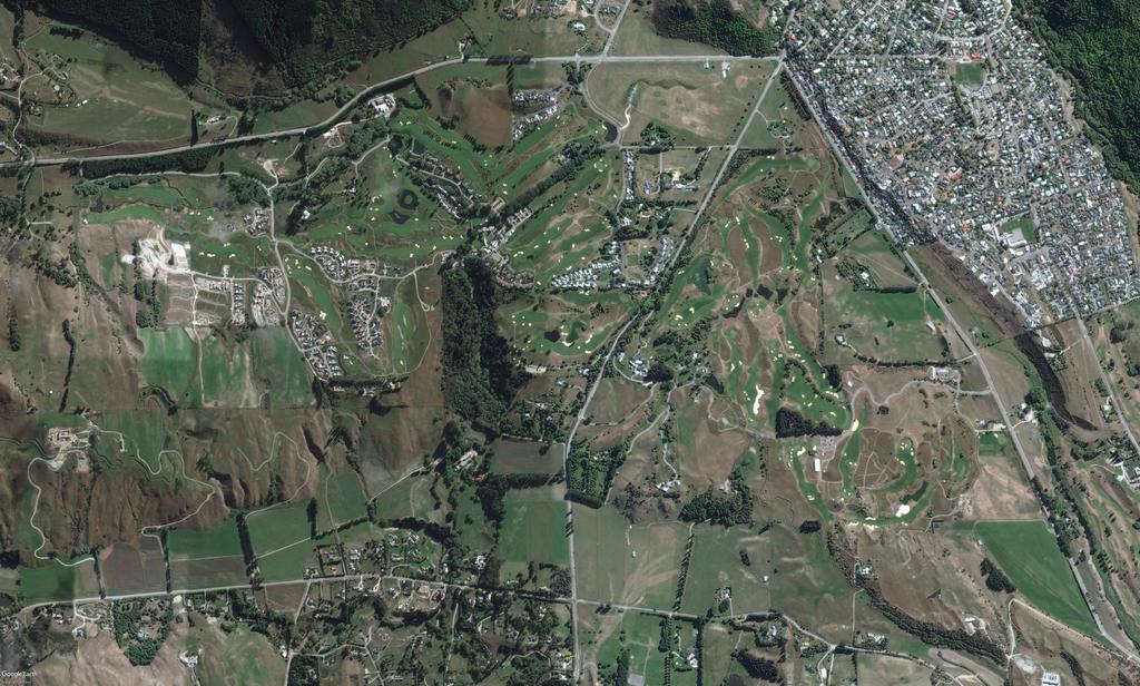
142
EVIDENCE OF CAREY VIVIAN (PLANNER) 13 JUNE 2018
 13 JUNE 2018") QUEENSTOWN-LAKES DISTRICT COUNCIL PROPOSED DISTRICT PLAN HEARING STREAM 14 IN THE MATTER of a hearing on submissions to the Proposed District Plan Stage 2 and Variation 1 pursuant to clause 8B of the First
QUEENSTOWN-LAKES DISTRICT COUNCIL PROPOSED DISTRICT PLAN HEARING STREAM 14 IN THE MATTER of a hearing on submissions to the Proposed District Plan Stage 2 and Variation 1 pursuant to clause 8B of the First
In the Environment Court of New Zealand Christchurch Registry ENV-2016-CHC- Appellants. Otago Regional Council. Respondent
 In the Environment Court of New Zealand Christchurch Registry ENV-2016-CHC- Under In the matter of Between the Resource Management Act 1991 (RMA) an appeal under Clause 14(1), First Schedule of the RMA
Chapter 3: Natural Environment. Proposed Waikato District Plan Stage 1. (Notified version)
") Chapter 3: Natural Environment Proposed Waikato District Plan Stage 1 Page 2 of 7 Contents Chapter 3: Natural Environment... 3 3.1 Indigenous Vegetation and Habitats... 3 3.1.1 Objective Biodiversity and
Chapter 3: Natural Environment Proposed Waikato District Plan Stage 1 Page 2 of 7 Contents Chapter 3: Natural Environment... 3 3.1 Indigenous Vegetation and Habitats... 3 3.1.1 Objective Biodiversity and
RURAL ZONE - POLICY. Rural Zone Policy. Issue: Rural Environment. Ruapehu District Plan Page 1 of 8
 Rural Zone Policy RU2 RURAL ZONE - POLICY RU2.1 Introduction The natural resources of the rural environment in the Ruapehu District provide the basis for the existing and potential character, intensity
STRATEGIC DIRECTION. QLDC PROPOSED DISTRICT PLAN [PART TWO] DECISIONS VERSION 3 strategic direction
![STRATEGIC DIRECTION. QLDC PROPOSED DISTRICT PLAN [PART TWO] DECISIONS VERSION 3 strategic direction](/thumbs/79/79711764.jpg "STRATEGIC DIRECTION. QLDC PROPOSED DISTRICT PLAN [PART TWO] DECISIONS VERSION 3 strategic direction") 3 STRATEGIC DIRECTION QLDC PROPOSED DISTRICT PLAN [PART TWO] DECISIONS VERSION 3 strategic direction QLDC DISTRICT PLAN [PART TWO] AUGUST 2015 3 strategic direction 3.1 Purpose This chapter sets out the
3 STRATEGIC DIRECTION QLDC PROPOSED DISTRICT PLAN [PART TWO] DECISIONS VERSION 3 strategic direction QLDC DISTRICT PLAN [PART TWO] AUGUST 2015 3 strategic direction 3.1 Purpose This chapter sets out the
I611. Swanson North Precinct
 I611. Swanson North Precinct I611.1. Precinct Description Swanson North is located in the north eastern foothills of the Waitakere Ranges. It is outside the Waitakere Ranges Heritage Area Act and the Waitakere
I Te Koti Taiao o Aotearoa Ōtautahi Rohe ENV-2018-CHC- Appellant. Queenstown Lakes District Council. Respondent
 In the Environment Court of New Zealand Christchurch Registry I Te Koti Taiao o Aotearoa Ōtautahi Rohe ENV-2018-CHC- Under In the matter of Between the Resource Management Act 1991 (RMA) An appeal under
SUSTAINABLE MANAGEMENT
 . Sustainable Management.1 The Concept of Sustainable Management The concept of sustainable management recognises there are limits to the use of natural and physical resources and there is a need to balance
Appendix A. Planning Processes. Introduction
 1 Planning Processes Introduction This appendix outlines a number of planning processes which are used in the Auckland Region to support the effective management of development in the region s rural and
Section 6A 6A Purpose of the Natural Features and Landscapes Provisions
 Section 6A 6A Purpose of the Natural Features and Landscapes Provisions This Chapter addresses the protection and management of natural features and landscapes within the City. The City has a number of
Urban Growth Boundaries
 Urban Growth Boundaries Discussion Document July 2008 Contents page Introduction... 3 What are urban growth boundaries?... 3 The need to manage growth... 3 Purpose of urban growth boundaries... 4 How will
H7 Open Space zones. (a) provide for the needs of the wider community as well as the needs of the community in which they are located;
 provide for the needs of the wider community as well as the needs of the community in which they are located;") H7. Open Space zones H7.1. Background The majority of land zoned as open space is vested in the Council or is owned by the Crown. However some areas zoned open space are privately owned. While the open
H7. Open Space zones H7.1. Background The majority of land zoned as open space is vested in the Council or is owned by the Crown. However some areas zoned open space are privately owned. While the open
LANDSCAPE GUIDELINES. Countryside & Coastal Countryside Environments. Landscape, Natural Character & Amenity Values Guide
 Landscape, Natural Character & Amenity Values Guide Copyright WDC 2009 Version A2 18May09 Environmental Services Group Publication Countryside & Coastal Countryside Environments START HERE Quality Land
GIBBSTON CHARACTER ZONE. QLDC PROPOSED DISTRICT PLAN [PART FOUR] AUGUST gibbston character zone
![GIBBSTON CHARACTER ZONE. QLDC PROPOSED DISTRICT PLAN [PART FOUR] AUGUST gibbston character zone](/thumbs/75/72573993.jpg "GIBBSTON CHARACTER ZONE. QLDC PROPOSED DISTRICT PLAN [PART FOUR] AUGUST gibbston character zone") 23 GIBBSTON CHARACTER ZONE QLDC PROPOSED DISTRICT PLAN [PART FOUR] AUGUST 2015 23 gibbston character zone QLDC PROPOSED DISTRICT PLAN [PART FOUR] AUGUST 2015 23 gibbston character zone 23.1 Zone Purpose
23 GIBBSTON CHARACTER ZONE QLDC PROPOSED DISTRICT PLAN [PART FOUR] AUGUST 2015 23 gibbston character zone QLDC PROPOSED DISTRICT PLAN [PART FOUR] AUGUST 2015 23 gibbston character zone 23.1 Zone Purpose
QUEENSTOWN LAKES DISTRICT COUNCIL
 QUEENSTOWN LAKES DISTRICT COUNCIL Hearing of Submissions on the Proposed District Plan Report 16.9 Report and Recommendations of Independent Commissioners Regarding Upper Clutha Planning Maps Lake McKay
CITY VIEW OBJECTIVES
 SECTION 2: CITY VIEW OBJECTIVES CONTENTS 2.1 Introduction 1 2.2 Strategic Direction 1 2.3 The City View Resource Management Issues for the City 1 2.4 The Goal 3 2.5 The City View Objectives 3 Palmerston
Plan Modification to Chapter B2 of the Auckland Unitary Plan(AUP) Operative in part (15 November 2016)
 Operative in part (15 November 2016)") UNITARY PLAN UPDATE REQUEST MEMORANDUM TO FROM Phill Reid Linley Wilkinson DATE 25 September 2018 SUBJECT Plan Modification to Chapter B2 of the Auckland Unitary Plan(AUP) Operative in part (15 November
UNITARY PLAN UPDATE REQUEST MEMORANDUM TO FROM Phill Reid Linley Wilkinson DATE 25 September 2018 SUBJECT Plan Modification to Chapter B2 of the Auckland Unitary Plan(AUP) Operative in part (15 November
Appendix 1 Structure plan guidelines
 Appendix 1 Structure plan guidelines This appendix forms part of the regional policy statement [rps]. 1.1. Introduction Structure plans are an important method for establishing the pattern of land use
Section 3b: Objectives and Policies Rural Environment Updated 19 November 2010
 Page 1 of Section 3b 3b RURAL ENVIRONMENT 3b.1 Introduction The Rural Environment comprises all the land outside of the Residential, Town Centre and Industrial Environments. Most land within the District
Tāhuhu whakaruruhau ā-taone The sheltering ridge pole
 B2. Tāhuhu whakaruruhau ā-taone - Urban growth and form B2.1. Issues Tāhuhu whakaruruhau ā-taone The sheltering ridge pole Auckland s growing population increases demand for housing, employment, business,
CA.1 Coastal Area. Index. CA.1.1 Description and Expectations
 Index.1.2.3.4 CA.2 CA.2.1 CA.2.2 CA.2.3 CA.3 CA.3.1 CA.3.2 CA.3.1 CA.4 CA.4.1 CA.4.2 CA.4.3 CA.4.4 CA.5 CA.5.1 CA.5.2 Description and Expectations Objectives Policies Guidance Note Landuse Eligibility
QUEENSTOWN LAKES DISTRICT COUNCIL
 QUEENSTOWN LAKES DISTRICT COUNCIL Hearing of Submissions on the Proposed District Plan Report 16.8 Report and Recommendations of Independent Commissioners Regarding Upper Clutha Planning Maps Church Road,
4 Residential and Urban Living Zones
 4 Residential and Urban Living Zones Refer to Chapters 11 to 20 for additional rules that may apply to these zones. 4.1 OBJECTIVES AND POLICIES Objective Res1 Policy 1 Policy 2 Policy 3 Policy 4 Policy
6 Landsc apes and rur al char ac
 LANDSCAPES AND RURAL CHARACTER QLDC PROPOSED DISTRICT PLAN [PART TWO] DECISION VERSION ter 6 Landsc apes and rur al char ac 6.1 Purpose Appendix C QLDC DISTRICT PLAN [PART TWO] DECISION VERSION 6 Landsc
Ensure that development within the Arrowtown Urban Growth Boundary provides:
 URBAN DEVELOPMENT 4 4.2.5.2 Ensure that development within the Arrowtown Urban Growth Boundary provides: an urban form that is sympathetic to the character of Arrowtown, including its scale, density, layout
SECTION ONE North East Industrial Zone Design Guide Palmerston North City Council June 2004
 SECTION ONE North East Industrial Zone Design Guide Palmerston North City Council June 2004 young heart easy living 1 Preface Industrial areas are a very important component of the economic well-being
Appendix A - Relief sought
 Appendix A - Relief sought Chapter 2 Definitions Definitions Tourism Activity (new) and Visitor Industry (new) The plan does not provide specific definition for tourism. The plan does introduce a new strategic
Planning Proposal Concurrent DA/LEP Amendment for Belmont North Pharmacy Amendment No. 24 to Lake Macquarie Local Environmental Plan (LMLEP) 2014
 2014") Planning Proposal Concurrent DA/LEP Amendment for Belmont North Pharmacy Amendment No. 24 to Lake Macquarie Local Environmental Plan (LMLEP) 2014 Local Government Area: Name of Draft LEP: Subject Land:
Planning Proposal Concurrent DA/LEP Amendment for Belmont North Pharmacy Amendment No. 24 to Lake Macquarie Local Environmental Plan (LMLEP) 2014 Local Government Area: Name of Draft LEP: Subject Land:
E15. Vegetation management and biodiversity
 E15. management and biodiversity E15.1. Background contributes to a range of ecosystem services such as erosion and sediment control, reducing stormwater flows, protecting or enhancing water quality, amenity
AND STATEMENT OF EVIDENCE OF JOHN LONINK ON BEHALF OF CHRISTCHURCH CITY COUNCIL SPECIFIC PURPOSE (GOLF RESORT) ZONE
 ZONE") Page 1 of 13 BEFORE THE CHRISTCHURCH REPLACEMENT DISTRICT PLAN INDEPENDENT HEARINGS PANEL IN THE MATTER of the Resource Management Act 1991 and the Canterbury Earthquake (Christchurch Replacement District
Page 1 of 13 BEFORE THE CHRISTCHURCH REPLACEMENT DISTRICT PLAN INDEPENDENT HEARINGS PANEL IN THE MATTER of the Resource Management Act 1991 and the Canterbury Earthquake (Christchurch Replacement District
I615. Westgate Precinct
 I615. Westgate Precinct I615.1. Precinct Description The Westgate Precinct is located approximately 18km west of the Auckland city centre. There are seven Sub-precincts in the Westgate Precinct: Sub-precinct
A Growing Community Rural Settlement Areas
 Town of Huntsville Official Plan Review - POLICY BACKGROUND PAPER A Growing Community Rural Settlement Areas BACKGROUND: In addition to the fully municipally-serviced Urban Settlement Area and the Hidden
AND MEMORANDUM OF COUNSEL FOR QUEENSTOWN LAKES DISTRICT COUNCIL REGARDING STRATEGIC TOPICS 23 JULY 2018
 BEFORE THE ENVIRONMENT COURT ENV-2018-CHC-000053 ENV-2018-CHC-000054 ENV-2018-CHC-000055 (continued over) IN THE MATTER of the Resource Management Act 1991 AND IN THE MATTER of appeals under clause 14
SECTION 7A: WHAKARONGO RESIDENTIAL AREA
 SECTION 7A: WHAKARONGO RESIDENTIAL AREA CONTENTS 7A.1 Introduction 1 7A.2 Resource Management Issues 1 7A.3 Objectives and Policies 1 7A.4 Methods 4 7A.5 Residential Zone 4 7A.5.1 Rules: Controlled Activities
RLE.1 Rural Living Environment
 Index.1 Description and Expectations.2 Objectives.3 Policies.4 Guidance RLE.2 Landuse RLE.2.1 Eligibility Rules RLE.2.2 Notification Rules RLE.2.3 Discretionary Activities RLE.3 Subdivision RLE.3.1 Eligibility
Rural (Urban Expansion) Environment
 Environment") RUEE.1 Rural (Urban Expansion) Environment Subsequent to the receipt of appeals, a 'marked up' version of the Proposed District Plan was prepared. The provisions of the Proposed Version of the Plan subject
RUEE.1 Rural (Urban Expansion) Environment Subsequent to the receipt of appeals, a 'marked up' version of the Proposed District Plan was prepared. The provisions of the Proposed Version of the Plan subject
1 INTRODUCTION TO NATURAL ENVIRONMENT
 Kāpiti Coast District Plan Review Section 32 Analysis Summary Report 1 INTRODUCTION TO NATURAL ENVIRONMENT Diverse landscapes, plants and animals make up the natural environment of the District. Much has
Plumpton Neighbourhood Development Plan Revised Pre Submission Document - Regulation 14 Consultation
 REPRESENTATIONS... Plumpton Parish Council Plumpton Neighbourhood Development Plan Revised Pre Submission Document - Regulation 14 Consultation Representations submitted on behalf of: Cala Homes (South
4 RESIDENTIAL ZONE. 4.1 Background
 4 RESIDENTIAL ZONE 4.1 Background The residential areas within the City are characterised by mainly lowrise dwellings sited on individual allotments. Past architectural styles, settlement patterns and
URBAN DEVELOPMENT QLDC PROPOSED DISTRICT PLAN [PART TWO] AUGUST 2015
![URBAN DEVELOPMENT QLDC PROPOSED DISTRICT PLAN [PART TWO] AUGUST 2015](/thumbs/80/81778199.jpg "URBAN DEVELOPMENT QLDC PROPOSED DISTRICT PLAN [PART TWO] AUGUST 2015") 4 URBAN VLOPMNT U R P QLC PROPO ITRICT PLAN [PART TWO] AUGUT 2015 4 ur b an de v elop ment QLC ITRICT PLAN [PART TWO] AUGUT 2015 4 urban development 4 2 4.1 Purpose The purpose of this Chapter is to set
4 URBAN VLOPMNT U R P QLC PROPO ITRICT PLAN [PART TWO] AUGUT 2015 4 ur b an de v elop ment QLC ITRICT PLAN [PART TWO] AUGUT 2015 4 urban development 4 2 4.1 Purpose The purpose of this Chapter is to set
2A District-wide Policies
 2A Introduction This Chapter contains policies which are relevant to subdivision, use and development activities occurring across all zones and areas of the District. The policies in this Chapter implement
Proposed Plan Change 55: District Wide Rules. Hearing Report
 Proposed Plan Change 55: District Wide Rules Hearing Report Appendix 5 BEFORE THE HEARINGS PANEL In the Matter of: The Resource Management Act 1991 And Proposed Plan Change 55: Chapter 3 District Wide
Section 12C Subdivision in the Rural Residential Zone
 Section 12C 12C Subdivision in the Rural Residential Zone The Rural Residential Zone provides part of the range of residential opportunities within the City. Land zoned rural residential is considered
Hearing Topic: 058 Public Open Space. Primary Evidence: from Andrea Broughton
 Submitter: Andrea & Alex Broughton Submission Number: 5650-1 Hearing Topic: 058 Public Open Space Primary Evidence: from Andrea Broughton Date: 10 June 2015 1. Introduction My name is Andrea Broughton
Section 32 Evaluation Report Variation 1 - Arrowtown Design Guidelines, 2016 Contents
 Section 32 Evaluation Report Variation 1 - Arrowtown Design Guidelines, 2016 Contents Section 32 Evaluation Report: Variation 1 - Arrowtown Design Guidelines, 2016 (ADG, 2016)... 3 1. Strategic Context...
BEFORE THE HEARINGS PANEL FOR THE QUEENSTOWN LAKES PROPOSED DISTRICT PLAN AND
 BEFORE THE HEARINGS PANEL FOR THE QUEENSTOWN LAKES PROPOSED DISTRICT PLAN IN THE MATTER of the Resource Management Act 1991 AND IN THE MATTER of Hearing Stream 12 Upper Clutha Annotations and Rezoning
Proposed Southland District Plan 2012 Appeal Version October 2016
 S e c t i o n 3. 5 - F i o r d l a n d / R a k i u r a Z o n e The Fiordland/Rakiura Zone encompasses the Fiordland and Rakiura National Parks and part of Mt Aspiring National Park. It also includes areas
I602. Birdwood Precinct
 I602. Birdwood Precinct I602.1. Precinct description The Birdwood Precinct applies to an area west of Don Buck Road and south of Red Hills Road in west Auckland. It incorporates subdivision and development
Neighbourhood Planning Local Green Spaces
 Neighbourhood Planning Local Green Spaces Introduction... 2 1. Why green space is important... 4 2. Neighbourhood plans and green space... 6 3. Evidence... 8 Statutory designations... 9 Green space audit...
Planning Proposal Toronto Road, Booragul. Amendment to Lake Macquarie Local Environmental Plan (LMLEP) 2014
 2014") Planning Proposal Toronto Road, Booragul Amendment to Lake Macquarie Local Environmental Plan (LMLEP) 2014 Local Government Area: Name of Draft LEP: Subject Land: Land Owner: Applicant: Folder Number:
Planning Proposal Toronto Road, Booragul Amendment to Lake Macquarie Local Environmental Plan (LMLEP) 2014 Local Government Area: Name of Draft LEP: Subject Land: Land Owner: Applicant: Folder Number:
QLDC PROPOSED DISTRICT PLAN [PART FOUR] NOVEMBER WAKATIPU BASIN WAKATIPU BASIN
![QLDC PROPOSED DISTRICT PLAN [PART FOUR] NOVEMBER WAKATIPU BASIN WAKATIPU BASIN](/thumbs/82/85315845.jpg "QLDC PROPOSED DISTRICT PLAN [PART FOUR] NOVEMBER WAKATIPU BASIN WAKATIPU BASIN") QLDC PROPOSED DISTRICT PLAN [PART FOUR] NOVEMBER 2017 24 WAKATIPU BASIN 24 WAKATIPU BASIN QLDC PROPOSED DISTRICT PLAN [PART FOUR] NOVEMBER 2017 24 WAKATIPU BASIN 24.1 Zone Purpose This chapter applies
QLDC PROPOSED DISTRICT PLAN [PART FOUR] NOVEMBER 2017 24 WAKATIPU BASIN 24 WAKATIPU BASIN QLDC PROPOSED DISTRICT PLAN [PART FOUR] NOVEMBER 2017 24 WAKATIPU BASIN 24.1 Zone Purpose This chapter applies
BEFORE THE HEARINGS PANEL FOR THE QUEENSTOWN LAKES PROPOSED DISTRICT PLAN AND
 BEFORE THE HEARINGS PANEL FOR THE QUEENSTOWN LAKES PROPOSED DISTRICT PLAN IN THE MATTER of the Resource Management Act 1991 AND IN THE MATTER of District Wide Hearing Stream 15 Open Space and REBUTTAL
Rural (Urban Expansion) Environment
 Environment") RUEE.1 Rural (Urban Expansion) Environment Index RUEE.1 RUEE.1.1 RUEE.1.2 RUEE.1.3 RUEE.1.4 RUEE.2 RUEE.2.1 RUEE.2.2 RUEE.2.3 RUEE.2.4 RUEE.3 Rural (Urban Expansion) Environment Description and Expectations
RUEE.1 Rural (Urban Expansion) Environment Index RUEE.1 RUEE.1.1 RUEE.1.2 RUEE.1.3 RUEE.1.4 RUEE.2 RUEE.2.1 RUEE.2.2 RUEE.2.3 RUEE.2.4 RUEE.3 Rural (Urban Expansion) Environment Description and Expectations
QUEENSTOWN LAKES DISTRICT COUNCIL Hearing of Submissions on the Proposed District Plan
 QUEENSTOWN LAKES DISTRICT COUNCIL Hearing of Submissions on the Proposed District Plan Report 16.4 Report and Recommendations of Independent Commissioners Regarding Upper Clutha Planning Maps Glen Dene
REMARKABLES PARK ZONE
 .10 Remarkables Park Zone.10.1 Resources, Activities and Values The Remarkables Park Area comprises approximately 150 hectares of perimeter urban land in the vicinity of Frankton and occupies a strategic
PART 5 - NATURAL AND PHYSICAL ENVIRONMENT
 CONTENTS...PAGE 5.1 INTRODUCTION...3 5.2 NATURAL RESOURCES...4 5.3 PHYSICAL RESOURCES...4 5.4 COASTAL ENVIRONMENT...4 5.5 HERITAGE FEATURES...4 5.6 HAZARDS...4 5.7 SUMMARY...4 ISTHMUS SECTION - OPERATIVE
ROCHFORD LOCAL DEVELOPMENT FRAMEWORK: Sustainability Appraisal/ Strategic Environmental Assessment. Rochford Core Strategy Preferred Options Document
 ROCHFORD LOCAL DEVELOPMENT FRAMEWORK: Sustainability Appraisal/ Strategic Environmental Assessment Non Technical Summary Rochford Core Strategy Preferred Options Document October 2008 SUSTAINABILITY APPRAISAL
64 Mineral Extraction Area Rules
 64 Mineral Extraction Area Rules 64.1 Introduction For the purposes of this Chapter: Active Area, in relation to a Mineral Extraction Area (MEA), is that part of the Mineral Extraction Area which is owned
PUBLIC NOTICE UNDER CLAUSE 5 OF SCHEDULE 1 OF THE RESOURCE MANAGEMENT ACT 1991 PLAN CHANGE 12 TO THE OPERATIVE CITY OF NAPIER DISTRICT PLAN
 PUBLIC NOTICE UNDER CLAUSE 5 OF SCHEDULE 1 OF THE RESOURCE MANAGEMENT ACT 1991 PLAN CHANGE 12 TO THE OPERATIVE CITY OF NAPIER DISTRICT PLAN Public notice is given in accordance with Clause 5 of Schedule
Section 32 Evaluation Report Urban Development Contents
 Section 32 Evaluation Report Urban Development Contents Section 32 Evaluation Report: Urban Development... 2 1. Introduction... 2 2. Statutory Policy context... 2 3. Non statutory policy context... 8 4.
SECTION 2.4 URBAN DEVELOPMENT AND STRATEGIC URBAN DIRECTIONS
 SECTION 2.4 URBAN DEVELOPMENT AND STRATEGIC URBAN DIRECTIONS 2.4.1 INTRODUCTION In 1993/94 the Hastings District Council completed the Hastings Urban Development Strategy. The purpose of this study was:
I539. Smales 2 Precinct
 I539. Smales 2 Precinct I539.1. Precinct Description The Smales 2 Precinct applies to a 4.8 hectare block of land located on the southern side of Northcote Road and fronting Lake Pupuke, Takapuna. The
Ms Ferguson, evidence in chief, Appendix 4 Memorandum for Cashmere / Worsley's Spur Significant Landscape
 Page 1 Ms Ferguson, evidence in chief, Appendix 4 Memorandum for Cashmere / Worsley's Spur Significant Landscape Page 2 BEFORE THE CHRISTCHURCH REPLACEMENT DISTRICT PLAN INDEPENDENT HEARINGS PANEL In the
15 Rural Residential Zone
 15 Rural Residential Zone Section 15A 15A Purpose of the Rural Residential Zone... 1 15A.1 Objectives and Policies of the Rural Residential Zone... 1 15A.2 Activity Status Rules... 5 15A.3 Permitted Activity
Stock-Taking on Integrated Coastal Zone Management (ICZM) in the Black Sea IMPLEMENTATION AUDIT QUESTIONNAIRE 2010
 in the Black Sea IMPLEMENTATION AUDIT QUESTIONNAIRE 2010") Stock-Taking on Integrated Coastal Zone Management (ICZM) in the Black Sea IMPLEMENTATION AUDIT QUESTIONNAIRE 2010 PURPOSE The purposes of this questionnaire are: (a) to perform the policy, legal and institutional
Stock-Taking on Integrated Coastal Zone Management (ICZM) in the Black Sea IMPLEMENTATION AUDIT QUESTIONNAIRE 2010 PURPOSE The purposes of this questionnaire are: (a) to perform the policy, legal and institutional
BETTER URBAN PLANNING
 BETTER URBAN PLANNING SUBMISSION TO THE PRODUCTIVITY COMMISSION 3 OCTOBER 2016 BACKGROUND TO IPENZ The Institution of Professional Engineers New Zealand (IPENZ) is the lead national professional body representing
The WAPC publications summarised in this report are (in order of policy importance):
:") Summary of WAPC Publications Relevant to Local Biodiversity Planning As part of the delivery of the land use planning component of the Western Australian Natural Resource Management (NRM) program in 2011/12,
Summary of WAPC Publications Relevant to Local Biodiversity Planning As part of the delivery of the land use planning component of the Western Australian Natural Resource Management (NRM) program in 2011/12,
Planning Proposal Wangi Power Station Complex Administrative Amendment Lake Macquarie Local Environmental Plan 2014
 Planning Proposal Wangi Power Station Complex Administrative Amendment Lake Macquarie Local Environmental Plan 2014 (Post Exhibition Version) Local Government Area: Name of Draft LEP: Subject Land: Land
Rochford District Council Allocations Development Plan Document: Discussion and Consultation Document Sustainability Appraisal
 Option SWH1 Balanced Communities Option SWH1 1 To ensure the delivery of high quality sustainable communities where people want to live and work Will it ensure the phasing of infrastructure, including
D10. Outstanding Natural Features Overlay and Outstanding Natural Landscapes Overlay
 D10. Outstanding Natural Features Overlay and Outstanding Natural Landscapes Overlay D10.1. Background These provisions give effect to Policy 15(a) of the New Zealand Coastal Policy Statement 2010, and
I511. Hatfields Precinct
 I511. Hatfields Precinct I511.1. Precinct Description The Hatfields Precinct is a contiguous 183.8 hectare block of rural land held in 8 freehold titles, located immediately to the north of Hatfields Beach.
QLDC PROPOSED DISTRICT PLAN [PART FIVE] AUGUST 2015 SUBDIVISION & DEVELOPMENT
![QLDC PROPOSED DISTRICT PLAN [PART FIVE] AUGUST 2015 SUBDIVISION & DEVELOPMENT](/thumbs/96/128451269.jpg "QLDC PROPOSED DISTRICT PLAN [PART FIVE] AUGUST 2015 SUBDIVISION & DEVELOPMENT") 27 QLDC PROPOSED DISTRICT PLAN [PART FIVE] AUGUST 2015 27 S ub division & D evelopment SUBDIVISION & DEVELOPMENT 27.1 Purpose Subdivision and the resultant development enables the creation of new housing
27 QLDC PROPOSED DISTRICT PLAN [PART FIVE] AUGUST 2015 27 S ub division & D evelopment SUBDIVISION & DEVELOPMENT 27.1 Purpose Subdivision and the resultant development enables the creation of new housing
QUEENSTOWN LAKES DISTRICT COUNCIL SUBDIVISION DESIGN GUIDELINES
 Attachment C: Draft QLDC Subdivision Design Guidelines QUEENSTOWN LAKES DISTRICT COUNCIL DESIGN GUIDELINES A DESIGN GUIDE FOR AND DEVELOPMENT IN THE URBAN ZONES QUEENSTOWN OFFICE 10 Gorge Road Queenstown
Lake Macquarie City. A copy of the published amendment including the instrument and maps, is provided in Attachment 7 of this report.
 Planning Proposal Amendment No. 77 to Lake Macquarie Local Environmental Plan 2004 and proposed Amendment to Draft Lake Macquarie Local Environmental Plan 2013 Minor Zone Boundary Adjustment - Pasminco
Guidance Notes Completing an AEE
 Guidance Notes Completing an AEE The purpose of this guidance note is to assist you with completing your Assessment of Environmental Effects (AEE) for your land-use consent application. If you do not provide
DECISION OF THE QUEENSTOWN LAKES DISTRICT COUNCIL RESOURCE MANAGEMENT ACT 1991
 DECISION OF THE QUEENSTOWN LAKES DISTRICT COUNCIL RESOURCE MANAGEMENT ACT 1991 Applicant: RM reference: Location: Proposal: Flax Trust (Mr F van Brandenburg) RM150185 Birchwood Road Wakatipu Basin Application
B4. Te tiaki taonga tuku iho - Natural heritage
 B4. Te tiaki taonga tuku iho - Natural heritage Tuia I runga, tuia i raro, tuia ki te waonui a Tiriwa Bind the life forces of heaven and earth to the great realm of Tiriwa B4.1. Issues Auckland s distinctive
D10. Outstanding Natural Features Overlay and Outstanding Natural Landscapes Overlay
 D10. Outstanding Natural Features Overlay and Outstanding Natural Landscapes Overlay D10.1. Background These provisions give effect to Policy 15(a) of the New Zealand Coastal Policy Statement 2010, and
I609. Penihana North Precinct
 I609. Penihana North Precinct I609.1. Precinct description The Penihana North Precinct is located south of the Swanson Railway Station, adjacent to the Rural Urban Boundary (RUB) and Waitakere Ranges Heritage
Assessing the impact of smallscale wind energy proposals on the natural heritage
 Scottish Natural Heritage Assessing the impact of smallscale wind energy proposals on the natural heritage Guidance March 2016 Version 3 1 Contents 1. Introduction. 3 2. Encouraging a spatial approach
About 10% of the Borough's population lives in the seven rural parishes. Population figures from the 1991 census are given below:-
 8. THE DISTRICT VILLAGES 8.1 Population About 10% of the Borough's population lives in the seven rural parishes. Population figures from the 1991 census are given below:- Village No. of Persons Cottingham
THREE PARKS ZONE Three Parks Special Zone The process of applying for resource consents in the zone.
 .25 Three Parks Special Zone The purpose of this zone is to provide for growth and to give effect to the Wanaka 2020 Community (2002) and the more recent Wanaka Structure (2007) and Wanaka Transport Strategy
AMENDMENT NO. 30 TO THE OFFICIAL PLAN OF THE TOWN OF MILTON
 AMENDMENT NO. 30 TO THE OFFICIAL PLAN OF THE TOWN OF MILTON Subject: Boyne Survey Secondary Plan and Related Official Plan Amendments The following text and schedules constitute Amendment No. 30 to the
11.3 SPECIAL CHARACTER ZONE HAWKE S BAY REGIONAL SPORTS PARK
 11.3 SPECIAL CHARACTER ZONE HAWKE S BAY REGIONAL SPORTS PARK 11.3.1 INTRODUCTION The availability of sports and recreation activities and facilities is important for the maintenance and enhancement of
BEFORE THE HEARINGS PANEL FOR THE QUEENSTOWN LAKES PROPOSED DISTRICT PLAN AND
 BEFORE THE HEARINGS PANEL FOR THE QUEENSTOWN LAKES PROPOSED DISTRICT PLAN IN THE MATTER of the Resource Management Act 1991 AND IN THE MATTER of District Wide Hearing Stream 15 - Open Space and Recreation
Appropriate Assessment in relation to County Donegal Draft Heritage Plan
 Appendix 12 - Consultation Response a) Sinead Harkin Central Planning Unit Donegal County Council County House Lifford County Donegal Dear Ms Harkin, Appropriate Assessment in relation to County Donegal
Strategic Environmental Assessment Screening Report. Dublin Port Masterplan Review 2017
 Strategic Environmental Assessment Screening Report Dublin Port Masterplan Review 2017 Table of Contents 1 Introduction... 1 2 Purpose of the Masterplan... 2 3 Task 1.1 Pre-Screening Check... 5 4 Task
TOWN OF BRUDERHEIM Report to the capital region board
 TOWN OF BRUDERHEIM Report to the capital region board Introduction to the Town of Bruderheim Municipal Development Plan amendment and Relation to the CRB Evaluation Criteria 02 march 2017 1 Introduction
Section 32 report: Natural heritage for the Proposed Natural Resources Plan for the Wellington Region
 Section 32 report: Natural heritage for the Proposed Natural Resources Plan for the Wellington Region Issues and Evaluation Report Section 32 report: Natural heritage for the Proposed Natural Resources
12 Subdivision, Services and Infrastructure
 12 Subdivision, Services and Infrastructure Section 12A 12A Purpose of Subdivision Provisions... 1 12A.1 General Subdivision Objectives and Policies... 2 12A.2 Activity Status Rules... 4 12A.3 General
PRIVATE PLAN CHANGE REQUEST REZONING OF LAND AT 49, 57 AND 71 MILL ROAD FROM RURAL 3 ZONE TO MAIN RESIDENTIAL ZONE. Amendments to:
 PRIVATE PLAN CHANGE REQUEST REZONING OF LAND AT 49, 57 AND 71 MILL ROAD FROM RURAL 3 ZONE TO MAIN RESIDENTIAL ZONE Amendments to: MANUKAU OPERATIVE DISTRICT PLAN 2002 AUCKLAND REGIONAL POLICY STATEMENT
NEW ZEALAND COASTAL POLICY STATEMENT
 NEW ZEALAND COASTAL POLICY STATEMENT 1994 This New Zealand Coastal Policy Statement 1994 was issued by notice in the Gazette on 5 May 1994. PREFACE The Resource Management Act 1991 established a new coastal
I542. Te Arai South Precinct
 I542. Te Arai South Precinct I542.1. Precinct Description The Te Arai South Precinct contains approximately 750ha of coastal land south of Te Arai Point, known as Mangawhai South Forest. The land within
Interim Advice Note 76 / 06 ASSESSMENT PART 1 AIMS AND OBJECTIVES OF ENVIRONMENTAL ASSESSMENT. Contents
 Interim Advice Note 76 / 06 VOLUME 11 SECTION 1: ENVIRONMENTAL ASSESSMENT INTRODUCTION PART 1 AIMS AND OBJECTIVES OF ENVIRONMENTAL ASSESSMENT Contents 1. Introduction and Application 2. Aims and Objectives
Proposed Kapiti Coast District Plan
 5 This Chapter primarily implements Objectives 2.1 Tāngata Whenua, 2.3 Development Management, 2.11 Character and Amenity Values, and 2.12 Housing Choice and Affordability as set out in Chapter 2. The
Call for Artists for: Design and Construction of Environmental Art Activation Story Mill Community Park, Bozeman, MT
 Call for Artists for: Design and Construction of Environmental Art Activation Story Mill Community Park, Bozeman, MT Seeking artists to design, fabricate and install art elements in the nature sanctuary
PLANNING COMMITTEE DATE: 07/09/2015 REPORT OF THE SENIOR MANAGER PLANNING AND ENVIRONMENT SERVICE CAERNARFON. Number: 4
 Number: 4 Application Number: C15/0034/37/LL Date Registered: 21/05/2015 Application Type: Full - Planning Community: Llanaelhaearn Ward: Llanaelhaearn Proposal: Location: Summary of the Recommendation:
WELLINGTON CITY DISTRICT PLAN
 Section 32 Report WELLINGTON CITY DISTRICT PLAN PROPOSED DISTRICT PLAN CHANGE 54 REZONING 178 AND 180 OWHIRO BAY PARADE 1 Introduction Before a Proposed District Plan change is publicly notified the Council
List of Policies. SESPlan. None applicable. Consolidated Scottish Borders Local Plan 2011: POLICY G1 - QUALITY STANDARDS FOR NEW DEVELOPMENT
 List of Policies Local Review Reference: 15/00021/RREF Planning Application Reference: 15/00616/FUL Development Proposal: Installation of 16no solar photovoltaic (PV) panels to roof Location: Raebank,
Ipswich Issues and Options for the Ipswich Local Plan Review, August 2017, Public Consultation
 Ipswich Issues and Options for the Ipswich Local Plan Review, August 2017, Public Consultation Having reviewed the issues and options documents, the Society has made the following response: Part 1 Strategic