Tonight s Agenda. Summary Presentation Open House. Group Discussion Next Steps: online community wide survey
|
|
|
- Lucas Houston
- 5 years ago
- Views:
Transcription
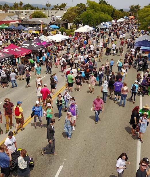
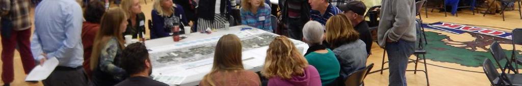
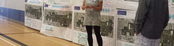
1 Community Open House February 22, 2018
2 Tonight s Agenda Summary Presentation Open House Station 1: Project Overview and Community Input Station 2: Draft Vision and Guiding Principles Station 3: Western, Middle and Eastern Portions Station 4: Building Setbacks and Stepbacks Station 5: Parking Group Discussion Next Steps: online community wide survey


3


4 Study Area
5 Community Comments

6 Community Comments and Ideas
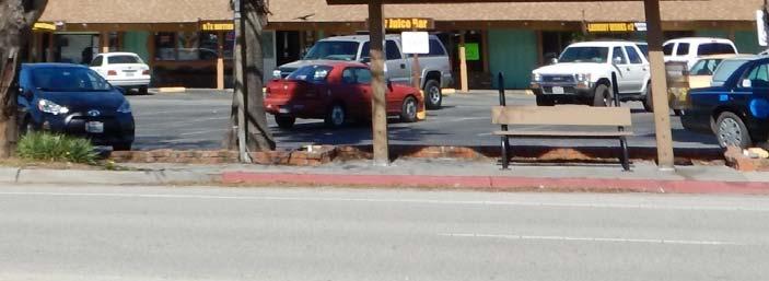
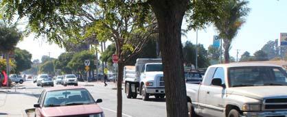
7 General Points of Agreement Portola Drive 1. Improve mobility and safety for pedestrians, bicyclists and motorists along Portola Drive 2. Add more on street parking to support businesses and reduce impacts to the Avenues 3. Add more visible and safer pedestrian crosswalks
8 General Points of Agreement Building and Site Design 1. Require quality architecture 2. Discourage hotels from locating in the Study Area 3. Ensure new buildings have articulated frontages and varying setback/stepbacks to maintain the character of the corridor
9 Tonight s Agenda Summary Presentation Open House Station 1: Project Overview and Community Input Station 2: Draft Vision and Guiding Principles Station 3: Western, Middle and Eastern Portions Station 4: Building Setbacks and Stepbacks Station 5: Parking Group Discussion Next Steps: online community wide survey
10 Open House Station Summary
11 Open House Stations
12 STATION 1 Project Overview and Community Input

, including Traffic Study Release Draft Environmental Impact Report (EIR) Conduct Community Meetings Respond to Comments, Prepare the Final EIR and hold public hearings with the Planning")
13 Overall Schedule Summer 2017 Fall 2017 Winter 2018 Spring 2018 Summer 2018 Fall 2018 thru Spring 2019 Summer 2019 Fall 2019 Winter 2020 Spring 2020 Pleasure Point Commercial Corridor Project Focus Groups & Community Workshop #1 Community Workshop #2 & Existing Conditions Summary Focus Groups & Community Open House Pleasure Point Vision and Guiding Design Principles Evaluation and Adoption of Program Elements Pleasure Point Element Accepted into the Sustainability General Plan & Regulatory Updates Begin to Analyze Potential Environ. Impacts (EIR), including Traffic Study Release Draft Environmental Impact Report (EIR) Conduct Community Meetings Respond to Comments, Prepare the Final EIR and hold public hearings with the Planning Commission and Board of Supervisors Coastal Commission consideration and Final Adoption Begin to seek grants and funding


14 Community Workshops #1 and #2
15 Project Goals 1. Create a Vision for the Pleasure Point Commercial and Mixed Use Corridor 2. Develop Guiding Design Principles for Future Commercial and Mixed Use Projects that Reflect the Vision 3. Identify Ways to Enhance the Portola Drive Streetscape
16 STATION 2 Draft Vision and Guiding Principles
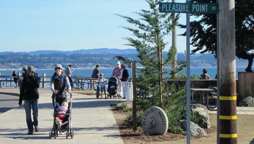
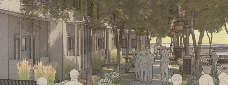
17 Draft Vision Statement A vibrant and eclectic place where people shop, dine, live, relax, and interact. Where people can walk along wide and active sidewalks, ride bikes and skateboards on safe and comfortable bicycle lanes, drive cars and access transit on streets designed for all modes of transportation. A place characterized by buildings with varied architectural styles and sizes, compatible with local character, and interesting open spaces. Where parking is convenient, but does not dominate the area. An active, locally focused social and commercial center where the neighborhoods on the north and south sides of Portola Drive meet.
18 Vision Framework Western Portion 26 th Ave to 35 th Ave Middle Portion 35 th Ave to 38 th Ave Eastern Portion 38 th Ave to 41 st Ave


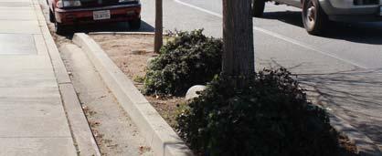
19 Overarching Streetscape Design Principles Repurpose the Portola Drive right of way to calm traffic, improve circulation and safety for all users, and increase parking opportunities. Enhance the eclectic Pleasure Point character with streetscape design and landscaping that responds to the specific conditions of each block. Improve pedestrian connectivity and safety through wider and more protected sidewalks, more frequent and better marked crosswalks, better visibility of cars when crossing the street, and better site design.


20 Overarching Streetscape Design Principles Enhance bicycle safety and connectivity through wider and safer bicycle lanes, contiguous green painted bicycle facilities, and new crosswalks with push button signals at key intersections Address circulation conflicts to improve site access, enhance safety and reduce delivery truck conflicts.

21 Overarching Site/Building Design Principles Support economic vitality by encouraging a mix of uses that complement the surrounding neighborhoods, while discouraging new hotels. Require quality architecture and materials that support the eclectic character of Pleasure Point. Encourage green open spaces to be incorporated into the site design of new projects to improve aesthetics, increase pedestrian activity and promote sustainability.


22 Overarching Site/Building Design Principles Maximize on street parking opportunities along Portola Drive to increase parking supply for commercial uses and minimize neighborhood impacts. Improve parking to support the commercial district and minimize impacts to surrounding neighborhoods. Encourage private parking to be located at the rear of parcels so it is not fronting Portola Drive.


23 Overarching Site/Building Design Principles Minimize the appearance of height by locating taller portions of buildings in the center of parcels and requiring articulated frontages. Encourage buildings no taller than 35 feet on the south side of Portola Drive between 38 th Avenue and 30 th Avenue. Establish design principles to address edge conditions and minimize the appearance of height through setbacks, upper story stepbacks and articulated frontages.
24 STATION 3 Western Portion 26 th Avenue to 35 th Avenue


25 Western Portion Private Realm Guidelines Western Portion 26 th Ave to 35 th Ave Middle Portion 35 th Ave to 38 th Ave Eastern Portion 38 th Ave to 41 st Ave
26 Western Portion Private Realm Guidelines Vision: A residential mixed use area with some smaller scale commercial uses. Encourages ground floor residential in order to strengthen the existing residential character of the area.
27 Western Portion Public Realm Guidelines Existing Street Condition South North
28 Western Portion Public Realm Guidelines Potential Near Term Changes South North
29 Western Portion Public Realm Guidelines Potential Long Term Changes #1 South North
30 Western Portion Public Realm Guidelines Potential Long Term Changes #2 South North
31 STATION 3 Middle Portion 35th Avenue to 38th Avenue


32 Western Portion Private Realm Guidelines Western Portion 26 th Ave to 35 th Ave Middle Portion 35 th Ave to 38 th Ave Eastern Portion 38 th Ave to 41 st Ave


33 Middle Portion Private Realm Guidelines Vision: A commercial mixed use area that builds on existing local and regional stores, shops, restaurants and other destinations.
34 Western Portion Public Realm Guidelines Existing Street Condition South North
35 Western Portion Public Realm Guidelines Potential Near Term Changes South North
36 Western Portion Public Realm Guidelines Potential Long Term Changes #1 South North
37 Western Portion Public Realm Guidelines Potential Long Term Changes #2 South North
38 STATION 3 Eastern Portion 38th Avenue to 41st Avenue


39 Western Portion Private Realm Guidelines Western Portion 26 th Ave to 35 th Ave Middle Portion 35 th Ave to 38 th Ave Eastern Portion 38 th Ave to 41 st Ave
40 Eastern Portion Private Realm Guidelines Vision: A commercial mixed use area that builds on the existing mix of retail, restaurant and other commercial uses.
41 Western Portion Public Realm Guidelines Existing Street Condition South North
42 Western Portion Public Realm Guidelines Potential Near Term Changes South North
43 Western Portion Public Realm Guidelines Potential Long Term Changes #1 South North
44 Western Portion Public Realm Guidelines Potential Long Term Changes #2 South North
45 STATION 4 Building Setbacks and Stepbacks


46 Front Setbacks and Sidewalks


47 Upper Floor Setback and Rear Setbacks 10 foot upper floor stepback 30 foot rear setback
48 STATION 5 Parking


49 Parking Standards 1. Existing parking requirements for retail, commercial and mixed use projects will remain unchanged. 2. Allow tandem parking for up to three vehicles in open and covered situations for residential units, such as townhomes. 3. Allow stacked parking for residential uses.
50 Open House
51 Open House Process 1. Station Content Handout 2. Comment Cards All materials will also be online tomorrow with an interactive survey and comment feature
52 Group Discussion
53 ABOUT YOU

54 How long have you lived or worked in the Pleasure Point neighborhood? A. 0 5 years B years C years D. 25+ years ABOUT YOU

55 Which age category describes you best? A years old B years old C years old D. 65+ years old ABOUT YOU
56 ACTIVATED SIDEWALKS


57 ACTIVATED SIDEWALKS Do you like this concept for Pleasure Point? A. I really like it B. It s worth considering C. I don t like it D. I m not sure
58 PARKING IN THE REAR


59 Do you like this concept for Pleasure Point? A. I really like it B. It s worth considering C. I don t like it D. I m not sure PARKING IN THE REAR
60 REPURPOSING PORTOLA DRIVE TO THREE LANES


61 Do you like this concept for Pleasure Point? A. I really like it B. It s worth considering C. I don t like it D. I m not sure REPURPOSING PORTOLA DRIVE TO THREE LANES
62 ADDING MORE ON STREET PARKING


63 Do you like this concept for Pleasure Point? A. I really like it B. It s worth considering C. I don t like it D. I m not sure ADDING MORE ON STREET PARKING
64 CONDUCT A PILOT PROGRAM TO TEST STREET CONCEPTS


65 Do you like this concept for Pleasure Point? A. I really like it B. It s worth considering C. I don t like it D. I m not sure CONDUCT A PILOT PROGRAM TO TEST STREET CONCEPTS
66 UPPER FLOOR STEPBACKS 10 foot upper floor stepback


67 Do you like this concept for Pleasure Point? 10 foot upper floor stepback A. I really like it B. It s worth considering C. I don t like it D. I m not sure UPPER FLOOR STEPBACKS
68 1. Existing parking requirements for retail, commercial and mixed use projects will remain unchanged. 2. Allow tandem parking for up to three vehicles in open and covered situations for residential units, such as townhomes. 3. Allow stacked parking for residential uses. PARKING STANDARDS
69 1. Encourage buildings no taller than 35 feet on the south side of Portola Drive between 38th Avenue and 30th Avenue 2. Elsewhere along corridor, existing height limits would apply with design principles established to address edge conditions and minimize the appearance of height through setbacks, upper story stepbacks and articulated frontages. BUILDING HEIGHTS
70 Next Steps
71 Next Steps Prepare full Draft Pleasure Point Commercial Corridor Vision and Guiding Design Concepts (March 2018) Incorporate this work into the Sustainable General Plan/LCP process (2018 early 2020)
72 Visit the Project Webpage Click the Pleasure Point Commercial Corridor button to access project documents, meeting information and community input summaries Comments/Questions to Staff Annie Murphy, Santa Cruz County Planning Department
73 Community Open House February 22, 2018
VISION AND GUIDING DESIGN PRINCIPLES
 pleasure point commercial corridor VISION AND GUIDING DESIGN PRINCIPLES Public Draft November 26, 2018 County of Santa Cruz with assistance from MIG CONTENTS PART I: INTRODUCTION AND VISION... 3 Community
Town Center (part of the Comprehensive Plan)
") Town Center (part of the Comprehensive Plan) Mercer Island Town Center Looking North (2014) In 1994, a year-long process culminated in a set of design guidelines and code requirements for the Town Center
Town Center (part of the Comprehensive Plan) Mercer Island Town Center Looking North (2014) In 1994, a year-long process culminated in a set of design guidelines and code requirements for the Town Center
PINE CURVE REZONING. BACKGROUND Purchased as two parcels in 2001 and 2002
 BACKGROUND Purchased as two parcels in 2001 and 2002 WHAT THE PROJECT IS AND IS NOT A Rezoning establishes the land use standards for Annexed and Zoned Greater Downtown District Historic Center September
Old Town Neighborhoods Plan. Choices Event Wednesday, December 9, 2015
 Old Town Neighborhoods Plan Choices Event Wednesday, December 9, 2015 Agenda 6:00 6:10 p.m. Welcome + Sign In 6:10 6:30 p.m. Presentation 6:30 8:00 p.m. Workshop + Open House Seeking your input on: Neighborhood
 Community Workshop #2 December 4, 2014 Team Tonight s Agenda 6:00 pm Welcome! 6:05 pm The Future of Downtown Tustin Ideas, Strategies and Recommendations 6:35 pm Questions and Comments 6:50 pm Open
Community Workshop November 19, 2014
 Community Workshop November 19, 2014 Agenda Welcome and Introduction What is a General Plan? About the General Plan Update Our General Plan Topics to be included in the Update Update process Opportunities
NORTH LAKE SPECIFIC PLAN AREA
 NORTH LAKE SPECIFIC PLAN AREA June 21, 2018 WELCOME Workshop Agenda Introduction Provide information about the program and introduce the team Background Information Share information about the North Lake
PINE CURVE REZONING. Property does not meet criteria for open space preservation and is not a candidate for a park
 PINE CURVE REZONING BACKGROUND Purchased as two parcels in 2001 and 2002 Annexed and Zoned Greater Downtown District Historic Center September 25, 2002 and October 7, 2002 WHAT THE PROJECT IS AND IS NOT
North Fair Oaks Community Plan Summary and Information
 North Fair Oaks Community Plan Summary and Information WHAT IS THE NORTH FAIR OAKS COMMUNITY PLAN? The North Fair Oaks Community Plan is part of the San Mateo County General Plan, and establishes policies
BROADWAY-ARBUTUS POLICIES. Adopted by City Council on July 7, NOTE: To be considered in combination with applicable guidelines
 50 City of Vancouver Land Use and Development Policies and Guidelines Community Services, 453 W. 12th Ave Vancouver, BC V5Y 1V4 F 873.7344 fax 873.7060 planning@city.vancouver.bc.ca BROADWAY-ARBUTUS POLICIES
4.9 Mendocino Avenue Corridor Plan Design Guidelines
 4.9 Mendocino Avenue Corridor Plan Design Guidelines The Mendocino Avenue Corridor Plan addresses the area between College Avenue and Steele Lane. Mendocino Avenue is a busy arterial that runs parallel
DOWNTOWN GEORGETOWN PLANNING STUDY
 DOWNTOWN GEORGETOWN PLANNING STUDY Community Workshop #3 Thursday, May 4, 08 The Planning Partnership OVERVIEW OF STUDY, PROCESS & MILESTONES We are here PURPOSE OF THE STUDY To develop a clear vision
Tyvola & Archdale Transit Station Area Plan. June 5, 2008
 Tyvola & Archdale Transit Station Area Plan Second Public Meeting June 5, 2008 Presentation Outline 1. Purpose and Process 2. Station Area Overview 3. Plan Recommendations 4. Comments Received and Proposed
A. Background Summary of Existing Challenges and Potential Possibilities. 1. Summary of Existing Assets and Potential Opportunities
 A. Background 1 A Main Street Master Plan Study was performed and completed in October of 2007. The study was initiated to review current land uses and development patterns along Main Street, from Parrish
Tonight s Agenda. 7:45 p.m. Next Steps 8:00 p.m. Close
 Community Workshop #3 January 28, 2016 Team Tonight s Agenda 6:00 p.m. Welcome and Introductions! 6:15 p.m. Draft Specific Plan Overview Project Process Update Vision and Objectives Overview Key Findings
Route 1 Corridor Study
 Route 1 Corridor Study Westbrook, Connecticut A Vision for the Connecticut Shoreline Public Informational Meeting July 28, 2015 Lower Connecticut River Valley Council of Governments Fitzgerald & Halliday,
VIRGINIA / LAKE HIGHLAND TRANSPORTATION AND LAND USE STUDY
 VIRGINIA / LAKE HIGHLAND TRANSPORTATION AND LAND USE STUDY COMMUNITY MEETING #2 - PRESENTATION OVERVIEW 1 INTRODUCTION 2 CONTEXT STUDIES 3 VISION FRAMEWORK 4 DEVELOPMENT SCENARIOS 2 1 INTRODUCTION Project
Atlanta BeltLine Subarea 3 Master Plan Update
 Atlanta BeltLine Subarea 3 Master Plan Update April 14, 2018 Workshop Meeting 1 22 miles, connecting 45 neighborhoods 22 MILES of transit 46 MILES of streetscapes and complete streets 33 MILES of urban
Presentation of the Staff Draft. July 17, 2014 SSRVP Team, Area 3
 Presentation of the Staff Draft July 17, 2014 SSRVP Team, Area 3 Presentation Overview Introduction Plan Framework Plan Recommendations Implementation Next Steps and Request for Public Hearing on September
JANUARY 19, 2011 CENTRAL AVENUE-METRO BLUE LINE TRANSIT-ORIENTED DEVELOPMENT IMPLEMENTATION PROJECT COMMUNITY FORUM
 CENTRAL AVENUE-METRO BLUE LINE TRANSIT-ORIENTED DEVELOPMENT IMPLEMENTATION PROJECT COMMUNITY FORUM JANUARY 19, 2011 THE MARYLAND-NATIONAL CAPITAL PARK AND PLANNING COMMISSION PRINCE GEORGE S COUNTY PLANNING
FRUITVALE TRANSIT VILLAGE (Phase 2) Residential Project
 Residential Project") FRUITVALE TRANSIT VILLAGE (Phase 2) Residential Project DEVELOPER: SIGNATURE PROPERTIES ARCHITECT: HKIT ARCHITECTS April 23, 2010 TABLE OF CONTENTS 3 Vision 4 Description of Site 5 Guiding Concepts 6
FRUITVALE TRANSIT VILLAGE (Phase 2) Residential Project DEVELOPER: SIGNATURE PROPERTIES ARCHITECT: HKIT ARCHITECTS April 23, 2010 TABLE OF CONTENTS 3 Vision 4 Description of Site 5 Guiding Concepts 6
WEST LOOP DESIGN GUIDELINES CHECKLIST
 WEST LOOP DESIGN GUIDELINES CHECKLIST Section 1.0 General Strategies 1.1 DESIGN EXCELLENCE: ENCOURAGE HIGH QUALITY AND INNOVATIVE DESIGN OF NEW BUILDINGS WITHIN THE WEST LOOP WITHOUT BEING PRESCRIPTIVE
Welcome. Walk Around. Talk to Us. Write Down Your Comments
 Welcome This is an information meeting introducing the applications for proposed redevelopment of the Yorkdale Shopping Centre site at 3401 Dufferin Street and 1 Yorkdale Road over the next 20+ years,
Introduction. Chapter 1. Purpose of the Comprehensive Plan Plan Organization Planning Process & Community Input 1-1
 Chapter 1 Introduction Lakewood 2025: Moving Forward Together Purpose of the Comprehensive Plan Plan Organization Planning Process & Community Input 1-1 Purpose of the Comprehensive Plan The Comprehensive
ARLINGTON COUNTY, VIRGINIA
 ARLINGTON COUNTY, VIRGINIA County Board Agenda Item Meeting October 15, 2005 DATE: September 28, 2005 SUBJECT: Request to Advertise the adoption of the 2005 Clarendon Sector Plan C. M. RECOMMENDATION:
Planning Board Briefing
 Planning Board Briefing Why Now? The Sector Plan Implementation Chapter States: Before Stage 1 begins, the following must occur: Approval of the Sectional Map Amendment. Approval of the Greater Lyttonsville
Draft Cary Community Plan Review Part 3: Shop, Engage, Serve, Special Area Plans, Other Updates. October 27, 2015 Police Department Training Room
 Draft Cary Community Plan Review Part 3: Shop, Engage, Serve, Special Area Plans, Other Updates Committee for the Future October 27, 2015 Police Department Training Room AGENDA 1. Welcome and Call to Order
Lehigh Acres Land Development Regulations Community Planning Project
 Lehigh Acres Land Development Regulations Planning Effort Summary In July, 2010 Commissioner Frank Mann invited the Lehigh Acres community to start discussing how to achieve their recently adopted community
SLIDE TITLE TRANSIT-ORIENTED DEVELOPMENT PLAN RED-PURPLE BYPASS STUDY AREA PUBLIC MEETING #2 RED AND PURPLE MODERNIZATION. RPM TOD Plan Update
 SLIDE TITLE TRANSIT-ORIENTED DEVELOPMENT PLAN RED-PURPLE BYPASS STUDY AREA PUBLIC MEETING #2 RED AND PURPLE MODERNIZATION 1 SLIDE TITLE AGENDA Project Introduction TOD s and Development Trends Real Estate
Public Meeting Final Recommendations August 8, 2013
 Public Meeting Final Recommendations August 8, 2013 Meeting Agenda 1. Existing Conditions 2. Plan Building Blocks & Process 3. The Plan Policies 4. What we heard 5. Next Steps Existing Conditions Existing
Executive Summary. NY 7 / NY 2 Corridor
 Executive Summary NY 7 / NY 2 Corridor Transportation and Land Use Study December 2005 Prepared for: Town of Colonie Capital District Transportation Committee Prepared by: Introduction: Land use decisions
Public input has been an important part of the plan development process.
 Lakewood s Comprehensive Plan recognizes that transportation helps shape the community, and that the way the community provides for the safe and efficient movement of people affects the character of the
Richmond Road Complete Street Meeting #1, April 25, 2016
 Richmond Road Complete Street Meeting #1, April 25, 2016 Agenda Overview Richmond Road Complete Street Other Ongoing Studies Discussion Map buses/day removed from Sir John A. Macdonald Parkway Confederation
SAN RAFAEL GENERAL PLAN 2040 INTRODUCTION AND OVERVIEW
 SAN RAFAEL GENERAL PLAN 2040 INTRODUCTION AND OVERVIEW Steering Committee Presentation February 14, 2018 Purpose of General Plan Guide land use and development decisions Coordinate transportation, infrastructure,
City of Farmington. Downtown Plan. Amendment to the 1998 Master Plan Adopted October 11, 2004
 City of Farmington Amendment to the 1998 Master Plan Adopted October 11, 2004 Introduction Planning Background 1 Scope and Components of the Plan Amendment 2 Concept Introduction 3 Plan Concepts 3 Conceptual
Pedestrian and Bike Bridge LOGO
 6.2.2 Pedestrian and Bike Bridge The proposed pedestrian and bike crossing re-envisions the existing bridge at Pismo Creek on Cypress Street. The bridge is currently underutilized by vehicular through
New York Avenue Streetscape and Trail Project Public Meeting #1 Summary
 New York Avenue Streetscape and Trail Project Public Meeting #1 Summary I. King Jordan Student Academic Center (SAC) Gallaudet University, Washington, DC February 23, 2017 Table of Contents 1.0 Introduction...
W O R K S H O P S U M M A R Y. Community Workshop #1: Visioning September 11th, 2007
 W O R K S H O P S U M M A R Y Community Workshop #1: Visioning September 11th, 2007 Upper Market Community Workshop Series and Design Plan Page 1 of 9 INTRODUCTION The Upper Market Community Workshop Series
DALY CITY VISIONING PROCESS COMMUNITY WORKSHOP 3 MAY 8, 2008
 DALY CITY VISIONING PROCESS COMMUNITY WORKSHOP 3 MAY 8, 2008 PROCESS General Plan - a statement of the community s values, vision and aspirations for now and into the future... Timeframe LONG TERM - 2030
SDOT DPD. SDOT Director s Rule DPD Director s Rule DCLU DR SED DR of 7 CITY OF SEATTLE
 SDOT SDOT Director s Rule 2-07 DPD Applicant: CITY OF SEATTLE Page 1 of 7 Supersedes: DCLU DR 11-93 SED DR 93-4 Seattle Department of Transportation (SDOT) Department of Planning and Development (DPD)
Small Area Plan. South Gateway
 Small Area Plan Adopted May 12, 2008 South Gateway Purpose. The South Gateway Small Area Plan defines the City s expectations for the future of the southern entrance to the City at Interstate 85 and Highway
Chapter 1.0 Introduction
 Chapter 1.0 Introduction 1.1 Background The North Metro commuter rail line is part of the RTD FasTracks regional transit system expansion program to build more than 100 miles of rail transit throughout
FROM DUPONT CIRCLE NORTH TO CALIFORNIA STREET, NW. Welcome!
 FROM DUPONT CIRCLE NORTH TO CALIFORNIA STREET, NW Welcome! Meeting Agenda 6:00 PM Open House 6:30 PM Presentation 7:00 PM Open House / Q&A at the Boards Project Design Team Connecticut Avenue, NW Project
PLAN ELEMENTS WORKSHOP. April 5, 2016
 PLAN ELEMENTS WORKSHOP April 5, 2016 needs more housing. But there is no one-size fits-all solution. Every neighborhood has its own character. In some places, density is not only appropriate it is badly
2035 General Plan Update and Belmont Village Specific Plan. Joint Study Session with the City Council and Planning Commission April 12, 2016
 2035 General Plan Update and Belmont Village Specific Plan Joint Study with the City Council and Planning Commission April 12, 2016 Agenda 1. Welcome and Introductions 2. General Plan Update Status of
EXPO LINE COMMUNITY WORKSHOPS NOVEMBER 27 TH & DECEMBER 3 RD Los Angeles Department of City Planning
 EXPO LINE COMMUNITY WORKSHOPS NOVEMBER 27 TH & DECEMBER 3 RD 2012 Los Angeles Department of City Planning Agenda for Tonight Open House 6:00 to 6:15pm Presentation and Questions 6:15 to 6:50 Small Group
RESEDA - WEST VAN NUYS COMMUNITY PLAN
 RESEDA - WEST VAN NUYS COMMUNITY PLAN Executive Summary As part of the initial outreach effort, the Department of City Planning hosted two workshops for the Reseda-West Van Nuys Community Plan Area during
Tyvola & Archdale Transit Station Area Plan. May 15, 2008
 Tyvola & Archdale Transit Station Area Plan First Public Meeting May 15, 2008 Presentation Outline 1. Purpose and Process 2. Station Area Overview 3. Plan Recommendations Vision Land Use Transportation
The transportation system in a community is an
 7 TRANSPORTATION The transportation system in a community is an important factor contributing to the quality of life of the residents. Without a sound transportation system to bring both goods and patrons
Study Area. Capitol Way. Greening America s Capitals 11/13/2014. A Greening America s Capitals Project
 Olympia, WA: Greening Capitol Way Supporting Communities move towards sustainability is a priority for the federal government. A Greening America s Capitals Project Office of Sustainable Communities U.S.
DRAFT Civic Center Station Area Plan. Executive Summary
 DRAFT Civic Center Station Area Plan Executive Summary This project is funded in part through the Metropolitan Transportation Commission s Station Area Planning Program. The preparation of this report
In partnership with: Harbor Corridor Plan Bali Hi Mobile Home Park July 24, 2013
 In partnership with: Harbor Corridor Plan Bali Hi Mobile Home Park July 24, 2013 Project Intro 2-miles of Harbor Boulevard Westminster/17 th Street to just north of Edinger Avenue Many people use the corridor
DRAFT PLAN PRESENTATION
 DRAFT PLAN PRESENTATION 1.23.2018 AGENDA Process Project Schedule Results from Visioning Workshop Draft Plan Highlights Concept Plans Feedback Next Steps PROJECT SCHEDULE KICK-OFF WORKSHOP August 29 th
Cobb County Design Guidelines Mableton Parkway & Veterans Memorial Highway Community Design Workshop January 12, 2017
 Community Design Workshop January 12, 2017 Agenda Opening Remarks / Introductions Scope of Work Existing Conditions Key Issues / Opportunities VPS Summary Draft Vision & Goal Statement Implementation Concepts
Community Open House March 26 th, 2018
 Community Open House March 26 th, 2018 Open House Agenda 1. Overview of Planning Process What we heard 2. Future Land Use Policy 3. Priority Growth Areas 4. Plan Elements Making it happen What is a Comprehensive
Coronation Park Neighbourhood Plan. Open House #2 15 September 2016
 Coronation Park Neighbourhood Plan Open House #2 15 September 2016 Outline What is a Neighbourhood Plan? Project Status Update Policy Context Refresher Coronation Park Yesterday & Today What We Heard -
Policies and Code Intent Sections Related to Town Center
 Policies and Code Intent Sections Related to Town Center The Town Center Vision is scattered throughout the Comprehensive Plan, development code and the 1994 Town Center Plan. What follows are sections
Aloha Tomorrow Study (2017)
") Study (2017) One step toward implementing the community vision from the Aloha-Reedville Study and Livable Community Plan (2014): A walkable, vibrant, livable town center with a mix of commercial and residential
Study (2017) One step toward implementing the community vision from the Aloha-Reedville Study and Livable Community Plan (2014): A walkable, vibrant, livable town center with a mix of commercial and residential
UNIVERSITY AVENUE CORRIDOR REDESIGN JULY 10, 2017 KICK-OFF MEETING
 UNIVERSITY AVENUE CORRIDOR REDESIGN JULY 10, 2017 KICK-OFF MEETING COLLABORATIVE COMMUNITY-BASED DESIGN IS THE FOUNDATION TO A SUCCESSFUL PROJECT AGENDA FOR TONIGHT 1 INTRODUCTIONS 2 PROJECT LIMITS & OVERVIEW
Urban Planning and Land Use
 Urban Planning and Land Use 701 North 7 th Street, Room 423 Phone: (913) 573-5750 Kansas City, Kansas 66101 Fax: (913) 573-5796 Email: planninginfo@wycokck.org www.wycokck.org/planning To: From: City Planning
Fifth and Detroit Street Design May 2017 Capital Improvements Committee. DOWNTOWN Street Design
 1 Fifth and Detroit Street Design May 2017 Capital Improvements Committee Agenda 2 Review Street Configuration Prior Meeting Review Outreach Synopsis Functional Street Design Refinements Curb Edge, Turning
PUBLIC OPEN HOUSE HURONTARIO-MAIN CORRIDOR SECONDARY PLAN
 PUBLIC OPEN HOUSE HURONTARIO-MAIN CORRIDOR SECONDARY PLAN Tuesday, February 28, 2012 6pm 9pm 1 st Floor Atrium, City Hall 2 Wellington Street West, Brampton 1 POLICY FRAMEWORK The 2006 Provincial Growth
Broadway District Specific Plan. Community Workshop #2 February 23,2016
 Broadway District Specific Plan Community Workshop #2 February 23,2016 1 Agenda Introductions Project Progress Status Upcoming Milestones Emerging Framework Land Use Urban Design Circulation Infrastructure
INSTITUTIONAL USE DESIGN COMPATIBILITY TECHNIQUES
 INSTITUTIONAL USE DESIGN COMPATIBILITY TECHNIQUES INTRODUCTION Community institutions are an important part of the character and vitality of neighborhoods in Forsyth County. Institutional uses include
University of the District of Columbia Van Ness Campus Master Plan Community Open House 3. December 8, 2010
 University of the District of Columbia Van Ness Campus Master Plan Open House 3 December 8, 2010 Introductions Sequence of Work: Campus Master Plan BEGIN: INTRODUCE AND START WORK Project Initiation Team
W O R K S H O P S U M M A R Y
 W O R K S H O P S U M M A R Y Community Workshop #2: Preliminary Design Strategies October 27, 2007 Upper Market Community Workshop Series and Design Plan Page 1 of 13 INTRODUCTION The Upper Market Community
FULL WORKING GROUP MEETING
 11/06/17 FULL WORKING GROUP MEETING Excelsior and Outer Mission Neighborhood Strategy Rachael A. Tanner, Planning Department 11/06/2017 Jorge Rivas Jr., Office of Economic and Workforce Development CONTENTS
Seneca Meadows. Block 4 Locate office, technology, and medical development adjacent to I Screen views of garage structures from I-270.
 Seneca Meadows Seneca Meadows has an industrial park in its southern end and a mixed-use employment area planned for the north end. The district benefits from extensive I-270 visibility, stream valley
FONTANA URBAN GREENING
 FONTANA URBAN GREENING MASTER PLAN COMMUNITY WORKSHOP #1 DECEMBER 17th, 2018 GOALS Fontana Forward Comprehensive Plan Urban Greening Master Plan State/Local Landscape Regulations Fontana Active Transportation
appendix and street interface guidelines
 appendix five: building and street interface guidelines appendix 5 building and street interface guidelines BOULEVARDS Boulevards are generally characterized by higher levels of traffic movement at higher
UCSF Parnassus Heights Re-Envisioning Process
 UCSF Parnassus Heights Re-Envisioning Process Community Working Group Meeting #5 February 27, 2019 Agenda Welcome, Introductions, Agenda Overview, and Review of Last Meeting Summary of Community Ideas
East Bayshore Road Neighbourhood
 East Bayshore Road Neighbourhood Northridge Property Management Urban Design Brief 3195 East Bayshore Road City of Owen Sound January 2016 East Bayshore Road Neighbourhood Northridge Property Management
What We Heard. Downtown Georgetown Planning Study. Consultation Event #3 May 24, 2018
 What We Heard Downtown Georgetown Planning Study Consultation Event #3 May 4, 08 Workshop - July 5, 07 0 WORKSHOP The Downtown Georgetown Planning Study will guide growth and development in the downtown
TOWN COUNCIL / PLANNING COMMISSION
 Workshop #3 TOWN COUNCIL / PLANNING COMMISSION January 20, 2011 Consultant Team In Attendance Tonight BMS Design Group Nevada City and San Francisco Michael Smiley, AICP, ASLA Partner-in-Charge Nancy L.
The Five Components of the McLoughlin Area Plan
 The Five Components of the McLoughlin Area Plan This documents contains the complete language of the five components of the McLoughlin Area Plan: The Vision Statement The Values The Guiding Principles
India Basin/Hunters Point Shoreline Community Workshop May 21, 2008
 India Basin/Hunters Point Shoreline Community Workshop May 21, 2008 Workshop Agenda Welcome Process Overview Context & Existing Conditions Presentation of Draft Concepts Land Use and Open Space Priorities
PIKE PINE RENAISSANCE: ACT ONE. October 19, 2017
 PIKE PINE RENAISSANCE: ACT ONE October 19, 2017 WATERFRONT SEATTLE PROGRAM PROJECT INTRODUCTION Pike and Pine streets, between First and Melrose avenues Pedestrian and streetscape improvements Budget:
REQUEST Current Zoning: O-15(CD) (office) Proposed Zoning: TOD-M(CD) (transit oriented development mixed-use, conditional)
 (office) Proposed Zoning: TOD-M(CD) (transit oriented development mixed-use, conditional)") Rezoning Petition 2016-117 Zoning Committee Recommendation January 4, 2017 REQUEST Current Zoning: O-15(CD) (office) Proposed Zoning: TOD-M(CD) (transit oriented development mixed-use, conditional) LOCATION
Rezoning Petition 2016-117 Zoning Committee Recommendation January 4, 2017 REQUEST Current Zoning: O-15(CD) (office) Proposed Zoning: TOD-M(CD) (transit oriented development mixed-use, conditional) LOCATION
East Bench Master Plan Update
 Community & Economic Development Office of the Director East Bench Master Plan Update To: From: Planning Commission Wayne Mills, Senior Planner Date: November 18, 2015 CC: Re: Nora Shepard, City Planning
Ann Arbor Downtown Street Design Manual. Ann Arbor DDA IDA 2015 Awards Planning Category
 Ann Arbor Downtown Street Design Manual Ann Arbor DDA IDA 2015 Awards Planning Category 1 Ann Arbor s downtown streets are vibrant public spaces that accommodate multi-modal transportation, special events,
FDOT D4 Complete Streets
 FDOT D4 Complete Streets Context Sensitive Solutions Directs that complete street solutions will complement the context of the community. Collaborative approach to decision making, project development,
Design Alternatives Workshop. Hilfiker Park Master Plan Workshop #2
 Design Alternatives Workshop Hilfiker Park Master Plan Workshop #2 Agenda for Tonight Staff Presentation (40 min) Introduction Master Plan Process Planning Context What We ve Heard So Far Design Alternatives
Building Great Neighbourhoods. Strathcona
 Building Great Neighbourhoods Strathcona March 21, 2018 Becky Redford Project Manager, Planning & Design Building Great Neighbourhoods Integrated Infrastructure Services Welcome and Purpose To provide
Introduction and Overview
 Introduction and Overview Articulate local values and priorities Guide land use and development decisions Coordinate transportation, infrastructure, and City services with expected growth and available
2.0 THE PLATINUM TRIANGLE VISION
 2.0 THE PLATINUM TRIANGLE VISION The envisions an exciting future for the area surrounding Angel Stadium of Anaheim, the Honda Center and The Grove of Anaheim. 2.1 Planning Principles In order to further
Future Proposed Development
 Future Proposed Development on and around Link light rail s Capitol Hill Station Meeting September 24, 2012 Tonight s Agenda 6:00 pm Open House 6:30 pm Introductions Richard Conlin, City of Seattle Councilmember/Sound
Public Forum. Kelley s Corner: The Corner that Connects Us. The Cecil Group. March 7, Acton 2020 Town of Acton.
 Public Forum Acton 2020 Town of Acton March 7, 2013 AGENDA Purpose of Forum Kelley s Corner Project Examples of the Planning Processes Next Steps Dialogue: Questions and Answers PURPOSE Acton 2020 April
Port Lavaca Future Land Use
 Port Lavaca Future Land Use Introduction The City of Port Lavaca is beginning to see sustained growth, after many years of relative stable population. New single family homes, apartments, and businesses
SECTION TWO: Urban Design Concepts
 SECTION TWO: Urban Design Concepts The Gardnerville Plan for Prosperity shapes economic opportunities presented by regional growth. The Urban Design Concepts provide policies and concepts for land use,
TORONTO COMPLETE STREETS GUIDELINES
 TORONTO COMPLETE STREETS GUIDELINES Presentation by Fiona Chapman, Manager, Pedestrian Projects Public Realm Section, Transportation Services, City of Toronto June 2017 PURPOSE OF THE PROJECT To develop
Clairtrell Area Context Plan
 Clairtrell Area Context Plan March 2005 Urban Development Services City Planning Contents 1. Introduction... 4 2. Development Structure... 6 2.1 Streets... 7 2.1.1 Sheppard Avenue and Bayview Avenue...
Future Five. Design/ Development Guidelines. January 2008 Amended June 08 per City Council motion
 Future Five Design/ Development Guidelines January 2008 Amended June 08 per City Council motion 5-Points Design Guidelines Table of Contents I. Introduction 3 II. Area boundaries 4 III. Review Process
Urban Design 9Identity
 Urban Design 9Identity URBAN DESIGN IDENTITY Urban design is about connecting people to their places through the built environment, nature, and overall urban form. Done well, it creates a memorable space
City of Long Beach. creating vibrant and exciting places
 City of Long Beach creating vibrant and exciting places Land Use Element Urban Design Element Overview of the two draft General Plan elements Discuss areas of change Economic goals of the plans Case study
Town Center Visioning and Development Code Update Interim Report to the Community
 Town Center Visioning and Development Code Update Interim Report to the Community City of Mercer Island, Washington August 31, 2015 Table of Contents Executive Summary...3 1. Background and Purpose of
MEMORANDUM. DATE: March 15, Chairman and Members Community Redevelopment Agency. Leif J. Ahnell, C.P.A., C.G.F.O. Executive Director
 MEMORANDUM DATE: March 15, 2019 TO: FROM: Chairman and Members Community Redevelopment Agency Leif J. Ahnell, C.P.A., C.G.F.O. Executive Director SUBJECT: Camino Square, IDA No. CRP-16-02, located at 171
Community Workshop. Tuesday, February 15, 2011 New Haven Free Public Library
 Community Workshop Tuesday, February 15, 2011 New Haven Free Public Library 1 Planning and Engineering Design Team PARSONS BRINCKERHOFF (PB) Lead Planning and Design NEWMAN ARCHITECTS Urban Architecture
shown on the following page.
 ARCHITECTURE PLANNING URBAN DESIGN May 5, 2016 Ms. Tricia Schimpp Department of Community Development City of San Mateo 330 West 20th Avenue San Mateo, CA 94403-1388 RE: Hillsdale Terrace Dear Tricia:
CITY OF PUYALLUP. Background. Development Services
 CITY OF PUYALLUP Development Services 333 South Meridian Puyallup WA 98371 To: City Council From: Katie Baker, AICP, Planning Division Re: South Hill Neighborhood Plan Adoption Date: (Meeting date: February
PLACEMAKING & MOBILITY WORKSHOP. January 27, 2016
 PLACEMAKING & MOBILITY WORKSHOP January 27, 2016 Boston needs more housing. But there is no one-size fitsall solution. Every neighborhood has its own character. In some places, density is not only appropriate