Principles of TOD: Just the Basics
|
|
|
- Quentin Butler
- 5 years ago
- Views:
Transcription


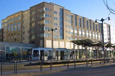
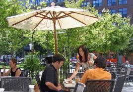
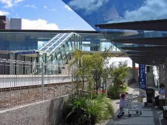
1 Principles of TOD: Just the Basics GB Arrington Mission Bay TOD, San Francisco, CA
2 1. Transit-Oriented Development T O D P O D D O T 2. Pedestrian- Oriented Development 3. Development- Oriented Transit
3 Creating Value with transit


4 TOD or TAD? Transit-Oriented Development or Transit Adjacent Development LRT Station Majority of development at US transit stations are not TODs TOD is still illegal in at most of US transit stops Not enough to be next to transit, must be shaped by transit Cisco Systems TAD San Jose, CA Street Car TOD Portland, OR


5 Shaped by Transit Greater density Less parking Better public realm Mix of uses Very walkable Tame the car San Diego, Portland, San Francisco, Washington, DC, Denver
6 Transit-Oriented Development


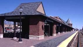
7 Orenco Station Fundamentals for TOD a great neighborhood Safe streets Strong center Local services Parks & open space Housing choices Good jobs LRT Station LRT Station
8 Scale matters


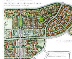
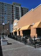
9 More than a Parcel, More than a Project Create a walkable district Area w/in a 5 minute walk Approximately 125 acres Walkable complete community Most TODs don t meet this standard Requires broader strategy, cooperation Understanding the bar needs to be higher Santa Ana TOD Santa Ana Station Development


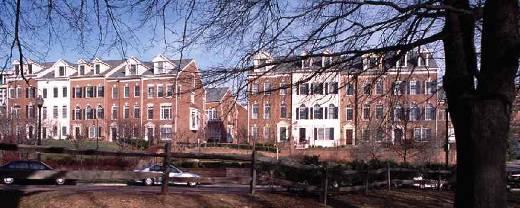
10 TOD: District not a Project Orenco Station The Round T T This Not This
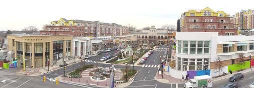
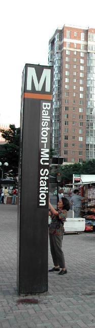
11 Market for TOD

12 Understanding your market Emerging Trends in Real Estate 08: TOD a top investment prospect Holds value well Majority of TOD residents are childless Empty-nesters & young urban professionals TOD households tend to be higher income Reflects newer construction


13 Decline in Families w/ Children 50% of households 33% of households 12% of households 30% current US housing demand Dense, walkable, mixed-use communities Today less than 2% of housing


14 Residents Near Transit Want From Transit Community Resident Surveys: Well designed communities Easy access to a center High quality residence Quality transit service Pedestrian Friendly Good price value The ability to walk to a pint of milk The Merrick Orenco Town Center
15 TOD Principles

16 a successful Six Principles for TOD 1. Medium to higher density 2. Mix of uses 3. Compact pedestrian-oriented 4. Active defined centre 5. Limited, managed parking 6. Public leadership

17 a successful Principles for TOD Medium to higher density Greater than community average Distance to transit matters To support transit on average: 6 to 7 du/ac for frequent bus 9 to 25 du/ac for rapid transit Retail & office closet to transit Minimum density effective tool


18 Rosslyn Ballston Corridor Development since m square feet office 14,400 residential units Station areas 25% county housing 37% county jobs Transit Access Arlington: 73% walk, 13% by car Fairfax: 15% walk, 58% by car Land use can change transportation behavior


19 An Oasis of Stability Amid a Downturn The New York Times October 7, 2009 (The Rosslyn-Ballston Corridor) has remained resilient during the worst recession in decades, and should continue to do so

20 a successful Principles for TOD Mix of uses Vertical or Horizontal Most difficult TOD element Great TOD benefits More walking More ridership Reduced auto-use Prohibit auto-oriented uses closest to transit


21 Pearl District Portland Former rail yard & warehouses Public & private development agreement Housing Infrastructure Parks Development since 1997 $750m units built 131 units per acre minimum density Before

22 a successful Principles for TOD Compact pedestrian-oriented Block sizes for 5-minute walk Max of 400 ft block face Orient buildings to sidewalks Calm streets Active street edges with wider sidewalks


23 Core Center Edge Core: Up to 800 ft greatest intensity Center: 800 to 1600 ft intermediate intensity Edge: 1/4 m to 1/2 m greater than community average of intensity Core Center Edge
24 Distance & Mode Share 2005 WMATA Development-Related Ridership Survey Distance from station Metrorail Mode Share Auto Mode Share Office Residential Office Residential At station 35% 54% 48% 29% ¼ mile 23% 43% 66% 41% ½ mile 10% 31% 83% 54% 35% of office trips right at the station entrance Office mode share drops about 1% every 100 ft ½ mile residential share 200% higher than office

25 a successful Principles for TOD Active defined centre 18 hours of activity Quality public realm /sense of place Employment closest to transit Compact & dense


26 Bloomington Central Bloomington, Mn 43 acre adaptive reuse 1,100 residential units 90 units per acre 350 room hotel 2m sq ft office 1.6 acre park

27 a successful Principles for TOD Limited, managed parking Always a challenging issue Consider: size, location, design & management No minimum ratios, maximums Disconnect parking from buildings, manage by district


28 TODs create less traffic TOD residents are: Twice as likely not to own a car as US Households 5 times more likely to commute by transit than others in region Self-selection: Responsible for up to 40% of TOD ridership bonus


29 TODs behave Differently 10 Trips Daily car trips for 50 dwellings SF 500 MF 333 TOD MF Trips 6.67 Trips Multifamily TOD Multifamily Single Family

30 a successful Principles for TOD Public leadership Generally critical for success Align political will & TOD objectives TOD plans + capital budget aligned Focus on implementation Nurture progressive developers

31 Arlington Heights IL. Revitalized Downtown New Metra Station Performing Arts Ctr Structured Parking Main street retail High Density Condo s Retail below
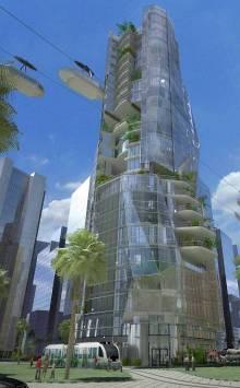


32 Development Oriented Transit MetroCities TOD Dubai UAE


33 Stations Defining Value Station helps define the most important place Civic architecture & place making Catalyst for community objectives A place to come back to Portland, San Francisco, Strasbourg
34 Beyond Auto-oriented transit


35 DuPont Circle, Washington, D.C. Branch Ave, suburban Washington M M M
36 Development-Oriented Transit Auto-Oriented Transit
37 pb s placemaking group Make a Place Connect to Community Make Transit Work Make Transit Work Make a Place Connect to Community Connect to Community Make Transit Work Make a Place
38 pb s placemaking group


39 pb s placemaking group Community Transit Arrival Place Arrival Place Community New Carrollton TOD Master Plan
40 pb s placemaking group
41 pb s placemaking group Transit Local Agencies TOD make it happen


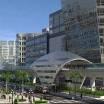
42 Making transit behave Design great transit & great places Keep vision in mind, not the automobile Break the mold Look outside the ROW Balance place and speed Create a great destination Going nowhere fast has little value


43 The DOT Process 3 to 5-day design charrette: Address transit design, community fit and TOD The participants: Transit agency, design team, local land use & public works Ground rules: Transit design can change Budget & schedule can t change

44 Addressing process & culture Schedule & financial pressures Part of every project Engineers want to decide They run the project Planners want to contemplate Late to the game Accelerate design & improve decisions


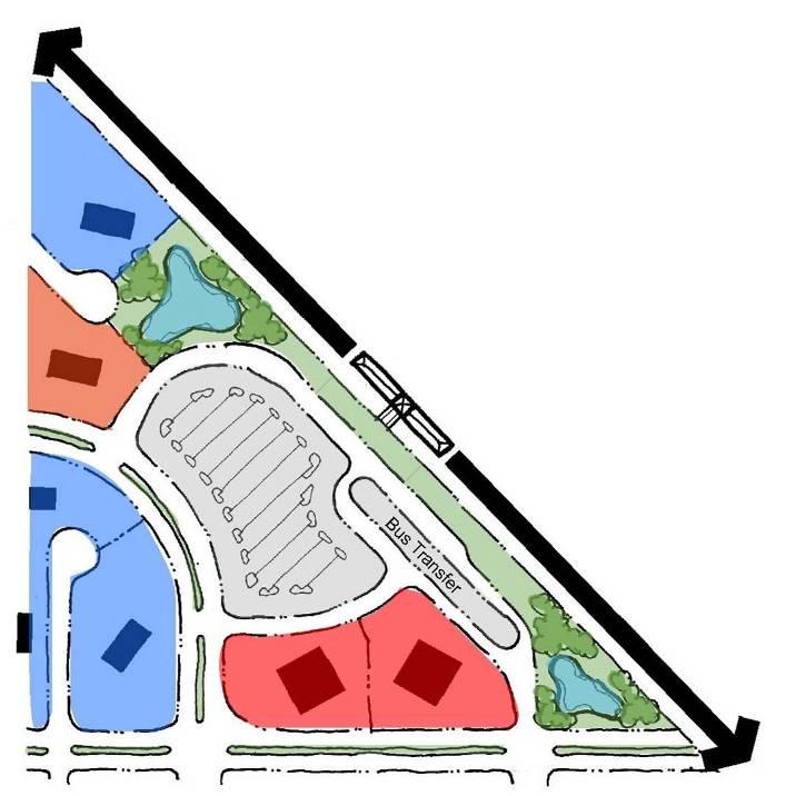
45 DOT Process Results: Identify TOD implications of alignment corridor station locations Recommend changes to design Document logic Identify next steps for TOD Develop DOT framework to guide future design Highway Median Access Mezzanine Access Arterial station access options Honolulu
46 Thinking about stations


47 What is a Station? Minimum building blocks of a station: 12 + Platform Shelter Bench Lighting Information Trash can


48 Two ways to view station design Engineering Scope Transit facility focus View from the station out to edge of ROW DOT Scope Community focus View from the community in


49 Station Location Considerations Proximity to uses that generate ridership Direct accessibility Safety and security Visibility to users System connections Dubai, UAE Valencienne, France


50 Place Making at Stations Places to come back not just to leave from to, Four different strategies: Station as a place Station invisible to complement place TOD defines place TOD serves as place


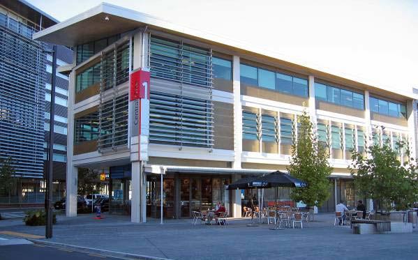
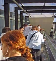
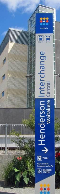
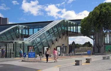
51 Designed for Development


52 Fruitvale Transit Village Joint Development of BART parking Transit center one side, development other Revitalized low-income community Calmed major arterial

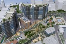
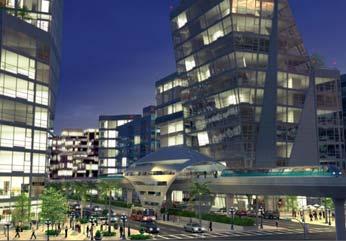
53 Fruitvale BART Pedestrian Spine Calmed Major Arterial Development Zone Development Phase II Park & Ride Structure Multi-Modal Transit Center Transit Zone


54 Fruitvale Transit Village Full service transit Rail Station Bus transfer Park & ride Kiss & ride Park & Ride Structure Transit Zone


55 Fruitvale Transit Village Community developed TOD Community Center Affordable housing Senior Housing Medical Clinic Retail Pedestrian Spine Development Zone

56 Baltimore DOT Principles
57 2 1 2 SubiCentro, Perth AU 3 Making the station to communit y SubiCentro, Perth, Western Australia

58 1 2 Making the connection : Downtown, Station, City Hall Henderson Civic Centre, Waitakere, NZ


59 Henderson, NZ Downtown separated by tracks Station + pedestrian bridge + Civic Center Connecting the community

60 Case Study: Transforming Tysons Corner America s Largest New TOD
61 a plan is in the works for a major transformation of Tysons Corner into a high-density, pedestrian-friendly, transitoriented mini-city. Urban Land 7.09

62 Tysons Corner The original edge city Sprawl on steroids Office equivalent of #12 US downtown Massive congestion 4 Metro stations: 2013 Assignment: transform Tysons into walkable mixed-use downtown From suburban apocalypse to an active vital place?
63 jiùde bùqù xīnde bùlái Chinese saying If the old doesn't go, the new won't come

64 Bold Transformation New plan & tools New land use plan New standards for streets New design guidelines New implementing authority New financial tools TOD demonstration projects Tysons Today Tysons Transformed

65 Building the blueprint Transforming Tysons

66 1. Intensity Around Transit M M M M 95% of growth within a 3 minute walk of transit

67 2. Redesign transportation Balancing walking, biking, transit & cars

68 3. Emphasis on environment 160 acres of new parks & open space A network of green across Tysons

69 4. Residential Across Tysons Virtually all of Tysons would encourage residential
70 Recommended Plan 160% more development, 11% more congestion
71 Lower Carbon Footprint Preliminary assessment: 175% increase in development Greenhouse Gas emissions 16% less per capita 2.5 billion lb reduction annually Results from Compact development Fewer auto trips Greater transit use Daily CO2 Per Capita 43 LBS 36 LBS Base Case Prototype B

72 Paying for Tysons More density + more amenity Transit / open space / civic uses / affordability / walkable streets Developer contributions + public finance Exactions / tax increment

73 Dulles Phase I Special Improvement District Encompasses Tysons Corner and Wiehle Avenue More than 6,600 businesses $200 million in taxes $100 million in property taxes Contribution to the Metrorail Capped at $400 million


74 Keys to private funding Must be enough private value Motivation not transit Developers need transit to support impacts of growth Need enough development rights to cover the exactions


75 Tysons Transformed Better, not just bigger A top 10 US downtown A place people want to live Defined by green stewardship The civic heart of N. Virginia Built around transit & walking


76 8 Unique Districts Existing Proposed This is going to be the model of how we transform King of Prussia, Perimeter Center, Costa Mesa down in Orange County, California. But you re going first. National Public Radio, Tysons Central 7


77 8 Unique Districts Existing Proposed The plan has been widely applauded as a forwardthinking blueprint to convert this edge city into the epitome of Smart Growth Tysons West - New York Times


78 8 Unique Districts Existing Proposed Never in the history of this county has such a dramatic transformation taken place. Nor has there ever been greater urgency. Tysons East Op-Ed The Washington Post

79 The implications of this redevelopment project stretch far beyond Fairfax County, as suburbs and exurbs across the country look for ways to repair the damage from five decades of outward, rather than upward, expansion. Time Magazine June 11, 2009
Rail~Volution October 2008
 Rail~Volution October 2008 1 Where is Tysons Corner? 2 Tysons Corner, Virginia The original edge city Equivalent of 12 th largest US downtown Sprawl on steroids 46m sq ft development 120,000 jobs Additional
Transit Oriented Development. PB PlaceMaking Group RTD Planning & Development Committee May 4, 2010
 Transit Oriented Development Peer Agency State of the t th Practice GB Arrington PB PlaceMaking Group RTD Planning & Development Committee May 4, 2010 TOD State of the Practice Overview 1. How does RTD
Partnerships in Transportation Transit-oriented Development The Return on Investment
 Partnerships in Transportation Transit-oriented Development The Return on Investment David M. Taylor, CNU Senior Vice President National Director, Sustainable Transportation Solutions Transit and Development
40 Years of Smart Growth Arlington County s Experience with Transit Oriented Development in the Rosslyn-Ballston Metro Corridor
 40 Years of Smart Growth Arlington County s Experience with Transit Oriented Development in the Rosslyn-Ballston Metro Corridor A presentation by the Arlington County Department of Community Planning,
Transportation Working Team Duane Diggs, Co-Chair (VOICE Buffalo) Kelly Dixon, Co-Chair (GBNRTC) Paul Ray, Facilitator (UB Regional Institute)
 Kelly Dixon, Co-Chair (GBNRTC) Paul Ray, Facilitator (UB Regional Institute)") towards a more sustainable Buffalo Niagara Transportation Working Team Duane Diggs, Co-Chair (VOICE Buffalo) Kelly Dixon, Co-Chair (GBNRTC) Paul Ray, Facilitator (UB Regional Institute) Agenda Welcome,
towards a more sustainable Buffalo Niagara Transportation Working Team Duane Diggs, Co-Chair (VOICE Buffalo) Kelly Dixon, Co-Chair (GBNRTC) Paul Ray, Facilitator (UB Regional Institute) Agenda Welcome,
40 Years of Smart Growth Arlington County s Experience with Transit Oriented Development in the Rosslyn-Ballston Metro Corridor
 40 Years of Smart Growth Arlington County s Experience with Transit Oriented Development in the Rosslyn-Ballston Metro Corridor A presentation by the Arlington County Department of Community Planning,
TOD 101 CREATING LIVABLE COMMUNITIES WITH TRANSIT
 1 CREATING LIVABLE COMMUNITIES WITH TRANSIT What are transit Centered Communities? Benefits of Partnerships to Support and Implement What You Will Learn Portland s Pearl District Your Trainers Today Catherine
Three Decades of Smart Growth: Arlington s Urban Village
 Three Decades of Smart Growth: Arlington s Urban Village An Overview Christopher Zimmerman Arlington County Board January 26, 2006 Arlington, Virginia 3 1 Arlington Today Population ~200,000 Jobs >200,000
Planning for TOD Implementation at a Corridor Scale
 Planning for TOD Implementation at a Corridor Scale Catherine Cox Blair, Reconnecting America Presentation to DRCOG and the Sustainable Communities Initiative May 14, 2012 What is Reconnecting America?
New Partners for Smart Growth Conference February 5, 2010
 Dan Stroh, Planning Director City of Bellevue Planning and Community Development Bellevue, WA New Partners for Smart Growth Conference February 5, 2010 Summary of Project Long-range plan update for Bel-Red
Planning for TOD Implementation at a Corridor Scale
 Planning for TOD Implementation at a Corridor Scale Bill Sadler, Reconnecting America Presentation to Gold Line Corridor Working Group July 2, 2013 What is Reconnecting America? Reconnecting America is
Corridor-Level Approaches to Creating Transit-Oriented Districts
 Corridor-Level Approaches to Creating Transit-Oriented Districts Dena Belzer Strategic Economics and Center for Transit-Oriented Development August 2011 5-year old partnership dedicated to improving practice
Reshaping The City: New Visions for Urban Transport. Trent Lethco, Associate Principal Allison Davis, Senior Planner Vicent Risica, Planner Arup
 Reshaping The City: New Visions for Urban Transport Trent Lethco, Associate Principal Allison Davis, Senior Planner Vicent Risica, Planner Arup Agenda Where are we now? Rethinking infrastructure? Cities
D-O LRT Zoning Discussion. Chapel Hill Boards & Commissions October 16, 2017
 D-O LRT Zoning Discussion Chapel Hill Boards & Commissions October 16, 2017 Update on Overall D-O LRT Station Area Initiative Objectives Design and educate on principles of Good Transit-Oriented Development
Subregion 4 Central Avenue-Metro Blue Line Corridor Transit-Oriented Development (TOD) Implementation Project. Community Meeting April 27, 2011
 Implementation Project. Community Meeting April 27, 2011") Subregion 4 Central Avenue-Metro Blue Line Corridor Transit-Oriented Development (TOD) Implementation Project Community Meeting April 27, 2011 Overview Introduction to Subregion 4 TOD Implementation Program
Subregion 4 Central Avenue-Metro Blue Line Corridor Transit-Oriented Development (TOD) Implementation Project Community Meeting April 27, 2011 Overview Introduction to Subregion 4 TOD Implementation Program
TRANSIT NEIGHBORHOOD PLANS PROGRAM OVERVIEW
 TRANSIT NEIGHBORHOOD PLANS PROGRAM OVERVIEW OCTOBER 2017 Los Angeles Department of City Planning @LATNP and @Planning4LA Outline Introduction Policy Framework The Transit Neighborhood Plans Program Overview:
SMART Plan East-West Corridor Land Use Scenario & Visioning Planning
 SMART Plan East-West Corridor Land Use Scenario & Visioning Planning Implementation Plan Charrettes January 2018 Presentation Outline 1. SMART Plan and Land Use Visioning Study Overview 2. Live Polling
DRAFT Land Use Chapter
 Stevens Creek Urban Village DRAFT 1 18 17 Land Use Chapter INTRODUCTION This Land Use Chapter describes how the Stevens Creek Urban Village will accommodate the growth that is planned for it in the Envision
SUSTAINABLE TRANSPORT & INTEGRATED LAND USE PLANNING
 SUSTAINABLE TRANSPORT & INTEGRATED LAND USE PLANNING UNESCAP Capacity Building Workshop, Colombo Integrated Land use and Urban Transport Planning : Principles and Practices 31st October 2017 ACTIVE TRANSPORTATION
Chapter 4. Linking Land Use with Transportation. Chapter 4
 Chapter 4 Linking Land Use with Transportation Chapter 4 59 Chapter 4 Linking Land Use with Transportation Community Design and Transportation Program Introduction Since the 1950s, the predominant development
TOD IMPLEMENTATION BEST PRACTICE TOOLBOX Leveraging Transit for City Shaping
 arrington.gb@gmail.com gbplacemaking.com THE TOD I LIVE IN ~ PORTLAND, OR TOD IMPLEMENTATION BEST PRACTICE TOOLBOX Leveraging Transit for City Shaping BEST PRACTICE TOPICS Timing & transit Parking & retail
Robbinsdale LRT Station. CDI Development Guidelines. August Overview
 Robbinsdale LRT Station August 2018 Overview The City of Robbinsdale may have the coolest opportunity site along the 13 mile stretch of the Bottineau LRT corridor / Blue Line extension. Located a block
Shift Rapid Transit Public Participation Meeting May 3, 2017
 Shift Rapid Transit Public Participation Meeting May 3, 2017 Shift Rapid Transit Initiative Largest infrastructure project in the city s history. Rapid Transit initiative will transform London s public
Taming Tysons Corner Transforming the Quintessential Edge City
 Taming Tysons Corner Transforming the Quintessential Edge City Transit is the greatest catalyst for change at Tysons, but how do we take advantage of this billion-dollar investment? If transit is built
Transit Oriented Development. Overview
 Trammell Crow Residential Sean G. Hyatt, Managing Director Transit Oriented Development What is TOD? TOD in King County TOD Characteristics and Examples Veloce (Alexan Redmond TOD) About Trammell Crow
THE GREEN VISION WORKSHOP Friday, November 6, 2009
 THE GREEN VISION WORKSHOP Friday, November 6, 2009 SUSTAINABLE LONG RANGE PLANNING IN SANTA MONICA Eileen Fogarty Director, Planning and Community Development GREEN BUILDINGS Santa Monica has the most
Are we creating and exploiting synergies on our transit investments?
 10 Years of TOD in the Denver Front Range Region: Are we creating and exploiting synergies on our transit investments? Tim Van Meter Van Meter Williams Pollack Architecture & Urban Design San Francisco
Coast Highway Oceanside, California
 Coast Highway Oceanside, California Coast Highway Plan Zones What We ve Heard - Walkable/Bikeable Community (Senior and Child Friendly) -Wider Sidewalks -Street Trees -Traffic Calming -Bike Lanes -Paseos
Integrated Urban Development. April Reflections from the NZPI Study Tour of Portland, Seattle and Vancouver
 Integrated Urban Development April 2009 Reflections from the NZPI Study Tour of Portland, Seattle and Vancouver Integrated Urban Development Urban Growth Management Transportation Transit Orientated Mixed
MONTGOMERY COUNTY METRO STATION AREA DESIGN CHARRETTE
 MONTGOMERY COUNTY METRO STATION AREA DESIGN CHARRETTE Shady Grove Metro Station Area Charrette Closing Presentation October 25-28, 2000 MONTGOMERY COUNTY, MD M-NCPPC Design Collective, Inc. Architects
Create Policy Options Draft Plan Plan Approval. Public Consultation Events. Phase 2
 Background Grandview-Woodland Community Plan In the spring of 2012, the City of Vancouver embarked on a comprehensive community planning program in the Grandview-Woodland neighbourhood. The process has
LEED-ND 101: Practical Strategies for Achieving Sustainability Goals. Travis Parker Lakewood Planning Director
 LEED-ND 101: Practical Strategies for Achieving Sustainability Goals Travis Parker Lakewood Planning Director Metro Vision Idea Exchange Oct 11, 2012 West Corridor Stations West Corridor Overview West
CHAPTER 7: Transportation, Mobility and Circulation
 AGLE AREA COMMUNITY Plan CHAPTER 7 CHAPTER 7: Transportation, Mobility and Circulation Transportation, Mobility and Circulation The purpose of the Transportation, Mobility and Circulation Chapter is to
CHAPTER 3 VISION, GOALS, & PLANNING PRINCIPLES. City of Greensburg Comprehensive Plan. Introduction. Vision Statement. Growth Management Goals.
 CHAPTER 3 VISION, GOALS, & PLANNING PRINCIPLES Introduction The Greensburg Comprehensive Plan is intended as a working community document. A combination of long and short-term goals, this document is intended
Public Open House #1
 Public Open House #1 TONIGHT S AGENDA Welcome Project Overview The Big Picture The Station Area The Analysis Thoughts about Future Change Breakout Group Discussions Summation / Next Steps Project Overview
Downtown Elkton Station Area Plan, Elkton, MD. Difficult enough to get support for new starts challenge to fund Houston transit
 Difficult enough to get support for new starts challenge to fund Houston transit More difficult to build Community Support for dense development at station areas Major Concerns: Traffic, Property values,
Economic Development and BRT. Cliff Henke Sr. Analyst, Parsons Brinckerhoff John Noel Public Transit Discovery Conference, Addison, IL October 2010
 Economic Development and BRT Cliff Henke Sr. Analyst, Parsons Brinckerhoff John Noel Public Transit Discovery Conference, Addison, IL October 2010 Topics Today The BRT- Economic Link Example Projects Latest
The Need to Develop a Transit Ready Community
 Evaluation & Appraisal Report (EAR) Major Issue # 6 The Need to Develop a Transit Ready Community July 3, 2007 EAR Major Issue # 6 Transit Ready Existing Comp Plan policies apply only to Indiantown Road:
José Campos Manager of Planning and Design Review SPUR San José Symposium October 12, 2018
 1 Transbay: Freeways to New Ways José Campos Manager of Planning and Design Review SPUR San José Symposium October 12, 2018 2 Transbay freeway land pre-1989 3 1989 Loma Prieta Earthquake 4 TRANSBAY c.
Making TOD Work in the Heart of Suburban Sprawl
 Making TOD Work in the Heart of Suburban Sprawl Rocky Mountain Land Use Institute March 6, 2009 Speakers Ben Herman, FAICP, Principal Clarion Associates Darcie White, AICP, Principal Clarion Associates
Making Transit Oriented Development Work For Boonton, NJ
 Making Transit Oriented Development Work For Boonton, NJ Bloustein School of Planning and Public Policy Studio Dan Burton Loannie Dao Webster Slater Brandon Williams Ian Watson Maria Laham Nicola Mammes
Knoxville Area Transit (KAT) Transit Development Plan Corridor Analysis
 Transit Development Plan Corridor Analysis") Knoxville Area Transit (KAT) Transit Development Plan Submitted to: Knoxville-Knox County Metropolitan Planning Commission Submitted by: PB Americas, Inc. Under contract to: The Corradino Group, Inc. October
Knoxville Area Transit (KAT) Transit Development Plan Submitted to: Knoxville-Knox County Metropolitan Planning Commission Submitted by: PB Americas, Inc. Under contract to: The Corradino Group, Inc. October
Cherokee. Corporate Headquarters 111 East Hargett Street Suite 300 Raleigh, NC
 Cherokee Corporate Headquarters 111 East Hargett Street Suite 300 Raleigh, NC 27601 919-743-2500 Denver 4600 S. Ulster Street Suite 500 Denver, CO 80237 303-689-1460 London 41-43 Maddox Street London W1S
ROBBINSDALE LRT STATION CDI DEVELOPMENT GUIDELINES
 August 2018 OVERVIEW The City of Robbinsdale has a prime-opportunity site in the middle of the 13 mile stretch of the Bottineau LRT corridor / Blue Line extension. Robbinsdale offers a prominent, vital,
Draft for Public Review. The Market and Octavia Neighborhood Plan
 Draft for Public Review The Market and Octavia Neighborhood Plan San Francisco Planning Department As Part of the Better Neighborhoods Program December 2002 IOverview Why Plan a Better Neighborhood Here
Building out the Regional Growth Strategy in Surrey: a Strong Centre & a Connected Transit City
 Building out the Regional Growth Strategy in Surrey: a Strong Centre & a Connected Transit City Surrey in the Metro Vancouver Region Regional Growth Strategy identifies Surrey as a major provider of housing
MALL REVITALIZATION CASE STUDIES
 MALL REVITALIZATION CASE STUDIES DECEMBER 9, 2012 MALL REVITALIZATION OVERVIEW Introduction Sample Case Studies prepared for Lacey Woodland District Steering Committee as it considers strategies to revitalize
TOWN OF NEW CASTLE - Master Plan Update
 Our Presentation Today (1) Recap the Master Planning Process To Date (2) Present the Outline of the Master Planning Work Plan (3) Present the Calendar for the Master Plan (4) Outline the scope of a Downtown
REVIEW AND EVALUATION OF REGIONAL LAND USE
 REVIEW AND EVALUATION OF REGIONAL LAND USE AND TRANSPORTATION SCENARIOS #220831 Environmental Justice Task Force October 7, 2014 VISION 2050 Process Development of Guiding Vision for Land Use and Transportation
Wasatch CHOICE for 2040
 Wasatch CHOICE for 2040 Economic Opportunities We Can Choose a Better Future We enjoy an unparalleled quality of life along the Wasatch Front. People from all over the world are drawn to our stunning scenery,
Transit-Oriented Development
 Transit-Oriented Development Path to Sustainability West Windsor February 22, 2007 George S. Hawkins Context for Presentation NJ Future is a non-partisan, 501(c)3 non-profit organization. Offer perspective,
1.3 TRANSIT VISION 2040 FROM VISION TO ACTION THEME 1: PUTTING TRANSIT AT THE CENTRE OF COMMUNITIES. Fully integrate transit with community planning
 TRANSIT VISION 2040 FROM VISION TO ACTION TRANSIT VISION 2040 defines a future in which public transit maximizes its contribution to quality of life with benefits that support a vibrant and equitable society,
Sustainably Repositioning Greyfield Sites. Greyfield Sites Anywhere
 Sustainably Repositioning Greyfield Sites Jim Constantine Looney Ricks Kiss Architects Todd Poole 4ward Planning Greyfield Sites Anywhere Pennsylvania Chapter American Planning Association Conference 2009
Tony Garcia, City-County Planning Commission & Beth Alden, Hillsborough MPO
 Tony Garcia, City-County Planning Commission & Beth Alden, Hillsborough MPO TOD Defined A compact neighborhood with housing, jobs and neighborhood services within easy walking distance of a transit station
PLAN ELEMENTS WORKSHOP. April 5, 2016
 PLAN ELEMENTS WORKSHOP April 5, 2016 needs more housing. But there is no one-size fits-all solution. Every neighborhood has its own character. In some places, density is not only appropriate it is badly
KCATA Transit Oriented Development Initiatives
 KCATA Transit Oriented Development Initiatives KCATA: Regional Transportation Authority Created by bi-state compact Approved by Congress 7 County service area Quasi-governmental with broad powers Power
DOWNTOWN AREA PLAN. June 9, 2009
 DOWNTOWN AREA PLAN June 9, 2009 Issues Identified by Councilmembers Overlap with Southside Plan Southwest Residential Area & Herrick Shadows & Residential Areas Shadows on Streets & Canyon Effect Transit
City of Villages Parking Strategies. William Anderson, FAICP City Planning & Community Investment San Diego Parking Symposium July 14, 2006
 City of Villages Parking Strategies William Anderson, FAICP City Planning & Community Investment San Diego Parking Symposium July 14, 2006 City of Villages Strategy A hierarchy of walkable, mixed use districts
Shifting Paradigms Urban Planning and Town Center Development in the United States
 Timothy H. Haahs PE, AIA April 20, 2010 Shifting Paradigms Urban Planning and Town Center Development in the United States Urban Life "The street is the river of life." Trends / 국민일보 2010 년 3 월 1 일자발췌
Repositioning Suburban Corridors: From Souless Strips to Something Better
 Repositioning Suburban Corridors: From Souless Strips to Something Better Moderator: Ed McMahon, Urban Land Institute Presenters: Takis Karatonis, Columbia Pike Revitalization Organization Mike Hallibaugh,
Exploiting Transit s City Shaping Powers Robert Cervero University of California, Berkeley
 Exploiting Transit s City Shaping Powers Robert Cervero University of California, Berkeley Session on: TOD TRANSIT AS AN ENGINE FOR URBAN DEVELOPMENT Metros & Urban Development: Experiences in Toronto
Transportation Land Use Integration & Regional Planning. Don Kostelec, AICP Senior Planner, Louis Berger Group February 1, 2010
 Transportation Land Use Integration & Regional Planning Don Kostelec, AICP Senior Planner, Louis Berger Group February 1, 2010 Transportation Land Use Integration DOT-HUD-EPA Sustainable Communities Initiative
EAR WORKSHOP FOR PALM BEACH COUNTY LOCAL GOVERNMENTS APRIL 2010 TREASURE COAST REGIONAL PLANNING COUNCIL
 EAR WORKSHOP FOR PALM BEACH COUNTY LOCAL GOVERNMENTS APRIL 2010 TREASURE COAST REGIONAL PLANNING COUNCIL Why Should I Care about Transportation & Land Use? Congestion or Mobility Pick One!! Congestion
THE 355/270 CORRIDOR:
 THE 355/270 CORRIDOR: Strategic Ideas for Sustaining a Livable Work Place Project Summary ACCESS LIFE DESIGN HEALTH WORK Montgomery County Planning Department The Maryland-National Capital Park and Planning
FUNDING CORRIDOR REVITALIZATION
 FUNDING CORRIDOR REVITALIZATION Integrated corridor planning for the 21 st Century America Planning Association Annual Conference Atlanta, GA April 27, 2014 Mariia Zimmerman, MZ Strategies, LLC mariia@mzstrategies.com
Walkable Urban Places are Different & Complex to Manage
 Walkable Urban Places are Different & Complex to Manage Teaching a NASCAR Driver to be a Fighter Pilot Must Have a Strategy & Be Managed to Succeed, e.g., BID Each New Element Adds Value to Existing Assets
FRUITVALE TRANSIT VILLAGE (Phase 2) Residential Project
 Residential Project") FRUITVALE TRANSIT VILLAGE (Phase 2) Residential Project DEVELOPER: SIGNATURE PROPERTIES ARCHITECT: HKIT ARCHITECTS April 23, 2010 TABLE OF CONTENTS 3 Vision 4 Description of Site 5 Guiding Concepts 6
FRUITVALE TRANSIT VILLAGE (Phase 2) Residential Project DEVELOPER: SIGNATURE PROPERTIES ARCHITECT: HKIT ARCHITECTS April 23, 2010 TABLE OF CONTENTS 3 Vision 4 Description of Site 5 Guiding Concepts 6
Northwest commuter rail station US 36 BRT. Westminster Station
 Northwest commuter rail station Westminster Station US 36 BRT Westminster Center US 36 & Church Ranch Broomfield Flatiron/96 th St. US 36 & McCaslin Table Mesa Boulder Junction 13-month effort that will
ITEM #8. Regional Smart Growth Program. Regional Smart Growth Program. Presentation Overview. Coast Highway Vision and Stategic Plan.
 Regional Smart Growth Program Economic Development Commission What is Smart Growth? Adopted as part of the Regional Comprehensive Plan (RCP) RCP provides vision for region based on Smart Growth and sustainability
Silver Line CPAM UPDATE. Transportation and Land Use Committee October 14, 2016
 Silver Line CPAM UPDATE Transportation and Land Use Committee October 14, 2016 Purpose Recap Project History and Map Changes Provide Overview of CPAM Components Discuss Transportation Impacts Discuss Fiscal
A BLUEPRINT FOR BROCKTON A CITY-WIDE COMPREHENSIVE PLAN
 A BLUEPRINT FOR BROCKTON A CITY-WIDE COMPREHENSIVE PLAN Public Meeting October 2016 1 Plan Summary and Discussion Public Meeting May 4 2017 City of Brockton Bill Carpenter, Mayor Department of Planning
III. Design Principles
 III. Design Principles The design of Bay Meadows Phase II has been guided by a series of Urban Design Principles. These principles, informed by consultant site analysis, City staff recommendations, and
EXHIBIT A. Tax Increment Reinvestment Zone No. 1 (Town Center) First Amended Project Plan 1
 First Amended Project Plan 1") EXHIBIT A Tax Increment Reinvestment Zone No. 1 (Town Center) First Amended Project Plan 1 1 As amended by Resolution No. 2008-02-001(TR1R) of the Tax Increment Reinvestment Zone No.1, and approved to
EXHIBIT A Tax Increment Reinvestment Zone No. 1 (Town Center) First Amended Project Plan 1 1 As amended by Resolution No. 2008-02-001(TR1R) of the Tax Increment Reinvestment Zone No.1, and approved to
Northwest Rail Corridor and US 36 BRT. Development Oriented Transit Analysis
 Nor t hwes trai lcor r i dorandus36brt Devel opmentor i ent edtr ans i tanal ys i s July 2007 This is a controlled document; please do not duplicate. If additional copies are required, please request them
Ranking US Cities Oil Addiction: Sprawl and Car Commuting Emerge as Real Estate Risk Factors
 Ranking US Cities Oil Addiction: Sprawl and Car Commuting Emerge as Real Estate Risk Factors Behavior, Energy and Climate Change November 17, 2008 Warren Karlenzig, President, Common Current www.commoncurrent.com
Chapter 1.0 Introduction
 Chapter 1.0 Introduction 1.1 Background The North Metro commuter rail line is part of the RTD FasTracks regional transit system expansion program to build more than 100 miles of rail transit throughout
TRANSIT ORIENTED DEVELOPMENT STRATEGIC PLAN t 2014 EXECUTIVE SUMMARY
 TRANSIT ORIENTED DEVELOPMENT STRATEGIC PLAN t 2014 SETTING THE STAGE Development around rail stations is part of Denver striving to become a world-class city where everyone can be part of the community.
Walnut Creek BART Station
 Walnut Creek BART Station Mixed Use Transit Oriented Project Design Review Commission Study Session May 17, 2006 Applicant: Walnut Creek Transit Lifestyles Associates Joint Venture: Transit Village Associates
Public may provide comments on the GDP within the next two weeks (December 24)
") 25/70 General Development Plan (GDP) Public Meeting Wednesday, December 10, 2014 6:00 8:00 P.M. District 1 Police Station Community Room 1311 W 46th Ave, Denver, CO 80211 Council Woman Montero: This particular
25/70 General Development Plan (GDP) Public Meeting Wednesday, December 10, 2014 6:00 8:00 P.M. District 1 Police Station Community Room 1311 W 46th Ave, Denver, CO 80211 Council Woman Montero: This particular
Sacramento Area Council of Governments (SACOG)
") Sacramento Area Council of Governments (SACOG) The Blueprint Vision The SACOG Board of Directors adopted the Preferred Blueprint Scenario in December 2004, a bold vision for growth that promotes compact,
Sacramento Area Council of Governments (SACOG) The Blueprint Vision The SACOG Board of Directors adopted the Preferred Blueprint Scenario in December 2004, a bold vision for growth that promotes compact,
1 Adapted from the Statewide Transit-Oriented Development Study by CalTrans, 2006
 APPENDIX C: LAND USE PLANNING FOR ENHANCED RAIL SERVICE 72 BACKGROUND One of the consistent themes heard from localities in the Route 29 corridor Planning Forums was the need for expanding rail service
Key Concepts of the General Plan
 Key Concepts of the General Plan General Plan Purpose Vision for City s future Standards for City Services Land Use Plan General Plan Purpose San Jose is creating its Blueprint for the Future to become
Chapter 1: Introduction
 Chapter 1: Introduction The Penn Avenue Community Works Corridor Vision and Implementation Framework presents an integrated communitybased vision and a coordinated, long-term implementation framework for
DRAFT. Urban Development Areas Fairfax County. UDA Needs Profile: Tysons Corner 13% Location Characteristics. Socio-Economic Characteristics
 14 Urban Development Areas Fairfax County UDA Needs Profile: Tysons Corner Tysons Corner is located in Fairfax County, surrounded by the town of McLean to the east and Vienna on the west along I-495, the
Northwest Rail Corridor and US 36 BRT Development Oriented Transit Analysis 4.4 STATION AREA FINDINGS
 4.4 STATION AREA FINDINGS Each station is different, and each one requires a separate set of recommendations based on the vision for the site. This section outlines an initial TOD strategy and recommendations
Realities and Assets in an In-Town Shopping Center
 SUSTAIN SOUTHERN MAINE MILL CREEK PILOT LESSONS LEARNED April 15, 2013 Realities and Assets in an In-Town Shopping Center 1. An older shopping district that was laid out in a low-density, strip center
In the heart of the Southern Sector is a diamond in the rough
 WESTMORELAND DART STATION AREA PLAN Map III-2.24 The Westmoreland DART Station Area In the heart of the Southern Sector is a diamond in the rough the Westmoreland Transit Station. This DART station, near
TOD 203 CORRIDOR PLANNING and TOD
 2 CORRIDOR PLANNING and Scales of What You Will Learn The Transit Corridor Types of Corridors Objectives and Strategies for Transit and at the Corridor Level Main Street Corridor Planning and Your Trainers
What. - Civic anchors including a park and an updated library branch
 SUMMARY What Master Plan aimed at delivering - A walkable, mixed-use downtown in the heart of University City anchored by UNC Charlotte and University Research Park - Civic anchors including a park and
Port Credit Local Advisory Panel October 20 th Meeting
 Port Credit Local Advisory Panel October 20 th Meeting Focus Of This Evening s Meeting: 1. Hurontario Main Street Higher Order Transit Study 2. Port Credit Mobility Hub & GO Station Parking Structure Study
South Fulton Parkway Transit Feasibility Study
 South Fulton Parkway Transit Feasibility Study Study Purpose To conduct a high level assessment of potential transit improvements in the South Fulton Parkway Corridor through the evaluation of various
Be it enacted by the Town Board of the Town of Guilderland that the following new A (Transit Oriented Development (TOD) District) is adopted:
 District) is adopted:") Local Law No. 4 of 2018 (Adoption of 280-18A (Transit Oriented Development District) Be it enacted by the Town Board of the Town of Guilderland that the following new 280-18A (Transit Oriented Development
Local Law No. 4 of 2018 (Adoption of 280-18A (Transit Oriented Development District) Be it enacted by the Town Board of the Town of Guilderland that the following new 280-18A (Transit Oriented Development
12/9/2013. HOLLYWOOD/PINES CORRIDOR PROJECT AMPO 2013 Annual Conference October 24, Our Perspective. Broward.
 HOLLYWOOD/PINES CORRIDOR PROJECT AMPO 2013 Annual Conference October 24, 2013 Our Perspective Broward Fort Lauderdale 1 Broward Metropolitan Planning Organization Fort Lauderdale Fort Lauderdale Skyline
Windsor Locks Transit-Oriented Development Planning Grant Request. Project Background
 Windsor Locks Transit-Oriented Development Planning Grant Request Project Background Downtown Windsor Locks runs along Main Street in the vicinity of the intersection of Routes 159 and 140. The current
b r a n c h av e n u e tr a n s it co r r i d o r r e vita lization pl a n a m o d el fo r s u b u r ban retro fit
 b r a n c h av e n u e tr a n s it co r r i d o r r e vita lization pl a n a m o d el fo r s u b u r ban retro fit P R I N C E G EO RG E S CO U NT Y, M D ADO PTED 0 p R O J E C T C AT E G O R Y : U R B
Urban Sustainability Area Designation
 Urban Sustainability Area Designation City of Santa Cruz October 2013 The City of Santa Cruz Urban Sustainability Area (USA) encompasses the City s business centers and primary transportation corridors
GAINING LEVERAGE through
 GAINING LEVERAGE through FTA s New Starts Land Use Criteria Brigid Hynes-Cherin Associate Administrator FTA Office of Planning and Environment Evaluation and Rating of Transit Supportive Land Use Agenda
ULI St. Louis Technical Assistance Panel
 ULI St. Louis Technical Assistance Panel ULI St. Louis Technical Assistance Panel Sponsored by: Citizens for Modern Transit in partnership with METRO ULI St. Louis Mission Statement The mission of the
2. Form and Character. 2.1 Introduction. 2.2 The Downtown Addition Plan. 2.1 Introduction
 2.1 Introduction 2.1 Introduction This section of the Specific Plan describes and illustrates the desired form, character and uses of the Downtown Addition and explains the underlying design principles.
Hopkins. Development Guidelines May Overview. Sponsored by: Blake Road Corridor Collaborative City of Hopkins
 Hopkins Blake Road LRT Station Area Development Guidelines May 2015 Sponsored by: Blake Road Corridor Collaborative City of Hopkins Overview Hopkins is a dynamic community of over 17,000 residents located