Bylaw 884/13 Schedule A. Town of Rimbey. June 2008.
|
|
|
- Georgina Wright
- 5 years ago
- Views:
Transcription


1

2 Bylaw 884/13 Schedule A Town of Rimbey June Revised April 2013
3 Bylaw 884/13 Schedule A Johnson Estates Table of Contents 1. Introduction Purpose Location Context Land Ownership Existing Conditions Surrounding Land Uses Existing Land Use Natural Features Pipelines Historical and Archaeological Features Municipal Policy and Regulatory Provisions Implications for Future Development The Development Concept Development Objectives Land Area Breakdown Design Elements Residential Commercial Institutional and Public Uses (IPU) District Open Space Municipal Services Water Distribution Concept Sanitary Sewage Concept Storm Water Management Concept Franchise Utilities Circulation Grading Staging and Implementation... 18
4 Figure 1:... Locational Context Figure 2:... Existing Conditions Figure 3:... Development Concept Figure 4:... Water Distribution Concept Figure 5:... Sanitary Sewer Concept Figure 6:... Storm Water Management Concept Figure 7:... Shallow Utilities Concept Figure 8:... Vehicular and Pedestrian Circulation Figure 9:... Phase Implementation Plan List of Tables Table 1: Land Area Breakdown... Page 9 Table 2: Number of Units and Population Estimates... Page 12 Appendices Appendix A: Appendix B Town of Rimbey Municipal Development Plan - Map 1- Long Term Land Use Town of Rimbey Municipal Development Plan - Map 2- Road Network Johnson Estates iii March 2013 Concept Plan
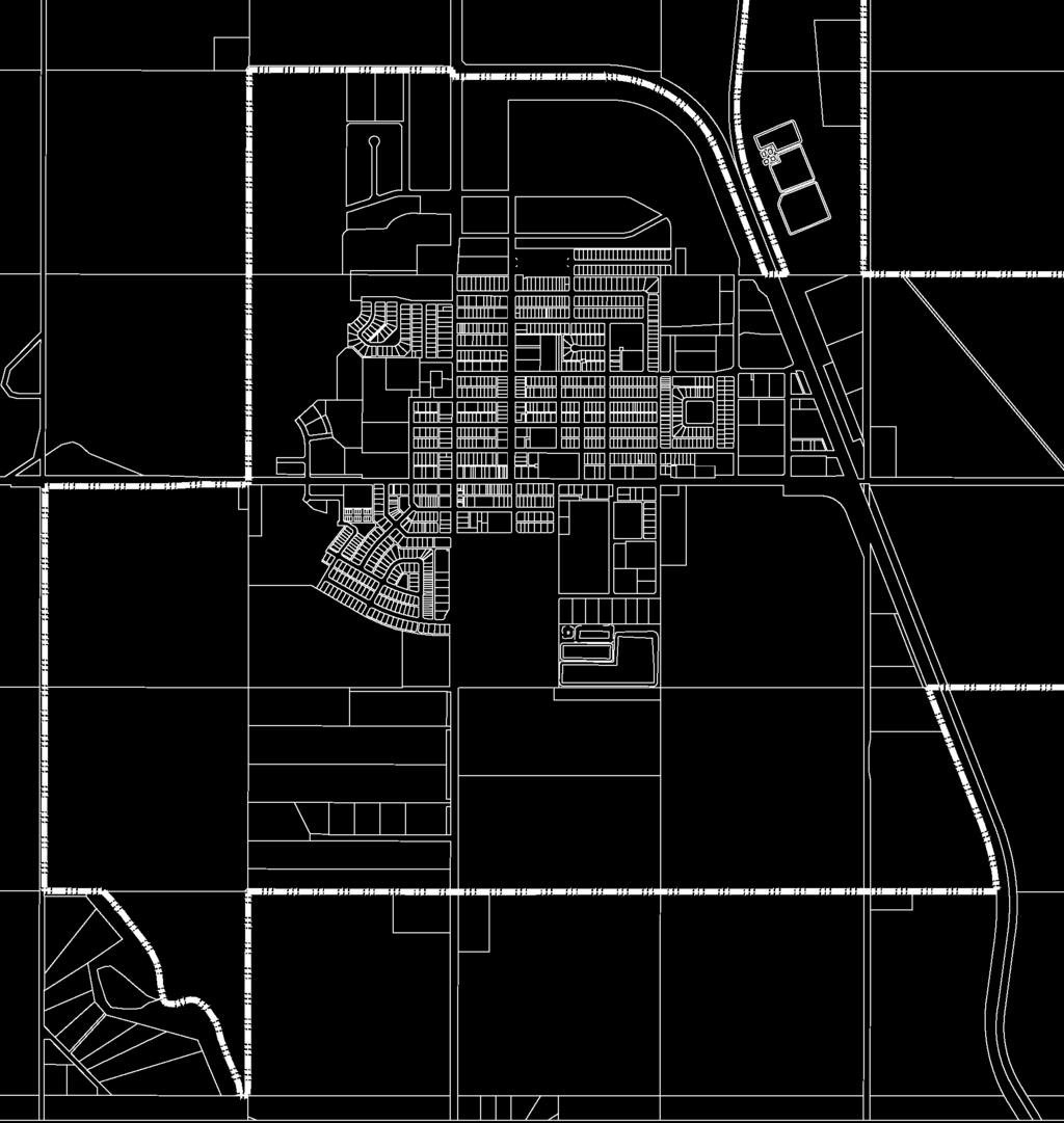
5 1. Introduction 1.1 Purpose This concept Plan has been prepared to provide a framework for the subdivision and development of Lot 6, Block 1, Plan , Pt. SE 1/ W5M and located in the west central quadrant of the Town of Rimbey. The Plan Area comprises of approximately hectares (64.09 acres) and will be developed primarily as a low to medium density residential neighbourhood. The Johnson Estates Concept Plan meets the requirements of Section 633 of the Municipal Government Act, and complies with the Town of Rimbey s Municipal Development Plan Bylaw 672/97 and Town of Rimbey s Areas Structure Plan Bylaw 839/09. As such, it describes future land uses and density, potential population levels, traffic circulation, municipal servicing, reserve dedication and staging of development. 1.2 Location Context The Johnson Estates area is located in the northwest quadrant of Rimbey and is defined by: 1. The Smithson International Truck Museum, Pas-Ka-Poo Historical Park and future single family residential development to the north; 2. Existing single family residential (Drader Crescent); Rimbey Community Centre, Public School Site, Provincial Building and hospital to the east; 3. Highway 53, to the south; and 4. Agricultural land to the west. Figure 1 shows the boundaries of the Plan Area and its location within the Town. 1.3 Land Ownership With the exception of the church parcel, located in the southeast corner of the Plan Area, the Plan Area is currently owned by Johnson Estates Corporation representing a number of local and Central Alberta residents. Johnson Estates 1 April 2013 (Revision)
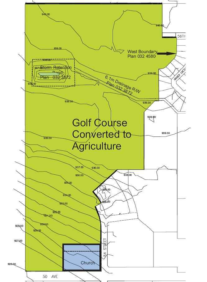
6 2. Existing Conditions 2.1 Surrounding Land Uses Existing uses surrounding the Plan Area are shown on Figure 1 and are described as follows: To the north, the lands are currently in agricultural crop production and are zoned Urban Expansion District UX. To the northeast, the area is zoned Institutional and Public Uses IPU and Low Density Residential R-1. The area is currently developed as a museum park and residential development. Directly east, lands are zoned Institutional and Public Uses IPU and developed as for school, community centre, hospital and provincial administration offices. There is one single family residential lot, located in the Urban Expansion District, which was recently subdivided from the subject parcel. To the south, across Highway 53 is primarily Urban Expansion District UX and is in agricultural production. The existing development is zoned Medium Residential District R-3, with additional of recently approved commercial, single family and medium density residential. To the west, lands are currently in agricultural production and zoned General Agriculture District AG by Ponoka County s Land Use Bylaw. The Johnson Estates Concept Plan will result in a neighbourhood that will be compatible with the surrounding land use pattern. 2.2 Existing Land Use The Plan Area is cleared. Until recently, the land was used for agriculture crop production. A portion of the subject property was developed as a 9-hole golf course, which remained until recently. The land has now been converted to agriculture until such time as it is developed. As indicated above, the farmstead was recently subdivided from the subject parcel prior to sale. A church site, located in the southeast corner of the Plan Area, was also subdivided and sold from prior to purchase. The site is currently undeveloped. 2.3 Natural Features The Alberta Soils Correlation Map identifies Rimbey and area as being located in Soils Correlation Area (SCA) 10. An area of Thick Black/Dark Gray-Gray Soil found in Central and East-Central Alberta. Soils in this area are medium textured loams, underlain by Glaciolacustrine deposits, forming the foundation for some of the best agricultural lands in Alberta. The Plan Area is generally sloping to the southwest, with elevations ranging from 927 metres (above sea level) in the south and west to about 940 metres (above sea level) in the north and east. The site drains primarily southwest, to Highway 53 and then west to Blindman River. See Figure 2 which illustrates existing Plan Area conditions. Excepting planted coniferous and deciduous trees, and native shrubs adjacent the north property line, no tree cover exists within the Plan Area. Johnson Estates 2 April 2013 (Revision)
7 2.4 Pipelines There are no pipeline right-of-way easements through the Plan Area, however, there is an Easement Right-of-Way, registered to the Town of Rimbey, for the purpose of stormwater management. The rightof-way extends from the east central portion of the Plan Area toward the northwest corner, to an existing manmade dugout. 2.5 Historical and Archaeological Features A review of historical data on the Town s website suggests there are no historically or archaeologically significant landmarks on the subject lands. The subject lands are located immediately southwest of Pas- Ka-Poo Park the Smithson International Truck Museum and Centennial Pavilion. Johnson Estates 3 April 2013 (Revision)
8 2.6 Municipal Policy and Regulatory Provisions Town of Rimbey Municipal Development Plan Bylaw #672/97 The following policies for the Municipal Development apply: Land Use Concept Policy 3.1 By law there is no right of access to a primary highway. Access is controlled by Alberta Transportation to preserve primary highways as high speed travel corridors. Policy 4.6 Identifies a number of regional and local community services available in the Town, including the hospital, schools, recreation and cultural amenities and the commercial sector. Policies Identifies goals for residential development based on the provision of a range of affordable housing, with a variety of housing types and densities, and ensuring pre-planned developments that fit, logically and economically with existing development. Section 6 Identifies the Town s desire to retain Rimbey s downtown core as the primary commercial centre. Indicates Council support for streetscape improvements along 50th Avenue. Policy 6.12 suggests Council may support commercial development on Highway 53, west of the hospital. Policy 11.9(b) Anticipated uses are predominantly residential. The determination of arterial and collector road alignments, municipal services and utilities and future road, service and utility connections to adjoining quarter sections will be crucial. There is no obvious way to route the arterial back to 51st Street/Highway 20. Policy Framework Servicing Concepts Policy 11.9 supports area structure plans as a means of preplanning the Town s future growth and development. Policy 3.7 Within present Town boundaries topography is not a constraint because land slopes down in all directions. If, as suggested in this Plan, the land between the west boundary and the Blindman River were annexed, the topography (i.e. the floodplain) would be a constraint. Policy 4.4 Suggests that existing municipal infrastructure is in good shape overall. The lifespan of the lagoon is between years. No significant upgrades to the municipal water system is anticipated in the short-term, however, a second reservoir may be needed in the northwest part of the Town. The existing water tower is not in use at this time. Policy 4.5 Indicates most developable land within the Town will be serviced by gravity flow servicing. Policies Requires the extension of servicing by the developer, with the construction of same to the Town s standards. Policy 6.15 Council may require service roads to provide controlled access. Johnson Estates 4 April 2013 (Revision)
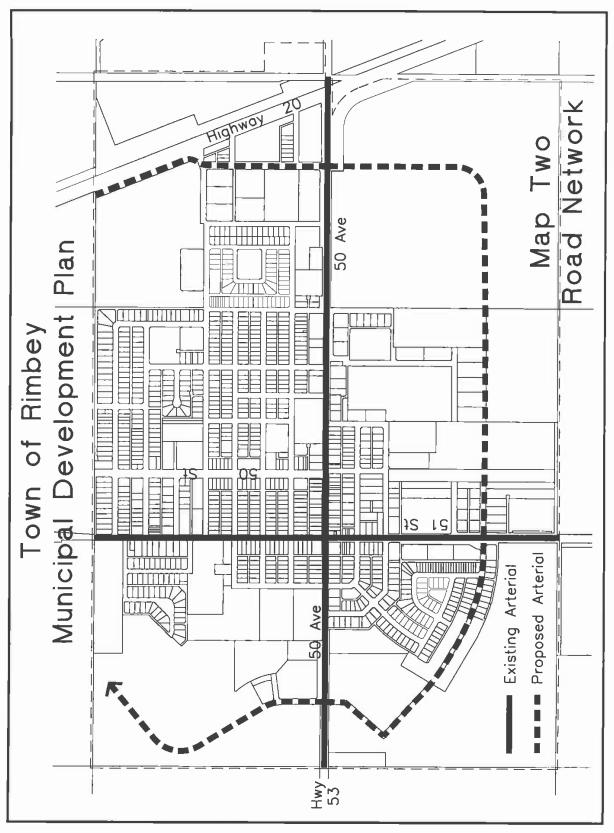
9 Pedestrian Linkages Policy 7.10 New subdivision may be developed as laned subdivisions. Policy 8.3 The existing water supply system has sufficient capacity for the immediate future (5-10 years). An additional reservoir may be required in the northwest part of Town. Policy 5.12 Encourages municipal infrastructure that improves access opportunities to seniors, including sidewalks, crosswalks and wheelchair ramps. Policy 6.10 supports enhancing pedestrian linkages to the downtown core. Parks and Open Space Policies School facilities are adequate to service Rimbey and the surrounding area. Council does not intend to acquire land, by dedication or purchase for this purpose. Policy 9.6 The Town does not require additional parks or recreation facilities in the foreseeable future. Parks should be developed to serve as many users as possible. Parks should be located adjacent school properties. Policies 10.3 Municipal Reserve dedication shall require the developer to provide 10% of the net parcel of land that is the subject of the application for reserves, and dedication may be provided in the form of land, cash-in-lieu or a combination of both. Housing Mix Policies Supports development aimed at older adult and seniors markets. Tenure Mix Area Structure Plan Policies The Town welcomes medium and high-density residential developments subject to acceptable standards, and may require transitional uses between high density and low density residential uses. Innovative housing developments are also welcome and self-contained suites and home based business within single family areas may also be acceptable. Lands immediately to the west may have the potential for low density country residential use. Policy 5.15 Medium and high-density residential developments such as duplexes, townhouses, multi-plex residential units and apartments are welcome in Rimbey subject to acceptable standards including but not limited to lot size and coverage, parking standards and access. Council may require medium and high-density residential developments to provide a transitional land use between the development and any adjacent low density residential uses which include but are not limited to roads, lands, utility lots, or reserve parcels. Policies Council supports Area Structure Plans as a means of preplanning the Town s future growth and development. In the years to come Council will require Area Structure Plans in the following areas, as shown on Map 1 (Appendix A); b) The remainder of SE W5M. Anticipated uses in this area are predominantly residential. Pre-planning will be necessary to determine arterial and collector road alignments, municipal services and utilities, and future road, service and utility connections to adjoin quarter sections. This last point is crucial with respect to his land. With respect to the generalized arterial road alignment shown on Map 2 (Appendix B) at the north end of the quarter, there is no easy or obvious way to route the arterial back to 51 st Street/Highway 20. Johnson Estates 5 April 2013 (Revision)
10 11.10 Council expects that developers in the private sector will pay for Area Structure Plans. However, Council may decide that it will be in the greater public interest to have an Area Structure Plan in place for a particular area. In this case, Council will budget for this project and will contract with West Central Planning Agency or another planning agency to do the work Any Area Structure Plan presented for Council s consideration and adoption may be required to address a list of topics, including, but not limited to: a) proposed new land uses in relation to adjacent existing land uses; b) land use densities with the planning area (e.g. single family vs. medium or high density residential); c) population densities arising from the proposed land uses; d) road types, alignments, and right-of-way standards; e) utility corridors; f) connection of proposed road alignments and utility corridors with existing similar uses on adjacent land; g) provision of municipal services, such as water, sewer and storm water drainage, as well as utilities; h) school, community facility or church sites; i) pedestrian facilities (e.g. walkways, sidewalks, pedestrian crosswalks, school crossings) and circulation; j) park spaces; k) site constraints, such as floodplain or contaminated site; l) proposed standards, such as architectural controls; m) phasing of development. The Concept Plan complies with all provisions of the Municipal Development Plan. The Town has indicated it will be adopting this as an Area Structure Plan Town of Rimbey Land Use Bylaw The Plan Area is zoned Urban Expansion District UX by the Town s Land Use Bylaw. The purpose of this district is to identify land which in future will probably be converted to urban use, but which can be used for agriculture as long as the owner elects to do so. An outline plan acceptable to council must be prepared before the land will be considered for reclassification to another use. The developer intends to make application to reclassify the lands to that show in the concept plan. (figure 3) 2.7 Implications for Future Development The existing conditions result in the following implications for future development. 1. The medium and low density development that abuts the Plan Area on the south and east sides, and the Town s Municipal Development Plan policies supporting a range of affordable housing, with a variety of housing types and densities, suggests that a mix of residential densities in Johnson Estates is appropriate. Similarly, a commercial site located directly north of Highway 1 Johnson Estates Corporation: January 2013 Johnson Estates 6 April 2013 (Revision)
11 53, and west of the hospital, in the southwest corner of the Plan Area is compatible with adjacent uses and the goals of the Municipal Development Plan. 2. Until subdivision proceeds, the Plan Area has been converted to, and will be retained as agricultural. 3. There are no significant natural features in the Plan Area. 4. The development concept addresses the existing stormwater management utility right-of-way in a responsible manner and improves existing stormwater management conditions resulting from adjacent development. 5. The Town s Municipal Development Plan suggests municipal servicing is adequate for short-term needs. A new water reservoir was recently developed in the northwest quadrant of the Town to meet long-term needs. 6. This Concept Plan has addressed the alignment of future infrastructure for adjacent lands. The foregoing implications are acknowledged in the Development Concept that is shown on Figure 3. Johnson Estates 7 April 2013 (Revision)
12 3. The Development Concept 3.1 Development Objectives The primary development objective of the Johnson Estates Concept Plan is to create a viable, comprehensively designed residential neighbourhood that focuses on curvilinear design with a combination of laned and laneless development opportunities and includes a 9.81 acre site for the creation of a 200 room senior housing complex 2. The existing museum, Pas-Ka-Poo Park and Centennial Pavilion, to the northwest, the school, community facility, and the hospital to the east, provide ideal amenities for a mix of housing densities and styles that support single family residential use, the senior housing complex 3, as well as multiple housing opportunities aimed at attracting Rimbey s aging population. These facilities are connected to the Plan Area with traditional sidewalks and a low impact bio-swale network. The development concept that is shown on Figure 3 reflects the following objectives: 1. To create opportunities for a residential neighbourhood that is linked to the balance of the Town to allow for community interaction. 2. To provide a meaningful choice of housing options catering to a range of incomes, ages and social groups as well as types of tenure. 3. To provide for a high standard of amenities, including provisions for low impact green infrastructure to serve the dual purpose of stormwater management for the Plan Area and the adjacent Drader Crescent residential development as well as a natural trail system. 4. To provide for a seamless transition between adjacent developed portions of the Town and future development. 5. To provide for a functional and safe internal circulation system based on a hierarchy of collector and local residential roads. 6. To provide for safe and efficient linkages to the Town`s arterial road system. 7. To encourage residential densities that are compatible with existing adjacent land uses and meets the Town`s future growth needs. 8. To accommodate commercial development in the vicinity of Highway 53. The foregoing policy objectives compliment and support the relevant policies of the Town`s Municipal Development Plan. Relevant Land Use Bylaw standards will be applied at the time of subdivision and development. 3.2 Land Area Breakdown Table 1 provides a summary of the land use breakdown by area proposed for the Development. Figure 3 illustrates the proposed land use concept for the Plan Area. 2 Johnson Estates Corporation: January Johnson Estates Corporation: January 2013 Johnson Estates 8 April 2013 (Revision)
13 Table 1 Area Breakdown Land Use Hectares % of GDA Gross Development Area Storm Water Management/Open Space Circulation Highway widening Low Density Residential (R1) Low Density General Residential (R2) Medium Density Residential (R3) High Density Residential (R4) Commercial Institutional & Public Uses (IPU) Note: The areas shown in Table 1 are approximate, and will be verified at the time of detailed survey 3.3 Design Elements The Development Concept shown on Figure 3 incorporates the following design elements: 1. Curvilinear roadways combined with a limited number of cul-de-sacs to create a more interesting streetscape with encouraging privacy; 2. A mix of lots served by lanes, to accommodate off-street parking and satisfy the desires of the community; and development without lanes, to accommodate overland stormwater drainage and a trail network for the community; 3. Green or low impact bio-swale infrastructure to direct stormwater flow and provide pedestrian circulation routes which link residential areas to public and commercial uses, could be developed as asphalt trails in the future, if the Town so desires. Trails can be offset from the flow concentration areas of the swale so the asphalt isn t impacted by water. The stormwater management feature will provide an amenity feature for residents of Johnson Estates and the Town of Rimbey; 4. A commercial or mixed use component adjacent to Highway AL Terra Engineering (Red Deer) Ltd. Johnson Estates 9 April 2013 (Revision)

14 3.4 Residential The Development Concept provides for a mix of residential densities and forms as per the Municipal Development Plan policies Low Density Residential Most of the Plan Area will be developed as single family housing with a mixture of laned and laneless development. Based on input provided by local residents and builders, laned subdivisions are considered desirable, however, lanes add maintenance costs for the Town. The Town does not support abutting lots in laneless developments. The provides a mix of lanes and stormwater management/open space in response to the needs of residents and the Town. The residents of Drader Crescent support the incorporation of a lane between the existing and proposed development, with a preference for single family detached housing immediately adjacent to Drader Crescent Canada Census data for the Town of Rimbey indicates an average household size of 2.3 persons/unit. Projected population for the singe detached dwelling component of the Plan Area is 317 persons 5. The R2 Low Density General Residential District as per the Town s Land Use Bylaw will also be applied. The purpose of the R2 district is to provide land for smaller detached houses and side-by-side duplexes. Lot dimensions will be confirmed at the time of detailed design. The Johnson Group is currently considering additional architectural controls, beyond what is established through the Town s Land Use Bylaw, which would be developed in consultation with the local builders Medium Density Residential Medium density residential sites are proposed along the south collector roadway, within close proximity to amenities, including the Smithson International Truck Museum and Pas-Ka-Poo Park and the stormwater management facility in the southwest corner of the Plan Area. Additional medium density sites are proposed around the perimeter of the proposed senior housing complex as well as at the north end of the Plan Area. 6 The purpose of the R3 district is to provide land for medium density housing in the form of town housing, row housing, and fourplexes. Duplexes and detached houses are also allowed. This district does not allow apartments or any type of housing with more than two floors above grade. It is anticipated that the Medium Density housing component of the Plan Area will be comprised of single family dwellings, duplex dwellings and row housing. It is expected a significant portion of the medium density residential district will attract a mix of young families and 50+ or seniors market. 5 AL Terra Engineering (Red Deer) Ltd. 6 AL Terra Engineering (Red Deer) Ltd. Johnson Estates 10 April 2013 (Revision)


15 3.4.3 High Density Residential The High Density Residential component will be in the form of higher density housing, including apartments as per the R4 High Density Residential District of the Land Use Bylaw. There has been interest by a local builder for approximately 0.6 hectares north of the existing church property for the construction of an apartment building. The Town has also suggested a need for this type of higher density development in the community. In the event there is not a market for a High Density Residential District at this location, the site is suitable for commercial or mixed use development as it is located immediately adjacent the Highway 53 service road and has excellent access. Recently, Alberta Infrastructure initiated negotiations with the Town of Rimbey for future road widening. A service road has been incorporated into the Plan Area to enhance access/egress to Highway 53 from the Plan Area, resulting in a significant reduction in the size of the commercial component. This area can accommodate commercial or mixed use, however, in the event, this use does not materialize within a reasonable timeframe, the site can also accommodate multifamily residential. Johnson Estates 11 April 2013 (Revision)

16 Number of Units and Population Population and number of unit estimates for the Johnson Estates area are summarized in Table 2. Based on the foregoing factors, the total number of dwelling units is estimated to be 518 and the population is projected to be Overall density of the Plan Area will be 20 units per hectare, which is typical of many communities in Central Alberta. In the event the commercial component of the Plan Area is eventually developed as mixed use, this density may increase, though not dramatically. Table 2 Number of Residential Units and Population Estimates 7 District Hectares Number of Units* Population** R R R R IPU Total *For R1, assumes 17 units/net ha. For R2, assumes 20 unites/net ha. For R3, assumes 30 units/net ha. For R4 assumes 80 units/net ha. **For R1 and R2, assumes 2.3 persons/unit. For R3 and R4, assumes 1.8 persons/unit. 3.5 Commercial There is a small fragment of land located north of Highway 53 which has been severed from the remnant by the introduction of a service road. The site has excellent visibility and access, making neighbourhood or highway commercial use compatible. The Town is sensitive to drawing existing businesses from the downtown area, but recognizes this location in the Municipal Development Plan as being appropriate for additional commercial development. Mixed use commercial or multi-family residential development is also compatible. There are two multi-family residential lots northeast 8 of the Church and service road. These lots were incorporated into the original design at the request of a local builder for the construction of an apartment complex, however, the sale is as yet unconfirmed. Because of its location adjacent the service road and institutional amenities, these lots could also accommodate neighbourhood commercial or mixed use development. 7 AL Terra Engineering (Red Deer) Ltd. 88 Johnson Estates Corporation: January 2013 Johnson Estates 12 April 2013 (Revision)

17 3.6 Institutional and Public Uses (IPU) District The 9.81 acre parcel zoned for IPU is being purchased by the Ponoka County and ultimately used for a 200 room senior housing complex to be built in two stages. This is compatible with surrounding uses being located in a residential area but bordering or being near the schools, hospital, parks and other public community services. The staff required to operate the facility would have parking space provided on location and would not be a disruption to the surrounding neighbours in terms of parking or traffic volume Open Space The school and church sites and community centre are linked to the neighbourhood pedestrian system through the dry stormwater management bio-swale system which serves the dual purpose of a low impact linear park. This open space component can be aesthetically enhanced through the use of rain gardens to serve both a public utility function and a visual amenity feature. Low impact green infrastructure provides the following benefits: 1. reduces pollutants from reaching local waterways; 2. reduces flooding; providing habitat for beneficial birds and insects; 3. replenishes local ground water; 4. provides a low-maintenance trail network 10, and; 5. provides an attractive, creative landscaping component. 9 Johnson Estates Corporation: January AL Terra Engineering (Red Deer) Ltd. Johnson Estates 13 April 2013 (Revision)
18 The Town s policy in regard to municipal reserves has been flexible to allow the Town to exercise preferred options when the opportunity arises. It is common for overland stormwater management systems to be incorporated into the lots and protected by way of an easement, often resulting in enforcement issues and remediation for the Town when private landowners mistakenly recontour or fill the swales. The Johnson Development Group will provide new stormwater management facilities to accommodate offsite flows from adjacent developments as part of the Johnson Estates development. The stormwater facilities will also contribute to opportunities for recreation and open space. The Johnson Development Group considers the additional costs which will be incurred in upgrading the stormwater management system comparable to costs associated with the provision of municipal reserves 11. The Town subdivision authority s decisions on reserves are to balance the needs of the Town while avoiding decisions which hinder or prevent development. The Town feels that this development has special circumstances in regards to the IPU lot and agrees that the public utility lots created for the stormwater management system will be accepted as Municipal Reserve and no further dedication of municipal reserves is required for this development. 9 The public utility lots can be identified as municipal reserve or the lots can be redesignated and the bio-swale protected by way of an easement. 4. Municipal Services Water Distribution Concept The proposed water distribution system will connect to the existing Town of Rimbey water supply network at the south end of the site north of Highway 53, on 55 Street. This distribution main will eventually connect through the site to the existing water reservoir near Drader Crescent. The water mains will be extended to adjacent properties to allow for future adjacent development. All public mains within the site will have a minimum diameter of 200 mm. As the phases of this project are developed, minor systems will be looped to prevent any dead end portions of the water lines. A new reservoir has been constructed to the northeast of the Plan Area and will ensure adequate peak hour pressure and fire flow for the area. The developer s consultant in conjunction with the Town s Engineers will assess water main pressure and flow for each proposed phase of construction and evaluate whether or not the north loop (from the new reservoir) will be required earlier than the anticipated (Phase 4) connection. The proposed water distribution concept is shown on Figure Sanitary Sewage Concept There are two existing sanitary sewer connection points to this subdivision, a 200 mm main on 55 Street at the south end of the development and a 200 mm main on Drader Crescent. The north-easterly 1/4 of the site will flow via gravity main to Drader Crescent and the balance of the site will flow via gravity main to 55 Street. 11 AL Terra Engineering (Red Deer) Ltd. 12 AL Terra Engineering (Red Deer) Ltd. Johnson Estates 14 April 2013 (Revision)

19 All deep utility installations within the Johnson Estates development will comply with current Town of Rimbey and Alberta Environment guidelines and specifications. The developer will provide sanitary sewer stubs to adjacent properties to allow for future developments. There may be opportunities to oversize sanitary mains within the Johnson Estates development to accommodate future Town of Rimbey growth. The developer s consultant will coordinate with the Town of Rimbey when sizing mains. The sanitary sewer concept is shown on Figure Storm Water Management Concept The Johnson Estates stormwater management concept serves six primary purposes: 1. prevent the likelihood of flooding to properties within the development by directing stormwater runoff to a reliable collection system and by accommodating runoff from larger storm events through the use of overland drainage routes; 2. reduce the impact to downstream water courses by restricting post development runoff flows to predevelopment rates per Alberta Environment stormwater management guidelines; 3. reduce the impact to downstream water courses by settling runoff pollutants within the stormwater management facilities per Alberta Environment stormwater management guidelines; 4. eliminate the existing storm water management easement and redirect existing stormwater flow from adjacent undeveloped lands to the proposed stormwater management facilities; 5. address the Town s current stormwater management concern at the southwest corner of Drader Crescent; 6. provide a low impact trail network and green space features throughout the Plan Area. Johnson Estates 15 April 2013 (Revision)
20 There is an existing stormwater management pond located toward the northwest corner of the subject site which has been serving as an additional water supply for the previous golf course use. An easement is registered from Drader Crescent to the storm pond. The Town will discharge the easement for the existing stormwater management facility, in favour of the new storm water management concept, which more aptly fits with the contours of the land as well as providing an attractive amenity feature. The Johnson Estates stormwater management concept will limit the peak discharge from the Plan Area to predevelopment rates through the use of stormwater detention facilities. The stormwater management system will also provide stormwater detention storage for 5.7 hectares of existing off-site development which currently makes use of the existing storm pond to restrict flows. Bio-swales are a form of low impact development which results in reduced runoff volumes; groundwater replenishment; reduced sediment and nutrient runoff; and provides aesthetic value to the neighbourhood. The swale is designed as a dry stormwater management facility; therefore, the bottom of the channel can also be used for pedestrian circulation. Al-Terra Engineering (Red Deer) Ltd., in consultation with Tagish Engineering Ltd., has determined that the storage system of pond and swale should restrict the post development flow of a1:100 year storm event to predevelopment rates. A predevelopment release rate of 13.1 Litres/second/hectare was used to determine the size of the storage facilities. The maximum storage volume required is 13,400 m3 which would comprise of an area of 1.13 ha with a water depth of 1.5 m and a 0.6 m freeboard. These volumes have been distributed over two ponds and conveyed by the bio-swales. Further to the stormwater detention facilities shown within the Plan Area, the proposed 4 hectare senior s living complex (IPU) within the development will also be required to restrict stormwater runoff to the 1:5 year post development rate through the use of on-site detention. Runoff from minor storm events (1:5 year storms) will be conveyed to stormwater management facilities via a network of catchbasins and storm mains. The storm water management system is identified on Figure Franchise Utilities Power, telephone, cable, television and gas will be provided to the area by the extension of existing facilities. Figure 7 illustrates the proposed shallow utility alignments within the Plan Area. 4.5 Circulation A Traffic Impact Assessment (TIA) has been completed by Johnson Estates Corporation for this proposed subdivision and is available upon request. This study addresses the intersection of 55 th Street and Highway 53 only and assumed that all traffic at the full build out stage of this site will use this intersection. This is a conservative approach for the development. The conclusions from the TIA are that no intersection upgrades or signal lights are warranted. Johnson Estates will be accessed from five points: the extension of 55 th Street provides access from the southeast while the extension of 56 th Avenue provides access from the northeast. The extension of 56 th Avenue, west through the Plan Area supports future development to the north and northwest, while the Johnson Estates 16 April 2013 (Revision)
21 addition of a minor collector road in the southwest quadrant of the Plan Area supports future development to the southwest. The service road alignment to 55 th Street will also facilitate vehicular traffic from Highway 53. Further, the Town has advised that there are plans to put a north-south arterial road in the land to the west of this development and hence the provision of two east-west collector roads within the Plan Area. On June 2010, Alberta Transportation with the assistance of Delcan Corporation prepared the Highway 53 Planning Study No. R It recommends that the Hwy 53 Bypass be considered in future planning work by the Town of Rimbey, as it would serve to make land available for future development. The Bypass would also serve as a possible atrial road option for large vehicles, who wish to Bypass the Town. The Town of Rimbey Area Structure Plan Bylaw 839/09 A.5.3.d indicates that the Town of Rimbey shall be responsible for required Traffic Impact Assessments (TIA) as they relate to the intersection of Highway 53 and 55 th Street. The Town has indicated that intersection upgrades, as determined by the TIA s, will be the responsibility of the Town to construct. Figure 8 illustrates the proposed vehicular and pedestrian circulation plan for the Johnson Estates development. The Plan Area will include several natural (low impact) trails for pedestrian circulation. The combination of trails and sidewalks will add a variety of pedestrian circulation alternative. Lastly, as was indicated earlier, the volume of traffic created by staff working at the senior housing complex and required by residents, would be no greater than that created if the area was zoned R1. Further, parking for staff will be provided onsite so as to not interfere with the local neighbourhood Grading The Johnson Estates development will be graded in accordance to current Town of Rimbey standards and construction Best Management Practices, and grading will be consistent with existing topographical slopes and directions. Longitudinal road grades and landscaping grades will be in the range of 0.6% to 4.0%. With the exception of walk-out lots adjacent to the southwest stormwater management facility, low and medium density lots will be graded in a split drainage yard pattern where runoff is directed towards the lane or swale in the back yard and towards the street in the front yard. Topsoil on the site will be stripped during each phase of development to reduce the overall potential for erosion and sedimentation. Topsoil will be stockpiled on site and will be used as landscaping material for open spaces and by builders at residential lots. Erosion and sedimentation control measures will be implemented throughout the course of construction to reduce the impact of construction on adjacent properties and water courses. The Developer will ensure that appropriate measures are taken to control dust during the course of construction activities. The existing stormwater facility on the site will be filled to accommodate residential lots. Structures constructed in deep fill areas (fill equal to or in excess of 1.2m) will require that builders obtain bearing certificates from an approved geotechnical consultant. 13 Johnson Estates Corporation: January 2013 Johnson Estates 17 April 2013 (Revision)
22 The Johnson Development Group and Ponoka County have agreed that the cost to construct the east bio-swale / stormwater management facility, southwest stormwater management facility, grassed trail network throughout the Plan Area (necessary for proper drainage of the IPU lot and surrounding area) and any necessary grading to allow proper drainage of the swale will be borne by the County of Ponoka Phase Implementation Figure 9 shows a conceptual staging sequence that is based on the extension of municipal services as described above. Phases will generally be completed from south to north. As mentioned in the servicing text, the north water main connection may be required earlier than shown on the Phase Implementation Plan if analysis proves inadequate pressure or flows during the detailed design of Phases 1 to 3. The staging concept is subject to change based on market conditions. The Developer may modify the staging concept without amending this Concept Plan. 14 Johnson Estates Corporation: January 2013 Johnson Estates 18 April 2013 (Revision)
23
24
25
26
27
28
29
30
31
32 APPENDIX A Town of Rimbey Municipal Development Plan - Map 1- Long Term Land Use

33
34 APPENDIX B Town of Rimbey Municipal Development Plan - Map 2- Road Network
35
City of Grande Prairie Development Services Department KENNEDY DEVELOPMENTS LTD. OUTLINE PLAN OP-09-01
 City of Grande Prairie Development Services Department KENNEDY DEVELOPMENTS LTD. OUTLINE PLAN OP-09-01 July 27, 2009 TABLE OF CONTENTS 1.0 Introduction... 1 1.1 Plan Area Location & Context... 1 1.2 Ownership
City of Grande Prairie Development Services Department
 City of Grande Prairie Development Services Department ROYAL OAKS NORTH OUTLINE PLAN OP-07-03 NW 35-71-6 W6M May 7, 2007 Royal Oaks North Outline Plan TABLE OF CONTENTS 1.0 INTRODUCTION........ 3 1.1 Purpose
Leduc Industrial Outline Plan SE W4
 Leduc Industrial Outline Plan SE 1-50-25-W4 Within the North Leduc Industrial ASP Prepared for: Leduc Energy Park Ltd. Prepared by: Stantec Consulting Ltd. File No. 1161 104655 V5 Table of Contents 1.0
OP Council Resolution June 16, Planning and Development Services
 OP-08-01 Council Resolution June 16, 2008 Planning and Development Services Kingsgate Landing Outline Plan Table of Contents 1.0 Introduction 1 1.1 Purpose of Plan 1 1.2 Plan Area Location 1 1.3 Ownership
WEST HILL BUSINESS PARK AREA STRUCTURE PLAN
 MUNICIPAL DISTRICT OF PEACE NO. 135 WEST HILL BUSINESS PARK AREA STRUCTURE PLAN Prepared by: TABLE OF CONTENTS 1.0 Introduction... 1 1.1 Purpose of Plan........ 1 1.2 Plan Area..... 1 1.3 Existing Conditions...
Palisades Outline Plan
 NE ¼ 25 36 28 W4 Town of Penhold Approved August 13, 2012 Contents Figures & Tables... 2 Introduction... 1 Overview... 1 Purpose... 1 Development Area... 3 Ownership... 3 Topography... 3 Existing & Surrounding
Red Fox Commercial Outline Plan
 Red Fox Commercial Outline Plan City of Cold Lake, Alberta Prepared by Durrance Projects Ltd and Ross W. Sharp & Associates Ltd October 2014 Rupert 1 Table of Contents 1. PURPOSE...3 1.1. Location...4
S o u t h C e n t r a l O u t l i n e P l a n. Leduc Business Park. North Leduc Industrial Area Structure Plan C it y of Led u c.
 Leduc Business Park North Leduc Industrial Area Structure Plan C it y of Led u c Prepared for Farm Air Properties Inc. January, 2007 Table of Contents Page Number 1.0 Purpose of Plan and Definition of
Bylaw C-1262 Adopted February 6, Planning and Development Department
 Bylaw C-1262 Adopted February 6, 2012 Planning and Development Department CITY OF GRANDE PRAIRIE BYLAW C-1262 A Bylaw to adopt the Brookfield Neighbourhood Outline Plan THE MUNICIPAL COUNCIL OF THE CITY
The Uplands Area Structure Plan. City of Cold Lake, NE & SE W4
 City of Cold Lake, NE & SE 13-63-2-W4 July 2009 1 Contents 1 Background information... 1 1.1 Foreword... 1 1.2 Purpose... 1 1.3 Plan Area and Location... 1 1.4 Ownership... 2 2 Factors Influencing Development...
Bylaw C-1186 Adopted November 5, Planning and Development Services
 Bylaw C-1186 Adopted November 5, 2007 Planning and Development Services CITY OF GRANDE PRAIRIE OFFICE CONSOLIDATION BYLAW C-1186 A Bylaw to adopt the Westgate Area Structure Plan (As Amended by Bylaw C-1186-1,
Central and East Neighbourhoods - Hermitage Outline Plan
 Central and East Neighbourhoods - Hermitage Outline Plan Office Consolidation September 2013 Prepared by: Planning and Policy Services Branch Planning and Development Department City of Edmonton The Central
C ity of Grande Prairie Development Services Department
 C ity of Grande Prairie Development Services Department FAIRWAY DEVELOPMENT OUTLINE PLAN OP 08 09 Approved April 6, 2009 Prepared by: Focus Corporation Table of Contents 1.0. Introduction 2 3 1.1. Plan
ROAD CLOSURE AND LAND USE AMENDMENT SILVER SPRINGS (WARD 1) NORTHEAST OF NOSEHILL DRIVE NW AND SILVER SPRINGS ROAD NW BYLAWS 2C2018 AND 29D2018
 NORTHEAST OF NOSEHILL DRIVE NW AND SILVER SPRINGS ROAD NW BYLAWS 2C2018 AND 29D2018") Page 1 of 19 EXECUTIVE SUMMARY This application proposes redesignating two parcels in the community of Silver Springs from Special Purpose Future Urban Development (S-FUD) District and undesignated road
Page 1 of 19 EXECUTIVE SUMMARY This application proposes redesignating two parcels in the community of Silver Springs from Special Purpose Future Urban Development (S-FUD) District and undesignated road
ADMINISTRATION RECOMMENDATION 2016 November 03. That Calgary Planning Commission recommends APPROVAL of the proposed Land Use Amendment.
 Page 1 of 12 EXECUTIVE SUMMARY This Land Use Amendment application covers an area of 75.76 hectares ± (187.20 acres ±) located in northeast Calgary, bound by Stoney Trail NE to the north, 128 Avenue NE
HAMPTONS Area Structure Plan Medicine Hat, Alberta
 HAMPTONS Medicine Hat, Alberta Prepared for: Lansdowne Equity Ventures Ltd. Prepared by: UMA Engineering Ltd. May 2005 Table of Contents Page No. 1. INTRODUCTION...1 1.1 Purpose...1 1.2 Location & Existing
5.0 Community Design Plan
 5.0 Community Design Plan The Community Design Plan for the Mer Bleue area is a composite of three plans: Land Use Plan Transportation Plan Municipal Servicing Plan Read together, these Plans and associated
LAND USE AMENDMENT CORNERSTONE (WARD 3) COUNTRY HILLS BOULEVARD AND STONEY TRAIL NE BYLAW 9D2017
 COUNTRY HILLS BOULEVARD AND STONEY TRAIL NE BYLAW 9D2017") Page 1 of 12 EXECUTIVE SUMMARY This Land Use Amendment application covers an area of 54.92 hectares ± (135.71 acres ±) located in northeast Calgary, bound by Country Hills Boulevard NE to the north and
Page 1 of 12 EXECUTIVE SUMMARY This Land Use Amendment application covers an area of 54.92 hectares ± (135.71 acres ±) located in northeast Calgary, bound by Country Hills Boulevard NE to the north and
Description of Preferred Alternative
 Chapter 2 Description of Preferred Alternative 2.1 Introduction This chapter of the programmatic Sammamish Town Center Sub-area Plan Final EIS provides a more detailed description of the Preferred Alternative
Bylaw No. B-03/2011 Adopted by Airdrie City Council February 21, 2012
 COOPER S CROSSING STAGE 4 Neighbourhood Structure Plan City of Airdrie WESTMARK HOLDINGS LTD. Bylaw No. B-03/2011 Adopted by Airdrie City Council February 21, 2012 CONSULTANTS: LAND USE PLANNING: Southwell
HURON COMMUNITY PLAN
 CITY OF KITCHENER DEPARTMENT OF DEVELOPMENT AND TECHNICAL SERVICES PD 94/7 HURON COMMUNITY PLAN Recommended by Planning and Economic Development Committee: October 31, 1994 Adopted by Kitchener City Council:
LAND USE AMENDMENT CORNERSTONE (WARD 3) 60 STREET NE AND COUNTRY HILLS BOULEVARD NE MAP 26NE BYLAW 22D2017
 60 STREET NE AND COUNTRY HILLS BOULEVARD NE MAP 26NE BYLAW 22D2017") Page 1 of 14 EXECUTIVE SUMMARY This Land Use Amendment application covers an area of 43.76 hectares ± (108.14 acres ±) located in northeast Calgary, bound by Country Hills Boulevard NE to the south and
Page 1 of 14 EXECUTIVE SUMMARY This Land Use Amendment application covers an area of 43.76 hectares ± (108.14 acres ±) located in northeast Calgary, bound by Country Hills Boulevard NE to the south and
Outline Plan in Belvedere (Ward 9) at Street SE, LOC (OP)
 at Street SE, LOC (OP)") 2018 October 04 Page 1 of 12 EXECUTIVE SUMMARY This outline plan application was submitted by B&A Planning Group on 2016 July 15, on behalf of Tristar Communities Inc. for 50.14 hectares (123.89 acres)
2018 October 04 Page 1 of 12 EXECUTIVE SUMMARY This outline plan application was submitted by B&A Planning Group on 2016 July 15, on behalf of Tristar Communities Inc. for 50.14 hectares (123.89 acres)
Complete Neighbourhood Guidelines Review Tool
 Complete Neighbourhood Guidelines Review Tool Prepared By: City of Regina Planning Department October 2014 Page 1 of 14 Community Development Review Checklist for Secondary Plans and Concept Plans The
Land Use Amendment in Southwood (Ward 11) at and Elbow Drive SW, LOC
 at and Elbow Drive SW, LOC") 2018 November 15 Page 1 of 10 EXECUTIVE SUMMARY This land use amendment application was submitted by Rick Balbi Architect on 2017 August 31 on behalf of Sable Developments Ltd, and with authorization from
2018 November 15 Page 1 of 10 EXECUTIVE SUMMARY This land use amendment application was submitted by Rick Balbi Architect on 2017 August 31 on behalf of Sable Developments Ltd, and with authorization from
HAMLET OF KINGMAN AREA STRUCTURE PLAN
 HAMLET OF KINGMAN AREA STRUCTURE PLAN Prepared by: Austrom Consulting Ltd. Page 1 of 19 Table of Contents TABLE OF CONTENTS... 2 1. BACKGROUND... 3 1.1 PLAN AREA... 3 1.2 PLAN PURPOSE... 3 1.3 LEGISLATIVE
City of Spruce Grove East Campsite Business Park Area Structure Plan
 City of Spruce Grove East Campsite Business Park Area Structure Plan Prepared by: UMA Engineering Ltd. 17007 107 Avenue Edmonton, AB T5S 1G3 T 780.486.7000 F 780.486.7070 www.uma.aecom.com Job No. 1560
AREA STRUCTURE PLAN NE W5M. Adopted by Council September 27, 2010 Bylaw
 AREA STRUCTURE PLAN NE 5-33-1 W5M Adopted by Council September 27, 2010 Bylaw 2010-14 CONTENTS 1.0 Introduction... 3 1.1 Purpose... 3 1.2 Objectives... 3 1.3 Discovery Plains Community Vision... 3 1.3.1
Westwind Developments Ltd. PIONEER LANDS AREA STRUCTURE PLAN - PROPOSED AMENDMENT
 FEBRUARY 2013 TABLE OF CONTENTS 1.0 BACKGROUND... 1 1.1 Amendment... 1 2.0 LOCATION & CONTEXT... 2 2.1 Land Ownership... 2 3.0 POLICY CONTEXT... 3 3.1 Municipal Development Plan... 3 3.2 Capital Region
TOWN OF COALDALE WEST COALDALE AREA STRUCTURE PLAN BYLAW NO. 512 P MAY 2003 (NW W4M)
") TOWN OF COALDALE WEST COALDALE AREA STRUCTURE PLAN 2003 (NW 10 9 20 W4M) BYLAW NO. 512 P 04 03 MAY 2003 TABLE OF CONTENTS West Coaldale Area Structure Plan Page 1.0 INTRODUCTION... 1 1.1 Background...
TOWN OF COALDALE WEST COALDALE AREA STRUCTURE PLAN 2003 (NW 10 9 20 W4M) BYLAW NO. 512 P 04 03 MAY 2003 TABLE OF CONTENTS West Coaldale Area Structure Plan Page 1.0 INTRODUCTION... 1 1.1 Background...
TABLE OF CONTENTS. Sierra Springs Outline Plan
 Sierra Springs Outline Plan TABLE OF CONTENTS 1. Introduction...3 1.1. Purpose of the Plan... 3 1.2. The Approval Process... 3 1.3. Policy and Legislative Framework... 3 2. Development Area...6 2.1. Location
Proposed Kenmount Hill CDS Amendment. Public Hearing October 25 th, 2018
 Proposed Kenmount Hill CDS Amendment Public Hearing October 25 th, 2018 History of Kenmount Hill Why Kenmount Hill? Why Now? We are a city with a vision for growth and the development of Kenmount Hill
CENTRAL PARK MAJOR AREA STRUCTURE PLAN. Bylaw No. 2017/30, Adopted February 20, P a g e
 CENTRAL PARK MAJOR AREA STRUCTURE PLAN Bylaw No. 2017/30, Adopted February 20, 2018 1 P a g e Table of Contents 1.0 Introduction 4 1.1 Background 4 1.2 Purpose 4 1.3 Location 4 1.4 Planning Process 4
Mayliewan Neighbourhood Structure Plan Neighbourhood 7 of the Edmonton North Area Structure Plan
 Mayliewan Neighbourhood Structure Plan Neighbourhood 7 of the Edmonton North Area Structure Plan Office Consolidation November 2008 Prepared by: Planning and Policy Services Branch Planning and Development
PRELIMINARY PLAT DESIGN REQUIREMENTS Updated 4/8/2016
 PRELIMINARY PLAT DESIGN REQUIREMENTS Updated 4/8/2016 The following items are required for the preliminary plat. Numbers correspond with those on the example preliminary plat. RENO COUNTY SUBDIVISION REQUIREMENTS
FORMER CANADIAN FORCES BASE (CFB) ROCKCLIFFE SECONDARY PLAN. Official Plan Amendment XX to the Official Plan for the City of Ottawa
 ROCKCLIFFE SECONDARY PLAN. Official Plan Amendment XX to the Official Plan for the City of Ottawa") FORMER CANADIAN FORCES BASE (CFB) ROCKCLIFFE SECONDARY PLAN Official Plan Amendment XX to the Official Plan for the City of Ottawa 1 INDEX THE STATEMENT OF COMPONENTS PART A THE PREAMBLE PAGE Purpose...
FORMER CANADIAN FORCES BASE (CFB) ROCKCLIFFE SECONDARY PLAN Official Plan Amendment XX to the Official Plan for the City of Ottawa 1 INDEX THE STATEMENT OF COMPONENTS PART A THE PREAMBLE PAGE Purpose...
6 PORT SYDNEY SETTLEMENT AREA
 Section 6 Port Sydney Page 61 6 PORT SYDNEY SETTLEMENT AREA 6.1 Basis and Principles Village of Port Sydney Waterfront Community Existing Services 6.1.1 Port Sydney is an historic settlement that has developed
Regency Developments. Urban Design Brief. Holyrood DC2 Rezoning
 Regency Developments Urban Design Brief Holyrood DC2 Rezoning Stantec Consulting Ltd. 7-31-2017 1. Overview Regency Developments intends to rezone the lands located at 8510 and 8511 93 Avenue, within the
Ten Mile Creek Planning Area
 PLANNING AREA POLICIES TEN MILE CREEK Ten Mile Creek Planning Area Location and Context The Ten Mile Creek Planning Area ( Ten Mile Creek area ) is located south of the current Boise AOCI, generally south
BYLAW C A Bylaw of Rocky View County to amend Land Use Bylaw C
 BYLAW C-7720-2017 A Bylaw of Rocky View County to amend Land Use Bylaw C-4841-97. The Council of Rocky View County enacts as follows: PART 1 TITLE This Bylaw shall be known as Bylaw C-7720-2017. PART 2
POLICY AMENDMENT AND LAND USE AMENDMENT KILLARNEY/GLENGARRY (WARD 8) NW CORNER OF RICHMOND ROAD AND 33 STREET SW BYLAWS 1P2015 AND 7D2015
 NW CORNER OF RICHMOND ROAD AND 33 STREET SW BYLAWS 1P2015 AND 7D2015") Page 1 of 13 EXECUTIVE SUMMARY This application seeks to redesignate an RC-2 (Residential Contextual One/Two Dwelling) parcel to MC-Gd72 (Multi-Residential Contextual Grade-Oriented) to allow for multi-residential
Page 1 of 13 EXECUTIVE SUMMARY This application seeks to redesignate an RC-2 (Residential Contextual One/Two Dwelling) parcel to MC-Gd72 (Multi-Residential Contextual Grade-Oriented) to allow for multi-residential
TABLE OF CONTENTS 1.0 INTRODUCTION GENERAL OBJECTIVES LAND USE DESIGNATIONS, OBJECTIVES AND POLICIES 4
 Schedule I- Redstone Golf Course Resort Area Sector Plan 1 TABLE OF CONTENTS 1.0 INTRODUCTION 3 2.0 GENERAL OBJECTIVES 3 3.0 LAND USE DESIGNATIONS, OBJECTIVES AND POLICIES 4 4.0 TRANSPORTATION AND ROAD
URBAN DESIGN BRIEF. 2136&2148 Trafalgar Road. Town of Oakville
 URBAN DESIGN BRIEF 2136&2148 Trafalgar Road Town of Oakville Prepared By: METROPOLITAN CONSULTING INC For 2500674 Ontario Inc November 2016 TABLE OF CONTENTS Page No. 1.0 Introduction/Description of Subject
LAND USE AMENDMENT DOWNTOWN COMMERCIAL CORE (WARD 7) MACLEOD TRAIL SE AND 5 AVENUE SE BYLAW 254D2017
 MACLEOD TRAIL SE AND 5 AVENUE SE BYLAW 254D2017") Page 1 of 10 EXECUTIVE SUMMARY This Land Use Amendment application seeks to redesignate a full downtown block (currently the YWCA site) from a Direct Control based on the CM-2 District (Land Use Bylaw
Page 1 of 10 EXECUTIVE SUMMARY This Land Use Amendment application seeks to redesignate a full downtown block (currently the YWCA site) from a Direct Control based on the CM-2 District (Land Use Bylaw
ADMINISTRATION RECOMMENDATION(S) 2016 November 03. That Calgary Planning Commission recommends APPROVAL of the proposed Land Use Amendment.
 2016 November 03. That Calgary Planning Commission recommends APPROVAL of the proposed Land Use Amendment.") Page 1 of 7 EXECUTIVE SUMMARY This Land Use Amendment application seeks to redesignate a portion of the parcel from Industrial General (I-G) District to Special Purpose City and Regional Infrastructure
Page 1 of 7 EXECUTIVE SUMMARY This Land Use Amendment application seeks to redesignate a portion of the parcel from Industrial General (I-G) District to Special Purpose City and Regional Infrastructure
ADMINISTRATION RECOMMENDATION(S) 2017 June 15. That Calgary Planning Commission recommends APPROVAL of the proposed Land Use Amendment.
 2017 June 15. That Calgary Planning Commission recommends APPROVAL of the proposed Land Use Amendment.") Page 1 of 7 EXECUTIVE SUMMARY The proposed land use amendment seeks to redesignate a Special Purpose Future Urban Development (S-FUD) District parcel in Residual Ward 3 Sub Area 3H to Industrial Outdoor
Page 1 of 7 EXECUTIVE SUMMARY The proposed land use amendment seeks to redesignate a Special Purpose Future Urban Development (S-FUD) District parcel in Residual Ward 3 Sub Area 3H to Industrial Outdoor
LACOMBE COUNTY. Highway 2 Corridor. Economic Development Study. Phase 2 Land Use Strategy
 LACOMBE COUNTY Highway 2 Corridor Economic Development Study Phase 2 Land Use Strategy adopted by Lacombe County Council September 8 th, 2003 LACOMBE COUNTY Land Use Strategy Table of Contents 1. Introduction...
PLANNING JUSTIFICATION REPORT
 PLANNING JUSTIFICATION REPORT 55 DELHI STREET CITY OF GUELPH PREPARED FOR: VESTERRA PROPERTY MANAGEMENT PREPARED BY: LABRECHE PATTERSON & ASSOCIATES INC. SCOTT PATTERSON, BA, CPT, MCIP, RPP PRINCIPAL,
URBAN DESIGN BRIEF 305, 309, & 315 SOUTHDALE ROAD WEST LONDON ONTARIO
 URBAN DESIGN BRIEF 305, 309, & 315 SOUTHDALE ROAD WEST LONDON ONTARIO CARVEST PROPERTIES LTD. December 2013 Section 1 - Land Use Planning Context 1.1 Subject Lands The subject lands are located immediately
Urban Design Brief December 23, 2015 Southside Construction Group Official Plan & Zoning By-Law Amendment
 Urban Design Brief Proposed Official Plan & Zoning By-Law Amendment 3244, 3263 and 3274 Wonderland Road South Southside Group December 23, 2015 TABLE OF CONTENTS Page No. INTRODUCTION... 1 SECTION 1 LAND
NEIGHBOURHOOD STRUCTURE PLAN
 NEIGHBOURHOOD STRUCTURE PLAN December 2012 2437.0023.06 This report is prepared for the sole use of Vesta Properties Ltd. No representations of any kind are made by Urban Systems Ltd. or its employees
Planning & Development. Background. Subject Lands
 Planning & Development APPLICATION BRIEFING Prepared For: Planning Advisory Committee Submitted by: Jason Fox, Director of Planning & Development Date: Subject: Development Agreement Application by Brentwood
Urban Design Brief Proposed Residential Development 5219 Upper Middle Road City of Burlington
 Urban Design Brief Proposed Residential Development 5219 Upper Middle Road City of Burlington Prepared by Weston Consulting Prepared for BLOOMFIELD DEVELOPMENT INC. Date: March 2017 Table of Contents 1.
SUMMER VILLAGE OF SUNRISE BEACH
 SUMMER VILLAGE OF SUNRISE BEACH Municipal Development Plan Bylaw No. 132-13 ~ 2 ~ Summer Village of Sunrise Beach Municipal Development Plan 1 INTRODUCTION 1.1 SETTING The Summer Village of Sunrise Beach
SECTION E. Realizing the Plan
 SECTION E Realizing the Plan 60 DESIGN REGINA - OFFICIAL COMMUNITY PLAN SECTION E Realizing the Plan Design Regina has been an ambitious plan-making exercise, with a high level of community, stakeholder,
Canossa NSP. Office Consolidation August Prepared by: Planning and Policy Services Branch Planning and Development Department City of Edmonton
 Canossa NSP Office Consolidation August 2004 Prepared by: Planning and Policy Services Branch Planning and Development Department City of Edmonton Bylaw 7613 (as amended) was adopted by Council October
Prepared for: Prepared by: Revised November 2013 by Stantec Consulting Ltd. 200, th Street Se Calgary, AB, T2A 7H8
 Prepared for: Prepared by: PLANNING PROTOCOL INC. 3916 1 ST STREET N.E. CALGARY, AB. T2E 3E3 Revised November 2013 by Stantec Consulting Ltd. 200, 325 25 th Street Se Calgary, AB, T2A 7H8 Table of Contents
EXHIBIT B PROJECT NARRATIVE POULSBO MEADOWS
 EXHIBIT B PROJECT NARRATIVE POULSBO MEADOWS Name of Project: Poulsbo Meadows; A Planned Residential Development (PRD)/Plat Applicants Name: PBH Group LLC/Byron Harris PO Box 1010 Silverdale, WA 98038 Description
LAND USE ASSESSMENT REPORT (LUAR) PROPOSED AFFORDABLE HOUSING COMPLEX MAIN ROAD PDE FILE NUMBER: REZ
 PROPOSED AFFORDABLE HOUSING COMPLEX MAIN ROAD PDE FILE NUMBER: REZ") LAND USE ASSESSMENT REPORT (LUAR) PROPOSED AFFORDABLE HOUSING COMPLEX 560-564 MAIN ROAD PDE FILE NUMBER: REZ13-00008 PREPARED FOR P.O. BOX 908 ST. JOHN'S, NL CANADA A1B 4C4 PROPONENT BROOKSIDE DEVELOPMENTS
LAND USE ASSESSMENT REPORT (LUAR) PROPOSED AFFORDABLE HOUSING COMPLEX 560-564 MAIN ROAD PDE FILE NUMBER: REZ13-00008 PREPARED FOR P.O. BOX 908 ST. JOHN'S, NL CANADA A1B 4C4 PROPONENT BROOKSIDE DEVELOPMENTS
Wolf Creek Crossing / Lacombe Market Square Outline Plan
 Wolf Creek Crossing / Square Outline Plan Prepared For: Square (C1C) Ltd. Presented By: DGE Civil Engineering Consultants Adopted June 2012 221, 9223-28 Ave NW Edmonton, AB T6N 1N1 P: 780.577.0073 F: 780.577.0074
SANDSTONE SPRINGS AREA STRUCTURE PLAN
 Sandstone Springs Development Corp. AREA STRUCTURE PLAN This report is prepared for the sole use of Sandstone Springs Development Corp. No representations of any kind are made by Urban Systems Ltd. or
Master Site Development Plan (MSDP) Rocky View County Campus at Balzac East
 Rocky View County Campus at Balzac East") Master Site Development Plan (MSDP) Rocky View County Campus at Balzac East Balzac East, Alberta July 2009 CONTENTS 1.0 purpose 1 2.0 guiding principles 2 3.0 site description 3 4.0 site analysis and county
Master Site Development Plan (MSDP) Rocky View County Campus at Balzac East Balzac East, Alberta July 2009 CONTENTS 1.0 purpose 1 2.0 guiding principles 2 3.0 site description 3 4.0 site analysis and county
5. Spring Garden Planning Area (Secondary Plan added by OPA #05 11/29/2002)
") 5. Spring Garden Planning Area (Secondary Plan added by OPA #05 11/29/2002) 5.0 Preamble THE PLANNING AREA FRAGMENTED OWNERSHIP PATTERN EMERGING LAND USE ISSUES IMPLEMENT STUDY FINDINGS The Spring Garden
5. Spring Garden Planning Area (Secondary Plan added by OPA #05 11/29/2002) 5.0 Preamble THE PLANNING AREA FRAGMENTED OWNERSHIP PATTERN EMERGING LAND USE ISSUES IMPLEMENT STUDY FINDINGS The Spring Garden
Planning Districts INTRODUCTION
 INTRODUCTION To facilitate detailed examination of development prospects for all areas of the community, Delano has been divided into 14 planning districts. The location of these planning districts is
STORMWATER MANAGEMENT CODES ANALYSIS RICHLAND COUNTY, SC SITE PLANNING ROUNDTABLE
 STORMWATER MANAGEMENT CODES ANALYSIS RICHLAND COUNTY, SC SITE PLANNING ROUNDTABLE Codes analyses for each subcommittee were completed to assist participants of the Richland County Site Planning Roundtable.
4 HUNTSVILLE URBAN SETTLEMENT AREA
 Section 4 Huntsville Urban Settlement Area Page 31 4 HUNTSVILLE URBAN SETTLEMENT AREA 4.1 Basis and Principles Huntsville Urban Settlement Area Accommodate Anticipated Growth Boundaries Land Use Designations
Design Specifications & Requirements Manual
 11 PARKS & OPEN SPACES 11.1 DEFINITIONS... 1 11.1.1 Neighbourhood Parks... 1 11.1.2 District Parks... 1 11.1.3. Sport Parks... 1 11.1.4 Urban Parks... 1 11.1.5 Civic Spaces... 1 11.1.6 Open Space System...
MASTER DEVELOPMENT DRAINAGE PLAN FOR MONUMENT HEIGHTS
 MASTER DEVELOPMENT DRAINAGE PLAN FOR MONUMENT HEIGHTS DRAINAGE REPORT STATEMENT ENGINEER'S STATEMENT: The attached drainage plan and report were prepared under my direction and supervision and are correct
ADMINISTRATION RECOMMENDATION(S) 2017 February 09. That Calgary Planning Commission recommends APPROVAL of the proposed Land Use Amendment.
 2017 February 09. That Calgary Planning Commission recommends APPROVAL of the proposed Land Use Amendment.") Page 1 of 10 EXECUTIVE SUMMARY This land use amendment application is to accommodate changes to the location of a stormwater retention pond and land use boundaries adjacent to Environmental Reserve in
Page 1 of 10 EXECUTIVE SUMMARY This land use amendment application is to accommodate changes to the location of a stormwater retention pond and land use boundaries adjacent to Environmental Reserve in
THE CITY OF WINNIPEG BY-LAW NO. 97/2014
 THE CITY OF WINNIPEG BY-LAW NO. 97/2014 A By-law of THE CITY OF WINNIPEG to adopt a secondary plan for Precinct E of the Complete Communities Direction Strategy By-law No. 68/2010. THE CITY OF WINNIPEG,
City of Sun Prairie Wetland Buffer Reduction Request
 City of Sun Prairie Wetland Buffer Reduction Request Westside Development Area January 9, 2017 Prepared by: City of Sun Prairie 300 E. Main Street Sun Prairie, WI 53590 BACKGROUND The City of Sun Prairie
North Oakville East Parks Facilities Distribution Plan. November, 2009
 North Oakville East November, 2009 POLICY CONTEXT 1) Purpose a) The purpose of this document is to be a guide for the location, configuration, design and development of the parks system for the North Oakville
PLANNED UNIT DEVELOPMENT & SUBDIVISION STAFF REPORT Date: May 18, 2017
 & PUD-0000102-2017 PLANNED UNIT DEVELOPMENT & SUBDIVISION STAFF REPORT Date: May 18, 2017 NAME SUBDIVISION NAME Dauphin Creek Estates Subdivision Dauphin Creek Estates Subdivision LOCATION CITY COUNCIL
6 Growth Management Challenges and Opportunities
 6 Growth Management Challenges and Opportunities The Town has established a goal of attaining a 50% participation rate with respect to employment opportunities versus residential population. The Town s
Urban Design Brief. Watson Parkway North & Watson Road North Guelph, Ontario. Prepared by Coletara Development
 Urban Design Brief Watson Parkway North & Watson Road North Guelph, Ontario Prepared by Coletara Development December, 2013 Urban Design Brief, Coletara Development 1 Introduction This Urban Design Brief
GRAYSTONE ESTATES CONCEPTUAL SCHEME
 GRAYSTONE ESTATES CONCEPTUAL SCHEME Bylaw C-5438-2001, Adopted November 6, 2001 MUNICIPAL DISTRICT OF ROCKY VIEW NO. 44 Department of Planning and Development TABLE OF CONTENTS 1.0 INTRODUCTION 5 1.1 Conceptual
13. PRELIMINARY PLAT NO MILLS FARM - Vicinity of the southeast corner of 159 th Street and Quivira Road
 13. corner of 159 th Street and Quivira Road 1. APPLICANT: HNTB Corporation is the applicant for this request. 2. REQUESTED ACTION: The applicant is requesting approval of a preliminary plat for a 383-lot
WESTMINSTER GLEN CONCEPTUAL SCHEME
 WESTMINSTER GLEN CONCEPTUAL SCHEME Bylaw C-5379-2001, Adopted July 31, 2001 MUNICIPAL DISTRICT OF ROCKY VIEW NO. 44 Department of Planning and Development MUNICIPAL DISTRICT OF ROCKY VIEW NO. 44 BYLAW
PORT WHITBY COMMUNITY
 PORT WHITBY COMMUNITY SECONDARY PLAN UPDATE COMMUNITY IMPROVEMENT PLAN URBAN DESIGN GUIDELINES September 2015 DRAFT PROPOSED AMENDMENT NUMBER # to the Whitby Official Plan PURPOSE: The intent of this Amendment
CITY COUNCIL AGENDA REPORT
 CITY COUNCIL AGENDA REPORT Subject: DESIGNATED FLOOD LINE CARROT CREEK Recommendation(s) That Administration bring forward a Land Use Bylaw amendment in October 2014 establishing the Designated Flood Line
Bressa Developments Limited. Planning Justification Report. Revised Draft Plan of Subdivision and Zoning By-Law Amendment
 Bressa Developments Limited Revised Draft Plan of Subdivision and Zoning By-Law Amendment Planning Justification Report Part of Lots 7 & 8 Concession 1, North of Dundas Street Town of Oakville September,
THREE-STEP DESIGN PROCESS FOR OPEN SPACE SUBDIVISIONS
 00216106.DOC NMA/RRK 1/30/14 THREE-STEP DESIGN PROCESS FOR OPEN SPACE SUBDIVISIONS Open space subdivisions, sometimes called cluster developments, maintain a significant portion of a development site in
This application has been applied for with support of an Outline Plan to provide the technical details for the site s development.
 Page 1 of 13 EXECUTIVE SUMMARY This application consists of a Land Use Amendment application proposing redesignation from Special Purpose Future Urban Development (S-FUD) District to an assortment of multiresidential,
BRIDGES OF LANGDON CONCEPTUAL SCHEME
 BRIDGES OF LANGDON CONCEPTUAL SCHEME Office Consolidation This page contains the history of relevant bylaws affecting this office consolidation. A copy of the original Bylaw and all amending Bylaws can
Advance Engineering & Surveying PLLC
 Advance Engineering & Surveying, PLLC Consulting in: Civil & Environmental Engineering Land Surveying Land Development 11 Herbert Drive Phone: (518) 698-3772 Latham, N.Y. 12110 Email:ncostape@gmail.com
Draft Ada Street Cardiff Area Plan
 Draft Ada Street Cardiff Area Plan (Draft Amendment to Lake Macquarie Development Control Plan 2014) Exhibition: The draft Area Plan is on public exhibition from 29 February 2016 to 29 March 2016. Submissions:
COMMUNITY, DISTRICT AND SPECIAL STUDY AREA PLANS
 1.8 RIVER OAKS COMMUNITY - FIGURE "O" a) Background The River Oaks Community is bounded by Dundas Street on the north; the Sixteen Mile Creek on the west; Upper Middle Road on the south; and Trafalgar
THE CITY OF WINNIPEG BY-LAW NO. 4/2013. A By-law of THE CITY OF WINNIPEG to adopt a Secondary Plan for the Waverley West Southwest Neighbourhood.
 THE CITY OF WINNIPEG BY-LAW NO. 4/2013 A By-law of THE CITY OF WINNIPEG to adopt a Secondary Plan for the Waverley West Southwest Neighbourhood. THE CITY OF WINNIPEG, in Council assembled, enacts as follows:
NEIGHBORHOOD STRUCTURE PLAN
 June 19, 2006 BYLAW 05/2006 NEIGHBORHOOD STRUCTURE PLAN ADOPTED BY CITY COUNCIL June 19, 2006 BYLAW 05/2006 Prepared for: Hopewell Residential Communities Prepared by: Brown & Associates Planning Group
PRELIMINARY DRAINAGE REPORT LATHAM 200 MMSCFD GAS PROCESSING PLANT
 PRELIMINARY DRAINAGE REPORT LATHAM 200 MMSCFD GAS PROCESSING PLANT LOTS B, RECORDED EXEMPTION 1211-2-1, RECX13-0096 LOCATED IN THE NORTH 1/2 OF SECTION 2, TOWNSHIP 3 NORTH, RANGE 66 WEST, 6 TH PRINCIPAL
OFFICE CONSOLIDATION SECONDARY PLAN AREA 22 THE BRAMALEA SOUTH INDUSTRIAL SECONDARY PLAN
 OFFICE CONSOLIDATION SECONDARY PLAN AREA 22 THE BRAMALEA SOUTH INDUSTRIAL SECONDARY PLAN November 2010 EXPLANATORY NOTES (Secondary Plan Area 22) General (pertaining to all secondary plan office consolidations)
USA Addition of South & East Side Residential Parcels. USA Deletion of a Town of Christiana Parcel. Conversion from USA to Limited Service Area
 Village of Rockdale Village of Rockdale 148 Water Street Cambridge, WI 53523 Phone 608.423.1497 Fax 608.423.9694 Urban Service Area (USA) Amendment USA Addition of South & East Side Residential Parcels
Schonsee Neighbourhood Structure Plan of the Edmonton North Area Structure Plan
 Schonsee Neighbourhood Structure Plan of the Edmonton North Area Structure Plan Office Consolidation September 2010 Prepared by: Planning and Policy Services Branch Planning and Development Department
Clearview North. Neighborhood Area Structure Plan. Reference# Ross Stre I Red Deer AB T4N 1X5. March 2009
 Clearview North Neighborhood Area Structure Plan Reference# 112870942 SLlr I _ Cv... ulhr.g l..v 600 4808 Ross Stre I Red Deer AB T4N 1X5 March 2009 Amended on March 23, 2009 Bylaw 3217/B-2009 Clearview
URBAN DESIGN BRIEF 181 Burloak Drive, Oakville
 URBAN DESIGN BRIEF 181 Burloak Drive, Oakville February 2017 Our File: 1730B 230-7050 WESTON ROAD / WOODBRIDGE / ONTARIO / L4L 8G7 / T: 905 761 5588/ F: 905 761 5589/WWW.MHBCPLAN.COM TABLE OF CONTENTS
Design Specifications & Requirements Manual
 11 PARKS & OPEN SPACES 11.1 DEFINITIONS... 1 11.1.1 Neighbourhood Parks... 1 11.1.2 District Parks... 1 11.1.3. Sport Parks... 1 11.1.4 Urban Parks... 1 11.1.5 Civic Spaces... 1 11.1.6 Open Space System...
Gruene River Place PDD CONCEPT PLAN AND DEVELOPMENT STANDARDS
 Gruene River Place PDD CONCEPT PLAN AND DEVELOPMENT STANDARDS GRUENE RIVER PLACE PLANNED DEVELOPMENT DISTRICT As per Section 3.5, Chapter 144 of the City s Zoning Ordinance To: The Planning & Zoning Commission
GENERAL LAND USE PLAN ELEMENT
 CITY OF Prepared by City of Medford Planning Department 200 South Ivy Street Medford, Oregon 97501 plnmed@ci.medford.or.us James E. Huber, AICP, Planning Director COMPREHENSIVE PLANNING SECTION John Adam,
SYRINGA VALLEY SPECIFIC PLAN NARRATIVE
 SYRINGA VALLEY SPECIFIC PLAN NARRATIVE Introduction With this application, Pleasant Valley South LLC ( Pleasant Valley ) seeks the City of Boise s approval of a new Specific Plan Ordinance to be added
1-17 Anndale Drive, Bales Avenue and Glendora Avenue Zoning Amendment Application Preliminary Report
 STAFF REPORT ACTION REQUIRED 1-17 Anndale Drive, 31-35 Bales Avenue and 22-70 Glendora Avenue Zoning Amendment Application Preliminary Report Date: August 20, 2007 To: From: Wards: Reference Number: North