SEWRPC. Joint Meeting of the Advisory Committees on Regional Land Use Planning and Regional Transportation Planning APRIL 26, 2018
|
|
|
- Prudence Fowler
- 5 years ago
- Views:
Transcription


1 SEWRPC Joint Meeting of the Advisory Committees on Regional Land Use Planning and Regional Transportation Planning APRIL 26, 2018 WISCONSIN DEPARTMENT OF TRANSPORTATION BRETT WALLACE, FOXCONN PROJECT DIRECTOR


2 The Project NOT TO SCALE North America s first advanced display manufacturing campus in Mount Pleasant in Racine County Will be one of the largest manufacturing campuses in the world


3 Project Development Challenge Complex simultaneous activities Multiple interfaces Accelerated schedule


4 Why WisDOT? WE BRING EXPERTISE WisDOT is adept at managing large and complex projects to help meet the tight timeframes related to utility coordination and management of numerous roadways WE ARE EFFICIENT One entity coordinating all road construction will be most efficient and cost-effective WE ARE READY WisDOT developed plans for improving I-94 North-South between Kenosha, Racine and Milwaukee counties
5 The Projects I-94 NORTH SOUTH FREEWAY $500 million Off-the-shelf plans Staging plans Environment re-evaluation Accelerated schedule FOXCONN DEVELOPMENT ROADS $166 million Since October 2017 Developed concepts Preliminary design Right of way by Mount Pleasant First Lets in June 2018


6 I-94 North-South Freeway Project NOT TO SCALE Three mainline segments Six interchanges 18.5 miles Completion in 2021 ***INFRA grant dependent


7 I-94 INFRA Grant Discretionary grant program administered by U.S. DOT WisDOT applied in October 2017 for $246.2M INFRA grant for I-94 N-S Freeway Project Receiving the entire amount would allow WisDOT to complete the I-94 N-S Project by the end of 2021 I-94 NORTH-SOUTH FREEWAY
8 I-94 INFRA Grant Public and private investments are 56 times higher than federal INFRA grant request $10 billion Foxconn development (private funds) $3 billion in state incentives for Foxconn development $246.3 million in state INFRA grant match contingency bonding (Act 58) $134 million state investment on WIS 11 and local roads surrounding Foxconn development $489 million in public infrastructure and public safety investments $115 million in private electrical infrastructure investment for the project area $2.4 billion in annual income from Foxconn related jobs $7 billion annual estimated economic impact for Wisconsin I-94 NORTH-SOUTH FREEWAY

9 I-94 Schedule I-94 NORTH-SOUTH FREEWAY
10 WisDOT Role in Development Roads $166 million WisDOT investment in WIS 11 and local roads surrounding Foxconn WisDOT taking temporary jurisdiction because: Significant projects best managed by one entity One entity coordinating will be most efficient and cost-effective WisDOT expertise in large complicated projects Local jurisdiction returned after construction completed No WisDOT projects committed in 2018 will be affected LOCAL DEVELOPMENT ROADS
 International Drive (extension to WIS 11) Wisconn Valley Way o New north-south roadway between County KR and WIS 11 NOT TO")
11 RACINE COUNTY Local Development Roads County KR (I-94 to old WIS 31) County H (County KR to Venice Ave) Braun Road (I-94 to 90th St) WIS 11 (56th Rd to County H) International Drive (extension to WIS 11) Wisconn Valley Way o New north-south roadway between County KR and WIS 11 NOT TO SCALE


12 Let Packages 14 packages February/ March lets June 2018 Lets Braun Road International Drive Other 2018 lets County KR County KR Box Culvert Wisconn Valley Way Box Culvert County KR/ Wisconn Valley Way intersection WIS 11 and Willow Road Intersection

13 Site Plan Coordination Foxconn Preliminary Area 1 Site Plan Traffic Grading Access Driveways Utilities Stormwater LOCAL DEVELOPMENT ROADS

14 Road Details 17 miles of multi-lane divided urban roadways Curb and gutter Storm sewer Signalized intersections Extensive local government coordination Lighting Landscaping Multi-use path Coordinated construction schedule LOCAL DEVELOPMENT ROADS

15 Traffic Signals NOT TO SCALE Design development Systems engineering in progress 22 signal installations o WisDOT o Village of Mount Pleasant o Racine County o Kenosha County Fiber network Ownership/operations agreements Underground infrastructure only


16 Major Utility Construction WATER: 42 mi GAS: 26 mi TELECOM: 28 mi lift station substation water tower booster station ELECTRIC: 21 mi SEWER: 18 mi LOCAL DEVELOPMENT ROADS
17 Environmental All work will be done per the WisDOT/DNR cooperative agreement Wetlands (wetland mitigation 2:1 ratio) Water resources and water quality Threatened and endangered species DNR reviews and recommends design and construction practices to comply with applicable environmental and regulatory requirement DNR will work with WisDOT to identify commitments to mitigate unavoidable impacts Interagency government coordination (Racine County, Kenosha County, Mount Pleasant, Sturtevant, Racine, Somers, Yorkville) LOCAL DEVELOPMENT ROADS
18 Environmental Section 404 Wetland Permit issued by the U.S. Army Corps of Engineers (USACE) which includes addressing potential impacts to threatened and endangered species and historic and archeological resources The Wisconsin Department of Agriculture, Trade and Consumer Protection (DATCP) prepared an Agricultural Impact Statement that addresses both the Foxconn Development Site and the Development Roadway Improvements The Southeast Wisconsin Regional Planning Commission is reviewing Development Roadway Improvements to comply with the Clean Air Act air quality conformity requirements The Department will be applying for all necessary Federal permits LOCAL DEVELOPMENT ROADS


19 Drainage/Stormwater Use Stormwater management techniques to mitigate increased stormwater runoff Use BMPs to treat the runoff from local roadway system Meeting all applicable stormwater quality and quantity regulations per TRANS 401 Stormwater treatment measures being evaluated and implemented as appropriate to the practical extent possible LOCAL DEVELOPMENT ROADS

20 Great Lakes Divide NOT TO SCALE Des Plaines (Mississippi River) and Pike River (Lake Michigan) watersheds WisDOT and DNR coordinating potential watershed improvements SEWRPC doing additional analysis and modeling for post construction flows LOCAL DEVELOPMENT ROADS
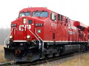
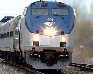
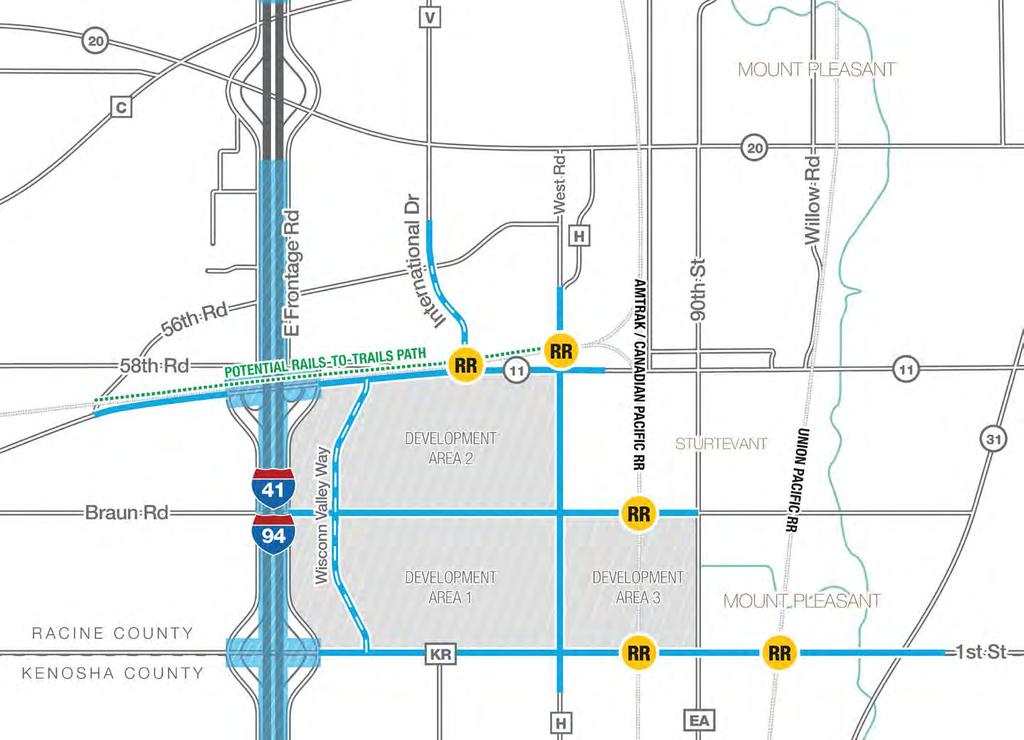

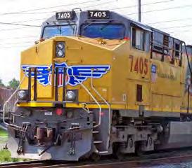
21 Railroad Coordination NOT TO SCALE LOCAL DEVELOPMENT ROADS

22 Eastern Racine County Transportation Task Force Seven person Task Force Advisory Committee Facilitated by WisDOT Ease east-west travel times east of I-94 Connect people to the influx of jobs LOCAL DEVELOPMENT ROADS


23 Future Improvements SEWRPC Vision 2050 Current projects address immediate needs Addressing long-term transportation needs SEWRPC Regional Land Use and Transportation Plan update Vision 2050 o o o Local County State PLANNING THE FUTURE

24 Smart Corridors Initial planning-level CV and AV deployment guides Guides refined as stakeholder needs identified, systems engineering process applied, technology matures Three CV and AV use cases identified Freeway and local road safety, operations Freeway commercial vehicle/freight efficiency, and throughput to/from GMIA Last Mile tech-based options on surface streets
25 I-94 Smart Corridor Development Next Steps Develop Concept of Operations (ConOps) on key smart corridor system features to address user and stakeholder needs Complete by August 2018 Create implementation plan for incrementally deploying required baseline infrastructure, merging mobility applications, and other system features Complete by October 2018 Continued system engineering activities including requirements development; design; procurement and installation; integration; testing and verification; validation; and, operations and maintenance Complete by 2020
26 Questions? For further information please visit


27 Brett Wallace, P.E. Foxconn Project Director Wisconsin Department of Transportation (262)
SH 199 Corridor Master Plan. Community Meeting No. 2 May 31, 2017
 Community Meeting No. 2 May 31, 2017 Transportation Projects On or Near SH 199 SH 199 from 0.3 miles south of FM 1886 to south end of Lake Worth bridge Construct freeway mainlanes and frontage roads 10-Year
SUMMARY. Support the Southeast Arkansas Regional Intermodal Facility.
 SUMMARY THE I-69 LOCATION STUDY The proposed I-69 Location Study from El Dorado to McGehee, Arkansas, represents one section (Section of Independent Utility No. 13) of the nationally designated I-69 Corridor
WELCOME! 8 8:30 6: TH STREET IMPROVEMENTS. Open House. Presentation & Q&A
 WELCOME! 168 TH STREET IMPROVEMENTS 6:30 Open House 7 8 Presentation & Q&A 8 8:30 Open House WELCOME Todd Pfitzer City of Omaha Engineer Bob Stubbe City of Omaha Public Works Director Jon Meyer Project
I-90 Mississippi River Bridge & Interchange Project
 I-90 Mississippi River Bridge & Interchange Project Presentation Outline I. Background: Context & Need for Project II. Preferred Alternative Overview III. Project Development IV. Project Management Tools
Dwelling Units Max 12 dwelling units per acre/min 8 dwelling units per acre. Development Mix 80% non residential/20% residential
 13. OSTEEN LOCAL PLAN Background: The Osteen Local Plan area is located in southwest Volusia County along the SR 415 corridor between Lemon Bluff Road and Acorn Lake Road and includes 3,990 acres. The
Scope of Services. River Oaks Boulevard (SH 183) Corridor Master Plan
 Corridor Master Plan") Scope of Services River Oaks Boulevard (SH 183) Corridor Master Plan PROJECT AREA The project area consists of the River Oaks Boulevard (SH 183) corridor bounded by SH 199 at the northern end and the Trinity
Scope of Services River Oaks Boulevard (SH 183) Corridor Master Plan PROJECT AREA The project area consists of the River Oaks Boulevard (SH 183) corridor bounded by SH 199 at the northern end and the Trinity
HAZARD MITIGATION GOALS AND OBJECTIVES
 SEWRPC Community Assistance Planning Report No. 282, 2nd Edition CITY OF MILWAUKEE ALL HAZARDS MITIGATION PLAN UPDATE Chapter IV HAZARD MITIGATION GOALS AND OBJECTIVES [NOTE: Throughout this plan update
AGENDA ITEM: IOWA. west] that were not FISCAL IMPACT. the City of Clive. STAFF REVIEW. Resolution II. Amendment PREPARED BY: REVIEWED BY:
![AGENDA ITEM: IOWA. west] that were not FISCAL IMPACT. the City of Clive. STAFF REVIEW. Resolution II. Amendment PREPARED BY: REVIEWED BY:](/thumbs/93/112428810.jpg "AGENDA ITEM: IOWA. west] that were not FISCAL IMPACT. the City of Clive. STAFF REVIEW. Resolution II. Amendment PREPARED BY: REVIEWED BY:") AGENDA ITEM: CITY OF WAUKEE, IOWA CITY COUNCIL MEETING COMMUNICATION MEETING DATE: March 7, 2016 AGENDA ITEM: Consideration of approval of a resolution approving Engineering Services Amendment No. 1 with
AGENDA ITEM: CITY OF WAUKEE, IOWA CITY COUNCIL MEETING COMMUNICATION MEETING DATE: March 7, 2016 AGENDA ITEM: Consideration of approval of a resolution approving Engineering Services Amendment No. 1 with
Overview of Southwestern Pennsylvania Commission s (SPC) 2040 Long Range Transportation Plan (LRTP)
 2040 Long Range Transportation Plan (LRTP)") Overview of Southwestern Pennsylvania Commission s (SPC) 2040 Long Range Transportation Plan (LRTP) Presented to Pennsylvania Agency Coordination Meeting May 27, 2015 Doug Smith & Ryan Gordon 1 Southwestern
Overview of Southwestern Pennsylvania Commission s (SPC) 2040 Long Range Transportation Plan (LRTP) Presented to Pennsylvania Agency Coordination Meeting May 27, 2015 Doug Smith & Ryan Gordon 1 Southwestern
Cottage Grove Road Reconstruction. City of Madison Engineering
 Public Informational Meeting Cottage Grove Road Reconstruction October 8, 2015 Presentation Outline Introduction Project Purpose & Need Proposed Design Overview Environmental Concerns Pedestrian Needs
The Ambassador Bridge/ Gateway Project
 The Ambassador Bridge/ Gateway Project Connecting Neighbors & Driving the Economy 2008 Ohio Conference on Freight Given by the Toledo Metropolitan Area Council of Governments, National Association of Regional
PROJECT BACKGROUND. Preliminary Design Scope and Tasks
 PROJECT BACKGROUND Preliminary Design Scope and Tasks The purpose of this Study is the development of preliminary designs for intersection improvements for Trunk Highway (TH) 36 at the intersections of
The Illinois Department of Transportation and Lake County Division of Transportation. Route 173, including the Millburn Bypass
 The Illinois Department of Transportation and Lake County Division of Transportation welcome you to this Public Hearing for U.S. Route 45 from Illinois Route 132 to Illinois Route 173, including the Millburn
Benchmark Nonpoint Source Management Approaches In Other States
 Governor s Environmental Advisory Council 2007 Nonpoint Source Pollution Control Initiative Benchmark Nonpoint Source Management Approaches In Other States Governor s Environmental Advisory Council April
ITS Concept Development Activity Descriptions
 ITS Concept Development Activity Descriptions October 2015 Procedures are subject to change without notice. Check the NJDOT website to ensure this is the current version. Table of Contents Concept Development
PREPARED FOR: PLATTEVIEW ROAD CORRIDOR STUDY EXECUTIVE SUMMARY
 PREPARED FOR: PLATTEVIEW ROAD CORRIDOR STUDY EXECUTIVE SUMMARY SEPTEMBER 2016 Introduction The Platteview Road Corridor Study was led by the Metropolitan Area Planning Agency (MAPA) with assistance from
State Highway 121 Southwest Parkway. Fort Worth s Transportation Success Story in Design and Cooperation
 State Highway 121 Southwest Parkway Fort Worth s Transportation Success Story in Design and Cooperation Greater Fort Worth Association of Realtors October 24, 2007 Presented by: Dan Lamers, P.E. North
SECTION 4(f) DE MINIMIS DOCUMENTATION
 DE MINIMIS DOCUMENTATION") SECTION 4(f) DE MINIMIS DOCUMENTATION Illinois Route 60/83 IL 176 to the intersection of IL 60 (Townline Road) Lake County P-91-084-07 Mundelein Park and Recreation District Project Limit SECTION 4(f)
SECTION 4(f) DE MINIMIS DOCUMENTATION Illinois Route 60/83 IL 176 to the intersection of IL 60 (Townline Road) Lake County P-91-084-07 Mundelein Park and Recreation District Project Limit SECTION 4(f)
Issues Requiring Future Study
 Issues Requiring Future Study Transportation planning is an ongoing process that tends to identify new issues as it finds solutions for others. Some issues are so complex that a solution to one problem
Longmeadow Parkway Fox River Bridge Corridor. August 6, 2015
 Longmeadow Parkway Fox River Bridge Corridor August 6, 2015 Longmeadow Parkway Bridge Corridor 5.6 miles from Huntley Road to IL 62 Unique municipal/county/state/federal partnership Links Randall Road
CITY OF CHARLOTTESVILLE, VIRGINIA CITY COUNCIL AGENDA
 CITY OF CHARLOTTESVILLE, VIRGINIA CITY COUNCIL AGENDA Agenda Date: December 16, 2013 Action Required: Adoption of Resolution Presenter: Staff Contacts: Title: James E. Tolbert, AICP, Director of NDS James
City of Waco Stormwater Management Regulations
 1.0 Applicability: City of Waco Stormwater Management Regulations These regulations apply to all development within the limits of the City of Waco as well as to any subdivisions within the extra territorial
RESOLUTION NO. R Refining the route, profile and stations for the Downtown Redmond Link Extension
 RESOLUTION NO. R2018-32 Refining the route, profile and stations for the Downtown Redmond Link Extension MEETING: DATE: TYPE OF ACTION: STAFF CONTACT: Capital Committee Board PROPOSED ACTION 09/13/2018
Kick-off Meeting. FM No: ETDM No: 14050
 Kick-off Meeting FM No: 433511-1-22-01 ETDM No: 14050 June 26, 2014 FM No. 433511 1 22 01 Project Location 2 Project Purpose and Need Improve traffic operations and safety conditions at the intersections
Intergovermental Coordination
 Intergovermental Coordination CITY OF WINTER PARK CHAPTER 8: INTERGOVERNMENTAL COORDINATION ELEMENT INTERGOVERNMENTAL COORDINATION ELEMENT GOAL 8-1: PROVIDE FOR IMPROVED INTERGOVERNMENTAL COORDINATION
Nine Mile Creek Regional Trail Update. Edina City Council Workshop March 4, 2014
 Nine Mile Creek Regional Trail Update Edina City Council Workshop March 4, 2014 Presentation Outline: Where we ve been - Recap of route assessment process and approved route Where we are now - Summary
Minutes of the Meeting of the ADVISORY COMMITTEE ON TRANSPORTATION SYSTEM PLANNING AND PROGRAMMING FOR THE KENOSHA URBANIZED AREA
 Minutes of the Meeting of the ADVISOY COMMITTEE ON TANSPOTATION SYSTEM PLANNING AND POGAMMING FO THE KENOSHA UBANIZED AEA DATE: April 28, 2014 TIME: PLACE: 10:00 a.m. Conference oom A Kenosha County Center
Secrest Short Cut and Monroe Expressway Small Area Plan AUGUST 29, 2018
 Secrest Short Cut and Monroe Expressway Small Area Plan AUGUST 29, 2018 Background and Process Monroe Expressway will be open by the end of 2018 Union County and Indian Trail identified a need to revisit
Shift Rapid Transit Public Participation Meeting May 3, 2017
 Shift Rapid Transit Public Participation Meeting May 3, 2017 Shift Rapid Transit Initiative Largest infrastructure project in the city s history. Rapid Transit initiative will transform London s public
Presenting a Vision for Thread Lake
 Presenting a Vision for Thread Lake FEBRUARY 20, 2014 SPECIAL THANKS TO: International Academy of Flint Flint River Watershed Coalition South Saginaw Business and Resident Association South Side Neighborhood
2018 Primary Road Capital Improvement Plan (CIP) Projects Preservation / Structural Improvement, Non-motorized and Engineering Design Projects
 Projects Preservation / Structural Improvement, Non-motorized and Engineering Design Projects") 2018 Primary Road Capital Improvement Plan (CIP) Projects Preservation / Structural Improvement, Non-motorized and Engineering Design Projects Preservation / Structural Improvement Projects in 2018 Ravine
2018 Primary Road Capital Improvement Plan (CIP) Projects Preservation / Structural Improvement, Non-motorized and Engineering Design Projects Preservation / Structural Improvement Projects in 2018 Ravine
IMPLEMENTING SOMERSET COUNTY S INVESTMENT FRAMEWORK
 IMPLEMENTING SOMERSET COUNTY S INVESTMENT FRAMEWORK SMART CONSERVATION THROUGH SMART GROWTH NJ LAND CONSERVATION RALLY March 22, 2014 Laurette Kratina, PP, AICP, Supervising Planner Somerset County Planning
INTEGRATING NATURAL RESOURCES INTO A DEVELOPMENT, PUBLIC AND PRIVATE ROLES
 INTEGRATING NATURAL RESOURCES INTO A DEVELOPMENT, PUBLIC AND PRIVATE ROLES Why? Integrating natural resources into a development can increase its market value, enhance the quality of life for those who
CHATHAM COUNTY S PATH TO SUSTAINABILITY - THE NATURAL RESOURCES SIDE
 CHATHAM COUNTY S PATH TO SUSTAINABILITY - THE NATURAL RESOURCES SIDE GEORGIA ENVIRONMENTAL CONFERENCE SAVANNAH, GEORGIA AUGUST 23, 2012 Jackie Jackson Teel Chatham County-Savannah Metropolitan Planning
Sustainable Storm Water Management
 Incorporating Water Management into the Community Planning Process August 16, 2012 Sustainable Storm Water Management Samantha Brown Environmental Engineer SD1 SD1 s Service Area CVG Airport SD1 Service
Lesson 6. Corridor Planning
 Lesson 6 Corridor Planning 1 Learning Outcomes Identify land use strategies and solutions that can be incorporated into multimodal transportation corridor plans Identify land use stakeholders and describe
Subject: Hendry County Evaluation and Appraisal Report Letter of Understanding - Identification of Major Issues
 HENDRY COUNTY PLANNING & ZONING DEPARTMENT POST OFFICE BOX 2340 165 S. LEE STREET LABELLE, FLORIDA 33975 (863) 675-5240 FAX: (863) 675-5317 SUNCOM 744-4750 November 16, 2007 Mr. Mike McDaniel, Chief Office
NASSAU COUNTY TOWN HALL NEW YORK & CONNECTICUT SUSTAINABLE COMMUNITIES. A Unique Bi-State Partnership to Improve Jobs, Housing and Transportation
 NASSAU COUNTY TOWN HALL NEW YORK & CONNECTICUT SUSTAINABLE COMMUNITIES A Unique Bi-State Partnership to Improve Jobs, Housing and Transportation Police Headquarters Auditorium Mineola, NY December 9 th,
Red Fox Commercial Outline Plan
 Red Fox Commercial Outline Plan City of Cold Lake, Alberta Prepared by Durrance Projects Ltd and Ross W. Sharp & Associates Ltd October 2014 Rupert 1 Table of Contents 1. PURPOSE...3 1.1. Location...4
Chapter 2: Strategies for Local Governments Chapter 3: Site Assessment and Design for Low Impact Development. Break Out Group 10:30 am to 12 pm
 Chapter 2: Strategies for Local Governments Chapter 3: Site Assessment and Design for Low Impact Development Break Out Group 10:30 am to 12 pm A Low Impact Development Manual for Coastal South Carolina
Potential Green Infrastructure Strategies May 6, 2015 Workshop
 Potential Green Infrastructure Strategies May 6, 2015 Workshop Background The City of Cortland is developing the Tioughnioga Urban Headwaters Green Infrastructure Action Plan with funding from the National
Elgin O Hare Western Access Project Local Advisory Committee. February 10, 2014
 Elgin O Hare Western Access Project Local Advisory Committee February 10, 2014 Agenda Project status update Design and construction Funding Aesthetics Project events and outreach Land acquisition Next
Hockessin Community Redevelopment Plan
 Hockessin Community Redevelopment Plan 3.1 Introduction The Community Redevelopment Plan for the Village of Hockessin is the result of the people s vision for a distinct village center that serves as the
CHAPTER 6 EXISTING PLANS AND ORDINANCES
 CHAPTER 6 EXISTING PLANS AND ORDINANCES This Comprehensive Plan is intended, in part, to review the land use and related plans adopted by the City of Kenosha, update those plans as necessary to comply
5-Year Street Reconstruction Plan ( )
") 5-Year Street Reconstruction Plan (2006-2010) City of Delano Wenck File #0564-37 Prepared for: CITY OF DELANO 234 2 nd Street West Delano, MN 55328 Prepared by: WENCK ASSOCIATES, INC. 1800 Pioneer Creek
5-Year Street Reconstruction Plan (2006-2010) City of Delano Wenck File #0564-37 Prepared for: CITY OF DELANO 234 2 nd Street West Delano, MN 55328 Prepared by: WENCK ASSOCIATES, INC. 1800 Pioneer Creek
IMPLEMENTATION STRATEGIES. In This Chapter. Goals & Strategies 182 Project List 183 Future Land Use 186 CHAPTER 11 IMPLEMENTATION STRATEGIES
 In This Chapter Goals & Strategies 182 Project List 183 Future Land Use 186 11 IMPLEMENTATION STRATEGIES NORTH AUGUSTA, SC 2017 COMPREHENSIVE PLAN 179 Individual commitment to a group effort that is what
Rapid Transit Implementation Working Group September 14, 2017
 Rapid Transit Implementation Working Group September 14, 2017 BACKGROUND Council approved the Rapid Transit Master Plan and Updated Business Case on July 25, 2017. Approval of the RTMP confirmed the BRT
PURPOSE: The purpose is to provide commercial facilities in the Vancouver and Clark County vicinity.
 US Army Corps of Engineers Seattle District Joint Public Notice Application for a Department of the Army Permit and a Washington Department of Ecology Water Quality Certification and/or Coastal Zone Management
Figure 5. Previously Identified Viable Corridors
 OVERVIEW The Central Florida Expressway Authority (CFX) is evaluating the potential to expand SR 408 from its current eastern terminus along SR 50 to SR 520 in northeastern Orange County, Fl. This new
May U.S. Department of Transportation Federal Highway Administration
 May 1999 U.S. Department of Transportation Federal Highway Administration AN OVERVIEW LAND USE AND ECONOMIC DEVELOPMENT IN STATEWIDE TRANSPORTATION PLANNING Prepared for FEDERAL HIGHWAY ADMINISTRATION
Mississippi Skyway Preliminary Engineering Report
 EXECUTIVE SUMMARY Mississippi Skyway Preliminary Engineering Report CITY OF RAMSEY, MINNESOTA DECEMBER 2014 City of RAMSEY EXECUTIVE SUMMARY Project Need and Intent The Mississippi Skyway pedestrian bridge
Public Hearing. Charlotte County-Punta Gorda MPO - Meeting Rooms A and B March 14, open house at 4 p.m., formal presentation at 5 p.m.
 Public Hearing Charlotte County-Punta Gorda MPO - Meeting Rooms A and B March 14, 2019 open house at 4 p.m., formal presentation at 5 p.m. Welcome to the Public Hearing for the Harborview Road (CR 776)
Welcome! MILLENNIUM LINE BROADWAY EXTENSION. Over the next 30 years, Metro Vancouver will welcome 1 million new residents and 600,000 new jobs.
 WELCOME Welcome! MILLENNIUM LINE BROADWAY EXTENSION Over the next 30 years, Metro Vancouver will welcome 1 million new residents and 600,000 new jobs. The Broadway Corridor is home to the second largest
APWA Expo August 27, Ground Water Recharge With Storm Management: A Sustainable Development
 APWA Expo August 27, 2013 Ground Water Recharge With Storm Management: A Sustainable Development Presented by: Joel S. Koenig, P.E. Andrew J. Hawkins Chris P. Dagiantis, P.E., CFM Bios Joel S. Koenig,
City of Meriden Harbor Brook Flood Control Project Overview
 City of Meriden Harbor Brook Flood Control Project Overview Updated August 2013 OVERVIEW The center of Meriden, including the HUB site is the low point of the town which is ringed by basalt ridges. Running
1.0 INTRODUCTION 1.1 TH 14 WEST STUDY AREA Project Description Functional Classification Purpose of the Project
 1.0 INTRODUCTION 1.1 TH 14 WEST STUDY AREA 1.1.1 Project Description The Trunk Highway (TH) 14 West Corridor is a two-lane roadway approximately 22 miles in length. Located in Nicollet County, the corridor
I. INTRODUCTION. Project Background and Study Area
 I. INTRODUCTION Project Background and Study Area Freedom Parkway is a key east-west corridor connecting I-25 on the west to the Town of Kersey on the east, running approximately one to two miles south
Toronto Complete Streets Guidelines
 Toronto Complete Streets Guidelines 108 110 7.1 Green Infrastructure Design Principles 112 7.2 Context-Sensitive Green Streets 114 7.3 Key Green Street Elements Green infrastructure refers to natural and
13. PRELIMINARY PLAT NO MILLS FARM - Vicinity of the southeast corner of 159 th Street and Quivira Road
 13. corner of 159 th Street and Quivira Road 1. APPLICANT: HNTB Corporation is the applicant for this request. 2. REQUESTED ACTION: The applicant is requesting approval of a preliminary plat for a 383-lot
Municipal Plan*Assessment
 Municipal Plan*Assessment This tool was developed to assist in reviewing municipal master plans and in determining if these plans are consistent with smart growth principles, neighboring municipal plans,
Two Sides of the Green Infrastructure Coin. Jaren Hiller, PE, LEED AP Nathan Guequierre
 Two Sides of the Green Infrastructure Coin Jaren Hiller, PE, LEED AP Nathan Guequierre May 5, 2016 Background Citywide Stormwater Planning WinSLAMM Analysis No Control Existing Conditions Proposed Conditions
Harlem Avenue Corridor Plan: Corridor Planning Across Municipal Boundaries
 Harlem Avenue Corridor Plan: Corridor Planning Across Municipal Boundaries Heather Tabbert, Manager, Local Planning and Programs Division Regional Transportation Authority (RTA) Jen McNeil Dhadwal, Principal
Information for File # MHK
 Information for File #2014-03555-MHK Applicant: Corps Contact: Wimmer Communities Marie Kopka Address: 250 N. Sunnyslope Road, Suite 296 Brookfield, Wisconsin 53005 E-Mail: Marie.H.Kopka@usace.army.mil
CONTEXT: the Highway, the River + the Railroads run through us.
 CONTEXT: the Highway, the River + the Railroads run through us. I-25 36 In the past they have divided us, now we have an opportunity to unite us. I-76 I-270 I-76 CSU I-25 LEGEND Cut + Cover River North
Community Sensitive Design: (Context Sensitive Design)
") What is? Community Sensitive Design: (Context Sensitive Design) The process by which urban design, land-use planning and aesthetic enhancements are applied to a project to make it an integral part of the
What is? Community Sensitive Design: (Context Sensitive Design) The process by which urban design, land-use planning and aesthetic enhancements are applied to a project to make it an integral part of the
SUNBRIDGE PARKWAY PRELIMINARY DESIGN STUDY. Board of County Commissioners Public Hearing
 SUNBRIDGE PARKWAY PRELIMINARY DESIGN STUDY Board of County Commissioners Public Hearing March 20, 2018 Presentation Overview Study Overview Existing Conditions Project Development Plan Public Involvement
Chapter Master Planned Communities (MPC) District
 District") Sections 14.53.010 Purpose and Intent 14.53.020 Applicability 14.53.030 Procedure 14.53.040 MPC Standards 14.53.050 Required Findings 14.53.010 Purpose and Intent Chapter 14.53 Master Planned Communities
Sections 14.53.010 Purpose and Intent 14.53.020 Applicability 14.53.030 Procedure 14.53.040 MPC Standards 14.53.050 Required Findings 14.53.010 Purpose and Intent Chapter 14.53 Master Planned Communities
Borderland Expressway Coalition Status Report Camino Real RMA Board Meeting. El Paso, TX April 11, 2018
 Borderland Expressway Coalition Status Report Camino Real RMA Board Meeting El Paso, TX April 11, 2018 Coalition Key Stakeholders Texas Department of Transportation New Mexico Department of Transportation
Southeast Michigan Council of Governments
 Southeast Michigan Council of Governments SEMCOG Green Infrastructure Activities Regional Green Infrastructure Vision GLRI Green Streets EPA Technical Assistance MDOT Grants Green Infrastructure Vision
EXECUTIVE SUMMARY. Introduction
 EXECUTIVE SUMMARY Introduction State Route 68 is a designated scenic route that connects the world-renowned Monterey Peninsula to US Highway 101 and the Salinas Valley. SR 68 is a key route for bicycle,
Route 1 Corridor Study
 Route 1 Corridor Study Westbrook, Connecticut A Vision for the Connecticut Shoreline Public Informational Meeting July 28, 2015 Lower Connecticut River Valley Council of Governments Fitzgerald & Halliday,
7.0 SOCIAL, ECONOMIC, AND ENVIRONMENTAL ISSUES
 7.0 SOCIAL, ECONOMIC, AND ENVIRONMENTAL ISSUES The following list of social, economic, and environmental issues have been identified based on a preliminary inventory of resources in the project area, an
Information for File # MVP MMJ; Elim Care
 Information for File # MVP-217-2628-MMJ; Elim Care Applicant: Elim Care of Maple Plain Corps Contact: Melissa Jenny Address: 18 Fifth Street East, Suite 7, St. Paul, MN 5511-168 E-Mail: Melissa.m.jenny@usace.army.mil
Transportation Committee
 Transportation Committee Business Item No. 2013-286SW Meeting date: October 14, 2013 For the Metropolitan Council meeting of October 16, 2013 Subject: Southwest Light Rail Transit (Green Line Extension):
Public Meeting. US Highway 14 (6TH Street) from Main Ave to Medary Ave Urban Reconstruction Project Brookings, SD P-PH 0014(179)419 PCN 027B
 from Main Ave to Medary Ave Urban Reconstruction Project Brookings, SD P-PH 0014(179)419 PCN 027B") Public Meeting US Highway 14 (6TH Street) from Main Ave to Medary Ave Urban Reconstruction Project Brookings, SD P-PH 0014(179)419 PCN 027B Mark Leiferman Chief Road Design Engineer April 28, 2014 Why
Public Meeting US Highway 14 (6TH Street) from Main Ave to Medary Ave Urban Reconstruction Project Brookings, SD P-PH 0014(179)419 PCN 027B Mark Leiferman Chief Road Design Engineer April 28, 2014 Why
implementation10 Village of Greendale Comprehensive Plan: Greendale, Wisconsin. Revisiting a Greenbelt Community
 implementation10 Village of Greendale Comprehensive Plan: 2010 - Village of Greendale Comprehensive Plan: 2010 - Implementation The recommendations of this Plan must be implemented by the Village of Greendale,
Transportation Systems and Utility Infrastructure
 77 Audience Local and regional units of government, Landowners and developers, Community and citizen organizations, and Transportation/utility planners and engineers. Overview Transportation systems and
DRAFT SECTION 4(f) EVALUATION INTERSTATE 73 FEIS: I-95 to I-73/I-74 in North Carolina
 EVALUATION INTERSTATE 73 FEIS: I-95 to I-73/I-74 in North Carolina") DRAFT SECTION 4(f) EVALUATION INTERSTATE 73 FEIS: I-95 to I-73/I-74 in North Carolina 1.0 INTRODUCTION Section 4(f) of the Department of Transportation Act of 1966, 49 U.S.C. 303, requires that prior to
DRAFT SECTION 4(f) EVALUATION INTERSTATE 73 FEIS: I-95 to I-73/I-74 in North Carolina 1.0 INTRODUCTION Section 4(f) of the Department of Transportation Act of 1966, 49 U.S.C. 303, requires that prior to
Expo Light Rail Line. Expo Line Community Meeting Phase 2 Design Update November 2011
 Expo Line Community Meeting Phase 2 Design Update November 2011 Meeting Agenda Phase 2 Design Update Meeting Meeting Purpose and Format Project Status Update Overview of Design Progress Next Steps Open
AASHTO Board of Directors. Standing Committees (Functional Areas): Finance and Administration. Highway Traffic Safety. Performance.
: Finance and Administration. Highway Traffic Safety. Performance.") AASHTO Board of Directors Executive Committee Standing Committees (Modal): Aviation Standing Committees (Functional Areas): Environment Special Committees: Intermodal and Economic Expansion Highways Finance
AASHTO Board of Directors Executive Committee Standing Committees (Modal): Aviation Standing Committees (Functional Areas): Environment Special Committees: Intermodal and Economic Expansion Highways Finance
Natomas Vision Plan and PLNP
 Natomas Vision Plan 20030171 and PLNP2014-00172 Department of Community Development Planning and Environmental Review Leighann Moffitt Sub-Agenda 1. Staff Presentation Leighann Moffitt, County Planning
March 30, 2017
 March 30, 2017 2 municipal examples of GI installments: Lancaster, PA (population: 60,000) Dover, NH (population 31,000) The City of Lancaster: Overview Incorporated in 1742 as a borough and in 1818
Corridor Vision. 1Pursue Minnehaha-Hiawatha Community Works Project. Mission of Hennepin County Community Works Program
 1Pursue Minnehaha-Hiawatha Community Works Project Minnehaha-Hiawatha Community Works is a project within the Hennepin Community Works (HCW) program. The mission of the HCW program is to enhance how the
PD&E STUDY SR 9/I-95 FROM SOUTH OF SR 870/COMMERCIAL BOULEVARD TO NORTH OF CYPRESS CREEK ROAD FM # ETDM 14222
 PD&E STUDY SR 870/COMMERCIAL BOULEVARD TO NORTH OF CYPRESS CREEK ROAD FM # 435808-1-22-02 ETDM 14222 WELCOME TO THE KICK-OFF MEETING May 24, 2016 1 1 2 3 4 5 6 PLANNING PROJECT DEVELOPMENT AND ENVIRONMENT
INTERGOVERNMENTAL COORDINATION ELEMENT
 Goals, Objectives and Policies COORDINATION ELEMENT GOAL 8.1.: ESTABLISH EFFECTIVE COORDINATION MEASURES AMONG ALL PERTINENT PUBLIC AND QUASI-PUBLIC ENTITIES SO TO BEST MAINTAIN PALM BEACH GARDENS' QUALITY
Transportation Land Use Integration & Regional Planning. Don Kostelec, AICP Senior Planner, Louis Berger Group February 1, 2010
 Transportation Land Use Integration & Regional Planning Don Kostelec, AICP Senior Planner, Louis Berger Group February 1, 2010 Transportation Land Use Integration DOT-HUD-EPA Sustainable Communities Initiative
FHWA INVEST. And the Harbor Bridge Project
 FHWA INVEST And the Harbor Bridge Project FHWA s Sustainable Highways Initiative The Sustainable Highways Initiative supports programs and activities conducted across the Federal Highway Administration
Gratigny Parkway East Extension Project Development & Environment (PD&E) Study
 Study") Gratigny Parkway East Extension Project Development & Environment (PD&E) Study Session 4: Presentation of Charrette Results December 8, 2010 MDX Work Program #: 92407 ETDM#: 11500 Project Location & Description
Gratigny Parkway East Extension Project Development & Environment (PD&E) Study Session 4: Presentation of Charrette Results December 8, 2010 MDX Work Program #: 92407 ETDM#: 11500 Project Location & Description
6:00 8:00 PM I-95 FROM EXIT 57 TO EXIT 60 PROJECT
 PUBLIC INFORMATIONAL MEETING TUESDAY, APRIL 27, 2010 AT NEWBURYPORT CITY HALL, AUDITORIUM 60 PLEASANT STREET NEWBURYPORT, MASSACHUSETTS 6:00 8:00 PM FOR THE PROPOSED WHITTIER BRIDGE / I-95 IMPROVEMENTS
Better Cycling. The City will update the cycling master plan (London ON Bikes) based on the approved BRT network.
 based on the approved BRT network.") Better Cycling Dedicated bike facilities will be constructed along BRT corridors where space is available. Nearby bike routes will also be upgraded to ensure a complete network is available for cyclists.
Better Cycling Dedicated bike facilities will be constructed along BRT corridors where space is available. Nearby bike routes will also be upgraded to ensure a complete network is available for cyclists.
AASHTO SUBCOMMITTEE ON DESIGN. June 15, 2006 MARK ROBINSON, P.E. DISTRICT 5 INTERSTATE PROGRAM MANAGER FLORIDA DEPARTMENT OF TRANSPORTATION
 AASHTO SUBCOMMITTEE ON DESIGN June 15, 2006 MARK ROBINSON, P.E. DISTRICT 5 INTERSTATE PROGRAM MANAGER FLORIDA DEPARTMENT OF TRANSPORTATION CENTRAL FLORIDA INTERSTATE 4 FACTS Trucks and Others 12% Tourist
Route Planning and Environmental Assessment Study Highway 17 Four-Laning from Sudbury to Markstay GWP
 Route Planning and Environmental Assessment Study Highway 17 Four-Laning from Sudbury to Markstay GWP 5031-09-00 Presentation to City of Greater Sudbury Council: January 26, 2011 1 Roch Pilon, P.Eng. Head,
City of Richland Stormwater Management Plan
 City of Richland Stormwater Management Plan City of Richland Public Works Department 840 Northgate Drive Richland, WA 99352 2015 Nancy Aldrich Special Projects Coordinator City of Richland Public Works
CITY OF VALPARAISO STORMWATER MASTER PLAN
 CITY OF VALPARAISO STORMWATER MASTER PLAN APPROVED BY THE VALPARAISO CITY UTILITIES BOARD OCTOBER, 2016 Prepared by the City of Valparaiso Engineering Department PLAN SUMMARY Major flash flooding in August
Farmersville Parkway Phase III
 Farmersville Parkway Phase III Application to the TIGER VI Discretionary Grant Program April 2014 Submitted By: City of Farmersville 205 South Main Street Farmersville, Texas 75442 972-782-6151 TABLE OF
RESILIENCY, ADAPTATION, & SUSTAINABILITY AT THE CITY OF ST. AUGUSTINE
 RESILIENCY, ADAPTATION, & SUSTAINABILITY AT THE CITY OF ST. AUGUSTINE PROGRAM UPDATE JANUARY 14, 2019 MICHAEL G. CULLUM, P.E. DIRECTOR, PUBLIC WORKS PROGRESSION OF PLANNING FOR RESILIENCY / ADAPTATION
Iowa s Statewide Urban Design Standards Promote Improved Access Management
 Iowa s Statewide Urban Design Standards Promote Improved Access Management David J. Plazak and Dale S. Harrington Center for Transportation Research and Education Iowa State University 2901 South Loop
TIRZ 17/Redevelopment Authority Capital Improvements Plan Projects
 Gessner Widening: T-1701 What: Widen the road from a six-lane divided boulevard to an eight-lane divided boulevard street section, increase turn lanes, update traffic signal system, improve drainage by
A G E N D A Council Update Training Room September 26, :45 p.m.
 CITY OF THORNTON CITY MANAGER S OFFICE A G E N D A Council Update Training Room September 26, 2017 5:45 p.m. A. Boards and Committees Reports (Estimated 20 Minutes) 1. Rangeview Library District Meeting
T H A T E V E R Y O N E
 B R I N G I N G C H A N G E T H A T E V E R Y O N E C A N F E E L. AT CHW, we survey, plan, design, engineer, administer and inspect with a purpose: to positively transform the communities we serve. From