December 11, December 10, 2015
|
|
|
- Clarence Berry
- 5 years ago
- Views:
Transcription


1 December 11, 2015 December 10, 2015

2 2 Welcome & Introductions Project Overview Discussion Questions Group Insights Key Takeaways Next Steps
3 3
4 4
5 5
6 6
7 7
8 8

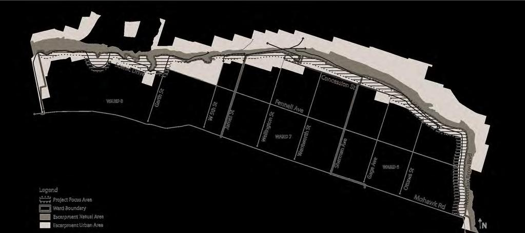
9 9 Governed by multiple layers of policy UNESCO World Biosphere Reserve Designation Provincial Policy Regional Policy Municipal Policy & By-laws

10 10 Protects natural and agricultural lands from Niagara Region to Northumberland County. Identifies where development can and cannot occur. States that lands found within the Niagara Escarpment Area are governed by the Niagara Escarpment Plan Policies.

11 11 Goal is to protect unique environment of Niagara Escarpment. Outlines policies on land use and criteria for development under the plan including Escarpment Natural Areas and Urban Area. Niagara Escarpment Plan Map Excerpt
12 12 Goal is to maintain the natural areas delineated within the Plan including: Stream valleys, wetlands, natural areas, cultural heritage features; Encourage recreation and education; Maintain and enhance landscape quality. Permitted uses include: Existing uses, single residential units, non-intensive recreation activities and forest management.
13 13 Municipal land which has already encroached on the Niagara Escarpment Plan Boundary. Goal is to minimize impact and further encroachment on Escarpment. Development should not adversely affect the Escarpment visually or environmentally.
14 14 Criteria for development within the Plan including: Protection of steep slopes and ravines (no disturbance or vegetation removal); Setbacks from watercourses; Protection of wildlife habitat; Forest Management through implementing authority.
15 15 Study area falls within Natural Area in Official Plan, Schedule A Permitted uses include active & passive parks, recreation or community centres or historic sites, pedestrian connections, marinas, cemeteries and/or management areas (forest, fish and wildlife). Study area also within the Core Areas, Schedule B Policy sates that vegetation removal and encroachment into Core Areas shall generally not be permitted.
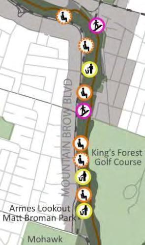
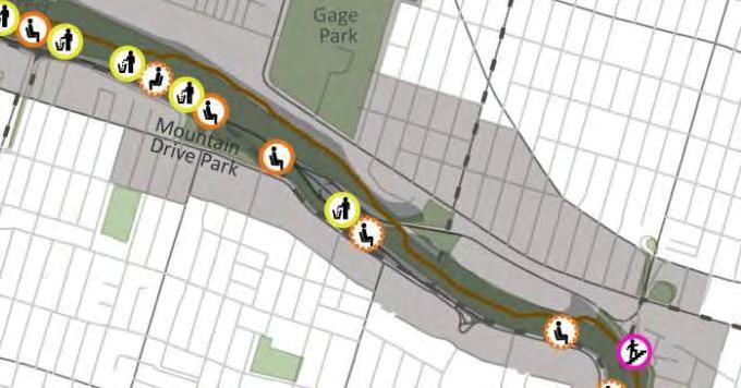
16 16 Public Tree Protection By-law (No ) No person shall injure, destroy or permit the injury or destruction of public trees in any way including: pruning any part of the tree, affecting root structure, working within drip line, fastening items to the tree, altering tree protection etc. Tree Preservation and Sustainability Policy Removals should be avoided but, if deemed necessary, require a permit application to be issued by Director. Permit applications should contain the following information: reasons for removal, species of trees to be removed, diameter at breast height measurement and photographs of the trees to be removed. Applicants are required to pay for removals or provide for replacements prior to the permit being issued.
17 17 Tree removal permit application to be submitted to Director for approval. Permit requires the following information and actions: Reasons for tree removal; Species of trees to be removed; Diameter at breast height measurement for trees to be removed; Prior to Permit issuance, applicant must pay for removal or arrange for replacement of trees of similar species. Once approval granted, plan for removals shall be brought before Niagara Escarpment Commission for their final approval as they are the Niagara Escarpment Plan implementing authority.

18 18 Provincial to Municipal


19 19 Niagara Escarpment Plan Designations

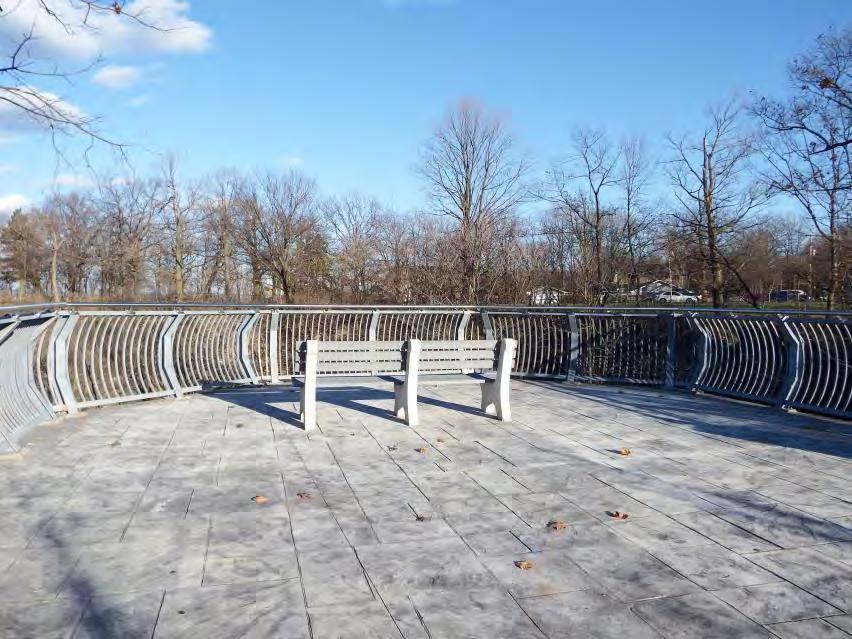
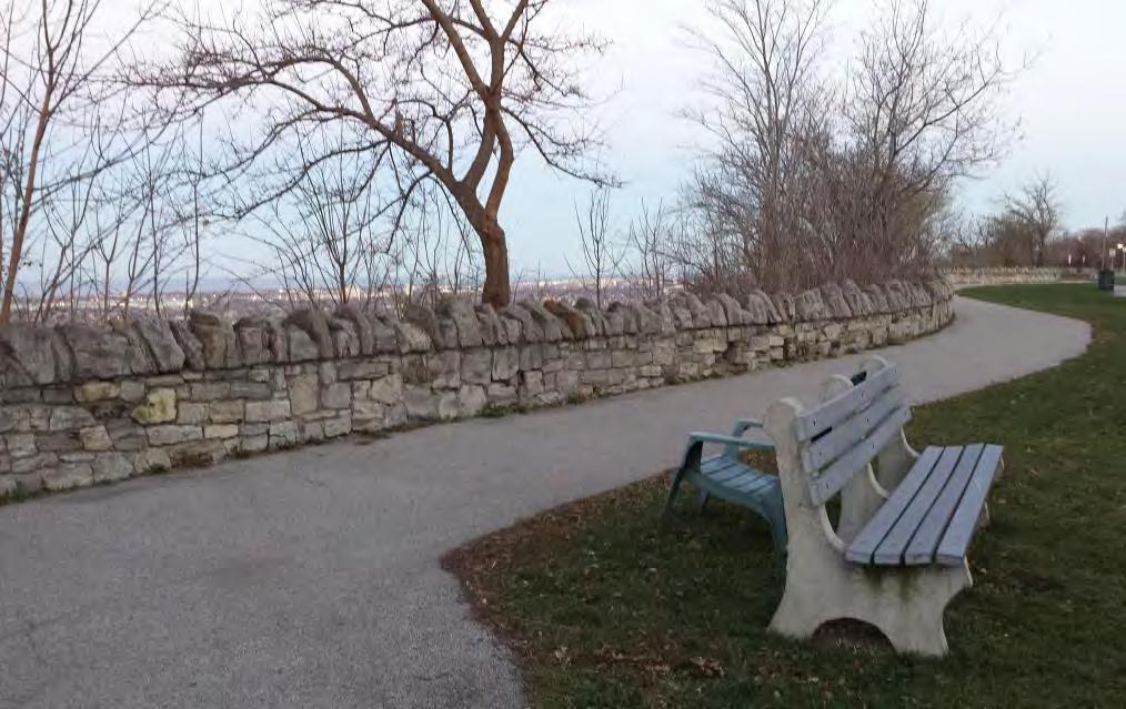
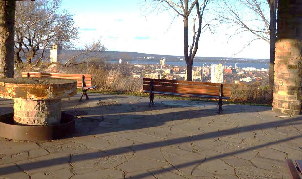
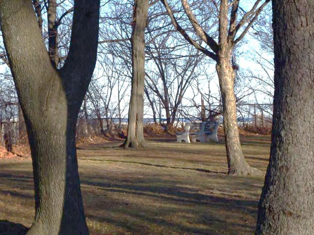
20 20 Natural Heritage, Open Space & Urban Forest
21 21 Urban Footprint
22 22 Private Access and Vistas
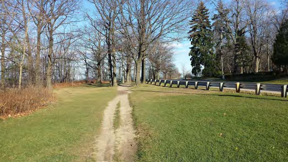
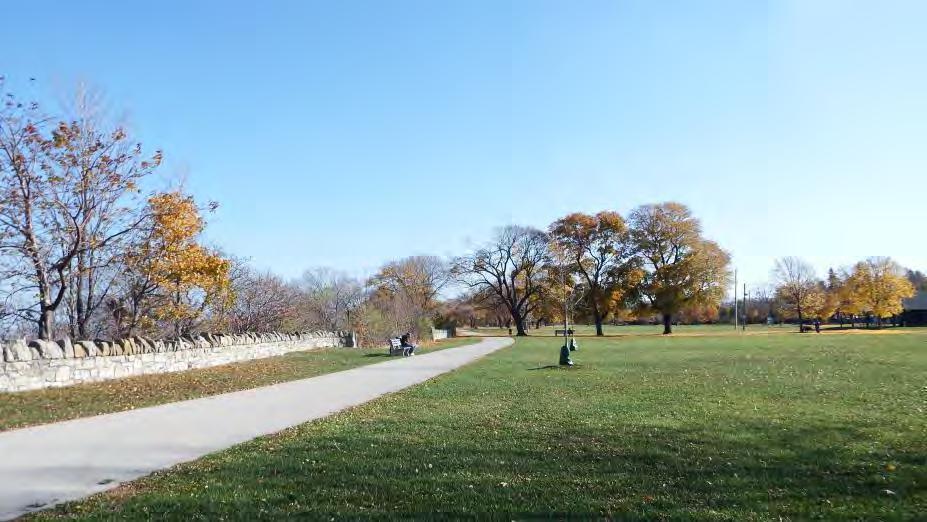
23 23 Connectivity Trails

 Staircase with Bike Access Staircase Conservation Area Waterfall Location Urban Fitness")
24 24 Municipal Park Green/Open Space Institution/Cultural Attraction Multi-use Rec Trail Trail Initiative Recreation & Trails Master Plan On-Street Bike Route Existing Trail Greenbelt Route Trans Canada Trail Lake Ontario Waterfront Trail Bruce Trail (Existing Footpath) Red Hill Valley Rec Trail Trail Head Sign Location Staging Area (Parking) Staircase with Bike Access Staircase Conservation Area Waterfall Location Urban Fitness Trail Location
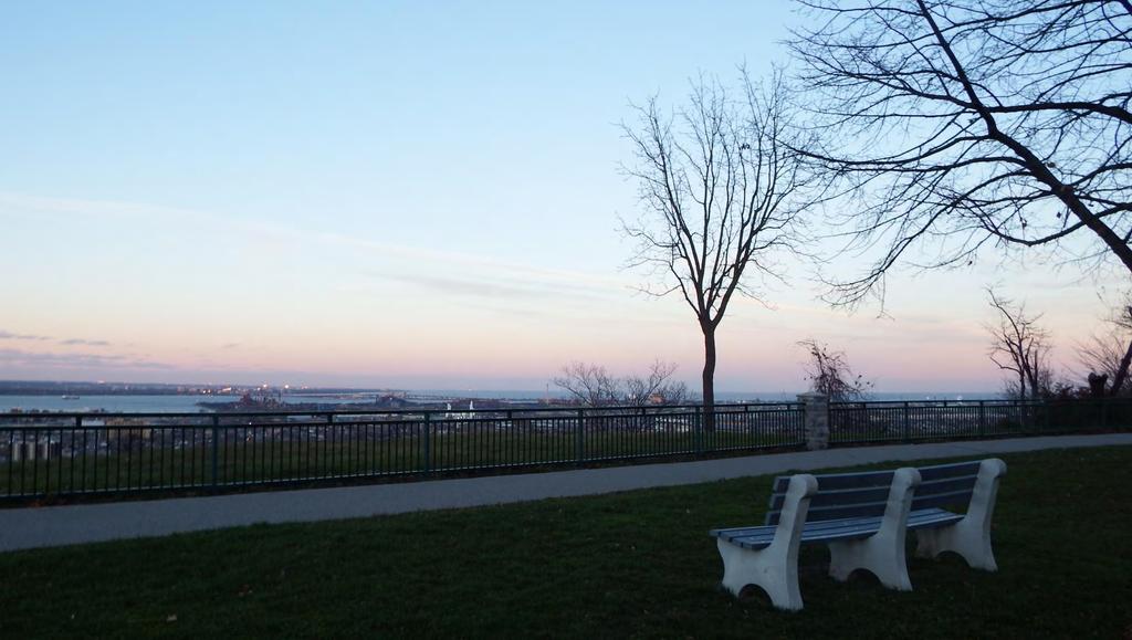
25 Mountain Brow Vista Investigations 25 Connectivity - Stairs
26 26 Connectivity - Bike Share
27 27 Public Amenities - Seating

28 28 Public Amenities Site Occupation
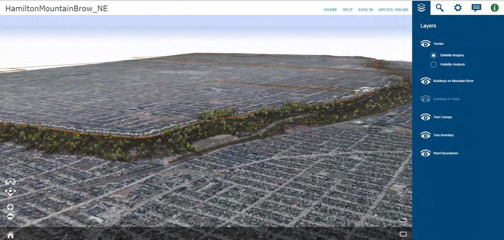
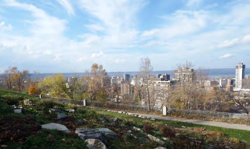
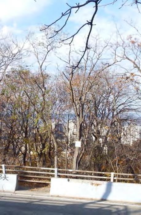
29 29 Trail Experience

30 30 Trail Experience Ward 7
31 31 Trail Experience Ward 6
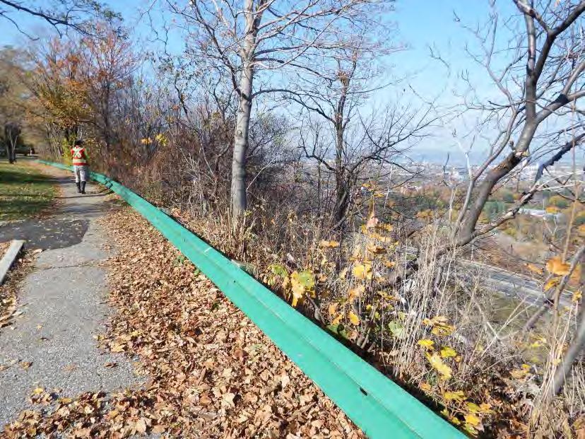
32 32 Trail Experience

33 33 Slope Analysis


34 34 Slope Analysis

35 35 Slope Analysis
36 36 Vegetation & Slope Analysis

37 37 Existing Vistas

38 38 Existing Vistas

39 39 Potential Vistas


40 40 Potential Vistas Ward 7


41 41 Potential Vistas Ward 6
42 42 Steep slopes and erosion of the Escarpment. Significant limitations within the policies. Safety concerns regarding the maintenance of vistas. Financial capacity for capital and ongoing operational costs.
43 43 Sustainable forest management - strategic one at a time removal of invasive species and hazard trees. Strengthen the slopes along the brow. Maximize urban forest contribution on the brow (private + public lands). Minimize visual impacts from the valley. Improve trail experience with strategic vistas.
44 44 Protect and enhance the natural features (slopes, forest, habitats) in the Niagara Escarpment Plan lands. Improve the urban forest in the Niagara Escarpment Plan lands. Minimize the impact and further encroachment of urban development on the Escarpment environment. Ensure that further visual intrusion of the urban area on the Escarpment is minimized.
45 45 1. What about this area do you value most? What concerns about this project do you have?


46 46 2. What are the most important elements that should be considered when selecting views along the Mountain Brow right-of way?
47 47 3. What are the most important and impressive views to be protected along the Mountain Brow right-of-way and why?

48 48 4. Where should new open views along the Mountain Brow right-ofway be located and why?

49 49 5. What open spaces should be protected as natural areas along the Mountain Brow and why?
50 50 6. Other comments?
51 51
52 52
53 53 Marcia Monaghan Senior Project Manager Forestry & Horticulture City of Hamilton Tel x2566 Eha Naylor Project Manager Dillon Consulting Limited Tel x2362
APPENDIX F: EXTERNAL APPROVALS
 1.0 RESPONSIBILITIES When the City is constructing the Park or Open Space Development lands (OPTION I), after the subdivision construction process is completed by the Developer, Open Space Development
4155 Yonge Street Official Plan Amendment and Rezoning Application Preliminary Report
 STAFF REPORT ACTION REQUIRED 4155 Yonge Street Official Plan Amendment and Rezoning Application Preliminary Report Date: May 5, 2011 To: From: Wards: Reference Number: North York Community Council Director,
TERRESTRIAL NATURAL HERITAGE SYSTEM STRATEGY APPENDIX F: MODEL POLICIES FOR THE IMPLEMENTATION OF THE TARGET TERRESTRIAL NATURAL HERITAGE SYSTEM
 TERRESTRIAL NATURAL HERITAGE SYSTEM STRATEGY APPENDIX F: MODEL POLICIES FOR THE IMPLEMENTATION OF THE TARGET TERRESTRIAL NATURAL HERITAGE SYSTEM C H A P T E R 1 M O D E L P O L I C I E S F O R I M P L
6Natural. Environment Development Permit Guidelines
 6Natural Bylaw 2600-2016, being "Official Community Plan Bylaw, 2016" Schedule "A" CITY OF ABBOTSFORD OFFICIAL COMMUNITY PLAN Environment Development Permit Guidelines Part V - 6-1 Area Subdivision or
AMENDMENT NO. 30 TO THE OFFICIAL PLAN OF THE TOWN OF MILTON
 AMENDMENT NO. 30 TO THE OFFICIAL PLAN OF THE TOWN OF MILTON Subject: Boyne Survey Secondary Plan and Related Official Plan Amendments The following text and schedules constitute Amendment No. 30 to the
PDS June 1, 2016 Page 1. Planning and Development Committee. MEETING DATE: Wednesday, June 01, 2016
 Page 1 REPORT TO: Planning and Development Committee MEETING DATE: Wednesday, June 01, 2016 SUBJECT: ROPA 12: Project Initiation Report Regional Official Plan Amendment (ROPA # 12) Watercourse Policies
APPENDIX K WINDSOR OFFICIAL PLAN
 CEAA ENVIRONMENTAL ENVIRONMENTAL IMPACT ASSESSMENT AMBASSADOR BRIDGE ENHANCEMENT PROJECT Replacement Span and Plaza Expansion APPENDIX K WINDSOR OFFICIAL PLAN Avalon Consulting Professionals of Ontario,
Article 6 Tree Protection
 Article 6 Tree Protection 8.1 Purpose 8.2 Applicability 8.2.1 General Provisions 8.2.2 Exemptions 8.3 Permitting Procedure 8.4 Planting Procedure 8.5 Performance Guarantee Required for Belated Planting
2.4 FUTURE LAND USE ELEMENT Goals, Objectives and Policies
 GOAL 1: To create developmental patterns that direct future growth to appropriate areas on campus, in a manner that promotes the educational mission of the University, the protection of environmentally
Environment and Sustainability. Environment and Sustainability
 4 Environment and Sustainability Environment and Sustainability ENVIRONMENT AND SUSTAINABILITY 4.1 CLIMATE CHANGE AND AIR QUALITY... 4-5 4.1.1 OBJECTIVES... 4-6 4.1.2 POLICIES... 4-6 4.2 NATURAL HERITAGE
The Bruce Trail: your good neighbour
 The Bruce Trail: your good neighbour HELP US PROTECT OUR CONSERVATION CORRIDOR The Bruce Trail Conservancy Our Mission The Bruce Trail Conservancy is a charitable organization committed to establishing
STAFF REPORT. December 20, North York Community Council. Director, Community Planning, North York District
 STAFF REPORT December 20, 2005 To: From: Subject: North York Community Council Director, Community Planning, North York District Preliminary Report Application to Amend the Official Plan and Zoning By-law
a) recognize agriculture as the primary activity and land use; b) maintain and preserve the agricultural resource base of the Town;
 recognize agriculture as the primary activity and land use; b) maintain and preserve the agricultural resource base of the Town;") PA RT E E1 AGRICULTURAL AREA E1.1 OBJECTIVES It is the objective of this designation to: a) recognize agriculture as the primary activity and land use; b) maintain and preserve the agricultural resource
PA RT E E1 AGRICULTURAL AREA E1.1 OBJECTIVES It is the objective of this designation to: a) recognize agriculture as the primary activity and land use; b) maintain and preserve the agricultural resource
Director, Community Planning, Etobicoke York District
 STAFF REPORT April 25, 2006 To: From: Subject: Etobicoke York Community Council Director, Community Planning, Etobicoke York District Refusal Report Rezoning Application 04 203855 WET 07 OZ Plan of Subdivision
RECREATION AND OPEN SPACE ELEMENT GOALS, OBJECTIVES, AND POLICIES
 RECREATION AND OPEN SPACE ELEMENT GOALS, OBJECTIVES, AND POLICIES Goal 7 To provide park facilities, recreation programs, and open space resources that are safe, adequate, and accessible to all City residents,
Welcome. Date: Thursday March 2, 2017 Time: 6:30 p.m. 9:00 p.m. Location: Woodview School Gym, 69 Flatt Road, Burlington Presentation Time: 7:00 p.m.
 Welcome Public Information Centre No.2 City of Burlington, City of Hamilton, Region of Halton Waterdown Road Widening Detailed Design Craven Avenue to Mountain Brow Road Date: Thursday March 2, 2017 Time:
4. What are the goals of the Kawarthas, Naturally Connected project? 7. What are watersheds and why are they being used as the project boundaries?
 Frequently Asked Questions (FAQs) 1. What are Natural Heritage Systems (NHS)? 2. Why are they important? 3. Which areas of the province have undertaken NHS projects? 4. What are the goals of the Kawarthas,
10 Park Lawn Rd - Zoning Amendment Application- Preliminary Report
 STAFF REPORT ACTION REQUIRED 10 Park Lawn Rd - Zoning Amendment Application- Preliminary Report Date: March 9, 2012 To: From: Wards: Reference Number: Etobicoke York Community Council Director, Community
Working Group Meeting
 April 4,, 2017 Parks Operations Bldg Working Group Meeting Arts Districts Overview Stormwater/RPA/Stream Considerations First Principles Agenda 7:00pm 7:05pm 7:10pm 7:40pm 8:30pm 9:40pm 9:45pm Welcome
TRCA Field Staking Protocol December 2016
 Page 1 of 6 TRCA Field Staking Protocol December 2016 This Protocol describes TRCA staff s current practice for field staking the physical top of bank, the physical toe of slope, and the limit of existing
Design Specifications & Requirements Manual
 11 PARKS & OPEN SPACES 11.1 DEFINITIONS... 1 11.1.1 Neighbourhood Parks... 1 11.1.2 District Parks... 1 11.1.3. Sport Parks... 1 11.1.4 Urban Parks... 1 11.1.5 Civic Spaces... 1 11.1.6 Open Space System...
Design Specifications & Requirements Manual
 11 PARKS & OPEN SPACES 11.1 DEFINITIONS... 1 11.1.1 Neighbourhood Parks... 1 11.1.2 District Parks... 1 11.1.3. Sport Parks... 1 11.1.4 Urban Parks... 1 11.1.5 Civic Spaces... 1 11.1.6 Open Space System...
Official Plan Review
 Official Plan Review Summary Report - The Built Environment August 2014 Part 1: Introduction Planning for a healthy, prosperous and sustainable community is an important goal for our municipality. From
ARTICLE IV: DEVELOPMENT STANDARDS 404 MASTER PLANNING
 IV 13 404 MASTER PLANNING Master Planning through the Site Analysis (Master Planning Site Analysis) or Planned Development (Master Planning Planned Development) is provided to encourage development which
DEVELOPMENT PERMIT SENSITIVE ECOSYSTEMS
 DEVELOPMENT PERMIT SENSITIVE ECOSYSTEMS What is the Sensitive Ecosystem Development Permit Area (SEDPA)? Surrey s SEDPA is made up of two distinct classifications of the natural environment: Streamside
Draft Stillwater 2030 Comprehensive Plan- Goals and Policies
 Draft Stillwater 2030 Comprehensive Plan- Goals and Policies Instructions- Review each goal and policy and discuss with group any changes, deletions for additions to the list using your groups pen. Keep
COMMUNITY SUSTAINABILITY AND ENVIRONMENTAL MASTER PLAN IMPLEMENTATION UPDATE
 Attachment 1 COMMUNITY SUSTAINABILITY AND ENVIRONMENTAL MASTER PLAN IMPLEMENTATION UPDATE Priorities and Key Initiatives Committee May 2013 Page E-1 How we grow Goal 2: To ensure sustainable development
Red Hill Valley Project More Than A Road October 16, 2006
 Red Hill Valley Project Presented By: More Than A Road October 16, 2006 September, 2007 Gerry Davis, C.M.A., Senior Director, Capital Planning and Implementation Division Public Works Department City of
Chapter 131 GENERAL REFERENCES
 Chapter 131 STREAM CORRIDOR PROTECTION ZONE 131-1. Objectives. 131-2. Definitions. 131-3. Establishment of the Stream Corridor Protection Zone. 131-4. Uses permitted. 131-5. Uses expressly prohibited.
3-2 Environmental Systems
 3-2 Environmental Systems 3.0 ENVIRONMENTAL SYSTEMS CONTENTS 3.1 GREENWAY SYSTEM 3.1.1 General Policies 3.1.2 Natural Heritage Network 3.1.3 Natural Heritage Network Enhancement Lands 3.1.4 Rouge Watershed
Parks Master Plan Implementation: Phase I Waterfront Use and Design REPORT #: September 7, 2016 File #
 0 'O DI Lan-171-14 1 - THE CORPORATION OF THE TOWN OF COBOURG..,. STAFF REPORT TO: FROM: Mayor and Members of Council Dean A. Hustwick, Director of Recreation and Culture DATE OF MEETING: Committee of
Cherry Beach Shoreline Protection Infrastructure Conceptual Design and Class EA
 Welcome Cherry Beach Shoreline Protection Infrastructure Conceptual Design and Class EA May 3, 2012 Study Area Cherry Beach neighbourhood is located in lower Stoney Creek on Lake Ontario, east of Millen
TO BE COMPLETED BY APPLICANT
 Planning Division #200-2564 Shaughnessy Street Port Coquitlam BC V3C 3G4 Tel 604.927.5442 Fax 604.927.5404 Email planning@portcoquitlam.ca Application for Watercourse Development Permit Watercourse Development
Central Lake Ontario Conservation Conservation Lands Master Plan
 Conservation Lands Master Plan Top 13 Frequently Asked Questions 1. What are conservation lands? Where are these conservation lands located in the Central Lake Ontario Conservation watershed? Conservation
RECREATION, OPEN SPACE AND GREENWAYS ELEMENT GOALS, OBJECTIVES, AND POLICIES
 RECREATION, OPEN SPACE AND GREENWAYS ELEMENT GOALS, OBJECTIVES, AND POLICIES GOAL R-1: DEVELOP A RECREATION, OPEN SPACE AND GREENWAYS SYSTEM AS AN INTEGRAL COMPONENT OF AN OVERALL, COUNTY-WIDE ECONOMIC
PART IV - LAND USE POLICIES - RURAL PLANNING AREA
 PART IV - LAND USE POLICIES - RURAL PLANNING AREA 1.0 INTRODUCTION *D9 This part of the Plan presents the principles, objectives and policies for the land use designations identified on the Settlement
APPENDIX L3. Table of Contents. SWP EA Information Sheets
 E N V I R O N M E N T A L A S S E S S M E N T APPENDIX L3 SWP EA Information Sheets Table of Contents EA Info Sheet 1... L3-1 EA Info Sheet 2... L3-3 EA Info Sheet 3... L3-5 EA Info Sheet 4... L3-7 SCARBOROUGH
TRCA Roles and Responsibilities in Planning and Development
 TRCA Roles and Responsibilities in Planning and Development Regional Watershed Alliance November 14, 2018 Laurie Nelson, MCIP, RPP Associate Director, Planning and Policy Outline Roles and Legislation
Woodland Conservation and the Master Plan
 1 WHAT IS A MASTER PLAN? A Vision for the Future of Your Community Woodland Conservation and the Master Plan Goals Objectives Strategies 2 How Will Your Community Look? TREE PRESERVATION AND THE MASTER
APPENDIX I Presentations
 APPENDIX I Presentations Workshop Summary Report 11 Peel Region Official Plan Review May 5, 2010 Compatible Active Recreation Workshop July 29, 2010 Components of PROPR Sustainability Planning Tools/Updates
Executive Summary.. 1. Introduction
 Executive Summary.. 1. Introduction 1.1. Park and Open Space Development... 1 1.2. Park and Open Space Designations and Zones.... 2 1.3. Types of Parks... 2 1.4. Types of Open Spaces... 3 1.5. Who Should
Scarborough Waterfront Project
 Scarborough Waterfront Project Public Information Centre #1 Environmental Assessment Terms of Reference September 10, 2014 Agenda Open House Presentation 7:00 to 7:30 pm Presentation 7:30 to 8:15 pm History
240 and 242 Finch Avenue West Zoning By-law Amendment Application Preliminary Report
 REPORT FOR ACTION 240 and 242 Finch Avenue West Zoning By-law Amendment Application Preliminary Report Date: March 1, 2019 To: North York Community Council From: Director, Community Planning, North York
Zoning Ordinance Article 3
 Article 3 Natural Resources Protection Section 301 Natural Resources Protection 301.1. Purpose - The following natural resources protection standards are established to protect the public health, safety
Development Reviews. An overview of the Commission s review process, primarily in Klickitat County. March 13, 2018
 Development Reviews An overview of the Commission s review process, primarily in Klickitat County March 13, 2018 Who should a landowner work with? Oregon Counties Washington Counties Multnomah County Land
St. Clair Avenue West Area Transportation Master Plan
 1 (Between Keele Street and Old Weston Road) Public Information Centre 1 December 2, 2015 2 Welcome Welcome to the first Public Information Centre for the St. Clair Avenue West Area. The panels will present
Phase I Ecological Network Report Terms of Reference
 Phase I Ecological Network Report Terms of Reference INTRODUCTION In 2007, the City of Edmonton created a new Natural Area Systems Policy (C-531) and a strategic plan, Natural Connections. Together, these
Procedures IV. V. Rural Road Design Option
 i IV. Procedures A. All applicants required to prepare a Conservation Design Subdivision shall provide the Planning Board with a conceptual conventional subdivision design as well as a proposed layout
STREAM BUFFERS
 88-415 STREAM BUFFERS 88-415-01 PURPOSE In the Kansas City region and throughout the nation, vegetated stream buffers have been clearly shown to protect stream stability and related infrastructure, improve
DISCUSSION TOPIC: ST JOHNS RIVER & ITS TRIBUTARIES (BPII) 2030 COMPREHENSIVE PLAN POLICES AND REGULATORY FRAMEWORK
 2030 COMPREHENSIVE PLAN POLICES AND REGULATORY FRAMEWORK") DISCUSSION TOPIC: ST JOHNS RIVER & ITS TRIBUTARIES (BPII) 2030 COMPREHENSIVE PLAN POLICES AND REGULATORY FRAMEWORK St. John s River & Its Tributaries Issue Summary: The St. Johns River is an important
DISCUSSION TOPIC: ST JOHNS RIVER & ITS TRIBUTARIES (BPII) 2030 COMPREHENSIVE PLAN POLICES AND REGULATORY FRAMEWORK St. John s River & Its Tributaries Issue Summary: The St. Johns River is an important
PUBLIC MEETING SEPTEMBER 19, 2012
 PUBLIC MEETING SEPTEMBER 19, 2012 M-NCPPC Project Manager Marian Elsasser Project Engineer Kim Paniati PROJECT TEAM Consultants Greenman-Pedersen, Inc. (GPI) Project Manager Liz Marcy Environmental Specialist
Rowntree Mill Road Zoning and Plan of Subdivision Applications Final Report
 STAFF REPORT ACTION REQUIRED 148-156 Rowntree Mill Road Zoning and Plan of Subdivision Applications Final Report Date: March 13, 2007 To: From: Wards: Reference Number: Etobicoke York Community Council
City of Langford Green Development Checklist
 City of Langford Green Development Checklist The following Green Development Checklist creates a sustainability standard for all comprehensive development within the City of Langford. The commitments made
Fact Sheet Regulating Oceanfront Accessory Structures Updated June 10, 2013
 What is being considered? Fact Sheet Regulating Oceanfront Accessory Structures Updated June 10, 2013 The Town of Duck is considering an ordinance that would limit how close pools, decks, and other accessory
Commissioners Road West Realignment Environmental Assessment
 City of London Commissioners Road West Realignment Environmental Assessment Public Information Centre No. 2 November 29, 2017 Welcome to the Public Information Centre This 2 nd Public Information Centre
The Niagara Escarpment Plan
 The Niagara Escarpment Plan OFFICE CONSOLIDATION June 12, 2014 THE NIAGARA ESCARPMENT PLAN (2005) Approved by the Lieutenant Governor on June 1, 2005 OFFICE CONSOLIDATION (June 12, 2014) This addition
Minnesota Department of Natural Resource - Natural Resource Guidance Checklist Conserving Natural Resources through Density Bonuses
 Minnesota Department of Natural Resource - Natural Resource Guidance Checklist Conserving Natural Resources through Density Bonuses NRDB Why Use Density Bonuses & This Checklist Local units of government
Mendota Heights 2040 Comprehensive Plan Draft Vers
 4 Parks and Trails The City of Mendota Heights boasts a variety of recreational and open space opportunities. Few cities can claim access to regional trails, riverside and lakeside parks, scenic bluffs
The protection of the agricultural resources of the Province;
 PART II INTRODUCTION An Official Plan is a policy document, which is intended to serve as the basis for making land use decisions and managing change in any municipality in Ontario. According to the Planning
3. VISION AND GOALS. Vision Statement. Goals, Objectives and Policies
 Vision Statement Queen Creek s interconnected network of parks, trails, open spaces and recreation opportunities provide safe and diverse activities and programs that sustain its unique, small town, equestrian
APPENDIX A 6 CONCEPTUAL PRELIMINARY PLAN GUIDE AND CHECKLIST FOR MAJOR SUBDIVISIONS CARRBORO DEVELOPMENT GUIDE APPENDIX A
 6 CONCEPTUAL PRELIMINARY PLAN GUIDE AND CHECKLIST FOR MAJOR SUBDIVISIONS Conceptual Preliminary Guide/Checklist for Major Subdivisions Page 1 FORM: REVIEW DATE: CONCEPTUAL PLAN REVIEW 2000 REVIEWED BY:
Highway 2, Courtice
 1475-1495 Highway 2, Courtice Public Information Centre January 11 th, 2017 6:30pm Faith United Church 1778 Nash Road, Courtice ON Municipality of Clarington File No. COPA 2016.0004 & ZBA 2016-0024 Team
Section 3 Non-Structural BMPs
 3.1 Stream Buffers A stream buffer or stream setback is a designated area around a stream, lake, or wetland left in a natural, densely vegetated state so as to protect the receiving water quality and provide
Land Use Policies. North Aldershot Area Land Use Policies. 10 North Aldershot Area
 Land Use Policies North Aldershot Area Land Use Policies 10 North Aldershot Area This page has been left intentionally blank LAND USE POLICIES NORTH ALDERSHOT 10.1 SECTORS... 10-5 10.1.1 CENTRAL SECTOR...
BISCUIT RUN PARK MASTER PLAN
 BOARD OF SUPERVISORS November 14, 2018 BISCUIT RUN PARK MASTER PLAN COUNTY OF ALBEMARLE ANHOLD ASSOCIATES Contents Project Introduction Property Background County Park Planning Process Existing Site &
Variance from Chapter 297, Signs, of the Former City of Toronto Municipal Code Bloor Street West (High Park)
") Variance from Chapter 297, Signs, of the Former City of Toronto Municipal Code - 2595 Bloor Street West (High Park) (City Council on August 1, 2, 3 and 4, 2000, adopted this Clause, without amendment.)
Variance from Chapter 297, Signs, of the Former City of Toronto Municipal Code - 2595 Bloor Street West (High Park) (City Council on August 1, 2, 3 and 4, 2000, adopted this Clause, without amendment.)
Bostwick Road. Municipal Class Environmental Assessment. October 13, City of London. Bostwick Road Municipal Class Environmental Assessment
 Bostwick Road Municipal Class Environmental Assessment October 13, 2016 Welcome! Welcome to the first Public Information Centre for the Bostwick Road Municipal Class Environmental Assessment. Representatives
1. Parks & Recreation Neighborhood Parks Community Parks Special Use Sites 2. Open Space 3. Trails
 Appendix A: Park Classifications The intent of parks and recreation classifications is to aid in making acquisition and design decisions for park sites, facilities and the organization of recreation space
Lawrencetown Beach & Rainbow Haven Beach
 Lawrencetown Beach & Rainbow Haven Beach Public Engagement Session Wednesday, September 27 th, 2017 6:00pm 8:00pm Cole Harbour Place 51 Forest Hills Pkwy, Dartmouth Agenda Welcome & Introductions Overview
Feasibility Analysis for Expansion of the Provincial Greenbelt Plan Area into Mississauga
 Feasibility Analysis for Expansion of the Provincial Greenbelt Plan Area into Mississauga November 8, 2013 Natural Heritage and Urban Forest Strategy: Draft Discussion Paper #3: Table of Contents 1.0 Introduction...
EPOD Environmental Protection Overlay Districts.
 Chapter Environmental Protection Overlay Districts 200-21.Chapter 201 EPOD Environmental Protection Overlay Districts. A. Purpose and intent. The purpose of the EPOD established in this article is to provide
B R I E F A p p e n d i x A : F i g u r e s
 HALTON MUNICIPALITIES BRIEF: APPENDIX A 1 B R I E F A p p e n d i x A : F i g u r e s 2 0 1 6 Halton Municipalities Regional Municipality of Halton Corporation of the City of Burlington Corporation of
Official Plan Review: Draft Built Form Policies
 PG.30.1 REPORT FOR ACTION Official Plan Review: Draft Built Form Policies Date: May 15, 2018 To: Planning and Growth Management Committee From: Chief Planner and Executive Director, City Planning Division
280 Manse Road - Official Plan Amendment, Zoning Amendment, Draft Plan of Subdivision Applications - Preliminary Report
 STAFF REPORT ACTION REQUIRED 280 Manse Road - Official Plan Amendment, Zoning Amendment, Draft Plan of Subdivision Applications - Preliminary Report Date: March 11, 2014 To: From: Wards: Reference Number:
Rule D Wetland and Creek Buffers
 Rule D Wetland and Creek Buffers 1 Policy It is the policy of the Board of Managers to ensure the preservation of the natural resources, recreational, habitat, water treatment and water storage functions
VISUAL IMPACT ASSESSMENT
 VISUAL IMPACT ASSESSMENT JULY 2010 / 9061V DUFFERIN AGGREGATES PROPOSED EXTENSION OF THE ACTON QUARRY CONTENTS 1.0 Introduction 3 1.1 Description of the Proposed Extension 3 1.2 Purpose 3 1.3 Description
edmonton.ca/ribbonofgreen #ribbonofgreen
 WHAT IS THE RIBBON OF GREEN? The Ribbon of Green is Edmonton s entire river valley and ravine system. The Ribbon of Green (2018) Project will provide strategic guidance for the southwest and northeast
WILLIAM STREET STORM SEWER OUTFALL. PUBLIC INFORMATION CENTRE March 23, 2017
 WILLIAM STREET STORM SEWER OUTFALL Municipal Class Environmental Assessment PUBLIC INFORMATION CENTRE March 23, 2017 ACCESSIBILITY Under the Accessibility Standards 2015 for Customer Service Regulation
Land Use Regional Planning in Alberta Collaborating with Stakeholders
 Land Use Regional Planning in Alberta Collaborating with Stakeholders Trevor Lema, Land & Integrated Management Planner September 2018 Overview Why Regional Planning? An Integrated Perspective Integrated
Planning for and Managing Open Space and Natural Areas
 Planning for and Managing Open Space and Natural Areas Increasingly, development proposals in Delaware include large amounts of open space and natural areas. While open space is important as a community
Town of Rico Three Mile Plan for Annexation
 Town of Rico Three Mile Plan for Annexation 10.20.2010 Adopted by Resolution 2010-2 Produced with funding support from the Colorado Department of Local Affairs 2 Content Guide Introduction. 3 Annexation
Royal Thai Embassy Ottawa. Major Zoning Amendment Proposal for 180 Island Park Drive. Planning Rationale
 Royal Thai Embassy Ottawa Major Zoning Amendment Proposal for INTRODUCTION This has been prepared in support of a Major Zoning Amendment for lands located at and currently occupied by Royal Thai Embassy.
BUFFERS, TREE PROTECTION AND LANDSCAPING. Sec Purpose and Intent.
 ARTICLE 20 BUFFERS, TREE PROTECTION AND LANDSCAPING Sec. 20.1. Purpose and Intent. Trees improve air and water quality, reduce soil erosion, reduce noise and glare, provide habitat for desirable wildlife,
Planning Justification Report. Milton Meadows Properties Ltd. Milton Meadows South IN SUPPORT OF ZONING BY-LAW AMENDMENT & DRAFT PLAN OF SUBDIVISION
 Planning Justification Report Milton Meadows Properties Ltd. Milton Meadows South IN SUPPORT OF ZONING BY-LAW AMENDMENT & DRAFT PLAN OF SUBDIVISION For Part of Lot 3, Concession 1 Town of Milton HUMPHRIES
Canyon Lake Master Plan Revision Public Information Meeting March 18, 2016
 Canyon Lake Master Plan Revision Public Information Meeting March 18, 2016 Marcus Schimank Canyon Lake Manager Capital Regional Office U.S. Army Corps of Engineers Fort Worth District US Army Corps of
Conservation Corridor Base and Thematic Maps
 Conservation Corridor Base and Thematic Maps August 20, 2010 This project is funded in part by the Virginia Coastal Zone Management Program at the Department of Environmental Quality through Grant #NAO9NOS4190163
Services Department B
 Report To: Development Services Committee Item: Date of Report: DS-08-242 June 10, 2008 From: Commissioner, Development File: Date of Meeting: Services Department Z-3/08 B-3100-0099 June 16, 2008 Subject:
St. Croix County Shoreland Overlay Zoning Districts. Public Hearing Community Development Committee December 19, 2013
 St. Croix County Shoreland Overlay Zoning Districts Public Hearing Community Development Committee December 19, 2013 Timeline CDC Review October 17 Public Information Meeting October 29 (6:00-8:00 pm)
COUNTY COUNCIL OF PRINCE GEORGE'S COUNTY, MARYLAND SITTING AS THE DISTRICT COUNCIL 2010 Legislative Session. Council Members Dernoga and Olson
 DR- COUNTY COUNCIL OF PRINCE GEORGE'S COUNTY, MARYLAND SITTING AS THE DISTRICT COUNCIL 00 Legislative Session Bill No. CB--00 Chapter No. Proposed and Presented by Introduced by Co-Sponsors The Chairman
This page intentionally blank.
 This page intentionally blank. Parks, Recreation, and Open Space Chapter Relationship to Vision Vision Parks, Recreation and Open Space Chapter Concepts County Government. County government that is accountable
4-Town Comprehensive Plan DRAFT 7/30/07
 4-Town Comprehensive Plan DRAFT 7/30/07 Acknowledgements ning Committee Town of Harrisburg Norman Roof Randy Nicol Town of Martinsburg Terry Thisse Paul Kelly Town of Montague Jan Bagdanowicz Wendy Perry
Peel Region. Greenbelt Plan Conformity. Plan Review. Background & Approach
 Peel Region Plan Review Background & Approach Greenbelt Plan Conformity November 2008 Page 2 of 13 2 COMMENT SHEET Region of Peel Greenbelt Plan Policy Review This comment sheet is to be used to provide
Vaughan Metropolitan Centre (VMC) Black Creek Renewal CLASS ENVIRONMENTAL ASSESSMENT
 Black Creek Renewal CLASS ENVIRONMENTAL ASSESSMENT") PUBLIC INFORMATION CENTRE Vaughan Metropolitan Centre (VMC) Black Creek Renewal Wednesday, May 10, 2017 6:00 p.m. to 8:00 p.m. Add photo Project Management, Environmental Assessment, Stormwater Management
PUBLIC INFORMATION CENTRE Vaughan Metropolitan Centre (VMC) Black Creek Renewal Wednesday, May 10, 2017 6:00 p.m. to 8:00 p.m. Add photo Project Management, Environmental Assessment, Stormwater Management
Highland Falls Waterfront Redevelopment Feasibility Study Village Board Meeting March 20, 2017
 Village Board Meeting March 20, 2017 Agenda I. Public Meeting #1 Visioning Summary II. Public Meeting #2 Comment Summary III. IV. IV. Case Study: Milton Train Station Schematic Design Concepts Schedule/Next
LICENSES FOR UTILITY CROSSINGS OF PUBLIC LANDS AND WATERS ACCORDING TO MINNESOTA RULES CHAPTER [Rules Effective July 1, 2004]
![LICENSES FOR UTILITY CROSSINGS OF PUBLIC LANDS AND WATERS ACCORDING TO MINNESOTA RULES CHAPTER [Rules Effective July 1, 2004]](/thumbs/78/77546780.jpg "LICENSES FOR UTILITY CROSSINGS OF PUBLIC LANDS AND WATERS ACCORDING TO MINNESOTA RULES CHAPTER [Rules Effective July 1, 2004]") LICENSES FOR UTILITY CROSSINGS OF PUBLIC LANDS AND WATERS ACCORDING TO MINNESOTA RULES CHAPTER 6135 [Rules Effective July 1, 2004] Minnesota Department of Natural Resources Division of Lands and Minerals
LICENSES FOR UTILITY CROSSINGS OF PUBLIC LANDS AND WATERS ACCORDING TO MINNESOTA RULES CHAPTER 6135 [Rules Effective July 1, 2004] Minnesota Department of Natural Resources Division of Lands and Minerals
Regional Context Statement
 Regional Context Statement REGIONAL CONTEXT STATEMENT 3. REGIONAL CONTEXT STATEMENT In 1995, the Provincial Government passed into law the Growth Strategies Act. The purpose of this provincial initiative
GEOMETRIC IMPROVEMENTS AND WATERMAIN LOOPING MUNICIPAL CLASS ENVIRONMENTAL ASSESSMENT
 GEOMETRIC IMPROVEMENTS AND WATERMAIN LOOPING MUNICIPAL CLASS ENVIRONMENTAL ASSESSMENT Veterans Way (previously Powerline Road) and Klondike Park Road Wasaga Beach Welcome Please sign in Take a comment
Rural Land Use Designations Kittitas County December 6, 2007 Draft
 KITTITAS COUNTY COMMUNITY DEVELOPMENT SERVICES 411 N. Ruby St., Suite 2, Ellensburg, WA 98926 CDS@CO.KITTITAS.WA.US Office (509) 962-7506 Fax (509) 962-7682 Rural Land Use Designations Kittitas County
36.1. PURPOSE APPLICABILITY DESIGN REVIEW GUIDELINES
 CHAPTER 36: DESIGN STANDARDS 36.1. PURPOSE The purpose of this chapter is to ensure that projects are designed and constructed consistent with the Community Design Subelement of the Land Use Element and
North Oakville East Parks Facilities Distribution Plan. November, 2009
 North Oakville East November, 2009 POLICY CONTEXT 1) Purpose a) The purpose of this document is to be a guide for the location, configuration, design and development of the parks system for the North Oakville