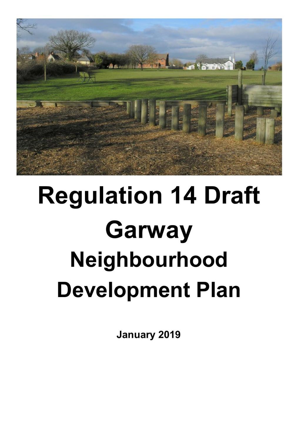
Copyright Nigel Deeley and licensed for reuse under this Creative Commons Licence
|
|
|
- Madeline Fox
- 5 years ago
- Views:
Transcription
1 1
2 Copyright Nigel Deeley and licensed for reuse under this Creative Commons Licence Prepared by the Neighbourhood Plan Steering Group on behalf of Garway Parish Council with assistance from 2
3 Table of Contents How to Comment on this Document Introduction Vision and objectives Future housing development Built environment - design of future development Natural environment - protecting landscape character Protecting local community facilities Rural employment and tourism Highways and infrastructure Timescales and next steps...18 Map 1 Garway village settlement boundary...19 Map 2 Broad Oak settlement boundary
4 How to Comment on this Document This is the Regulation 14 Consultation Version of the Draft Garway Neighbourhood Development Plan produced by Garway Parish Council. The consultation period will run from Wednesday 23 rd January 2019 to Wednesday 6 th March All comments must be received by 5pm on Wednesday 6th March You are invited to give us (Garway Parish Council) your views and comment on this document. If you would like to do this, please use a separate representation form for each comment. Please comment electronically where possible. There will be two drop-in events held in Garway Community Hall as follows: Saturday 2 nd February 2019 between 10am and 11.30am Saturday 2 nd March 2019 between 10am and 11.30am The document, and representation forms are all available to view and download at the following website address: Hard paper copies of this document and representation forms are available to view at Garway Community Hall. All comments should be returned as follows: By to: clerk@garwayparishcouncil.co.uk By post to: Mrs Kath Greenow (Clerk to Garway Parish Council) Hackford House Dinedor Hereford HR2 6PD 4
5 1.0 Introduction 1.1 A Neighbourhood Development Plan (NDP) is a mechanism for helping communities, including both local residents and businesses to influence the planning of the area in which they live and work. It can be used to: a. Develop a shared vision for the neighbourhood. b. Propose where new homes, shops, offices and other development should be built. c. Influence what new buildings should look like. d. Identify and protect important local green spaces. 1.2 Garway Parish Council is preparing a Neighbourhood Development Plan, under the provisions of the Localism Act Neighbourhood Development Plans are a new part of the statutory development planning system. Local authorities, such as Herefordshire Council, can produce development plans to promote, guide and control development of houses, businesses, open spaces and other uses of land. Parish Councils can do this by preparing a Neighbourhood Development Plan. 1.3 The Garway Parish Council felt it was important to exercise their rights to influence local development and in September 2012 applied for the area to be designated a Neighbourhood Development Planning Area. For a map see Figure 1. Herefordshire Council approved this application in November Neighbourhood Development Plans have to be prepared following a process set by Government. Figure 2 is a table showing the process. 1.5 Since early 2016, a Parish Council Steering Group has been preparing this Draft Neighbourhood Development Plan and has carried out community consultations since that date. The Neighbourhood Development Plan will enable local residents to help shape future development in the parish. 1.6 Whilst the Garway Neighbourhood Development Plan documents appears technical in parts, this is because it has a future use as a statutory planning document. 5


6 Figure 1: Garway Designated Area Figure 2: Neighbourhood Development Planning Process Designation Preparing the Plan Formal Consultation (6 weeks) WE ARE HERE Herefordshire Council Consult for 6 weeks Submit to Herefordshire Council Revise Plan Examination Referendum Garway Neighbourhood Plan made 6
7 2.0 Vision and objectives 2.1 The overall vision for the Garway Neighbourhood Plan are as follows: Vision Development in the parish of Garway will be within the settlement boundaries of Garway Village and Broad Oak shown in this plan. All development will aim to enhance the sense of community, character of buildings and environment of the settlements making Garway and Broad Oak vibrant and interesting centres of value to the residents and the wider parish. 2.2 The following table includes the objectives to achieve the vision, with the relevant policies within the Neighbourhood Plan to facilitate this. Objective 1 The Neighbourhood Development Plan defines the Settlement Boundaries where development will be supported. 2 The rural character of both village and countryside will be conserved and enhanced by new development. 3 New development will be integrated into its setting, whether at the heart of the villages, or in the more rural areas. 4 All development will be designed to ensure it has minimal impact on the area s distinctive character and environment. 5 All development will maintain the layout of the villages, taking into account features such as ribbon development and ensuring significant views are protected. 6 Important issues such as access and road safety are taken into account. 7 Rainwater and sewage drainage systems are fit for purpose avoiding risks to health and safety. 8 Distinctive features such as landscape and dark skies are preserved. 9 All development is essential to support the needs of the local community, including affordable housing. 10 Community facilities are protected (such as pubs, school, community centre etc.) Relevant Policy GAR1 GAR1, GAR2, GAR4, GAR5, GAR6, GAR7, GAR8, GAR9 GAR1, GAR2, GAR4, GAR5, GAR6, GAR7, GAR8, GAR9 GAR2 GAR1, GAR2, GAR4, GAR5, GAR6, GAR7, GAR8, GAR9 GAR1, GAR2, GAR7, GAR8, GAR9, GAR10 GAR3 GAR4, GAR5 GAR1, GAR8, GAR9 GAR7 7
8 3.0 Future housing development 3.1 There is a need in the parish for suitable new housing both open market and affordable to allow locally. This is a primary focus of this Neighbourhood Development Plan. 3.2 The Herefordshire Core Strategy sets the strategic policy for the Garway Neighbourhood Development Plan area. Within this document, Garway Parish falls within the Ross on Wye Rural Housing Market Area which is required to grow by 14% over the Plan period up to Herefordshire Council s Neighbourhood Planning Team have confirmed that the proportional growth required for Garway Parish is a minimum of 25 new dwellings up to As of August 2018, there were 21 units either with planning permission or built. This leaves a net housing requirement of at least 4 new houses over the Plan period. 3.3 Garway Village is identified in the Core Strategy as a settlement which will be the main focus of proportionate housing development (Fig 4.14 of the Herefordshire Local Plan Core Strategy). With Broad Oak identified as another settlement where proportionate growth is appropriate, (Figure 4.15 of the Herefordshire Local Plan Core Strategy) and therefore everywhere outside the two settlements will be considered to be the wider rural area, where new housing development is inappropriate. 3.4 To have some control over the location of new housing development, the Parish Council consider it appropriate to identify a settlement boundary for both Garway Village and Broad Oak and seek to allocate sites for new housing development to achieve the minimum residual target of 4 dwellings set by the Herefordshire Core Strategy. Call for Sites 3.5 As part of the NDP preparation the Parish Council Steering Group has looked at the allocation of land for residential development A Call for Sites exercise was carried out between November 2017 and January In total 19 sites were either submitted to, or identified by, the Neighbourhood Plan Steering Group. The sites were assessed independently, and the Site Assessment Report is available on the Parish Council website. 3.7 The Parish Council considered that a local weighting should be applied to the scoring mechanism and the resultant spreadsheet is also available on the Parish Council website. 3.8 A further consultation was carried out with the community in July 2018 in relation to the sites proposed for allocation in the Neighbourhood Development Plan which supported the allocation of the proposed sites. 3.9 The following policy is proposed for any future housing development in the plan period. 8
9 Policy GAR1: New Housing Development in Garway Village and Broad Oak Within the defined settlement boundaries of Garway Village (Map 1) and Broad Oak (Map 2) or on a site allocated for residential development in this Neighbourhood Plan, new housing development proposals will be supported when they: a. Re-use previously developed land, where possible; b. Are an appropriate conversion of an existing building; c. Are appropriate to the size, role and function of the village; d. Provide a range and mix of house sizes, types and tenures; e. Enhance the rural character of the area, by being in accordance with the design policy in this plan; f. Do not increase traffic congestion, encourage on-street parking, or jeopardise road safety; g. Do not lead to the loss, damage or detriment of existing community facilities, Local Green Space, Special Wildlife Sites or assets on the National Heritage List for England and Herefordshire Council s Monuments Record; h. Do not lead to the loss of local employment opportunities, including tourism; i. Are not at significant risk of flooding and they can demonstrate they will not increase the risk of flooding elsewhere; j. Where applicable, they provide appropriate affordable housing when assessed against Herefordshire Core Strategy Policy H1: and k. Comply with, in Garway Village, the linear character of the layout of the village. 9
10 4.0 Built environment - design of future development 4.1 Garway has a wealth of listed buildings and scheduled monuments within its parish boundary. These consist of two Grade I, one Grade II*, twenty-eight Grade II listed buildings and two scheduled monuments. 4.2 Today, with regard to the style of properties, the parish is a mix of older and more recent, modern properties. Traditional materials include Herefordshire red sandstone and slate roofs with red brick being introduced more recently. 4.3 The Garway Neighbourhood Development Plan seeks to encourage all new development to be of high quality design. 4.4 Paragraph 125 of the revised National Planning Policy Framework states: Plans should, at the most appropriate level, set out a clear design vision and expectations, so that applicants have as much certainty as possible about what is likely to be acceptable. Design policies should be developed with local communities, so they reflect local aspirations, and are grounded in an understanding and evaluation of each area s defining characteristics. Neighbourhood development plans can play an important role in identifying the special qualities of each area and explaining how this should be reflected in development. 4.5 Policy GAR2 has been developed to set out the quality of development we expect and is based on a thorough understanding and evaluation of the area s defining characteristics. This policy will be used in the assessment of all planning proposals and will help secure high-quality development in the future. This approach is in line with the aims of national planning policy to promote good design. Policy GAR2: Design in Garway Parish All new development in the area will be expected to be of high quality design. Proposals will be assessed against the following criteria: a. Contribution to improving and enhancing the built heritage and natural environment of the site and its surroundings; b. The overall design of the proposal in terms of siting, scale, height, proportions, massing, orientation, mix of uses, detailing, and materials; c. The design does not adversely impact on existing natural horizons, and has appropriate regard to existing roof lines; d. The design does not adversely impact on the residential amenity of existing and future residents; e. Sustainable construction and design is used to minimise the use of resources and emissions and use recycled materials, renewable energy and the natural treatment of waste water and the re-use of grey water, wherever possible; f. The use of locally-sourced or recycled natural slate tiles for roofing and local stone for walling is encouraged; 10
11 g. Use of suitable native species in any planting and inclusion of bird nest boxes and roosting opportunities for bats; and h. Access and highway safety, including the provision of new and improved pedestrian footpaths and footways, permissive pedestrian rights of way and cyclepaths, and provision of safe pedestrian road crossings where required. 4.6 Whilst the majority of the parish is located in Flood Zone 1, the areas around the River Monnow are located in Flood Zone 3. There are a number of tributaries that suffer from surface water flooding. 4.7 In line with the National Planning Policy Framework, inappropriate development in areas at risk of flooding will be avoided by directing development away from the areas at highest risk. Where development is necessary in such areas, measures should be included to make it safe without increasing flood risk elsewhere. 4.8 This policy is included in order that new development is designed to incorporate surface water drainage systems. Policy GAR3 Flooding and Drainage All new development is required to include adequate surface water drainage measures (including Sustainable Drainage Systems) to protect existing and new development from flooding. Development should be designed to reduce the consequences of flooding and to facilitate recovery from the effects of flooding. All development of existing properties (including alterations) must demonstrate that surface water is diverted into suitable and adequate drainage systems and not sewers. 11
12 5.0 Natural environment - protecting landscape character 5.1 The rural nature of the parish is evident from whichever way it is approached. Garway Village itself sits well within the landscape and does not dominate it in any way. Any future development should aim to preserve this and avoid large uniform housing estates on the edge of the village. Any development in Broad Oak should also be in scale and in sympathy with the existing housing stock, and should also take into account the natural habitat and have a minimal impact on it. 5.2 There are 21 kilometres of public footpaths in the parish along with numerous public rights of way in the villages and throughout this rural parish. These footpaths are heavily used by locals and visitors alike and the Parish Plan 2009 report noted the importance of the network to local people. It is important that these are maintained and protected, as the footpaths are an asset to the local economy by attracting walkers to the area. The footpaths also facilitate dog walking and encourage healthy exercise in an ageing population. Development that would compromise the open aspect of these rural footpaths should be avoided as far as possible. 5.3 The landscape is one of the parish s strongest assets. This policy identifies those aspects that make the landscape so important. In developing this policy regard has been had to Natural England s National Character Area (NCA) Profiles. The north of the Neighbourhood Development Plan Area is situated within NCA104 South Herefordshire and Over Severn. POLICY GAR4 - Protecting Local Landscape Character To protect and enhance the valued landscape of the parish development proposals will have to demonstrate that: a. The character of the parish landscape has influenced the design, scale, form and siting of the development proposed; b. They protect and enhance the range of differing settings of the various settlements in the parish; c. They protect and enhance any designated areas such as wildlife sites, listed buildings, and ancient monuments; d. They retain and enhance non-designated assets such as stone walls, ancient and veteran trees, wildlife sites and commons; e. They protect and enhance the natural environment, heritage and scenic beauty of the parish; f. They incorporate appropriate landscaping schemes and future ongoing management of such schemes to ensure the proposal integrates into the surrounding landscape; g. They maintain and extend native tree species, hedgerows, and other important vegetation; h. They will not have an adverse impact on the environmental quality of the area s priority habitats and ancient woodlands; and i. Proposals should conserve watercourses and riverside habitats. Where necessary, this should include management and mitigation 12
13 measures for the improvement and enhancement of water quality and habitat. 5.4 Obtrusive lighting installations can have a devastating impact in a community, causing nuisance to neighbours, and obscuring views of the night sky, as well as wasting energy. Well-designed lighting installations reduce the risk of crime and improve public safety. 5.5 The neighbourhood area s rural environment means it benefits from dark skies. This means when skies are clear, people can see the stars constellations in all their glory. To ensure that this will be the same in the future, the following policy will be used to assess the light generated from development proposals. Light pollution from the ground is one of the reasons many areas do not enjoy the type of dark skies found in this parish. In limiting or reducing light pollution there may also be benefits to the owners and users of developments through reduced energy bills as a result of lower energy consumption. Reducing light pollution also reduces the impact on species affected by inappropriate lighting such as bats. Policy GAR5 - Dark Skies To minimise light pollution in the parish and to improve the views of our night time skies, planning proposals that include external lighting and significant openings that would allow internal lighting to be seen externally, will have to demonstrate the following: a) They have undertaken an appropriate assessment and can demonstrate the need for the lighting proposed; b) That care has been taken to provide appropriate lighting, using systems designed to prevent obtrusive lighting nuisance, minimise light pollution and reduce energy consumption. 5.7 Key characteristics of the area are the rural environment and its tranquility. Policy GAR6 aims to protect these characteristics by seeking to ensure that development is appropriate in terms of its use, scale and type of activity suitable to a tranquil, rural environment. Policy GAR6 Rural Environment and Tranquility To protect the integrity of the rural environment and the tranquility of the parish, development proposals will be supported when they do not give rise to significant adverse impacts on these resources. The following criteria will be used to assess proposals: a. The use, nature, scale, type of activity and opening hours (where appropriate) of any proposal; 13
14 b. For business and tourism proposals a Noise Impact Assessment will be required with any planning application, and may be required, in certain circumstances, for other forms of development; and c. The inclusion of suitable mitigation measures to reduce to a minimum any significant adverse impact. Such measures will be conditioned where necessary. 14
15 6.0 Protecting local community facilities 6.1 There are many excellent community facilities in Garway which serve the parish itself, and other surrounding rural villages. 6.2 Community facilities are essential to village life and help maintain the rural character. Policy GAR7- Protecting and Improving Community Facilities The following local recreational facilities are protected: Village Hall Community Centre Garway Inn Garway School Churches There will be a presumption in favour of the re-use of such facilities for recreational, health, community type uses. The change of use of existing facilities to other uses will not be permitted unless the following can be demonstrated: 1. The proposal includes alternative provision, on a site within the locality, of equivalent or enhanced facilities. Such sites should be accessible by public transport, walking and cycling and have adequate car parking; or 2. it can be satisfactorily demonstrated that the facility is no longer required or is no longer viable. Development which contributes towards the improvement of existing, or provision of, new recreational, community and educational facilities will be encouraged. 15
16 7.0 Rural employment and tourism 7.1 Employment opportunities such as homeworking and tourism are key to the rural areas of Herefordshire. The following policies have been developed for Garway Parish which promote tourism opportunities and also rural businesses and homeworking. Policy GAR8 Tourism in Garway Parish Proposals for new tourism development or to improve and enhance existing tourism facilities will be supported when: a. They are appropriate within the local landscape setting; b. They do not have a significant adverse impact on the landscape, tranquility or views within the wider parish; c. They do not result in a detrimental impact on road safety, traffic congestion or car parking problems; and d. They do not have a significant adverse impact on residential amenity. Policy GAR9 Rural Businesses and Homeworking Proposals for new rural businesses and homeworking will be encouraged when they meet the following criteria: a. They do not have a significant adverse impact on residential amenity; b. They do not have an adverse impact on the landscape, tranquility or Green Infrastructure network of the parish; and c. They include suitable access and car parking. 16
17 8.0 Highways and infrastructure 8.1 The Parish Plan 2009 identified issues with speeding traffic and repair and maintenance of roads. However, these issues are not planning issues to be dealt with through a Neighbourhood Development Plan. 8.2 The following policy has been developed for Garway Parish which promote a better highway infrastructure Policy GAR10 Highways and Transport All new development proposals should include appropriate measures to minimise their impact on the Neighbourhood Development Plan Area by providing: a. Safe and suitable access by focusing development on the main road that forms the spine of the linear Garway Village b. Any necessary and appropriate traffic management measures; c. Off-road car parking that avoids the use of large areas of hardstandings, particularly using materials more appropriate to urban locations. All car parking should be appropriately sited and screened within the landscape; and d. Access to public transport including the creation of permissive footpaths to bus stops, where appropriate. 17
18 9.0 Timescales and next steps 9.1 The proposed timetable for the preparation of Garway NDP is set out below. Garway NDP - Proposed Timetable Target Date January 2019 April/May 2019 June 2019 July/August 2019 Autumn 2019 Late 2019 Action Reg 14 formal 6 weeks consultation on Draft NDP Revise NDP Submit NDP to Herefordshire Council Herefordshire Council consult for 6 weeks Examination Referendum and Plan Made. 9.2 This Regulation 14 consultation will close at 5pm on Wednesday 6 th March Please provide all comments to the Parish Clerk by that date. 9.3 Following careful consideration of all comments and responses to the questions, we revise the Draft Garway Neighbourhood Plan for submission to Herefordshire Council 18
19 Map 1 Garway village settlement boundary 19
20 Map 2 Broad Oak settlement boundary 20

21 Garway Parish Council January
Copyright Nigel Deeley and licensed for reuse under this Creative Commons Licence
 1 Copyright Nigel Deeley and licensed for reuse under this Creative Commons Licence Prepared by the Neighbourhood Plan Steering Group on behalf of Garway Parish Council with assistance from 2 Table of
The Gwennap Parish Vision Statement
 QUICK GUIDE What is a Neighbourhood Development Plan? Ultimately it is a document used by developers or anyone wishing to submit a planning application that describes the vision, strategy, plans, regeneration,
Parish of Repton NEIGHBOURHOOD DEVELOPMENT PLAN
 Parish of Repton NEIGHBOURHOOD DEVELOPMENT PLAN BASIC CONDITIONS STATEMENT December 2018 CEF 4 Legal Requirements This statement has been produced by the NDP Working Group on behalf of Repton Parish Council
Great Easton Neighbourhood Plan Statement of Basic Conditions
 Great Easton Neighbourhood Plan 2017-2031 Statement of Basic Conditions OCTOBER 2016 GREAT EASTON PARISH COUNCIL Contents 1.0 Introduction....Page 2 2.0 Summary of Submission Documents and Supporting Evidence..
EXTRACT FROM THE CUDDINGTON NEIGHBOURHOOD PLAN The Policies
 EXTRACT FROM THE CUDDINGTON NEIGHBOURHOOD PLAN The Policies Environment and Landscape Policy 1 - Landscape Setting Development should respect and wherever possible enhance the landscape setting of Cuddington
DUNSFOLD NEIGHBOURHOOD PLAN Site Selection Policies
 DUNSFOLD NEIGHBOURHOOD PLAN Site Selection Policies The criteria for assessing sites for future housing and business development in Dunsfold are set out below. (Development criteria, covering what it is
Contents. 1 Introduction 5 2 Why are we preparing a neighbourhood plan for Dinedor? 7. 3 How long will it take to finalise the plan?
 Contents 1 Introduction 5 2 Why are we preparing a neighbourhood plan for Dinedor? 7 3 How long will it take to finalise the plan? 8 4 Key Issues 11 5 Objectives and Policies 19 6 Review and Monitoring
Plumpton Neighbourhood Development Plan Revised Pre Submission Document - Regulation 14 Consultation
 REPRESENTATIONS... Plumpton Parish Council Plumpton Neighbourhood Development Plan Revised Pre Submission Document - Regulation 14 Consultation Representations submitted on behalf of: Cala Homes (South
Neighbourhood Plan Representation
 Date: 10 th November 2017 Neighbourhood Plan Representation Land to the east of Callow Hill Road, Alvechurch Introduction This representation has been prepared by RPS Planning and Development on behalf
Kibworth Harcourt. Introduction. Introduction
 Introduction Introduction Welcome to this public exhibition on the proposals for the delivery of new homes on land at The Kibworths. The purpose of today s exhibition is to give you the opportunity to
OKEFORD FITZPAINE NEIGHBOURHOOD PLAN
 OKEFORD FITZPAINE NEIGHBOURHOOD PLAN Dear Parishioner, The Neighbourhood Plan Project Team have prepared this leaflet to summarise the full Neighbourhood Plan document. It provides a summary of the Vision,
INTRODUCTION NORTH HEYBRIDGE GARDEN SUBURB
 INTRODUCTION This event is being hosted by the promoters of the proposed North Heybridge Garden Suburb who are working with Maldon District Council and other key stakeholders on the preparation of a comprehensive
3. Neighbourhood Plans and Strategic Environmental Assessment
 1. Introduction This report sets out a draft Screening Determination for the Preston Parish Council s Neighbourhood Plan and has been prepared by rth Hertfordshire District Council. The purpose of the
LONGDEN VILLAGE DEVELOPMENT STATEMENT
 LONGDEN VILLAGE DEVELOPMENT STATEMENT 2017-2027 1 Longden Development Statement 2017-2027 15/01/18 1. Background 1.1 Longden Village Longden village is a very rural and traditional community first mentioned
ALLERTHORPE NEIGHBOURHOOD PLAN
 Allerthorpe s Neighbourhood Plan sets out a vision for the Parish for the next 15 years (2018 2033) that builds on and reflects the opinions and views of parish residents. VISION In 2033 Allerthorpe will
Planning and Sustainability Statement
 Land adjacent to Manor Farm, Catterick Village Pallett Hill Sand and Gravel Co Ltd Proposed 10 new dwellings, (6 No market dwellings and 4 No affordable dwellings) with access, associated car parking and
Our City Centre is a vibrant, creative and welcoming destination, with a modern business, cultural, shopping, leisure and residential offer
 3. Sheffield in 2034 Our City sits at the heart of a strong, distinctive and internationally successful City Region economy which supports innovation and enterprise Our City Centre is a vibrant, creative
DEVELOPMENT MANAGEMENT REPORT
 ITEM A08-1 DEVELOPMENT MANAGEMENT REPORT TO: BY: DATE: DEVELOPMENT: SITE: WARD: APPLICATION: APPLICANT: Development Management Committee Development Manager Proposed live/work unit in connection with existing
Mid Coquetdale Neighbourhood Plan - Vision and Objectives Consultation
 Neighbourhood Planning came into force in 2011, through the Localism Bill. It gives us a unique opportunity to produce our own Neighbourhood Development Plan for our own area. Rothbury Parish Council,
Welford-on-Avon. Neighbourhood Development Plan Welford-on-Avon Parish Council
 Welford-on-Avon Neighbourhood Development Plan 2011-2031 Welford-on-Avon Parish Council Parish Consultation: Summary Version December 2014 January 2015 Foreword This is the latest version of the Welford
Site Assessment Technical Document Appendix A: Glossary
 Central Bedfordshire Council www.centralbedfordshire.gov.uk Site Assessment Technical Document Appendix A: Glossary July 2017 1.1.11-1 - ii Appendix A: Glossary Term Agricultural Land Classification AONB
Schedule of Planning Applications Committee Date: 23 May Reference: 06/17/0726/F Parish: Hemsby Officer: Mr J Beck Expiry Date:
 Schedule of Planning Applications Committee Date: 23 May 2018 Reference: 06/17/0726/F Parish: Hemsby Officer: Mr J Beck Expiry Date: 22-05-2018 Applicant: Proposal: Site: Mr Gillett Change of use to the
Welford-on-Avon Neighbourhood Plan Consultation Event Sunday, 6 April Your name Your address
 Welford-on-Avon Neighbourhood Plan Consultation Event Sunday, 6 April 2014 Your name Your email address Please either: - complete this feedback form and put it in the box before leaving the Memorial Hall
Sustainability Statement. Whitby Business Park Area Action Plan
 Sustainability Statement Whitby Business Park Area Action Plan November 2014 Contents Page 1. Introduction 1 2. Scoping 3 3. Sustainability Appraisal of Options 6 4. Assessment of Draft Area Action Plan
SOUTH CAMBRIDGESHIRE DISTRICT COUNCIL. REPORT TO: Planning Committee 1 April 2015 Planning and New Communities Director
 SOUTH CAMBRIDGESHIRE DISTRICT COUNCIL REPORT TO: Planning Committee 1 April 2015 AUTHOR/S: Planning and New Communities Director Application Number: Parish(es): Proposal: Site address: Applicant(s): Recommendation:
Babergh and Mid Suffolk Joint Draft Local Plan Consultation, August 2017, Public Consultation
 Babergh and Mid Suffolk Joint Draft Local Plan Consultation, August 2017, Public Consultation Having reviewed the documents, the Society has made the following response: Housing Delivery Q 7. Do you agree
EAST LANGTON PARISH NEIGHBOURHOOD PLAN. Submission version
 EAST LANGTON PARISH NEIGHBOURHOOD PLAN Submission version 2011 2031 Contents Chapter heading Page Introduction from Chair 3 1. Why Neighbourhood Plans are important 5 2. Why we need a Neighbourhood Plan
Development in the setting of the Cotswolds AONB
 COTSWOLDS CONSERVATION BOARD POSITION STATEMENT Development in the setting of the Cotswolds AONB.1. Introduction Areas of Outstanding Natural Beauty (AONBs) are designated by the Government for the purpose
Public Consultation. Land at Monks Farm, North Grove. Welcome
 Welcome Welcome to our public exhibition for development on Land at Monks Farm, orth Grove. Gallagher Estates and Gleeson Strategic Land are preparing an outline planning application for new homes, open
Rochford District Council Allocations Development Plan Document: Discussion and Consultation Document Sustainability Appraisal
 Option SWH1 Balanced Communities Option SWH1 1 To ensure the delivery of high quality sustainable communities where people want to live and work Will it ensure the phasing of infrastructure, including
8.0 Design and Form of Development 43/
 42/ 8.0 Design and Form of Development 43/ Rothwells Farm, Golborne/ Development Statement Figure 7. Site Constraints Key 44/ Site Boundary 360 Bus Route/Stops Existing Trees Underground Water Pipe Sensitive
Basic Conditions Statement Exmouth Neighbourhood Plan
 Exmouth Neighbourhood Plan 2018-2031. On behalf Exmouth Neighbourhood Plan Steering Group July 2018 Table of Contents 1. Introduction... 4 2. Legal Requirements... 5 3. Why there is a need for a Neighbourhood
WELCOME GYPSY LANE. Wider Site Location plan. Proposals for the development of LAND OFF FOXLYDIATE LANE WEBHEATH. Proposals for the development of
 WELCOME The developers are preparing an outline planning application for a residential led development and need the community s views in order to develop the proposals further WHAT IS PROPOSED? A high
Briefing Document of CNP. June 2017
 Cholsey Parish Council Cholsey Neighbourhood Plan Briefing Document of CNP June 2017 Cholsey Neighbourhood Plan Page! 1 of! 8 Cholsey Plan Briefing v1.4 Page Left Intentionally Blank Cholsey Neighbourhood
LETTER OF OBJECTION LAND TO THE SOUTH WEST OF FORGE GARAGE, HIGH STREET, PENSHURST, KENT, TN11 8BU
 Senior Planning Officer Andrew Byrne Sevenoaks District Council Community & Planning Services PO Box 183 Argyle Road Sevenoaks Kent TN13 1GN 04 November 2011 Your Ref: 11/02258/FUL For the attention of
Neighbourhood Planning Local Green Spaces
 Neighbourhood Planning Local Green Spaces Introduction... 2 1. Why green space is important... 4 2. Neighbourhood plans and green space... 6 3. Evidence... 8 Statutory designations... 9 Green space audit...
SOUTH EAST LINCOLNSHIRE LOCAL PLAN: HOUSING PAPER DONINGTON (JUNE 2016)
") SOUTH EAST LINCOLNSHIRE LOCAL PLAN: HOUSING PAPER DONINGTON (JUNE 2016) 1 DONINGTON S PLACE IN THE SPATIAL STRATEGY 1.1 Policy 2 of the South East Lincolnshire Local Plan 2011-2036 Draft for Public Consultation
SOUTH EAST LINCOLNSHIRE LOCAL PLAN: HOUSING PAPER DONINGTON (JUNE 2016) 1 DONINGTON S PLACE IN THE SPATIAL STRATEGY 1.1 Policy 2 of the South East Lincolnshire Local Plan 2011-2036 Draft for Public Consultation
Statement of Community Involvement LAND OFF SOUTHDOWN ROAD HORNDEAN, HAMPSHIRE
 LAND OFF SOUTHDOWN ROAD HORNDEAN, HAMPSHIRE CONTENTS Page 1. Introduction 3 2. Pre-application Discussions 4 3. The Consultation Process 5 4. Consultation Feedback 7 5. Responses to Consultation Feedback
Mortimer NDP, Principles, Vision and Policies
 The Three Principles Mortimer NDP, Principles, Vision and Policies 1. The NDP must make it possible for people to live the whole of their lives in the parish if they so wish 2. 2. The NDP will ensure that
Welcome. Land adjacent Sandy Lane WALTHAM CHASE THE PROPOSED SITE
 Land adjacent Sandy Lane WALTHAM CHASE Existing Linden Homes developments Welcome Welcome to Linden Homes Southern s ( Linden ) public exhibition about its proposals for a range of high-quality homes for
Local Development Scheme
 Local Development Scheme 2012 2016 The Local Development Scheme (LDS) is a project plan that outlines how and when the Authority will update its planning policies and other associated documents. It ensures
Settlement Boundaries Methodology North Northumberland Coast Neighbourhood Plan (August 2016)
") Introduction This background paper sets out a methodology for the definition of settlement boundaries in the North Northumberland Coast Neighbourhood Plan. The neighbourhood plan is planning positively
Introduction This background paper sets out a methodology for the definition of settlement boundaries in the North Northumberland Coast Neighbourhood Plan. The neighbourhood plan is planning positively
WINCHESTER TOWN 3.1 LOCATION, CHARACTERISTICS & SETTING
 WINCHESTER TOWN 3.1 LOCATION, CHARACTERISTICS & SETTING 3.1.1 The area referred to by the City Council, as Winchester Town, consists of the Winchester Wards plus the adjoining built up areas of Badger
1.3 The following table presents a Statement of Compliance demonstrating how the Standish Neighbourhood Plan meets those requirements.
 1. Introduction 1.1 This Basic Condition Statement was prepared to accompany the draft Standish Neighbourhood Plan (2018). 1.2 Paragraph 8 of Schedule 4B of the Town and Country Planning Act 1990 requires
BLEWBURY NEIGHBOURHOOD DEVELOPMENT PLAN STATEMENT OF BASIC CONDITIONS
 BLEWBURY NEIGHBOURHOOD DEVELOPMENT PLAN STATEMENT OF BASIC CONDITIONS Introduction 1.1 This statement has been prepared to accompany the submission of the Blewbury Neighbourhood Development Plan ( the
BEDFORD BOROUGH COUNCIL PLAN IMPLEMENTATION MONITORING REPORT
 BEDFORD BOROUGH COUNCIL PLAN IMPLEMENTATION MONITORING REPORT 2017-18 Summary 1 Progress on local development documents 1 Local development documents adopted in the monitoring period 1st April 2017 31st
1. Objectives of this consultation
 1. Objectives of this consultation Provide an update on the results of the December 2014 consultation Provide a summary of the Pre-Submission Plan which is now out for formal consultation To ask for your
ROCHFORD LOCAL DEVELOPMENT FRAMEWORK: Sustainability Appraisal/ Strategic Environmental Assessment. Rochford Core Strategy Preferred Options Document
 ROCHFORD LOCAL DEVELOPMENT FRAMEWORK: Sustainability Appraisal/ Strategic Environmental Assessment Non Technical Summary Rochford Core Strategy Preferred Options Document October 2008 SUSTAINABILITY APPRAISAL
SOUTH CAMBRIDGESHIRE DISTRICT COUNCIL. Planning and New Communities Director
 SOUTH CAMBRIDGESHIRE DISTRICT COUNCIL REPORT TO: Planning Committee 5 June 2013 AUTHOR/S: Planning and New Communities Director S/0747/13/FL HISTON Construction of Car Park at Histon Baptist Church, Station
Land at Fiddington Hill Nursery, Market Lavington
 Land at Fiddington Hill Nursery, Market Lavington Briefing Report for Market Lavington Parish Council Persimmon Homes (Wessex) April 2016 Background This brief report has been prepared following the Market
Suffolk Coastal Local Plan Review Issues and Options, August 2017, Public Consultation
 Suffolk Coastal Local Plan Review Issues and Options, August 2017, Public Consultation Having reviewed the issues and options documents, the Society has made the following response: Part 1 - Strategic
WELCOME. North East Haverhill. The Planning Process
 WELCOME North East The site to the North East of, known as Great Wilsey Park, is identified by St Edmundsbury Borough Council in its Core Strategy as capable of delivering a Sustainable Urban Extension.
STATEMENT OF OBJECTION TO THE PROPOSED DEVELOPMENT OF LAND AT CHURCH CLIFF DRIVE FILEY
 STATEMENT OF OBJECTION TO THE PROPOSED DEVELOPMENT OF LAND AT CHURCH CLIFF DRIVE FILEY You will be aware that Scarborough borough council have adopted a new local plan that includes land at Church Cliff
Neighbourhood Planning Guidance Local Green Spaces
 Neighbourhood Planning Guidance Local Green Spaces Introduction This guidance note has been produced for communities preparing neighbourhood plans in North Dorset to help them to identify, assess and designate
Full Name /title*. Address 1. Address 2 Post Code* *.. Phone* *Required fields for draw
 You can return this later to post boxes at: the Parish Council Office, Rowney Green Village Hall, The Petrol Station at Hopwood, or the Library. Closing date 14 th March: Draw on 14 th April 2014 at Alvechurch
DESIGN & ACCESS STATEMENT
 DESIGN & ACCESS STATEMENT January 2016 Contents Introduction section 1 Section 1 - Introduction Section 2 - Assessment Section 3 - Involvement Section 4 - Evaluation Section 5 - Design Section 6 - Layout
Planning and Regulatory Committee 20 May Applicant Local Councillor Purpose of Report
 Planning and Regulatory Committee 20 May 2014 7. APPLICATION FOR PLANNING PERMISSION FOR THE CARRYING-OUT OF DEVELOPMENT PURSUANT TO PLANNING PERMISSION REFERENCE NUMBER 603451 DATED 28 FEBRUARY 2007 WITHOUT
Great Easton Sustainable Housing Development Sites - Site Seven, Broadgate extension site SHLAA Ref HSG/03)
") Great Easton Sustainable Housing Development Sites - Site Seven, Broadgate extension site SHLAA Ref HSG/03) 1. Introduction The Great Easton Neighbourhood Plan Group are preparing a Neighbourhood Plan
Great Easton Sustainable Housing Development Sites - Site Seven, Broadgate extension site SHLAA Ref HSG/03) 1. Introduction The Great Easton Neighbourhood Plan Group are preparing a Neighbourhood Plan
Derry City and Strabane District Council Planning Committee Report. Amended layout from approval A/2004/0462/F with reduction from 166 units
 Derry City and Strabane District Council Planning Committee Report COMMITTEE DATE: 1 st February 2017 APPLICATION No: APPLICATION TYPE: PROPOSAL: LOCATION: APPLICANT: AGENT: Full Planning application Amended
DEVELOPMENT MANAGEMENT REPORT
 ITEM A07-1 DEVELOPMENT MANAGEMENT REPORT TO: BY: Development Management Committee (South) Development Manager DATE: 21 June 2016 DEVELOPMENT: SITE: WARD: APPLICATION: APPLICANT: Outline application for
Welcome to our Public Consultation
 About our development This exhibition gives you the chance to view and comment on our emerging plans for a proposed residential development located on land to the West of Alwyn Road, Rugby. Welcome to
Stratford Neighbourhood Plan Questionnaire
 Stratford Neighbourhood Plan Questionnaire Please tick the appropriate box or answer in the space provided. If you require further copies of the questionnaire, as more than one person in the household
Repton Parish Neighbourhood Development Plan - Consultation March 2017
 Repton Parish Neighbourhood Development Plan - Consultation March 2017 25 replies Policy No Comments Response H1 Agree 22 Amend to include Milton Road & footpath but exclude above footpath. Neither agree
Welcome to our exhibition
 Welcome to our exhibition The Homes & Communities Agency (HCA) welcomes you to this public exhibition explaining our proposals for the redevelopment of the former Lea Castle Hospital site. About the Homes
Land at Rampton Road. Cottenham
 Land at Rampton Road Cottenham Introduction TEP is preparing an outline planning application for 54 dwellings on 6.9 hectares of land adjacent to Rampton Road, Cottenham on behalf of the owners Cambridgeshire
Statutory and Non-Statutory Designated Sites and Ecology
 Statutory and Non-Statutory Designated Sites and Ecology The National Planning Policy Framework considers the conservation and enhancement of the natural environment in chapter 11 paragraphs 109-119, where
Effingham Neighbourhood Plan 1. Basic Conditions Statement
 Effingham Neighbourhood Plan 1 Basic Conditions Statement Effingham Neighbourhood Plan 2016: Basic Conditions Statement 2 Contents This statement has been prepared by Effingham Parish Council to accompany
WELCOME. Land North of STEVENAGE. We would like to thank you for attending our public exhibition today.
 WELCOME We would like to thank you for attending our public exhibition today. The purpose of this event is to share our proposals and hear your thoughts on our ideas. Members of the project team are on
Response by The Dartington Hall Trust
 Consultation Response by The Dartington Hall Trust Site Reference: SH_39_02_08/13 Contents Introduction 1 Site Description 2 Development Proposal and Context 3 Site Technical Assessment 4 Planning Policy
CA//17/02777/FUL. Scale 1:1,250. Planning Services Canterbury City Council Military Road Canterbury Kent CT1 1YW
 O CA//17/02777/FUL Scale 1:1,250 Map Dated: 15/03/2018 Planning Services Canterbury City Council Military Road Canterbury Kent CT1 1YW AGENDA ITEM NO 16 PLANNING COMMITTEE APPLICATION NUMBER: SITE LOCATION:
PLANNING STATEMENT. Market House Market Place Kingston upon Thames KT1 1JS
 PLANNING STATEMENT To support planning and listed building consent applications for change of use from Class A1 shop and Class A3 cafe to Class A3 restaurant at: Market House Market Place Kingston upon
Everton s Neighbourhood Plan. Site Allocation - Assessment Criteria
 Everton s Neighbourhood Plan Site llocation - ssessment Criteria Introduction 1.1 This report assesses all the sites identified through the emerging Neighbourhood Plan for Everton and their potential for
Much Wenlock Neighbourhood Development Plan
 Much Wenlock Neighbourhood Development Plan Public Consultation Draft 15 February 2013 www.wenlockplan.org mail@wenlockplan.org In accordance with Neighbourhood Planning (General) Regulations 2012, Part
Newcourt Masterplan. November Exeter Local Development Framework
 Newcourt Masterplan November 2010 Exeter Local Development Framework Background The Exeter Core Strategy Proposed Submission sets out the vision, objectives and strategy for the development of Exeter up
PLANNING COMMITTEE DATE: 07/09/2015 REPORT OF THE SENIOR MANAGER PLANNING AND ENVIRONMENT SERVICE CAERNARFON. Number: 4
 Number: 4 Application Number: C15/0034/37/LL Date Registered: 21/05/2015 Application Type: Full - Planning Community: Llanaelhaearn Ward: Llanaelhaearn Proposal: Location: Summary of the Recommendation:
an Inspector appointed by the Secretary of State for Communities and Local Government
 Appeal Decision Site visit made on 14 July 2015 by I Radcliffe BSc(Hons) MCIEH DMS an Inspector appointed by the Secretary of State for Communities and Local Government Decision date: 18 August 2015 Appeal
Former North Works, Lickey Road, Longbridge, Birmingham
 Committee Date: 14/11/2013 Application Number: 2013/06431/PA Accepted: 27/08/2013 Application Type: Full Planning Target Date: 26/11/2013 Ward: Longbridge Former North Works, Lickey Road, Longbridge, Birmingham
Droitwich Spa 6. Reasoned Justification
 87 Droitwich Spa 6 Reasoned Justification 6.1 Droitwich Spa is identified in the settlement hierarchy (Policy SWDP1) as a main town being the largest settlement in Wychavon District with an estimated population
Official Plan Review
 Official Plan Review Summary Report - The Built Environment August 2014 Part 1: Introduction Planning for a healthy, prosperous and sustainable community is an important goal for our municipality. From
DRAFT STRATEGIC ENVIRONMENTAL ASSESSMENT REPORT
 DRAFT STRATEGIC ENVIRONMENTAL ASSESSMENT REPORT Published by Limpsfield Parish Council in accordance with EU Directive 2001/42 on Strategic Environmental Assessment and with the Environmental Assessment
Stantonbury Neighbourhood Plan
 Stantonbury Neighbourhood Plan 2018-2031 Basic Conditions Statement October 2018 Intentionally blank 1.0 Basic Conditions Statement Introduction 1.1 This statement has been prepared by Stantonbury Parish
SAHAM TONEY NEIGHBOURHOOD DEVELOPMENT PLAN : THE POLICIES
 SAHAM TONEY NEIGHBOURHOOD DEVELOPMENT PLAN 2018-2036: THE POLICIES This is a much-abridged version of the full neighbourhood Plan, and includes only the policy text, the main policy maps and some key charts.
1 The development hereby permitted shall be carried out in accordance with the following approved plans:
 Location The Avenue Tennis Club The Avenue London N3 2LE Reference: 16/6509/FUL Received: 10th October 2016 Accepted: 10th October 2016 Ward: Finchley Church End Expiry 5th December 2016 Applicant: Mrs
Barvills Solar Farm Environmental Statement Non-Technical Summary
 Barvills Solar Farm Environmental Statement Non-Technical Summary 13 March 2015 Produced for Prepared by St John s House Queen Street, Manchester M2 5JB Contents Contents... 2 1 Introduction... 3 1.1 Development
LAVANT NEIGHBOURHOOD DEVELOPMENT PLAN
 LAVANT NEIGHBOURHOOD DEVELOPMENT PLAN 2016-2032 PRE-SUBMISSION NEIGHBOURHOOD PLAN SUSTAINABILITY APPRAISAL Lavant Parish Council March 2016 2 INTRODUCTION TABLE OF CONTENTS INTRODUCTION... 4 What is a
Welcome. Site/11/04. Site/11/03. Proposed Site. 11,400 new homes needed in east Cambs
 Welcome Welcome to our consultation on our proposals for new homes on land north east of Soham Road, Fordham. Members of the project team are available to answer any questions you have and listen to feedback.
1 Lyonshall NDP First Draft Plan version 6 - June 2018
 1 Lyonshall NDP First Draft Plan version 6 - June 2018 2 Lyonshall NDP First Draft Plan version 6 - June 2018 Contents Background... 3 Public Consultation... 5 Lyonshall Policies... 6 1.0 Introduction
PLANNING DECISION NOTICE
 PLANNING DECISION NOTICE TOWN AND COUNTRY PLANNING ACT, 1990 Applicant WILLITON VILLAGE HALL STEERING COMM. C/O ALISON CALLOWWAY 54 NORTHCROFT WILLITON TAUNTON TA4 4RT Date Registered 11/08/2006 Application
2015/1020 Mr Edward Cockburn Caravan storage on hardcore base (Retrospective) Ranah Stones, Whams Road, Hazlehead, Sheffield, S36 4HT
 Ranah Stones, Whams Road, Hazlehead, Sheffield, S36 4HT") 2015/1020 Mr Edward Cockburn Caravan storage on hardcore base (Retrospective) Ranah Stones, Whams Road, Hazlehead, Sheffield, S36 4HT Dunford Parish Council have not commented Councillor Andrew Millner
2015/1020 Mr Edward Cockburn Caravan storage on hardcore base (Retrospective) Ranah Stones, Whams Road, Hazlehead, Sheffield, S36 4HT Dunford Parish Council have not commented Councillor Andrew Millner
Rural Planning and National Parks. John Scott Director of Conservation and Planning Peak District National Park Authority 2 November 2018
 Rural Planning and National Parks John Scott Director of Conservation and Planning Peak District National Park Authority 2 November 2018 UK national parks So how green is this land? Are we concreting
WELCOME LAND EAST OF TYE LANE, WALBERTON. Above all, it s about people
 WELCOME Welcome to this public exhibition relating to our draft residential proposals for the land east of Tye Lane, Walberton. Today gives you the opportunity to have an active role in shaping these ideas
an Inspector appointed by the Secretary of State for Communities and Local Government
 Appeal Decision Site visit made on 23 January 2017 by Gareth Wildgoose BSc (Hons) MSc MRTPI an Inspector appointed by the Secretary of State for Communities and Local Government Decision date: 6 February
South Worcestershire Development Plan. South Worcestershire Design Guide Supplementary Planning Document
 South Worcestershire Development Plan South Worcestershire Design Guide Supplementary Planning Document Statement of Consultation: Early Engagement Scoping Paper February 2017 1. Introduction 1.1 This
Sutton cum Lound Neighbourhood Plan
 Sutton cum Lound Parish Neighbourhood Plan 2016-2031 Pre-Submission Consultation Version Sutton cum Lound Neighbourhood Plan 2016-2031 Sutton cum Lound Neighbourhood Plan Steering Group on behalf of Sutton
CALA Homes is preparing a planning application for a development of up to 36 new homes, including a mix of properties to meet local demand.
 WELCOME Welcome to this public consultation event for our proposed development on land to the south of Twelve Leys in Wingrave. Thank you for taking the time to come along today. Homes is preparing a planning
About 10% of the Borough's population lives in the seven rural parishes. Population figures from the 1991 census are given below:-
 8. THE DISTRICT VILLAGES 8.1 Population About 10% of the Borough's population lives in the seven rural parishes. Population figures from the 1991 census are given below:- Village No. of Persons Cottingham
Committee Report. Case Officer: Gemma Walker. Ward: Bacton & Old Newton. Ward Member/s: Cllr Jill Wilshaw.
 Committee Report Item No: 1 Ward: Bacton & Old Newton. Ward Member/s: Cllr Jill Wilshaw. Reference: DC/17/05423 Case Officer: Gemma Walker Description of Development Outline planning application (all matters
Plumpton Neighbourhood Plan Site Assessment Report
 Plumpton Neighbourhood Plan Site Assessment Report May 2016 1 Contents 1. Introduction 3 2. Methodology 4 2.1 Identification of Potential Sites 4 2.2 Assessment Process 5 2.3 Assessment Criteria 6 2.4
Ward: Southbourne. Outline application with all matters reserved. Erection of 5 no. dwellings and associated works.
 Parish: Southbourne Ward: Southbourne SB/16/00205/OUT Proposal Site Outline application with all matters reserved. Erection of 5 no. dwellings and associated works. Dunkirk South Lane Southbourne Emsworth
Draft Hailey Neighbourhood Plan
 Persimmon Homes (Wessex) Draft Hailey Neighbourhood Plan Representations to West Oxfordshire District Council s Regulation 16 Consultation December 2018 2 Copyright 2018 Persimmon Homes Ltd. All rights