12/9/2013. HOLLYWOOD/PINES CORRIDOR PROJECT AMPO 2013 Annual Conference October 24, Our Perspective. Broward.
|
|
|
- Elwin Hines
- 5 years ago
- Views:
Transcription


1 HOLLYWOOD/PINES CORRIDOR PROJECT AMPO 2013 Annual Conference October 24, 2013 Our Perspective Broward Fort Lauderdale 1
. 3 County Commissioners. 1 School Board.")
 Advisory Boards: Technical Coordinating Committee (TCC). Community Involvement Roundtable (CIR).")
2 Broward Metropolitan Planning Organization Fort Lauderdale Fort Lauderdale Skyline Who governs the Broward MPO? 38 Member Board: 14 Largest Cities (Census population). 3 County Commissioners. 1 School Board. 1 South Florida Regional Transportation Authority 19 Alternates voting rights when others are absent. Three (3) Advisory Boards: Technical Coordinating Committee (TCC). Community Involvement Roundtable (CIR). Local Coordinating Board (LCB). 2

 Development")


3 Livability Connection MOBILITY HUBS Gateway Hubs $8.2M PREMIUM TRANSIT High Capacity Anchor Hubs $1.9M Rapid Bus Community Hubs $57K Mobility Hubs Boardings & Alightings (forecast) Development Connectivity Estimated investment Gateway Anchor Community High > 2,200. Moderate to high (1,500 to 2,200) Surrounded by high density mixed use developments: TOCs, TODs, Downtowns Provide connections for two or more high capacity lines around $8.2 million per hub. Located by Regional Activity Centers or Local Activity Centers: Employment Centers, Town Centers, Major Institutions. Provide connection to at least one high capacity line around $1.9 million per hub. < 1500 Attracts more local trips than regional trips Area is served by Rapid Bus around $57 thousand per hub 3
 River Road Community Organization (Eugene, OR) www.pedbikeimages.")

4 Project Introduction Livable community that is safe, enjoyable, and sustainable for all citizens and visitors Focuses on Development of Mobility Hubs and congestion management project opportunities Northwest Progressive Institute (Portland, OR) River Road Community Organization (Eugene, OR) Dan Burden (East Lansing, MI) 7 Project Overview Technical Process Public Engagement Process Land use/transportation assessment Mobility Hub scenario development Congestion management recommendations Prioritization and implementation Community meetings, stakeholder interviews Visioning workshops itown Hall Meeting City Commission and MPO Briefings W e b s i t e 4

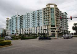
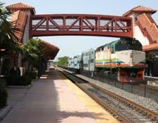
5 Project Study Area City of Pembroke Pines City of Hollywood ~20 miles Pembroke Lakes Mall Broward College Young Circle Memorial Hospital West Pembroke Pines City Hall North Perry Airport Hollywood City Hall Gateway Hub Anchor Hub Community Hub Memorial Regional Hospital 9 Corridor Segments Recognize varying characteristics along corridor Identify solutions appropriate to context URBAN TRANSITIONAL SUBURBAN 10 5

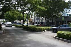
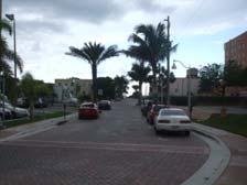
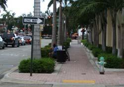
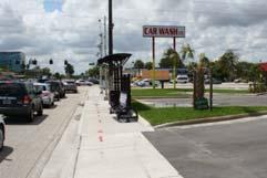
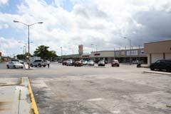
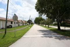
6 Corridor Segments Urban Corridor Segments Transitional 6


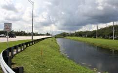
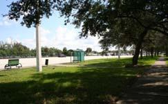
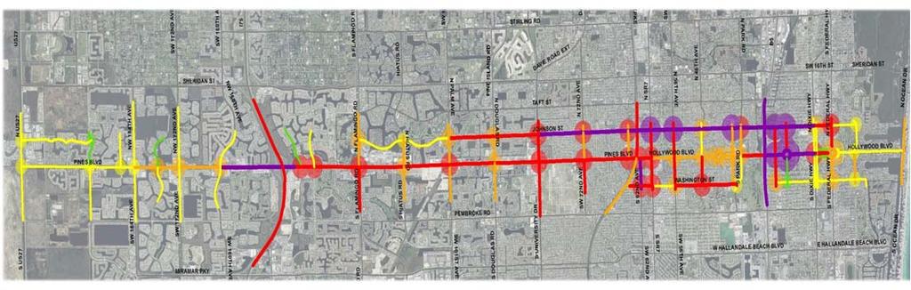
7 Corridor Segments Suburban Traffic and Level of Service Volume/Capacity Ratio (2009) < >1.20 (Max=1.87) 14 7


8 Transit Activity 1,300 Customers 1,400 Customers 1,700 Customers Daily Stop Volume > Crash History Crash Summary > 100 (Max 282) 16 8


9 Multimodal Network Multimodal Network Mobility Hubs17 Public Engagement Visioning Workshops 18 9


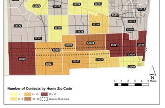
10 Public Engagement (Zip Code Analysis Jan. 2013) First Review: 9 of 11 zip codes Second Review: 11 of 11 zip codes Public Engagement (Zip Code Analysis April 2013) 10


11 Visioning Process Mobility Hub Selection Hollywood Blvd & Dixie Highway Pines Blvd & Flamingo Road Hollywood Blvd & SR 7 Pines Blvd & University Dr. Scenario Building Process Building Types Scenario Development Evaluation 1 Step 1: Model a library of building types that are financially feasible at the local level. 11
12 Scenario Building Process Building Types Scenario Development Evaluation 2 Step 2: Paint future land use scenarios to test the implications of different decisions or policies. Scenario Building Process Building Types Scenario Development Evaluation 3 Step 3: Compare the scenarios and monitor the impact of land use decisions in real time. 12


")


13 Comparing the Scenarios Site, node, corridor level indicators: Return on investment Employment density Jobs housing balance Mixed use (entropy) score Walkability Air quality impacts Energy consumption Fiscal impacts Shared Parking VMT Transit Trips etc Visioning Workshops 13


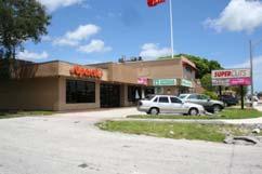
14 Hollywood Blvd & SR 7 Hollywood Blvd & SR 7 Provide greenway as part of SR 7 widening project Neighborhood scale infill/ redevelopment along SR 7 & Hollywood Blvd. Consider multifamily development buffered from major roads with retail/ mixed use Provide enhanced transit facilities at northeast and southwest corners Wrap Wal Mart site to create more walkable street frontage 14


15 Hollywood Blvd & Dixie Highway Hollywood Blvd & Dixie Highway Redevelop lower intensity uses adjacent to station platform area Leverage Cityowned properties; provide new stops to serve station Potential FEC Rail Station Organic infill and redevelopment over time 15


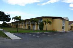
16 Pines Blvd & Flamingo Road CB Smith Park 95E and Commuter Svc. Park n Ride Memorial West Hospital Big box Retail Pembroke Lakes Mall Walmart Publix Big box Retail Multi family Residential Pines Blvd & Flamingo Road Redevelop northeast corner as medical/office complex Consider splitting BCT Route 7 to the east and west of Flamingo Road Preserve anchor tenants Preserve anchor tenants Accommodate multi family development Shift bus transfer center from mall to redevelopment site; transit routes circulate through Mobility hub convenient to the hospital, mall and new land uses Wrap retail using mixed use liner buildings 16

 Limited development potential, but short term use for Mobility Hub and parkand ride")
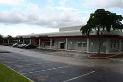
17 Pines Blvd & University Drive Current 95E Park n Ride Site (Publix) Multi family Residential Lowes Retail Multi family Residential Retail Car dealership & storage Aviation Authority Property North Perry Airport Pines Blvd & University Drive Infill development with shared /structured parking Longer term mixed use development Redevelop as multi family (mid term) Limited development potential, but short term use for Mobility Hub and parkand ride options 17
 10 Sidewalks/side path projects (8 miles) 33")


18 Summary of Recommendations: 31 Bicycle facility projects (24 miles) 10 Sidewalks/side path projects (8 miles) 33 Crosswalks and pedestrian enhancement recommendations 3 major complete streets projects 10 bus stop enhancement/ siting recommendations 9 Traffic operations opportunities Urban design toolkit Example Complete Streets Project: 18

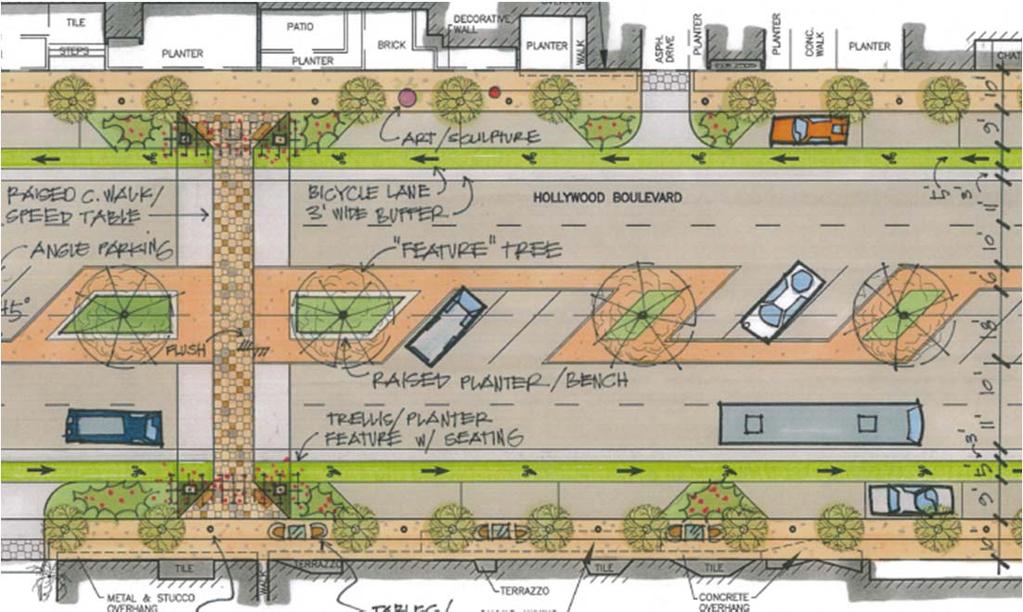
19 Example Complete Streets Project: Example Complete Streets Project: 19


20 Example Pedestrian Safety Enhancement: RRFB = Rectangular Rapid Flash Beacon High emphasis markings Advance stop bar; solid High lane line emphasis to stopping markings Advance High sight emphasis distance stop bar; markings solid lane Advance RRFB line or Hybrid stop stopping bar; Beacon solid sight lane Check line distance lighting to stopping sight RRFB Check High emphasis distance or landscaping Hybrid markings Beacon Example Multimodal Facility Project: Add Multiuse Trail Option Conflict Area 20


21 Outreach itown Hall Agency Coordination City Commission and MPO Committee Briefings Other Recommendations Advanced signal controllers, adaptive control Real time monitoring Driver information 21


22 Other Recommendations Intersection lighting enhancements Bus stop placement For safer/more convenient access Evaluate elimination of bus route deviations Other safety and operational considerations Project Prioritization Sidewalks and Bicycle Lanes Roadway characteristics Quality of existing facilities Potential to provide access to transit Availability of alternatives 22


23 Project Prioritization Bus Stop Enhancements/Relocation Stop ridership Roadway characteristics Traffic Operational Improvements Extent of congestion Traffic volumes Multimodal Safety Enhancements Exposure Crash history James Cromar Livability Planner Broward MPO Elisabeth Schuck, AICP, LEED GA Senior Project Manager Tindale Oliver & Associates, Inc
City of Fort Lauderdale UPTOWN URBAN VILLAGE. Public Workshop December 7, 2016
 Public Workshop December 7, 2016 Workshop Agenda Introductions Project Presentation o o o History Project Scope/Timeline Character of Study Area o o o o Land Use Public Realm/Pedestrian Mobility Multimodal
MORRISVILLE TRANSPORTATION PLAN TOWN COUNCIL PRESENTATION AUGUST 22, 2017
 TOWN COUNCIL PRESENTATION AUGUST 22, 2017 SCENARIO PLANNING CORRIDORS Town Hall Drive Baseline + 2 McCrimmon Parkway Baseline + 2 NC 54 Baseline + 2 7 subregion model runs determining carrying capacity
REVIEW AND EVALUATION OF REGIONAL LAND USE
 REVIEW AND EVALUATION OF REGIONAL LAND USE AND TRANSPORTATION SCENARIOS #220831 Environmental Justice Task Force October 7, 2014 VISION 2050 Process Development of Guiding Vision for Land Use and Transportation
Executive Summary. NY 7 / NY 2 Corridor
 Executive Summary NY 7 / NY 2 Corridor Transportation and Land Use Study December 2005 Prepared for: Town of Colonie Capital District Transportation Committee Prepared by: Introduction: Land use decisions
Transit / Housing Oriented Redevelopment
 Broward County Urban Planning and Redevelopment Department Kick-Off Meeting October 24, 2007 Transit / Housing Oriented Redevelopment 1 Future Land Use 2 Broward County Charter Voters approved in 1974.
Implementation Guide Comprehensive Plan City of Allen
 Implementation Guide 2030 Comprehensive Plan City of Allen DRAFT 2015 Implementation Guide Allen 2030 Comprehensive Plan INTRODUCTION The Comprehensive Plan serves as a guide for the growth and development
Hillsborough County MPO Transit Study. Citizens Team Workshop Wednesday, February 28 th, 2006 Hillsborough Community College - Brandon
 Hillsborough County MPO Transit Study Citizens Team Workshop Wednesday, February 28 th, 2006 Hillsborough Community College - Brandon What is the MPO Transit Study? An effort to look at the full range
ROBBINSDALE LRT STATION CDI DEVELOPMENT GUIDELINES
 August 2018 OVERVIEW The City of Robbinsdale has a prime-opportunity site in the middle of the 13 mile stretch of the Bottineau LRT corridor / Blue Line extension. Robbinsdale offers a prominent, vital,
INDEPENDENCE BOULEVARD AREA PLAN
 INDEPENDENCE BOULEVARD AREA PLAN Public Meeting October 28, 2008 Tonight s Agenda Introduction 4:00 4:05 Tom Warshauer Presentation 4:05 5:00 Blake Drury Group Exercises 5:00 5:50 All Wrap Up & Next Steps
FDOT D4 Complete Streets
 FDOT D4 Complete Streets Context Sensitive Solutions Directs that complete street solutions will complement the context of the community. Collaborative approach to decision making, project development,
SH 199 Corridor Master Plan. Community Meeting No. 2 May 31, 2017
 Community Meeting No. 2 May 31, 2017 Transportation Projects On or Near SH 199 SH 199 from 0.3 miles south of FM 1886 to south end of Lake Worth bridge Construct freeway mainlanes and frontage roads 10-Year
Urban Planning and Land Use
 Urban Planning and Land Use 701 North 7 th Street, Room 423 Phone: (913) 573-5750 Kansas City, Kansas 66101 Fax: (913) 573-5796 Email: planninginfo@wycokck.org www.wycokck.org/planning To: From: City Planning
West Ocala Vision & Community Plan City Council Work Session. Presented by West Ocala Community Plan Steering Committee
 West Ocala Vision & Community Plan City Council Work Session Presented by West Ocala Community Plan Steering Committee November 29,2011 Ocala 2035 Vision West Ocala Community Vision & Master Plan West
Port Credit Local Advisory Panel October 20 th Meeting
 Port Credit Local Advisory Panel October 20 th Meeting Focus Of This Evening s Meeting: 1. Hurontario Main Street Higher Order Transit Study 2. Port Credit Mobility Hub & GO Station Parking Structure Study
CHAPTER 7: Transportation, Mobility and Circulation
 AGLE AREA COMMUNITY Plan CHAPTER 7 CHAPTER 7: Transportation, Mobility and Circulation Transportation, Mobility and Circulation The purpose of the Transportation, Mobility and Circulation Chapter is to
TRANSIT ORIENTED DEVELOPMENT PINELLAS COUNTY MPO LIVABLE COMMUNITIES INITIATIVE PINELLAS COUNTY COMPREHENSIVE PLAN AMENDMENTS
 PINELLAS COUNTY MPO LIVABLE COMMUNITIES INITIATIVE MODEL LAND DEVELOPMENT CODE TRANSIT ORIENTED DEVELOPMENT PINELLAS COUNTY COMPREHENSIVE PLAN AMENDMENTS MPO Livable Communities Initiative Goal: Improve
495/MetroWest Development Compact Plan Citizen Planner Training Collaborative Conference. March 17, 2012
 495/MetroWest Development Compact Plan Citizen Planner Training Collaborative Conference March 17, 2012 Project Process Local and Regional Priority Areas Growth Scenarios Transportation Investment Categories
Robbinsdale LRT Station. CDI Development Guidelines. August Overview
 Robbinsdale LRT Station August 2018 Overview The City of Robbinsdale may have the coolest opportunity site along the 13 mile stretch of the Bottineau LRT corridor / Blue Line extension. Located a block
Chapter 1.0 Introduction
 Chapter 1.0 Introduction 1.1 Background The North Metro commuter rail line is part of the RTD FasTracks regional transit system expansion program to build more than 100 miles of rail transit throughout
SOUTH FLORIDA TOD GRANT UPDATE
 Palm Beach Transportation Planning Agency October 2018 SOUTH FLORIDA TOD GRANT UPDATE Presented by Treasure Coast Regional Planning Council in partnership with SFRTA & SFRPC What is Transit Oriented Development
Equitable Growth Through TOD Planning
 Equitable Growth Through TOD Planning Community Meeting # 2 November 2017 Goals Objectives Extend investment from downtown Connect neighborhoods physically and economically Enhance places based on local
FUNDING CORRIDOR REVITALIZATION
 FUNDING CORRIDOR REVITALIZATION Integrated corridor planning for the 21 st Century America Planning Association Annual Conference Atlanta, GA April 27, 2014 Mariia Zimmerman, MZ Strategies, LLC mariia@mzstrategies.com
Route 1 Corridor Study
 Route 1 Corridor Study Westbrook, Connecticut A Vision for the Connecticut Shoreline Public Informational Meeting July 28, 2015 Lower Connecticut River Valley Council of Governments Fitzgerald & Halliday,
TOD 203 CORRIDOR PLANNING and TOD
 2 CORRIDOR PLANNING and Scales of What You Will Learn The Transit Corridor Types of Corridors Objectives and Strategies for Transit and at the Corridor Level Main Street Corridor Planning and Your Trainers
TOD 101 CREATING LIVABLE COMMUNITIES WITH TRANSIT
 1 CREATING LIVABLE COMMUNITIES WITH TRANSIT What are transit Centered Communities? Benefits of Partnerships to Support and Implement What You Will Learn Portland s Pearl District Your Trainers Today Catherine
PD&E STUDY SR 9/I-95 FROM SOUTH OF SR 870/COMMERCIAL BOULEVARD TO NORTH OF CYPRESS CREEK ROAD FM # ETDM 14222
 PD&E STUDY SR 870/COMMERCIAL BOULEVARD TO NORTH OF CYPRESS CREEK ROAD FM # 435808-1-22-02 ETDM 14222 WELCOME TO THE KICK-OFF MEETING May 24, 2016 1 1 2 3 4 5 6 PLANNING PROJECT DEVELOPMENT AND ENVIRONMENT
West Kendall Corridor June 11, 2014
 June 11, 2014 Miami-Dade County Department of Regulatory and Economic Resources Development Services Division ā 1 Presentation Outline Review Study Area Review of Citizens Plans and Presentations Planning
Integrating Land Use and Transportation
 FEATURE Integrating Land Use and Transportation For years the transportation profession has emphasized mobility in the development of plans, programs, and projects. This emphasis on mobility moving people
Transportation Land Use Integration & Regional Planning. Don Kostelec, AICP Senior Planner, Louis Berger Group February 1, 2010
 Transportation Land Use Integration & Regional Planning Don Kostelec, AICP Senior Planner, Louis Berger Group February 1, 2010 Transportation Land Use Integration DOT-HUD-EPA Sustainable Communities Initiative
Today Land & People. Northeast Nampa Gateway District. Employment. Land Use Characteristics. Demographics. Current Zoning
 Today Land & People Employment Major employers include Saint Alphonsus, the College of Western Idaho, the Auto Mall, Sorrento Lactalis and Walmart. 3,004 jobs in 2010 (COMPASS-CIM 2040 TAZ data) 4,345
ORANGE COUNTY IMPLEMENTING THE FOUR C s
 ORANGE COUNTY IMPLEMENTING THE FOUR C s East Central Florida Corridor Task Force O R A N G E COUN TY P LA N N I N G DIVISION C O M M U N I T Y, E N V I R O N M E N T A L A N D D E V E L O P M E N T S E
WELCOME and introduction
 1 WELCOME and introduction Mobility Hub Locations within Burlington STUDY OVERVIEW STUDY OBJECTIVES The City of Burlington is developing four Area Specific Plans, one for each of Burlington s Mobility
The GATEWAYS Sub Area Master Plan. City of Walker
 The GATEWAYS Sub Area Master Plan City of Walker Introduction: The Walker City Commission and Planning Commission decided in 2011 to create a sub-area master plan for the Remembrance Road and Wilson Avenue
TRANSPORTATION ELEMENT GOALS, OBJECTIVES, AND POLICIES
 TRANSPORTATION ELEMENT GOALS, OBJECTIVES, AND POLICIES GOAL 2 The City shall provide a safe, convenient, effective, and energy efficient multimodal transportation system which is coordinated with the Future
Northwest Rail Corridor and US 36 BRT Development Oriented Transit Analysis 4.4 STATION AREA FINDINGS
 4.4 STATION AREA FINDINGS Each station is different, and each one requires a separate set of recommendations based on the vision for the site. This section outlines an initial TOD strategy and recommendations
FUTURE LAND USE ELEMENT
 FUTURE LAND USE ELEMENT GOAL I: To create and sustain a great place to live, play, and prosper Objective 1: The City of Ocala shall incorporate the principles and strategies of the Ocala 2035 Vision into
This page left intentionally blank.
 July 2012 This page left intentionally blank. Table of Contents Appendix A : Project Development Checklist Appendix B: At-Grade Rail Crossings Appendix C: Maintenance and Operations Examples Appendix D:
City of Long Beach. creating vibrant and exciting places
 City of Long Beach creating vibrant and exciting places Land Use Element Urban Design Element Overview of the two draft General Plan elements Discuss areas of change Economic goals of the plans Case study
BROOKLYN PARK / 85TH AVE LRT STATION CDI DEVELOPMENT GUIDELINES DRAFT
 August 2018 Page intentionally left blank The Brooklyn Park Library adjacent to the 85th Ave LRT Station Area. OVERVIEW The Blue Line LRT Extension / Bottineau corridor offers a unique opportunity to leverage
Economic Development & Housing Council Committee Comprehensive Plan Update September 20, 2005
 1 Economic Development & Housing Council Committee Comprehensive Plan Update September 20, 2005 Purpose To update the Committee on the ForwardDallas! Plan, including: Status Anticipated Products Public
Northwest LRT Downtown to. Northwest Edmonton Study. Public Workshops
 Northwest LRT Downtown to Northwest Edmonton Study Public Workshops March 23 & 24, 2010 Welcome Thank you all for attending Welcome Introductions Welcome Our Team s Commitment to You for Tonight To provide
South Davis County COMMUNITY SPOTLIGHT
 South Davis County COMMUNITY SPOTLIGHT Davis/SLC Community Connector Bus Rapid Transit line connecting SLC & Davis County RTP Phase 1 Project Generate 3,100 average weekday riders Relieve congestion on
Gold Line Bus Rapid Transit Transit Oriented Development (BRTOD) Helmo Station Area Plan
 Helmo Station Area Plan") Appendix F Gold Line Bus Rapid Transit Transit Oriented Development (BRTOD) Helmo Station Area Plan Introduction and Purpose of the Plan The Gold Line Bus Rapid Transit facility is an eleven-mile dedicated
Appendix F Gold Line Bus Rapid Transit Transit Oriented Development (BRTOD) Helmo Station Area Plan Introduction and Purpose of the Plan The Gold Line Bus Rapid Transit facility is an eleven-mile dedicated
Public Open House #1
 Public Open House #1 TONIGHT S AGENDA Welcome Project Overview The Big Picture The Station Area The Analysis Thoughts about Future Change Breakout Group Discussions Summation / Next Steps Project Overview
Making TOD Work in the Heart of Suburban Sprawl
 Making TOD Work in the Heart of Suburban Sprawl Rocky Mountain Land Use Institute March 6, 2009 Speakers Ben Herman, FAICP, Principal Clarion Associates Darcie White, AICP, Principal Clarion Associates
Project Update. Hillsborough County 2045 Population and Employment Projections and Allocations. Board of County Commissioners February 13, 2018
 Hillsborough County 2045 Population and Employment Projections and Allocations Project Update Board of County Commissioners February 13, 2018 What will Hillsborough County look like in 25 years? Working
GPA FALL 2017 CONFERENCE
 Change in Doraville Doraville at the beginning of a new era Design Doraville (Comp. Plan) adopted in 2016 Doraville Town Center Masterplan LCI (2005) Downtown Doraville Masterplan LCI (2010) 2014 Adoption
Danvers High Street I-1 District Study
 Danvers High Street I-1 District Study Presentation of Final Recommendations Planning Board Presentation June 26 th, 2018 1 Introductions Metropolitan Area Planning Council Sam Cleaves AICP, Principal
Silverdale Regional Center
 Silverdale Regional Center Vision for Silverdale Regional Center The Silverdale Regional Center Plan (Plan) will guide the evolution of the Silverdale Regional Center from a collection of strip malls and
Developer s Program. The Station at East 54
 Developer s Program The Station at East 54 Existing Conditions The Station at East 54 is proposed for a 1.12 acre site at the northeast corner of Hamilton Road and Prestwick Road, tucked between the East
Secrest Short Cut and Monroe Expressway Small Area Plan AUGUST 29, 2018
 Secrest Short Cut and Monroe Expressway Small Area Plan AUGUST 29, 2018 Background and Process Monroe Expressway will be open by the end of 2018 Union County and Indian Trail identified a need to revisit
One said, without a clear understanding of what will be annexed, this is an exercise in futility.
 Stakeholder Focus Groups: Summary of Meetings Stakeholder Focus Group meetings were held on at the Pinellas County Planning Department conference room. Focus Group meetings will be held during each of
Integrated Urban Development. April Reflections from the NZPI Study Tour of Portland, Seattle and Vancouver
 Integrated Urban Development April 2009 Reflections from the NZPI Study Tour of Portland, Seattle and Vancouver Integrated Urban Development Urban Growth Management Transportation Transit Orientated Mixed
Stakeholders Advisory Working Groups (SAWGs) Smart Growth and TOD Land Use (#11) SAWG Meeting
 Smart Growth and TOD Land Use (#11) SAWG Meeting") Presentation - Part II Tappan Zee Bridge/I-287 Corridor Project July 21, 2010 Slide 1. David Kooris (Regional Plan Association) welcomed members of the Land Use Stakeholders Advisory Working Groups (SAWGs)
Presentation - Part II Tappan Zee Bridge/I-287 Corridor Project July 21, 2010 Slide 1. David Kooris (Regional Plan Association) welcomed members of the Land Use Stakeholders Advisory Working Groups (SAWGs)
Scope of Services. River Oaks Boulevard (SH 183) Corridor Master Plan
 Corridor Master Plan") Scope of Services River Oaks Boulevard (SH 183) Corridor Master Plan PROJECT AREA The project area consists of the River Oaks Boulevard (SH 183) corridor bounded by SH 199 at the northern end and the Trinity
Scope of Services River Oaks Boulevard (SH 183) Corridor Master Plan PROJECT AREA The project area consists of the River Oaks Boulevard (SH 183) corridor bounded by SH 199 at the northern end and the Trinity
Downtown Elkton Station Area Plan, Elkton, MD. Difficult enough to get support for new starts challenge to fund Houston transit
 Difficult enough to get support for new starts challenge to fund Houston transit More difficult to build Community Support for dense development at station areas Major Concerns: Traffic, Property values,
ForwardDallas! Comprehensive Plan. City Council Briefing February 15, 2006
 ForwardDallas! Comprehensive Plan City Council Briefing February 15, 2006 Purpose Brief City Council on the preliminary products of the Forward Dallas! Comprehensive Plan 2 Where we are in the process
CHARLES PUTMAN CHARLES PUTMAN AND ASSOCIATES, INC
 MEMORANDUM CHARLES PUTMAN & ASSOCIATES, INC. LAND DEVELOPMENT CONSULTANTS PLANNING ZONING PERMITTING 4722 NW Boca Raton Boulevard, Suite C-106 Boca Raton, Florida 33431 Phone: 561/994-6411 FAX: 561/994-0447
Route 5 Corridor Land Use and Transportation Plan
 N Y S M P O Integrated Transportation Planning & Community Design Processes ALBANY Great streets do not just happen... They are streets for both pedestrians and drivers. They have definition, a sense of
UPDATE ON THE INDEPENDENCE BOULEVARD AREA PLAN. Citizen Advisory Group Meeting March 3, 2011
 UPDATE ON THE INDEPENDENCE BOULEVARD AREA PLAN Citizen Advisory Group Meeting March 3, 2011 Purpose: Why are we here? To provide an update on the Independence Boulevard Area Plan 1. Overview of the ULI
Harlem Avenue Corridor Plan: Corridor Planning Across Municipal Boundaries
 Harlem Avenue Corridor Plan: Corridor Planning Across Municipal Boundaries Heather Tabbert, Manager, Local Planning and Programs Division Regional Transportation Authority (RTA) Jen McNeil Dhadwal, Principal
Mountain View & Old Dixie Master Plans DACC Meeting. July 10, 2018
 Mountain View & Old Dixie Master Plans DACC Meeting July 10, 2018 Agenda I. Project Schedule II. Goals III. Design Workshop Our Team Sizemore Group: Award-Winning Planning and Architecture Principal: Bill
The Need to Develop a Transit Ready Community
 Evaluation & Appraisal Report (EAR) Major Issue # 6 The Need to Develop a Transit Ready Community July 3, 2007 EAR Major Issue # 6 Transit Ready Existing Comp Plan policies apply only to Indiantown Road:
Making Transit Oriented Development Work For Boonton, NJ
 Making Transit Oriented Development Work For Boonton, NJ Bloustein School of Planning and Public Policy Studio Dan Burton Loannie Dao Webster Slater Brandon Williams Ian Watson Maria Laham Nicola Mammes
PUBLIC OPEN HOUSE HURONTARIO-MAIN CORRIDOR SECONDARY PLAN
 PUBLIC OPEN HOUSE HURONTARIO-MAIN CORRIDOR SECONDARY PLAN Tuesday, February 28, 2012 6pm 9pm 1 st Floor Atrium, City Hall 2 Wellington Street West, Brampton 1 POLICY FRAMEWORK The 2006 Provincial Growth
Mobility Districts and Traffic Studies
 Mobility Districts and Traffic Studies During the last Comprehensive Plan update in 2008, the City of Sarasota identified the need to develop a citywide strategy for enhancing the mobility options of all
Linking Land Use and Transportation
 Linking Land Use and Transportation NJ s Experience January 18, 2006 NYMTC - PFAC Mark Stout Planning & Development New Jersey Department of Transportation Where We Are Los Angeles, CA San Francisco, CA
Lesson 6. Corridor Planning
 Lesson 6 Corridor Planning 1 Learning Outcomes Identify land use strategies and solutions that can be incorporated into multimodal transportation corridor plans Identify land use stakeholders and describe
DRAFT Land Use Chapter
 Stevens Creek Urban Village DRAFT 1 18 17 Land Use Chapter INTRODUCTION This Land Use Chapter describes how the Stevens Creek Urban Village will accommodate the growth that is planned for it in the Envision
Lake Oswego to Portland Transit Project. Lessons Learned. John Cullerton Senior Project Manager, URS 2012 APTA/TRB Light Rail Conference
 Lake Oswego to Portland Transit Project Lessons Learned John Cullerton Senior Project Manager, URS 2012 APTA/TRB Light Rail Conference Overview Project Location and Context Corridor History and Project
Street Flooding Mitigation Plan KYOVA Interstate Planning Commission. Presented to AMPO National Conference October 18, 2017
 Street Flooding Mitigation Plan KYOVA Interstate Planning Commission Presented to AMPO National Conference October 18, 2017 Saleem Salameh, Ph.D., P.E., M.ASCE Chet Parsons, AICP CTP Agenda: Background
3. ELEMENTS OF THE METRO VISION 2035 PLAN
 3. ELEMENTS OF THE METRO VISION 2035 PLAN What is Metro Vision and why does it matter? For more than 50 years, DRCOG has championed a regional perspective on key issues facing the metropolitan area and
Tony Garcia, City-County Planning Commission & Beth Alden, Hillsborough MPO
 Tony Garcia, City-County Planning Commission & Beth Alden, Hillsborough MPO TOD Defined A compact neighborhood with housing, jobs and neighborhood services within easy walking distance of a transit station
TRANSIT-ORIENTED DEVELOPMENT POLICY DRAFT. City Planning and Development Department Kansas City, Missouri
 TRANSIT-ORIENTED DEVELOPMENT POLICY DRAFT City Planning and Development Department Kansas City, Missouri What is Transit Oriented Development (TOD)? Development that focuses land uses around a transit
Plano Tomorrow Vision and Policies
 Plano Tomorrow Vision and Policies PLANO TOMORROW PILLARS The Built Environment The Social Environment The Natural Environment The Economic Environment Land Use and Urban Design Transportation Housing
Presenting a Vision for Thread Lake
 Presenting a Vision for Thread Lake FEBRUARY 20, 2014 SPECIAL THANKS TO: International Academy of Flint Flint River Watershed Coalition South Saginaw Business and Resident Association South Side Neighborhood
Planning for TOD Implementation at a Corridor Scale
 Planning for TOD Implementation at a Corridor Scale Catherine Cox Blair, Reconnecting America Presentation to DRCOG and the Sustainable Communities Initiative May 14, 2012 What is Reconnecting America?
U T D N o r t h C a m p u s T O D and D o w n t o w n D e n t o n T O D
 U n i v e r s i t y o f T e x a s a t D a l l a s C i t y o f R i c h a r d s o n U T D N o r t h C a m p u s T O D and D o w n t o w n D e n t o n T O D Rick Leisner, AICP Assistant Director of Development
Planning for TOD Implementation at a Corridor Scale
 Planning for TOD Implementation at a Corridor Scale Bill Sadler, Reconnecting America Presentation to Gold Line Corridor Working Group July 2, 2013 What is Reconnecting America? Reconnecting America is
Rio/29 Future Land Use Alternatives. Rio/29 Small Area Plan Phase 1 December 12, 2016
 Rio/29 Future Land Use Alternatives Rio/29 Small Area Plan Phase 1 December 12, 2016 PRESENTATION OVERVIEW 1 BACKGROUND 2 COMMUNITY INPUT 3 DESIGN PRINCIPLES 4 5 ALTERNATIVES OPEN HOUSE 2 1 PROJECT BACKGROUND
NORTH CLAYMONT AREA MASTER PLAN COMMUNITY WORKSHOP #1 FEBRUARY 3, 2016
 NORTH CLAYMONT AREA MASTER PLAN COMMUNITY WORKSHOP #1 FEBRUARY 3, 2016 1. Introduction To the team and to the Plan Planning Partners The Claymont Community WILMAPCO New Castle County Claymont Renaissance
EAR WORKSHOP FOR PALM BEACH COUNTY LOCAL GOVERNMENTS APRIL 2010 TREASURE COAST REGIONAL PLANNING COUNCIL
 EAR WORKSHOP FOR PALM BEACH COUNTY LOCAL GOVERNMENTS APRIL 2010 TREASURE COAST REGIONAL PLANNING COUNCIL Why Should I Care about Transportation & Land Use? Congestion or Mobility Pick One!! Congestion
Blue Line LRT Extension
 v e Noble Pkwy Noble Pkwy Xerxes Ave N Shingle Creek Penn Ave N Penn Ave N Fremont Ave N Lyndale Ave N S Washington Ave University Ave NE Blue Line LRT Extension LIGHT RAIL PLATFORM AND STATION DESIGN
MONTGOMERY COUNTY METRO STATION AREA DESIGN CHARRETTE
 MONTGOMERY COUNTY METRO STATION AREA DESIGN CHARRETTE Shady Grove Metro Station Area Charrette Closing Presentation October 25-28, 2000 MONTGOMERY COUNTY, MD M-NCPPC Design Collective, Inc. Architects
Chapter 3: Land Use and Local Planning
 3.1 Chapter 3: Land Use and Local Planning 2040 3.2 Chapter 3: Land Use and Local Planning CONTENTS Introduction 3.3 Coordinating Thrive MSP 2040 and Transportation Policy Plan 3.6 Coordination of Regional
Nassau County Cultivating Opportunities for Sustainable Development Nassau County Infill Redevelopment Feasibility Study
 Nassau County Cultivating Opportunities for Sustainable Development Nassau County Infill Redevelopment Feasibility Study NY-CT Sustainable Communities Steering Committee Meeting March 14, 2014 Project
International Blvd. TOD Plan Public Workshop #1
 International Blvd. TOD Plan Public Workshop #1 Add photos or project images September 21 and 22, 2010 Workshop Purpose Introduce the public to the Project Review and discuss the existing conditions analysis
Urban Design Manual PLANNING AROUND RAPID TRANSIT STATIONS (PARTS) Introduction. Station Study Areas
 Introduction. Station Study Areas") 111111 PLANNING AROUND RAPID TRANSIT STATIONS (PARTS) Introduction The ION rapid transit system will link Waterloo, Kitchener and Cambridge through a central transit corridor (CTC). There are a number
111111 PLANNING AROUND RAPID TRANSIT STATIONS (PARTS) Introduction The ION rapid transit system will link Waterloo, Kitchener and Cambridge through a central transit corridor (CTC). There are a number
Connecting Key Activity Centers with High Quality Bus Service
 Connecting Key Activity Centers with High Quality Bus Service Lessons Learned from the DC Circulator Transit Development Plan April 15, 2011 1 DC Circulator Transit Development Plan Ten-year plan for development
NORTH-SOUTH CORRIDOR STUDY EXECUTIVE SUMMARY. Executive Summary
 Executive Summary Background As congestion continues to affect mobility in the region, the Ozarks Transportation Organization (OTO) is particularly concerned with traffic movement. The North-South Corridor
INDEPENDENCE BOULEVARD AREA PLAN. Economic Development Committee Overview March 10, 2011
 INDEPENDENCE BOULEVARD AREA PLAN Economic Development Committee Overview March 10, 2011 Presentation Outline Purpose: To provide an overview of the Independence Boulevard Area Plan and to request a recommendation
Tysons Circulator Study: Process and Preliminary Results Summary. March 2012
 Tysons Circulator Study: Process and Preliminary Results Summary March 2012 Background: 1. The Comprehensive Plan for the Tysons Corner Urban Center calls for a System of Circulators in Tysons Corner to:
Gary & Regional Investment Project. October 27, Creating Tomorrow Today Comprehensive Regional Plan - NIRPC
 Creating Tomorrow Today 2040 Comprehensive Regional Plan Gary & Regional Investment Project October 27, 2010 Creating Tomorrow Today - 2040 Comprehensive Regional Plan - NIRPC What is NIRPC? - Northwestern
Corridor Vision. 1Pursue Minnehaha-Hiawatha Community Works Project. Mission of Hennepin County Community Works Program
 1Pursue Minnehaha-Hiawatha Community Works Project Minnehaha-Hiawatha Community Works is a project within the Hennepin Community Works (HCW) program. The mission of the HCW program is to enhance how the
DRAFT Civic Center Station Area Plan. Executive Summary
 DRAFT Civic Center Station Area Plan Executive Summary This project is funded in part through the Metropolitan Transportation Commission s Station Area Planning Program. The preparation of this report
Mobility in the Gardens Palm Beach Gardens ~ Station Area TOD Plan
 Mobility in the Gardens Palm Beach Gardens ~ Station Area TOD Plan City Commission Update November 2, 2017 A Multi-Agency Approach... that includes the Community Prepared by TCRPC 1 System Segments * 1.
The State Road 7/U.S. 441 Collaborative. 8 th Annual New Partners for Smart Growth Building Safe, Healthy and Livable Communities
 The State Road 7/U.S. 441 Collaborative 8 th Annual New Partners for Smart Growth Building Safe, Healthy and Livable Communities J. Gary Rogers City of Lauderdale Lakes Florida Community Redevelopment
REGIONAL ACTIVITY CENTER
 DRAFT REGIONAL ACTIVITY CENTER 70 EAST BENCH MASTER PLAN DRAFT 06 Introduction The East Bench Regional Activity center is comprised of large educational, research, medical, and employment centers. These
1.3 TRANSIT VISION 2040 FROM VISION TO ACTION THEME 1: PUTTING TRANSIT AT THE CENTRE OF COMMUNITIES. Fully integrate transit with community planning
 TRANSIT VISION 2040 FROM VISION TO ACTION TRANSIT VISION 2040 defines a future in which public transit maximizes its contribution to quality of life with benefits that support a vibrant and equitable society,
TRANSIT SUPPORTIVE DEVELOPMENT ANALYSIS
 7 TRANSIT SUPPORTIVE DEVELOPMENT ANALYSIS One of the key comments heard over and over through the public involvement process was that the region needs a more robust transit system to provide a viable alternative