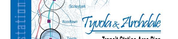
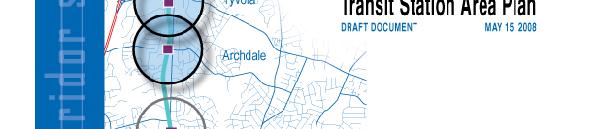
Tyvola & Archdale Transit Station Area Plan. June 5, 2008
|
|
|
- Jewel Myra Berry
- 5 years ago
- Views:
Transcription
1 Tyvola & Archdale Transit Station Area Plan Second Public Meeting June 5, 2008


2 Presentation Outline 1. Purpose and Process 2. Station Area Overview 3. Plan Recommendations 4. Comments Received and Proposed Plan Revisions 5. Plan Adoption and Implementation


3 Purpose and Process

 Serves as the")
4 Plan Purpose Defines vision for area Makes recommendations for land use and community design, transportation, infrastructure and environment Updates the Centers, Corridors and Wedges boundary in the plan area. Updates adopted land use policies (Southwest and South District Plans) Serves as the official streetscape plan for the study area


5 Policy Framework Centers, Corridors and Wedges Growth Framework General Development Policies i Transit Station Area Principles Transportation Action Plan and Urban Street Design Guidelines
6
7 Plan Development Process Began with planning for LYNX Blue Line Notification to property owners, business owners, neighborhood groups, residents Citizen Meetings Staff team developed plan recommendations Citizen meetings Citizen feedback and revisions to recommendations Plan adoption Plan implementation, including rezonings
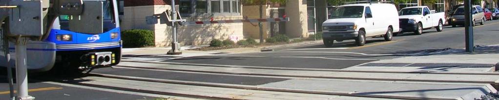
8 Station Area Overview Lynx Blue Line 10 miles 15 stations including Uptown and South End Plans for 8 stations in progress


9 Transit Station Area Plans to date South End Plan: Adopted June 2005 (covers 3 stations) New Bern Plan: City Council public comment in June 2008 Scaleybark Plan: Planning Committee recommendation in June 2008 Woodlawn Plan: Planning Committee recommendation in June 2008
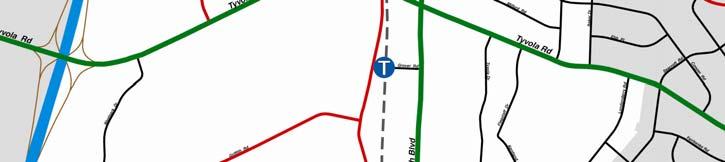
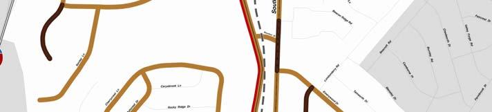
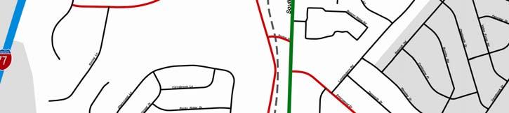
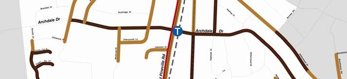
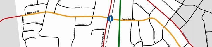
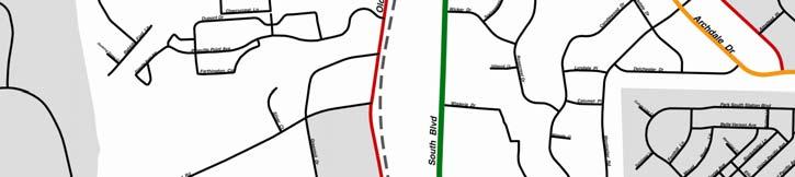
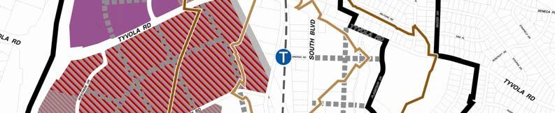
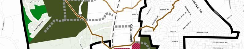
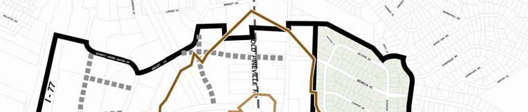
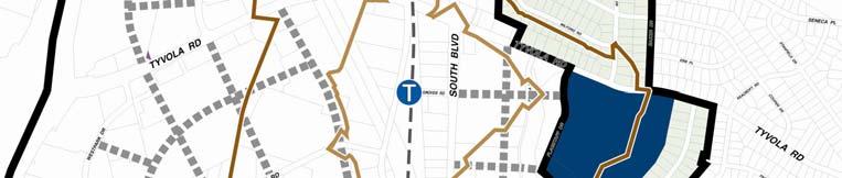
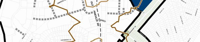
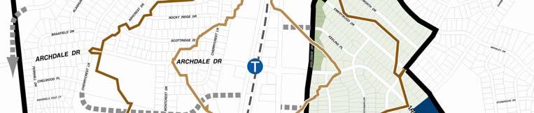
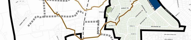
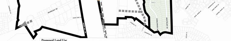
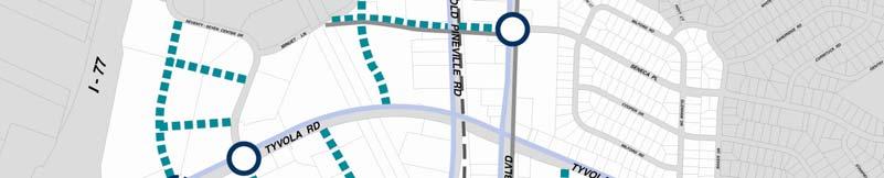
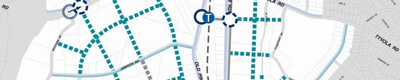
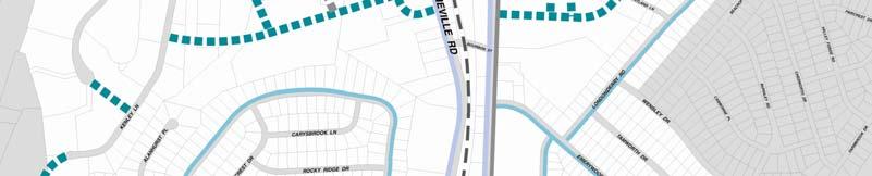
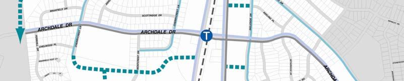
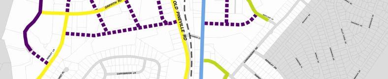
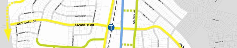
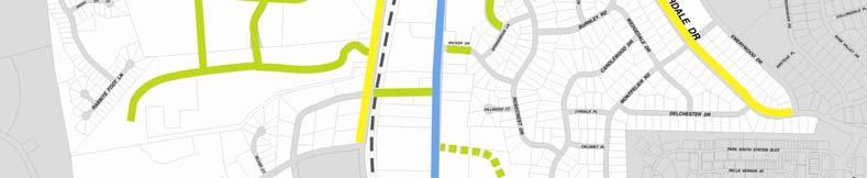
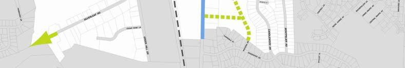
10 Tyvola & Archdale Plan Area 1120 acres Located in the South Growth Corridor and adjoining Wedge Bounded by Madison Park, Montclaire, Starmount, & Montclaire South neighborhoods Major roads include I-77, South Boulevard, Tyvola Road, Archdale Road, Old Pineville Road
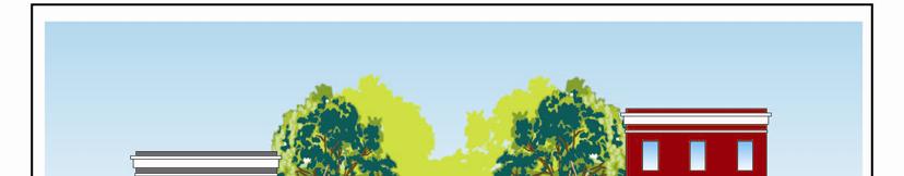
11 Single-family Neighborhoods
12 Townhomes at Station
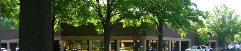
13 Office/Industrial Development
14 Strip Commercial


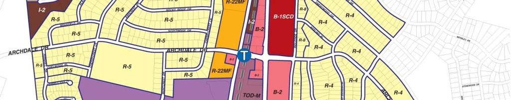
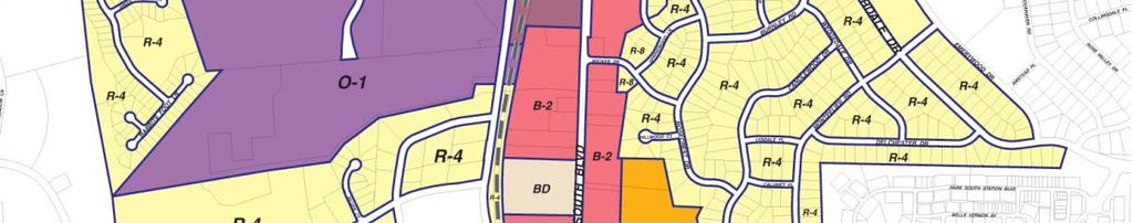
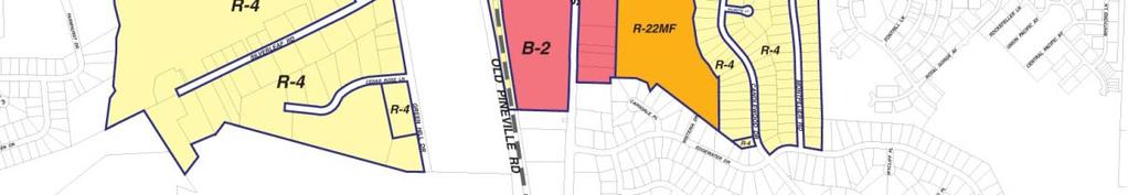
15 Existing Zoning Single Family: 42% Multi-Family: 8% Industrial: 28% Commercial: 10% Office (MF Res): 7% MUDD: 2% TOD: 2%
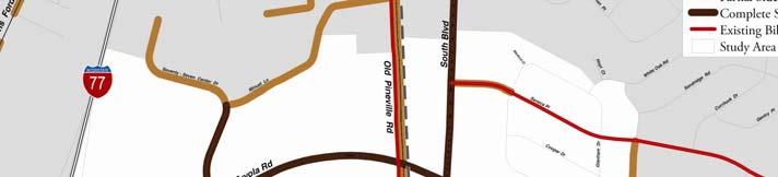
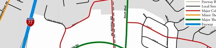
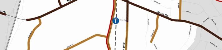

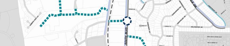
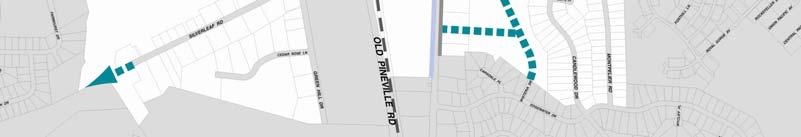
16 Existing Transportation System Streets Sidewalks
17 Inadequate sidewalk and planting strips
18 Opportunities and Constraints OPPORTUNITIES Visible Station Location Some Assembled Land Underutilized Land Strong Market Opportunities Housing Diversity Stable Residential Neighborhoods Improved Transportation Environment CONSTRAINTS Norfolk Southern Railroad Line Small Parcels at Station Recent Office Park & Warehouse Development Limited Street Network East-West Mobility Difficult Pedestrian Environment Lack of Open Space Need for Improved Natural Environment
19 Plan Recommendations
20 Vision Statement The Tyvola & Archdale plan area will become part of a series of vibrant, high density nodes along the South Corridor. It will include: Station ti Area: Urban, pedestrian-oriented; General Corridor Area: More auto-oriented; Wedge: Neighborhoods.


21 Land Use, Community Design and Street Network


22 Transit Station Area Transit Oriented Development (TOD) Ground floor retail Park & Ride Lot (future deck) Urban Plazas New Street Connections


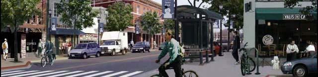

23 Vision: Future Development
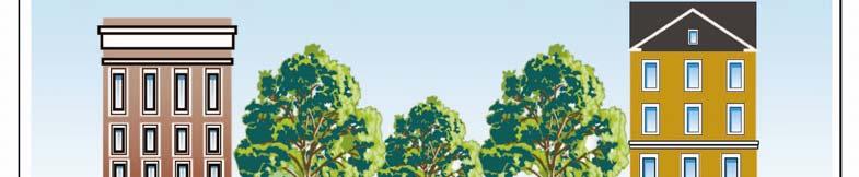
24 New residential development along line

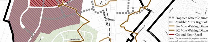
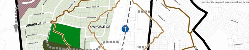
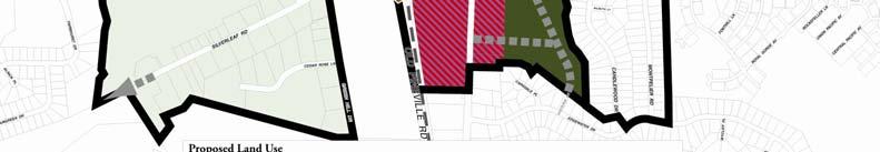
25 General Corridor Area Archdale Park Office/Retail/Industrial areas Multi-family residential with redevelopment opportunity Montclaire South and Silverleaf Road single-family neighborhoods preserved New street connections


26 Mixture of office, commercial, and industrial uses
27 Wedge Neighborhood Area Preservation of Madison Park, Montclaire, and Starmount single- family neighborhoods New Street New Street Connections
28 Single family preservation
29 Transportation and Streetscape Street Network Sidewalks Pedestrian Crossings Bicycle Facilities
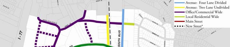
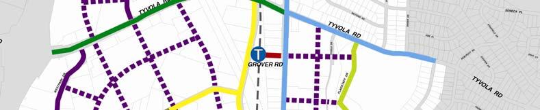
30 Street Cross-Sections Street types based on the proposed future land uses and Urban Street Design Guidelines
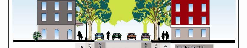


31 Street Cross-Sections Main Street Four Lane Divided Avenue


32 TOD Building Heights TOD zoning ordinance limits heights adjacent to single-family properties. Allowable height increases as distance from single family increases
33 Street Cross Section: Setback Building setback on TOD residential streets increased to 30 feet g where facing or abutting single family residential


34 Comments Received and Proposed Plan Revisions


35 Street Connection Citizen Comments: Concerned about impact of extending Silverleaf westward Page 12, text change Extension only through development or redevelopment; Only connecting similar residential land uses; Only through indirect route.


36 Archdale Road Citizen Comments: Concerned about speed and volume and safety on Archdale Road Page 12, text change Consider special intersection treatments such as pedestrian crossings and traffic circles.
37 Additional Citizen Comments: Generally covered by plan Bike lanes need to connect to each other better, and reach key destinations (new street cross sections and bike lane extensions are proposed) Increase street connectivity and connections into neighborhoods h (a number of new connections are proposed) Option for retail at Greenhill & Old Pineville (plan will allow conditional TOD, but only if surrounding properties are included)
38 Additional Citizen Comments: Generally covered by plan Improvements to access along Tyvola Road (focus is west of South Blvd; new cross section to east in longer term) Provide incentives to make TOD uses happen (mainly new rail line and attractive zoning to encourage redevelopment) Don t want tall buildings or brownstone stoops in close proximity to existing homes (height restrictions and wider front yard setback adjacent to residential)
39 Additional Citizen Comments: Outside the scope of plan; referred to other bodies Crack down on food trailers and ice vending machine Need neighborhood feeder buses to stretch use of light rail Bus approach not graded to allow bus to enter

40 Plan Adoption and Implementation
41 Plan Implementation Process Transit Station Area Plan Corrective Rezonings Infrastructure Improvements New Development


42 Proposed Corrective Rezonings Update to TOD district standards is underway concurrently Considering strategy for TOD rezoning
43 Plan Adoption NEXT STEPS: Planning Commission (Planning Committee) Review and Recommendation Tuesday, June 17, 5 pm (additional opportunity for Citizen input) City Council Review and Decision Dates to be determined (additional opportunity for Citizen input) Implementation


44 We still need your feedback! Contact us (704)
45 Questions
46
Tyvola & Archdale Transit Station Area Plan. May 15, 2008
 Tyvola & Archdale Transit Station Area Plan First Public Meeting May 15, 2008 Presentation Outline 1. Purpose and Process 2. Station Area Overview 3. Plan Recommendations Vision Land Use Transportation
Citizen Advisory Group Meeting 5: Land Use April 14, 2011
 Citizen Advisory Group Meeting 5: Land Use April 14, 2011 Meeting Agenda 1. Background Review 2. Transportation Follow-up 3. PED Overlay Approach 4. Land Use Mapping 5. Group Exercise 6. Wrap-up and Next
The petition proposes to rezone 3.17 acres to allow all uses in the TOD-M (transit oriented development mixed-use) district.
 district.") Rezoning Petition 2018-053 Pre-Hearing Staff Analysis December 17, 2018 REQUEST Current Zoning: R-5 (single family), B-1 (neighborhood business), I-1 (light industrial), and I-2 (general industrial) Proposed
Rezoning Petition 2018-053 Pre-Hearing Staff Analysis December 17, 2018 REQUEST Current Zoning: R-5 (single family), B-1 (neighborhood business), I-1 (light industrial), and I-2 (general industrial) Proposed
Rezoning Petition Post-Hearing Staff Analysis February 5, 2019
 Rezoning Petition 2018-053 Post-Hearing Staff Analysis February 5, 2019 REQUEST Current Zoning: R-5 (single family), B-1 (neighborhood business), I-1 (light industrial), and I-2 (general industrial) Proposed
Cobb County Design Guidelines Mableton Parkway & Veterans Memorial Highway Community Design Workshop January 12, 2017
 Community Design Workshop January 12, 2017 Agenda Opening Remarks / Introductions Scope of Work Existing Conditions Key Issues / Opportunities VPS Summary Draft Vision & Goal Statement Implementation Concepts
Welcome to the LYNX Blue Line Extension Transit Station Area Plans Public Workshop No. 3. Presentation will begin at 6:00 P.M.
 Welcome to the LYNX Blue Line Extension Transit Station Area Plans Public Workshop No. 3 Presentation will begin at 6:00 P.M. Meeting Agenda Blue Line Extension (BLE) Project Update LYNX Blue Line Extension
The transportation system in a community is an
 7 TRANSPORTATION The transportation system in a community is an important factor contributing to the quality of life of the residents. Without a sound transportation system to bring both goods and patrons
Volume 4: Adopted Plans and Policies
 121 Volume 4: JW Clay Blvd/UNC Charlotte UNC Charlotte Main McCullough University City Blvd 122 Policies in Place to Guide Development Since the 1980s, Charlotte has been one of the nation s fastest growing
Independence Boulevard Area Plan Planning Committee Public Comment May 18, 2010
 Independence Boulevard Area Plan Planning Committee Public Comment May 18, 2010 Presentation Outline Focus on Key Recommendations within Draft Plan Plan Purpose and Development Process Draft Plan Policies
NEC of Central Avenue and Indian School Road
 NEC of Central Avenue and Indian School Road For this location, there are two applicable plans that provide guidance on development. The two plans include the Indian School Specific Plan (1991) and the
REQUEST Current Zoning: O-15(CD) (office) Proposed Zoning: TOD-M(CD) (transit oriented development mixed-use, conditional)
 (office) Proposed Zoning: TOD-M(CD) (transit oriented development mixed-use, conditional)") Rezoning Petition 2016-117 Zoning Committee Recommendation January 4, 2017 REQUEST Current Zoning: O-15(CD) (office) Proposed Zoning: TOD-M(CD) (transit oriented development mixed-use, conditional) LOCATION
Rezoning Petition 2016-117 Zoning Committee Recommendation January 4, 2017 REQUEST Current Zoning: O-15(CD) (office) Proposed Zoning: TOD-M(CD) (transit oriented development mixed-use, conditional) LOCATION
Citizen Comment Staff Response Staff Recommended Revision Planning Committee
 Citizen Comment Staff Response Staff Recommended Revision Planning Committee Area No. 1: Owner desires retail land uses. Area No. 1a: Owner of two small parcels adjacent to Area No. 1 desires retail land
Tonight s Agenda. Summary Presentation Open House. Group Discussion Next Steps: online community wide survey
 Community Open House February 22, 2018 Tonight s Agenda Summary Presentation Open House Station 1: Project Overview and Community Input Station 2: Draft Vision and Guiding Principles Station 3: Western,
Executive Summary. NY 7 / NY 2 Corridor
 Executive Summary NY 7 / NY 2 Corridor Transportation and Land Use Study December 2005 Prepared for: Town of Colonie Capital District Transportation Committee Prepared by: Introduction: Land use decisions
Land Use Policy & Development Ordinance Update
 Land Use Policy & Development Ordinance Update Charlotte Chamber of Commerce, Land Use Committee July 27, 2016 Land Use Policy & Development Ordinance Update Land Use Policy & Development Ordinance Update
INDEPENDENCE BOULEVARD AREA PLAN. Economic Development Committee Overview May 25, 2010
 INDEPENDENCE BOULEVARD AREA PLAN Economic Development Committee Overview May 25, 2010 Presentation Outline Plan Purpose and Development Process Draft Plan Policies and Implementation Strategies Request
PUBLIC OPEN HOUSE HURONTARIO-MAIN CORRIDOR SECONDARY PLAN
 PUBLIC OPEN HOUSE HURONTARIO-MAIN CORRIDOR SECONDARY PLAN Tuesday, February 28, 2012 6pm 9pm 1 st Floor Atrium, City Hall 2 Wellington Street West, Brampton 1 POLICY FRAMEWORK The 2006 Provincial Growth
Prosperity Hucks Area Plan. Transportation and Planning Committee May 11, 2015
 Prosperity Hucks Area Plan Transportation and Planning Committee May 11, 2015 Presentation Outline 1. Background and Location 2. Community Dialog Process 3. Activity Center Recommendations 4. Wedge Recommendations
Northwest commuter rail station US 36 BRT. Westminster Station
 Northwest commuter rail station Westminster Station US 36 BRT Westminster Center US 36 & Church Ranch Broomfield Flatiron/96 th St. US 36 & McCaslin Table Mesa Boulder Junction 13-month effort that will
1.0 VISION STATEMENT. December 6, PRINCIPLES
 Vision Statement Lincoln Regional Airport 1.0 VISION STATEMENT 1.1 City LOCATION of AND OVERVIEW The Easton Lincoln Place Land Use Master Plan identifies the principles, goals, policies, and standards
Gold Line Bus Rapid Transit Transit Oriented Development (BRTOD) Helmo Station Area Plan
 Helmo Station Area Plan") Appendix F Gold Line Bus Rapid Transit Transit Oriented Development (BRTOD) Helmo Station Area Plan Introduction and Purpose of the Plan The Gold Line Bus Rapid Transit facility is an eleven-mile dedicated
Appendix F Gold Line Bus Rapid Transit Transit Oriented Development (BRTOD) Helmo Station Area Plan Introduction and Purpose of the Plan The Gold Line Bus Rapid Transit facility is an eleven-mile dedicated
INDEPENDENCE BOULEVARD AREA PLAN
 INDEPENDENCE BOULEVARD AREA PLAN Public Meeting October 28, 2008 Tonight s Agenda Introduction 4:00 4:05 Tom Warshauer Presentation 4:05 5:00 Blake Drury Group Exercises 5:00 5:50 All Wrap Up & Next Steps
Planning Charlotte s Future. Planning Committee June 21, 2016
 Planning Charlotte s Future Planning Committee June 21, 2016 Charlotte s Vision Livable city Vibrant economy Thriving natural environment Diverse population Choices for housing, education, employment Safe
ATTACHMENT A 09/12/2011. Attachment A - 1. A. Preliminary Future Transit Station Sub-area
 ATTACHMENT A A. Preliminary Future Transit Station Sub-area The Centers, Corridors and Wedges Growth Framework describes Transit Station Areas, which are sub-areas within Growth Corridors, as areas surrounding
INDEPENDENCE BOULEVARD AREA PLAN. Economic Development Committee Overview March 10, 2011
 INDEPENDENCE BOULEVARD AREA PLAN Economic Development Committee Overview March 10, 2011 Presentation Outline Purpose: To provide an overview of the Independence Boulevard Area Plan and to request a recommendation
International Blvd. TOD Plan Public Workshop #1
 International Blvd. TOD Plan Public Workshop #1 Add photos or project images September 21 and 22, 2010 Workshop Purpose Introduce the public to the Project Review and discuss the existing conditions analysis
A. WHAT IS A GENERAL PLAN?
 I. Introduction A. WHAT IS A GENERAL PLAN? A general plan is the planning guideline for the future of a city. It contains goals and policies which regulate urban development, the protection of the natural
Don Mills Crossing Study and Celestica Lands Development Application Community Meeting, Open House, and Breakout Discussions
 Consultation Summary Don Mills Crossing Study and Celestica Lands Development Application Community Meeting, Open House, and Breakout Discussions This report is not intended to provide a verbatim transcript
Urban Planning and Land Use
 Urban Planning and Land Use 701 North 7 th Street, Room 423 Phone: (913) 573-5750 Kansas City, Kansas 66101 Fax: (913) 573-5796 Email: planninginfo@wycokck.org www.wycokck.org/planning To: From: City Planning
9 North Downtown Master Plan & Saskatchewan Polytechnic
 9 North Downtown Master Plan & Saskatchewan Polytechnic Overview The area south of 33 rd Street (across from Kelsey-Woodlawn) will begin to see significant changes in the future. The North Downtown Master
Atlanta BeltLine Subarea 3 Master Plan Update
 Atlanta BeltLine Subarea 3 Master Plan Update April 14, 2018 Workshop Meeting 1 22 miles, connecting 45 neighborhoods 22 MILES of transit 46 MILES of streetscapes and complete streets 33 MILES of urban
This Review Is Divided Into Two Phases:
 Semiahmoo Town Centre Review The purpose of this review: To review the Semiahmoo Town Centre Concept Plan, originally approved in 1993, to ensure that this centre will continue to serve the needs of South
Chapter 1.0 Introduction
 Chapter 1.0 Introduction 1.1 Background The North Metro commuter rail line is part of the RTD FasTracks regional transit system expansion program to build more than 100 miles of rail transit throughout
West Kendall Corridor June 11, 2014
 June 11, 2014 Miami-Dade County Department of Regulatory and Economic Resources Development Services Division ā 1 Presentation Outline Review Study Area Review of Citizens Plans and Presentations Planning
Rezoning Petition Pre-Hearing Staff Analysis May 21, 2018
 Rezoning Petition 2018-018 Pre-Hearing Staff Analysis May 21, 2018 REQUEST Current Zoning: R-5 (single family residential), R-5 HD-O (single family residential, historic district overlay) and B-2(CD) HD-O
CENTERS CORRIDORS WEDGES GLOSSARY
 Affordable Housing: Generally defined as housing for which the occupant is paying no more than 30 percent of their gross income for housing costs, including utilities. The City of Charlotte defines affordable
Atlanta BeltLine. Subareas 9 & 10. Master Plan Updates. March 26, Washington Park Jamboree 1
 Atlanta BeltLine Subareas 9 & 10 Master Plan Updates March 26, 2018 Washington Park Jamboree 1 22 miles, connecting 45 neighborhoods 22 MILES of transit 46 MILES of streetscapes and complete streets 33
Rezoning Petition Pre-Hearing Staff Analysis May 21, 2018
 Rezoning Petition 2017-205 Pre-Hearing Staff Analysis May 21, 2018 REQUEST Current Zoning: MUDD-O (mixed use development district, optional) Proposed Zoning: MUDD-O SPA (mixed use development district,
Rezoning Petition Final Staff Analysis May 21, 2018
 Rezoning Petition 2018-010 Final Staff Analysis May 21, 2018 REQUEST Current Zoning: I-2 (general industrial) Proposed Zoning: TOD-M (transit oriented development, mixed-use) LOCATION Approximately 0.25
Sheridan Boulevard S TAT I O N A R E A P L A N S H E R I D A N B O U L E VA R D S TAT I O N A R E A P L A N
 Sheridan Boulevard S TAT I O N A R E A P L A N 1 City of Lakewood Adopted November, 2006 S H E R I D A N B O U L E VA R D S TAT I O N A R E A P L A N The Vision The City of Lakewood s overall vision is
Subareas 9 & 10 Master Plan Updates
 Atlanta BeltLine Subareas 9 & 10 Master Plan Updates Study Group Meeting 4 September 17, 2018 Washington Park Jamboree 1 22 miles, connecting 45 neighborhoods 22 MILES of transit 46 MILES of streetscapes
Rezoning Petition Final Staff Analysis October 2, 2018
 Rezoning Petition 2017-205 Final Staff Analysis October 2, 2018 REQUEST Current Zoning: MUDD-O (mixed use development district, optional) Proposed Zoning: MUDD-O SPA (mixed use development district, optional,
MURRAY CENTRAL STATION MASTER PLAN Central Station Area of Influence and Site Analysis
 CENTRAL STATION MASTER PLAN Central Station Area of Influence and Site Analysis OVERVIEW Planned Fire Station TAYLORSVILLE A thorough Site Analysis was conducted to ensure planning and design concepts
A P P E N D I X B - O P P O R T U N I T Y S I T E S
 A P P E N D I X B - O P P O R T U N I T Y S I T E S OPPORTUNITY SITES As listed in the Land Use Element, the City has identified 15 Opportunity Sites expected to be the focus of change and revitalization
Staff Report and Recommendation
 Community Planning and Development Planning Services 201 W. Colfax Ave., Dept. 205 Denver, CO 80202 p: 720.865.2915 f: 720.865.3052 www.denvergov.org/cpd TO: City Council Neighborhoods and Planning Committee
Making TOD Work in the Heart of Suburban Sprawl
 Making TOD Work in the Heart of Suburban Sprawl Rocky Mountain Land Use Institute March 6, 2009 Speakers Ben Herman, FAICP, Principal Clarion Associates Darcie White, AICP, Principal Clarion Associates
ARTICLE 6: Special and Planned Development Districts
 ARTICLE 6: Special and Planned Development Districts 6-10 Traditional Neighborhood Development (TND) District 6-10.10 Purpose and Intent The Traditional Neighborhood Development (TND) District provides
PLANNING STAFF REVIEW
 Rezoning Petition 2016-087 Pre-Hearing Staff Analysis October 17, 2016 REQUEST Current Zoning: R-3 (single family residential), O-1(CD) (office, conditional), and INST (institutional) Proposed Zoning:
September 25th, 2018 $2000 fee pd CC
 2.7267 acres 2018I-00075 September 25th, 2018 $2000 fee pd CC Rezoning Review Criteria Analysis - Map Amendment Application Number: 2018I-00075 805 W. 38 th Avenue October 19, 2018 (amd.) September 17,
TRANSIT ORIENTED DEVELOPMENT PINELLAS COUNTY MPO LIVABLE COMMUNITIES INITIATIVE PINELLAS COUNTY COMPREHENSIVE PLAN AMENDMENTS
 PINELLAS COUNTY MPO LIVABLE COMMUNITIES INITIATIVE MODEL LAND DEVELOPMENT CODE TRANSIT ORIENTED DEVELOPMENT PINELLAS COUNTY COMPREHENSIVE PLAN AMENDMENTS MPO Livable Communities Initiative Goal: Improve
WELCOME and introduction
 1 WELCOME and introduction Mobility Hub Locations within Burlington STUDY OVERVIEW STUDY OBJECTIVES The City of Burlington is developing four Area Specific Plans, one for each of Burlington s Mobility
ELMVALE ACRES SHOPPING CENTRE MASTER PLAN
 ELMVALE ACRES SHOPPING CENTRE MASTER PLAN Contents 1.0 INTRODUCTION... 2 2.0 LOCATION... 2 3.0 EXISTING CONTEXT... 2 4.0 VISION & GUIDING PRINCIPLES... 2 5.0 LAND USE AND BUILT FORM... 4 5.1 St. Laurent
SLIDE TITLE TRANSIT-ORIENTED DEVELOPMENT PLAN RED-PURPLE BYPASS STUDY AREA PUBLIC MEETING #2 RED AND PURPLE MODERNIZATION. RPM TOD Plan Update
 SLIDE TITLE TRANSIT-ORIENTED DEVELOPMENT PLAN RED-PURPLE BYPASS STUDY AREA PUBLIC MEETING #2 RED AND PURPLE MODERNIZATION 1 SLIDE TITLE AGENDA Project Introduction TOD s and Development Trends Real Estate
The Five Components of the McLoughlin Area Plan
 The Five Components of the McLoughlin Area Plan This documents contains the complete language of the five components of the McLoughlin Area Plan: The Vision Statement The Values The Guiding Principles
Subregion 4 Central Avenue-Metro Blue Line Corridor Transit-Oriented Development (TOD) Implementation Project. Community Meeting April 27, 2011
 Implementation Project. Community Meeting April 27, 2011") Subregion 4 Central Avenue-Metro Blue Line Corridor Transit-Oriented Development (TOD) Implementation Project Community Meeting April 27, 2011 Overview Introduction to Subregion 4 TOD Implementation Program
Subregion 4 Central Avenue-Metro Blue Line Corridor Transit-Oriented Development (TOD) Implementation Project Community Meeting April 27, 2011 Overview Introduction to Subregion 4 TOD Implementation Program
BROOKHILL NEIGHBORHOOD MODEL ZONING MAP AMENDMENT PREFACE TO APPLICATION
 BROOKHILL NEIGHBORHOOD MODEL ZONING MAP AMENDMENT PREFACE TO APPLICATION June 15, 2015 Revised: August 1, 2016 I. VISION Brookhill is a proposed community based upon the principles of Albemarle County
REZONING GUIDE. Zone Map Amendment (Rezoning) - Application. Rezoning Application Page 1 of 3. Return completed form to
 - Application. Rezoning Application Page 1 of 3. Return completed form to") Zone Map Amendment (Rezoning) - Application COMMUNITY PLANNING & DEVELOPMENT REZONING GUIDE Rezoning Application Page 1 of 3 PROPERTY OWNER INFORMATION* CHECK IF POINT OF CONTACT FOR APPLICATION Property
Zone Map Amendment (Rezoning) - Application COMMUNITY PLANNING & DEVELOPMENT REZONING GUIDE Rezoning Application Page 1 of 3 PROPERTY OWNER INFORMATION* CHECK IF POINT OF CONTACT FOR APPLICATION Property
A. Background Summary of Existing Challenges and Potential Possibilities. 1. Summary of Existing Assets and Potential Opportunities
 A. Background 1 A Main Street Master Plan Study was performed and completed in October of 2007. The study was initiated to review current land uses and development patterns along Main Street, from Parrish
UPDATE ON THE INDEPENDENCE BOULEVARD AREA PLAN. Citizen Advisory Group Meeting March 3, 2011
 UPDATE ON THE INDEPENDENCE BOULEVARD AREA PLAN Citizen Advisory Group Meeting March 3, 2011 Purpose: Why are we here? To provide an update on the Independence Boulevard Area Plan 1. Overview of the ULI
V. Vision and Guiding Principles
 V. Vision and Guiding Principles The Master Plan for the Powers Ferry Corridor seeks a foundation in the desires of the community. At times, various elements of the community offered opposing viewpoints,
CHAPTER 1. Ms. Guajardo s Class - Central Elementary CH 1 1
 INTRODUCTION CHAPTER 1 Ms. Guajardo s Class - Central Elementary CH 1 1 1.1 SETTING South Centre City is a linear corridor south of Downtown Escondido paralleling Centre City Parkway and South Escondido
FUTURE LAND USE ELEMENT
 FUTURE LAND USE ELEMENT GOAL I: To create and sustain a great place to live, play, and prosper Objective 1: The City of Ocala shall incorporate the principles and strategies of the Ocala 2035 Vision into
Status Report: MD 355 Project
 Status Report: MD 355 Project OCTOBER 2006 M-NCPPC MONTGOMERY COUNTY PLANNING DEPARTMENT Summary of Community Comments, and break to the Results of the MD 355 Participation Session Brookside Gardens -
The transportation and land use connection
 The transportation and land use connection A sustainable trend? 180% 160% 140% 120% 100% 80% 60% 40% 20% 0% Annual vehicle miles traveled US Population Road mileage We re driving more. Infrastructure can
INDEPENDENCE BOULEVARD AREA PLAN. June 24, 2008
 INDEPENDENCE BOULEVARD AREA PLAN Public Meeting #1 June 24, 2008 Tonight s Agenda Introduction Welcome and Ground Rules Overview Presentation Purpose of the Plan What Brings Us Here? A Tour of the Corridor
MONTGOMERY COUNTY METRO STATION AREA DESIGN CHARRETTE
 MONTGOMERY COUNTY METRO STATION AREA DESIGN CHARRETTE Shady Grove Metro Station Area Charrette Closing Presentation October 25-28, 2000 MONTGOMERY COUNTY, MD M-NCPPC Design Collective, Inc. Architects
Urban Design Manual PLANNING AROUND RAPID TRANSIT STATIONS (PARTS) Introduction. Station Study Areas
 Introduction. Station Study Areas") 111111 PLANNING AROUND RAPID TRANSIT STATIONS (PARTS) Introduction The ION rapid transit system will link Waterloo, Kitchener and Cambridge through a central transit corridor (CTC). There are a number
111111 PLANNING AROUND RAPID TRANSIT STATIONS (PARTS) Introduction The ION rapid transit system will link Waterloo, Kitchener and Cambridge through a central transit corridor (CTC). There are a number
A larger version of this map is located on the last page of this PDF.
 MAP Committee Input McLoughlin Area Draft Vision Map A larger version of this map is located on the last page of this PDF. 1. The map above is intended to portray a vision for the McLoughlin area. It highlights
Rapid Transit Implementation Working Group Transit Oriented Development and Transit Villages January 12, 2017
 Rapid Transit Implementation Working Group Transit Oriented Development and Transit Villages January 12, 2017 Purpose of Presentation Highlight opportunities for Transit-Oriented Development in London
POCKET COMMUNITY PLAN
 POCKET COMMUNITY PLAN Part Three : COMMUNITY PLAN AREAS AND SPECIAL STUDY AREAS CONTENTS Community Location... 3-P-3 Community Vision... 3-P-4 Community Profile... 3-P-4 Community Issues... 3-P-6 Land
Glenborough at Easton Land Use Master Plan
 Vision Statement Sunrise Blvd. Hazel Ave. Prairie City Rd. Gencorp Property Lincoln Regional Airport 1.0 VISION STATEMENT The identifies City of the principles, goals, policies, and standards Lincoln that
The petition proposes the development of five townhomes on a vacant parcel between Charlotte Latin School and Providence Presbyterian Church.
 Rezoning Petition 2017-202 Final Staff Analysis June 18, 2018 REQUEST LOCATION Current Zoning: R-3 (single family residential) Proposed Zoning: UR-2(CD) (urban residential, conditional) with five-year
SAFETY AND CONNECTIVITY IN A PLANNED COMMUNITY
 DALE CITY TLC SAFETY AND CONNECTIVITY IN A PLANNED COMMUNITY PROJECT KICKOFF MEETING MARCH 7, 2016 AGENDA 1. Introductions 2. Project Overview 3. Discussion 4. Site Visit PROJECT KICKOFF MEETING MARCH
2136 & 2148 Trafalgar Road Town of Oakville Region of Halton
 PLANNING JUSTIFICATION REPORT 2136 & 2148 Trafalgar Road Town of Oakville Region of Halton Zoning By-Law Amendment Application 2500674 Ontario Inc. November 2016 Table of Contents Page 1.0 Location/Summary
Woodlawn. south corridor station area plans. Transit Station Area Plan. Uptown. South End. New Bern. Scaleybark. Woodlawn. Tyvola. Archdale.
 south corridor station area plans Uptown New Bern Scaleybark Woodlawn yvola Archdale Arrowood Sharon Road West South End I-485/South Boulevard Woodlawn ransit Station Area Plan ADOPED BY CHARLOE CIY COUNCIL
Niagara GO Hub and Transit Stations Study
 Niagara GO Hub and Transit Stations Study Public Open House #2 June 2017 Study Purpose The purpose of this study is to prepare four key deliverables for each station area: 1. Work with Metrolinx to provide
Regency Developments. Urban Design Brief. Holyrood DC2 Rezoning
 Regency Developments Urban Design Brief Holyrood DC2 Rezoning Stantec Consulting Ltd. 7-31-2017 1. Overview Regency Developments intends to rezone the lands located at 8510 and 8511 93 Avenue, within the
YONGE STEELES CORRIDOR SECONDARY PLAN. Young + Wright / IBI Group Architects Dillon Consulting Ltd. GHK International (Canada) Ltd.
 Ltd.") PART A: PREAMBLE 1.0 PURPOSE The purpose of this Secondary Plan is to provide a development framework for intensification of the Yonge/ Steeles corridor including the north side of Steeles Avenue West
PART A: PREAMBLE 1.0 PURPOSE The purpose of this Secondary Plan is to provide a development framework for intensification of the Yonge/ Steeles corridor including the north side of Steeles Avenue West
REVIEW AND EVALUATION OF REGIONAL LAND USE
 REVIEW AND EVALUATION OF REGIONAL LAND USE AND TRANSPORTATION SCENARIOS #220831 Environmental Justice Task Force October 7, 2014 VISION 2050 Process Development of Guiding Vision for Land Use and Transportation
Welcome. Walk Around. Talk to Us. Write Down Your Comments
 Welcome This is an information meeting introducing the applications for proposed redevelopment of the Yorkdale Shopping Centre site at 3401 Dufferin Street and 1 Yorkdale Road over the next 20+ years,
Staff Report to the North Ogden City Planning Commission
 Staff Report to the North Ogden City Planning Commission SYNOPSIS / APPLICATION INFORMATION Application Request: Concept review on a legislative application to rezone land located at approximately 1750
Planning Charlotte s Future. Transportation & Planning Committee March 14, 2016
 Planning Charlotte s Future Transportation & Planning Committee March 14, 2016 Charlotte s Vision Livable city Vibrant economy Thriving natural environment Diverse population Choices for housing, education,
BUILDING SCALE AND SETBACKS 5 ELEMENTS:... 5 FAÇADES (COMMERCIAL/RESIDENTIAL) 5
 5") VISION STATEMENT 3 UTILIZATION OF THE GUIDELINES 3 IMPLEMENTATION 3 PROCEDURES FOR DESIGN REVIEW 3 LAND USE AND ZONING 4 LAND USE 4 ELEMENTS:... 4 ZONING 4 ELEMENTS:... 4 BUILDING SCALE AND SETBACKS 5
VISION STATEMENT 3 UTILIZATION OF THE GUIDELINES 3 IMPLEMENTATION 3 PROCEDURES FOR DESIGN REVIEW 3 LAND USE AND ZONING 4 LAND USE 4 ELEMENTS:... 4 ZONING 4 ELEMENTS:... 4 BUILDING SCALE AND SETBACKS 5
To: S-MX-8 AIO, S-MX-8A AIO, S-MX-12 AIO, C-MX-8 AIO, C-MX-12 AIO, and S-CC-5 AIO
 Community Planning and Development Planning Services 201 W. Colfax Ave., Dept. 205 Denver, CO 80202 p: 720.865.2915 f: 720.865.3052 www.denvergov.org/cpd TO: City Council Neighborhoods and Planning Committee
LEED-ND 101: Practical Strategies for Achieving Sustainability Goals. Travis Parker Lakewood Planning Director
 LEED-ND 101: Practical Strategies for Achieving Sustainability Goals Travis Parker Lakewood Planning Director Metro Vision Idea Exchange Oct 11, 2012 West Corridor Stations West Corridor Overview West
DENVER DESIGN DISTRICT GDP
 DENVER DESIGN DISTRICT GDP Urban Design Standards and Guidelines November 17, 2008 Amended February 3, 2016 City and County of Denver CF Property Management, Inc. C/O Denver Design District - Starboard
A Plan for the Heart of the Region: Tukwila, WA
 : Tukwila, WA 1 The Plan orchestrates the Restructuring of a 1,000-acre Regional Shopping Area into a Social and Symbolic for the Region. REGIONAL CONTEXT Downtown Seattle (Metropolitan ) 20 miles Bellevue
FRUITVALE TRANSIT VILLAGE (Phase 2) Residential Project
 Residential Project") FRUITVALE TRANSIT VILLAGE (Phase 2) Residential Project DEVELOPER: SIGNATURE PROPERTIES ARCHITECT: HKIT ARCHITECTS April 23, 2010 TABLE OF CONTENTS 3 Vision 4 Description of Site 5 Guiding Concepts 6
FRUITVALE TRANSIT VILLAGE (Phase 2) Residential Project DEVELOPER: SIGNATURE PROPERTIES ARCHITECT: HKIT ARCHITECTS April 23, 2010 TABLE OF CONTENTS 3 Vision 4 Description of Site 5 Guiding Concepts 6
U T D N o r t h C a m p u s T O D and D o w n t o w n D e n t o n T O D
 U n i v e r s i t y o f T e x a s a t D a l l a s C i t y o f R i c h a r d s o n U T D N o r t h C a m p u s T O D and D o w n t o w n D e n t o n T O D Rick Leisner, AICP Assistant Director of Development
Land Use. Hardware Street Vendor Mixed-Use
 Land Use Definition Land Use is the way a piece of real estate is utilized. Existing, proposed, and adopted land uses all play a role in the planning process. Once a land use plan is adopted, the next
City of Bristol Route 6 Corridor Implementation Program
 City of Bristol Route 6 Corridor Implementation Program FITZGERALD & HALLIDAY, INC. Innovative Planning, Better Communities June 2017 Route 6 Corridor Plan IMPLEMENTATION PROGRAM The following Implementation
M E M O R A N D U M SITE DATA
 Department of Community Planning & Economic Development 250 South 4 th Street, Room 300 Minneapolis, MN 55415-1385 M E M O R A N D U M TO: City Planning Commission, Committee of the Whole FROM: Lisa Steiner,
Urban Design Review Panel Submission. The Ottawa Train Yards - Office Development. 405 Terminal Avenue. 17 April Table of Contents.
 Table of Contents PHOTOGRAPHS OF EXISTING SITE CONDITION URBAN DESIGN BRIEF PART A: Summary and Response to City Urban Design Guidelines and Policies PART B: Site Specific Urban Design Objectives PART
UNIVERSITY CITY AREA PLAN. Volume Two: Implementation Plan
 UNIVERSITY CITY AREA PLAN Volume Two: Implementation Plan Transforming the University City MSD into the vibrant, people-oriented place envisioned in the University City Plan will occur incrementally through
Welcome to the Oakridge Centre Open House
 Welcome to the Oakridge Centre Open House Why is the City hosting this event? This open house is to inform you of a rezoning application submitted to the City of Vancouver to amend the existing CD-1 (Comprehensive
Planning Board Briefing
 Planning Board Briefing Why Now? The Sector Plan Implementation Chapter States: Before Stage 1 begins, the following must occur: Approval of the Sectional Map Amendment. Approval of the Greater Lyttonsville
City of Fort Lauderdale UPTOWN URBAN VILLAGE. Public Workshop December 7, 2016
 Public Workshop December 7, 2016 Workshop Agenda Introductions Project Presentation o o o History Project Scope/Timeline Character of Study Area o o o o Land Use Public Realm/Pedestrian Mobility Multimodal
3.0 URBAN DESIGN. December 6, OVERVIEW
 Urban Design 3.0 URBAN DESIGN December 6, 2007 3.1 OVERVIEW The highly urban character of Easton Place is defined by the overall design of the community. The following sections provide an overview of the
Official Zoning Map Amendment Application #2018I-00047
 Community Planning and Development Planning Services 201 W. Colfax Ave., Dept. 205 Denver, CO 80202 p: 720.865.2915 f: 720.865.3052 www.denvergov.org/cpd TO: Denver Planning Board FROM: Chandler Van Schaack,
Bank Street Secondary Plan
 1.1 Introduction The is a guide to the long term design and development of the portion of Bank Street between Riverside Drive and Ledbury Park, and provides direction on land use, built form, design, parking,