EAST LANGTON PARISH NEIGHBOURHOOD PLAN. Submission version
|
|
|
- Anne Tucker
- 5 years ago
- Views:
Transcription


1 EAST LANGTON PARISH NEIGHBOURHOOD PLAN Submission version
2 Contents Chapter heading Page Introduction from Chair 3 1. Why Neighbourhood Plans are important 5 2. Why we need a Neighbourhood Plan in East Langton 6 3. How the Plan was prepared 7 4. Our neighbourhood 9 5. What we want the Neighbourhood Plan to achieve Meeting the requirement for sustainable development Neighbourhood Plan Policies 16 a. Sustainable Development 16 b. Housing 17 c. Employment 26 d. Community Services 31 e. Design and the Built Environment 35 f. The Natural and Ecological Environment g. Traffic, Parking and Transport Monitoring and Review 62 Page 2 of 63
3 Introduction from the Chair of East Langton Parish Council The Parish of East Langton forms part of a well-known area in the Harborough District within the heart of rural south Leicestershire known as the Langtons. It comprises the villages of Church Langton and East Langton and lies some 4 miles north of the town of Market Harborough. Demand for housing is high and consultation has told us that residents value the tranquility of the Parish, its proximity to the countryside and its rural nature. Residents wish to maintain these qualities, but also recognise that the Parish must continue to grow to reflect the need for development across the District. The Parish Council wishes to control and manage this development and to make sure that growth occurs in a way that meets the priorities identified by people that live within the Parish. We also recognise that there is a need to rebalance the housing stock within the two villages with the provision of smaller homes and homes suitable for older people to enable those just starting out to remain in the Parish, older residents to be housed appropriately and to free up larger properties for families. We embarked on the process of preparing a Neighbourhood Plan to give us control over these important matters and to help address other issues that have been raised through the process. Preparing a Neighbourhood Plan in the run-in to the production of a new Local Plan for Harborough has not been easy as, in particular, housing requirements in terms of the numbers required to be delivered have fluctuated sharply. As this Neighbourhood Plan is submitted, these important issues are still to be resolved and for this reason, and in view of comments received through pre-submission consultation, the Parish Council took the decision to remove the revised Limits to Development so that that housing development can be delivered irrespective of the numbers finally agreed as the Local Plan is finalised. Page 3 of 63
4 I would like to thank Officers from Harborough District Council for their support as we have undertaken this work and for the grant funding received from Locality; Leicestershire s Big Society and Big Lottery Awards for All, without which the preparation of this Neighbourhood Plan would not have been possible. Rosalind Folwell Chair East Langton Parish Council November 2016 Page 4 of 63
5 1. Why Neighbourhood Plans are important A Neighbourhood Plan is an opportunity for local people to create a framework for delivering a sustainable future for the benefit of all who live, work or visit our area. The right for communities to prepare Neighbourhood Plans was established through the Localism Act 2011 and the rules governing their preparation were published in The National Planning Policy Framework (NPPF) states that a Neighbourhood Plan gives the community direct power to develop a shared vision for their neighbourhood and deliver the sustainable development they need (NPPF para 183). It enables us to ensure we get the right types of development in the right locations; and to set planning policies that will be used in determining decisions on planning applications across the Parish of East Langton. A Neighbourhood Plan is part of the statutory Development Plan for the area and this statutory status gives Neighbourhood Plans far more weight than other local documents such as Parish Plans or Village Design Statements. But a Plan must also comply with European and National legislation and be in general conformity with existing strategic planning policy. Whilst every effort has been made to make the main body of this Plan easy to read and understand, the wording of the actual policies is necessarily more formal so that they comply with these statutory requirements. Robust evidence is the foundation on which a Neighbourhood Plan has to be based. This includes evidence of community engagement and consultation and how the views, aspirations, wants and needs of local people have been taken into account alongside stakeholder comment and statistical information to justify the policies contained within the Plan. A detailed Statement of Consultation and a comprehensive Evidence Pack have been produced to support this Neighbourhood Plan. Page 5 of 63
6 2. Why we need a Neighbourhood Plan in East Langton Parish The Parish Council is very keen to promote the villages of Church Langton and East Langton and to take the decisions locally that will serve the best interests of the community in the years to come. There is recognition that sustainable development is not only necessary but desirable, as without it our villages and economies will stagnate, but we want to influence and direct the shape and nature of the development and where within our Neighbourhood Plan area it takes place. A Neighbourhood Plan cannot be used to prevent development and we have been very clear from the outset that we will work within the broad housing requirements specified by Harborough District Council. Having a Neighbourhood Plan gives us the opportunity to identify the best ways to deliver development, directing it towards what the local community needs and wants, while protecting our natural environment and social and leisure assets and ensuring a more sustainable future for ourselves and future generations. This Plan has been prepared by members of the community with these goals in mind. We have embraced the NPPF s core principle of a presumption in favour of sustainable development and have approached our task as a creative exercise in finding ways to enhance and improve the places in which we live our lives (NPPF para 17). Page 6 of 63


7 3. How the Plan was prepared This Neighbourhood Plan was prepared under the direction of the Parish Council supported by Neighbourhood Planning Consultants Yourlocale. Its mandate was to drive the process, consult with the local community, gather evidence to support emerging policies and deliver the Plan. A questionnaire was produced in early 2014 which was completed by 43 residents of the Parish and gave a strong steer to the good things people thought about the Parish and the issues people wanted to see improved. We also gathered statistical information about the Parish from a range of sources so that we had a growing amount of evidence upon which to base our emerging policies. We followed this up with meetings at the local Primary School, and held Open Events at both villages within the Parish as well as specific meetings with groups who had expressed an interest. The draft Neighbourhood Plan policies were put to well-attended open events that took place in the Parish in June There was strong support from amongst those attending the events for the policies on display. The Neighbourhood Plan was developed from these discussions, from all the other consultations and interviews conducted by members of the Neighbourhood Plan team and from research and evidence collected. Comments were received through the formal pre-submission consultation and as a result of changing circumstances a further public meeting was held in November 2016 where 49 members of the community came to hear Page 7 of 63
8 about the status of the Neighbourhood Plan and to agree changes to the draft to meet the changing circumstances reflected in the increasing housing numbers. Throughout the Plan s development we have also liaised with Officers from Harborough District Council to ensure not only that our policies are in general conformity with the existing Core Strategy but are also unlikely to conflict with policies being progressed in the emerging Local Plan, likely to be adopted within 12 months of the Making of this Neighbourhood Plan. The draft Neighbourhood Plan is now ready to be submitted to Harborough District Council who will publicise it for a further six weeks and then forward it with accompanying documents and all representations made during the publicity period to an Independent Examiner who will review it and check that it meets the Basic Conditions. If the Plan successfully passes this stage, with any modifications, it will be put forward for referendum. The referendum question will be a straight yes or no on the entire Plan, as set out by Neighbourhood Planning Regulations. People will not be able to vote for or against individual policies. If 50% or more of those voting vote for the Plan, it will be brought into force and become part of Districtwide planning policy. It is important to note that not having a Neighbourhood Plan does not mean that development won t happen. Development will still take place, but without the policies in this Plan, which set out the type of development that is in keeping with our area s character having any effect. Decisions will instead be based on the District s policies rather than local criteria. Page 8 of 63

9 4. Our Neighbourhood The Plan area comprises the whole of the Parish of East Langton in the Harborough District within the south of Leicestershire, as shown in figure 1. Figure 1 Parish of East Langton designated area A small number of homes are within the village of Church Langton but in the Parish of West Langton. Page 9 of 63
10 It is proposed through the draft Local Plan Options Consultation Paper (September 2015) that Church Langton is classified as a Selected Rural Village as it has two of the facilities required for this classification. This will mean that it is expected to accommodate development which is primarily in the form of small-scale infill developments or limited extensions to help address economic, social or community objectives The emerging Local Plan proposes that the village of East Langton is classified as a Sub-Selected Rural Village as a result of it having one of six key services (a pub) and having more than 50 households. The approach to development in Sub-Selected Rural villages is covered under Countryside policies limiting development to helping to meet local need and to support existing local services. The population of the Parish of East Langton grew by 42 between 2001 and 2011 to 393, mainly due to inward migration. At 12% the rate of increase was just above the equivalent figure for Market Harborough (11.5%), and well above the regional (8.7%) and national averages (7.9%). Reflecting the national trend, the Parish has an ageing population with the proportion of people in the Parish aged over 60 increasing to 22.1% in 2011 from 17.9% in Just under half (47.1%) of the population is aged between 25 and 44. This compares to 42.1% in Market Harborough District as a whole and 40% for England. There are 162 dwellings in the Parish (up from 145 in 2001). The main form of tenure is owner occupied (81.4%), and the housing stock is generally in a very good and above average condition. Average house prices are relatively high. Page 10 of 63
.")
.")
11 Levels of economic activity in the Parish are also high, with 78.2% of residents aged between stating that they are economically active, compared to 69.9% nationally. The skill levels amongst the economically active population are also very high with, for example, 37% of residents having a level 4 qualification or above (this compares to 27.4% for England). There are limited employment opportunities in the Parish itself, and many residents commute to the surrounding towns and villages for work. At 55.3%, the proportion of residents that commute to work by car is about half again the England average (36.9%). Just under 10% of residents state that they work from home - a rate that is far higher than the national, regional and District equivalent figures. Generally the residents of the Parish are in good health. 60.8% of residents described their health as very good. This rate is about ten percentage points higher than for the District as a whole (50.9%) and some thirteen percentage points higher than across England (47.2%). Levels of deprivation in the Parish are low, as is the crime rate. The Parish has a very good built and natural environment. It is set within attractive countryside, and contains a number of important and good quality open spaces. Much of the Parish has Conservation Area designation and six buildings plus a boundary wall are Listed as being of special architectural and historic interest. Page 11 of 63
 including")
.")


12 Local surveys and other sources suggest that the Parish is well served with formal and informal open space (both in terms of quantity and quality) including an allotment and cricket ground as well as a burial ground within the Parish Church (C of E). The air quality in the Parish is good, however average CO2 emissions in the Parish and wider District are higher than the regional and national averages mainly due to the local dependence on the car for travel. There are some community facilities in the Parish including public houses, village hall, the Coronation Gardens, allotments, Primary School and sporting and play areas. Generally, however, residents travel to surrounding towns and villages to access many community facilities such as doctors surgeries, post offices and to shop. Page 12 of 63
13 5. What we want the Neighbourhood Plan to achieve Should the Neighbourhood Plan be made, it would become part of the Development Plan for the District of Harborough. The policies in the Plan must support the NPPF s presumption in favour of sustainable development and also be in general conformity with the District s strategic policies. However, if there is a conflict with existing non-strategic policies in the Local Plan, the Neighbourhood Plan policies will take precedence. This is the first time that communities have had the opportunity to create planning policies with this degree of statutory weight. Once the Neighbourhood Plan has been Made, when a planning application is submitted to Harborough District Council, the Planning Officers, and ultimately the Planning Committee, will be required to refer to the Neighbourhood Plan (alongside the District s own Core Strategy) and check whether the proposed development is in keeping with the policies the community has developed. There are some restrictions to what Neighbourhood Plans can achieve. For example: They cannot promote less development than is set out in the Local Plan. They deal essentially with land use issues; they cannot address enforcement issues. While issues such as the funding of a bus route do not directly relate to land use issues, Neighbourhood Plans can encourage funding for these through developer contributions. It is the aim of the East Langton Neighbourhood Plan to set out policies for the years up to 2031 that will ensure that our area develops and grows in a way that is sustainable economically, socially and environmentally, and which enhances and improves the communities in which we live. Page 13 of 63
14 6. Meeting the requirement for sustainable development The NPPF states that there are three dimensions to sustainable development: social, environmental and economic, all of which are important and interrelated. a) Social The Neighbourhood Plan does not allocate specific sites for housing development but sets the criteria to be met in determining the suitability of locations. Following Regulation 14 consultation, the proposed redrawing of the Limits to Development has been removed. We are also seeking to protect existing community facilities and to deliver a mix of housing types so that we can meet the needs of present and future generations and ensure that we support the community s needs and its health, social and cultural wellbeing. b) Environment In order to protect and enhance our natural, built and historic environment, we are seeking to ensure that: Housing development is of the right type and design so that it does not harm but instead positively reflects the existing and historic character of the area; The important open gaps within and between our villages are protected from development, to protect the individual village identities and retain the rural nature of their surroundings; Local Green Spaces and important views are maintained for the enjoyment of future generations; Development recognises the need to protect and, where possible, improve biodiversity and important habitats; and Provision is made for improved pedestrian and cycling facilities. Page 14 of 63
15 c) Economic Whilst the communities in the Parish of East Langton are primarily residential, there is a desire to ensure that appropriate economic activity is maintained as long as the local infrastructure supports it and it does not impact detrimentally on the amenity of neighbours or the road network. We therefore wish to encourage small scale employment opportunities in our area by: Supporting small scale business development and expansion where the local infrastructure would not be adversely affected by the proposals; Encouraging start-up businesses and home working; and Protecting existing employment in appropriate locations. Astley Grange Farm in East Langton Village supports two businesses, the Attic Room and the Malthouse where there are nearly 70 people in employment. This is the major employment site within the Parish. This document sets out local considerations for delivering sustainable development across the Parish of East Langton. Development proposals should meet the requirements of all relevant policies in this Neighbourhood Plan and be in line with Harborough District and national policies. Page 15 of 63
16 7. Neighbourhood Plan Policies 7.1 Sustainable development The purpose of the UK Planning System as set out in the NPPF is to achieve sustainable development. This means ensuring that providing for the needs of the current generation does not make life worse for future generations. This Neighbourhood Plan has the need to secure sustainable development at its heart. This includes how much new development is required to meet the needs of the local community, where it should best go and how it should be designed, both for now and in the future. This encompasses all proposals for development from the very smallest, such as a minor extension to a house, to major housing and employment developments. The Parish Council will take a positive approach to the consideration of development proposals that contribute to sustainable development. This includes working with the District Council, County Council, local community, developers and other partners to encourage the formulation of development proposals, which clearly demonstrate how sustainable development has been considered and addressed, and can be approved without delay. POLICY S1: PRESUMPTION IN FAVOUR OF SUSTAINABLE DEVELOPMENT - When considering development proposals, the Plan will take a positive approach that reflects the presumption in favour of sustainable development. The Plan is not intended to replace the policies contained in the Harborough Core Strategy, Harborough Local Plan (when adopted) and the NPPF. It sits alongside these, to add additional more detailed East Langton specific policies and help achieve the Community s vision. Where suitable policies already exist in the Harborough Core Strategy or NPPF they are not duplicated in this Plan. Page 16 of 63
17 7.2 Housing a) Housing Provision East Langton Parish is a popular and attractive place to live. It is easily accessible from major towns and cities such as Leicester and Market Harborough and has a very good natural and built environment. As a consequence there is a strong demand for housing. The Parish has already been the subject of some house building. The Plan recognises that further limited housing building will take place, primarily in Church Langton, however, consultation has shown that many local residents are concerned about this. They value the rural nature of the Parish and consider that it should remain so and not become a larger settlement. They are also concerned about the type and style of new housing, and that the Parish's infrastructure is not keeping up with housing growth. Harborough s Core Strategy is in the process of being replaced by a Local Plan which is due to be Adopted in The emerging Local Plan for Harborough is updating the housing need across the District and the allocation of housing within it. The Executive Report on the preferred Housing Distribution Option (September 2016) states that there is a requirement to provide for at least 11,000 new dwellings between 2011 and 2031 across the District. The New Local Plan Options Consultation Paper (September 2015) proposes a hierarchy of settlements to help to determine the most appropriate locations for development. On the basis of this hierarchy, Church Langton is identified as a Selected Rural Village. Selected Rural Villages are identified on the basis of the presence of least 2 of the 6 key services (food shop, GP surgery, library, post office, primary school and pub) and are identified as being suitable for rural development of a smaller scale than Rural Centres (which have at least 4 of the 6 key services) primarily in the form of small-scale infill Page 17 of 63
18 developments or limited extensions. East Langton is proposed as a Sub- Selected Rural Village. There are three possible options for East Langton and other Sub-Selected Rural Villages including strictly controlling development in the countryside; Limited infill and development management led and Meeting locally identified need. The precise approach to determining the settlement hierarchy for Harborough is yet to be confirmed, however the calculation as to how much of the requirement for new dwellings the Parish should plan for is not straightforward. The draft Local Plan does not apportion a housing target to specific Selected Rural Villages. It has, however, put forward a number of options (4) for each of the Selected Rural Villages across the District. In the case of Church Langton, this could see the Parish having a minimum housing target of anywhere from 13 to 19 new homes depending on the distribution strategy finally agreed through the Local Plan (which may be a combination of options). In a paper agreed by the Executive in September 2016 these options were reduced to one and the requirement for Church Langton proposed to be 17. East Langton did not initially have a specific target in view of its position within the settlement hierarchy. This was the situation that was included within the pre-submission version of the Neighbourhood Plan. However, as the options for the new Local Plan took shape in advance of a pre-submission version of the Local Plan scheduled for publication in July 2017, a further option presented itself and was agreed by the Harborough Executive in October 2016 to be included in the Local Plan consultation. This was to link East Langton with Church Langton because of the proximity of the villages and the presence of a Primary School in Church Langton, with a footpath connection. Although the housing numbers to be associated with this change in classification are yet to be released, early indications are that it will result in at least a doubling of the housing requirement for the Parish. Page 18 of 63
19 As this position will not be finalised within the timescale for preparing the Neighbourhood Plan, East Langton Parish Council took the view that it should proceed with the Neighbourhood Plan and reconsider its approach to housing provision and allocations. It had been intended to revise and update the Limits to Development for the two villages, but the potential increase in numbers required called into question the ability of the Plan to deliver the numbers of new house required up to It has therefore been agreed that in response to the pre-submission consultation and the fluctuating position in relation to the numbers of new houses required in the Parish the Limits to Development would be removed and planning applications determined on the basis of the policies within this Neighbourhood Plan and the Development plan for Harborough District Council. Church Langton is the smallest of all the proposed Selected Rural Villages across the District. Consultation has shown that people who live in the Parish are aware of the need to contribute towards the housing supply for the District and are content with the draft Local Plan requirement for new housing to be met through small-scale infill development. POLICY H1: HOUSING PROVISION - The Neighbourhood Plan provides for the development of sufficient new homes as required for completion in the period from 2015 to 2031, to be determined once housing distribution targets have been finalised by Harborough District Council, to be met through Windfall Sites in line with Policy H3 and in-fill development in line with the definition of Selected and Sub-Selected Rural Villages within the emerging Local Plan. b) Windfall and Infill Sites Church Langton has delivered a number of windfall sites over recent years and it is reasonable to expect further sites to come forward over the Page 19 of 63
20 lifetime of the Plan. These are small infill or redevelopment sites that are made available unexpectedly and which have not been specifically identified for new housing in a planning document. These small sites often comprise redundant or underutilised buildings, including former farm buildings, or a restricted gap in the continuity of existing frontage buildings and can range from small sites suitable for only a single dwelling to areas with a capacity for several houses. This type of development has provided a source of new housing in Church Langton averaging two dwellings a year (14 completions from and a further 7 completions and commitments between April 2011 and March 2015 making a total of 21 new homes in the 10 years between 2005 and 2015). Though windfall sites cannot be identified in advance, the high land values in the Parish coupled with the level of vacant and underutilised land and buildings mean that it is reasonable to expect that they will continue to provide a reliable source of housing supply. If not sensitively undertaken and designed, windfall development can have an adverse impact on the character of the area. Such new development will generally increase car ownership and there is a need to ensure that it does not worsen traffic and parking issues, especially in those parts of the Parish not designed or suited for modern traffic, such as Back Lane in East Langton village. Consultation has shown there are concerns about some of the windfall development that has taken place recently in the Parish; that it is of poor or out-of-keeping design and the type of housing that is being built (notably larger homes) does not reflect local need. For this reason windfall development will be required to meet criteria noted in Policy H2. POLICY H2: WINDFALL SITES Small scale development proposals for infill housing will be supported where: Page 20 of 63
21 a) It is within the existing built up area of the villages of Church Langton and East Langton (as defined by the Limits to Development identified, see fig 2); b) It helps to meet the identified housing requirement for East Langton Parish; c) It respects the shape and form of the villages of Church Langton and East Langton in order to maintain its distinctive character and enhance it where possible; d) It is of an appropriate scale which reflects the size, character and level of service provision within the Parish; e) It retains, where possible, existing important natural boundaries such as trees, hedges and streams; f) It provides for a safe vehicular and pedestrian access to the site; g) It does not result in an unacceptable loss of amenity for neighbouring occupiers by reason of loss of privacy, loss of daylight, visual intrusion or noise; h) In East Langton village, due to the historic nature and characteristics of the village, it does not reduce garden space to an extent where it adversely impacts on the character of the area, or the amenity of neighbours and the occupiers of the dwelling; i) It is in accordance with other policies contained in this and other relevant planning documents including those relating to East Langton and Church Langton Conservation Area Character Statements; j) Traffic generation and parking impact created does not result in an unacceptable direct or cumulative impact on congestion or road and pedestrian safety; and Page 21 of 63
22 k) Where development would result in the number of completions plus outstanding permissions exceeding the identified target, regard will be given to: i. The degree by which the requirement is exceeded; ii. The likelihood of delivery of the outstanding permissions; and iii. The benefits arising from the development. c) Housing Mix New building should make a positive contribution to meeting the needs of present and future residents of the Parish and ensuring a vibrant and mixed community. Analysis shows that the housing stock is imbalanced. It has a greater proportion of larger houses than the national and local averages. Consultation events have shown that the community wants a variety of houses, especially smaller housing for young couples and housing to help local people stay in the area. The Parish also is seeing an increase in the average age of the population (See section 4 Our Neighbourhood above). This raises issues at both ends of the age spectrum. Firstly, in terms of the need for more family housing to ensure a mixed community and secondly, for more elderly persons housing to cater for the ageing population and to enable the many older people who live in larger homes and wish to stay in the Parish to downsize, thereby releasing larger homes for families. The number of smaller houses (1-3 bedroom) are fewer than across Harborough district as a whole, whilst there are proportionately more larger homes (4 bed plus). A more detailed assessment of housing need is provided as Appendix 1 along with Census data about the Parish. Page 22 of 63
23 Table one Housing Mix East Langton Harborough District 1 bed 4% 1 bed 6% 2 bed 19% 2 bed 22% 3 bed 35% 3 bed 37% 4 bed 29% 4 bed 26% 5+ bed 12% 5+ bed 9% Policy H3: HOUSING MIX - All proposals for new housing will be expected to demonstrate how the proposal will meet the current and future housing needs of the Parish. Applications for small family homes (2 or 3 bedrooms) or accommodation suitable for older people will be particularly supported where in accordance with other policies. d) Affordable housing Affordability remains a key housing issue for the Parish and there is a compelling case to meet local targets for affordable housing provision, with average house prices too high for those on average incomes. The emerging Local Plan contains a requirement to provide 40% affordable units on-site for all developments with in excess of 10 dwellings through provision for social rented, affordable rented and intermediate housing. As the level of housing provision in the Parish of East Langton is to be met largely through in-fill development, there will be no obligation on developers to provide the affordable housing needed within the Parish. There is support demonstrated through consultation for affordable units to be provided for those individuals in housing need who have a local connection so that local need is prioritised. Similarly, the provision of Page 23 of 63
24 Starter Homes or Shared Ownership will be supported to help address the affordability gap in the Parish. Affordable housing that is provided on rural exception sites of a small scale located on land where planning permission would not usually be granted for housing, for example agricultural land next to the village is supported. Given that housing permitted through this process is, by definition, an exception to normal countryside policies, it is important that it remains affordable and available to meet a local need in perpetuity. A key advantage of rural exception sites is that the allocations policy gives priority to people with a local connection to the Parish over people elsewhere in the District. Government policy enables small numbers of market homes on rural exception sites where this is essential to enable the delivery of affordable units without grant funding. In such circumstances, the market housing should be the minimum needed to secure the delivery of the affordable homes. Proposals to make the market housing available for sale to local residents for an agreed period of time prior to release onto the open market would be welcomed. POLICY H5: AFFORDABLE HOUSING - To meet identified needs within the community, the provision of high quality affordable housing through an exception site will be supported where the following criteria are met: a) The site is within or adjoins the village; b) The type and scale of affordable housing is justified by evidence of need from a local housing needs survey; c) Arrangements for the management and occupation of the affordable housing will ensure that it will be available and affordable in perpetuity for people with a local connection to the Plan area; and d) The development consists entirely of affordable housing or is for a mixed-tenure scheme where an element of market housing is essential Page 24 of 63
25 to the delivery of the affordable housing. The market housing must be the minimum necessary to make the scheme viable and be of a type and size that will meet a specific locally identified housing need for low cost market housing. e) Starter homes and self-build proposals will be welcomed. Planning obligations will be used to ensure that the market and affordable housing is available in perpetuity for people with a local connection to the Plan area. Page 25 of 63
26 7.3 Employment a) Employment Opportunities There are some employment opportunities within East Langton Parish such as the school, local pubs and shops, farms and tourism related activities such as local bed and breakfasts. A relatively large and growing proportion of the working age population also work at home. Small scale employment sites are important as they contribute to the vitality and sustainability of the Parish and mean for example that residents do not have to travel outside of the Parish to work. At the same time, it is also important that employment related development is in keeping and does not conflict with the special nature and characteristics of the Parish. In addition, much of the road network in the Parish is narrow and is not designed for, or able to easily accommodate, modern traffic flows in terms of scale or size. There are already issues with traffic, especially heavy goods vehicles, having an adverse impact on the residential amenity in the Parish. Policy E1: EMPLOYMENT - Proposals for small scale development for Class B1 Light Industrial purposes will be supported where it can be demonstrated that there would be no adverse impact or conflict on surrounding residential and community amenity and uses. Proposals for General Industrial use (B2) and distribution and storage (B8) and large scale B1 uses will not be permitted unless in exceptional circumstances. b) RE-USE OF AGRICULTRAL OR COMMERCIAL BUILDINGS The conversion of former agricultural buildings has enabled farm diversification, led to the sustainable re-use of vacant buildings and provided opportunities for the establishment and development of small businesses which generate income and employment opportunities for local Page 26 of 63
27 people. This is supported subject to the proper consideration of residential amenity for nearby houses, visual impact on the countryside and highway safety issues. Given the pressures on existing road networks within the Parish, the expansion of existing commercial premises will only be supported if there is no adverse impact on surrounding areas. Through consultation, concern was expressed for the overdevelopment of a commercial sites and the adverse impact on local residents through excessive traffic; noise; damage to verges and concern over safety. To help maintain the rural economy and protect the open countryside from inappropriate development, the Plan supports the sustainable growth and expansion of business and enterprise through the development and where appropriate conversion of existing farm buildings in the countryside. Specifically, this is intended to: Promote a viable and sustainable farming and rural economy in East Langton Parish; Promote the diversification of rural businesses; Encourage new businesses to provide a wider range of local produce, services and leisure facilities, to provide local employment and attract visitors to the Parish; Maintain and enhance the local environment of rural and agricultural lands. The change of use of some rural buildings to new uses is already permitted under the General Permitted Development Orders. The Town and Country Planning (General Permitted Development) (Amendment and Consequential Provisions) (England) Order 2014 allows, under certain circumstances, the change of use of agricultural buildings to residential use and change of use of agricultural buildings to registered nurseries providing childcare or state-funded schools, under the prior approval system. Page 27 of 63
28 Policy E2: RE-USE OF AGRICULTRAL OR COMMERCIAL BUILDINGS - The reuse, conversion and adaptation of rural buildings for small businesses, recreation, or tourism purposes will be supported where: a) The use proposed is appropriate to the rural location; b) The conversion/adaptation works respect the local character of the surrounding area c) The development will not have an adverse impact on any archaeological, architectural, historic or environmental features d) The local road system is capable of accommodating the traffic generated by the proposed new use and adequate parking can be accommodated within the site. e) There is no significant adverse impact on neighbours through noise, light or other pollution, increased traffic levels or increased flood risk. c) Home working Home working has been welcomed through consultation exercises and proposals to develop home working will be supported through the Plan to help reduce car journeys, where this does not adversely impact on the parking on roads within the Parish or on residential amenity. Policy E3: Home working Proposals combining living and employment space will be supported if they are in line with Policy H2 and where: a) No significant and adverse impact arises to nearby residents or other sensitive land uses from noise, fumes, odour or other nuisance associated with the work activity; b) Does not generate unacceptable levels of traffic movement or additional on-street parking; and Page 28 of 63
29 c) Any extension or free standing building shall be designed having regard to policies in this Plan and should not detract from the quality and character of the building to which they are subservient by reason of height, scale, massing, location or the facing materials used in their construction. d) Broadband infrastructure The modern economy is changing and increasingly requires a good communications infrastructure as a basic requirement to maximise technological advances. High speed internet connectivity is driving business innovation and growth, helping people access services, and opening up new opportunities for learning. This is particularly important in small rural settings where better broadband enables improved access to an increasing number of on-line applications and services provided by the public and private sector and can help to reduce social exclusion. The need for further development of high speed broadband infrastructure to serve East Langton Parish is therefore very important, and although some high-speed internet access is available, this is not consistently good throughout the Parish. POLICY E4: BROADBAND INFRASTRUCTURE - Proposals to provide increased access to a super-fast broadband service (including future developments at present unforeseen) and improve the mobile telecommunication network that will serve businesses and other properties within the Parish will be supported. This may require above ground network installations, which must be sympathetically located and designed to integrate into the landscape and not be located in or near to open landscapes. All new developments should have access to superfast broadband (of at least 30Mbps). Developers should take active steps to incorporate Page 29 of 63
30 superfast broadband at the pre-planning phase and should engage with telecoms providers to ensure superfast broadband is available as soon as build on the development is complete. Page 30 of 63
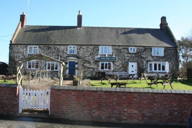
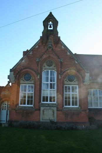
31 7.4 Community Services a) Protecting Key Community Services Community facilities and services such as pubs and shops, community centres, schools, libraries, places of worship, sport and leisure facilities are important as they provide a focus for community life and interaction and are important for good health and the long term sustainability of the community. The Parish has a good range of community facilities including a Primary School, two pubs, a community hall, an allotment site, Coronation Gardens, a Church and a cricket club. Consultation shows that the protection and enhancement of these and other important community services and facilities is a top priority for the Plan. Policy CS1: PROTECTING KEY COMMUNITY SERVICES Proposals to retain and enhance existing community services and facilities (Primary School, the Bell and Langton Arms public houses, cricket club, Coronation Gardens, allotments, community hall and Church) will be supported. Development proposals that fail to protect these existing community services and facilities will not be permitted, unless the service or facility is replaced by equivalent or better provision in terms of quantity and quality in an equally suitable location or it can be demonstrated that the service or facility is not viable or no longer needed. b) Promoting additional community facilities and amenities Community consultations have confirmed the value of enhancing the range of community services in the Parish, recognising their benefits to the local community. Page 31 of 63
32 POLICY CS2: NEW OR IMPROVED COMMUNITY FACILITIES - Proposals that improve the quality and/or range of community facilities will be supported provided that the development: a) Meets the design criteria stated in policy DBE3; b) Will not result in severe traffic movements; c) Will not generate a need for parking that cannot be adequately catered for; d) Is of a scale appropriate to the needs of the locality and conveniently accessible for residents of the Parish wishing to walk or cycle; and e) Is demonstrably sustainable financially and managerially. c) Assets of Community Value The designation of a community facility as an Asset of Community Value provides the opportunity to give it added protection from inappropriate development. In addition, if an asset is Listed the Parish Council or other community organisations will then be given the opportunity to bid to purchase the asset on behalf of the local community, if it comes up for sale on the open market. The Localism Act 2011 defines an Asset of Community Value as a building or other land (whose) main use has recently been or is presently used to further the social well-being or social interests of the local community and could do so in the future. The Localism Act states that social interests include cultural, recreational and sporting interests. Where an asset is Listed the Parish Council or other community organisations will be given the opportunity to bid to purchase the asset on behalf of the local community, if it comes up for sale on the open market. Its Listing can also be taken into consideration when determining a Page 32 of 63

33 planning application for a development proposal, which would affect the reason why it was listed. The Langton Arms pub and adjoining Grounds were listed as an Asset of Community Value in The following community services and assets are expected to be designated as Assets of Community Value and more may come forward over the life time of the Plan. Assets of special importance to the well-being of the Parish and to which local people have a strong affinity and wish to protect may come forward over the lifetime of the Plan. These include: Church Langton: Langton Community Hall and grounds Church Langton Primary School and grounds St Peter s Church and Churchyard Allotments St Anne s Well Village Green/War Memorial Page 33 of 63
34 East Langton: Cricket ground and pavilion The Bell public house and grounds Coronation Garden COMMUNITY ACTION 1: ASSETS OF COMMUNITY VALUE The Parish Council will support the listing of Assets of Community Value and once listed, will work to support their longevity. Page 34 of 63
35 7.5 - Design and the Built Environment a) Conservation Areas and Listed Buildings The Parish of East Langton has an attractive built environment, which is highly valued by the community. Its protection and enhancement is a top priority as consultation has shown. Much of the built environment is protected by statutory designations. There are currently 7 structures (see below) that have Listed Building Status, which means that they have been recognised nationally to be of special character or historical interest. Boundary wall to the Old Rectory Church of St Peter s Cottage with attached forge Leadclune Court The Bell public house The Hanbury Schools with attached school houses The Old Rectory Langton Hall, a 17 th Century building and grounds registered under the Historic Buildings and Ancient Monuments Act 1953 within the Register of Historic Parks and Gardens by English Heritage for its special historic interest, is in the adjoining West Langton Parish. There are also two Conservation Areas covering much of the villages of Church Langton and East Langton (see maps below), again in recognition of their special architectural and historic interest. The Plan supports these national designations and the protection this gives them from inappropriate development. Page 35 of 63


36 Figure 4 - East Langton Conservation Area 0 30 Meters Designated 1972 Boundary Revised 9 th March 2005 Crown Copyright. All rights reserved. Harborough District Council Page 36 of 63


37 Figure 5 Church Langton Conservation area Meters Designated 1994 Boundary Revised: 16 th July 2007 Crown Copyright. All rights reserved. Harborough District Council
38 Policy DBE1: PROTECTION OF THE BUILT ENVIRONMENT: CONSERVATION AREAS AND LISTED BUILDINGS - Proposals within a Conservation Area as defined in figures 4 and 5 above, or affecting the setting of these Conservation Areas or a Listed Building will be expected to preserve and enhance them, in accordance with local and national planning policies. b) Locally Listed Buildings In addition to the Conservation Area, there is a rich built heritage within the Parish. This heritage is not only important to the Parish, because of its contribution to its history, but also because of the contribution it makes to the distinct and special character of East Langton Parish. In addition to the nationally recognised Listed buildings and the special protection this brings, there are other buildings and structures that have been identified as being locally important to the architectural and historic heritage of the Parish and need to be preserved and enhanced. These local heritage assets do not have statutory protection so are referred to as nondesignated, however the effect of a development proposal on the significance of a local heritage asset should be taken into account. The reasons as to why these local heritage assets are significant is varied, often going beyond only historical or architectural interest to demonstrate a range of values that all contribute to the distinctiveness and heritage of East Langton Parish. Policy DBE2: LOCAL HERITAGE ASSETS OF HISTORICAL AND ARCHITECTURAL INTEREST Development proposals that affect an identified building or structure of local significance or its setting will be required to preserve and enhance the significance and setting of that building or structure. Locally listed buildings include the following: War memorial
39 Ledclune Court stable block House on green in East Langton The Grange Deene Cottage Brooke House and adjoining property The Cottage Allotment wall and Churchyard wall Langton Arms public house c) Design Consultation confirmed the importance of the design of new housing and the need for development to remain in keeping with traditional design in evidence across the Villages within the Parish. This is reflected in the need for any new development to be in keeping with existing nearby dwellings and in particular to be aware of design features such as porches, use of rendering; roof lines; height. The Parish of East Langton has a long history, with a wide number of listed buildings and attractive countryside which contributes to a distinctive local character. Consultation has revealed a desire to protect the character of the Parish alongside the need for the villages to grow and evolve in a sensitive and proportionate manner in order to sustain the community and its facilities. The policies in this section seek to reflect the design principles which the community believes will help to achieve this aim. The overall aim is to protect the Parish of East Langton so that it retains its character as a unique and distinctive Parish. The planning system can support this aim to respond sensitively to the wide range of historic buildings, structures, landscapes and archaeology situated within the Parish. These assets form many of its key characteristics, and future development should seek to enhance, reinforce and preserve this distinctive historic environment. Page 39 of 63
40 In this section therefore, the Neighbourhood Plan sets out planning policies which seek to identify and protect the distinctive elements which together provide the special qualities of the landscape setting and built heritage of East Langton Parish. Design requirements New development proposals should be designed sensitively to sit within the distinctive settlement patterns of the Parish. Existing settlement patterns have grown incrementally over time. The buildings date from many different periods, providing a richness and variety of styles and materials. This traditional rural character should be enhanced by new development and schemes should be designed to ensure that new buildings sit comfortably within the existing settlement pattern, and are respectful of their surroundings, including the countryside. In this regard, the protection of trees is considered to be of great importance for their aesthetic qualities and their role in regulating temperatures, especially in hot weather which can be an issue particularly for older people. The importance of introducing energy efficient development is amplified by the fact that parts of the Parish are off the gas grid. The community consider it to be important that new residential development is of the highest standard to ensure that it is in keeping with the majority of residential properties in the village. It is not considered necessary to have a uniform series of properties that all look the same, rather to ensure that new developments respect the features of buildings which make the villages of east and Church Langton desirable places in which to live. New development proposals should be designed sensitively to ensure that the high quality built environment of the Parish is maintained and enhanced, particularly where schemes are located within or in close proximity to the Conservation Areas. New designs should respond in a positive way to the local character through careful and appropriate use of high quality materials and detail. Proposals should also demonstrate consideration of height, scale Page 40 of 63
41 and massing, to ensure that new development delivers a positive contribution to the street scene and adds value to the distinctive character of the area. Policy DBE3: DESIGN - This policy will apply to all new commercial and residential developments, including one or more houses, and replacement dwellings. All development should continue to reflect the character and historic context of existing developments within the Parish. However, contemporary and innovative materials and design will be supported where positive improvement can be robustly demonstrated without detracting from this historic context. The following criteria should be met: a) The design of developments should recognise the distinctive local character of the Parish and sensitively contribute to creating dwellings of a high architectural and rural quality; b) Materials in any new development should complement the established vernacular in the use of natural, local resources and colours; c) Height should be restricted to two storey with careful design of roof elevations particularly on rising ground. In general, clay, slate or stone roofing materials should be used; d) Flat roof dormer windows and Velux-style windows, where permission is required, should be avoided; e) Enclosure of plots should be of native hedging, rural wooden fencing, or brick wall of rural design; f) Developments should be enhanced by landscaping with existing trees and hedges preserved whenever possible; g) Any new development adjacent to a listed building or buildings of historic interest and/or open space as defined in Policy DBE1 & DBE2 should be sensitively designed to conserve and enhance the setting form and character of the building and/or space; Page 41 of 63
42 h) Development should incorporate sustainable design and construction techniques to meet high standards for energy and water efficiency, including the use of renewable and low carbon energy technology, as appropriate; and i) The following items must also be considered early in the design process and sympathetically integrated into the overall scheme: a. Screened bin stores and recycling facilities b. Cycle stores c. Meter boxes d. Flues and ventilation ducts e. Gutters and pipes f. Satellite dishes and telephone lines g. Lighting Page 42 of 63
43 7.6 - The Natural and Ecological Environment a) Context and history The area now covered by this Plan has been inhabited for at least 10,000 years. Archaeological finds and sites prove occupation here in the Mesolithic, Neolithic and Iron Ages, while the British (Celtic) people who became Romanised had farms and villas here. But it was during the dark ages following the end of Roman occupation that the present-day Langtons first appeared out of the wildwood. The parish of East Langton is in the corridor through which Anglo-Saxon settlement of the midlands and north spread: from Europe, through East Anglia, up the Welland valley to Medbourne, then over the hills toward Leicester, in about 500 AD. The first Anglo-Saxon settlement locally was probably on the future site of Church Langton, because this is where, soon after 720 AD, an early Christian church was built, at what must have been an older British site close to the sacred well of Anu (now St Anne s well). This Langton ( Langton is an Anglo-Saxon place-name) became the centre of a large pre-conquest estate comprising all four modern Langton civil parishes. East Langton village developed (possibly beside the remains of an older fortified site) in the early middle ages as a daughter settlement of Church Langton. Both were components of one large medieval manor. While Church Langton continued as the ecclesiastical centre, East Langton became the economic centre from which the three open fields were worked, and it was East Langton which grew fastest, having the larger population of the two until the 20 th century. The houses of medieval Church Langton clustered round the church, surrounded by, but not closely related to, the manor s open fields. East Langton, on the other hand, developed as a more typical medieval village of streets, cottages and crofts, homes of the freemen and villeins who shared rights on the acreages of farmland across the manor. Church Langton changed substantially in the late 18 th and 19 th centuries with the rebuilding of most of the 13 th century St Peter s church, the building of several substantial houses and, later, the remodelling associated with the Hanbury Estate. East Langton is a largely 18 th century rebuild of the medieval village; it is still essentially a 1792 village on a medieval street plan. Page 43 of 63
44 Most woodland was cleared early in the Langtons history, but the fields now mainly grazing land the two brooks in their natural valleys and the panoramic views from the Langton ridge still include pockets of precious and locally important biodiversity. Over 1500 years of history have given East and Church Langton distinct characters and distinctive natural and built environments. It is these different and shared characteristics that the two communities wish to preserve as part of the parish s planned, sustainable development. The benefits to public health for retaining open spaces in the Parish have been highlighted through consultation. b) Protection of sites of environmental significance An environmental inventory (appendix 2) of all unbuilt land in the parish was carried out between July 2015 and February Information was compiled from existing sources (national and local designations, records and mapping) and fieldwork, together with the results of consultation (open events and questionnaire) with residents. Thirty sites were identified both as having significant environmental features (wildlife, history, landscape, etc.) and as being valued by the community. These sites were assessed and scored using the criteria in the National Planning Policy Framework (NPPF 2012), and the six highest scoring (70% and over) are proposed as those best representing the Plan Area s most important, characteristic and valued open spaces. Their protection is regarded as essential and is fully compatible with the aims of sustainable development in the Plan Area. Policy ENV 1: PROTECTION OF LOCAL GREEN SPACES - The following sites are proposed for designation as Local Green Spaces (LGS). Development proposals that result in their loss, or in any harm to their biodiversity, historical features, character, setting, accessibility or amenity value will not be permitted. Church Langton allotments (inventory site 1) Thorpe path Open Space, Church Langton (6) Village green, Church Langton (12) Page 44 of 63
45 Cricket Ground, East Langton (16) Coronation Gardens, East Langton (19) See figure 6 below, and Environmental Proposals map (figure 12) Figure 6. Proposed Local Green Space sites. Numbers refer to entries in Environmental Inventory (see Appendix 2) The remaining 24 sites have significant natural or historical environment features but do not score as highly, particularly under the NPPF community and amenity criteria: some are formally inaccessible, or are distant from the settlement areas. Of these, those scoring 41% (15/36) or over are deemed to be key to preserving the characteristic environment and landscapes of the parish. While their combined area is less than 9% of the total area, these are the only sites in the Plan Area where significant, extant, natural and historical heritage still survives. Every effort should be made to resist development which threatens or damages them. Page 45 of 63
46 Policy ENV 2: OTHER ENVIRONMENTALLY SIGNIFICANT SITES - The sites listed (appendix 2) and mapped (figure 7 below and appendix 3) have been identified as being of local significance for their environmental features (natural and/or historical). They are ecologically important in their own right, their historical features are extant and have visible expression, and they are locally valued. The protection and enhancement of the identified features of sites shown on figure 7 and listed in Appendix 2 as 'Other Environmentally significant sites' will be supported. Page 46 of 63
 Page")
47 Figure 7.Other environmentally significant sites. Numbers are in Environmental Inventory (appendix 2) Page 47 of 63
48 c) Biodiversity As noted elsewhere, East Langton is a parish with a few isolated pockets of locally important habitat, little woodland and few species-rich hedgerows. Although much of the farmland is, or has been, under Entry Level and Higher Level Environmental Stewardship, overall biodiversity across the Plan Area is relatively low. The need for every Parish to make its own contribution to reversing the current threats to and loss of priority habitats and species is recognised in East Langton; the following Policy and related Community Action are aimed at protecting the species and habitats that remain here and to begin the process of restoring lost habitats and enhancing biodiversity. Biodiversity enhancement (species and habitats) is supported by the NPPF, which is itself compliant with the European Habitats Directive 1992 (Council Directive 92/43/EEC on the Conservation of natural habitats and of wild fauna and flora) and the UK Conservation of Species and Habitats Regulations, 2010, Amended POLICY ENV 3: BIODIVERSITY a) Development proposals will be expected to protect local habitats and species, especially those covered by relevant European and English legislation and, where possible, to create new habitats for wildlife; b) The Plan will designate two wildlife corridors as shown (map below) along the flood plains of Langton Brook and Stonton Brook; and c) All new housing development of one unit or more will be required to contribute towards the improvement of the wildlife corridors. Page 48 of 63

49 Page 49 of 63 Figure 8. Proposed wildlife corridors
50 d) Trees and hedges For historical reasons there is a complete absence of natural and seminatural woods in East Langton parish. However, trees and hedges are a significant feature of the Plan Area; they make an important contribution to the landscape and character of the area and enhance biodiversity. They are of two types: planted (ornamental) trees in the two villages (a combination of trees and shrubberies in the 19 th and early 20 th century landscaped grounds of the larger houses with late 20 th century garden, roadside and amenity planting); and standard trees in 18 th -19 th century field hedgerows. Both Church Langton and East Langton have conservation areas, in which trees are afforded some protection; in addition, other individual trees and significant groups are protected under Tree Preservation Orders, including those along Stonton Road, the lane to Glebe Farm and along the northern edge of the Churchyard (all in Church Langton. Hedges have some protection under current legislation (Hedgerows Regulations, 1997) but the majority of trees across the parish are left without protection at present. Finally, no Phase I Habitat Survey has been undertaken by County Ecologists, so no trees have been designated as Local Wildlife Sites by Natural England. Consultation shows that trees and hedges are highly valued by the local community, who wish to see them protected wherever possible. POLICY ENV 3: TREES - Development proposals that damage or result in the loss of trees and hedges of good arboricultural, ecological and amenity value will not normally be permitted. Proposals should be designed to retain trees and hedges of arboricultural, ecological and amenity value. Proposals should be accompanied by a tree survey that establishes the health and longevity of any affected trees. e) Ridge and furrow fields Like almost all other rural settlements in the Midlands (and across lowland northwest Europe) the open land of East Langton parish was almost entirely medieval ploughlands from the 12 th century until the time of its Enclosure Page 50 of 63
51 (1792). Historically, however, the parish had an interesting and uncommon arrangement of these open fields. The fields were used by people from both villages (under a succession of landlords) to grow a rotation of arable crops and to feed livestock. Centuries of ploughing produced the earthworks now known as ridge and furrow. Some Langton fields were turned over to grazing land, and the tenants and owners gave up their common rights, in 1744; all the rest were similarly Enclosed in The surviving ridge and furrow fields provide a surviving, extant record of this unique parish history. East Langton was the original settlement and it is recorded in the Domesday Survey of 1086 as Langetone. Its name derives from Old English, lang + tun, meaning long farmstead or estate. The Leicestershire Survey of c1130 shows the first spilt of the land unit into Langetone, East-Langton and alia Langetone, or another Langton, modern day West-Langton. Thorpe- Langton was recorded in 1086, as torp, and later, in 1277, as Thorp iuxta Langton, indicating a dependant settlement on Langton. Church-Langton however, is not recorded until the early fourteenth century as Kirk(e) Lanegton. The church was probably there at the time of the Domesday Survey but was not recorded, as was the case for most churches. The church is believed to have been built as an isolated church on a pagan site, probably around the 9th century, and is thought to have been an Anglo Saxon minster. These churches were the very early churches in England and were usually built in prominent positions, often isolated, and on sites of pagan worship. A settlement frequently grew up around the church. The villages of modern day East, West and Thorpe Langton all lie below the top of the ridge on a line natural springs which supplied their water. Church Langton has no natural springs, the nearest one being St Anne s well down the Stonton Road. Its lack of water supply meant it did not develop until later. The name of the parish containing both East and Church Langton is East Langton parish, with Church Langton being a secondary settlement. The existence of parish boundaries goes back before the 1300s. Reflecting the national trend (loss of between 95% and 100% per parish, mostly since 1940), East Langton has lost a majority of its ridge and furrow Page 51 of 63
52 fields. Only 16 of the c.90 fields (17% by number, 16% by area) in the parish retain well-preserved examples (map below). In English legislation, except for the few that are also Scheduled Monuments, ridge and furrow fields are not protected, despite a recognition that as the open field system was once commonplace in NW Europe, these [surviving] sites take on an international importance (English Heritage, 2012). While individual fields in the Plan Area are not claimed to be of international importance, they are an important part of the distinctive character of the parish. They are valued by the local community and any further, avoidable, loss of ridge and furrow in East Langton would be irreversibly detrimental. This policy not only seeks to protect the remaining ridge and furrow fields from development, but highlights their importance to the community, especially bearing in mind that many of the threats to ridge and furrow fields often involve types of development and practices that do not require planning approval. POLICY ENV 4: RIDGE AND FURROW FIELDS Ridge and furrow earthworks are non-designated heritage assets. Development proposals that adversely affect or damage an identified surviving area of ridge and furrow will be resisted. Page 52 of 63

53 Page 53 of 63 Figure 9. Well-preserved surviving ridge and furrow earthworks in the Plan Area

54 f) Protection of views of local importance Consultation during the Plan s preparation identified a widely-held wish to protect the rural settings of the settlements of East and Church Langton, in particular their relationship with one another and with the surrounding farmland and the wider landscape. Church Langton s hilltop position is especially characteristic, while maintaining its geographic, but not social, separation from its medieval daughter settlement of East Langton is regarded as important. One of the main ways in which residents expressed this wish was by describing a number of important views within, between, away from and toward the two villages. These consultation findings were supported by the environmental inventory, which although principally aimed at identifying sites of environmental significance also confirmed the sight-lines of the suggested views and mapped them. POLICY ENV 5 PROTECTION OF IMPORTANT VIEWS: Development that impacts on the following locally important and valued views (map below and figure 10) will not be supported unless in exceptional circumstances: Page 54 of 63
55 i. North from the west door of St Peter s Church and the churchyard toward the open fields (its medieval context ii. East from the northern limit of Church Langton village across ridge and furrow fields and over the valley of Stonton Brook to Langton Caudle iii. East and southeast from the start of footpath A79 in Church Langton toward Stonton Brook, the Caudle and Thorpe Langton village iv. Across and southwest from East Langton Cricket Ground Page 55 of 63
56 Page 56 of 63 Figure 10.Important views in the Plan Area

57 Areas of Separation The Parish is made up of two villages Church Langton and East Langton. Each has its own history, identity and character. Consultation shows that maintaining the separation of the two communities is important to ensure that the distinct identity and character of these two villages is maintained. In addition, the field abutting the Parish boundary which separates East Langton from West Langton is important to ensure the continued separation of the villages. POLICY ENV6: AREA OF SEPARATION - Development proposals which would reduce the separation of Church Langton and East Langton and between East Langton and West Langton Parish boundary as shown on the map (figure 11) and the Environmental Proposals map (fig 12) will not be supported. Page 57 of 63
58 Page 58 of 63 Figure 11. Areas of separation

59 Page 59 of 63 Figure 12 Environmental proposals map
60 7.7 Traffic, Parking and Transport a) Traffic Management Transport and accessibility is key to enable people to move between locations, especially in a rural setting such as the Parish of East Langton where people often have to travel long distances to access key services such as work, education, healthcare and shops. At the same time the demand for travel needs to be balanced with the need to reduce congestion and some of other potential negative effects such as road safety and impact on the environment. The consultation shows that this is a serious concern for many residents. They are especially concerned about road safety, noise, roadside damage and vehicle emissions associated with the growing volume and speed of traffic travelling along Back Lane in East Langton Village, a narrow road unsuitable for use by large vehicles. Residents wish to minimise the impact of additional traffic using narrow roads, including Back Lane, generated by new development. POLICY T1: TRAFFIC MANAGEMENT Development proposals will not be supported if the cumulative impact of additional traffic on the local highway network (including on narrow roads within the conservation areas) is severe, unless appropriate mitigation measures are undertaken. b) Congestion Parking and vehicular movements are a particular issue in the Village of Church Langton on Stonton Road at school drop-off and pick-up times. Page 60 of 63


61 Community Action 2: CONGESTION Safe routes to school policies will be supported and the use of the Community Hall car park by parents is encouraged, with the agreement of the Hanbury Charity who own the freehold, for as long as support for this use is available. Traffic management arrangements will be pursued to enhance safety for children at school drop-off and pick-up times. c) Footpaths, Footways and Bridleways The Parish has an abundance of footpaths, footways and bridleways (including a section of the Leicestershire Round). These are important for health, the environment and well-being of residents as well as helping people get around. POLICY T2: FOOTPATHS, FOOTWAYS AND BRIDLEWAYS Improvements (including signage) to the network of footways and footpaths will be supported. Development proposals that will adversely affect existing footways and footpaths will not be permitted except in special circumstances or where appropriate mitigating measures can be provided. The retention and enhancement of the public transport system was identified through consultation as an important feature for those living in the Parish. It Page 61 of 63
Great Easton Neighbourhood Plan Statement of Basic Conditions
 Great Easton Neighbourhood Plan 2017-2031 Statement of Basic Conditions OCTOBER 2016 GREAT EASTON PARISH COUNCIL Contents 1.0 Introduction....Page 2 2.0 Summary of Submission Documents and Supporting Evidence..
Parish of Repton NEIGHBOURHOOD DEVELOPMENT PLAN
 Parish of Repton NEIGHBOURHOOD DEVELOPMENT PLAN BASIC CONDITIONS STATEMENT December 2018 CEF 4 Legal Requirements This statement has been produced by the NDP Working Group on behalf of Repton Parish Council
LONGDEN VILLAGE DEVELOPMENT STATEMENT
 LONGDEN VILLAGE DEVELOPMENT STATEMENT 2017-2027 1 Longden Development Statement 2017-2027 15/01/18 1. Background 1.1 Longden Village Longden village is a very rural and traditional community first mentioned
Briefing Document of CNP. June 2017
 Cholsey Parish Council Cholsey Neighbourhood Plan Briefing Document of CNP June 2017 Cholsey Neighbourhood Plan Page! 1 of! 8 Cholsey Plan Briefing v1.4 Page Left Intentionally Blank Cholsey Neighbourhood
Copyright Nigel Deeley and licensed for reuse under this Creative Commons Licence
 1 Copyright Nigel Deeley and licensed for reuse under this Creative Commons Licence Prepared by the Neighbourhood Plan Steering Group on behalf of Garway Parish Council with assistance from 2 Table of
ELLISTOWN & BATTLEFLAT PARISH COUNCIL NEIGHBOURHOOD PLAN
 ELLISTOWN & BATTLEFLAT PARISH COUNCIL NEIGHBOURHOOD PLAN 2015 2031 Contents Chapter heading Page Introduction from the Chair 3 1. What is a Neighbourhood Plan and why are they important? 4 2. Why we need
ALLERTHORPE NEIGHBOURHOOD PLAN
 Allerthorpe s Neighbourhood Plan sets out a vision for the Parish for the next 15 years (2018 2033) that builds on and reflects the opinions and views of parish residents. VISION In 2033 Allerthorpe will
Schedule of Planning Applications Committee Date: 23 May Reference: 06/17/0726/F Parish: Hemsby Officer: Mr J Beck Expiry Date:
 Schedule of Planning Applications Committee Date: 23 May 2018 Reference: 06/17/0726/F Parish: Hemsby Officer: Mr J Beck Expiry Date: 22-05-2018 Applicant: Proposal: Site: Mr Gillett Change of use to the
Neighbourhood Plan Representation
 Date: 10 th November 2017 Neighbourhood Plan Representation Land to the east of Callow Hill Road, Alvechurch Introduction This representation has been prepared by RPS Planning and Development on behalf
Planning and Sustainability Statement
 Land adjacent to Manor Farm, Catterick Village Pallett Hill Sand and Gravel Co Ltd Proposed 10 new dwellings, (6 No market dwellings and 4 No affordable dwellings) with access, associated car parking and
3. Neighbourhood Plans and Strategic Environmental Assessment
 1. Introduction This report sets out a draft Screening Determination for the Preston Parish Council s Neighbourhood Plan and has been prepared by rth Hertfordshire District Council. The purpose of the
EXTRACT FROM THE CUDDINGTON NEIGHBOURHOOD PLAN The Policies
 EXTRACT FROM THE CUDDINGTON NEIGHBOURHOOD PLAN The Policies Environment and Landscape Policy 1 - Landscape Setting Development should respect and wherever possible enhance the landscape setting of Cuddington
Local Development Scheme
 Local Development Scheme 2012 2016 The Local Development Scheme (LDS) is a project plan that outlines how and when the Authority will update its planning policies and other associated documents. It ensures
The Gwennap Parish Vision Statement
 QUICK GUIDE What is a Neighbourhood Development Plan? Ultimately it is a document used by developers or anyone wishing to submit a planning application that describes the vision, strategy, plans, regeneration,
Kibworth Harcourt. Introduction. Introduction
 Introduction Introduction Welcome to this public exhibition on the proposals for the delivery of new homes on land at The Kibworths. The purpose of today s exhibition is to give you the opportunity to
STATEMENT OF OBJECTION TO THE PROPOSED DEVELOPMENT OF LAND AT CHURCH CLIFF DRIVE FILEY
 STATEMENT OF OBJECTION TO THE PROPOSED DEVELOPMENT OF LAND AT CHURCH CLIFF DRIVE FILEY You will be aware that Scarborough borough council have adopted a new local plan that includes land at Church Cliff
INTRODUCTION NORTH HEYBRIDGE GARDEN SUBURB
 INTRODUCTION This event is being hosted by the promoters of the proposed North Heybridge Garden Suburb who are working with Maldon District Council and other key stakeholders on the preparation of a comprehensive
Welford-on-Avon Neighbourhood Plan Consultation Event Sunday, 6 April Your name Your address
 Welford-on-Avon Neighbourhood Plan Consultation Event Sunday, 6 April 2014 Your name Your email address Please either: - complete this feedback form and put it in the box before leaving the Memorial Hall
Everton s Neighbourhood Plan. Site Allocation - Assessment Criteria
 Everton s Neighbourhood Plan Site llocation - ssessment Criteria Introduction 1.1 This report assesses all the sites identified through the emerging Neighbourhood Plan for Everton and their potential for
DEVELOPMENT MANAGEMENT REPORT
 ITEM A08-1 DEVELOPMENT MANAGEMENT REPORT TO: BY: DATE: DEVELOPMENT: SITE: WARD: APPLICATION: APPLICANT: Development Management Committee Development Manager Proposed live/work unit in connection with existing
1. Objectives of this consultation
 1. Objectives of this consultation Provide an update on the results of the December 2014 consultation Provide a summary of the Pre-Submission Plan which is now out for formal consultation To ask for your
OKEFORD FITZPAINE NEIGHBOURHOOD PLAN
 OKEFORD FITZPAINE NEIGHBOURHOOD PLAN Dear Parishioner, The Neighbourhood Plan Project Team have prepared this leaflet to summarise the full Neighbourhood Plan document. It provides a summary of the Vision,
Land at Rampton Road. Cottenham
 Land at Rampton Road Cottenham Introduction TEP is preparing an outline planning application for 54 dwellings on 6.9 hectares of land adjacent to Rampton Road, Cottenham on behalf of the owners Cambridgeshire
Plumpton Neighbourhood Development Plan Revised Pre Submission Document - Regulation 14 Consultation
 REPRESENTATIONS... Plumpton Parish Council Plumpton Neighbourhood Development Plan Revised Pre Submission Document - Regulation 14 Consultation Representations submitted on behalf of: Cala Homes (South
Copyright Nigel Deeley and licensed for reuse under this Creative Commons Licence
 1 Copyright Nigel Deeley and licensed for reuse under this Creative Commons Licence Prepared by the Neighbourhood Plan Steering Group on behalf of Garway Parish Council with assistance from 2 Table of
Suffolk Coastal Local Plan Review Issues and Options, August 2017, Public Consultation
 Suffolk Coastal Local Plan Review Issues and Options, August 2017, Public Consultation Having reviewed the issues and options documents, the Society has made the following response: Part 1 - Strategic
About 10% of the Borough's population lives in the seven rural parishes. Population figures from the 1991 census are given below:-
 8. THE DISTRICT VILLAGES 8.1 Population About 10% of the Borough's population lives in the seven rural parishes. Population figures from the 1991 census are given below:- Village No. of Persons Cottingham
Neighbourhood Planning Local Green Spaces
 Neighbourhood Planning Local Green Spaces Introduction... 2 1. Why green space is important... 4 2. Neighbourhood plans and green space... 6 3. Evidence... 8 Statutory designations... 9 Green space audit...
Stantonbury Neighbourhood Plan
 Stantonbury Neighbourhood Plan 2018-2031 Basic Conditions Statement October 2018 Intentionally blank 1.0 Basic Conditions Statement Introduction 1.1 This statement has been prepared by Stantonbury Parish
Full Name /title*. Address 1. Address 2 Post Code* *.. Phone* *Required fields for draw
 You can return this later to post boxes at: the Parish Council Office, Rowney Green Village Hall, The Petrol Station at Hopwood, or the Library. Closing date 14 th March: Draw on 14 th April 2014 at Alvechurch
Our City Centre is a vibrant, creative and welcoming destination, with a modern business, cultural, shopping, leisure and residential offer
 3. Sheffield in 2034 Our City sits at the heart of a strong, distinctive and internationally successful City Region economy which supports innovation and enterprise Our City Centre is a vibrant, creative
DUNSFOLD NEIGHBOURHOOD PLAN Site Selection Policies
 DUNSFOLD NEIGHBOURHOOD PLAN Site Selection Policies The criteria for assessing sites for future housing and business development in Dunsfold are set out below. (Development criteria, covering what it is
Neighbourhood Planning Guidance Local Green Spaces
 Neighbourhood Planning Guidance Local Green Spaces Introduction This guidance note has been produced for communities preparing neighbourhood plans in North Dorset to help them to identify, assess and designate
Repton Parish Neighbourhood Development Plan - Consultation March 2017
 Repton Parish Neighbourhood Development Plan - Consultation March 2017 25 replies Policy No Comments Response H1 Agree 22 Amend to include Milton Road & footpath but exclude above footpath. Neither agree
DEVELOPMENT MANAGEMENT REPORT
 ITEM A07-1 DEVELOPMENT MANAGEMENT REPORT TO: BY: Development Management Committee (South) Development Manager DATE: 21 June 2016 DEVELOPMENT: SITE: WARD: APPLICATION: APPLICANT: Outline application for
Statement of Community Involvement LAND OFF SOUTHDOWN ROAD HORNDEAN, HAMPSHIRE
 LAND OFF SOUTHDOWN ROAD HORNDEAN, HAMPSHIRE CONTENTS Page 1. Introduction 3 2. Pre-application Discussions 4 3. The Consultation Process 5 4. Consultation Feedback 7 5. Responses to Consultation Feedback
WINCHESTER TOWN 3.1 LOCATION, CHARACTERISTICS & SETTING
 WINCHESTER TOWN 3.1 LOCATION, CHARACTERISTICS & SETTING 3.1.1 The area referred to by the City Council, as Winchester Town, consists of the Winchester Wards plus the adjoining built up areas of Badger
WELCOME GYPSY LANE. Wider Site Location plan. Proposals for the development of LAND OFF FOXLYDIATE LANE WEBHEATH. Proposals for the development of
 WELCOME The developers are preparing an outline planning application for a residential led development and need the community s views in order to develop the proposals further WHAT IS PROPOSED? A high
Sutton cum Lound Neighbourhood Plan
 Sutton cum Lound Parish Neighbourhood Plan 2016-2031 Pre-Submission Consultation Version Sutton cum Lound Neighbourhood Plan 2016-2031 Sutton cum Lound Neighbourhood Plan Steering Group on behalf of Sutton
Sustainability Statement. Whitby Business Park Area Action Plan
 Sustainability Statement Whitby Business Park Area Action Plan November 2014 Contents Page 1. Introduction 1 2. Scoping 3 3. Sustainability Appraisal of Options 6 4. Assessment of Draft Area Action Plan
Site Assessment Technical Document Appendix A: Glossary
 Central Bedfordshire Council www.centralbedfordshire.gov.uk Site Assessment Technical Document Appendix A: Glossary July 2017 1.1.11-1 - ii Appendix A: Glossary Term Agricultural Land Classification AONB
Vigo Neighbourhood Plan Basic Conditions Statement
 Vigo Neighbourhood Plan Basic Conditions Statement Plan Period: 2016 to 2028 Status: Submission Version Qualifying Body: Vigo Parish Council Glossary of Some Terms & Abbreviations Used in this Document
Public Consultation. Land at Monks Farm, North Grove. Welcome
 Welcome Welcome to our public exhibition for development on Land at Monks Farm, orth Grove. Gallagher Estates and Gleeson Strategic Land are preparing an outline planning application for new homes, open
PLANNING DECISION NOTICE
 PLANNING DECISION NOTICE TOWN AND COUNTRY PLANNING ACT, 1990 Applicant WILLITON VILLAGE HALL STEERING COMM. C/O ALISON CALLOWWAY 54 NORTHCROFT WILLITON TAUNTON TA4 4RT Date Registered 11/08/2006 Application
WINGERWORTH PARISH DRAFT NEIGHBOURHOOD PLAN
 WINGERWORTH PARISH DRAFT NEIGHBOURHOOD PLAN 2016-2031 February 2016 WINGERWORTH PARISH COUNCIL Page 1 of 18 TABLE OF CONTENTS SECTION PAGE 1. Introduction 2. 2. What Happens Next 2. 3. How the Plan fits
ROCHFORD LOCAL DEVELOPMENT FRAMEWORK: Sustainability Appraisal/ Strategic Environmental Assessment. Rochford Core Strategy Preferred Options Document
 ROCHFORD LOCAL DEVELOPMENT FRAMEWORK: Sustainability Appraisal/ Strategic Environmental Assessment Non Technical Summary Rochford Core Strategy Preferred Options Document October 2008 SUSTAINABILITY APPRAISAL
Cookham Parish Council s Response to The Draft Local Borough Plan
 Cookham Parish Council s Response to The Draft Local Borough Plan As Agreed at the Planning Committee Meeting on 10 th January 2017. Designation of Poundfield as a Local Green Space The Parish Council
DRAFT STRATEGIC ENVIRONMENTAL ASSESSMENT REPORT
 DRAFT STRATEGIC ENVIRONMENTAL ASSESSMENT REPORT Published by Limpsfield Parish Council in accordance with EU Directive 2001/42 on Strategic Environmental Assessment and with the Environmental Assessment
Basic Conditions Statement
 POTTON NEIGHBOURHOOD DEVELOPMENT PLAN Basic Conditions Statement Date: 19/10/2018 Version: 1 Status: draft Table of Contents 1 INTRODUCTION... 3 1.1 POTTON NEIGHBOURHOOD PLAN DESIGNATED AREA... 3 1.2 PREPARATION
Settlement Boundaries Methodology North Northumberland Coast Neighbourhood Plan (August 2016)
") Introduction This background paper sets out a methodology for the definition of settlement boundaries in the North Northumberland Coast Neighbourhood Plan. The neighbourhood plan is planning positively
Introduction This background paper sets out a methodology for the definition of settlement boundaries in the North Northumberland Coast Neighbourhood Plan. The neighbourhood plan is planning positively
SOUTH EAST LINCOLNSHIRE LOCAL PLAN: HOUSING PAPER DONINGTON (JUNE 2016)
") SOUTH EAST LINCOLNSHIRE LOCAL PLAN: HOUSING PAPER DONINGTON (JUNE 2016) 1 DONINGTON S PLACE IN THE SPATIAL STRATEGY 1.1 Policy 2 of the South East Lincolnshire Local Plan 2011-2036 Draft for Public Consultation
SOUTH EAST LINCOLNSHIRE LOCAL PLAN: HOUSING PAPER DONINGTON (JUNE 2016) 1 DONINGTON S PLACE IN THE SPATIAL STRATEGY 1.1 Policy 2 of the South East Lincolnshire Local Plan 2011-2036 Draft for Public Consultation
Babergh and Mid Suffolk Joint Draft Local Plan Consultation, August 2017, Public Consultation
 Babergh and Mid Suffolk Joint Draft Local Plan Consultation, August 2017, Public Consultation Having reviewed the documents, the Society has made the following response: Housing Delivery Q 7. Do you agree
Rochford District Council Allocations Development Plan Document: Discussion and Consultation Document Sustainability Appraisal
 Option SWH1 Balanced Communities Option SWH1 1 To ensure the delivery of high quality sustainable communities where people want to live and work Will it ensure the phasing of infrastructure, including
The targets do not adhere to the government projections or methodology, being aspirational rather than achievable.
 Question 1: Preferred Growth Option (see pages 7-9 of the consultation document) Do you agree with the preferred growth option for the Joint Local Plan? The targets do not adhere to the government projections
SECOND DRAFT ARMTHORPE NEIGHBOURHOOD DEVELOPMENT PLAN AUGUST 2014
 SECOND DRAFT ARMTHORPE NEIGHBOURHOOD DEVELOPMENT PLAN AUGUST 2014 ARMTHORPE NEIGHBOURHOOD DEVELOPMENT PLAN August 2014 Contents Copyright Armthorpe Parish Council 2014 Introduction... 4 Vision and Aims...
Basic Conditions Statement
 POTTON NEIGHBOURHOOD DEVELOPMENT PLAN Basic Conditions Statement Date: 19/10/2018 Version: 1 Status: draft Table of Contents 1 INTRODUCTION... 3 1.1 POTTON NEIGHBOURHOOD PLAN DESIGNATED AREA... 3 1.2 PREPARATION
Newcourt Masterplan. November Exeter Local Development Framework
 Newcourt Masterplan November 2010 Exeter Local Development Framework Background The Exeter Core Strategy Proposed Submission sets out the vision, objectives and strategy for the development of Exeter up
Welford-on-Avon. Neighbourhood Development Plan Welford-on-Avon Parish Council
 Welford-on-Avon Neighbourhood Development Plan 2011-2031 Welford-on-Avon Parish Council Parish Consultation: Summary Version December 2014 January 2015 Foreword This is the latest version of the Welford
WHITELEY TOWN COUNCIL NORTH WHITELEY DEVELOPMENT SEPTEMBER 2014
 WHITELEY TOWN COUNCIL NORTH WHITELEY DEVELOPMENT SEPTEMBER 2014 Dear Resident This Special Edition of the Whiteley Voice which has been prepared in conjunction with the North Whiteley Consortium is to
Draft Hailey Neighbourhood Plan
 Persimmon Homes (Wessex) Draft Hailey Neighbourhood Plan Representations to West Oxfordshire District Council s Regulation 16 Consultation December 2018 2 Copyright 2018 Persimmon Homes Ltd. All rights
Planning and Regulatory Committee 20 May Applicant Local Councillor Purpose of Report
 Planning and Regulatory Committee 20 May 2014 7. APPLICATION FOR PLANNING PERMISSION FOR THE CARRYING-OUT OF DEVELOPMENT PURSUANT TO PLANNING PERMISSION REFERENCE NUMBER 603451 DATED 28 FEBRUARY 2007 WITHOUT
Mendip Local Plan Part II: Sites and Policies - Issues and Options Consultation MDC LPP2 consultation response.pdf
 From: Nicola Duke Sent: 15 February 2018 11:17 To: PlanningPolicy Subject: Mendip Local Plan Part II: Sites and Policies - Issues and Options Consultation Attachments: 180215
Wallingford Neighbourhood Plan
 Wallingford Neighbourhood Plan Introduction What is neighbourhood planning? Neighbourhood planning was introduced by the Localism Act 2011 to give local people more influence over how development comes
Basic Conditions Statement Exmouth Neighbourhood Plan
 Exmouth Neighbourhood Plan 2018-2031. On behalf Exmouth Neighbourhood Plan Steering Group July 2018 Table of Contents 1. Introduction... 4 2. Legal Requirements... 5 3. Why there is a need for a Neighbourhood
Former Temple Cowley Pools, Oxford TEMPLE COWLEY LIBRARY * ELEVATION SHOWN IS INDICATIVE AND SUBJECT TO FINAL DESIGN AND AGREEMENT.
 OPEN SPACE TEMPLE COWLEY LIBRARY library beyond Proposed apartments Proposed apartments Proposed houses Temple Road * ELEVATION SHOWN IS INDICATIVE AND SUBJECT TO FINAL DESIGN AND AGREEMENT. * Welcome
SAHAM TONEY NEIGHBOURHOOD DEVELOPMENT PLAN : THE POLICIES
 SAHAM TONEY NEIGHBOURHOOD DEVELOPMENT PLAN 2018-2036: THE POLICIES This is a much-abridged version of the full neighbourhood Plan, and includes only the policy text, the main policy maps and some key charts.
Quantity and Type of Development. POLICY CODE: DP1 Economic Development
 Quantity and Type of Development POLICY CODE: DP1 Economic Development DP1 Sustainable Economic Development Strategic Objectives: 7) To promote a place which is attractive to business, and where local
The Fairfield Partnership Vision for North-East Elsenham
 The Fairfield Partnership Vision for North-East Elsenham August 2009 Frequently Asked Questions Who is The Fairfield Partnership? The Fairfield Partnership is a joint venture between Marchfield Developments
2. Spatial Portrait, Vision and Objectives
 VISION & OBJECTIVES 2. Spatial Portrait, Vision and Objectives Introduction 2.1 This section sets out the spatial portrait of Uttlesford, the vision we have for the future of the area and the objectives
Basic Conditions Statement. Ugborough Neighbourhood Development Plan Giving our community more power in planning local development...
 Ugborough Neighbourhood Development Plan 2017-2032 Basic Conditions Statement Town and Country Planning Act 1990 (as amended) Paragraph 8(2) of Schedule 4B Statement Submission Date Giving our community
Called-in by Cllr Richard Stay for the following reasons: DETERMINE. Application recommended for refusal
 Item No. 13 APPLICATION NUMBER CB/15/00275/OUT LOCATION Prebendal Farm, Grove Road, Slip End, Luton, LU1 4BZ PROPOSAL Outline Development: Redevelopment of land previously used as a farm yard to residential
Rural Planning and National Parks. John Scott Director of Conservation and Planning Peak District National Park Authority 2 November 2018
 Rural Planning and National Parks John Scott Director of Conservation and Planning Peak District National Park Authority 2 November 2018 UK national parks So how green is this land? Are we concreting
Ebbsfleet Development Corporation
 Title of Paper Planning and Housing Delivery Report September 2018 Presented by Sub-Committee Mark Pullin, Chief Planning Officer Planning Committee Purpose of Paper and Executive Summary This paper provides
2015/1020 Mr Edward Cockburn Caravan storage on hardcore base (Retrospective) Ranah Stones, Whams Road, Hazlehead, Sheffield, S36 4HT
 Ranah Stones, Whams Road, Hazlehead, Sheffield, S36 4HT") 2015/1020 Mr Edward Cockburn Caravan storage on hardcore base (Retrospective) Ranah Stones, Whams Road, Hazlehead, Sheffield, S36 4HT Dunford Parish Council have not commented Councillor Andrew Millner
2015/1020 Mr Edward Cockburn Caravan storage on hardcore base (Retrospective) Ranah Stones, Whams Road, Hazlehead, Sheffield, S36 4HT Dunford Parish Council have not commented Councillor Andrew Millner
WELCOME TO THE NEW WILTON PARK
 WELCOME TO THE NEW WILTON PARK VISION HISTORY OF WILTON PARK TOWARDS A PLANNING APPLICATION Our objective is to create a truly outstanding environment at Wilton Park. At the heart of our proposals is a
A Growing Community Rural Settlement Areas
 Town of Huntsville Official Plan Review - POLICY BACKGROUND PAPER A Growing Community Rural Settlement Areas BACKGROUND: In addition to the fully municipally-serviced Urban Settlement Area and the Hidden
Effingham Neighbourhood Plan 1. Basic Conditions Statement
 Effingham Neighbourhood Plan 1 Basic Conditions Statement Effingham Neighbourhood Plan 2016: Basic Conditions Statement 2 Contents This statement has been prepared by Effingham Parish Council to accompany
Welcome to our exhibition
 Welcome to our exhibition The Homes & Communities Agency (HCA) welcomes you to this public exhibition explaining our proposals for the redevelopment of the former Lea Castle Hospital site. About the Homes
PLANNING COMMITTEE DATE: 07/09/2015 REPORT OF THE SENIOR MANAGER PLANNING AND ENVIRONMENT SERVICE CAERNARFON. Number: 4
 Number: 4 Application Number: C15/0034/37/LL Date Registered: 21/05/2015 Application Type: Full - Planning Community: Llanaelhaearn Ward: Llanaelhaearn Proposal: Location: Summary of the Recommendation:
Revised draft District Plan for Council
 Revised draft District Plan for Council June 2012 1 Chapter 1: Background to the revised draft District Plan 1.1 This revised draft District Plan has been written in the context of the Localism Act and
Cotswolds AONB Landscape Strategy and Guidelines. June 2016
 Cotswolds AONB Landscape Strategy and Guidelines June 2016 Cotswolds AONB Landscape Strategy and Guidelines Introduction The evolution of the landscape of the Cotswolds AONB is a result of the interaction
To secure a Green Belt around Cambridge whose boundaries are clearly defined and which will endure for the plan period and beyond.
 4. GREEN BELT OBJECTIVES GB/a GB/b GB/c GB/d To secure a Green Belt around Cambridge whose boundaries are clearly defined and which will endure for the plan period and beyond. To maintain the purposes
APP/G1630/W/15/
 Appeal Decision Site visit made on 20 October 2015 by William Fieldhouse BA (Hons) MA MRTPI an Inspector appointed by the Secretary of State for Communities and Local Government Decision date: 20 November
BLEWBURY NEIGHBOURHOOD DEVELOPMENT PLAN STATEMENT OF BASIC CONDITIONS
 BLEWBURY NEIGHBOURHOOD DEVELOPMENT PLAN STATEMENT OF BASIC CONDITIONS Introduction 1.1 This statement has been prepared to accompany the submission of the Blewbury Neighbourhood Development Plan ( the
Ipswich Issues and Options for the Ipswich Local Plan Review, August 2017, Public Consultation
 Ipswich Issues and Options for the Ipswich Local Plan Review, August 2017, Public Consultation Having reviewed the issues and options documents, the Society has made the following response: Part 1 Strategic
Welcome to our public exhibition
 About our scheme Welcome to our public exhibition Taylor Wimpey East Anglia intends to submit a detailed planning application for a new residential development of 39 high-quality homes at the B&M Concrete
National Planning Policy Framework
 National Planning Policy Framework February 2019 Ministry of Housing, Communities and Local Government ( ( (!"#$%&"'()'"&&$&*()%'$+,( -."/01%.2( ( ( @$"0"/1"9(12(@&$
WELCOME. Land North of STEVENAGE. We would like to thank you for attending our public exhibition today.
 WELCOME We would like to thank you for attending our public exhibition today. The purpose of this event is to share our proposals and hear your thoughts on our ideas. Members of the project team are on
BLETCHLEY PARK AREA - DEVELOPMENT FRAMEWORK
 ANNEX A To Item 9 REVISED TEXT: additions shown bold and underlined, deletions in (brackets and in italics). BLETCHLEY PARK AREA - DEVELOPMENT FRAMEWORK This framework sets out the key objectives and requirements
PROPOSED RESIDENTIAL DEVELOPMENT LAND AT GREEN LANE, YARM
 PROPOSED RESIDENTIAL DEVELOPMENT LAND AT GREEN LANE, YARM PUBLIC CONSULTATION YOUR VIEW MATTERS TO US LOCATION PLAN Thank you for taking the time to read this information leaflet regarding a proposed residential
CA//17/02777/FUL. Scale 1:1,250. Planning Services Canterbury City Council Military Road Canterbury Kent CT1 1YW
 O CA//17/02777/FUL Scale 1:1,250 Map Dated: 15/03/2018 Planning Services Canterbury City Council Military Road Canterbury Kent CT1 1YW AGENDA ITEM NO 16 PLANNING COMMITTEE APPLICATION NUMBER: SITE LOCATION:
LAND EAST OF SUDBURY ROAD, HALSTEAD PUBLIC CONSULTATION. Proposed Residential Development
 LAND EAST OF SUDBURY ROAD, HALSTEAD PUBLIC CONSULTATION Proposed Residential Development YOUR VIEW MATTERS TO US PROPOSED RESIDENTIAL DEVELOPMENT AREA Thank you for taking the time to read this information
Land at Fiddington Hill Nursery, Market Lavington
 Land at Fiddington Hill Nursery, Market Lavington Briefing Report for Market Lavington Parish Council Persimmon Homes (Wessex) April 2016 Background This brief report has been prepared following the Market
Linden Homes Proposals for the Ridgewood Centre, Old Bisley Road, Frimley
 Linden Homes Welcome Welcome to our public exhibition. Today we are displaying draft proposals for a high quality residential redevelopment of land off Old Bisley Road, currently known as the Ridgewood
19 th October FAO Paul Lewis Planning Policy Branch Planning Division Welsh Assembly Government Cathays Park Cardiff CF10 3 NQ
 19 th October 2009 FAO Paul Lewis Planning Policy Branch Planning Division Welsh Assembly Government Cathays Park Cardiff CF10 3 NQ Dear Sir / Madam Technical Advice Note 6 Planning for Sustainable Rural
Ward: West Wittering. Proposal Change of use from public highway pavement to residential garden use.
 Parish: West Wittering Ward: West Wittering WW/17/03295/FUL Proposal Change of use from public highway pavement to residential garden use. Site Izora 1 Watersedge Gardens West Wittering PO20 8RA Map Ref
Much Wenlock Neighbourhood Plan
 Much Wenlock Neighbourhood Plan 2013-26 Referendum Version 09 April 2014 This page is intentionally left blank 1 Much Wenlock Neighbourhood Plan 2013-26 Referendum Version Contents Introduction pg 3 Objective
Carterton Construction Ltd is bringing forward plans for up to 85 new family homes and extra care facilities on land east of Burford.
 Welcome Carterton Construction Ltd is bringing forward plans for up to 85 new family homes and extra care facilities on land east of. We are at the early stages of designing our proposals and have a number
1.3 The following table presents a Statement of Compliance demonstrating how the Standish Neighbourhood Plan meets those requirements.
 1. Introduction 1.1 This Basic Condition Statement was prepared to accompany the draft Standish Neighbourhood Plan (2018). 1.2 Paragraph 8 of Schedule 4B of the Town and Country Planning Act 1990 requires
Droitwich Spa 6. Reasoned Justification
 87 Droitwich Spa 6 Reasoned Justification 6.1 Droitwich Spa is identified in the settlement hierarchy (Policy SWDP1) as a main town being the largest settlement in Wychavon District with an estimated population