Alternative Routes Determined
|
|
|
- Alaina Wilcox
- 5 years ago
- Views:
Transcription
1 Alternative Routes Determined

2 Preferred Route Selection
3 Preferred Route Selection Expert judgment is used to determine the Final Preferred Route Takes into account feedback from Round One engagement and preliminary assessment information Round Two Public Open Houses will provide public feedback on the Final Preferred Route from stakeholders at routing phase and in public and aboriginal engagement
4 Route Selection - Conclusion With the help of stakeholder input, expert judgment and internal expertise, a balanced, transparent and defendable Final Preferred Route is developed.
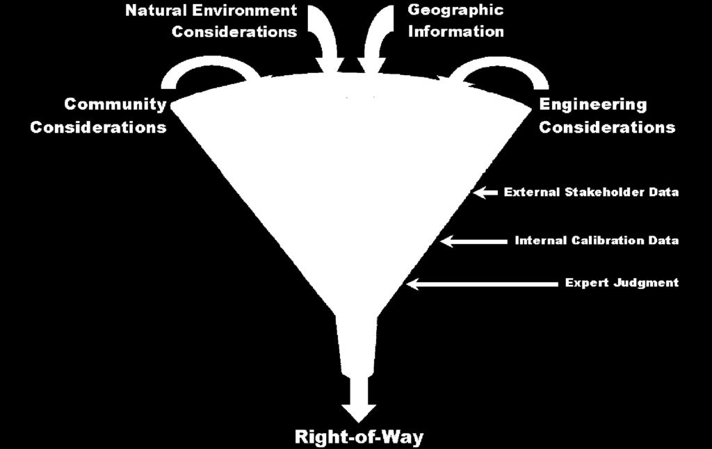
5 EPRI-GTC* Methodology Stakeholder Calibration Siting Criteria Stakeholders identify/refine and provide relative suitability values (modified Delphi process to gain consensus) Engineering Stakeholders infrastructure co-location Natural Environment Stakeholders natural areas considerations Built Environment Stakeholders land use issues Stakeholders provide relative importance /weights (analytical hierarchy process) Computer-generated corridor models GIS data, moving from general to specific Models for each of the above criteria (5:1:1) Models with Equal weighting Combination Model Expert Judgment (Internal Stakeholders) *Electric Power Research Institute-Georgia Transmission Corp.
6 Benefits of EPRI Process Objective Based on clear identification of criteria by stakeholders Values and weights developed during the process are applied to geographic information As the area of interest becomes more focused and defined, data becomes more detailed and accurate Consistent Algorithms provide replicable results Defensible Understanding what is required and how to do it before determining where to put it
7 Preliminary Structure Design Towers, H-Frame 2 steel columns 6m wide between column Average 300m between towers Height 16m to 39.5m Higher towers at end points and crossings Final tower design may depend on route characteristics
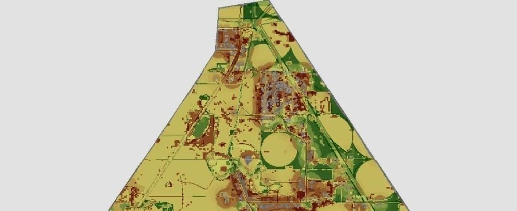
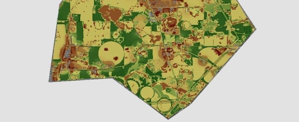
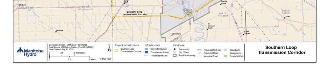
8 Alternative Routes St. Vital to La Verendrye Station - Southern Loop Transmission Corridor In a fixed right-of-way St. Vital to Letellier Station 20 different segments 4 segments common to all routes Goal of Workshops Identify one Preferred Route

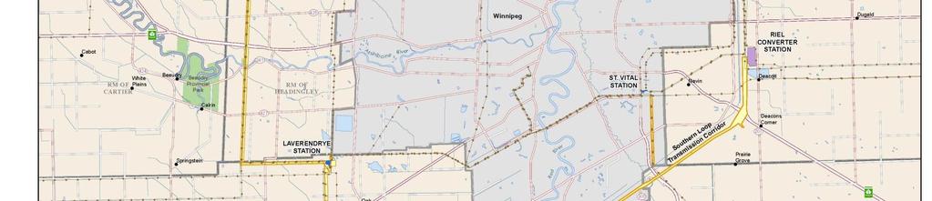
9 St. Vital to La Verendrye Transmission Line

10 St. Vital Station to Letellier Station

11 St. Vital Station to Letellier Station North Segments Alternative Routes N-1 N-2 N-3 N-4 N-6 N-7 N-5 N-8 N-9 N-10 N-11

12 St. Vital Station to Letellier Station South Segment Alternative Routes N-11 S-2 S-1 S-3 S-4 S-6 S-5 S-8 S-7 S-9
13 2.2 Environmental Assessment The Project is considered a Class 2 development under The Environment Act (Manitoba) and will require an Environmental Assessment Report to be completed and submitted to Regulators.
14 Environmental Assessment Environmental Assessment generally consists of: Characterization of the environment Identification of potential effects on people and the environment Stakeholder and public engagement process Determination of methods to avoid or reduce potential adverse effects while enhancing beneficial effects
15 Study Area Characterization The Environmental Assessment will include characterization of the following aspects of the Study Area: Physical Environment (climate, soils, surficial geology, hydrogeology) Aquatic Environment (surface hydrology, water quality, fish and fish habitat) Terrestrial Environment (vegetation, wildlife and habitat) Socio-economic Environment (land use, infrastructure, agriculture and landowners, economy, heritage resources, general concerns/issues with the Project)

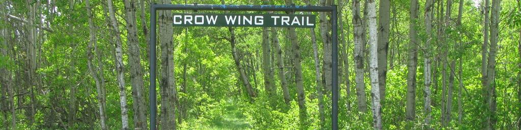
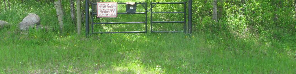

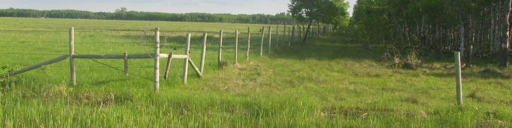
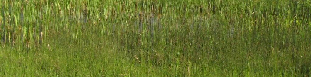
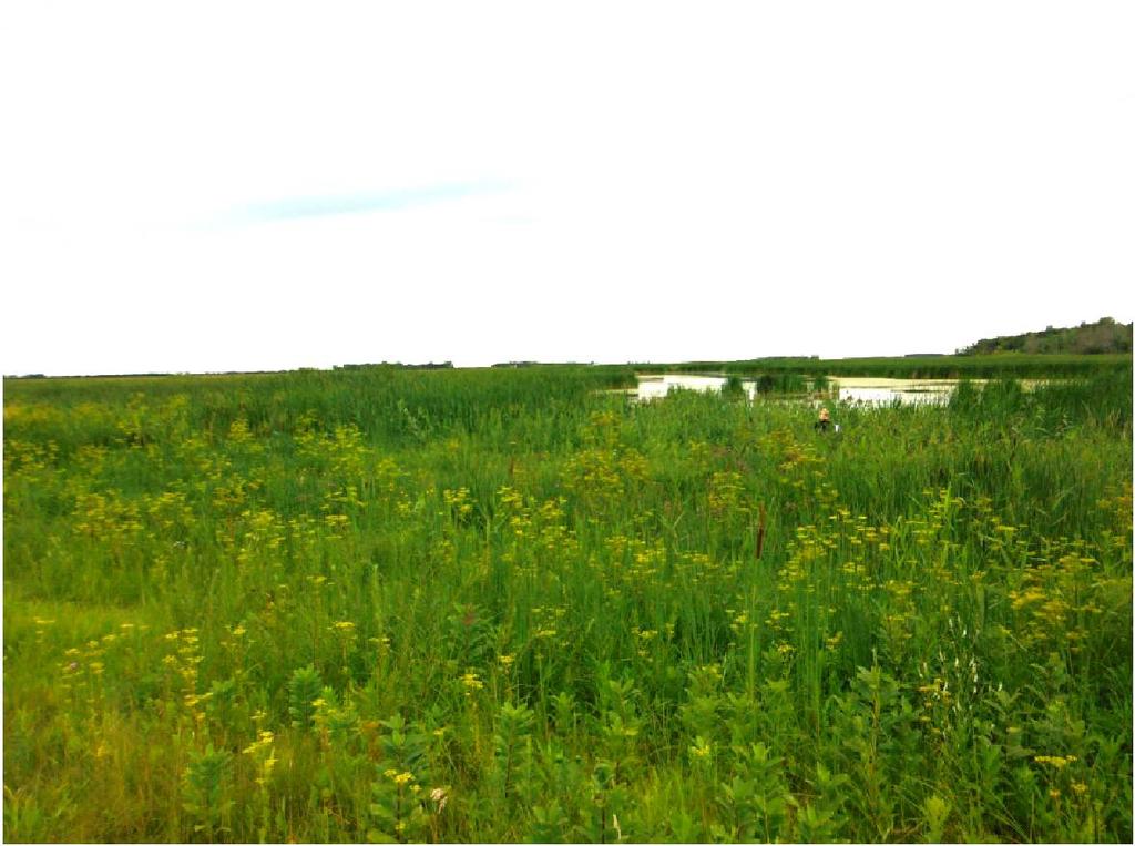
16 Study Area Characterization Pasture, NE of Roseau River Entry sign to Crow Wing Trail, near Senkiw Unnamed wetland, near Tourond
17 Valued Environmental Components The Environmental Assessment will determine Valued Environmental Components (VECs) VEC - Any part of the environment that is considered important by the proponent, public, scientists, and government involved in the assessment process; importance may be determined on the basis of societal or cultural values, or scientific interest or concern. VECs are selected by Utilizing experience from other, similar projects Getting input from specialists in the various disciplines Collecting input from interested stakeholders and the public
18 VECs for St. Vital Transmission Complex VECs currently being considered for the St. Vital Transmission Complex Project include: Wildlife Habitat Native Prairie Employment and Business Opportunities Property and Residential Development Aboriginal Lands Agricultural Productivity Agricultural Land Uses Communication and Transportation Human Health Public Safety Aesthetics
19 Examination of Effects To assess the potential environmental effects of the project, the following will be undertaken: Identification and assessment of potential environmental effects of the project on VECs Identification of mitigation measures for environmental effects on VECs Identification of methodology for determining significance of environmental effects on VECs Identification of measurable parameters to quantify and evaluate the significance of environmental effects on VECs An assessment of cumulative effects on identified VECs
20 2.3. Public Engagement Program Key Person Interviews over 70 contacts Stakeholder Workshops 3 locations Two Rounds of Public Open Houses 4 locations Winnipeg, Mitchell, Dominion City and Oak Bluff Website Newsletters and Advertising Direct Mailings Meetings
Alternative Routes. St. Vital to La Verendrye Station - Southern Loop Transmission Corridor. 20 different segments 4 segments common to all routes
 Alternative Routes St. Vital to La Verendrye Station - Southern Loop Transmission Corridor In a fixed right-of-way St. Vital to Letellier Station 20 different segments 4 segments common to all routes Goal
Alternative Route Selection
 Alternative Route Selection Multiple routes are developed within the Alternative Corridors Developed by Project Team taking into account all information gathered to date Buildings St. Vital Station to
Presentation August 20, 2013
 Presentation August 20, 2013 St. Vital Transmission Complex Stakeholder Workshop WELCOME! Manitoba Hydro 9:00am to 1:50pm Purpose of Workshop Share current project information Including outcomes of the
Proposed St. Vital Transmission Complex
 Proposed St. Vital Transmission Complex Round 2 Preferred Route for the St. Vital to Letellier Line What is it? Manitoba Hydro is proposing construction of two 230-kilovolt (kv) transmission lines to improve
Rapid Transit Implementation Working Group September 14, 2017
 Rapid Transit Implementation Working Group September 14, 2017 BACKGROUND Council approved the Rapid Transit Master Plan and Updated Business Case on July 25, 2017. Approval of the RTMP confirmed the BRT
APPENDIX L3. Table of Contents. SWP EA Information Sheets
 E N V I R O N M E N T A L A S S E S S M E N T APPENDIX L3 SWP EA Information Sheets Table of Contents EA Info Sheet 1... L3-1 EA Info Sheet 2... L3-3 EA Info Sheet 3... L3-5 EA Info Sheet 4... L3-7 SCARBOROUGH
National Association of Conservation Districts. Kris Hoellen Vice President, Sustainable Programs The Conservation Fund September 19, 2013
 National Association of Conservation Districts Kris Hoellen Vice President, Sustainable Programs The Conservation Fund September 19, 2013 Our Mission The Conservation Fund forges partnerships to conserve
4. What are the goals of the Kawarthas, Naturally Connected project? 7. What are watersheds and why are they being used as the project boundaries?
 Frequently Asked Questions (FAQs) 1. What are Natural Heritage Systems (NHS)? 2. Why are they important? 3. Which areas of the province have undertaken NHS projects? 4. What are the goals of the Kawarthas,
Inform you of the purpose and scope of the study for PTH 100 and a proposed future St. Norbert Bypass;
 WELCOME The intent of today s Open House is to: Inform you of the purpose and scope of the study for PTH 100 and a proposed future St. Norbert Bypass; Review highway crossing locations, future access closures
Burloak Drive Grade Separation
 Burloak Drive Grade Separation Transit Project Assessment Process Public Meeting #1 March 30, 2017 GO Lakeshore West Service Plan Weekday Rush Hour 15-minute, two-way service between Aldershot* and Union
Arkansas River Corridor
 Planning for Access Welcome to the Access Project. This project is a recreational planning effort in response to an interest by regional communities along the Arkansas River corridor. The project plan
Scarborough Waterfront Project
 Scarborough Waterfront Project Public Information Centre #1 Environmental Assessment Terms of Reference September 10, 2014 Agenda Open House Presentation 7:00 to 7:30 pm Presentation 7:30 to 8:15 pm History
Lower Don River West Remedial Flood Protection Project TABLE OF CONTENTS. Page. Executive Summary
 TABLE OF CONTENTS Page Executive Summary 1.0 INTRODUCTION...1-1 1.1 Purpose of the Undertaking...1-1 1.2 Study Area Description...1-1 1.3 Description of the Undertaking...1-1 1.4 Rationale for the Undertaking...1-2
TRCA Field Staking Protocol December 2016
 Page 1 of 6 TRCA Field Staking Protocol December 2016 This Protocol describes TRCA staff s current practice for field staking the physical top of bank, the physical toe of slope, and the limit of existing
APPENDIX I Presentations
 APPENDIX I Presentations Workshop Summary Report 11 Peel Region Official Plan Review May 5, 2010 Compatible Active Recreation Workshop July 29, 2010 Components of PROPR Sustainability Planning Tools/Updates
Parks, Trails, and Open space Element
 Parks, Trails, and Open space Element Parks, Trails, and Open Space element Parks, Recreation, and Open Space are important components of the quality of life desired by the residents of Elk Grove. This
Middle Mississippi River. Regional Corridor
 Middle Mississippi River St. Louis District Regional Corridor Lessons Learned from a Collaborative Planning Study Brian Johnson US Army Corps of Engineers 12 th Biennial Governor s Conference on the Management
Presentation Overview
 DETROIT RIVER INTERNATIONAL CROSSING STUDY Presentation to Windsor Rotary Club October 23, 2006 1 Presentation Overview 1. Overview 2. Progress Update Technical Work Program Environmental Work Program
2011 ASLA Design Awards. Westside Creeks Restoration Plan Merit Award AECOM, Fort Collins. Planning & Urban Design
 2011 ASLA Design Awards Westside Creeks Restoration Plan Merit Award AECOM, Fort Collins Planning & Urban Design Project Fact Sheet Category of Entry: Rotating Specialty Award: 2011 2011 ASLA Colorado
Great Lakes Conservation Blueprint for Terrestrial Biodiversity on the Canadian Shield
 Great Lakes Conservation Blueprint for Terrestrial Biodiversity on the Canadian Shield Bonnie L. Henson 1, Kara E. Brodribb 2 and John L. Riley 3 1 Ontario Ministry of Natural Resources 2,3 The Nature
Rapid Transit Implementation Working Group
 Rapid Transit Implementation Working Group October 12, 2017 1 Agenda 1. Consultation Update 2. Technical Work Update 3. LTC Rapid Transit Integration 4. Next Steps 2 Consultation Update 3 Consultation
BLACK/HARMONY/FAREWELL CREEK WATERSHED EXISTING CONDITIONS REPORT CHAPTER 5 IMPERVIOUS SURFACES
 BLACK/HARMONY/FAREWELL CREEK WATERSHED EXISTING CONDITIONS REPORT CHAPTER 5 IMPERVIOUS SURFACES Draft November 2009 TABLE OF CONTENTS 1.0 INTRODUCTION... 3 2.0 STUDY AREA AND SCOPE... 4 3.0 METHODOLOGY...
Appendix 1 Structure plan guidelines
 Appendix 1 Structure plan guidelines This appendix forms part of the regional policy statement [rps]. 1.1. Introduction Structure plans are an important method for establishing the pattern of land use
A Joined-up Regional Landscape: A Roadmap to connect the parts
 Breaking the Barriers: Engineering Solutions to Ecological Problems A Joined-up Regional Landscape: A Roadmap to connect the parts Associate Professor Darryl Low Choy Urban Research Program Outline Nature
Photo by Carlton Ward Jr. Executive Summary
 Photo by Carlton Ward Jr. Executive Summary The Cooperative Conservation Blueprint (Blueprint) is a multi-partner strategic conservation process developed by the Florida Fish and Wildlife Commission (FWC)
Ecosystem Restoration Business Line Budgeting A Systems Approach
 Ecosystem Restoration Business Line Budgeting A Systems Approach Laura Orr (NWS), Shawn Phillips (MVM), Greg Steele (NAO) Introduction Chesapeake Bay Bridge Mouth of Mississippi River Bonneville Dam Fish
INDIA Biodiversity Conservation and Rural Livelihood Improvement Project
 INDIA Biodiversity Conservation and Rural Livelihood Improvement Project Indigenous Peoples Planning Framework INDIA BIODIVERSITY CONSERVATION AND RURAL LIVELIHOOD IMPROVEMENT PROJECT Indigenous Peoples
Chris Powter Executive Director Oil Sands Research and Information Network School of Energy and the Environment University of Alberta
 Chris Powter Executive Director Oil Sands Research and Information Network School of Energy and the Environment University of Alberta www.osrin.ualberta.ca OSRIN Creating and Sharing Knowledge 2 CRR provides
My role and specialisms. Worked at spawforths for nearly 13 years. Worked on EIA projects for approx. 10 years and had co-ordinator role for approx.
 My role and specialisms. Worked at spawforths for nearly 13 years. Worked on EIA projects for approx. 10 years and had co-ordinator role for approx. 9 years. Lead EIA activities in the company. The majority
ALL SECURE SELF STORAGE SEPA APPEAL RECOMMENDATION TO THE HEARING EXAMINER
 KITSAP COUNTY DEPARTMENT OF COMMUNITY DEVELOPMENT 619 DIVISION STREET MS-36, PORT ORCHARD WASHINGTON 98366-4682 LOUISA GARBO, DIRECTOR (360) 337-5777 FAX (360) 337-4415 HOME PAGE - www.kitsapgov.com ALL
Blue/Green Infrastructure Study Accomack County, VA
 Blue/Green Infrastructure Study Accomack County, VA Draft Asset Maps March 8-9, 2010 Green Infrastructure Center, Inc. 2 Overview What is Green and Blue Infrastructure Project Timeline & Tasks Literature
AMENDMENT NO. 30 TO THE OFFICIAL PLAN OF THE TOWN OF MILTON
 AMENDMENT NO. 30 TO THE OFFICIAL PLAN OF THE TOWN OF MILTON Subject: Boyne Survey Secondary Plan and Related Official Plan Amendments The following text and schedules constitute Amendment No. 30 to the
Peninsular Florida Landscape Conservation Cooperative. Marine and Estuarine Priority Resources and Conservation Targets
 Peninsular Florida Landscape Conservation Cooperative Marine and Estuarine Priority Resources and Conservation Targets Why are we here today? Workshop Goals: Develop a list of potential conservation targets
SCARBOROUGH SUBWAY EXTENSION. Scarborough Subway Extension. Final Terms of Reference
 Scarborough Subway Extension Final Terms of Reference 1 1.0 Introduction and Background 1.1 Introduction Toronto City Council recently confirmed support for an extension of the Bloor-Danforth Subway from
Study Area Map. Wasatch Hollow Open Space Restoration, Use, & Management Plan. Legend. Harrison Ave East. Roosevelt East.
 Harrison Ave Roosevelt Emerson «4 «5 Rosecrest 1900 East «3 1800 East Wasatch Hollow Open Space Restoration, Use, & Management Plan Study Area Map Legend «2 «1 Potential Access Location Emigration Creek
Lake O the Pines Master Plan Revision Public Information Meeting April 25 & 27, 2017
 Lake O the Pines Master Plan Revision Public Information Meeting April 25 & 27, 2017 Presented By Matthew Like, Lake Manager U.S. Army Corps of Engineers Fort Worth District US Army Corps of Engineers
NORTHEAST RIVER CROSSING FUNCTIONAL PLANNING STUDY
 WELCOME Northeast River Crossing Functional Planning Study Phase 2 Public Meeting 4 to 8 PM Informal drop-in format and discussion tables Meeting Purpose Introduce the Northeast River Crossing Functional
Central Lake Ontario Conservation Conservation Lands Master Plan
 Conservation Lands Master Plan Top 13 Frequently Asked Questions 1. What are conservation lands? Where are these conservation lands located in the Central Lake Ontario Conservation watershed? Conservation
VILLAGE OF BOLTON HERITAGE CONSERVATION DISTRICT PLAN
 Page 1 1. INTRODUCTION AND BACKGROUND 1.1 THE PROJECT VILLAGE OF BOLTON HERITAGE CONSERVATION DISTRICT PLAN TERMS OF REFERENCE The Town of Caledon (Town) is a large, predominantly rural municipality with
TOWN OF SAUGEEN SHORES OFFICIAL PLAN
 TOWN OF SAUGEEN SHORES OFFICIAL PLAN Adopted by Council: December 10, 2012 Approved by County of Bruce: March 26, 2014 (Office Consolidation September 2014) Town of Saugeen Shores 1 Table of Contents Saugeen
B4. Te tiaki taonga tuku iho - Natural heritage
 B4. Te tiaki taonga tuku iho - Natural heritage Tuia I runga, tuia i raro, tuia ki te waonui a Tiriwa Bind the life forces of heaven and earth to the great realm of Tiriwa B4.1. Issues Auckland s distinctive
Parks, Trails, and Open Space Element
 P arks, Recreation, and Open Space are important components of the quality of life desired by the residents of Elk Grove. This Element of the General Plan addresses the City s goals, policies, and actions
Edgeley Pond + Park Public Meeting
 Edgeley Pond + Park Public Meeting February 21, 2017 Purpose of the meeting This Public Meeting is an opportunity for you to review the project background, process and provide input. City of Vaughan staff
Environmental Impact Assessment
 Environmental Impact Assessment Environmental impact assessment (EIA) is the process of systematically drawing together an assessment of the likely significant environmental effects of a development project.
A Network Theory Framework for Urban Cultural Heritage Conservation. Manal Ginzarly LEMA, Université de Liège
 A Network Theory Framework for Urban Cultural Heritage Conservation Manal Ginzarly LEMA, Université de Liège Objective Develop an ecological approach to the integration of heritage conservation and urban
Citizen Engagement for a Sustainable Built Environment
 Citizen Engagement for a Sustainable Built Environment Examples and Case Studies from Michigan Communities Genesee County Metropolitan Planning Commission 10 th Annual Planning Forum October 23, 2015 Wayne
INTRODUCING THE BALTIMORE CITY GREEN NETWORK VISION PLAN
 INTRODUCING THE BALTIMORE CITY GREEN NETWORK VISION PLAN GOALS OF THE GREEN NETWORK PLAN Protect and enhance the unique ecological resources of our city Support economic growth and sustainable redevelopment
Meeting Agenda. City of Guelph. River Systems Advisory Committee. Agenda Items. Item 1, 2 and 3. Item 4 Ward to Downtown Pedestrian Bridge
 Meeting Agenda City of Guelph River Systems Advisory Committee September 19, 2018 City Hall, Meeting Room B From 4:00 to 6:00 p.m. Meeting Chair: Mariette Pushkar Agenda Items Welcome to all Item 1, 2
Template for Restoration in a Lake Superior Area of Concern. Template for Restoration in a Lake Superior Area of Concern
 Keith Bowers, Principal Ivette Bolender, Great Lake Bioregion Team Leader Presentation outline: Project background Master planning process Habitat restoration approach Lessons learned Hog Island and Newton
Planning and Permitting
 SCE Transmission Project Planning and Permitting DRECP Stakeholder Meeting August 17, 2011 California s renewable energy and climate goals are among the most ambitious in the nation. Substantial investments
TERRESTRIAL NATURAL HERITAGE SYSTEM STRATEGY APPENDIX F: MODEL POLICIES FOR THE IMPLEMENTATION OF THE TARGET TERRESTRIAL NATURAL HERITAGE SYSTEM
 TERRESTRIAL NATURAL HERITAGE SYSTEM STRATEGY APPENDIX F: MODEL POLICIES FOR THE IMPLEMENTATION OF THE TARGET TERRESTRIAL NATURAL HERITAGE SYSTEM C H A P T E R 1 M O D E L P O L I C I E S F O R I M P L
Public Information Centre No. 1 King-Vaughan Road Bridge Replacement Municipal Class Environmental Assessment City of Vaughan
 Public Information Centre No. 1 King-Vaughan Road Bridge Replacement Municipal Class Environmental Assessment City of Vaughan Date: April 7, 2016 Location: Al Palladini Community Centre, Meeting Room #1
HAZARD MITIGATION GOALS AND OBJECTIVES
 SEWRPC Community Assistance Planning Report No. 282, 2nd Edition CITY OF MILWAUKEE ALL HAZARDS MITIGATION PLAN UPDATE Chapter IV HAZARD MITIGATION GOALS AND OBJECTIVES [NOTE: Throughout this plan update
University Park, Worcester Non Technical Summary December 2011
 University Park, Worcester Non Technical Summary December 2011 Introduction UW Wrenbridge LLP, a Joint Venture Company of the University of Worcester and Wrenbridge Land Ltd (the Applicants ) intend to
Review of Environmental Factors Addendum. Green Square Stormwater Drain Shea s Creek Channel Corridor Restoration
 Review of Environmental Factors Addendum Green Square Stormwater Drain Shea s Creek Channel Corridor Restoration November 2016 Sydney Water Corporation (2014). Commercial in Confidence. All rights reserved.
Public Open House. Welcome! Presentation at 5:15 p.m. Please sign-in at the registration table
 Public Open House Welcome! Presentation at 5:15 p.m. Please sign-in at the registration table The Grand Avenue Extension Location and Environmental Study will determine the location of the extension of
PUBLIC ENGAGEMENT & SIX THEMES OF THE PLAN
 Connecting the heart of Eagle to the soul of the river - Kathy Chandler-Henry, Commissioner Eagle County CHAPTER 1 PUBLIC ENGAGEMENT & SIX THEMES OF THE PLAN town of eagle - river corridor plan 1 PUBLIC
Development of green infrastructure in EU regions Nature-based solutions delivering multiple benefits
 Development of green infrastructure in EU regions Nature-based solutions delivering multiple benefits A Policy Brief from the Policy Learning Platform on Environment Introduction What is green infrastructure?
LAND AT WEST YELLAND. Environmental Statement Non-Technical Summary Welbeck Strategic Land LLP
 LAND AT WEST YELLAND Environmental Statement Non-Technical Summary Welbeck Strategic Land LLP May 2014 Quality Management Issue/revision Issue 1 Revision 1 Revision 2 Revision 3 Remarks Draft FINAL Date
MAYFIELD WEST SECONDARY PLAN PHASE 2
 MAYFIELD WEST SECONDARY PLAN PHASE 2 Council Information Workshop February 16, 2010 Draft Preferred Land Use Plan TOWN OF CALEDON PLANNING & DEVELOPMENT DEPARTMENT Workshop Agenda TOWN OF CALEDON 1. Welcome
Case Study Presentation of the Downtown Brampton Flood Protection Class EA
 Case Study Presentation of the Downtown Brampton Flood Protection Class EA Presented by: Kenneth M. Dion, Project Director Port Lands Integration, Waterfront Toronto (formerly Senior Manager, TRCA) At:
LANDSCAPE SCALE PLANNING AND SITING FOR SHALE DEVELOPMENT
 LANDSCAPE SCALE PLANNING AND SITING FOR SHALE DEVELOPMENT An Energy by Design approach to reducing the overall environmental footprint. MICHELLE MCGREGOR SR. OIL & GAS DEVELOPMENT ADVISOR Agenda Introduction
CITY OF VAUGHAN EXTRACT FROM COUNCIL MEETING MINUTES OF DECEMBER 10, 2013
 Item 1, Report No. 55, of the Committee of the Whole (Working Session), which was adopted without amendment by the Council of the City of Vaughan on December 10, 2013. Regional Councillor Di Biase declared
THE CORPORATION OF THE CITY OF WINDSOR Office of the City Solicitor Planning Department
 THE CORPORATION OF THE CITY OF WINDSOR Office of the City Solicitor Planning Department REPORT TO THE CITY OF WINDSOR PLANNING ADVISORY COMMITTEE DATE OF REPORT: August 19, 2010 SUBJECT: Official Plan
Conservation Corridor Base and Thematic Maps
 Conservation Corridor Base and Thematic Maps August 20, 2010 This project is funded in part by the Virginia Coastal Zone Management Program at the Department of Environmental Quality through Grant #NAO9NOS4190163
Township of Adjala-Tosorontio Official Plan Review. Natural Heritage
 Township of Adjala-Tosorontio Official Plan Review 13 Natural Heritage Introduction What is an Official Plan? An official plan is a municipal policy document which sets out the community s vision and strategies
COASTAL CONSERVANCY. Staff Recommendation March 25, 2004 LOS ANGELES GREEN VISION PLAN. File No.: Project Manager: Marc Beyeler
 COASTAL CONSERVANCY Staff Recommendation March 25, 2004 File No.: 04-014 Project Manager: Marc Beyeler RECOMMENDED ACTION: Authorization to disburse up to $50,000 to the University of Southern California
Environmental Impact Assessment. York Glasgow Edinburgh
 Environmental Impact Assessment York Glasgow Edinburgh Our Services Our Approach EIA (Environmental Impact Assessment) ASSESSMENTS Environmental Impact Assessment (EIA) Environmental Statements and Reports
An Introduction to the Far North Land Use Strategy
 An Introduction to the Far North Land Use Strategy December, 2013 Ministry of Natural Resources Table of Contents PREFACE... 3 About the Far North... 3 Evolution of Land Use Planning in the Far North...
2011 ASLA Design Awards
 2011 ASLA Design Awards Interstate 70 Mountain Corridor Aesthetic Guidance Honor Award Design Workshop, Aspen / THK Associates, Inc. / CH2MHill Planning and Urban Design Project Title: Interstate70 Mountain
Strategic Environmental Assessment Screening Report. Dublin Port Masterplan Review 2017
 Strategic Environmental Assessment Screening Report Dublin Port Masterplan Review 2017 Table of Contents 1 Introduction... 1 2 Purpose of the Masterplan... 2 3 Task 1.1 Pre-Screening Check... 5 4 Task
Presented by: Remy Norbert DUHUZE Director/ER&PC REMA
 Presented by: Remy Norbert DUHUZE Director/ER&PC REMA 1 Presentation Outline What is Environment, Social and Economic Impact Assessment? Objectives and Principles of EIA EIA background & regulations Stakeholders
Spencer Environmental 3.0 METHODS
 3.0 METHODS 3.1 General Methods Following is a summary of the main steps and activities employed in the preparation of this EISA. These were not necessarily sequential steps; many were iterative. We participated
2014 South Atlantic LCC
 2014 South Atlantic LCC Annual Report 1 Allie Stewart, U.S. FWS The South Atlantic LCC s 2014 Annual Report this year of progress and accomplishments is dedicated to South Atlantic LCC Coordinator, Ken
6Natural. Environment Development Permit Guidelines
 6Natural Bylaw 2600-2016, being "Official Community Plan Bylaw, 2016" Schedule "A" CITY OF ABBOTSFORD OFFICIAL COMMUNITY PLAN Environment Development Permit Guidelines Part V - 6-1 Area Subdivision or
WASHINGTON COUNTY OREGON
 WASHINGTON COUNTY OREGON LONG RANGE PLANNING DIVISION North Bethany Subarea Stream Corridors: Existing Regulations In Oregon, there is a distinct difference between the land use rules that apply in rural
Rannoch 132 / 33 kv Substation Extension
 Who we are Scottish and Southern Energy Power Distribution is part of the SSE plc group of companies. We own, maintain and invest in the networks in the north of Scotland the electricity transmission network
Community Conservation Workshop. Lake Placid
 Community Conservation Workshop Lake Placid 2 Community Conservation Program Welcome! We have designed a Community Conservation Program that listens to the needs of community members. We are conducting
Hands-on mapping with QUICKScan
 Hands-on mapping with QUICKScan Peter Verweij May 9 th 2018 A tool to facilitate the decision process in participatory settings Why QUICKScan? Different tools to do integrated assessments, e.g.: Expert
Municipal Plan*Assessment
 Municipal Plan*Assessment This tool was developed to assist in reviewing municipal master plans and in determining if these plans are consistent with smart growth principles, neighboring municipal plans,
Key Elements of Successful Conservation Planning. John Paskus October 17, 2013 Pierce Cedar Creek Institute Michigan Natural Features Inventory
 Key Elements of Successful Conservation Planning John Paskus October 17, 2013 Pierce Cedar Creek Institute Michigan Natural Features Inventory What is Conservation Planning? Pressey et al (2008): The process
MDX SR 836/DOLPHIN EXPRESSWAY SOUTHWEST EXTENSION
 MDX SR 836/DOLPHIN EXPRESSWAY SOUTHWEST EXTENSION Project Development and Environment (PD&E) STUDY Miami-Dade County, Florida Preliminary Executive Summary Alternative Corridor Evaluation (ACE) Report
Circular L8/08 2 September Water Services Investment and Rural Water Programmes Protection of Natural Heritage and National Monuments
 Circular L8/08 2 September 2008 Water Services Investment and Rural Water Programmes Protection of Natural Heritage and National Monuments 1. The purpose of this Circular is to provide local authorities
Open Space and Recreational Facilities
 Chapter 5: Open Space and Recreational Facilities A. INTRODUCTION According to the guidelines of the 2001 New York City Environmental Quality Review (CEQR) Technical Manual, an open space analysis is necessary
Canyon Lake Master Plan Revision Public Information Meeting March 18, 2016
 Canyon Lake Master Plan Revision Public Information Meeting March 18, 2016 Marcus Schimank Canyon Lake Manager Capital Regional Office U.S. Army Corps of Engineers Fort Worth District US Army Corps of
Green Infrastructure Project Guidance
 OTHER OPTIONS Green Infrastructure Project Guidance Stakeholder Informed Introduction Green infrastructure is an approach to mitigating environmental challenges using vegetation, soils and natural processes
ROSEMONT 138kV TRANSMISSION LINE PROJECT. Public Open House Meeting #2 August 27, 2009
 ROSEMONT 138kV TRANSMISSION LINE PROJECT Public Open House Meeting #2 August 27, 2009 Project Overview Tucson Electric Power (TEP), as a part of its obligation to serve, is proposing to construct and operate
REQUEST FOR PROPOSALS. Preparation of National Register of Historic Places. Nominations for the following:
 REQUEST FOR PROPOSALS Preparation of National Register of Historic Places Nominations for the following: The Conner Swales Site, The Baumann Village Site, The Bird Point Heaven Village Site, The Wise Village
Design Around Waterways and Wetlands
 Design Around Waterways and Wetlands NL Green Economy Conference Newleef-2014 NEIA, St. John s, NL October 9-10 th, 2014 Wade Lewis Amherst, Nova Scotia, w_lewis@ducks.ca DUC conserves, restores and manages
Joe Pool Lake Lake Master Plan Public Information Meeting Presentation of Final Draft Revision July 31, 2018
 Joe Pool Lake Lake Master Plan Public Information Meeting Presentation of Final Draft Revision July 31, 2018 Presented By Jeremy Spencer Lake Manager U.S. Army Corps of Engineers Fort Worth District US
Preliminary Plan Framework: Vision and Goals
 Preliminary Plan Framework: Vision and Goals Draft: May 2015 Introduction Since the Town of Milliken s comprehensive plan was last updated in 2010, the community was heavily impacted by the 2013 flood,
APPENDIX 1. Long Range Planning and the Vision for the Future of the Town
 APPENDIX 1 Long Range Planning and the Vision for the Future of the Town Long Range Planning and the Vision for the Future of the Town Given the requirements of the Provincial Policy Statement and Growth
Smart City Governance URBIS Solutions. David Ludlow, Assoc. Professor European Smart Cities University of the West of England, Bristol
 Smart City Governance URBIS Solutions David Ludlow, Assoc. Professor European Smart Cities University of the West of England, Bristol Integrated smart city model Smart Mobility Services focused on decreasing
January 18, JOINT PUBLIC NOTICE Savannah District/State of Georgia
 DEPARTMENT OF THE ARMY SAVANNAH DISTRICT, CORPS OF ENGINEERS 100 WEST OGLETHORPE AVENUE SAVANNAH, GEORGIA 31401-3640 January 18, 2019 Regulatory Branch SAS-2009-00770 JOINT PUBLIC NOTICE Savannah District/State
Shell Upstream Americas Resource Use
 Resource Use Bethany Beale Sociologist, Golder Associates Ltd. David Blower Senior Archaeologist, Golder Associates Ltd. Copyright of SHELL CANADA FMFN Technical Review September-21-11 1 Fort McKay s Technical
The Trust for Public Land. in Minnesota
 The Trust for Public Land in Minnesota Protecting Minnesota s Natural Legacy In Minnesota, The Trust for Public Land (TPL) is protecting strategic land and water resources for people to enjoy as parks,
volume 11 environmental assessment section 2 environmental impact assessment Part 7 ha 218/08
 DESIGN MANUAL FOR ROADS AND BRIDGES volume 11 environmental assessment section 2 environmental impact assessment Part 7 ha 218/08 glossary of terms Used in DMRB Volume 11, Sections 1 and 2 SUMMARY This
Developing Landscape Conservation Designs & Adaptation Strategies for the GCPO LCC
 Developing Landscape Conservation Designs & Adaptation Strategies for the GCPO LCC D. Todd Jones-Farrand Science Coordinator david_jones-farrand@fws.gov 29-30 June 2015 Replace this box with key image
Member Service Plan Sierra Nevada AmeriCorps Partnership
 Member Service Plan Sierra Nevada AmeriCorps Partnership Service plans lay the framework for what each Member will be doing during their service. Service plans detail the major projects and expected results
PEOPLE, WATER, AND WILDLIFE: BLUE PRINCIPLES FOR RIVER DESIGN
 PEOPLE, WATER, AND WILDLIFE: BLUE PRINCIPLES FOR RIVER DESIGN Category One: People Protecting and Enhancing the Quality of Life Role of the Chicago River People and the River For many, the connection between