BELLARINE PENINSULA Draft Localised Planning Statement JUNE 2014
|
|
|
- Lillian Blake
- 5 years ago
- Views:
Transcription

1 BELLARINE PENINSULA Draft Localised Planning Statement JUNE 2014

2 BELLARINE PENINSULA Draft Localised Planning Statement JUNE 2014 The Bellarine Peninsula Draft Localised Planning Statement has been developed collaboratively by the Borough of Queenscliffe and City of Greater Geelong with support from the Department of Transport, Planning and Local Infrastructure. The Victorian Government has provided each council with funding to assist community engagement and consultation and support development of the statement. FOR FURTHER INFORMATION: Borough of Queenscliffe PO BOX 93, QUEENSCLIFF, VIC, 3225 Phone: Website: City of Greater Geelong PO BOX 104, GEELONG, VIC, 3220 Phone: Website: Department of Transport, Planning and Local Infrastructure GPO Box 2392, MELBOURNE, VIC, 3001 Phone: Website:
3 Contents Introduction...2 Overview of the area...4 Framework Plan Significance of the area Policy objectives and strategies Background documents
4 INTRODUCTION 2
5 Identify the key valued attributes of these areas and put in place objectives and strategies to ensure that they are preserved and enhanced for ongoing use by present and future generations. THE ROLE OF LOCALISED PLANNING STATEMENTS The Victorian Government, in partnership with local government, is establishing Localised Planning Statements for four key areas; the Bellarine Peninsula, Macedon Ranges, Mornington Peninsula and Yarra Valley. These highly valued areas have significant geographic and physical features which contribute to the quality of life for Victorians and are a distinctive part of our state. They play an important role in the state as tourist destinations and have strong economic bases driven by tourism, agribusiness and lifestyle, with all areas linking strongly with Melbourne. Because of their attractiveness, accessibility and proximity to metropolitan Melbourne these areas are increasingly coming under pressure for growth and change. This could potentially undermine the long-term natural or non-urban uses of land in these areas and needs to be carefully managed. Because of this there is a need to identify the key valued attributes and activities important to these areas and put in place objectives and strategies to ensure that they are preserved and enhanced for ongoing use by present and future generations. HOW WILL LOCALISED PLANNING STATEMENTS GUIDE DECISIONS? Localised Planning Statements will provide the basis for planning policy within the Victorian Planning Provisions at a state level for the relevant area. As such, all statements will need to be adopted by the respective councils as well as the Minister for Planning before they can be given effect in state policy. Once implemented into the state planning policy framework, all planning decisions will need to have regard to the relevant policies as appropriate. A new Ministerial Direction will be introduced that will require all planning authorities to have regard to the Localised Planning Statement when any amendments to the planning scheme are prepared and considered. As these areas are important at a state level Localised Planning Statements can provide the basis for a more specific and tailored approach to land use, development and subdivision controls at the local level where appropriate. HOW HAS THIS LOCALISED PLANNING STATEMENT BEEN DEVELOPED? The Bellarine Peninsula Localised Planning Statement has been developed collaboratively by the Borough of Queenscliffe and City of Greater Geelong with support from the Department of Transport, Planning and Local Infrastructure. This Localised Planning Statement builds on existing strategies and policies of both Councils that are in place and relevant to the Bellarine Peninsula. It has been developed for community input prior to finalisation. 3

6 Overview of the area The Bellarine Peninsula is located approximately 90 kilometres from Melbourne and approximately 12 kilometres to the east of the urban area of Geelong. It features significant wetland areas and open farmed landscapes with the distinct townships of Leopold, Drysdale/Clifton Springs, Portarlington, St Leonards, Indented Head, Queenscliff, Point Lonsdale, Ocean Grove, Barwon Heads and the rural living area around Wallington. Most townships are located along the coast, are popular with holiday makers, and in recent years have attracted increased numbers of permanent residents. ABS Census data indicates that in 2001 the population of the Bellarine Peninsula was just over 40,100. This increased to just under 51,700 by 2011 representing a 28% growth rate over a 10 year period, or 2.8% per year. The key areas where population increases occurred were Ocean Grove and Leopold, which aligns with their designation as growth locations in the City of Greater Geelong. This contrasts with the Borough of Queenscliffe which has a relatively stable permanent resident population of approximately 3100 with a slight growth in housing and a significant non-resident population. However, significant growth in tourism increases its population to around 17,100 people over the summer period. The Bellarine Peninsula is one of the fastest growing areas in the City of Greater Geelong with people attracted to the area for its beautiful landscapes, relaxed lifestyle and close proximity to the coast and to Melbourne. The Bellarine Peninsula is surrounded by Port Phillip Bay to the east, Corio Bay to the north and Bass Strait to the south. The western boundary of the Bellarine Peninsula follows an irregular alignment running generally north-south along the suburban boundaries of Leopold, Connewarre, and Barwon Heads. The Bellarine Peninsula retains unique, high quality rural landscapes associated with extensive areas of cropping and grazing, viticulture and horticulture. The area plays an important role, being highly valued for its scenic attributes, open rural landscapes, proximity to the coast and surf beaches, tourism role and lifestyle appeal. It has key relationships with Geelong, Queenscliffe, the Surfcoast and Great Ocean Road, as well as providing an important ferry link to Mornington Peninsula from Queenscliff. The environment on the Bellarine is one of the key reasons people are attracted to it, with its strong farmed landscape character between Bellarine settlements. It also includes significant coasts and environmental landscapes, beaches and waterways, some of international significance. This character is extremely important and highly valued by the local community. 4

7 The area plays an important role, being highly valued for its scenic attributes, open rural landscapes, proximity to the coast, tourism role and lifestyle appeal. The townships of Leopold, Ocean Grove and Drysdale/ Clifton Springs are designated growth areas on the Bellarine and play a key role as district towns as identified in the G21 Regional Growth Plan providing services and facilities to the growing population and surrounding rural areas. Structure Plans have defined clear settlement boundaries for townships which enable protection of the rural and coastal landscapes. The relatively small size of the Borough of Queenscliffe does not diminish its importance as an area of high conservation value both historically and environmentally. It is surrounded by the Port Phillip Heads Marine National Park (Swan Bay in addition being protected by international migratory bird treaties including Ramsar). The conservation of the historical built form and the environmental attributes of the Borough are important, particularly in relation to its significance as a major tourist attraction and its proximity to the Great Ocean Road tourist route. Many of the towns offer coastal recreation, food and wine experiences and holiday accommodation. Typically they experience significant population peaks and pressure on infrastructure over key holiday periods. Retail and hospitality businesses generate significant employment on the Bellarine and rely heavily on tourism and dual residents to survive. Forecast growth in the region, it s adjoining regions and Melbourne, when combined with increased tourism and recreational visitation, will place additional pressure on the natural assets of the Bellarine Peninsula. As the Bellarine grows it is important that these characteristics are upheld by continuing to maintain key coastal landscapes and agricultural production in rural areas. 5

8 Farming activity on the Bellarine Peninsula shapes the landscape which is so valued by the community. LAND USE IN RURAL AREAS Pastoral land holdings and grazing dominate the land use at the hinterland and inland areas of the Bellarine Peninsula, while at the coastal edge, settlements and nature conservation reserves form the major land uses. Small buildings and structures are also scattered throughout the entire area. In the north east, vineyards and homesteads are frequent. The Lonsdale Lakes State Nature Reserve forms a major land use at the south-eastern part of the Bellarine Peninsula. The City of Greater Geelong Rural Land Use Strategy, recommended that the unique, high quality rural landscapes of the Bellarine Peninsula be maintained through the ongoing support for agriculture in the rural areas. This rural character of the Bellarine Peninsula is highly valued by local residents and visitors, and is a fundamental part of the liveability and identity of Geelong. (page ix) Considerable strategic planning has been undertaken to provide for the managed expansion of urban areas in the Bellarine Peninsula, and townships have been planned on the basis of clear settlement boundaries. Ongoing population and employment growth within the Greater Geelong area, combined with the unique and high quality rural and coastal landscapes is contributing to increasing development pressures in rural areas of the Bellarine Peninsula. Managing growth and development is therefore critical to protecting and enhancing the significant values of the Bellarine Peninsula. Farming activity on the Bellarine Peninsula shapes the landscape which is so valued by the community. Elements such as the agricultural use of rural land, the layout of properties, fences, rural road patterns including that most buildings are well setback from roads, tree planting on rural properties in rows or clumps are all important because of their high form and visibility. These landscape elements should be retained. The vision for the rural areas of the Bellarine Peninsula is for the continuation of a working farmed landscape where the right to farm is respected and the key features of this open farmed landscape and values of the environmental assets are retained. This Statement supports the continuing use of the area for agriculture, in particular viticulture, horticulture, cropping and grazing as the main land use in rural areas on the Bellarine Peninsula and as an integral part of the rural economy and character of the area and the region. Intensive agricultural activities which could 6

9 change the appearance of this open farmed landscape are encouraged to locate in other rural areas. The Bellarine Peninsula is also home to a growing aquaculture industry. The main forms are mussel aquaculture and spat collection. There are opportunities to consolidate and expand aquaculture activities at Portarlington, Queenscliff and St Leonards, coupled with opportunities to utilise Avalon Airport for export to international markets. These can make a significant contribution to the local economy and should be supported to provide employment opportunities. Siting of sheds for aquaculture should be carefully considered to ensure they do not compromise local landscape characteristics. Horse breeding, raising and training is another significant emerging industry and is well suited to rural areas on the Bellarine Peninsula. NON-URBAN BREAKS the environs surrounding existing settlements. Urban consolidation is encouraged to enable the existing boundaries of urban townships to be maintained and provide for increased densities that will justify provisions of additional services and utilise surplus capacity in existing services. The non-urban breaks between settlements include areas of environmental significance, areas with significant landscape value, sites with significant vegetation and some of the most productive rural land within the City of Greater Geelong. Work on the City of Greater Geelong Rural Land Use Strategy revealed that there was strong support for the protection of rural land on the Bellarine Peninsula and strong commitment by many interest groups in ensuring the protection and management of the landscape on the Bellarine Peninsula. Community support for non-urban breaks between settlements was evident in the Bellarine Peninsula Strategic Plan and was raised in a number of consultations as a key issue. There is a long history of planning policy maintaining non-urban breaks between settlements on the Bellarine Peninsula. Non-urban breaks foster a sense of identity for each township and protect the intrinsic qualities of 7

10 TOWNSHIP CHARACTERISTICS Barwon Heads Barwon Heads is located at the mouth of the Barwon River. With proximity to the Lake Connewarre system, Bass Strait and Murtnaghurt Lagoon the environment is a key influence. Its role is as a seaside resort and home to a growing population of permanent residents. Drysdale/Clifton Springs Drysdale/Clifton Springs is one of three designated growth locations on the Bellarine. The historic town centre is the main commercial centre servicing the northern Bellarine. The town also hosts significant school and arts facilities. Growth of the town is directed to the west in the Jetty Road Urban Growth Area. The community values the country town atmosphere of the township. Leopold Leopold is one of the three growth designated growth locations on the Bellarine. Predominantly a residential township the area is an urban island within the rural setting of the Bellarine and is the gateway to the coast. Ocean Grove Ocean Grove is one of three designated growth locations on the Bellarine. The town centre at the Terrace is the commercial heart, with the neighbourhood centre at Shell Road providing additional retail facilities. Ocean Grove is experiencing strong growth as a destination for both permanent residents and tourists. The major growth front is to the north with residential and commercial growth planned. The surf beach at Ocean Grove is identified by the community as the most important natural asset and the need to enhance the coastal environment is important. 8

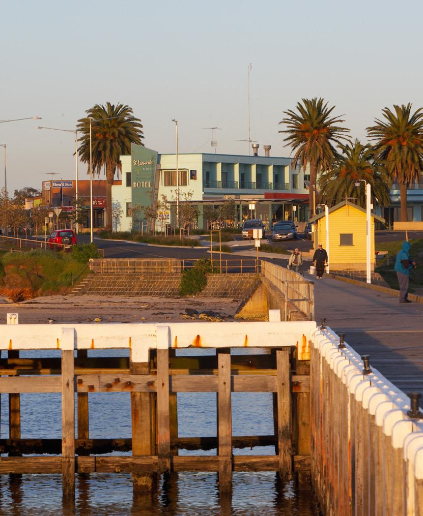
11 Point Lonsdale The township of Point Lonsdale is also a coastal seaside resort town characterised by twentieth century buildings and more contemporary architecture, with the residential areas set amongst significant stands of vegetation, dunes and significant coastal and foreshore landscape features. The township offers a range of sporting facilities and venues. The Point Lonsdale commercial centre provides core retail and service operations, with the commercially zoned area having a mixed use nature due to the existence of residential built form located amongst contemporary commercial development. Portarlington/Indented Head Portarlington/Indented Head are smaller settlements which have both residential and tourism roles. They are not designated growth locations. Portarlington is the northern most point on the Bellarine Peninsula and is an older settlement with strong links to it history as a fishing town and holiday resort. Indented Head is a smaller residential settlement which relies upon Portarlington for most services and community infrastructure. A distinct non-urban break exists between the two settlements. Queenscliff The urban and commercial areas of the township of Queenscliff are characterised by mainly Victorian and early twentieth century architecture of significant cultural and built heritage value. The township is a key coastal seaside resort with foreshore reserves, parkland, sporting venues and coastal and wetland landscapes which have significant environmental and tourism values. It has a significant regional tourism role based not only on the built and natural environments but also the car and passenger ferry terminal (which provides a link to the Mornington Peninsula), and the Queenscliff Harbour. The Queenscliff commercial areas contains a number of core retail and service operations, as well as specialty shops reflecting tourist led demand. St Leonards St Leonards is a small coastal settlement with both holiday homes and permanent residents and a focus on fishing and camping. It is not a designated growth location. Situated in a sensitive coastal environment close to the Salt Lagoon Wildlife Reserve and the beach, St Leonards includes a small existing commercial centre. 9
12 Framework Plan CLIFTON SPRINGS GEELONG - PORTARLINGTON RD DRYSD MOOLAP Reedy Lake GRUBB RD WALLINGTON RD Lake Connewarre WALLINGTON BELLARINE HWY Barwon River OCEAN GROVE SHELL RD BARWON HEADS RD BREAMLEA BARWON HEADS 10
13 PORTARLINGTON PREPARED BY CITY OF GREATER GEELONG - 31 MARCH 2014 Although all due care has been taken to ensure that this document is correct, no warranty is expressed or implied by the City of Greater Geelong, Barwon Water of the State of Victoria in its use. L IN RD INDENTED HEAD GEELONG - Murradoc Hill MOOLAP Edward Point Reedy Lake C RD ST LEONARDS RD MURR ADO GTON RD RD DALE PORTARLIN WALLINGTO N P R TA OR ON GT FF - PORTA RLINGTON PLAN LEGEND QUEENSCLI Lake Connewarre Localised Planning Statement Area WALLINGTON Municipal Boundary Existing Urban Areas Swan Bay Existing Rural Living Ba rw Ramsar Wetlands o n BARWON HEA Ri Significant Coastlines v er DS RD Areas Of Visual Significance Designated Growth Location Protect Non-Urban Breaks Between Settlements Tourist Railway LO W SR D TourismBARWON Route F EL Lake Victoria POINT LONSDALE HEADS Sub Regional Centre QUEENSCLIFFBREAMLEA Ferry Link Significant Views Sub Regional Theme Park The Heads Aquaculture Bellarine Peninsula Viticulture Draft Localised Planning Statement JUNE

14 Significance of the area 12
15 The Bellarine Peninsula is significant for its visual landscape characteristics, individually distinct coastal settlements in a rural setting, sweeping views across rolling hills, coastlines, wetlands and open farmed landscapes. The Bellarine Peninsula is significant for its visual landscape characteristics, individually distinct coastal settlements in a rural setting, sweeping views across rolling hills, coastlines, wetlands and open farmed landscapes. It is a popular tourist destination with attractive beaches, quality golf courses, a regional scale water based theme park, diverse cafes and restaurants in townships in addition to a growing food based tourism sector centred on wineries, aquaculture, olives, berries, cheeses and other local produce. The township of Queenscliff has a rich history of Aboriginal and European activity and settlement which contributes to the cultural and historical significance of the broader region. Queenscliff and Point Lonsdale fall within the known traditional boundaries of the Bengalut Balug Clan of the Wadawurrung people. To date over 2000 archaeological sites have been found in the region that the Wadawurrung people occupied. Queenscliff s well preserved heritage buildings are a key tourism asset and the car and passenger ferry service between Queenscliff and Sorrento provides a key link to the Mornington Peninsula and beyond. The Queenscliff Harbour provides for a range of marine activities. The Borough of Queenscliffe in addition has significant sporting and camping facilities which adds to its culture. Swan Bay and the Lake Connewarre Complex are identified as wetlands of International importance under the Ramsar convention. In addition, The Heads at Point Lonsdale are identified as being of State significance by the Coastal Spaces Landscape Assessment Study (City of Greater Geelong Municipal Reference Document). Significant indigenous vegetation is found throughout the Bellarine Peninsula including roadside vegetation many of which are subject to overlay controls. The Ocean Grove Nature Reserve is listed by the National Trust as a significant example of remnant flora of the Bellarine Peninsula. Other key features of the Bellarine Peninsula include: > > Strong linear vegetation features including exotic windbreaks and significant indigenous roadside vegetation. > > Open and expansive views throughout. > > Large and significant water features including the Barwon River, Lake Connewarre complex, Lake Victoria and Swan Bay. > > Sparse built elements and settlements, particularly in the western areas of the Bellarine Peninsula > > Typically rugged surf coast with sweeping beaches, headlands and dunes with extensive and largely intact indigenous dune vegetation. > > Lookouts, walking trails, heavily used recreational locations and coastal settlements, often with expansive outviews. > > Steep, low cliffs and minor escarpment at the coastal and lake edges. The Bellarine Peninsula Strategic Plan found that the communities on the Bellarine Peninsula place a strong emphasis on the retention of farming on the Bellarine, retention of distinct rural breaks between townships, and protection of the environmental values of the Bellarine. This Localised Planning Statement reinforces this emphasis. 13

16 Policy objectives & strategies 1 2 To protect and enhance the rural and coastal environment on the Bellarine Peninsula and maintain non-urban breaks with open farmed landscapes between settlements. To support the ongoing use of rural land on the Bellarine Peninsula for agriculture and to preserve the open farmed landscape. STRATEGIES > > Protect rural and coastal environments from inappropriate urban encroachment and development. > > Protect the scenic qualities of key landscape features. > > Ensure development outside of settlement boundaries (as shown in the Structure Plan maps) does not compromise the rural, environmental and landscape values of the non-urban breaks, significant views or longer term growth opportunities. STRATEGIES > > Support the establishment and ongoing use of rural areas on the Bellarine Peninsula for agricultural activities which do not impact upon the open farmed landscape including viticulture, horticulture and crop raising and grazing. > > Discourage intensive agricultural development or industrial development in rural areas on the Bellarine Peninsula that would have an adverse impact on the rural landscape. > > Ensure the development of dwellings and the excision of existing dwellings in rural areas on the Bellarine Peninsula is consistent with the use of the land for sustainable rural uses. > > Ensure new developments are designed and sited to avoid compromising the open farmed landscape. 14

17 3 4 To preserve and maintain the ecology of the Bellarine Peninsula s environmentally significant coastal, wetland and vegetated areas. To protect, preserve and enhance built heritage, cultural and urban character values and preserve the individual identity and role of townships. STRATEGIES > > Protect cliff, dune and foreshore areas from inappropriate development and subdivision. > > Protect and restore significant and remnant native vegetation, particularly tea tree, moonah and coastal heath. > > Ensure that new developments allow for the protection of significant vegetation and/or planting around buildings and have minimal impact on roadside vegetation. STRATEGIES > > Ensure that development responds to the identity and character of the individual township in which it is located. > > Protect the character of local conservation precincts, places, objects and sites and heritage areas on the Bellarine Peninsula. > > Encourage development which respects the setting of coastal settlements by providing reasonable sharing of views of the coast and foreshore and ensuring development uses contemporary design that reflects existing built form. 15

18 5 To facilitate the planned residential growth of Ocean Grove, Drysdale/Clifton Springs and Leopold consistent with adopted Structure Plans and as service hubs for the Bellarine Peninsula. In all other townships, provide retail, commercial and community uses and facilities that serve the daily needs of the community and encourage street based activity and local employment. STRATEGIES > > Ensure land use and development proceeds generally in accordance with the relevant Structure Plan maps. > > Provide for a range of retail, commercial, community uses in town centres to provide services for the community and local employment opportunities in accordance with Structure Plans. > > Direct the bulk of residential growth and retail development to the designated growth locations of Ocean Grove, Drysdale/Clifton Springs and Leopold consistent with the relevant Structure Plan maps. > > Direct bulky goods retailing and industrial development to existing and future areas as identified in Structure Plan maps. 16

19 6 To support and encourage diverse and sustainable tourism as a key economic activity in townships and in rural areas where it complements and respects the farmed rural landscape of the area and is ancillary to an existing farming activity. STRATEGIES > > Support a range of appropriately scaled and located tourism accommodation and activities within township boundaries. > > Preserve and enhance key tourism assets, in particular the built and natural environments and sporting and tourist areas. > > Support the development of rural land for tourism where the use is associated with a farming activity and where the primary use of the land remains rural/farming in nature. > > Ensure that tourism uses in rural areas will not compromise agricultural activities on adjoining land. Background DocumentS > > Coastal Spaces Landscape Assessment Study (City of Greater Geelong Municipal Reference Document) > > City of Greater Geelong Rural Land Use Strategy (Parsons Brinckerhoff 2007) > > Bellarine Peninsula Strategic Plan (City of Greater Geelong 2006) > > Bellarine Peninsula Strategic Plan-Five Year Progress Audit (2012) > > G21 Regional Growth Plan > > > G21 Regional Growth Plan Implementation Plan > The Building Siting and Design Guidelines contained in the Borough of Queenscliffe Urban Character Study. > > The Queenscliffe Urban Conservation Study > > ABS Census data > > Relevant township structure plans 17
20 CITY OF GREATER GEELONG PO BOX 104 GEELONG 3220 AUSTRALIA GENERAL ENQUIRIES
STRATEGIC IMPLEMENTATION PANEL SUBMISSION
 STRATEGIC IMPLEMENTATION PANEL SUBMISSION AMENDMENT C375 to the GREATER GEELONG PLANNING SCHEME BARWON HEADS STRUCTURE PLAN IMPLEMENTATION Part A Submission to the Independent Panel Panel: Con Tsotsoros
INCREMENTAL CHANGE AREA REVIEW March 2015 Page 1
 INCREMENTAL CHANGE AREA REVIEW March 2015 Page 1 Table of Contents Introduction... 3 Background to Review... 3 Comparison of the Schedules to the General Residential Zone... 7 Methodology... 7 Policy Context...
APPENDIX 1 - OCEAN GROVE SIGNIFICANT TREE PROJECT SIGNIFICANT TREE AREA DEVELOPMENT PATTERNS 1960 S TO 2013
 APPENDIX 1 - OCEAN GROVE SIGNIFICANT TREE PROJECT SIGNIFICANT TREE AREA DEVELOPMENT PATTERNS 1960 S TO 2013 1966 1977 APPENDIX 1 - OCEAN GROVE SIGNIFICANT TREE PROJECT 1984 1990 APPENDIX 1 - OCEAN GROVE
Mollers Lane, Leopold, Victoria Significant Landscape Overlay Re-assessment
 XURBAN Mollers Lane, Leopold, Victoria Significant Landscape Overlay Re-assessment For: TGM Group November 2016 Final Mollers Lane, Leopold, Victoria Significant Landscape Overlay Re-assessment Client
OCEAN GROVE STRUCTURE PLAN
 OCEAN GROVE STRUCTURE PLAN December 2015 1 WWW.GEELONGAUSTRALIA.COM.AU 2 Contents Part A Structure Plan 1 Introduction... 5 1.1 Purpose of the Structure Plan 5 1.2 How will this plan be used? 5 1.3 Plan
JETTY ROAD URBAN GROWTH PLAN
 JETTY ROAD URBAN GROWTH PLAN Adopted 26 June 2007 (Amended 23 September 2008) WWW.GEELONGAUSTRALIA.COM.AU PREFACE STATUS AND ROLE OF THE URBAN GROWTH PLAN The Jetty Road Urban Growth Plan (UGP) sets the
3. STATEMENTS OF DESIRED CHARACTER FOR PLANNING AREAS AND PRECINCTS
 3.30 Planning Area No. 30 Mary River Valley 3.30.1 Location and Role This Planning Area encompasses rural lands in the western part of the Shire. These lands are located within the catchment area of the
Vision Statement for Point Lonsdale
 TOWNSHIP BROCHURE This Township Brochure applies to all of Point Lonsdale (CoGG). Please see overleaf for precinct map and refer to the individual Precinct Brochure for your area. Vision Statement for
LEOPOLD LAND CAPABILITY AND BAY ACCESS REPORT
 LEOPOLD LAND CAPABILITY AND BAY ACCESS REPORT JULY 2015 Prepared by Spiire for City of Greater Geelong This report has been prepared by the office of Spiire Level 2 10 Moorabool Street PO Box 4032 Geelong
PHASE ONE. A summary report: What the community told Alcoa during Phase One of the community engagement program for Point Henry 575.
 PHASE ONE A summary report: What the community told Alcoa during Phase One of the community engagement program for Point Henry 575. DECEMBER 2015 FEBRUARY 2016 INTRODUCTION In 2014 Alcoa closed its Point
DRAFT GREATER SYDNEY REGION PLAN OBJECTIVES, STRATEGIES AND ACTIONS
 Greater Sydney Commission DRAFT GREATER SYDNEY REGION PLAN OBJECTIVES, STRATEGIES AND ACTIONS Issued: 26 OCTOBER 2017 Version: 1 Subject: Greater Sydney Region and District Plans This information note
COMMUNITY ACTIONS for a SUSTAINABLE BARWON HEADS. February 2016
 COMMUNITY ACTIONS for a SUSTAINABLE BARWON HEADS February 2016 Acknowledgements Traditional Owners We acknowledge the traditional owners of this land and pay our respects to their elders past and present,
Tāhuhu whakaruruhau ā-taone The sheltering ridge pole
 B2. Tāhuhu whakaruruhau ā-taone - Urban growth and form B2.1. Issues Tāhuhu whakaruruhau ā-taone The sheltering ridge pole Auckland s growing population increases demand for housing, employment, business,
Combined Planning Scheme Amendment Request and Planning Permit Application
 Combined Planning Scheme Amendment Request and Planning Permit Application Rezone land from the Farming Zone to the Commercial 1 Zone and develop a SubRegional Activity Centre Bellarine Gateway Plaza,
2A District-wide Policies
 2A Introduction This Chapter contains policies which are relevant to subdivision, use and development activities occurring across all zones and areas of the District. The policies in this Chapter implement
4.3 Dudley Area Plan. Introduction. History and Existing Character. Desired Future Character for Dudley
 4.3 Dudley Area Plan Introduction The suburb of Dudley has developed as a result of various circumstances including its topography, history and mineral resources. Dudley development has been identified
LEOPOLD STRUCTURE PLAN. Prepared by the City of Greater Geelong September 2011 (Amended Jan 2013)
") LEOPOLD STRUCTURE PLAN Prepared by the City of Greater Geelong September 2011 (Amended Jan 2013) Table of Contents PART A STRUCTURE PLAN 1.0 Introduction... 3 1.2 How will this plan be used?... 3 1.3 Plan
LEOPOLD STRUCTURE PLAN Prepared by the City of Greater Geelong September 2011 (Amended Jan 2013) Table of Contents PART A STRUCTURE PLAN 1.0 Introduction... 3 1.2 How will this plan be used?... 3 1.3 Plan
The Proposed Auckland Unitary Plan (notified 30 September 2013)
") 3 Business zones Introduction There are 10 business zones in the Unitary Plan: City Centre Metropolitan Centre Town Centre Local Centre Neighbourhood Centre Mixed Use General Business Business Park Light
3 Business zones Introduction There are 10 business zones in the Unitary Plan: City Centre Metropolitan Centre Town Centre Local Centre Neighbourhood Centre Mixed Use General Business Business Park Light
Plan Modification to Chapter B2 of the Auckland Unitary Plan(AUP) Operative in part (15 November 2016)
 Operative in part (15 November 2016)") UNITARY PLAN UPDATE REQUEST MEMORANDUM TO FROM Phill Reid Linley Wilkinson DATE 25 September 2018 SUBJECT Plan Modification to Chapter B2 of the Auckland Unitary Plan(AUP) Operative in part (15 November
UNITARY PLAN UPDATE REQUEST MEMORANDUM TO FROM Phill Reid Linley Wilkinson DATE 25 September 2018 SUBJECT Plan Modification to Chapter B2 of the Auckland Unitary Plan(AUP) Operative in part (15 November
REVISED DRAFT NORTH DISTRICT PLAN PLANNING PRIORITIES AND ACTIONS
 Greater Sydney Commission REVISED DRAFT NORTH DISTRICT PLAN PLANNING PRIORITIES AND ACTIONS Issued: 26 OCTOBER 2017 Version: 1 Subject: Greater Sydney Region and District Plans This information note is
Queensland Coastal Plan. Presented by John Lane Director Environment Planning
 Queensland Coastal Plan Presented by John Lane Director Environment Planning Queensland Coastal Plan - Status Released 7 April 2011, but NOT YET IN EFFECT Formatting & operational amendments required Yet
ELLIOTT HEADS STRUCTURE PLAN
 ELLIOTT HEADS STRUCTURE PLAN BACKGROUND This report has been prepared to provide an overview of the land that has been included in the Urban Footprint within the Wide Bay Burnett Regional Plan, September
STRATEGIC DIRECTION. QLDC PROPOSED DISTRICT PLAN [PART TWO] DECISIONS VERSION 3 strategic direction
![STRATEGIC DIRECTION. QLDC PROPOSED DISTRICT PLAN [PART TWO] DECISIONS VERSION 3 strategic direction](/thumbs/79/79711764.jpg "STRATEGIC DIRECTION. QLDC PROPOSED DISTRICT PLAN [PART TWO] DECISIONS VERSION 3 strategic direction") 3 STRATEGIC DIRECTION QLDC PROPOSED DISTRICT PLAN [PART TWO] DECISIONS VERSION 3 strategic direction QLDC DISTRICT PLAN [PART TWO] AUGUST 2015 3 strategic direction 3.1 Purpose This chapter sets out the
3 STRATEGIC DIRECTION QLDC PROPOSED DISTRICT PLAN [PART TWO] DECISIONS VERSION 3 strategic direction QLDC DISTRICT PLAN [PART TWO] AUGUST 2015 3 strategic direction 3.1 Purpose This chapter sets out the
North District What we heard
 What we heard Vision to 2056 and Priorities Governance and implementation Infrastructure and funding The vision for a metropolis of three cities, and the 30 minute city. Feedback emphasised: That for the
4 RESIDENTIAL ZONE. 4.1 Background
 4 RESIDENTIAL ZONE 4.1 Background The residential areas within the City are characterised by mainly lowrise dwellings sited on individual allotments. Past architectural styles, settlement patterns and
RE: AMENDMENT C375 GEELONG PLANNING SCHEME 1900 BARWON HEADS ROAD, BARWON HEADS
 Reference: #V157080 14 August 2018 Barwon Heads Lifestyle Group Pty Ltd C/- Best Hooper Lawyers Level 9, 451 Little Bourke Street MELBOURNE VIC 3000 Attention: Mr. Edward Mahony (Lawyer) Dear Edward RE:
Eastern Golf Course, Doncaster Road, Doncaster
 , 463-535 Road, Heritage Assessment in accordance with Schedule to the Development Plan Overlay July 2013 bryce raworth conservation urban design 19 Victoria Street St Kilda Vic 3182 , 463-535 Road, Heritage
DRAFT WESTERN CITY DISTRICT PLAN PLANNING PRIORITIES AND ACTIONS
 Greater Sydney Commission DRAFT WESTERN CITY DISTRICT PLAN PLANNING PRIORITIES AND ACTIONS Issued: 26 OCTOBER 2017 Version: 1 Subject: Greater Sydney Region and District Plans This information note is
PART 02 HASTINGS POINT IN CONTEXT
 PART 02 HASTINGS POINT IN CONTEXT 2.1 Background 2.1.1 Demographic Information 2.1.2 Existing Locality Characteristics 2.2 The Planning Framework 2.2.1 The Far North Coast Regional Strategy 2006 2.2.2
Leopold Sub-Regional Activity Centre Master Plan - Background Report
 Report Leopold Sub-Regional Activity Centre Master Plan - Background Report Prepared for City of Greater Geelong (Client) By Beca Pty Ltd (Beca) 3 June 2011 Beca 2011 (unless Beca has expressly agreed
DRYSDALE - CLIFTON SPRINGS STRUCTURE PLAN Prepared by the City of Greater Geelong Adopted September 2010
 DRYSDALE - CLIFTON SPRINGS STRUCTURE PLAN Prepared by the City of Greater Geelong Adopted September 2010 Table of Contents PART A STRUCTURE PLAN 1 1.0 Introduction... 1 1.1 Purpose of the Structure Plan...
A Growing Community Rural Settlement Areas
 Town of Huntsville Official Plan Review - POLICY BACKGROUND PAPER A Growing Community Rural Settlement Areas BACKGROUND: In addition to the fully municipally-serviced Urban Settlement Area and the Hidden
Eastern City District Plan
 OUR GREATER SYDNEY 2056 Revised Draft Eastern City District Plan OVERVIEW Bayside Burwood Canada Bay City of Sydney Inner West Randwick Strathfield Waverley Woollahra Snapshot of the Eastern City District
H7 Open Space zones. (a) provide for the needs of the wider community as well as the needs of the community in which they are located;
 provide for the needs of the wider community as well as the needs of the community in which they are located;") H7. Open Space zones H7.1. Background The majority of land zoned as open space is vested in the Council or is owned by the Crown. However some areas zoned open space are privately owned. While the open
H7. Open Space zones H7.1. Background The majority of land zoned as open space is vested in the Council or is owned by the Crown. However some areas zoned open space are privately owned. While the open
DAREBIN PLANNING SCHEME AMENDMENT C137
 Who is the planning authority? Planning and Environment Act 1987 DAREBIN PLANNING SCHEME AMENDMENT C137 EXPLANATORY REPORT This amendment has been prepared by the Darebin City Council, who is the planning
REMARKABLES PARK ZONE
 .10 Remarkables Park Zone.10.1 Resources, Activities and Values The Remarkables Park Area comprises approximately 150 hectares of perimeter urban land in the vicinity of Frankton and occupies a strategic
Greater Geelong Planning Scheme Amendment C349 Ocean Grove Significant Tree Project
 Planning and Environment Act 1987 Panel Report Greater Geelong Planning Scheme Amendment C349 Ocean Grove Significant Tree Project 13 December 2017 Planning and Environment Act 1987 Panel Report pursuant
1.0 PLANNING MARKHAM S FUTURE CONTENTS
 1-1 Planning Markham s Future 1.0 PLANNING MARKHAM S FUTURE CONTENTS 1.1 THE PURPOSE OF THE OFFICIAL PLAN 1.2 THE MARKHAM CONTEXT 1.3 THE REGULATORY CONTEXT 1.3.1 Province of Ontario 1.3.2 York Region
10.0 Open Space and Public Realm
 10.0 Open Space and Public Realm 10.0 Open Space and Public Realm The Public Open Space System is comprised of: outdoor spaces available for public use that are either publicly owned (e.g., parks and
CA.1 Coastal Area. Index. CA.1.1 Description and Expectations
 Index.1.2.3.4 CA.2 CA.2.1 CA.2.2 CA.2.3 CA.3 CA.3.1 CA.3.2 CA.3.1 CA.4 CA.4.1 CA.4.2 CA.4.3 CA.4.4 CA.5 CA.5.1 CA.5.2 Description and Expectations Objectives Policies Guidance Note Landuse Eligibility
B4. Te tiaki taonga tuku iho - Natural heritage
 B4. Te tiaki taonga tuku iho - Natural heritage Tuia I runga, tuia i raro, tuia ki te waonui a Tiriwa Bind the life forces of heaven and earth to the great realm of Tiriwa B4.1. Issues Auckland s distinctive
Ipswich Issues and Options for the Ipswich Local Plan Review, August 2017, Public Consultation
 Ipswich Issues and Options for the Ipswich Local Plan Review, August 2017, Public Consultation Having reviewed the issues and options documents, the Society has made the following response: Part 1 Strategic
GREEN BELTS, GREEN WEDGES OR DISPUTED GROUND
 GREEN BELTS, GREEN WEDGES OR DISPUTED GROUND John Ginivan Department of Planning and Community Development State Government of Victoria Melbourne Australia Greenbelts: Local Solutions for Global Challenges
Point Nepean National Park Master Plan. Community update and discussion paper January 2016
 Point Nepean National Park Master Plan Community update and discussion paper January 2016 Purpose The Victorian Government is reaffirming the direction for management of Point Nepean National Park and
Inclusive and Engaging City
 Inclusive and Engaging City An Inclusive City welcomes and enables all people to participate fully in City life. Population, housing, services, social inclusion and liveability are important elements of
14.5 HOPEFIELD: (REFER PLAN 39 AND PLAN 40)
") URBAN DYNAMICS WESTERN CAPE INC. 248 14.5 HOPEFIELD: (REFER PLAN 39 AND PLAN 40) FIGURE 83: LOCALITY - HOPEFIELD Within the context of the Saldanha Bay Municipal area, Hopefield, an historical agricultural
URBAN DYNAMICS WESTERN CAPE INC. 248 14.5 HOPEFIELD: (REFER PLAN 39 AND PLAN 40) FIGURE 83: LOCALITY - HOPEFIELD Within the context of the Saldanha Bay Municipal area, Hopefield, an historical agricultural
CITY CLERK. Parkland Acquisition Strategic Directions Report (All Wards)
") CITY CLERK Clause embodied in Report No. 10 of the, as adopted by the Council of the City of Toronto at its meeting held on November 6, 7 and 8, 2001. 10 Parkland Acquisition Strategic Directions Report
CITY CLERK Clause embodied in Report No. 10 of the, as adopted by the Council of the City of Toronto at its meeting held on November 6, 7 and 8, 2001. 10 Parkland Acquisition Strategic Directions Report
2.1 Location and Size
 2.0 Context 7 2.1 Location and Size The Saanich Penninsula The study area is centrally located within the Town boundaries on the east side of Highway 17, which runs through Sidney in a north-south direction.
Town of Cobourg Heritage Master Plan. Statutory Public Meeting
 Town of Cobourg Heritage Master Plan Statutory Public Meeting April 25 th 2016 Presentation Overview 1. Introduction 2. Project background and schedule overview 3. Review of strategic direction content
2.0 Strategic Context 4
 2.0 Strategic Context 4 2.1 The Area Action Plan is a non-statutory plan, which forms a corporate policy document, expressing particular issues and areas of concern while also providing a vision for the
Schedule of Planning Applications Committee Date: 23 May Reference: 06/17/0726/F Parish: Hemsby Officer: Mr J Beck Expiry Date:
 Schedule of Planning Applications Committee Date: 23 May 2018 Reference: 06/17/0726/F Parish: Hemsby Officer: Mr J Beck Expiry Date: 22-05-2018 Applicant: Proposal: Site: Mr Gillett Change of use to the
Applying the Heritage Overlay
 Practice Note 01 Revised September 2012 Applying the Heritage Overlay This practice note provides guidance about the use of the Heritage Overlay. What places should be included in the Heritage Overlay?
Central City District What we heard
 What we heard Vision to 2056 and Priorities Governance and implementation Infrastructure and funding The vision for a metropolis of three cities, and the 30 minute city. Feedback requested: Clearer communication
OUR GREATER SYDNEY A metropolis of three cities. OVERVIEW. connecting people. DRAFT Greater Sydney Region Plan
 OUR GREATER SYDNEY 2056. A metropolis of three cities. OVERVIEW. connecting people. DRAFT Greater Sydney Region Plan October 2017 This document is an overview of the draft Greater Sydney Region Plan. To
City of Rockingham. Local Management Practices, Costs and Strategic Coastal Planning
 City of Rockingham Local Management Practices, Costs and Strategic Coastal Planning Decision Making Process Considerations Climate Change Response Action Plan Ongoing observations/major Storm events Ongoing
Suffolk Coastal Local Plan Review Issues and Options, August 2017, Public Consultation
 Suffolk Coastal Local Plan Review Issues and Options, August 2017, Public Consultation Having reviewed the issues and options documents, the Society has made the following response: Part 1 - Strategic
WINCHESTER TOWN 3.1 LOCATION, CHARACTERISTICS & SETTING
 WINCHESTER TOWN 3.1 LOCATION, CHARACTERISTICS & SETTING 3.1.1 The area referred to by the City Council, as Winchester Town, consists of the Winchester Wards plus the adjoining built up areas of Badger
Draft Drysdale. Urban Design Framework. June
 Draft Drysdale June 2012 WWW.GEELONGAUSTRALIA.COM.AU Draft Drysdale Prepared by Planning Strategy, City of Greater Geelong 131 Myers St Geelong, 3220, Australia www.geelongaustralia.com.au June 2012 Version
STATEMENT OF OBJECTION TO THE PROPOSED DEVELOPMENT OF LAND AT CHURCH CLIFF DRIVE FILEY
 STATEMENT OF OBJECTION TO THE PROPOSED DEVELOPMENT OF LAND AT CHURCH CLIFF DRIVE FILEY You will be aware that Scarborough borough council have adopted a new local plan that includes land at Church Cliff
Sunshine Coast Council Coastal Management Overview. January 2016 edition
 Sunshine Coast Council Coastal Management Overview January 2016 edition Mayor Mark Jamieson Mayor s foreword Our impressive beaches are fundamental to our Sunshine Coast lifestyle, economy and coastal
our greater future settlement and housing 11 Greater Shepparton 2030 focusing on the future
 our greater future 5 settlement and housing Shepparton, Mooroopna and Tatura will be bigger and more compact Urban areas will bustle with an expanded population base and will take up land identified for
2040 LUP is a part of the Comprehensive Plan and carries the same legal authority. Economic Challenges
 1.1. Guiding Anchorage s Growth Where will new residents settle over the next two decades? Where will people work, shop, and play? Will there be enough room to grow? How will Anchorage look? Will growth
Draft South West District Plan - Campbelltown City Council Submission Attachment 1
 Draft South West District Plan - Campbelltown City Council Submission Attachment 1 Campbelltown City Council Report and Resolution - Draft South West District Plan - Draft Submission Ordinary Meeting 28/03/17
Planning Proposal Concurrent DA/LEP Amendment for Belmont North Pharmacy Amendment No. 24 to Lake Macquarie Local Environmental Plan (LMLEP) 2014
 2014") Planning Proposal Concurrent DA/LEP Amendment for Belmont North Pharmacy Amendment No. 24 to Lake Macquarie Local Environmental Plan (LMLEP) 2014 Local Government Area: Name of Draft LEP: Subject Land:
Planning Proposal Concurrent DA/LEP Amendment for Belmont North Pharmacy Amendment No. 24 to Lake Macquarie Local Environmental Plan (LMLEP) 2014 Local Government Area: Name of Draft LEP: Subject Land:
BATMAN PARK, INDENTED HEAD INCORPORATED PLAN
 BATMAN PARK, INDENTED HEAD INCORPORATED PLAN JUNE 2015 This document is an incorporated document in the Greater Geelong Planning Scheme pursuant to section 6(2)(j) of the Planning and Environment Act 1987.
6 PORT SYDNEY SETTLEMENT AREA
 Section 6 Port Sydney Page 61 6 PORT SYDNEY SETTLEMENT AREA 6.1 Basis and Principles Village of Port Sydney Waterfront Community Existing Services 6.1.1 Port Sydney is an historic settlement that has developed
Yarra Strategic Plan community engagement summary
 Yarra Strategic Plan community engagement summary Between May and August 2018 Melbourne Water undertook community engagement to build the content of the draft Yarra Strategic Plan. This engagement included
OCEAN GROVE STRUCTURE PLAN
 OCEAN GROVE STRUCTURE PLAN Adopted 27 February 2007 (amended 23 September 2008) WWW.GEELONGAUSTRALIA.COM.AU The City of Greater Geelong (CoGG) appointed Hansen Partnership Pty Ltd - Town Planners, Urban
DRAFT PLANNING SCHEME AMENDMENT GC81
 Outline of changes proposes to the Melbourne and Port Phillip Planning Scheme Fishermans Bend Fishermans Bend is one of several priority precincts identified in Plan Melbourne and plays a central role
Appendix A - Relief sought
 Appendix A - Relief sought Chapter 2 Definitions Definitions Tourism Activity (new) and Visitor Industry (new) The plan does not provide specific definition for tourism. The plan does introduce a new strategic
Chapter 3: Natural Environment. Proposed Waikato District Plan Stage 1. (Notified version)
") Chapter 3: Natural Environment Proposed Waikato District Plan Stage 1 Page 2 of 7 Contents Chapter 3: Natural Environment... 3 3.1 Indigenous Vegetation and Habitats... 3 3.1.1 Objective Biodiversity and
Chapter 3: Natural Environment Proposed Waikato District Plan Stage 1 Page 2 of 7 Contents Chapter 3: Natural Environment... 3 3.1 Indigenous Vegetation and Habitats... 3 3.1.1 Objective Biodiversity and
URBAN DEVELOPMENT QLDC PROPOSED DISTRICT PLAN [PART TWO] AUGUST 2015
![URBAN DEVELOPMENT QLDC PROPOSED DISTRICT PLAN [PART TWO] AUGUST 2015](/thumbs/80/81778199.jpg "URBAN DEVELOPMENT QLDC PROPOSED DISTRICT PLAN [PART TWO] AUGUST 2015") 4 URBAN VLOPMNT U R P QLC PROPO ITRICT PLAN [PART TWO] AUGUT 2015 4 ur b an de v elop ment QLC ITRICT PLAN [PART TWO] AUGUT 2015 4 urban development 4 2 4.1 Purpose The purpose of this Chapter is to set
4 URBAN VLOPMNT U R P QLC PROPO ITRICT PLAN [PART TWO] AUGUT 2015 4 ur b an de v elop ment QLC ITRICT PLAN [PART TWO] AUGUT 2015 4 urban development 4 2 4.1 Purpose The purpose of this Chapter is to set
Lake Macquarie City. A copy of the published amendment including the instrument and maps, is provided in Attachment 7 of this report.
 Planning Proposal Amendment No. 77 to Lake Macquarie Local Environmental Plan 2004 and proposed Amendment to Draft Lake Macquarie Local Environmental Plan 2013 Minor Zone Boundary Adjustment - Pasminco
Hobart A Strategic Framework
 Hobart 2025 A Strategic Framework Adopted by the Hobart City Council 15 October 2007 Table of Contents Introduction...2 Vision and Future Directions...3 FD1 Offers opportunities for all ages and a city
CITY OF LANGLEY OFFICIAL COMMUNITY PLAN BYLAW, 2005, NO APPENDIX II - REGIONAL CONTEXT MAP
 CITY OF LANGLEY OFFICIAL COMMUNITY PLAN BYLAW, 2005, NO. 2600 APPENDIX II - REGIONAL CONTEXT MAP ± Legend Agricultural Mixed Employment Industrial Conservation & Recreation Regional City Centre Urban Containment
Elderberry Walk. Developer HAB Housing
 Case studies Elderberry Walk Developer HAB Housing Development of 161 new homes on the former Dunmail Primary School site, focused around a central green street, with retained trees, new multifunctional
Coastal hazard assessments in Victoria
 Coastal hazard assessments in Victoria Viktor Brenners viktor.brenners@delwp.vic.gov.au Future Coasts program 4 year program established in 2007. Outputs included: Coastal Digital Elevation Models Victorian
UNIVERSITY TOWN NEIGHBOURHOODS 5.2 ECO-CORRIDOR MELBOURNE CAMPUS MASTER PLAN 2014
 5.2 ECO-CORRIDOR 37 ECO-CORRIDOR EXISTING CONDITIONS & VISION NEIGHBOURHOOD VISION Investment in the Eco-corridor Neighbourhood will signify the University s commitment to supporting local ecology and
Western Sydney Parklands Australia s Largest Urban Park
 Western Sydney Parklands Australia s Largest Urban Park 37 WLA 1 MAGAZINE 21 38 WESTERN SYDNEY PARKLANDS AUSTRALIA S LARGEST URBAN PARK Large urban parks have dual roles to play in meeting the demands
Central City District Plan
 OUR GREATER SYDNEY 2056 Revised Draft Central City District Plan OVERVIEW Blacktown Cumberland Parramatta The Hills Snapshot of the Central City District today and into the future People Population, age
Contents of Part 6. Part 6 Zones
 Contents of Part 6 Part 6 Zones... 6-1 6.1 Preliminary... 6-1 6.2 Zone codes... 6-3 6.2.1 Low density residential zone code... 6-3 6.2.1.1 Application... 6-3 6.2.1.2 Purpose and overall outcomes... 6-3
6. Ballintogher Mini-Plan
 County Development Plan 2017-2023 Consolidated Draft + Adopted Amendments August 2017 Volume 2, Chapter 6 Ballintogher Mini-Plan 6. Ballintogher Mini-Plan Village profile Ballintogher is located approximately
South District Plan OVERVIEW
 OUR GREATER SYDNEY 2056 Revised Draft South District Plan OVERVIEW Canterbury-Bankstown Georges River Sutherland Snapshot of the South District today and into the future The Greater Sydney Commission acknowledges
Understanding Wellington City s DISTRICT PLAN
 Understanding Wellington City s DISTRICT PLAN Wellington City Council 1 UNDERTANDING WELLINGTON CITY S DISTRICT PLAN CONTENTS 1. Introduction...3 1.1. Overview of this Guide...3 1.2. What is the District
Western City District What we heard
 What we heard Vision to 2056 and Priorities Governance and implementation Infrastructure and funding The protection of the natural landscape including biodiversity and the Metropolitan Rural Area for food
CITY OF GREATER GEELONG DEVELOPMENT HEARINGS PANEL MINUTES OF THE MEETING HELD AT BROUGHAM STREET OFFICE, 100 BROUGHAM STREET, GEELONG
 CITY OF GREATER GEELONG DEVELOPMENT HEARINGS PANEL MINUTES OF THE MEETING HELD AT BROUGHAM STREET OFFICE, 100 BROUGHAM STREET, GEELONG ON THURSDAY 3 MAY 2018 Meeting opened at 5:00pm. 1. COMMITTEE MEMBERS
CASEY PLANNING SCHEME AMENDMENT C188
 Who is the planning authority? Planning and Environment Act 1987 CASEY PLANNING SCHEME AMENDMENT C188 EXPLANATORY REPORT This amendment has been prepared by the Growth Areas Authority (now known as the
Planning Proposal Toronto Road, Booragul. Amendment to Lake Macquarie Local Environmental Plan (LMLEP) 2014
 2014") Planning Proposal Toronto Road, Booragul Amendment to Lake Macquarie Local Environmental Plan (LMLEP) 2014 Local Government Area: Name of Draft LEP: Subject Land: Land Owner: Applicant: Folder Number:
Planning Proposal Toronto Road, Booragul Amendment to Lake Macquarie Local Environmental Plan (LMLEP) 2014 Local Government Area: Name of Draft LEP: Subject Land: Land Owner: Applicant: Folder Number:
CITY OF GREATER GEELONG
 CITY OF GREATER GEELONG AGENDA DEVELOPMENT HEARINGS PANEL MEETING NO 573 TO BE HELD AT BROUGHAM STREET OFFICE (GROUND FLOOR) 100 BROUGHAM STREET, GEELONG ON THURSDAY, 4 OCTOBER 2018 AT 5.00 P.M. 1. Committee
CHONGMING ISLAND SHANGHAI CENTRAL CITY
 Chongming Island CHONGMING ISLAND SHANGHAI CENTRAL CITY Chongming Island Shanghai, China THE VISION: A GREEN ISLAND Chongming Island benefits from a magnificent setting, adjacency to the vibrant center
The WAPC publications summarised in this report are (in order of policy importance):
:") Summary of WAPC Publications Relevant to Local Biodiversity Planning As part of the delivery of the land use planning component of the Western Australian Natural Resource Management (NRM) program in 2011/12,
Summary of WAPC Publications Relevant to Local Biodiversity Planning As part of the delivery of the land use planning component of the Western Australian Natural Resource Management (NRM) program in 2011/12,
25 AVALON ROAD, AVALON
 Development Hearings Panel Page 1 Application No: 1200/2015 Applicant: Subject Land: Owner: Zone: Overlays: Existing Use: Proposed Use: Ivelja Design 25 Avalon Road, Avalon C J Bate and S M Bate Farming
HELP SHAPE THE PLACE ENGAGEMENT BARWON HEADS STRUCTURE PLAN UPDATE UNEDITED OUTPUTS. November 2016 REPORT
 BARWON HEADS STRUCTURE PLAN UPDATE HELP SHAPE THE PLACE ENGAGEMENT November 2016 UNEDITED OUTPUTS REPORT WWW.GEELONGAUSTRALIA.COM.AU Barwon Heads Structure Plan Update HELP SHAPE THE PLACE Engagement Unedited
AT A GLANCE... Our People, Culture & Place. A plan to sustain Ballarat s heritage (final draft)
") AT A GLANCE... Our People, Culture & Place A plan to sustain Ballarat s heritage 2017-2030 (final draft) Image: Lydiard Street, Ballarat, c1875-1938, John Henry Harvey collection, La Trobe Picture Collection,
AT A GLANCE... Our People, Culture & Place A plan to sustain Ballarat s heritage 2017-2030 (final draft) Image: Lydiard Street, Ballarat, c1875-1938, John Henry Harvey collection, La Trobe Picture Collection,
Northland Regional Landscape Assessment Worksheet
 Northland Regional Landscape Assessment Worksheet DESCRIPTION AND CHARACTERISATION Component Land Types (refer to list overleaf) Volcanic cones Geology (including geopreservation sites) Soil Types Unit
Regional Context Statement
 Regional Context Statement REGIONAL CONTEXT STATEMENT 3. REGIONAL CONTEXT STATEMENT In 1995, the Provincial Government passed into law the Growth Strategies Act. The purpose of this provincial initiative
GREENBANK DEVELOPMENT MASTERPLAN
 DEVELOPMENT MASTERPLAN POTENTIAL TRAIN STATION COMMUNITY CENTRE Greenbank will be a connected masterplanned community providing easy access to local and surrounding amenity. Affordable quality homes, green
LANDSCAPE GUIDELINES. Countryside & Coastal Countryside Environments. Landscape, Natural Character & Amenity Values Guide
 Landscape, Natural Character & Amenity Values Guide Copyright WDC 2009 Version A2 18May09 Environmental Services Group Publication Countryside & Coastal Countryside Environments START HERE Quality Land
Northland Regional Landscape Assessment Worksheet
 Northland Regional Landscape Assessment Worksheet Unit name TE POUAHI HEADLAND DESCRIPTION AND CHARACTERISATION Component Land Types (refer to list overleaf) Dune complex Coastal cliffs / escarpment Reefs
HOROWHENUA DEVELOPMENT PLAN June create a safe crossing for children moving to and from the school and other areas. 7.8 Ohau
 7.8 Ohau create a safe crossing for children moving to and from the school and other areas. Ohau has a traditional village form with a collective of school, church and reserve at the main road intersection.