Open House RIVER DES PERES GREENWAY: LANSDOWNE SHREWSBURY METROLINK TO FRANCIS R. SLAY PARK
|
|
|
- Leonard Weaver
- 5 years ago
- Views:
Transcription

1 Open House RIVER DES PERES GREENWAY: LANSDOWNE SHREWSBURY METROLINK TO FRANCIS R. SLAY PARK


2 MEETING AGENDA Great Rivers Greenway and Project Partners River des Peres Greenway Overview Project Details Feedback Landscaping Construction Staging Timeline Q & A GREAT RIVERS GREENWAY TITLE GOES HERE 1

3 MEET US: GREAT RIVERS GREENWAY Regional parks & trails district St. Louis City St. Louis County St. Charles County Steward of the taxpayers legacy & investment Partner in the CityArchRiver transformation

4 VISION FOR THE ST. LOUIS REGION: a dynamic network of greenways connecting our communities strengthening the social, economic and environmental well-being of our region.
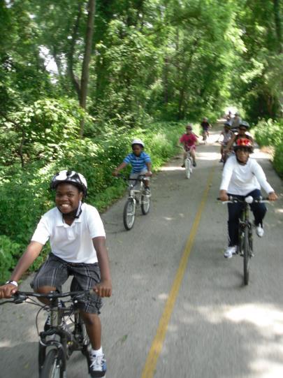
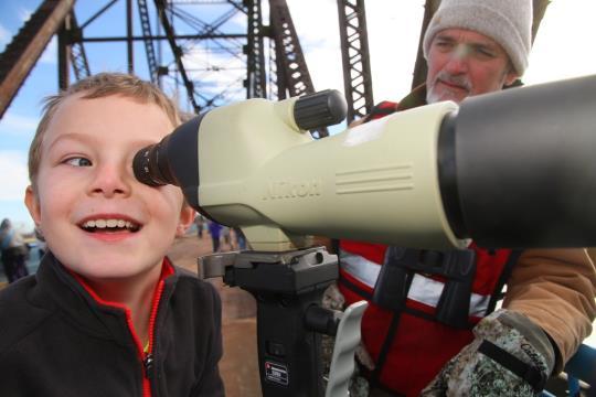
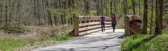
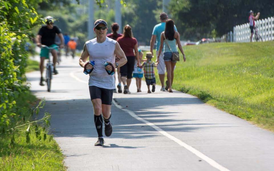
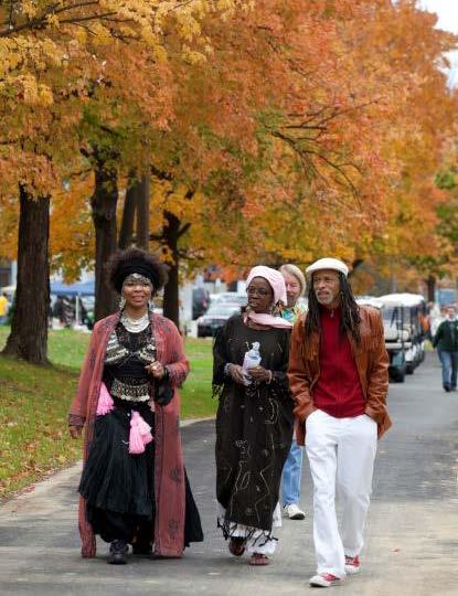
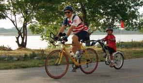
5 GREENWAYS CONNECT OUR REGION LIVE LIFE OUTSIDE GREAT RIVERS GREENWAY TITLE GOES HERE 4
6
7
8

9


10

11


12

13 5% premium to the market value of homes neighboring greenways The Economic Benefits of Great Rivers Greenway Report and Fact Sheet available online at
14

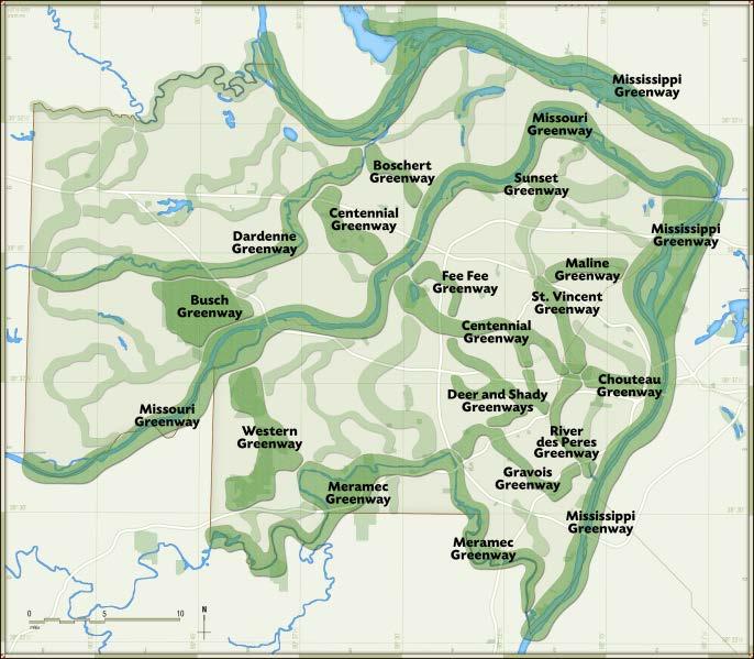
15 1,200 square miles 16 greenways 54 projects 167collaborative partners 113 miles of greenway 2 million visits/year 1,600 acres connecting 38,000 acres of public lands


16 MEET THE PROJECT: RIVER DES PERES GREENWAY GREAT RIVERS GREENWAY TITLE GOES HERE 15
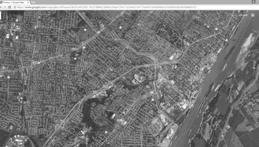
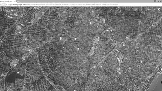
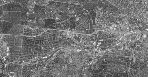
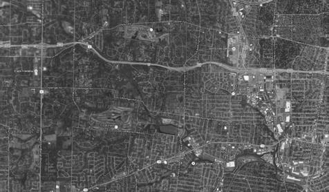
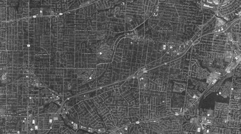
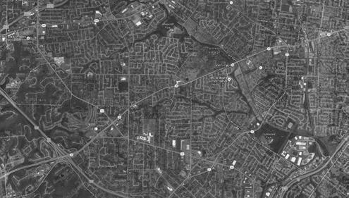
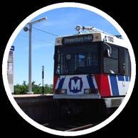
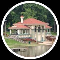

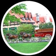
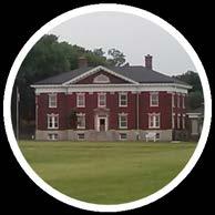
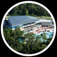
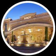
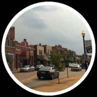

17 REGIONAL CONNECTIONS Deer Creek Park Forest Park Maplewood MetroLink & MetroBus Kirkwood River des Peres Greenway Francis R. Slay Park Jefferson Barracks Grant s Trail Grant s Farm Clydesdale Park The Pavilion at Lemay Carondelet Park Current Project Existing Greenway Future Greenway Mississippi Greenway River City Casino
 2013: Phase III opens (I-55 to Alabama Ave) Under Construction: Phase IV (Alabama to River City Casino) opens in 2017!")
18 RIVER DES PERES GREENWAY HISTORY 1999: River des Peres Environmental Restoration Reconnaissance Study completed 2005: Phase I opens (Gravois to Morganford) 2008: Phase II opens (Morganford to I-55) 2013: Phase III opens (I-55 to Alabama Ave) Under Construction: Phase IV (Alabama to River City Casino) opens in 2017! 2014: Phase V opens (Gravois to Lansdowne)

19 PHASE VI PROJECT HISTORY : Wellington Bridge Construction 2013: Phase VI alignment review 2014: Applied for $1.5 million in Federal transportation funds 2015: 1 st Lansdowne Shrewsbury MetroLink to Francis R. Slay Park Open House 2016: 2 nd and 3 rd Lansdowne Shrewsbury MetroLink to Francis R. Slay Park Open Houses


 St.")

")
 Great")
20 PROJECT PARTNERS City of St. Louis (property owner, operations & maintenance) Missouri Department of Transportation (property owner, operations and maintenance on I-44 Bridge & administer federal grant) St. Louis Metropolitan Sewer District (property owner, permitting & utility coordination) East-West Gateway Council of Governments (award federal funding) Bi-State Development Agency (provide location for bicycle parking) Great Rivers Greenway (project management & funding)
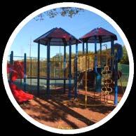
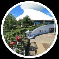
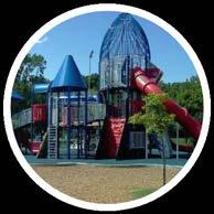
21 PROJECT GOALS Connections to:» River des Peres» MetroLink & MetroBus» Residential Neighborhoods» Business Districts Exercise, socialize, and learn about history, culture and nature Calm vehicle traffic to increase safety Manage stormwater Improve ADA accessibility Provide Eyes along the route Provide native landscape Expand transportation options Access to parks, open space and recreational amenities» Francis R. Slay Park» River des Peres Park and Fultz Field» Willmore Park» Lemay Park» Carondelet Park


22 WHAT WE HEARD AT THE SPRING 2016 PROJECT OPEN HOUSE Very excited to see this in my neighborhood! I think extending the greenway by reducing vehicular traffic on Wabash/McCausland is a horrible idea. I m really excited that the greenway is being extended to us. I can t wait until it goes all the way to Forest Park too! The single lane on Ellendale and Wabash will cause unacceptable negative impacts. Love the new project. The quieting effect it will have on Ellendale and Wabash is much needed.
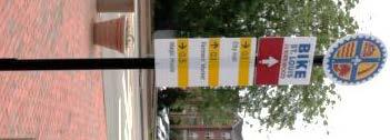
23 WHAT WE HEARD Why can t the trail go along the River des Peres?» Trail cannot go along the riverbank due to safety, structural and logistical reasons.» Constricted right-of way north of Lansdowne towards I-44, the route would need right-ofway acquisition.» The slope is not stable, (between Tholozan and Mardel in particular) and would need extensive restoration» Existing utilities are a challenge because of high voltage transmission lines overhead. Can we enhance on-street bike routes?» Bike St. Louis signage and on-street striping on Lansdowne will remain» Bikes May Use Full Lane signs will be added on Wabash and Ellendale» Wabash will be striped so that people riding bicycles on the street can pull over to let people driving cars pass
24 WHAT WE HEARD Eliminating a southbound lane will cause problems for people driving cars» Lane removal will reduce dangerous speeding behaviors on Wabash and Ellendale» Average daily traffic volume on Wabash/Ellendale is 9,200-13,800 vehicles 4 lane roadways with fewer than 20,000 vehicles per day are good candidates for lane removal Turning left on Lindenwood from southbound Wabash will be difficult» Southbound traffic turning left can pull into spaces to make the turn» Additional left turn spaces will be created on Wabash for the other streets

25 TRAFFIC STUDY Initial Traffic Counts and Study Completed in 2013 Second Traffic Study Completed in Possible Configurations Studied: >>> Current 4 lane configuration >>> 1 northbound lane, 1 southbound lane and 1 two way left turn lane >>> 2 northbound lanes and 1 southbound lane

26 Daily Traffic Counts McCausland at I-64 23,650 vehicles per day McCausland at Arsenal 18,700 vehicles per day Ellendale at Esplanade 9,000 to 13,500 vpd Wabash at Lindenwood 9,200 to 13,800 vpd
27 TRAFFIC STUDY Existing traffic projected on Ellendale in Peak Hours

28 TRAFFIC STUDY Existing Vehicular Traffic Exceeds Speed Limit 85 th Speed Percentile = 40 mph


29 TRAFFIC STUDY Traffic Count Results


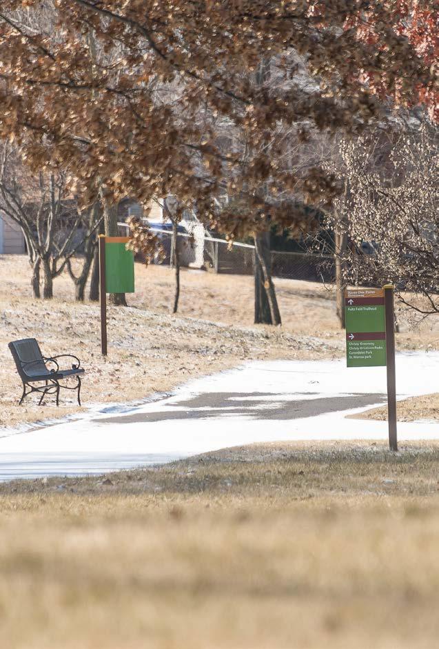
30 TRAFFIC STUDY Traffic Study Results on Wabash


31 TRAFFIC STUDY Traffic Study Results on Ellendale
32 TRAFFIC STUDY Lindenwood and Wabash Intersection studied for a traffic signal


33 Widen and fix sidewalks ADA compliance No impacts to traffic Maximize parking More signalized intersections than Wabash & Ellendale Before SIMILAR ROADWAY CHANGES MANCHESTER AVE. (KINGSHIGHWAY TO VANDEVENTER) After

34 Cross Section Vehicle traffic patterns do not change Walking and bicycling path widened along north side of bridge; barrier separates path and travel lane Lansdowne traffic signals and crosswalks improved at River des Peres Blvd. and Wabash Ave. Tie into Metro Station and existing River des Peres Greenway Bicycle parking added at Metro Station Seal coat road surface and install bicycle may use full lane signs SECTION A LANSDOWNE AVE. (METRO STATION TO WABASH AVE.)

35 Cross Section No parking lost; widened lane to 8 ; right edge striped to denote parking Eliminate one southbound travel lane on Wabash Widen path along west side of Wabash to 10 and relocate utility poles for ADA access Improve curb ramps for ADA compliance at each intersection Add trail stop signs at street intersections Add a landscaped median that includes space for left turns New pavement and seal coat road surface SECTION B WABASH AVE. (LANSDOWNE AVE. TO LINDENWOOD PL.)

36 Cross Section Existing no parking to remain Eliminate one southbound travel lane on Wabash Widen path along west side of Wabash to 10 and relocate utility poles for ADA access Improve curb ramps for ADA compliance at each intersection Add trail stop signs at street intersections Landscaped median to match the new median south of Lindenwood Add mid-block pedestrian crossing between Lindenwood and Mardel New pavement and seal coat road surface SECTION C WABASH AVE. (LINDENWOOD PL. TO I-44 UNDERPASS)

37 Cross Section Existing no parking to remain Eliminate one southbound travel lane on Wellington Add dual path along west side of Wellington Replace sidewalk along east side of Wellington Use existing Wellington Bridge path Add lighting under I-44, paint columns Work with volunteers to sweep gravel under I-44 New pavement and seal coat road surface SECTION D Interstate 44 UNDERPASS


38 Cross Section Existing no parking to remain Eliminate one southbound travel lane on Ellendale Add new 10 wide path with tree lawn along west side of Ellendale Add curb ramps for ADA compliance at each intersection Add trail stop signs at street intersections Reconstructed concrete medians Raise street crossings for people walking and bicycling across Piccadilly Ave. and Manhattan Ave. Street closures with emergency and pedestrian/bicycle access only at St. James Sq. and Leamington Ave. New pavement and seal coat road surface Road/Greenway intersection sign SECTION E ELLENDALE AVE. (I-44 UNDERPASS TO LEAMINGTON AVE.)
39 Add left turn lane into BNSF Railroad Facility from southbound Ellendale Existing left turn lane for Wellington Court to remain SECTION E ELLENDALE AVE. (I-44 UNDERPASS TO LEAMINGTON AVE.)

40 Cross Section Existing no parking to remain Eliminate one southbound travel lane on Ellendale Add 10 wide path along west side of Ellendale with improved curb ramps for ADA compliance Add trail stop signs at street intersections Reconstructed concrete medians Raise street crossing for people walking and bicycling across Esplanade St. Street closure with emergency and pedestrian/bicycle access only at Tremont Ave. New pavement and seal coat road surface SECTION F ELLENDALE AVE. (LEAMINGTON AVE. TO CANTERBURY AVE.)

41 Modify Canterbury/McCausland traffic signal and add crosswalks to tie into new City Trail Create trailhead at Francis R. Slay Park with benches, waste receptacles, and trees Future connection to Deer Creek Greenway and Forest Park GREAT RIVERS GREENWAY TITLE GOES HERE 40


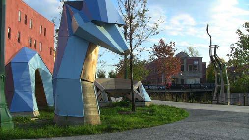
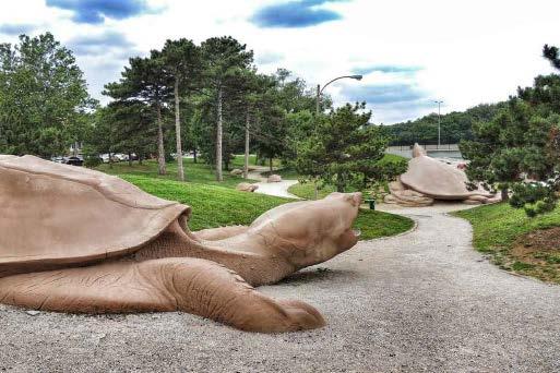
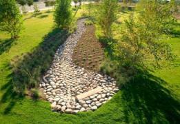
42 River Monster Public Art Chippewa Bridge POSSIBLE OPPORTUNITIES
 so lines of sight will remain good Remaining trees protected during construction Additional plantings at key spots» South side")
43 LANDSCAPING Location # of Trees Added # of Trees Removed Trees cannot be planted over existing utilities so many will be planted in parks and tree lawn Wide, grassy medians help to filter pollutants and manage stormwater runoff Grass and tress will be planted (no shrubs) so lines of sight will remain good Remaining trees protected during construction Additional plantings at key spots» South side of Lansdowne/Wabash intersection» Francis R. Slay Park Trailhead» Triangle between Ellendale, McCausland and Arsenal» Tree lawn where utilities are not an issue Tree Lawn Median 4 12 Parks 10 0 Total 39 25
44 CONSTRUCTION STAGING Vehicle travel in both directions at all times during project construction Driveways and streets constructed half side at a time to stay open for residents and property owners Pedestrian access to be maintained with minimal detours Parking on Wabash will be intermitted as construction progresses Parking available on side streets during construction Construction timeline March-December 2017» Phased construction» Communication with residents, property owners, City Aldermen and staff» Great Rivers Greenway will keep everyone informed during the entire project
45 PROJECT TIMELINE Fall 2016: City of St. Louis, St. Louis Metropolitan Sewer District, and Missouri Department of Transportation approvals November 2016: Construction bidding January 2017: Construction bid presented to Great Rivers Greenway Board of Directors for approval March 2017: Break ground December 2017: Anticipated completion GREAT RIVERS GREENWAY TITLE GOES HERE 44


46 Q u e s t i o n s? Todd Antoine Director of Planning and Projects tantoine@grgstl.org Elizabeth Simons Community Program Manager esimons@grgstl.org
Potential Green Infrastructure Strategies May 6, 2015 Workshop
 Potential Green Infrastructure Strategies May 6, 2015 Workshop Background The City of Cortland is developing the Tioughnioga Urban Headwaters Green Infrastructure Action Plan with funding from the National
Johnson Street Bridge Public Realm Update
 Johnson Street Bridge Public Realm Update August 20, 2015 Background Johnson Street Bridge Replacement Project impacts a diverse range of stakeholders In addition to a new bridge, the project also includes
Rainscaping. Rainscaping includes rain gardens, bioswales, combinations of. A guide to local projects in St. Louis
 Rainscaping A guide to local projects in St. Louis Rain garden on South Grand Boulevard in the city of St. Louis. Rainscaping includes rain gardens, bioswales, combinations of plantings, water features,
The Illinois Department of Transportation and Lake County Division of Transportation. Route 173, including the Millburn Bypass
 The Illinois Department of Transportation and Lake County Division of Transportation welcome you to this Public Hearing for U.S. Route 45 from Illinois Route 132 to Illinois Route 173, including the Millburn
AGENDA ACTION ITEMS INFORMATION ITEMS
 NOACA Bicycle and Pedestrian Advisory Council Meeting Friday, March 21 st, 2014 10:30 a.m. NOACA Office 1299 Superior Avenue Cleveland, Ohio 44114 Phone: (216) 241-2414; website: www.noaca.org AGENDA ACTION
Mississippi Skyway Preliminary Engineering Report
 EXECUTIVE SUMMARY Mississippi Skyway Preliminary Engineering Report CITY OF RAMSEY, MINNESOTA DECEMBER 2014 City of RAMSEY EXECUTIVE SUMMARY Project Need and Intent The Mississippi Skyway pedestrian bridge
Cottage Grove Road Reconstruction. City of Madison Engineering
 Public Informational Meeting Cottage Grove Road Reconstruction October 8, 2015 Presentation Outline Introduction Project Purpose & Need Proposed Design Overview Environmental Concerns Pedestrian Needs
The Vision. Photo provided by The Minervini Group. 46 Vision, Objectives & Strategies
 Vision, Objectives & Strategies The is the public framework and guide for future development of the Grand Traverse Commons. The establishes public polices for infrastructure, the preservation of natural
Maplewood Avenue Downtown Complete Street Project
 Maplewood Avenue Downtown Complete Street Project Second Public Meeting January 24, 2018 Welcome and Introduction of Project Team City Planning and Public Works Staff City of Portsmouth Juliet Walker Planning
Project Goal. RRRC Living Towns Planning Workshp. Town of Halifax Revitalization Project. Dynamic Planning & Management Duo: July 12, 2006
 Project Goal Town of Halifax Revitalization Project RRRC Living Towns Planning Workshp July 12, 2006 Town of Halifax Halifax County *** Revitalization Project Goal*** To create Economic Opportunity and
SOUTH UNIVERSITY Street Design Alternatives in Progress
 1 Alternatives in Progress 2016.01.20 Meeting Agenda 2 1. Progress & Schedule 2. Utilizing the Street Design Manual 3. Site Characteristics and Input Received 4. Street Geometry What can we accomplish
TIRZ 17/Redevelopment Authority Capital Improvements Plan Projects
 Gessner Widening: T-1701 What: Widen the road from a six-lane divided boulevard to an eight-lane divided boulevard street section, increase turn lanes, update traffic signal system, improve drainage by
Project Status. Construction is underway for Phase 3. Overall Project Area and Schedule. Schedule of Current Construction Phases.
 I-95 Avenue Interchange Project Status Construction is underway for Phase 3. Overall Project Area and Schedule Phase 0: Completed 2010 Section GR0: Completed in Fallin 2010 Phase 2: Completed Section GR2:
Rt. 29 Solutions Project Delivery Advisory Panel. January 7, 2016
 Rt. 29 Solutions Project Delivery Advisory Panel January 7, 2016 Agenda item 1: Introductions Project Delivery Advisory Panel Technical Team 2 Agenda item 2: Interaction and Feedback Live Streaming Dec
Rt. 29 Solutions Project Delivery Advisory Panel. December 3, 2015
 Rt. 29 Solutions Project Delivery Advisory Panel December 3, 2015 Agenda item 1: Introductions Project Delivery Advisory Panel Technical Team 2 Agenda item 2: Interaction and Feedback Live Streaming Nov
SH 199 Corridor Master Plan. Community Meeting No. 2 May 31, 2017
 Community Meeting No. 2 May 31, 2017 Transportation Projects On or Near SH 199 SH 199 from 0.3 miles south of FM 1886 to south end of Lake Worth bridge Construct freeway mainlanes and frontage roads 10-Year
WELCOME! 8 8:30 6: TH STREET IMPROVEMENTS. Open House. Presentation & Q&A
 WELCOME! 168 TH STREET IMPROVEMENTS 6:30 Open House 7 8 Presentation & Q&A 8 8:30 Open House WELCOME Todd Pfitzer City of Omaha Engineer Bob Stubbe City of Omaha Public Works Director Jon Meyer Project
Project Overview. Fairfax County Parkway Widening Fairfax County. Get Involved. Public Information Meeting. Contact Information
 Get Involved VDOT representatives will review and evaluate information received as a result of this meeting. Please fill out the comment sheet provided in this brochure if you have any comments or questions.
Fall 2017 Construction Update
 Fall 2017 Construction Update Ward 4 Southeast Engineering Department Riverwalk Red Multi-Use Trail Bridge Rehabilitation The Riverwalk Red Multi Use Trail Bridge was awarded to Cramer and Associates,
Fifth and Detroit Street Design May 2017 Capital Improvements Committee. DOWNTOWN Street Design
 1 Fifth and Detroit Street Design May 2017 Capital Improvements Committee Agenda 2 Review Street Configuration Prior Meeting Review Outreach Synopsis Functional Street Design Refinements Curb Edge, Turning
BENJAMIN BANNEKER PARK FRAMEWORK PLAN (PLAN ADOPTION)
") BENJAMIN BANNEKER PARK FRAMEWORK PLAN (PLAN ADOPTION) COUNTY BOARD MEETING DECEMBER 16, 2017 County Board Consideration: Adopt the Benjamin Banneker Park Framework Plan and Design Guidelines Framework
BENJAMIN BANNEKER PARK FRAMEWORK PLAN (PLAN ADOPTION) COUNTY BOARD MEETING DECEMBER 16, 2017 County Board Consideration: Adopt the Benjamin Banneker Park Framework Plan and Design Guidelines Framework
I-70 Corridor Enhancement Plan
 i - Table of Contents Table of Contents Chapter I Overview Chapter II Bridge and Roadway Improvements Chapter III Landscape Enhancements Chapter IV Riparian Corridors Chapter V Showcase Missouri Plan Chapter
Errol Heights Park and Community Garden Frequently Asked Questions March 22, 2018
 Errol Heights Park and Community Garden Frequently Asked Questions March 22, 2018 Question 1: What improvements are planned for Errol Heights Park? How will the community be engaged in the process to shape
Edenfield Avenue Green Street Demonstration Project Neighborhood Meeting
 Edenfield Avenue Green Street Demonstration Project Neighborhood Meeting Edenfield Avenue Green Street Demonstration Project Neighborhood Meeting Road Reconstruction Elements Grant Background What is a
The Lemay Branding and Streetscape Plan: Streetscape Plan March 24, 2011
 The Lemay Branding and Streetscape Plan: Streetscape Plan March 24, 2011 This page intentionally left blank Table of Contents Page 1.0 Executive Summary... 1 2.0 Project Process... 5 2.1 Streetscape Goals...
Jenifer Street Reconstruction Neighborhood Engagement Meeting November 4, 2015
 Jenifer Street Reconstruction Neighborhood Engagement Meeting November 4, 2015 Hosted by the Marquette Neighborhood Association Facilitated by Urban Assets Funded in part by the City of Madison Neighborhood
COMPLETE GREEN STREET CHECKLIST
 COMPLETE GREEN STREET CHECKLIST This document was developed to dissect the structure of an urban street and explore opportunities to make our streets more complete while also integrating green street strategies.
New York Avenue Streetscape and Trail Project Public Meeting #1 Summary
 New York Avenue Streetscape and Trail Project Public Meeting #1 Summary I. King Jordan Student Academic Center (SAC) Gallaudet University, Washington, DC February 23, 2017 Table of Contents 1.0 Introduction...
Public Meeting May 20, 2014
 Public Meeting May 20, 2014 Overview Study Purpose Study Area Overview Strategies Potential Opportunities Implementation and Discussion Skeo Solutions Raleigh Walkable Watershed Pilot 2 Purpose Develop
West Dennis Center: Bass River to Old Main Street. West Dennis Business District: Old Main Street to Dennis Commons
 West Dennis Center: Bass River to Old Main Street West Dennis Business District: Old Main Street to Dennis Commons Dennisport Center: Dennis Commons to Division Street Main Street Project Goals Project
GREENING THE BOULEVARD Master Plan Concepts for Venice Boulevard between Lincoln and Sawtelle
 GREENING THE BOULEVARD Katherine Spitz Associates Inc. 4212½ Glencoe Avenue Marina Del Rey, CA 90292 310 574 4460 Fax 574 4462 January 2008 Table of Contents Overview Proposed Design Improvements Illustration
Moving The Metro. A special construction update for the metro Omaha area.
 Moving The Metro A special construction update for the metro Omaha area. ebraska Department of Roads Spring/Summer 2017 I-80 / I-480 / US-75 Interchange The improvements on this project consist of bridge
2014 Capital Budget Project Descriptions
 2014 Capital Budget Project Descriptions Major Greenways MISSOURI RIVER GREENWAY, NORTH ST. LOUIS COUNTY The Missouri River Greenway is a major greenway that connects the Confluence Greenway at Columbia
TOWNSHIP OF HOWELL TOWNSHIP OF HOWELL ENGINEERING PROJECTS STATUS REPORT OCTOBER 19, Resurfacing of Aldrich Road West Contract # 11-06
 TOWNSHIP OF HOWELL DEPARTMENT OF COMMUNITY DEVELOPMENT & LAND USE DIVISION OF ENGINEERING 251 Preventorium Road Phone: (732) 938-4500 x2300 Post Office Box 580 Fax: (732) 919-1080 Howell, NJ 07731-0580
Cleveland Innerbelt Bridge / Central Viaduct City Planning Commission November 6, 2009
 Cleveland Innerbelt Bridge / Central Viaduct City Planning Commission November 6, 2009 Process for Aesthetics Subcommittee June 25, 2009 Kick off Meeting June 26, 2009 Gateway and Tremont Focus Groups
Mississippi Drive Corridor Revitalization. A DestinationTransportation Project...
 Mississippi Drive Corridor Revitalization A DestinationTransportation Project... Mississippi Drive Corridor Revitalization Welcome! Tonight s Agenda: Further define the Scope of the Project Discuss the
Fairfax County Parkway (Route 286) Widening Project
 Widening Project") Fairfax County Parkway (Route 286) Widening Project Route 29 (Lee Highway) to Route 123 (Ox Road) State Project No. 0286-029-259, P101; UPC 107937 Fairfax Station HOA Meeting January 30, 2018 7:00 to 9:00
Fairfax County Parkway (Route 286) Widening Project Route 29 (Lee Highway) to Route 123 (Ox Road) State Project No. 0286-029-259, P101; UPC 107937 Fairfax Station HOA Meeting January 30, 2018 7:00 to 9:00
Memorandum CITY OF DALLAS. Riverfront Boulevard Design From Continental Avenue to Cadiz Street
 Memorandum DATE November 10, 2011 CITY OF DALLAS TO Trinity River Corridor Project Committee Members: Vonciel Jones Hill (Chair) Linda Koop (Vice Chair), Monica Alonzo, Scott Griggs, Angela Hunt, and Delia
DESIGN & GREEN INFRASTRUCTURE UPDATE December 13, 2016
 DESIGN & GREEN INFRASTRUCTURE UPDATE December 13, 2016 Welcome & Introduction Michael J. Finn, P.E. City Engineer Summary of Public Outreach to Date Ground the work in established principles December 2015
Public input has been an important part of the plan development process.
 Lakewood s Comprehensive Plan recognizes that transportation helps shape the community, and that the way the community provides for the safe and efficient movement of people affects the character of the
ULI St. Louis Technical Assistance Panel
 ULI St. Louis Technical Assistance Panel ULI St. Louis Technical Assistance Panel Sponsored by: Citizens for Modern Transit in partnership with METRO ULI St. Louis Mission Statement The mission of the
Overall Map. Chicago. St. Louis. Summit. Joliet. Dwight. Pontiac. Bloomington-Normal Lincoln. Springfield. Carlinville. Alton EXPERIENCE IT YOURSELF.
 Overall Map Summit Chicago Bloomington-Normal Lincoln New Station Planned New Station Planned Dwight Pontiac Joliet Pedestrian overpass and second platform planned Higher speed service began in this section
I-95 Girard Avenue Interchange Near Neighbors Meeting. Project Status
 I-95 Girard Avenue Interchange Project Status Construction is underway for Phase 1 and 2. Phase 3 construction will begin early 2014. Overall Project Area and Schedule GR0: Completed GR0: Completed in
5-Year Street Reconstruction Plan ( )
") 5-Year Street Reconstruction Plan (2006-2010) City of Delano Wenck File #0564-37 Prepared for: CITY OF DELANO 234 2 nd Street West Delano, MN 55328 Prepared by: WENCK ASSOCIATES, INC. 1800 Pioneer Creek
5-Year Street Reconstruction Plan (2006-2010) City of Delano Wenck File #0564-37 Prepared for: CITY OF DELANO 234 2 nd Street West Delano, MN 55328 Prepared by: WENCK ASSOCIATES, INC. 1800 Pioneer Creek
TRANSPORTATION PROJECTS
 TRANSPORTATION PROJECTS 40 BUFFALO S LWRP PROPOSED PROJECTS T1. Niagara Street/Great Lakes Seaway Trail Streetscape Project City of Buffalo Department of Public Works Niagara Street from Niagara Square
PennDOT Public Meeting. S.R. 3044, Section A01 Castle Shannon Boulevard Roadway Improvement Project
 PennDOT Public Meeting S.R. 3044, Section A01 Castle Shannon Boulevard Roadway Improvement Project Mt Lebanon Township, Allegheny County Mt Lebanon Township Municipal Building November 6, 2014 1 Project
Route 347. New York State Department of Transportation Region 10, Long Island. THE GREENING of ROUTE 347
 The GREENING of Route 347 The Greening of Route 347 The Greening of Route 347: History 3 The Greening of Route 347 4 The Greening of Route 347 5 The Greening of Route 347 Smith Haven Mall 6 The Greening
Great Rivers Greenway CLEAN GREEN CONNEC TED T RAILS
 Great Rivers CLEAN GREEN CONNEC TED T RAILS Great Rivers (GRG) was established in 2000 to create a clean, green, connected St. Louis region. Today, many new and exciting projects demonstrate the social,
Capital Projects in and near Odenton Town Center
 Capital Projects in and near Odenton Town Center Map ID Anne Arundel County Department of Public Works This project provides for the design, right of way acquisition, and construction of approximately
METRO Gold Line BRT CMC Meeting
 METRO Gold Line BRT CMC Meeting April 26, 2018 Today s Topics Welcome and Introductions Project Overview CMC Roles and Responsibilities Current Project Baseline: Scope and Cost Estimate Overview Municipal
Charles P. Johnson and Associates. Annapolis Landscape Architects
 Charles P. Johnson and Associates Annapolis Landscape Architects AGENDA Introduction Project Limits and Scope Site Analysis Opportunities & Constraints Program Goals Image Boards Design Alternatives Pros
Welcome to the. Open House
 Welcome to the 5th Street to Kinsman Road Open House November 14 5:30 7:00 p.m. Please sign in Project Overview In December 2016, City Council adopted SW 5th Street as the preferred alignment to connect
The Capital Design Advisory Committee St. Mary s College of Maryland & Historic St. Mary s City
 The Capital Design Advisory Committee St. Mary s College of Maryland & Historic St. Mary s City Welcome April 21, 2010 Capital Design Advisory Presentation: Relocating Margaret Brent Hall Traffic Calming
California Environmental Quality Act (CEQA) Environmental Review Process
 Environmental Review Process") California Environmental Quality Act (CEQA) Environmental Review Process Los Angeles Union Station Forecourt and Esplanade Improvements constitute a Project Los Angeles County Metropolitan Transportation
California Environmental Quality Act (CEQA) Environmental Review Process Los Angeles Union Station Forecourt and Esplanade Improvements constitute a Project Los Angeles County Metropolitan Transportation
FY STATEWIDE TRANSPORTATION IMPROVEMENT PROGRAM New Jersey Department of Transportation Projects
 Route 1&9, County Road 99380 99380 Improvements are planned at the Route 1&9, County Road intersection to address operational and safety issues in the vicinity of Manhattan Avenue and County Road. COUNTY:
Metro 2010 Pedestrian Symposium Walking into the Future City
 Metro 2010 Pedestrian Symposium Walking into the Future City John Kaliski, AIA, May 12, 2010 How can our transportation and land use policies create complete streets for all users? How do we optimize the
2017 General Obligation Bond
 2017 General Obligation Bond Presentation of Public and Council Projects to the Transportation & Mobility Stakeholder Committee April 13, 2017 Agenda Deferred Maintenance Project Development Process Projects
The Trinity River Corridor Project Update
 The Trinity River Corridor Project Update Councilmember Carolyn A. Davis Community Meeting October 14, 2008 The project covers 20 miles of the Trinity River, approx. 10,000 acres 2 Trinity River Corridor
Project Overview. Get Involved. Public Information Meeting. Contact Information
 Get Involved VDOT representatives will review and evaluate information received as a result of this meeting. Please fill out the comment sheet provided in this brochure if you have any comments or questions.
Southern Gateway Project and Public Green
 Southern Gateway Project and Public Green Transportation and Trinity River Project Committee May 23, 2016 Purpose of Presentation Provide the history and an overview of the Southern Gateway Project (SGP)
Construction Engineering & Inspection
 Construction Engineering & Inspection Serving Florida for 20 Years CEI Engineering Planning Landscape Architecture Urban Design Construction Engineering & Inspection (CEI) I N T R O D U C T I O N Over
I-494 Rehabilitation Project SP (I-394 to Fish Lake Interchange) June 2014 Section 4(f) De Minimis Determination
 June 2014 Section 4(f) De Minimis Determination") I-494 Rehabilitation Project SP 2785-330 (I-394 to Fish Lake Interchange) June 2014 Section 4(f) De Minimis Determination State Project Number 2785-330 Federal Project No. NHPP-I494 (002) Trunk Highway:
I-494 Rehabilitation Project SP 2785-330 (I-394 to Fish Lake Interchange) June 2014 Section 4(f) De Minimis Determination State Project Number 2785-330 Federal Project No. NHPP-I494 (002) Trunk Highway:
Capital Projects impacting Odenton Town Center
 Capital Projects impacting Odenton Town Center 1 2 E549700 W801600/ W801602 Anne Arundel County Department of Public Works Manor View Elementary School Transmission Main - MD 32 @ Meade Phase 2 $34,399,000
St. Louis Engineering and Transportation Services
 St. Louis Engineering and Transportation Services Amec Foster Wheeler s St. Louis office, with over 80 professional and support personnel, provides excellence in engineering and professional consulting
PRELIMINARY PLAT DESIGN REQUIREMENTS Updated 4/8/2016
 PRELIMINARY PLAT DESIGN REQUIREMENTS Updated 4/8/2016 The following items are required for the preliminary plat. Numbers correspond with those on the example preliminary plat. RENO COUNTY SUBDIVISION REQUIREMENTS
LOCATION AND DESIGN DIVISION
 VIRGINIA DEPARTMENT OF TRANSPORTATION LOCATION AND DESIGN DIVISION INSTRUCTIONAL AND INFORMATIONAL MEMORANDUM GENERAL SUBJECT: Landscape Architecture Program NUMBER: SPECIFIC SUBJECT: Integration of Landscape
Welcome to the LYNX Blue Line Extension Transit Station Area Plans Public Workshop No. 3. Presentation will begin at 6:00 P.M.
 Welcome to the LYNX Blue Line Extension Transit Station Area Plans Public Workshop No. 3 Presentation will begin at 6:00 P.M. Meeting Agenda Blue Line Extension (BLE) Project Update LYNX Blue Line Extension
Kankakee River Bridge & Track Improvements Supplemental Environmental Assessment. May 5, 2016
 Kankakee River Bridge & Track Improvements Supplemental Environmental Assessment May 5, 2016 1 History: Chicago-St. Louis Corridor Since 1980 s IDOT has been looking at this corridor for high-speed service
Prince William Street Project (Grant Avenue to Wellington Road)
") Prince William Street Project (Grant Avenue to Wellington Road) 1 Goals Improve pedestrian and bike traffic safety Improve street drainage with curb & gutter Upsize water mains Enhance overall street appearance
Prince William Street Project (Grant Avenue to Wellington Road) 1 Goals Improve pedestrian and bike traffic safety Improve street drainage with curb & gutter Upsize water mains Enhance overall street appearance
SOUTH UNIVERSITY Street Design Setting a Direction for Schematic Design
 1 SOUTH UNIVERSITY Street Design Setting a Direction for Schematic Design Meeting Agenda 2 1. Project Scope 2. Design Direction 3. Design Details 4. Schedule and Construction Logistics 3 SOUTH UNIVERSITY
ARLINGTON COUNTY, VIRGINIA. County Board Agenda Item Meeting of January 28, 2017 SUPPLEMENTAL REPORT
 ARLINGTON COUNTY, VIRGINIA County Board Agenda Item Meeting of January 28, 2017 SUPPLEMENTAL REPORT DATE: January 26, 2017 SUBJECT: The Virginia Department of Transportation s Transform I-66 Inside the
DOMINION BOULEVARD CORRIDOR STUDY AND ECONOMIC DEVELOPMENT STRATEGIC PLAN A MODEL FOR CHESAPEAKE S FUTURE
 DOMINION BOULEVARD CORRIDOR STUDY AND ECONOMIC DEVELOPMENT STRATEGIC PLAN A MODEL FOR CHESAPEAKE S FUTURE Overview I. Draft Plan Process II. Draft Plan Overview a. Market Analysis b. Master Land Use Plan
Montana Rail Link Park
 Montana Rail Link Park Neighborhood Open House A Missoula Community Partnership WITH LEADERSHIP FROM THE FRANKLIN TO THE FORT & SOUTHGATE TRIANGLE NEIGHBORHOODS Sovereign Hope Church, (1919 North Ave.)
TOWN BRANCH COMMONS & VINE STREET MOBILITY IMPROVEMENTS
 TOWN BRANCH COMMONS & VINE STREET MOBILITY IMPROVEMENTS CONTACT: Jeff Fugate, President O: 859-367-4972 F: 859-425-2292 JFugate@LexingtonDDA.com www.lexingtondda.com TOWN BRANCH COMMONS & VINE STREET MOBILITY
BRENTWOOD PARKS SYSTEM MASTER PLAN INITIAL ASSESSMENT
 BRENTWOOD PARKS SYSTEM MASTER PLAN INITIAL ASSESSMENT Prepared by Planning Design Studio Prepared for City of Brentwood Parks & Recreation September 4, 2013 Brentwood Parks System Master Plan Initial Assessment
The University District envisions, in its neighborhood
 Envisioning the University District Link Light Rail in Seattle s neighborhoods CIY OF SEALE CONCEP-LEVEL SAION AREA PLANNING RECOMMENDAION RESOLUION # 30165 EXHIBI L Vision 08.2000 he University District
FY STATEWIDE TRANSPORTATION IMPROVEMENT PROGRAM New Jersey Department of Transportation Projects
 ROUTE/ Project ID No. TIP No. Burlington County Computerized Signal Control, IV D9911 D9911 This ITS project will be a traffic responsive signal system, consisting of 24 intersections--9 on CR 607, 4 on
East Midtown Greenway East 53 rd 61 st Street. Community Board 8 Project Introduction November 16, 2017
 East Midtown Greenway East 53 rd 61 st Street Community Board 8 Project Introduction November 16, 2017 Agenda Overview - Development of the East Midtown Waterfront Esplanade Current East Midtown Greenway
The transportation system in a community is an
 7 TRANSPORTATION The transportation system in a community is an important factor contributing to the quality of life of the residents. Without a sound transportation system to bring both goods and patrons
Please see attached for more detailed project information. Project Schedule Designer Award by SBC Executive Sub-Committee December 21, 2015
 Project Title Campus Beautification Projects Volunteer Blvd Ph 1 540/009-08-2015 Institution Description UT Knoxville This project will improve Volunteer Boulevard from West Cumberland Ave. to East Cumberland
Secrest Short Cut and Monroe Expressway Small Area Plan AUGUST 29, 2018
 Secrest Short Cut and Monroe Expressway Small Area Plan AUGUST 29, 2018 Background and Process Monroe Expressway will be open by the end of 2018 Union County and Indian Trail identified a need to revisit
Citizen Information Meeting
 Prince William County Government Citizen Information Meeting Vint Hill Road Extension May 11, 2016 Benefits: Route 28 Corridor Improvement Program Estimated significant cost savings versus bidding these
ARGENTA TRAIL (CSAH 28/63) REALIGNMENT SOUTH PROJECT (CP 63-25)
 REALIGNMENT SOUTH PROJECT (CP 63-25)") ARGENTA TRAIL (CSAH 28/63) REALIGNMENT SOUTH PROJECT (CP 63-25) Preliminary Design Report February 2015 Prepared For: City of Inver Grove Heights Dakota County Prepared By: Kimley-Horn and Associates,
ARGENTA TRAIL (CSAH 28/63) REALIGNMENT SOUTH PROJECT (CP 63-25) Preliminary Design Report February 2015 Prepared For: City of Inver Grove Heights Dakota County Prepared By: Kimley-Horn and Associates,
4.1 Build Alternative 1 Construction Phasing
 SECTION 4 Implementation Plan This section discusses potential segmentation of the build alternatives into multiple projects for implementation of improvements to the NSH from Rabbit Creek Road to 36th
The open space system should provide connective elements, relate to natural resources, and enhance the suburban character of the landscape..
 The open space system should provide connective elements, relate to natural resources, and enhance the suburban character of the landscape.. Mixed-use and infill development should maintain or enhance
Street Flooding Mitigation Plan KYOVA Interstate Planning Commission. Presented to AMPO National Conference October 18, 2017
 Street Flooding Mitigation Plan KYOVA Interstate Planning Commission Presented to AMPO National Conference October 18, 2017 Saleem Salameh, Ph.D., P.E., M.ASCE Chet Parsons, AICP CTP Agenda: Background
Transportation Land Use Integration & Regional Planning. Don Kostelec, AICP Senior Planner, Louis Berger Group February 1, 2010
 Transportation Land Use Integration & Regional Planning Don Kostelec, AICP Senior Planner, Louis Berger Group February 1, 2010 Transportation Land Use Integration DOT-HUD-EPA Sustainable Communities Initiative
TOWN OF JUPITER. Honorable Mayor and Members of Town Council Andrew D. Lukasik, Town Manager
 DATE: June 07, 2016 TO: THRU: TOWN OF JUPITER Honorable Mayor and Members of Town Council Andrew D. Lukasik, Town Manager FROM: Thomas V. Driscoll, P.E., Director of Engineering, Parks & Public Works SUBJECT:
University Parkway Corridor Plan. Public Workshop Sept. 18, 2017
 University Parkway Corridor Plan Public Workshop Sept. 18, 2017 AGENDA 1. Overview of Process 2. Study Area 3. Components of the Plan 4. What We Know 5. What We Have Heard 6. Tonight s Input 7. Next Steps
Monroe Street Reconstruction. Business Roundtable March 29, 2017
 Monroe Street Reconstruction Business Roundtable March 29, 2017 Thank you to HotelRED and Roman Candle Pizza! Tonight s Agenda 1. Monroe Street Business Strategy Overview 2. Reconstruction Project Scope
Midtown Greenway to lake street
 Making the connection: Midtown Greenway to lake street May 2016 Design experiment: site amenities, wayfinding, and activities at Cepro, near the Midtown Global Market Recent Greenway Development Highlights
The Ambassador Bridge/ Gateway Project
 The Ambassador Bridge/ Gateway Project Connecting Neighbors & Driving the Economy 2008 Ohio Conference on Freight Given by the Toledo Metropolitan Area Council of Governments, National Association of Regional
Access Management: An Overview
 Figures 1-5 Below Evolution of development along a highway. In the early stages, land along the road is used for farming with little traffic generated. As time passes, the highway corridor becomes a de
Urban Planning and Land Use
 Urban Planning and Land Use 701 North 7 th Street, Room 423 Phone: (913) 573-5750 Kansas City, Kansas 66101 Fax: (913) 573-5796 Email: planninginfo@wycokck.org www.wycokck.org/planning To: From: City Planning
Completing the Vision:
 Completing the Vision: North A1A-Lane Reconfiguration TDLC-Transportation Design for Liveable Communities Surf Rd. Redirection of Traffic Phase III Streetscape October 30, 2012 1 Project Overview District
Municipality of Anchorage, Alaska Parks & Recreation Department
 Municipality of Anchorage, Alaska Parks & Recreation Department 632 W. 6 th Avenue, Suite 630 P.O. Box 196650 Anchorage, AK 99519 Tel 907-343-4355 URL www.muni.org/departments/parks MEMORANDUM Date: October
AVONDALE ESTATES GREENSPACE AD-HOC COMMITTEE
 AVONDALE ESTATES GREENSPACE AD-HOC COMMITTEE INVENTORY AND RECOMMENDATIONS REPORT November 7, 2018 Our Mission Statement: To provide assistance and support, through professional expertise in matters of
NOTES FROM PUBLIC MEETING #3 AUGUST 30, 2017
 NOTES FROM PUBLIC MEETING #3 AUGUST 30, 2017 1. MEETING SUMMARY & MAIN POINTS The community meeting consisted of one overview presentation and two small group discussions of preferred approaches to Hale
Spring 2018 Construction Update
 Spring 2018 Construction Update Ward 3 Southwest Engineering Department Locust Street Bridge over the Des Moines River The Locust Street Bridge over the Des Moines River project is being let through the
PLANNING COORDINATING COMMITTEE
 PLANNING COORDINATING COMMITTEE Fall Meeting/Luncheon Welcome! October 16, 2009 PLANNING COORDINATING COMMITTEE Fall Meeting/Luncheon WELCOME! WELCOME! October 16, 2009 October 16, 2009 Agenda I. Lunch/Socialize