ForwardDallas! Comprehensive Plan. City Council Briefing February 15, 2006
|
|
|
- Eleanore Baker
- 5 years ago
- Views:
Transcription

1 ForwardDallas! Comprehensive Plan City Council Briefing February 15, 2006
2 Purpose Brief City Council on the preliminary products of the Forward Dallas! Comprehensive Plan 2

3 Where we are in the process Develop Vision for City Neighborhood Workshops Citywide Visioning Develop Comprehensive Plan strategies and policies based on vision, modeling and analysis Develop implementation plan Develop monitoring and evaluation program 3

4 Dallas First Comprehensive Plan Builds on many past plans 4


5 Forward Dallas! Comprehensive Plan Four Components Vision Policy Plan Implementation Plan Monitoring System 5

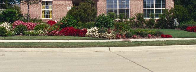
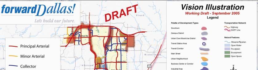
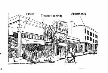
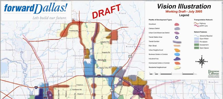
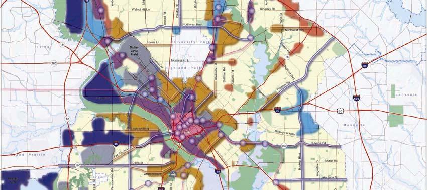
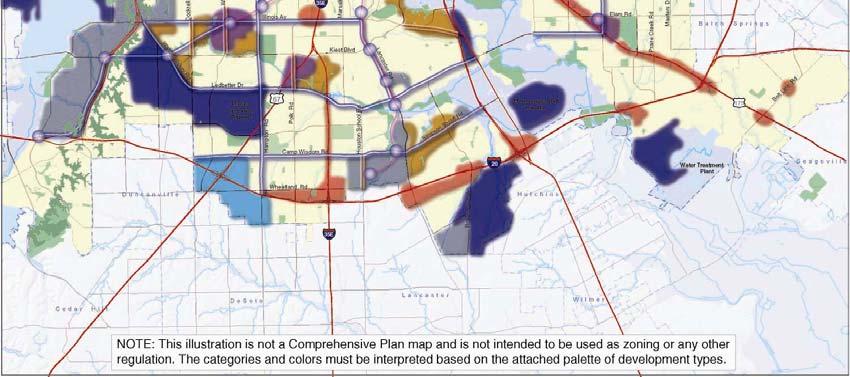
6 1 st Component The Vision Capturing Dallas dreams: Core Values derived from broad-based public input Six Key Initiatives to realize the Vision Vision Illustration based on a palette of building blocks or development patterns 6
7 Core Values Personal Safety Environmental Stewardship Fair Access to Education and Prosperity Choices in Transportation Quality of Life Investment in the Southern Sector 7
8 Guiding Principles Economic Development Housing & Community Social Equity Environmental Sustainability Transportation & Public Infrastructure 8
9 Six Key Initiatives Encourage new development patterns Enhance the economy Strengthen Downtown Dallas Focus on Trinity & Southern Sector Enhance Core Industries Make quality housing more attainable Promote strong and healthy neighborhoods Enhance transportation and infrastructure systems Protect the environment 9


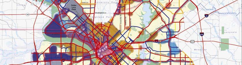
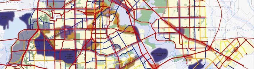
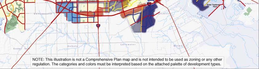
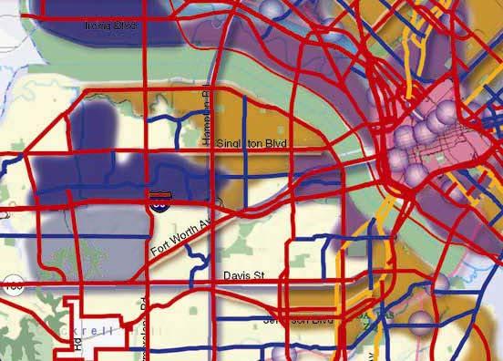
10 11 New building blocks to guide quality development 10
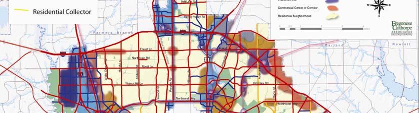
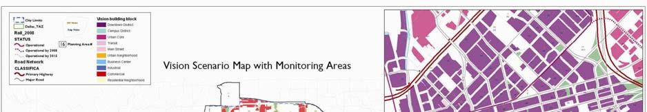
11 Vision Building Blocks Special Mixed-Use Building Blocks Downtown Campus District Urban Core Transit Center Main Street Urban Neighborhood Conventional Separate Use Building Blocks Business Center/ Corridor Industrial Area Commercial Center/Corridor Residential Neighborhood Natural Areas/Trinity River 11

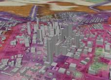
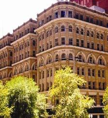
12 Example: Downtown Downtown Dallas 12

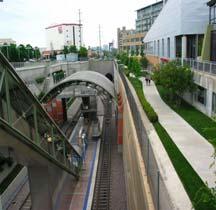
13 Example: Transit Station Center or Corridor 13

14 Example: Industrial Area South of Trinity River 14
15 2 nd Component The Policy Document Seven Elements linked that establish the policy foundation for achieving the Vision: Land Use Housing Economics Transportation Urban Design Environment Neighborhoods Updated on 5 to 10 year cycle (Policies for all 7 elements are compiled in the appendix.) 15


16 Land Use Element Establishes basis for zoning capacity to achieve growth targets of 220,000 new households and 400,000 new jobs by 2030 Balances and integrates land uses with transportation systems to enable sustainable growth Incorporates Trinity River Land Use Plan Institutes a framework for ongoing, small area planning to refine and implement the Vision 16

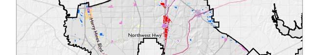
17 COG Composite
18 Vision Composite

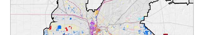
19 Current Zoning Vs. Vision Development Trend Vision 19


20 Vision Scenario Forward Dallas! Vision Building Blocks applied to developable land establishes: Citywide framework for Area Plans Basis for monitoring and benchmarking progress to achieve our goals Public document for Plan implementation 20


21 Implementation Through Area Employs Comprehensive Plan methodology & analysis Commitment to local involvement Comprehensive solutions Action oriented Plans 21
22 Key Policies for Land Use Establishes land use policies for quality development tied to Vision building blocks Aligns zoning ordinance with the Vision Monitor and maintain 15 to 20 year supply of land with appropriate zoning to build the Vision Refines Vision for implementation through Small Area Plans and Neighborhood Plans Coordinates land use, infrastructure and environmental planning Incorporates social equity polices 22
23 Desired Results Land uses are balanced to generate a robust tax base that builds prosperity for all Dallas citizens A development climate that encourages private investment and leverages public investment Establishes a basis for proactive planning for future transportation and infrastructure 23


24 Housing Element Recognizes Dallas urban future Encourages new types of ownership opportunities for non-traditional home buyers Encourages housing supply to meet needs across the income spectrum for future generations Creates housing conditions to attract middle income families to the Southern Sector 24


25 Dallas is approaching housing buildout on raw land Land supply sufficient for 30,000 to 50,000 single family units Housing need for 220,000 units Increasing ownership is key to City s goals 25


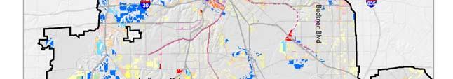
26 Undeveloped Land Map Undeveloped residential land will be consumed in the next 15 to 20 years Much of the remaining land is constrained 26
27 Dallas has a higher percentage of rental housing than the region 70% 60% 50% 40% 30% Owner Occupied Renter Occupied 20% 10% 0% City of Dallas Dallas County Dallas-- Fort Worth, TX CMSA 27
28 Solution: Increase share of infill ownership types Urban lifestyle population find Dallas attractive: Capture that market Townhouse and Condo are compatible as infill housing types Encourage innovative ownership housing styles that are higher density Work towards developing mixed income projects 28
29 Forward Dallas! Plan Housing matched to income 80,000 60,000 40,000 20,000 0 Below Market Apt Condo Townh ouse SFR Small SFR Med SFR Large Hirise Condo Demand 31,677 67,964 33,694 31,123 20,282 27,861 1,728 15,194 Supply - 65,235 43,560 36,375 22,773 29,923 1,911 29,735 Demand Supply 29
30 Key Policies for Housing Encourage more home ownership in urban housing styles small lots, townhouses, condominiums Encourage mixed-income residential developments Leverage housing implementation with City assistance and transportation and infrastructure investment Work toward building strong middle-income neighborhoods in the Southern Sector 30
31 Desired Results Home-ownership is increased in all areas of Dallas Southern Dallas is an attractive choice for middle-income families The cultural and ethnic character of neighborhoods is embraced 31
32 Economic Element Demographics FIGURE 3: RACE & ETHNICITY, White/Anglo Hispanic/Latino African American Asian/Pacific Islander Native American Other (includes 2 or more races) Source: U.S. Census Bureau Jobs Forecast 0 0% 10% 20% 30% 40% 50% 60% 70% 80% City of Dallas Dallas-Fort W orth Texas Office Industrial Retail US Supports the Strategic Engagement Plan and establishes policies that advance economic goals Fosters expansion and retention of business and industry Targets medical, logistics and technology-intensive industries Informs land use element to ensure it provides the right zoning for the right development in the right places Trend Vision 32

33 Major Business Sectors Location Quotients, 2005 Economic Plan works to Dallas Strengths 33
34 Factors Affecting D/FW Job Growth Targets Industries that have the most potential to grow in Dallas 34
35 Targeted Industry Categories Healthcare Logistics Technology Intensive Industries 35
36 Key Policies for Economic Development Support development activities in areas with best potential return on City investment Trinity Downtown DART Stations Southern Sector Develop clear, understandable land use regulations with zoning capacity to meet desired growth with reasonable standards that ensure quality development 36
37 Desired Results Coordinated economic development and land use planning Land use policies that are matched with sound economic strategies and programs Zoning and subdivision regulations that are market-tested to ensure that development is economically viable and of desirable quality 37
38 Transportation Element Establishes fundamental linkage between thoroughfares and Vision building blocks Establishes Context Sensitive Design (CSD) standards for streets Establishes policies for ongoing coordination between land use and transportation and implementation of CSD standards 38
39 Reduces Vehicle Miles, Reduces Congestion, Increases Ridership VMT (Miles) TREND VISION TURBO , , , , , , , ,400 Trips 150, , ,000 50,000 0 TREND VISION RENAISSANCE Peak Transit Off Off Peak Transit 39

40 Establishes the Land Use Connection to Transit Dallas DART Stations Operational by 2008 Currently in Operation Operational by
41 Linking Thoroughfares to Development Patterns 41
 District District Center Corridor Street Neighborhood Corridor Area Corridor / Center Neighborhood")
42 Thoroughfare Design Standards DESIGN STANDARD PRINCIPAL ARTERIAL, SIX LANES, DIVIDED Should respond to desired development pattern along the corridor Land Use Type Design Element Downtown Campus Mixed Use Transit Main Urban Business Center / Industrial Commercial Residential (Width in Feet) District District Center Corridor Street Neighborhood Corridor Area Corridor / Center Neighborhood Travel Way Median Travel Way Transit Way 12 (Shared) N/A N/A 12 N/A N/A N/A N/A N/A Realm Multi-use Lane N/A N/A N/A N/A N/A N/A N/A N/A N/A Posted Speed 35 mph 35 mph 35 mph 35 mph 35 mph 45 mph 45 mph 45 mph 35 mph Total Travel Way Realm Parking Lane N/A 8 N/A N/A N/A N/A N/A N/A N/A Pedestrian Sidewalk N/A Realm Plus Planting Planting Buffer Type Treewell Treewell Treewell Treewell Planting Strip Parking Strip Strip N/A N/A Buffer Width Total Pedestrian Realm Context Realm Setback N/A 20 N/A Total Right of Way


43 Building Block Design Standards 43


44 Context Sensitive Design Integrated into Thoroughfare Plan Buckner Blvd. Transformation 44
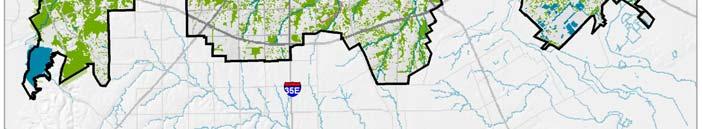
45 Key Policies for Transportation Coordinate land use and transportation planning Invest in full range of transportation modes Develop design standards that encourage the type of development desired along thoroughfares and corridors 45
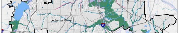
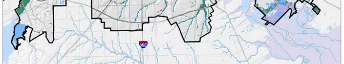
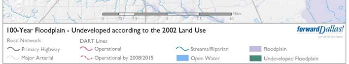
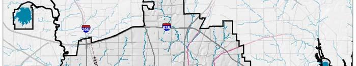
46 Desired Results Reduced automobile trips Improved air quality Increased transit ridership Street environments that support alternative modes of transportation and respond to the character of the area through which they pass 46


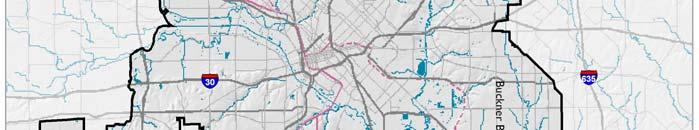
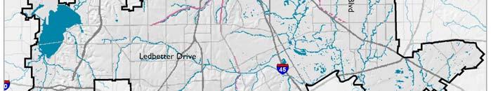
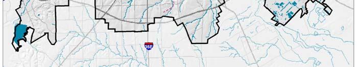
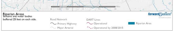
47 Urban Design Element Establishes urban design policies tied to Vision building blocks Encourages walkable convenience Encourages architecture that responds to the surrounding community in context and scale Jefferson Blvd Visualization 47
48 48
49 Key Policies for Urban Design Develop walk to convenience in urban neighborhoods Land Use Density Connectivity Amenity Consideration given to context and scale of neighborhoods when developing commercial/retail edges Gateways and neighborhood identity are reflected and enhanced through the built environment 49
50 Desired Results Quality development standards that: Encourage private investment Sustains property value Mitigates opposition to development Good urban design creates an atmosphere of public safety and civic pride Create a consistent and predictable approach to quality development 50

51 Environment Element Establishes policies related to water quality and watersheds, urban tree canopy, open space and energy efficiency Provides basis for future updates of the Renaissance Plan to provide for open space and recreational needs to meet growth targets 51
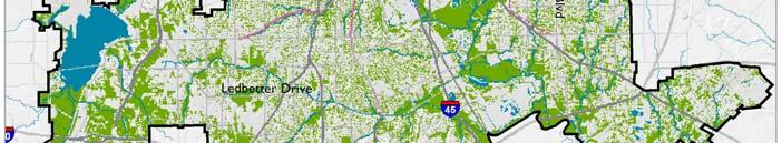
52 Impervious Surface 52


53 Natural Areas and Urban Tree Canopy Coverage 53
54 100 Year Floodplain 54

55 Riparian Areas 55
56 Key Policies for the Environment Protect Water Quality and Watersheds Protect and enhance floodplain and riparian areas Embrace Green Storm Drainage Practices Increase vegetation and shading of waterways Increase Tree Canopy Promote Energy Efficiency Protect Open Space Plan for Future Parks Maintain Important Vistas and Views 56
57 Desired Results Improved efforts to plant and protect trees reduce heat island and improve air quality Establish development practices that are sensitive to the environment improve water quality and reduce flooding Fully implement the Trinity River Plan 57


58 Neighborhoods Element Promotes and protects the enduring value of Dallas successful neighborhoods: Encourages and supports neighborhood participation in land use and quality of life decisions Encourages historic preservation and development standards that are sensitive to neighborhood scale and character Provides the basis for an update of the 1987 Dallas Preservation Plan 58
59 Desired Results for Neighborhoods Clean, safe neighborhoods with quality schools Expanded opportunities and choices for all Dallas citizens Strong neighborhoods promote positive community image and civic participation The enduring value of Dallas successful neighborhoods is promoted and protected through quality development standards 59


60 3rd Component The Implementation Plan 60
61 Implementation Plan Projects for implementation prioritized by: 5 to 7-year implementation items 2-year action items Provides for annual update in coordination with budget and bond program cycles 61
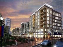
62 Selection of Plans Target areas with the potential to deliver results Address key action items in a quick and effective manner Create outcome oriented plans with key targets and actions identified Implement a performance management system that monitors results and responds to mid-course corrections 62
63 Implementation Programs Market-tested Mixed Use Zoning Districts Urban Design Standards for Walkability Urban Parking Standards CSD Implementation Program Ailing Multifamily Stabilization Program Non-traditional Home Ownership Programs Neighborhood Association Program Economic Development Programs for Targeted Industries 2-year Action Items are shown in red 63


64 Implementation Area Plans Stemmons / Medical District UNT Campus Area DART Station Area: Westmoreland Southport / Agile Port Area Downtown Streetcar Trinity River Corridor Vickery Meadow Lancaster Corridor Cedars/Farmer s Market Asian Trade District Skillman Street Love Field Transit Connection 2-year Action Items are shown in red 64
65 This Presentation will focus on 3 areas as examples Examples of the integrated nature of Forward Dallas Each area implements all 7 elements of the Plan Methodology guarantees local involvement Includes economic testing and capital needs financing mechanism 65
66 Stemmons Corridor/Southwest Medical District Southwestern Medical Center Area 66
67 Area Advantages Medical sector is a targeted industry Major redevelopment potential Mixed use housing potential Transit oriented development potential Initiative and leadership from within area Major transformation possible 67

68 Proposed District 68
69 Potential for Old Trinity Trail 69

70 Design District Vision 70

71 SW Medical District Vision 71
72 Outcomes 50,000 new jobs 22,000 new homes Revitalized economic driver for Dallas City can play a facilitation and leadership role 72

73 Example: DART Station 73
74 Currently Declining 74

75 WESTMORELAND WORKSHOP CONCEPT PLAN 100+ acres with direct access to DART Station 19 congestion free minutes to downtown Large parcels, low value Good infrastructure Good area for new small business Active local housing market Active and engaged local neighborhood 75
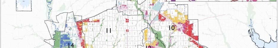
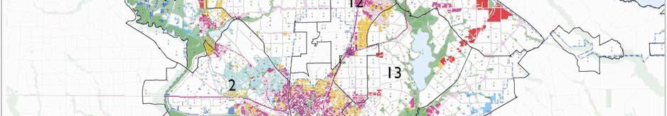
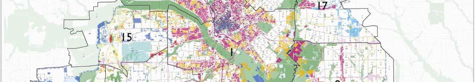
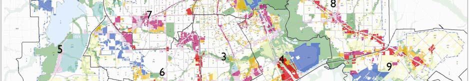
76 Outcomes New mixed income, mixed use neighborhood Strong Growth Forecasts Increased Property Value Walkable Neighborhood prototype Sustainable Development Demonstration Project 76

77 Downtown Dallas Streetcar Feasibility Study Coordinate with DART MIS Study Focus on Redevelopment Looks at Non-DART funding and operations 12 month timeline - focus on implementation 77


78 Learn from other Streetcar Portland, Seattle, Miami, Atlanta Focus on Redevelopment Not regional systems Intended to improve a small area Often paid for by a variety of funds Implemented rapidly Systems 78


79 Can be used to spread redevelopment to new areas Most of Northern Downtown is in parking lots and low rise buildings Ross Avenue 79
80 Downtown Dallas

81 Downtown Dallas
82 Desired Results of Implementation Plan Shovel-ready sites in key areas for developments that are compatible with the Forward Dallas! Vision Ready-to-use programs and tools that can be used to address common issues across the City Closely integrated transportation and land use coordination program to implement context sensitive street design 82
83 4 th th Component: Performance Management System that monitors progress toward goals Establishes a tracking system for key growth indicators relative to Year 2000 base, Year 2005 milestone and Year 2030 target Provides basis for annual or bi-annual reports and periodic target and implementation adjustments 83
84 Monitoring Areas Map 84
85 Key Monitoring Data Currently Under Development Example: Planning Area Households Total Employment Industrial Jobs Office Jobs Retail Jobs
86 Next Steps Continue public outreach effort Modify draft through public input process Begin Plan Commission and Council review process 86
87 Schedule 2006 Advisory Committee Weekly Work Sessions Jan Mar Council Briefing Feb 15 Media Briefing Feb 16 Public Meetings Feb 23 & 27 CPC Briefings/Hearings Mar 2, 9 & 23 Council Briefing Apr 5 87
88 ForwardDallas! Comprehensive Plan City Council Briefing February 15,
Economic Development & Housing Council Committee Comprehensive Plan Update September 20, 2005
 1 Economic Development & Housing Council Committee Comprehensive Plan Update September 20, 2005 Purpose To update the Committee on the ForwardDallas! Plan, including: Status Anticipated Products Public
The Trinity River Corridor, offering Dallas areas of natural
 IMPLEMENTATION PLAN FOR THE TRINITY RIVER CORRIDOR The Trinity River Corridor, offering Dallas areas of natural beauty and untapped potential, runs through the heart of the city. Proposed improvements
Plano Tomorrow Vision and Policies
 Plano Tomorrow Vision and Policies PLANO TOMORROW PILLARS The Built Environment The Social Environment The Natural Environment The Economic Environment Land Use and Urban Design Transportation Housing
Concord Community Reuse Project Goals and Guiding Principles. Overarching Goals (OG)
") Concord Community Reuse Project Goals and Guiding Principles Overarching Goals (OG) No priority is implied by the order of presentation of the goals and guiding principles. Overarching goals for the Concord
Concord Community Reuse Project Goals and Guiding Principles Overarching Goals (OG) No priority is implied by the order of presentation of the goals and guiding principles. Overarching goals for the Concord
New Partners for Smart Growth Conference February 5, 2010
 Dan Stroh, Planning Director City of Bellevue Planning and Community Development Bellevue, WA New Partners for Smart Growth Conference February 5, 2010 Summary of Project Long-range plan update for Bel-Red
BUDGETING FOR OUTCOMES TRINITY RIVER CORRIDOR
 BUDGETING FOR OUTCOMES TRINITY RIVER CORRIDOR Trinity River Corridor Team Members: Kelly High, Streets Department Megan Lam, Office of Financial Services Mike Mikeska, Dallas Water Utilities Diana Ochoa,
The Five Components of the McLoughlin Area Plan
 The Five Components of the McLoughlin Area Plan This documents contains the complete language of the five components of the McLoughlin Area Plan: The Vision Statement The Values The Guiding Principles
Blueprint Denver A BLUEPRINT FOR AN INCLUSIVE CITY. Executive Summary
 Blueprint Denver A BLUEPRINT FOR AN INCLUSIVE CITY Executive Summary PUBLIC REVIEW DRAFT 2 1/7/2019 DENVERIGHT BLUEPRINTDENVER Blueprint Denver: A Blueprint for an Inclusive City An Equitable City Planning
forwarddallas! Sunrise over White Rock Lake by Dahlia Woods forwarddallas! Vision THE VISION I-1
 forwarddallas! Comprehensive plan V I S I O N Sunrise over White Rock Lake by Dahlia Woods CITY OF DALLAS ADOPTED JUNE 2006 forwarddallas! Vision THE VISION I-1 The future of Dallas is in your hands. The
D-O LRT Zoning Discussion. Chapel Hill Boards & Commissions October 16, 2017
 D-O LRT Zoning Discussion Chapel Hill Boards & Commissions October 16, 2017 Update on Overall D-O LRT Station Area Initiative Objectives Design and educate on principles of Good Transit-Oriented Development
2040 LUP is a part of the Comprehensive Plan and carries the same legal authority. Economic Challenges
 1.1. Guiding Anchorage s Growth Where will new residents settle over the next two decades? Where will people work, shop, and play? Will there be enough room to grow? How will Anchorage look? Will growth
Atlanta BeltLine Corridor Environmental Study. Scoping Meeting August 2008
 Atlanta BeltLine Corridor Environmental Study Scoping Meeting August 2008 What Will We Be Discussing Today? Study Overview - How Did We Get Here? - What Is the Study About? - Who Is Involved? - Where Is
Gold Line Bus Rapid Transit Transit Oriented Development (BRTOD) Helmo Station Area Plan
 Helmo Station Area Plan") Appendix F Gold Line Bus Rapid Transit Transit Oriented Development (BRTOD) Helmo Station Area Plan Introduction and Purpose of the Plan The Gold Line Bus Rapid Transit facility is an eleven-mile dedicated
Appendix F Gold Line Bus Rapid Transit Transit Oriented Development (BRTOD) Helmo Station Area Plan Introduction and Purpose of the Plan The Gold Line Bus Rapid Transit facility is an eleven-mile dedicated
Implementation Guide Comprehensive Plan City of Allen
 Implementation Guide 2030 Comprehensive Plan City of Allen DRAFT 2015 Implementation Guide Allen 2030 Comprehensive Plan INTRODUCTION The Comprehensive Plan serves as a guide for the growth and development
Preliminary Plan Framework: Vision and Goals
 Preliminary Plan Framework: Vision and Goals Draft: May 2015 Introduction Since the Town of Milliken s comprehensive plan was last updated in 2010, the community was heavily impacted by the 2013 flood,
EXECUTIVE SUMMARY DRAFT CHAPTER 1 INTRODUCTION EXECUTIVE SUMMARY
 CHAPTER 1 EXECUTIVE SUMMARY INTRODUCTION Through the joint efforts of the City of Tulsa planning staff and the Land Services division of Indian Nations Council of Governments (INCOG), the Berryhill Land
In the heart of the Southern Sector is a diamond in the rough
 WESTMORELAND DART STATION AREA PLAN Map III-2.24 The Westmoreland DART Station Area In the heart of the Southern Sector is a diamond in the rough the Westmoreland Transit Station. This DART station, near
TOWN OF NEW CASTLE - Master Plan Update
 Our Presentation Today (1) Recap the Master Planning Process To Date (2) Present the Outline of the Master Planning Work Plan (3) Present the Calendar for the Master Plan (4) Outline the scope of a Downtown
The proposed programs address issues identified by Dallas
 IMPLEMENTATION PROJECTS The proposed programs address issues identified by Dallas citizens and the development community. Some programs are specific to Dallas and its planning regulations; others involve
International Blvd. TOD Plan Public Workshop #1
 International Blvd. TOD Plan Public Workshop #1 Add photos or project images September 21 and 22, 2010 Workshop Purpose Introduce the public to the Project Review and discuss the existing conditions analysis
CHAPTER 3 VISION, GOALS, & PLANNING PRINCIPLES. City of Greensburg Comprehensive Plan. Introduction. Vision Statement. Growth Management Goals.
 CHAPTER 3 VISION, GOALS, & PLANNING PRINCIPLES Introduction The Greensburg Comprehensive Plan is intended as a working community document. A combination of long and short-term goals, this document is intended
SAN RAFAEL GENERAL PLAN 2040 INTRODUCTION AND OVERVIEW
 SAN RAFAEL GENERAL PLAN 2040 INTRODUCTION AND OVERVIEW Steering Committee Presentation February 14, 2018 Purpose of General Plan Guide land use and development decisions Coordinate transportation, infrastructure,
A. WHAT IS A GENERAL PLAN?
 I. Introduction A. WHAT IS A GENERAL PLAN? A general plan is the planning guideline for the future of a city. It contains goals and policies which regulate urban development, the protection of the natural
Status Update (2006 vs. Now) Citizen s Advisory Committee February Plan for Prosperity
 Citizen s Advisory Committee February Plan for Prosperity") Status Update (2006 vs. Now) Citizen s Advisory Committee February 2018 Plan for Prosperity 2000 2017 2000 2017 Gardnerville Population 6,000 5,760 5746 5,500 5,000 5,067 5,550 5,165 5,394 5,412 5,250
Status Update (2006 vs. Now) Citizen s Advisory Committee February 2018 Plan for Prosperity 2000 2017 2000 2017 Gardnerville Population 6,000 5,760 5746 5,500 5,000 5,067 5,550 5,165 5,394 5,412 5,250
Q:%4~ Memorandum CITY OF DALLAS
 Memorandum DATE December 10, 2010 CITY OF DALLAS TO Members of the Transportation and Environment Committee: Linda Koop (Chair), Sheflie Kadane (Vice Chair), Pauline Medrano, Vonciel Jones Hill, Jerry
Visioning Statement and Guiding Principles
 Visioning Statement and Guiding Principles Planning for the Future The General Plan The General Plan represents Woodland's shared vision of the future and defines a path to lead the community toward its
East Central Area Plan
 East Central Area Plan Steering Committee Meeting January 10 th, 2019 Tears-McFarlane House Community Room East Central Area Plan Steering Committee Meeting January 10 th, 2019 CHUN Tears-McFarlane House
RE-Imagining the Downtown Colorado Springs Master Plan
 RE-Imagining the Downtown Colorado Springs Master Plan 2016 APA Colorado State Conference October 25, 2016 Overview 8:00 Welcome, Introductions, and Overview 8:15 Downtown s Planning History 8:30 A Market
Sustainability, Health, Safety, Recreation & Open Space Working Group August 3, 2017
 Sustainability, Health, Safety, Recreation & Open Space Working Group August 3, 2017 DOWNTOWN OAKLAND SPECIFIC PLAN WELCOME Sustainability, Health, Safety, Recreation & Open Space Working Group Social
Joint Meeting City Council and the Plan Commission. September 1st, 2015
 Joint Meeting City Council and the Plan Commission September 1st, 2015 1 The City Plan Commission shall recommend a City Plan for the physical development of the City Article IX Section 2 of the City of
Broken Arrow Comprehensive Plan Update Public Workshop Meeting #3 January 23,
 Broken Arrow Comprehensive Plan Update Public Workshop Meeting #3 January 23, September 25,2018 2018 26 April 2016 AGENDA 1. Status Presentation - Charrette Recap - Proposed Vision Framework - Preliminary
DALY CITY VISIONING PROCESS COMMUNITY WORKSHOP 3 MAY 8, 2008
 DALY CITY VISIONING PROCESS COMMUNITY WORKSHOP 3 MAY 8, 2008 PROCESS General Plan - a statement of the community s values, vision and aspirations for now and into the future... Timeframe LONG TERM - 2030
Scope of Services. River Oaks Boulevard (SH 183) Corridor Master Plan
 Corridor Master Plan") Scope of Services River Oaks Boulevard (SH 183) Corridor Master Plan PROJECT AREA The project area consists of the River Oaks Boulevard (SH 183) corridor bounded by SH 199 at the northern end and the Trinity
Scope of Services River Oaks Boulevard (SH 183) Corridor Master Plan PROJECT AREA The project area consists of the River Oaks Boulevard (SH 183) corridor bounded by SH 199 at the northern end and the Trinity
City of Long Beach. creating vibrant and exciting places
 City of Long Beach creating vibrant and exciting places Land Use Element Urban Design Element Overview of the two draft General Plan elements Discuss areas of change Economic goals of the plans Case study
III. Design Principles
 III. Design Principles The design of Bay Meadows Phase II has been guided by a series of Urban Design Principles. These principles, informed by consultant site analysis, City staff recommendations, and
Create Policy Options Draft Plan Plan Approval. Public Consultation Events. Phase 2
 Background Grandview-Woodland Community Plan In the spring of 2012, the City of Vancouver embarked on a comprehensive community planning program in the Grandview-Woodland neighbourhood. The process has
Silverdale Regional Center
 Silverdale Regional Center Vision for Silverdale Regional Center The Silverdale Regional Center Plan (Plan) will guide the evolution of the Silverdale Regional Center from a collection of strip malls and
PLAN ELEMENTS WORKSHOP. April 5, 2016
 PLAN ELEMENTS WORKSHOP April 5, 2016 needs more housing. But there is no one-size fits-all solution. Every neighborhood has its own character. In some places, density is not only appropriate it is badly
FOUR MILE RUN VALLEY WORKING GROUP AND CHARGE
 FOUR MILE RUN VALLEY WORKING GROUP AND CHARGE Adopted April 16, 2016 Amended July 19, 2016 Overview of Integrated Effort The overall goal of the Four Mile Run Valley (4MRV) initiative is to develop a comprehensive
Guiding Principles, Objectives, Strategies and Policies
 Guiding Principles, Objectives, Strategies and Policies Section 1 Introduction These Guiding Principles were adopted as part of the 1999 Athens-Clarke County Comprehensive Plan and are carried over, in
CITY OF COLWICH COMPREHENSIVE PLAN LAND USE LAND USE 1
 LAND USE LAND USE 1 WHAT YOU WILL FIND IN THIS CHAPTER: Discussion of today s conditions and tomorrow s projections Discussion of challenges and opportunities Discussion of the environmental quality goals,
Blueprint Denver Task Force Meeting #
 Blueprint Denver Task Force Meeting #1 6.23.16 1. Welcome and Introductions Your name and affiliation Name 1 thing you love about Denver Name 1 thing you d change about Denver All in 30 seconds! Ready,
NORTH CLAYMONT AREA MASTER PLAN COMMUNITY WORKSHOP #1 FEBRUARY 3, 2016
 NORTH CLAYMONT AREA MASTER PLAN COMMUNITY WORKSHOP #1 FEBRUARY 3, 2016 1. Introduction To the team and to the Plan Planning Partners The Claymont Community WILMAPCO New Castle County Claymont Renaissance
East Central Area Plan
 East Central Area Plan Steering Committee Meeting March 8 th, 2018 CHUN Tears McFarlane House Vision Statement Development Opportunities Analysis Vision Elements 1. Equitable, Affordable and Inclusive
Corridor Vision. 1Pursue Minnehaha-Hiawatha Community Works Project. Mission of Hennepin County Community Works Program
 1Pursue Minnehaha-Hiawatha Community Works Project Minnehaha-Hiawatha Community Works is a project within the Hennepin Community Works (HCW) program. The mission of the HCW program is to enhance how the
Preliminary Recommendations Tk Takoma/Langley Crossroads Sector Plan
 Preliminary Recommendations Tk Takoma/Langley Crossroads Sector Plan Vision is to achieve a Transit Oriented, pedestrian friendly Community that Celebrates and builds upon the cultural Diversity of the
3. VISION AND GOALS. Vision Statement. Goals, Objectives and Policies
 Vision Statement Queen Creek s interconnected network of parks, trails, open spaces and recreation opportunities provide safe and diverse activities and programs that sustain its unique, small town, equestrian
North Fair Oaks Community Plan Summary and Information
 North Fair Oaks Community Plan Summary and Information WHAT IS THE NORTH FAIR OAKS COMMUNITY PLAN? The North Fair Oaks Community Plan is part of the San Mateo County General Plan, and establishes policies
12/9/2013. HOLLYWOOD/PINES CORRIDOR PROJECT AMPO 2013 Annual Conference October 24, Our Perspective. Broward.
 HOLLYWOOD/PINES CORRIDOR PROJECT AMPO 2013 Annual Conference October 24, 2013 Our Perspective Broward Fort Lauderdale 1 Broward Metropolitan Planning Organization Fort Lauderdale Fort Lauderdale Skyline
EXISTING COMPREHENSIVE PLAN
 EXISTING COMPREHENSIVE PLAN Town Center Land Use Element: V. LAND USE POLICIES Town Center Mercer Island's business district vision as described in "Your Mercer Island Citizen-Designed Downtown" was an
ELK GROVE GENERAL PLAN VISION
 2-1 CHAPTER 2: 2-2 CREATING OUR The Community Vision for Elk Grove, expressed through a Vision Statement and a series of Supporting Principles, is a declaration of the kind of community that Elk Grove
8implementation. strategies
 PROGRAM STRATEGIES 8implementation strategies T he implementation actions of this chapter are designed to support and carry out the land use, economic development, transportation, urban design, and program
JANUARY 19, 2011 CENTRAL AVENUE-METRO BLUE LINE TRANSIT-ORIENTED DEVELOPMENT IMPLEMENTATION PROJECT COMMUNITY FORUM
 CENTRAL AVENUE-METRO BLUE LINE TRANSIT-ORIENTED DEVELOPMENT IMPLEMENTATION PROJECT COMMUNITY FORUM JANUARY 19, 2011 THE MARYLAND-NATIONAL CAPITAL PARK AND PLANNING COMMISSION PRINCE GEORGE S COUNTY PLANNING
A BLUEPRINT FOR BROCKTON A CITY-WIDE COMPREHENSIVE PLAN
 A BLUEPRINT FOR BROCKTON A CITY-WIDE COMPREHENSIVE PLAN Public Meeting October 2016 1 Plan Summary and Discussion Public Meeting May 4 2017 City of Brockton Bill Carpenter, Mayor Department of Planning
1 Introduction. 4 Environmental Integrity. 7 Community Facilities
 2037: A CALL TO ACTION 2017 COMPREHENSIVE PLAN EXECUTIVE SUMMARY is the purpose of the Q: What Comprehensive Plan? The comprehensive plan serves as a guide for the community s physical, social, and economic
TEMPLE MEDICAL & EDUCATION DISTRICT
 City of Temple, Texas TEMPLE MEDICAL & EDUCATION DISTRICT 1 Description. The City of Temple joined in partnership with key public and private entities to jointly promote education and medical activities
SECTION ONE: INTRODUCTION. introduction
 introduction 1 INTRODUCTION Since it was first established in 1843 as a trading post for the Hudson s Bay Company, Victoria has evolved into a Provincial capital city that is recognized across Canada and
WELCOME and introduction
 1 WELCOME and introduction Mobility Hub Locations within Burlington STUDY OVERVIEW STUDY OBJECTIVES The City of Burlington is developing four Area Specific Plans, one for each of Burlington s Mobility
7Page 1 CLEMMONS COMMUNITY COMPASS 1 PLAN OVERVIEW
 1 Plan Overview WHAT IS I THE CLEMMONS COMMUNITY COMPASS? The Clemmons Community Compass is our community s comprehensive plan. It serves as our blueprint and provides direction for the future of the Village
TRANSPORTATION ELEMENT GOALS, OBJECTIVES, AND POLICIES
 TRANSPORTATION ELEMENT GOALS, OBJECTIVES, AND POLICIES GOAL 2 The City shall provide a safe, convenient, effective, and energy efficient multimodal transportation system which is coordinated with the Future
Cumberland Region Tomorrow is a private, non-profit, citizen based regional organization working with Greater Nashville Regional Council
 Cumberland Region Tomorrow is a private, non-profit, citizen based regional organization working with Greater Nashville Regional Council and others in the public and private sectors, dedicated to planning
Mobility Districts and Traffic Studies
 Mobility Districts and Traffic Studies During the last Comprehensive Plan update in 2008, the City of Sarasota identified the need to develop a citywide strategy for enhancing the mobility options of all
TOD 101 CREATING LIVABLE COMMUNITIES WITH TRANSIT
 1 CREATING LIVABLE COMMUNITIES WITH TRANSIT What are transit Centered Communities? Benefits of Partnerships to Support and Implement What You Will Learn Portland s Pearl District Your Trainers Today Catherine
Draft Cary Community Plan Review Part 3: Shop, Engage, Serve, Special Area Plans, Other Updates. October 27, 2015 Police Department Training Room
 Draft Cary Community Plan Review Part 3: Shop, Engage, Serve, Special Area Plans, Other Updates Committee for the Future October 27, 2015 Police Department Training Room AGENDA 1. Welcome and Call to Order
FUNDING CORRIDOR REVITALIZATION
 FUNDING CORRIDOR REVITALIZATION Integrated corridor planning for the 21 st Century America Planning Association Annual Conference Atlanta, GA April 27, 2014 Mariia Zimmerman, MZ Strategies, LLC mariia@mzstrategies.com
4.1.3 LAND USE CATEGORIES
 4.1.3 LAND USE CATEGORIES a. City Center District The City Center District incorporates the existing character and mix of uses in downtown Belmont to encourage redevelopment and new development in keeping
S C O P E O F W O R K A P R I L
 white flint 2 sector plan S C O P E O F W O R K A P R I L 2 0 1 2 MONTGOMERY COUNTY PLANNING DEPARTMENT M-NCPPC MontgomeryPlanning.org 1 white flint 2 sector plan Scope of Work abstract This scope of work
Planned Residential Neighborhoods Land Use Goals
 Planned Residential Neighborhoods Land Use Goals Issue: Guidelines that provide for diverse high quality residential areas that include a variety of housing styles and layouts are needed. Goal 1: Create
Issues Requiring Future Study
 Issues Requiring Future Study Transportation planning is an ongoing process that tends to identify new issues as it finds solutions for others. Some issues are so complex that a solution to one problem
Section 4 BUILDING THE MASTER PLAN
 The Master Plan 33 Section 4 BUILDING THE MASTER PLAN Figure 4:1. A collaborative effort characterized the two design workshops sponsored by DISC to create hypothetical Master Plans for the Towers Property
LAND USE OVERVIEW WHAT YOU WILL FIND IN THIS CHAPTER
 LAND USE WHAT YOU WILL FIND IN THIS CHAPTER Information about the City s expected population and employment growth. Description and capacity of existing and future land use designations. Policies that
Ivywild On The Creek PRELIMINARY CREEK DISTRICT MASTER PLAN
 Ivywild On The Creek PRELIMINARY CREEK DISTRICT MASTER PLAN Introduction: Rejuvenating an extraordinary Creekside neighborhood THE CREEKSIDE DISTRICT The Ivywild On The Creek Neighborhood District Master
CDAC. Update: Downtown Dartmouth Update: CDAC July 25 th Motion
 CDAC Update: Downtown Dartmouth Update: CDAC July 25 th Motion 2018-10-24 Downtown Dartmouth Plan Open House October 22, 2018 6:00 pm Open House 6:30 pm Presentation + Q&A 7:20 pm Open House 8:30 pm Close
ROBBINSDALE LRT STATION CDI DEVELOPMENT GUIDELINES
 August 2018 OVERVIEW The City of Robbinsdale has a prime-opportunity site in the middle of the 13 mile stretch of the Bottineau LRT corridor / Blue Line extension. Robbinsdale offers a prominent, vital,
City of Tacoma Planning and Development Services
 Agenda Item E-1 City of Tacoma Planning and Development Services To: Planning Commission From: Elliott Barnett, Planning Services Division Subject: Tacoma Mall Regional Center Subarea Plan and EIS Meeting
The transportation system in a community is an
 7 TRANSPORTATION The transportation system in a community is an important factor contributing to the quality of life of the residents. Without a sound transportation system to bring both goods and patrons
Robbinsdale LRT Station. CDI Development Guidelines. August Overview
 Robbinsdale LRT Station August 2018 Overview The City of Robbinsdale may have the coolest opportunity site along the 13 mile stretch of the Bottineau LRT corridor / Blue Line extension. Located a block
Chapter 1: Introduction
 Chapter 1: Introduction The Penn Avenue Community Works Corridor Vision and Implementation Framework presents an integrated communitybased vision and a coordinated, long-term implementation framework for
Hopkins. Development Guidelines May Overview. Sponsored by: Blake Road Corridor Collaborative City of Hopkins
 Hopkins Blake Road LRT Station Area Development Guidelines May 2015 Sponsored by: Blake Road Corridor Collaborative City of Hopkins Overview Hopkins is a dynamic community of over 17,000 residents located
Enhancing Community. Establishing Place.
 Enhancing Community. Establishing Place. Draft Version 12/27/2017 ii ENVISION OAK POINT DECEMBER 2017 ENVISION OAK POINT Table of Contents 01 1 02 Community Vision 11 03 Implementation 29 04 Recommendations
RECOMMENDED GOALS, CONCEPTS, GUIDELINES PUBLIC PARTICIPATION PROGRAM
 2015 RECOMMENDED GOALS, CONCEPTS, GUIDELINES PUBLIC PARTICIPATION PROGRAM THE MARYLAND-NATIONAL CAPITAL PARK AND PLANNING COMMISSION PRINCE GEORGE S COUNTY PLANNING DEPARTMENT SEPTEMBER 24, 2015 INTRODUCTION
Plan Overview. Manhattan Area 2035 Reflections and Progress. Chapter 1: Introduction. Background
 Plan Overview The Manhattan Urban Area Comprehensive Plan (the Comprehensive Plan) is a joint planning initiative of the City of Manhattan, Pottawatomie County, and Riley County. The 2014 Comprehensive
Chapter 1.0 Introduction
 Chapter 1.0 Introduction 1.1 Background The North Metro commuter rail line is part of the RTD FasTracks regional transit system expansion program to build more than 100 miles of rail transit throughout
TORTI GALLAS and partners, inc. How to Retrofit Your Suburb to Make a Downtown
 How to Retrofit Your Suburb to Make a Downtown April, 2010 Where to Start What should the Town look like? How do I attract new residents, businesses and visitors?? Should we preserve our heritage? How
CHAPTER 7: VISION AND ACTION STATEMENTS. Noble 2025 Vision Statement
 CHAPTER 7: VISION AND ACTION STATEMENTS This chapter presents the vision, policy and action statements that transform the comprehensive planning study, an analysis of Noble s past, future trends and community
Description of Preferred Alternative
 Chapter 2 Description of Preferred Alternative 2.1 Introduction This chapter of the programmatic Sammamish Town Center Sub-area Plan Final EIS provides a more detailed description of the Preferred Alternative
ITEM #8. Regional Smart Growth Program. Regional Smart Growth Program. Presentation Overview. Coast Highway Vision and Stategic Plan.
 Regional Smart Growth Program Economic Development Commission What is Smart Growth? Adopted as part of the Regional Comprehensive Plan (RCP) RCP provides vision for region based on Smart Growth and sustainability
Welcome to the Oakridge Centre Open House
 Welcome to the Oakridge Centre Open House Why is the City hosting this event? This open house is to inform you of a rezoning application submitted to the City of Vancouver to amend the existing CD-1 (Comprehensive
Public Open House. Overview of the Downtown Plan Official Plan Amendment April 23, 2018
 Public Open House Overview of the Downtown Plan Official Plan Amendment April 23, 2018 1 A 25-Year Plan for Downtown To ensure growth contributes positively to Toronto s Downtown as a great place to live,
Hockessin Community Redevelopment Plan
 Hockessin Community Redevelopment Plan 3.1 Introduction The Community Redevelopment Plan for the Village of Hockessin is the result of the people s vision for a distinct village center that serves as the
Table L-1 Summary Action Strategy. Action Item Timing Status Responsible Agency
 CHAPTER 4: CIRCULATION ELEMENT ISSUE #1: MAJOR THOROUFARES AND TRANSPORTATION ROUTES A balanced transportation system for Fontana is provided that meets the mobility needs of current and future residents
Good Neighbor Plan Dallas Love Field Airport Transportation and Environment Committee
 June 25, 2012 Good Neighbor Plan Dallas Love Field Airport Transportation and Environment Committee Overview Vision for Dallas Love Field Downtown Dallas 360 Plan Targeted Improvement Zones Lemmon Avenue
MALL REVITALIZATION CASE STUDIES
 MALL REVITALIZATION CASE STUDIES DECEMBER 9, 2012 MALL REVITALIZATION OVERVIEW Introduction Sample Case Studies prepared for Lacey Woodland District Steering Committee as it considers strategies to revitalize
CHAPTER 7: Transportation, Mobility and Circulation
 AGLE AREA COMMUNITY Plan CHAPTER 7 CHAPTER 7: Transportation, Mobility and Circulation Transportation, Mobility and Circulation The purpose of the Transportation, Mobility and Circulation Chapter is to
DRAFT. 10% Common Open Space
 % OF CHARLOTTE IS CATEGORIZED AS A. LAND USES : Placeholder map displaying location of Place Type GOALS: Accommodate XX% of future growth. Provide a concentration of primarily commercial and civic activity
Transportation Land Use Integration & Regional Planning. Don Kostelec, AICP Senior Planner, Louis Berger Group February 1, 2010
 Transportation Land Use Integration & Regional Planning Don Kostelec, AICP Senior Planner, Louis Berger Group February 1, 2010 Transportation Land Use Integration DOT-HUD-EPA Sustainable Communities Initiative
NEW YORK AND CONNECTICUT SUSTAINABLE COMMUNITIES. Fair Housing & Equity Assessment & Regional Planning Enhancement
 NEW YORK AND CONNECTICUT SUSTAINABLE COMMUNITIES Fair Housing & Equity Assessment & Regional Planning Enhancement November 12, 2013 Yonkers Public Library Federal grant to improve regional planning to
1.0 Purpose of a Secondary Plan for the Masonville Transit Village
 Report to Planning and Environment Committee To: Chair and Members Planning & Environment Committee From: John M. Fleming Managing Director, Planning and City Planner Subject: Masonville Transit Village
ELMVALE ACRES SHOPPING CENTRE MASTER PLAN
 ELMVALE ACRES SHOPPING CENTRE MASTER PLAN Contents 1.0 INTRODUCTION... 2 2.0 LOCATION... 2 3.0 EXISTING CONTEXT... 2 4.0 VISION & GUIDING PRINCIPLES... 2 5.0 LAND USE AND BUILT FORM... 4 5.1 St. Laurent
Port Lavaca Future Land Use
 Port Lavaca Future Land Use Introduction The City of Port Lavaca is beginning to see sustained growth, after many years of relative stable population. New single family homes, apartments, and businesses