Innovative Land Use Techniques
|
|
|
- Bryan Lindsey
- 5 years ago
- Views:
Transcription


1 Innovative Land Use Techniques A Handbook for Sustainable Development Eric Williams, Assistant Administrator, NHDES Carolyn Russell, Principal Planner, NHDES Cliff Sinnott, Executive Director, RPC Jill Robinson, Senior Planner, RPC
 A brief history The 2-Year Plan")

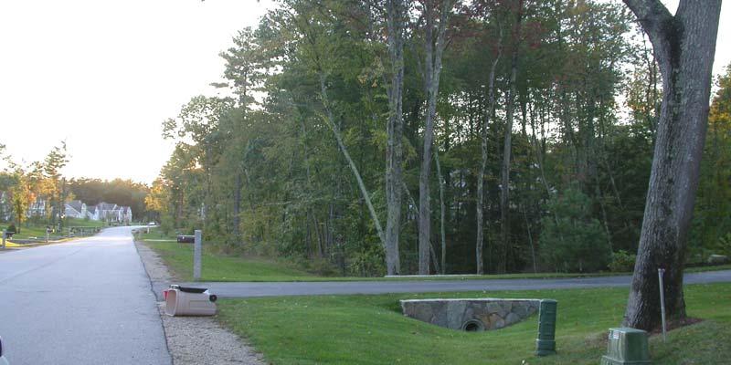
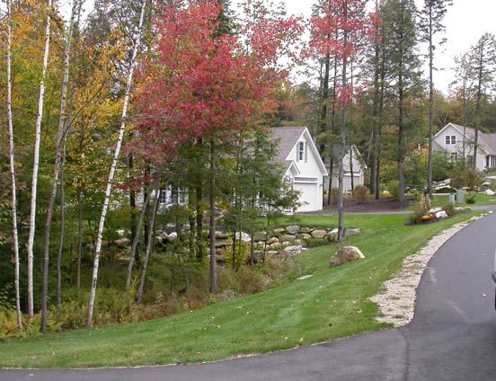
2 REPP (Regional Environmental Planning Program) A brief history The 2-Year Plan for the ILU Guide Focus on direct assistance to Towns Photo Credit: Dan Habib/The Concord Monitor


3 Innovative Land Use Techniques: A Handbook for Sustainable Development Concept Provide guidance and on 674:21 Handbook reference tool Collaborative Effort


4 Dealing with growth Why Develop the Innovative Land Use Guide?

5 Landscape Change


6 Water Quality

7 Changing Pattern of Development Pre-development
8 Suburban Development
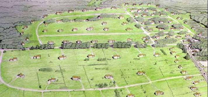
9 Conventional Suburban Subdivision
10 Post-Development


11 Paved Surfaces Change Where Water Flows 10% 55% 50% 15%
12 Waterway Health & Imperviousness WATERSHED IMPERVIOUSNESS (%) ADAPTED FROM SCHUELER, ET. AL., 1992 STREAM DEGRADATION DEGRADED IMPACTED PROTECTED

13 ILU Guide Contents 1. Multi-Density Zoning 2. Environmental Characteristics Zoning 3. Site-Level Design


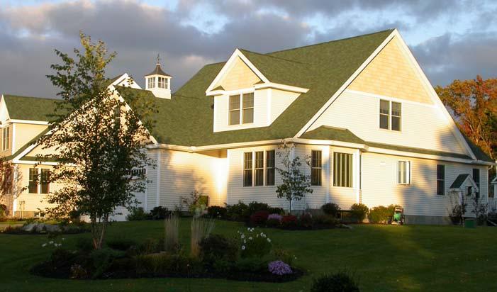
14 ILU Guide Contents 1. Multi-Density Zoning Transfer of Development Rights Innovative Density Regulations Conservation Subdivision Village Plan Alternative Infill Development Inclusionary Housing Growth Boundaries Photo Credit: Dan Habib/Concord Monitor

15 ILU Guide Contents 2. Environmental Characteristics Zoning Stormwater Management Ridgeline/Steep Slopes Development Wildlife Habitat Management Water Resources Protection: Wetlands Drinking water Shoreline and riparian areas Floodplains Erosion and sediment control

16 ILU Guide Contents 3. Site-Level Design Transit-oriented Development Livable/Walkable Design Access Management Dark Skies Lighting Energy-efficient Development Landscaping Regulations
17 General Chapter Outline I. Background and Purpose II. Appropriate Circumstances and Context for Use III. Legal Basis and Considerations IV. Examples V. Model Ordinance
18 Chapters for Today Steep Slopes and Ridgeline Protection Feature-based Density Lot Size Averaging Transfer of Density Rights Village Plan Alternative Conservation Subdivision


19 Steep Slopes and Ridgeline Protection Steep Slopes primarily addresses environmental concerns Ridgeline Overlay primarily addresses view protection
20 Steep Slopes Ordinance Applies to land > 15% slope Triggered by site disturbance Performance standards approach Limit cut and fill to 2:1 ratio Driveways limited to 10% max slope No structures on > 25% slope Detailed erosion control plans
21 Ridgeline Protection Based on Visual Resource Inventory Overlay zones Triggered by site disturbance Building envelopes on plans Clearing limited to building envelopes
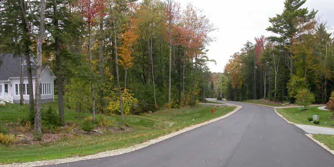
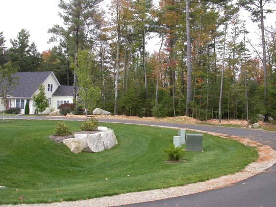
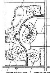
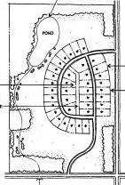
22 Building Envelope

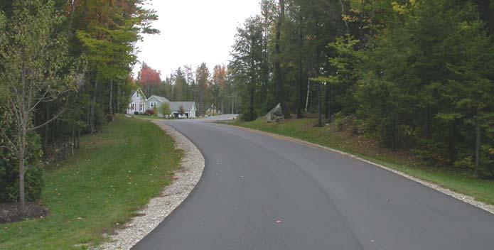
23 Clearing Limits
24 Flexible Density Feature-based Density Lot Size Averaging
25 Feature-based Density Applies to new subdivisions Need to rely on overlay districts to protect features in existing lots Developable area and overall density determined by land characteristics
26 Determination of Developable Area Physical Features on the Parcel Slopes in excess of 25% Slopes 15% - 24% 100 Year Floodplain Wetlands and Surface Waters Wetland Buffers Shoreline Buffers Deer Wintering Areas Insert your community's other priorities here. All Other Land Developable Area Adjustment deduct 100% deduct 50% deduct 100% deduct 100% no deduction no deduction 50% deduction no deduction
27 Determination of Development Density Parcel Location A. Proposed driveway or development road will access: Paved State or Class V Highway Gravel Class V Highway Substandard** Class V Highway (as identified by the Town/City) or other private B. Travel distance from the municipal building to the parcel Less than 1.5 miles 1.5 to 3 miles 3 to 5 5+ C. [Optional: Consider adding additional objectives, e.g. After adjusting for access and travel distance, the density shall be adjusted for proximity to the significant public lands listed below:] [e.g. state park land, Appalachian Trail corridor] Adjustment to Area Required for each Unit x 1 x 2 x 4 x 1 x 3 x 5 x 10 [e.g. x 2]
28 Lot Size Averaging Same approach as Conservation Subdivision Can be used for minor subdivisions Density determination for overall parcel Individual lots may vary Requires good town record-keeping
29 Density Determination Zoning District Lot Size 5-10 Acres % Deduction for roads and utilities 5% Acres 10% 1 Acre or less 15%
30 LSA before development

31 After Large Lot Zoning
32 After, with LSA Note: Only two more lots may be subdivided from this parcel


33 Density Transfer Credits A workable approach to TDR for New Hampshire
34 Village Design Jill Robinson, Ph.D. Senior Planner Rockingham Planning Commission
35 Roadmap What it is How to do it Benefits
36 Village Design: What is it? A compatible mix of uses in a village that is: Cost-efficient for a municipality, Walkable and small-scale, Protects natural resources Innovative Land Use Controls 674:21
37 Goals of Village Design Environmental: control sprawl, protect resources, reduce automobile use Civic: create neighborhoods, give freedom and mobility to senior citizens and youth Economic: reduce infrastructure and maintenance costs
38 Roadmap What it is How to do it Benefits
39 Village Design: Authority 674:21 (n) Innovative Land Use Controls Village Plan Alternative Subdivision Entire density must be located on 20 percent or less of the entire parcel Remaining land solely for agriculture, forestry, conservation or recreation
40 Three Areas in the District Village Residential Area: mix of housing types Village Conservancy Areas: greens, playing fields, woodlots Small-Scale Retail Area: retail, civic, offices, second-story residential
41 Design elements: safety, mobility, human-scale A walkable and safe neighborhood A mixed-use neighborhood for all ages Reduced setbacks, form-based code Photo courtesy of PBIC Recreation, conservation areas

42 Smaller houses, smaller lots For young families, single people, empty nesters, or retired couples Move up or downsize within same neighborhood as income and family size fluctuate
43 Roadmap What it is How to do it Benefits

44 Benefits of village design Safety Increases in social capital Lower municipal costs for services
45 Safety A sense of community is effective in reducing crime. Harvard School of Public Health study. Provide places and reasons for people to meet in their daily routines.
46 Social capital Respondents living in walkable neighborhoods were more likely to know their neighbors, participate politically, trust others, and be socially engaged. American J. of Public Health 2003, Kevin Leyden, Ph.D.

47 Good Design and Good Health 55 percent of Americans would like to walk more instead of driving, and 52 percent would like to bicycle more. American Journal of Health Promotion, 2003.
48 Lower municipal costs Shorter streets, better layout, easier to provide town road services Lower infrastructure costs for developers and towns Better road network increases safety, decrease congestion

49 Summary Safety, mobility and choices Increases in social capital, recreation, conservation Lower municipal costs for services
50
51 Conservation Subdivision Design Minimizing the Impact of Subdivisions Carolyn Russell, AICP NH Department of Environmental Services
52 Definition: Conservation subdivision design goes beyond the simple goal of clustering buildings together and preserving a portion of the parcel as open space Conservation subdivision design is Based on the natural and cultural resource attributes of the property Reflects the broader environmental and social goals of the community Allows for greater flexibility in design to provide for greater natural resource protection


53 Conservation Subdivision Design Step 1: Identify Primary Conservation Areas 140 Acres 2 acre min lot size Source: Arendt et al: Open Space Design Guidebook for the Albemarle-Pamlico Estuarine Region, NC Assoc of County Commissioners, 1996.

54 Conservation Subdivision Design Step 2: Identify Secondary Conservation Areas

55 Conservation Subdivision Design Step 3: Identify Potential Areas for Development

56 Conservation Subdivision Design Step 4: Locate Potential House Sites

57 Conservation Subdivision Design Step 5: Lot Lines, Roads and Trails 140 acre parcel 97 acres protected 42 house lots Source: Arendt et al: Open Space Design Guidebook for the Albemarle-Pamlico Estuarine Region, NC Assoc of County Commissioners, 1996.
58


59 Conservation Subdivision Design One Tool for MID Conventional Open Space Same number of housing units 10-50% less impervious surface Reduces amount of infrastructure Flexibility to tailor development to the land and preserve natural & cultural features
 Protects wetlands and adjacent uplands")
60 Examples Ezra Green s Farm Dover, NH 46 homes grouped on 40% of property (60% conserved) Protects wetlands and adjacent uplands

61 Ezra Green s Farm, Dover
 72 units (52 Condos, 20 SF) on 37")
62 The Hills at Crockett Farm, Stratham 142 Acre Parcel 105 acres preserved 74% Land Conserved Open Space (60% of buildable land ) 72 units (52 Condos, 20 SF) on 37 developed acres


63 The Hills at Crockett Farm, Stratham
 Community Leachfield and Community Well")
64 Chisholm Farm, Stratham 115 acres, 85 acres as open space (74%) 42 house lots (1/3+ to just under 1 acre) Community Leachfield and Community Well

65 Chisholm Farm, Stratham

66 Great Pines, New London, New Hampshire


67 Great Pines, New London
 14 lots on 28 acres (1.4-2.")
68 Brookwood, Hopkinton 40 acre parcel, 12 acres conserved (30%) 14 lots on 28 acres ( acres/each)
69 Brookwood, Hopkinton

.")
70 Caldwell Farm Newbury, MA 125 acre site, 100 acres conserved (80%) open space includes fields, forest, freshwater, and saltwater wetlands adjacent to the Parker River National Wildlife Refuge and an Area of Critical Environmental Concern (ACEC). 66 units (includes 4 bonus units)
71 Issue: Conservation Goals Single or Variable Level 50% of Buildable Land Increasing % for Larger Parcels or Properties in More Sensitive Areas What Features to Protect Natural resources: habitat, streams, lakes, groundwater, etc Cultural: stone walls, trails, etc Aesthetic: views, mature trees, etc


72 Using Conservation Subdivision Approach with Natural Resource Inventory
73 Using Conservation Subdivision Approach with Natural Resource Inventory
74 Issue: Uses of Conserved Land What uses are allowed on conserved land? - Uses could vary depending on parcel features and/or location - Might establish limit on % of conserved land that can be used Require appropriate management and stewardship
75 Issue: Design Features Connect open spaces to create networks and large, contiguous blocks Flexibility to fit development to landscape Provide performance standards for built areas aimed at maintaining Rural Character or creating Traditional Village


76 Site Development and Design Standards Are Important Consider Applying to All Development Examples: Clearing, Grading, Retention of Mature Vegetation, Architectural Design
77 Alternative Layouts
78 Getting the Most from Conservation Subdivision Design Make Process Simple Focus on Goal Flexibility in Lot Sizing and Dimensional Requirements but with Standards for Design Coordinate with Local/Regional Open Space or Natural Resource Conservation Plan
79 The End
Town of Peru Comprehensive Plan Executive Summary
 Town of Peru Comprehensive Plan Executive Communities that plan grow by choice, not by chance. A plan makes growth thoughtful, understandable, and predictable. A plan shows that a community is managing
Improve Neighborhood Design and Reduce Non Point Source Water Pollution
 HOW TO Planning Guide Improve Neighborhood Design and Reduce Non Point Source Water Pollution This document was funded by a grant from the New Hampshire Coastal Program with funding from the National Oceanic
IV. Development in the Rural Overlay District
 Intracoastal Waterway Route 17 Route 168 Great Dismal Swamp VIRGINIA NORTH CAROLINA IV. Development in the Rural Overlay District IV-1 Route 17 in Chesapeake s Rural Overlay District affords distant views
This page intentionally blank.
 This page intentionally blank. Parks, Recreation, and Open Space Chapter Relationship to Vision Vision Parks, Recreation and Open Space Chapter Concepts County Government. County government that is accountable
Chapter 10 IMPLEMENTATION RECOMMENDATIONS
 Chapter 10 IMPLEMENTATION RECOMMENDATIONS The recommended land use plan presented in the previous chapter provides a design for the attainment of the urban and rural development and open space preservation
TOWN OF SPRINGFIELD, NEW HAMPSHIRE
 TOWN OF SPRINGFIELD, NEW HAMPSHIRE NATURAL RESOURCES INVENTORY EXECUTIVE SUMMARY March 2008 Prepared by: Watershed to Wildlife, Inc. Natural Resource Consultants 42 Mill Street, Suite 3 Littleton, NH 03561
Conservation Development
 Acknowledgements RIDEM: Scott Millar Anthony Lachowicz-Planning and Zoning Consultant Director of Planning 1 : a creative land use technique that allows a community to guide growth to the most appropriate
Minnesota Department of Natural Resource - Natural Resource Guidance Checklist Conserving Natural Resources through Density Bonuses
 Minnesota Department of Natural Resource - Natural Resource Guidance Checklist Conserving Natural Resources through Density Bonuses NRDB Why Use Density Bonuses & This Checklist Local units of government
2.1 Principles & Objectives
 Designing With The Landform 2.1 Principles & Objectives Land planning which integrates the natural features of a site (i.e., designing with the landform ) into the site design is a major component of the
CHAPTER 4 FUTURE LAND USE AND URBAN SERVICES DISTRICTS
 CHAPTER 4 FUTURE LAND USE AND URBAN SERVICES DISTRICTS Introduction This chapter discusses how Benzie County should grow and change in the future. A community can grow and change in many different ways.
Green Infrastructure. NYS Department of Environmental Conservation
 Green Infrastructure Green infrastructure is an interconnected network of natural areas and open spaces that sustains ecosystems. Benedict, M.A. and E.T. McMahon. 2006. Green Infrastructure Linking Landscapes
NEW CASTLE COUNTY S ZONING DISTRICTS
 NEW CASTLE COUNTY S ZONING DISTRICTS This is general information about New Castle County s zoning districts. The information included is by no means exhaustive or complete. Before designing plans to develop
TRANSPORTATION AND LAND USE
 CHAPTER 10 TRANSPORTATION AND LAND USE Transportation and land use are intimately linked. The expansion of a highway typically spurs housing, employment growth and land development in the communities that
Environmental Protection Ordinances (Performance Zoning) Bedminster Township, Bucks County
 Bedminster Township, Bucks County") Environmental Protection Ordinances (Performance Zoning) Bedminster Township, Bucks County ARTICLE VI. PERFORMANCE STANDARDS Section 600 Compliance All uses, activities, subdivisions and/or land developments
Environmental Protection Ordinances (Performance Zoning) Bedminster Township, Bucks County ARTICLE VI. PERFORMANCE STANDARDS Section 600 Compliance All uses, activities, subdivisions and/or land developments
Rural Land Use Designations Kittitas County December 6, 2007 Draft
 KITTITAS COUNTY COMMUNITY DEVELOPMENT SERVICES 411 N. Ruby St., Suite 2, Ellensburg, WA 98926 CDS@CO.KITTITAS.WA.US Office (509) 962-7506 Fax (509) 962-7682 Rural Land Use Designations Kittitas County
SECTION II SECTION II STATEMENT OF GOALS, OBJECTIVES, PRINCIPLES, ASSUMPTIONS, POLICIES AND STANDARDS
 STATEMENT OF GOALS, OBJECTIVES, PRINCIPLES, ASSUMPTIONS, POLICIES AND STANDARDS 1 2 STATEMENT OF GOALS, OBJECTIVES, PRINCIPLES, ASSUMPTIONS, POLICIES AND STANDARDS INTRODUCTION The New Jersey Municipal
E. RURAL COMMERCIAL/INDUSTRIAL PARK MODEL
 E. RURAL COMMERCIAL/INDUSTRIAL PARK MODEL 1. PURPOSE The purpose of the Rural Commerce/Industrial Park Model is to provide parameters within which a grouping of business buildings with parking, loading
4-Town Comprehensive Plan DRAFT 7/30/07
 4-Town Comprehensive Plan DRAFT 7/30/07 Acknowledgements ning Committee Town of Harrisburg Norman Roof Randy Nicol Town of Martinsburg Terry Thisse Paul Kelly Town of Montague Jan Bagdanowicz Wendy Perry
Planned Development Review Revisions (Project No. PLNPCM )
") Planned Development Review Revisions (Project No. PLNPCM2014-00139) Standard residential development Planned Development Example: Smaller lot sizes than what is allowed to create open space amenity. What
Planned Development Review Revisions (Project No. PLNPCM2014-00139) Standard residential development Planned Development Example: Smaller lot sizes than what is allowed to create open space amenity. What
Green Infrastructure Policies and Ordinances
 Green Infrastructure Policies and Ordinances October 23, 2013 By Karen Firehock, Green Infrastructure Center 2013 Georgia Urban Forest Council s 23 rd Annual Conference The mission of the nonprofit Green
Scorecard. WaterQuality. Appendix B USEPA WATER QUALITY SCORECARD APPENDIX B
 Appendix B USEPA WATER QUALITY SCORECARD EPA 231B09001 October 2009 http://www.epa.gov WaterQuality Scorecard Incorporating Green Infrastructure Practices at the Municipal, Neighborhood, and Site Scales
2. Would the proposed project comply with the Land Use map? 3. Would the proposed project require a rezoning? 4. What is the proposed zoning district?
 TOWN OF CHAPEL HILL Planning and Sustainability Department 405 Martin Luther King Jr. Blvd. Chapel Hill, NC 27514 www.townofchapelhill.org phone (919) 968 2728 Concept Plans are intended to be an opportunity
LAMPREY RIVER SUBWATERSHED
 LAMPREY RIVER SUBWATERSHED PISCATAQUA REGION ENVIRONMENTAL PLANNING ASSESSMENT 05 Lamprey River Subwatershed, including: Candia, Deerfield, Epping, Newmarket, Northwood, Nottingham, Raymond www.prepestuaries.org
Proposed Comprehensive Plan Strategies DRAFT for discussion June 28, 2017
 Proposed Comprehensive Plan Strategies DRAFT for discussion June 28, 2017 Land Use Rural Areas Refine the Farm and Forest area (FF) Update FF boundaries to account for existing lots less than five acres
COMMUNITY ENVIRONMENTAL MANAGEMENT
 COMMUNITY ENVIRONMENTAL MANAGEMENT CEM HANDBOOK FOR COMMUNITY CONSERVATION PLANNING ----- Draft ----- Prepared by the CENTER FOR COMMUNITY ENVIRONMENTAL MANAGEMENT in association with the NEW YORK STATE
City of Surrey Ecosystem Management Study. Integration of ecological processes with land use
 City of Surrey Ecosystem Management Study Integration of ecological processes with land use Natural areas in Surrey are changing as the City grows and evolves. Many important natural areas remain or may
Town of Washington Master Plan & Regulatory Audit: Interim Results
 Town of Washington Master Plan & Regulatory Audit: Interim Results May 20, 2008 Presented by: 30 Bank Street Lebanon, NH 03766 www.uvlsrpc.org Introduction & Purpose Compare the Master Plan to the regulations
One County s Success in Linking Watershed Protection and Land Use Planning
 One County s Success in Linking Watershed Protection and Land Use Planning Bob Thompson Porter County Plan Commission March 28, 2012 Indiana Watershed Leadership Academy Population 160,000 Approximately
Access Management: An Overview
 Figures 1-5 Below Evolution of development along a highway. In the early stages, land along the road is used for farming with little traffic generated. As time passes, the highway corridor becomes a de
CHAPTER 3 VISION, GOALS, & PLANNING PRINCIPLES. City of Greensburg Comprehensive Plan. Introduction. Vision Statement. Growth Management Goals.
 CHAPTER 3 VISION, GOALS, & PLANNING PRINCIPLES Introduction The Greensburg Comprehensive Plan is intended as a working community document. A combination of long and short-term goals, this document is intended
Chapter 3 Site Planning and Low Impact Development
 CHAPTER 3 Site Planning and Low Impact Development Chapter 3 Site Planning and Low Impact Development 3.0 Introduction The City of Charleston requires that major residential, large commercial (>1 acre),
2. Would the proposed project comply with the Land Use map? 3. Would the proposed project require a rezoning? 4. What is the proposed zoning district?
 TOWN OF CHAPEL HILL Planning and Sustainability Department 405 Martin Luther King Jr. Blvd. Chapel Hill, NC 27514 www.townofchapelhill.org phone (919) 9682728 Concept Plans are intended to be an opportunity
Importance of Master Planning Marcy Colclough
 Importance of Master Planning Marcy Colclough Senior Planner Southwest Michigan Planning Commission WHERE and HOW we develop Land affects Water Quality! 43.2 Acres total 20 Homes 35.8 Acres of open space
Working Group Meeting
 April 4,, 2017 Parks Operations Bldg Working Group Meeting Arts Districts Overview Stormwater/RPA/Stream Considerations First Principles Agenda 7:00pm 7:05pm 7:10pm 7:40pm 8:30pm 9:40pm 9:45pm Welcome
Community LID Workgroup Issue Paper #6
 Community LID Workgroup Issue Paper #6 Topic: Hard and Impervious Surface Coverage Limits Objective: Minimize the amount of hard and impervious surfaces in developments to allow more stormwater to infiltrate
LAND USE ELEMENT. Purpose. General Goals & Policies
 LAND USE ELEMENT Purpose This Land Use Element contains the goals and policies necessary to support the City s responsibility for managing land resources and guiding development through implementing regulations,
Municipal Plan*Assessment
 Municipal Plan*Assessment This tool was developed to assist in reviewing municipal master plans and in determining if these plans are consistent with smart growth principles, neighboring municipal plans,
Exhibit A. 8:9 Scuffletown Rural Conservation District
 Exhibit A 8:9 Scuffletown Rural Conservation District 8:9.1 Intent and Purpose The Scuffletown Rural Conservation (SRC) District is intended to provide for residential development that supports the development
Section 4 BUILDING THE MASTER PLAN
 The Master Plan 33 Section 4 BUILDING THE MASTER PLAN Figure 4:1. A collaborative effort characterized the two design workshops sponsored by DISC to create hypothetical Master Plans for the Towers Property
EXECUTIVE SUMMARY DRAFT CHAPTER 1 INTRODUCTION EXECUTIVE SUMMARY
 CHAPTER 1 EXECUTIVE SUMMARY INTRODUCTION Through the joint efforts of the City of Tulsa planning staff and the Land Services division of Indian Nations Council of Governments (INCOG), the Berryhill Land
Site Design (Table 2) Fact Sheet & Focus Questions:
 Fact Sheet & Focus Questions:") Site Design (Table 2) Fact Sheet & Focus Questions: BACKGROUND WHAT IS SITE DESIGN? Site design refers to the arrangement of buildings and open spaces on adjacent sites to maximize the shared benefits
Site Design (Table 2) Fact Sheet & Focus Questions: BACKGROUND WHAT IS SITE DESIGN? Site design refers to the arrangement of buildings and open spaces on adjacent sites to maximize the shared benefits
Secrest Short Cut and Monroe Expressway Small Area Plan AUGUST 29, 2018
 Secrest Short Cut and Monroe Expressway Small Area Plan AUGUST 29, 2018 Background and Process Monroe Expressway will be open by the end of 2018 Union County and Indian Trail identified a need to revisit
Shoreland Zoning. Kay Lutze Shoreland Zoning Policy Coordinator
 Shoreland Zoning Kay Lutze Shoreland Zoning Policy Coordinator Kay.Lutze@wisconsin.gov Purposes of shoreland zoning include Prevent and control water pollution Protect spawning grounds, fish and aquatic
CONSERVATION SUBDIVISIONS & SITE DESIGN
 CONSERVATION SUBDIVISIONS & SITE DESIGN A Presentation for the 2008 Tennessee Farmland Legacy Conference By the Tennessee Local Planning Assistance Office Department of Economic and Community Development
Metropolitan Area Planning Council 60 Temple Place, Boston, Massachusetts fax
 Metropolitan Area Planning Council 60 Temple Place, Boston, Massachusetts 02111 617-451-2770 fax 614-482-7185 www.mapc.org Serving the 101 Cities and Towns in the Metropolitan Boston Region MEMORANDUM
6 PORT SYDNEY SETTLEMENT AREA
 Section 6 Port Sydney Page 61 6 PORT SYDNEY SETTLEMENT AREA 6.1 Basis and Principles Village of Port Sydney Waterfront Community Existing Services 6.1.1 Port Sydney is an historic settlement that has developed
The Floyds Fork Area Study A Framework for Growth
 The Floyds Fork Area Study A Framework for Growth Planning Committee 7/8/10 City of Parks 2 Growth Pattern REZONINGS (1976 2007) 1976 1983 1984 1991 1992 1999 2000 2007 1976-1983 3 Growth Pattern REZONINGS
PARKS AND RECREATION
 PARKS AND RECREATION WHAT YOU WILL FIND IN THIS CHAPTER: Background information on the development of the Park, Recreation, and System Plan (PRSP). General overview of Ellensburg s parks and recreation
THREE-STEP DESIGN PROCESS FOR OPEN SPACE SUBDIVISIONS
 00216106.DOC NMA/RRK 1/30/14 THREE-STEP DESIGN PROCESS FOR OPEN SPACE SUBDIVISIONS Open space subdivisions, sometimes called cluster developments, maintain a significant portion of a development site in
DRAFT SCOPE FOR THE DRAFT ENVIRONMENTAL IMPACT STATEMENT FOR HUDSON HIGHLANDS RESERVE TOWN OF PHILIPSTOWN, NEW YORK June 5, 2018
 DRAFT SCOPE FOR THE DRAFT ENVIRONMENTAL IMPACT STATEMENT FOR HUDSON HIGHLANDS RESERVE TOWN OF PHILIPSTOWN, NEW YORK June 5, 2018 Project Name: Project Location SEQRA Classification of Project: Lead Agency:
Concord Community Reuse Project Goals and Guiding Principles. Overarching Goals (OG)
") Concord Community Reuse Project Goals and Guiding Principles Overarching Goals (OG) No priority is implied by the order of presentation of the goals and guiding principles. Overarching goals for the Concord
Concord Community Reuse Project Goals and Guiding Principles Overarching Goals (OG) No priority is implied by the order of presentation of the goals and guiding principles. Overarching goals for the Concord
SECTION UNIFIED DEVELOPMENT ORDINANCE SECTION Part 1 Ordinance. ARTICLE 1 Zoning Districts
 SECTION 1-100 UNIFIED DEVELOPMENT ORDINANCE SECTION 1-300 Part 1 Ordinance SECTION 1-100. Introduction. ARTICLE 1 Zoning Districts Crystal Lake strives to maintain a balance of various land uses for a
Major Subdivision Sketch Plan Checklist
 This checklist provides specific requirements that are apart of the Sketch process. The entire process is described by the Huntersville Subdivision Review Process which details all the submittal and resubmittal
Town of Liberty, NY COMPREHENSIVE PLAN & ZONING UPDATES
 Town of Liberty, NY S Public Informational Meeting October 4, 2016 High School Auditorium Welcome Thank you for coming tonight. Agenda Part I Overview of Proposed Changes What is Being Prepared Anticipated
Chapter IV: Development Pattern
 Chapter IV: Development Pattern Introduction The 2002 Prince George s County Approved General Plan designates three growth policy tiers Developed, Developing, and Rural as well as three center designations
Ridgefield and the Growth Management Act
 1 2 Ridgefield and the Growth Management Act 3 Why Do We Plan History of Planning in Ridgefield Washington experiences rapid growth in the late 1980 s that began to change the perceived quality of life.
How To Get the Development You Planned
 How To Planning Series Prepared by Strafford Regional Planning Commission. Funded by the NH Office of State Planning How To Get the Development You Planned The purpose of the master plan is... to guide
3 Vision and Goals. Vision and Goals. Blueprint for Bloomsburg. Vision. Town of Bloomsburg Comprehensive Plan,
 Vision and Goals 3 Vision and Goals Citizens of the Town of Bloomsburg clearly value their natural and cultural heritage, the walkable, mixed use pattern of downtown, the access to education, and the community
Weston Conservation Commission
 Weston Conservation Commission Commission Roles and Responsibilities Laws that protect Wetlands What residents can do to protect wetlands and open space 1 Conservation Commission Made up of 7 volunteer
New Town Mixed Use District
 New Town Mixed Use District Montgomery County Planning Commission 2009 Annual Conference PA Chapter of the American Planning Association October 6, 2009 What is NTMU? More urban style of development Complementary
St. Croix County Shoreland Overlay Zoning Districts. Public Hearing Community Development Committee December 19, 2013
 St. Croix County Shoreland Overlay Zoning Districts Public Hearing Community Development Committee December 19, 2013 Timeline CDC Review October 17 Public Information Meeting October 29 (6:00-8:00 pm)
SALISBURY TOMORROW Our Vision
 SALISBURY TOMORROW Our Vision Salisbury is committed to supporting a high quality of life and sense of community for all residents. These commitments need to be reflected in our community programs, services
Chapter 2: Strategies for Local Governments Chapter 3: Site Assessment and Design for Low Impact Development. Break Out Group 10:30 am to 12 pm
 Chapter 2: Strategies for Local Governments Chapter 3: Site Assessment and Design for Low Impact Development Break Out Group 10:30 am to 12 pm A Low Impact Development Manual for Coastal South Carolina
3.10 LAND USE SETTING PROJECT SITE EXISTING LAND USE DESIGNATIONS AND ZONING. General Plan Land Use Designations.
 This section of the Draft EIR addresses the existing land uses on and adjacent to the project site and discusses the potential impacts of the proposed project on existing land uses. Key issues addressed
Future Land Use SAMPLE RECOMMENDATIONS
 SAMPLE RECOMMENDATIONS Future Land Use The Future Land Use Chapter of the Master Plan builds upon prior chapters examining the existing conditions in their respective topic areas to present a comprehensive
APPENDIX A 6 CONCEPTUAL PRELIMINARY PLAN GUIDE AND CHECKLIST FOR MAJOR SUBDIVISIONS CARRBORO DEVELOPMENT GUIDE APPENDIX A
 6 CONCEPTUAL PRELIMINARY PLAN GUIDE AND CHECKLIST FOR MAJOR SUBDIVISIONS Conceptual Preliminary Guide/Checklist for Major Subdivisions Page 1 FORM: REVIEW DATE: CONCEPTUAL PLAN REVIEW 2000 REVIEWED BY:
General Location Annex, Rezone & Preliminary Plat Lansdowne Addition, Unit Three
 NEWFOUNDLAND I-5 Agricultural District Subject Site SUNDANCE ANDERSON Single Family Residential CHRISTY PUD Agricultural District Highway Business General Location Annex, Rezone & Preliminary Plat Lansdowne
VILLAGE OF CLEMMONS PLANNING BOARD DRAFT STAFF REPORT
 VILLAGE OF CLEMMONS PLANNING BOARD DRAFT STAFF REPORT PETITION INFORMATION Docket # C-226 Staff Megan Ledbetter Petitioner(s) JBJH Properties, LLC Owner(s) JBJH Properties, LLC Subject Property 5892-49-1766
1. Parks & Recreation Neighborhood Parks Community Parks Special Use Sites 2. Open Space 3. Trails
 Appendix A: Park Classifications The intent of parks and recreation classifications is to aid in making acquisition and design decisions for park sites, facilities and the organization of recreation space
Chapter 3 Land Use Planning as the First BMP: Linking Stormwater to Land Use
 Chapter 3 Land Use Planning as the First BMP: Linking Stormwater to Land Use Companion Tools for Chapter 3 Download Post-Construction Tools at: www.cwp.org/postconstruction What s In This Chapter Why stormwater
AREASTRUCTURE PLAN AMENDMENT COCHRANE NORTH
 AREASTRUCTURE PLAN AMENDMENT COCHRANE NORTH In order to implement the vision outlined in the Conceptual Scheme, the following three amendments to the Cochrane North ASP are proposed: 1. Allow commercial
Danvers High Street I-1 District Study
 Danvers High Street I-1 District Study Presentation of Final Recommendations Planning Board Presentation June 26 th, 2018 1 Introductions Metropolitan Area Planning Council Sam Cleaves AICP, Principal
Floyds Fork Area Study Project Overview, Suitability Analysis, & Form Districts July 29, title
 Floyds Fork Area Study Project Overview, Suitability Analysis, & Form Districts July 29, 2008 Agenda Floyds Fork Area Study Project overview and purpose Process and schedule Ongoing initiatives Floyds
A Guide to Open Space Design Development in Halifax Regional Municipality
 A uide to Open Space Design Development in Halifax Regional Municipality May 2007 1 Introduction Pursuant to Section 3.5 of the Regional Municipal Planning Strategy (RMPS), subdivision of land may proceed
-MENDOCINO COUNTY PLANNING AND BUILDING SERVICES- DIVISION II OF TITLE 20--COASTAL ZONING CODE
 CHAPTER 20.504 VISUAL RESOURCE AND SPECIAL TREATMENT AREAS Sec. 20.504.005 Applicability. Sec. 20.504.010 Purpose. Sec. 20.504.015 Highly Scenic Areas. Sec. 20.504.020 Special Communities and Neighborhoods.
Procedures IV. V. Rural Road Design Option
 i IV. Procedures A. All applicants required to prepare a Conservation Design Subdivision shall provide the Planning Board with a conceptual conventional subdivision design as well as a proposed layout
GENERAL LAND USE PLAN ELEMENT
 CITY OF Prepared by City of Medford Planning Department 200 South Ivy Street Medford, Oregon 97501 plnmed@ci.medford.or.us James E. Huber, AICP, Planning Director COMPREHENSIVE PLANNING SECTION John Adam,
Gadsden County Planning Commission Agenda Request
 Date of Meeting: November 16, 2017 To: From: Through: Subject: Gadsden County Planning Commission Agenda Request Honorable Chairperson and Members of the Board Jill A. Jeglie, AICP, Senior Planner Clyde
City of Surrey Ecosystem Management Study. Integration of ecological processes with land use
 City of Surrey Ecosystem Management Study Integration of ecological processes with land use Natural areas in Surrey are changing as the City grows and evolves. Many important natural areas remain or may
RECREATION, OPEN SPACE AND GREENWAYS ELEMENT GOALS, OBJECTIVES, AND POLICIES
 RECREATION, OPEN SPACE AND GREENWAYS ELEMENT GOALS, OBJECTIVES, AND POLICIES GOAL R-1: DEVELOP A RECREATION, OPEN SPACE AND GREENWAYS SYSTEM AS AN INTEGRAL COMPONENT OF AN OVERALL, COUNTY-WIDE ECONOMIC
Planning Academy MARCH 8, 2015
 Planning Academy MARCH 8, 2015 Overview of Growth Management in Albemarle County Comprehensive Plans, Planning Initiatives Major Milestones Key Policies History Comprehensive Plan should precede Zoning
A BLUEPRINT FOR BROCKTON A CITY-WIDE COMPREHENSIVE PLAN
 A BLUEPRINT FOR BROCKTON A CITY-WIDE COMPREHENSIVE PLAN Public Meeting October 2016 1 Plan Summary and Discussion Public Meeting May 4 2017 City of Brockton Bill Carpenter, Mayor Department of Planning
Community Development Department Planning Division 1600 First Street + P.O. Box 660 Napa, CA (707)
") Community Development Department Planning Division 1600 First Street + P.O. Box 660 Napa, CA 94559-0660 (707) 257-9530 PLANNING COMMISSION STAFFREPORT December 4, 2014 AGENDA ITEM 8.A. 14-0138; ALTAMURA
Community Development Department Planning Division 1600 First Street + P.O. Box 660 Napa, CA 94559-0660 (707) 257-9530 PLANNING COMMISSION STAFFREPORT December 4, 2014 AGENDA ITEM 8.A. 14-0138; ALTAMURA
COMMUNITY DESIGN. GOAL: Create livable and attractive communities. Intent
 COMMUNITY DESIGN Intent An attractive, well-designed County will attract quality development, instill civic pride, improve the visual character of the community, and create a strong, positive image for
Staff will be providing an overview of the project need, purpose and intent for consideration as part of the Amendment cycle.
 Agenda Item D-2 City of Tacoma Planning and Development Services To: Planning Commission From: Stephen Atkinson, Planning Services Division Subject: Open Space Corridors Project Meeting Date: March 1,
Community Design Guidelines. Port Wallace DRAFT
 Community Design Guidelines Port Wallace DRAFT Energy 1 2 3 Nature Movement Connections Built Form DRAFT Layout Energy 1 Nature Community Design Guidelines GREAT COMMUNITIES PROTECT, CELEBRATE, AND CONSERVE
GUIDEBOOK ON LOCAL PLANNING FOR HEALTHY COMMUNITIES (2014)
") GUIDEBOOK ON LOCAL PLANNING FOR HEALTHY COMMUNITIES (2014) Prepared and Presented by: Jerry Weitz, Ph.D., FAICP Associate Professor and Director, Urban and Regional Planning Program Department of Geography,
GUIDEBOOK ON LOCAL PLANNING FOR HEALTHY COMMUNITIES (2014) Prepared and Presented by: Jerry Weitz, Ph.D., FAICP Associate Professor and Director, Urban and Regional Planning Program Department of Geography,
I. STAFF POLICY RECOMMENDATIONS. The following RMP policy strategies are proposed by staff in support of a Scenic Resource Protection Program:
 Policy Consideration: Scenic Resource Protection Program Status: For Consideration by the Highlands Council at September 14, 2006 Work session Date: September 12, 2006 I. STAFF POLICY RECOMMENDATIONS The
Riparian Buffer on the Bushkill Creek. Policies
 Riparian Buffer on the Bushkill Creek Riparian buffers provide numerous benefits to landowners and the community by protecting groundwater recharge areas, providing flood control, providing stormwater
Be it enacted by the Town Board of the Town of Guilderland that the following new A (Transit Oriented Development (TOD) District) is adopted:
 District) is adopted:") Local Law No. 4 of 2018 (Adoption of 280-18A (Transit Oriented Development District) Be it enacted by the Town Board of the Town of Guilderland that the following new 280-18A (Transit Oriented Development
Local Law No. 4 of 2018 (Adoption of 280-18A (Transit Oriented Development District) Be it enacted by the Town Board of the Town of Guilderland that the following new 280-18A (Transit Oriented Development
LAND USE MODEL UPDATE. Planning and Land Use Advisory Committee Meeting #2 September 4, 2014
 1 LAND USE MODEL UPDATE Planning and Land Use Advisory Committee Meeting #2 September 4, 2014 2 Presentation Outline Introduction and Recap Model Process Study Design Place Types Suitability Factors 3
Nick Sigmund, Sr. Zoning Officer
 Nick Sigmund, Sr. Zoning Officer Wisconsin Department of Natural Resources Administrative Code NR 115 under the authority of Wisconsin Statute 59.692, establishes and provides that shoreland zoning regulations
ADMINISTRATION RECOMMENDATION(S) 2017 February 09. That Calgary Planning Commission recommends APPROVAL of the proposed Land Use Amendment.
 2017 February 09. That Calgary Planning Commission recommends APPROVAL of the proposed Land Use Amendment.") Page 1 of 10 EXECUTIVE SUMMARY This land use amendment application is to accommodate changes to the location of a stormwater retention pond and land use boundaries adjacent to Environmental Reserve in
Page 1 of 10 EXECUTIVE SUMMARY This land use amendment application is to accommodate changes to the location of a stormwater retention pond and land use boundaries adjacent to Environmental Reserve in
Envision Skagit 2060 Citizen Committee Briefing Paper
 Envision Skagit 2060 Citizen Committee Briefing Paper Rural Villages & Fully Contained Communities (FCCs) By Mark Personius, AICP, Growth Management Consultant Rural Villages and Fully Contained Communities
Section 3 Non-Structural BMPs
 3.1 Stream Buffers A stream buffer or stream setback is a designated area around a stream, lake, or wetland left in a natural, densely vegetated state so as to protect the receiving water quality and provide
FUTURE LAND USE PLAN 7
 FUTURE LAND USE PLAN 7 The recommendations of each of the preceding chapters can be combined to present an overall Future Land Use Plan for Wilton. The Future Land Use Plan, presented on the following
5. Would the proposed project require modifications to the existing regulations?
 TOWN OF CHAPEL HILL Planning and Sustainability Department 405 Martin Luther King Jr. Blvd. Chapel Hill, NC 27514 www.townofchapelhill.org phone (919) 968-2728 Concept Plans are intended to be an opportunity
Gold Line Bus Rapid Transit Transit Oriented Development (BRTOD) Helmo Station Area Plan
 Helmo Station Area Plan") Appendix F Gold Line Bus Rapid Transit Transit Oriented Development (BRTOD) Helmo Station Area Plan Introduction and Purpose of the Plan The Gold Line Bus Rapid Transit facility is an eleven-mile dedicated
Appendix F Gold Line Bus Rapid Transit Transit Oriented Development (BRTOD) Helmo Station Area Plan Introduction and Purpose of the Plan The Gold Line Bus Rapid Transit facility is an eleven-mile dedicated
SHEFFIELD PARK Paulding County, GA DRI #588
 SHEFFIELD PARK Paulding County, GA DRI #588 Supplemental Information for RDC s DRI (Form 2) Review August 16, 2004 Prepared for: Mr. David Howerin Coosa Valley RDC 1 Jackson Hill Drive Rome, GA 30161 P.O.
Draft Stillwater 2030 Comprehensive Plan- Goals and Policies
 Draft Stillwater 2030 Comprehensive Plan- Goals and Policies Instructions- Review each goal and policy and discuss with group any changes, deletions for additions to the list using your groups pen. Keep