Contents. 1 Introduction 5 2 Why are we preparing a neighbourhood plan for Dinedor? 7. 3 How long will it take to finalise the plan?
|
|
|
- Darleen Cook
- 5 years ago
- Views:
Transcription
1
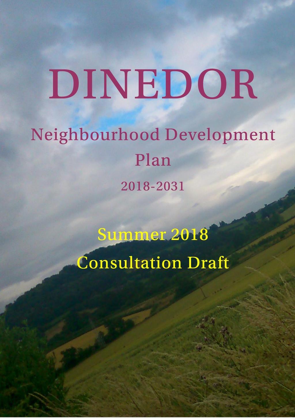
2 Contents 1 Introduction 5 2 Why are we preparing a neighbourhood plan for Dinedor? 7 3 How long will it take to finalise the plan? 8 4 Key Issues 11 5 Objectives and Policies 19 6 Review and Monitoring 33 7 How to comment on the draft plan 34
3 Our Vision for Dinedor Parish is to maintain its rural nature and to promote the health, well-being and sense of community of the residents. To support this, all development in the parish should go forward in such a manner as to minimise the effect on the parish s current character and environment.

4 Figure 1 The Dinedor Neighbourhood Plan Area (OS Licence Number )
5 1 Introduction 1.1 In August 2013 Dinedor Parish Council decided to prepare a neighbourhood plan for the parish. Taking advantage of the new power available to parish councils granted through the Localism Act 2011, the parish applied to be designated as a neighbourhood planning area (Figure 1). This designation was approved by Herefordshire Council in October The parish includes the village of Dinedor, as well as a small number of houses to the east of the B4399, and, in the west, scattered housing on roads emanating from Dinedor Cross. 1.2 This is the first draft of our neighbourhood plan. When complete our plan will give local people more say on the future development of the area by helping to guide, control and promote development. 1.3 Put together by parish councillors and volunteers our neighbourhood plan has reached an important stage and we want to hear your views. If you look at Chapter 7 at the end of the plan you will see how you can make a response to this draft plan. 1.4 The neighbourhood plan is structured in the following way: Chapter 2 Why are we preparing a neighbourhood plan for Dinedor? sets out the background to the neighbourhood plan and describes why the Parish Council think it important we use this power. Chapter 3 How long will it take to finalise the plan? sets out the neighbourhood plan preparation process defined by government that we must follow to prepare a neighbourhood plan; and shows our intended timetable for getting through this process. Chapter 4 Key Issues describes the parish as it currently is and examines some of the key issues.
6 Chapter 5 Objectives and Policies is the real heart of the document and sets out our draft objectives and policies for the parish. Chapter 6 Review and Monitoring describes how the parish council will keep the neighbourhood plan under review and monitor its effectiveness and appropriateness to meet its objectives. Chapter 7 How to comment on the draft plan explains how residents and others can make a response about this draft during the consultation period. 1.5 The overriding thrust of this plan concerns the residential and rural areas of Dinedor. The parish council does not have influence over what takes place in those areas, such as Rotherwas Industrial Estate and Skylon Park, that fall within the parish boundary as these are overseen by Herefordshire Council. Therefore, generally speaking, when the plan talks about industry and industrial development, it is referring to the village and surrounding rural areas.
7 2 Why are we preparing a Neighbourhood Plan for Dinedor? 2.1 Neighbourhood plans are a new part of the statutory development planning system. Just as local authorities, such as Herefordshire, can produce development plans to promote, guide and control development of houses, businesses, open spaces and other uses of land, parish councils can now have some control by preparing a neighbourhood plan. 2.2 Neighbourhood plans, when complete, form part of the statutory development plan for an area. They will be used to promote and guide what goes where and, importantly, will be used to help determine planning applications. 2.3 The parish council thinks this is an important right to exercise, and in 2013 the parish council applied for the whole parish area (Figure 1) to be designated a neighbourhood planning area. Herefordshire Council approved this application in October Following designation, the parish council's steering group held a number of consultation meetings and events. This draft plan is the result. When finalised the plan will give local people more say in the future development in the parish of Dinedor.
8 3 How long will it take to finalise the plan? 3.1 Neighbourhood plans have to be prepared following a procedures set by government (Figure 2). At the moment we are in the early stages of plan preparation. Designation Preparing the Plan, including informal consultation Formal Consultation (6 weeks) Herefordshire Consult for 6 weeks Submit Plan to Herefordshire Revise Plan Examination Referendum Plan made 3.2 This procedure must include two minimum six-week periods of consultation on the draft plan. The initial Regulation 14 consultation took place in December 2017 and this current period is not a statutory requirement but is as a result of changes made to the plan following that consultation. The preparation of the plan will culminate in a referendum on whether the plan should be made part of the statutory development plan for Herefordshire.
9 3.3 After this consultation the Dinedor Neighbourhood Plan will be revised and submitted to Herefordshire Council. Herefordshire will consult on this submitted draft plan for a further minimum six-week period. 3.4 The Dinedor Neighbourhood Plan will then be subject to independent examination. The independent examiner will look to see that the plan meets the basic conditions set out in paragraph 8(2) of Schedule 4B to the Town and Country Planning Act 1990 as applied to neighbourhood plans by section 38A of the Planning and Compulsory Purchase Act These are: having regard to national policies and advice contained in guidance issued by the Secretary of State it is appropriate to make the order (or neighbourhood plan). the making of the order (or neighbourhood plan) contributes to the achievement of sustainable development. the making of the order (or neighbourhood plan) is in general conformity with the strategic policies contained in the development plan for the area of the authority (or any part of that area). the making of the order (or neighbourhood plan) does not breach, and is otherwise compatible with, EU obligations. prescribed conditions are met in relation to the Order (or plan) and prescribed matters have been complied with in connection with the proposal for the order (or neighbourhood plan). 3.5 Once the neighbourhood plan has been examined it will have to be put to a vote, a referendum, of all those eligible to vote in the parish, as to whether or not it should be made part of the statutory development plan system in Herefordshire. 3.6 We hope to reach referendum stage by end-2018 and have a final neighbourhood plan shortly after. 3.7 One final point to bear in mind is that our neighbourhood plan must take account of national planning policy set by government; and strategic planning policy set by Herefordshire Council. The latter, as we show in the next chapter, is extremely important in terms of planning for future housing. Strategic Environmental Assessment/Habitat Regulations Assessment 3.8 This Regulation 14 Consultation Draft Dinedor NDP is accompanied by an Environment Report. The Environment Report has been
10 prepared by Herefordshire Council and brings together two formal screening processes that have to be undertaken when preparing a neighbourhood development plan: Strategic Environmental Assessment (SEA) Habitat Regulations Assessment (HRA) 3.9 The Environment Report concludes that the Dinedor NDP does not require full SEA or HRA assessments to be prepared. Copies of the full report can be found at Should the consultation on the Environment Report indicate the need for any revisions to the NDP these will be made before the NDP is submitted to Herefordshire.
11 4 Key Issues Introduction 4.1 The parish of Dinedor is located about 2.5 miles south of the city of Hereford and is fundamentally a rural area. It is dominated by the iron-age fort Dinedor Camp (182 metres above sea level) - on Dinedor Hill and the ridge that also takes in Rotherwas Park Wood, formerly part of the estate that belonged to Rotherwas House. 4.2 In the north of the parish, there is Rotherwas Chapel, a scheduled monument, which is the last building of the Rotherwas Estate, and a cluster of industrial and commercial concerns. Housing in the parish is roughly divided into three areas: in the east, along the B4399 and around Dinedor Court: the centre of the village on the roads close to the church: and in the west of the parish in roads emanating from Dinedor Cross. 4.3 Adjacent to the north-western boundary of Dinedor lies the Rotherwas Industrial Estate in which an Enterprise Zone is being developed. If the Enterprise Zone is fully developed some estimates suggest that it will provide employment for a further 5,000 people. The majority of Rotherwas Industrial Estate is located within the parish of Lower Bullingham but a section of it is in Dinedor parish, i.e. the Chapel Lane and Cold Nose Road areas of Rotherwas and the Enterprise Zone. There are plans for 1,000 new houses, retail centre and new primary school in Lower Bullingham, these moves will undoubtedly have an impact on the village and parish of Dinedor.
12 4.4 Much of the parish s housing is detached and is occupied by mature people, many of whom are retired. There are few children of school age or young married couples. However, the needs and interests of the residents are diverse and will be subject to change. There are also a number of farms and small businesses. There are approximately 134 houses in the parish holding a population of just over 300. Whilst there is no school, public house or shop in the village, the traditional centre contains the church, the former school, the village hall and the 18 th century Dinedor Hall. Village activities take place in the village hall and Dinedor Parish Church. 4.5 There is no public transport into the village centre or to Dinedor Cross. There are infrequent bus services along the Hereford Rotherwas- Holme Lacy Road, B4399, and very limited services on the Hereford- Hoarwithy Road. However, residents can use their cars to gain access to bus services on the Rotherwas Industrial Estate that constitute an informal park-and ride scheme with buses running half hourly from 7.30am to 6.30pm. The B4399, has a 7.5-ton weight restriction from the Holme Lacy Bridge, but still acts as a conduit for heavy goods vehicles servicing the businesses on the industrial estate. 4.6 Other than in the businesses close to Rotherwas Chapel in the Skylon Business Park in the north of the parish, or to a very limited extent on the farms in the parish, there are few places of employment in the parish. Residents need to travel into Hereford or further afield for work. 4.7 A factor which inhibits self-employment and home-working is low speed and limited internet capacity. Superfast broadband is available in the parish although many houses do not have access. An alternative service may be available via satellite systems. 4.8 The main recreational activity in the parish is walking, making use of the network of footpaths. Dinedor Camp, with its 360 degree views, draws in a small number of visitors either on foot or by car. Recently, the Dinedor Heritage Group has identified various walking routes through the parish with information boards and leaflets. This work was supported by the National Heritage Lottery Fund. 4.9 There is evidence in fields in the parish of archaeological remains and some work has been carried out to try and establish what they represent.

13 4.10 There are various activities that take place in the village hall. Apart from the small amount of industry in the north of the parish, the environment is a rural one, to a large extent made up of working farmland. What are the key issues facing the area? 4.11 The steering group has identified the following key issues as facing the area in the next fifteen years. Housing 4.12 Herefordshire Council s Core Strategy Local Plan (adopted in December 2015) sets strategic planning policy for housing and other development in the county s rural area over the period Policy RA1 of the Core Strategy identifies seven rural housing market areas for the county. Dinedor falls within the Hereford Rural Housing Market Area (HRHMA). Policy RA1 sets an indicative growth target for this whole area of 18%, There are a small number but differing styles of housing in Dinedor village 4.13 To ensure the indicative growth target is met, the Core Strategy (Policy RA2) then goes on to identify a number of villages that will be the main focus of housing development, and then a further group of villages, including Dinedor, where new housing may be appropriate. If Dinedor were to meet the indicative growth target in full of 18%, based on the 134 households in the parish in the 2011 Census, this would mean new housing growth of 24 new dwellings by In planning
14 for new homes appropriate infrastructure needs to be in place, including addressing things such as access and disposal of sewage It is understood that, as the plans for the development of the Enterprise Zone, in particular, and the whole of the Rotherwas Industrial Estate, in general, reach fruition, existing housing in Dinedor may become more desirable for those employed there. Over the passage of time the age distribution of Dinedor residents may change and become younger. Business 4.15 There are a small number of family-owned and run businesses mainly farming, within the parish to whom the additional residential proposal criteria in relation to villages listed in Table RA2 in the Core Strategy could apply. This would facilitate the continuation of the businesses by succeeding generations. Any new housing must be located adjacent to the business concerned and would conform to the principles laid down in Core Strategy Policy RA The neighbourhood plan supports the further development and diversification of the businesses in the rural parts of Dinedor. As markets vary to meet contemporary demands, so these businesses will need to change to remain successful. This means that the requirement for new or altered buildings or their change of use must be seen as a normal facet of their commercial activity. The need for a limited amount of housing, as referred to in 4.12 and 4.13 above, is part of this essential business development. Any extension of commercial buildings must be of good quality design and well related to its surroundings. Transport and Roads 4.17 The majority of roads are narrow, winding and single track, frequently without passing places and areas available for parking are extremely limited. This is a consideration for any development in the parish.
15 Communications 4.18 Herefordshire Council has joined with Gloucestershire in a contract with BT for superfast internet to be delivered throughout the two counties. By the end of 2018 the county envisages all who need having an internet speed of 24Mbps Recreation and the Environment Dinedor does not have the infrastructure in terms of car parks and public lavatories to act as a centre for tourist. Village Green The parish has a very small village green, alongside the Glebe Barn, used mainly for parking two or three cars. It is hoped to identify a small area in the centre of the parish for a new village green, with sufficient space for some benches and a parish notice board Dinedor has a selection of public footpaths (see Figure 3) that, it is hoped, can be extended by means of permissive agreements and further signposted by local volunteers. It is also hoped that the former turnpike road over Dinedor Hill, that starts in the centre of the village and proceeds up Prospect Lane, will be re-opened as a public right of way, both for historic reasons and to increase pedestrian access to and from the north, and provide a more direct footpath from Dinedor to Hereford. Figure 3 Footpaths (OS Licence Number )
16 4.21 Dinedor Parish Council has taken ownership through a capital asset transfer from Herefordshire Council of the ownership and management of Dinedor Camp, the Outdoor Centre and various tracts of field and woodland. The maintenance of Dinedor Camp needs to be improved with the longer-term intention of controlling the vegetation so that its original ramparts can be more readily seen. As this is a scheduled monument any such management plan will be subject to the agreement of Historic England The parish council has adopted a management plan from Herefordshire Council to guide the management of the camp area. The purpose of this move is to improve the management of the asset and not to encourage large numbers of tourists and vehicles because vehicular access to the area is along a single-track road up Dinedor Hill The parish is within the catchment area of the River Wye which has been designated a site of Special Scientific Interest (SSSI). Much of the parish is not on mains drainage, There is concern in the SEA that 'new development within the area (of the SSSI) could lead to the water quality failing the phosphate levels and conservation objectives'. There is a Nutrient Development Plan for the catchment area. New development in the parish should therefore be consistent with the requirements of this plan.

17 Figure 4 Strategic Environmental Assessment Map 1 for Dinedor (OS Licence number )

18 Figure 5 Strategic Environmental Assessment Map 2 for Dinedor (OS Licence Number )
19 5 Objectives and Policies Objective 1 - To help meet local housing needs up to 2031 POLICY A - NEW HOUSING DEVELOPMENT IN DINEDOR VILLAGE Small scale proposals (generally of no more than 1 or 2 houses) for new market and affordable housing will be supported within the village settlement of Dinedor, (see Figure 6, Policies Map) providing that it is proportionate to the existing number and form of housing in the immediate area of the village. Such proposals will be assessed against the following criteria and will be supported when they: a. relate well to the existing built up area of the village in all aspects; b. meet, or exceed, the highest possible sustainable design and construction standards prevailing at the time ; c. do not have an adverse impact on residential amenity, local heritage assets and local infrastructure; d. do not lead to isolated homes which are detached from the main village areas and/or standing in open countryside; e. do not erode the existing character and setting of village areas; f. show that existing brownfield sites have been considered before greenfield sites Proposals for development that do not adjoin existing housing in Dinedor village and would lead to free-standing, individual, or small groups of dwellings will not be supported.
20 Figure 6 Dinedor Village Policies Map (OS Licence Number ) Key Community Facilities Settlement boundary
21 POLICY B RURAL EXCEPTION HOUSING Within the neighbourhood plan area proposals for small affordable housing development (social rented, affordable rented and intermediate low cost or rented homes) may be supported on land not normally considered appropriate for new housing when: a) the proposal meets a proven need for affordable housing backed by appropriate evidence from a local housing needs survey; and b) such housing is made available to, and retained in perpetuity for, local people in need of affordable housing. Background and Justification 5.1 Policies A and B set out how Dinedor will contribute to achieving the indicative housing growth target of 18% for the Hereford Rural Housing Market Area. 5.2 Development will be concentrated in the village settlement of Dinedor. This will be market housing to meet local needs. In order to preserve the open, rural nature of the area, the building of accommodation in the open countryside outside the village s current housing areas will not be supported.
22 Objective 2 - To ensure all new development is of good quality design POLICY C HIGH QUALITY DESIGN All new development proposals within the neighbourhood plan area will be expected to demonstrate the following that it: a) exploits existing infrastructure, or provides adequate new services so as to ensure the development does not have a negative impact on existing infrastructure; b) does not have a detrimental effect on residential amenity by reason of noise or other nuisance; c) does not have a detrimental effect on the safe and efficient operation of the existing transport and road infrastructure; and d) that it does not result in the loss of an area which makes a significant contribution to public amenity by virtue of its open space character, appearance and function. The plan area has a distinctive and special character. Development will be supported which would make a positive contribution to that distinctive character and be of good design and quality. In seeking to protect and enhance the unique identity of the area, all development will also have to have regard to the following: a) contribution to local identity, and sense of place; b) suitability of the overall design and appearance of the proposed development (including size, scale, density, layout, access, lighting, street furniture, and signage) when assessed in relationship with surrounding buildings, spaces, vegetation, water areas and other features of the street scene; c) use, and where appropriate re-use, of local and traditional materials or suitable artificial alternatives. Standardised materials and products should be avoided; d) use of space and landscape design; e) protection and enhancement of woods, trees, hedgerows, rivers, ditches and ponds; f) movement to, within, around, and through the development; g) originality, innovation and initiative; h) inclusion of energy efficiency and conservation measures; and i) use of sustainable drainage systems, effluent from which must Conform to the Nutrient Development Plan for the River Wye.
23 Background and Justification 5.3 This policy seeks to ensure that any new buildings are built to a good quality design. This will enhance the area s rural character and landscape and produce better buildings for those who have to live in, work and live around them and protect the River Wye.
 discussions will take place with Herefordshire Council and the Police to seek enforcement of the weight limit on the B4399 from the Holme Lacy")
24 Objective 3 Travelling in and around Dinedor POLICY D THE MANAGEMENT OF TRAFFIC AROUND DINEDOR To minimise the impact of traffic and to create a safer environment for all road users, the following improvements to the road network will be supported: a) discussions will take place with Herefordshire Council and the Police to seek enforcement of the weight limit on the B4399 from the Holme Lacy river bridge, through Dinedor and into the Rotherwas industrial area; b) any extension to the Greenway cycle path through to Holme Lacy will be supported subject to local consultation on the route and its construction; c) the network of green routes identified on Figure 3 will be protected and enhanced. Development proposals will only be supported when it can be demonstrated they have taken account of this identified network, and, where possible, seek to enhance and extend this network; d) development proposals leading to loss or breaks in this network of routes will not be supported, unless adequate or better replacement is provided.
25 Background and Justification 5.4 Given the area s rural nature and very limited access to public transport, people are very much reliant on the private car. This becomes a particular issue for anyone who does not have access to a car e.g. the young, elderly or infirm. It is acknowledged that the opportunities to make significant improvements to public transport are limited. The Parish Council will work with Herefordshire Council and transport providers to seek improved bus services to serve the village. 5.5 To support this aim further the network of footpaths, cycleways and green routes shown on Figure 6 will be protected and enhanced.
26 Objective 4 To promote the development and diversification of rural businesses POLICY E TO SUPPORT THE GROWTH OF SMALL SCALE RURAL BUSINESSES Proposals for the development of small-scale business enterprises suitable to a rural area will be encouraged when they do not adversely affect the rural character, environment and landscape of Dinedor or existing residential amenities and are for the following: a. for the conversion or reuse of an existing building; b. homeworking proposals; c. live/work units; d. diversification of an existing rural business; e. the proposal is in accordance with Policy C in terms of its design. Background/Justification 5.6 To foster the economic growth of the area, whilst at the same time maintaining the area s rural character, and not impacting on existing and future residential amenity, new appropriately sized proposals for business development will be encouraged
27 Objective 5 Protecting and enhancing the rural environment and landscape POLICY F TO PROTECT AND ENHANCE THE RURAL ENVIRONMENT AND LANDSCAPE Development proposals will have to demonstrate that the protection and enhancement of the rural environment and landscape is a prime consideration in the following terms: a. the character of the rural environment and landscape have influenced the design, scale, form and siting of the development proposed; b. they enhance and protect the various settings of the village; c. they conserve and enhance such assets as wildlife sites, listed buildings, ancient monuments, and archaeological remains; d. they protect and enhance the natural and scenic beauty of Dinedor; e. they incorporate appropriate landscaping schemes and future on-going management arrangements to ensure the proposal integrates into the surrounding landscape and rural environment; f. they maintain and extend native tree species, hedgerows and other important vegetation; g. they do not have an adverse impact on the environmental quality of the parish s rivers, streams and brooks. Background/Justification 5.7 Policy LD1 Landscape and Townscape of the Core Strategy seeks to conserve and enhance important landscapes. The landscape of the parish, dominated as it is by Dinedor Hill, provides a natural, historic and scenic backdrop to the wider area, including Hereford city. It is also valued for its own sake by residents and visitors alike.
28 Objective 6 - To protect local heritage assets and support heritage investigations POLICY G PROTECTING LOCAL HERITAGE ASSETS Development proposals should conserve and enhance the local heritage assets, particularly those listed below: Rotherwas Chapel Lands adjoining Dinedor Camp Lands around the east end of Dinedor Ridge Lands which may have archaeology beneath e.g. associated with the likely course of Rotherwas Ribbon Any development proposals will have to ensure that: a. no heritage asset will be damaged by building or associated work; and b. there is no detrimental effect on the visual aspect of any heritage asset; Proposals for new development should consult the Historic Environment Record. Where there is an indication or potential that there may be assets of heritage or archaeological interest suitable deskbased and site investigation should be carried out. Site investigations must follow the appropriate professional practices so that there is no detriment to the rural environment. The plan envisages that there will be further investigations into the know and presumed heritage assets and the outcome of these investigations will add to the intrinsic nature and value of Dinedor's unique rural environment

29 Earthworks near the Church
30 POLICY H TO ENCOURAGE AND SUPPORT INVESTIGATIONS INTO LOCAL HERITAGE ASSETS The plan envisages that there will be further investigations into the known and presumed heritage assets and the outcome of these investigations will add to the intrinsic nature and value of Dinedor s unique rural environment. Background/Justification 5.8 The Dinedor Origins Project explored historical sites, established a series of heritage walks and provided information boards at points of interest. Dinedor has a rich historical environment and these policies will ensure protection and encourage investigations.

31 Objective 7 To protect local green spaces POLICY I PROTECTING LOCAL GREEN SPACES The local green spaces identified below will be protected. Development of these spaces will only be supported in very special circumstances; the Village Green the practicality of a new small village green will be explored Dinedor Camp Background/Justification 5.9 Paragraphs 76 and 77 of national planning policy allow local communities to identify and protect local green spaces. Such spaces have to meet criteria set in national policy. If they do, and are then identified in neighbourhood plans, protection of such sites is akin to national Green Belt policy. This means such sites should only be developed for uses that are compatible with their openness, and inappropriate development should only be supported in very special circumstances. Dinedor Village Hall
32 Objective 8 To protect community facilities POLICY J COMMUNITY FACILITIES 5.10 The community facilities listed below and shown on Figure 6 the Policies Map will be protected: Village Hall St Andrew s Church Development to enhance or improve these facilities will be supported when it preserves local character and distinctiveness and does not harm the landscape or residential amenity. Development leading to the loss of these facilities will only be supported when equivalent, or better, provision is made elsewhere in the area. Background/Justification 5.11 Community facilities are the glue that holds a community together. The facilities identified in Policy J will be protected for community uses. Their loss to community use will only be supported when equivalent, or better provision, is made elsewhere in the area. This policy is in general conformity with Policy SC1 of the Core Strategy.
33 Objective 9 Promoting local residents' enjoyment of the parish POLICY K LOCAL RESIDENTS' ENJOYMENT OF THE PARISH All new development proposals should respect Dinedor's rural environment and tranquillity. Proposals should include suitable measures to mitigate any impact on residential amenity and proposals that are considered to have an adverse impact on residential amenity will not be supported. To preserve the area's rural environmental quality and relative tranquillity, proposals will only be supported where they retain or enhance that environmental quality and retain the parish's tranquillity. Background/Justification 5.12 In spite of the parish's close proximity to Hereford city, the area retains a strong and tranquil rural environment. This is encapsulated in the rural landscape, heritage assets, rural businesses and dispersed settlement pattern. This is a critical asset that should be retained and protected. To achieve this, all new development proposals should be designed in a way that respects Dinedor's rural environment. Residential amenity of local residents is also a critical factor in making Dinedor a quality place to live. Residential amenity should be protected and where any adverse impacts are identified, suitable mitigation must be put in place.
34 6 Review and Monitoring 6.1 The plan will be monitored and kept under review by the parish council. Twice within any 12-month period during the life of the council, at meetings pre-determined by councillors, the plan will be an agenda item so that it can be formally reviewed. Additionally, any councillor can request an extra review of the plan by asking the clerk to place it on the agenda of the next meeting. Any parishioner can make the same request.
35 7 How to comment on the Draft Plan 7.1 This is the amended draft Neighbourhood Development plan following comments made on the Regulation 14 Consultation Draft of the Dinedor Neighbourhood Development Plan. The main change to the plan has been to extend the 'village envelope' to include an extra parcel of land, sufficient to build up to eight houses in the village. By making this amendment, the Neigbourhood Plan should meet the requirements of Herefordshire Council's Strategic Plan. We are now giving you the opportunity to comment on this amended plan before the next stage of the process. This further consultation is not essential under the legislation, but the parish council is very keen to ensure the fullest local involvement. Copies of the NDP are available from the Parish Clerk at the address below. Copies will also be available at the coffee morning at the Village Hall on Saturday 4 th August Formal comments and responses on the plan must be made in writing, preferably on the comment form below, or available at this link or from the Parish Clerk at the following address: Liz Kelso Clerk, Dinedor Parish Council c/o 5 Deerhurst Drive Belmont Hereford HR2 7XX Tel:
36 Dinedor Amended Regulation 14 Draft Neighbourhood Development Plan (NDP) Public Consultation 1 st 31 st August 2018 Representation Form PLEASE COMPLETE AND RETURN ONE FORM FOR EVERY COMMENT MADE Name Organisation Address Tel. No. Dinedor Parish Council is the Data Controller under data protection law and will use the information you provide on this form in order to include your views on the amendments to the draft NDP. Your personal information will not be shared with any organisation other than the parish council or its NDP working group members. Individuals have a number of rights under data protection law, including the right to request their information. You also have a right to make a complaint about our handling of your personal data to the Information Commissioner s Office Further information on how we handle your data is available from the Clerk at the address overleaf.
37 Are you supporting, objecting, or making a comment? (Please Tick ) Support Object Making a Comment Please use the box below and overleaf for any comments. Thank you for your time and interest. Please return this form by 5pm on 31 st August 2018 to: Liz Kelso, Clerk, Dinedor Parish Council, c/o 5 Deerhurst Drive, Belmont, Hereford HR2 7XX or to dinedorparishcouncil@gmail.com
Copyright Nigel Deeley and licensed for reuse under this Creative Commons Licence
 1 Copyright Nigel Deeley and licensed for reuse under this Creative Commons Licence Prepared by the Neighbourhood Plan Steering Group on behalf of Garway Parish Council with assistance from 2 Table of
Parish of Repton NEIGHBOURHOOD DEVELOPMENT PLAN
 Parish of Repton NEIGHBOURHOOD DEVELOPMENT PLAN BASIC CONDITIONS STATEMENT December 2018 CEF 4 Legal Requirements This statement has been produced by the NDP Working Group on behalf of Repton Parish Council
Copyright Nigel Deeley and licensed for reuse under this Creative Commons Licence
 1 Copyright Nigel Deeley and licensed for reuse under this Creative Commons Licence Prepared by the Neighbourhood Plan Steering Group on behalf of Garway Parish Council with assistance from 2 Table of
LONGDEN VILLAGE DEVELOPMENT STATEMENT
 LONGDEN VILLAGE DEVELOPMENT STATEMENT 2017-2027 1 Longden Development Statement 2017-2027 15/01/18 1. Background 1.1 Longden Village Longden village is a very rural and traditional community first mentioned
Great Easton Neighbourhood Plan Statement of Basic Conditions
 Great Easton Neighbourhood Plan 2017-2031 Statement of Basic Conditions OCTOBER 2016 GREAT EASTON PARISH COUNCIL Contents 1.0 Introduction....Page 2 2.0 Summary of Submission Documents and Supporting Evidence..
Plumpton Neighbourhood Development Plan Revised Pre Submission Document - Regulation 14 Consultation
 REPRESENTATIONS... Plumpton Parish Council Plumpton Neighbourhood Development Plan Revised Pre Submission Document - Regulation 14 Consultation Representations submitted on behalf of: Cala Homes (South
3. Neighbourhood Plans and Strategic Environmental Assessment
 1. Introduction This report sets out a draft Screening Determination for the Preston Parish Council s Neighbourhood Plan and has been prepared by rth Hertfordshire District Council. The purpose of the
DUNSFOLD NEIGHBOURHOOD PLAN Site Selection Policies
 DUNSFOLD NEIGHBOURHOOD PLAN Site Selection Policies The criteria for assessing sites for future housing and business development in Dunsfold are set out below. (Development criteria, covering what it is
Newcourt Masterplan. November Exeter Local Development Framework
 Newcourt Masterplan November 2010 Exeter Local Development Framework Background The Exeter Core Strategy Proposed Submission sets out the vision, objectives and strategy for the development of Exeter up
The Gwennap Parish Vision Statement
 QUICK GUIDE What is a Neighbourhood Development Plan? Ultimately it is a document used by developers or anyone wishing to submit a planning application that describes the vision, strategy, plans, regeneration,
About 10% of the Borough's population lives in the seven rural parishes. Population figures from the 1991 census are given below:-
 8. THE DISTRICT VILLAGES 8.1 Population About 10% of the Borough's population lives in the seven rural parishes. Population figures from the 1991 census are given below:- Village No. of Persons Cottingham
Welford-on-Avon Neighbourhood Plan Consultation Event Sunday, 6 April Your name Your address
 Welford-on-Avon Neighbourhood Plan Consultation Event Sunday, 6 April 2014 Your name Your email address Please either: - complete this feedback form and put it in the box before leaving the Memorial Hall
Briefing Document of CNP. June 2017
 Cholsey Parish Council Cholsey Neighbourhood Plan Briefing Document of CNP June 2017 Cholsey Neighbourhood Plan Page! 1 of! 8 Cholsey Plan Briefing v1.4 Page Left Intentionally Blank Cholsey Neighbourhood
Neighbourhood Plan Representation
 Date: 10 th November 2017 Neighbourhood Plan Representation Land to the east of Callow Hill Road, Alvechurch Introduction This representation has been prepared by RPS Planning and Development on behalf
OKEFORD FITZPAINE NEIGHBOURHOOD PLAN
 OKEFORD FITZPAINE NEIGHBOURHOOD PLAN Dear Parishioner, The Neighbourhood Plan Project Team have prepared this leaflet to summarise the full Neighbourhood Plan document. It provides a summary of the Vision,
Land at Fiddington Hill Nursery, Market Lavington
 Land at Fiddington Hill Nursery, Market Lavington Briefing Report for Market Lavington Parish Council Persimmon Homes (Wessex) April 2016 Background This brief report has been prepared following the Market
Site Assessment Technical Document Appendix A: Glossary
 Central Bedfordshire Council www.centralbedfordshire.gov.uk Site Assessment Technical Document Appendix A: Glossary July 2017 1.1.11-1 - ii Appendix A: Glossary Term Agricultural Land Classification AONB
Planning and Sustainability Statement
 Land adjacent to Manor Farm, Catterick Village Pallett Hill Sand and Gravel Co Ltd Proposed 10 new dwellings, (6 No market dwellings and 4 No affordable dwellings) with access, associated car parking and
Development in the setting of the Cotswolds AONB
 COTSWOLDS CONSERVATION BOARD POSITION STATEMENT Development in the setting of the Cotswolds AONB.1. Introduction Areas of Outstanding Natural Beauty (AONBs) are designated by the Government for the purpose
Land at Rampton Road. Cottenham
 Land at Rampton Road Cottenham Introduction TEP is preparing an outline planning application for 54 dwellings on 6.9 hectares of land adjacent to Rampton Road, Cottenham on behalf of the owners Cambridgeshire
Draft Hailey Neighbourhood Plan
 Persimmon Homes (Wessex) Draft Hailey Neighbourhood Plan Representations to West Oxfordshire District Council s Regulation 16 Consultation December 2018 2 Copyright 2018 Persimmon Homes Ltd. All rights
Neighbourhood Planning Guidance Local Green Spaces
 Neighbourhood Planning Guidance Local Green Spaces Introduction This guidance note has been produced for communities preparing neighbourhood plans in North Dorset to help them to identify, assess and designate
Welford-on-Avon. Neighbourhood Development Plan Welford-on-Avon Parish Council
 Welford-on-Avon Neighbourhood Development Plan 2011-2031 Welford-on-Avon Parish Council Parish Consultation: Summary Version December 2014 January 2015 Foreword This is the latest version of the Welford
Kibworth Harcourt. Introduction. Introduction
 Introduction Introduction Welcome to this public exhibition on the proposals for the delivery of new homes on land at The Kibworths. The purpose of today s exhibition is to give you the opportunity to
DRAFT STRATEGIC ENVIRONMENTAL ASSESSMENT REPORT
 DRAFT STRATEGIC ENVIRONMENTAL ASSESSMENT REPORT Published by Limpsfield Parish Council in accordance with EU Directive 2001/42 on Strategic Environmental Assessment and with the Environmental Assessment
Basic Conditions Statement Exmouth Neighbourhood Plan
 Exmouth Neighbourhood Plan 2018-2031. On behalf Exmouth Neighbourhood Plan Steering Group July 2018 Table of Contents 1. Introduction... 4 2. Legal Requirements... 5 3. Why there is a need for a Neighbourhood
Effingham Neighbourhood Plan 1. Basic Conditions Statement
 Effingham Neighbourhood Plan 1 Basic Conditions Statement Effingham Neighbourhood Plan 2016: Basic Conditions Statement 2 Contents This statement has been prepared by Effingham Parish Council to accompany
Settlement Boundaries Methodology North Northumberland Coast Neighbourhood Plan (August 2016)
") Introduction This background paper sets out a methodology for the definition of settlement boundaries in the North Northumberland Coast Neighbourhood Plan. The neighbourhood plan is planning positively
Introduction This background paper sets out a methodology for the definition of settlement boundaries in the North Northumberland Coast Neighbourhood Plan. The neighbourhood plan is planning positively
Sustainability Statement. Whitby Business Park Area Action Plan
 Sustainability Statement Whitby Business Park Area Action Plan November 2014 Contents Page 1. Introduction 1 2. Scoping 3 3. Sustainability Appraisal of Options 6 4. Assessment of Draft Area Action Plan
ROCHFORD LOCAL DEVELOPMENT FRAMEWORK: Sustainability Appraisal/ Strategic Environmental Assessment. Rochford Core Strategy Preferred Options Document
 ROCHFORD LOCAL DEVELOPMENT FRAMEWORK: Sustainability Appraisal/ Strategic Environmental Assessment Non Technical Summary Rochford Core Strategy Preferred Options Document October 2008 SUSTAINABILITY APPRAISAL
Full Name /title*. Address 1. Address 2 Post Code* *.. Phone* *Required fields for draw
 You can return this later to post boxes at: the Parish Council Office, Rowney Green Village Hall, The Petrol Station at Hopwood, or the Library. Closing date 14 th March: Draw on 14 th April 2014 at Alvechurch
Neighbourhood Planning Local Green Spaces
 Neighbourhood Planning Local Green Spaces Introduction... 2 1. Why green space is important... 4 2. Neighbourhood plans and green space... 6 3. Evidence... 8 Statutory designations... 9 Green space audit...
EAST LANGTON PARISH NEIGHBOURHOOD PLAN. Submission version
 EAST LANGTON PARISH NEIGHBOURHOOD PLAN Submission version 2011 2031 Contents Chapter heading Page Introduction from Chair 3 1. Why Neighbourhood Plans are important 5 2. Why we need a Neighbourhood Plan
Local Development Scheme
 Local Development Scheme 2012 2016 The Local Development Scheme (LDS) is a project plan that outlines how and when the Authority will update its planning policies and other associated documents. It ensures
EXTRACT FROM THE CUDDINGTON NEIGHBOURHOOD PLAN The Policies
 EXTRACT FROM THE CUDDINGTON NEIGHBOURHOOD PLAN The Policies Environment and Landscape Policy 1 - Landscape Setting Development should respect and wherever possible enhance the landscape setting of Cuddington
CLEVE PARK, THORNBURY
 CLEVE PARK, THORNBURY Community Planning Day Report Back Broadsheet February 206 A VISION FOR CLEVE PARK Over 0 local people attended the Cleve Park Community Planning Day at Armstrong Hall on Saturday
DEVELOPMENT MANAGEMENT REPORT
 ITEM A08-1 DEVELOPMENT MANAGEMENT REPORT TO: BY: DATE: DEVELOPMENT: SITE: WARD: APPLICATION: APPLICANT: Development Management Committee Development Manager Proposed live/work unit in connection with existing
Public Consultation 23 January Peel Hall, Warrington Board 1. A message from Satnam... Site history...
 Board 1 A message from Satnam... Thank you for attending today s public consultation about proposals to develop a new residential neighbourhood at. The display boards show why the development is needed
SOUTH EAST LINCOLNSHIRE LOCAL PLAN: HOUSING PAPER DONINGTON (JUNE 2016)
") SOUTH EAST LINCOLNSHIRE LOCAL PLAN: HOUSING PAPER DONINGTON (JUNE 2016) 1 DONINGTON S PLACE IN THE SPATIAL STRATEGY 1.1 Policy 2 of the South East Lincolnshire Local Plan 2011-2036 Draft for Public Consultation
SOUTH EAST LINCOLNSHIRE LOCAL PLAN: HOUSING PAPER DONINGTON (JUNE 2016) 1 DONINGTON S PLACE IN THE SPATIAL STRATEGY 1.1 Policy 2 of the South East Lincolnshire Local Plan 2011-2036 Draft for Public Consultation
ALLERTHORPE NEIGHBOURHOOD PLAN
 Allerthorpe s Neighbourhood Plan sets out a vision for the Parish for the next 15 years (2018 2033) that builds on and reflects the opinions and views of parish residents. VISION In 2033 Allerthorpe will
Welcome to our exhibition
 Welcome to our exhibition The Homes & Communities Agency (HCA) welcomes you to this public exhibition explaining our proposals for the redevelopment of the former Lea Castle Hospital site. About the Homes
Statement of Community Involvement LAND OFF SOUTHDOWN ROAD HORNDEAN, HAMPSHIRE
 LAND OFF SOUTHDOWN ROAD HORNDEAN, HAMPSHIRE CONTENTS Page 1. Introduction 3 2. Pre-application Discussions 4 3. The Consultation Process 5 4. Consultation Feedback 7 5. Responses to Consultation Feedback
8.0 Design and Form of Development 43/
 42/ 8.0 Design and Form of Development 43/ Rothwells Farm, Golborne/ Development Statement Figure 7. Site Constraints Key 44/ Site Boundary 360 Bus Route/Stops Existing Trees Underground Water Pipe Sensitive
Suffolk Coastal Local Plan Review Issues and Options, August 2017, Public Consultation
 Suffolk Coastal Local Plan Review Issues and Options, August 2017, Public Consultation Having reviewed the issues and options documents, the Society has made the following response: Part 1 - Strategic
Schedule of Planning Applications Committee Date: 23 May Reference: 06/17/0726/F Parish: Hemsby Officer: Mr J Beck Expiry Date:
 Schedule of Planning Applications Committee Date: 23 May 2018 Reference: 06/17/0726/F Parish: Hemsby Officer: Mr J Beck Expiry Date: 22-05-2018 Applicant: Proposal: Site: Mr Gillett Change of use to the
1. Objectives of this consultation
 1. Objectives of this consultation Provide an update on the results of the December 2014 consultation Provide a summary of the Pre-Submission Plan which is now out for formal consultation To ask for your
Public Consultation. Land at Monks Farm, North Grove. Welcome
 Welcome Welcome to our public exhibition for development on Land at Monks Farm, orth Grove. Gallagher Estates and Gleeson Strategic Land are preparing an outline planning application for new homes, open
WELCOME. Land North of STEVENAGE. We would like to thank you for attending our public exhibition today.
 WELCOME We would like to thank you for attending our public exhibition today. The purpose of this event is to share our proposals and hear your thoughts on our ideas. Members of the project team are on
A Growing Community Rural Settlement Areas
 Town of Huntsville Official Plan Review - POLICY BACKGROUND PAPER A Growing Community Rural Settlement Areas BACKGROUND: In addition to the fully municipally-serviced Urban Settlement Area and the Hidden
Vigo Neighbourhood Plan Basic Conditions Statement
 Vigo Neighbourhood Plan Basic Conditions Statement Plan Period: 2016 to 2028 Status: Submission Version Qualifying Body: Vigo Parish Council Glossary of Some Terms & Abbreviations Used in this Document
APP/G1630/W/15/
 Appeal Decision Site visit made on 20 October 2015 by William Fieldhouse BA (Hons) MA MRTPI an Inspector appointed by the Secretary of State for Communities and Local Government Decision date: 20 November
Cottenham Civil Parish. Neighbourhood Development Plan to 2031
 Cottenham Civil Parish Neighbourhood Development Plan 2017 to 2031 Cottenham Parish Council Basic Conditions Statement December 2018 In 2031 Cottenham will still be an attractive safe rural village, proud
Linden Homes Proposals for the Ridgewood Centre, Old Bisley Road, Frimley
 Linden Homes Welcome Welcome to our public exhibition. Today we are displaying draft proposals for a high quality residential redevelopment of land off Old Bisley Road, currently known as the Ridgewood
4 RESIDENTIAL ZONE. 4.1 Background
 4 RESIDENTIAL ZONE 4.1 Background The residential areas within the City are characterised by mainly lowrise dwellings sited on individual allotments. Past architectural styles, settlement patterns and
STATEMENT OF OBJECTION TO THE PROPOSED DEVELOPMENT OF LAND AT CHURCH CLIFF DRIVE FILEY
 STATEMENT OF OBJECTION TO THE PROPOSED DEVELOPMENT OF LAND AT CHURCH CLIFF DRIVE FILEY You will be aware that Scarborough borough council have adopted a new local plan that includes land at Church Cliff
elbridge Core Strategy
 C elbridge Core Strategy Celbridge is designated as a Moderate Growth Town in the RPGs. The County Development Plan reinforces this designation in its settlement strategy. Moderate Growth Towns within
LOGGERHEADS NEIGHBOURHOOD PLAN LOCAL GREEN SPACE DESIGNATION OCTOBER 2016
 DRAFT LOGGERHEADS NEIGHBOURHOOD PLAN LOCAL GREEN SPACE DESIGNATION OCTOBER 2016 1. Introduction For many local communities, green infrastructure in and around their neighbourhood is an important issue,
INTRODUCTION NORTH HEYBRIDGE GARDEN SUBURB
 INTRODUCTION This event is being hosted by the promoters of the proposed North Heybridge Garden Suburb who are working with Maldon District Council and other key stakeholders on the preparation of a comprehensive
DEVELOPMENT MANAGEMENT REPORT
 ITEM A07-1 DEVELOPMENT MANAGEMENT REPORT TO: BY: Development Management Committee (South) Development Manager DATE: 21 June 2016 DEVELOPMENT: SITE: WARD: APPLICATION: APPLICANT: Outline application for
CA//17/02777/FUL. Scale 1:1,250. Planning Services Canterbury City Council Military Road Canterbury Kent CT1 1YW
 O CA//17/02777/FUL Scale 1:1,250 Map Dated: 15/03/2018 Planning Services Canterbury City Council Military Road Canterbury Kent CT1 1YW AGENDA ITEM NO 16 PLANNING COMMITTEE APPLICATION NUMBER: SITE LOCATION:
University Park, Worcester Non Technical Summary December 2011
 University Park, Worcester Non Technical Summary December 2011 Introduction UW Wrenbridge LLP, a Joint Venture Company of the University of Worcester and Wrenbridge Land Ltd (the Applicants ) intend to
Basic Conditions Statement
 POTTON NEIGHBOURHOOD DEVELOPMENT PLAN Basic Conditions Statement Date: 19/10/2018 Version: 1 Status: draft Table of Contents 1 INTRODUCTION... 3 1.1 POTTON NEIGHBOURHOOD PLAN DESIGNATED AREA... 3 1.2 PREPARATION
LETTER OF OBJECTION LAND TO THE SOUTH WEST OF FORGE GARAGE, HIGH STREET, PENSHURST, KENT, TN11 8BU
 Senior Planning Officer Andrew Byrne Sevenoaks District Council Community & Planning Services PO Box 183 Argyle Road Sevenoaks Kent TN13 1GN 04 November 2011 Your Ref: 11/02258/FUL For the attention of
Wildlife and Planning Guidance: Local Plans
 Wildlife and Planning Guidance: Local Plans This Leaflet is one of a series of 4 Wildlife and Planning Guidance Leaflets and is intended to provide useful information to assist you to campaign effectively
Balcombe Neighbourhood Plan. Habitats Regulations Assessment Screening Report
 Balcombe Neighbourhood Plan Habitats Regulations Assessment Screening Report Produced for Regulation 14 of the Neighbourhood Planning (General) Regulations 2012 17 th July 2015 1.0 Introduction 1.1 This
Barvills Solar Farm Environmental Statement Non-Technical Summary
 Barvills Solar Farm Environmental Statement Non-Technical Summary 13 March 2015 Produced for Prepared by St John s House Queen Street, Manchester M2 5JB Contents Contents... 2 1 Introduction... 3 1.1 Development
Ipswich Issues and Options for the Ipswich Local Plan Review, August 2017, Public Consultation
 Ipswich Issues and Options for the Ipswich Local Plan Review, August 2017, Public Consultation Having reviewed the issues and options documents, the Society has made the following response: Part 1 Strategic
South Worcestershire Development Plan. South Worcestershire Design Guide Supplementary Planning Document
 South Worcestershire Development Plan South Worcestershire Design Guide Supplementary Planning Document Statement of Consultation: Early Engagement Scoping Paper February 2017 1. Introduction 1.1 This
Repton Parish Neighbourhood Development Plan - Consultation March 2017
 Repton Parish Neighbourhood Development Plan - Consultation March 2017 25 replies Policy No Comments Response H1 Agree 22 Amend to include Milton Road & footpath but exclude above footpath. Neither agree
WELCOME GYPSY LANE. Wider Site Location plan. Proposals for the development of LAND OFF FOXLYDIATE LANE WEBHEATH. Proposals for the development of
 WELCOME The developers are preparing an outline planning application for a residential led development and need the community s views in order to develop the proposals further WHAT IS PROPOSED? A high
Rural Planning and National Parks. John Scott Director of Conservation and Planning Peak District National Park Authority 2 November 2018
 Rural Planning and National Parks John Scott Director of Conservation and Planning Peak District National Park Authority 2 November 2018 UK national parks So how green is this land? Are we concreting
Cotswolds AONB Landscape Strategy and Guidelines. June 2016
 Cotswolds AONB Landscape Strategy and Guidelines June 2016 Cotswolds AONB Landscape Strategy and Guidelines Introduction The evolution of the landscape of the Cotswolds AONB is a result of the interaction
Babergh and Mid Suffolk Joint Draft Local Plan Consultation, August 2017, Public Consultation
 Babergh and Mid Suffolk Joint Draft Local Plan Consultation, August 2017, Public Consultation Having reviewed the documents, the Society has made the following response: Housing Delivery Q 7. Do you agree
BEDFORD BOROUGH COUNCIL PLAN IMPLEMENTATION MONITORING REPORT
 BEDFORD BOROUGH COUNCIL PLAN IMPLEMENTATION MONITORING REPORT 2017-18 Summary 1 Progress on local development documents 1 Local development documents adopted in the monitoring period 1st April 2017 31st
Basic Conditions Statement
 POTTON NEIGHBOURHOOD DEVELOPMENT PLAN Basic Conditions Statement Date: 19/10/2018 Version: 1 Status: draft Table of Contents 1 INTRODUCTION... 3 1.1 POTTON NEIGHBOURHOOD PLAN DESIGNATED AREA... 3 1.2 PREPARATION
Tarrington Neighbourhood Development Plan Housing site assessment
 Tarrington Neighbourhood Development Plan Housing site assessment December 2015 Dr DJ Nicholson DJN Planning Ltd 1. Introduction 1.1 Tarrington Neighbourhood Development Plan (NDP) Steering Group have
Wildlife and Planning Guidance: Neighbourhood Plans
 Wildlife and Planning Guidance: Neighbourhood Plans This Leaflet is one of a series of 4 Wildlife and Planning Guidance Leaflets and is intended to provide useful information to assist you to campaign
SOUTH CAMBRIDGESHIRE DISTRICT COUNCIL. REPORT TO: Planning Committee 1 April 2015 Planning and New Communities Director
 SOUTH CAMBRIDGESHIRE DISTRICT COUNCIL REPORT TO: Planning Committee 1 April 2015 AUTHOR/S: Planning and New Communities Director Application Number: Parish(es): Proposal: Site address: Applicant(s): Recommendation:
Northfield and Willowbrae Community Council
 Northfield and Willowbrae Community Council Head of Planning and Building Standards, Services for Communities, Waverley Court, 4 East Market Street, Edinburgh, EH8 8BG 30 Piershill Terrace, Edinburgh,
RULE 6 (6) STATEMENT OF CASE
 STATEMENT OF CASE") RULE 6 (6) STATEMENT OF CASE Former Allerthorpe Park Golf Club, Allerthorpe, YO42 4RL Submitted on Behalf of Allerthorpe Parish Council Appeal by Turnwalk Ltd. and Park Leisure 2000 Ltd. Appeal Reference:
RULE 6 (6) STATEMENT OF CASE Former Allerthorpe Park Golf Club, Allerthorpe, YO42 4RL Submitted on Behalf of Allerthorpe Parish Council Appeal by Turnwalk Ltd. and Park Leisure 2000 Ltd. Appeal Reference:
Designations protecting the historic designed landscape
 Historic Landscape Project Designations protecting the historic designed landscape A. Key national designations affecting the historic environment: 1. Listed buildings 2. Scheduled Monuments (generally
The Town and Country Planning (Environmental Impact Assessment) (Wales) Regulations 2016, Regulation 13 Scoping Opinion
 (Wales) Regulations 2016, Regulation 13 Scoping Opinion") Mr Graham Clark Berrys Newchurch Farm Kinnersley Hereford HR3 6QQ BY EMAIL The Town and Country Planning (Environmental Impact Assessment) (Wales) Regulations 2016, Regulation 13 Scoping Opinion SC/2017/0001
Mr Graham Clark Berrys Newchurch Farm Kinnersley Hereford HR3 6QQ BY EMAIL The Town and Country Planning (Environmental Impact Assessment) (Wales) Regulations 2016, Regulation 13 Scoping Opinion SC/2017/0001
Stratford Neighbourhood Plan Questionnaire
 Stratford Neighbourhood Plan Questionnaire Please tick the appropriate box or answer in the space provided. If you require further copies of the questionnaire, as more than one person in the household
Ward: West Wittering. Proposal Change of use from public highway pavement to residential garden use.
 Parish: West Wittering Ward: West Wittering WW/17/03295/FUL Proposal Change of use from public highway pavement to residential garden use. Site Izora 1 Watersedge Gardens West Wittering PO20 8RA Map Ref
6. Ballintogher Mini-Plan
 County Development Plan 2017-2023 Consolidated Draft + Adopted Amendments August 2017 Volume 2, Chapter 6 Ballintogher Mini-Plan 6. Ballintogher Mini-Plan Village profile Ballintogher is located approximately
Neighbourhood Planning Site Assessment Pro-forma and Guide Version 2
 Neighbourhood Planning Site Assessment Pro-forma and Guide Version 2 September 2014 Site HNP 006 Land East of Stanbridge Road and North of Lower Road 1. Background information Site location and use Site
Stantonbury Neighbourhood Plan
 Stantonbury Neighbourhood Plan 2018-2031 Basic Conditions Statement October 2018 Intentionally blank 1.0 Basic Conditions Statement Introduction 1.1 This statement has been prepared by Stantonbury Parish
Called-in by Cllr Richard Stay for the following reasons: DETERMINE. Application recommended for refusal
 Item No. 13 APPLICATION NUMBER CB/15/00275/OUT LOCATION Prebendal Farm, Grove Road, Slip End, Luton, LU1 4BZ PROPOSAL Outline Development: Redevelopment of land previously used as a farm yard to residential
Wallingford Neighbourhood Plan
 Wallingford Neighbourhood Plan Introduction What is neighbourhood planning? Neighbourhood planning was introduced by the Localism Act 2011 to give local people more influence over how development comes
The eight-week period for this application expires on 5 October 2006.
 06/01213/FUL CHANGE OF USE FROM AGRICULTURAL LAND TO PRIVATE CAR PARK AND NEW FENCING. AT Land To The South of Perceval Almhouses, Lower Weald, Calverton FOR Calverton Parochial Church Council INTRODUCTION
Representation to East Lothian Council Local Development Plan, Main Issues Report
 Representation to East Lothian Council Local Development Plan, Main Issues Report CALA Management Ltd - In respect of land at Pinkie Mains Farm, Inveresk Question 11: Musselburgh Cluster The Site The site
PLANNING DECISION NOTICE
 PLANNING DECISION NOTICE TOWN AND COUNTRY PLANNING ACT, 1990 Applicant WILLITON VILLAGE HALL STEERING COMM. C/O ALISON CALLOWWAY 54 NORTHCROFT WILLITON TAUNTON TA4 4RT Date Registered 11/08/2006 Application
DESIGN & ACCESS STATEMENT
 DESIGN & ACCESS STATEMENT Land to the South East of the A495, Bronington Erection of 31 Dwellings (27 dwellings and 4 bungalows including 4 Affordable Dwellings), Realignment and Improvements to A495 (including
Droitwich Spa 6. Reasoned Justification
 87 Droitwich Spa 6 Reasoned Justification 6.1 Droitwich Spa is identified in the settlement hierarchy (Policy SWDP1) as a main town being the largest settlement in Wychavon District with an estimated population
To secure a Green Belt around Cambridge whose boundaries are clearly defined and which will endure for the plan period and beyond.
 4. GREEN BELT OBJECTIVES GB/a GB/b GB/c GB/d To secure a Green Belt around Cambridge whose boundaries are clearly defined and which will endure for the plan period and beyond. To maintain the purposes
Mid Coquetdale Neighbourhood Plan - Vision and Objectives Consultation
 Neighbourhood Planning came into force in 2011, through the Localism Bill. It gives us a unique opportunity to produce our own Neighbourhood Development Plan for our own area. Rothbury Parish Council,
BLEWBURY NEIGHBOURHOOD DEVELOPMENT PLAN STATEMENT OF BASIC CONDITIONS
 BLEWBURY NEIGHBOURHOOD DEVELOPMENT PLAN STATEMENT OF BASIC CONDITIONS Introduction 1.1 This statement has been prepared to accompany the submission of the Blewbury Neighbourhood Development Plan ( the
PLANNING COMMITTEE REPORT
 PLANNING COMMITTEE REPORT TO: BY: Planning Committee South Head of Development DATE: 19 December 2017 DEVELOPMENT: SITE: WARD: APPLICATION: APPLICANT: Conversion of existing water storage reservoir to
Welcome. Proposals for land at Smug Oak Lane BRICKET WOOD
 Proposals for land at Smug Oak Lane BRICKET WOOD Previous Linden Homes and Wates Developments scheme Welcome Welcome to Linden Homes and Wates Developments public exhibition. Working together as joint
12 TH ANNUAL CHILTERNS AONB PLANNING CONFERENCE ENGLISH HERITAGE: HISTORIC ENVIRONMENT GOOD PRACTICE ADVICE
 12 TH ANNUAL CHILTERNS AONB PLANNING CONFERENCE ENGLISH HERITAGE: HISTORIC ENVIRONMENT GOOD PRACTICE ADVICE MARTIN SMALL HISTORIC ENVIRONMENT PLANNING ADVISER ENGLISH HERITAGE Policy ENGLISH HERITAGE GOOD