Welcome to A Planners Breakfast. Sponsored by Greater Vernon Chamber of Commerce & Kerr Wood Leidal Associates Ltd., Consulting Engineers
|
|
|
- Ursula Powell
- 5 years ago
- Views:
Transcription
1 Welcome to A Planners Breakfast Sponsored by Greater Vernon Chamber of Commerce & Kerr Wood Leidal Associates Ltd., Consulting Engineers
2 Kerr Wood Leidal Associates Ltd. Consulting Engineers Infrastructure & Resource Development Generally water resource based 100 engineers & technologists,15 in Vernon Employee-owned, since 1975 Niche is technical excellence, most challenging projects, strong environmental ethic

3 Kerr Wood Leidal Associates Ltd. Consulting Engineers


4 Some Local KWL Projects MultiUse Facility Performing Arts Centre


5 Some Local KWL Projects tekmar Manufacturing Facility


6 Local Waterworks Projects Greater Vernon Water - Master Water Plan Mission Hill Water Treatment Plant


7 Local Land Development Tavistock Adventure Bay Development Wesbild Turtle Mountain Development

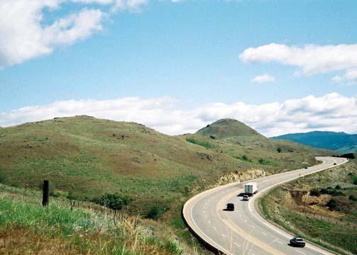
8 Local Planning in a Global Context Satellite imagery supplied by, Google Earth
9 Dale Rintoul Presenters Planner, City of Vernon Craig Broderick Director of Development Services, District of Coldstream Darwin Horning Long Range Planner, City of Vernon Rob Smailes Manager of Development Services, RDNO
10 City of Vernon Speaker: Dale Rintoul

11 Current Projects North Vernon Area

12 Silver Star Foothills Area

13 Middleton Mountain Area

14 Okanagan Landing Area

15 Outback Residential Resort

16 CLD / Adventure Bay Point Projects

17 Okanagan Hills Area Projects

18 Turtle Mountain / Downtown Projects

19 District of Coldstream Speaker: Craig Broderick
20 District of Coldstream Growth comes with many challenges and was the focal point of the recent municipal election. These issues impact many aspects of community life and are evident in the headlines of our local papers. Some topics covered by the media this past weekend include: potential schools closures; hospital overcrowding; downtown Vernon rezoning; creation of new ratepayers associations; expansion of parking facilities for the Kalavista Boat launch; concerns about development impacting wetlands; air quality issues; and traffic concerns.
21 District of Coldstream Major Developments There are several developments at different stages within Coldstream. Due to escalating real estate values, only recently some of these developments have become economically viable. Graystone 35 lots; Emerald Estates 15 lots; Sage Pointe 31 lots & 10 townhouses; Invercraig 20 lots; The Highlands multiple phases; Breaburn Heights 31 lots; Inverness/Sarsons; The Ranchlands 25 rural lots; Whisper Ridge 23 rural lots. Each development is unique and adds a community amenities (i.e. park, trails, walkways or other amenity).

22 District of Coldstream
23 District of Coldstream Three major initiatives for All related to Phase 2 of the review of the Official Community Plan. ALR & Industrial Review Sensitive Ecosystem Inventory Partnership with Coldstream, MoE, Allan Brooks Nature Centre Cycling & Pedestrian Network Plan Started off with a community group approaching Council. Recently informed that the Province has provided a grant to complete the study.
24 District of Coldstream Community Improvement Projects Commitment in 2006 budget to build small neighbourhood projects having a focus on encouraging walking and cycling. Examples: walkways, stairs cases; trails and small parks. Would like to explore potential partnerships with service clubs for some of these projects.
25 District of Coldstream Need to ensure that quality of life and environment is improved and not just accommodate growth. Need to ensure that development contributes to the community. Need to work together on a regional strategy to coordinate planning efforts and public investment.
26 City of Vernon Speaker: Darwin Horning

27 Council Workshop
28 Council Workshop PLAN VERNON LEG END U RBAN C O MMERCIAL C OMMU N IT Y COMMERCIAL VIL L AG E C O MMERCIAL T O U RIS T C OMMERCIAL RES ID EN TIAL - L OW D EN SITY RES ID EN T IAL - MEDIUMDENSITY RES ID EN TIAL - H IG H DENS ITY D OWNT OWN CREEKS ID E REDEVELOPMEN T AREA RURAL AGRIC UL TU RAL L IGHT INDUS TRIAL / SERVIC E COMMERCIAL AIRPO RT IND US TRIAL PUBLIC & IN ST IT UT IONAL.. PARKS & O PEN SPACE U RBAN G RO WT H AREA N EIGH BOURHOOD PLAN AREA BOUND ARY OF AN ADOPTED NEIG HBOU RHOO D PLAN WAT ERFRO N T PLAN AREA

29 Waterfront Plan Land Use Review Environmental Plan Service Plan Traffic Analysis Public Amenities Marina & Promontory Guidelines Airport Business Analysis Cost Analysis Implementation Strategy

30 Building Design Environmental Grading Retaining Walls Visual Control Landscaping Design Infrastructure Design Hillside Standards
31 OCP Review 1 st Official Community Plan Adopted in a revised format Revised and Adopted Revised and Adopted Revised and Adopted Master Revision Update Population & Development Trends Review Plan Objectives& Structure Review Plan Policy Revise Implementation Strategies
32 OCP Review


33 Regional Growth Strategy Current trend Focus on urban fringe Focus on city cores Community Vision Summary Current Trend Current trend Focus on office parks Focus on transit hubs Favor suburbs Current trend Favor compact growth Compact growth only Today
34 Regional Growth Strategy Current trend Focus on urban fringe Focus on city cores Community Vision Current Trend Population Distribution Current trend Focus on office parks Focus on transit hubs Favor suburbs Current trend Favor compact growth Compact Compact growth growth only only

35 Regional District of North Okanagan Speaker: Rob Smailes
36 RDNO Overview 787,000 ha total area (2 million acres) 155,000 ha private land (383,000 acres) 69,000 ha ALR (170,000 acres 2006 Population ~80,000 (conservative estimate)
37 RDNO Overview 6 Municipalities: Vernon Coldstream Spallumcheen Armstrong Enderby Lumby 5 Electoral Areas: Electoral Area B Electoral Area C Electoral Area D Electoral Area E Electoral Area F Note: Area A (Okanagan Landing) was annexed into the City of Vernon in 1993


38 Community Overview Electoral Areas B and C


39 RDNO Community Overview Electoral Areas D and E


40 RDNO Community Overview Electoral Area F
41 RDNO Planning Department Provides Land Use Planning Services for the Electoral Areas (including Silver Star): mapping / GIS, subdivision referral, current development, special projects, and long range planning (OCP s) 5 Official Community Plans 2 Zoning Bylaws 1 Servicing Bylaw
42 RDNO Planning Department Provides a variety of Land Use Planning Services on contract to 4 municipalities (Armstrong, Enderby, Lumby and Spallumcheen) including: mapping/ GIS, subdivision & current development, special projects, and long range planning (OCP s) * Each municipality has it s own elected Council, Official Community Plans, Zoning Bylaws and Servicing bylaws.

43 Planning & Development Projects: Electoral Areas Recreation & Resort Developments on Mara, Mabel, & Sugar Lakes Limited number of rural subdivisions ALR Boundary Review Official Community Plan Reviews
 The Ridge Subdivision (90 lots Phases I & II) Neighbourhood Plan for the Cabin")
44 Planning & Development Projects: Silver Star Mountain Snowbird Lodge Phase I & II (100+ high end units) Alpine Meadows Subdivision (49 Victorian design residences) The Ridge Subdivision (90 lots Phases I & II) Neighbourhood Plan for the Cabin Colony
45 Planning & Development Projects: City of Armstrong 180+ residential units (single, duplex and multi-family) Expecting redevelopment plans for Dairyland site (6 acres) Seniors housing at Haugen Centre Some Commercial and Industrial developments

46 Planning & Development Projects: City of Enderby ~100 Single Family Lots ~100 Multi-Family Units ~200 acres designated for future Single Family Lots Some Commercial and Industrial developments Seniors Housing Developments Proposed


47 Planning & Development Projects: Village of Lumby 150 Single family lots 50 Small Holdings lots Hillside Development Weyerhaeuser Lumby Salmon Trail along Bessette and Duteau Creeks Industrial and Commercial developments Seniors Care Facility
 Home Based Business")
48 Planning & Development Projects: Township of Spallumcheen 50+ Small Acreages proposed (Non-ALR) Phase I of Industrial Park nearing capacity Agricultural Area Plan (55% of land base in ALR) Home Based Business Implementation Strategy

49 Planning Challenges Water quantity and quality issues Competition for use of the limited land base ALR or Hillsides? Environmental & Social impacts of growth
50 Planning Challenges Establish a common vision to guide the entire region so we can grow in a sustainable manner that promotes: economic development which supports the unique character of all communities; protection of environmentally sensitive areas; affordable and safe places to live; efficient transportation systems; efficient use of facilities, services and resources.
51 Regional Context: Planning for the Greater Vision A Regional Growth Strategy provides a comprehensive vision for community growth for 20 years and beyond. Provides a mechanism to integrate planning efforts and cooperation amongst jurisdictions to address common issues related to community growth over the long term.
52 Regional Context: Planning for the Greater Vision Regional Board direction to investigate how other areas are addressing regional growth (learn from the experiences of others) Intent: to determine the scope of a potential Growth Strategy for this region Quest Computer Modeling Program (time permitting)

53 Thank you Questions?
DEFINED VILLAGE CENTRES & NEIGHBOURHOODS
 DEFINED VILLAGE CENTRES & NEIGHBOURHOODS residents in Nanoose Bay support focusing attractive, planned future development in Red Gap Centre and the Area s neighbourhood centres. In addition, the development
A Growing Community Rural Settlement Areas
 Town of Huntsville Official Plan Review - POLICY BACKGROUND PAPER A Growing Community Rural Settlement Areas BACKGROUND: In addition to the fully municipally-serviced Urban Settlement Area and the Hidden
A. Selma Park, Davis Bay and Wilson Creek
 A. Selma Park, Davis Bay and Wilson Creek This waterfront neighbourhood consists of three separate community areas, linked by Highway 101, but with different character, land use patterns and future potential.
June 23, 2016 Greater Vernon Water Procedures for Administering Non-Potable Water Service Rates and Construction of Separation Projects
 REGIONAL DISTRICT of NORTH OKANAGAN REPORT File No.: 5720.08.08.01 TO: FROM: MEETING DATE: SUBJECT: Greater Vernon Advisory Committee Engineering June 23, 2016 Greater Vernon Water Procedures for Administering
MOUNT PLEASANT SECONDARY PLAN & VILLAGE BLOCK PLAN. Wednesday, March 5, 2008 Informal Public Open House
 MOUNT PLEASANT SECONDARY PLAN & VILLAGE BLOCK PLAN Wednesday, March 5, 2008 Informal Public Open House 1. Welcome & Introductions 2. Highlights of Provincial Growth Plan 3. Overview and Status Update -
Chapter 3. Community Vision and Goals
 Chapter 3. Community Vision and Goals 3.1 Public Involvement Charlevoix s master plan was prepared in a way that maximized public participation. Dating back to 2004, the Planning Commission and staff held
Regional Context Statement
 Regional Context Statement REGIONAL CONTEXT STATEMENT 3. REGIONAL CONTEXT STATEMENT In 1995, the Provincial Government passed into law the Growth Strategies Act. The purpose of this provincial initiative
STUDY AREA LOCATION & CONTEXT:
 UNLOCKING THE POTENTIAL OF THE KEATING CROSS ROAD BUSINESS CORRIDOR A PLAN TO CREATE + RETAIN JOB-GENERATING BUSINESSES AND TO GUIDE INFRASTRUCTURE INVESTMENT The Keating Cross Road Corridor (the Keating
SECTION ONE: INTRODUCTION. introduction
 introduction 1 INTRODUCTION Since it was first established in 1843 as a trading post for the Hudson s Bay Company, Victoria has evolved into a Provincial capital city that is recognized across Canada and
OFFICIAL COMMUNITY PLAN. Bylaw 1750, 2014
 OFFICIAL COMMUNITY PLAN Bylaw 1750, 2014 AS ADOPTED ON JUNE 24, 2014 CITY OF ARMSTRONG BYLAW 1750, 2014 A BYLAW TO ADOPT AN OFFICAL COMMUNITY PLAN WHEREAS the Local Government Act authorizes Council to
VILLAGE OF LUMBY OFFICIAL COMMUNITY PLAN BYLAW NO. 761, 2014 BYLAW NO. 761, 2014 SCHEDULE A
 VILLAGE OF LUMBY OFFICIAL COMMUNITY PLAN BYLAW NO. 761, 2014 BYLAW NO. 761, 2014 SCHEDULE A Table of Contents 1 Introduction... 1 1.1 Official Community Plan Organization... 1 1.2 Purpose of the OCP...
4 Sustainability and Growth Management
 4 Sustainability and Growth Management Introduction Traditionally, has assumed growth and development with limited consideration for the long-term negative social, environmental or economic impacts on
Official Plan Review
 Official Plan Review Summary Report - The Built Environment August 2014 Part 1: Introduction Planning for a healthy, prosperous and sustainable community is an important goal for our municipality. From
A BLUEPRINT FOR BROCKTON A CITY-WIDE COMPREHENSIVE PLAN
 A BLUEPRINT FOR BROCKTON A CITY-WIDE COMPREHENSIVE PLAN Public Meeting October 2016 1 Plan Summary and Discussion Public Meeting May 4 2017 City of Brockton Bill Carpenter, Mayor Department of Planning
SAN RAFAEL GENERAL PLAN 2040 INTRODUCTION AND OVERVIEW
 SAN RAFAEL GENERAL PLAN 2040 INTRODUCTION AND OVERVIEW Steering Committee Presentation February 14, 2018 Purpose of General Plan Guide land use and development decisions Coordinate transportation, infrastructure,
Planning for Waterfront Communities
 Planning for Waterfront Communities Redevelopment Ready Communities Supplemental Training Program OFFICE OF THE GREAT LAKES Waterfront Community Best Practices and Guidelines New supplemental criteria
COMMISSION ACTION FORM
 ITEM #: 6 DATE: 09-06-17 COMMISSION ACTION FORM REQUEST: Introduction and Initial Review of Proposed Amendments to the Ames Urban Fringe Future Land Map for the North Growth Gap Area BACKGROUND INFORMATION:
VILLAGE & TOWN OF BERGEN: COMPREHENSIVE PLAN
 VILLAGE & TOWN OF BERGEN: COMPREHENSIVE PLAN CPC Public Hearing April 21, 2016 History 1996 Comprehensive Plan Comprehensive Plan Update Committee Consultant (LaBella Associates): December 2014 Residents
THE CORPORATION OF THE CITY OF VERNON BYLAW NUMBER A bylaw to amend the City of Vernon s Plan Vernon Bylaw Number 5151
 THE CORPORATION OF THE CITY OF VERNON BYLAW NUMBER 5277 A bylaw to amend the City of Vernon s Plan Vernon Bylaw Number 5151 WHEREAS the Council of The Corporation of the City of Vernon has determined to
BROOKHILL NEIGHBORHOOD MODEL ZONING MAP AMENDMENT PREFACE TO APPLICATION
 BROOKHILL NEIGHBORHOOD MODEL ZONING MAP AMENDMENT PREFACE TO APPLICATION June 15, 2015 Revised: August 1, 2016 I. VISION Brookhill is a proposed community based upon the principles of Albemarle County
Strategies/Actions Priority List
 Strengthening the Creative Sector: Build stronger relationships with, and between, cultural organizations and businesses and increase opportunities for working together to build capacity within organizations.
City of Royalton Comprehensive Land Use Plan 2005 to Revision February 8, 2011
 City of Royalton Comprehensive Land Use Plan 2005 to 2015 2011 Revision February 8, 2011 PART ONE: INTRODUCTION TO THE COMPREHENSIVE PLAN 1.0 Purpose and Introduction The Comprehensive Land Use Plan provides
KAMLOOPS BACKGROUND. Let s Ta!k KAMPLAN REVIEW & UPDATE Call: Web: REVIEW UPDATE
 REVIEW UPDATE February 2014 Development and Engineering Services City of Kamloops Let s Ta!k KAMPLAN REVIEW & UPDATE Call: 250-828-3568 Email: kamplan@kamloops.ca Web: www.kamloops.ca/kamplan REVIEW UPDATE
1.0 Purpose of a Secondary Plan for the Masonville Transit Village
 Report to Planning and Environment Committee To: Chair and Members Planning & Environment Committee From: John M. Fleming Managing Director, Planning and City Planner Subject: Masonville Transit Village
Chair and Members of the Planning, Public Works and Transportation Committee. Tara Buonpensiero, Senior Planner Policy, MCIP, RPP
 REPORT TO: REPORT FROM: Chair and Members of the Planning, Public Works and Transportation Committee Tara Buonpensiero, Senior Planner Policy, MCIP, RPP DATE: April 9, 2018 REPORT NO.: RE: PLS-2018-0027
3.1 Existing Land Use
 3.0 Land Use This strategy has been developed taking into account the position of the Town of Sidney as the economic center of the Saanich Peninsula. It acknowledges existing land use patterns in the downtown
RECREATION AND OPEN SPACE ELEMENT GOALS, OBJECTIVES, AND POLICIES
 RECREATION AND OPEN SPACE ELEMENT GOALS, OBJECTIVES, AND POLICIES Goal 7 To provide park facilities, recreation programs, and open space resources that are safe, adequate, and accessible to all City residents,
2010 Plan of Conservation and Development
 2010 Plan of Conservation and Development Wilton Planning and Zoning Commission Adopted November 2, 2009 Effective January 1, 2010 WILTON 2010 PLAN OF CONSERVATION & DEVELOPMENT PARTICIPANTS Planning &
THE CORPORATION OF THE CITY OF VERNON BYLAW NUMBER A bylaw to amend the City of Vernon s Plan Vernon Bylaw Number 5151
 THE CORPORATION OF THE CITY OF VERNON BYLAW NUMBER 5455 A bylaw to amend the City of Vernon s Plan Vernon Bylaw Number 5151 WHEREAS the Council of The Corporation of the City of Vernon has determined to
Metro Vancouver. Regional Growth. Strategy. Optimizing the Urban Footprint
 Metro Vancouver Regional Growth Metro Vancouver Fraser Valley Regional District Strategy USA Victoria Bellingham Optimizing the Urban Footprint 2011 Salish Sea Ecosystem Conference October 25, 2011 Terry
PLANNING ADVISORY BOARD AGENDA OCTOBER
 ! City of Langley PLANNING ADVISORY BOARD AGENDA OCTOBER 1, 2014 3-5pm LANGLEY CITY HALL - 112 2 nd Street, Langley WA 1) Call to Order and Roll Call 2) Approval of the Minutes September 10, 2014 3) Public
Municipal Development Plan Update Urban Service Area and Hamlets
 ENCLOSURE 1 Municipal Development Plan Update Urban Service Area and Hamlets Priorities Committee January 24, 2017 MUNICIPAL DEVELOPMENT PLAN UPDATE SHAPING OUR FUTURE MDP Update - Agenda MDP Update Public
Staff Report and Recommendation
 Community Planning and Development Planning Services 201 W. Colfax Ave., Dept. 205 Denver, CO 80202 p: 720.865.2915 f: 720.865.3052 www.denvergov.org/cpd TO: City Council Neighborhoods and Planning Committee
CITY OF LANGLEY OFFICIAL COMMUNITY PLAN BYLAW, 2005, NO APPENDIX II - REGIONAL CONTEXT MAP
 CITY OF LANGLEY OFFICIAL COMMUNITY PLAN BYLAW, 2005, NO. 2600 APPENDIX II - REGIONAL CONTEXT MAP ± Legend Agricultural Mixed Employment Industrial Conservation & Recreation Regional City Centre Urban Containment
Oakland County s Green Infrastructure Vision. L. Brooks Patterson Oakland County Executive
 Oakland County s Green Infrastructure Vision L. Brooks Patterson Oakland County Executive Southeast Michigan 20 miles northwest of Detroit Consists of 910 square miles Population of 1.2 million More than
Chapter 1. Community Context. Vision Statement Population and Housing Trends Legislative Context Regional Context Statement
 Chapter 1 Community Context Vision Statement Population and Housing Trends Legislative Context Regional Context Statement 1.1 VISION STATEMENT CORPORATE MISSION STATEMENT To promote a safe and livable
Please read the entire document
 projects impacting the waterfront revitalization area. The waterfront revitalization area of the town will have to subareas to the west and east of the village. Page 6 of 6 Wayfinding master plan create
CHAPTER 7: VISION AND ACTION STATEMENTS. Noble 2025 Vision Statement
 CHAPTER 7: VISION AND ACTION STATEMENTS This chapter presents the vision, policy and action statements that transform the comprehensive planning study, an analysis of Noble s past, future trends and community
City of Langford Green Development Checklist
 City of Langford Green Development Checklist The following Green Development Checklist creates a sustainability standard for all comprehensive development within the City of Langford. The commitments made
EXISTING COMPREHENSIVE PLAN
 EXISTING COMPREHENSIVE PLAN Town Center Land Use Element: V. LAND USE POLICIES Town Center Mercer Island's business district vision as described in "Your Mercer Island Citizen-Designed Downtown" was an
HE VISION. Building a Better Connected Place
 HE VISION Building a Better Connected Place WALK INTO THE FUTURE. Life in Cranberry, 2030 Here s what our residents told us they wanted to see in their community by 2030: The Cranberry of 2030 is a place
Municipal Comprehensive and Open Space Plans
 Appendix 13-A Local Historic Policy Municipal Comprehensive and Open Space Plans Oxford Regional Comprehensive Plan (1969) The Oxford Regional Comprehensive Plan serves as the Comprehensive Plan for Oxford
section 3: Vision, Values and Goals
 Vision, Values and Goals 3 2041 Vision: Victoria is an urban sustainability leader inspiring innovation, pride and progress towards greater ecological integrity, livability, economic vitality, and community
LAND USE OVERVIEW WHAT YOU WILL FIND IN THIS CHAPTER
 LAND USE WHAT YOU WILL FIND IN THIS CHAPTER Information about the City s expected population and employment growth. Description and capacity of existing and future land use designations. Policies that
TAHOE CITY VISION PLAN June 2012
 TAHOE CITY VISION PLAN June 2012 Tahoe City Public Utility District North Lake Tahoe Resort Association Sustainable Community Advocates Agenda Process Overview Purpose TRPA Regional Plan Update Conversations
South of Eastern Strategic Direction Status Update
 STAFF REPORT ACTION REQUIRED South of Eastern Strategic Direction Status Update Date: July 10, 2014 To: From: Planning and Growth Management Committee Chief Planner and Executive Director, City Planning
LAND USE AMENDMENT CORNERSTONE (WARD 3) 60 STREET NE AND COUNTRY HILLS BOULEVARD NE MAP 26NE BYLAW 22D2017
 60 STREET NE AND COUNTRY HILLS BOULEVARD NE MAP 26NE BYLAW 22D2017") Page 1 of 14 EXECUTIVE SUMMARY This Land Use Amendment application covers an area of 43.76 hectares ± (108.14 acres ±) located in northeast Calgary, bound by Country Hills Boulevard NE to the south and
Page 1 of 14 EXECUTIVE SUMMARY This Land Use Amendment application covers an area of 43.76 hectares ± (108.14 acres ±) located in northeast Calgary, bound by Country Hills Boulevard NE to the south and
Village of Fair Haven Goals & Objectives
 Village of Fair Haven Goals & Objectives 1 Natural Environmental Quality & Aesthetics Embrace policies and programs that preserve and enhance the Village s natural resources, environment, water quality,
DISCUSSION TOPIC: ST JOHNS RIVER & ITS TRIBUTARIES (BPII) 2030 COMPREHENSIVE PLAN POLICES AND REGULATORY FRAMEWORK
 2030 COMPREHENSIVE PLAN POLICES AND REGULATORY FRAMEWORK") DISCUSSION TOPIC: ST JOHNS RIVER & ITS TRIBUTARIES (BPII) 2030 COMPREHENSIVE PLAN POLICES AND REGULATORY FRAMEWORK St. John s River & Its Tributaries Issue Summary: The St. Johns River is an important
DISCUSSION TOPIC: ST JOHNS RIVER & ITS TRIBUTARIES (BPII) 2030 COMPREHENSIVE PLAN POLICES AND REGULATORY FRAMEWORK St. John s River & Its Tributaries Issue Summary: The St. Johns River is an important
Chapter 14: Community Services and Public Utilities
 Chapter 14: Community Services and Public Utilities Goal: Cost-effective community services related to the needs of the community. Background The City of Dundas provides a variety of services to community
Downtown Dubuque...it s a great time.
 Downtown Dubuque...it s a great time. Your timing could not be better to invest in Downtown. With hundreds of millions in public and private investment occurring on the City s downtown waterfront, millions
GATEWAY AREA STRUCTURE PLAN
 CHESTERMERE GATEWAY AREA STRUCTURE PLAN COMMUNITY OPEN HOUSE SEPTEMBER 22 nd, 2015 PLAN AREA ± 512 hectares (± 1,265 acres) GATEWAY LOCATION UNDEVELOPED LANDS PRESENT AGRICULTURAL USE REGIONAL LAND USE
40 Years: A Brief History of Whistler - The Role of Long Term Planning Colorado Association of Ski Towns. January 20, 2016
 40 Years: A Brief History of Whistler - The Role of Long Term Planning Colorado Association of Ski Towns January 20, 2016 Presentation overview Whistler s unique history Building of Whistler Premise, purpose
Kick-off Meeting,: September 11, 2014
 Town of Midland Downtown Master Plan Study Kick-off Meeting,: September 11, 2014 PRESENTATION OVERVIEW 1. Trip Agenda 2. Introduction 3. Work Program & Schedule Consultation Strategy Project Phases and
2009 Community Excellence Award DOWNTOWN LANGLEY MASTER PLAN
 2009 Community Excellence Award DOWNTOWN LANGLEY MASTER PLAN A Multi-Phased Strategy for Economic, Physical, and Social Growth Category: Leadership & Innovation, Large Community LAND USE AND PLANNING Submitted
6 Strategic Vision and Vision Matrix
 PUBLIC HANDOUT: FEBRUARY 11, 2013 TOWN COUNCIL MEETING STRATEGIC VISION PLAN: VISIONING INTO ACTION 6 Strategic Vision and Vision Matrix 6.1 Strategic Vision The Strategic Vision builds on the vision of
CITY COUNCIL AGENDA REPORT
 CITY COUNCIL AGENDA REPORT Subject: COUNCIL MOTION LRT ALIGNMENT REMOVAL FROM THE TRANSPORTATION MASTER PLAN On February 10, 2016 Councillor Hughes provided notice in accordance with Section 23 of Procedure
3. VISION AND GOALS. Vision Statement. Goals, Objectives and Policies
 Vision Statement Queen Creek s interconnected network of parks, trails, open spaces and recreation opportunities provide safe and diverse activities and programs that sustain its unique, small town, equestrian
LAND USE AMENDMENT DOWNTOWN COMMERCIAL CORE (WARD 7) MACLEOD TRAIL SE AND 5 AVENUE SE BYLAW 254D2017
 MACLEOD TRAIL SE AND 5 AVENUE SE BYLAW 254D2017") Page 1 of 10 EXECUTIVE SUMMARY This Land Use Amendment application seeks to redesignate a full downtown block (currently the YWCA site) from a Direct Control based on the CM-2 District (Land Use Bylaw
Page 1 of 10 EXECUTIVE SUMMARY This Land Use Amendment application seeks to redesignate a full downtown block (currently the YWCA site) from a Direct Control based on the CM-2 District (Land Use Bylaw
ARISE: The Rock Renaissance Area Redevelopment & Implementation Strategy
 2014 Professional Awards 1 ARISE: The Rock Renaissance Area Redevelopment & Implementation Strategy Janesville, WI Completed December 2014 Analysis & Planning Purpose of Project 2 The purpose of the Rock
ADMINISTRATION RECOMMENDATION 2016 November 03. That Calgary Planning Commission recommends APPROVAL of the proposed Land Use Amendment.
 Page 1 of 12 EXECUTIVE SUMMARY This Land Use Amendment application covers an area of 75.76 hectares ± (187.20 acres ±) located in northeast Calgary, bound by Stoney Trail NE to the north, 128 Avenue NE
Municipal Development Plan. Summer Village of ROCHON SANDS. Bylaw #241-18
 Municipal Development Plan Summer Village of ROCHON SANDS Bylaw #241-18 TABLE OF CONTENTS PART ONE: BACKGROUND AND PURPOSE 3 SECTION 1: BACKGROUND 3 SECTION 2: GOALS AND POLICIES 3 PART TWO: PHYSICAL ENVIRONMENT
Transit / Housing Oriented Redevelopment
 Broward County Urban Planning and Redevelopment Department Kick-Off Meeting October 24, 2007 Transit / Housing Oriented Redevelopment 1 Future Land Use 2 Broward County Charter Voters approved in 1974.
Naomi Weiss, Executive Director, DBPA Jason Jeffries, Project Manager, City of Daytona Beach
 Naomi Weiss, Executive Director, DBPA Jason Jeffries, Project Manager, City of Daytona Beach Nottingham Plan 2002 Adopted Redevelopment Plan 2002 Riverfront Action Plan 2004 Downtown Vision Plan 2007
PLAN ELEMENTS WORKSHOP. April 5, 2016
 PLAN ELEMENTS WORKSHOP April 5, 2016 needs more housing. But there is no one-size fits-all solution. Every neighborhood has its own character. In some places, density is not only appropriate it is badly
Improve Neighborhood Design and Reduce Non Point Source Water Pollution
 HOW TO Planning Guide Improve Neighborhood Design and Reduce Non Point Source Water Pollution This document was funded by a grant from the New Hampshire Coastal Program with funding from the National Oceanic
RECREATION, OPEN SPACE AND GREENWAYS ELEMENT GOALS, OBJECTIVES, AND POLICIES
 RECREATION, OPEN SPACE AND GREENWAYS ELEMENT GOALS, OBJECTIVES, AND POLICIES GOAL R-1: DEVELOP A RECREATION, OPEN SPACE AND GREENWAYS SYSTEM AS AN INTEGRAL COMPONENT OF AN OVERALL, COUNTY-WIDE ECONOMIC
What Does It Take To Create A Town Center?
 What Does It Take To Create A Town Center? Context, Design, and Process The Prince Frederick Master Plan Update 1 Background and Overview A Brief History of Town Centers in Calvert County 2 Background
HOT SPRINGS COMPREHENSIVE PLAN OUTLINE
 HOT SPRINGS COMPREHENSIVE PLAN OUTLINE 7/28/2015 Draft outline - Hot Springs Comprehensive Plan Draft outline of topics to be discussed at public hearings and in planning sessions. Order and topics and
2018 Northampton Township Comprehensive Plan
 2018 BUCKS COUNTY, PENNSYLVANIA What is a? A comprehensive plan is a municipality s main policy document that details the collective vision for the future, the historic, environmental, and cultural facilities
10 Implementation. Implementation. Responsibility for Implementation. Blueprint for Bloomsburg. Town of Bloomsburg Comprehensive Plan 10-1
 Implementation 10 Implementation This chapter overviews how to use the comprehensive plan as a land use and programming tool for the Town of Bloomsburg and recommends annual review of the plan by the Town
WATERFORD Plan of Preservation, Conservation and Development Supplement Part 1 - Policy Element
 WATERFORD 2012 Plan of Preservation, Conservation and Development 2015 Supplement Part 1 - Policy Element Effective June 11, 2015 2015 Plan Update GOAL To respond to the evolving land use needs and continually
Hamilton Area Plan Bylaw 9000 Schedule 2.14
 Official Community Plan (OCP) Hamilton Area Plan Bylaw 9000 Schedule 2.14 Original Adoption: June 19, 1995 Plan Adoption: February 25, 2014 Planning Area Boundaries Map Hamilton Area Plan Boundary Map
178 Carruthers Properties Inc.
 178 Carruthers Properties Inc. Planning Rationale for 178 Carruthers Avenue Site Plan Control Application June 2014 Table of Contents 1.0 Introduction 2.0 Overview of Subject Property 3.0 Current Zoning
City of St. Thomas New Official Plan
 City of St. Thomas New Official Plan Sustainable & Healthy Community Workshop Ann Joyner and Paddy Kennedy Dillon Consulting Limited Work Shop Outline Introduction Presentation Exercise 1 (individual)
Welcome. Thank you for attending our first Early Input Opportunity Meeting. The Purpose of this meeting is to: Introduce you to the project team
 Welcome Our proposal at 2050-2070 Marine Drive & 2000 Curling Road represents an exciting opportunity to contribute to the vibrancy of the Lions Gate Village area and our growing community. Thank you for
LAND USE AMENDMENT CORNERSTONE (WARD 3) COUNTRY HILLS BOULEVARD AND STONEY TRAIL NE BYLAW 9D2017
 COUNTRY HILLS BOULEVARD AND STONEY TRAIL NE BYLAW 9D2017") Page 1 of 12 EXECUTIVE SUMMARY This Land Use Amendment application covers an area of 54.92 hectares ± (135.71 acres ±) located in northeast Calgary, bound by Country Hills Boulevard NE to the north and
Page 1 of 12 EXECUTIVE SUMMARY This Land Use Amendment application covers an area of 54.92 hectares ± (135.71 acres ±) located in northeast Calgary, bound by Country Hills Boulevard NE to the north and
KAMPLAN City of Kamloops. Section D. Land Use Policies D-1
 KAMPLAN City of Kamloops Section D Land Use Policies D-1 City of Kamloops KAMPLAN D 1 Land Management and Development This section links to the following Community Values: D-2 develop complete neighbourhoods
SECTION 1 Introduction...1. SECTION 2 Regional Context Criteria for Planning Districts Description of Planning District...
 Table of Contents SECTION 1 Introduction...1 SECTION 2 Regional Context...2 2.1 - Criteria for Planning Districts...2 2.2 - Description of Planning District...2 SECTION 3 Goals & Objectives...5 SECTION
implementation r expression in landscape
 6 ubc okanagan implementation campus plan r expression in landscape 68 6 implementation campus plan sections The Campus Plan supports the academic mission, values and commitments of the University by providing
This chapter describes the purpose of the Plan, introduces how the Plan is organized and provides contextual background for the Plan.
 Chapter 1: INTRODUCTION Purpose of a Comprehensive Plan The 2040 Comprehensive Plan establishes Medina s vision as a community and sets goals and objectives which guide future decisions and policies. The
Land Use Amendment in Southwood (Ward 11) at and Elbow Drive SW, LOC
 at and Elbow Drive SW, LOC") 2018 November 15 Page 1 of 10 EXECUTIVE SUMMARY This land use amendment application was submitted by Rick Balbi Architect on 2017 August 31 on behalf of Sable Developments Ltd, and with authorization from
2018 November 15 Page 1 of 10 EXECUTIVE SUMMARY This land use amendment application was submitted by Rick Balbi Architect on 2017 August 31 on behalf of Sable Developments Ltd, and with authorization from
Director, Community Planning, Toronto and East York District
 Lower Yonge Precinct Plan Update STAFF REPORT ACTION REQUIRED Date: October 16, 2012 To: From: Wards: Reference Number: Toronto and East York Community Council Director, Community Planning, Toronto and
This page intentionally blank.
 This page intentionally blank. Parks, Recreation, and Open Space Chapter Relationship to Vision Vision Parks, Recreation and Open Space Chapter Concepts County Government. County government that is accountable
INDEPENDENCE BOULEVARD AREA PLAN. June 24, 2008
 INDEPENDENCE BOULEVARD AREA PLAN Public Meeting #1 June 24, 2008 Tonight s Agenda Introduction Welcome and Ground Rules Overview Presentation Purpose of the Plan What Brings Us Here? A Tour of the Corridor
THE GARDEN CITY PLAN. City of St. Catharines Official Plan. City of St. Catharines
 THE GARDEN CITY PLAN City of St. Catharines Official Plan City of St. Catharines August 2010 APPROVAL INFORMATION This Official Plan of the City of St. Catharines Planning Area, known as the Garden City
Table 8-4: Road Classification Local Roads, second table, of Chapter 8 Create a Multi-Modal City, be amended by adding the following:
 1 Port Street East Official Plan Amendment APPENDIX 3 Amendments to Mississauga Official Plan Table 8-4: Road Classification Local Roads, second table, of Chapter 8 Create a Multi-Modal City, be amended
Plan Overview. Manhattan Area 2035 Reflections and Progress. Chapter 1: Introduction. Background
 Plan Overview The Manhattan Urban Area Comprehensive Plan (the Comprehensive Plan) is a joint planning initiative of the City of Manhattan, Pottawatomie County, and Riley County. The 2014 Comprehensive
COUNTY OF SACRAMENTO CALIFORNIA PLANNING COMMISSION REPORT
 COUNTY OF SACRAMENTO CALIFORNIA PLANNING COMMISSION REPORT TO: FROM: SUBJECT: COUNTY PLANNING COMMISSION DEPARTMENT OF COMMUNITY DEVELOPMENT GROWTH AREA PLANS UPDATE CONTACT: Cindy Storelli, Principal
Chapter 1 Vision Statement & Goals
 Chapter 1 Section 1.1 Section 1.2 Section 1.3 Section 1.4 Section 1.5 Introduction Vision Statement Visioning Exercise Prioritization of Land Use Issues Goals of the Comprehensive Plan CHAPTER 1 SECTION
Gary & Regional Investment Project. October 27, Creating Tomorrow Today Comprehensive Regional Plan - NIRPC
 Creating Tomorrow Today 2040 Comprehensive Regional Plan Gary & Regional Investment Project October 27, 2010 Creating Tomorrow Today - 2040 Comprehensive Regional Plan - NIRPC What is NIRPC? - Northwestern
MAYFIELD WEST SECONDARY PLAN PHASE 2
 MAYFIELD WEST SECONDARY PLAN PHASE 2 Public Open House #3 February 25, 2010 Draft Preferred Land Use Scenario TOWN OF CALEDON PLANNING & DEVELOPMENT DEPARTMENT Open House Agenda TOWN OF CALEDON 1. Welcome
Courthouse Planning Area
 Courthouse Planning Area Current Reality The Courthouse Planning Area is the characterized by expansive suburbanscale residential areas as well as the community resource planned area of athletic, educational,
A New Plan For The Calgary Region June calgary.ca call 3-1-1
 A New Plan For The Calgary Region June 2009 calgary.ca call 3-1-1 Introduction Since January 2006, The City of Calgary has been actively participating with the member municipalities of the Calgary Regional
NEC of Central Avenue and Indian School Road
 NEC of Central Avenue and Indian School Road For this location, there are two applicable plans that provide guidance on development. The two plans include the Indian School Specific Plan (1991) and the
Planning and Public Consultation Process for the Preparation of a General Land Use Plan for South Port Kells TERMS OF REFERENCE
 APPENDIX "B" Planning and Public Consultation Process for the Preparation of a General Land Use Plan for South Port Kells TERMS OF REFERENCE PURPOSE South Port Kells is located in the northeastern quadrant
Vision 2020 Economic Redevelopment Team Final Report
 Vision 2020 Economic Redevelopment Team Final Report October 24, 2011 7/30/2011 1 2020 Visioning Redevelopment Economics Team Fritz Beiermeister Mike Evangelista Bill Largent Mark Lifter Team Members Shel
Port Credit Local Advisory Panel October 20 th Meeting
 Port Credit Local Advisory Panel October 20 th Meeting Focus Of This Evening s Meeting: 1. Hurontario Main Street Higher Order Transit Study 2. Port Credit Mobility Hub & GO Station Parking Structure Study
ANC 2A Presentation. November 9, 2006
 ANC 2A Presentation November 9, 2006 Introduction & Overview Applicants Boston Properties and KSI Services (project developers) The George Washington University (land owner) 2.66 acre site (former GW hospital
Delaware River Port Authority Southern New Jersey Waterfront Master Plan
 Delaware River Port Authority Southern New Jersey Waterfront Master Plan Press Conference January 11, 2006 Agenda Plan Purpose & Objectives Market Demand Residential Forecast Maritime Forecast Waterfront