The Master Plan Framework
|
|
|
- Heather Lane
- 5 years ago
- Views:
Transcription


1 The Master Plan Framework The East Harbour Master Plan advances the development of 60 acres of former industrial lands east of the Don River. The Master Plan outlines a vision for a vibrant, transit-oriented and dynamic employment district that will accommodate substantial new office uses, a highquality public realm and new open spaces million sf The Master Plan will create a major new destination at the edge of the Port Lands that will be integrated into the surrounding city fabric. East Harbour will provide for: A major cluster of new office space that will support the City s economy High-quality open spaces, including new parks, plazas, courtyards, greenways and a naturalized River s Edge A fine-grained street system that will ensure a comfortable pedestrian experience and public realm A new Transit Hub that will support existing GO Transit service and future subway and streetcar service A diverse and sustainable range of entertainment, retail, food, institutional, cultural uses and other amenities jobs Development of the East Harbour will occur incrementally over the long term and will be aligned with major public infrastructure and transit investments. The East Harbour Transit Hub will support regional connectivity and provide a local anchor for development, placemaking and new employment opportunities. employment space on the First Gulf lands Over 50,000 Phasing Plan Illustrative rendering of East Harbour, looking west towards Downtown Toronto Heritage buildings will establish a sense of place and an anchor for the open space network. The naturalized River s Edge will provide flood protection and integrate with the Lower Don Park systems. Flexible office tower development sites will support dynamic and innovative working spaces for the new economy. 1.7 million sf retail, culture, recreation and entertainment 5 major transit lines Approximately 8.5 acres of open space on the First Gulf lands New plazas, a renewed soap factory building and dynamic retail will support a vibrant and dynamic community. New large green spaces will expand opportunities for play within a regionally connected network of open spaces. Broadview will provide address for new office buildings and a focal point for main street retail. The Lake Shore Greenway will establish a green spine and gateway into the downtown. Illustrative rendering of East Harbour, looking south towards the Port Lands First Gulf Lands


 Mode Morning Peak Hours Afternoon Peak Hours Saturday Peak Hours In Out 2-way In Out 2- way In")
2 Mobility and Connectivity Transportation Network East Harbour will become a major multi-modal mobility hub. With the addition of new transit infrastructure, an interconnected street network, a high-quality public realm and a series of plazas and mid-block connections, East Harbour will become one of the most accessible places in the City. It will be a hyper-connected place that is easily accessed whether taking transit, cycling, walking, driving or carpooling. Parking and Service Access Existing infrastructure and major planned improvements to transit will allow East Harbour to thrive. A new, pedestrian-oriented street and block network will support movement throughout the area, improve linkages to surrounding neighbourhoods, and create a safe and welcoming environment. Mobility will be substantially enhanced through the creation of a high-quality public realm and new pedestrian and cycling connections which will promote non-vehicular movement and ensure a comfortable experience for workers and visitors. New development and public realm improvements will be thoughtfully designed to facilitate convenient access to a range of transportation modes, encouraging transit use and cycling. Principles of universal accessibility will support mobility for all ages and abilities. Transportation Demand Management Framework The TDM Framework outlines strategies and measures, combined with physical attributes of the Master Plan, to reduce the number of vehicle demand to/from East Harbour, and to generate and facilitate demand for more active and sustainable travel modes, including transit, cycling and walking. The TDM Framework will respond to the mobility needs of employees and visitors over time. The Framework focuses on 3 key concepts: 1. Vehicle Parking Limit vehicle parking as much as possible, Actively manage parking supply through efficiencies, phasing, and pricing policies 2. Mobility Choice Offer an array of multi-modal transportation choices for workers and visitors 3. Menu of TDM Measures Encourage transit use Promote and facilitate cycling Enhance pedestrian movement Manage vehicle parking Provide transit-supportive building infrastructure Cycling Network Forecast Travel Demand (Full Build-Out) Mode Morning Peak Hours Afternoon Peak Hours Saturday Peak Hours In Out 2-way In Out 2- way In Out 2-way B Sensitivity Analysis: Year Site Trips by Mode Auto Driver 1, , ,155 1, ,420 Auto Passenger C Transit Rider 8,670 1,320 10,190 2,315 8,125 10,440 1,770 1,770 3,540 Pedestrian 1, , ,260 1, A E Cyclist 2, , ,795 2, Total Site Trips 13,675 2,130 15,745 3,075 12,835 16,510 3,400 3,400 6,660 D Broadview Streetcar Development blocks Parking Note: Transit hub and associated pedestrian/cycling path to be determined through the Transit Hub design process. Loading/Vehicular access Pedestrian Travel Demands Cyclist Travel Demands Transit Travel Demands Vehicle Travel Demands


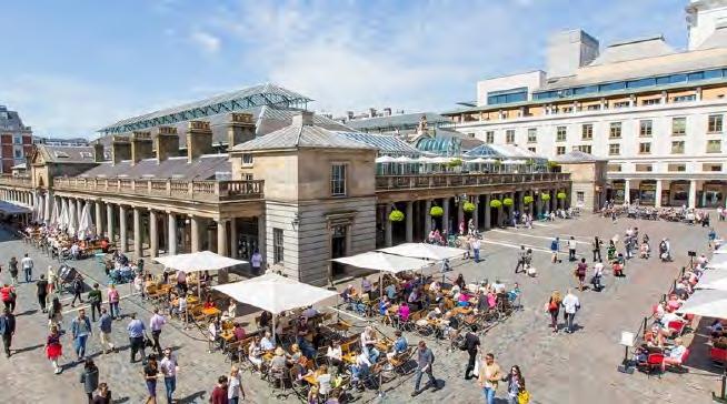
3 Open Space and Pedestrian Connections A connected network of open spaces will provide diverse places for community enjoyment and support green linkages to the regional open space network. These spaces will enhance amenity and create a sense of place for employees, visitors and the broader community. Integrated with the regional open space network, the open space network will establish new green links from the existing communities into the Don River Valley Park and Lake Ontario waterfront. Open Space Framework The proposed open space network is made up of both a primary and a secondary open space system. The primary network consists of a robust set of green spaces that will be connected to the local and regional open systems, are anticipated to be designed to incorporate significant natural features and landscaping, and to support a range of active and passive park programming. The secondary open space network will consist of finer-grain connections, plazas, and open spaces, that will animate each block. These spaces are intended to be connected as part of a legible framework, but to otherwise develop organically, carefully designed together with adjacent buildings to ensure their character is complementary to new active frontages and future uses Well landscaped greenways can create an attractive setting. 4 Retail uses can be closely integrated into the design of a transit station, helping to animate areas around the station (Hackesher Market, Berlin) 5 The river s edge should be designed to allow people to make use of this space. 6 First Gulf Lands Heritage buildings will establish a sense of place and an anchor for the open space network. East Harbour Precinct Existing Buildings River Edge Station Plazas Internal Plazas Mid-Block Connections The station plaza will act as the front door to the station and give prominence to the transit hub. Soap Factory Plaza The naturalized river s edge will provide flood protection and integration with the Lower Don Park systems. The Lake Shore Greenway will establish a green spine and gateway into the downtown. New plazas, a renewed soap factory building and dynamic retail will support a vibrant and dynamic community. New large green spaces will expand opportunities for play within a regionally connected network of open spaces. Broadview will provide address for new office buildings and a focal point for main street retail. This image represents an approximation of the location and configuration of open spaces. The First Gulf team continues to work with the City of Toronto to refine and confirm these details. Illustrative rendering of proposed Soap Factory Plaza Parks and green spaces allow for a range of programming and activities. Open spaces and make plazas a year-round destination (Campus Martius, Detroit). Mid-block connections should be attractive and comfortable spaces that support pedestrian movement (Stockholm).


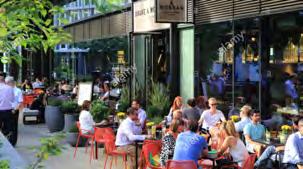
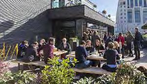
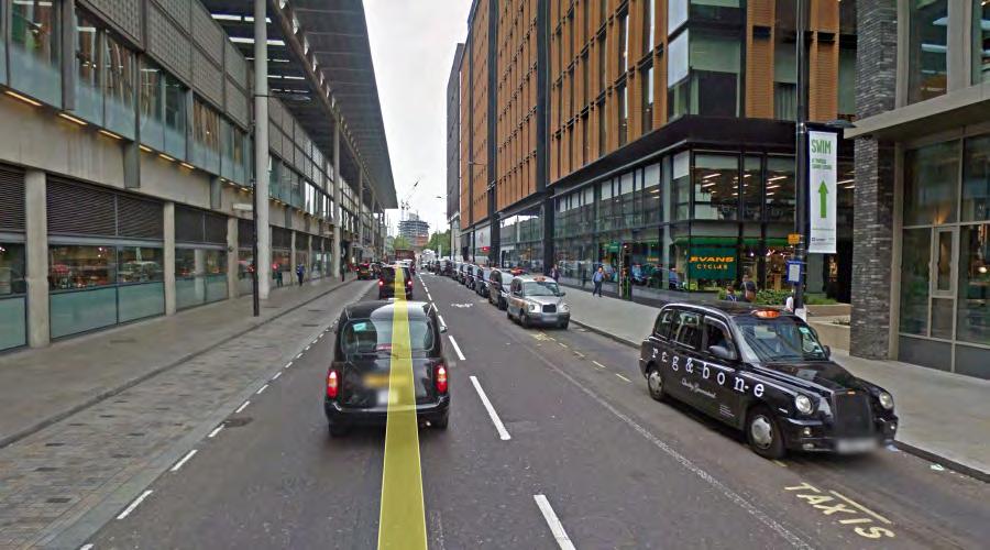
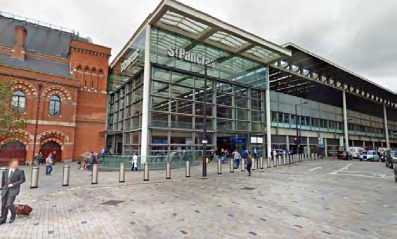
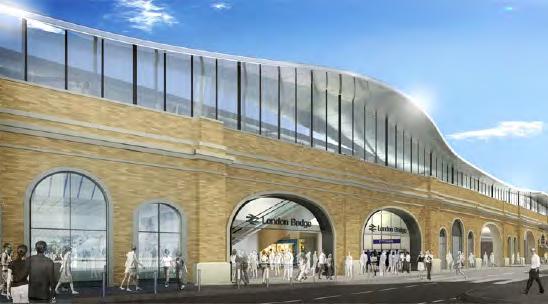
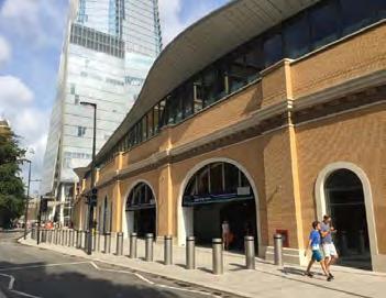
4 Transit Plaza As the gateways to a vibrant office district, the Transit Hub Plazas outside East Harbour Station need to accommodate large flows of pedestrian traffic at peak hours, and be welcoming, animated spaces at all hours of the day. The Plaza will be complemented with active retail, service and commercial uses within and around the station, which will support activity levels and create pedestrian amenity. The illustrations below represent an exploration of options for the open space and access routes to the Transit Hub Plazas. Local and international precedents illustrate the potential configurations and functionality of these spaces. While the transit station is a key element of the public realm, its design will need to be advanced further in collaboration with the City and Metrolinx. The detailed design will consider opportunities to facilitate multiple access points and achieve seamless integration with new development and open spaces. UNION STATION - Scale Study - Toronto Total Plaza Area = 2720 m m m m 2 18m 8m UNION STATION - Air Canada Fan Zone Scale Study - Toronto Total Plaza Area = 6340 m 2 +/- 1,050 sq/m 2 +/- 5,290 sq/m 2 41m THE SHARD 28m 1148 m 2 8m 35m 12m 8m 2 TOTAL LENGTH 875 m 2 25m 70m 28m 25m 700 m 2 28m 25m 700 m 2 LONDON BRIDGE STATION - St Thomas Street Frontage Scale Study - London, UK Total Plaza Area = 2240 m 2 LONDON BRIDGE STATION - Plaza at the Shard Scale Study - London, UK Total Plaza Area = 1400 m 2 EAST HARBOUR - Station Plaza Dimensions Total Plaza Area = 2023 m 2 OFFICIAL DROP OFF LOCATION WITH CANOPY 20 14m 130 Tank House Lane (9m) BYMARK, TORONTO HACKESCHER STATION, BERLIN KING S CROSS, LONDON KING S CROSS, LONDON 118m Case Goods Lane (6m) A=3, ENTRANCE PANCRAS SQUARE, LONDON UNION STATION, DENVER HACKESCHER STATION, BERLIN KING S CROSS, LONDON KING S CROSS, LONDON PANCRAS STREET (ST PANCRAS STATION, LONDON) 4300 m 2 153m 73m TANKHOUSE LANE 18m 9m EL CATRIN PATIO 1440 m 2 ENTRANCE UNION STATION, TORONTO TIMES SQUARE, NYC COVENT GARDEN, LONDON HACKESCHER MARKT - Scale Study - Berlin DISTILLERY DISTRICT, TANKHOUSE LANE - Scale Study - Toronto KINGS CROSS - St Pancras Station Drop Off - London, UK Total Plaza Area = 4300 m 2 Total Drop Off Area = 1440 m 2 FOOD VENDORS IN OPEN SPACES - Precedents


")
 Daylit shopping centre (Chadstone Shopping Centre, Melbourne)")
 Internal walkways and plazas can be designed to support")

 The river s edge can be designed to support active")
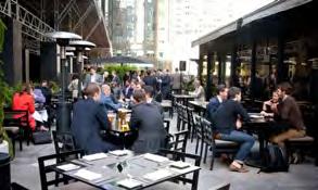
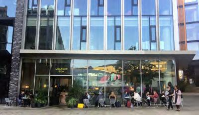
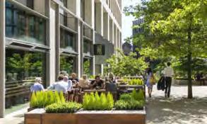
5 Placemaking and Animation As a commercial district, ensuring East Harbour is active throughout all hours of the day and during weekends is key to its success. The animation strategy for East Harbour is focused on highquality placemaking, the creation of a superior public realm, and accommodating a mix of complementary retail, cultural and entertainment uses that will draw people in. New open spaces will be supported with active at-grade uses, landscaping, public art, seating areas, and other design elements. The area s heritage character will also be recognized through the adaptive reuse of the Soap Factory Building and potential public art that can commemorate the district s past and cultural heritage. Outdoor courtyard and green space (Ponce City Market, Atlanta) Outdoor markets can help to animate transit plazas (Union Station, Toronto) Industrial heritage supported by public art (Distillery District, Toronto) Daylit shopping centre (Chadstone Shopping Centre, Melbourne) Well-designed open spaces can support vibrancy and animation (Sanlitun Beijing) Internal walkways and plazas can be designed to support animation and active uses (Quincy Market, Boston) Street facing retail wtih Spacious sidewalk zones can support patios and other active uses Weather-protected spaces can support activity during all seasons (Salt Lake City) The river s edge can be designed to support active recreation (Buffalo Bayou, Texas) Streetscape plazas with pop-up and temporary uses such as public art (Montreal) Public art can support placemaking and animation (Calgary)


6 Land Use and Built Form East Harbour will be home to a significant cluster of new office uses and supported by a range of complementary amenities that will bring energy to the district. New development has been planned to respond to the transit station and to the surrounding context in order to create an appropriately scaled cluster of new office and complementary commercial uses. The height and built form strategy reinforces a transit-oriented node around the Transit Hub. Building heights will generally be tallest near the station, ranging between 35 and 50 storeys. Heights will transition down towards the edges of the district to respond to the existing neighbourhood context north of Eastern Avenue, as well as the planned context within the Port Lands. The scale of the base buildings will vary depending on intended function of the podium; the design, character and scale of the street; consideration for wind and shadow impacts; and the immediate context and built form character. Typical base building heights of metres are planned. Base building stepbacks will create appropriate relationships to streets and open spaces. The height strategy is intended to establish a flexible framework for distributing height across the district. The ultimate building heights and individual building designs will be determined through the detailed design process. Lake Shore Boulevard Broadview Avenue East Harbour Blvd Eastern Avenue Examples of recent commercial developments in Toronto which incorporate well-defined base buildings and a variety of building forms and floor plate sizes. At detailed design, individual buildings will be designed to in a similar fashion, prioritizing design excellence, high quality materials and a welcoming public realm. Animation and retail uses will define the base of buildings with office uses occupying upper levels of podiums. Towers will be positioned on the podiums to frame and respond to the public realm.the zoning framework is intended to establish building envelopes, as shown in the image above. Further designs of individual buildings will be determined at the detailed design stage. Conceptual rendering of East Harbour, illustrating one version of how the built form strategy could be implemented over the long term.
ELMVALE ACRES SHOPPING CENTRE MASTER PLAN
 ELMVALE ACRES SHOPPING CENTRE MASTER PLAN Contents 1.0 INTRODUCTION... 2 2.0 LOCATION... 2 3.0 EXISTING CONTEXT... 2 4.0 VISION & GUIDING PRINCIPLES... 2 5.0 LAND USE AND BUILT FORM... 4 5.1 St. Laurent
WELCOME and introduction
 1 WELCOME and introduction Mobility Hub Locations within Burlington STUDY OVERVIEW STUDY OBJECTIVES The City of Burlington is developing four Area Specific Plans, one for each of Burlington s Mobility
Workshop 3. City of Burlington Waterfront Hotel Planning Study. September 14, The Planning Partnership
 Workshop 3 City of Burlington Waterfront Hotel Planning Study September 14, 2017 The Planning Partnership The Waterfront Hotel Planning Study 01 The Brant & Lakeshore Planning Study will establish a Strategic
[PLANNING RATIONALE] For Site Plan Control and Lifting of Holding Zone By-Law 101 Champagne Avenue. May 23, 2014
![[PLANNING RATIONALE] For Site Plan Control and Lifting of Holding Zone By-Law 101 Champagne Avenue. May 23, 2014](/thumbs/75/71599615.jpg "[PLANNING RATIONALE] For Site Plan Control and Lifting of Holding Zone By-Law 101 Champagne Avenue. May 23, 2014") [PLANNING RATIONALE] For Site Plan Control and Lifting of Holding Zone By-Law 101 Champagne Avenue May 23, 2014 Contents 1.0 Introduction... 2 2.0 Site Context... 2 2.1 Adjacent Uses... 2 Figure 1: Site
[PLANNING RATIONALE] For Site Plan Control and Lifting of Holding Zone By-Law 101 Champagne Avenue May 23, 2014 Contents 1.0 Introduction... 2 2.0 Site Context... 2 2.1 Adjacent Uses... 2 Figure 1: Site
Port Credit Local Advisory Panel October 20 th Meeting
 Port Credit Local Advisory Panel October 20 th Meeting Focus Of This Evening s Meeting: 1. Hurontario Main Street Higher Order Transit Study 2. Port Credit Mobility Hub & GO Station Parking Structure Study
GO Station Mobility Hubs: Draft Precinct Plans. Committee of the Whole July 12, 2018
 GO Station Mobility Hubs: Draft Precinct Plans Committee of the Whole July 12, 2018 Purpose of this Workshop Present Draft Precinct Plans for the 3 GO Station Mobility Hubs Continue the conversations that
SECTION ONE: INTRODUCTION. introduction
 introduction 1 INTRODUCTION Since it was first established in 1843 as a trading post for the Hudson s Bay Company, Victoria has evolved into a Provincial capital city that is recognized across Canada and
burlington mobility hubs study Downtown Burlington Mobility Hub
 burlington mobility hubs study Downtown Burlington Mobility Hub Draft Precinct Plan Workbook PIC #3, September 7, 2017 downtown mobility hub objectives City staff and their consultants are proposing an
Urban Design Manual PLANNING AROUND RAPID TRANSIT STATIONS (PARTS) Introduction. Station Study Areas
 Introduction. Station Study Areas") 111111 PLANNING AROUND RAPID TRANSIT STATIONS (PARTS) Introduction The ION rapid transit system will link Waterloo, Kitchener and Cambridge through a central transit corridor (CTC). There are a number
111111 PLANNING AROUND RAPID TRANSIT STATIONS (PARTS) Introduction The ION rapid transit system will link Waterloo, Kitchener and Cambridge through a central transit corridor (CTC). There are a number
Figure 3-1: Public Realm Plan
 3 Public Realm Figure 3-1: Public Realm Plan 3.1 Public Realm Concept The public realm concept for the Little Mountain site integrates a clear and accessible movement network with public spaces for social
DOWNTOWN PARKS & PUBLIC REALM PLAN
 DOWNTOWN PARKS & PUBLIC REALM PLAN CHALLENGES The Parks and Public Realm Strategy addresses challenges associated with a growing Downtown, including: GOALS 3.3 New buildings will fit within their existing
DOWNTOWN GEORGETOWN PLANNING STUDY
 DOWNTOWN GEORGETOWN PLANNING STUDY Community Workshop #3 Thursday, May 4, 08 The Planning Partnership OVERVIEW OF STUDY, PROCESS & MILESTONES We are here PURPOSE OF THE STUDY To develop a clear vision
Queensborough Eastern Neighbourhood Node. Community Open House
 Queensborough Eastern Community Open House The Vision The Queensborough Eastern will become the heart of eastern Queensborough. Through a sensitive mix of viable commercial and residential areas, the neighbourhood
Clairtrell Area Context Plan
 Clairtrell Area Context Plan March 2005 Urban Development Services City Planning Contents 1. Introduction... 4 2. Development Structure... 6 2.1 Streets... 7 2.1.1 Sheppard Avenue and Bayview Avenue...
King-Spadina Secondary Plan Community Consultation Meeting. Michelle Knieriem, City Planner October 11, 2017
 King-Spadina Secondary Plan Community Consultation Meeting Michelle Knieriem, City Planner October 11, 2017 Agenda 6:30 Welcome 6:35 Presentation 7:15 Question and Answer Session 8:15 Closing Remarks HOW
Uptown Rideau Street Secondary Plan [Amendment #166, January 12, 2016]
![Uptown Rideau Street Secondary Plan [Amendment #166, January 12, 2016]](/thumbs/76/73760497.jpg "Uptown Rideau Street Secondary Plan [Amendment #166, January 12, 2016]") [Amendment #166, January 12, 2016] The policies of this Secondary Plan are in effect, save and except for the property at 560 Rideau Street, for which there remains a site specific appeal to this Secondary
[Amendment #166, January 12, 2016] The policies of this Secondary Plan are in effect, save and except for the property at 560 Rideau Street, for which there remains a site specific appeal to this Secondary
Welcome. Community Consultation Meeting November 28, Review and discuss the Bathurst Quay Neighbourhood Plan Framework
 Welcome Community Consultation Meeting November 28, 2016 Why Are We Here Today? Review and discuss the Bathurst Quay Neighbourhood Plan Framework Review and discuss an Action Plan for Implementation Next
GOLDEN MILE SECONDARY PLAN. Community Consultation Meeting #3 June 26, 2018
 GOLDEN MILE SECONDARY PLAN Community Consultation Meeting #3 June 26, 2018 Meeting Overview 1. Introduction 2. Principles + Vision 3. Street + Block Alternatives 4. Parks + Open Space Alternatives 5. Land
Complete Neighbourhood Guidelines Review Tool
 Complete Neighbourhood Guidelines Review Tool Prepared By: City of Regina Planning Department October 2014 Page 1 of 14 Community Development Review Checklist for Secondary Plans and Concept Plans The
Mark-up of the effect of the proposed Bronte Village Growth Area OPA No.18 on the text of section 24, Bronte Village, of the Livable Oakville Plan
 Mark-up of the effect of the proposed Bronte Village Growth Area OPA No.18 on the text of section 24, Bronte Village, of the Livable Oakville Plan Notes: This document is provided for information purposes
CONTENTS 2.0 A FRAMEWORK FOR SUSTAINABLE GROWTH 2.1 MANAGING SUSTAINABLE GROWTH THE VISION TO GOALS AND OBJECTIVES 2.3 MARKHAM STRUCTURE
 2 A Framework for Sustainable Growth 2.0 A FRAMEWORK FOR SUSTAINABLE GROWTH CONTENTS 2.1 MANAGING SUSTAINABLE GROWTH THE VISION TO 2031 2.2 GOALS AND OBJECTIVES 2.2.1 Protecting the Natural Environment
CONTENTS 6.1 URBAN DESIGN
 6-2 Urban Design and Sustainable Development 6.0 URBAN DESIGN AND SUSTAINABLE DEVELOPMENT CONTENTS 6.1 URBAN DESIGN 6.1.1 General Policies 6.1.2 The Public Realm 6.1.3 Streets and Blocks 6.1.4 Streetscapes
appendix and street interface guidelines
 appendix five: building and street interface guidelines appendix 5 building and street interface guidelines BOULEVARDS Boulevards are generally characterized by higher levels of traffic movement at higher
City of Toronto Official Plan Indicators
 City of Toronto Official Plan Indicators Attachment 1 2017 Gladki Planning Associates in association with Hemson Consulting & Studio Jaywall City of Toronto Official Plan Indicators 1 Introduction What
Table 8-4: Road Classification Local Roads, second table, of Chapter 8 Create a Multi-Modal City, be amended by adding the following:
 1 Port Street East Official Plan Amendment APPENDIX 3 Amendments to Mississauga Official Plan Table 8-4: Road Classification Local Roads, second table, of Chapter 8 Create a Multi-Modal City, be amended
Plan Framework Report. Attachment A
 Plan Framework Report Attachment A Uptown-Douglas Corridor Plan - Plan Framework Report Contents Introduction... 1 Planning Process... 3 Project Objectives... 4 Vision... 5 Community Values... 6 Structural
Community Design Guidelines. Port Wallace DRAFT
 Community Design Guidelines Port Wallace DRAFT Energy 1 2 3 Nature Movement Connections Built Form DRAFT Layout Energy 1 Nature Community Design Guidelines GREAT COMMUNITIES PROTECT, CELEBRATE, AND CONSERVE
Welcome. Walk Around. Talk to Us. Write Down Your Comments
 Welcome This is an information meeting introducing the applications for proposed redevelopment of the Yorkdale Shopping Centre site at 3401 Dufferin Street and 1 Yorkdale Road over the next 20+ years,
Thank you for coming to the Rail Corridor Land Use Study Public Meeting.
 01 Welcome! Thank you for coming to the Rail Corridor Land Use Study Public Meeting. Tonight is an opportunity to learn about the Land Use Study for the Rail Corridor Site. In Fall 2016, Toronto City Council
2.0 A FRAMEWORK FOR SUSTAINABLE GROWTH CONTENTS
 2-2 A Framework for Sustainable Growth 2.0 A FRAMEWORK FOR SUSTAINABLE GROWTH CONTENTS 2.1 MANAGING SUSTAINABLE GROWTH THE VISION TO 2031 2.2 GOALS AND OBJECTIVES 2.2.1 Protecting the Natural Environment
This Review Is Divided Into Two Phases:
 Semiahmoo Town Centre Review The purpose of this review: To review the Semiahmoo Town Centre Concept Plan, originally approved in 1993, to ensure that this centre will continue to serve the needs of South
INTRODUCTION TO THE CONCEPTUAL SITE PLANS
 INTRODUCTION TO THE CONCEPTUAL SITE PLANS At this stage in the planning process, we are seeking your feedback on the draft Guiding Principles and input in evaluating three conceptual site plans. Each of
PUBLIC OPEN HOUSE HURONTARIO-MAIN CORRIDOR SECONDARY PLAN
 PUBLIC OPEN HOUSE HURONTARIO-MAIN CORRIDOR SECONDARY PLAN Tuesday, February 28, 2012 6pm 9pm 1 st Floor Atrium, City Hall 2 Wellington Street West, Brampton 1 POLICY FRAMEWORK The 2006 Provincial Growth
Regency Developments. Urban Design Brief. Holyrood DC2 Rezoning
 Regency Developments Urban Design Brief Holyrood DC2 Rezoning Stantec Consulting Ltd. 7-31-2017 1. Overview Regency Developments intends to rezone the lands located at 8510 and 8511 93 Avenue, within the
Town Center (part of the Comprehensive Plan)
") Town Center (part of the Comprehensive Plan) Mercer Island Town Center Looking North (2014) In 1994, a year-long process culminated in a set of design guidelines and code requirements for the Town Center
Town Center (part of the Comprehensive Plan) Mercer Island Town Center Looking North (2014) In 1994, a year-long process culminated in a set of design guidelines and code requirements for the Town Center
THE CITY OF VAUGHAN BY-LAW BY-LAW NUMBER A By-law to adopt Amendment Number 1 to the Official Plan of the Vaughan Planning Area.
 THE CITY OF VAUGHAN BY-LAW BY-LAW NUMBER 015-2014 A By-law to adopt Amendment Number 1 to the Official Plan of the Vaughan Planning Area. NOW THEREFORE the Council of the Corporation of the City of Vaughan
WELCOME TO THE SOUTH OF EASTERN OPEN HOUSE
 WELCOME TO THE SOUTH OF EASTERN OPEN HOUSE Providing for Good Jobs and Supporting Services in the South of Eastern Area City Planning has initiated the Unilever Precinct Planning Study to comprehensively
APPENDIX K WINDSOR OFFICIAL PLAN
 CEAA ENVIRONMENTAL ENVIRONMENTAL IMPACT ASSESSMENT AMBASSADOR BRIDGE ENHANCEMENT PROJECT Replacement Span and Plaza Expansion APPENDIX K WINDSOR OFFICIAL PLAN Avalon Consulting Professionals of Ontario,
38 Queen s University Campus Master Plan Part 1
 38 Queen s University Campus Master Plan Part 1 46 The Campus at the City Scale Chapter 4 The Campus at the City Scale 39 Queen s is an urban University centrally located in Kingston. Decisions made by
University of Saskatchewan CAMPUS MASTER PLAN. Senate Meeting Preliminary Presentation. April 21, 2018 DIALOG ECS DA WATT
 University of Saskatchewan CAMPUS MASTER PLAN Senate Meeting Preliminary Presentation April 21, 2018 DIALOG ECS DA WATT project process presentation agenda Stakeholder Engagement Project Control phase1
URBAN DESIGN BRIEF URBAN DESIGN BRIEF 721 FRANKLIN BLVD, CAMBRIDGE August 2018
 URBAN DESIGN BRIEF URBAN DESIGN BRIEF 721 FRANKLIN BLVD, CAMBRIDGE August 2018 DESIGN BRIEF CONTENTS PART A 1.0 INTRODUCTION 2.0 DESCRIPTION & ANALYSIS OF SITE CONTEXT 3.0 DESIGN CONSTRAINTS AND OPPORTUNITIES
GUIDELINES EXHIBITION PLACE LOCATION: OBJECTIVES. Structure Plan URBAN DESIGN GUIDELINES
 Development in the Exhibition Place lands will be consistent with the following urban design guidelines. They provide a framework for new development of the lands and are to be read in conjunction with
Welcome to the Oakridge Centre Open House
 Welcome to the Oakridge Centre Open House Why is the City hosting this event? This open house is to inform you of a rezoning application submitted to the City of Vancouver to amend the existing CD-1 (Comprehensive
QUEEN-RIVER SECONDARY PLAN
 34 QUEEN-RIVER SECONDARY PLAN 34. QUEEN RIVER SECONDARY PLAN 1. INTRODUCTION The Queen-River area is approximately 6.4 hectares and is located at the eastern edge of the Downtown as shown on Map 34-1.
CITY OF VAUGHAN KIRBY GO TRANSIT HUB SUB-STUDY
 WELCOME! Thank you for attending, and welcome to the first of three Public Meetings for the Kirby GO Transit Hub Study. Your feedback is important to us, and will help inform the development of the draft
Chairman and Members of the Planning and Development Committee. Thomas S. Mokrzycki, Commissioner of Planning and Building
 LA.09.TOR (Toronto) DATE: TO: FROM: SUBJECT: Chairman and Members of the Planning and Development Committee Thomas S. Mokrzycki, Commissioner of Planning and Building Central Waterfront Secondary Plan
Keystone Business Park Precinct Structure Plan North East Industrial Precinct. Part 2 Design Principles
 Keystone Business Park Precinct Structure Plan North East Industrial Precinct Part 2 Design Principles Context Issues Services Landform Issues Geotech and contamination Ecology Traffic and access Issues
Urban Design Brief December 23, 2015 Southside Construction Group Official Plan & Zoning By-Law Amendment
 Urban Design Brief Proposed Official Plan & Zoning By-Law Amendment 3244, 3263 and 3274 Wonderland Road South Southside Group December 23, 2015 TABLE OF CONTENTS Page No. INTRODUCTION... 1 SECTION 1 LAND
11.3 Steeles West Secondary Plan
 11.3 Steeles West Secondary Plan ADOPTED BY VAUGHAN CITY COUNCIL NOT YET APPROVED BY THE ONTARIO MUNICIPAL BOARD 11.3.1 Introduction This Secondary Plan recognizes that it will take a number of years for
Agenda. 7 Wright Crescent Urban Design Study. Public Meeting and Urban Design Workshop. 1 INTRODUCTION AND BACKGROUND (City of Kingston)
") Urban Design Study Public Meeting and Urban Design Workshop October 02, 2013 Agenda 1 INTRODUCTION AND BACKGROUND (City of Kingston) 2 URBAN DESIGN STUDY PRESENTATION (Antonio Gomez-Palacio, DIALOG) 3
Urban Design Study Public Meeting and Urban Design Workshop October 02, 2013 Agenda 1 INTRODUCTION AND BACKGROUND (City of Kingston) 2 URBAN DESIGN STUDY PRESENTATION (Antonio Gomez-Palacio, DIALOG) 3
section THREE: DISTRICTS districts
 section THREE: DISTRICTS districts 3 INTRODUCTION The Downtown Core Area Plan establishes five Downtown Core Area Districts. As stated in the Introduction, these new Districts do not replace existing neighbourhood
DRAFT DRAFT DRAFT DRAFT
 # 19 EXPAND GREEN AND OPEN SPACES AND COMMUNITY FACILITIES IN TANDEM WITH NEW DEVELOPMENT The role of Eglinton will change in the coming years, along with the intensity of activity and land uses. As more
Lakeview. March 18, N. Barry Lyon Consultants Ltd. UEM TMIG
 Lakeview March 18, 2014 N. Barry Lyon Consultants Ltd. UEM TMIG Mississauga s Waterfront A Coordinated Approach mississauga.ca/waterfront Mississauga s Waterfront - Projects Natural Heritage and Urban
Lambeth Main Street Streetscape Improvements
 Lambeth Main Street Streetscape Improvements Open House October 5th, 2017 Agenda 1. Introduction 2. Project Background 3. Context 4. Project Objectives 5. Design Principles & Approach 6. Streetscape Design
Animating the Rideau Canal December 2013
 Executive Summary Animating the Rideau Canal December 2013 Why study the Rideau Canal? The Rideau Canal has been an important part of Ottawa throughout its history, and has shaped and been shaped by the
2.0 THE PLATINUM TRIANGLE VISION
 2.0 THE PLATINUM TRIANGLE VISION The envisions an exciting future for the area surrounding Angel Stadium of Anaheim, the Honda Center and The Grove of Anaheim. 2.1 Planning Principles In order to further
Bloor Street East Potential Ravine Portal Overlook and Access Passage to the Rosedale Valley and Don River Valley Ravine, Toronto, Canada
 TRANSFORMATIVE IDEA 2. GREAT STREETS Bloor Street Christie Pits Park Bloor St Spadina Ave Bathurst St Shaw St 1 Recognize the significant public realm improvements along Bloor Street and extend and enhance
UTSC SECONDARY PLAN COMMUNITY OPEN HOUSE
 WELCOME TO THE UTSC SECONDARY PLAN COMMUNITY OPEN HOUSE 1 Welcome to the first Community Open House for the UTSC Secondary Plan. Hosted by the University of Toronto Scarborough (UTSC), the following panels
New Westminster Downtown Parking Strategy Public Open House #1 September 13, 2012
 New Westminster Downtown Parking Strategy Public Open House #1 September 13, 2012 The City is preparing a strategy for parking in Downtown New Westminster. The study team and a group of key stakeholders
Land Use Policies Urban Area. Land Use Policies Urban Area
 8 Land Use Policies Urban Area Land Use Policies Urban Area This page has been left intentionally blank LAND USE POLICIES URBAN AREA 8.1 MIXED USE INTENSIFICATION AREAS... 8-5 8.1.1 URBAN CENTRES... 8-5
2.0 A FRAMEWORK FOR SUSTAINABLE GROWTH CONTENTS
 2-2 A Framework for Sustainable Growth 2.0 A FRAMEWORK FOR SUSTAINABLE GROWTH CONTENTS 2.1 MANAGING SUSTAINABLE GROWTH THE VISION TO 2031 2.2 GOALS AND OBJECTIVES 2.2.1 Protecting the Natural Environment
Region of Waterloo Multi-Modal Transit Hub Urban Design Brief. 16, 56 and 60 Victoria Street North King Street West City of Kitchener
 Region of Waterloo Multi-Modal Transit Hub Urban Design Brief 16, 56 and 60 Victoria Street North 490 520 King Street West City of Kitchener January 2013 Contents 1 Background 1 2 Design Context 2 Community
McCowan Precinct Plan Study Background & Deliverables
 1 DRAFT & WITHOUT PREJUDICE McCowan Precinct Plan Study Background & Deliverables In September, 2011, City Planning (Scarborough District) began a study of an area within the Scarborough Centre, identified
Public Open House. Overview of the Downtown Plan Official Plan Amendment April 23, 2018
 Public Open House Overview of the Downtown Plan Official Plan Amendment April 23, 2018 1 A 25-Year Plan for Downtown To ensure growth contributes positively to Toronto s Downtown as a great place to live,
Westwind Developments Ltd. PIONEER LANDS AREA STRUCTURE PLAN - PROPOSED AMENDMENT
 FEBRUARY 2013 TABLE OF CONTENTS 1.0 BACKGROUND... 1 1.1 Amendment... 1 2.0 LOCATION & CONTEXT... 2 2.1 Land Ownership... 2 3.0 POLICY CONTEXT... 3 3.1 Municipal Development Plan... 3 3.2 Capital Region
PORT WHITBY COMMUNITY
 PORT WHITBY COMMUNITY SECONDARY PLAN UPDATE COMMUNITY IMPROVEMENT PLAN URBAN DESIGN GUIDELINES September 2015 DRAFT PROPOSED AMENDMENT NUMBER # to the Whitby Official Plan PURPOSE: The intent of this Amendment
Policies and Code Intent Sections Related to Town Center
 Policies and Code Intent Sections Related to Town Center The Town Center Vision is scattered throughout the Comprehensive Plan, development code and the 1994 Town Center Plan. What follows are sections
Old East Village Dundas Street Corridor Secondary Plan
 Old East Village Dundas Street Corridor Secondary Plan DRAF T February 2019 Contents 1.0 INTRODUCTION 1 1.1 Background 1 1.2 Location 2 1.3 Purpose and Use 3 1.4 Vision and Principles 4 2.0 CHARACTER
Mid-Rise Buildings on Toronto s Avenues Responding to the Public Realm Andrea Oppedisano, City of Toronto
 Mid-Rise Buildings on Toronto s Avenues Responding to the Public Realm Andrea, City of Toronto Introduction The Avenues and Mid-Rise Buildings Study explores opportunities to encourage a built form that
Metrogate Agincourt Redevelopment
 Toronto Urban Design Guidelines Metrogate Agincourt Redevelopment City Planning Urban Design September 2008 METROGATE AGINCOURT REDEVELOPMENT TABLE OF CONTENTS 1.0 INTRODUCTION......................................................
East Bayshore Road Neighbourhood
 East Bayshore Road Neighbourhood Northridge Property Management Urban Design Brief 3195 East Bayshore Road City of Owen Sound January 2016 East Bayshore Road Neighbourhood Northridge Property Management
PUBLIC RIGHT-OF-WAY IN THIS CHAPTER PUBLIC REALM
 PUBLIC RIGHT-OF-WAY This section provides design guidelines for improvements in the public right-of-way. The public right-of-way refers to streets, sidewalks, non-vehicular thoroughfares, parks and greenways
Table of Contents. 5.1 Introduction Parks and Open Spaces Cooksville Creek Corridor Stormwater Management...
 SCHEDULE "A" Table of Contents 1.0 How to Read the Downtown Core Local Area Plan... 1 2.0 Context... 2 3.0 Collaboration... 2 4.0 Vision... 2 4.1 Guiding Principles... 3 4.2 Community Concept... 3 4.3
Cit of Kitchener Ur 6 an Design Manual PARTA. Desi n for _--::
 Cit of Kitchener Ur 6 an Design Manual Date PARTA Year ) Desi n for k Nodes Corridors _--:: Section Page 01 of 12 2 INTRODUCTION Purpose & Application Nodes and Corridors have been identified as key intensification
1.3 TRANSIT VISION 2040 FROM VISION TO ACTION THEME 1: PUTTING TRANSIT AT THE CENTRE OF COMMUNITIES. Fully integrate transit with community planning
 TRANSIT VISION 2040 FROM VISION TO ACTION TRANSIT VISION 2040 defines a future in which public transit maximizes its contribution to quality of life with benefits that support a vibrant and equitable society,
BESSARION-LESLIE CONTEXT PLAN
 Development in the Bessarion-Leslie area will be consistent with the following urban design guidelines. They provide a framework for development in the area and are to be read in conjunction with the urban
PLAN ELEMENTS WORKSHOP. April 5, 2016
 PLAN ELEMENTS WORKSHOP April 5, 2016 needs more housing. But there is no one-size fits-all solution. Every neighborhood has its own character. In some places, density is not only appropriate it is badly
Derry Green Corporate Business Park
 Town of Milton Derry Green Corporate Business Park Urban Design Guidelines BMI/Pace - June 2010 Draft 3 Prepared by: Brook McIlroy Planning + Urban Design / Pace Architects Suite 300-51 Camden Street Toronto,
SCARBOROUGH SUBWAY EXTENSION. Scarborough Subway Extension. Final Terms of Reference
 Scarborough Subway Extension Final Terms of Reference 1 1.0 Introduction and Background 1.1 Introduction Toronto City Council recently confirmed support for an extension of the Bloor-Danforth Subway from
LAND USE AMENDMENT DOWNTOWN COMMERCIAL CORE (WARD 7) MACLEOD TRAIL SE AND 5 AVENUE SE BYLAW 254D2017
 MACLEOD TRAIL SE AND 5 AVENUE SE BYLAW 254D2017") Page 1 of 10 EXECUTIVE SUMMARY This Land Use Amendment application seeks to redesignate a full downtown block (currently the YWCA site) from a Direct Control based on the CM-2 District (Land Use Bylaw
Page 1 of 10 EXECUTIVE SUMMARY This Land Use Amendment application seeks to redesignate a full downtown block (currently the YWCA site) from a Direct Control based on the CM-2 District (Land Use Bylaw
PILLAR FOUR INTEGRATE LAND USE & TRANSPORTATION
 PILLAR FOUR INTEGRATE LAND USE & TRANSPORTATION 8 Scarborough Centre on the Move Transportation Master Plan 123 8 Transportation Pillar Four Integrate Land Use & The fourth pillar focuses on the relationship
Hamilton Pier 7&8 Draft Urban Design Plan
 Hamilton Pier 7&8 Draft Urban Design Plan Public Open House October 29, 2015 Contents 1. Study Overview 2. Area Design Goals 3. Urban Structure 4. Public Realm 5. Urban Design Plan Options 6. Next Steps
8. Urban Design. 8.0 Preamble. 8.1 Goals
 8. Urban Design 8.0 Preamble A memorable, attractive and liveable city is one where people feel comfortable and are inspired by their surroundings. The physical systems and built form of the city are also
DRAFT Northeast Quadrant of Kipling Avenue and Highway 7 DRAFT AUGUST 29, Goals Land Use. The goals of this Plan are to:
 AUGUST 29, 2017 12.15 Northeast Quadrant of Kipling Avenue and Highway 7 12.15.1 Goals 12.15.2 Land Use The goals of this Plan are to: 12.15.2.1 General Provisions: a) Ensure the development of a compact
401/Keele Provincial Campus Ontario Realty Corp.
 1.0 INTRODUCTION 1.1 Site Location and Description The study area consists of approximately 74 acres (30 ha) located in the Keele Street and Wilson Avenue area. It is bounded by Wilson Avenue to the north,
16. KING-SPADINA SECONDARY PLAN
 16. KING-SPADINA SECONDARY PLAN 1. INERPREAION 1.1 he lands affected by this Secondary Plan for the King-Spadina Area are shown on Map 16-1. 1.2 Where a building within a Regeneration Areas designation
CREATE A VIBRANT MIXED-USE COMMUNITY
 CREATE A VIBRANT MIXED-USE COMMUNITY Land Use Public Realm Plan Built Form Heritage Tell us what you think! Place a sticky note here or leave us a comment form LAND USE The land use framework of this Secondary
URBAN DESIGN BRIEF REPORT
 URBAN DESIGN BRIEF REPORT PREPARED FOR 2568401 ONTARIO INC NEW GASBAR, CONVENIENCE STORE & CARWASH DEVELOPMENT @ 1509 FANSHAWE PARK ROAD WEST LONDON, ONTARIO GAMA ENGINEERING INC. PROJECT NUMBER 1669 PREPARED
CONTENTS 8.0 LAND USE 8.1 GENERAL LAND USE 8.2 RESIDENTIAL 8.3 MIXED USE 8.4 COMMERCIAL 8.5 EMPLOYMENT LANDS
 8-2 Land Use 8.0 LAND USE CONTENTS 8.1 GENERAL LAND USE 8.1.1 Uses provided for in all Land Use Designations 8.1.2 Uses prohibited in Hazardous Lands, Hazardous Sites and Special Policy Areas 8.1.3 Uses
DRAFT. 10% Common Open Space
 % OF CHARLOTTE IS CATEGORIZED AS A. LAND USES : Placeholder map displaying location of Place Type GOALS: Accommodate XX% of future growth. Provide a concentration of primarily commercial and civic activity
Corridor Vision. 1Pursue Minnehaha-Hiawatha Community Works Project. Mission of Hennepin County Community Works Program
 1Pursue Minnehaha-Hiawatha Community Works Project Minnehaha-Hiawatha Community Works is a project within the Hennepin Community Works (HCW) program. The mission of the HCW program is to enhance how the
SCHEDULE 'A' TO BY-LAW as Amended by AMENDMENT NO. 90 TO THE WHITBY OFFICIAL PLAN
 SCHEDULE 'A' TO BY-LAW 6413-10 as Amended by 6553-11 AMENDMENT NO. 90 TO THE WHITBY OFFICIAL PLAN SECTION A: GROWTH PLAN CONFORMITY PURPOSE: LOCATION: BASIS: The purpose of this Amendment is to: conform
Urban Design Brief Fanshawe Park Road. Competition Toyota
 Urban Design Brief 1300 Fanshawe Park Road Competition Toyota May 2, 2014 TABLE OF CONTENTS Page No. INTRODUCTION... 1 SECTION 1 LAND USE PLANNING CONTEXT... 1 1.1 The Subject Lands... 1 1.2 The Proposal...
Yonge Eglinton Centre Urban Design Guidelines
 Yonge Eglinton Centre Urban Design Guidelines City Planning Urban Design January 2009 YONGE EGLINTON CENTRE INTRODUCTION.................................................... 1 GENERAL SITE PLAN OBJECTIVES......................................
Hamilton Pier 7&8 Public Meeting and Workshop #1
 Hamilton Pier 7&8 Public Meeting and Workshop #1 May 12, 2015 May 01, 2015 Meeting Agenda 6:30 Doors Open 6:30-6:45 Review Boards 6:45-7:10 Introductions and Presentation Study Overview Policy Background
Land Use Policies Urban Area. Land Use Policies Urban Area
 8 Land Use Policies Urban Area Land Use Policies Urban Area LAND USE POLICIES URBAN AREA 8.1 MIXED USE INTENSIFICATION AREAS... 8-5 8.1.1 URBAN CENTRES... 8-5 8.1.1(3) DOWNTOWN URBAN CENTRE... 8-9 8.1.1(4)
3. Urban Design in the Central Area
 3. Urban Design in the Central Area The Central Area Planning and Design Group assumes the responsibility to promote high quality urban and architectural design in the Central Area, plan and ensure the
YONGE STEELES CORRIDOR SECONDARY PLAN. Young + Wright / IBI Group Architects Dillon Consulting Ltd. GHK International (Canada) Ltd.
 Ltd.") PART A: PREAMBLE 1.0 PURPOSE The purpose of this Secondary Plan is to provide a development framework for intensification of the Yonge/ Steeles corridor including the north side of Steeles Avenue West
PART A: PREAMBLE 1.0 PURPOSE The purpose of this Secondary Plan is to provide a development framework for intensification of the Yonge/ Steeles corridor including the north side of Steeles Avenue West
Gold Line Bus Rapid Transit Transit Oriented Development (BRTOD) Helmo Station Area Plan
 Helmo Station Area Plan") Appendix F Gold Line Bus Rapid Transit Transit Oriented Development (BRTOD) Helmo Station Area Plan Introduction and Purpose of the Plan The Gold Line Bus Rapid Transit facility is an eleven-mile dedicated
Appendix F Gold Line Bus Rapid Transit Transit Oriented Development (BRTOD) Helmo Station Area Plan Introduction and Purpose of the Plan The Gold Line Bus Rapid Transit facility is an eleven-mile dedicated
1 Introduction. Chapter. In this chapter:
 Chapter 1 Introduction In this chapter: 1.1 A Snapshot of the Region 1.2 Towards a Sustainable Region 1.3 The Provincial Context 1.4 Purpose and Organization The Regional Municipality of York Official