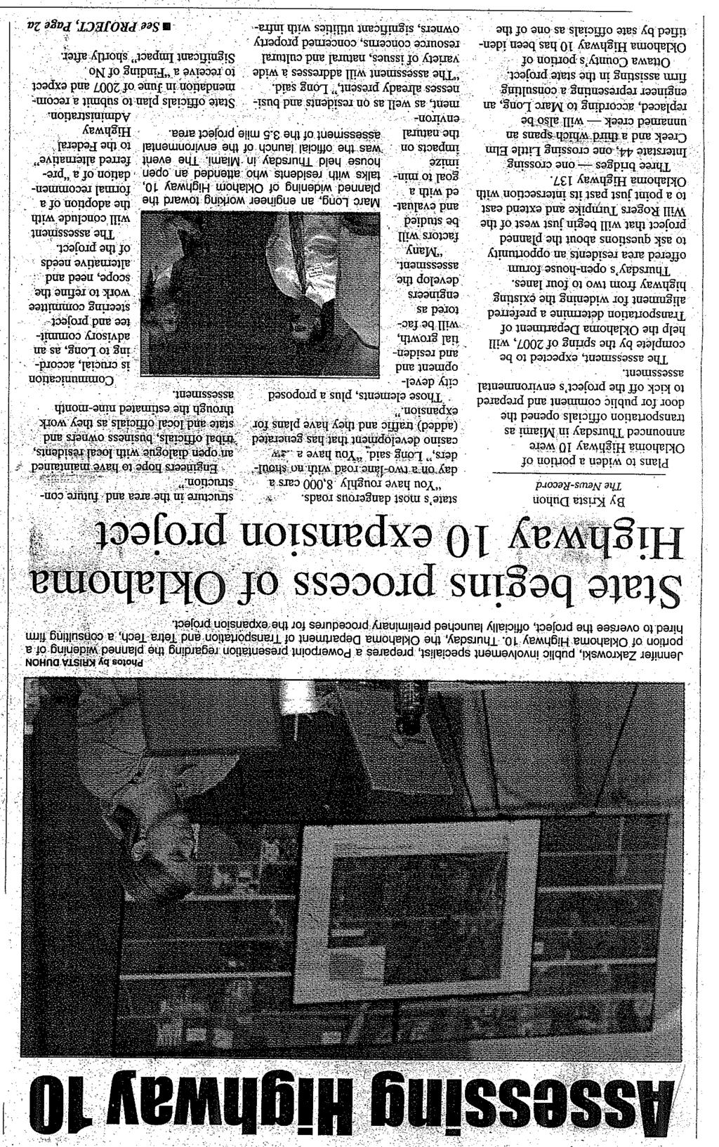
APPENDIX I PUBLIC MEETING AT PROJECT INCEPTION
|
|
|
- Cathleen Adams
- 5 years ago
- Views:
Transcription
1 APPENDIX I PUBLIC MEETING AT PROJECT INCEPTION
2
 for the proposed widening of State Highway (SH-) 10 beginning just west of the Will Rogers Turnpike")
3 OKLAHOMA DEPARTMENT OF TRANSPORTATION STATE HIGHWAY 10 ENVIRONMENTAL ASSESSMENT (MIAMI, OKLAHOMA) OPEN HOUSE SEPTEMBER 7, 2006 PROJECT OVERVIEW The Oklahoma Department of Transportation (ODOT), with the assistance from the consulting firm Tetra Tech, is developing an environmental assessment (EA) for the proposed widening of State Highway (SH-) 10 beginning just west of the Will Rogers Turnpike (Interstate 44) bridge and extending east approximately 3.5 miles to SH-137, near Miami, Oklahoma. The project proposes to widen SH-10 from two to four lanes (with a 16-foot paved median) and replace three bridges: the SH-10 crossing over Interstate 44, the SH-10 crossing over Little Elm Creek, and the SH-10 crossing over an unnamed creek. Research during the EA process will help determine a preferred alignment for widening the existing highway from two to four lanes and to replace the identified bridges. Many factors will be studied and evaluated, with a goal to minimize impacts on the natural environment, as well as on residents and businesses already present. The EA will address a wide variety of issues, including, but not limited to: Consensus building for project success; Natural and cultural resources; Concerned property owners; Significant utilities with infrastructure in the area; Adequate right-of-way preservation for future construction; Area commercial and residential development; and Other issues. Public Involvement The public will be provided the information it needs to understand issues surrounding the project and is encouraged to provide input. The ODOT s objective is to provide a collaboratively based approach to developing alternatives for widening SH-10. A steering committee and an advisory committee have been developed to assist the ODOT in the EA process. Collaboration will include these committees involvement in planning meetings throughout the EA process, and regular updates on the EA will be provided to the committees. These committees are comprised of representatives from local, state, federal, and tribal agencies, and local organizations and agencies. WE WANT TO HEAR FROM YOU! We encourage you to provide comments and suggestions about the SH-10 widening and bridge replacement project. Your early and continuous input is critical to a successful collaborative process. Issues raised through public participation will help drive the different alternatives that are developed. Please provide comments in writing to the ODOT via US Mail, fax, or (see below). Project Web Site: PROJECT CONTACTS: OKLAHOMA DEPARTMENT OF TRANSPORTATION Kevin Larios, P.E. Planning & Research Division 200 N. E. 21st Street Oklahoma City, OK klarios@odot.org (405) Fax (405) TETRA TECH Marc Long, P.E. Project Manager Jennifer Zakrowski, Public Involvement Specialist 302 SW 7th Street Oklahoma City, OK 73109

4 Oklahoma Department of Transportation State Highway 10 Widening and Bridge Replacement (Miami, Oklahoma) Environmental (NEPA) Process Schedule Schedule Environmental (NEPA) Public Involvement Activities Process Milestones August September 2006 Public Scoping & Agency Solicitation Steering Committee Meeting August 17, 2006 Steering & Advisory Committee Meetings September 7, 2006 Public Information Meeting to Kick off Project & Collect Public Feedback September 7, 2006 Fall 2006 Define Problem & Analyze constraints in project area Steering & Advisory Committee Meetings October 12, 2006 October 26, 2006 Winter 2006 Define Highway Reconstruction Alignment & Conduct Special Studies Steering & Advisory Committee Meetings November 9, 2006 November 30, 2006 Spring 2007 Prepare & Publish Environmental Document Potential for Public Hearing (to be determined based on level of environmental documentation required). = Current step FUTURE STEPS (after environmental assessment is completed) 1. Replacement of the two load posted bridges (across two creeks) is a high priority. Right-of-way acquisition, utility relocation, and construction associated with the replacement of these bridges would occur as soon as possible after the environmental documentation process has been completed. 2. The remaining State Highway 10 corridor would be reconstructed upon receipt of future funding.


5 Oklahoma Vicinity Map Proposed bridge replacement Cr ee k N. Treaty Rd. 44 El Approximate Project Area m Lit tle S. 600 Rd. Proposed bridge replacement S. 592 Rd. S. 590 Rd. Proposed bridge replacement S. 580 Rd ¹ 0 Note: The outline of the project location is approximate and does not reflect the widths of rights-of-way or the area of disturbance. These dimensions will be refined as the design of the project progresses. Tetra Tech 1,100 2,200 3,300 4,400 Feet Project Area Map State Highway 10 Widening and Bridge Replacement Project Miami, Oklahoma

6 PLANNING & RESEARCH DIVISION The Oklahoma Department of Transportation has prepared this form to give you an opportunity to offer comment on the proposed reconstruction of State Highway 10 in Miami, Oklahoma. You may complete the form at public meetings, return it by mail, or return it by facsimile: Mail: Planning & Research Division Engineer Oklahoma Department of Transportation 200 N. E. 21st Street Oklahoma City, OK Fax: (405) Proposed Reconstruction of SH-10 in Miami from I-44 east to SH-137, Ottawa County, Oklahoma. Comments: Date: Please add me to the project mailing list: Yes No Name: Phone: Mailing Address: Zip Code: Affiliation (Company, Organization, or Agency you represent):


7 KICKOFF OPEN HOUSE Environmental Clearance ~ SH-10 From I-44 to SH 137 September 7, 2006

8 Project Overview Stakeholder input will help define issues City of Miami Ottawa County State & federal regulatory agencies (OWRB, ODEQ, COE, SHPO, FAA) FHWA Quapaw Tribe, Peoria Tribe, Ottawa Tribe, Miami Tribe Business owners (lumber company, car dealerships, etc.) Glen Abbey Memorial Gardens Residential & Agricultural property owners Utility & Pipeline companies
9 Project Overview Important Future Development Casino at SH-10 and SH-137 Future commercial retail area at SH-10 and I-44 Important Utilities Oil and natural gas pipelines Fiber optics Water lines Overhead power lines

10 Project Overview Constraints identified should remain within valid shelf life recognized by FHWA Reference constraint mapping to maximize shelf life Utilize GIS technology Conceptual engineering studies must identify adequate right-of-way during the process to preserve corridor for future construction

11 Project Overview NEPA, Natural Resources, & Social Resources Purpose and Need Cultural Tribal Water, including Wetlands Biological Hazardous Waste Environmental Justice Potential business impacts along SH-10
12 What is NEPA The National Environmental Policy Act (NEPA) is our Nation s umbrella environmental law. It is triggered by a federal action that may have impacts on the human environment. It is a full disclosure law that involves the public in federal decision making.
13 The Objectives of NEPA NEPA spurpose is informed decisionmaking. Two objectives of NEPA: (1) Ensure agencies consider every significant aspect of the environmental impact of the proposed action; and (2) Inform and involve the public of potential impacts and alternatives to the proposed action.
14 Steps in the NEPA Process 1. Determine the appropriate level of NEPA documentation. An Environmental Assessment will be completed for the ODOT s State Highway 10 project, to evaluate the possibility of significant impacts. 2. Define the purpose and need for the action. 3. Identify the scope of analysis.
15 Steps in the NEPA Process 4. Identify any federal, state, or local agencies with permitting or funding authority over some aspect of the proposal, or that could help with the environmental analysis. 5. Develop and implement a public involvement strategy. 6. Integrate requirements of other environmental laws.
16 Steering/Advisory Committees Steering Committee Policy/ Decision Making Group ODOT City of Miami FHWA Consensus throughout the process Advisory Committee Technical Oversight and Input Identify issues Key Stakeholders, Agency Representatives, Steering Committee


17 Public Involvement Public Involvement Tools Website Brochure Public Meetings MS Access database with user-friendly interface


18 WE WANT YOUR COMMENTS Oklahoma Department of Transportation Kevin Larios, P.E. Planning & Research Division 200 NE 21 st Street Oklahoma City, OK (405) Fax (405) PROJECT WEB SITE
.")
19 PUBLIC MEETING Provide input on and learn about the proposed reconstruction of State Highway 10 east of Miami The Oklahoma Department of Transportation invites you to attend a public information meeting concerning an environmental assessment that has just begun for the proposed reconstruction of State Highway 10 from two to four lanes (with a 16-foot paved median). The project would begin just west of the Will Rogers Turnpike (Interstate 44) bridge and extend east approximately 3.5 miles to State Highway 137. Three bridges also would be replaced. We encourage you to provide comments and suggestions about this road widening and bridge replacement project. A come-and-go informational open house will be held (no formal presentations will be made, so come and go as you wish): Date Location Time Miami Civic Center Banquet Room Thursday, 129 5th Avenue NW September 7, 2006 Miami, Oklahoma 6:00 8:00 p.m This public meeting is only one of the opportunities you have to provide input. Written comments can be submitted to Planning & Research Division Engineer, Oklahoma Department of Transportation, 200 N.E. 21st Street, Oklahoma City, OK 73105; Fax ; or to klarios@odot.org. If you have special needs, please contact the Oklahoma Department of Transportation at
20 PUBLIC NOTICE ODOT Public Meeting Scheduled for State Highway 10 Widening Project The Oklahoma Department of Transportation (ODOT) has begun preparation of an environmental assessment for the State Highway (SH-) 10 Widening and Bridge Replacement project in Miami, Oklahoma. The ODOT is holding a come-and-go informational open house on Thursday, September 7, 2006, from 6 p.m. to 8 p.m. in the Miami Civic Center Banquet Room, 129 5th Avenue NW, Miami, Oklahoma. The project proposes widening of SH-10 beginning just west of the Will Rogers Turnpike (Interstate 44) bridge and extending east approximately 3.5 miles to State Highway 137. The project proposes to reconstruct SH-10 from two to four lanes (with a 16-foot paved median) and replace three bridges located at Interstate 44, Little Elm Creek, and an unnamed creek. Research during the assessment will help determine a preferred alternative to improve this segment of SH-10. The ODOT is accepting written comments. To submit comments, please do so in writing using one of the following means: (1) By mail to Planning & Research Division Engineer, ODOT, 200 N. E. 21st Street, Oklahoma City, OK ; (2) By fax to (405) ; (3) By completing the comment form on the Website ( or (3) By to klarios@odot.org.
21
22
23
24
25 Public Meeting Set: SH-10 Widening and Bridge Project FOR IMMEDIATE RELEASE August 30, 2006 PR# Oklahoma Department of Transportation Information Release Public Affairs Division, 4002 N. Mingo Valley Expressway, Tulsa, OK ext. 308 The Oklahoma Department of Transportation has begun preparation of an environmental assessment for a widening and bridge replacement project on SH-10 in Miami, OK. ODOT invites you to attend this informational open house on Thursday, September 7, 2006, from 6 p.m. to 8 p.m. in the Miami Civic Center Banquet Rm. located at 129 5th Ave. in Miami. The project proposal includes widening SH-10 beginning just west of the Will Rogers Turnpike (I-44) bridge, and extending east approximately 3.5 miles to SH-137. The proposal includes the reconstruction of SH-10 from two to four lanes (with a 16-foot paved median) and the replacement of three bridges. The bridges are over I-44, Little Elm Creek, and an unnamed creek. The engineering consulting firm Tetra Tech will conduct the environmental assessment, which is scheduled for completion in June Research during the assessment will help determine a preferred alternative to improve this segment of SH-10. Many factors will be studied and evaluated with a goal to minimize impacts on the natural environment, as well as on the residents and businesses already present. The project internet site, will be updated with information as it becomes available. Again, ODOT is accepting written comments on the SH-10 widening and bridge replacement project. To submit comments, please do so in writing using one of the following means: (1) By mail to Planning & Research Division Engineer, ODOT, 200 N. E. 21st Street, Oklahoma City, OK ; (2) By fax to (405) ; (3) By completing the comment form on the Website ( or (3) By to klarios@odot.org. With questions, contact Kevin Larios at (405) End-
26 Public Website Available: SH-10 Widening and Bridge Project FOR IMMEDIATE RELEASE November 13, 2006 PR# Oklahoma Department of Transportation Information Release Public Affairs Division, 4002 N. Mingo Valley Expressway, Tulsa, OK ext. 308 The Oklahoma Department of Transportation has begun preparation of an environmental assessment for a widening and bridge replacement project on SH-10 in Miami, OK. An internet site with project information for the SH-10 widening and bridge project has been created to provide interested parties information about the project. Visit the site at to access a detailed project description, contact information, public meetings schedules, information on how to become involved, as well as a list of documents and bulletins pertinent to this planning effort. ODOT is accepting written comments on the SH-10 widening and bridge replacement project. To submit comments, please do so in writing using one of the following means: (1) By mail to Planning & Research Division Engineer, ODOT, 200 N. E. 21st Street, Oklahoma City, OK ; (2) By fax to (405) ; (3) By completing the comment form on the Website ( or (3) By to klarios@odot.org. For questions about the project, or if experiencing difficulties accessing the project internet site, contact Kevin Larios at (405) End-
US-69 McAlester. Anthony Echelle, P.E. ODOT Division II Engineer
 US-69 McAlester US-69 from the US-270 junction south approximately 2 miles to Fourteenth Street, including the Village Road (Kinkead Road) interchange and adjacent frontage roads. Anthony Echelle, P.E.
PROJECT BACKGROUND. Preliminary Design Scope and Tasks
 PROJECT BACKGROUND Preliminary Design Scope and Tasks The purpose of this Study is the development of preliminary designs for intersection improvements for Trunk Highway (TH) 36 at the intersections of
North Carolina Department of Transportation Project Development and Environmental Analysis Branch
 North Carolina Department of Transportation Project Development and Environmental Analysis Branch Citizens Informational Workshop I-85, from I-485 to NC 73 Mecklenburg and Cabarrus Counties October 30,
State Project No Heroes Tunnel
 Public Scoping Meeting State Project No. 167-108 Bridge No. 00773 Heroes Tunnel Route 15 Wilbur Cross Parkway Through West Rock Ridge Towns of Hamden, Woodbridge City of New Haven Agenda Show Project Location
South Dakota 100 Corridor Preservation
 South Dakota 100 Corridor Preservation Purpose of this Public Hearing Inform Receive Input SD100 Project Progress East Side Corridor 1993 East Side Corridor EA March 20, 2003 SD100 Corridor Preservation
SECTION 4(f) DE MINIMIS DOCUMENTATION
 DE MINIMIS DOCUMENTATION") SECTION 4(f) DE MINIMIS DOCUMENTATION Illinois Route 60/83 IL 176 to the intersection of IL 60 (Townline Road) Lake County P-91-084-07 Mundelein Park and Recreation District Project Limit SECTION 4(f)
SECTION 4(f) DE MINIMIS DOCUMENTATION Illinois Route 60/83 IL 176 to the intersection of IL 60 (Townline Road) Lake County P-91-084-07 Mundelein Park and Recreation District Project Limit SECTION 4(f)
MDX SR 836/DOLPHIN EXPRESSWAY SOUTHWEST EXTENSION
 MDX SR 836/DOLPHIN EXPRESSWAY SOUTHWEST EXTENSION Project Development and Environment (PD&E) STUDY Miami-Dade County, Florida Preliminary Executive Summary Alternative Corridor Evaluation (ACE) Report
2. AGENCY COORDINATION AND PUBLIC INVOLVMENT
 2. AGENCY COORDINATION AND PUBLIC INVOLVMENT This chapter discusses the process carried out for conducting agency coordination and public involvement activities. TECHNICAL ADVISORY COMMITTEE A Technical
Northwest Corridor LRT Line to Irving/DFW Public Meeting No. 1 Project Overview
 LRT Line to Irving/DFW Public Meeting No. 1 Project Overview January 21, 2004 Agenda Purpose Corridor Background Environmental Impact Assessment Public Involvement Plan Project Schedule Purpose Project
Corridor Management Committee. September 29, 2017
 Corridor Management Committee September 29, 2017 1 Today s Topics Chair s Update Proposed Corridor Protection Wall Aesthetic Design Overview Public Outreach Environmental Review Civil Construction Update
Pine Flat Lake Master Plan Update FACT SHEET September 2014
 Pine Flat Lake Master Plan Update FACT SHEET September 2014 PURPOSE AND OBJECTIVE The U.S. Army Corps of Engineers Sacramento District is revising the 1976 Pine Flat Lake Master Plan and is seeking public
ITS Concept Development Activity Descriptions
 ITS Concept Development Activity Descriptions October 2015 Procedures are subject to change without notice. Check the NJDOT website to ensure this is the current version. Table of Contents Concept Development
PROJECT STATEMENT LOCATION/DESIGN PUBLIC HEARING. 19 th AVENUE NORTH EXTENSION PROJECT FROM SPRINGDALE DRIVE TO NORTH 2 ND STREET/U.S.
 PROJECT STATEMENT LOCATION/DESIGN PUBLIC HEARING 19 th AVENUE NORTH EXTENSION PROJECT FROM SPRINGDALE DRIVE TO NORTH 2 ND STREET/U.S. 67 HEARING LOCATION: ERICKSEN COMMUNITY CENTER 1401 11 TH AVENUE NORTH
Project Overview. Get Involved. Public Information Meeting. Contact Information
 Get Involved VDOT representatives will review and evaluate information received as a result of this meeting. Please fill out the comment sheet provided in this brochure if you have any comments or questions.
FANSHAWE PARK ROAD/RICHMOND STREET INTERSECTION IMPROVEMENTS. PUBLIC INFORMATION CENTRE 2 June 16, 2016
 FANSHAWE PARK ROAD/RICHMOND STREET INTERSECTION IMPROVEMENTS Municipal Class Environmental Assessment PUBLIC INFORMATION CENTRE 2 June 16, 2016 ACCESSIBILITY Under the Accessibility Standards 2015 for
CITY OF CHARLOTTESVILLE, VIRGINIA CITY COUNCIL AGENDA
 CITY OF CHARLOTTESVILLE, VIRGINIA CITY COUNCIL AGENDA Agenda Date: December 16, 2013 Action Required: Adoption of Resolution Presenter: Staff Contacts: Title: James E. Tolbert, AICP, Director of NDS James
The Illinois Department of Transportation and Lake County Division of Transportation. Route 173, including the Millburn Bypass
 The Illinois Department of Transportation and Lake County Division of Transportation welcome you to this Public Hearing for U.S. Route 45 from Illinois Route 132 to Illinois Route 173, including the Millburn
HARBOR BRIDGE. Randall C. Grones, PE - SPD. US 181 Harbor Bridge October
 HARBOR BRIDGE Randall C. Grones, PE - SPD US 181 Harbor Bridge October October 13, 13, 2015 2015 Project Scope Develop, design, construct and maintain a total project length of 6.44 miles. Base scope New
Vaughan Metropolitan Centre (VMC) Black Creek Renewal CLASS ENVIRONMENTAL ASSESSMENT
 Black Creek Renewal CLASS ENVIRONMENTAL ASSESSMENT") PUBLIC INFORMATION CENTRE Vaughan Metropolitan Centre (VMC) Black Creek Renewal Wednesday, May 10, 2017 6:00 p.m. to 8:00 p.m. Add photo Project Management, Environmental Assessment, Stormwater Management
PUBLIC INFORMATION CENTRE Vaughan Metropolitan Centre (VMC) Black Creek Renewal Wednesday, May 10, 2017 6:00 p.m. to 8:00 p.m. Add photo Project Management, Environmental Assessment, Stormwater Management
6:00 8:00 PM I-95 FROM EXIT 57 TO EXIT 60 PROJECT
 PUBLIC INFORMATIONAL MEETING TUESDAY, APRIL 27, 2010 AT NEWBURYPORT CITY HALL, AUDITORIUM 60 PLEASANT STREET NEWBURYPORT, MASSACHUSETTS 6:00 8:00 PM FOR THE PROPOSED WHITTIER BRIDGE / I-95 IMPROVEMENTS
Project Overview. Fairfax County Parkway Widening Fairfax County. Get Involved. Public Information Meeting. Contact Information
 Get Involved VDOT representatives will review and evaluate information received as a result of this meeting. Please fill out the comment sheet provided in this brochure if you have any comments or questions.
Gratigny Parkway East Extension Project Development & Environment (PD&E) Study
 Study") Gratigny Parkway East Extension Project Development & Environment (PD&E) Study Session 4: Presentation of Charrette Results December 8, 2010 MDX Work Program #: 92407 ETDM#: 11500 Project Location & Description
Gratigny Parkway East Extension Project Development & Environment (PD&E) Study Session 4: Presentation of Charrette Results December 8, 2010 MDX Work Program #: 92407 ETDM#: 11500 Project Location & Description
PUBLIC HEARING. Thursday, December 14, 2017 FDOT Urban Office 2198 Edison Avenue Jacksonville, FL 32204
 DISTRICT TWO PUBLIC HEARING I 10 (SR 8) from I 295 to I 95 Project Development & Environment Study Duval County, Florida Financial Project Number 213326 2 22 01 Efficient Transportation Decision Making
Poinciana Parkway Extension Project Development & Environment Study
 Poinciana Parkway Extension Project Development & Environment Study Nicole Gough, Dewberry Mary Brooks, Quest Corporation of America Clif Tate, Kimley-Horn and Associates February 19, 2019 Title VI Compliance
SOUTHEAST CORRIDOR EXTENSION. PUBLIC SCOPING MEETING/OPEN HOUSE October 15, 2008
 SOUTHEAST CORRIDOR EXTENSION PUBLIC SCOPING MEETING/OPEN HOUSE October 15, 2008 PROJECT BACKGROUND Project Overview Southeast Light Rail opened 2006 Southeast Corridor/Lone Tree Light Rail Extension Limited
PREPARED FOR: PLATTEVIEW ROAD CORRIDOR STUDY EXECUTIVE SUMMARY
 PREPARED FOR: PLATTEVIEW ROAD CORRIDOR STUDY EXECUTIVE SUMMARY SEPTEMBER 2016 Introduction The Platteview Road Corridor Study was led by the Metropolitan Area Planning Agency (MAPA) with assistance from
Atlanta BeltLine Corridor Environmental Study. Scoping Meeting August 2008
 Atlanta BeltLine Corridor Environmental Study Scoping Meeting August 2008 What Will We Be Discussing Today? Study Overview - How Did We Get Here? - What Is the Study About? - Who Is Involved? - Where Is
Scope of Services. River Oaks Boulevard (SH 183) Corridor Master Plan
 Corridor Master Plan") Scope of Services River Oaks Boulevard (SH 183) Corridor Master Plan PROJECT AREA The project area consists of the River Oaks Boulevard (SH 183) corridor bounded by SH 199 at the northern end and the Trinity
Scope of Services River Oaks Boulevard (SH 183) Corridor Master Plan PROJECT AREA The project area consists of the River Oaks Boulevard (SH 183) corridor bounded by SH 199 at the northern end and the Trinity
Rapid Transit Implementation Working Group September 14, 2017
 Rapid Transit Implementation Working Group September 14, 2017 BACKGROUND Council approved the Rapid Transit Master Plan and Updated Business Case on July 25, 2017. Approval of the RTMP confirmed the BRT
PURPOSE: The purpose is to provide commercial facilities in the Vancouver and Clark County vicinity.
 US Army Corps of Engineers Seattle District Joint Public Notice Application for a Department of the Army Permit and a Washington Department of Ecology Water Quality Certification and/or Coastal Zone Management
SOUTHWEST CORRIDOR EXTENSION. Environmental Evaluation and Basic Engineering Results PUBLIC MEETING/OPEN HOUSE November 18, 2009
 SOUTHWEST CORRIDOR EXTENSION Environmental Evaluation and Basic Engineering Results PUBLIC MEETING/OPEN HOUSE November 18, 2009 AGENDA I. Welcome/Introductions II. Project Review and Status III. Environmental
METRO Gold Line BRT CBAC Meeting. August 23, 2018
 METRO Gold Line BRT CBAC Meeting August 23, 2018 1 Today s Topics Introductions Corridor Management Committee Update Public Engagement Update History of Alignment Project Scope Discussions Upcoming CBAC
Overview of Southwestern Pennsylvania Commission s (SPC) 2040 Long Range Transportation Plan (LRTP)
 2040 Long Range Transportation Plan (LRTP)") Overview of Southwestern Pennsylvania Commission s (SPC) 2040 Long Range Transportation Plan (LRTP) Presented to Pennsylvania Agency Coordination Meeting May 27, 2015 Doug Smith & Ryan Gordon 1 Southwestern
Overview of Southwestern Pennsylvania Commission s (SPC) 2040 Long Range Transportation Plan (LRTP) Presented to Pennsylvania Agency Coordination Meeting May 27, 2015 Doug Smith & Ryan Gordon 1 Southwestern
OVERMOUNTAIN VICTORY TRAIL BURKE CALDELL CORRIDOR FEASIBLITY STUDY REQUEST FOR QUALIFICATIONS CALDWELL COUNTY PATHWAYS
 OVERMOUNTAIN VICTORY TRAIL BURKE CALDELL CORRIDOR FEASIBLITY STUDY REQUEST FOR QUALIFICATIONS CALDWELL COUNTY PATHWAYS Caldwell County Pathways along with our co-partners City of Lenoir, Town of Gamewell,
CONSULTING SERVICES FOR THE WHITEBELT VISIONING EXERCISE ADDENDUM TO THE GTA WEST LAND USE STUDY WORK PROGRAM
 CONSULTING SERVICES FOR THE WHITEBELT VISIONING EXERCISE ADDENDUM TO THE GTA WEST LAND USE STUDY 1. Introduction WORK PROGRAM The Town of Caledon is a large, local municipality located in the Greater Toronto
Ashland BRT Environmental Assessment: logos of CTA, CDOT, Chicago Department of Housing and Economic Development
 Ashland BRT Environmental Assessment: logos of CTA, CDOT, Chicago Department of Housing and Economic Development Overview The Chicago Transit Authority (CTA), in partnership with the Chicago Department
RESOLUTION NO. R Refining the route, profile and stations for the Downtown Redmond Link Extension
 RESOLUTION NO. R2018-32 Refining the route, profile and stations for the Downtown Redmond Link Extension MEETING: DATE: TYPE OF ACTION: STAFF CONTACT: Capital Committee Board PROPOSED ACTION 09/13/2018
master plan of highways bus rapid transit amendment
 Scope of Work master plan of highways bus rapid transit amendment September 2011 Montgomery County Planning Department M-NCPPC MontgomeryPlanning.org 1 Scope of Work master plan of highways bus rapid transit
THE COMMUNITY-DRIVEN DESIGN PROCESS
 THE COMMUNITY-DRIVEN DESIGN PROCESS A PUBLIC DRIVEN PROCESS STEERING COMMITEE THE COMPREHENSIVE PLAN OPPORTUNITIES AND CONSTRAINTS THE COMMUNITY DRIVEN DESIGN PROCESS A Public Driven Process Beginning
Southern Gateway Project and Public Green
 Southern Gateway Project and Public Green Transportation and Trinity River Project Committee May 23, 2016 Purpose of Presentation Provide the history and an overview of the Southern Gateway Project (SGP)
I-66 EASTBOUND WIDENING INSIDE THE BELTWAY PARDON OUR DUST MEETING
 I-66 EASTBOUND WIDENING INSIDE THE BELTWAY From the Dulles Connector Road (Route 267) to Fairfax Drive (Route 237) PARDON OUR DUST MEETING Bill Cuttler, PE (VDOT District Construction Engineer, Northern
Bassett Creek Valley Working Group. October 4, 2017
 Bassett Creek Valley Working Group October 4, 2017 1 Today s Topics Introductions Overview of Design Teams (P+W and WSP) Expertise Working Group Roles and Responsibilities Schedule & Community Engagement
Decision Notice. Proposed Action
 Decision Notice Paving Weld County Road 105 USDA Forest Service Arapaho and Roosevelt National Forest and Pawnee National Grassland Pawnee National Grassland Ranger District Weld County, Colorado November
2017 General Obligation Bond
 2017 General Obligation Bond Presentation of Public and Council Projects to the Transportation & Mobility Stakeholder Committee April 13, 2017 Agenda Deferred Maintenance Project Development Process Projects
NORTH-SOUTH CORRIDOR STUDY EXECUTIVE SUMMARY. Executive Summary
 Executive Summary Background As congestion continues to affect mobility in the region, the Ozarks Transportation Organization (OTO) is particularly concerned with traffic movement. The North-South Corridor
STATE OF TENNESSEE DEPARTMENT OF TRANSPORTATION ENVIRONMENTAL DIVISION
 STATE OF TENNESSEE DEPARTMENT OF TRANSPORTATION ENVIRONMENTAL DIVISION Suite 900 - James K. Polk Building 505 Deaderick Street Nashville, Tennessee 37243-0334 MEMORANDUM TO: FROM: Files Joe W. Matlock,
Public Hearing. Charlotte County-Punta Gorda MPO - Meeting Rooms A and B March 14, open house at 4 p.m., formal presentation at 5 p.m.
 Public Hearing Charlotte County-Punta Gorda MPO - Meeting Rooms A and B March 14, 2019 open house at 4 p.m., formal presentation at 5 p.m. Welcome to the Public Hearing for the Harborview Road (CR 776)
ROGUE VALLEY SEWER SERVICES STORMWATER MANAGEMENT PROGRAM (SWMP)
") ROGUE VALLEY SEWER SERVICES STORMWATER MANAGEMENT PROGRAM (SWMP) 1.0 INTRODUCTION This Stormwater Management Program (SWMP) for Rogue Valley Sewer Services (RVS) has been developed to meet the Municipal
ROGUE VALLEY SEWER SERVICES STORMWATER MANAGEMENT PROGRAM (SWMP) 1.0 INTRODUCTION This Stormwater Management Program (SWMP) for Rogue Valley Sewer Services (RVS) has been developed to meet the Municipal
PD&E STUDY SR 9/I-95 FROM SOUTH OF SR 870/COMMERCIAL BOULEVARD TO NORTH OF CYPRESS CREEK ROAD FM # ETDM 14222
 PD&E STUDY SR 870/COMMERCIAL BOULEVARD TO NORTH OF CYPRESS CREEK ROAD FM # 435808-1-22-02 ETDM 14222 WELCOME TO THE KICK-OFF MEETING May 24, 2016 1 1 2 3 4 5 6 PLANNING PROJECT DEVELOPMENT AND ENVIRONMENT
Open House Public Involvement Meeting Howland High School Cafeteria, 200 Shaffer Drive NE, Warren, Ohio. Informational Handout
 Open House Public Involvement Meeting Howland High School Cafeteria, 200 Shaffer Drive NE, Warren, Ohio SR 46 (Niles Cortland Road) and SR 82 Proposed Improvements Howland Township, Trumbull County, Ohio
Beckett Bridge PD& E Study. Presentation to: Board of County Commissioners
 Beckett Bridge PD& E Study Presentation to: Board of County Commissioners October 22, 2013 Introduction Study Began January 2012 Alternatives Presented to Commission October 2013 Alternatives Presented
SUMMARY. Support the Southeast Arkansas Regional Intermodal Facility.
 SUMMARY THE I-69 LOCATION STUDY The proposed I-69 Location Study from El Dorado to McGehee, Arkansas, represents one section (Section of Independent Utility No. 13) of the nationally designated I-69 Corridor
Introductions Project overview Scope of work Schedule. Agenda. Community/Stakeholder Input Process Discussion Summary/Next Steps
 CPIT / Civic Associations Meeting December 14, 2009 Introductions Project overview Scope of work Schedule Agenda Community/Stakeholder Input Process Discussion Summary/Next Steps Columbia Pike Context
The Village of Sugar Grove, in partnership with Kane County, the Illinois Department of Transportation, and the Illinois Tollway welcomes you to the
 The Village of Sugar Grove, in partnership with Kane County, the Illinois Department of Transportation, and the Illinois Tollway welcomes you to the first Public Meeting for the proposed interchange improvement
Public Information Meeting
 Public Information Meeting Corridor Study / Environmental Analysis for County Road 600 West from County Road 300 North to County Road 1000 North (96 th Street) Study Limits it County Road 600 West from
NOTICE OF PREPARATION
 NOTICE OF PREPARATION To: All Interested Parties Subject: Notice of Preparation of an Environmental Impact Report From: City of Petaluma Address: 11 English Street, Petaluma, CA 94952-2610 Contact: Heather
City Council Special Meeting AGENDA ITEM NO. C.
 City Council Special Meeting AGENDA ITEM NO. C. DATE: 01/04/2019 TO: Honorable Mayor and City Council Members SUBJECT: Transit Villages Specific Plan project Study Session (Development Services Director
II PREVIOUS REPORTS PERTINENT TO THIS MATTER II
 ~ ~~ ~~~ ~ ~~ ~ ~~~~ ~ ~~ ~~ ~~~~ ~ Agenda Item # Page # TO: FROM: -..-.-I- 3UBJCL I CHAIR AND MEMBERS ENVIRONMENT AND TRANSPORTATION COMMITTEE MEETING ON OCTOBER 17,2005 DAVID A. LECKIE, P. ENG DIRECTOR
Coco Palms Community Development District. Engineer s Report Infrastructure Improvements
 Coco Palms Community Development District Engineer s Report Infrastructure Improvements Prepared for Coco Palms Community Development District Board of Supervisors Miami-Dade County, Florida Prepared by
SH 199 Corridor Master Plan. Community Meeting No. 2 May 31, 2017
 Community Meeting No. 2 May 31, 2017 Transportation Projects On or Near SH 199 SH 199 from 0.3 miles south of FM 1886 to south end of Lake Worth bridge Construct freeway mainlanes and frontage roads 10-Year
2035 General Plan Update and Belmont Village Specific Plan. Joint Study Session with the City Council and Planning Commission April 12, 2016
 2035 General Plan Update and Belmont Village Specific Plan Joint Study with the City Council and Planning Commission April 12, 2016 Agenda 1. Welcome and Introductions 2. General Plan Update Status of
WELCOME! 8 8:30 6: TH STREET IMPROVEMENTS. Open House. Presentation & Q&A
 WELCOME! 168 TH STREET IMPROVEMENTS 6:30 Open House 7 8 Presentation & Q&A 8 8:30 Open House WELCOME Todd Pfitzer City of Omaha Engineer Bob Stubbe City of Omaha Public Works Director Jon Meyer Project
WURZBACH PARKWAY WURZBACH PARKWAY
 WURZBACH PARKWAY WURZBACH PARKWAY From Lockhill-Selma Rd to NW Military Hwy Open NW Military HouseHwy/Lockhill-Selma Open House Barshop Jewish Community Center December Barshop Jewish 14, 2017 Community
Oconee Rivers Greenway Project. TSPLOST 2018 Project # 5 Project Concept Sub-projects 7, 8, 9, 10, & 11. Mayor & Commission Work Session
 Oconee Rivers Greenway Project Project # 5 Project Concept Sub-projects 7, 8, 9, 10, & 11 Mayor & Commission Work Session February 13, 2018 North Oconee River Greenway 1 Project # 05 - Oconee Rivers Greenway
Alternatives Development Three conceptual alternatives were developed for the Race Road/Jessup Village Planning Study and are described below:
 Race Road/Jessup Village Planning Study (H550601) Project Newsletter Spring 2015 Project Description The Study Team, consisting of staff from Anne Arundel County (Department of Public Works and Department
Clay Street Bridge Replacement Project
 Clay Street Bridge Replacement Project Frequently Asked Questions (FAQs) No. 2 April 4, 2018 The project is located in downtown Placerville on Clay Street between US Highway 50 and Main Street and Cedar
Introduction and Overview
 Introduction and Overview Articulate local values and priorities Guide land use and development decisions Coordinate transportation, infrastructure, and City services with expected growth and available
Welcome to the. Citizen Information Meeting for the Martinsville Southern Connector Study. The purpose of this meeting is to:
 Route Environmental Impact Statement Welcome to the Citizen Information Meeting for the Martinsville Southern Connector Study The purpose of this meeting is to: Introduce the Martinsville Southern Connector
Public Information Centre #1
 and Highway 401 Interchange Improvements WELCOME Public Information Centre #1 Veterans Memorial Parkway Extension and Highway 401 Interchange Improvements Study May 23, 2012 4 p.m. to 7 p.m. Brief Overview
Report to: Development Services Committee Report Date: September 11, 2017
 ~RKHAM Report to: Development Services Committee Report Date: September 11, 2017 SUBJECT: PREPARED BY: Conceptual Master Plan for the Future Urban Area - Community Structure Plan and Key Policy Direction
SAN MARTIN BOULEVARD OVER RIVIERA BAY PROJECT DEVELOPMENT & ENVIRONMENT (PD&E) STUDY
 STUDY") KICK-OFF PRESENTATION SAN MARTIN BOULEVARD OVER RIVIERA BAY PROJECT DEVELOPMENT & ENVIRONMENT (PD&E) STUDY PROJECT IDENTIFICATION NUMBER (PID): #001036A May 13, 2015 1 2 PROJECT LOCATION PROJECT HISTORY
KICK-OFF PRESENTATION SAN MARTIN BOULEVARD OVER RIVIERA BAY PROJECT DEVELOPMENT & ENVIRONMENT (PD&E) STUDY PROJECT IDENTIFICATION NUMBER (PID): #001036A May 13, 2015 1 2 PROJECT LOCATION PROJECT HISTORY
California Environmental Quality Act (CEQA) Environmental Review Process
 Environmental Review Process") California Environmental Quality Act (CEQA) Environmental Review Process Los Angeles Union Station Forecourt and Esplanade Improvements constitute a Project Los Angeles County Metropolitan Transportation
California Environmental Quality Act (CEQA) Environmental Review Process Los Angeles Union Station Forecourt and Esplanade Improvements constitute a Project Los Angeles County Metropolitan Transportation
4/8/2015 Item #10D Page 1
 MEETING DATE: April 8, 2015 PREPARED BY: Christy Villa, Associate Civil Engineer DEPT. DIRECTOR: Glenn Pruim DEPARTMENT: Public Works CITY MANAGER: Larry Watt SUBJECT: NORTH COAST HIGHWAY 101 STREETSCAPE
UPDATE ON THE INDEPENDENCE BOULEVARD AREA PLAN. Citizen Advisory Group Meeting March 3, 2011
 UPDATE ON THE INDEPENDENCE BOULEVARD AREA PLAN Citizen Advisory Group Meeting March 3, 2011 Purpose: Why are we here? To provide an update on the Independence Boulevard Area Plan 1. Overview of the ULI
Urban Planning and Land Use
 Urban Planning and Land Use 701 North 7 th Street, Room 423 Phone: (913) 573-5750 Kansas City, Kansas 66101 Fax: (913) 573-5796 Email: planninginfo@wycokck.org www.wycokck.org/planning To: From: City Planning
Second Line West Pedestrian/Cyclist Crossing of Highway 401 Class EA. Second Line West Pedestrian/Cyclist Crossing of Highway 401 Class EA
 1 1 Purpose of Public Information Centre #2 To provide interested and/or potentially affected stakeholders with an opportunity to participate in the planning and decision-making process for this Municipal
Presentation Overview
 DETROIT RIVER INTERNATIONAL CROSSING STUDY Presentation to Windsor Rotary Club October 23, 2006 1 Presentation Overview 1. Overview 2. Progress Update Technical Work Program Environmental Work Program
Welcome. Northern Segment of Hwy 100 I-90 to South of Madison Street Meeting Goals:
 Welcome Northern Segment of Hwy 100 I-90 to South of Madison Street Meeting Goals: - Review Environmental Assessment - Share Preferred Alternative -Receive Public Comments 2003 EA Preferred Alternative
Mavis Road Class Environmental Assessment
 Mavis Road Class Environmental Assessment Public Information Centre #2 Wednesday November 9, 2016 6:00 to 8:00 p.m. Please sign in and complete a comment sheet Review the displays on your own or join in
New York Avenue Streetscape and Trail Project Public Meeting #1 Summary
 New York Avenue Streetscape and Trail Project Public Meeting #1 Summary I. King Jordan Student Academic Center (SAC) Gallaudet University, Washington, DC February 23, 2017 Table of Contents 1.0 Introduction...
BeltLine Corridor Environmental Study
 BeltLine Corridor Environmental Study Citywide Conversation on Transit and Trails April 2, 2009 Agenda & Introductions Introductions Environmental Study Process Overview of the BeltLine Project BeltLine
Chelsea Creek Municipal Harbor Plan
 Chelsea Creek Municipal Harbor Plan Public Meeting #1 June 11th, 2018 1 Presentation outline I. Introduction: Why are we doing this plan? II. Evolution of Chelsea Creek III. State of Chelsea Creek IV.
ROAD CONSTRUCTION. 36 June 2014 ROADS&BRIDGES
 ROAD CONSTRUCTION 36 June 2014 ROADS&BRIDGES Young is full of life Recent expansion completes continuous, multilane arterial By Donald Hammack, P.E. Contributing Author The Florida Department of Transportation
CITY OF BOCA RATON GOVERNMENTAL CAMPUS Master Plan Progress August 22, 2017
 CITY OF BOCA RATON GOVERNMENTAL CAMPUS Master Plan Progress August 22, 2017 This is a rare moment in the City s history which affords us the opportunity to create a civic landmark born of comprehensive
Midtown Corridor Alternatives Analysis. Appendix A - Initially Considered Alternatives Screening
 Midtown Corridor Alternatives Analysis Appendix A - Initially Considered Alternatives Screening Arterial BRT on Lake Street - Overall Rating: RATING Metropolitan Council recommendations stated in the Transportation
Rapid Transit Implementation Working Group
 Rapid Transit Implementation Working Group October 12, 2017 1 Agenda 1. Consultation Update 2. Technical Work Update 3. LTC Rapid Transit Integration 4. Next Steps 2 Consultation Update 3 Consultation
September 28, 2017 Wentworth Avenue (CR 8) Sidewalk Improvements Open House
 Sidewalk Improvements Open House") TIME Anytime from 5:00 PM to 7:00 PM LOCATION City Hall Council Chambers Learn about the project Speak with project representatives Provide input YOU RE INVITED! September 28, 2017 Wentworth Avenue (CR
TIME Anytime from 5:00 PM to 7:00 PM LOCATION City Hall Council Chambers Learn about the project Speak with project representatives Provide input YOU RE INVITED! September 28, 2017 Wentworth Avenue (CR
Welcome. to the 95th Street Terminal Improvement Project Public Hearing
 Welcome to the 95th Street Terminal Improvement Project Public Hearing The purpose of this Public Hearing is to solicit comments from the community about the Environmental Assessment prepared for the 95th
I-95 Interchange & Ellis Road PD&E Study
 I-95 Interchange & Ellis Road PD&E Study Brevard County, Florida Presentation to the Space Coast TPO October 14, 2010 The Project Provide a New Interchange with I-95 Using the Ellis Road Corridor, Extend
Infrastructure Engineering Planning Construction Suite 300 Minneapolis, MN Tel: Fax:
 Infrastructure Engineering Planning Construction 701 Xenia Avenue outh uite 300 Minneapolis, MN 55416 Tel: 763-541-4800 Fax: 763-541-1700 Memorandum To: Minnehaha Creek Watershed District Board From: Tony
Alternative Routes. St. Vital to La Verendrye Station - Southern Loop Transmission Corridor. 20 different segments 4 segments common to all routes
 Alternative Routes St. Vital to La Verendrye Station - Southern Loop Transmission Corridor In a fixed right-of-way St. Vital to Letellier Station 20 different segments 4 segments common to all routes Goal
Figure 5. Previously Identified Viable Corridors
 OVERVIEW The Central Florida Expressway Authority (CFX) is evaluating the potential to expand SR 408 from its current eastern terminus along SR 50 to SR 520 in northeastern Orange County, Fl. This new
Transportation Committee
 Transportation Committee Business Item No. 2013-286SW Meeting date: October 14, 2013 For the Metropolitan Council meeting of October 16, 2013 Subject: Southwest Light Rail Transit (Green Line Extension):
Cottage Grove Road Reconstruction. City of Madison Engineering
 Public Informational Meeting Cottage Grove Road Reconstruction October 8, 2015 Presentation Outline Introduction Project Purpose & Need Proposed Design Overview Environmental Concerns Pedestrian Needs
Southeast Extension to RidgeGate Parkway Scoping Booklet
 Southeast Extension to RidgeGate Parkway Scoping Booklet PUBLIC SCOPING MEETING SCHEDULE Public Scoping Meeting Wednesday, November 2, 2011 6:00pm to 7:30pm City of Lone Tree Recreation Center Willow Room
COMMUNICATION URBAN DESIGN REVIEW BOARD CITY OF DES MOINES, IOWA MAY 16, 2017 MEETING
 COMMUNICATION URBAN DESIGN REVIEW BOARD CITY OF DES MOINES, IOWA MAY 16, 2017 MEETING Subject: Recommendation Prepared by: PRELIMINARY DESIGN REVIEW OF LOCUST STREET BRIDGE CONSTRUCTION & COURT AVENUE,
Sewanee Village + Request for Builder/Developer Proposals
 Sewanee Village + Request for Builder/Developer Proposals Contact: Frank X. Gladu Special Assistant to the Vice Chancellor University of the South 735 University Ave Version 3 Sewanee TN 37383 Released:
Pittsburgh District Pittsburgh, PA Notice No Closing Date: May 29, 2015
 Public Notice U.S. Army Corps In Reply Refer to US Army Corps of Engineers, Pittsburgh District of Engineers Notice No. below 1000 Liberty Avenue Pittsburgh District Pittsburgh, PA 15222-4186 Application
US 24 & SR 66 Interchange Modification and Corridor Improvement Project Public Involvement Meeting December 5, 2007
 US 24 & SR 66 Interchange Modification and Corridor Improvement Project Public Involvement Meeting December 5, 2007 Sponsored by: The Ohio Department of Transportation and The City of Defiance Project
Memorandum CITY OF DALLAS
 Memorandum DATE September 23, 2016 CITY OF DALLAS TO The Honorable Members of the Transportation and Trinity River Project Committee: Lee M. Kleinman (Chair), Deputy Mayor Pro Tem Erik Wilson (Vice-Chair),