Old East Village Dundas Street Corridor Secondary Plan
|
|
|
- Cathleen Robinson
- 5 years ago
- Views:
Transcription

1 Old East Village Dundas Street Corridor Secondary Plan DRAF T February 2019
2
3 Contents 1.0 INTRODUCTION Background Location Purpose and Use Vision and Principles CHARACTER AREAS Overview Dundas Street Midtown Character Area Dundas Street Old East Village Core Character Area Dundas Street Old East Village East Character Area King Street Character Area POLICIES Overview Land Use 12 i
4 3.3 Built Form Permitted Heights General Built Form Mid-Rise Form High-Rise Form Bonusing Public Realm Connectivity and Mobility Pedestrian Priority Cycling Transit Parking and Vehicle Access Rights-of-Way Design Cultural Heritage SCHEDULES 35 Schedule 1: Secondary Plan Area 36 Schedule 2: Ground-Floor Uses 37 Schedule 3: Permitted Heights 38 Schedule 4: Connectivity Framework 39 ii
5 1.0 Introduction 1.1 BACKGROUND Important regeneration efforts have been carried out in Old East Village and the surrounding area for more than three decades. In 2003, the Ontario Professional Planners Institute s Planners Action Team came together to undertake a detailed analysis of the corridor. Their report, Re-establishing Value: A Plan for the Old East Village, included a number of strategies for improvement and revitalization. Guided by these recommendations, the Community Improvement Plan area was established in The associated Old East Village Community Improvement Plan was created to provide context for a coordinated municipal effort to improve the physical, economic, and social conditions of Old East Village and to stimulate private investment and property maintenance and renewal. Following this, the Old East Village Commercial Corridor Urban Design Manual was prepared by the City of London and adopted in The purpose of this design manual is to promote high-quality design that responds to the area s unique context and overall vision. Throughout all of these projects and initiatives, the neighbourhood and business community has been instrumental, working closely with staff to ensure the project outcomes are appropriate for the local context. The area faces future challenges and opportunities that come with rapid transit service, infrastructure upgrades, cycling infrastructure and development. This Secondary Plan aims to build on the ongoing efforts to revitalize the community, knitting together planned transit and cycling infrastructure upgrades with development pressures and public realm design priorities. 1

6 1.2 LOCATION The Old East Village Dundas Street Corridor Secondary Plan applies to the general area along Dundas Street between Colborne Street and Burbrook Place, and King Street between Colborne Street and Ontario Street. The Secondary Plan boundary is illustrated in Schedule 1. This Secondary Plan incorporates the area that extends beyond the boundaries of what is traditionally considered Old East Village to ensure that appropriate connections are created to the downtown to the west as well as to the McCormick Area Secondary Plan area and former Kellogg s property to the east. The East Woodfield Heritage Conservation District, the West Woodfield Heritage Conservation District, and the Old East Heritage Conservation District are in close proximity to the Secondary Plan area. In addition, there are areas located adjacent to the Secondary Plan boundary, identified as Areas of Special Sensitivity (illustrated in Schedule 1), where development guidance would help prevent conflicts with the existing built form and uses. Schedule 1: Secondary Plan Area 2

7 1.3 PURPOSE AND USE The purpose of this Secondary Plan is to establish the vision, principles, and detailed policies for the Old East Village and surrounding areas and to continue the neighbourhood s evolution into a unique destination and a vibrant community core. This Secondary Plan provides a policy framework for future developments and for public realm improvements within the Old East Village Dundas Street Corridor Secondary Plan area. The intent of the policies is to ensure that the Secondary Plan area finds continuing uses for its cultural heritage resources and provides a rich, diverse, and balanced street life for residents, shoppers, pedestrians, cyclists, transit users, vehicles, and other modes of transportation. This Secondary Plan provides a greater level of detail than the general policies in The London Plan and is guided by the policies of the Provincial Policy Statement. This Secondary Plan shall be used for the review of planning applications. This Secondary Plan is further intended to be used in conjunction with other policies of The London Plan. In instances where the overall policies of The London Plan and the Old East Village Dundas Street Corridor Secondary Plan are inconsistent, the Secondary Plan shall prevail. The text and schedules of the Old East Village Dundas Street Corridor Secondary Plan will be added to Policy 1565 of The London Plan. The schedules form part of this Secondary Plan and have policy status whereas other figures and photographs included in this Secondary Plan are provided for graphic reference, illustration, and information. Any required funding associated with the recommendations in the Secondary Plan are subject to the availability and approval of funding through the Corporation s multi-year budget process. 3

8 1.4 VISION AND PRINCIPLES The Old East Village Dundas Street Corridor Secondary Plan area is envisioned as a vibrant commercial core with a unique heritage character that serves as a community hub for local residents and draws visitors as a distinct destination. The vision for this area has been developed to continue the momentum of three decades of revitalization efforts, the ongoing evolution and the current success of Old East Village and the surrounding areas. The development of this Secondary Plan has been guided by the following principles: Foster the local and creative entrepreneurial spirit and support community economic development; Respect and reinvest in heritage resources to enhance the unique character of the area; Provide a distinct retail offer with a wide range of commercial uses including restaurants and cafes; Create a safe and welcoming environment to pedestrians and cyclists of all ages and abilities; Establish safe connections to the local transit system and surface parking lots; and, Support properly scaled residential growth. 4

9 2.0 Character Areas 2.1 OVERVIEW The Old East Village Dundas Street Corridor Secondary Plan area is broadly made up of four character areas: Dundas Street Midtown, Dundas Street Old East Village Core, Dundas Street Old East Village East, and King Street. Each character area has distinct characteristics that together create a unique identity for the Secondary Plan area. Figure 1: Character Areas 5

10 2.2 DUNDAS STREET MIDTOWN CHARACTER AREA Midtown is characterized by low-rise buildings with institutional and commercial uses fronting Dundas Street. High-quality cultural heritage resrources line both sides of the street. The area provides a transition between the downtown to the west, and the core of Old East Village to the east. The vision for Midtown is for the area to be a vibrant and pedestrian-oriented connection between the downtown and Old East Village. Supporting the continued retail health is a priority for this character area. New development is envisioned, especially on the south side of the corridor, in a form that is wellintegrated into the existing context and is respectful of the cultural heritage resources in the area. This portion of Dundas Street is identified as a Main Street within the Rapid Transit Corridor Place Type in The London Plan, where street-oriented built form is supported, meaning that buildings are close to the street and parking is generally located to the rear of the building, underground, or within the architectural mass of the building. A broad range of uses and intensification is envisioned to take place at a walkable neighbourhood scale. 6

11 2.3 DUNDAS STREET OLD EAST VILLAGE CORE CHARACTER AREA The Old East Village Core is located along Dundas Street, between Adelaide Street and Ontario Street, and is the heart of Old East Village anchoring the overall Secondary Plan area. Today, this segment of Dundas Street is lined with independent shops and restaurants. This area has a history of grassroots revitalization efforts that have created a distinct and attractive character. The momentum of revitalization needs to be maintained and fostered for the area s continued success. The vision for the Old East Village Core is a vibrant pedestrian-oriented district with a broad range of commercial uses. In The London Plan, this segment of Dundas Street is identified as a Main Street within the Rapid Transit Corridor Place Type, where continuous street-oriented built form is supported, with a broad range of uses and intensification designed at a walkable neighbourhood scale. Retaining and enhancing the character of the Old East Village Core to achieve a continuous streetscape is a key strategy of this Secondary Plan. New development should be harmonious with the existing character, rhythm, and massing of the current built form, and have building materials that are sympathetic to the character of the existing structures, cultural heritage resources, and the street. 7

12 2.4 DUNDAS STREET OLD EAST VILLAGE EAST CHARACTER AREA Old East Village East is located along Dundas Street, between Ontario Street and Burbrook Place, and is characterized by the Western Fair Grounds and Queens Park to the south and fine-grained retail uses on the north side of the street. The Western Fair Farmer and Artisan Market anchors the character area, and has been an incubator for independent local businesses, some of which have opened storefront locations along Dundas Street. This segment of Dundas Street connects the Old East Village Core to the McCormick Area Secondary Plan area and the former Kellogg s property, two industrial neighbourhoods with distinct heritage character undergoing significant transformation and revitalization. The vision for Old East Village East is to strengthen the walkability of the area with strong retail and restaurant presence to sustain year-round activity, in addition to supporting its marquee events like the Western Fair. Significant change is anticipated on this segment of Dundas Street with future rapid transit service and the associated streetscape redesign. Strengthening the physical connection to the Old East Village Core will be a priority for this character area. 8

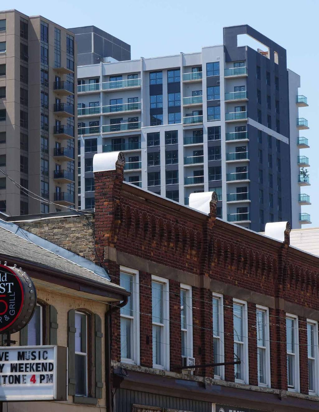
13 2.5 KING STREET CHARACTER AREA King Street is characterized by varying land uses ranging from residential to light industrial and institutional. The built form is also varied with low-rise single-detached dwellings alongside high-rise apartment buildings. Today along King Street, there are a number of large surface parking lots offering excellent opportunities for transit-oriented intensification. The area between Dundas Street and King Street is characterised by deep lots which offer good high-rise development opportunities. Rapid transit service is anticipated along King Street, from the downtown through to Ontario Street. King Street is identified as a Rapid Transit Boulevard within the Rapid Transit Corridor Place Type in The London Plan. The Plan encourages intensification here, especially around future rapid transit stations planned along King Street at Colborne Street, Adelaide Street North and Ontario Street. High-rise residential and office uses are appropriate along King Street, and have recently been introduced to the corridor. It is envisioned that the highest residential intensity will be accommodated in the King Street Character Area to strengthen the market for Old East Village businesses, especially within walking distance to the future rapid transit stations. 9
14 10
15 3.0 Policies 3.1 OVERVIEW The intent of this Secondary Plan is to provide a policy framework to guide future development and public projects in the Old East Village Dundas Street Corridor Secondary Plan area. Policies in this Secondary Plan support the vision by providing guidance on: land uses; built form; public realm design and the mobility framework; and, heritage. The policies of this Secondary Plan generally provide a greater level of detail than the general policies of The London Plan. Where the policies of The London Plan provided sufficient guidance to implement the vision of this Secondary Plan, these policies were not repeated in this Secondary Plan. As such, the policies of this Secondary Plan should be read in conjuncture with The London Plan. In instances where the overall policies of The London Plan and the Old East Village Dundas Street Corridor Secondary Plan are inconsistent, the Secondary Plan shall prevail. The policies of this Secondary Plan that use the words will or shall express a mandatory course of action. Where the word should is used, suitable alternative approaches to meet the intent of the policy may be considered. The policies of this Secondary Plan will be implemented through mechanisms set out in this Secondary Plan, Municipal investments in infrastructure and public realm improvements, as well as other tools available to the City 11

16 including the Zoning By-law, the Site Plan Control By-law, and urban design review. 3.2 LAND USE Today, Old East Village, Midtown, and King Street feature a diverse mix of land uses and an artisanal spirit which contribute to its positioning as an active urban node and an area of entrepreneurial activity. The intent of the following land use policies is to allow for the Secondary Plan area to continue to evolve as a thriving mixed-use community and a cultural hub. The Zoning By-law will provide more detail on individual permitted uses; this may not include the full range of uses identified in this Secondary Plan. The following land use policies apply to the entire Secondary Plan area, unless otherwise specified within the individual policy: a) Mixed-use buildings are encouraged as the preferred form of development within the Secondary Plan area. b) A broad range of residential, retail, service, office, cultural, recreational, and institutional uses may be permitted. c) Dundas Street properties, between Adelaide Street North and Burbrook Place, shall provide street-oriented active uses on the ground floor for the majority of the Dundas Street frontage. Street-oriented active uses include, but are not limited to: 12 Retail; Service; Recreational; Cultural; and, Institutional. Street-oriented non-active uses, such as residential lobbies and office uses, may be permitted if they comprise less than the majority of the Dundas Street frontage of
 Street-oriented active uses are encouraged at the ground floor of properties fronting Dundas Street, between Colborne Street and Adelaide Street North, as well as properties on Colborne Street,")
17 Schedule 2: Ground-Floor Uses an individual property. The segment where this policy is applicable is illustrated in Schedule 2: Ground-floor Uses. d) Street-oriented active uses are encouraged at the ground floor of properties fronting Dundas Street, between Colborne Street and Adelaide Street North, as well as properties on Colborne Street, Adelaide Street North and Ontario Street between Dundas Street and King Street. e) Residential uses are encouraged above the ground floor to increase the residential population and provide a variety of housing options. f ) Primary access to residential units above the ground floor should be located on a street-facing facade. g) Artisanal workshops and craft breweries may be permitted to support the emerging businesses. h) Community facilities and institutional uses may be permitted for the continued provision of neighbourhood services. The ground floor of these uses will be designed to contribute to the vibrancy and animation of the street. i) Drive-through facilities may be permitted where it can be clearly demonstrated that they will not detract from the vision and role of the Place Type and the quality and character of the pedestrian-oriented street environment. Proposals for new drive through facilities will be subject to a zoning by-law amendment and site plan approval, in conformity with the policies of this Secondary Plan and The London Plan. 13

18 3.3 BUILT FORM One of the Secondary Plan area s strongest assets is its rich and complex built environment with various building forms and types that contribute to a unique sense of place. From the historic low-rise houses and retail buildings fronting on Dundas Street to the high-density podium-tower condominiums emerging along King Street, the variety of building types that allow diverse uses to flourish will be key to the area s continued evolution and vibrancy. The purpose of this Secondary Plan is to provide guidelines to coordinate and guide future developments while celebrating the continued diversity in the urban fabric PERMITTED HEIGHTS a) For the purposes of this Secondary Plan, low-rise will describe buildings up to, and including, three storeys in height. Within the entirety of the Secondary Plan area, low-rise buildings will be permitted, with a required minimum of height of two storeys or eight metres. b) For the purposes of this Secondary Plan, mid-rise will describe buildings four storeys and up to and including eight storeys in height. c) Low-rise and mid-rise buildings are generally permitted on the north side of Dundas Street and on the south side of Dundas Street between Egerton Street and Kellogg Lane. Refer to Schedule 3: Permitted Heights. Maximum building heights may be less than eight storeys as determined through the policies in Section Mid-Rise Form. d) For the purposes of this Secondary Plan, high-rise will describe buildings nine storeys in height and taller. 14

19 Schedule 3: Permitted Heights e) Low-rise, mid-rise, and high-rise buildings up to 12 storeys are generally permitted on the south side of Dundas Street, on both sides of King Street, and on both sides of Ontario Street. Refer to Schedule 3: Permitted Heights. f ) Within a 100 metre radius of a rapid transit station and within the boundary of the Secondary Plan area, permitted building height shall be up to 16 storeys to promote transit-oriented development. g) Where high-rise forms are permitted (refer to Schedule 3), height exceeding the established maximum, up to 24 storeys, may be permitted through a site-specific bonus zone, where it can be demonstrated that significant measures are put in place to support or mitigate this additional height or density, subject to the policies of Section 3.4 Bonusing. h) Development proposals for residential intensification may require studies to determine servicing capacity and necessary upgrades. The results of these studies may influence the maximum permitted height and density that is permitted through zoning. 15
20 3.3.2 GENERAL BUILT FORM a) The Old East Village Core and Old East Village East character areas have an existing relatively consistent built form which establishes a continuous street wall. The placement of buildings within these character areas should support this continuous street wall, and exceptions for small plazas, courtyards or patios spaces should be designed to carefully integrate into this established streetscape. b) The Midtown character area has an existing built form condition which is highly diverse. The placement of buildings will respond to the immediately adjacent built form context. c) The King Street character area is planned to accommodate rapid transit service and high-rise development. To create a comfortable pedestrian environment along King Street, new buildings in this character area will be set back from the right-of-way to provide space for landscaping. d) Portions of buildings at intersections may be setback for small plazas, courtyards, patios spaces, or to accommodate enhanced sidewalk treatments. e) Parking shall not be located between the building front and public right-of-way. f ) Landscape treatment should be provided along the edge of parking lots and within parking lots to mitigate water runoff, heat island effect and enhance the user experience. g) Access for parking and service areas should be located away from main streets and on side streets and laneways where possible. Where it is not possible, parking access will be minimized to reduce pedestrian conflict 16 and will be integrated in a way that does not detract from the character of the street. h) Corner buildings should be designed with the primary building entrances fronting onto the higher order street. i) High- and mid-rise buildings should be designed to express three defined components: a base, middle, and top. Alternative design solutions that address the following intentions may be permitted: The base should establish a humanscale façade with active frontages including, where appropriate, windows with transparent glass, forecourts, patios, awnings, lighting, and the use of materials that reinforce a human scale. The middle should be visually cohesive with, but distinct from, the base and top. The top should provide a finishing treatment, such as a roof or a cornice treatment, and will serve to hide and integrate mechanical penthouses. j) Buildings should have articulated façades that complement the façade rhythm of the existing streetscape and no large blank walls should be visible from the street. k) Building façades should address and frame the public street at grade. l) Façade elements of infill development or new construction fronting onto Dundas Street will be designed to support the existing character along the Dundas Corridor. These elements may include: Entryways and doors; Windows; Window base; Sign band and signage; Awnings; and, Lighting.

21 m) Regardless of the intended use, the ground floor of new buildings should be designed with the flexibility to accommodate future conversion to non-residential uses in the future. Strategies could be considered, such as providing a raised floor over the slab that can be removed to provide additional ground floor height in the future. n) All development fronting onto Dundas Street should be consistent with the Old East Village Commercial Corridor Urban Design Manual to coordinate the façade and built form with the existing character of Dundas Street. Figure 2: Illustration of New Low-Rise Buildings 17

22 3.3.3 MID-RISE FORM a) To provide an appropriate transition of building scale to the adjacent lowrise neighbourhood areas, transition policies will apply in Height Transition Areas illustrated in Schedule 3: Permitted Heights. b) A 45-degree angular plane beginning from the rear of the low-rise properties fronting Queens Avenue will set the limit to the height of new buildings located on the north side of Dundas Street. A 45-degree angular plane beginning from the rear of the low-rise properties fronting King Street will set the limit to the height of new buildings on the south side of Dundas Street east of Burbrook Street, to ensure an appropriate transition to the low-rise neighbourhoods as illustrated in Figure 3 and 4. c) Mid-rise buildings should stepback a minimum of five metres at the third or fourth storey, depending on the built form context, to mitigate downward wind shear and support the existing street character at street level. Figure 3: Illustration of New Mid-Rise Buildings 18
 The tower portion should be stepped back above the podium along all public rights-of-way, at the third or fourth storey, to mitigate downward wind shear and limit the visual impact of the building")
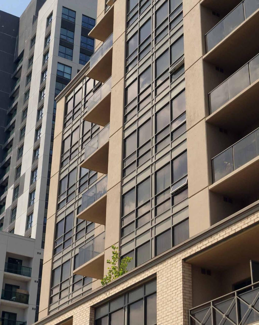
23 Figure 4: 45-degree Angular Plane Transition HIGH-RISE FORM a) The podium shall be designed to support a pedestrian-scaled environment at street level. b) The tower portion should be stepped back above the podium along all public rights-of-way, at the third or fourth storey, to mitigate downward wind shear and limit the visual impact of the building at street level. c) High-rise buildings should be designed with slender towers that reduce shadow impact, minimize the obstruction of views, and are less massive to neighbouring properties. A typical floor plate of approximately 1,000 square metres is a reasonable target to achieve this goal. d) Separation distance between towers should generally be not less than 30 metres to ensure adequate privacy. 19
 Towers shall not have any blank façades.")
24 e) Where possible, towers should be offset to provide maximum access to sunlight and views. In cases where towers can be offset, reduction of tower separation distance may be considered to approximately 25 metres. f ) Towers shall not have any blank façades. g) The top portions of the tower shall be articulated through the use of a small setback, difference in articulation, or the use of an architectural feature. The mechanical penthouse shall be integrated into the design of the tower. Figure 5: Illustration of New High-Rise Buildings 20
25 3.4 BONUSING a) Where high-rise forms are permitted and where it can be demonstrated that significant measures are put in place to support or mitigate additional height or density, City Council may pass a by-law, known as a bonus zone, to authorize increases in the height and density of development beyond what is otherwise permitted by the Zoning By-Law, in return for the provision of such facilities, services, or matters as are set out in the bonus zone. b) In accordance with the permitted heights identified in Section Permitted Heights, additional height or density may be permitted in favour of facilities, services, or matters such as: Cultural heritage resources designation and conservation. Affordable housing. Public art. Provision of off-site community amenities, such as parks, plazas, civic spaces, or community facilities. Publicly-accessible mid-block connections and laneways, or widening of existing mid-block connections that provide access from Dundas Street to municipal parking lots. Generous front yard setbacks along King Street to widen the public rightof-way, provide landscaping and noise buffer, and act as a spatial relief for high-rise building forms. Contribution to the development of transit amenities, features and facilities, available to the public during transit operating hours. 21 Substantial contribution to publicly accessible secure bicycle parking, and cycling infrastructure such as lockers and change rooms. Contribution to façade restoration and other heritage investments within the Secondary Plan area. Other facilities, services, or matters that provide substantive public benefit. c) The facilities, services and matters to be provided in return for greater height or density do not necessarily have to be provided on the same site as the proposed development. City Council may want to have such benefits directed to another property within the Secondary Plan area. d) Each proposal for bonus zoning will be considered on its own merits. The allowance for greater height and density on one site in return for certain facilities, services and matters will not be considered to establish a precedent for similar height and density on any other site.

26 3.5 PUBLIC REALM A well-designed public realm will contribute to the success of the Old East Village Dundas Street Corridor Secondary Plan area as a safe and attractive place for people to live and visit. An excellent pedestrian environment, lively public spaces, a coordinated streetscaping approach, and safe and convenient connections to transit and parking will help to achieve this. In addition to enhancing the pedestrian thoroughfares of the Secondary Plan area, there is a need to build up a network of public spaces that will provide places to gather and act as focal points for the community. There is also a need to safeguard landscape areas which will help act as a buffer between the pedestrian zones and the proposed rapid transit infrastructure along King Street. The design of the public realm within Old East Village and the surrounding areas should provide a safe, comfortable, and attractive environment. The public realm and streetscape will be designed in a way that allows flexibility and the ability for adaptation over time as resources become available and as the area evolves. The following policies apply to the public realm, including all public streets and mid-block connections to municipal parking lots within the Old East Village Dundas Street Corridor Secondary Plan area: a) Pedestrian comfort, connectivity, and safety will be prioritized in the design of the public realm. b) Main building entrances, terraces, and gathering spaces will be oriented towards public rights-of-way to support safety and provide direct access from the sidewalk. 22
27 c) All north-south streets connecting Queens Avenue, Dundas Street, and King Street are essential pedestrian and cycling connections, and will be enhanced through: Ensuring generous sidewalk width; Adding integrated and coordinated directional signage; Incorporating pedestrian-scaled lighting; Creating safe cycling conditions on north-south streets that connect the existing and future cycling infrastructure; Providing bicycle parking facilities; and, Designing attractive and high-quality landscaping, planted in conditions that support a future mature landscape. d) Safety and accessibility of connections to municipal parking lots from public rightsof-way will be enhanced with appropriate sightlines, pedestrian-scaled lighting, and signage. e) A coordinated wayfinding approach should be developed for the Secondary Plan area, which includes municipal parking lots. f ) Existing street trees will be retained where possible, and new trees with potential for large canopy will be planted in landscape zones with adequate soil volume to provide shade. i) Coordinated street furniture, including bicycle parking, benches, planters, waste receptacles, and lighting will be incorporated into the street design. j) Opportunities to add walkways and/or widen and extend laneways to provide safe midblock connections and connections to municipal parking lots should be explored. k) Opportunities to accommodate outdoor restaurant patios within the sidewalk and in on-street parking spaces should be considered. l) Dundas Street will be designed with the flexibility to accommodate events of different scales and sizes; consideration should be given to electrical outlet access and capacity as well as moveable features. g) The integration of open spaces, such as plazas or parkettes, are encouraged with new development, especially at street intersections for visibility and accessibility. h) Opportunities to incorporate gateway features should be considered at key intersections. 23

28 3.6 CONNECTIVITY AND MOBILITY The Old East Village Dundas Street Corridor Secondary Plan area is located in close proximity to established residential neighbourhoods, new high-rise residential development, the downtown, the evolving industrial areas of the McCormick Area Secondary Plan area and the former Kellogg s property, and at the juncture of four heritage conservation districts. The area is anticipating cycling infrastructure improvements on Dundas Street and Queens Avenue, as well as rapid transit service along King Street, Ontario Street, and Dundas Street. To serve residents, attract visitors, and support the local businesses in the area, establishing safe access by various modes of transportation is vital to ensure the Secondary Plan area functions for everyone. Schedule 4: Connectivity Framework provides an overview of the current pedestrian routes and future areas for mid-block connections as well as the planned Rapid Transit routes and the proposed cycling network. The following section outlines policies that provide directions for pedestrian, cycling, transit, and automobile connections. The intent of these policies is to improve existing connectivity, and to identify potential opportunities for new connections to be established as the area evolves. Schedule 4: Connectivity Framework 24

29 3.6.1 PEDESTRIAN PRIORITY The core of Old East Village is a pedestrian supportive environment today with landscaping and street furniture. With anticipated improvement to the cycling infrastructure and introduction of rapid transit service, the walking environment requires special attention and upgraded treatments. Well-designed streetscapes with opportunities to incorporate street furniture and patio space will also encourage visitors to linger and patronise the local businesses, enhancing Old East Village s appeal as an urban destination. The design of Dundas Street, King Street, connections to municipal parking lots, and all intersecting north-south streets will be designed to prioritize pedestrian connectivity, safety, comfort, and enjoyment by: a) Ensuring a generous sidewalk width; b) Incorporating attractive paving, plantings, and lighting; c) Seeking opportunities to create safe new connections to provide public access to municipal parking lots, public space or public streets. This will include exploring opportunities to create new mid-block connections where appropriate, through acquisition of property as it becomes available, or through redevelopment as it occurs; d) Installing coordinated directional signage at key locations, particularly on northsouth streets that provide connections between commercial uses, residential neighbourhoods rapid transit service, and municipal parking lots; and, e) Ensuring that rights-of-way, mid-block connections, and laneways that provide access to municipal parking lots are safe and well lit with pedestrian-scale lighting. 25

30 3.6.2 CYCLING Cycling infrastructure upgrades are planned for Dundas Street and Queens Avenue. Eastbound and westbound cycling lanes will be provided on Dundas Street between the downtown and William Street. At William Street the network will split, with the eastbound cycling lane continuing along Dundas Street and the westbound cycling lane along Queens Avenue. At Quebec Street, the cycling lanes will merge again onto Dundas Street, as illustrated in Schedule 4: Connectivity Framework. This arrangement accommodates the limited rightof-way width through the core of Old East Village and allows for the retention of on-street parking and widened sidewalks as well as opportunities for bicycle parking facilities on Dundas Street. Cycling within the Secondary Plan area will be further supported by: a) Integrating cycling infrastructure, such as separated cycling lanes and route signage, into the design of the rights-of-way; and, b) Providing cycling facilities, such as bicycle parking and repair stations, in accessible and highly visible locations TRANSIT Local bus routes along Dundas Street, Adelaide Street North, and Quebec Street currently service the Secondary Plan area. Rapid transit service is anticipated to run along King Street from the downtown to Ontario Street, then proceed along Dundas Street from Ontario Street eastward, as illustrated in Schedule 4: Connectivity Framework. 26
31 As the Secondary Plan area is and will continue to be highly accessible by transit, considerations for transit-oriented intensification informed the built form policies and streetscape design throughout the Secondary Plan area. a) Pedestrian connections between Dundas Street and planned rapid transit stations on King Street at Colborne Street, Adelaide Street North, and Ontario Street will be prioritized for future enhancements to the pedestrian environment. b) Where possible, local transit stops will be designed and located to minimize the impact to vehicular traffic PARKING AND VEHICLE ACCESS a) Considering the needs of the existing commercial uses as well as new businesses emerging in the area, loading spaces and on-street parking will continue to be provided and considered in the design of the rights-of-way within the Secondary Plan area. Loading spaces will be provided in the rear of buildings where possible. b) Pedestrian and vehicle access to existing municipal parking lots will be improved through securing new access points through redevelopment, extending existing laneways, and enhancing existing public laneways with improved lighting and design treatment. c) Pedestrian access to existing municipal parking lots should be delineated and separated from vehicle access whenever possible for pedestrian safety RIGHTS-OF-WAY DESIGN The following section illustrates the design of rights-of-way within the Secondary Plan area alongside applicable policies for the following segments: Dundas Street, between Colborne and William Streets Dundas Street, between William and Ontario Streets Dundas Street, between Ontario and Quebec Streets Dundas Street, between Quebec and Egerton Streets King Street, between Colborne and Ontario Streets Connectors street, between Dundas and King Streets 27
32 Dundas Street, between Colborne Street and William Street The design of Dundas Street between Colborne Street and William Street will include: a) Widened sidewalks on both sides of the road to create a comfortable pedestrian condition; b) Landscape zones on both sides of the road with large canopy trees with appropriate soil volume, and spaces for street furniture; c) Pedestrian-scaled lighting with coordinated design throughout the Secondary Plan area; d) Separated cycling lanes travelling in both directions; e) Loading zones on the north side of the street to support institutional functions; and, f ) Two traffic lanes, travelling in both directions. Figure 6: Dundas Street, Colborne Street to William Street 28
 Widened sidewalks on both sides of the road to create")
33 Dundas Street, between William Street and Ontario Street The design of Dundas Street between William Street and Ontario Street will include: a) Widened sidewalks on both sides of the road to create a comfortable and safe pedestrian environment; b) Generous landscape zones on both sides of the road with large canopy trees with appropriate soil volume, and spaces for street furniture; c) Pedestrian-scaled lighting with coordinated design throughout the Secondary Plan area; d) A separated cycling lane travelling eastbound; e) On-street parking on the north side of the street to support retail and commercial functions on both sides of the street; f ) Two traffic lanes, travelling in both directions; and, g) Opportunities for restaurant patios between transit stops and loading areas on the south side of the street. Figure 7: Dundas Street, William Street to Ontario Street 29
34 Dundas Street, between Ontario Street and Quebec Street The design of Dundas Street between Ontario Street and Quebec Street will include: a) A widened sidewalk on the north side of the road with generous landscape zones for large canopy trees with appropriate soil volume, and street furniture; b) A widened south sidewalk to accommodates street furniture; c) Pedestrian-scaled lighting with coordinated design throughout the Plan area; d) A separated cycling lane travelling eastbound; e) Two dedicated rapid transit lanes, travelling both directions, subject to the results of the Bus Rapid Transit Environment Assessment; and, f ) Two traffic lanes, travelling both directions Dundas Street, between Quebec Street and Egerton Street The design of Dundas Street between Quebec Street and Egerton Street will include: a) A widened sidewalk on the north side of the road with generous landscape zones for large canopy trees with appropriate soil volume, and street; b) A widened south sidewalk to accommodates street furniture; c) Pedestrian-scaled lighting with coordinated design throughout the Plan area; d) Separated cycling lanes travelling both directions; 30 e) Two dedicated rapid transit lanes, travelling both directions, subject to the results of the Bus Rapid Transit Environment Assessment; and, f ) Two traffic lanes, travelling both directions Dundas Street, between Egerton Street and Burbrook Place The design of Dundas Street between Egerton Street and Burbrook Place will include: a) Widened sidewalks on the north side of the road with generous landscape zones for large canopy trees with appropriate soil volume, and street; b) A widened south sidewalk to accommodates street furniture; c) Pedestrian-scaled lighting with coordinated design throughout the Plan area; d) On-street parking on the north side of the street to support the emerging retail and commercial functions; e) Two dedicated rapid transit lanes, travelling both directions, subject to the results of the Bus Rapid Transit Environment Assessment; and, f ) Two traffic lanes, travelling both directions King Street, between Colborne Street and Ontario Street The streetscape design for King Street will include: a) Generous sidewalks on both sides of the road to accommodate the rapid transit function of the corridor and ensure adequate room for pedestrians and transit riders; b) Generous landscape zones on the both sides of the road with large canopy trees

35 with appropriate soil volume, and space for street furniture including benches, waste receptacles, and rapid transit stations; play an important role in facilitating pedestrian movement, particularly near transit stations on King Street. c) General front-yard setback for landscaping between the sidewalk and the private realm to be secured through development; d) Pedestrian-scaled lighting with coordinated design throughout the Plan area; e) Two dedicated rapid transit lanes, travelling both directions, subject to the results of the Bus Rapid Transit Environment Assessment; and, f ) One traffic lane, travelling eastbound North-South Connector Streets North-south streets within the Secondary Plan area have an important role of connecting people between Dundas Street, King Street, and Queens Avenue. With future planned cycling infrastructure upgrades on Queens Avenue and Dundas Street, there is an imperative to create safe cycling connections between these two streets. Furthermore, the north-south connections between King Street and Dundas Street will 31 To enhance pedestrian and cycling connections, the design of connector streets will include: a) Wide sidewalks on both sides of the street to create comfortable pedestrian conditions; b) Cycling infrastructure and/or on-street parking where possible; c) Directional signage for pedestrians and cyclists; d) Generous landscape zones with large canopy trees with appropriate soil volume; and, e) Pedestrian-scaled lighting with coordinated design.

36 3.7 CULTURAL HERITAGE The Old East Village Dundas Street Corridor Secondary Plan area has a substantial number of cultural heritage resources. It is the intent of the Secondary Plan to promote the restoration and enhancement of heritage properties. Significant cultural heritage resources shall be integrated with new development and public realm improvements in respectful and creative ways. The City of London maintains a Register (Inventory of Heritage Resources). Any proposed development on or adjacent to a property designated under the Ontario Heritage Act or a property listed in City of London s Register shall: a) Require a Heritage Impact Assessment (HIA) to ensure that significant cultural heritage resources are conserved. Any assessment must include consideration of its historical and natural context within the City of London, and should include a comprehensive evaluation of the design, historical, and contextual values of the property. 32
 Avoidance and mitigation to allow development to proceed while retaining the cultural heritage resources in situ and intact; c) Adaptive")
37 The following potential mitigation approaches may be suitable for consideration and application for minimizing impacts from proposed developments on or adjacent to listed, designated, and potential cultural heritage resources within the Secondary Plan area: b) Avoidance and mitigation to allow development to proceed while retaining the cultural heritage resources in situ and intact; c) Adaptive re-use of a built heritage structure or cultural heritage resources; d) Commemoration of the cultural heritage of a property/structure/area, historical commemoration means such as plaques or cultural heritage interpretive signs; and, e) Urban design policies and guidelines for building on, adjacent, and nearby to heritage designated and heritage listed properties, and properties with potential cultural heritage resources to ensure compatibility by integrating and harmonizing mass, setback, setting, and materials. 33
38 34
39 4.0 Schedules 35

40 SCHEDULE 1: SECONDARY PLAN AREA 36
41 SCHEDULE 2: GROUND-FLOOR USES 37
42 SCHEDULE 3: PERMITTED HEIGHTS 38
43 SCHEDULE 4: CONNECTIVITY FRAMEWORK 39
The draft Secondary Plan will serve as the basis for further consultation with the community and stakeholders;
 File: O-8879 Planner: K. Killen Report to Planning and Environment Committee To: Chair and Members Planning & Environment Committee From: John M. Fleming Managing Director, Planning and City Planner Subject:
John M. Fleming Managing Director, Planning and City Planner. Old East Village Dundas Street Corridor Secondary Plan Draft Terms of Reference
 Report to Planning and Environment Committee To: From: Subject: Chair and Members Planning & Environment Committee John M. Fleming Managing Director, Planning and City Planner Old East Village Dundas Street
Urban Design Manual PLANNING AROUND RAPID TRANSIT STATIONS (PARTS) Introduction. Station Study Areas
 Introduction. Station Study Areas") 111111 PLANNING AROUND RAPID TRANSIT STATIONS (PARTS) Introduction The ION rapid transit system will link Waterloo, Kitchener and Cambridge through a central transit corridor (CTC). There are a number
111111 PLANNING AROUND RAPID TRANSIT STATIONS (PARTS) Introduction The ION rapid transit system will link Waterloo, Kitchener and Cambridge through a central transit corridor (CTC). There are a number
Uptown Rideau Street Secondary Plan [Amendment #166, January 12, 2016]
![Uptown Rideau Street Secondary Plan [Amendment #166, January 12, 2016]](/thumbs/76/73760497.jpg "Uptown Rideau Street Secondary Plan [Amendment #166, January 12, 2016]") [Amendment #166, January 12, 2016] The policies of this Secondary Plan are in effect, save and except for the property at 560 Rideau Street, for which there remains a site specific appeal to this Secondary
[Amendment #166, January 12, 2016] The policies of this Secondary Plan are in effect, save and except for the property at 560 Rideau Street, for which there remains a site specific appeal to this Secondary
Clairtrell Area Context Plan
 Clairtrell Area Context Plan March 2005 Urban Development Services City Planning Contents 1. Introduction... 4 2. Development Structure... 6 2.1 Streets... 7 2.1.1 Sheppard Avenue and Bayview Avenue...
ELMVALE ACRES SHOPPING CENTRE MASTER PLAN
 ELMVALE ACRES SHOPPING CENTRE MASTER PLAN Contents 1.0 INTRODUCTION... 2 2.0 LOCATION... 2 3.0 EXISTING CONTEXT... 2 4.0 VISION & GUIDING PRINCIPLES... 2 5.0 LAND USE AND BUILT FORM... 4 5.1 St. Laurent
Mark-up of the effect of the proposed Bronte Village Growth Area OPA No.18 on the text of section 24, Bronte Village, of the Livable Oakville Plan
 Mark-up of the effect of the proposed Bronte Village Growth Area OPA No.18 on the text of section 24, Bronte Village, of the Livable Oakville Plan Notes: This document is provided for information purposes
CHAPTER 5: GUIDING PRINCIPLES
 CHAPTER 5: GUIDING PRINCIPLES The following 10 principles were developed based on public consultation, planning policy and the background analysis conducted during Phase 1. The Guiding Principles significantly
5.1 Site Plan Guidelines
 5. Community Core Guidelines Development of the Community Core will take place by plan of subdivision and site plan approval. It will occur in a phased manner that will reflect the timing of residential
DRAFT Northeast Quadrant of Kipling Avenue and Highway 7 DRAFT AUGUST 29, Goals Land Use. The goals of this Plan are to:
 AUGUST 29, 2017 12.15 Northeast Quadrant of Kipling Avenue and Highway 7 12.15.1 Goals 12.15.2 Land Use The goals of this Plan are to: 12.15.2.1 General Provisions: a) Ensure the development of a compact
QUEEN-RIVER SECONDARY PLAN
 34 QUEEN-RIVER SECONDARY PLAN 34. QUEEN RIVER SECONDARY PLAN 1. INTRODUCTION The Queen-River area is approximately 6.4 hectares and is located at the eastern edge of the Downtown as shown on Map 34-1.
Policies and Code Intent Sections Related to Town Center
 Policies and Code Intent Sections Related to Town Center The Town Center Vision is scattered throughout the Comprehensive Plan, development code and the 1994 Town Center Plan. What follows are sections
Town Center (part of the Comprehensive Plan)
") Town Center (part of the Comprehensive Plan) Mercer Island Town Center Looking North (2014) In 1994, a year-long process culminated in a set of design guidelines and code requirements for the Town Center
Town Center (part of the Comprehensive Plan) Mercer Island Town Center Looking North (2014) In 1994, a year-long process culminated in a set of design guidelines and code requirements for the Town Center
appendix and street interface guidelines
 appendix five: building and street interface guidelines appendix 5 building and street interface guidelines BOULEVARDS Boulevards are generally characterized by higher levels of traffic movement at higher
CONTENTS 8.0 LAND USE 8.1 GENERAL LAND USE 8.2 RESIDENTIAL 8.3 MIXED USE 8.4 COMMERCIAL 8.5 EMPLOYMENT LANDS
 8-2 Land Use 8.0 LAND USE CONTENTS 8.1 GENERAL LAND USE 8.1.1 Uses provided for in all Land Use Designations 8.1.2 Uses prohibited in Hazardous Lands, Hazardous Sites and Special Policy Areas 8.1.3 Uses
Official Plan Review: Draft Built Form Policies
 PG.30.1 REPORT FOR ACTION Official Plan Review: Draft Built Form Policies Date: May 15, 2018 To: Planning and Growth Management Committee From: Chief Planner and Executive Director, City Planning Division
New-Cast Mixed-use Development Proposal King Street West, Newcastle, Ontario
 URBAN DESIGN BRIEF New-Cast Mixed-use Development Proposal King Street West, Newcastle, Ontario TABLE OF CONTENTS: 1.0 Executive Summary 2.0 Creating Vibrant and Sustainable Urban Places: Excerpts from
Yonge Eglinton Centre Urban Design Guidelines
 Yonge Eglinton Centre Urban Design Guidelines City Planning Urban Design January 2009 YONGE EGLINTON CENTRE INTRODUCTION.................................................... 1 GENERAL SITE PLAN OBJECTIVES......................................
13 THORNHILL YONGE STREET STUDY IMPLEMENTATION CITY OF VAUGHAN OPA 669 AND TOWN OF MARKHAM OPA 154
 13 THORNHILL YONGE STREET STUDY IMPLEMENTATION CITY OF VAUGHAN OPA 669 AND TOWN OF MARKHAM OPA 154 The Planning and Economic Development Committee recommends the adoption of the recommendations contained
WELCOME and introduction
 1 WELCOME and introduction Mobility Hub Locations within Burlington STUDY OVERVIEW STUDY OBJECTIVES The City of Burlington is developing four Area Specific Plans, one for each of Burlington s Mobility
URBAN DESIGN BRIEF URBAN DESIGN BRIEF 721 FRANKLIN BLVD, CAMBRIDGE August 2018
 URBAN DESIGN BRIEF URBAN DESIGN BRIEF 721 FRANKLIN BLVD, CAMBRIDGE August 2018 DESIGN BRIEF CONTENTS PART A 1.0 INTRODUCTION 2.0 DESCRIPTION & ANALYSIS OF SITE CONTEXT 3.0 DESIGN CONSTRAINTS AND OPPORTUNITIES
Highland Village Green Design Guidelines
 Highland Village Green Design Guidelines Publishing Information Title Highland Village Green Design Guidelins Author The City of Calgary Status DRAFT - Proposed document subject to changes Additional Copies
URBAN DESIGN BRIEF. 2136&2148 Trafalgar Road. Town of Oakville
 URBAN DESIGN BRIEF 2136&2148 Trafalgar Road Town of Oakville Prepared By: METROPOLITAN CONSULTING INC For 2500674 Ontario Inc November 2016 TABLE OF CONTENTS Page No. 1.0 Introduction/Description of Subject
Bathurst Bloor Four Corners Study Official Plan Amendment and Zoning By-law Amendment Final Report
 STAFF REPORT ACTION REQUIRED Bathurst Bloor Four Corners Study Official Plan Amendment and Zoning By-law Amendment Final Report Date: November 2, 2016 To: From: Wards: Reference Number: Toronto and East
[PLANNING RATIONALE] For Site Plan Control and Lifting of Holding Zone By-Law 101 Champagne Avenue. May 23, 2014
![[PLANNING RATIONALE] For Site Plan Control and Lifting of Holding Zone By-Law 101 Champagne Avenue. May 23, 2014](/thumbs/75/71599615.jpg "[PLANNING RATIONALE] For Site Plan Control and Lifting of Holding Zone By-Law 101 Champagne Avenue. May 23, 2014") [PLANNING RATIONALE] For Site Plan Control and Lifting of Holding Zone By-Law 101 Champagne Avenue May 23, 2014 Contents 1.0 Introduction... 2 2.0 Site Context... 2 2.1 Adjacent Uses... 2 Figure 1: Site
[PLANNING RATIONALE] For Site Plan Control and Lifting of Holding Zone By-Law 101 Champagne Avenue May 23, 2014 Contents 1.0 Introduction... 2 2.0 Site Context... 2 2.1 Adjacent Uses... 2 Figure 1: Site
The Master Plan Framework
 The Master Plan Framework The East Harbour Master Plan advances the development of 60 acres of former industrial lands east of the Don River. The Master Plan outlines a vision for a vibrant, transit-oriented
TALL BUILDING GUIDELINES
 TALL BUILDING GUIDELINES Urban Design Guidance for the Site Planning and Design of Tall Buildings in Milton May, 2018 A Place of Possibility Contents 1.0 INTRODUCTION 1 1.1 What is a Tall Building? 2
FRUITVALE TRANSIT VILLAGE (Phase 2) Residential Project
 Residential Project") FRUITVALE TRANSIT VILLAGE (Phase 2) Residential Project DEVELOPER: SIGNATURE PROPERTIES ARCHITECT: HKIT ARCHITECTS April 23, 2010 TABLE OF CONTENTS 3 Vision 4 Description of Site 5 Guiding Concepts 6
FRUITVALE TRANSIT VILLAGE (Phase 2) Residential Project DEVELOPER: SIGNATURE PROPERTIES ARCHITECT: HKIT ARCHITECTS April 23, 2010 TABLE OF CONTENTS 3 Vision 4 Description of Site 5 Guiding Concepts 6
EXISTING COMPREHENSIVE PLAN
 EXISTING COMPREHENSIVE PLAN Town Center Land Use Element: V. LAND USE POLICIES Town Center Mercer Island's business district vision as described in "Your Mercer Island Citizen-Designed Downtown" was an
Welcome. Walk Around. Talk to Us. Write Down Your Comments
 Welcome This is an information meeting introducing the applications for proposed redevelopment of the Yorkdale Shopping Centre site at 3401 Dufferin Street and 1 Yorkdale Road over the next 20+ years,
1.0 Purpose of a Secondary Plan for the Masonville Transit Village
 Report to Planning and Environment Committee To: Chair and Members Planning & Environment Committee From: John M. Fleming Managing Director, Planning and City Planner Subject: Masonville Transit Village
Figure 1- Site Plan Concept
 Figure 1- Site Plan Concept Parking will be provided underground on three levels at rate of 1.0 space/ unit; this rate includes all visitors parking. MMM Group has prepared a parking assessment (April,
St. Lawrence Neighbourhood Focused Area - Official Plan Amendment Status Report
 STAFF REPORT ACTION REQUIRED St. Lawrence Neighbourhood Focused Area - Official Plan Amendment Status Report Date: May 21, 2015 To: From: Wards: Reference Number: Toronto and East York Community Council
178 Carruthers Properties Inc.
 178 Carruthers Properties Inc. Planning Rationale for 178 Carruthers Avenue Site Plan Control Application June 2014 Table of Contents 1.0 Introduction 2.0 Overview of Subject Property 3.0 Current Zoning
38 Queen s University Campus Master Plan Part 1
 38 Queen s University Campus Master Plan Part 1 46 The Campus at the City Scale Chapter 4 The Campus at the City Scale 39 Queen s is an urban University centrally located in Kingston. Decisions made by
DRAFT DRAFT DRAFT DRAFT
 # 19 EXPAND GREEN AND OPEN SPACES AND COMMUNITY FACILITIES IN TANDEM WITH NEW DEVELOPMENT The role of Eglinton will change in the coming years, along with the intensity of activity and land uses. As more
4.0 Design Guidelines For The Village Centre. South fields Community Architectural Design Guidelines Town of Caledon
 4.0 Design Guidelines For The Village Centre 4.0 Design Guidelines for the Village Centre The Village Centre is the focal point of the entire South Fields Community and is designed as a traditional commercial
ARLINGTON COUNTY, VIRGINIA
 ARLINGTON COUNTY, VIRGINIA County Board Agenda Item Meeting October 15, 2005 DATE: September 28, 2005 SUBJECT: Request to Advertise the adoption of the 2005 Clarendon Sector Plan C. M. RECOMMENDATION:
HIGHLAND VILLAGE GREEN URBAN DESIGN PRINCIPLES/GUIDELINES
 URBAN DESIGN GUIDING PRINCIPLES/GUIDELINES CONTEXT/CHARACTER The City of Calgary s Municipal Development Plan (MDP), Transit-Oriented Development (TOD) Policy Guidelines and Main Street/Corridor policy
FORMER CANADIAN FORCES BASE (CFB) ROCKCLIFFE SECONDARY PLAN. Official Plan Amendment XX to the Official Plan for the City of Ottawa
 ROCKCLIFFE SECONDARY PLAN. Official Plan Amendment XX to the Official Plan for the City of Ottawa") FORMER CANADIAN FORCES BASE (CFB) ROCKCLIFFE SECONDARY PLAN Official Plan Amendment XX to the Official Plan for the City of Ottawa 1 INDEX THE STATEMENT OF COMPONENTS PART A THE PREAMBLE PAGE Purpose...
FORMER CANADIAN FORCES BASE (CFB) ROCKCLIFFE SECONDARY PLAN Official Plan Amendment XX to the Official Plan for the City of Ottawa 1 INDEX THE STATEMENT OF COMPONENTS PART A THE PREAMBLE PAGE Purpose...
Figure 3-1: Public Realm Plan
 3 Public Realm Figure 3-1: Public Realm Plan 3.1 Public Realm Concept The public realm concept for the Little Mountain site integrates a clear and accessible movement network with public spaces for social
YONGE STEELES CORRIDOR SECONDARY PLAN. Young + Wright / IBI Group Architects Dillon Consulting Ltd. GHK International (Canada) Ltd.
 Ltd.") PART A: PREAMBLE 1.0 PURPOSE The purpose of this Secondary Plan is to provide a development framework for intensification of the Yonge/ Steeles corridor including the north side of Steeles Avenue West
PART A: PREAMBLE 1.0 PURPOSE The purpose of this Secondary Plan is to provide a development framework for intensification of the Yonge/ Steeles corridor including the north side of Steeles Avenue West
Wide asphalt driveway abutting school property. garage built with incompatible materials, too close to park. incompatible fencing materials
 Wide asphalt driveway abutting school property incompatible fencing materials garage built with incompatible materials, too close to park Lack of plantings as a buffer between private property and open
Downtown Streetscape Manual & Built Form Standards
 City of Guelph Downtown Streetscape Manual & Built Form Standards July 2014 Prepared by Brook McIlroy Inc. in association with Unterman McPhail Associates and McCormick Rankin Inc. City of Guelph Downtown
Community Design Plan
 Gardena General Plan 2006 Authority While the is not a required element of a General Plan, it is included because improving the community appearance and image is paramount to the overall quality of life
1354 CARLING AVENUE FORMAL RESUBMISSION HOLLOWAY LODGING
 1354 CARLING AVENUE FORMAL RESUBMISSION HOLLOWAY LODGING DECEMBER, 2017 THE SITE 1354 CARLING AVENUE The subject property is at a key gateway to the Carlington Neighbourhood, and when combined with future
The Village. Chapter 3. Mixed Use Development Plan SPECIFIC PLAN
 The Village SPECIFIC PLAN Chapter 3 3.1 INTRODUCTION 3.1.1 Purpose This Chapter describes the development regulations applicable to the Mixed-Use and Transit Center Planning Areas. These form-based regulations
TABLE OF CONTENTS 1.0 INTRODUCTION... 3
 TABLE OF CONTENTS 1.0 INTRODUCTION... 3 1.1. BACKGROUND... 3 1.2. THE PROPOSAL... 5 2.0 EXISTING POLICY FRAMEWORK... 5 2.1. PROVINCIAL POLICY STATEMENT (PPS)... 5 2.2. CITY OF LONDON OFFICIAL PLAN (OP)...
Lambeth Main Street Streetscape Improvements
 Lambeth Main Street Streetscape Improvements Open House October 5th, 2017 Agenda 1. Introduction 2. Project Background 3. Context 4. Project Objectives 5. Design Principles & Approach 6. Streetscape Design
WELLINGTON STREET WEST COMMUNITY DESIGN PLAN
 36 3.CDP POLICIES 37 Wellington Street West CDP Vision Statement 38 3.1 Introduction 3.1.1 Purpose The development of buildings and public spaces is influenced by a variety of factors over time. City of
King-Spadina Secondary Plan Community Consultation Meeting. Michelle Knieriem, City Planner October 11, 2017
 King-Spadina Secondary Plan Community Consultation Meeting Michelle Knieriem, City Planner October 11, 2017 Agenda 6:30 Welcome 6:35 Presentation 7:15 Question and Answer Session 8:15 Closing Remarks HOW
16. KING-SPADINA SECONDARY PLAN
 16. KING-SPADINA SECONDARY PLAN 1. INERPREAION 1.1 he lands affected by this Secondary Plan for the King-Spadina Area are shown on Map 16-1. 1.2 Where a building within a Regeneration Areas designation
Authority: Toronto and East York Community Council Item 26.14, as adopted by City of Toronto Council on October 8, 9, 10 and 11, 2013 CITY OF TORONTO
 Authority: Toronto and East York Community Council Item 26.14, as adopted by City of Toronto Council on October 8, 9, 10 and 11, 2013 CITY OF TORONTO BY-LAW No. 1507-2013 To adopt Amendment No. 183 to
East Bayshore Road Neighbourhood
 East Bayshore Road Neighbourhood Northridge Property Management Urban Design Brief 3195 East Bayshore Road City of Owen Sound January 2016 East Bayshore Road Neighbourhood Northridge Property Management
PORT WHITBY COMMUNITY
 PORT WHITBY COMMUNITY SECONDARY PLAN UPDATE COMMUNITY IMPROVEMENT PLAN URBAN DESIGN GUIDELINES September 2015 DRAFT PROPOSED AMENDMENT NUMBER # to the Whitby Official Plan PURPOSE: The intent of this Amendment
(DC1) Direct Development Control Provision DC1 Area 4
 Direct Development Control Provision DC1 Area 4") . General Purpose (DC) Direct Development Control Provision DC Area 4 The purpose of this Provision is to provide for an area of commercial office employment and residential development in support of the
. General Purpose (DC) Direct Development Control Provision DC Area 4 The purpose of this Provision is to provide for an area of commercial office employment and residential development in support of the
BROADVIEW PLANNING STUDY Community Consultation Meeting 4. January 2016
 BROADVIEW PLANNING STUDY Community Consultation Meeting 4 January 2016 2 Agenda 6:00 pm Open House and Displays 7:00 pm Introductions, Agenda Review and Welcome 7:10 pm Presentation Broadview Planning
DOWNTOWN GEORGETOWN PLANNING STUDY
 DOWNTOWN GEORGETOWN PLANNING STUDY Community Workshop #3 Thursday, May 4, 08 The Planning Partnership OVERVIEW OF STUDY, PROCESS & MILESTONES We are here PURPOSE OF THE STUDY To develop a clear vision
Revitalization Guidelines for Corridors, Villages and Town Centres
 Revitalization Guidelines for Corridors, Villages and Town Centres July 2017 Updated May, 2018 Publishing Information Title: Prepared by: Revitalization Guidelines for Corridors, Villages and Town Centres
Workshop 3. City of Burlington Waterfront Hotel Planning Study. September 14, The Planning Partnership
 Workshop 3 City of Burlington Waterfront Hotel Planning Study September 14, 2017 The Planning Partnership The Waterfront Hotel Planning Study 01 The Brant & Lakeshore Planning Study will establish a Strategic
Westwind Developments Ltd. PIONEER LANDS AREA STRUCTURE PLAN - PROPOSED AMENDMENT
 FEBRUARY 2013 TABLE OF CONTENTS 1.0 BACKGROUND... 1 1.1 Amendment... 1 2.0 LOCATION & CONTEXT... 2 2.1 Land Ownership... 2 3.0 POLICY CONTEXT... 3 3.1 Municipal Development Plan... 3 3.2 Capital Region
New Street Proposed Redevelopment Architecture & Urban Design Brief
 2130 2136 New Street Proposed Redevelopment Architecture & Urban Design Brief Prepared By: Cynthia Zahoruk Architect Inc. 3077 New Street, Burlington, ON, L7N 1M6 TABLE OF CONTENTS Background and Objective
Lehigh Acres Land Development Regulations Community Planning Project
 Lehigh Acres Land Development Regulations Planning Effort Summary In July, 2010 Commissioner Frank Mann invited the Lehigh Acres community to start discussing how to achieve their recently adopted community
Cit of Kitchener Ur 6 an Design Manual PARTA. Desi n for _--::
 Cit of Kitchener Ur 6 an Design Manual Date PARTA Year ) Desi n for k Nodes Corridors _--:: Section Page 01 of 12 2 INTRODUCTION Purpose & Application Nodes and Corridors have been identified as key intensification
599 Kennedy Road - Official Plan Amendment and Zoning Amendment Application - Preliminary Report
 STAFF REPORT ACTION REQUIRED 599 Kennedy Road - Official Plan Amendment and Zoning Amendment Application - Preliminary Report Date: March 7, 2017 To: From: Wards: Reference Number: Scarborough Community
1071 King Street West Zoning Amendment Application - Preliminary Report
 STAFF REPORT ACTION REQUIRED 1071 King Street West Zoning Amendment Application - Preliminary Report Date: August 9, 2012 To: From: Wards: Reference Number: Toronto and East York Community Council Director,
Regency Developments. Urban Design Brief. Holyrood DC2 Rezoning
 Regency Developments Urban Design Brief Holyrood DC2 Rezoning Stantec Consulting Ltd. 7-31-2017 1. Overview Regency Developments intends to rezone the lands located at 8510 and 8511 93 Avenue, within the
Appendix A COMMUNITY IMPROVEMENT PLAN DESIGN GUIDELINES
 Appendix A COMMUNITY IMPROVEMENT PLAN DESIGN GUIDELINES INTRODUCTION The continuous and desirable improvement of Arnprior requires a clear understanding of what is envisioned for the Town. These Design
Future Five. Design/ Development Guidelines. January 2008 Amended June 08 per City Council motion
 Future Five Design/ Development Guidelines January 2008 Amended June 08 per City Council motion 5-Points Design Guidelines Table of Contents I. Introduction 3 II. Area boundaries 4 III. Review Process
THE CITY OF VAUGHAN BY-LAW BY-LAW NUMBER A By-law to adopt Amendment Number 1 to the Official Plan of the Vaughan Planning Area.
 THE CITY OF VAUGHAN BY-LAW BY-LAW NUMBER 015-2014 A By-law to adopt Amendment Number 1 to the Official Plan of the Vaughan Planning Area. NOW THEREFORE the Council of the Corporation of the City of Vaughan
8. Urban Villages. Other Relevant Policies & Bylaws Official Community Plan Development Permit Area Designations and Guidelines
 8. Urban Villages Urban villages provide walkable shops and services, encourage a neighbourhood social life, create a sense of place and provide different housing options. More housing near Urban Villages
Housing and Coach House Guidelines - Ladner
 Housing and Coach House Guidelines - Ladner Policy D.8: Encourage Compatible Housing Design Encourage housing design that is sensitive to existing single family housing neighbourhoods by requiring a design
URBAN DESIGN BRIEF 305, 309, & 315 SOUTHDALE ROAD WEST LONDON ONTARIO
 URBAN DESIGN BRIEF 305, 309, & 315 SOUTHDALE ROAD WEST LONDON ONTARIO CARVEST PROPERTIES LTD. December 2013 Section 1 - Land Use Planning Context 1.1 Subject Lands The subject lands are located immediately
Derry Green Corporate Business Park
 Town of Milton Derry Green Corporate Business Park Urban Design Guidelines BMI/Pace - June 2010 Draft 3 Prepared by: Brook McIlroy Planning + Urban Design / Pace Architects Suite 300-51 Camden Street Toronto,
CONTENTS 6.1 URBAN DESIGN
 6-2 Urban Design and Sustainable Development 6.0 URBAN DESIGN AND SUSTAINABLE DEVELOPMENT CONTENTS 6.1 URBAN DESIGN 6.1.1 General Policies 6.1.2 The Public Realm 6.1.3 Streets and Blocks 6.1.4 Streetscapes
Urban Design Brief December 23, 2015 Southside Construction Group Official Plan & Zoning By-Law Amendment
 Urban Design Brief Proposed Official Plan & Zoning By-Law Amendment 3244, 3263 and 3274 Wonderland Road South Southside Group December 23, 2015 TABLE OF CONTENTS Page No. INTRODUCTION... 1 SECTION 1 LAND
420 FANSHAWE PARK ROAD EAST London, ON
 420 FANSHAWE PARK ROAD EAST London, ON URBAN DESIGN BRIEF, CHARACTER STATEMENT & COMPATIBILITY REPORT April 2016 Prepared by MHBC Planning 630 COLBORNE STREET SUITE 202 LONDON, ON N6B 2V2 TABLE OF CONTENTS
11.5 Kipling Avenue Corridor Secondary Plan
 11.5 Kipling Avenue Corridor Secondary Plan ADOPTED BY VAUGHAN CITY COUNCIL NOT YET APPROVED BY THE ONTARIO MUNICIPAL BOARD 11.5.1 Development Principles and Objectives The following principles support
Site Planning. 1.0 Site Context. 2.0 Pedestrian Circulation Systems. Pag e 2-23
 The following photographs from throughout the country illustrate key urban design principles. Photographs are provided to illustrate the overall urban design concepts described in Chapter 1 of the Downtown
WINDSOR GLEN DESIGN GUIDELINES
 WINDSOR GLEN DESIGN GUIDELINES Adopted by Council, 2006 WINDSOR GLEN REDEVELOPMENT DESIGN GUIDELINES August 2006 1.0 Master Plan Organization For this area of the Coquitlam Town Centre, a mix of high,
Table of Contents. Elm Avenue Improvement Plan City of Waco, Texas. Introduction 1. Existing Context 1 Figure 1 2.
 Table of Contents Introduction 1 Existing Context 1 Figure 1 2 Plan Guidelines 3 Future Urban Form 4 The West-End 4 Main Street 6 The East-End 7 Figure 2 9 Public Improvement Recommendations 7 General
DAVENPORT VILLAGE SECONDARY PLAN
 27 DAVENPORT VILLAGE SECONDARY PLAN 27. DAVENPORT VILLAGE SECONDARY PLAN 1. VISION FOR THE DAVENPORT VILLAGE SECONDARY PLAN Davenport Village, municipally known as 830, 940, 980 and 1100 Lansdowne Avenue,
KING-SPADINA SECONDARY PLAN
 16 KING-SPADINA SECONDARY PLAN 16. KING-SPADINA SECONDARY PLAN 1. INERPREAION 1.1 he lands affected by this Secondary Plan for the King-Spadina Area are shown on Map 16-1. 1.2 Where a building within a
Urban Design Direction for Oakville. Endorsed by Council on May 12, 2014 Endorsed by Council , Version - 1.0
 Urban Design Direction for Oakville Endorsed by Council on May 12, 2014 Endorsed by Council 01.30.2014, Version - 1.0 Urban Design Direction for Oakville Livable by Design Manual Urban Design Direction
Context Plan and Urban Design Guidelines for the lands west of Provost Drive
 Concord Park Place Context Plan and Urban Design Guidelines for the lands west of Provost Drive Amendment to the Bessarion-Leslie Context Plan October 2013 Concord Park Place Urban Design Guidelines The
Downtown Whitby Action Plan
 Downtown Whitby Action Plan Final Report October 2016 Table of Contents Introduction 1 Public Consultation 2 Walkability 3 Downtown Whitby Walkability Map 4 Vision 5 Goal & Objectives 6 Objective 1 7 Objective
SCHEDULE 'A' TO BY-LAW as Amended by AMENDMENT NO. 90 TO THE WHITBY OFFICIAL PLAN
 SCHEDULE 'A' TO BY-LAW 6413-10 as Amended by 6553-11 AMENDMENT NO. 90 TO THE WHITBY OFFICIAL PLAN SECTION A: GROWTH PLAN CONFORMITY PURPOSE: LOCATION: BASIS: The purpose of this Amendment is to: conform
Mid-Rise Buildings on Toronto s Avenues Responding to the Public Realm Andrea Oppedisano, City of Toronto
 Mid-Rise Buildings on Toronto s Avenues Responding to the Public Realm Andrea, City of Toronto Introduction The Avenues and Mid-Rise Buildings Study explores opportunities to encourage a built form that
burlington mobility hubs study Downtown Burlington Mobility Hub
 burlington mobility hubs study Downtown Burlington Mobility Hub Draft Precinct Plan Workbook PIC #3, September 7, 2017 downtown mobility hub objectives City staff and their consultants are proposing an
Community Design Guidelines. Port Wallace DRAFT
 Community Design Guidelines Port Wallace DRAFT Energy 1 2 3 Nature Movement Connections Built Form DRAFT Layout Energy 1 Nature Community Design Guidelines GREAT COMMUNITIES PROTECT, CELEBRATE, AND CONSERVE
DRAFT. 10% Common Open Space
 % OF CHARLOTTE IS CATEGORIZED AS A. LAND USES : Placeholder map displaying location of Place Type GOALS: Accommodate XX% of future growth. Provide a concentration of primarily commercial and civic activity
4- PA - LD - LIVELY DOWNTOWN. LD - Background
 4- PA - LD - LIVELY DOWNTOWN LD - Background The downtown has been the service centre for the community since the city s inception and the area continues to supply people with their personal services,
WEST LOOP DESIGN GUIDELINES CHECKLIST
 WEST LOOP DESIGN GUIDELINES CHECKLIST Section 1.0 General Strategies 1.1 DESIGN EXCELLENCE: ENCOURAGE HIGH QUALITY AND INNOVATIVE DESIGN OF NEW BUILDINGS WITHIN THE WEST LOOP WITHOUT BEING PRESCRIPTIVE
Urban Design Brief to 1557 Gordon Street & 34 Lowes Road West
 Urban Design Brief 1533 to 1557 Gordon Street & 34 Lowes Road West Reid s Heritage Homes Ltd. & 883928 Ontario Ltd. and RHH Property Management Ltd. City of Guelph Zoning By-law Amendment November 2017
FLORIN ROAD CORRIDOR Site Plan and Design Review Guidelines Checklist
 FLORIN ROAD CORRIDOR Site Plan and Design Review Guidelines Checklist Applicant s Name: Project Address: Phone: Email: Applicant shall fill out the design guidelines checklist for all guidelines applicable
Urban Design Brief. Watson Parkway North & Watson Road North Guelph, Ontario. Prepared by Coletara Development
 Urban Design Brief Watson Parkway North & Watson Road North Guelph, Ontario Prepared by Coletara Development December, 2013 Urban Design Brief, Coletara Development 1 Introduction This Urban Design Brief
Agenda. 7 Wright Crescent Urban Design Study. Public Meeting and Urban Design Workshop. 1 INTRODUCTION AND BACKGROUND (City of Kingston)
") Urban Design Study Public Meeting and Urban Design Workshop October 02, 2013 Agenda 1 INTRODUCTION AND BACKGROUND (City of Kingston) 2 URBAN DESIGN STUDY PRESENTATION (Antonio Gomez-Palacio, DIALOG) 3
Urban Design Study Public Meeting and Urban Design Workshop October 02, 2013 Agenda 1 INTRODUCTION AND BACKGROUND (City of Kingston) 2 URBAN DESIGN STUDY PRESENTATION (Antonio Gomez-Palacio, DIALOG) 3
Bloor St. W. Rezoning - Preliminary Report
 STAFF REPORT ACTION REQUIRED 1638-1644 Bloor St. W. Rezoning - Preliminary Report Date: April 1, 2008 To: From: Wards: Reference Number: Toronto and East York Community Council Acting Director, Community
2136 & 2148 Trafalgar Road Town of Oakville Region of Halton
 PLANNING JUSTIFICATION REPORT 2136 & 2148 Trafalgar Road Town of Oakville Region of Halton Zoning By-Law Amendment Application 2500674 Ontario Inc. November 2016 Table of Contents Page 1.0 Location/Summary
4.9 Mendocino Avenue Corridor Plan Design Guidelines
 4.9 Mendocino Avenue Corridor Plan Design Guidelines The Mendocino Avenue Corridor Plan addresses the area between College Avenue and Steele Lane. Mendocino Avenue is a busy arterial that runs parallel