Northland Regional Landscape Assessment Worksheet
|
|
|
- Julius Copeland
- 5 years ago
- Views:
Transcription
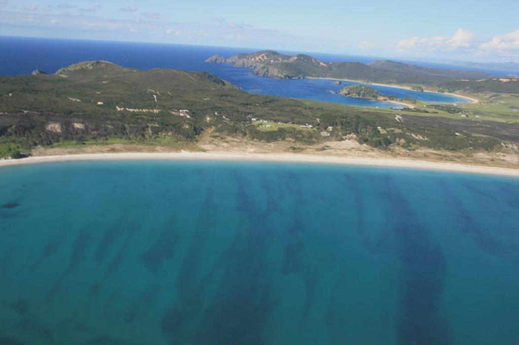
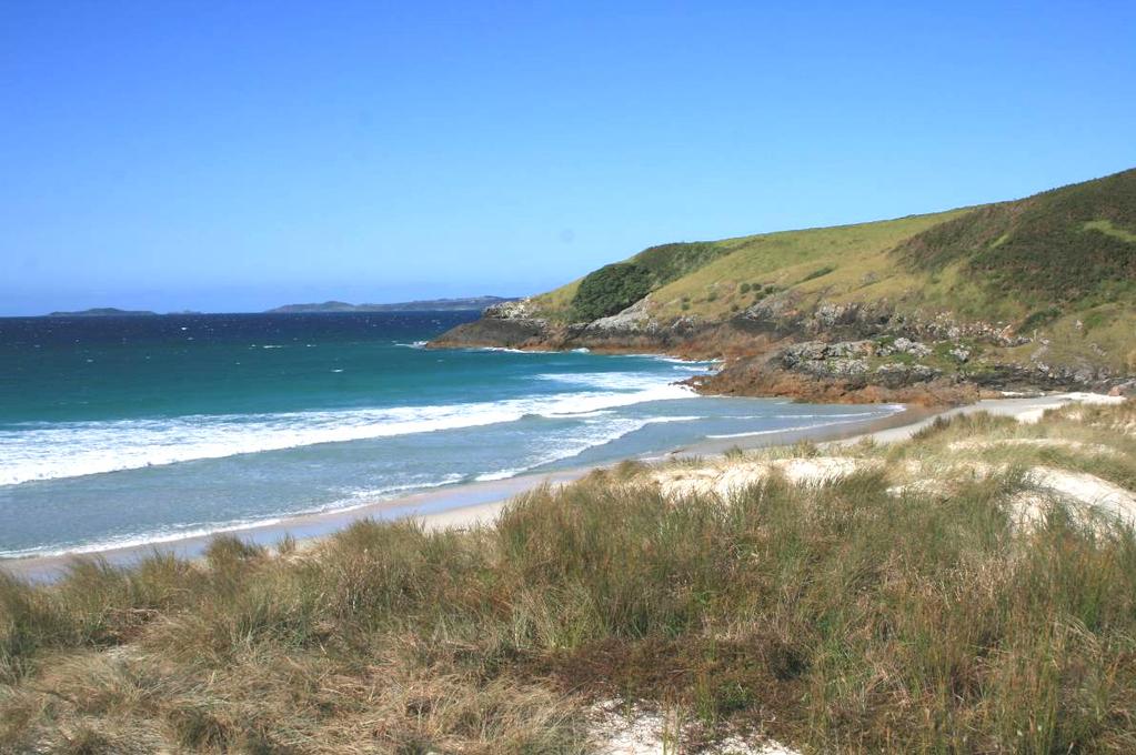
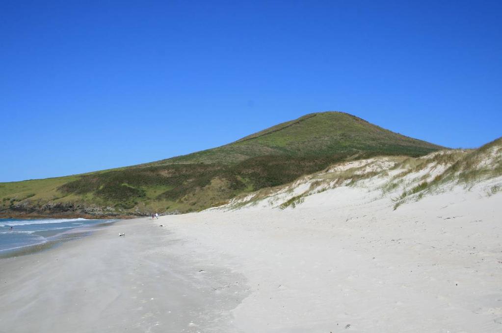
1 Northland Regional Landscape Assessment Worksheet DESCRIPTION AND CHARACTERISATION Component Land Types (refer to list overleaf) Coastal cliffs / escarpment Bays and headlands Dune complex Beach Reefs and islands Wetland Unit name KARIKARI BEACH, PUHEKE & SOUTHERN RANGIPUTA HEAD Comment Physically varied, with hard and soft coast, extensive wetlands and fresh-water bodies and a volcanic cone, found within a relatively limited extent. Geology (including geopreservation sites) Karikari Plutonics at the inland northern end of the unit, with diorite and quartz monzonite intrusions with overlying Pleistocene consolidated dune sands. Main Karikari beach comprises a Holocene foredune belt with deflation zones at its south western end. Waimango Swamp and Lakes Rotokawau are freshwater wetlands that have been ponded between a Holocene / Pleistocene coastal foredune belt and old foredunes formed in the last interglacial period and consolidated. Some peat swamp and some mineralized sands. NZ Geopreservation sites: Karikari Peninsula tombolo an extremely large tombolo extending from the foot of the peninsula that is classified as a moderately well defined landform of scientific/educational and scenic value. Soil Types Ecology (including protected vegetation / features, PNAP Level 1 and 2 sites) Ruakaka loamy peat, Ruakaka peaty sandy loam, and Tangitiki sandy loam and sand, Te Kopuru sand. Puheke: Maungarei clay and Parahaki fine sandy loam and silt loam with pan. Waimango swamp contains 5 ecological units and is primarily characterised by reed and sedge associations. It is defined as a good example of a formerly widespread coastal wetland complex which provides habitat to many threatened plants and animals. The Rotokawau Lakes and Puheke Beach are more diverse, containing the open water of dune lakes, pohutukawa on the lake margin, and a range of ecological units related to interdune depressions. ecological units involving pingao, Spinifex, Coprosma acerosa and pohuehue are to be found in the dunefields backing the beach. This area is considered one of the best examples in the Ecological Region of a wide diversity of habitats that has high wildlife values including many threatened species. Dune lakes noted as being particularly rare on the east coast of Northland. Shrubland backing Karikari Bay and extending over the Taupioroa Range is simplest on its northern margins and contains threatened species. Spinifex grassland characterises the Karikari Moana (main beach to north). This is identified as high-quality and representative duneland habitat for a number of threatened species. It is also an important breeding and/or roosting area for a number of indigenous coastal bird species. 1
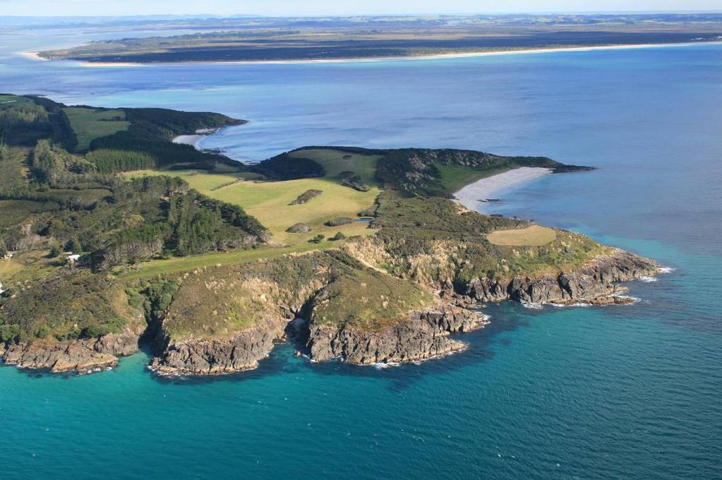
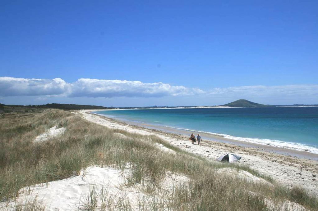
2 Archaeological sites Heritage Landscapes A high density of recorded sites throughout this unit, with the exception of the patch of hard coast around Koura Point and Raupo Bay. Landscape characterisation (including the identification of any specific characteristics) A very distinctive, broad headland landscape that amalgamates a number of component elements: wetlands, open freshwater bodies, dunefields, expansive ocean beach, a small volcanic cone and portions of headland with a fringing reef. Whilst these components are individually identifiable, they come together to compose this outstanding landscape as an inter-related system. The wide and simple sweep of Karikari beach, defined by headlands at either end, broken by Puheke and backed a dunefield which in part then sequences into wet areas is highly memorable and a commonly referenced part of Northland. Whilst there is very little built development within the unit itself, there are a number of buildings that overlook the area and which have a subtle influence from outside this particularly landscape. Similarly, a small part of the unit is grazed primarily in the north western portion so that agricultural landuse compromises the sense of naturalness and intactness in the nearby area. EVALUATION Criteria Rank Comment Natural Science Factors Representativeness Natural landscapes are clearly characteristic of the area, district or region. The key components of the landscape will be present in a way that defines the character of the place and distills its character and essence. Endemic associations. Rarity Natural features are unique or rare in the region or nationally, and few comparable examples exist. 5 This landscape is very distinctive and inherently related to the Karikari Peninsula. The assemblage of coastal flanks, dunes, backshore wetlands and containing headlands is evocative and explicitly defines the local identity. Whilst the elements involved as not unique, their character and assemblage is specifically related to this place. Aesthetic Values Coherence The patterns of land cover and land use are largely in harmony with the underlying natural pattern of the landform of the area and there are no significant discordant elements of land cover or land use. Diversity & Complexity The elements contributing to overall landscape character are diverse and complex (particularly in ecological terms) without creating disharmony. Vividness Natural features and landscape are widely recognized across the community and beyond the local area and remain clearly in the memory; striking landscapes are symbolic of an area due to their recognisable and memorable qualities. Very coherent and inter-related. Adjacent land uses and development have a relatively minor adverse impact. 5 Highly diverse, incorporating a number of landscape elements/types and overlaid ecologies in a way that is predictable and consistent with formative processes. 5 An extremely memorable landscape and one which is frequently photographed and referred to as one of Northland s most compelling segments of coastline. Naturalness How affected by human activity is the landscape? Does human activity intrude on the landscape? Eg. Presence of buildings and associated built development. Presence of infrastructure services. Extent of indigenous forest cover. Homogeneity of exotic vegetation. Presence / extent of The composition of this ONL is a clear product of natural forces and is predominantly free of buildings, infrastructure and noticeable human intervention. There are a range of indigenous ecological associations which are extensive and well-established, particular in terms of wetland, dunefield and shrubland areas. Buildings and productive uses on related areas exerts only a subtle influence. 2
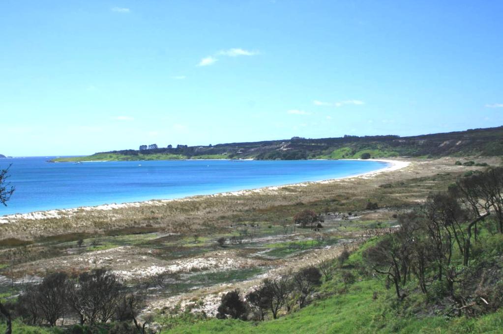
3 modified agricultural land use. Strength of natural processes / ecological patterns. Unmodified and legible physical relief and landform. Presence of water. Intactness Natural systems are intact and aesthetically coherent and do not display significant visual signs of human modification, intervention or manipulation, visually intact and highly aesthetic natural landscapes. Experiential Values Expressiveness The legibility of the landscape. Natural features clearly demonstrate the natural processes that formed them. Sensory qualities (These are landscape phenomena as directly perceived and experienced by humans, such as the view of a scenic landscape, or the distinctive smell and sound of the foreshore). Transient Values The consistent and repeated occurrence of transient features that contributes to the character, qualities and values of the landscape; landscapes are widely recognised for their transient features and the contribution that these make to the landscape. Remoteness / Wildness Does the landscape display a wilderness character, remote from and untouched by human presence? Eg. Sense of remoteness Accessibility Distance from built development Shared and recognised values Natural features and landscape are widely known and valued by the immediate and wider community for their contribution to a sense of place leading to a strong community association with, or high public esteem for the place. Spiritual, cultural and historical associations Natural features and landscapes can be clearly and widely known and influenced by their connection to the spiritual, cultural and historical valued in the place and includes associative meanings and associative activities valued by the community. These can include both activities and meanings associative meanings are spiritual, cultural or social associations with particular landscape elements, features, or areas, whilst associative activities are patterns of social activity that occur in particular parts of a landscape, for example, popular walking routes or fishing spots. 5 Highly legible and demonstrative of formative processes, particularly in relation to the Karikari tombolo form that is understood to spill out through this area. 5 A extremely distinctive landscape, with Puheke projecting from the midst of the embayment backshore, extensive wetlands projecting along the rear of the backshore and the dazzling sands of the beach. This outer part of the peninsula has a strong maritime character and the state of the sea, water clarity of shallows over white sand, and salty winds all contribute to the sensory experience. Highly influenced by sea conditions and light. The area has scattered housing outside of this ONL, along with the Carrington Club resort and Whatawhiwhi settlement nearby. The Matai Bay campground is heavily used through summer, with many crossing the narrow neck of the peninsula to visit this coast. Despite these various sources of people, there is an individual sense of isolation when on either of the expansive beaches and separated from inland influences by the foredune. A popular and well-known destination. A key thread to marketing the exclusive Carrington Club resort. Likely to be held in high esteem by the local community/ies. **** Consultation was initiated during the mapping process, but has not led to any feedback within the required period. Rank scale between 1 (low) and 5 (high) 3

4 Land Types Coastal cliffs / escarpment Low escarpment Bays and headlands Beach Dune complex Reefs and islands Estuarine / inlet Open harbour Coastal plain Rolling hills Steep hills; moderate to high relief Ranges; high relief Strongly rolling land Low rolling land Valley floors and flats Plains Volcanic cones River mouth Wetland Watercourses Lakes and water bodies Photographs of unit
5 5
6 6
7 7

8 8
Northland Regional Landscape Assessment Worksheet
 Northland Regional Landscape Assessment Worksheet Unit name TE POUAHI HEADLAND DESCRIPTION AND CHARACTERISATION Component Land Types (refer to list overleaf) Dune complex Coastal cliffs / escarpment Reefs
Northland Regional Landscape Assessment Worksheet
 Northland Regional Landscape Assessment Worksheet DESCRIPTION AND CHARACTERISATION Component Land Types (refer to list overleaf) Volcanic cones Geology (including geopreservation sites) Soil Types Unit
Northland Regional Landscape Assessment Worksheet
 Northland Regional Landscape Assessment Worksheet DESCRIPTION AND CHARACTERISATION Component Comment Land Types (refer to list overleaf) Coastal cliffs / escarpment Bays and headlands Dune complex Beach
Northland Regional Landscape Assessment Worksheet
 Northland Regional Landscape Assessment Worksheet DESCRIPTION AND CHARACTERISATION Component Land Types Northern and eastern dissected hills; moderate to high relief land type Unit name NORTH EAST BUSH
Northland Regional Landscape Assessment Worksheet
 Northland Regional Landscape Assessment Worksheet Unit name KAURI MOUNTAIN BUSH DESCRIPTION AND CHARACTERISATION Component Land Types Volcanic cones land type Northern and eastern dissected hills; moderate
Northland Regional Landscape Assessment Worksheet
 Northland Regional Landscape Assessment Worksheet Unit name BALD ROCK DESCRIPTION AND CHARACTERISATION Component Land Types (refer to list overleaf) Volcanic cone (remains). Comment The site is an eye-catching
Northland Regional Landscape Assessment Worksheet
 Northland Regional Landscape Assessment Worksheet Unit name MARERETU RANGE DESCRIPTION AND CHARACTERISATION Component Land Types Northern and eastern dissected ranges; high relief land type Geology (including
Section 6A 6A Purpose of the Natural Features and Landscapes Provisions
 Section 6A 6A Purpose of the Natural Features and Landscapes Provisions This Chapter addresses the protection and management of natural features and landscapes within the City. The City has a number of
LANDSCAPE UNIT 10 Te Kawau, Turipeka & Otautu Point
 Location Map LANDSCAPE VALUES Landscape Unit No. 10 Description: Te Kawau, Turipeka, & Otautu Point KEY LANDSCAPE FACTORS / VARIABLES LANDSCAPE UNIT 10 Te Kawau, Turipeka & Otautu Point LEGEND Outstanding
Northland Regional Landscape Assessment Worksheet
 Northland Regional Landscape Assessment Worksheet DESCRIPTION AND CHARACTERISATION Component Land Types Volcanic cones land type Geology (including geopreservation sites) Unit name PARAKIORE VOLCANIC CONE
B4. Te tiaki taonga tuku iho - Natural heritage
 B4. Te tiaki taonga tuku iho - Natural heritage Tuia I runga, tuia i raro, tuia ki te waonui a Tiriwa Bind the life forces of heaven and earth to the great realm of Tiriwa B4.1. Issues Auckland s distinctive
Raewyn Peart. Policy Director Environmental Defence Society
 1 Raewyn Peart Policy Director Environmental Defence Society www.eds.org.nz Coastal Environment Where the sea impacts on the land and the land impacts on the sea 2 www.eds.org.nz Section 6 RMA matters
Part 3 : : Outstanding Natural Features and Landscapes
 Part 3 : : Outstanding Natural Features and Landscapes Review and Evaluation of Outstanding Natural Features and Landscapes tauranga city : : landscape study 157 Introduction Introduction Tauranga City
Northland Regional Landscape Assessment Worksheet
 Northland Regional Landscape Assessment Worksheet Unit name MAUNGATAPERE DESCRIPTION AND CHARACTERISATION Component Land Types Volcanic cones land type Comment One of a sequence of volcanic cones, which
1 INTRODUCTION TO NATURAL ENVIRONMENT
 Kāpiti Coast District Plan Review Section 32 Analysis Summary Report 1 INTRODUCTION TO NATURAL ENVIRONMENT Diverse landscapes, plants and animals make up the natural environment of the District. Much has
3. Highway Landscaping Assessment
 Guidelines for Highway Landscaping 3-1 3. Highway Landscaping Assessment 3.1 Introduction This section outlines the steps necessary to assess the highway landscaping component of a state highway construction
Chapter 3: Natural Environment. Proposed Waikato District Plan Stage 1. (Notified version)
") Chapter 3: Natural Environment Proposed Waikato District Plan Stage 1 Page 2 of 7 Contents Chapter 3: Natural Environment... 3 3.1 Indigenous Vegetation and Habitats... 3 3.1.1 Objective Biodiversity and
Chapter 3: Natural Environment Proposed Waikato District Plan Stage 1 Page 2 of 7 Contents Chapter 3: Natural Environment... 3 3.1 Indigenous Vegetation and Habitats... 3 3.1.1 Objective Biodiversity and
ENVIRONMENT BAY OF PLENTY. Outstanding Natural Features and Landscapes Review in Inland Bay of Plenty
 ENVIRONENT BAY OF PLENTY Outstanding Natural Features and Landscapes Review in Inland Bay of Plenty February 2009 Outstanding Natural Features and Landscapes Review in Inland Bay of Plenty CONTENTS 1.0
LANDSCAPE GUIDELINES. Countryside & Coastal Countryside Environments. Landscape, Natural Character & Amenity Values Guide
 Landscape, Natural Character & Amenity Values Guide Copyright WDC 2009 Version A2 18May09 Environmental Services Group Publication Countryside & Coastal Countryside Environments START HERE Quality Land
Apply scoring methodology
 1 Assessment of Alternatives The purpose of this assessment is to evaluate runway options against a range of environmental criteria. The first step is to formulate evaluation criteria necessary to understand
CA.1 Coastal Area. Index. CA.1.1 Description and Expectations
 Index.1.2.3.4 CA.2 CA.2.1 CA.2.2 CA.2.3 CA.3 CA.3.1 CA.3.2 CA.3.1 CA.4 CA.4.1 CA.4.2 CA.4.3 CA.4.4 CA.5 CA.5.1 CA.5.2 Description and Expectations Objectives Policies Guidance Note Landuse Eligibility
Evidence-based Assessment of Natural Character
 Evidence-based Assessment of Natural Character RMLA Waikato Branch 07 Sept 2016 Michael Steven Landscape Architect/Landscape Planner Pohara, Golden Bay 1 The key issue. The adequacy of landscape & natural
H7 Open Space zones. (a) provide for the needs of the wider community as well as the needs of the community in which they are located;
 provide for the needs of the wider community as well as the needs of the community in which they are located;") H7. Open Space zones H7.1. Background The majority of land zoned as open space is vested in the Council or is owned by the Crown. However some areas zoned open space are privately owned. While the open
H7. Open Space zones H7.1. Background The majority of land zoned as open space is vested in the Council or is owned by the Crown. However some areas zoned open space are privately owned. While the open
PART 5 - NATURAL AND PHYSICAL ENVIRONMENT
 CONTENTS...PAGE 5.1 INTRODUCTION...3 5.2 NATURAL RESOURCES...4 5.3 PHYSICAL RESOURCES...4 5.4 COASTAL ENVIRONMENT...4 5.5 HERITAGE FEATURES...4 5.6 HAZARDS...4 5.7 SUMMARY...4 ISTHMUS SECTION - OPERATIVE
COROMANDEL PENINSULA LANDSCAPE ASSESSMENT. PREPARED FOR Thames Coromandel District Council DATE September STATUS Draft
 PREPARED FOR Thames Coromandel District Council DATE September 2011. STATUS Draft STATUS DRAFT. SCALE as shown @ A3. DATE September 2011. PAGE 2 INTRODUCTION OUTSTANDING & AMENITY LANDSCAPES Coromandel
Waipohutukawa Bay, Bay of Islands Visual, Natural Character and Landscape Effects
 Photograph 20: View of Waipohutukawa Bay from the water (Thornton property to the left of view, Collie property to the right of view) Photograph 21: Closer range view from the water (Thornton property
Assessment of Landscape, Visual and Natural Character Effects
 Assessment of Landscape, Visual and Natural Character Effects Consent Footprint Amendments Mangamaunu Half Moon Bay Okiwi Bay South Report prepared for: New Zealand Transport Agency and KiwiRail Holdings
Digital Terrestrial Television Infrastructure Rollout. Environmental Impact Assessment - Corridor -
 Digital Terrestrial Television Infrastructure Rollout Environmental Impact Assessment - Corridor - 1 1 ENVIRONMENTAL IMPACT ASSESSMENT (EIA): CORRIDOR 1.1 INTRODUCTION Corridor is a small farming community
Appendix One. Landscape. Areas of Outstanding Landscape Value: Criteria for Selection. Landscape Character
 Areas of Outstanding Value: Criteria for Selection The dimensions of landscape are landscape character and landscape quality. The analysis of landscape character and quality draws heavily on the visual
D10. Outstanding Natural Features Overlay and Outstanding Natural Landscapes Overlay
 D10. Outstanding Natural Features Overlay and Outstanding Natural Landscapes Overlay D10.1. Background These provisions give effect to Policy 15(a) of the New Zealand Coastal Policy Statement 2010, and
D10. Outstanding Natural Features Overlay and Outstanding Natural Landscapes Overlay
 D10. Outstanding Natural Features Overlay and Outstanding Natural Landscapes Overlay D10.1. Background These provisions give effect to Policy 15(a) of the New Zealand Coastal Policy Statement 2010, and
Appendix 17A Scenic Quality Rating Forms
 1 2 Appendix 17A Scenic Quality Rating Forms UNITED STATES DEPARTMENT OF THE INTERIOR BUREAU OF LAND MANAGEMENT SCENIC QUALITY RATING SUMMARY Date: March 7, 2018 Landscape Character Unit: N/A Key Observation
Lower Sensitivity. VS Classification Level 2: Exposed Upland/Plateau
 S02 Y Carneddau Reproduced from the Ordnance Survey map with the permission of Ordnance Survey on behalf of the Controller of Her Majesty s Stationery Office, Crown copyright Licence No. 100023387 Location
LANDSCAPE CHARACTER ASSESSMENT
 THE COUNTY DURHAM LANDSCAPE CHARACTER ASSESSMENT FOREWORD The landscape of County Durham is one of great contrast and diversity. From the North Pennines in the west to the Durham Coast in the east it contains
I541. Te Arai North Precinct
 I541. Te Arai North Precinct I541.1. Precinct Description The Te Arai North Precinct contains approximately 616ha of coastal land north of Te Arai Point, generally known as Mangawhai North Forest. The
7. Landscape. Introduction
 Introduction Our landscapes provide us with a Marlborough identity and are an integral part of the Marlborough environment. Landscapes are distinct spatial areas influenced by location-specific processes
Lower Sensitivity. VS Classification Level 2: Exposed Upland/Plateau
 S04 Moel Hebog Reproduced from the Ordnance Survey map with the permission of Ordnance Survey on behalf of the Controller of Her Majesty s Stationery Office, Crown copyright Licence No. 100023387 Location
BREEDON NORTHERN LIMITED
 Non Technical Summary CONTENTS 1 INTRODUCTION... 1 2 SITE DESCRIPTION... 1 3 DESCRIPTION OF THE DEVELOPMENT... 6 4 NEED FOR THE DEVELOPMENT... 8 5 KEY ISSUES CONSIDERED IN THE ENVIRONMENTAL IMPACT ASSESSMENT...
coastal plain coastal plain
 NORFOLK O R F O L K COAST C O A SAONB T A O NIntegrated B I n t elandscape g r a t e d L Guidance a n d s c a p e G u i d a n c e 1 Integrated landscape character MAP 23a - Coastal Plain Key Plan This
Visual Impact Rating Form - Instructions
 Visual Impact Rating Form Instructions Project Name: Baron Winds Project EDR Project No: 13039 Date: 05.16.17 Reference: Visual Impact Rating Form - Instructions These instructions are intended to guide
- - - Key Characteristics
 S23 Dyffryn Dysynni Reproduced from the Ordnance Survey map with the permission of Ordnance Survey on behalf of the Controller of Her Majesty s Stationery Office, Crown copyright Licence No. 100023387
Appendices. Contents. Appendices - Sep 1997 CP-1 AP-1
 Appendices Contents 1. Goals for Protected Areas in British Columbia... AP-3 2. Guiding Principles for Protected Areas... AP-4 3. Resource and Recreation Use Guidelines for Protected Areas... AP-5 4. Aboriginal
Tables of Criteria and Matrices for Landscape Assessment (LSCA & LVIA)
") Carly Tinkler CMLI Environmental, Landscape and Colour Consultancy 46 Jamaica Road, Malvern, Worcestershire WR14 1TU Tel +44 (0)7711 538854 carlytinkler@hotmail.co.uk Tables of Criteria and Matrices for
Carly Tinkler CMLI Environmental, Landscape and Colour Consultancy 46 Jamaica Road, Malvern, Worcestershire WR14 1TU Tel +44 (0)7711 538854 carlytinkler@hotmail.co.uk Tables of Criteria and Matrices for
UNIT 3. LANDSCAPES CHANGE. PRIMARY 3/ Social Science Pedro Antonio López Hernández
 UNIT 3. LANDSCAPES CHANGE PRIMARY 3/ Social Science Pedro Antonio López Hernández LANDSCAPES They are all the elements you can see in a specific area of land. There are two types of landscapes 1. Natural
Proposed Southland District Plan 2012 Appeal Version October 2016
 S e c t i o n 3. 5 - F i o r d l a n d / R a k i u r a Z o n e The Fiordland/Rakiura Zone encompasses the Fiordland and Rakiura National Parks and part of Mt Aspiring National Park. It also includes areas
Digital Terrestrial Television Infrastructure Rollout
 Digital Terrestrial Television Infrastructure Rollout Environmental Impact Assessment - Ruacana - ENVIRONMENTAL IMPACT ASSESSMENT: RUACANA 1 INTRODUCTION Ruacana is a town in the Omusati Region, in northern
Coast Protection, Development and Coastal Biodiversity. Brian Caton Member CEMAC, AMLR NRM Former Chair & Member, Coast Protection Board
 Coast Protection, Development and Coastal Biodiversity Brian Caton Member CEMAC, AMLR NRM Former Chair & Member, Coast Protection Board Saltmarsh: an extensive problem for Biodiversity and Planning Law
CB1 Moderately undulating landscape with slight gilgai (few inches) formation: broad ridge tops and upper slopes of moderately shallow grey cracking
 formation: broad ridge tops and upper slopes of moderately shallow grey cracking") CB1 Moderately undulating landscape with slight gilgai (few inches) formation: broad ridge tops and upper slopes of moderately shallow grey cracking clays (Ug5.22 and Ug5.23). Associated are: (i) some
CB1 Moderately undulating landscape with slight gilgai (few inches) formation: broad ridge tops and upper slopes of moderately shallow grey cracking clays (Ug5.22 and Ug5.23). Associated are: (i) some
Views About Management
 Views About Management A statement of English Nature s views about the management of Site of Special Scientific Interest (SSSI). This statement represents English Nature s views about the management of
Rolling Wooded Pasture Lulworth Wooded Pasture Rempstone Wooded Pasture
 Landscape type: Character areas: Rolling Wooded Pasture Lulworth Wooded Pasture Rempstone Wooded Pasture The rolling wooded pasture landscape type is found around the margins of the Dorset Heaths. Although
Landscape considerations in Forests & Woodlands. Jill Bullen, Senior Landscape Specialist
 Landscape considerations in Forests & Woodlands Jill Bullen, Senior Landscape Specialist UK Forestry Standard (UKFS) Sustainable forest management Landscape sub-section (S6.4, page 96) Standards and requirements
ELLIOTT HEADS STRUCTURE PLAN
 ELLIOTT HEADS STRUCTURE PLAN BACKGROUND This report has been prepared to provide an overview of the land that has been included in the Urban Footprint within the Wide Bay Burnett Regional Plan, September
Landscape Guidelines. Landscape type: Valley Pasture Character areas: Frome Valley Pasture Stour Valley Pasture. Landscape change
 Landscape type: Valley Pasture Character areas: Frome Valley Pasture Stour Valley Pasture The valley pasture landscape type is found along the lower reaches of the Stour and Frome, formed from alluvial
Section 32 report: Natural heritage for the Proposed Natural Resources Plan for the Wellington Region
 Section 32 report: Natural heritage for the Proposed Natural Resources Plan for the Wellington Region Issues and Evaluation Report Section 32 report: Natural heritage for the Proposed Natural Resources
SCIENCE AND RESEARCH INTERNAL REPORT NO.75 DATABASES AND THEIR APPLICATION TO MANAGEMENT PLANNING. W. Mary McEwen
 SCIENCE AND RESEARCH INTERNAL REPORT NO.75 DATABASES AND THEIR APPLICATION TO MANAGEMENT PLANNING by W. Mary McEwen This is an internal Department of Conservation report and must be cited as Science and
Part 7 Heritage. Diagrams and tables
 Part 7 Heritage Contents Page 7.1 Introduction... 3 7.2 Resource management issues... 3 7.3 Objective... 5 7.4 Resource management strategy... 5 7.5 Roles and responsibilities... 6 7.6 Notification requirements
4.3 Dudley Area Plan. Introduction. History and Existing Character. Desired Future Character for Dudley
 4.3 Dudley Area Plan Introduction The suburb of Dudley has developed as a result of various circumstances including its topography, history and mineral resources. Dudley development has been identified
H19.1 Background There are five rural zones covered in H19. Rural zones: Rural Rural Production Zone; Rural Mixed Rural Zone;
 H19. zones H19.1 Background There are five rural zones covered in H19. zones: Production ; Mixed ; Coastal ; Conservation ; and Countryside Living. These zones, and their provisions, provide the main framework
Building and Public Space Design Guidelines
 AMERICA'S CUP WYNYARD HOBSON Building and Public Space Design Guidelines INTRODUCTION 10 April 2018 The 36 th America s Cup in Auckland requires the construction of new wharf and breakwater structures.
6.1 Introduction [In 2007, Proposed Change 8: Volcanic Features and Landscape was separated into two components, being
 Heritage: 6 1 6.1 Introduction [In 2007, Proposed Change 8: Volcanic Features and Landscape was separated into two components, being Volcanic Features and Landscape. Proposed Change 8: Volcanic Features
C Landscape and Visual Effects Assessment
 C Landscape and Visual Effects Assessment Hawkes Bay Office: PO Box 8823 Havelock North Hawke's Bay 4157 www.hudsonassociates.co.nz john@hudsonassociates.co.nz Ph 06 877-9808 HUDSON ASSOCIATES M 021 324-409
3.1 This evidence is based on the landscape and visual impact assessment included in Chapter 10 and Appendix I of the EIS.
 LANDSCAPE & VISUAL 1 QUALIFICATIONS AND EXPERIENCE 1.1 My name is Raymond Holbeach and I am a Regional Director for RPS Planning & Environment with full responsibility for management of the RPS Belfast
APPENDIX 1: SCOPED ENVIRONMENTAL IMPACT STATEMENT (EIS) FORM
 FORM") APPENDIX 1: SCOPED ENVIRONMENTAL IMPACT STATEMENT (EIS) FORM This form is intended for use by applicants (primarily private landowners) who need to conduct a Scoped EIS in support of minor development
APPENDIX 1: SCOPED ENVIRONMENTAL IMPACT STATEMENT (EIS) FORM This form is intended for use by applicants (primarily private landowners) who need to conduct a Scoped EIS in support of minor development
Section 3b: Objectives and Policies Rural Environment Updated 19 November 2010
 Page 1 of Section 3b 3b RURAL ENVIRONMENT 3b.1 Introduction The Rural Environment comprises all the land outside of the Residential, Town Centre and Industrial Environments. Most land within the District
LANDMAP Methodology Overview
 LANDMAP Methodology Overview June 2017 Jill Bullen, Senior Landscape Specialist jill.bullen@cyfoethnaturiolcymru.gov.uk 0300 065 4706 (Please note this is an information document and not a training presentation)
E15. Vegetation management and biodiversity
 E15. management and biodiversity E15.1. Background contributes to a range of ecosystem services such as erosion and sediment control, reducing stormwater flows, protecting or enhancing water quality, amenity
Exceptional ecological landscapes support wildlife across New Hampshire
 Natural Com Exceptional ecological landscapes support wildlife across New Hampshire T he natural landscape of New Hampshire offers a fascinating study of great contrasts and rich biological wonders. To
3. STATEMENTS OF DESIRED CHARACTER FOR PLANNING AREAS AND PRECINCTS
 3.30 Planning Area No. 30 Mary River Valley 3.30.1 Location and Role This Planning Area encompasses rural lands in the western part of the Shire. These lands are located within the catchment area of the
WELLINGTON HOSPITAL DESIGN GUIDE TABLE OF CONTENTS
 WELLINGTON HOSPITAL DESIGN GUIDE TABLE OF CONTENTS 1.0 Introduction Page 2 The Place of Wellington Hospital 2 The Future of the Hospital 2 2.0 The Intention of the Design Guide 3 3.0 Analysis 4 General
ADDENDUM TO BIOLOGICAL SCOPING SURVEY REPORT, BOTANICAL SURVEY AND WETLAND DELINEATION
 ADDENDUM TO BIOLOGICAL SCOPING SURVEY REPORT, BOTANICAL SURVEY AND WETLAND DELINEATION FOR AVALON INN (APN 069-241-27 & -04) 1201 & 1211 NORTH MAIN STREET FORT BRAGG, CA MENDOCINO COUNTY prepared for:
Kevin M. Rampe, President -- Lower Manhattan Development Corporation
 For Internal Use Only: Date Received: WRP no. DOS no. NEW YORK CITY WATERFRONT REVITALIZATION PROGRAM Consistency Assessment Form Proposed actions that are subject to CEQR, ULURP or other local, state
Mollers Lane, Leopold, Victoria Significant Landscape Overlay Re-assessment
 XURBAN Mollers Lane, Leopold, Victoria Significant Landscape Overlay Re-assessment For: TGM Group November 2016 Final Mollers Lane, Leopold, Victoria Significant Landscape Overlay Re-assessment Client
2A District-wide Policies
 2A Introduction This Chapter contains policies which are relevant to subdivision, use and development activities occurring across all zones and areas of the District. The policies in this Chapter implement
Swan Coastal Plain - Reading
 Swan Coastal Plain Almost all the soils of the Swan Coastal Plain are formed by material deposited by rivers and wind. The Yilgarn Block, east and south of the scarp bordering the Swan Coastal Plain, rose
Ōpōtiki Landscape Review Outstanding Natural Landscape Evaluation and Mapping Prepared for Ōpōtiki District Council 8 th July 2016
 Ōpōtiki Landscape Review Outstanding Natural Landscape Evaluation and Mapping Prepared for Ōpōtiki District Council 8 th July 2016 3 Table of Contents Contents 1.0 Introduction... 4 1.1 Background...
REMARKABLES PARK ZONE
 .10 Remarkables Park Zone.10.1 Resources, Activities and Values The Remarkables Park Area comprises approximately 150 hectares of perimeter urban land in the vicinity of Frankton and occupies a strategic
Toddington Central Bedfordshire Stage 3 Green Belt Study December 2017
 Toddington Central Bedfordshire Stage 3 Green Belt Study December 2017 Site: ALP086 - Middle Lakes, Toddington Site size (ha): 2.83 Site: ALP086 - Middle Lakes, Toddington Site size (ha): 2.83 Site description
Sustainable Natural Environment Wetlands
 Town of Huntsville Official Plan Review - POLICY BACKGROUND PAPER Sustainable Natural Environment Wetlands BACKGROUND: Wetlands are an important natural resource. The ecological, social and economic benefits
Site Option 3: Te Matai
 Site Option 3: Te Matai Location Napier Drain looking south east Description The Te Matai growth option is located between the existing residential boundary (Ruamahanga Crescent) Napier Road (State Highway
D1. High-use Aquifer Management Areas Overlay
 D1. High-use Aquifer Management Areas Overlay D1.1. Background Aquifers are important as direct sources of water supply for domestic, industrial and rural use. They are the major contributors to the base
For Peat s Sake. Good management practices for Waikato peat farmers
 For Peat s Sake Good management practices for Waikato peat farmers For Peat s Sake Good management practices for Waikato peat farmers Prepared by Environment Waikato In association with the Waikato Peat
BELLARINE PENINSULA Draft Localised Planning Statement JUNE 2014
 BELLARINE PENINSULA Draft Localised Planning Statement JUNE 2014 BELLARINE PENINSULA Draft Localised Planning Statement JUNE 2014 The Bellarine Peninsula Draft Localised Planning Statement has been developed
3.0 PART THREE: STRATEGIES FOR RESERVES
 3.0 PART THREE: STRATEGIES FOR RESERVES 3.1 RESERVE ACT OBJECTIVES The purposes of the Reserves Act 1977 are: providing for the preservation and management of areas for the benefit and enjoyment of the
Figure 6e: Ndwalane Mainline Toll Plaza Viewshed Analysis
 Figure 6e: Ndwalane Mainline Toll Plaza Viewshed Analysis CAVE KLAPWIJK AND ASSOCIATES 27 Figure 6f: Alternative Ndwalane Mainline Toll Plaza Viewshed Analysis CAVE KLAPWIJK AND ASSOCIATES 28 Figure 6g:
Kerikeri Structure Plan Review 2008 Landscape Assessment
 Kerikeri Structure Plan Review 2008 Landscape Assessment 1. INTRODUCTION Littoralis Landscape Architecture has been commissioned by Far North District Council to prepare an updated Landscape Assessment
Rochford District Council Allocations Development Plan Document: Discussion and Consultation Document Sustainability Appraisal
 Option SWH1 Balanced Communities Option SWH1 1 To ensure the delivery of high quality sustainable communities where people want to live and work Will it ensure the phasing of infrastructure, including
BACKGROUND INFORMATION DOCUMENT
 BACKGROUND INFORMATION DOCUMENT PROPOSED UPGRADING OF THE N2 NATIONAL ROAD FROM KRAAIBOSCH TO DIE VLEIE BASIC ENVIRONMENTAL IMPACT ASSESSMENT The South African National Roads Agency Society Limited (SANRAL)
I542. Te Arai South Precinct
 I542. Te Arai South Precinct I542.1. Precinct Description The Te Arai South Precinct contains approximately 750ha of coastal land south of Te Arai Point, known as Mangawhai South Forest. The land within
Statutory and Non-Statutory Designated Sites and Ecology
 Statutory and Non-Statutory Designated Sites and Ecology The National Planning Policy Framework considers the conservation and enhancement of the natural environment in chapter 11 paragraphs 109-119, where
CALA Homes is preparing a planning application for a development of up to 36 new homes, including a mix of properties to meet local demand.
 WELCOME Welcome to this public consultation event for our proposed development on land to the south of Twelve Leys in Wingrave. Thank you for taking the time to come along today. Homes is preparing a planning
STEWARDSHIP OF LONG ISLAND SOUND S ECOLOGICAL AND RECREATIONAL RESOURCES
 STEWARDSHIP OF LONG ISLAND SOUND S ECOLOGICAL AND RECREATIONAL RESOURCES Robin Kriesberg, Save the Sound, Inc. Thomas Halavik, US Fish and Wildlife Service Coastal Program An Initiative to Identify, Protect
Verde Valley Landscape Character Type
 Existing Condition Landscape Character The existing landscape character describes the existing set of valued aesthetic attributes for the current landscape. The landscape character descriptions include
Section 12C Subdivision in the Rural Residential Zone
 Section 12C 12C Subdivision in the Rural Residential Zone The Rural Residential Zone provides part of the range of residential opportunities within the City. Land zoned rural residential is considered
PART 05 VISUAL SETTING
 PART 05 VISUAL SETTING 5.1 How to use the Visual Settings 5.2 Views from the Headland 5.3 Creek Foreshore Park Looking North 5.4 Bridge looking North 5.5 Bridge looking West 5.6 Bridge looking South 5.7
Design Guidance. Introduction, Approach and Design Principles. Mauritius. November Ministry of Housing and Lands. .. a
 sig evelo r D Mauritius s. Utilities.. Individu a s. er itects.to ls chpers.po e Public. T. h rban D Sc U e me Promot e h ners. A Design Guidance o.h Planne rs n w iticians r l useholde National Development
S08 Dyffryn Y Ddwyryd
 S08 Dyffryn Y Ddwyryd Reproduced from the Ordnance Survey map with the permission of Ordnance Survey on behalf of the Controller of Her Majesty s Stationery Office, Crown copyright Licence No. 100023387
Appendix A. Planning Processes. Introduction
 1 Planning Processes Introduction This appendix outlines a number of planning processes which are used in the Auckland Region to support the effective management of development in the region s rural and
Lower Sensitivity. VS Classification Level 2: Exposed Upland/Plateau (86%)/ Upland Valleys (10%)
/ Upland Valleys (10%)") S09 Y Mignient Reproduced from the Ordnance Survey map with the permission of Ordnance Survey on behalf of the Controller of Her Majesty s Stationery Office, Crown copyright Licence No. 100023387 Location
S09 Y Mignient Reproduced from the Ordnance Survey map with the permission of Ordnance Survey on behalf of the Controller of Her Majesty s Stationery Office, Crown copyright Licence No. 100023387 Location
INTRODUCTION CHAPTER 1 MONICA PETERS CONTENTS INTRODUCTION. 1 USING THE HANDBOOK 1.1 Handbook structure Handbook sections
 CHAPTER 1 INTRODUCTION MONICA PETERS CONTENTS INTRODUCTION 1 USING THE HANDBOOK 1.1 Handbook structure 1.1.2 Handbook sections 2 CASE STUDIES 2.1 Case study locations CHAPTER ONE INTRODUCTION 1 INTRODUCTION
Severn Estuary Shoreline Management Plan What does it mean for planning in North Somerset?
 Severn Estuary Shoreline Management Plan What does it mean for planning in North Somerset? Coastal planning The National Planning Policy Framework sets out the Government s planning policies for England.