City of Villages Parking Strategies. William Anderson, FAICP City Planning & Community Investment San Diego Parking Symposium July 14, 2006
|
|
|
- Nickolas Ross
- 5 years ago
- Views:
Transcription

1 City of Villages Parking Strategies William Anderson, FAICP City Planning & Community Investment San Diego Parking Symposium July 14, 2006


2 City of Villages Strategy A hierarchy of walkable, mixed use districts connected by transit Provide public spaces and facilities Provide a diversity of housing Preserve open space

3 Parking, Walkability, and Density Parking challenges: A large consumer of land Influences mode of travel Affects design Can distort project economics and residual land value


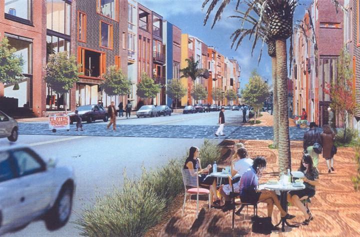
4 Mobility Strategies: Walkability General Plan addresses: Safety and accessibility Street Connectivity Overall walkability Mixed use People will park once, and walk further, in a walkable environment Less need to drive with local destinations


5 Mobility Strategies: Transit Increase transit ridership and mode share Improve transit service accessibility, frequency, connectivity, and service Transit-land use coordination and transit-oriented development Transit priority treatments and right-of of-way


6 To achieve villages that are: Mixed-use Walkable Transit-friendly Affordable Approved


7 Parking needs to be: Supplied Part of the neighborhood infrastructure Regulated by innovative codes Managed Supply and demand solutions Tailored approach by location Designed Use land efficiently Reduce impacts to streetscape

8 Parking Supply Parking as part of the community infrastructure Master plans to inventory supply and needs Shared and public parking structures Innovative regulations Adjustments for transit, affordable housing, mixed use Shared use provisions Bicycle parking


9 Reduce parking requirements. Cities exist not for the passage of cars, but for the care and culture c of human beings. Lewis Mumford Triple-stack car-lift at the Berkeleyan, Berkeley, CA Electric car & City Care Share s Honda Civic at the Gaia Building in Berkeley, CA

10 Parking Management Manage spaces in the public right-of of-way Parking management districts On-street parking turnover Reduce demand Improve transit services Improve walking and bicycling infrastructure Car sharing TDM strategies


11 Pedestrian-Oriented Design Street facing entrances Rear, side, or structured parking Ground floor activity Crime prevention measures Public art


12 Community Parking Districts Community-specific parking studies Parking location maps Signage and wayfinding Funds mobility projects in district Funds community parking facilities
13 Community Parking Districts Allows communities to implement parking management solutions for specific needs. CPDs with parking meters receive about 45 percent of the meter revenue generated within their district. CPDs can capture a portion of other new parking revenues based on Council approval. City has CPDs in: Centre City, Uptown, Mid-City, La Jolla, Pacific Beach, and Old Town.


14 Discretionary Project Review Multi-modal LOS standards and impact thresholds Traffic impact study guidelines and parking needs -- consideration of alternative modes


15 Land Development Code Commercial and residential zones Affordable housing reductions Transit area reductions Mixed use reductions Bicycle parking Citywide parking regulations Shared parking TDM reductions Tandem parking
16 Parking How much is enough? Residential and job sites Depends on commuting patterns and mode options Needs relatively regular Commercial retail and attractions Depends on peak-hour Design day demand Varies by type Mixed-use Shared parking opportunities
17 Parking How much is enough? For public Maximum to mitigate impacts For developer/investors Minimum to satisfy demand and regulations For lenders Maximum to reduce market risk
18 City of San Diego s Multifamily Residential Parking Requirements 1.5 spaces for 1 bedroom units 2.0 spaces for 2 bedroom units 2.25 spaces for 3+ bedrooms.25 space reduction for Transit Area Overlay Zone (TAOZ)
19 City of San Diego s Commercial Parking Requirements 2.5 spaces per 1,000 square feet of gross floor area except in CN-3 3 and CV-3 3 zones 2.1 spaces per 1,000 s.f. in the TAOZ 1.25 spaces per 1,000 s.f. in CN-3 3 and CV-3
20 Transit-Area Overlay Zone (TAOZ) What is it? Reduces parking rates in well-served transit areas Linked to transit service map Local and national studies have confirmed that fewer spaces are needed in high transit and pedestrian areas Key benefits: Helps fulfill transportation, land use, and environmental goals Results in improved, more pedestrian-friendly design Reduces construction costs Will be reviewed after Mobility Element is adopted
21 Residential Tandem Parking Overlay Zone (RTPOZ ) What is it? Park one car behind another 8 x 35 space unless obstructed on the side Key benefits: Helps implement transit, land use, housing, and environmental goals. Provides required parking using less space. Allows a more pedestrian-friendly design, at a lower cost.

22 Townhouses with Tandem Parking


23 What Isn t Tandem Parking? Cars parked in a driveway behind another car, close to or blocking the sidewalk. These are not valid spaces. Wide curb cuts shown are no longer allowed.
24 Parking costs per space by type $25,000 $20,000 $15,000 $10,000 $5,000 $0 Surface Tuck-under Above Grade Structure Underground Source: Marshall & Swift/City of San Diego Redevelopment Agency
25 Impact on Monthly Mortgage $200 $150 $100 $50 Surface Tuck-under Above Grade Structure Underground $0
26 Parking costs per sq. ft. by type when density makes economic sense $70 Land Value $60 $50 $40 $30 $20 $10 $0 Surface Tuck-under Above Grade Structure Underground Source: Marshall & Swift
27 Residual value vs. market value $120 $100 Price/S.F. $80 $60 $40 Residual Value Market Value $20 $0


28 MEASURING SUCCESS R-B B CORRIDOR 1970 R-B B CORRIDOR TODAY 22,000 jobs 5.5 million sf office 7,000 housing units 94,000 jobs 23.5 million sf office 24,500 housing units
29 Arlington s capacity incentive Site Plan allows higher capacity & height than does zoning By-right = 1.5 and 45 ft Site plan = FAR and ft Parking 2/1,000 s.f. vs 4/1,000 s.f. Value created 3 ways 1.5 FAR vs 3.8 to 10 FAR creates economic value Reduced parking saves $27,000 A SPACE Increased height creates premium view space
30 Arlington County capacity as an incentive Used incentive zoning extensively to create TOD Land use plan for metro corridors Indicates willingness to rezone for higher density But land remains zoned for fairly low density County rezones for higher density use as shown on land use plan in response to development proposal Special exception Site plan used to approve development
31 Arlington modes to work 39% who live in corridor take transit to work 10% walk to work Those who live in corridor own 1.13 vehicles/household versus 1.53 in rest of county
40 Years of Smart Growth Arlington County s Experience with Transit Oriented Development in the Rosslyn-Ballston Metro Corridor
 40 Years of Smart Growth Arlington County s Experience with Transit Oriented Development in the Rosslyn-Ballston Metro Corridor A presentation by the Arlington County Department of Community Planning,
TRANSIT ORIENTED DEVELOPMENT PINELLAS COUNTY MPO LIVABLE COMMUNITIES INITIATIVE PINELLAS COUNTY COMPREHENSIVE PLAN AMENDMENTS
 PINELLAS COUNTY MPO LIVABLE COMMUNITIES INITIATIVE MODEL LAND DEVELOPMENT CODE TRANSIT ORIENTED DEVELOPMENT PINELLAS COUNTY COMPREHENSIVE PLAN AMENDMENTS MPO Livable Communities Initiative Goal: Improve
Making Transit Oriented Development Work For Boonton, NJ
 Making Transit Oriented Development Work For Boonton, NJ Bloustein School of Planning and Public Policy Studio Dan Burton Loannie Dao Webster Slater Brandon Williams Ian Watson Maria Laham Nicola Mammes
Three Decades of Smart Growth: Arlington s Urban Village
 Three Decades of Smart Growth: Arlington s Urban Village An Overview Christopher Zimmerman Arlington County Board January 26, 2006 Arlington, Virginia 3 1 Arlington Today Population ~200,000 Jobs >200,000
The University District envisions, in its neighborhood
 Envisioning the University District Link Light Rail in Seattle s neighborhoods CIY OF SEALE CONCEP-LEVEL SAION AREA PLANNING RECOMMENDAION RESOLUION # 30165 EXHIBI L Vision 08.2000 he University District
TRANSIT-ORIENTED DEVELOPMENT POLICY DRAFT. City Planning and Development Department Kansas City, Missouri
 TRANSIT-ORIENTED DEVELOPMENT POLICY DRAFT City Planning and Development Department Kansas City, Missouri What is Transit Oriented Development (TOD)? Development that focuses land uses around a transit
MONTGOMERY COUNTY METRO STATION AREA DESIGN CHARRETTE
 MONTGOMERY COUNTY METRO STATION AREA DESIGN CHARRETTE Shady Grove Metro Station Area Charrette Closing Presentation October 25-28, 2000 MONTGOMERY COUNTY, MD M-NCPPC Design Collective, Inc. Architects
D-O LRT Zoning Discussion. Chapel Hill Boards & Commissions October 16, 2017
 D-O LRT Zoning Discussion Chapel Hill Boards & Commissions October 16, 2017 Update on Overall D-O LRT Station Area Initiative Objectives Design and educate on principles of Good Transit-Oriented Development
TRANSIT NEIGHBORHOOD PLANS PROGRAM OVERVIEW
 TRANSIT NEIGHBORHOOD PLANS PROGRAM OVERVIEW OCTOBER 2017 Los Angeles Department of City Planning @LATNP and @Planning4LA Outline Introduction Policy Framework The Transit Neighborhood Plans Program Overview:
CHAPTER 7: Transportation, Mobility and Circulation
 AGLE AREA COMMUNITY Plan CHAPTER 7 CHAPTER 7: Transportation, Mobility and Circulation Transportation, Mobility and Circulation The purpose of the Transportation, Mobility and Circulation Chapter is to
ITEM #8. Regional Smart Growth Program. Regional Smart Growth Program. Presentation Overview. Coast Highway Vision and Stategic Plan.
 Regional Smart Growth Program Economic Development Commission What is Smart Growth? Adopted as part of the Regional Comprehensive Plan (RCP) RCP provides vision for region based on Smart Growth and sustainability
EXISTING COMPREHENSIVE PLAN
 EXISTING COMPREHENSIVE PLAN Town Center Land Use Element: V. LAND USE POLICIES Town Center Mercer Island's business district vision as described in "Your Mercer Island Citizen-Designed Downtown" was an
Silverdale Regional Center
 Silverdale Regional Center Vision for Silverdale Regional Center The Silverdale Regional Center Plan (Plan) will guide the evolution of the Silverdale Regional Center from a collection of strip malls and
THE GREEN VISION WORKSHOP Friday, November 6, 2009
 THE GREEN VISION WORKSHOP Friday, November 6, 2009 SUSTAINABLE LONG RANGE PLANNING IN SANTA MONICA Eileen Fogarty Director, Planning and Community Development GREEN BUILDINGS Santa Monica has the most
Coast Highway Oceanside, California
 Coast Highway Oceanside, California Coast Highway Plan Zones What We ve Heard - Walkable/Bikeable Community (Senior and Child Friendly) -Wider Sidewalks -Street Trees -Traffic Calming -Bike Lanes -Paseos
The Need to Develop a Transit Ready Community
 Evaluation & Appraisal Report (EAR) Major Issue # 6 The Need to Develop a Transit Ready Community July 3, 2007 EAR Major Issue # 6 Transit Ready Existing Comp Plan policies apply only to Indiantown Road:
City of Hermosa Beach Administrative Policy #
 City of Hermosa Beach Administrative Policy # SUBJECT: Living Streets Policy Date: Approved by: City Council Authority: Public Works Department & Community Development Department Mayor, PURPOSE The City
TOWN OF NEW CASTLE - Master Plan Update
 Our Presentation Today (1) Recap the Master Planning Process To Date (2) Present the Outline of the Master Planning Work Plan (3) Present the Calendar for the Master Plan (4) Outline the scope of a Downtown
Transit-Oriented Development
 Transit-Oriented Development Path to Sustainability West Windsor February 22, 2007 George S. Hawkins Context for Presentation NJ Future is a non-partisan, 501(c)3 non-profit organization. Offer perspective,
Mobility Districts and Traffic Studies
 Mobility Districts and Traffic Studies During the last Comprehensive Plan update in 2008, the City of Sarasota identified the need to develop a citywide strategy for enhancing the mobility options of all
Tony Garcia, City-County Planning Commission & Beth Alden, Hillsborough MPO
 Tony Garcia, City-County Planning Commission & Beth Alden, Hillsborough MPO TOD Defined A compact neighborhood with housing, jobs and neighborhood services within easy walking distance of a transit station
The Lincoln Neighborhood Corridor Plan. The LiNC
 October 1, 2014 Planning Commission Study Session The Lincoln Neighborhood Corridor Plan The LiNC Purpose of Tonight s Meeting Introduction to The LiNC Review of Existing Conditions and Community Identified
Redevelopment of Downtown
 June 25, 2013 Redevelopment of Downtown Old US 41 Corridor Redevelopment Masterplan Downtown Color Palette Southern Shores and Beaches Sherwin Williams Downtown Vision Rendering Old Florida Design EcoDistricts
Partnerships in Transportation Transit-oriented Development The Return on Investment
 Partnerships in Transportation Transit-oriented Development The Return on Investment David M. Taylor, CNU Senior Vice President National Director, Sustainable Transportation Solutions Transit and Development
ORANGE LINE TRANSIT NEIGHBORHOOD PLANS VAN NUYS NEIGHBORHOOD COUNCIL, PLUM COMMITTEE DEPARTMENT OF CITY PLANNING, CITY OF LOS ANGELES
 Photo: Mission Meridian(Moule & Polyzoides) ORANGE LINE TRANSIT NEIGHBORHOOD PLANS VAN NUYS NEIGHBORHOOD COUNCIL, PLUM COMMITTEE DEPARTMENT OF CITY PLANNING, CITY OF LOS ANGELES JULY 18, 2018 Project partially
Attachment B: Centers and Corridors Proposal
 Attachment B: Centers and Corridors Proposal B. B This page is intentionally left blank. ATTACHMENT B: CENTERS AND CORRIDORS FRAMEWORK PROPOSAL B-2 Table of Contents Introduction... B-7 Focus Area... B-7
JANUARY 19, 2011 CENTRAL AVENUE-METRO BLUE LINE TRANSIT-ORIENTED DEVELOPMENT IMPLEMENTATION PROJECT COMMUNITY FORUM
 CENTRAL AVENUE-METRO BLUE LINE TRANSIT-ORIENTED DEVELOPMENT IMPLEMENTATION PROJECT COMMUNITY FORUM JANUARY 19, 2011 THE MARYLAND-NATIONAL CAPITAL PARK AND PLANNING COMMISSION PRINCE GEORGE S COUNTY PLANNING
Town Center (part of the Comprehensive Plan)
") Town Center (part of the Comprehensive Plan) Mercer Island Town Center Looking North (2014) In 1994, a year-long process culminated in a set of design guidelines and code requirements for the Town Center
Town Center (part of the Comprehensive Plan) Mercer Island Town Center Looking North (2014) In 1994, a year-long process culminated in a set of design guidelines and code requirements for the Town Center
Transportation. Strategies for Action
 Transportation A major priority for the Overlake Neighborhood is to develop a multimodal transportation system. To achieve this system, a balance has to be found among travel, circulation and access needs;
WELCOME and introduction
 1 WELCOME and introduction Mobility Hub Locations within Burlington STUDY OVERVIEW STUDY OBJECTIVES The City of Burlington is developing four Area Specific Plans, one for each of Burlington s Mobility
LEED-ND 101: Practical Strategies for Achieving Sustainability Goals. Travis Parker Lakewood Planning Director
 LEED-ND 101: Practical Strategies for Achieving Sustainability Goals Travis Parker Lakewood Planning Director Metro Vision Idea Exchange Oct 11, 2012 West Corridor Stations West Corridor Overview West
Taming Tysons Corner Transforming the Quintessential Edge City
 Taming Tysons Corner Transforming the Quintessential Edge City Transit is the greatest catalyst for change at Tysons, but how do we take advantage of this billion-dollar investment? If transit is built
Horizon 2035 Land Use and Transportation Element
 CITY OF SUNNYVALE Horizon 2035 Land Use and Transportation Element City Council Study Session March 7, 2017 Overview General Plan Context Mixed Use Villages Transportation Mode & Parking General Plan Policy
Plan-It Greenville (2009) Comprehensive Plan 5-Year Update
 Comprehensive Plan 5-Year Update") Plan-It Greenville (2009) Comprehensive Plan 5-Year Update What is the comprehensive plan: Collecting communitywide data Projecting future population growth Setting communitywide goals Framing policies
Plan-It Greenville (2009) Comprehensive Plan 5-Year Update What is the comprehensive plan: Collecting communitywide data Projecting future population growth Setting communitywide goals Framing policies
New Partners for Smart Growth Conference February 5, 2010
 Dan Stroh, Planning Director City of Bellevue Planning and Community Development Bellevue, WA New Partners for Smart Growth Conference February 5, 2010 Summary of Project Long-range plan update for Bel-Red
Nassau County Cultivating Opportunities for Sustainable Development Nassau County Infill Redevelopment Feasibility Study
 Nassau County Cultivating Opportunities for Sustainable Development Nassau County Infill Redevelopment Feasibility Study NY-CT Sustainable Communities Steering Committee Meeting March 14, 2014 Project
LAND USE DESIGNATIONS AND ZONING CLASSIFICATIONS
 LAND USE DESIGNATIONS AND ZONING CLASSIFICATIONS One of the most significant issues addressed within the community plan process is land use. How land is utilized within a community directly affects the
Citizen Advisory Group Meeting 5: Land Use April 14, 2011
 Citizen Advisory Group Meeting 5: Land Use April 14, 2011 Meeting Agenda 1. Background Review 2. Transportation Follow-up 3. PED Overlay Approach 4. Land Use Mapping 5. Group Exercise 6. Wrap-up and Next
Westbound: A One-day Exploration of Growth
 Westbound: A One-day Exploration of Growth Frog Pond Area 2018 UGB Expansion Proposal June 13, 2018 Growing Out: UGB Asks Four cities submitted proposals to expand greater Portland s urban footprint by
City of Fort Lauderdale UPTOWN URBAN VILLAGE. Public Workshop December 7, 2016
 Public Workshop December 7, 2016 Workshop Agenda Introductions Project Presentation o o o History Project Scope/Timeline Character of Study Area o o o o Land Use Public Realm/Pedestrian Mobility Multimodal
Downtown Elkton Station Area Plan, Elkton, MD. Difficult enough to get support for new starts challenge to fund Houston transit
 Difficult enough to get support for new starts challenge to fund Houston transit More difficult to build Community Support for dense development at station areas Major Concerns: Traffic, Property values,
City of Fairfax, Virginia City Council Work Session
 City of Fairfax, Virginia City Council Work Session Agenda Item # WS 2 City Council Meeting 7/5/2016 TO: FROM: SUBJECT: Honorable Mayor and Members of City Council Robert Sisson, City Manager Request of
Onondaga County Sustainable Streets Project. Onondaga County Planning Federation June 7, Onondaga County Sustainable Streets Project 1
 Onondaga County Sustainable Streets Project Onondaga County Planning Federation June 7, 2012 Onondaga County Sustainable Streets Project 1 Sustainable Streets 1. Introduction to the SMTC 2. Sustainable
Plano Tomorrow Vision and Policies
 Plano Tomorrow Vision and Policies PLANO TOMORROW PILLARS The Built Environment The Social Environment The Natural Environment The Economic Environment Land Use and Urban Design Transportation Housing
Transportation Working Team Duane Diggs, Co-Chair (VOICE Buffalo) Kelly Dixon, Co-Chair (GBNRTC) Paul Ray, Facilitator (UB Regional Institute)
 Kelly Dixon, Co-Chair (GBNRTC) Paul Ray, Facilitator (UB Regional Institute)") towards a more sustainable Buffalo Niagara Transportation Working Team Duane Diggs, Co-Chair (VOICE Buffalo) Kelly Dixon, Co-Chair (GBNRTC) Paul Ray, Facilitator (UB Regional Institute) Agenda Welcome,
towards a more sustainable Buffalo Niagara Transportation Working Team Duane Diggs, Co-Chair (VOICE Buffalo) Kelly Dixon, Co-Chair (GBNRTC) Paul Ray, Facilitator (UB Regional Institute) Agenda Welcome,
Recommendations Affecting the University Heights Neighborhood that Overlap Both the Uptown and North Park Community Planning Areas
 October 21, 2010 William Anderson, Director City Planning and Community Investment City of San Diego 202 C Street, MS 5A San Diego, CA 92101 RE: Recommendations Affecting the University Heights Neighborhood
The Five Components of the McLoughlin Area Plan
 The Five Components of the McLoughlin Area Plan This documents contains the complete language of the five components of the McLoughlin Area Plan: The Vision Statement The Values The Guiding Principles
Table L-1 Summary Action Strategy. Action Item Timing Status Responsible Agency
 CHAPTER 4: CIRCULATION ELEMENT ISSUE #1: MAJOR THOROUFARES AND TRANSPORTATION ROUTES A balanced transportation system for Fontana is provided that meets the mobility needs of current and future residents
Draft Bergamot Area Plan
 ATTACHMENT 1 Draft Bergamot Area Plan Taskforce on the Environment April 15, 2013 www.bergamotplan.net 1 Overview WHAT IS THE BERGAMOT AREA PLAN? A Community-Based Planning Document Guiding the Future
V. Vision and Guiding Principles
 V. Vision and Guiding Principles The Master Plan for the Powers Ferry Corridor seeks a foundation in the desires of the community. At times, various elements of the community offered opposing viewpoints,
NEC of Central Avenue and Indian School Road
 NEC of Central Avenue and Indian School Road For this location, there are two applicable plans that provide guidance on development. The two plans include the Indian School Specific Plan (1991) and the
1 Adapted from the Statewide Transit-Oriented Development Study by CalTrans, 2006
 APPENDIX C: LAND USE PLANNING FOR ENHANCED RAIL SERVICE 72 BACKGROUND One of the consistent themes heard from localities in the Route 29 corridor Planning Forums was the need for expanding rail service
Policies and Code Intent Sections Related to Town Center
 Policies and Code Intent Sections Related to Town Center The Town Center Vision is scattered throughout the Comprehensive Plan, development code and the 1994 Town Center Plan. What follows are sections
Chapter 1: Introduction
 Chapter 1: Introduction The Penn Avenue Community Works Corridor Vision and Implementation Framework presents an integrated communitybased vision and a coordinated, long-term implementation framework for
Chapter 5.0 Guiding Principles
 Chapter 5.0 Guiding Principles TOD in the station area is more than adding higher density housing on the vacant sites near the Thornton Crossroads at 104th Station. The interweaving of the transit station,
Silver Line CPAM UPDATE. Transportation and Land Use Committee October 14, 2016
 Silver Line CPAM UPDATE Transportation and Land Use Committee October 14, 2016 Purpose Recap Project History and Map Changes Provide Overview of CPAM Components Discuss Transportation Impacts Discuss Fiscal
TOWN COUNCIL / PLANNING COMMISSION
 Workshop #3 TOWN COUNCIL / PLANNING COMMISSION January 20, 2011 Consultant Team In Attendance Tonight BMS Design Group Nevada City and San Francisco Michael Smiley, AICP, ASLA Partner-in-Charge Nancy L.
ARTICLE 6: Special and Planned Development Districts
 ARTICLE 6: Special and Planned Development Districts 6-10 Traditional Neighborhood Development (TND) District 6-10.10 Purpose and Intent The Traditional Neighborhood Development (TND) District provides
Status Report: MD 355 Project
 Status Report: MD 355 Project OCTOBER 2006 M-NCPPC MONTGOMERY COUNTY PLANNING DEPARTMENT Summary of Community Comments, and break to the Results of the MD 355 Participation Session Brookside Gardens -
Corridor-Level Approaches to Creating Transit-Oriented Districts
 Corridor-Level Approaches to Creating Transit-Oriented Districts Dena Belzer Strategic Economics and Center for Transit-Oriented Development August 2011 5-year old partnership dedicated to improving practice
Somers Point Master Plan
 Somers Point Master Plan Progress Report and Public Meeting August 20, 2014 Master Plan Reexamination Municipal Land Use Law require that all municipalities reexamine their master plan every ten years.
Blueprint Denver A BLUEPRINT FOR AN INCLUSIVE CITY. Executive Summary
 Blueprint Denver A BLUEPRINT FOR AN INCLUSIVE CITY Executive Summary PUBLIC REVIEW DRAFT 2 1/7/2019 DENVERIGHT BLUEPRINTDENVER Blueprint Denver: A Blueprint for an Inclusive City An Equitable City Planning
Transportation Land Use Integration & Regional Planning. Don Kostelec, AICP Senior Planner, Louis Berger Group February 1, 2010
 Transportation Land Use Integration & Regional Planning Don Kostelec, AICP Senior Planner, Louis Berger Group February 1, 2010 Transportation Land Use Integration DOT-HUD-EPA Sustainable Communities Initiative
Reshaping The City: New Visions for Urban Transport. Trent Lethco, Associate Principal Allison Davis, Senior Planner Vicent Risica, Planner Arup
 Reshaping The City: New Visions for Urban Transport Trent Lethco, Associate Principal Allison Davis, Senior Planner Vicent Risica, Planner Arup Agenda Where are we now? Rethinking infrastructure? Cities
REVIEW AND EVALUATION OF REGIONAL LAND USE
 REVIEW AND EVALUATION OF REGIONAL LAND USE AND TRANSPORTATION SCENARIOS #220831 Environmental Justice Task Force October 7, 2014 VISION 2050 Process Development of Guiding Vision for Land Use and Transportation
Tyvola & Archdale Transit Station Area Plan. June 5, 2008
 Tyvola & Archdale Transit Station Area Plan Second Public Meeting June 5, 2008 Presentation Outline 1. Purpose and Process 2. Station Area Overview 3. Plan Recommendations 4. Comments Received and Proposed
Urban Design Manual PLANNING AROUND RAPID TRANSIT STATIONS (PARTS) Introduction. Station Study Areas
 Introduction. Station Study Areas") 111111 PLANNING AROUND RAPID TRANSIT STATIONS (PARTS) Introduction The ION rapid transit system will link Waterloo, Kitchener and Cambridge through a central transit corridor (CTC). There are a number
111111 PLANNING AROUND RAPID TRANSIT STATIONS (PARTS) Introduction The ION rapid transit system will link Waterloo, Kitchener and Cambridge through a central transit corridor (CTC). There are a number
Subregion 4 Central Avenue-Metro Blue Line Corridor Transit-Oriented Development (TOD) Implementation Project. Community Meeting April 27, 2011
 Implementation Project. Community Meeting April 27, 2011") Subregion 4 Central Avenue-Metro Blue Line Corridor Transit-Oriented Development (TOD) Implementation Project Community Meeting April 27, 2011 Overview Introduction to Subregion 4 TOD Implementation Program
Subregion 4 Central Avenue-Metro Blue Line Corridor Transit-Oriented Development (TOD) Implementation Project Community Meeting April 27, 2011 Overview Introduction to Subregion 4 TOD Implementation Program
The transportation system in a community is an
 7 TRANSPORTATION The transportation system in a community is an important factor contributing to the quality of life of the residents. Without a sound transportation system to bring both goods and patrons
DOWNTOWN AREA PLAN. June 9, 2009
 DOWNTOWN AREA PLAN June 9, 2009 Issues Identified by Councilmembers Overlap with Southside Plan Southwest Residential Area & Herrick Shadows & Residential Areas Shadows on Streets & Canyon Effect Transit
Concord Community Reuse Project Goals and Guiding Principles. Overarching Goals (OG)
") Concord Community Reuse Project Goals and Guiding Principles Overarching Goals (OG) No priority is implied by the order of presentation of the goals and guiding principles. Overarching goals for the Concord
Concord Community Reuse Project Goals and Guiding Principles Overarching Goals (OG) No priority is implied by the order of presentation of the goals and guiding principles. Overarching goals for the Concord
The Village of Shirlington
 The Village of Shirlington Suburban Smart Growth Without Rail Transit July 2018 Agenda History (1940 to present) Attributes and Outcomes Lessons Learned Setting the Stage Arlington County Arlington is
SITE PLAN REVIEW COMMITTEE MEETING AGENDA Clarendon Boulevard Conference Room 311 Arlington, VA 22201
 SITE PLAN REVIEW COMMITTEE MEETING AGENDA DATE: Thursday, July 13, 2017 TIME: 7:00 8:30 p.m. PLACE: 2100 Clarendon Boulevard Conference Room 311 Arlington, VA 22201 SPRC STAFF COORDINATOR: TBD Item 1.
ARLINGTON COUNTY, VIRGINIA
 ARLINGTON COUNTY, VIRGINIA County Board Agenda Item Meeting October 15, 2005 DATE: September 28, 2005 SUBJECT: Request to Advertise the adoption of the 2005 Clarendon Sector Plan C. M. RECOMMENDATION:
New Town Mixed Use District
 New Town Mixed Use District Montgomery County Planning Commission 2009 Annual Conference PA Chapter of the American Planning Association October 6, 2009 What is NTMU? More urban style of development Complementary
Urban Planning and Land Use
 Urban Planning and Land Use 701 North 7 th Street, Room 423 Phone: (913) 573-5750 Kansas City, Kansas 66101 Fax: (913) 573-5796 Email: planninginfo@wycokck.org www.wycokck.org/planning To: From: City Planning
Northwest commuter rail station US 36 BRT. Westminster Station
 Northwest commuter rail station Westminster Station US 36 BRT Westminster Center US 36 & Church Ranch Broomfield Flatiron/96 th St. US 36 & McCaslin Table Mesa Boulder Junction 13-month effort that will
Welcome to the Oakridge Centre Open House
 Welcome to the Oakridge Centre Open House Why is the City hosting this event? This open house is to inform you of a rezoning application submitted to the City of Vancouver to amend the existing CD-1 (Comprehensive
Executive Summary. The Mebane CLP is not a regulatory document, but is intended to guide land development decisions. The plan includes:
 Executive Summary P URPOSE AND O RGANIZATION OF THE P LAN The City of Mebane, with input from citizens and an appointed CLP Advisory Committee, adopted Mebane by Design, a Comprehensive Land Development
Chapter 6.0 Guiding Principles
 Chapter 6.0 Guiding Principles 6.1 Introduction TOD is not simply higher-density housing near a transit station. An authentic and complete neighborhood with amenities such as stores, parks, landscaping,
The New Rochelle Comprehensive Plan
 The New Rochelle Comprehensive Plan Preliminary Public Hearing, March 21, 2016 www.newrochelleny.com/envisonr Recommendations History and Regional Context Key Concept: Restore Downtown to its regional
2. MULTI-MODAL TRANSPORTATION ELEMENT Goals, Objectives, and Policies
 2. Goals, Objectives, and Policies GOAL 2-1: TO INTEGRATE THE MULTI-MODALTRANSPORTATION SYSTEM WITH THE FUTURE LAND USE ELEMENT, THE FUTURE LAND USE MAP, ANDTHE LAND DEVELOPMENT CODE TO GUIDE DEVELOPMENT
TREASURE COAST REGIONAL PLANNING COUNCIL M E M O R A N D U M. To: Council Members AGENDA ITEM 5H
 TREASURE COAST REGIONAL PLANNING COUNCIL M E M O R A N D U M To: Council Members AGENDA ITEM 5H From: Date: Subject: Staff October 17, 2008 Council Meeting Local Government Comprehensive Plan Review Draft
Tyvola & Archdale Transit Station Area Plan. May 15, 2008
 Tyvola & Archdale Transit Station Area Plan First Public Meeting May 15, 2008 Presentation Outline 1. Purpose and Process 2. Station Area Overview 3. Plan Recommendations Vision Land Use Transportation
Access to the University of North Carolina at Chapel Hill, UNC Hospitals, and Chapel Hill Transit.
 M 1/ 4 1/ 2 E IL M E IL Station Family: County: City: UNC Hospitals WHY THIS STATION? University Village Orange Chapel Hill Access to the University of North Carolina at Chapel Hill, UNC Hospitals, and
Executive Summary. NY 7 / NY 2 Corridor
 Executive Summary NY 7 / NY 2 Corridor Transportation and Land Use Study December 2005 Prepared for: Town of Colonie Capital District Transportation Committee Prepared by: Introduction: Land use decisions
Making TOD Work in the Heart of Suburban Sprawl
 Making TOD Work in the Heart of Suburban Sprawl Rocky Mountain Land Use Institute March 6, 2009 Speakers Ben Herman, FAICP, Principal Clarion Associates Darcie White, AICP, Principal Clarion Associates
Hockessin Community Redevelopment Plan
 Hockessin Community Redevelopment Plan 3.1 Introduction The Community Redevelopment Plan for the Village of Hockessin is the result of the people s vision for a distinct village center that serves as the
Communities Plan. Parkland-Spanaway-Midland. LUAC Review of Draft Policies
 Parkland-Spanaway-Midland Communities Plan LUAC Review of Draft Policies Presented by: Tiffany O Dell, Senior Planner Planning & Public Works Tiffany.Odell@co.pierce.wa.us 253-798-6859 November 1, 2017
BRYN MAWR. Tier 2 Characteristics: Location: Lancaster Avenue from Old Lancaster Road on the east to Norwood Avenue on the west
 BRYN MAWR Tier 2 Characteristics: Transit-oriented Mixed use Along Lancaster Avenue Serve township-wide needs Civic space Employment centers Location: Lancaster Avenue from Old Lancaster Road on the east
A BLUEPRINT FOR BROCKTON A CITY-WIDE COMPREHENSIVE PLAN
 A BLUEPRINT FOR BROCKTON A CITY-WIDE COMPREHENSIVE PLAN Public Meeting October 2016 1 Plan Summary and Discussion Public Meeting May 4 2017 City of Brockton Bill Carpenter, Mayor Department of Planning
TOP TEN LIST OF COMMUNITY CONCERNS REGARDING PROPOSED AMENDMENTS TO CHAPTER 42
 TOP TEN LIST OF COMMUNITY CONCERNS REGARDING PROPOSED AMENDMENTS TO CHAPTER 42 1. Extend the urban area to Beltway 8 in stages, over say a three-year period, prioritizing development in transit and declining
TOD 101 CREATING LIVABLE COMMUNITIES WITH TRANSIT
 1 CREATING LIVABLE COMMUNITIES WITH TRANSIT What are transit Centered Communities? Benefits of Partnerships to Support and Implement What You Will Learn Portland s Pearl District Your Trainers Today Catherine
EXHIBIT A. Tax Increment Reinvestment Zone No. 1 (Town Center) First Amended Project Plan 1
 First Amended Project Plan 1") EXHIBIT A Tax Increment Reinvestment Zone No. 1 (Town Center) First Amended Project Plan 1 1 As amended by Resolution No. 2008-02-001(TR1R) of the Tax Increment Reinvestment Zone No.1, and approved to
EXHIBIT A Tax Increment Reinvestment Zone No. 1 (Town Center) First Amended Project Plan 1 1 As amended by Resolution No. 2008-02-001(TR1R) of the Tax Increment Reinvestment Zone No.1, and approved to
Broadway District Specific Plan. Community Workshop #2 February 23,2016
 Broadway District Specific Plan Community Workshop #2 February 23,2016 1 Agenda Introductions Project Progress Status Upcoming Milestones Emerging Framework Land Use Urban Design Circulation Infrastructure
TOD IMPLEMENTATION BEST PRACTICE TOOLBOX Leveraging Transit for City Shaping
 arrington.gb@gmail.com gbplacemaking.com THE TOD I LIVE IN ~ PORTLAND, OR TOD IMPLEMENTATION BEST PRACTICE TOOLBOX Leveraging Transit for City Shaping BEST PRACTICE TOPICS Timing & transit Parking & retail
Secrest Short Cut and Monroe Expressway Small Area Plan AUGUST 29, 2018
 Secrest Short Cut and Monroe Expressway Small Area Plan AUGUST 29, 2018 Background and Process Monroe Expressway will be open by the end of 2018 Union County and Indian Trail identified a need to revisit
4. Shape Transitions. 4. Shape Transitions
 4. Shape Transitions 49 Zoning District Policies Overall Intent: Maintain neighborhood character by creating compatible transitions that minimize land use conflicts. Strategy: Define the character of zoning
Corridors. Re-vitalize our Corridors and Gateways
 Corridors Re-vitalize our Corridors and Gateways Artist s rendering from the 287 Strategic Plan, 2015 Corridors are the major throughways of Loveland but they also provide important commercial, community