U R B A N D E S I G N & D E V E L O P M E N T P L A N
|
|
|
- Mary O’Neal’
- 5 years ago
- Views:
Transcription

1 U R B A N D E S I G N & D E V E L O P M E N T P L A N F O R T H E S K I N K E R D e B A L I V I E R E C O M M U N I T Y P U B L I C W O R K S H O P # 3 S T. L O U I S, M I S S O U R I H 3 S T U D I O M A R C H 2 6,


2 AGENDA INTRODUCTION PLANNING PROCESS Intent & Objectives Project Boundaries Scope of Services Project Schedule Stakeholder Interviews TOD STATION AREA PLANNING PROJECT SUMMARY OF PUBLIC WORKSHOP # 02 Consensus Issues & Ideas One Word Cards Workboards PREFERRED OPTION PLAN Neighborhood Center DeBaliviere Avenue Forest Park Parkway Skinker Boulevard
3 INTENT & OBJECTIVES The intent of the Urban Design & Development Plan is to continue the neighborhoods revitalization to achieve the Community Council s (CC) stated Long- Term Goal for SkinkerDeBaliviere to be an inclusive, cohesive, sustainable and vibrant urban community. (ref: RFP) Objectives: Engage residents and stakeholders Build on the CC's sub-committee work such as the Identity & Positioning Plan. Identify specific projects and community priorities. Provide necessary implementation documentation for development partners, funding sources, and the community. Revitalization to occur over the longterm (20-25years) without the use of eminent domain


4 CONTEXT AREA Page Avenue to the North Kingsland Boulevard & Big Bend Boulevard to the West Union Boulevard to the East Forsyth Boulevard to the South STUDY AREA 2.2 miles x 1.9 miles ½ Block North of Delmar Boulevard Centerline of Lindell / Centerline of Skinker / Centerline of Forest Park Pkwy. ½ Block East of DeBaliviere Avenue Centerline of Melville Avenue 1.17 miles x 0.59 miles


5 SCOPE OF SERVICES 1.0 SITE INVESTIGATION 2.0 GUIDING VISION & LIVABILITY PRINCIPLES 3.0 SKINKER DEBALIVIERE NEIGHBORHOOD OPTIONS 4.0URBAN DEISGN & DEVELOPMENT PLAN PREFERRED OPTION Urban Design & Development Plan Preferred Option Draft Focus Areas Concepts & Strategies Draft Delmar Boulevard/DeBaliviere Avenue Commercial & TOD Strategies Steering Committee Meeting 03/Public Workshop 03 Steering Committee Meeting FINAL URBAN DEISGN & DEVELOPMENT PLAN Final Urban Design & Development Plan Preferred Option Final Focus Areas Concepts & Strategies Final Delmar Boulevard/DeBaliviere Avenue Commercial & TOD Strategies Draft Implementation Plan, Project Identification & Prioritization Final Implementation Plan, Project Identification & Prioritization Final Public Presentation Submission of Final Deliverables
6 PROJECT SCHEDULE November 12, 2012 Steering Committee Meeting 01 November 13, 2012 Public Workshop 01 November 16, 17,19, 27 December 4, 2012 February 11, 2013 February 11, 2013 Stakeholder Interviews Steering Committee Meeting Community Council Board Meeting February 13, 2013 Public Workshop 02 March 21, 2013 Steering Committee Meeting March 26, 2013 Public Workshop 03 The schedule for the completion of the Urban Design & Development Plan is to be determined by and subject to completion of the Delmar and DeBaliviere Transit-Oriented Development Project
7 TRANSIT ORIENTED DEVELOPMENT PROJECT DELMAR & FOREST PARK / DEBALIVIERE STATIONS

8 TOD PROJECT DELMAR & FOREST PARK/DEBALIVIERE Contract inception March 4, 2013 H3 Studio contracted to create the following deliverables for the Delmar and Forest/Park DeBaliviere MetroLink Stations: Detailed Station Area Plans Development Pro Formas Form Based Districts Project timeframe from March 4, 2013 to September 1, 2013 Public TOD Meetings in May, June/July

9 PUBLIC WORKSHOP 02 SUMMARY


10 PUBLIC WORKSHOP #02 DATE: February 13, 2013 Residents and community members participated in identifying the most important issues, ideas, and design options for Skinker- DeBaliviere with a presentation and group work session. PRESENTED Summary of Work to Date Summary of Public Meeting 01 Additional Community Analysis Updated Summary Issues & Ideas Updated Community Vision & Goals Draft Design Options SMALL GROUPS WORKSESSION Participants used markers on a neighborhood options workboard to illustrate ideas, preferences and concerns about proposed vision, goals, and design options

11 HANDOUT, ONE WORD CARDS, WORKBOARDS PROCESS Individuals spent 10 minutes with the Issues & Ideas Handout reviewing the summary to create consensus and priorities. Individuals also filled out One Word Cards about the current state and future of the neighborhood. TRANSIT ISSUES & IDEAS HANDOUT ONE WORD CARD Small groups spent 30 minutes reviewing the Vision, Goals, and Proposed Design Options for the following neighborhood areas: Des Peres Avenue Delmar Loop TOD DeBaliviere TOD Lucier Park Metro Garage Forest Park Parkway Skinker Boulevard PURPOSE Give new Ideas, identify preferences for design options, revise Community Goals and Vision. TABLE WORKBOARD
12 ONE WORD CARDS - NOW Trees Momentum Great Standard Wonderful Invested Less Secure Tired Historic Inconsistent Good Center Comfortable w/ Potential Cohesive OK Diverse Fragmented Community Friendly Transition Groovy Neighborly Stable Apprehensive Close
13 ONE WORD CARDS - FUTURE Accessibility Integrated Awesome Exciting Regional Center More Secure Vibrant Established Historic Safety Developed Large Shopping Center Diversity (race, incomes, age, religion) Cohesive Attractive (to people, families, businesses) Community Green Wired Progressive Eclectic Invitational Stability

14 CONSENSUS ISSUES & IDEAS ISSUES IDEAS ORIGINAL ISSUES & IDEAS HANDOUTS

15 CONSENSUS ISSUES & IDEAS SAMPLE OF COMPLETED ISSUES & IDEAS HANDOUTS
16 CONSENSUS ISSUES & IDEAS CONSENSUS ISSUES Edges Create a Negative Image. are Perceived as Unsafe, and Do Not Support Daily Community Activities.. Negative perception of DeBaliviere Avenue Crime and Safety in the neighborhood generally, and in particular Lucier Park, Delmar, and MetroLink Stations is an On-going Concern Address Neighborhood Vacancies, including Des Peres School One-way Streets, Dead Ends, and Alleys Inhibit Cut-through Traffic, but Result in Poor Circulation, Speeding and Traffic Flow Issues Limited Entrances and Exits Cause Poor Connectivity Main Intersections are Dangerous for Pedestrians Lack of Diverse and Viable Businesses Lack of Grocery Store
17 CONSENSUS ISSUES & IDEAS CONSENSUS ISSUES Edges Create a Negative Image. are Perceived as Unsafe, and Do Not Support Daily Community Activities.. Negative perception of DeBaliviere Avenue Crime and Safety in the neighborhood generally, and in particular Lucier Park, Delmar, and MetroLink Stations is an On-going Concern Address Neighborhood Vacancies, including Des Peres School One-way Streets, Dead Ends, and Alleys Inhibit Cut-through Traffic, but Result in Poor Circulation, Speeding and Traffic Flow Issues Limited Entrances and Exits Cause Poor Connectivity Main Intersections are Dangerous for Pedestrians Lack of Diverse and Viable Businesses Lack of Grocery Store * Minority Opinion include: Barriers are NOT a problem; Connectivity is NOT a problem; Circulation is NOT a problem; Hamilton School, Fragmented, Sustainability of larger houses demographics are changing, 4 Corners needs improvement, long blocks, parks and open spaces lack amenities and have poor access, Communication, engagement, inclusiveness
18 CONSENSUS ISSUES & IDEAS CONSENSUS IDEAS Need a Grocery Store Bring Diverse and Viable businesses to Delmar and DeBaliviere Create Transit Oriented Development at Delmar and DeBaliviere Stations Create an Identifiable Street Character for Eastern Delmar Corridor Create a dog park, Improve Lucier Park, Improve the Connection to Forest Park Infill Vacant Lots and Rehabilitate Deteriorating Homes Improve Timing and Bike and Pedestrian Safety at Intersections Create Parks and Programs for Youth and Seniors Create Accessible Senior Housing
19 CONSENSUS ISSUES & IDEAS CONSENSUS IDEAS Need a Grocery Store Bring Diverse and Viable businesses to Delmar and DeBaliviere Create Transit Oriented Development at Delmar and DeBaliviere Stations Create an Identifiable Street Character for Eastern Delmar Corridor Create a dog park, Improve Lucier Park, Improve the Connection to Forest Park Infill Vacant Lots and Rehabilitate Deteriorating Homes Improve Timing and Bike and Pedestrian Safety at Intersections Create Parks and Programs for Youth and Seniors Create Accessible Senior Housing * Minority Opinion include: parking standards for the neighborhood, replace bridges over metrolink, fix broken sidewalks, thin Delmar to slow traffic, Improve McPherson/Laurel area, Bike lanes on Skinker, more lighting, green streets, green Des Peres, increase owner occupancy, improve circulation, enhance 4 corners, expand trolley to CWE, don t open Des Peres to Delmar
20 WORKBOARDS PUBLIC MEETING #2: DESIGN OPTIONS
21 TRANSIT WORKBOARDS: DESIGN OPTIONS Table 1 Table 21 Table 3 Table 4 Table 5 Table 6

22 COMMUNITY VISION & GOALS
23 COMMUNITY VISION (as amended by Public Meeting 01 and Stakeholders) Build upon Skinker DeBaliviere s history, revitalization, diversity, sense of community, institutions, and unmatched location and access to transit to create the city s premier healthy, multi-generational, walkable, and transit-based, car-optional community.
24 Improve safety and visual quality of streets with healthy trees, robust native landscapes, improved sidewalks. COMMUNITY GOALS (as amended by Public Meeting 01 and Stakeholders) (not ordered by priority) Continue the ongoing revitalization of Delmar Boulevard and DeBaliviere Avenue as a mixed-use, urban, multi-modal corridor. Improve Forest Park Parkway and Skinker Boulevard for visual quality, safety, and connectivity. Envision Des Peres Avenue, the 4 Corners, and Lucier Park as the heart of the neighborhood Incentivize and create new neighborhood businesses and services to achieve a mixed-use, complete community. Improve parks, community gardens, and open space amenities
25 Promote owner occupancy of single family homes and responsible management of rental properties. Enhance neighborhood integration, circulation, safety, and connectivity for all residents pedestrians, cyclists, drivers, and transit riders. Create a multi-generational neighborhood that supports active and independent lifestyle choices for all ages. Retain and continue to attract a diversity of residents to ensure an inclusive community. Promote community health, safety, and environmental sustainability. Organize for implementation success and community empowerment and leadership.
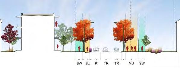
26 PREFERRED OPTION PLAN DeBALIVIERE AVENUE FOREST PARK PARKWAY SKINKER BOULEVARD

27 PREFERRED OPTION PLAN
28 PREFERRED OPTION PLAN Des Peres Avenue Delmar Loop TOD Lucier Park

29 PREFERRED OPTION PLAN Des Peres Avenue Delmar Loop TOD Lucier Park DeBALIVIERE AVENUE Forest Park/DeBaliviere TOD DeBaliviere Avenue Metro Garage
30 PREFERRED OPTION PLAN Des Peres Avenue Delmar Loop TOD Lucier Park DeBALIVIERE AVENUE Forest Park/DeBaliviere TOD DeBaliviere Avenue Metro Garage FOREST PARK PARKWAY
31 PREFERRED OPTION PLAN Des Peres Avenue Delmar Loop TOD Lucier Park DeBALIVIERE AVENUE Forest Park/DeBaliviere TOD DeBaliviere Avenue Metro Garage FOREST PARK PARKWAY SKINKER BOULEVARD
32 PREFERRED OPTION PLAN
33 DES PERES AVENUE : DELMAR LOOP TOD : LUCIER PARK


34 Previous Design Options DES PERES AVENUE OPTION 1: Hybrid Linear Park OPTION 2: Hybrid East Side Greenway OPTION 1: Hybrid Linear Park OPTION 2: Hybrid East Side Greenway


35 Previous Design Options DES PERES AVENUE OPTION 1: Hybrid Linear Park OPTION 2: Hybrid East Side Greenway Preference: East-Side Greenway East Side Greenway: 4 Linear Park: 2 Do not Open Des Peres Preserve existing green spaces Dog Park OPTION 2: Hybrid East Side Greenway East-Side Greenway


36 Previous Design Options DES PERES INTERSECTION OPTION 1: Painted Intersection OPTION 2: Brick Intersection OPTION 3: New Bridge with Painted Intersection Not shown on Work Board OPTION 1: Painted Intersection Planting/Sound Wall OPTION 2: Brick Intersection OPTION 3: New Bridge & Painted Intersection
37 Previous Design Options LUCIER PARK OPTION 1: Neighborhood Park OPTION 2: Community Greenway Neighborhood Park Community Park

38 Previous Design Options LUCIER PARK OPTION 1: Neighborhood Park OPTION 2: Community Greenway No Consensus for Lucier Park Neighborhood: 3; Community: 3 Must be eyes on the Park Neighborhood Park Community Park
39 Previous Design Options DELMAR LOOP TOD OPTION 1: Incremental Infill OPTION 2: Redevelopment District OPTION 2: Redevelopment District OPTION 1: Incremental Infill
40 Previous Design Options DELMAR LOOP TOD OPTION 1: Incremental Infill OPTION 2: Redevelopment District Preference: Redevelopment District Option 1: 0; Option 2: 4 Hide the buses Use the Wabash Station Do not open Des Peres Unsure about the Transit Plaza OPTION 2: Redevelopment District

41 New Information GREENING OF DES PERES SDCC Greenways Committee planning for Lucier Park and Des Peres Greenway Collaboration with Great Rivers Greenway, Wash U, Centennial Greenway Goals A perimeter walking/bicycling path around the edge of Lucier Park to serve as a secondary trailhead for the St. Vincent Greenway. Des Peres Avenue as the secondary greenway path from Forest Park to the main Vernon route for the Centennial Greenway (Melville as the primary path). Narrower Delmar Boulevard from 4 lanes to 2 with parking on both sides Greenways Plan 2009 Achievements 2006 Des Peres Avenue designated a secondary greenway for Centennial Greenway
42 DES PERES AVENUE : DELMAR LOOP TOD : LUCIER PARK


43 DES PERES AVENUE East-Side Greenway Sidewalk, bike path, and tree allee on east side 4 Corners improved as a multi-functional destination and neighborhood center Major infrastructure project Requires buying properties along Des Peres Geotechnical considerations for buildings along Des Peres Public park spaces along the greenway Dog Park Community Garden Chess Tables Sculpture Garden Children s Play area/pocket Park Redevelopment of Des Peres School as Community Center
 Buying 6 privately owned properties 1 property is Wash U owned 1 is vacant 1 property could be")
44 DES PERES AVENUE East-Side Greenway West Side of Des Peres (Up to 4 Corners) Affects 3 properties 1 city owned property 1 Wash U owned property 1 Privately owned property Redevelop Wash U site with new building or park Infill other 2 sites with new buildings East Side of Des Peres (Up to 4 Corners) Buying 6 privately owned properties 1 property is Wash U owned 1 is vacant 1 property could be divided fee simple (SE corner of Des Peres and Pershing) Removing 4 buildings on those sites

45 DES PERES AVENUE East-Side Greenway Creating a Sidewalk, bike path, and tree allee on east side 4 Corners improved as a multi-functional destination and neighborhood center Major infrastructure project Requires buying properties along Des Peres Geotechnical considerations for buildings along Des Peres Public park spaces along the greenway Dog Park Community Garden Chess Tables Sculpture Garden Children s Play area/pocket Park 2 1

46 DES PERES AVENUE East-Side Greenway EXISTING CONDITIONS 1

47 DES PERES AVENUE East-Side Greenway PROPOSED 1: Greenway
48 DES PERES AVENUE East-Side Greenway EXISTING CONDITIONS 2
49 DES PERES AVENUE East-Side Greenway PROPOSED 2: Greenway + Dog Park or Community Garden

50 DES PERES AVENUE East-Side Greenway PROPOSED 2: Greenway + Dog Park or Community Garden + Redevelopment

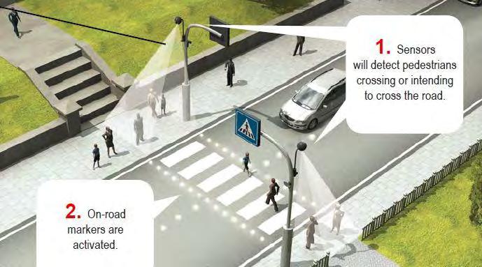
51 DES PERES AVENUE East-Side Greenway Intersection at Forest Park Parkway Painted crosswalk interim strategy for improved intersection safety New bridge for long term connectivity. Bridge will be a phased future option Improved Pedestrian lighting, visibility, timing Entrance Gates Painted Intersection + Pedestrian Bridge + Pedestrian Lighting

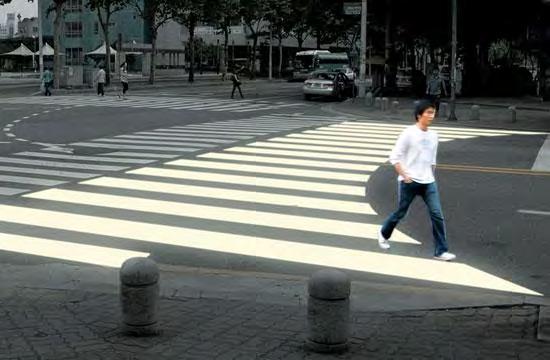
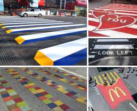
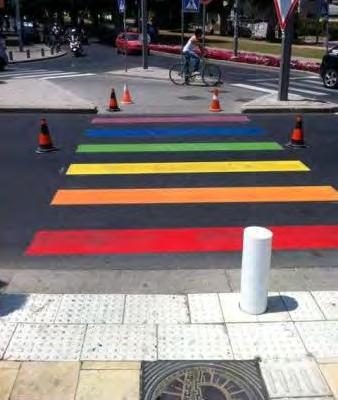

52 Improved Crosswalk Examples

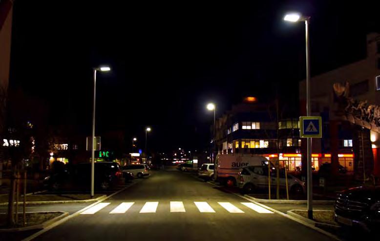

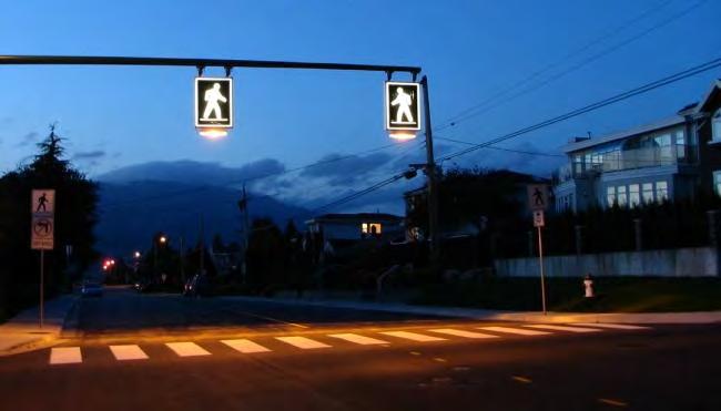
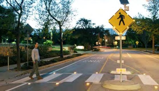
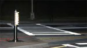
53 Improved Pedestrian Lighting


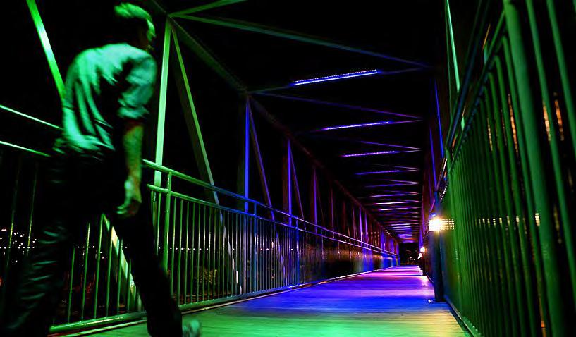
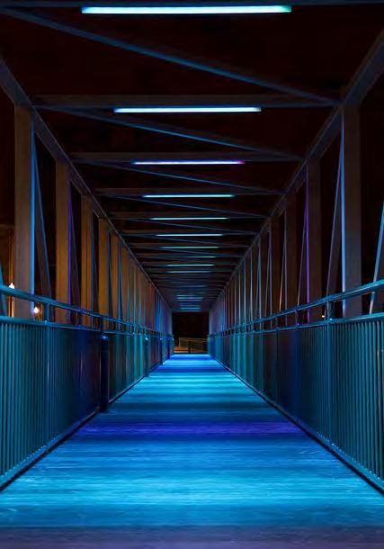
54 Lit Pedestrian Bridge Examples

55 Entrance Marker Examples

56 DEMAR LOOP TOD Redevelopment District Wabash Station as MetroLink Entrance Smaller Transit Plaza Across from Wabash Station Mixed-use building at DeGiverville Development on west side Des Peres from Delmar to Four Corners Infill Mixed-use & Residential Infill on north side of Delmar east of Hodiamont Reconfigured streets North of Delmar Structured Parking on Enright Bus traffic integrated into Structured Parking 1 1 2

57 DEMAR LOOP TOD Redevelopment District EXISTING CONDITIONS 1: West of MetroLink
 : Loop Trolley + Redevelopment + Streetscape")
58 DEMAR LOOP TOD Redevelopment District PROPOSED 1 (west of Metro) : Loop Trolley + Redevelopment + Streetscape
59 LUCIER PARK Community Park CITY PARKS PROTECTION CHARTER change in boundary of any park must go through a city-wide election. This approach is appropriate for a long term time frame. Delmar can only support an additional 155,000 sq. ft. of retail the Park fronting on Delmar will allow this retail to cover more blocks along the length of the street Serve needs of Skinker DeBaliviere Neighborhood and future TOD residents and visitors National Recreation and Park Association recommends 1 acre of park per 1,000 residents. Proposed Park is 4.25 Acres, and will support 4,250 people. Current Population of Skinker DeBaliviere is 4,077
60 LUCIER PARK Community Park CONSTRAINTS City Parks Protection Charter change in boundary of any park must go through a citywide election CITY PARKS PROTECTION CHARTER Any real estate, now or hereafter owned by the City or any agency or instrumentality of the City, which is principally used or held out for use as a public park, shall not be sold, leased, given away or otherwise disposed of, and shall be used only as a public park, nor shall any structure be built in any such park to accommodate activities not customarily associated with park use or outdoor recreation, unless such sale, lease, disposal, gift or structure is approved by a majority of the qualified electors voting thereon. The clerk of the board of aldermen shall certify to the board of election commissioners the intention of board of aldermen to authorize such sale, lease, disposal or change of use, together with the proposed ordinance for that purpose, to the board of election commissioners. Said board of election commissioners shall thereupon provide for submitting said proposed ordinance, in its original form, to the voters at the first election at which such submission may lawfully be had, but not less than thirty days after such certification to it by the clerk of the board of aldermen.


61 LUCIER PARK Community Park Extend Hamilton South to Kinsgbury Park moves full frontage onto Delmar Blvd. Infill mixed-use and residential development on Delmar across from park. Infill residential development adjacent to park and Hamilton School Becomes a community park with multiple uses for all ages Green connection to 4 Corners Pedestrian Bridge across MetroLink tracks 2 National Recreation and Park Association recommends 1 acre of park per 1,000 residents. Proposed Park is 4.25 Acres, and will support 4,250 people. Current Population of Skinker DeBaliviere is 4,

62 LUCIER PARK : DEMAR LOOP TOD Community Park : Redevelopment District EXISTING CONDITIONS 2: Delmar East of MetroLink

63 LUCIER PARK : DEMAR LOOP TOD Community Park : Redevelopment District PROPOSED 2: Loop Trolley + Redevelopment + Streetscape + Lucier Park

64 LUCIER PARK Community Park EXISTING CONDITIONS 3: Kingsbury Avenue
65 LUCIER PARK Community Park PROPOSED 3: Bike Lanes
66 LUCIER PARK Community Park EXISTING CONDITIONS 4: Kingsbury Bridge over MetroLink

67 LUCIER PARK Community Park PROPOSED 4: Bike Lanes + Planters

68 DES PERES AVENUE : DELMAR LOOP TOD : LUCIER PARK

69 PREFERRED OPTION PLAN DeBALIVIERE AVENUE
70 DeBALIVIERE AVENUE DeBALIVIERE TOD : METRO GARAGE

71 DeBALIVIERE AVENUE Previous Design Options DeBALIVIERE TOD OPTION 1: Infill Development OPTION 2: TOD + Transit Plaza OPTION 3: Expanded TOD OPTION 1: Infill Development OPTION 2: TOD + Transit Plaza OPTION 3: Expanded TOD


72 DeBALIVIERE AVENUE Previous Design Options DeBALIVIERE TOD OPTION 1: Infill Development OPTION 2: TOD + Transit Plaza OPTION 3: Expanded TOD Preference for Option 2: TOD + Transit Plaza Option 1: 0; Option 2: 4; Option 3: 1 No more than 3 stories for parking Like Option 3, but 2 is more realistic OPTION 2: TOD + Transit Plaza


73 DeBALIVIERE AVENUE Previous Design Options METRO GARAGE OPTION 1: Residential Infill OPTION 2: Residential Redevelopment OPTION 3: Residential Redevelopment/Senior Housing OPTION 4: Residential Redevelopment + Urban Retail OPTION 3: Residential Redevelopment/Senior Housing OPTION 2: Residential Redevelopment OPTION 1: Residential Infill OPTION 4: Residential Redevelopment + Urban Retail
74 DeBALIVIERE AVENUE Previous Design Options METRO GARAGE OPTION 1: Residential Infill OPTION 2: Residential Redevelopment OPTION 3: Residential Redevelopment/Senior Housing OPTION 4: Residential Redevelopment + Urban Retail Preference for Residential Redevelopment and Senior Housing, not retail redevelopment Option 1: 0 ; Option 2: 1 ; Option 3: 4 ; Option 4: 1 OPTION 3: Residential Redevelopment/Senior Housing OPTION 2: Residential Redevelopment Less of a priority area Support for focusing on Residential Development Support for Senior Housing
75 DeBALIVIERE AVENUE DeBALIVIERE TOD TOD + Transit Plaza 1 Zero setback infill at both DeBaliviere side and DeGiverville side of Metro Park and Ride Lot with structure parking beneath, 3-6 stories, 3 at DeGiverville Zero setback redevelopment of strip mall, 3-6 stories Redevelopment of bus turn-around site, 3-6 stories Bus turn removed New transit plaza over MetroLink tracks connects to neighborhood to west

76 DeBALIVIERE AVENUE DeBALIVIERE TOD TOD + Transit Plaza 2 Zero setback infill at both DeBaliviere side and DeGiverville side of Metro Park and Ride Lot with structure parking beneath, 3-6 stories, 3 at DeGiverville Zero setback redevelopment of strip mall, 3-6 stories Bus turn around remains in new transit plaza New transit plaza over MetroLink tracks connects to neighborhood to west

77 DeBALIVIERE AVENUE METRO GARAGE Residential Redevelopment Metro Garage redeveloped into traditional residential blocks Residential redevelopment on north side of Delmar Blvd. Redevelopment of site across from Crossroads School
78 DeBALIVIERE AVENUE DeBALIVIERE TOD : METRO GARAGE Trolley + Greenway + Redevelopment Existing Conditions
79 DeBALIVIERE AVENUE DeBALIVIERE TOD : METRO GARAGE Trolley + Greenway + Redevelopment PROPOSED: Loop Trolley

80 DeBALIVIERE AVENUE DeBALIVIERE TOD : METRO GARAGE Trolley + Greenway + Redevelopment PROPOSED: Loop Trolley + Greenway

81 DeBALIVIERE AVENUE DeBALIVIERE TOD : METRO GARAGE Trolley + Greenway + Redevelopment PROPOSED: Loop Trolley + Greenway + Redevelopment
82 DeBALIVIERE AVENUE DeBALIVIERE TOD : METRO GARAGE
Status Update (2006 vs. Now) Citizen s Advisory Committee February Plan for Prosperity
 Citizen s Advisory Committee February Plan for Prosperity") Status Update (2006 vs. Now) Citizen s Advisory Committee February 2018 Plan for Prosperity 2000 2017 2000 2017 Gardnerville Population 6,000 5,760 5746 5,500 5,000 5,067 5,550 5,165 5,394 5,412 5,250
Status Update (2006 vs. Now) Citizen s Advisory Committee February 2018 Plan for Prosperity 2000 2017 2000 2017 Gardnerville Population 6,000 5,760 5746 5,500 5,000 5,067 5,550 5,165 5,394 5,412 5,250
PLAN ELEMENTS WORKSHOP. April 5, 2016
 PLAN ELEMENTS WORKSHOP April 5, 2016 needs more housing. But there is no one-size fits-all solution. Every neighborhood has its own character. In some places, density is not only appropriate it is badly
The Lincoln Neighborhood Corridor Plan. The LiNC
 October 1, 2014 Planning Commission Study Session The Lincoln Neighborhood Corridor Plan The LiNC Purpose of Tonight s Meeting Introduction to The LiNC Review of Existing Conditions and Community Identified
University of Saskatchewan CAMPUS MASTER PLAN. Senate Meeting Preliminary Presentation. April 21, 2018 DIALOG ECS DA WATT
 University of Saskatchewan CAMPUS MASTER PLAN Senate Meeting Preliminary Presentation April 21, 2018 DIALOG ECS DA WATT project process presentation agenda Stakeholder Engagement Project Control phase1
Long Lost Allies? Walking Advocates & Business District Organizations. Matt Kazinka Lake Street Council. Shaina Brassard Seward Redesign
 Long Lost Allies? Walking Advocates & Business District Organizations Shaina Brassard Seward Redesign Rob Hanson West Broadway Business and Area Coalition Matt Kazinka Lake Street Council Jamie Schumacher
Atlanta BeltLine Subarea 3 Master Plan Update
 Atlanta BeltLine Subarea 3 Master Plan Update April 14, 2018 Workshop Meeting 1 22 miles, connecting 45 neighborhoods 22 MILES of transit 46 MILES of streetscapes and complete streets 33 MILES of urban
Urban Planning and Land Use
 Urban Planning and Land Use 701 North 7 th Street, Room 423 Phone: (913) 573-5750 Kansas City, Kansas 66101 Fax: (913) 573-5796 Email: planninginfo@wycokck.org www.wycokck.org/planning To: From: City Planning
North Fair Oaks Community Plan Summary and Information
 North Fair Oaks Community Plan Summary and Information WHAT IS THE NORTH FAIR OAKS COMMUNITY PLAN? The North Fair Oaks Community Plan is part of the San Mateo County General Plan, and establishes policies
Tyvola & Archdale Transit Station Area Plan. June 5, 2008
 Tyvola & Archdale Transit Station Area Plan Second Public Meeting June 5, 2008 Presentation Outline 1. Purpose and Process 2. Station Area Overview 3. Plan Recommendations 4. Comments Received and Proposed
TOD STATION AREA PLANNING DELMAR & FOREST PARK/ DEBALIVERE STATION
 TOD STATION AREA PLANNING DELMAR & FOREST PARK/ DEBALIVERE STATION PUBLIC WORKSHOP 1 SAINT LOUIS DEVELOPMENT CORPORATION T H E C I T Y O F S A I N T L O U I S M A Y 2 1, 2 0 1 3 C O N S U L T A N T S H3
Atlanta BeltLine. Subareas 9 & 10. Master Plan Updates. March 26, Washington Park Jamboree 1
 Atlanta BeltLine Subareas 9 & 10 Master Plan Updates March 26, 2018 Washington Park Jamboree 1 22 miles, connecting 45 neighborhoods 22 MILES of transit 46 MILES of streetscapes and complete streets 33
RESEDA - WEST VAN NUYS COMMUNITY PLAN
 RESEDA - WEST VAN NUYS COMMUNITY PLAN Executive Summary As part of the initial outreach effort, the Department of City Planning hosted two workshops for the Reseda-West Van Nuys Community Plan Area during
City of Tacoma Planning and Development Services
 Agenda Item E-1 City of Tacoma Planning and Development Services To: Planning Commission From: Elliott Barnett, Planning Services Division Subject: Tacoma Mall Regional Center Subarea Plan and EIS Meeting
Town Center (part of the Comprehensive Plan)
") Town Center (part of the Comprehensive Plan) Mercer Island Town Center Looking North (2014) In 1994, a year-long process culminated in a set of design guidelines and code requirements for the Town Center
Town Center (part of the Comprehensive Plan) Mercer Island Town Center Looking North (2014) In 1994, a year-long process culminated in a set of design guidelines and code requirements for the Town Center
International Blvd. TOD Plan Public Workshop #1
 International Blvd. TOD Plan Public Workshop #1 Add photos or project images September 21 and 22, 2010 Workshop Purpose Introduce the public to the Project Review and discuss the existing conditions analysis
NOVEMBER 2016 AARP IN ST. LOUIS & CITIZENS FOR MODERN TRANSIT PLACEMAKING STRATEGIES FOR ST. LOUIS TRANSIT DRAFT
 NOVEMBER 2016 AARP IN ST. LOUIS & CITIZENS FOR MODERN TRANSIT PLACEMAKING STRATEGIES FOR ST. LOUIS TRANSIT DRAFT SECTION 3 RECOMMENDATIONS AARP IN ST. LOUIS + CMT + ARCTURIS + THE INNIS GROUP 37 SECTION
Welcome to the Oakridge Centre Open House
 Welcome to the Oakridge Centre Open House Why is the City hosting this event? This open house is to inform you of a rezoning application submitted to the City of Vancouver to amend the existing CD-1 (Comprehensive
John M. Fleming Managing Director, Planning and City Planner. Old East Village Dundas Street Corridor Secondary Plan Draft Terms of Reference
 Report to Planning and Environment Committee To: From: Subject: Chair and Members Planning & Environment Committee John M. Fleming Managing Director, Planning and City Planner Old East Village Dundas Street
Chapter 1.0 Introduction
 Chapter 1.0 Introduction 1.1 Background The North Metro commuter rail line is part of the RTD FasTracks regional transit system expansion program to build more than 100 miles of rail transit throughout
East Central Area Plan
 East Central Area Plan Steering Committee Meeting March 8 th, 2018 CHUN Tears McFarlane House Vision Statement Development Opportunities Analysis Vision Elements 1. Equitable, Affordable and Inclusive
Silverdale Regional Center
 Silverdale Regional Center Vision for Silverdale Regional Center The Silverdale Regional Center Plan (Plan) will guide the evolution of the Silverdale Regional Center from a collection of strip malls and
Request for Proposals: Architectural/Design Guidelines
 Request for Proposals: Architectural/Design Guidelines January 11, 2017 1.0 INTRODUCTION The City of Issaquah, Washington is soliciting proposals from qualified consulting firms to lead a community conversation
Tyvola & Archdale Transit Station Area Plan. May 15, 2008
 Tyvola & Archdale Transit Station Area Plan First Public Meeting May 15, 2008 Presentation Outline 1. Purpose and Process 2. Station Area Overview 3. Plan Recommendations Vision Land Use Transportation
Stakeholders Advisory Working Groups (SAWGs) Smart Growth and TOD Land Use (#11) SAWG Meeting
 Smart Growth and TOD Land Use (#11) SAWG Meeting") Presentation - Part II Tappan Zee Bridge/I-287 Corridor Project July 21, 2010 Slide 1. David Kooris (Regional Plan Association) welcomed members of the Land Use Stakeholders Advisory Working Groups (SAWGs)
Presentation - Part II Tappan Zee Bridge/I-287 Corridor Project July 21, 2010 Slide 1. David Kooris (Regional Plan Association) welcomed members of the Land Use Stakeholders Advisory Working Groups (SAWGs)
Introduction. Chapter 1. Purpose of the Comprehensive Plan Plan Organization Planning Process & Community Input 1-1
 Chapter 1 Introduction Lakewood 2025: Moving Forward Together Purpose of the Comprehensive Plan Plan Organization Planning Process & Community Input 1-1 Purpose of the Comprehensive Plan The Comprehensive
Ivywild On The Creek PRELIMINARY CREEK DISTRICT MASTER PLAN
 Ivywild On The Creek PRELIMINARY CREEK DISTRICT MASTER PLAN Introduction: Rejuvenating an extraordinary Creekside neighborhood THE CREEKSIDE DISTRICT The Ivywild On The Creek Neighborhood District Master
Lehigh Acres Land Development Regulations Community Planning Project
 Lehigh Acres Land Development Regulations Planning Effort Summary In July, 2010 Commissioner Frank Mann invited the Lehigh Acres community to start discussing how to achieve their recently adopted community
Complete Neighbourhood Guidelines Review Tool
 Complete Neighbourhood Guidelines Review Tool Prepared By: City of Regina Planning Department October 2014 Page 1 of 14 Community Development Review Checklist for Secondary Plans and Concept Plans The
BROOKLYN PARK / 85TH AVE LRT STATION CDI DEVELOPMENT GUIDELINES DRAFT
 August 2018 Page intentionally left blank The Brooklyn Park Library adjacent to the 85th Ave LRT Station Area. OVERVIEW The Blue Line LRT Extension / Bottineau corridor offers a unique opportunity to leverage
JANUARY 19, 2011 CENTRAL AVENUE-METRO BLUE LINE TRANSIT-ORIENTED DEVELOPMENT IMPLEMENTATION PROJECT COMMUNITY FORUM
 CENTRAL AVENUE-METRO BLUE LINE TRANSIT-ORIENTED DEVELOPMENT IMPLEMENTATION PROJECT COMMUNITY FORUM JANUARY 19, 2011 THE MARYLAND-NATIONAL CAPITAL PARK AND PLANNING COMMISSION PRINCE GEORGE S COUNTY PLANNING
Implementation Guide Comprehensive Plan City of Allen
 Implementation Guide 2030 Comprehensive Plan City of Allen DRAFT 2015 Implementation Guide Allen 2030 Comprehensive Plan INTRODUCTION The Comprehensive Plan serves as a guide for the growth and development
Citizen Advisory Group Meeting 5: Land Use April 14, 2011
 Citizen Advisory Group Meeting 5: Land Use April 14, 2011 Meeting Agenda 1. Background Review 2. Transportation Follow-up 3. PED Overlay Approach 4. Land Use Mapping 5. Group Exercise 6. Wrap-up and Next
Shared Principles and Emerging Plan Directions
 Shared Principles and Emerging Plan Directions Introduction Since the Fairfield Neighbourhood planning process launched in June 2016, we have heard from many residents, businesses, groups and other people
Danvers High Street I-1 District Study
 Danvers High Street I-1 District Study Presentation of Final Recommendations Planning Board Presentation June 26 th, 2018 1 Introductions Metropolitan Area Planning Council Sam Cleaves AICP, Principal
3.1 community vision. 3.3 required plan elements
 Chapter 3 Community Form 3.1 community vision 3.2 Parks & landscaping concepts 3.3 required plan elements D R A F T 20 Community Form Chapter 3 3.0 Community form 3.1 community vision The Specific Plan
Robbinsdale LRT Station. CDI Development Guidelines. August Overview
 Robbinsdale LRT Station August 2018 Overview The City of Robbinsdale may have the coolest opportunity site along the 13 mile stretch of the Bottineau LRT corridor / Blue Line extension. Located a block
SUMMERSIDE / MT. CARMEL REINVESTMENT CORRIDOR COMMUNITY DEVELOPMENT STRATEGY
 SUMMERSIDE / MT. CARMEL REINVESTMENT CORRIDOR COMMUNITY DEVELOPMENT STRATEGY FEBRUARY 2013 I. Location of the Summerside/Mt. Carmel Reinvestment Corridor The Summerside/Mt. Carmel Reinvestment Corridor
East Central Area Plan
 East Central Area Plan Steering Committee Meeting January 10 th, 2019 Tears-McFarlane House Community Room East Central Area Plan Steering Committee Meeting January 10 th, 2019 CHUN Tears-McFarlane House
WELCOME and introduction
 1 WELCOME and introduction Mobility Hub Locations within Burlington STUDY OVERVIEW STUDY OBJECTIVES The City of Burlington is developing four Area Specific Plans, one for each of Burlington s Mobility
Whitemarsh Comprehensive Plan Update: Housing & Land Use. Public Workshop #3: September 20, 2018
 Whitemarsh Comprehensive Plan Update: Housing & Land Use Public Workshop #3: September 20, 2018 Agenda Welcome Process Recap What We ve Heard The Plan Framework Review of Recommended Actions Land Use Housing
MAIN STREET ECONOMIC DEVELOPMENT STRATEGY
 MAIN STREET ECONOMIC DEVELOPMENT STRATEGY A PATHWAY TO A BETTER POUGHKEEPSIE DRAFT Working Paper #2: Planning Strategies Submitted December 1 st, 2015 to the City of Poughkeepsie LAND USE LAW CENTER PACE
2.0 THE PLATINUM TRIANGLE VISION
 2.0 THE PLATINUM TRIANGLE VISION The envisions an exciting future for the area surrounding Angel Stadium of Anaheim, the Honda Center and The Grove of Anaheim. 2.1 Planning Principles In order to further
City of Farmington. Downtown Plan. Amendment to the 1998 Master Plan Adopted October 11, 2004
 City of Farmington Amendment to the 1998 Master Plan Adopted October 11, 2004 Introduction Planning Background 1 Scope and Components of the Plan Amendment 2 Concept Introduction 3 Plan Concepts 3 Conceptual
4.1.3 LAND USE CATEGORIES
 4.1.3 LAND USE CATEGORIES a. City Center District The City Center District incorporates the existing character and mix of uses in downtown Belmont to encourage redevelopment and new development in keeping
The Five Components of the McLoughlin Area Plan
 The Five Components of the McLoughlin Area Plan This documents contains the complete language of the five components of the McLoughlin Area Plan: The Vision Statement The Values The Guiding Principles
This Review Is Divided Into Two Phases:
 Semiahmoo Town Centre Review The purpose of this review: To review the Semiahmoo Town Centre Concept Plan, originally approved in 1993, to ensure that this centre will continue to serve the needs of South
Coatesville Station Area Planning Work in Progress Meeting, August 19, 2010 STATION AREA PLANNING WORK IN PROGRESS PRESENTATION
 COATESVILLE STATION AREA PLANNING WORK IN PROGRESS PRESENTATION Summarize Project Approach and Schedule Discuss What We ve Heard So Far Present Strategies Get Your Feedback On Design Options Tonight s
City of Fort Lauderdale UPTOWN URBAN VILLAGE. Public Workshop December 7, 2016
 Public Workshop December 7, 2016 Workshop Agenda Introductions Project Presentation o o o History Project Scope/Timeline Character of Study Area o o o o Land Use Public Realm/Pedestrian Mobility Multimodal
ROBBINSDALE LRT STATION CDI DEVELOPMENT GUIDELINES
 August 2018 OVERVIEW The City of Robbinsdale has a prime-opportunity site in the middle of the 13 mile stretch of the Bottineau LRT corridor / Blue Line extension. Robbinsdale offers a prominent, vital,
Animating the Rideau Canal December 2013
 Executive Summary Animating the Rideau Canal December 2013 Why study the Rideau Canal? The Rideau Canal has been an important part of Ottawa throughout its history, and has shaped and been shaped by the
MONTGOMERY COUNTY METRO STATION AREA DESIGN CHARRETTE
 MONTGOMERY COUNTY METRO STATION AREA DESIGN CHARRETTE Shady Grove Metro Station Area Charrette Closing Presentation October 25-28, 2000 MONTGOMERY COUNTY, MD M-NCPPC Design Collective, Inc. Architects
Port Credit Local Advisory Panel October 20 th Meeting
 Port Credit Local Advisory Panel October 20 th Meeting Focus Of This Evening s Meeting: 1. Hurontario Main Street Higher Order Transit Study 2. Port Credit Mobility Hub & GO Station Parking Structure Study
In surveys, Dallas residents say what they want to change most
 NEIGHBORHOODS ELEMENT In surveys, Dallas residents say what they want to change most in the city is its appearance they want it to look beautiful, with trees and pedestrian-friendly neighborhoods. The
Gold Line Bus Rapid Transit Transit Oriented Development (BRTOD) Helmo Station Area Plan
 Helmo Station Area Plan") Appendix F Gold Line Bus Rapid Transit Transit Oriented Development (BRTOD) Helmo Station Area Plan Introduction and Purpose of the Plan The Gold Line Bus Rapid Transit facility is an eleven-mile dedicated
Appendix F Gold Line Bus Rapid Transit Transit Oriented Development (BRTOD) Helmo Station Area Plan Introduction and Purpose of the Plan The Gold Line Bus Rapid Transit facility is an eleven-mile dedicated
b r a n c h av e n u e tr a n s it co r r i d o r r e vita lization pl a n a m o d el fo r s u b u r ban retro fit
 b r a n c h av e n u e tr a n s it co r r i d o r r e vita lization pl a n a m o d el fo r s u b u r ban retro fit P R I N C E G EO RG E S CO U NT Y, M D ADO PTED 0 p R O J E C T C AT E G O R Y : U R B
The University District envisions, in its neighborhood
 Envisioning the University District Link Light Rail in Seattle s neighborhoods CIY OF SEALE CONCEP-LEVEL SAION AREA PLANNING RECOMMENDAION RESOLUION # 30165 EXHIBI L Vision 08.2000 he University District
ARLINGTON COUNTY, VIRGINIA
 ARLINGTON COUNTY, VIRGINIA County Board Agenda Item Meeting October 15, 2005 DATE: September 28, 2005 SUBJECT: Request to Advertise the adoption of the 2005 Clarendon Sector Plan C. M. RECOMMENDATION:
Transportation. Strategies for Action
 Transportation A major priority for the Overlake Neighborhood is to develop a multimodal transportation system. To achieve this system, a balance has to be found among travel, circulation and access needs;
Don Mills Crossing Study and Celestica Lands Development Application Community Meeting, Open House, and Breakout Discussions
 Consultation Summary Don Mills Crossing Study and Celestica Lands Development Application Community Meeting, Open House, and Breakout Discussions This report is not intended to provide a verbatim transcript
DOMINION BOULEVARD CORRIDOR STUDY AND ECONOMIC DEVELOPMENT STRATEGIC PLAN A MODEL FOR CHESAPEAKE S FUTURE
 DOMINION BOULEVARD CORRIDOR STUDY AND ECONOMIC DEVELOPMENT STRATEGIC PLAN A MODEL FOR CHESAPEAKE S FUTURE Overview I. Draft Plan Process II. Draft Plan Overview a. Market Analysis b. Master Land Use Plan
Welcome. Walk Around. Talk to Us. Write Down Your Comments
 Welcome This is an information meeting introducing the applications for proposed redevelopment of the Yorkdale Shopping Centre site at 3401 Dufferin Street and 1 Yorkdale Road over the next 20+ years,
CHAPTER 8 ISSUES, CONCERNS, CONSTRAINTS AND OPPORTUNITIES
 CHAPTER 8 ISSUES, CONCERNS, CONSTRAINTS AND OPPORTUNITIES Introduction This River Conservation Plan was developed during a time of tremendous activity and effort in planning the transformation of the Delaware
Scope of Services. River Oaks Boulevard (SH 183) Corridor Master Plan
 Corridor Master Plan") Scope of Services River Oaks Boulevard (SH 183) Corridor Master Plan PROJECT AREA The project area consists of the River Oaks Boulevard (SH 183) corridor bounded by SH 199 at the northern end and the Trinity
Scope of Services River Oaks Boulevard (SH 183) Corridor Master Plan PROJECT AREA The project area consists of the River Oaks Boulevard (SH 183) corridor bounded by SH 199 at the northern end and the Trinity
Planning for TOD Implementation at a Corridor Scale
 Planning for TOD Implementation at a Corridor Scale Catherine Cox Blair, Reconnecting America Presentation to Northwest Corridor Working Group November 6, 2013 What is Reconnecting America? Reconnecting
DRAFT. 10% Common Open Space
 % OF CHARLOTTE IS CATEGORIZED AS A. LAND USES : Placeholder map displaying location of Place Type GOALS: Accommodate XX% of future growth. Provide a concentration of primarily commercial and civic activity
8implementation. strategies
 PROGRAM STRATEGIES 8implementation strategies T he implementation actions of this chapter are designed to support and carry out the land use, economic development, transportation, urban design, and program
The Cambie Corridor 2015 Fall workshop series. What we heard WORKSHOP OUTLINE
 The Cambie Corridor 2015 Fall workshop series W 16 AVE Area 5 CAMBIE CORRIDOR Phase 3 What we heard ovember 21, 2015, 9am-noon, 1:30-4:30pm Peretz Centre 89 Participants* WORKSHOP OUTLIE Introductions
4- PA - LD - LIVELY DOWNTOWN. LD - Background
 4- PA - LD - LIVELY DOWNTOWN LD - Background The downtown has been the service centre for the community since the city s inception and the area continues to supply people with their personal services,
Chapter 1: Introduction
 Chapter 1: Introduction The Penn Avenue Community Works Corridor Vision and Implementation Framework presents an integrated communitybased vision and a coordinated, long-term implementation framework for
ELK GROVE GENERAL PLAN VISION
 2-1 CHAPTER 2: 2-2 CREATING OUR The Community Vision for Elk Grove, expressed through a Vision Statement and a series of Supporting Principles, is a declaration of the kind of community that Elk Grove
Planning Board Briefing
 Planning Board Briefing Why Now? The Sector Plan Implementation Chapter States: Before Stage 1 begins, the following must occur: Approval of the Sectional Map Amendment. Approval of the Greater Lyttonsville
South Davis County COMMUNITY SPOTLIGHT
 South Davis County COMMUNITY SPOTLIGHT Davis/SLC Community Connector Bus Rapid Transit line connecting SLC & Davis County RTP Phase 1 Project Generate 3,100 average weekday riders Relieve congestion on
Route 1 Corridor Study
 Route 1 Corridor Study Westbrook, Connecticut A Vision for the Connecticut Shoreline Public Informational Meeting July 28, 2015 Lower Connecticut River Valley Council of Governments Fitzgerald & Halliday,
Northwest commuter rail station US 36 BRT. Westminster Station
 Northwest commuter rail station Westminster Station US 36 BRT Westminster Center US 36 & Church Ranch Broomfield Flatiron/96 th St. US 36 & McCaslin Table Mesa Boulder Junction 13-month effort that will
ELMVALE ACRES SHOPPING CENTRE MASTER PLAN
 ELMVALE ACRES SHOPPING CENTRE MASTER PLAN Contents 1.0 INTRODUCTION... 2 2.0 LOCATION... 2 3.0 EXISTING CONTEXT... 2 4.0 VISION & GUIDING PRINCIPLES... 2 5.0 LAND USE AND BUILT FORM... 4 5.1 St. Laurent
38 Queen s University Campus Master Plan Part 1
 38 Queen s University Campus Master Plan Part 1 46 The Campus at the City Scale Chapter 4 The Campus at the City Scale 39 Queen s is an urban University centrally located in Kingston. Decisions made by
1 October Dear Citizens of Charlotte and Mecklenburg County,
 1 October 2011 Dear Citizens of Charlotte and Mecklenburg County, As co-chairs of the Center City 2020 Vision Plan Steering Committee, we are proud to present the Center City 2020 Vision Plan, which sets
A BLUEPRINT FOR BROCKTON A CITY-WIDE COMPREHENSIVE PLAN
 A BLUEPRINT FOR BROCKTON A CITY-WIDE COMPREHENSIVE PLAN Public Meeting October 2016 1 Plan Summary and Discussion Public Meeting May 4 2017 City of Brockton Bill Carpenter, Mayor Department of Planning
URBAN DESIGN BRIEF. 2136&2148 Trafalgar Road. Town of Oakville
 URBAN DESIGN BRIEF 2136&2148 Trafalgar Road Town of Oakville Prepared By: METROPOLITAN CONSULTING INC For 2500674 Ontario Inc November 2016 TABLE OF CONTENTS Page No. 1.0 Introduction/Description of Subject
Small Area Plan. South Gateway
 Small Area Plan Adopted May 12, 2008 South Gateway Purpose. The South Gateway Small Area Plan defines the City s expectations for the future of the southern entrance to the City at Interstate 85 and Highway
REQUEST Current Zoning: O-15(CD) (office) Proposed Zoning: TOD-M(CD) (transit oriented development mixed-use, conditional)
 (office) Proposed Zoning: TOD-M(CD) (transit oriented development mixed-use, conditional)") Rezoning Petition 2016-117 Zoning Committee Recommendation January 4, 2017 REQUEST Current Zoning: O-15(CD) (office) Proposed Zoning: TOD-M(CD) (transit oriented development mixed-use, conditional) LOCATION
Rezoning Petition 2016-117 Zoning Committee Recommendation January 4, 2017 REQUEST Current Zoning: O-15(CD) (office) Proposed Zoning: TOD-M(CD) (transit oriented development mixed-use, conditional) LOCATION
LUNDY S LANE COMMUNITY IMPROVEMENT PLAN STUDY
 PUBLIC INFORMATION MEETING #2 October 12, 2016 LUNDY S LANE COMMUNITY IMPROVEMENT PLAN STUDY AGENDA 5:00 to 5:30pm: Open House 5:30 to 6:15pm: Presentation 6:15 to 7:00pm: Individual paced workshop with
Today Land & People. Northeast Nampa Gateway District. Employment. Land Use Characteristics. Demographics. Current Zoning
 Today Land & People Employment Major employers include Saint Alphonsus, the College of Western Idaho, the Auto Mall, Sorrento Lactalis and Walmart. 3,004 jobs in 2010 (COMPASS-CIM 2040 TAZ data) 4,345
Study Area. Capitol Way. Greening America s Capitals 11/13/2014. A Greening America s Capitals Project
 Olympia, WA: Greening Capitol Way Supporting Communities move towards sustainability is a priority for the federal government. A Greening America s Capitals Project Office of Sustainable Communities U.S.
CITY OF CHARLOTTESVILLE, VIRGINIA CITY COUNCIL AGENDA
 CITY OF CHARLOTTESVILLE, VIRGINIA CITY COUNCIL AGENDA Agenda Date: December 16, 2013 Action Required: Adoption of Resolution Presenter: Staff Contacts: Title: James E. Tolbert, AICP, Director of NDS James
WHAT WE HEARD REPORT - Summary Bonnie Doon Mall Redevelopment Application (LDA )
") WHAT WE HEARD REPORT - Summary Bonnie Doon Mall Redevelopment Application (LDA18-0184) PROJECT ADDRESS: 1 Bonnie Doon Shopping Centre NW, 8420 85 Street NW & 8715 85 Street NW PROJECT DESCRIPTION: Rezoning
WHAT WE HEARD REPORT - Summary Bonnie Doon Mall Redevelopment Application (LDA18-0184) PROJECT ADDRESS: 1 Bonnie Doon Shopping Centre NW, 8420 85 Street NW & 8715 85 Street NW PROJECT DESCRIPTION: Rezoning
Making TOD Work in the Heart of Suburban Sprawl
 Making TOD Work in the Heart of Suburban Sprawl Rocky Mountain Land Use Institute March 6, 2009 Speakers Ben Herman, FAICP, Principal Clarion Associates Darcie White, AICP, Principal Clarion Associates
Building Great Neighbourhoods. Strathcona
 Building Great Neighbourhoods Strathcona March 21, 2018 Becky Redford Project Manager, Planning & Design Building Great Neighbourhoods Integrated Infrastructure Services Welcome and Purpose To provide
K. SMART ASSOCIATES LIMITED
 Planning Justification Report Zoning By-Law Amendment 185 King Street North Waterloo, Ontario April 7th, 2017 Project Reference Number 16-245 K. SMART ASSOCIATES LIMITED CONSULTING ENGINEERS AND PLANNERS
ULI St. Louis Technical Assistance Panel
 ULI St. Louis Technical Assistance Panel ULI St. Louis Technical Assistance Panel Sponsored by: Citizens for Modern Transit in partnership with METRO ULI St. Louis Mission Statement The mission of the
City of Hermosa Beach Administrative Policy #
 City of Hermosa Beach Administrative Policy # SUBJECT: Living Streets Policy Date: Approved by: City Council Authority: Public Works Department & Community Development Department Mayor, PURPOSE The City
DRAFT. October Wheaton. Design Guidelines
 October 2011 DRAFT Wheaton Design Guidelines 2 Draft - Design Guidelines - Wheaton Sector Plan Contents 04 Section 1: Introduction 06 Section 2: Context 08 Section 3: Design Guidelines 09 Goal 1: Create
Tonight s Agenda. Summary Presentation Open House. Group Discussion Next Steps: online community wide survey
 Community Open House February 22, 2018 Tonight s Agenda Summary Presentation Open House Station 1: Project Overview and Community Input Station 2: Draft Vision and Guiding Principles Station 3: Western,
Wasatch CHOICE for 2040
 Wasatch CHOICE for 2040 Economic Opportunities We Can Choose a Better Future We enjoy an unparalleled quality of life along the Wasatch Front. People from all over the world are drawn to our stunning scenery,
Downtown Whitby Action Plan
 Downtown Whitby Action Plan Final Report October 2016 Table of Contents Introduction 1 Public Consultation 2 Walkability 3 Downtown Whitby Walkability Map 4 Vision 5 Goal & Objectives 6 Objective 1 7 Objective
Subareas 9 & 10 Master Plan Updates
 Atlanta BeltLine Subareas 9 & 10 Master Plan Updates Study Group Meeting 4 September 17, 2018 Washington Park Jamboree 1 22 miles, connecting 45 neighborhoods 22 MILES of transit 46 MILES of streetscapes
Corridor Vision. 1Pursue Minnehaha-Hiawatha Community Works Project. Mission of Hennepin County Community Works Program
 1Pursue Minnehaha-Hiawatha Community Works Project Minnehaha-Hiawatha Community Works is a project within the Hennepin Community Works (HCW) program. The mission of the HCW program is to enhance how the
FULL WORKING GROUP MEETING
 11/06/17 FULL WORKING GROUP MEETING Excelsior and Outer Mission Neighborhood Strategy Rachael A. Tanner, Planning Department 11/06/2017 Jorge Rivas Jr., Office of Economic and Workforce Development CONTENTS
Chapter 4. Linking Land Use with Transportation. Chapter 4
 Chapter 4 Linking Land Use with Transportation Chapter 4 59 Chapter 4 Linking Land Use with Transportation Community Design and Transportation Program Introduction Since the 1950s, the predominant development
hermitage town center
 hermitage town center A Community Vision prepared by Strada for The City of Hermitage and The Mercer County Regional Planning Commission January 2007 table of contents introduction 3 design principles