Proposed Major Institution Master Plan Street Vacation. March 19, 2009
|
|
|
- Alexander Washington
- 5 years ago
- Views:
Transcription


1 Presentation to Seattle Design Commission Proposed Major Institution Master Plan Street Vacation March 19,
2 Why We Need to Grow More children surviving with chronic disease increasing the demand for specialized care Infection control considerations Single occupancy rooms Family centered care In February 2008, our average occupancy was 88%; the national pediatric average is 65%. One day in March, 254 of our 250 beds were full, putting the hospital over 100% capacity A need for 180 new beds within the next five years and a total t of 500 to 600 beds in 20 years 2

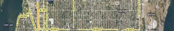


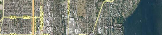


3 Location/Neighborhood Context Magnuson Park Ravenna Bryant I U Village Seattle Children s UW Talaris Laurelhurst N


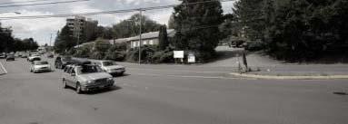
4 Laurelon Terrace Laurelon Terrace Condominium owners have consented to the sale to Seattle Children s of the entire 6.7 acre site comprising 136 units. On September 8, 2008 the Seattle Landmarks Preservation Board denied the nomination of Laurelon Terrace as a historic landmark. 40 th Ave NE NE 46 th St Seattle Children s has committed $5 million to housing replacement and will work with the City s Office of Housing to ensure comparable replacement in NE Seattle for 136 units. NE 46 th Street and 41 st Ave. NE were built in the 1940 s to support the then new Laurelon Terrace development. NE 45 th St 4


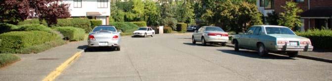
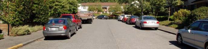
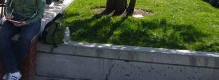
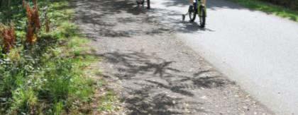
5 Laurelon Terrace 40 th Ave NE looking NE 46 th Street Looking east from 40 th Ave NE Looking SE on 41 st Ave NE Looking east on NE 46 th street 5
6 MIM Proposed Boundaries Site NE 50 th St th Ave NE 44 t Hartmann NE 47 th St 1.7 acres E 6.7 acres 21.7 acres N 40 th Ave N NE 46 th St Laurelon Terrace NE 45 th St Children s Hospital Campus 45 th Ave 6
7 MIM Pedestrian Boundaries Access Existing Existing Signal & Crosswalk NE 50 th St th Ave NE 44 t NE 47 th St Existing Signal & Crosswalk E 40 th Ave N Laurelon Terrace Seattle Children s Campus 45 th Ave N NE 45 th St 7
8 MIM Vehicle Boundaries Access Existing Penny Drive Access NE 50 th St Fire Access 44 th Ave NE Parking Access Emergency & Ambulance Access NE 47 th St E 40 th Ave N Laurelon Terrace Seattle Children s Campus 45 th Ave N NE 45 th St 8
9 MIM Transit Boundaries Existing Metro Bus Stop NE 50 th St th Ave NE 44 t NE 47 th St Metro Bus Stop N Metro Bus Stop E 40 th Ave N Laurelon Terrace Metro Bus Stop NE 45 th St Seattle Children s Campus 45 th Ave Metro Bus Stop 9
10 Proposed Final Master Plan SAND POINT WAY NE N 10


11 Elevation: Looking North from NE 45th St EL th Ave NE Laurelon Terrace EL 46 Seattle Children s Hospital EL 152 Hartmann 40 th Ave NE Highest point 1953 Building Key: N 11
12 FMP Proposed MIO HEIGHTS FMP MIO Heights EL 99 NE 50TH STREET EL 155 E 44TH AVENUE NE EL 82 EL 60 EL 156 NE 47TH STREET EL 57 EL 172 EL 92 EL 64 E NE 40TH AVENUE 45TH AVENUE NE N EL 46 NE 45TH STREET EL
13 Pedestrian Access Proposed NE 50 TH ST 40 TH AVE NE Improved Signal & Crosswalk 44 TH AVE NE Trail Access Proposed Signal & Crosswalk NE 47 TH ST 45 TH AVE NE NE 45 TH ST Existing Signal & Crosswalk 13
14 Vehicle Access Proposed 40 TH AVE NE Penny Drive Access NE 50 TH ST Fire Access 44 TH AVE NE NE 47 TH ST Parking Access Emergency & Ambulance Access Parking Access NE 45 TH ST 45 TH AVE NE 14
15 Transit Proposed NE 50 TH ST Proposed Transit Hub 40 TH AVE NE 44 TH AVE NE NE 47 TH ST Metro Bus Stop NE 45 TH ST 45 TH AVE NE Metro Bus Stop 15
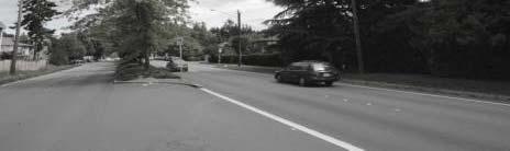
16 Sand Point Way NE: East NE 50 TH ST NE 47 TH ST 40 TH AVE N E 44 TH AV E NE 45 TH AVE NE N NE 45 TH ST 16
17 Sand Point Way NE: Street Frontage MIO Height/Setback Profile Key: Sand Point Way NE 100 ROW 17


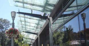
18 Sand Point Way NE: Street Frontage HIGHLIGHTS Transit Oriented Pedestrian-Friendly Retail Urbanized Streetscape Portal Connector to Garden Campus Safe Connection to Burke- Gilman Trail Roof Terraces / Campus Pathway Connections Glazed Overhead Weather Protection Safe Sand Point Way NE Crossing / Traffic Mitigation 18


19 Sand Point Way NE: Street Frontage View looking NE on Sand Point Way NE 19
20 Sand Point Way NE: West NE 50 TH ST NE 47 TH ST 40 TH AVE N E 44 TH AV E NE 45 TH AVE NE N NE 45 TH ST 20
21 Hartmann: Street Frontage Key: MIO Height/Setback Profile 21
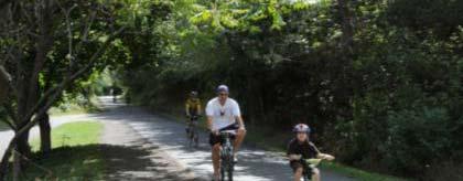
22 Hartmann: Trail Connection 82 Burke-Gilman Trail Sand Point Way NE 100 ROW 60 Key: Burke Gilman Trail Connection 22


23 Hartmann: Street Frontage HIGHLIGHTS Transit Oriented Pedestrian-Friendly Fi dl Amenities Urbanized Streetscape Preserve Redwood Grove Portal Connector to Garden Campus Safe Connection to Burke- Gilman Trail Roof Terraces / Campus Pathway Connections Glazed Overhead Weather Protection Safe Sand Point Way NE Crossing / Traffic Mitigation 23


24 Hartmann: Street Frontage View looking West to Hartmann Property & Burke-Gilman Trail 24
25 40th Avenue NE: Garden Edge NE 50 TH ST 44 TH AV E NE NE 47 TH ST 45 TH AVE NE 40 TH AVE N E N NE 45 TH ST 25
26 40th Avenue NE: Garden Edge Key: MIO Height/Setback Profile 26


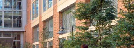
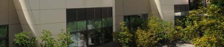
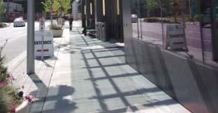
27 40th Avenue NE: Garden Edge Examples HIGHLIGHTS Green Street Auto / Pedestrian Entrance / ER Parking Structure with Landscaped Screening Elements Building Terracing Pedestrian Amenities Landscaped Building Setbacks Transition from Sand Point Way NE frontage and NE 45 th Street Buffer 27
28 40th Avenue NE: Garden Edge View looking N on 40 th AVE NE 28
29 E NE Garden Edge Buffers NE 50 TH ST NE 47 TH ST 40 TH AVE N E 44 TH AV 45 TH AVE NE N NE 45 TH ST 29


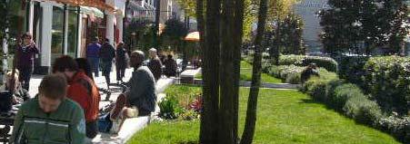
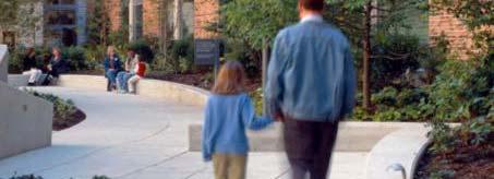
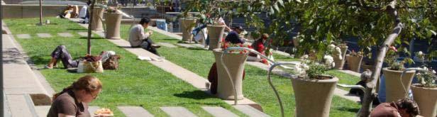
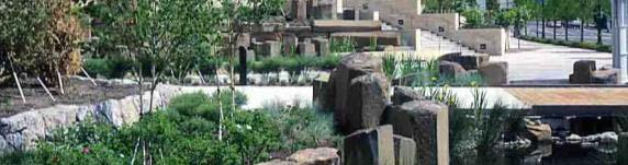
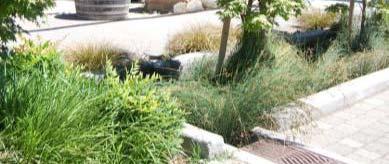
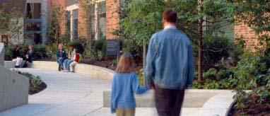
30 NE 45 th Street: Garden Edge Buffers HIGHLIGHTS Landscape Buffers Storm water Features Sunny Open Space / Roof Terrace Pocket Parks within Landscape Buffer Campus Pathway Connections Residential Friendly Entry Campus Pedestrian Connections 30
31 NE 45 th Street: Garden Edge View looking NE from 40 th Ave NE and NE 45 th Street 31
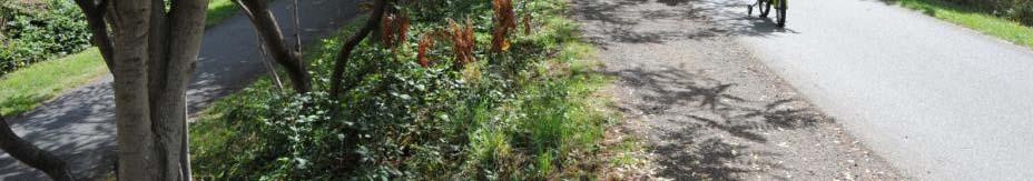
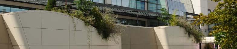
32 Design Guidelines 1. The physical appearance of the hospital campus, to the extent practicable, should fit in with the materials, colors and textures of the neighborhood. 2. Sand Point Way NE should be improved and developed as the front door of the medical campus. 3. Sand Point Way NE should be enhanced with an active street front in support of transit use. The street front program may include hospital functions open to and/or visible from the street (lobbies, waiting areas, conference spaces and food service) and sales and service uses serving the hospital and neighborhood. 4. Buildings within the Major Institution Overlay boundary should be related to one another to form a continuous and cohesive environment. 5. Development withinthemajorthe InstitutionOverlay boundary should respond, to the extent practicable, to the scale and character of adjacent neighborhood areas. 6. Circulation on the hospital campus should provide clear and orderly access to and through the campus. 7. The hospital campus should be coordinated with and respond, to the extent practicable, to the local neighborhood structure. 8. Healing landscape environments in support of patient recovery should be developed withinthehospitalcampusthe hospital campus. 9. Some hospital campus gardens, courtyards and plazas should be accessible to the neighborhood and be an extension of the neighborhood open space system. 32
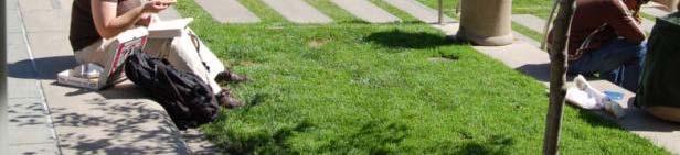
33 Open Space Laurelon Terrace Existing Open Space Site Area 288,134 SF Structures Streets Parking lots 62,644 SF 41,916 SF 42,063 SF Open Space 141,511 SF (49%) Laurelon Terrace Open Space under Proposed Master Plan Site Area 288,134 SF Structures 224,120 SF Driveways 11,600 SF Accessible Roof Garden 82,770 SF Open Space 135,184 SF (47%) Seattle Children s Total Campus Open Space Commitment is 41% 34
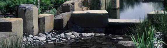
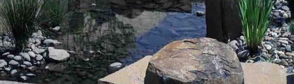
34 Garden Edges Winter view of the Sand Point Way NE buffer in front of the parking garage 35
35 Garden Edges NE 50 th Street Buffer 36
36 Garden Edges NE 45 th Street Buffer 37

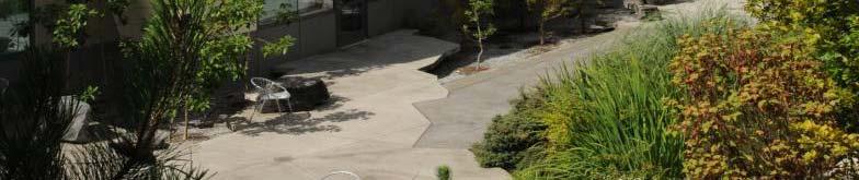
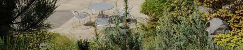
37 Gardens This is the Ambulatory Care Building Courtyard, showing the roof gardens 38
38 Gardens 39
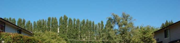
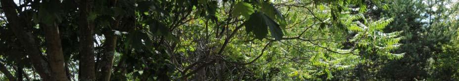
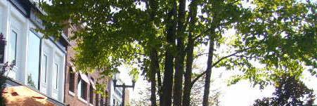
39 Landscape Existing Trees at Laurelon Terrace 40
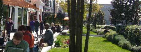
40 Landscape Northward view on Sand Point Way NE at Laurelon Terrace 41
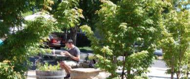
41 Landscape Sequoias on Hartmann Site seen from Roof of Seattle Children s 42
42 Sustainability Guidelines 1. Adopt 2030 Challenge reduction in green House Gas Emissions for new construction. 2. Reduce BTU per square foot energy use of new building area over existing. 3. Generate renewable energy on site. 4. Supply building s energy use purchase form off site renewable green power sources. 5. Use Green Roof coverage. 6. Purchase wood products used from certified sustainable forests. 7. Increase the number of employees using alternatives to driving to work alone. 8. Continue to support visitors to use alternative transportation, e.g., transit, walking, shuttles, etc.. 9. Reduce construction waste; maintain high levels of demolition reuse and/or recycling. 10. Employ operational recycling, solid waste diversion. 11. Reduce potable water usage. 12. Use locally sourced building materials. 13. Purchase environmentally preferred, low V.O.C. products. 43
43 Public/Community Benefit Mobility Improvements Connections to Burke Gilman trail. Pd Pedestrian ti safety ft Place Making, Street Amenities, Transit Hub Environmental Improvements Open Space, accessible to public, patients and staff Sustainable Design and Operations Tree Preservation Education Garden Tours Sustainability Tours and Signage Mobility Options Pediatric Care Increased Programs for Public Outreach and Education Increase in Uncompensated Care for Families Unable to Pay 44


44 Public/Community Benefit
IV. Development Standards
 IV. Development Standards Seattle Children s proposes development standards to govern physical development within the MIO boundaries. As a supplement to the proposed development standards, Children s proposes
Garden edges provide vertical plantings to buffer the neighbors from the building facilities around the entire campus.
 Open Space Existing Open Space Children s intends to maintain the landscape as a garden around the campus to help children heal while providing spaces for visitors, caregivers, staff and neighbors. Children
CITY OF SEATTLE ANALYSIS, RECOMMENDATION AND DETERMINATION OF THE DIRECTOR OF THE DEPARTMENT OF PLANNING AND DEVELOPMENT. Seattle Children s Hospital
 City of Seattle Gregory J Nickels, Mayor Department of Planning and Development Diane Sugimura, Director CITY OF SEATTLE ANALYSIS, RECOMMENDATION AND DETERMINATION OF THE DIRECTOR OF THE DEPARTMENT OF
UNIVERSITY OF WASHINGTON MASTER PLAN SEATTLE CAMPUS
 UNIVERSITY OF WASHINGTON MASTER PLAN SEATTLE CAMPUS Approved Compiled Plan January 2003 Appoved Compiled Plan Janauary 2003 Table of Contents I. Introduction 1 The Visioning Project 3 1998 City University
The University District envisions, in its neighborhood
 Envisioning the University District Link Light Rail in Seattle s neighborhoods CIY OF SEALE CONCEP-LEVEL SAION AREA PLANNING RECOMMENDAION RESOLUION # 30165 EXHIBI L Vision 08.2000 he University District
Community Meeting of May 19, Meeting the Challenge
 Community Meeting of May 19, 2007 Meeting the Challenge Case Study Case Study: Bellevue Regional Library Case Study Case Study: Fred Hutchinson Cancer Research Case Study Case Study: Dorenbecher Children
Design Guidelines. Roosevelt. Mike Podowski DPD Design Guidelines Ordinance ATT 13 August 13, 2012 Version #1
 Roosevelt Design Guidelines The Roosevelt Neighborhood Design Guidelines apply within the Neighborhood Boundary. Map 1 2 Map 2 3 Map 3 4 CS1 Natural Systems and Site Features Citywide Guideline: Use natural
Metro. Activity Center Design Guidelines. Recommendations For Developing Focused, Mixed-Use Commercial/Residential Centers
 Metro Activity Center Design Guidelines Recommendations For Developing Focused, Mixed-Use Commercial/Residential Centers Metro Activity Centers What is a MAC? Legacy, the adopted guide for the future growth
Figure 3-1: Public Realm Plan
 3 Public Realm Figure 3-1: Public Realm Plan 3.1 Public Realm Concept The public realm concept for the Little Mountain site integrates a clear and accessible movement network with public spaces for social
FRUITVALE TRANSIT VILLAGE (Phase 2) Residential Project
 Residential Project") FRUITVALE TRANSIT VILLAGE (Phase 2) Residential Project DEVELOPER: SIGNATURE PROPERTIES ARCHITECT: HKIT ARCHITECTS April 23, 2010 TABLE OF CONTENTS 3 Vision 4 Description of Site 5 Guiding Concepts 6
FRUITVALE TRANSIT VILLAGE (Phase 2) Residential Project DEVELOPER: SIGNATURE PROPERTIES ARCHITECT: HKIT ARCHITECTS April 23, 2010 TABLE OF CONTENTS 3 Vision 4 Description of Site 5 Guiding Concepts 6
AMEND DMENT H HOSPITAL
 AMEND DMENT TO LAND USE PLAN ELEMENT VILLAGE OF RIDGEWOOD MASTER PLAN H HOSPITAL ZONE DISTRICT Village of Ridgewood Planning Board February 28, 2014with technical revisions from June 9, 2014 Planning Board
Gordon Clowers City of Seattle - Department of Planning and Development 700 Fifth Avenue, Suite 2000 PO Box Seattle, Washington
 Major Institution Master Plan Annual Report 2014 March 15, 2015 Gordon Clowers City of Seattle - Department of Planning and Development 700 Fifth Avenue, Suite 2000 PO Box 34019 Seattle, Washington 98124-4019
DESIGN GUIDELINES. Seattle Children s Major Institution Master Plan. Approved May 7, 2010
 Approved May 7, 2010 Contact: Todd Johnson, todd.johnson@seattlechildrens.org, (206)987-5259 A. MASTER PLAN... 3 A1.0 Context... 3 A1.1 Purpose of Design Guidelines... 3 A1.2 Design Guidelines... 4 B....
Gordon Clowers City of Seattle - Department of Planning and Development 700 Fifth Avenue, Suite 2000 PO Box Seattle, Washington
 Major Institution Master Plan Annual Report 2017 March 15, 2018 Gordon Clowers City of Seattle - Department of Planning and Development 700 Fifth Avenue, Suite 2000 PO Box 34019 Seattle, Washington 98124-4019
LEED-ND 101: Practical Strategies for Achieving Sustainability Goals. Travis Parker Lakewood Planning Director
 LEED-ND 101: Practical Strategies for Achieving Sustainability Goals Travis Parker Lakewood Planning Director Metro Vision Idea Exchange Oct 11, 2012 West Corridor Stations West Corridor Overview West
THE 355/270 CORRIDOR:
 THE 355/270 CORRIDOR: Strategic Ideas for Sustaining a Livable Work Place Project Summary ACCESS LIFE DESIGN HEALTH WORK Montgomery County Planning Department The Maryland-National Capital Park and Planning
Status Report: MD 355 Project
 Status Report: MD 355 Project OCTOBER 2006 M-NCPPC MONTGOMERY COUNTY PLANNING DEPARTMENT Summary of Community Comments, and break to the Results of the MD 355 Participation Session Brookside Gardens -
Gateway commercial MIXED USE MASTER SITE PLAN. CITILAND AIrDRIE GATEWAY VENTURE INC. airdrie GATEWAY COMMERCE CENTRE. airdrie, ALBERTA FEBRUARY 2012
 Gateway commercial MIXED USE MASTER SITE PLAN 1914 CENTRE STREET NORTH CALGARY, AB CANADA T2E 2S8 T. 403.264.7177 F. 403.264-7175 WWW.CITILAND.CA CITILAND AIrDRIE GATEWAY VENTURE INC. airdrie GATEWAY COMMERCE
SECTION TWO: Urban Design Concepts
 SECTION TWO: Urban Design Concepts The Gardnerville Plan for Prosperity shapes economic opportunities presented by regional growth. The Urban Design Concepts provide policies and concepts for land use,
MIXED-USE VILLAGE OVERLAY FLOATING DISTRICT
 MIXED-USE VILLAGE OVERLAY FLOATING DISTRICT Zoning regulations developed by committee to the Planning Board for the Town of DeWitt, NY Issue date: 13 July 2017 revised 3/12/2018, revised 4/26/2018, 5/9/2018
Presentation of the Staff Draft. July 17, 2014 SSRVP Team, Area 3
 Presentation of the Staff Draft July 17, 2014 SSRVP Team, Area 3 Presentation Overview Introduction Plan Framework Plan Recommendations Implementation Next Steps and Request for Public Hearing on September
MONTGOMERY COUNTY METRO STATION AREA DESIGN CHARRETTE
 MONTGOMERY COUNTY METRO STATION AREA DESIGN CHARRETTE Shady Grove Metro Station Area Charrette Closing Presentation October 25-28, 2000 MONTGOMERY COUNTY, MD M-NCPPC Design Collective, Inc. Architects
 Health Sciences City The available land area, although limited, combined with the unique partnership between the primary institutions and the supporting partnerships of the development interests within
(DC1) Direct Development Control Provision DC1 Area 4
 Direct Development Control Provision DC1 Area 4") . General Purpose (DC) Direct Development Control Provision DC Area 4 The purpose of this Provision is to provide for an area of commercial office employment and residential development in support of the
. General Purpose (DC) Direct Development Control Provision DC Area 4 The purpose of this Provision is to provide for an area of commercial office employment and residential development in support of the
elk grove design guidelines Table Contents
 Table Contents of I. Introduction... 7 A. Purpose and Intent...7 B. Background...7 C. Organization and Use...8 II. Administration... 11 A. What is Design Review?...11 B. When is Design Review Required?...11
INSTITUTIONAL USE DESIGN COMPATIBILITY TECHNIQUES
 INSTITUTIONAL USE DESIGN COMPATIBILITY TECHNIQUES INTRODUCTION Community institutions are an important part of the character and vitality of neighborhoods in Forsyth County. Institutional uses include
Institutional Overlay Zone (IOZ) Regulatory Framework
 Regulatory Framework") Institutional Overlay Zone (IOZ) Regulatory Framework Approved by Portland City Council November 20, 2017 APPLICABILITY All development proposed by Maine Medical Center (MMC) within the boundary of the
Institutional Overlay Zone (IOZ) Regulatory Framework Approved by Portland City Council November 20, 2017 APPLICABILITY All development proposed by Maine Medical Center (MMC) within the boundary of the
DEVELOPMENT CONTROLS MEDICAL DISTRICT
 6.01. GENERAL DESIGN GUIDELINES A. Site Planning B. Architectural Design C. Medical Facility Signage & Lighting D. Exhibit 48. ARCHITECTURAL DESIGN CONCEPTS 6.02. MEDICAL FACILITY STANDARDS & GUIDELINES
REGIONAL ACTIVITY CENTER
 DRAFT REGIONAL ACTIVITY CENTER 70 EAST BENCH MASTER PLAN DRAFT 06 Introduction The East Bench Regional Activity center is comprised of large educational, research, medical, and employment centers. These
PLAN ELEMENTS WORKSHOP. April 5, 2016
 PLAN ELEMENTS WORKSHOP April 5, 2016 needs more housing. But there is no one-size fits-all solution. Every neighborhood has its own character. In some places, density is not only appropriate it is badly
C. Westerly Creek Village & The Montview Corridor
 C. Westerly Creek Village & The VISION Community Vision When the goals of the city are achieved Westerly Creek Village, a distinctive community defined by Montview Boulevard and Westerly Creek, is a strong
University of the District of Columbia Van Ness Campus Master Plan Community Open House 3. December 8, 2010
 University of the District of Columbia Van Ness Campus Master Plan Open House 3 December 8, 2010 Introductions Sequence of Work: Campus Master Plan BEGIN: INTRODUCE AND START WORK Project Initiation Team
WEST LOOP DESIGN GUIDELINES CHECKLIST
 WEST LOOP DESIGN GUIDELINES CHECKLIST Section 1.0 General Strategies 1.1 DESIGN EXCELLENCE: ENCOURAGE HIGH QUALITY AND INNOVATIVE DESIGN OF NEW BUILDINGS WITHIN THE WEST LOOP WITHOUT BEING PRESCRIPTIVE
ELMVALE ACRES SHOPPING CENTRE MASTER PLAN
 ELMVALE ACRES SHOPPING CENTRE MASTER PLAN Contents 1.0 INTRODUCTION... 2 2.0 LOCATION... 2 3.0 EXISTING CONTEXT... 2 4.0 VISION & GUIDING PRINCIPLES... 2 5.0 LAND USE AND BUILT FORM... 4 5.1 St. Laurent
Behnke Ranch Property, Pasco County: Master Plan Development Approach
 February 24, 2014 , Pasco County: Master Plan Development Approach Location & Program The (Legacy PUD) is located in southwest Pasco County along State Road 54 approximately 1.5 miles west of the Suncoast
Future Five. Design/ Development Guidelines. January 2008 Amended June 08 per City Council motion
 Future Five Design/ Development Guidelines January 2008 Amended June 08 per City Council motion 5-Points Design Guidelines Table of Contents I. Introduction 3 II. Area boundaries 4 III. Review Process
Community Design Guidelines. Port Wallace DRAFT
 Community Design Guidelines Port Wallace DRAFT Energy 1 2 3 Nature Movement Connections Built Form DRAFT Layout Energy 1 Nature Community Design Guidelines GREAT COMMUNITIES PROTECT, CELEBRATE, AND CONSERVE
Seneca Meadows. Block 4 Locate office, technology, and medical development adjacent to I Screen views of garage structures from I-270.
 Seneca Meadows Seneca Meadows has an industrial park in its southern end and a mixed-use employment area planned for the north end. The district benefits from extensive I-270 visibility, stream valley
Historic Preservation Preserve, restore or adaptively re-use historic structures and landscapes.
 Checklist for New Construction Developers of building projects in the Loring Park Neighborhood are encouraged to pursue the standards that are identified below. For large projects requiring special allowances,
Property Profile 2954 WEST FRANKLIN ROAD MERIDIAN, ID
 082614 FOR SALE > MIXED-USE LAND Franklin & Ten Mile Land 2954 WEST FRANKLIN ROAD MERIDIAN, ID Property Profile > ~38 acres for sale, located on the NE corner of Franklin and Ten Mile > Power and gas running
Tyvola & Archdale Transit Station Area Plan. May 15, 2008
 Tyvola & Archdale Transit Station Area Plan First Public Meeting May 15, 2008 Presentation Outline 1. Purpose and Process 2. Station Area Overview 3. Plan Recommendations Vision Land Use Transportation
Table L-1 Summary Action Strategy. Action Item Timing Status Responsible Agency
 CHAPTER 4: CIRCULATION ELEMENT ISSUE #1: MAJOR THOROUFARES AND TRANSPORTATION ROUTES A balanced transportation system for Fontana is provided that meets the mobility needs of current and future residents
UCSF Parnassus Heights Re-Envisioning Process
 UCSF Parnassus Heights Re-Envisioning Process Community Working Group Meeting #5 February 27, 2019 Agenda Welcome, Introductions, Agenda Overview, and Review of Last Meeting Summary of Community Ideas
DENVER DESIGN DISTRICT GDP
 DENVER DESIGN DISTRICT GDP Urban Design Standards and Guidelines November 17, 2008 Amended February 3, 2016 City and County of Denver CF Property Management, Inc. C/O Denver Design District - Starboard
Policies and Code Intent Sections Related to Town Center
 Policies and Code Intent Sections Related to Town Center The Town Center Vision is scattered throughout the Comprehensive Plan, development code and the 1994 Town Center Plan. What follows are sections
greenprint midtown SUSTAINABILITY ACTION PLAN 2012
 greenprint midtown SUSTAINABILITY ACTION PLAN 2012 MIDTOWN ALLIANCE SOUTHFACE ENERGY INSTITUTE RENAISSANCE PLANNING GROUP SUSTAINABLE ATLANTA PERKINS+WILL 2 GREENPRINT MIDTOWN 1. Introduction Sustainability
Neighborhood Districts
 NEIGHBORHOOD DISTRICTS SEVEN MAIN DISTRICTS Neighborhood Districts While the Development Plan provides a broad-scale overview of the neighborhood, this section focuses on uses and relationships at the
Urban Design 9Identity
 Urban Design 9Identity URBAN DESIGN IDENTITY Urban design is about connecting people to their places through the built environment, nature, and overall urban form. Done well, it creates a memorable space
DRAFT Northeast Quadrant of Kipling Avenue and Highway 7 DRAFT AUGUST 29, Goals Land Use. The goals of this Plan are to:
 AUGUST 29, 2017 12.15 Northeast Quadrant of Kipling Avenue and Highway 7 12.15.1 Goals 12.15.2 Land Use The goals of this Plan are to: 12.15.2.1 General Provisions: a) Ensure the development of a compact
Eastlake Subarea plan land use comparison
 Eastlake Subarea plan land use comparison PROPOSED FUTURE LAND USE MAP, as presented SECOND ST BIRCH ST THIRD ST to City Council (2016) LAKE AVE Future Plaza 124th / Eastlake Station RTD FIRST ST Parking
THE GAS PLANT DISTRICT MASTER PLAN SCENARIO 2. COMMUNITY MEETING August 6, 2018
 THE GAS PLANT DISTRICT MASTER PLAN SCENARIO 2 COMMUNITY MEETING August 6, 2018 The Gas Plant Neighborhood in the 1970 s The development should honor the history of the Gas Plant neighborhood and the community
Developer s Program. The Station at East 54
 Developer s Program The Station at East 54 Existing Conditions The Station at East 54 is proposed for a 1.12 acre site at the northeast corner of Hamilton Road and Prestwick Road, tucked between the East
Bethesda Downtown Plan
 Bethesda Downtown Plan Planning Board Update Connecticut Avenue Location Economic Sustainability Social Environmental Scope Coming Soon! Team Listening, Twitter Outreach We Are Here Engagement Challenge
Draft Memorandum #1: Goals and Vision for Revitalization
 Keizer Revitalization Plan Draft Memorandum #1: Goals and Vision for Revitalization Submitted to: City of Keizer April 12, 2018 (revised) Prepared By: Angelo Planning Group and Otak, Inc. Project No. 17482.A
Transportation. Strategies for Action
 Transportation A major priority for the Overlake Neighborhood is to develop a multimodal transportation system. To achieve this system, a balance has to be found among travel, circulation and access needs;
Lower Merion Commercial Districts Issues and Characteristics Handbook November 2013
 Lower Merion Commercial Districts Issues and Characteristics Handbook November 2013 DRAFT TOWNSHIP-WIDE VISION: To maintain and enhance commercial areas to complement the surrounding high-quality residential
I539. Smales 2 Precinct
 I539. Smales 2 Precinct I539.1. Precinct Description The Smales 2 Precinct applies to a 4.8 hectare block of land located on the southern side of Northcote Road and fronting Lake Pupuke, Takapuna. The
Sierra Springs Regional Commercial Master Site Plan Airdrie, Alberta Hopewell Development Corporation Project No May 26, 2010
 Sierra Springs Regional Commercial Master Site Plan Airdrie, Alberta Hopewell Development Corporation Project No. 205-077 May 26, 2010 TABLE OF CONTENTS Purpose... 2 Master Site Plan Guidelines... 3 Overall
B L A C K D I A M O N D D E S I G N G U I D E L I N E S for Multi-family Development
 B L A C K D I A M O N D D E S I G N G U I D E L I N E S for Multi-family Development Adopted June 18, 2009 This section of the Design and focuses on site planning and design guidance for new multi-family
Little Mountain UDP Presentation
 Summary of UDP Evaluation of Dec 2015 Plan Dec 2015 Site Plan Transitional edges work well Central spine and permeability are strong Tree retention is good Establish Big Idea Sameness of built form contributes
Clairtrell Area Context Plan
 Clairtrell Area Context Plan March 2005 Urban Development Services City Planning Contents 1. Introduction... 4 2. Development Structure... 6 2.1 Streets... 7 2.1.1 Sheppard Avenue and Bayview Avenue...
VEHICULAR AND PEDESTRIAN CIRCULATION
 This perspective sketch communicates the intended character and quality of a proposed streetscape design. Locate benches near a major intersection where people tend to gather. Seating and lighting provide
WHEREAS, after consideration of the evidence presented at the public hearing on January 14, 2010, the Prince George's County Planning Board finds:
 R E S O L U T I O N WHEREAS, the Prince George s County Planning Board has reviewed DDS-600 requesting a departure for the location of two loading spaces without driveway access along Toledo Terrace in
LAND USE AMENDMENT DOWNTOWN COMMERCIAL CORE (WARD 7) MACLEOD TRAIL SE AND 5 AVENUE SE BYLAW 254D2017
 MACLEOD TRAIL SE AND 5 AVENUE SE BYLAW 254D2017") Page 1 of 10 EXECUTIVE SUMMARY This Land Use Amendment application seeks to redesignate a full downtown block (currently the YWCA site) from a Direct Control based on the CM-2 District (Land Use Bylaw
Page 1 of 10 EXECUTIVE SUMMARY This Land Use Amendment application seeks to redesignate a full downtown block (currently the YWCA site) from a Direct Control based on the CM-2 District (Land Use Bylaw
FREEWAY/TOURIST DISTRICT
 FREEWAY/TOURIST DISTRICT DESIGN STANDARDS FOR THE CITY OF MOUNTLAKE TERRACE March, 2014 MOUNTLAKE TERRACE FREEWAY/TOURIST DESIGN STANDARDS March, 2014 1 TABLE OF CONTENTS Introduction...1 Design Site Design
I404 Beachlands 2 Precinct
 I404. Beachlands 2 I404.1. Precinct Description The Beachlands 2 precinct covers approximately 6 hectares of land at the corner of Beachlands and Whitford Maraetai Roads. Its purpose is to provide for
Pentagon Centre (SP#297) Phase I Site Plan Amendments SPRC #3
 Phase I Site Plan Amendments SPRC #3") Pentagon Centre (SP#297) Phase I Site Plan Amendments SPRC #3 CPHD April 23, 2015 Meeting Agenda Overview of approved Phase I Site Plan Review of relevant design guidelines Presentation of current proposal
Pentagon Centre (SP#297) Phase I Site Plan Amendments SPRC #3 CPHD April 23, 2015 Meeting Agenda Overview of approved Phase I Site Plan Review of relevant design guidelines Presentation of current proposal
The Master Plan Framework
 The Master Plan Framework The East Harbour Master Plan advances the development of 60 acres of former industrial lands east of the Don River. The Master Plan outlines a vision for a vibrant, transit-oriented
City of Long Beach. creating vibrant and exciting places
 City of Long Beach creating vibrant and exciting places Land Use Element Urban Design Element Overview of the two draft General Plan elements Discuss areas of change Economic goals of the plans Case study
EXHIBIT A. Tax Increment Reinvestment Zone No. 1 (Town Center) First Amended Project Plan 1
 First Amended Project Plan 1") EXHIBIT A Tax Increment Reinvestment Zone No. 1 (Town Center) First Amended Project Plan 1 1 As amended by Resolution No. 2008-02-001(TR1R) of the Tax Increment Reinvestment Zone No.1, and approved to
EXHIBIT A Tax Increment Reinvestment Zone No. 1 (Town Center) First Amended Project Plan 1 1 As amended by Resolution No. 2008-02-001(TR1R) of the Tax Increment Reinvestment Zone No.1, and approved to
REDLANDS TRANSIT VILLAGES SPECIFIC PLAN
 REDLANDS TRANSIT VILLAGES SPECIFIC PLAN CITY COUNCIL STUDY SESSION JANUARY 4, 2019 Redlands Blvd. Eureka St. Orange St. State St. Citrus Ave. Vine St. GENERAL PLAN TRANSIT VILLAGES WE ARE HERE SPECIFIC
Highland Village Green Design Guidelines
 Highland Village Green Design Guidelines Publishing Information Title Highland Village Green Design Guidelins Author The City of Calgary Status DRAFT - Proposed document subject to changes Additional Copies
4 LAND USE DESIGNATIONS
 4 LAND USE DESIGNATIONS Chapter 4 describes the land use designations and densities that will implement the development vision for North Burlingame outlined in Chapter 3. Land use densities are described
Status Update (2006 vs. Now) Citizen s Advisory Committee February Plan for Prosperity
 Citizen s Advisory Committee February Plan for Prosperity") Status Update (2006 vs. Now) Citizen s Advisory Committee February 2018 Plan for Prosperity 2000 2017 2000 2017 Gardnerville Population 6,000 5,760 5746 5,500 5,000 5,067 5,550 5,165 5,394 5,412 5,250
Status Update (2006 vs. Now) Citizen s Advisory Committee February 2018 Plan for Prosperity 2000 2017 2000 2017 Gardnerville Population 6,000 5,760 5746 5,500 5,000 5,067 5,550 5,165 5,394 5,412 5,250
Westbound: A One-day Exploration of Growth
 Westbound: A One-day Exploration of Growth Frog Pond Area 2018 UGB Expansion Proposal June 13, 2018 Growing Out: UGB Asks Four cities submitted proposals to expand greater Portland s urban footprint by
GUIDING PRINCIPLES IN THIS CHAPTER
 GUIDING PRINCIPLES The guiding principles and design concepts in this chapter work together with the Chapel Hill 2020 Comprehensive Plan to support new public places that can be enjoyed by all while also
Derry Green Corporate Business Park
 Town of Milton Derry Green Corporate Business Park Urban Design Guidelines BMI/Pace - June 2010 Draft 3 Prepared by: Brook McIlroy Planning + Urban Design / Pace Architects Suite 300-51 Camden Street Toronto,
Sub Area 2: Downtown Overland Park
 Downtown 132 2.12 encompasses over 600 acres and extends between 71st Street and 87 th Street including Downtown Overland Park. The area is home to several individual historic sites and structures, including
Zoning Technical Review Presented by Camiros. November 10, 2015
 Zoning Technical Review Presented by Camiros November 10, 2015 TECHNICAL REVIEW OVERVIEW Purpose of this Report Outline issues with current Ordinance Present preliminary approaches for revisions Set drafting
V. Case Study Sites. Case Study Site Descriptions and Concepts. Case Study #1: Lake Street and Calhoun
 V. Case Study Sites The project area includes a wide variety of neighborhood contexts with diverse development opportunities. To better understand these contexts and how they affect choices concerning
Charles P. Johnson and Associates. Annapolis Landscape Architects
 Charles P. Johnson and Associates Annapolis Landscape Architects AGENDA Introduction Project Limits and Scope Site Analysis Opportunities & Constraints Program Goals Image Boards Design Alternatives Pros
The Vision. Photo provided by The Minervini Group. 46 Vision, Objectives & Strategies
 Vision, Objectives & Strategies The is the public framework and guide for future development of the Grand Traverse Commons. The establishes public polices for infrastructure, the preservation of natural
CHARLES PUTMAN CHARLES PUTMAN AND ASSOCIATES, INC
 MEMORANDUM CHARLES PUTMAN & ASSOCIATES, INC. LAND DEVELOPMENT CONSULTANTS PLANNING ZONING PERMITTING 4722 NW Boca Raton Boulevard, Suite C-106 Boca Raton, Florida 33431 Phone: 561/994-6411 FAX: 561/994-0447
PINE CURVE REZONING. Property does not meet criteria for open space preservation and is not a candidate for a park
 PINE CURVE REZONING BACKGROUND Purchased as two parcels in 2001 and 2002 Annexed and Zoned Greater Downtown District Historic Center September 25, 2002 and October 7, 2002 WHAT THE PROJECT IS AND IS NOT
Planning Board Briefing
 Planning Board Briefing Why Now? The Sector Plan Implementation Chapter States: Before Stage 1 begins, the following must occur: Approval of the Sectional Map Amendment. Approval of the Greater Lyttonsville
ANC 2A Presentation. November 9, 2006
 ANC 2A Presentation November 9, 2006 Introduction & Overview Applicants Boston Properties and KSI Services (project developers) The George Washington University (land owner) 2.66 acre site (former GW hospital
SECTION TWO: Overall Design Guidelines
 SECTION TWO: Overall Design Guidelines This section provides overall design principles and guidelines for the Gardnerville Mixed-use Overlay. They provide criteria for mixed-use places consisting of residential,
PUBLIC RIGHT-OF-WAY IN THIS CHAPTER PUBLIC REALM
 PUBLIC RIGHT-OF-WAY This section provides design guidelines for improvements in the public right-of-way. The public right-of-way refers to streets, sidewalks, non-vehicular thoroughfares, parks and greenways
I331. St John s Theological College Precinct
 I331. St John s Theological College Precinct I331.1. Precinct Description The precinct contains the existing St John s Theological College which is a residential college for the Anglican Church in New
Plano Tomorrow Vision and Policies
 Plano Tomorrow Vision and Policies PLANO TOMORROW PILLARS The Built Environment The Social Environment The Natural Environment The Economic Environment Land Use and Urban Design Transportation Housing
Parcel 5. Level 1 Application March 12, Design Submittal POST ROAD RESIDENTIAL
 P:\3371 Providence \graphic\meetings and Presentations\2018.03.12_Level 1 Submission/ I-195 Level Redevelopment 1 Design Submission.pdf District Commission Introduction The Level 1 conceptualization of
Subarea 4 Indian Creek. Vision The combination of park networks and transportation amenities make Subarea 4 the greenest hub in the Corridor.
 indian creek 180 extends south from 101st Street to I-435. The I-435 and Metcalf intersection is one of the primary intersections in the Kansas City Metro Area. The area includes several residential neighborhoods
4 C OMMUNITY D ISTRICTS
 4 C OMMUNITY D ISTRICTS N ew development in the Area will include many different types of land uses, including a destination retail area that attracts people from all over the region; recreation opportunities
EXISTING COMPREHENSIVE PLAN
 EXISTING COMPREHENSIVE PLAN Town Center Land Use Element: V. LAND USE POLICIES Town Center Mercer Island's business district vision as described in "Your Mercer Island Citizen-Designed Downtown" was an
Courthouse Square Planning & Urban Design Study. Courthouse Square Working Group #13 October 15, 2014
 Courthouse Square Planning & Urban Design Study Courthouse Square Working Group #13 October 15, 2014 1 Courthouse Square Process Working Group Community Courthouse Square Advisory Groups & Civic Associations
3.1 community vision. 3.3 required plan elements
 Chapter 3 Community Form 3.1 community vision 3.2 Parks & landscaping concepts 3.3 required plan elements D R A F T 20 Community Form Chapter 3 3.0 Community form 3.1 community vision The Specific Plan
SYRINGA VALLEY SPECIFIC PLAN NARRATIVE
 SYRINGA VALLEY SPECIFIC PLAN NARRATIVE Introduction With this application, Pleasant Valley South LLC ( Pleasant Valley ) seeks the City of Boise s approval of a new Specific Plan Ordinance to be added
City of Yelm. Tahoma Terra Final Master Plan Development Guidelines. Table of Contents
 City of Yelm Tahoma Terra Final Master Plan Development Guidelines Table of Contents Table of Contents... 1 Purpose... 2 Low Density Residential (R4-6)... 3 Moderate Density Residential (R6-10)... 5 Neighborhood
AUTO CIRCULATION & PARKING
 CHAPTER 5 Chapter 5 Auto Circulation & Parking AUTO CIRCULATION & PARKING Parking use and automobile circulation have been topics of many discussions on street corners as well as at public workshops and
PROPOSED WATERFRONT DISTRICT DESIGN STANDARDS
 PROPOSED WATERFRONT DISTRICT DESIGN STANDARDS 20.25 DESIGN REVIEW. 20.25.080 WATERFRONT DISTRICT A. Purpose. This section is intended to implement The Waterfront District Subarea Plan by: 1. Creating a