Integrating Sustainability in Policy, Planning and Zoning. Jeff LeJava Associate Counsel Open Space Institute
|
|
|
- Molly Summers
- 5 years ago
- Views:
Transcription


1 Integrating Sustainability in Policy, Planning and Zoning Jeff LeJava Associate Counsel Open Space Institute
2 WELCOME& OVERVIEW Pace LULC awarded a Cleaner, Greener Communities Program Grantfrom NYSERDAto work with four pilot municipalities to develop planning and zoning recommendations to implement specific aspects of the Mid- Hudson Regional Sustainability Plan
3 WELCOME& OVERVIEW City of Peekskill: Transit- Oriented Development Town of Mamaroneck: Green Infrastructure City of Kingston: Utility Coordination Town of Somers: Greater Access to Renewable Energy Focused on Community Solar Projects
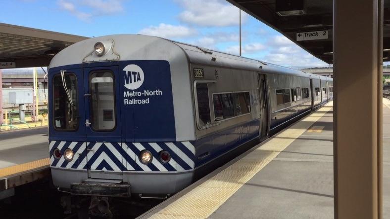
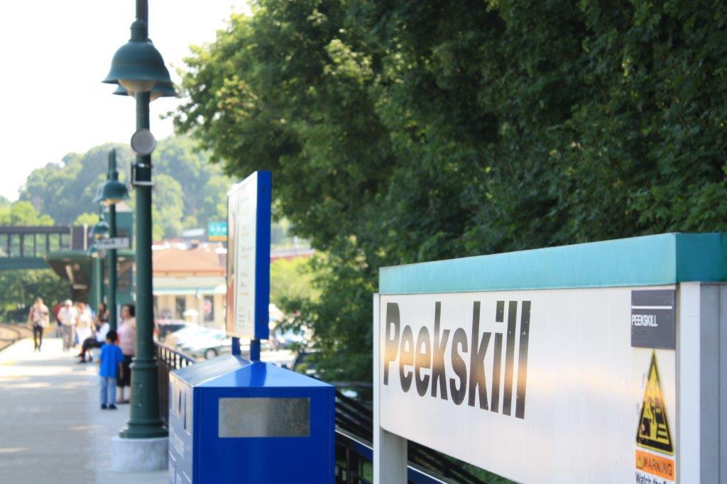
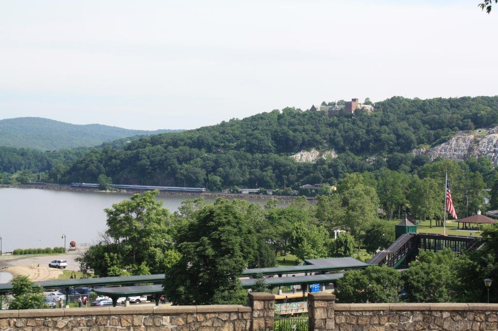
4 PEEKSKILL Transit-Oriented Development (TOD)
5 PEEKSKILL TOD Barriers Somewhat limited permitted uses, including residential Pedestrian environment within Waterfront District could be improved Better integration of mixed uses needed Building height limitations impact efficient use of land
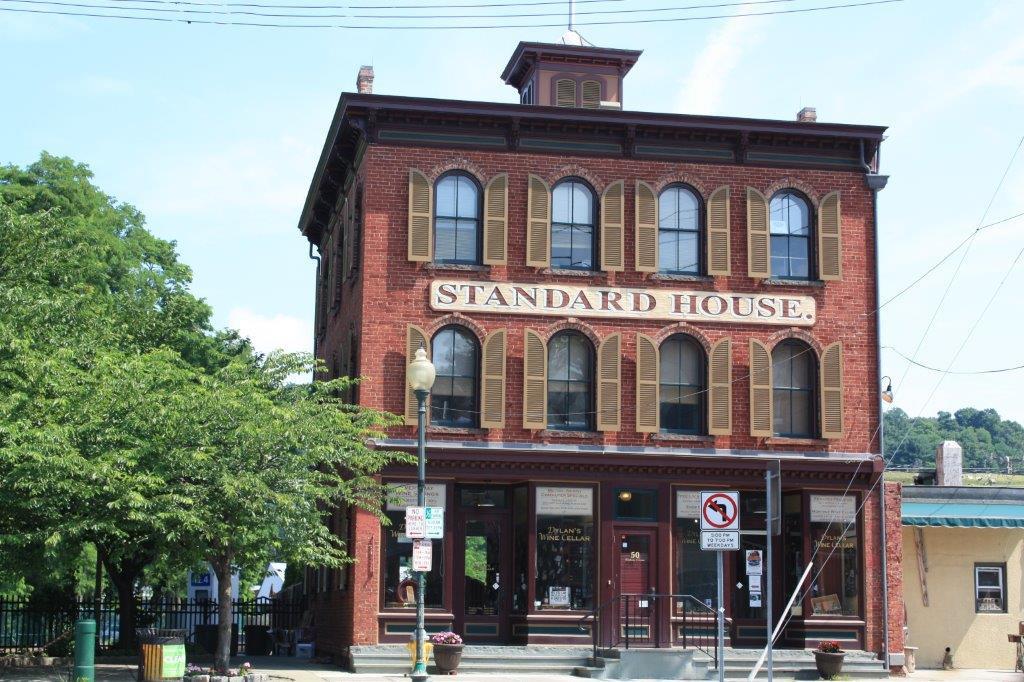
6 PEEKSKILL TOD Planning City does not have a written comprehensive plan Currently updating its Local Waterfront Revitalization Program (LWRP) that encompasses the City s waterfront, including its Metro-North station Working to integrate TOD supportive policies and provisions into the LWRP update and zoning

7 PEEKSKILL TOD Goals Promote new housing within ½ mile of train station Work to further mixed uses Improve pedestrian environment Goals to be reflected in updated LWRP
8 PEEKSKILL TOD Metrics Number of housing units by type Amount of new non-residential development Number of vertically mixed-use buildings Number of new commercial establishments by type Number of transit riders Length of high-quality sidewalks Number of zero-car households Percent income spent on transportation
9 PEEKSKILL TOD Zoning Recommendations Allow additional permitted uses (food & community-serving retail, services, civic & community facilities) Allow additional accessory uses (home occupations, accessory dwelling units, produce gardens/greenhouses) Increase residential density Increase building height limitation Allow off-street parking reductions for amenities that reduce parking demand
10 PEEKSKILL-NEXTSTEPS
11 MAMARONECK Green Infrastructure
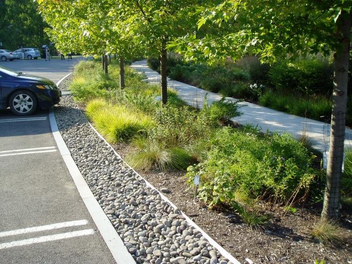
12 MAMARONECK Green Infrastructure Barriers Like Peekskill, the Town does not have a written, municipal-wide comprehensive plan Need for more consideration of GI during land use approval process
13 MAMARONECK Planning for Green Infrastructure Town developed & is implementing Plan for a Resilient and Sustainable Mamaroneck Town is updating its joint LWRP with Village of Larchmont; LWRP area encompasses much of the Town Seeks to integrate & implement current GI initiatives identified in Sustainability Plan with LWRP policies and amendments to Town code


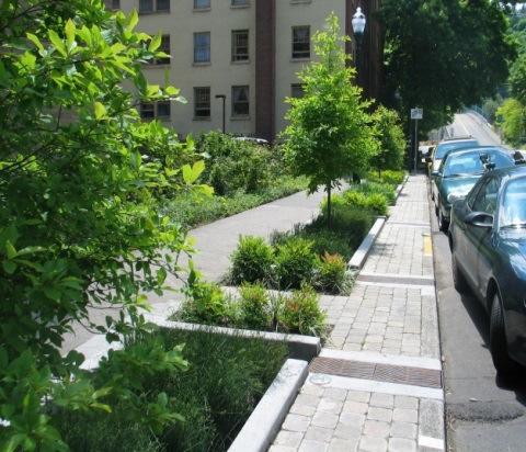
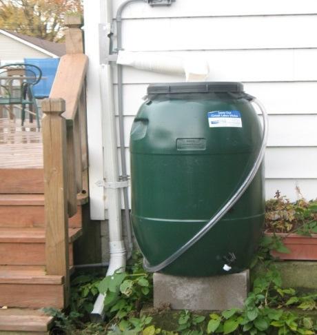
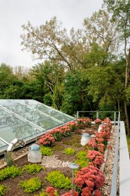
14 MAMARONECK Green Infrastructure Goals Promoting green infrastructure practices as alternative to expanding sewer lines Amending lot coverage, impervious coverage, tree canopy coverage, and detention tank requirements Increasing tree cover Retaining and cleaning runoff Implementing permeable pavement in new streetscapes
15 MAMARONECK Green Infrastructure Metrics Amount of impervious surface reduction Number of acres retrofitted with GI interventions Number of green roofs Number of rain gardens and infiltration practices Amount of stormwater diverted from sewer system Amount of flow volume reductions
16 MAMARONECK Green Infrastructure Code Recommendations Prevent building and filling in 100-year floodplain Forbid development on steep slopes Require site plan applicants to delineate natural conservation areas Require protection of conservation areas and native vegetation Allow pervious driveways Require stormwater BMPs from NYS Stormwater Management Design Manual criteria Allow rooftop runoff discharge to yards Promote stormwater infiltration to recharge groundwater
17 MAMARONECK-NEXTSTEPS

18 KINGSTON Utility Coordination


19 KINGSTON Utility Coordination Barriers Lack of utility coordination leads to upgrades that destroy complete street improvements Utility tree pruning of street trees Enforcement of sidewalk excavation permit & protected streets list
20 KINGSTON Planning for Utility Coordination City is about to adopt updated comprehensive plan Need for comprehensive plan goal and objectives that speak to improving communication and planning with utilities
21 KINGSTON Utility Coordination Goal Amended goal and established new objectives & strategies under Section 7, Public Facilities: Goal-Be proactive rather than reactive in improving and coordinatingpublic infrastructure, including City streets, water and wastewater infrastructure, and enhanced park facilities. Objective-Establish consortium to coordinate utility upgrades with City land use and sustainability plans: Regular communication and meetings Timely notice to Utilities Shared trenches and coordination of construction timing Utility notification of vegetation removal Utility activities consistent with City land use regulations Community involvement in facility siting decisions
22 KINGSTON Utility Coordination Best Practices Boston, MA Utility Coordination Software (COBUCS) Jersey City, NJ Street Excavation Regulations Require utilities to inform the City of anticipated excavation projects, Forbid road cuts within a minimum period of street repaving or reconstruction Require street restoration to the original condition just prior to excavation.
23 KINGSTON Programmatic Recommendations ID and gather contact info for all utilities Designate utility representatives Regular meetings to coordinate activities Advanced notice of proposed street reconstruction Tracking system that IDs conflicts and coordinates projects Enforcement mechanisms Street excavation regulations

24 KINGSTON-NEXTSTEPS


25 SOMERS Solar Access for All Community Solar
26 SOMERS Barriers to Solar Current comprehensive plan does not address solar Solar energy systems not defined in zoning Zoning does not exempt systems from bulk & area requirements Community-scale systems not permitted in zoning districts No approval process for systems other than smallscale, roof mounted systems ARB review Business Historic Preservation District (BH-P)
27 SOMERS Planning for Solar Somers is updating its existing comprehensive plan and adopted a Sustainability Action Plan in 2013 Seeks to allow solar energy systems in appropriate zoning districts to accommodate community solar projects in addition to individual systems Suggest types of systems, where to allow them, how to allow them

28 SOMERS Solar Goal Ensure solar energy generation capabilities for municipal and school facilities, residences, and businesses.
29 SOMERS Regulating for Solar Define small-scale and community-scale solar energy systems in the Town s zoning and allow these systems as principal, accessory, or special uses within the Town s zoning districts as appropriate. Ensure approval processes for solar energy systems facilitate system development while addressing any associated land use impacts. Exempt solar energy systems from dimensional standards and other zoning requirements that obstruct solar energy system development where possible or amend such provisions to accommodate these systems. Require new subdivisions to adhere to solar orientation requirements
30 SOMERS Next Steps To provide all of the populace of Somers access to Solar Energy the Town developed a comprehensive Solar program: Residential and Commercial Solar - Solarize Schools K-Solar State program Municipality Municipal Buying group Solar Gardens ownership in a virtual solar garden for those that fell out of the above programs.

31 Available at s/lulc/solar_barrier_removal_guide.pdf
32 Barriers to Solar Specific Permit Implementation 1. Fail to define solar electric systems appropriately; 2. Approve all solar electric systems using the same process, including by requiring a site plan; 3. Apply each zoning district s bulk and area requirements to solar electric systems; 4. Require architectural review board review for these systems; and/or 5. Require historic preservation commission review for solar electric systems.
33 Solarize Westchester Technical Assistance Contact: Jessica Bacher Land Use Law Center Pace Law School (914)
34 Integrating Sustainability in Policy, Planning and Zoning Thank you!
Metropolitan Area Planning Council 60 Temple Place, Boston, Massachusetts fax
 Metropolitan Area Planning Council 60 Temple Place, Boston, Massachusetts 02111 617-451-2770 fax 614-482-7185 www.mapc.org Serving the 101 Cities Towns in the Metropolitan Boston Region MEMORANDUM TO:
Design for Health Comprehensive Plan Review Checklists. Design for Health,
 Comprehensive Plan Review Checklists, 2007 info@designforhealth.net These Comprehensive Plan Review Checklists summarize the key points of the (DFH) background and health impact assessment (HIA) materials.
City of Langford Green Development Checklist
 City of Langford Green Development Checklist The following Green Development Checklist creates a sustainability standard for all comprehensive development within the City of Langford. The commitments made
Chapter 3 Site Planning and Low Impact Development
 CHAPTER 3 Site Planning and Low Impact Development Chapter 3 Site Planning and Low Impact Development 3.0 Introduction The City of Charleston requires that major residential, large commercial (>1 acre),
Ten Mile Creek Planning Area
 PLANNING AREA POLICIES TEN MILE CREEK Ten Mile Creek Planning Area Location and Context The Ten Mile Creek Planning Area ( Ten Mile Creek area ) is located south of the current Boise AOCI, generally south
GOING GREEN! NEWBURYPORT S PLAN FOR THE FUTURE
 GOING GREEN! NEWBURYPORT S PLAN FOR THE FUTURE Jennifer K. Lachmayr, PE, BCEE Kathryn B. Edwards, PE November 2015 Agenda Background Little River Flood Study Little River Pilot Program Vision for Implementation
Appendix E: Illustrative Green Infrastructure Examples
 Appendix E: Illustrative Green Infrastructure Examples Integrating LID into San Francisco s Urban Landscape Figure E. High-density Residential Figure E. Low-density Residential Figure E. Mixed Use 7 Figure
Green Infrastructure and Low-Impact Development Technologies
 Green Infrastructure and Low-Impact Development Technologies The guiding principles of these technologies is to manage stormwater at their sources using natural means, and establish conditions so that
EXISTING PLANS Harriet Festing Center for Neighborhood Technology Midlothian Community Meeting March 12, 2015
 EXISTING PLANS Harriet Festing Center for Neighborhood Technology Midlothian Community Meeting March 12, 2015 BENEFITS Bring economic, community + environmental benefits Enhance property values Use
Review Zone Application for D&R Canal Commission Decision
 Review Zone Application for D&R Canal Commission Decision MEETING DATE: July 20, 2016 DRCC #: 16-4803 Latest Submission Received: June 13, 2016 Applicant: Robert McCarthy, PE PSE&G 4000 Hadley Road, 2
LEED-ND 101: Practical Strategies for Achieving Sustainability Goals. Travis Parker Lakewood Planning Director
 LEED-ND 101: Practical Strategies for Achieving Sustainability Goals Travis Parker Lakewood Planning Director Metro Vision Idea Exchange Oct 11, 2012 West Corridor Stations West Corridor Overview West
Toronto Complete Streets Guidelines
 Toronto Complete Streets Guidelines 108 110 7.1 Green Infrastructure Design Principles 112 7.2 Context-Sensitive Green Streets 114 7.3 Key Green Street Elements Green infrastructure refers to natural and
Project Applicant Checklist for NPDES Permit Requirements SAN MATEO COUNTYWIDE STORMWATER POLLUTION PREVENTION PROGRAM
 Project Applicant Checklist for NPDES Permit Requirements SAN MATEO COUNTYWIDE STORMWATER POLLUTION PREVENTION PROGRAM I. PROJECT DATA Project Name Bay Meadows Development Phase II Project Address 2600
Metropolitan Area Planning Council 60 Temple Place, Boston, Massachusetts fax
 Metropolitan Area Planning Council 60 Temple Place, Boston, Massachusetts 02111 617-451-2770 fax 614-482-7185 www.mapc.org Serving the 101 Cities and Towns in the Metropolitan Boston Region MEMORANDUM
LOW DENSITY RESIDENTIAL
 LOW DENSITY RESIDENTIAL Corner lots with coach houses to increase diversity, provide unity to the streetscape and increase eyes on the street. Garages and ancillary units accessed via rear lanes. Parking
Green Infrastructure Overview
 Green Infrastructure Overview Christopher C. Obropta, Ph.D., P.E. obropta@envsci.rutgers.edu Jeremiah Bergstrom, LLA, ASLA jbergstrom@envsci.rutgers.edu February 26, 2016 Water Resources Program NJDEP
PAVING PARKING AREAS AND ROADS DESCRIPTION. Alternate Names: Pavement Practices, Impervious Paving
 4.2-i PAVING PARKING AREAS AND ROADS Alternate Names: Pavement Practices, Impervious Paving DESCRIPTION All roads, driveways, and parking lots proposed for year-round use shall be paved with a hard plowable
REZONING APPLICATION MPD SUPPLEMENT
 REZONING APPLICATION MPD SUPPLEMENT For Staff Use Only: DATE/TIMESTAMP: ZA# RECEIVED BY: The intent of the Master Planned District (MPD) designation is to allow flexibility in the design and construction
Draft Impervious Cover Reduction Action Plan for West New York, Hudson County, New Jersey
 Draft Impervious Cover Reduction Action Plan for West New York, Hudson County, New Jersey Prepared for the Town of West New York by the Rutgers Cooperative Extension Water Resources Program March 29, 2017
Watershed Planning Workshop
 Watershed Planning Workshop Upper Four Mile Run, Gulf Branch and Donaldson Run March 18, 2010 Langston Brown Community Center Outline Overview of Arlington s s Watersheds Watershed Management in Arlington
SECTION UNIFIED DEVELOPMENT ORDINANCE SECTION Part 1 Ordinance. ARTICLE 1 Zoning Districts
 SECTION 1-100 UNIFIED DEVELOPMENT ORDINANCE SECTION 1-300 Part 1 Ordinance SECTION 1-100. Introduction. ARTICLE 1 Zoning Districts Crystal Lake strives to maintain a balance of various land uses for a
SECTION II SECTION II STATEMENT OF GOALS, OBJECTIVES, PRINCIPLES, ASSUMPTIONS, POLICIES AND STANDARDS
 STATEMENT OF GOALS, OBJECTIVES, PRINCIPLES, ASSUMPTIONS, POLICIES AND STANDARDS 1 2 STATEMENT OF GOALS, OBJECTIVES, PRINCIPLES, ASSUMPTIONS, POLICIES AND STANDARDS INTRODUCTION The New Jersey Municipal
PORT WHITBY COMMUNITY
 PORT WHITBY COMMUNITY SECONDARY PLAN UPDATE COMMUNITY IMPROVEMENT PLAN URBAN DESIGN GUIDELINES September 2015 DRAFT PROPOSED AMENDMENT NUMBER # to the Whitby Official Plan PURPOSE: The intent of this Amendment
FORMER CANADIAN FORCES BASE (CFB) ROCKCLIFFE SECONDARY PLAN. Official Plan Amendment XX to the Official Plan for the City of Ottawa
 ROCKCLIFFE SECONDARY PLAN. Official Plan Amendment XX to the Official Plan for the City of Ottawa") FORMER CANADIAN FORCES BASE (CFB) ROCKCLIFFE SECONDARY PLAN Official Plan Amendment XX to the Official Plan for the City of Ottawa 1 INDEX THE STATEMENT OF COMPONENTS PART A THE PREAMBLE PAGE Purpose...
FORMER CANADIAN FORCES BASE (CFB) ROCKCLIFFE SECONDARY PLAN Official Plan Amendment XX to the Official Plan for the City of Ottawa 1 INDEX THE STATEMENT OF COMPONENTS PART A THE PREAMBLE PAGE Purpose...
Transportation. Strategies for Action
 Transportation A major priority for the Overlake Neighborhood is to develop a multimodal transportation system. To achieve this system, a balance has to be found among travel, circulation and access needs;
Why and How to Evaluate the Feasibility of Infiltrating or Harvesting and Using Stormwater. Laura Prickett, EOA, Inc.
 Why and How to Evaluate the Feasibility of Infiltrating or Harvesting and Using Stormwater Laura Prickett, EOA, Inc. November 17, 2011 Outline of Presentation Why prioritize infiltration and harvest/use
APPENDIX A SIMPLIFIED APPROACH TO STORMWATER MANAGEMENT FOR SMALL PROJECTS. In West Sadsbury Township, Chester County, Pennsylvania
 APPENDIX A SIMPLIFIED APPROACH TO STORMWATER MANAGEMENT FOR SMALL PROJECTS In West Sadsbury Township, Chester County, Pennsylvania TABLE OF CONTENTS I. Introduction 3 II. Importance of Stormwater Management
PROP. 84 REMOVING BARRIERS TO LID: MUNICIPAL CODE UPDATE ASSISTANCE CASE STUDY: CODE UPDATES IN ARCATA
 PROP. 84 REMOVING BARRIERS TO LID: MUNICIPAL CODE UPDATE ASSISTANCE CASE STUDY: CODE UPDATES IN ARCATA OCTOBER 7, 2015 CASE STUDY: CODE UPDATES IN ARCATA Arcata is a city located in Humboldt County immediately
INTRODUCTION TO GREEN INFRASTRUCTURE HOW WE CAN PROTECT OUR COMMUNITIES AND OUR WATERS Maywood Public Library Bergen County, New Jersey
 INTRODUCTION TO GREEN INFRASTRUCTURE HOW WE CAN PROTECT OUR COMMUNITIES AND OUR WATERS Maywood Public Library Bergen County, New Jersey Jeremiah D. Bergstrom, LLA, ASLA Rutgers Cooperative Extension Water
Subregion 4 Central Avenue-Metro Blue Line Corridor Transit-Oriented Development (TOD) Implementation Project. Community Meeting April 27, 2011
 Implementation Project. Community Meeting April 27, 2011") Subregion 4 Central Avenue-Metro Blue Line Corridor Transit-Oriented Development (TOD) Implementation Project Community Meeting April 27, 2011 Overview Introduction to Subregion 4 TOD Implementation Program
Subregion 4 Central Avenue-Metro Blue Line Corridor Transit-Oriented Development (TOD) Implementation Project Community Meeting April 27, 2011 Overview Introduction to Subregion 4 TOD Implementation Program
APPENDIX G: TOWN ORDINANCE REVIEW
 APPENDIX G: TOWN ORDINANCE REVIEW TYLin (225740) Woodard & Curran SWMP January 2013 Stormwater LID strategies, ranked for Zoning Bylaw and Site Plan Review Standards Dimensional Requirements Permit the
STORMWATER MANAGEMENT CODES ANALYSIS RICHLAND COUNTY, SC SITE PLANNING ROUNDTABLE
 STORMWATER MANAGEMENT CODES ANALYSIS RICHLAND COUNTY, SC SITE PLANNING ROUNDTABLE Codes analyses for each subcommittee were completed to assist participants of the Richland County Site Planning Roundtable.
CMAP Resources for Green Infrastructure Planning
 CMAP Resources for Green Infrastructure Planning Resilient Chicago July 8, 2015 Kate Evasic Associate Planner Chicago Metropolitan Agency for Planning Formed by state law in 2005 to integrate planning
COMPLETE GREEN STREET CHECKLIST
 COMPLETE GREEN STREET CHECKLIST This document was developed to dissect the structure of an urban street and explore opportunities to make our streets more complete while also integrating green street strategies.
NYC Green Infrastructure Program
 NYC Green Infrastructure Program Parks Without Borders May 24, 2016 NYC Water Quality Improvement Program $10B investment since the early 2000s has yielded the highest water quality observed in the NYC
Going Green with the NYS Stormwater Design Standards
 Going Green with the NYS Stormwater Design Standards Shohreh Karimipour, P.E. NYSDEC History of Stormwater Management Ancient Greek Cisterns Water Cistern Systems in Greece from Minoan to Hellenistic Period,
Appendix I. Checklists
 Appendix I Checklists Town of Greenwich Drainage Manual Department of Public Works - Engineering Division Town Hall - 101 Field Point Road, Greenwich, CT 06836-2540 Phone 203-622-7767 - Fax 203-622-7747
Horsley Witten Group Sustainable Environmental Solutions. Rich Claytor, P.E. Janet Bernardo, P.E. horsleywitten.com
 Horsley Witten Group Sustainable Environmental Solutions Rich Claytor, P.E. Janet Bernardo, P.E. horsleywitten.com 857-263-8193 Agenda Introduction & Grant Goals Stormwater & GI Overview Grant Work Completed
City of Yelm. Tahoma Terra Final Master Plan Development Guidelines. Table of Contents
 City of Yelm Tahoma Terra Final Master Plan Development Guidelines Table of Contents Table of Contents... 1 Purpose... 2 Low Density Residential (R4-6)... 3 Moderate Density Residential (R6-10)... 5 Neighborhood
Phase II Storm Water Permit Program MS4 Permit
 Phase II Storm Water Permit Program MS4 Permit Karen Katamay Environmental Protection Engineer/CPESC Illinois EPA Des Plaines Regional Office karen.katamay@illinois.gov 847-294-4043 Types of Storm Water
Third Ave CSO Integrated Green Infrastructure
 Third Ave CSO Integrated Green Infrastructure Neil Myers Williams Creek Consulting OWEA Annual Conference June 2013 For growing municipalities to be perceived as world class communities, each must move
GREEN BUILDING PROGRAM. COUNTY OF LOS ANGELES A joint effort by Department of Regional Planning and Department of Public Works
 GREEN BUILDING PROGRAM COUNTY OF LOS ANGELES A joint effort by Department of Regional Planning and Department of Public Works Waste Management Board Fire Department Realtors National Park Service Regional
The Baileys Planning District portion of the Comprehensive Plan contains site design recommendations for both the Baileys Crossroads Community
 The Baileys Planning District portion of the Comprehensive Plan contains site design recommendations for both the Baileys Crossroads Community Business Center and the Seven Corners Community Business Center.
STORMWATER GREEN INFRASTRUCTURE AND PLANNING/ZONING BOARDS
 STORMWATER GREEN INFRASTRUCTURE AND PLANNING/ZONING BOARDS Source: Center for Watershed Protection, 2007 Southern Tier Central Regional Planning & Development Board Chemung County Stormwater Team OUTLINE
Town of Washington Master Plan & Regulatory Audit: Interim Results
 Town of Washington Master Plan & Regulatory Audit: Interim Results May 20, 2008 Presented by: 30 Bank Street Lebanon, NH 03766 www.uvlsrpc.org Introduction & Purpose Compare the Master Plan to the regulations
URBAN DESIGN BRIEF 181 Burloak Drive, Oakville
 URBAN DESIGN BRIEF 181 Burloak Drive, Oakville February 2017 Our File: 1730B 230-7050 WESTON ROAD / WOODBRIDGE / ONTARIO / L4L 8G7 / T: 905 761 5588/ F: 905 761 5589/WWW.MHBCPLAN.COM TABLE OF CONTENTS
Housing and Coach House Guidelines - Ladner
 Housing and Coach House Guidelines - Ladner Policy D.8: Encourage Compatible Housing Design Encourage housing design that is sensitive to existing single family housing neighbourhoods by requiring a design
understanding Green Infrastructure In Zoning
 understanding Green Infrastructure In Zoning Purpose Measurable standards can be adopted within municipal zoning codes, and subdivision and stormwater regulations, to promote a comprehensive approach to
I615. Westgate Precinct
 I615. Westgate Precinct I615.1. Precinct Description The Westgate Precinct is located approximately 18km west of the Auckland city centre. There are seven Sub-precincts in the Westgate Precinct: Sub-precinct
ARTICLE 6: Special and Planned Development Districts
 ARTICLE 6: Special and Planned Development Districts 6-10 Traditional Neighborhood Development (TND) District 6-10.10 Purpose and Intent The Traditional Neighborhood Development (TND) District provides
RIVERSIDE, Newton MA June 9, 2011
 June 9, 2011 TONIGHT S AGENDA: 1.Project Update (5 min.) 2.Master Plan Update (10 min.) 3.Environmental Update (5 min.) 4.Traffic Plan Update (25 min.) Questions PROJECT STATUS UPDATE Responding / Clarifying
GREEN ON THE HORIZON. Challenges of Integrating LID into New Development. Southeast Stormwater Association
 GREEN ON THE HORIZON Challenges of Integrating LID into New Development Southeast Stormwater Association Annual Seminar, Charleston SC October 9, 2014 JENNIFER A. NUNN, PE THE BALMORAL GROUP Acknowledgments
Green Infrastructure Recommendations For Parks and Public Spaces
 Green Infrastructure Recommendations For Parks and Public Spaces Issued by the Jersey Water Works Green Infrastructure Committee And Prepared by Meliora Design This document recommends ways to integrate
Introduction to Low Impact Development. Dr Kathy Chaston Coral & Coastal Management Specialist NOAA Office of Ocean & Coastal Resource Management
 Introduction to Low Impact Development Dr Kathy Chaston Coral & Coastal Management Specialist NOAA Office of Ocean & Coastal Resource Management http://hawaii.gov/dbedt/czm/resource/publication.php A Comprehensive
Transit-Oriented Development
 Transit-Oriented Development Path to Sustainability West Windsor February 22, 2007 George S. Hawkins Context for Presentation NJ Future is a non-partisan, 501(c)3 non-profit organization. Offer perspective,
2018 Northampton Township Comprehensive Plan
 2018 BUCKS COUNTY, PENNSYLVANIA What is a? A comprehensive plan is a municipality s main policy document that details the collective vision for the future, the historic, environmental, and cultural facilities
Please read the entire document
 projects impacting the waterfront revitalization area. The waterfront revitalization area of the town will have to subareas to the west and east of the village. Page 6 of 6 Wayfinding master plan create
REQUEST Current Zoning: O-15(CD) (office) Proposed Zoning: TOD-M(CD) (transit oriented development mixed-use, conditional)
 (office) Proposed Zoning: TOD-M(CD) (transit oriented development mixed-use, conditional)") Rezoning Petition 2016-117 Zoning Committee Recommendation January 4, 2017 REQUEST Current Zoning: O-15(CD) (office) Proposed Zoning: TOD-M(CD) (transit oriented development mixed-use, conditional) LOCATION
Rezoning Petition 2016-117 Zoning Committee Recommendation January 4, 2017 REQUEST Current Zoning: O-15(CD) (office) Proposed Zoning: TOD-M(CD) (transit oriented development mixed-use, conditional) LOCATION
Noblesville Unified Development Ordinance Audit
 Noblesville Unified Development Ordinance Audit December 4 th, 2012 Shane Burkhardt, AICP RW Armstrong Project Summary Started project in the beginning of June 2012 Conducted focus groups July 2012 Conducted
Mark-up of the effect of the proposed Bronte Village Growth Area OPA No.18 on the text of section 24, Bronte Village, of the Livable Oakville Plan
 Mark-up of the effect of the proposed Bronte Village Growth Area OPA No.18 on the text of section 24, Bronte Village, of the Livable Oakville Plan Notes: This document is provided for information purposes
An Integrated Green Infrastructure Plan to Address Combined Sewer Overflow, Stormwater and Nutrient Reductions in Lancaster City, PA
 An Integrated Green Infrastructure Plan to Address Combined Sewer Overflow, Stormwater and Nutrient Reductions in Lancaster City, PA Charlotte Katzenmoyer American Public Works Association Sustainability
Green Infrastructure & Low Impact Development
 Green Infrastructure & Low Impact Development CITY OF COVINGTON STORMWATER MANAGEMENT WHAT IS GREEN INFRASTRUCTURE? Green infrastructure uses vegetation, soils and natural processes to manage water and
REZONING GUIDE. Zone Map Amendment (Rezoning) - Application. Rezoning Application Page 1 of 3. Return completed form to
 - Application. Rezoning Application Page 1 of 3. Return completed form to") Zone Map Amendment (Rezoning) - Application COMMUNITY PLANNING & DEVELOPMENT REZONING GUIDE Rezoning Application Page 1 of 3 PROPERTY OWNER INFORMATION* CHECK IF POINT OF CONTACT FOR APPLICATION Property
Zone Map Amendment (Rezoning) - Application COMMUNITY PLANNING & DEVELOPMENT REZONING GUIDE Rezoning Application Page 1 of 3 PROPERTY OWNER INFORMATION* CHECK IF POINT OF CONTACT FOR APPLICATION Property
Somers Point Master Plan
 Somers Point Master Plan Progress Report and Public Meeting August 20, 2014 Master Plan Reexamination Municipal Land Use Law require that all municipalities reexamine their master plan every ten years.
Zoning Technical Review Presented by Camiros. November 10, 2015
 Zoning Technical Review Presented by Camiros November 10, 2015 TECHNICAL REVIEW OVERVIEW Purpose of this Report Outline issues with current Ordinance Present preliminary approaches for revisions Set drafting
Sustainable Stormwater Retrofit Best Practices
 Sustainable Stormwater Retrofit Best Practices Presenter Zach Sample, PE Stormwater Products Manager XP Solutions XP Solutions has a long history of Providing original, high-performing software solutions
Urban Design Manual PLANNING AROUND RAPID TRANSIT STATIONS (PARTS) Introduction. Station Study Areas
 Introduction. Station Study Areas") 111111 PLANNING AROUND RAPID TRANSIT STATIONS (PARTS) Introduction The ION rapid transit system will link Waterloo, Kitchener and Cambridge through a central transit corridor (CTC). There are a number
111111 PLANNING AROUND RAPID TRANSIT STATIONS (PARTS) Introduction The ION rapid transit system will link Waterloo, Kitchener and Cambridge through a central transit corridor (CTC). There are a number
Micco Park Village Development
 FOR SALE Call For Pricing Micco Park Village Development Proposed Project Property Details Micco Park Village Development PRICE Call For Pricing A monumental development opportunity of a lifetime! The
Prepared for: Central Coast Low Impact Development Initiative centralcoastlidi.org
 Page 1 of 37 USER GUIDE & TEMPLATE: Municipal Landscape Gap Analysis Tool for Planning & Development Review Standards and Procedures Prepared for: Central Coast Low Impact Development Initiative centralcoastlidi.org
Chapter RM MULTI FAMILY BUILDING ZONES
 Chapter 19.17 RM MULTI FAMILY BUILDING ZONES 19.17.010 Established 19.17.020 Primary Permitted Uses 19.17.030 Accessory Permitted Uses 19.17.040 Secondary Permitted Uses 19.17.050 Conditional Property
Using AutoCAD Civil 3D and ESRI ArcGIS to meet LEED-ND (Neighborhood Development) Requirements NDIA O Brien & Gere. All Rights Reserved.
 Requirements NDIA O Brien & Gere. All Rights Reserved.") Using AutoCAD Civil 3D and ESRI ArcGIS to meet LEED-ND (Neighborhood Development) Requirements NDIA 12457 1 Using AutoCAD Civil 3D and ESRI ArcGIS to meet LEED-ND (Neighborhood Development) Requirements
Using AutoCAD Civil 3D and ESRI ArcGIS to meet LEED-ND (Neighborhood Development) Requirements NDIA 12457 1 Using AutoCAD Civil 3D and ESRI ArcGIS to meet LEED-ND (Neighborhood Development) Requirements
State Water Board s Post Construction Stormwater Calculator. Instructions for El Centro
 State Water Board s Post Construction Stormwater Calculator Instructions for El Centro Important: This workbook must be completed for each Drainage Management Area (DMA) in the project site. For example,
CAPE ELIZABETH, MAINE TOWN CENTER STORMWATER MANAGEMENT PLAN UPDATE
 CAPE ELIZABETH, MAINE TOWN CENTER STORMWATER MANAGEMENT PLAN UPDATE September 2015 This report was prepared by The Town of Cape Elizabeth under award CZM NA14NOS4190066 to the Maine Coastal Program from
Case studies. B1.1 Lloyds Crossing, Portland (USA)
") B. Case Studies 57 B1 Case studies B1.1 Lloyds Crossing, Portland (USA) Lloyds Crossing in Portland is a brownfields redevelopment site in the central city area, with the aim of: Developing a conceptual
B. Case Studies 57 B1 Case studies B1.1 Lloyds Crossing, Portland (USA) Lloyds Crossing in Portland is a brownfields redevelopment site in the central city area, with the aim of: Developing a conceptual
USF System Campus Master Plan Updates Goals, Objectives and Policies
 2015-2025 USF System Campus Master Plan Updates Goals, Objectives and Policies Tampa Goals, Objectives, and Policies Table of Contents Executive Summary 2015 2025 USF Campus Master Plan Update Introduction
Draft Impervious Cover Reduction Action Plan for West Long Branch Borough, Monmouth County, New Jersey
 Draft Impervious Cover Reduction Action Plan for West Long Branch Borough, Monmouth County, New Jersey Prepared for West Long Branch Borough by the Rutgers Cooperative Extension Water Resources Program
Camden SMART Initiative Stormwater Management and Resource Training
 Camden SMART Initiative Stormwater Management and Resource Training www.camdensmart.com Camden s Struggle with Stormwater 1 The City of Camden is served by a combined sewer system, which uses the same
Improve Neighborhood Design and Reduce Non Point Source Water Pollution
 HOW TO Planning Guide Improve Neighborhood Design and Reduce Non Point Source Water Pollution This document was funded by a grant from the New Hampshire Coastal Program with funding from the National Oceanic
Des Plaines River Watershed: Opportunity Areas North Community Cluster 1:80,000. Miles. Public Parks or Preserve. Wetland Area
 Service Layer Credits: Harris Corp, Earthstar Geographics LLC Earthstar Geographics SIO 2015 Microsoft Corporation Des Plaines River Watershed: Opportunity Areas North Community Cluster SFR: Single Family
B L A C K D I A M O N D D E S I G N G U I D E L I N E S for Multi-family Development
 B L A C K D I A M O N D D E S I G N G U I D E L I N E S for Multi-family Development Adopted June 18, 2009 This section of the Design and focuses on site planning and design guidance for new multi-family
4. UTILITIES ELEMENT.
 4. UTILITIES ELEMENT. The purpose of this element is to provide for necessary public facilities and services correlated to future land use projections and population demand. Utilities Sub-Elements (A)
BROOKHILL NEIGHBORHOOD MODEL ZONING MAP AMENDMENT PREFACE TO APPLICATION
 BROOKHILL NEIGHBORHOOD MODEL ZONING MAP AMENDMENT PREFACE TO APPLICATION June 15, 2015 Revised: August 1, 2016 I. VISION Brookhill is a proposed community based upon the principles of Albemarle County
Keep the Rain, not the runoff! Residential Best Management Practice (BMP) Incentive Program Criteria
 Incentive Program Criteria") CleanSScapes Keep the Rain, not the runoff! Residential Best Management Practice (BMP) Incentive Program Criteria Howard County Office of Community Sustainability, 410-313-0678 CleanScapes Program, www.cleanwaterhoward.com
CleanSScapes Keep the Rain, not the runoff! Residential Best Management Practice (BMP) Incentive Program Criteria Howard County Office of Community Sustainability, 410-313-0678 CleanScapes Program, www.cleanwaterhoward.com
Green Infrastructure Basics
 1 Green Infrastructure Basics Emily Vail Hudson River Estuary Program NYS Department of Environmental Conservation New York State Water Resources Institute at Cornell University December 8, 2016 2 Presentation
Appendix D - Technical Design Criteria for BMPs
 Appendix D - Technical Design Criteria for BMPs City of Wayzata Page 3 On-site infiltration features Definitions and Scope: Infiltration facilities are constructed basins or depressions located in permeable
GREEN STREETS & INFRASTRUCTURE: A COUNTY APPROACH. Mimicking Nature to Manage Stormwater in Developed Areas
 GREEN STREETS & INFRASTRUCTURE: A COUNTY APPROACH Mimicking Nature to Manage Stormwater in Developed Areas Jennifer Gonzalez, Environmental Planner Passaic County Depar tment of Planning & Economic Development
5. LOW IMPACT DEVELOPMENT DESIGN STANDARDS
 5. LOW IMPACT DEVELOPMENT DESIGN STANDARDS Low Impact Development (LID) requires a shift in stormwater management away from conveying runoff to a small number of downstream points through hydraulically
Chapter 10 IMPLEMENTATION RECOMMENDATIONS
 Chapter 10 IMPLEMENTATION RECOMMENDATIONS The recommended land use plan presented in the previous chapter provides a design for the attainment of the urban and rural development and open space preservation
Impervious Cover Reduction Action Plan for Hampton Township, Sussex County, New Jersey
 Impervious Cover Reduction Action Plan for Hampton Township, Sussex County, New Jersey Prepared for Hampton Township by the Rutgers Cooperative Extension Water Resources Program November 8, 2016 Table
Land Use Amendment in Southwood (Ward 11) at and Elbow Drive SW, LOC
 at and Elbow Drive SW, LOC") 2018 November 15 Page 1 of 10 EXECUTIVE SUMMARY This land use amendment application was submitted by Rick Balbi Architect on 2017 August 31 on behalf of Sable Developments Ltd, and with authorization from
2018 November 15 Page 1 of 10 EXECUTIVE SUMMARY This land use amendment application was submitted by Rick Balbi Architect on 2017 August 31 on behalf of Sable Developments Ltd, and with authorization from
Gas Stations ottawa.ca
 Urban Design Guidelines for Gas Stations ottawa.ca Ce document est disponible en français sur ottawa.ca. This document is available in French on ottawa.ca. Approved by City Council May 24, 2006 City of
COMMUNITY DESIGN. GOAL: Create livable and attractive communities. Intent
 COMMUNITY DESIGN Intent An attractive, well-designed County will attract quality development, instill civic pride, improve the visual character of the community, and create a strong, positive image for
Planning & Development. Background. Subject Lands
 Planning & Development APPLICATION BRIEFING Prepared For: Planning Advisory Committee Submitted by: Jason Fox, Director of Planning & Development Date: Subject: Development Agreement Application by Brentwood
Tacoma Mall Neighborhood Subarea Plan & EIS. Planning Commission February15, 2017
 Tacoma Mall Neighborhood Subarea Plan & EIS Planning Commission February15, 2017 1 Meeting objectives Commission direction on: Medium and Long-term visions Residential, neighborhood and housing topics
DEVELOPMENT FRAMEWORK POST 2030 LAND USE PLAN INTRODUCTION
 INTRODUCTION Oak Grove s Comprehensive Plan identifies a future Metropolitan Urban Service Area (MUSA). The Metropolitan Council does not anticipate extending utilities to this area prior to 2030. The
Pennsylvania Stormwater Best Management Practices Manual. Chapter 4. Integrating Site Design and Stormwater Management
 Pennsylvania Stormwater Best Management Practices Manual Chapter 4 Integrating Site Design and Stormwater Management 363-0300-002 / December 30, 2006 Chapter 4 Integrating Site Design and Stormwater Management
Interpreting and Using the RI Site Specific Soil Mapping Standards and Procedures
 Interpreting and Using the RI Site Specific Soil Mapping Standards and Procedures Using the New Rhode Island Site Specific Soil Mapping Guide URI Coastal Institute, Kingston November 15, 2007 Lorraine
JANUARY 19, 2011 CENTRAL AVENUE-METRO BLUE LINE TRANSIT-ORIENTED DEVELOPMENT IMPLEMENTATION PROJECT COMMUNITY FORUM
 CENTRAL AVENUE-METRO BLUE LINE TRANSIT-ORIENTED DEVELOPMENT IMPLEMENTATION PROJECT COMMUNITY FORUM JANUARY 19, 2011 THE MARYLAND-NATIONAL CAPITAL PARK AND PLANNING COMMISSION PRINCE GEORGE S COUNTY PLANNING
Dwelling Units Max 12 dwelling units per acre/min 8 dwelling units per acre. Development Mix 80% non residential/20% residential
 13. OSTEEN LOCAL PLAN Background: The Osteen Local Plan area is located in southwest Volusia County along the SR 415 corridor between Lemon Bluff Road and Acorn Lake Road and includes 3,990 acres. The
PUBLIC SERVICES ELEMENT GOALS / POLICIES / MEASURES
 PUBLIC SERVICES ELEMENT GOALS / POLICIES GOALS / POLICIES / MEASURES Authority The Public Services Element addresses provision of municipal services to City residents. The following paragraphs provide